teaching with wmt irina overeem [email protected] mark piper [email protected] eric...
TRANSCRIPT


Agenda
Why Teaching of Modeling of Earth Surface Processes?
What possibilities does CSDMS WMT offer?
Integrated Help System between WMT and CSDMS wiki
Model-Labs in EKT Repository
Hand-on Modeling Lab with CEM

Vision
CSDMS motto: “Explore Earth’s Surface with Community Software”
Develop a modular modeling environment capable of significantly advancing fundamental earth-system science; and
Develop fully functional and useful repositories for models, supporting data and tools, and other products for education in quantitative modeling.
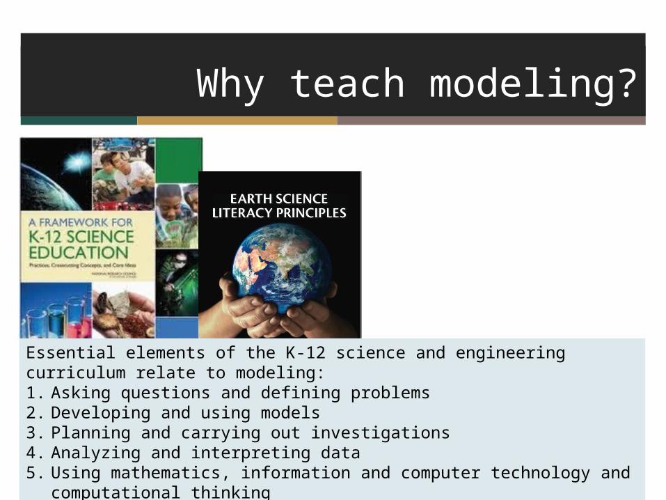
Why teach modeling?
Essential elements of the K-12 science and engineering curriculum relate to modeling:1. Asking questions and defining problems2. Developing and using models3. Planning and carrying out investigations4. Analyzing and interpreting data5. Using mathematics, information and computer technology and computational thinking6. Constructing explanations and designing solutions

Why teach modeling?
Modeling is imperative to forecasting the behavior of a complex and
evolving Earth System
Geoscience research nowadays heavily uses models:1. Asking questions and defining problems2. Developing and using models3. Planning and carrying out investigations4. Analyzing and interpreting data5. Using mathematics, information and computer technology and computational thinking6. Constructing explanations and designing solutions
Hurricane SandyNOAA surge model, Oct 28, 2012

Learning outcomes of modeling labs
Awareness of models versus instrumental data
Awareness of simplification, assumptions and uncertainty in models
Explore possible outcomes of a system under different parameters
Create and analyze model output
Predict attributes of complex system behavior
Describe feedbacks in coupled systems
Computing skills – familiarity with HPCC procedures

Using WMT for teaching
CSDMS members and > 100 graduate students have been exposed to CSDMS Modeling Tool- CSDMS clinics in 2010, 2011, 2012 and 2013- CU graduate courses on Earth Surface Process modeling- NCED SIESD 2-day clinics in 2011, 2012, 2013
We are moving this course material to WMT web-based tool

Integration between WMT and wiki
Click here

Model Help?
or Click Here
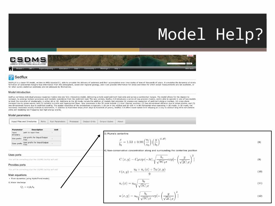
Model Help?

Model Labs
Overview of Labs for Teaching:http://csdms.colorado.edu/wiki/Labs_portal
Example:http://csdms.colorado.edu/wiki/Labs_WMT_River_Sediment_Supply

Model Labs
Labs are intended for advanced undergraduate and graduate classes (3-4 hrs, with homework). Labs include:
1) Tutorial on use of WMT
2) Presentations on the specific model and processes.
3) Instructions to run simulations. These runs have been tested.
4) Questions to meet topical learning objectives.
5) Key references to learn more on relevant processes and models.

Logistics
Students need accounts on the CSDMS super-computer. This takes time; count on 5 work days.
Student need to familiarize with WMT
Students learn to visualize NetCDF time-series and grids. All CSDMS compliant models output NetCDF files. NetCDF can be visualized in VisIT or ParaView (open-source visualization tools) or Matlab. Some models have their own ASCII files.

Example of a Model Labhttp://csdms.colorado.edu/wiki/Labs_WMT_PLUME
Instructions on Parameter Settings
Questions to guide more in-depth analysis of parameters

Hands-on Model Lab
Explore a model lab on coastal evolution modeling (20 min)CEM Model (Murray, Ashton, Nienhuis), HydroTrend Model (Kettner), Avulsion Model (Hutton)
Team up with people who have their Beach account information available: you will need your user name and password.
Directions are on CSDMS wiki:http://csdms.colorado.edu/wiki/Labs_WMT_CEM

Simulation Setup
Option: use the pre-wired example; and start changing parameters from there.

Parameter Setup

More information on Model

Simulation Status
Simulation takes about 5 minutes to complete, it reports progress in the ‘Simulation Status’ window
https://csdms.colorado.edu/wmt/api-dev/run/show

Visualize NetCDF files with VisIT
Download VisIT software
https://wci.llnl.gov/codes/visit/
Downloads are available for Windows XP/Vista, Mac OS X,
Linux RedHat and Ubuntu

Hands-on Model Lab (1)
T = 3,000 T = 6,000
T = 9,000 T = 12,000
Single River
CEM+Avulsion+Riverbase-case
Simulation 1 allows simple exploration of coastal geomorphological evolution over time.Learning Objective: Create-Describe-Interpret Model information
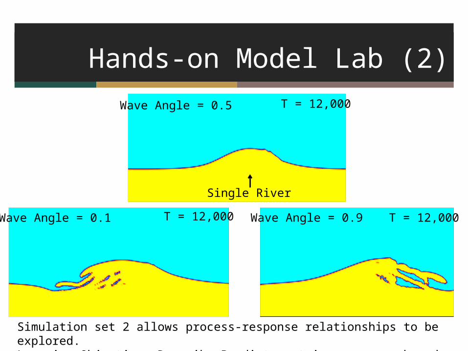
Hands-on Model Lab (2)
T = 12,000
Single River
Wave Angle = 0.5
T = 12,000Wave Angle = 0.9Wave Angle = 0.1 T = 12,000
Simulation set 2 allows process-response relationships to be explored.Learning Objective: Describe-Predict certain responses based on specific process parameters

Hands-on Model Lab (2)
T = 12,000
Single River
Wave Highness = 0.1 Wave Highness = 0.9 T = 12,000
Simulation set 2 allows process-response relationships to be explored.Learning Objective: Describe-Predict certain responses based on specific process parameters

Hands-on Model Lab (3)
River 1,2 River 3
T = 12,000 T = 12,000
10 Rivers
Simulation set 3 explores feedbacks between processes. Divide bedload based on channel length. Learning Objective: Describe-Predict feedbacks between specific process parameters
A. Ashton, E. Hutton, A. Kettner, F. Xing, J. Kallumadikal, J. Nienhuis, L. Giosan, Progress in coupling models of coastline and fluvial dynamics, Computers & Geosciences, 53, 2013, 21-29, http://dx.doi.org/10.1016/j.cageo.2012.04.004.

Available Model Labs
WMT basics
HydroTrend
River Plumes
Coastal Evolution – Avulsion - Waves
Sedflux2D Stratigraphy
Soon to be updated from CMT lab
TOPOFLOW
CHILD
ERODE

Questions and Discussion
Community input through EKT WG - What models are next? - Which topics are next?- What about documenting output?
Community volunteering
- We are recruiting TA’s and faculty to adopt and evaluate these teaching resources
AquaTellUs
ERODE