1 seismic reflection data – overview · pdf fileseismic reflection data – ......
TRANSCRIPT

1
PG&E DCPP SSHAC Study
Seismic Reflection Data – Overview Seismic Source Characterization
Stu Nishenko Central Coastal California Seismic Imaging Project Technical Manager November 30, 2011

PG&E DCPP SSHAC Study 2
SSC Sensitivity Results Central Coastal California Seismic Imaging Project Surveys to Date Future Surveys Legacy Archive

PG&E DCPP SSHAC Study 3
Summary of SSC Sensitivity: PGA Hosgri SR
Hosgri Location Hosgri Dip
Hosgri Rupture Length Shoreline SR
Los Osos Dip Los Osos SR
San Luis Bay SR San Luis Bay Dip
Los Osos C. Thickness San Luis Bay Rup Length
Shoreline Length Los Osos Rup Length
SLB C. Thickness Hosgri Joint Ruptures

PG&E DCPP SSHAC Study 4
Improvements in Geophysical Data Acquisition
Geophysical Instrumentation Geophysical Data Processing
DGPS Navigation Geographic Information Systems
“X-rays” v “CAT scans”
Revolution in Resolution
PG&E DCPP SSHAC Study 5
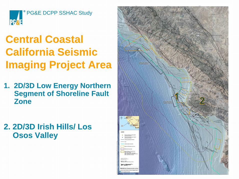
Central Coastal California Seismic Imaging Project Area 1. 2D/3D Low Energy Northern
Segment of Shoreline Fault Zone
2. 2D/3D Irish Hills/ Los Osos Valley
PG&E DCPP SSHAC Study 6
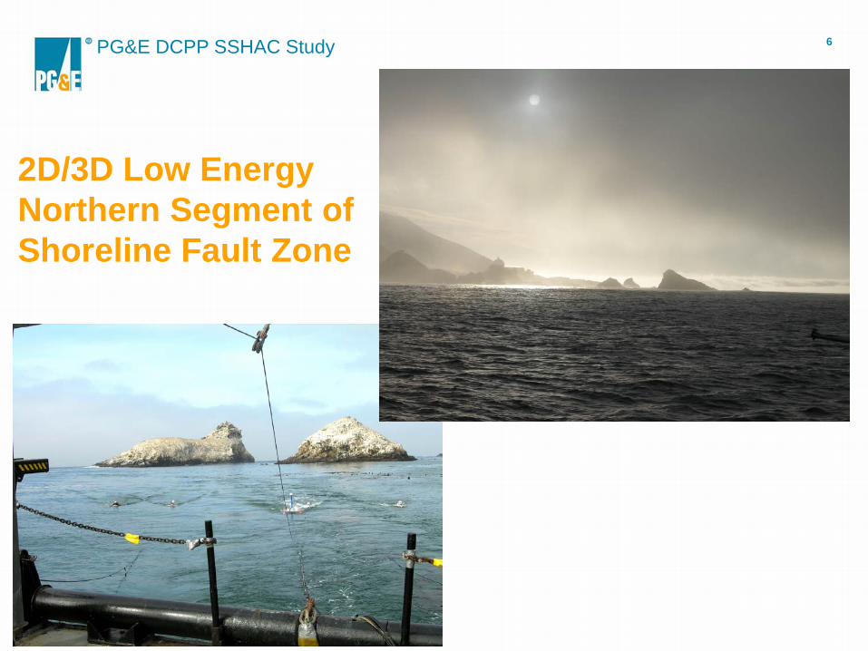
2D/3D Low Energy Northern Segment of Shoreline Fault Zone
PG&E DCPP SSHAC Study 7
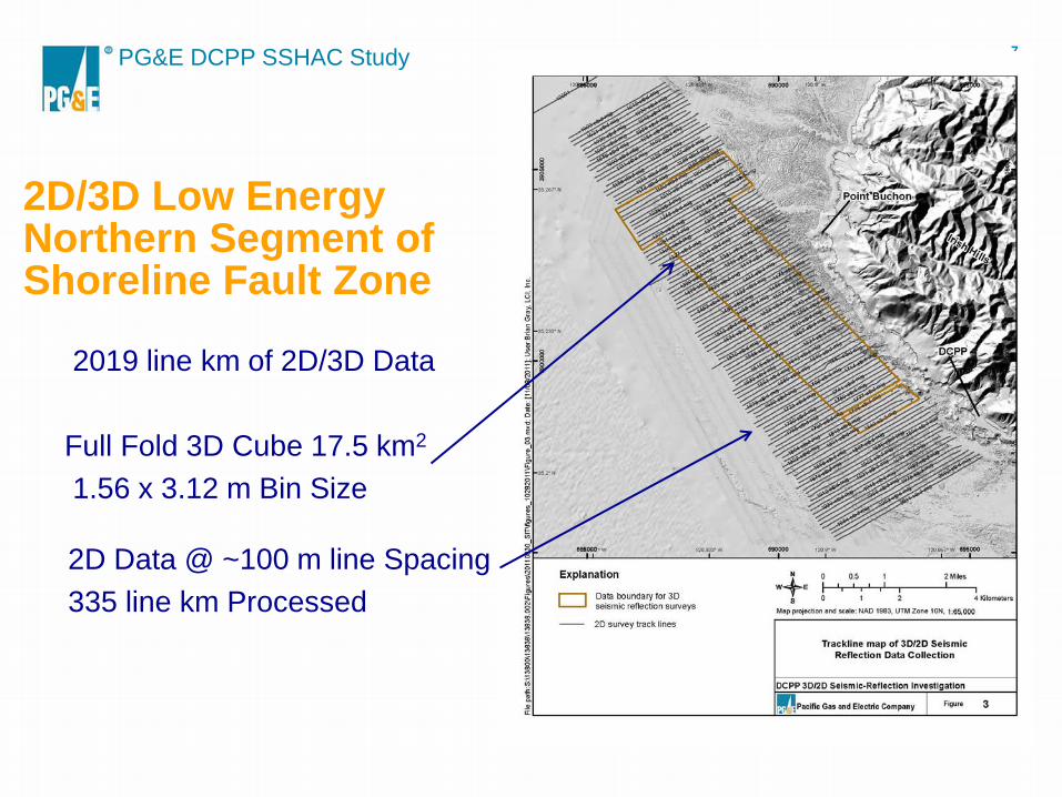
2D/3D Low Energy Northern Segment of Shoreline Fault Zone
2019 line km of 2D/3D Data Full Fold 3D Cube 17.5 km2
1.56 x 3.12 m Bin Size
2D Data @ ~100 m line Spacing 335 line km Processed

PG&E DCPP SSHAC Study 8
2D/3D Irish Hills/ Los Osos Valley

PG&E DCPP SSHAC Study 9
AWD + Vibroseis + Nodes

PG&E DCPP SSHAC Study 10
2011- 2012 Central Coastal California Seismic Imaging Project 1. 3D Low Energy Southern End
of Shoreline Fault Zone 2. 2D Low Energy San Simeon-
Hosgri Step Over 3. 3D High Energy Seismic
Survey (HESS)

PG&E DCPP SSHAC Study 11
FALL 2011 3D Low Energy Southern End of Shoreline Fault Zone
• SubSea Systems AP3000 Triple Plate Boomer • Geometrics P-cable System
12 to 18 - 50 m long Solid Streamers 8 Hydrophones @ 6.25 m Group Interval Bin Size 3.125 m x 3.125 m
• Contour Interval – 2 Feet

PG&E DCPP SSHAC Study 12
2012 2D Low Energy San Simeon-Hosgri Step Over
SubSea Systems AP3000 Triple Plate Boomer Geometrics GeoEel Solid Streamers 24 channel 3.125 m Group Interval 48 channel 6.25 m Group Interval 100 m line spacing

PG&E DCPP SSHAC Study 13
2012 3D High Energy Seismic Survey (HESS)
3000 in3 Bolt Air Gun Array
Four 6 km Streamers w/ 12.5 m Group Interval
100 – 150 m Cross Line Spacing
R/ V Marcus Langseth
PG&E DCPP SSHAC Study 14

PG&E DCPP SSHAC Study 15
Transition/ Intertidal Zone
Zland nodal systems
Z700 Marine geophone systems

PG&E DCPP SSHAC Study 16
Legacy Data Archive • Earthquakes • Geology • GPS • LiDAR • Multi Beam Echo Sounding • Potential Field (Magnetics/ Gravity) • Seismic Reflection/ Refraction

PG&E DCPP SSHAC Study 17
Thank You !