10 c40 gpg tod.original
TRANSCRIPT
GOOD PRACTICE GUIDE
Transit Oriented Development
C40 Cities Climate Leadership Group
The C40 Cities Climate Leadership Group, now in its 10th year, connects more than 80 of the world’s greatest cities, representing 600+ million people and one quarter of the global economy. Created and led by cities, C40 is focused on tackling climate change and driving urban action that reduces greenhouse gas emissions and climate risks, while increasing the health, well-being and economic opportunities of urban citizens. www.c40.org The C40 Cities Climate Leadership Group has developed a series of Good Practice Guides in areas critical for reducing greenhouse gas emissions and climate risk. The Guides provide an overview of the key benefits of a particular climate action and outline successful approaches and strategies cities can employ to implement or effectively scale up these actions. These Guides are based on the experience and lessons learned from C40 cities and on the findings and recommendations of leading organisations and research institutions engaged in these areas. The good practice approaches are relevant for cities engaged in C40Networks as well as for other cities around the world.
TABLE OF CONTENTS EXECUTIVE SUMMARY ............................................................................................................ 3 1 BACKGROUND .................................................................................................................. 4
1.1 PURPOSE .............................................................................................................................. 4 1.2 INTRODUCTION ...................................................................................................................... 4
2 TOD AND CLIMATE CHANGE .............................................................................................. 4 2.1 WHAT IS TOD? ..................................................................................................................... 4 2.2 BENEFITS OF TOD .................................................................................................................. 5
3 GOOD PRACTICE APPROACHES TO DELIVERING SUCCESSFUL TOD ...................................... 6 3.1 CATEGORIES OF BEST PRACTICE .................................................................................................. 6 3.2 WALK: DEVELOP NEIGHBOURHOODS THAT PROMOTE WALKING ........................................................ 7
Case study: New York City -‐ Broadway Boulevard Project ..................................................... 7 Case study: Melbourne -‐ Laneways ........................................................................................ 8
3.3 CYCLE: PRIORITISE NON-‐MOTORISED TRANSPORT NETWORKS ........................................................... 8 Case study: Copenhagen -‐ City of Cyclists .............................................................................. 9
3.4 CONNECT: CREATE DENSE NETWORKS OF STREETS AND PATHS .......................................................... 9 Case study: Singapore -‐ Pedestrian Links ............................................................................. 10
3.5 TRANSIT: LOCATE DEVELOPMENT NEAR HIGH-‐QUALITY PUBLIC TRANSPORT ........................................ 10 Case study: Stockholm -‐ Hammarby Sjöstad ........................................................................ 11
3.6 MIX: PLAN FOR MIXED USE ..................................................................................................... 11 Case study: Vancouver -‐ Olympic Village .............................................................................. 12
3.7 DENSIFY: OPTIMISE DENSITY AND TRANSIT CAPACITY .................................................................... 12 Case study: London -‐ Central Saint Giles .............................................................................. 13
3.8 COMPACT: CREATE REGIONS WITH SHORT COMMUTES ................................................................. 13 Case study: Paris -‐ Quartier Massena, Rive Gauche ............................................................. 14
3.9 SHIFT: INCREASE MOBILITY BY REGULATING PARKING AND ROAD USE ................................................ 14 Case study: London -‐ Public Transport Accessibility Level Scoring ....................................... 14
4 FURTHER READING .......................................................................................................... 15
3
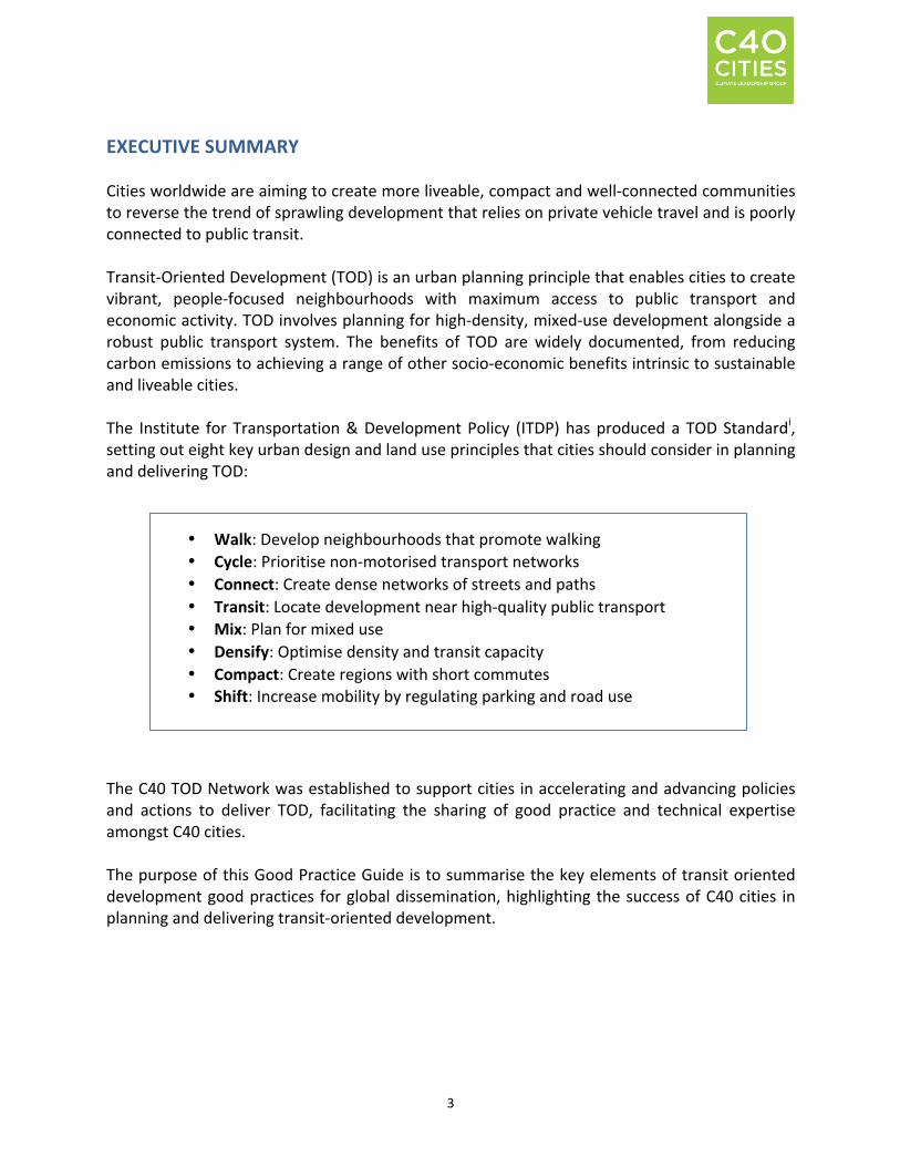
EXECUTIVE SUMMARY Cities worldwide are aiming to create more liveable, compact and well-‐connected communities to reverse the trend of sprawling development that relies on private vehicle travel and is poorly connected to public transit. Transit-‐Oriented Development (TOD) is an urban planning principle that enables cities to create vibrant, people-‐focused neighbourhoods with maximum access to public transport and economic activity. TOD involves planning for high-‐density, mixed-‐use development alongside a robust public transport system. The benefits of TOD are widely documented, from reducing carbon emissions to achieving a range of other socio-‐economic benefits intrinsic to sustainable and liveable cities. The Institute for Transportation & Development Policy (ITDP) has produced a TOD Standardi, setting out eight key urban design and land use principles that cities should consider in planning and delivering TOD:
The C40 TOD Network was established to support cities in accelerating and advancing policies and actions to deliver TOD, facilitating the sharing of good practice and technical expertise amongst C40 cities. The purpose of this Good Practice Guide is to summarise the key elements of transit oriented development good practices for global dissemination, highlighting the success of C40 cities in planning and delivering transit-‐oriented development.
• Walk: Develop neighbourhoods that promote walking • Cycle: Prioritise non-‐motorised transport networks • Connect: Create dense networks of streets and paths • Transit: Locate development near high-‐quality public transport • Mix: Plan for mixed use • Densify: Optimise density and transit capacity • Compact: Create regions with short commutes • Shift: Increase mobility by regulating parking and road use
4
1 BACKGROUND
1.1 Purpose The C40 Cities Climate Leadership Group has developed a series of Good Practice Guides in areas critical for reducing greenhouse gas (GHG) emissions and climate risk. The C40 Good Practice Guides provide an overview of the key benefits of a particular climate action and outline successful approaches and strategies cities can employ to effectively scale up these actions. These Guides are based on the experience and lessons learned from C40 cities, and on the findings and recommendations of leading organisations and research institutions engaged in these areas. The following Good Practice Guide focuses on the Transit-‐Oriented Development (TOD) Standard, developed by the Institute for Transportation & Development Policy (ITDP, a C40 Partner), which sets out eight key urban design and land use policies, and looks at the key elements to successfully deliver TOD in cities, with a survey of best practices leading to better economic, social, and environmental outcomes for cities. These approaches are relevant for cities engaged in C40’s Transit-‐Oriented Development (TOD) Network as well as for other cities around the world. 1.2 Introduction Cities worldwide are aiming to create more liveable, compact and well-‐connected communities to reverse the trend of sprawling development that relies on private vehicle travel. Through adopting the principles of ‘transit-‐oriented development’ (TOD), cities can plan for and create vibrant, well-‐connected, people-‐focused neighbourhoods, reducing carbon emissions and increasing economic prosperity.
The 2014 and 2015 New Climate Economy Reports – Better Growth, Better Climateii and Seizing the Global Opportunityiii by the Global Commission on the Economy and Climate – provide further support for connected and compact cities as the preferred form of urban development to promote economic growth alongside lower emissions. The report finds that, contrary to sprawling car-‐dependent cities, planning for density around a public transport will help keep emissions down, cut local pollution and improve quality of life.
2 TOD AND CLIMATE CHANGE 2.1 What is TOD?
TOD is an urban planning principle that promotes high-‐density, mixed-‐use development integrated with a robust public transport system. TOD represents a transition away from the ‘urban sprawl’ model of development, something the 2014 New Climate Economy Reportiv calls “one of the world’s most significant – and least well documented – market failures.” TOD
5
concentrates development within walking distance of high-‐capacity transit stations, supporting public transport ridership and a mix of services and amenities.
The C40 TOD Network was established to support cities in accelerating and advancing policies and actions to create compact, well-‐connected, mixed-‐used communities; minimising vehicle kilometres travelled and increasing access to transportation. The Network facilitates the sharing of TOD good practice and technical expertise amongst C40 cities through a range of platforms, including webinars, telephone conferences and face-‐to-‐face workshops. The purpose of this Good Practice Guide is to summarise the key elements of TOD good practice for global dissemination, highlighting the success of C40 cities in planning and delivering TOD. 2.2 Benefits of TOD The benefits of TOD are well documented by both urban practitioners and academics. TOD promotes a sustainable model of urban development for cities, helping to reduce carbon emissions as well as achieve a range of other benefits intrinsic to sustainable cities, such as a decrease in traffic congestion and local air pollution. In addition to environmental improvements, TOD also promotes a number of socio-‐economic benefits, such as increasing economic prosperity by connecting housing to employment opportunities. Reduces traffic generation through compact development: By concentrating land uses in walking distance of transport interchanges, cities reduce the need for travel by private vehicles, with associated reduction in the impact of traffic congestion and improvements in air quality and road safety. New York City in particular has reduced traffic and pedestrian injuries by 63% and 35% respectively through public realm interventions in the city’s streets that encouraged walking and cycling.v By adopting a compact and integrated city design, and allowing people to live and work in close proximities, cities can dramatically reduce their carbon footprint and air pollution associated with heavy traffic congestion. Improves access to economic opportunities and social equity: A robust public transportation infrastructure system is a key component of TOD. In cities like Los Angeles, a high proportion of public transport ridership is from low-‐income communities that rely on transit as an affordable alternative to private vehicles. Expanding and strengthening the service and connectivity of public transport systems with housing and economic opportunities enables cities to become more socially equitable by improving access to jobs and services. Encourages active, safe and healthy communities: By reducing reliance on private vehicles and creating a modal shift towards walking and cycling, TOD encourages vibrant and lively public spaces, supporting more people-‐oriented activities such as cafés and shops. Cities that have focused on high-‐quality public realm include Melbourne, which has introduced a range of daytime and night-‐time activities to their historic ‘laneways’ to bring people into once
6
neglected spaces and improve safety in the city centre. Through improving walkability, TOD not only encourages high-‐quality public realm and safe spaces but also more active communities. Regular walking is shown to reduce chronic diseases and encourage a healthier lifestyle, which are important co-‐benefits of TOD.
3 GOOD PRACTICE APPROACHES TO DELIVERING SUCCESSFUL TOD 3.1 Categories of best practice The Institute for Transportation & Development Policy (ITDP), a key C40 partner, has produced a TOD Standard setting out a number of crucial urban design and land use elements that are associated with high performing TOD projects. The TOD Standard is available in English, Spanish, Portuguese, Chinese, Indonesian, Dutch and Russian and can be found at: https://www.itdp.org/library/standards-‐and-‐guides/transit-‐oriented-‐development-‐are-‐you-‐on-‐
the-‐map/about-‐the-‐tod-‐standard/
As defined by the TOD Standard, the key basic elements of TOD should comprise eight core principles:
• Walk: Develop neighbourhoods that promote walking • Cycle: Prioritise non-‐motorised transport networks • Connect: Create dense networks of streets and paths • Transit: Locate development near high-‐quality public transport • Mix: Plan for mixed use • Densify: Optimise density and transit capacity • Compact: Create regions with short commutes • Shift: Increase mobility by regulating parking and road use
When cities decide to implement TOD, in accordance with accepted good practice, these eight elements should be included in the planning and design of the development in order to deliver projects that maximise the benefits of TOD. The TOD Standard applies a scoring system to each project against the eight principles, objectively assigning points and awarding a ‘Gold Standard’ to the top performing projects.vi While cities should aspire to deliver Gold Standard TOD projects, it is accepted that local conditions may mean this is not always possible. However, the more comprehensively the eight elements of the TOD Standard are included within a scheme, the more it will increase the project’s potential to deliver the wide assortment of TOD benefits.
7
In order for cities to successfully plan and deliver TOD, they should strive to incorporate the eight core principles that comprise the ITDP TOD Standard. This good practice brief identifies city case studies for each of these TOD Standard principles that also demonstrates good practice for the C40 TOD Network. 3.2 Walk: Develop neighbourhoods that promote walking
Walking provides the most affordable, sustainable and healthy mode of transport for short distances, whilst also contributing to an active public realm and safe streets. Walking is highly sensitive to the surrounding urban conditions. Accordingly, the TOD Standard states that TOD projects should ensure:
• The pedestrian network is safe and complete, through a variety of crossings and
interchanges, including wheelchair-‐accessible walkways. • The pedestrian realm is active and vibrant, by providing ground-‐floor commercial
activities. • The pedestrian realm is temperate and comfortable, such as the provision of shading
through trees or awnings. Case study: New York City -‐ Broadway Boulevard Projectvii Summary: One of New York City’s most iconic streets used to be heavily congested with queuing vehicles and many pedestrians forced onto narrow sidewalks, resulting in an unpleasant and unsafe working and shopping environment. In May 2009, the City of New York sought to improve the pedestrian experience of the area and began the Broadway Boulevard Project, introducing pedestrian zones in a range of locations, including Times Square, Herald and Greely Squares, and at Madison Square Park. Today, Broadway has dramatically changed to become thriving with activity, with the project reclaiming streets from cars to allow for cafés, concerts, art exhibitions, and even yoga classes.viii Results: Despite these changes to roughly 2.3 miles of a main Manhattan thoroughfare, congestion actually decreased on most surrounding avenues. Traffic injuries were reduced by 63% and pedestrian injuries decreased by 35%. Pedestrian volumes increased by 11% in Times Square and 6% in Herald Square, with pedestrians staying longer in these locations. Bicycle volumes increased 16% on weekdays and 33% on weekendsix. Reasons for success: The project was deemed a success due to the consideration of improvements to pedestrian and traffic safety as well as aesthetic enhancements.x According to Project for Public Spacesxi, the project’s success is also attributed to its wide scope, involving an area-‐wide transportation network overhaul which included adjusting turning lanes, parking regulations, and signal timing. Local businesses supported the plan throughout with none stating that the project has had any adverse impact on their business, and 20% of owners/managers thought their business had improved.
8
When/why a city might adopt an approach like this: Other cities might be interested in following the example of New York to reduce the impact of traffic in central areas and encourage walking as a mode of transport. The Broadway Boulevard Project proves that these two seemingly conflicting objectives can be achieved at the same time, even in car-‐centric cities, through the introduction of small-‐scale urban design interventions to improve the pedestrian experience. Case study: Melbourne -‐ Laneways Summary: Melbourne has a network of laneways created by the historic small block grid pattern design in the city centre, which offer a diverse mix of cafés, bars, small restaurants, boutique shops and artwork. Whilst the laneways are now a warren of daytime and night-‐time activity, they were once neglected and underused spaces predominately used for service access only. In addition to the mix of commercial uses offer, the design of the laneways has considered the pedestrian experience with lighting, awnings, signage/wayfinding and paving considerations.xii Results: The number of accessible and active laneways in Melbourne increased from 300 metres to 3.43 kilometres between 1994 and 2004.xiii The laneways have enhanced the unique character of the city by creating lively, dense and human-‐scale spaces. The hugely popular annual St Jerome’s Laneway Festival, involving live music and performances, originated in the laneways.xiv Reasons for success: The City of Melbourne introduced various policies to support the revitalisation and protection of the laneways. Such policies included a ‘Laneway Policy’ to identify the important characteristics of the city’s lanes and to indicate the preferred character and form of development.xv The City of Melbourne also established the ‘Laneway Commissions Programme’ focusing on projects for more neglected lanes to transform into ‘art galleries’ through street art, murals and performance space.xvi When/ why a city might adopt an approach like this: By planning and designing a network of interlocking pedestrian-‐focused streets, lanes and arcades, cities not only encourage walking but also create vibrant areas for cultural daytime and night-‐time activity, creating safer spaces and a higher quality of living. 3.3 Cycle: Prioritise non-‐motorised transport networks
Cycling is an efficient, convenient and zero-‐carbon transport option that consumes little space and few resources. The TOD Standard states that planning for cycling should consider the safety and convenience of the user, including:
9
• The cycling network is safe and complete, through various cycle-‐friendly interventions such as cycle paths and lanes and cycle-‐friendly junctions.
• Cycle parking and storage is ample and secure, including the provision of secure cycle racks at public transit stops.
Case study: Copenhagen -‐ City of Cyclistsxvii Summary: Copenhagen is renowned for its cycling culture. Since the 1970s, the city has invested heavily in cycle infrastructure, tailoring roads and transport policy to cyclists’ needs. In 2012, the City of Copenhagen adopted a new cycling strategy for 2025 with a goal of increasing the modal share of bicycles to 50% of commuter trips and reducing serious injuries by 70%.xviii Results: According to the Copenhagen Bicycle Account 2014xix, 45% of the total number of people working or studying in Copenhagen cycle to their place of work or education. There are 350 kilometres of segregated cycle tracks, which accommodate all types of cyclists, including children, seniors, and families. The shift to a dominant cycling mode share has also had beneficial economic impacts given reductions in air pollution and healthcare costs. Cycling is generally perceived as a healthier, more environmentally friendly, cheaper and often a quicker way to move around town than public transport or a car. 50% of Copenhagen cyclists claim they cycle because that is the easiest way to get around the city. Reasons for success: Copenhagen has been successful in its cycling strategy thanks to a range of large and small interventions to support cycling in the city. The City of Copenhagen has introduced a vast network of Green Cycle routes and Super Cycle Highways. The cycle tracks are designed with safety and convenience of the bike user in mind, with clear segregation from cars, often with a curb or trees separating the two transport users.xx A key improvement has also been the introduction of the ‘Cykelslangen’, or ‘cycle snake’, an elevated bike lane that combines an enhanced cycling experience with an iconic design addition to the city. xxi Commuters are permitted to bring bicycles on local trains for free, which further encourages mixed-‐mode commuting. Copenhagen also has a number of high-‐profile cycling advocates, including city government officials and even the Danish Royal Family.xxii When/why a city might adopt an approach like this: Copenhagen’s cycling efforts have long been a source of inspiration for other cities that aspire for cycling to be the primary mode of transportation. This has given rise to the term ‘Copenhagenisation’, coined by Danish architect and professor Jan Gehl.xxiii Urban and transport planners from all over the world have been looking to Copenhagen for ways to shift people away from their cars and onto bikes.xxiv 3.4 Connect: Create dense networks of streets and paths In order to encourage walking and cycling, routes should be short and direct. This requires planning for an urban fabric with small, permeable blocks and a tight network of paths and
10
streets. According to the TOD Standard, urban and transport planners should consider the following objectives:
• Walking and cycling routes are short, direct and varied, through small average block
size and varied routes that access a number of activities. • Walking and cycling routes are shorter than motor vehicle routes, providing for higher
ratios of non-‐motorised travel path connectivity to car-‐accessible road connectivity.
Case study: Singapore -‐ Pedestrian Links Summary: Singapore has introduced urban design guidelines to encourage the provision of new through-‐block pedestrian links and view corridors within selected developments in order to break down the scale and improve permeability of street blocks.xxv The overall pedestrian network in Singapore includes covered walkways, linkways as well as through-‐block links, and has been designed to be three-‐dimensional with key routes linking upper and basement levels in addition to at-‐grade pathways. Specific design guidelines have also been implemented on some key sites, alongside minimum widths and heights of through-‐block links. Results: Downtown Singapore has been planned as a pedestrian-‐friendly area. The city features a comprehensive network of pathways that provide convenient connections between developments, transport nodes, and key facilities. Due to strong design guidelines, the pedestrian networks have been planned for an enhanced walking experience, with the inclusion of awnings being particularly important to protect walkers from the extreme sunshine and rainfall typical to the climate of Singapore. Reasons for success: The provision of through-‐block links is guided by a set of planning parameters and urban design guidelines used to assess development proposals. In addition, further incentives are given by exempting linkages from Gross Floor Area calculations if they form part of the larger pedestrian network. When/why a city might adopt an approach like this: Cities with large footprint buildings might adopt through-‐block policies to provide more permeable urban environment and convenient walking routes, encouraging pedestrian activity. In addition, cities with inclement weather could benefit from the three-‐dimensional pedestrian network approach of Singapore by providing links on upper and basement levels, and covered paths for a sheltered and more comfortable experience. 3.5 Transit: Locate development near high-‐quality public transport
The provision of high-‐quality public transport is a prerequisite for TOD, allowing for efficient and equitable urban mobility. Public transport, however, needs to be paired with urban development located in close proximity to transit stations. As such, a key objective in the TOD Standard is for cities to provide for:
11
• High-‐quality transit accessible by foot, with a maximum recommended distance defined
at 1 kilometre, or a 15-‐20 minute walk for high-‐capacity services.
Case study: Stockholm -‐ Hammarby Sjöstadxxvi Summary: Hammarby Sjöstad is a redevelopment project in southern Stockholm. The project was central to Stockholm’s bid to host the 2004 Olympics, with Hammarby Sjöstad part of the ecological Olympic Village. Although the bid was unsuccessful, the site has since been converted from a run-‐down industrial area into a modern, environmentally sustainable, mixed-‐use district with good public transit connections.xxvii Results: According to ITDP, Hammarby Sjöstad is home to approximately 20,000 residents and includes nearly 100 retail units and restaurants as well as office space and light industrial uses, employing over 5,000 people. Only 21% of trips made by Hammarby Sjöstad residents are by car, while 52% are by public transportation, and 27% by bicycle or by foot. CO2 emissions per apartment from transport by car are more than 50% lower in Hammarby Sjöstad than in the surrounding districts, and GHG emissions from buildings are 40-‐46% lower.xxviii Reasons for success: Hammarby Sjöstad’s success can be attributed to strong environmental goals that shaped the development plan, incorporating land use, building materials, energy, water and sewage, and solid waste. A transport modal shift was the main objective of the redevelopment, with the goal to create a place where 80% of trips would be made by public transport, bike or foot. This goal has been achieved by complementing expansion of the district with transport investments, including increased bus service, cycle paths, pedestrian bridges, ferry service and an extension of the tramline. Development has been focused on a dense settlement structure, concentrated along main transit corridors. In addition, to discourage car use, parking in the area is limited and expensive. When/why a city might adopt an approach like this: Cities seeking to plan sustainability-‐driven large-‐scale redevelopment projects may be interested in following the example of Hammarby Sjöstad. It is important to note that the sustainability benefits of Hammarby Sjöstad extend beyond reducing carbon emissions to increased quality of life through the provision of nature parks and waterfront walkways. 3.6 Mix: Plan for mixed use
Vibrant and dynamic communities are created by planning for a mix of land uses and activities in an area. Residents have shorter daily trips when jobs and homes, services amenities are located in close proximity, encouraging walking and cycling. A mix of land uses also allows for a range of daytime and night-‐time amenities, creating activity at all times of the day. A mix of housing tenure close to public transit stations is also important to allow a range of social
12
communities to benefit from public transport access. The TOD Standard promotes the following objectives to plan for mixed use:
• Trip lengths are reduced by the provision of diverse and complementary uses, allowing
for a wide range of daily trips to be accessible by walking or cycling. • Mixed income communities include dedicated affordable housing.
Case study: Vancouver -‐ Olympic Villagexxix Summary: The Olympic Village in Vancouver, built for the 2010 Winter Olympics, is part of the larger, mixed-‐use community of Southeast False Creek, which has a total population of 13,000 people. The neighbourhood includes housing and jobs that are close to transit, and provides access to goods and services within walking distance. The development provides for a diverse range of uses, incorporating retail, offices and community facilities along with mixed-‐income housing. Open spaces, plazas, streets, lanes, and pathways connect the entire site and link with adjacent neighbourhoods. The Village is designed to enhance the pedestrian and social experiences of residents and visitors through the incorporation of heritage, sustainability, and urban design. Results: The development was driven by ambitious sustainability and social goals. The Olympic Village is Canada's first residential multi-‐unit net-‐zero community – generating as much energy as it uses. The project included the rehabilitation of the shoreline, along with a new habitat island, seawall, pedestrian bridge and intertidal marine habitat. By 2020, the Olympic Village will have 5,000 residential units with a focus on affordable housing, with the dwellings complemented by a community centre on the waterfront, three childcare centres, a newly expanded library, and 26 acres of open public space. Reasons for success: The Olympic Village has succeeded in achieving its sustainability goals primarily because of the strong institutions and policies underpinning the development. The City of Vancouver introduced general planning principles addressing ecological, social, and economic aspects as early as 1999. When/why a city might adopt an approach like this: The Olympic Village project in Vancouver may be of interest to cities looking to transform former industrial areas located near the city centre and/or close to transit. The opportunities provided by the planning and organisation of a global mega-‐event such as the Winter Olympics in Vancouver could be leveraged by other cities staging similar large-‐scale events. 3.7 Densify: Optimise density and transit capacity
To avoid urban sprawl, cities must grow vertically. Higher densities also support high frequency, robust transit systems and a wide range of services and amenities. The TOD Standard promotes the following objective for cities:
13
• Residential and job densities support high-‐quality transit and local services, whilst also
remaining sensitive to the local context. Case study: London -‐ Central Saint Giles Summary: Central Saint Giles is a redevelopment project in central London, which aimed to create new office and residential space close to important transit hubs. The mixed-‐use space includes 46,000 square metres of offices – almost double that of the old St Giles Court – and over 100 apartments surrounding a new public square with cafes, restaurants and retail units, increasing density on the site through the introduction of 15-‐storey and 11-‐storey high buildings.xxx The development minimises its environmental impact through biomass boilers, planted roof terraces, recycled rain and grey water, and extremely limited parking.xxxi Results: The development was completed in 2010 and has since attracted major firms such as Google and Mindshare. It was also nominated in November 2010 for the London Planning Awards under the Best New Place to Live category.xxxii Reasons for success: Central Saint Giles has succeeded in revitalising a large area in central London by investing in high-‐quality offices and residences but emphasising shared, public spaces at the same time. Despite the high densities achieved on the site, the buildings encircle a publicly accessible courtyard with cafes and restaurants to increase the quality of public realm. There are only ten car parking spaces due to the local planning authority insisting the development be largely car-‐free, with each parking space at a cost of £100,000, thereby creating a strong financial incentive to use other modes of transport.xxxiii When/why a city might adopt an approach like this: Cities redeveloping areas close to high-‐capacity public transport can learn from the Central Saint Giles project on how to provide densities whilst also creating high-‐quality public realm and reducing private vehicle use. 3.8 Compact: Create regions with short commutes
Compact development requires various activities and uses to be spatially integrated in close proximity. By promoting compact development, cities gain a wide range of benefits, including minimising infrastructure costs and preserving rural land. The TOD Standard promotes the following performance objectives:
• The development is in an existing urban area, by promoting densification of previously
developed land. • Travelling through the city is convenient, by providing multi-‐modal transport options to
encourage more people to use public transport.
14
Case study: Paris -‐ Quartier Massena, Rive Gauchexxxiv Summary: The Quartier Massena is one of three districts along the left bank of the River Seine in Paris’s 13th arrondissement. The district is part of a compact, mixed-‐use, and pedestrian and cycle friendly new development built in the early 1990s on former rail yards, warehouses, and industrial land. Results: Paris Rive Gauche is an area experiencing the emergence of a thriving district with local shops and services. According to SEMAPA, almost 20,000 residents, 30,000 students, lecturers and researchers, and 60,000 workers cross paths every day. The area also benefits from ten hectares of green spaces and 2,000 trees. In addition, unlike much of Paris where buildings generally follow a standard design code, the area offers a broad mix of building styles. Reasons for success: The Quartier Massena integrates residential, work, retail and entertainment activities into one area. As such, everyday destinations are mixed together, as opposed to concentrated in separate spaces, thus making many trips short and walkable. The diverse, mixed-‐use neighbourhoods also allow for more varied, rich and interesting streetscapes, with diverse street activities at all hours.xxxv When/why a city might adopt an approach like this: Cities with underutilised space may be interested in replicating the example of Quartier Massena as an example of providing for a range of daily activities within one neighbourhood. 3.9 Shift: Increase mobility by regulating parking and road use
The final principle of the TOD Standard is to shift away from private vehicle use. By following the previous seven principles, the need for motor vehicles is already reduced, allowing cities to reclaim road and parking spaces for more productive land uses. The TOD Standard sets the following performance objective:
• The land occupied by motor vehicles is minimised, with a low provision of on-‐street and
off-‐street parking space for private vehicles. Case study: London -‐ Public Transport Accessibility Level Scoring Summary: Transport for London (TfL – the transport authority for London) has developed a tool that rates the accessibility of locations across London to public transport, informing reduced parking standards in highly accessible areas. The Public Transport Accessibility Level (PTAL) method assesses the level of walking distances to transport stops and stations, including measuring the level of transport service and wider connectivity.xxxvi PTAL is then used in development planning to set parking and density standards, with highly accessible areas to public transport afforded the lowest parking requirements and the highest densities.xxxvii
15
Results: The PTAL scoring allows the Greater London Authority (GLA – the authority responsible for urban planning in London) to understand accessibility to public transport across the whole of London, and accordingly permit developers to reduce private vehicle provision at accessible locations. The PTAL score allows planners to identify TOD-‐appropriate areas and plan accordingly. Reasons for success: PTAL is a citywide rating tool that is clear and transparent in its methodology. By making accessibility data available, PTAL enables planners to reduce minimum parking requirements in high-‐scoring areas close to public transport and plan appropriately for density. When/ why a city might adopt an approach like this: Cities looking to reduce parking provision and increase developable space might use the PTAL methodology to identify areas highly accessible to public transport to inform parking provision standards.
4 FURTHER READING A number of external organisations, including C40 partners, have published best practice guidance in a few TOD-‐related areas including:
• TOD Standard, from ITDP, available at: https://www.itdp.org/library/standards-‐and-‐guides/transit-‐oriented-‐development-‐are-‐you-‐on-‐the-‐map/about-‐the-‐tod-‐standard/
• Transit Oriented Development Guide for Urban Communities, from EMBARQ (WRI), available at: http://www.wricities.org/research/publication/transit-‐oriented-‐development-‐tod-‐guide-‐urban-‐communities
• New Climate Economy Report – Better Growth, Better Climate, available at: http://2014.newclimateeconomy.report/
• New Climate Economy Report – Seizing the Global Opportunity, available at: http://2015.newclimateeconomy.report/
i ITDP (2014). TOD Standard. Available at: https://www.itdp.org/tod-‐standard/ ii The New Climate Economy (2014). New Climate Economy Report – Better Growth, Better Climate. Available at: http://2014.newclimateeconomy.report/ iii The New Climate Economy (2015). New Climate Economy Report -‐ Seizing the Global Opportunity. Available at: http://2015.newclimateeconomy.report/ iv The New Climate Economy (2014). New Climate Economy Report – Better Growth, Better Climate. Available at: http://2014.newclimateeconomy.report/ v ITDP (2014). Our Cities Ourselves – Principles for Transport in Urban Life. Available at: https://www.itdp.org/wp-‐content/uploads/2014/07/OCO8principles_ITDP.pdf vi ITDP (2015). Best Practices – TOD. Available at: https://www.itdp.org/library/standards-‐and-‐guides/transit-‐oriented-‐development-‐are-‐you-‐on-‐the-‐map/best-‐practices/
16
vii Project for Public Spaces (N/A). Broadway Boulevard: Transforming Manhattan’s Most Famous Street. Available at: http://www.pps.org/reference/broadway-‐boulevard-‐transforming-‐manhattans-‐most-‐famous-‐street-‐to-‐improve-‐mobility-‐increase-‐safety-‐and-‐enhance-‐economic-‐vitality/ viii ITDP (2014). Our Cities Ourselves – Principles for Transport in Urban Life. Available at: https://www.itdp.org/wp-‐content/uploads/2014/07/OCO8principles_ITDP.pdf ix Project for Public Spaces (N/A). see above. Available at: http://www.pps.org/reference/broadway-‐boulevard-‐transforming-‐manhattans-‐most-‐famous-‐street-‐to-‐improve-‐mobility-‐increase-‐safety-‐and-‐enhance-‐economic-‐vitality/ x http://www.nytimes.com/2010/02/12/nyregion/12broadway.html?_r=1 xi Project for Public Spaces (N/A). Broadway Boulevard: Transforming Manhattan’s Most Famous Street. Available at: http://www.pps.org/reference/broadway-‐boulevard-‐transforming-‐manhattans-‐most-‐famous-‐street-‐to-‐improve-‐mobility-‐increase-‐safety-‐and-‐enhance-‐economic-‐vitality/ xii Ferreter, S et al. (2008). Melbourne’s Revitalized Laneways. Available at: https://courses.washington.edu/gehlstud/gehl-‐studio/wp-‐content/themes/gehl-‐studio/downloads/Autumn2008/Melbourne_Lanes.pdf xiii ITDP (2014). Our Cities Ourselves – Principles for Transport in Urban Life. Available at: https://www.itdp.org/wp-‐content/uploads/2014/07/OCO8principles_ITDP.pdf xiv Melbourne (2015). St. Jerome’s Laneway Festival. Available at: http://melbourne.lanewayfestival.com/ xv City of Melbourne (2015). Planning controls FAQ. City of Melbourne Website. Available at: https://www.melbourne.vic.gov.au/BuildingandPlanning/Planning/FAQ/Pages/PlanningcontrolFAQ.aspx xvi E-‐Melbourne (2008). Laneway Commissions. Available at: http://www.emelbourne.net.au/biogs/EM01679b.htm xvii ITDP (2014). Our Cities Ourselves – Principles for Transport in Urban Life. Available at: https://www.itdp.org/wp-‐content/uploads/2014/07/OCO8principles_ITDP.pdf xviii UCI (2014). Copenhagen, the most bicycle-‐friendly city in the world. Union Cycliste Internationale website. Available at: http://www.uci.ch/cyclingforall/copenhagen-‐the-‐most-‐bicycle-‐friendly-‐city-‐the-‐world/ xix http://www.cycling-‐embassy.dk/2015/05/06/new-‐bicycle-‐account-‐from-‐copenhagen/ xx Hanscom, G. (2013). Riding lessons for U.S. cities from one of Europe’s bike capitals. Grist. Available at: http://grist.org/cities/riding-‐lessons-‐what-‐u-‐s-‐cities-‐can-‐learn-‐from-‐one-‐of-‐europes-‐bike-‐capitals/ xxi Colville-‐Andersen, M. (2014). Innovation in, lycra out: what Copenhagen can teach us about cycling. The Guardian. Available at: http://www.theguardian.com/cities/2014/oct/16/copenhagen-‐cycling-‐innovation-‐lycra-‐louts-‐green-‐wave-‐bike-‐bridges xxii C40 Webinar by M. Kåstrup, Cycling Program Manager at City of Copenhagen and K. Bondam, Director at Danish Cyclists’ Federation xxiii http://www.copenhagenize.com/2009/12/copenhagen-‐jan-‐gehl-‐and-‐contested.html xxiv Jacobsen, H. (2009). Bicycle-‐friendly Copenhagen a model for big cities. Reuters. Available at: http://www.reuters.com/article/2009/12/14/us-‐climate-‐copenhagenisation-‐idUSTRE5BD2GK20091214 xxvUrban Design Guidelines for Developments within Downtown Core Planning Area. Available at: https://www.ura.gov.sg/uol/circulars/2013/nov/~/media/User%20Defined/URA%20Online/circulars/2013/nov/dc13-‐14/dc13-‐14_Annex%20A.ashx xxvi ITDP (2014). Our Cities Ourselves – Principles for Transport in Urban Life. Available at: https://www.itdp.org/wp-‐content/uploads/2014/07/OCO8principles_ITDP.pdf xxvii Notaras, M. (2010). Sweden’s Gold Medal Winning Eco-‐Town. Our World. Available at: http://ourworld.unu.edu/en/hammarby-‐swedens-‐gold-‐medal-‐winning-‐eco-‐town xxviii C40 (2015). Case Study – Industrial Area Transformed: Hammarby Sjöstad. Available at: http://www.c40.org/case_studies/industrial-‐area-‐transformed-‐hammarby-‐sjostad xxix City of Vancouver (2014). Olympic Village. City of Vancouver Website. Available at: http://vancouver.ca/home-‐property-‐development/olympic-‐village.aspx; City of Vancouver (2015). Southeast False Creek. City of Vancouver Website. Available at: http://vancouver.ca/home-‐property-‐development/southeast-‐false-‐creek.aspx xxx Woodman, E. (2010). Central St Giles by Renzo Piano. Building.co.uk. Available at: http://www.building.co.uk/buildings/central-‐st-‐giles-‐by-‐renzo-‐piano/5000286.article xxxi ARUP (N/A). Central St Giles. ARUP. Available at: http://www.arup.com/Projects/Central_St_Giles.aspx xxxii London First (2010). Shortlist announced for London’s prestigious planning awards. Available at: http://londonfirst.co.uk/shortlist-‐announced-‐for-‐londons-‐prestigious-‐planning-‐awards/ xxxiii Building4Change (2013). Central St Giles, London. Available: http://www.building4change.com/article.jsp?id=1834#.Va4ZYe1VhBc xxxiv SEMAPA (N/A). Paris Rive Gauche. Available at: http://en.semapa.fr/Urban-‐development/Operations-‐in-‐progress/Paris-‐Rive-‐Gauche xxxv ITDP (2014). Our Cities Ourselves – Principles for Transport in Urban Life. Available at: https://www.itdp.org/wp-‐content/uploads/2014/07/OCO8principles_ITDP.pdf xxxvi TfL (2015). Accessibility & connectivity. Transport for London. Available at: https://tfl.gov.uk/info-‐for/urban-‐planning-‐and-‐construction/transport-‐assessment-‐guide/transport-‐assessment-‐inputs/accessibility-‐analysis xxxvii Greater London Authority (2015). The London Plan. Available at: http://www.london.gov.uk/priorities/planning/london-‐plan

LondonNorth West Entrance, City-Gate House39-45 Finsbury Square, Level 7London EC2A 1PXUnited Kingdom
New York120 Park Avenue, 23rd FloorNew York, NY 10017United States
Rio de JaneiroR. São Clemente, 360 - Morro Santa MartaBotafogo, 22260-000Rio de Janeiro - RJBrazil [email protected]
© C40 Cities Climate Leadership Group February 2016