180110 sa appendix viib safeguarded broad locational ... · pdf fileproblem + minor positive...
TRANSCRIPT
Central Bedfordshire Local Plan: SA Appendix VIIb: Safeguarded Broad Locational Options
278_November 2017 AVIIb_1/67 Enfusion
Appendix VIIb: Strategic SA of Safeguarded Broad Locational Options
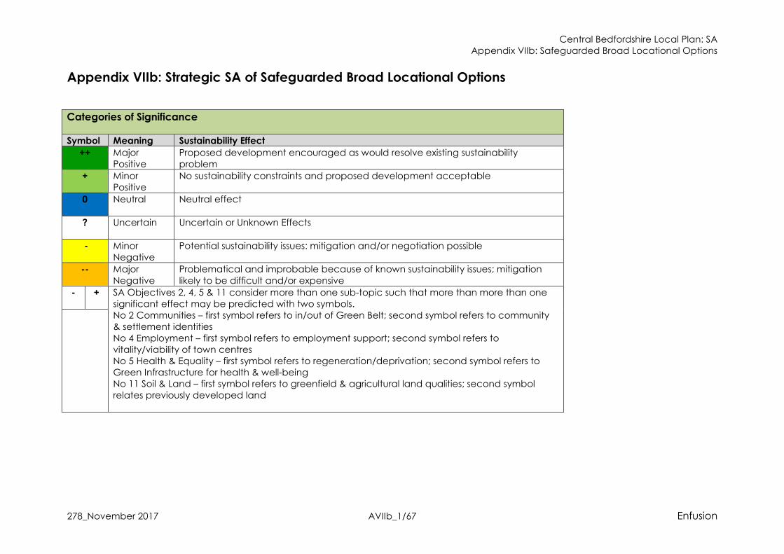
Categories of Significance
Symbol Meaning Sustainability Effect
++ Major Positive
Proposed development encouraged as would resolve existing sustainability problem
+ Minor Positive
No sustainability constraints and proposed development acceptable
0 Neutral
Neutral effect
?
Uncertain Uncertain or Unknown Effects
- Minor Negative
Potential sustainability issues: mitigation and/or negotiation possible
-- Major
Negative
Problematical and improbable because of known sustainability issues; mitigation
likely to be difficult and/or expensive
- + SA Objectives 2, 4, 5 & 11 consider more than one sub-topic such that more than more than one significant effect may be predicted with two symbols. No 2 Communities – first symbol refers to in/out of Green Belt; second symbol refers to community & settlement identities
No 4 Employment – first symbol refers to employment support; second symbol refers to vitality/viability of town centres No 5 Health & Equality – first symbol refers to regeneration/deprivation; second symbol refers to Green Infrastructure for health & well-being No 11 Soil & Land – first symbol refers to greenfield & agricultural land qualities; second symbol relates previously developed land

Central Bedfordshire Local Plan: SA Appendix VIIb: Safeguarded Broad Locational Options
278_November 2017 AVIIb_2/67 Enfusion
SUMMARY Broad Location/Alternative SA Objectives 1 2 3 4 5 6 7 8 9 10 11 12 13 14
Housing
Communities –
Green Belt; Identity
Services & Facilities
Employment
Health & Equality
Highways & Air
Quality
Sustainable
Transport
Energy & Clim
ate
Change
Water Resources &
Quality
Flood Risk
Soil
Biodiversity &
Geodiversity
Landscape
Historic
Environment
Aspley Guise Triangle
3500 homes ++ 0 +
? ++?
+
+
?
+ 0 +
+ 0? ++ +? 0? 0
-
-
?
0 +? +? 0?
Luton West
3600 homes ++ -
-
-
? ++? 0 +
+
+
?
+
+ -? + +? 0? 0
-
-
?
0 +? --? 0?
Marston Thrift
2000 homes ++ 0 - ++ 0 + 0 +
+
-? + +? 0? 0 -
-
?
0 +? + 0
RAF Henlow
1000 homes
++ 0 -
? ++? 0 +
0
? + 0? + +? 0? 0
-
-
?
+
? +? +? ?
RAF Henlow1
Mixed-use employment land 0 0 -
? +?
+
+ +
0
? + 0? + +? 0? 0
-
-
?
+
? +? +? ?
North & North East Sandy
4,750 homes
++ 0 -
? ++?
+
? +
+
+
?
+
+ 0? ++ +? 0? 0?
-
-
?
0 +? -? 0?

Central Bedfordshire Local Plan: SA Appendix VIIb: Safeguarded Broad Locational Options
278_November 2017 AVIIb_3/67 Enfusion
Tempsford
New settlement up to 10000 homes
++ 0 -
? ++? 0 +
+
+
?
+
+ 0? +? +? 0? 0?
-
-
?
+
? +? -? -?
East of Biggleswade Phase 2
Up to a further 1,500 homes Assessed and reported in Appendix VIIa with East of Biggleswade Phase 1
Growth Location: Aspley Guise Triangle Number of Dwellings: 3500 homes
SA Objective
Assessment of Effects Nature of the likely sustainability effect (including positive/negative, short - medium term (5-10 years)/long
term (10 - 20 years plus), permanent/temporary, secondary, cumulative and synergistic); Uncertainty
1. Housing To ensure that the housing needs of all residents and
communities are met
The delivery of up to 3000 new homes will have major long-term positive effects. A small level of development (650 homes) is being prosed in the plan period, and this will contribute towards the identified housing need for Central Bedfordshire.
It is assumed that development at the broad location can meet the policy objectives of draft Local Plan policy (Housing Mix) to provide an appropriate mix of housing types, tenures and sizes.
++
2. Communities2 To maintain and enhance community and settlement identities
Development in this area will not result in the loss of any Green Belt land with neutral effects. The broad location is located approx. 500m from the main settlement of Aspley Guise3, although
there is some development housing development in closer proximity (adjacent to the southern boundary of the broad location). However, it is unlikely that development will contribute to coalescence with the main settlement of Aspley Guise due to the presence of the railway line and landscape buffers proposed in masterplanning4 for a site at the broad location, which should ensure new development is self-contained. New development to the north should avoid potential coalescence with Milton Keynes to the west.
0 +?
2 Please note that first symbol relates to location in/out of Green Belt designation; second symbol relates to effects on integration & identity for existing settlements 3 Measured using GIS (2017) 4 Savills on behalf of the Hayfield Consortium (2017) A Vision for Hayfield
Central Bedfordshire Local Plan: SA Appendix VIIb: Safeguarded Broad Locational Options
278_November 2017 AVIIb_4/67 Enfusion
Growth Location: Aspley Guise Triangle Number of Dwellings: 3500 homes
The expansion north of the settlement however is less likely to effectively integrate given the existing railway line providing a barrier for movement and connection with the existing urban form. However, Parish Councils in the area have indicated they would prefer new development to be
separated from the existing urban area by the use of greenspaces. Therefore, it is considered that development at the broad location will not result in coalescence and will protect settlement identities, with a minor positive effect, although uncertainty remains as the assessment is of a broad location.
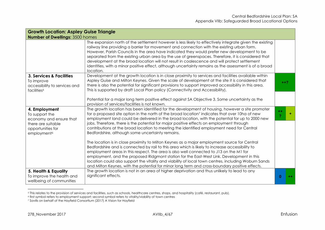
3. Services & Facilities To improve accessibility to services and facilities5
Development at the growth location is in close proximity to services and facilities available within
Aspley Guise and Milton Keynes. Given the scale of development at the site it is considered that there is also the potential for significant provisions to support improved accessibility in this area. This is supported by draft Local Plan policy (Connectivity and Accessibility). Potential for a major long term positive effect against SA Objective 3. Some uncertainty as the provision of services/facilities is not known.
++?
4. Employment To support the economy and ensure that
there are suitable opportunities for employment6
The growth location has been identified for the development of housing, however a site promoter for a proposed site option in the north of the broad location7 indicates that over 10ha of new employment land could be delivered in the broad location, with the potential for up to 2000 new jobs. Therefore, there is the potential for major positive effects on employment through
contributions at the broad location to meeting the identified employment need for Central Bedfordshire, although some uncertainty remains. The location is in close proximity to Milton Keynes as a major employment source for Central Bedfordshire and is connected by rail to this area which is likely to increase accessibility to employment areas in this respect. The area is also well connected to J13 on the M1 for
employment, and the proposed Ridgmont station for the East-West Link. Development in this location could also support the vitality and viability of local town centres, including Woburn Sands and Milton Keynes, with the potential for minor long term and cross-boundary positive effects.
++
? +
5. Health & Equality To improve the health and wellbeing of communities
The growth location is not in an area of higher deprivation and thus unlikely to lead to any significant effects.
0 ++
5 This relates to the provision of services and facilities, such as schools, healthcare centres, shops, and hospitality (café, restaurant, pub). 6 first symbol refers to employment support; second symbol refers to vitality/viability of town centres 7 Savills on behalf of the Hayfield Consortium (2017) A Vision for Hayfield
Central Bedfordshire Local Plan: SA Appendix VIIb: Safeguarded Broad Locational Options
278_November 2017 AVIIb_5/67 Enfusion
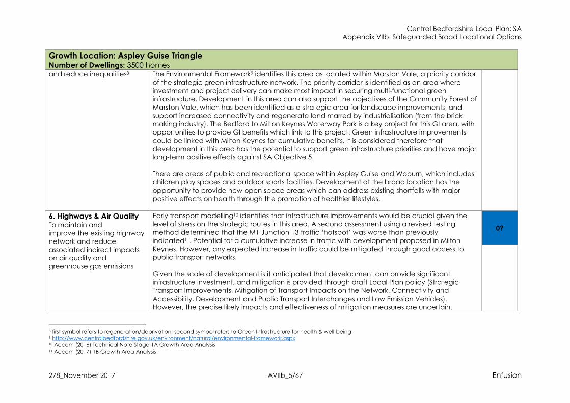
Growth Location: Aspley Guise Triangle Number of Dwellings: 3500 homes and reduce inequalities8 The Environmental Framework9 identifies this area as located within Marston Vale, a priority corridor
of the strategic green infrastructure network. The priority corridor is identified as an area where investment and project delivery can make most impact in securing multi-functional green
infrastructure. Development in this area can also support the objectives of the Community Forest of Marston Vale, which has been identified as a strategic area for landscape improvements, and support increased connectivity and regenerate land marred by industrialisation (from the brick making industry). The Bedford to Milton Keynes Waterway Park is a key project for this GI area, with opportunities to provide GI benefits which link to this project. Green infrastructure improvements could be linked with Milton Keynes for cumulative benefits. It is considered therefore that
development in this area has the potential to support green infrastructure priorities and have major long-term positive effects against SA Objective 5. There are areas of public and recreational space within Aspley Guise and Woburn, which includes children play spaces and outdoor sports facilities. Development at the broad location has the opportunity to provide new open space areas which can address existing shortfalls with major
positive effects on health through the promotion of healthier lifestyles.
6. Highways & Air Quality To maintain and improve the existing highway network and reduce associated indirect impacts on air quality and greenhouse gas emissions
Early transport modelling10 identifies that infrastructure improvements would be crucial given the level of stress on the strategic routes in this area. A second assessment using a revised testing
method determined that the M1 Junction 13 traffic ‘hotspot’ was worse than previously indicated11. Potential for a cumulative increase in traffic with development proposed in Milton Keynes. However, any expected increase in traffic could be mitigated through good access to public transport networks. Given the scale of development is it anticipated that development can provide significant
infrastructure investment, and mitigation is provided through draft Local Plan policy (Strategic Transport Improvements, Mitigation of Transport Impacts on the Network, Connectivity and Accessibility, Development and Public Transport Interchanges and Low Emission Vehicles). However, the precise likely impacts and effectiveness of mitigation measures are uncertain.
0?
8 first symbol refers to regeneration/deprivation; second symbol refers to Green Infrastructure for health & well-being 9 http://www.centralbedfordshire.gov.uk/environment/natural/environmental-framework.aspx 10 Aecom (2016) Technical Note Stage 1A Growth Area Analysis 11 Aecom (2017) 1B Growth Area Analysis

Central Bedfordshire Local Plan: SA Appendix VIIb: Safeguarded Broad Locational Options
278_November 2017 AVIIb_6/67 Enfusion
Growth Location: Aspley Guise Triangle Number of Dwellings: 3500 homes
Masterplanning for a proposed site option in the north of the broad location12 suggests that a park and ride facility could be included as part of development. This would help remove existing load
from the highway network, potentially reducing congestion in key areas and would have positive effects for Milton Keynes, however at this strategic level there remains uncertainty until site level transport studies are undertaken. There is no designated AQMA in close distance and therefore, no significant effects on air quality from traffic indicated at this stage. It had been assumed that long-term air quality is likely to
improve as a result of stringent emissions controls on new vehicles via European standards13. In 15 to 20 years’ time low emission vehicles will make up the majority of cars on the roads in the UK. It is also likely that there will be reductions in various contributing sectors that will also result in reductions in background concentrations of atmospheric pollutants. However, whilst there have been very significant drops in exhaust emissions, the NO2 emissions from road transport have not been reduced as much as expected because emissions during real world driving conditions are
often higher than those measured during the type approval test, especially for diesel vehicles. The EU Commission has changed the test procedures (2017) and this discrepancy should resolve the predicted improvements in air quality in time. However, this is uncertain at this stage.
7. Sustainable Transport To encourage a demonstrable modal shift and reduce the need to travel
The location is separated from the urban area of Aspley Guise by the existing railway line, however the area could connect well with Aspley Guise. This is likely to have major positive effects on sustainable transport. The broad location will also have good access to the proposed EWR station at Ridgmont. There are bus stops to the south of the broad location with bus service connections and there is the
potential for bus services to be extended within the broad location as part of development contributions.
++
12 Savills on behalf of the Hayfield Consortium (2017) A Vision for Hayfield
13 http://ec.europa.eu/environment/air/transport/road.htm

Central Bedfordshire Local Plan: SA Appendix VIIb: Safeguarded Broad Locational Options
278_November 2017 AVIIb_7/67 Enfusion
Growth Location: Aspley Guise Triangle Number of Dwellings: 3500 homes
National cycle route 51 is located adjacent to the west of the broad location14. Therefore, development could provide cycleway connections with the national cycle route and potential
enhancements to the cycle route for positive effects. There are existing PRoW routes that cross the broad location, and development could enhance these to provide safe access to nearby settlements and connections with the wider PRoW network with positive effects on sustainable transport. Potential to improve sustainable transport connections with Milton Keynes, with associated positive effects.
8. Energy & Climate
Change To maximise the potential for energy efficiency, reduce greenhouse gas emission and ensure that the built and natural environment and its
communities withstand the effects of climate change15
Given the potential sustainable transport connections identified against SA Objective 7 it is anticipated that development in this growth location can support a continued reduction in GHG emissions, this is further supported by draft Local Plan policy (Connectivity and Accessibility). It is further anticipated that through compliance with draft Local Plan policy (Successful and
Sustainable Places,) development could achieve policy targets for energy efficiency, high quality design standards that ensure resilience to the effects of climate change and offer potential opportunities for renewable energy production. Potential for a long-term minor positive effect but some uncertainty at this stage.
+?
9. Water Resources &
Quality To minimise the demand for water and maintain or improve water quality
The Water Cycle Study identifies that this location lies within the Upper Bedford and Ouse catchment, where the main pressure on water resources is the abstraction of water for public
supply. Abstraction for consumption is only available for up to 32% of the time and 25% of licenses in the area are time limited and tied to a Common End Date (CED) of March 2028. It is also recognised16 that one of the most likely effects of climate change to impact upon Central Bedfordshire will be a shortage of water resources. The Ruthamford South Water Resource Zone
(WRZ) is predicted to be in supply-demand deficit by 2026/27 as a result of growth and reduced yield.
0?
14 https://www.sustrans.org.uk/ncn/map?gclid=EAIaIQobChMIwovToqO01wIVlFQYCh3TNgYREAAYASAAEgJQsvD_BwE 15 Please note that Flood Risk is considered by the SA within objective number 10 16 LDA Design (2012) Central Bedfordshire Climate Change Adaptation Evidence Base Final Report

Central Bedfordshire Local Plan: SA Appendix VIIb: Safeguarded Broad Locational Options
278_November 2017 AVIIb_8/67 Enfusion
Growth Location: Aspley Guise Triangle Number of Dwellings: 3500 homes
There are no strategic limitations on development growth as Water Companies have a statutory duty to supply water; however, capacity for providing additional supply varies & any new infrastructure requirements have to be aligned with Water Resources Management Plans. The
addition of 3000 new homes in this area is therefore considered to have the potential for cumulative effects on water resources but uncertainty until the scale & location is identified and the Water Cycle Study Phase 2 is undertaken. Rivers in the vicinity of the growth location are considered to be in a moderate overall water body class. The majority of watercourses in the Plan area are not currently meeting ‘good’ classification
and the most common reason for this is ‘pollution from waste water’. The Water Cycle Study identifies that all WwTWs have some capacity within their existing quality permits to accommodate future development without causing a class of 10% deterioration, however in some settlements the available capacity is quite small, and in some cases development may also require WwTW upgrades
With draft Local Plan Policies on Climate Change & Sustainability, Water Quality and Pollution, strong mitigation measures are in place to ensure at least neutral effects on water quality, and ensure that development supports local WRMPs with high water efficiency targets.
10. Flood Risk To reduce the risk of flooding from all sources
The growth location is predominantly not at risk of flooding from rivers or the sea17. However, there
is a small area of Flood Zone 2 and 3 in the north-east corner of the broad location18. It is expected that development could avoid this area of the location with no likely significant effects. Draft Local Plan policy (Successful and Sustainable Places) requires development to maximise opportunities or Sustainable Drainage Systems, where applicable, with the potential for some positive effects. Likely residual neutral effects.
0
11. Soil To protect and conserve
Development in this broad location will predominantly result in the loss of greenfield land with the potential for minor long-term negative effects There is some Grade 3 best and most versatile agricultural land in the broad growth location20, however as the sub-grade (3a or 3b) is not known
--? 0
17 Environment Agency (2016) Flood Map for Planning 18 Ibid. 20 Central Bedfordshire Council GIS layers (2017)

Central Bedfordshire Local Plan: SA Appendix VIIb: Safeguarded Broad Locational Options
278_November 2017 AVIIb_9/67 Enfusion
Growth Location: Aspley Guise Triangle Number of Dwellings: 3500 homes soil19
it is considered there is the potential for a major negative effect through the loss of soil resources. Some uncertainty remains.
Given that the location is greenfield land, development is unlikely to contain or require remediation for any contaminated land. The broad location does not contain brownfield land, with a neutral effect.
12. Biodiversity &
Geodiversity To protect, enhance and manage biodiversity & geodiversity
The nearest Natura 2000 site to the broad location is Chilterns Beechwoods SAC, approx. 23km to the south, is designated for its beech woodlands21. Upper Nene Valley Gravel Pits Ramsar and SPA
sites are approx. 26km to the north and both of which are designated for their wintering waterbird populations22. Significant effects are not considered likely against the Natura 2000 designated sites due to the distance and Local Plan mitigation. Wavendon Heath Ponds SSSI is located approx. 3km south of the broad location23, however there is existing development between the growth location and the SSSI and a residual neutral effect is therefore likely. Marston Thrift SSSI is approx. 5km24 to the north of the broad location.
Braystone County Wildlife Sites (CWS) is within the broad location, and Aspley Guise Meadows CWS is approx. 150m to the south25. Priority Habitat in the broad location is limited to an area of Lowland Meadow and Semi-Improved Grassland. There are also Priority Habitats in the land surrounding the broad growth location, which includes Woodpasture & Parkland and Deciduous Woodland26. The
broad growth location and the surrounding land is also located in the biodiversity network. Development in this location therefore has the potential to cause fragmentation of existing Priority Habitats, with the potential loss of ecological corridors and disturbance to the biodiversity network which is in the area. However, mitigation is provided through draft Local Plan policy (Nature Conservation) which seeks to ensure that development does not adversely affect designated sites, and draft Local Plan policy (Enhancing Ecological Networks) further seeks to ensure that
development positively contributes to biodiversity. The provision of new public open spaces and recreational facilities as part of development, and improvements to the green infrastructure
+?
19 first symbol refers to greenfield & agricultural land qualities; second symbol relates previously developed land 21 DEFRA (2017) Magic Map Application 22 DEFRA (2017) Magic Map Application 23 Ibid. 24 Ibid. 25 Ibid. 26 Ibid.
Central Bedfordshire Local Plan: SA Appendix VIIb: Safeguarded Broad Locational Options
278_November 2017 AVIIb_10/67 Enfusion
Growth Location: Aspley Guise Triangle Number of Dwellings: 3500 homes
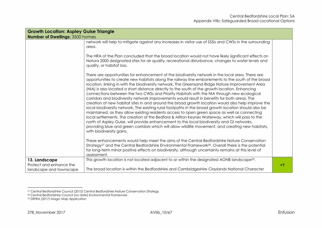
network will help to mitigate against any increases in visitor use of SSSIs and CWSs in the surrounding area.
The HRA of the Plan concluded that the broad location would not have likely significant effects on Natura 2000 designated sites for air quality, recreational disturbance, changes to water levels and quality, or habitat loss. There are opportunities for enhancement of the biodiversity network in the local area. There are opportunities to create new habitats along the railway line embankments to the south of the broad
location, linking in with the biodiversity network. The Greensand Ridge Nature Improvement Area (NIA) is also located a short distance directly to the south of the growth location. Enhancing connections between the two CWSs and Priority Habitats with the NIA through new ecological corridors and biodiversity network improvements would result in benefits for both areas. The creation of new habitat sites in and around the broad growth location would also help improve the local biodiversity network. The existing rural footpaths in the broad growth location should also be
maintained, as they allow existing residents access to open green space as well as connecting local settlements. The creation of the Bedford & Milton Keynes Waterway, which will pass to the north of Aspley Guise, will provide enhancement to the local biodiversity and GI networks, providing blue and green corridors which will allow wildlife movement, and creating new habitats, with biodiversity gains.
These enhancements would help meet the aims of the Central Bedfordshire Nature Conservation Strategy27 and the Central Bedfordshire Environmental Framework28. Overall there is the potential for long-term minor positive effects on biodiversity, although uncertainty remains at this level of assessment.
13. Landscape Protect and enhance the landscape and townscape
This growth location is not located adjacent to or within the designated AONB landscape29. The broad location is within the Bedfordshire and Cambridgeshire Claylands National Character
+?
27 Central Bedfordshire Council (2015) Central Bedfordshire Nature Conservation Strategy 28 Central Bedfordshire Council (no date) Environmental Framework 29 DEFRA (2017) Magic Map Application

Central Bedfordshire Local Plan: SA Appendix VIIb: Safeguarded Broad Locational Options
278_November 2017 AVIIb_11/67 Enfusion
Growth Location: Aspley Guise Triangle Number of Dwellings: 3500 homes Area30, and the statements of environmental opportunity identify the potential to create high
quality green infrastructure (identified against SA Objective 5) and landscape regeneration in new development and the need to protect the aquifers and quality of the River Great Ouse.
Development in this broad location is considered overall to support these objectives with the potential for minor long term positive effects against SA Objective 13. The broad location is within the Salford-Aspley Clay Vale landscape character type31. Visually sensitive features in this landscape area includes the visual setting of the Greensand Ridge and the hedgerow framework in the area. The landscape strategy for the character type includes the
enhancement/renewal of the landscape and environmentally led regeneration for areas within the Forest of Marston Vale32. It is expected that development would make positive contributions to the landscape strategy, with potential minor positive effects on landscape. Some uncertainty remains at this level of assessment.
14. Historic Environment To ensure the protection and enhancement of heritage assets, the historic
environment and its setting
There are 3 small Archaeological Notification Areas within the location33, in which development (according with draft Local Plan Policy Archaeology) could contribute to investigating and recording heritage assets of archaeological significance. The broad location is located in close proximity to Listed Buildings in both Aspley Guise and
Wavendon, as well as Conservation Areas in Aspley Guise and Husborne Crawley to the south. Given the scale of development at this location it is likely to affect the open countryside setting in between these two areas, and design will be required to respond to differing heritage settings in the south and west. Mitigation is provided through draft Local Plan Policy (Built Heritage) which should ensure
development does not lead to any significant effects on the settings of the Listed Buildings and the Conservation Areas with neutral effects but some uncertainty at this stage until lower level assessments have been completed.
0?
30 Natural England (2015) Bedfordshire and Cambridgeshire Claylands National Character Area Profile 31 Central Bedfordshire Council (2015) Central Bedfordshire Landscape Character Assessment 32 Ibid. 33 Central Bedfordshire Council GIS Map Layers

Central Bedfordshire Local Plan: SA Appendix VIIb: Safeguarded Broad Locational Options
278_November 2017 AVIIb_12/67 Enfusion
Growth Location: Aspley Guise Triangle Number of Dwellings: 3500 homes
SUMMARY:
Key Positive Effects: � The broad location will provide housing, with major positive effects. � Enhancements to access to services/facilities and the provision of services/facilities can be delivered at the broad location, with
potential major positive effects. Although some uncertainty. � There is the potential for the delivery of new employment land with major positive effects, although some uncertainty at this stage of
assessment.
� Enhancements to GI and public open space have the potential for major positive effects on health. � The broad location has existing links to both rail and bus services, and there is the potential for enhancement of these services with
potential major positive effects. � Landscaping can ensure there is no coalescence or risk of settlement identity loss, and will meet the requests of local Parish Councils,
with minor positive effects.
� The broad location has good links to employment opportunities and will support the vitality of local towns, with minor positive effects. � There is the potential for the delivery of a park and ride at the broad location which will reduce the load on the road network, with
potential minor positive effect on highways and air quality. Some uncertainty as transport assessments are on-going. � The broad location is expected to be able to incorporate energy efficiency measures with positive effects on energy and climate
change. � Potential for a net gain for biodiversity to be achieved, with minor positive effects, although some uncertainty at this stage of
assessment. � Development at the broad location can help meet the aims of the landscape strategy for the area with positive effects although
some uncertainty at this stage of assessment.
Key Negative Effects: � There is the potential for the loss of best and most versatile agricultural land with major negative effects, although some uncertainty as
the sub-grade (3a or 3b) is not known. � Potential for an increase in traffic on the strategic road network and at identified traffic hotspot, however potential mitigation
available through proposed Park & Ride and highway infrastructure delivery.
SA Recommendations for the Aspley Guise Triangle Broad Location: � Landscaping and design should protect the identity of Aspley Guise from being affected by new development and should ensure
coalescence is mitigated against, and a holistic approach should be taken to ensure that there are synergistic benefits for the Marston Vale GI network and biodiversity.
� Development should provide services/facilities to support local communities and address any existing lack of services/facilities or

Central Bedfordshire Local Plan: SA Appendix VIIb: Safeguarded Broad Locational Options
278_November 2017 AVIIb_13/67 Enfusion
Growth Location: Aspley Guise Triangle Number of Dwellings: 3500 homes
capacity issues for the local area. � The broad location is well located to provide green infrastructure benefits, and support the objectives of the Marston Vale priority GI
corridor. Specifically, development should be required to contribute to both the Marston Vale Community Forest and there are
opportunities to provide GI links with the Bedford to Milton Keynes Waterway Park which will be a short distance from the broad location. Where possible GI improvements should be linked with the Greensand Ridge NIA. Smaller scale GI improvements should also be required for positive effects.
� A new park and ride facility should be a requirement for development at the broad location, and further investment to the highway road network to mitigate against any increase in traffic.
� Development should ensure safe access to Aspley Guise and Ridgmont railway stations. Enhancement should be required for the
existing bus services and ensure there are frequent services to nearby railway stations. New cycle routes and connections to National Cycle Route 51 should be in line with GI aspirations for the Marston Vale. New PRoW routes and enhancement to existing routes should also be in line with GI aspirations for the Marston Vale. Where possible sustainable transport links should be connected with the proposed park and ride facility.
� Require development at the broad location to maximise opportunities for Sustainable Drainage System, including connectivity with the GI aspirations for the Marston Vale.
� Development should achieve a net gain for biodiversity. Development should link biodiversity improvements with the Marston Vale GI strategic area, the NIA and the Marston Vale Forest for synergistic and wide-ranging positive effects. Developers should also consult with Bedfordshire Local Nature Partnership who are developing a Natural Capital Investment Plan for the Oxford-Cambridge Growth Corridor, to asses show development could contribute towards this. The CWS within the broad location should be retained and enhanced.
� Landscape enhancement should contribute to the landscape strategy and environmental opportunities, and ensure landscaping has positive effects on Marston vale GI, the Forest of Marston Vale and the NIA.

Central Bedfordshire Local Plan: SA Appendix VIIb: Safeguarded Broad Locational Options
278_November 2017 AVIIb_14/67 Enfusion
Growth Location: Luton West Number of Dwellings: 3600 homes
SA
Topic & Objective
Assessment of Effects Nature of the likely sustainability effect (including positive/negative, short - medium term (5-10 years)/long term (10
- 20 years plus), permanent/temporary, secondary, cumulative and synergistic); Uncertainty
1. Housing To ensure that the
housing needs of all residents and communities are met
The delivery of up to 3600 new homes has the potential for major long-term positive effects. It is assumed that development at the growth location can meet the policy objectives of draft Local Plan policy (Housing Mix) to provide an appropriate mix of housing types, tenures and sizes.
++
2. Communities34 To maintain and enhance community and settlement identities
Development in this area will result in the loss of Green Belt land. The Green Belt Study35 identifies this land as parcel L6, within which the small fields adjacent to the village of Caddington may make a
relatively weak contribution to Green Belt purposes. The proposed development of up to 3600 new homes is likely to extend beyond these small fields, with the potential for major negative effects through loss of Green Belt. Housing growth in this broad locational option will expand the urban area of Luton to the west and contribute to the coalescence of Luton with the north of Caddington with the potential for a minor long
term negative effect. Development at the broad location is also likely to contribute to the coalescence of Luton with the small village of Chaul End, and erode the small settlement identity, with the potential for major long term negative effects. However, development in this area is unlikely to integrate well with the existing urban area of Luton due to the separation provided by the M1 -there may be opportunity to enhance the identity of
communities in Luton – uncertainty at this stage and any new development is likely to function as a self-contained settlement. Overall, there are likely minor negative effects with uncertainty as to the effectiveness of mitigation measures until further studies are completed.
-- -?
34 Please note that first symbol relates to location in/out of Green Belt designation; second symbol relates to effects on integration & identity for existing settlements 35 LUC for Central Bedfordshire Council Green Belt Study (October, 2016)

Central Bedfordshire Local Plan: SA Appendix VIIb: Safeguarded Broad Locational Options
278_November 2017 AVIIb_15/67 Enfusion
Growth Location: Luton West Number of Dwellings: 3600 homes
3. Services & Facilities To improve
accessibility to services and facilities36
Development at the growth location option is in close proximity to services and facilities available within Luton and Dunstable. Given the scale of development proposed, it is considered that there is also the potential for significant provisions to support improved accessibility in this area and address and existing
capacity issues or lack of service/facility provision. This is supported by draft Local Plan policy (Connectivity and Accessibility). Potential for a major long term positive effects although some uncertainty as the exact provision of services/facilities is not known.
++?
4. Employment To support the economy and ensure
that there are suitable opportunities for employment37
The growth location option has been identified for the development of housing and as such is unlikely to lead to any significant effects against this SA Objective, with the potential for a neutral effect. The option’s close proximity to Luton as a major employment source for Central Bedfordshire is likely to increase accessibility to employment areas in this respect. Housing development in this area may also
support the vitality and viability of the major town centres in close proximity, namely Dunstable and Luton, with the potential for minor long term and cross-boundary positive effects.
0 +
5. Health & Equality To improve the health and wellbeing of communities and
The broad location is within one of the 30% most deprived neighbourhoods in the country, and is
adjacent to areas which are in the top 10% and 20% of deprived neighbourhoods in the country39. Development therefore has the potential to improve accessibility, promote investment & reduce inequalities with the potential for major long-term and cumulative positive effects. There is the potential
++? ++
36 This relates to the provision of services and facilities, such as schools, healthcare centres, shops, and hospitality (café, restaurant, pub). 37 first symbol refers to employment support; second symbol refers to vitality/viability of town centres 39 http://dclgapps.communities.gov.uk/imd/idmap.html
Central Bedfordshire Local Plan: SA Appendix VIIb: Safeguarded Broad Locational Options
278_November 2017 AVIIb_16/67 Enfusion
Growth Location: Luton West Number of Dwellings: 3600 homes reduce inequalities38 for noise pollution from the M1 and London Luton Airport with the potential to cause significant health
implications for future occupiers if development is not suitably located, designed and impacts mitigated. Development Management Policies CC7 Pollution and HQ1 Health Impact Assessment
should provide sufficient mitigation measures but some uncertainty remains at this stage of assessment until further studies and masterplanning developed. The Environmental Framework40 identifies this area as located within The Chalk Arc, a priority corridor of the strategic green infrastructure network. The priority corridor is identified as an area where investment and project delivery can make most impact in securing multi-functional green infrastructure. Of
importance is The Chalk Arc Project41 which focuses on securing green space in and around proposed housing growth. The growth location is identified in the Chalk Arc Project as Area C – South Dunstable and South Luton Priority Zone. Development in this area could contribute to existing projects including enhanced access and interpretation, as well as community involvement at Blows Down, increased public use of the green space at Downside, and improvements to the quality of one of the accesses to Blow’s Downs Park. It is considered therefore that development in this area has the potential to support
green infrastructure priorities and have major long-term positive effects. This is further considered to indirectly positively affect the landscape objectives of the National Character Area 110: Chilterns (see SA Objective 13). The broad location is adjacent to open spaces which includes Blows Down informal recreation area
and open spaces in and around Caddington. Development at the broad location has the potential to deliver strategic levels of new open spaces for the local area. This will promote healthy lifestyles and help address any existing provision issues, with associated positive effects on health for local communities.
6. Highways & Air
Quality To maintain and
Early transport modelling42 identifies that development adjacent to Luton is likely to increase congestion
for routes into Luton and other urban roads as well as links to the strategic highway network; Chaul End Road is a country lane that would need significant upgrades. Luton Road will require junction
-?
38 first symbol refers to regeneration/deprivation; second symbol refers to Green Infrastructure for health & well-being 40 http://www.centralbedfordshire.gov.uk/environment/natural/environmental-framework.aspx 41 http://www.bedscape.org.uk/BRMC/chalkarc/home.htm 42 Aecom (2016) Technical Note Stage 1A Growth Area Analysis
Central Bedfordshire Local Plan: SA Appendix VIIb: Safeguarded Broad Locational Options
278_November 2017 AVIIb_17/67 Enfusion
Growth Location: Luton West Number of Dwellings: 3600 homes improve the existing highway network and reduce associated
indirect impacts on air quality and greenhouse gas emissions
improvements. A second assessment using a revised testing method determined that the Dunstable traffic ‘hotspot’ was worse than previously indicated43. This could also be mitigated to some extent through enhanced access to public transport networks including the Midland Main railway line.
A Transport Issues Paper commissioned by a site promoter44 for a potential site in the east of the broad location determined that a number of junctions will be affected by additional traffic, and that greatest impacts on the highway network as a result of development at the broad location will be at Hatters Way and Dunstable town centre.
Given the scale of development is it anticipated that new development can provide significant infrastructure investment, and mitigation is provided through draft Local Plan policy (Strategic Transport Improvements, Mitigation of Transport Impacts on the Network, Connectivity and Accessibility, Development and Public Transport Interchanges and Low Emission Vehicles). At this stage, it is considered there is the potential for minor negative effects on highways as the broad
location will result in an increase in traffic on the highway network. Although mitigation is available through Local Plan policy the precise likely impacts and effectiveness of mitigation measures are uncertain until further transport modelling studies are completed for the Council later in 2017. There are 3 AQMAs in Luton45 and one in nearby Dunstable. The broad location has the potential to
increase traffic along the M1 and in Dunstable town centre, which could lead to increased emissions within AQMAs. It had been assumed that long-term air quality is likely to improve as a result of stringent emissions controls on new vehicles via European standards46. In 15 to 20 years’ time low emission vehicles will make up the majority of cars on the roads in the UK. It is also likely that there will be reductions in various contributing sectors that will also result in reductions in background concentrations of atmospheric pollutants. However, whilst there have been very significant drops in exhaust emissions,
the NO2 emissions from road transport have not been reduced as much as expected because emissions during real world driving conditions are often higher than those measured during the type approval test, especially for diesel vehicles. The EU Commission has changed the test procedures (2017) and this
43 Aecom (2017) 1B Growth Area Analysis 44 Mott Macdonald for Abbey Land Developments (2017) Land West of Luton- Transport Issues 45 https://uk-air.defra.gov.uk/aqma/maps 46 http://ec.europa.eu/environment/air/transport/road.htm

Central Bedfordshire Local Plan: SA Appendix VIIb: Safeguarded Broad Locational Options
278_November 2017 AVIIb_18/67 Enfusion
Growth Location: Luton West Number of Dwellings: 3600 homes
discrepancy should resolve the predicted improvements in air quality in time. However, this is uncertain at this stage.
7. Sustainable
Transport To encourage a demonstrable modal shift and reduce the need to travel
Although the broad location is adjacent to the urban area of Luton, it is disconnected by the M1 motorway which creates a significant barrier to integration, with likely significant infrastructure investment requirements to create the appropriate connections to existing modes of sustainable
transport, including bus services along Dallow Road (801, X31) and Castle Croft Road (28, 28A, 29, 29A, 828 & 82947); however, there is the Busway48 that links Houghton Regis, Dunstable & Luton, and the closest train station at Luton (approx. 2.5miles49). However, given the scale of development for this option and that it is more likely to be a self-contained development, it is anticipated that these infrastructure provisions can be provided, and supported by
emerging draft Local Plan Policies, with the potential for minor long term positive effects. There are no national cycle routes in close proximity of the broad location50, however national cycle route 6 does pass through Luton to the east of the broad location. Development at the broad location can provide a network of cycle routes in the local area to address the lack of provision, and these could provide cycle access to Dunstable and Luton with positive effects.
There are existing PRoW routes which cross the settlement. Enhancements to these as part of development would have positive effects on sustainable transport and could encourage walking access to both Luton and Dunstable. Potential for a minor positive effect on sustainable transport through enhancements to bus services,
cycle routes and walking routes.
+
47 Google Maps 48 http://www.busway.net/ 49 Google Maps estimated drive time from Hatters Way (existing road in the north of the growth location) to Luton Station 50 https://www.sustrans.org.uk/ncn/map?gclid=EAIaIQobChMIwovToqO01wIVlFQYCh3TNgYREAAYASAAEgJQsvD_BwE

Central Bedfordshire Local Plan: SA Appendix VIIb: Safeguarded Broad Locational Options
278_November 2017 AVIIb_19/67 Enfusion
Growth Location: Luton West Number of Dwellings: 3600 homes
8. Energy & Climate
Change To maximise the potential for energy efficiency, reduce greenhouse gas
emission and ensure that the built and natural environment and its communities withstand the effects of climate change51
Given the potential sustainable transport connections identified against SA Objective 7 it is anticipated that development in this growth location can support a continued reduction in GHG emissions, this is further supported by draft Local Plan policy (Connectivity and Accessibility).
It is further anticipated that through compliance with draft Local Plan policy (Successful and Sustainable Places,) development could achieve policy targets for energy efficiency, high quality design standards that ensure resilience to the effects of climate change and offer potential opportunities for renewable energy production. Potential for a long-term minor positive effect but some uncertainty at this stage.
+?
9. Water Resources &
Quality To minimise the demand for water and maintain or improve water quality
The Water Cycle Study52 identifies that this locational option lies within the Upper Lea catchment, located on unconfined chalk geology, in which there are a large number of abstraction licences for groundwater resources, utilised for supporting the public water supply and agricultural uses. There is no surface water available for licensing across this catchment at any flow level as the recent flows are below the requirement to meet a Good Ecological Status. It is identified that no new consumptive
licenses for groundwater will be granted in the catchment, and the water resources (for both surface and groundwater abstraction) are available less than 30% of the time, indicating pressures on the catchment for resources. It is also recognised53 that one of the most likely effects of climate change to impact upon Central Bedfordshire will be a shortage of water resources. The Lee Water Resource Zone (WRZ) is predicted to
be in supply-demand deficit by 2020. There are no strategic limitations on development growth as Water Companies have a statutory duty to supply water; however, capacity for providing additional supply varies & any new infrastructure requirements have to be aligned with Water Resources Management Plans. The addition of 2000 new
homes in this area is therefore considered to have the potential for cumulative effects on water resources but uncertainty until the scale & location is identified and the Water Cycle Study Phase 2 is
0?
51 Please note that Flood Risk is considered by the SA within objective number 10 52 JBA for Central Bedfordshire Council (Jan 2017) Water Cycle Study Stage 1 53 LDA Design (2012) Central Bedfordshire Climate Change Adaptation Evidence Base Final Report

Central Bedfordshire Local Plan: SA Appendix VIIb: Safeguarded Broad Locational Options
278_November 2017 AVIIb_20/67 Enfusion
Growth Location: Luton West Number of Dwellings: 3600 homes
undertaken. Rivers in the vicinity of the growth location are considered to be in a moderate overall water body class.
The majority of watercourses in the Plan area are not currently meeting ‘good’ classification and the most common reason for this is ‘pollution from waste water’. The Water Cycle Study identifies that all WwTWs have some capacity within their existing quality permits to accommodate future development without causing a class of 10% deterioration, however in some settlements the available capacity is quite small, and in some cases development may also require WwTW upgrades
With draft Local Plan Policies on Climate Change & Sustainability, Water Quality and Pollution, strong mitigation measures are in place to ensure at least neutral effects on water quality, and ensure that development supports local WRMPs with high water efficiency targets.
10. Flood Risk To reduce the risk of flooding from all
sources
The growth option is not in an area at risk of flooding from rivers or the sea54. Draft Local Plan policy (Successful and Sustainable Places) requires development to maximise opportunities for Sustainable Drainage Systems where applicable and there may be possibilities for enhanced effects to help resolve existing flooding problems but uncertain at this stage of appraisal. Overall, a residual neutral effect at
this stage.
0
11. Soil To protect and conserve soil55
Development in this option will predominantly result in the loss of greenfield land (with the exception of a large vehicle compound area, if this is included) with the potential for minor long-term negative
effects. The broad growth location contains Grade 3 best and most versatile agricultural land (sub-grade 3a or 3b not known)56. 1 promoter for a site in the east of the broad growth location has commissioned an Agricultural Land Classification Document57, which concluded that land is likely to comprise a mixture of
grade 3a and 3b agricultural land. It is recognised that there remains an element of uncertainty due to the assessment of a broad location, however at this stage it is considered there is the potential for the
--? 0
54 Environment Agency (2016) Flood Map for Planning 55 first symbol refers to greenfield & agricultural land qualities; second symbol relates previously developed land 56 Central Bedfordshire Council GIS layers (2017) 57 RPS (2017) Land West of Luton Agricultural Land Classification

Central Bedfordshire Local Plan: SA Appendix VIIb: Safeguarded Broad Locational Options
278_November 2017 AVIIb_21/67 Enfusion
Growth Location: Luton West Number of Dwellings: 3600 homes
loss of best and most versatile land, with a major negative effect. Given that the location is greenfield land, development is unlikely to contain or require remediation for any contaminated land.
At this stage, the broad location is not considered likely to regenerate brownfield land, with a neutral effect.
12. Biodiversity &
Geodiversity To protect, enhance and manage biodiversity &
geodiversity
The nearest Natura 2000 site to the broad location is Chilterns Beechwoods SAC, approx. 9km to the south west and designated for its beech woodlands58. The HRA of the Plan concluded that the broad
location would not have likely significant effects on Natura 2000 designated sites for air quality, recreational disturbance, changes to water levels and quality, or habitat loss. The broad location is located close to a nationally designated biodiversity site, Blow’s Down SSSI (also a County Wildlife Site (CWS)), located around 1km to the west of the growth location59. The SSSI is a rich and varied site with a large area of open, unimproved grassland60, and contains Lowland Calcareous
Grassland Priority Habitat. The SSSI may be negatively affected by potential development due to an increase in recreational use and potential increase in noise and light pollution. However, it should be noted that the SSSI is already heavily bordered by urban development in Houghton Regis. Mitigation is provided through draft Local Plan policy (Nature Conservation) with the potential for an overall long-term residual neutral effect. It is understood that there are areas of ancient woodland within the broad
locational area and these would need to be avoided by any new development. Approx. 2km to the west of the growth location is Cotton Bottom Fields Local Nature Reserve (LNR)61 which contains Lowland Calcareous Grassland Priority Habitat and Deciduous Woodland Priority Habitat62. There are 2 CWSs within the broad location and several others to the east and west of the broad location. The proposed option contains Lowland Calcareous Grassland Priority Habitat and
Deciduous Woodland Priority Habitat63. The area, together with land to the north-west and west is also
+?
58 DEFRA (2016) Magic Map Application 59 DEFRA (2016) Magic Map Application 60 Blow’s Down SSSI Citation (1998) [Accessed Online: 2016] http://www.sssi.naturalengland.org.uk/citation/citation_photo/1005495.pdf 61 DEFRA (2016) Magic Map Application 62 Ibid. 63 Ibid.

Central Bedfordshire Local Plan: SA Appendix VIIb: Safeguarded Broad Locational Options
278_November 2017 AVIIb_22/67 Enfusion
Growth Location: Luton West Number of Dwellings: 3600 homes
within the biodiversity network64. Priority Habitat within the broad location is limited to Deciduous Woodland, which is also present in the landscape surrounding the broad location.
A site specific ecological assessment for a site option in the east of the broad location65 determined that there are records of badgers and recommended that further studies are conducted, including a detailed vegetation study and a study to determine the presence of roosting bats. However, no significant constraints were determined.
Due to the presence of a number of different Priority Habitats as well as a LNR and CWSs, there is the possibility of negative effects, including habitat fragmentation and species disturbance. However, mitigation is provided through draft Local Plan policy (Nature Conservation) which seeks to ensure that development does not adversely affect biodiversity sites, and draft Local Plan policy (Enhancing Ecological Networks) further seeks to ensure that development positively contributes to biodiversity.
Enhancement could be achieved through increasing the connectivity of areas of Priority Habitats with the SSSI, LNR and CWSs in the surrounding area and within the broad location via new ecological corridors. Existing rural footpaths could also be developed to allow future residents better access to the area’s natural environment, with positive benefits for health and green space access (see also SA Objective No 5). These enhancements would help meet the aims of the Central Bedfordshire Nature
Conservation Strategy66 and the Central Bedfordshire Environmental Framework67. Overall it is considered that there is the potential for long-term minor positive effects for improving local biodiversity but some uncertainty at this stage of assessment.
13. Landscape Protect and enhance the landscape and
This growth location is adjacent to / partially within (precise boundary unclear at this stage) the designated AONB landscape68. Development at this scale has significant potential to negatively affect the AONB setting through urbanisation in a previously undeveloped area. It is considered therefore that
--?
64 The Wildlife Trust for Central Bedfordshire Council (2015) A Nature Conservation Strategy for Central Bedfordshire 65 The Ecology Partnership (2017) Preliminary Ecology Appraisal: West of Luton, Bedfordshire 66 The Ecology Partnership (2017) Preliminary Ecology Appraisal: West of Luton, Bedfordshire 67 Central Bedfordshire Council (no date) Environmental Framework 68 DEFRA (2016) Magic Map Application
Central Bedfordshire Local Plan: SA Appendix VIIb: Safeguarded Broad Locational Options
278_November 2017 AVIIb_23/67 Enfusion
Growth Location: Luton West Number of Dwellings: 3600 homes townscape
there is the potential for major long-term negative effects against SA Objective 13. The broad location is within the Chilterns National Character Area, and the statements of environmental
opportunity identify the need to conserve the Chilterns’ groundwater resource and secure sustainable water use (discussed further in SA Objective 9) and to create or enhance green infrastructure in relation to the urban fringe and growth areas such as Luton (discussed in SA Objective 5) to support the objectives of this landscape area. The broad location is within the Caddington-Slip End Chalk Dipslope Landscape Character Type69.
Visually sensitive features in this landscape include the open and exposed nature of the area which means development would be highly visible, and the views to the ridgeline. The landscape strategy for the character type focuses on renewing landscape elements that have been lost or degraded. Although development can contribute to the landscape strategy, it is likely to result in the loss of visually sensitive features, with potential negative effects.
A Landscape & Visual Impact Assessment70 commissioned for a site developer who is proposing a site in the east of the broad location concluded that development, with appropriate landscaping and design, would not result in significant negative visual or landscape effects on the local landscape or the AONNB.
However, for the broad location assessment it is still considered that there is the potential for a major negative effect until further details regarding site boundaries and masterplanning are confirmed, and some uncertainty remains.
14. Historic
Environment To ensure the
There are two Listed Buildings (Chaul End Farmhouse in the north and Church of All Saints in Caddington in the south) that may be affected by development within this growth option, which is also in close
proximity to Caddington Conservation Area. Development may require mitigation measures to avoid negative effects on the settings of these Listed Buildings and possibly the Conservation Area. Mitigation
0?
69 Central Bedfordshire Council (2015) Central Bedfordshire Landscape Character Assessment 70 CSA Environmental (2017) Landscape & Visual Impact Assessment and Green Belt Assessment: Land West of Luton

Central Bedfordshire Local Plan: SA Appendix VIIb: Safeguarded Broad Locational Options
278_November 2017 AVIIb_24/67 Enfusion
Growth Location: Luton West Number of Dwellings: 3600 homes protection and enhancement of heritage assets, the
historic environment and its setting
is provided through draft Local Plan policy (Built Heritage) which should ensure development does not lead to any significant effects with the potential for a residual neutral effect.
The option also includes a number of Archaeological Notification Areas71, in which development (according with draft Local Plan Policy Archaeology) could contribute to investigating and recording heritage assets of archaeological significance. Likely neutral effects but uncertainty until site level assessments have been completed. A Heritage Assessment72 commissioned for a site developer who is proposing a site in the east of the
broad location concluded that there are no significant archaeological constraints for development but that further studies are likely to be required, including a detailed Built Heritage Statement.
SUMMARY:
Key Positive Effects: � The broad location will provide housing, with major positive effects. � Enhancements to access to services/facilities and the provision of services/facilities can be delivered at the broad location, with
potential major positive effects. Although some uncertainty. � The broad location is within and adjacent to areas of higher deprivation, with major positive effects on equality, although some
uncertainty remains. � Enhancements to GI and public open space have the potential for major positive effects on health. � The broad location has good links to employment opportunities and will support the vitality of local towns, with minor positive effects. � The broad location is expected to be able to incorporate energy efficiency measures with positive effects on energy and climate
change. � The broad location can improve sustainable transport in the area with associated minor positive effects.
� Potential for a net gain for biodiversity to be achieved, with minor positive effects.
Key Negative Effects: � The broad location is within the Green Belt, with a major negative effect, and could result in coalescence and loss of settlement
identity, with a minor negative effect, although some uncertainty remains assessing the broad location. � There is the potential for the loss of best and most versatile agricultural land with major negative effects, although some uncertainty as
the sub-grade (3a or 3b) is not known.
71 Central Bedfordshire Council (2016) GIS Map Layers 72 Cgms Heritage (2017) Heritage Summary Report: Land to the West of Luton, Central Bedfordshire
Central Bedfordshire Local Plan: SA Appendix VIIb: Safeguarded Broad Locational Options
278_November 2017 AVIIb_25/67 Enfusion
Growth Location: Luton West Number of Dwellings: 3600 homes
� There is the potential for major negative effects on landscape due to the close proximity of the AONB to the broad location, and the loss of visually sensitive features for the local landscape, although some uncertainty remains at this stage of assessment.
� The broad location may result in an increase in traffic on the road network with potential effects on air quality, with some uncertainty
as traffic assessments are on-going.
SA Recommendations for the Luton West Broad Location: � Landscaping and design should protect the identity of Caddington and Chaul End from being affected by new development and
should ensure coalescence is mitigated against, and a holistic approach should be taken to ensure that there are synergistic benefits for the Chalk Arc GI network and biodiversity.
� Development should provide services/facilities to support local communities and address any existing lack of services/facilities or capacity issues for the local area.
� The broad location can contribute towards the GI strategy for the Chalk Arc. Development in this area could be required to enhance access and interpretation, as well as community involvement at Blows Down and increase public use of the green space at Downside.
� Development should be required to provide strategic infrastructure improvements to the local road network to mitigate against any increase in traffic, and ensure there is no significant increase in traffic within the AQMAs.
� Development should ensure that there are bus services available and that these are regular and reliable, and link with the nearby railway stations in Luton. Enhancements to the cycle network and PRoW network should be a necessity, and provide benefits for the Chalk Arc GI strategy where possible.
� Require development at the broad location to maximise opportunities for Sustainable Drainage System, including connectivity with the GI aspirations for the Chalk Arc.
� Development should achieve a net gain for biodiversity. Development should retain existing CWS sites and enhance these by providing connections between Priority Habitats and the wider biodiversity network. Visitor studies for the nearby SSSI sites and the Chilterns Beechwoods SAC should be required to better understand the effect of increased recreational pressure. Enhancements to biodiversity should be in-line with aspirations for Central Bedfordshire as a whole, and due to the broad locations location, can link in with biodiversity in surrounding authorities.
� Landscape enhancement should contribute to the landscape strategy and environmental opportunities, and should ensure negative
effects on the AONB are mitigated against.
Central Bedfordshire Local Plan: SA Appendix VIIb: Safeguarded Broad Locational Options
278_November 2017 AVIIb_26/67 Enfusion
Growth Location: Marston Thrift Number of Dwellings: up to 2000 homes
SA Objective
Assessment of Effects Nature of the likely sustainability effect (including positive/negative, short - medium term (5-10 years)/long term (10
- 20 years plus), permanent/temporary, secondary, cumulative and synergistic); Uncertainty
1. Housing To ensure that the housing needs of all residents and communities are met
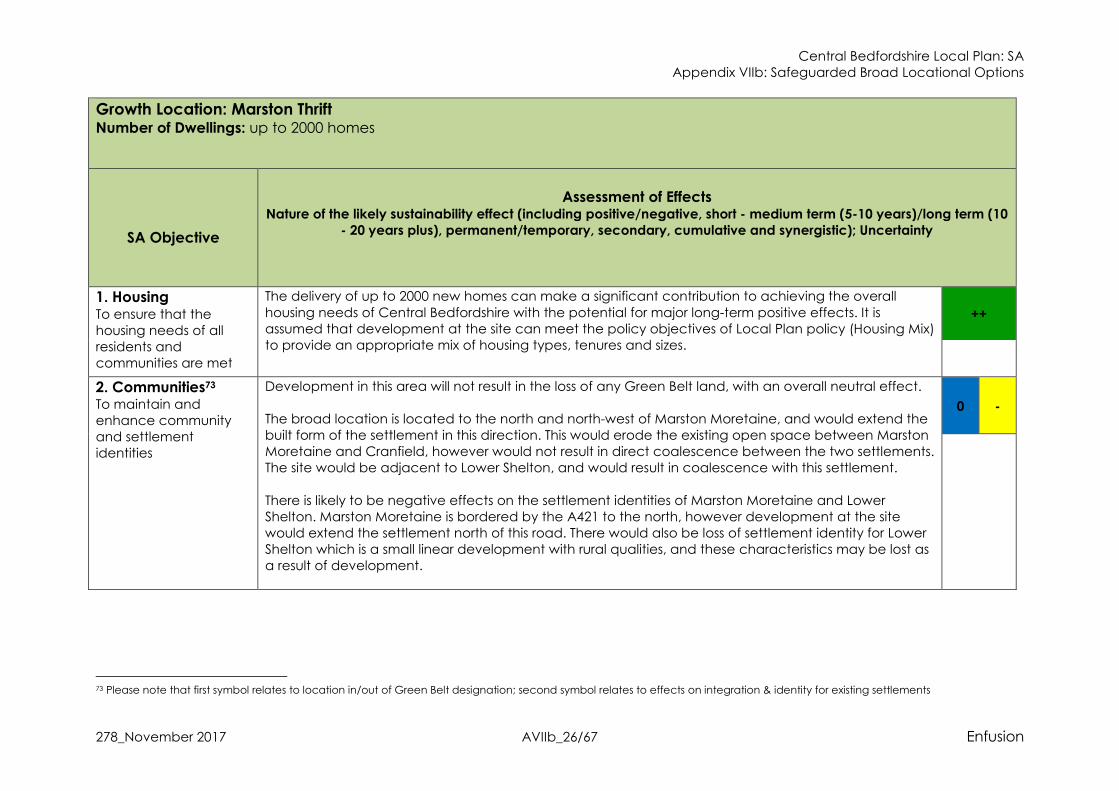
The delivery of up to 2000 new homes can make a significant contribution to achieving the overall
housing needs of Central Bedfordshire with the potential for major long-term positive effects. It is assumed that development at the site can meet the policy objectives of Local Plan policy (Housing Mix) to provide an appropriate mix of housing types, tenures and sizes.
++
2. Communities73 To maintain and enhance community and settlement identities
Development in this area will not result in the loss of any Green Belt land, with an overall neutral effect. The broad location is located to the north and north-west of Marston Moretaine, and would extend the built form of the settlement in this direction. This would erode the existing open space between Marston Moretaine and Cranfield, however would not result in direct coalescence between the two settlements. The site would be adjacent to Lower Shelton, and would result in coalescence with this settlement.
There is likely to be negative effects on the settlement identities of Marston Moretaine and Lower Shelton. Marston Moretaine is bordered by the A421 to the north, however development at the site would extend the settlement north of this road. There would also be loss of settlement identity for Lower Shelton which is a small linear development with rural qualities, and these characteristics may be lost as a result of development.
0 -
73 Please note that first symbol relates to location in/out of Green Belt designation; second symbol relates to effects on integration & identity for existing settlements

Central Bedfordshire Local Plan: SA Appendix VIIb: Safeguarded Broad Locational Options
278_November 2017 AVIIb_27/67 Enfusion
Growth Location: Marston Thrift Number of Dwellings: up to 2000 homes
3. Services & Facilities To improve accessibility to services and facilities74
The broad location is in close proximity to existing services/facilities within Marston Moretaine75. This
includes healthcare facilities, schools, pubs, restaurants and shops. The scale means there is scope for enhancements to access and provision of services/facilities. Development can ensure new services/facilities are provided which new residential development will have access to. Any existing capacity issues and provision issues could be addressed. Development at this location can ensure residents have safe access via public footpaths and cycleways, with the
potential for enhancing access to Marston Moretaine from this area. This is supported by draft Local Plan policy (Connectivity and Accessibility). Potential for major positive effects on services/facilities. The phasing of development throughout the Plan period provides the opportunity for development to provide services/facilities to meet identified deficits in the earlier phases of development, mitigating against any potential capacity issues. The provision of new services/facilities should continue through the development of the site, and can provide cumulative positive effects with the provision of
services/facilities at Marston Vale.
++
4. Employment To support the economy and ensure that there are suitable opportunities for employment76
The broad location will not result in the loss of existing employment land, as such is unlikely to lead to
any significant effects against this SA Objective, with the potential for a neutral effect. The site is adjacent to the A421 which provides access to Bedford and Milton Keynes as major employment sources for Central Bedfordshire.
0 +
5. Health & Equality To improve the health and wellbeing of
The site is not within or adjacent to an area of higher deprivation and thus unlikely to lead to any significant effects. The Environmental Framework78 identifies this area as located within Marston Vale, a priority corridor of
0 +
+
74 This relates to the provision of services and facilities, such as schools, healthcare centres, shops, and hospitality (café, restaurant, pub). 75 Google Maps (2017) 76 first symbol refers to employment support; second symbol refers to vitality/viability of town centres 78 http://www.centralbedfordshire.gov.uk/environment/natural/environmental-framework.aspx

Central Bedfordshire Local Plan: SA Appendix VIIb: Safeguarded Broad Locational Options
278_November 2017 AVIIb_28/67 Enfusion
Growth Location: Marston Thrift Number of Dwellings: up to 2000 homes
communities and
reduce inequalities77
the strategic green infrastructure network. The priority corridor is identified as an area where investment
and project delivery can make most impact in securing multi-functional green infrastructure. Development in this area can also support the objectives of the Community Forest of Marston Vale, which has been identified as a strategic area for landscape improvements, and support increased connectivity and regenerate land marred by industrialisation (from the brick making industry). The Bedford to Milton Keynes Waterway Park is a key project for this GI area, however this will be located outside of the site allocation, although there are opportunities to provide GI benefits which link to this
project. Due to the strategic level of growth and the location of the site is considered that development in this area has the potential to support green infrastructure and blue infrastructure priorities and have long-term positive effects against SA Objective 5.
The site is in close proximity to a range of existing public open space. This includes Marston Vale Millennium Country Park, community woodland and informal recreation spaces. Overall potential for long-term positive effects on health through the promotion of healthy lifestyles.
6. Highways & Air
Quality To maintain and improve the existing
highway network and reduce associated indirect impacts on air quality and greenhouse gas emissions
The broad location is adjacent to the A421, and is therefore considered to have good access to the strategic road network. A short distance to the south the A421 provides access to the M1. Early transport modelling79 identifies that infrastructure improvements, such as to the M1 J13 and other local highway issues, would be crucial given the level of stress and identified congestion on the strategic routes in this area. Development at the site would result in a significant increase on traffic in the local area, including on roads which experience congestion and a potential increase on traffic in nearby settlements such as
Marston Moretaine, Lower Sutton and Cranfield. Due to the strategic level of proposed development is it anticipated that development can provide significant infrastructure investment in the local road network which could mitigate against the increase in traffic as a result of development. Good sustainable transport links could also provide mitigation by reducing the reliance on private vehicle use. However, the precise likely impacts and effectiveness of
-?
77 first symbol refers to regeneration/deprivation; second symbol refers to Green Infrastructure for health & well-being 79 Aecom (2016) Technical Note Stage 1A Growth Area Analysis

Central Bedfordshire Local Plan: SA Appendix VIIb: Safeguarded Broad Locational Options
278_November 2017 AVIIb_29/67 Enfusion
Growth Location: Marston Thrift Number of Dwellings: up to 2000 homes
mitigation measures are uncertain until further transport modelling studies are completed for the
Council later in 2017. The nearest AQMA to the site allocation is in Ampthill80 some 8km distance and is unlikely to result in an increase in traffic in this area such that significant negative effects are not considered likely. It had been assumed that long-term air quality is likely to improve as a result of stringent emissions controls on new vehicles via European standards81. In 15 to 20 years’ time low emission vehicles will make up the
majority of cars on the roads in the UK. It is also likely that there will be reductions in various contributing sectors that will also result in reductions in background concentrations of atmospheric pollutants. However, whilst there have been very significant drops in exhaust emissions, the NO2 emissions from road transport have not been reduced as much as expected because emissions during real world driving conditions are often higher than those measured during the type approval test, especially for diesel vehicles. The EU Commission has changed the test procedures (2017) and this discrepancy should
resolve the predicted improvements in air quality in time. However, this is uncertain at this stage.
7. Sustainable
Transport To encourage a demonstrable modal shift and reduce the
need to travel
The site has access to bus stops located within Marston Moretaine. Services from these bus stops include
regular (hourly or more) services to Bedford and less regular services to Lidlington. Development at the site could provide new bus stops in the development and extend existing services to the site so residents can access these public transport services through appropriate development contributions. This will reduce the reliance on private vehicles, and help mitigate against any increase in traffic. The site does not have access to a railway station, with the nearest stations approx. 2km away, and on
the opposite side of Marston Moretaine. Development at the site could contribute to improved access to the railway stations, and contribute to meeting the objectives provided by the Marston Vale Community Rail Partnership, which aims to improve trains services. This would have positive effects on sustainable transport for the area.
+
80 https://uk-air.defra.gov.uk/aqma/maps 81 http://ec.europa.eu/environment/air/transport/road.htm

Central Bedfordshire Local Plan: SA Appendix VIIb: Safeguarded Broad Locational Options
278_November 2017 AVIIb_30/67 Enfusion
Growth Location: Marston Thrift Number of Dwellings: up to 2000 homes
National cycle route 5182 is located to the south west of the site, and provides access to Bedford, Cranfield and Milton Keynes. There are existing PRoW paths in the settlement boundary which connect to the wider ranging PRoW network. Indicative proposals83 for the site suggest that there will be enhancements to the existing cycle network and new cycle network with easy access for residents, and that there will be enhancements to the existing PRoW network and access to key destinations. Overall potential for long-term minor positive effects on sustainable transport.
8. Energy & Climate
Change To maximise the potential for energy efficiency, reduce greenhouse gas emission and ensure
that the built and natural environment and its communities withstand the effects of climate change84
Given the potential sustainable transport connections identified against SA Objective 7 it is anticipated that development at this site can support a continued reduction in GHG emissions, this is further supported by draft Local Plan policy (Connectivity and Accessibility).
It is further anticipated that through compliance with draft Local Plan policy (Successful and Sustainable Places,) development could achieve policy targets for energy efficiency, high quality design standards that ensure resilience to the effects of climate change and offer potential opportunities for renewable energy production. Potential for a long-term minor positive effect but some uncertainty at this stage.
+?
9. Water Resources &
Quality To minimise the
demand for water and maintain or improve water quality
The Water Cycle Study identifies that this site lies within the Upper Bedford and Ouse catchment, where the main pressure on water resources is the abstraction of water for public supply. Abstraction for consumption is only available for up to 32% of the time and 25% of licenses in the area are time limited and tied to a Common End Date (CED) of March 2028. It is also recognised85 that one of the most likely effects of climate change to impact upon Central Bedfordshire will be a shortage of water resources.
The Ruthamford South Water Resource Zone (WRZ) is predicted to be in supply-demand deficit by 2026/27 as a result of growth and reduced yield.
0?
82 https://www.sustrans.org.uk/ncn/map?gclid=EAIaIQobChMIoLi12Zuv1wIVpgrTCh0oYA5bEAAYASAAEgJsU_D_BwE 83 Catesby Property Group- Marston Thrift Vision Document 84 Please note that Flood Risk is considered by the SA within objective number 10 85 LDA Design (2012) Central Bedfordshire Climate Change Adaptation Evidence Base Final Report

Central Bedfordshire Local Plan: SA Appendix VIIb: Safeguarded Broad Locational Options
278_November 2017 AVIIb_31/67 Enfusion
Growth Location: Marston Thrift Number of Dwellings: up to 2000 homes
There are no strategic limitations on development growth as Water Companies have a statutory duty to supply water; however, capacity for providing additional supply varies & any new infrastructure requirements have to be aligned with Water Resources Management Plans. The addition of 2000 new homes in this area is therefore considered to have the potential for cumulative effects on water resources but uncertainty until the Water Cycle Study Phase 2 is undertaken.
Rivers in the vicinity of the site are considered to be in a moderate overall water body class. The majority of watercourses in the Plan area are not currently meeting ‘good’ classification and the most common reason for this is ‘pollution from waste water’. The Water Cycle Study identifies that all WwTWs have some capacity within their existing quality permits to accommodate future development without causing a class of 10% deterioration, however in some settlements the available capacity is quite small, and in some cases development may also require WwTW upgrades
With draft Local Plan Policies on Climate Change & Sustainability, Water Quality and Pollution, strong mitigation measures are in place to ensure at least neutral effects on water quality, and ensure that development supports local WRMPs with high water efficiency targets.
10. Flood Risk To reduce the risk of flooding from all sources
The site is not in an area at risk of flooding86. Draft Local Plan policy (Successful and Sustainable Places) requires development to maximise opportunities for Sustainable Drainage Systems, where applicable. Likely residual neutral effects.
0
11. Soil To protect and
The site is greenfield and contains grade 3 best and most versatile agricultural land. The sub-grade (3a or 3b) of the agricultural land is not known, and therefore it is considered there is the potential for a major negative effect on soil resources, with some uncertainty remaining.
--? 0
86 Environment Agency (2016) Flood Map for Planning

Central Bedfordshire Local Plan: SA Appendix VIIb: Safeguarded Broad Locational Options
278_November 2017 AVIIb_32/67 Enfusion
Growth Location: Marston Thrift Number of Dwellings: up to 2000 homes
conserve soil
The site does not contain any previously developed land, with a neutral effect.
12. Biodiversity &
Geodiversity To protect, enhance and manage biodiversity & geodiversity
The nearest Natura 2000 site to the site is Upper Nene Valley Gravel Pits Ramsar and SPA sites, approx. 22km to the north and both of which are designated for their wintering waterbird populations87. Chiltern Beechwoods SAC, approx. 23km to the south, is designated for its beech woodlands88. Adjacent to the west of the site is Marston Thrift SSSI, Local Nature Reserve (LNR) and County Wildlife Site
(CWS), which is an example of ash/maple woodland89. There are several locally designated County Wildlife Sites in the surrounding landscape of the site allocation. This includes Stewartby Lake CWS, Brogborough Lake CWS and Millbrook Pillinge Pit CWS90. Within the site there is a block of Deciduous Woodland Priority Habitat, and there is additional Deciduous Woodland Priority Habitat adjacent to the west of the site allocation in Marston Thrift SSSI91.
Due to the size of the site development may affect these sites. This may occur through increased recreation use from future residents resulting in habitat disturbance and destruction. Other possible impacts may be increased noise and light pollution having adverse effects on local wildlife residing at these sites. The site and surrounding land is mostly greenfield with a range of hedgerows present, and the damage or loss of hedgerows would have an impact on ecological corridors. There is the potential
for a cumulative effect with development at the Marston Vale site, and with development in the neighbouring authorities of Bedford and Milton Keynes. However, the HRA of the Plan concluded that the allocation would not have likely significant effects on Natura 2000 designated sites for air quality, recreational disturbance, changes to water levels and quality, or habitat loss. The site is also in close proximity to the Nature Improvement Area (NIA)92, providing opportunities to
improve the NIA’s and Central Bedfordshire’s biodiversity network. The area around the site has a high
+?
87 DEFRA (2017) Magic Map Application 88 Ibid. 89 Ibid. 90 Central Bedfordshire Council GIS Layers (2017) 91 DEFRA (2017) Magic Map Application 92 Central Bedfordshire Council GIS Layers (2017)
Central Bedfordshire Local Plan: SA Appendix VIIb: Safeguarded Broad Locational Options
278_November 2017 AVIIb_33/67 Enfusion
Growth Location: Marston Thrift Number of Dwellings: up to 2000 homes
number of Priority Habitats and nationally and locally designated biodiversity sites. Improving existing
ecological corridors between sites and habitats within the NIA and sites and habitats outside the NIA will benefit both the NIA and surrounding ecosystem, and help meet NIA targets of strengthening ecological networks. Providing connections for current residents and future residents between the growth location and the NIA would also provide benefits for resident’s health and help meet targets of enhancing public awareness and providing opportunities for people to access and experience the Ridge. Potential for long-term minor positive effects. These enhancements would help meet the aims of
the Central Bedfordshire Nature Conservation Strategy and the Central Bedfordshire Environmental Framework. The provision of new public open spaces and recreational facilities as part of development, and improvements to the green infrastructure network will help to mitigate against any increases in visitor use of SSSIs and CWSs in the surrounding area. The site is also located in the Forest of Marston Vale93, a community forest made up of a patchwork of
woodlands which includes local SSSI and LNR sites. The aim of the designation is to regenerate the industrially scarred landscape, whilst meeting objectives which include creating new opportunities for nature conservation, improving access for all and encourage community commitment to the concept. Development at this site could support the objectives of the Forest of Marston Vale with the potential for minor long term positive effects. The creation of the Bedford & Milton Keynes Waterway, which has the
potential to pass in close proximity to the site, will provide enhancement to the local biodiversity and GI networks, providing blue and green corridors which will allow wildlife movement and creating new habitat areas, with biodiversity gains. Mitigation is provided through draft Local Plan policy (Nature Conservation) which seeks to ensure that development does not adversely affect designated biodiversity sites, and draft Local Plan policy
(Enhancing Ecological Networks) further seeks to ensure that development positively contributes to biodiversity. Mitigation is also provided through draft Local Plan policy (Nature Conservation) which ensures that development will not adversely affect designated biodiversity. There is the potential for multiple enhancements to existing bio and geodiversity, and for development to achieve an overall net gain for biodiversity. The existing Priority Habitat should be retained as
93 http://marstonvale.org/

Central Bedfordshire Local Plan: SA Appendix VIIb: Safeguarded Broad Locational Options
278_November 2017 AVIIb_34/67 Enfusion
Growth Location: Marston Thrift Number of Dwellings: up to 2000 homes
detailed in indicative proposals, and development should protect the nearby SSSI. Opportunities
detailed in the initial ecology assessment would achieve an overall net gain for biodiversity. Potential for a minor positive effect.
13. Landscape Protect and enhance
the landscape and townscape
This site is not located adjacent to or within the designated AONB landscape94. The site is within the Bedfordshire and Cambridgeshire Claylands National Character Area, and the statements of environmental opportunity identify the potential to create high quality green infrastructure (identified
against SA Objective 5) and landscape regeneration in new development and the need to protect the aquifers and quality of the River Great Ouse (SA Objective 9 outlines the available mitigation for such effects). Development at the site is considered overall to support these objectives with the potential for minor long term positive effects against SA Objective 13. The local landscape assessment places the site predominantly within the North Marston Clay Vale
character area95. Visual sensitivities in this area include the extensive views and contrast between the open vale and woodland slopes. The landscape strategy for the area includes renewing the landscape which has previously been used for mineral extraction, and that regeneration should be environmentally-led. It is considered that development at the site can contribute towards the landscape strategy and have
positive effects on landscape and visual amenity, with a potential minor positive effect.
+
14. Historic
Environment To ensure the protection and
There are a number of Archaeological Notification Areas within the site96, in which development (according with draft Local Plan Policy Archaeology) could contribute to investigating and recording heritage assets of archaeological significance.
0
94 DEFRA (2016) Magic Map Application 95 Central Bedfordshire Council (2015) Central Bedfordshire Landscape Character Assessment 96 Central Bedfordshire Council GIS Map Layers

Central Bedfordshire Local Plan: SA Appendix VIIb: Safeguarded Broad Locational Options
278_November 2017 AVIIb_35/67 Enfusion
Growth Location: Marston Thrift Number of Dwellings: up to 2000 homes
enhancement of
heritage assets, the historic environment and its setting
There are two Grade II Listed Buildings within the site97. There are additional Listed Buildings adjacent to
the site in the north, east and west. There are two Scheduled Monuments within 1km of the site. Moat Farm moated enclosure is approx. 700m to the south of the site, and another moated site is approx. 1km to the north98. The presence of designated heritage assets on the site means there is the potential for development at the site to have significant negative effects on the two Listed Buildings. Furthermore, there is the
potential for negative effects on the setting of adjacent Listed Buildings and on the 2 Scheduled Monuments. Mitigation is provided through draft Local Plan policy (Built Heritage) which should ensure development does not lead to any significant effects. Overall potential for a residual neutral effect.
SUMMARY:
Key Positive Effects:
� The site will provide a strategic level of housing, with a major positive effect. � Development can provide new services/facilities and enhance access with major positive effects on SA Objective 3, although some
uncertainty remains. � Development can make strategic contributions to Green Infrastructure and public open spaces, with major positive effects on health. � Development will support the vitality of Marston Moretaine and Cranfield town centres, with a minor positive effect on employment. � There are good existing sustainable transport links and the potential to enhance services and access, with potential minor positive
effects. � Potential positive effect on energy as development is considered able to incorporate energy efficiency measures. � The site can enhance biodiversity and provide an overall net gain in biodiversity, with a potential minor positive effect. Some
uncertainty until site level assessments are completed. � Initial assessments suggest that development will not have a significant negative effect on landscape, and that there is the potential
for landscape enhancement with minor positive effects. Key Negative Effects:
97 Central Bedfordshire Council GIS Map Layers 98 Ibid.

Central Bedfordshire Local Plan: SA Appendix VIIb: Safeguarded Broad Locational Options
278_November 2017 AVIIb_36/67 Enfusion
Growth Location: Marston Thrift Number of Dwellings: up to 2000 homes
� The site has the potential to result in the loss of best and most versatile agricultural land (grade 3), however some uncertainty as the
sub-grade is not known. � There is the potential for a significant increase in traffic on the road network with a minor negative effect, although some uncertainty
as transport studies are on-going. SA Recommendations for the Marston Thrift Broad Location:
� Landscape buffers should protect the settlement identity of both Marston Moretaine and Lower Shelton, and should integrate
landscaping with aspirations for the Forest of Marston Vale and the Marston Vale GI strategy. � Development should make appropriate contributions to local services/facilities and improve access to existing provision, with a focus
on addressing existing capacity issues or lack of specific services/facilities. Services/facilities should be delivered early on contribute to meeting any identified deficit.
� The broad location is well located to provide strategic blue and green infrastructure benefits, and support the objectives of the Marston Vale priority GI corridor.
� Development would be required to contribute towards infrastructure improvements to address the potential increase in traffic on the road network.
� Enhancement should be required for the existing bus services and ensure there are frequent services to nearby railway stations. New cycle routes and connections to National Cycle Route 51 should be in line with GI aspirations for the Marston Vale, and should benefit the wider community such as Cranfield and Marston Moretaine. New PRoW routes and enhancement to existing routes should also be
in line with GI aspirations for the Marston Vale. � The site should maximise opportunities for Sustainable Drainage System, including connectivity with the GI aspirations for the Marston
Vale. � Development should achieve a net gain for biodiversity. Opportunities outlined in the ecological assessment should be necessary for
development, including enhancements to habitats and the removal of arable land adjacent to the SSSI. Development should link biodiversity improvements with the Marston Vale GI strategic, the NIA and the Marston Vale Forest for synergistic and wide-ranging
positive effects.

Central Bedfordshire Local Plan: SA Appendix VIIb: Safeguarded Broad Locational Options
278_November 2017 AVIIb_37/67 Enfusion
Growth Location: RAF Henlow Number of Dwellings: 1000 homes OR Mixed-use employment land
SA Objective
Assessment of Effects
Nature of the likely sustainability effect (including positive/negative, short - medium term
(5-10 years)/long term (10 - 20 years plus), permanent/temporary, secondary, cumulative
and synergistic); Uncertainty Scenario 1.
Housing
Scenario 2.
Mixed-use
Employment
1. Housing To ensure that the housing needs of all residents and communities are met
The delivery of up to 1000 new homes for scenario 1 will have major long-term positive
effects. It is assumed that development at the growth location can meet the policy objectives of draft Local Plan policy (Housing Mix) to provide an appropriate mix of housing types, tenures and sizes. Neutral effect for the employment scenario.
++
0
2. Communities99 To maintain and enhance community and settlement
Development in this area will not result in the loss of any Green Belt land with neutral effects for both scenarios.
0 -? 0 -?
99 Please note that first symbol relates to location in/out of Green Belt designation; second symbol relates to effects on integration & identity for existing settlements

Central Bedfordshire Local Plan: SA Appendix VIIb: Safeguarded Broad Locational Options
278_November 2017 AVIIb_38/67 Enfusion
Growth Location: RAF Henlow Number of Dwellings: 1000 homes OR Mixed-use employment land
identities Both scenarios will develop the land between Henlow and Henlow Camp. While it is
assumed that these two areas share connected identities to some extent, given the scale of development in comparison to the small scale of the existing settlements, this is likely to significantly affect community identities in these areas, including the settlement identity of Stondon to the north of the broad location, with the potential for a minor long-term
cumulative negative effect against SA Objective 2. Some uncertainty at this stage of assessment.
3. Services & Facilities To improve accessibility to services and facilities100
The growth location is in close proximity to services and facilities available within Lower Stondon, Henlow and Henlow Camp.
Under both scenarios it is considered that there is the potential for provisions to support improved accessibility in this area, however the housing allocation has more scope for this with a potential for a major long term positive effect, and a potential minor positive effect for employment as there is less scope for new provision. This is supported by draft Local Plan policy (Connectivity and Accessibility). Some uncertainty at this level of assessment.
There are existing services and facilities on site that are unique to Henlow Camp, including a theatre.
++? +?
4. Employment To support the economy and ensure that there are suitable opportunities for employment101
Under scenario 1 a potential neutral effect is considered for employment land provision as the scenario is proposing housing.
Under scenario 2 a major positive effect is considered as the broad location will deliver a strategic level of mixed-use employment land. The broad location is located in close proximity to a strategic rail connection route at
Arlesey which is likely to increase accessibility to employment areas. Development at this location is also likely to support the vitality and viability of local town centres, including Arlesey, Shefford and Stotfold, with the potential for minor long term positive effects for both scenarios.
0 + ++ +
100 This relates to the provision of services and facilities, such as schools, healthcare centres, shops, and hospitality (café, restaurant, pub). 101 first symbol refers to employment support; second symbol refers to vitality/viability of town centres

Central Bedfordshire Local Plan: SA Appendix VIIb: Safeguarded Broad Locational Options
278_November 2017 AVIIb_39/67 Enfusion
Growth Location: RAF Henlow Number of Dwellings: 1000 homes OR Mixed-use employment land
5. Health & Equality To improve the health and wellbeing of communities and reduce inequalities102
The growth location is not in an area of higher deprivation and thus unlikely to lead to any significant effects. The growth location is bordered by an explosive making facility, which poses a risk to human health. However, appropriate mitigation through Local Plan Policy HS1 will ensure that a health impact assessment is carried out, with no likely significant effects.
The broad locational area includes previously developed land including a golf course that had waste imported for site bunding. It is understood that there have been historically stored hazardous substances (medical and aircraft fuel) and there is also a source of contamination from a disused railway line. MBDA Systems (including manufacture and storage of missiles) are located to the north and care will be required to ensure the health
and well-being for any proposed residential areas. Development Management Policies such as Policy CC7 Pollution and HQ1 Health Impact Assessment provide mitigation measures regarding the protection of human health indicating neutral effects but some uncertainty at this stage of assessment until more detailed masterplanning and project level studies. Previously developed and contaminated land are dealt with SA Objective No 11 Soils & Land and it is acknowledged that remediation would be required to safe
guard the health of future occupiers. The Environmental Framework103 identifies that this area is not located within a priority corridor of the strategic green infrastructure network. However, it is considered that development in this area has the potential to support green infrastructure and habitat connectivity with the potential for minor long-term positive effects against SA Objective 5.
0? + 0? +
6. Highways & Air Quality To maintain and improve the existing
Early transport modelling104 identifies that further growth in this area may put additional pressure on the local roads, particularly the A507 and routes towards Hitchin, as well as the strategic routes such as the A507 and A1. Scenario 2 may result in an increase in HGVs on
0? 0?
102 first symbol refers to regeneration/deprivation; second symbol refers to Green Infrastructure for health & well-being 103 http://www.centralbedfordshire.gov.uk/environment/natural/environmental-framework.aspx 104 Aecom (2016) Technical Note Stage 1A Growth Area Analysis

Central Bedfordshire Local Plan: SA Appendix VIIb: Safeguarded Broad Locational Options
278_November 2017 AVIIb_40/67 Enfusion
Growth Location: RAF Henlow Number of Dwellings: 1000 homes OR Mixed-use employment land
highway network and reduce associated indirect impacts on air quality and greenhouse gas emissions
the local road network, however this is uncertain as the employment land proposed is not known. However, any increase in traffic could be mitigated through good access to public transport networks. Given the scale of development is it anticipated that development for both scenarios can
provide significant infrastructure investment, and mitigation is provided through draft Local Plan policy (Strategic Transport Improvements, Mitigation of Transport Impacts on the Network, Connectivity and Accessibility, Development and Public Transport Interchanges and Low Emission Vehicles) with the potential for a residual neutral effect for both scenarios. However, the precise likely impacts and effectiveness of mitigation measures are uncertain until further transport modelling studies are completed for the Council later
in 2017. There is no designated AQMA in close distance and therefore, no significant effects on air quality from traffic indicated at this stage. It had been assumed that long-term air quality is likely to improve as a result of stringent emissions controls on new vehicles via European standards105. In 15 to 20 years’ time low emission vehicles will make up the majority of cars
on the roads in the UK. It is also likely that there will be reductions in various contributing sectors that will also result in reductions in background concentrations of atmospheric pollutants. However, whilst there have been very significant drops in exhaust emissions, the NO2 emissions from road transport have not been reduced as much as expected because emissions during real world driving conditions are often higher than those measured during the type approval test, especially for diesel vehicles. The EU Commission has changed the
test procedures (2017) and this discrepancy should resolve the predicted improvements in air quality in time. However, this is uncertain at this stage.
7. Sustainable Transport To encourage a demonstrable modal shift
The location is connected to the existing urban areas of Henlow, Henlow Camp and Lower
Stondon which is served by bus services. It is anticipated that growth in this location for both scenarios could accommodate viable extensions to such services (e.g. service
+ +
105 http://ec.europa.eu/environment/air/transport/road.htm

Central Bedfordshire Local Plan: SA Appendix VIIb: Safeguarded Broad Locational Options
278_November 2017 AVIIb_41/67 Enfusion
Growth Location: RAF Henlow Number of Dwellings: 1000 homes OR Mixed-use employment land
and reduce the need to travel
number 71, 188, 190, W1, W4 and W7106) through appropriate development contributions. The existing northern edge of the broad location is located around 1.5 miles from Arlesey Station107, with the potential for a minor long term positive effect for both scenarios.
8. Energy & Climate
Change To maximise the potential for energy efficiency,
reduce greenhouse gas emission and ensure that the built and natural environment and its communities withstand
the effects of climate change108
Given the potential sustainable transport connections identified against SA Objective 7 it is anticipated that development in this growth location can support a continued reduction in GHG emissions, this is further supported by draft Local Plan policy (Connectivity and Accessibility). It is further anticipated that through compliance with draft Local Plan policy (Successful
and Sustainable Places,) development could achieve policy targets for energy efficiency, high quality design standards that ensure resilience to the effects of climate change and offer potential opportunities for renewable energy production. Potential for a long-term minor positive effect for both scenarios but some uncertainty at this stage.
+? +?
9. Water Resources &
Quality To minimise the demand for water and maintain or improve water quality
The Water Cycle Study identifies that this location lies within the Upper Bedford and Ouse catchment, where the main pressure on water resources is the abstraction of water for public supply. Abstraction for consumption is only available for up to 32% of the time and
25% of licenses in the area are time limited and tied to a Common End Date (CED) of March 2028. It is also recognised109 that one of the most likely effects of climate change to impact upon Central Bedfordshire will be a shortage of water resources. The Ruthamford South Water Resource Zone (WRZ) is predicted to be in supply-demand deficit by 2026/27 as a result of
growth and reduced yield. There are no strategic limitations on development growth as Water Companies have a statutory duty to supply water; however, capacity for providing additional supply varies &
0? 0?
106 Google Maps 107 Google Maps estimated drive time from the A507 to Arlesey Station 108 Please note that Flood Risk is considered by the SA within objective number 10 109 LDA Design (2012) Central Bedfordshire Climate Change Adaptation Evidence Base Final Report

Central Bedfordshire Local Plan: SA Appendix VIIb: Safeguarded Broad Locational Options
278_November 2017 AVIIb_42/67 Enfusion
Growth Location: RAF Henlow Number of Dwellings: 1000 homes OR Mixed-use employment land
any new infrastructure requirements have to be aligned with Water Resources Management Plans. The addition of 1000 new homes in this area is therefore considered to have the potential for cumulative effects on water resources but uncertainty until the scale & location is identified and the Water Cycle Study Phase 2 is undertaken.
Rivers in the vicinity of the growth location are considered to be in a moderate overall water body class. The majority of watercourses in the Plan area are not currently meeting ‘good’ classification and the most common reason for this is ‘pollution from waste water’. The Water Cycle Study identifies that all WwTWs have some capacity within their existing quality permits to accommodate future development without causing a class of 10% deterioration, however in some settlements the available capacity is quite small, and in
some cases development may also require WwTW upgrades With draft Local Plan Policies on Climate Change & Sustainability, Water Quality and Pollution, strong mitigation measures are in place to ensure at least neutral effects on water quality, and ensure that development supports local WRMPs with high water efficiency targets.
10. Flood Risk To reduce the risk of
flooding from all sources
Though there are areas of flood risk within the location option110, in line with draft Local Plan policy (Flood Risk Management) it is expected that development for both scenarios would avoid these areas with the potential for a residual neutral effect.
Draft Local Plan policy (Successful and Sustainable Places) requires development to maximise opportunities for Sustainable Drainage Systems, where applicable, and there may be possibilities for enhanced effects to help resolve existing flooding problems with the potential for some positive effects but uncertain at this stage of appraisal. Likely residual neutral effects for both scenarios.
0 0
11. Soil To protect and conserve
Development in this broad location will result in the loss of some greenfield land and there is Grade 2 best and most versatile agricultural land in the broad growth location, specifically to the east, south and west of Henlow Camp. To the north there is Grade 3
--? +? --
? +?
110 Environment Agency (2016) Flood Map for Planning

Central Bedfordshire Local Plan: SA Appendix VIIb: Safeguarded Broad Locational Options
278_November 2017 AVIIb_43/67 Enfusion
Growth Location: RAF Henlow Number of Dwellings: 1000 homes OR Mixed-use employment land
soil111
agricultural land (sub-grade 3a or 3b not known)112. Potential for major negative effects through the loss of best and most versatile agricultural land for both scenarios, although some uncertainty at this strategic level. Given the nature of the land use at RAF Henlow there may be contamination constraints
and as described above under SA Objective No 5 on health, contaminated land through previous uses is likely with the potential for negative effects. Draft Local Plan policy (Pollution) should ensure that there will be no significant effects on health, and project level mitigation can ensure the appropriate remediation if necessary with the potential for minor positive effects through land restoration and helping resolve an existing sustainability problem – some uncertainty remains at this stage until further studies and details of
mitigation possibilities prepared. Further positive effects through the potential redevelopment of some brownfield land.
12. Biodiversity &
Geodiversity To protect, enhance and manage biodiversity & geodiversity.
There are no internationally designated biodiversity sites in or immediately around the proposed growth location. There are also no SSSIs, National Nature Reserves or Local Nature Reserves around the growth location. The HRA of the Plan concluded that the
broad location would not have likely significant effects on Natura 2000 designated sites for air quality, recreational disturbance, changes to water levels and quality, or habitat loss. To the east of the growth location there are a number of County Wildlife Sites (CWS) and a range of Priority Habitats113. The Priority Habitats include Deciduous Woodland, Floodplain Grazing Marsh, Lowland Meadows and semi-improved Grassland. The biodiversity network
is also located to the east of the growth location, encompassing the Priority Habitat and CWSs, whilst following the path of the River Purwell. Development in this growth location therefore has the potential to result in negative effects such as light and noise pollution affecting local wildlife, increased recreation use resulting in disturbance and destruction, and possible effects on the River Purwell through run-off and waste. A buffer zone around
this area would help protect the CWSs and Priority Habitat. Mitigation is provided through draft Local Plan policy (Nature Conservation) which seeks to ensure that development
+? +?
111 first symbol refers to greenfield & agricultural land qualities; second symbol relates previously developed land 112 Central Bedfordshire Council GIS layers (2017) 113 DEFRA (2016) Magic Map Application

Central Bedfordshire Local Plan: SA Appendix VIIb: Safeguarded Broad Locational Options
278_November 2017 AVIIb_44/67 Enfusion
Growth Location: RAF Henlow Number of Dwellings: 1000 homes OR Mixed-use employment land
does not adversely affect CWSs, and draft Local Plan policy (Enhancing Ecological Networks) further seeks to ensure that development positively contributes to biodiversity. There is the potential for improvement and enhancement of the biodiversity network. The growth location is in an area which has a limited amount of biodiversity network, and so
the creation of new ecological corridors and new habitats would help increase the ecological value of the area. These enhancements would help meet the aims of the Central Bedfordshire Nature Conservation Strategy114 and the Central Bedfordshire Environmental Framework115. Any footpaths in the growth location should be maintained to allow current and future residents access to greenspace and the CWSs. Overall it is considered that there is the potential for long-term minor positive effects for both
scenarios, although some uncertainty at this level of assessment.
13. Landscape Protect and enhance the landscape and townscape
This growth location is not located adjacent to or within the designated AONB landscape. The broad location is within the Bedfordshire and Cambridgeshire Claylands National Character Area, and the statements of environmental opportunity identify the potential to
create high quality green infrastructure (identified against SA Objective 5) and landscape regeneration in new development and the need to protect the aquifers and quality of the River Great Ouse. Development in this location is considered overall to support these objectives with the potential for minor long term positive effects against SA Objective 13. The local landscape assessment identifies the broad location as being located partially
within the Upper Ivel Clay Valley116. The visual sensitives of the area include open views over arable farmland and the landscape strategy is to enhance degrade features such as hedgerows and tree planting to increase biodiversity. It is expected that development for both scenarios at the broad location would support the landscape strategy, with potential minor positive effects. Some uncertainty at this stage of assessment.
+? +?
114 Central Bedfordshire Council (2015) Central Bedfordshire Nature Conservation Strategy 115 Central Bedfordshire Council (no date) Environmental Framework 116 Central Bedfordshire Council (2015) Central Bedfordshire Landscape Character Assessment
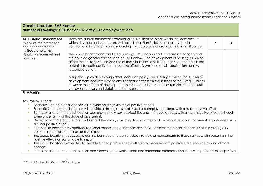
Central Bedfordshire Local Plan: SA Appendix VIIb: Safeguarded Broad Locational Options
278_November 2017 AVIIb_45/67 Enfusion
Growth Location: RAF Henlow Number of Dwellings: 1000 homes OR Mixed-use employment land
14. Historic Environment To ensure the protection and enhancement of heritage assets, the
historic environment and its setting.
There are a small number of Archaeological Notification Areas within the location117, in which development (according with draft Local Plan Policy Archaeology) could contribute to investigating and recording heritage assets of archaeological significance. The broad location contains Listed Buildings (190 Hitchin Road, and aircraft hangars and
the coupled general service shed at RAF Henlow). The development of housing is likely to affect the heritage setting and use of these buildings, and it is recognised that there is the potential for both positive and negative effects. Development will require high quality, responsive design. Mitigation is provided through draft Local Plan policy (Built Heritage) which should ensure
development does not lead to any significant effects on the settings of the Listed Buildings, however the effects of development in this area for both scenarios remain uncertain until site level proposals and details can be assessed.
? ?
SUMMARY:
Key Positive Effects:
� Scenario 1 at the broad location will provide housing with major positive effects. � Scenario 2 at the broad location will provide a strategic level of mixed-use employment land, with a major positive effect.
� Both scenarios at the broad location can provide new services/facilities and improved access, with a major positive effect, although some uncertainty at this stage of assessment.
� Development for both scenarios will support the vitality of existing town centres and there is access to employment opportunities, with a minor positive effect.
� Potential to provide new open/recreational spaces and enhancements to GI, however the broad location is not in a strategic GI corridor, potential for a minor positive effect.
� The broad location has access to existing bus stops, and can provide strategic enhancements to these services, with potential minor positive effects on sustainable transport.
� The broad location is expected to be able to incorporate energy efficiency measures with positive effects on energy and climate change.
� Both scenarios at the broad location can redevelop brownfield land and remediate contaminated land, with potential minor positive
117 Central Bedfordshire Council GIS Map Layers

Central Bedfordshire Local Plan: SA Appendix VIIb: Safeguarded Broad Locational Options
278_November 2017 AVIIb_46/67 Enfusion
Growth Location: RAF Henlow Number of Dwellings: 1000 homes OR Mixed-use employment land
effects although some uncertainty at this level of assessment.
� The broad location can provide enhancements to biodiversity for both scenarios with long term minor positive effects, although some uncertainty at this stage of assessment.
� Development at the broad location for both scenarios can enhance the existing landscape and contribute towards the landscape strategy for the area, with minor positive effect, although some uncertainty remains at this strategic level.
Key Negative Effects:
� The broad location contains best and most versatile agricultural land with a potential major negative effect for both scenarios, although some uncertainty at this level of assessment.
� Development at the broad location could result in the coalescence of settlements and the loss of settlement identity, with a minor negative effect for both scenarios, although some uncertainty remains at this strategic level because of the existing airfield use of the
land, including the military accommodation and aircraft hangars.

Central Bedfordshire Local Plan: SA Appendix VIIb: Safeguarded Broad Locational Options
278_November 2017 AVIIb_47/67 Enfusion
Growth Location: North & North East Sandy Number of Dwellings: 4,750 homes
SA
Topic & Objective
Assessment of Effects Nature of the likely sustainability effect (including positive/negative,
short - medium term (5-10 years)/long term (10 - 20 years plus), permanent/temporary,
secondary, cumulative and synergistic); Uncertainty
1. Housing To ensure that the
housing needs of all residents and communities are met
The delivery of up to 4,750 new homes will have major long-term positive effects. It is assumed that development at the growth location can meet the policy objectives of draft Local Plan policy (Housing Mix) to provide an appropriate mix of housing types, tenures and sizes.
++
2. Communities118 To maintain and enhance community and settlement identities
Development in this area will not result in the loss of any Green Belt land with neutral effects.
Development in this broad location will expand the settlement of Sandy to the north and to the east. This expansion is not considered likely to result in the coalescence of Sandy with neighbouring settlements, although there will be a reduction in open space between them. However, effective landscaping will mitigate against this. The broad location will not be a self-contained new settlement, but will be an extension of the existing
settlement of Sandy. The settlement character is partly defined by the A1 bordering the settlement to the west and the railway line bordering to the east. Development at the broad location could integrate well with the urban edge of Sandy, however development will extend the settlement beyond the railway line to the east, and therefore may affect the identity of the townscape. Therefore, it is considered there is the potential for a minor negative effect on settlement identity, although some uncertainty at this stage of assessment.
0 -?
3. Services & Facilities To improve accessibility to services
and facilities119
Development at the option is in close proximity to services and facilities available within Sandy and Tempsford. Given the scale of development at the site it is considered that there is also the potential for significant provisions to support improved accessibility to services/facilities in this area. This is supported by draft Local Plan policy (Connectivity and Accessibility). Furthermore, there is the scope to provide
++?
118 Please note that first symbol relates to location in/out of Green Belt designation; second symbol relates to effects on integration & identity for existing settlements 119 This relates to the provision of services and facilities, such as schools, healthcare centres, shops, and hospitality (café, restaurant, pub).
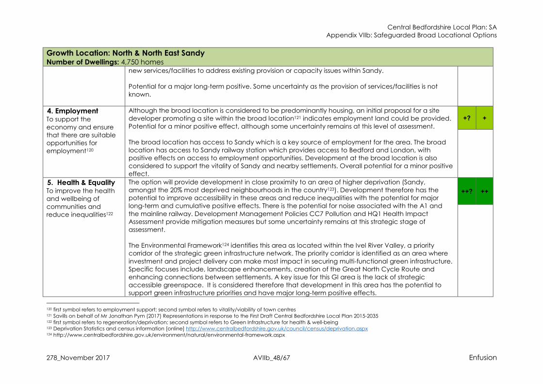
Central Bedfordshire Local Plan: SA Appendix VIIb: Safeguarded Broad Locational Options
278_November 2017 AVIIb_48/67 Enfusion
Growth Location: North & North East Sandy Number of Dwellings: 4,750 homes
new services/facilities to address existing provision or capacity issues within Sandy. Potential for a major long-term positive. Some uncertainty as the provision of services/facilities is not
known.
4. Employment To support the
economy and ensure that there are suitable opportunities for employment120
Although the broad location is considered to be predominantly housing, an initial proposal for a site developer promoting a site within the broad location121 indicates employment land could be provided. Potential for a minor positive effect, although some uncertainty remains at this level of assessment.
The broad location has access to Sandy which is a key source of employment for the area. The broad location has access to Sandy railway station which provides access to Bedford and London, with positive effects on access to employment opportunities. Development at the broad location is also considered to support the vitality of Sandy and nearby settlements. Overall potential for a minor positive effect.
+? +
5. Health & Equality To improve the health and wellbeing of
communities and reduce inequalities122
The option will provide development in close proximity to an area of higher deprivation (Sandy, amongst the 20% most deprived neighbourhoods in the country123). Development therefore has the potential to improve accessibility in these areas and reduce inequalities with the potential for major long-term and cumulative positive effects. There is the potential for noise associated with the A1 and
the mainline railway. Development Management Policies CC7 Pollution and HQ1 Health Impact Assessment provide mitigation measures but some uncertainty remains at this strategic stage of assessment. The Environmental Framework124 identifies this area as located within the Ivel River Valley, a priority corridor of the strategic green infrastructure network. The priority corridor is identified as an area where
investment and project delivery can make most impact in securing multi-functional green infrastructure. Specific focuses include, landscape enhancements, creation of the Great North Cycle Route and enhancing connections between settlements. A key issue for this GI area is the lack of strategic accessible greenspace. It is considered therefore that development in this area has the potential to support green infrastructure priorities and have major long-term positive effects.
++? ++
120 first symbol refers to employment support; second symbol refers to vitality/viability of town centres 121 Savills on behalf of Mr Jonathan Pym (2017) Representations in response to the First Draft Central Bedfordshire Local Plan 2015-2035 122 first symbol refers to regeneration/deprivation; second symbol refers to Green Infrastructure for health & well-being 123 Deprivation Statistics and census information [online] http://www.centralbedfordshire.gov.uk/council/census/deprivation.aspx 124 http://www.centralbedfordshire.gov.uk/environment/natural/environmental-framework.aspx
Central Bedfordshire Local Plan: SA Appendix VIIb: Safeguarded Broad Locational Options
278_November 2017 AVIIb_49/67 Enfusion
Growth Location: North & North East Sandy Number of Dwellings: 4,750 homes
The broad location is in close proximity to a range of open space facilities located within Sandy. This is likely to promote healthy lifestyles. However, it is expected that development could provide new areas of open space which can address any existing shortfalls and capacity issues within Sandy. Therefore, it is
considered that there is the potential for major positive effects on health.
6. Highways & Air
Quality To maintain and improve the existing highway network and
reduce associated indirect impacts on air quality and greenhouse gas emissions
Early transport modelling125 identifies that all new potential growth in this area is likely to have an impact on the A1 and cause further congestion on the highway network such that infrastructure improvements
are likely to be required to mitigate against this. A second assessment using a revised testing method determined that the Sandy traffic ‘hotspot’ was worse than previously indicated126. However, any increase in traffic could potentially be mitigated through good access to public transport networks, which Sandy has. Given the scale of new development it is anticipated that development can provide significant
infrastructure investment, and mitigation is provided through draft Local Plan policy (Strategic Transport Improvements, Mitigation of Transport Impacts on the Network, Connectivity and Accessibility, Development and Public Transport Interchanges and Low Emission Vehicles) with the potential for a residual neutral effect. However, the precise likely impacts and effectiveness of mitigation measures are uncertain until further transport modelling studies are completed for the Council later in 2017.
There is an AQMA in Sandy127, which runs along the A1 to the west of the settlement. It had been assumed that long-term air quality is likely to improve as a result of stringent emissions controls on new vehicles via European standards128. In 15 to 20 years’ time low emission vehicles will make up the majority of cars on the roads in the UK. It is also likely that there will be reductions in various contributing sectors that will also result in reductions in background concentrations of atmospheric pollutants.
However, whilst there have been very significant drops in exhaust emissions, the NO2 emissions from road transport have not been reduced as much as expected because emissions during real world driving conditions are often higher than those measured during the type approval test, especially for diesel vehicles. The EU Commission has changed the test procedures (2017) and this discrepancy should
0?
125 Aecom (2016) Technical Note Stage 1A Growth Area Analysis 126 Aecom (2017) 1B Growth Area Analysis 127 https://uk-air.defra.gov.uk/aqma/maps 128 http://ec.europa.eu/environment/air/transport/road.htm

Central Bedfordshire Local Plan: SA Appendix VIIb: Safeguarded Broad Locational Options
278_November 2017 AVIIb_50/67 Enfusion
Growth Location: North & North East Sandy Number of Dwellings: 4,750 homes
resolve the predicted improvements in air quality in time. Furthermore, good sustainable transport links at Sandy will mitigate against the potential increase in traffic. Overall likely residual neutral effect, however, this is uncertain at this stage.
7. Sustainable
Transport To encourage a demonstrable modal shift and reduce the need to travel
The option is well connected to the existing urban area of Sandy, which is well-served by bus services. It is anticipated that growth in this location could accommodate a viable extension to such services which operate in the northern area of Sandy (e.g. service number 1, 4, 18 and 112129) through
appropriate development contributions. It is also anticipated that development would be designed such that new housing would have easy and safe access to a well serviced bus stop, with positive effects on sustainable transport. The broad location is also in close proximity (approx. 2km) from Sandy railway station. Services from here are frequent and include destinations such as London and Peterborough. Development at this location
could ensue connections with the railway station, and could benefit from an East-West Rail Link (central section). Existing PRoW routes which run through the broad location could be enhanced and connected with other PRoW routes. National cycle route 12 passes130 through the broad location, however this route is unfinished. Development at the broad location could provide enhancements and connections with this
cycle route. Overall potential for major positive effects on sustainable transport.
++
8. Energy & Climate
Change To maximise the potential for energy efficiency, reduce greenhouse gas
emission and ensure that the built and natural environment
Given the potential sustainable transport connections identified against SA Objective 7 it is anticipated that development in this growth location can support a continued reduction in GHG emissions, this is further supported by draft Local Plan policy (Connectivity and Accessibility).
It is further anticipated that through compliance with draft Local Plan policy (Successful and Sustainable Places,) development could achieve policy targets for energy efficiency, high quality design standards that ensure resilience to the effects of climate change and offer potential opportunities for renewable energy production. Potential for a long-term minor positive effect but some uncertainty at this stage.
+?
129 Google Maps 130 https://www.sustrans.org.uk/ncn/map?gclid=EAIaIQobChMIjZTw5bq71wIVV80bCh3okAFdEAAYASAAEgLJ6fD_BwE
Central Bedfordshire Local Plan: SA Appendix VIIb: Safeguarded Broad Locational Options
278_November 2017 AVIIb_51/67 Enfusion
Growth Location: North & North East Sandy Number of Dwellings: 4,750 homes and its communities withstand the effects of climate change131
9. Water Resources &
Quality To minimise the demand for water and
maintain or improve water quality
The Water Cycle Study identifies that this location lies within the Upper Bedford and Ouse catchment,
where the main pressure on water resources is the abstraction of water for public supply. Abstraction for consumption is only available for up to 32% of the time and 25% of licenses in the area are time limited and tied to a Common End Date (CED) of March 2028. It is also recognised132 that one of the most likely effects of climate change to impact upon Central Bedfordshire will be a shortage of water resources. The Ruthamford South Water Resource Zone (WRZ) is
predicted to be in supply-demand deficit by 2026/27 as a result of growth and reduced yield. There are no strategic limitations on development growth as Water Companies have a statutory duty to supply water; however, capacity for providing additional supply varies & any new infrastructure requirements have to be aligned with Water Resources Management Plans. The addition of 7000 new homes in this area is therefore considered to have the potential for cumulative effects on water
resources but uncertainty until the scale & location is identified and the Water Cycle Study Phase 2 is undertaken. Rivers in the vicinity of the growth location are considered to be in a moderate overall water body class. The majority of watercourses in the Plan area are not currently meeting ‘good’ classification and the
most common reason for this is ‘pollution from waste water’. The Water Cycle Study identifies that all WwTWs have some capacity within their existing quality permits to accommodate future development without causing a class of 10% deterioration, however in some settlements the available capacity is quite small, and in some cases development may also require WwTW upgrades With draft Local Plan Policies on Climate Change & Sustainability, Water Quality and Pollution, strong
mitigation measures are in place to ensure at least neutral effects on water quality, and ensure that development supports local WRMPs with high water efficiency targets.
0?
131 Please note that Flood Risk is considered by the SA within objective number 10 132 LDA Design (2012) Central Bedfordshire Climate Change Adaptation Evidence Base Final Report

Central Bedfordshire Local Plan: SA Appendix VIIb: Safeguarded Broad Locational Options
278_November 2017 AVIIb_52/67 Enfusion
Growth Location: North & North East Sandy Number of Dwellings: 4,750 homes
10. Flood Risk To reduce the risk of flooding from all sources
Though there are areas of flood risk in the north of the broad location133, in line with draft Local Plan
policy (Flood Risk Management) it is expected that development would avoid these areas with the potential for a residual neutral effect. Draft Local Plan policy (Successful and Sustainable Places) requires development to maximise opportunities for Sustainable Drainage Systems, where applicable, and there may be possibilities for enhanced effects to help resolve existing flooding problems with the potential for some positive effects
but uncertain at this stage of appraisal. Likely residual neutral effects.
0?
11. Soil To protect and
conserve soil134
Development in this broad locational option will predominantly result in the loss of greenfield land. Within the broad location there is grade 1, 2 and 3 (sub-grade not known) best and most versatile agricultural land, with a potential major negative effect, although some uncertainty remains at this stage of assessment.
The broad location is not considered likely to regenerate brownfield land, with a neutral effect.
--? 0
12. Biodiversity &
Geodiversity To protect, enhance and manage biodiversity & geodiversity
The nearest Natura 2000 designated site to the broad location is the Eversden and Wimpole Woods SAC, approx. 15km to the east and designated for the presence of Barbastelle bats135. The HRA of the Plan concluded that the broad location would not have likely significant effects on Natura 2000
designated sites for air quality, recreational disturbance, changes to water levels and quality, or habitat loss. The growth location option is not located in the Nature Improvement Area, however there are a number of nationally designated sites to the east. Sandy Warren SSSI is approx. 2km to the south of the broad location. Weaveley & Sand Woods SSSI is to the north east of the growth location136, and contains
Ancient Woodland with a mix of species, and an additional interest due to the underlying geology137;
+?
133 Environment Agency (2016) Flood Map for Planning 134 first symbol refers to greenfield & agricultural land qualities; second symbol relates previously developed land 135 DEFRA (2016) Magic Map Application 136 Ibid. 137 Weaveley & Sand Wood Citation (1983) [Online 2016] http://www.sssi.naturalengland.org.uk/citation/citation_photo/1003181.pdf

Central Bedfordshire Local Plan: SA Appendix VIIb: Safeguarded Broad Locational Options
278_November 2017 AVIIb_53/67 Enfusion
Growth Location: North & North East Sandy Number of Dwellings: 4,750 homes
also Gamlingay Wood SSSI138, which holds well developed plant and animal communities139.Potton Wood SSSI is approx. 6km to the east of the broad location. Possible impacts on these SSSI sites could occur through noise and light pollution caused by new development, increased recreation use from
future residents and possible loss of ecological corridors. However, due to the distance of the SSSIs from the growth option these negative effects would be minimal, and mitigation is provided through draft Local Plan policy (Nature Conservation) with a likely residual neutral effect. Within the growth location option there is a County Wildlife Site (CWS) and some small areas of Deciduous Woodland Priority Habitat, with additional CWSs a short distance to the east, south and west.
Potential negative effects are mitigated through draft Local Plan policy (Nature Conservation) and draft Local Plan policy (Enhancing Ecological Networks) that further seeks to ensure that development positively contributes to biodiversity. The option is not located within the biodiversity elements of the Priority Corridors as set out in the Central Bedfordshire Nature Conservation Strategy140 & Strategic Green Infrastructure Plan. Whilst new
development can provide biodiversity enhancements, these would not progress strategic aims with less possibilities for positive effects. Therefore, there is the potential for minor positive effects in the longer term but uncertain at this stage until more detailed studies.
13. Landscape Protect and enhance the landscape and townscape
This broad location is not located adjacent to or within the designated AONB landscape & therefore no
major negative effects indicated. The option is predominantly within the Bedfordshire Greensand Ridge National Character Area141, and the statements of environmental opportunity identify the need to protect long open views and high levels of tranquillity, as well as the Ridge’s aquifer. Development in this broad location is considered likely to impact upon the open character and levels of tranquillity with the potential for minor long term
negative effects. Mitigation possibilities uncertain until further studies undertaken. The broad location is within the Biggin Wood Clay Vale Landscape Character Type142, and visually sensitive features in this area include the flat, open landscape, clear views across the landscape and
-?
138 DEFRA (2016) Magic Map Application 139 Gamlingay Wood Citation (1983) [Online 2016] http://www.sssi.naturalengland.org.uk/citation/citation_photo/1001138.pdf 140 Central Bedfordshire Council (2015) Central Bedfordshire Nature Conservation Strategy 141 LUC for Central Bedfordshire Council Landscape Character Areas (2015) 142 Central Bedfordshire Council (2015) Central Bedfordshire Landscape Character Assessment

Central Bedfordshire Local Plan: SA Appendix VIIb: Safeguarded Broad Locational Options
278_November 2017 AVIIb_54/67 Enfusion
Growth Location: North & North East Sandy Number of Dwellings: 4,750 homes
the small blocks of woodlands and high hedgerows. The landscape strategy for the area focuses on enhancing the landscape by reinforcing the integrated field boundaries, enhancing woodland cover and restoring floodplain elements. It is expected that development at the broad location could result in
the loss of visually sensitive features, but could also contribute to the landscape strategy. Some uncertainty therefore remains.
14. Historic
Environment To ensure the protection and enhancement of
heritage assets, the historic environment and its setting
There is one Listed Building located along the A1 (Dick Turpin Public House) whose setting could be affected by development in this growth location (although separated by the A1). Mitigation is provided
through draft Local Plan policy (Built Heritage) which should ensure development does not lead to any significant effects on the setting of the Listed Building, with the potential for a residual neutral effect. The growth location option lies partially within an Archaeological Notification Area143 in the west, in which development (according with draft Local Plan Policy Archaeology) could contribute to investigating and recording heritage assets of archaeological significance, with the potential for minor
long term positive effects. Likely neutral effects but element of uncertainty until site level assessments have been completed. Overall neutral effects at this stage.
0?
143 Central Bedfordshire Council (2016) GIS Map Layers

Central Bedfordshire Local Plan: SA Appendix VIIb: Safeguarded Broad Locational Options
278_November 2017 AVIIb_55/67 Enfusion
Growth Location: North & North East Sandy Number of Dwellings: 4,750 homes
SUMMARY:
Key Positive Effects: � The broad location will provide housing with major positive effects. � Enhancements to access to services/facilities and the provision of services/facilities can be delivered at the broad location, with
potential major positive effects. Although some uncertainty. � The broad location is within close proximity to an area of higher deprivation, with major positive effects on equality, although some
uncertainty remains.
� Enhancements to GI and public open space have the potential for major positive effects on health. � The broad location has access to a railway station and can improve sustainable transport in the area with associated major positive
effects, although uncertainty remains regarding the potential positive effects associated with the East-West Rail Link. � Some employment could be accommodated in the broad location, as indicated by a site promoter of a site option in the broad
location. Potential for a minor positive effect, with some uncertainty.
� The broad location has good links to employment opportunities and will support the vitality of local towns, with minor positive effects. � The broad location is expected to be able to incorporate energy efficiency measures with positive effects on energy and climate
change. � Development at the broad location can regenerate existing brownfield land, with a minor positive effect, although some uncertainty
as the exact location of development is not known. � Potential for a net gain for biodiversity to be achieved, with minor positive effects, some uncertainty.
� Development can contribute to the landscape strategy for the area with a minor positive effect, and some uncertainty at this stage of assessment.
Key Negative Effects: � There is the potential for the loss of best and most versatile agricultural land with major negative effects, and some uncertainty
regarding potential contaminated land.
� There is the potential for a minor negative effect on communities through the loss of settlement identity for Sandy. � Development at the broad location will result in increased levels of traffic on the highway network in and around Luton/Dunstable.
SA Recommendations for the North & North East Sandy Broad Location: � Landscaping and design should protect the settlement identity of Sandy and contribute to achieving aims and objectives within the
Ivel River Valley GI network.
� Development at the broad location should provide services/facilities to support local communities and address any existing lack of services/facilities or capacity issues for the local area.
� The broad location is well located to provide strategic green infrastructure benefits, Specifically, development should be required to

Central Bedfordshire Local Plan: SA Appendix VIIb: Safeguarded Broad Locational Options
278_November 2017 AVIIb_56/67 Enfusion
Growth Location: North & North East Sandy Number of Dwellings: 4,750 homes
contribute towards the Ivel River Valley GI Strategy, and this can include enhancing connections between settlements, providing accessible greenspace and contributing towards the proposed cycle route in the GI area.
� Development should be required to provide strategic infrastructure improvements to the local road network to mitigate against any
increase in traffic, with a focus on addressing congestion on the A1. � Development should provide sustainable transport improvements to address the existing lack of sustainable transport links in the broad
location. This should include new bus services which can link with the railway station at Sandy. Further enhancements should focus on new cycle routes and the PRoW network, possibly linking these with the railway station at Sandy for cumulative positive effects.
� Require development at the broad location to maximise opportunities for Sustainable Drainage System, including connectivity with the GI aspirations for the Ivel River Valley GI network.
� Development should achieve a net gain for biodiversity. Development should retain existing CWS sites and enhance these by providing connections between Priority Habitats and the wider biodiversity network. Visitor studies for the nearby SSSI sites and the should be required to better understand the effect of increased recreational pressure. Enhancements to biodiversity should be in-line with aspirations for Central Bedfordshire as a whole, and due to the broad locations location, can link in with biodiversity in surrounding authorities.
� Landscape enhancement should contribute to the landscape strategy and environmental opportunities for the area, and where
possible link with the Ivel River Valley GI network.
Growth Location: Tempsford South and Tempsford Airfield Number of Dwellings: New settlement up to 10,000 homes
Central Bedfordshire Local Plan: SA Appendix VIIb: Safeguarded Broad Locational Options
278_November 2017 AVIIb_57/67 Enfusion
Growth Location: Tempsford South and Tempsford Airfield Number of Dwellings: New settlement up to 10,000 homes
SA
Topic & Objective
Assessment of Effects Nature of the likely sustainability effect (including positive/negative,
short - medium term (5-10 years)/long term (10 - 20 years plus), permanent/temporary,
secondary, cumulative and synergistic); Uncertainty
1. Housing To ensure that the
housing needs of all residents and communities are met
The delivery of up to 10,000 new homes will have major long-term positive effects. It is assumed that development at the growth location can meet the policy objectives of draft Local Plan policy (Housing Mix) to provide an appropriate mix of housing types, tenures and sizes.
++
2. Communities144 To maintain and enhance community and settlement identities
Development in this area will not result in the loss of any Green Belt land with neutral effects.
The large amount of housing growth proposed in this broad locational means there is the chance for development to contribute to coalescence with the settlements of Everton and Sandy with Tempsford. Although there is the potential for a well-designed development to be self-contained in this broad location and the formation of a new community, at this strategic level this is not certain. Furthermore, the settlement identity of Tempsford may be altered as a result of a large development in this location, with a potential minor negative effect. Some uncertainty at this stage of assessment.
0 -?
3. Services & Facilities To improve
accessibility to services and facilities145
Development at the option is in close proximity to services/facilities in Tempsford, and approx. 2km to services and facilities available within Sandy and Everton. Given the scale of development at the site it is considered that there is also the potential for significant provisions to support improved accessibility in this area. This is supported by draft Local Plan policy (Connectivity and Accessibility).
Potential for a major long-term positive. Some uncertainty as the provision of services/facilities is not known.
++?
144 Please note that first symbol relates to location in/out of Green Belt designation; second symbol relates to effects on integration & identity for existing settlements 145 This relates to the provision of services and facilities, such as schools, healthcare centres, shops, and hospitality (café, restaurant, pub).

Central Bedfordshire Local Plan: SA Appendix VIIb: Safeguarded Broad Locational Options
278_November 2017 AVIIb_58/67 Enfusion
Growth Location: Tempsford South and Tempsford Airfield Number of Dwellings: New settlement up to 10,000 homes
4. Employment To support the
economy and ensure that there are suitable opportunities for employment146
The option has been identified for the development of housing and as such is unlikely to lead to any significant effects, with the potential for a neutral effect.
The location is in close proximity to Bedford as a major employment source for Central Bedfordshire and is located close to a strategic rail connection route with a mainline railway station in the centre of Sandy which is likely to increase accessibility to employment areas in this respect. Development in this location may also support the vitality and viability of Sandy town centre, with the potential for minor long term positive effects. Also, access on the A1 north and south to other employment areas, and the site is also located in close proximity to A428 with connections to Cambridge.
0 +
5. Health & Equality To improve the health
and wellbeing of communities and reduce inequalities147
The option will provide development in close proximity to an area of higher deprivation (Sandy, amongst the 20% most deprived neighbourhoods in the country148). Development therefore has the potential to improve accessibility in these areas and reduce inequalities with the potential for major long-term and cumulative positive effects. There is the potential for noise associated with the A1 and
the mainline railway; also, a nearby composting facility with potential issues for odours. Development Management Policies CC7 Pollution and HQ1 Health Impact Assessment provide mitigation measures but some uncertainty remains at this strategic stage of assessment. The Environmental Framework149 identifies this area as located within the Ivel River Valley, a priority
corridor of the strategic green infrastructure network. The priority corridor is identified as an area where investment and project delivery can make most impact in securing multi-functional green infrastructure. Specific focuses include, landscape enhancements, creation of the Great North Cycle Route and enhancing connections between settlements. A key issue for this GI area is the lack of strategic accessible greenspace. It is considered therefore that development in this area has the potential to support green infrastructure priorities and have major long-term positive effects.
There is limited pubic open spaces within Temspford and around the broad location, although Sandy to the south has several areas offering a range of recreational facilities. Development in this broad location could provide strategic levels of new open spaces and recreational facilities, which can
++? ++
146 first symbol refers to employment support; second symbol refers to vitality/viability of town centres 147 first symbol refers to regeneration/deprivation; second symbol refers to Green Infrastructure for health & well-being 148 Deprivation Statistics and census information [online] http://www.centralbedfordshire.gov.uk/council/census/deprivation.aspx 149 http://www.centralbedfordshire.gov.uk/environment/natural/environmental-framework.aspx

Central Bedfordshire Local Plan: SA Appendix VIIb: Safeguarded Broad Locational Options
278_November 2017 AVIIb_59/67 Enfusion
Growth Location: Tempsford South and Tempsford Airfield Number of Dwellings: New settlement up to 10,000 homes
address the current deficit. This is likely to have major positive effects on health through the promotion of healthier lifestyles.
6. Highways & Air
Quality To maintain and improve the existing highway network and reduce associated indirect impacts on air quality and greenhouse
gas emissions
Early transport modelling150 identifies that all new potential growth in this area is likely to have an impact on the A1 and cause further congestion such that infrastructure improvements are likely to be required. It is understood that the existing level crossing between Tempsford and Everton would be required to be removed. The crossing goes over the mainline between Edinburgh and Kings Cross (London) and causes significant waiting times and delays to traffic. Without the removal of this level crossing it is not
considered that this site would be acceptable in this respect. A second initial transport assessment using a revised testing method determined that the A1 ‘hotspot’ near Tempsford was worse than previously indicated151. Some mitigation could be provided through good access to public transport networks. Given the scale of development is it anticipated that development can provide significant infrastructure investment, and mitigation is provided through draft Local Plan policy (Strategic Transport
Improvements, Mitigation of Transport Impacts on the Network, Connectivity and Accessibility, Development and Public Transport Interchanges and Low Emission Vehicles) with the potential for a residual neutral effect. However, the precise likely impacts and effectiveness of mitigation measures are uncertain until further transport modelling studies are completed for the Council later in 2017. There is an AQMA in Sandy, and an AQMA on the A428 to the east of the broad location near
Cambridge152. However, the broad area option is located some distance from the AQMAs such that mitigation measures should be effective with likely neutral effects. It had been assumed that long-term air quality is likely to improve as a result of stringent emissions controls on new vehicles via European standards153. In 15 to 20 years’ time low emission vehicles will make up the majority of cars on the roads in the UK. It is also likely that there will be reductions in various contributing sectors that will also result in
reductions in background concentrations of atmospheric pollutants. However, whilst there have been very significant drops in exhaust emissions, the NO2 emissions from road transport have not been
0?
150 Aecom (2016) Technical Note Stage 1A Growth Area Analysis 151 Aecom (2017) 1B Growth Area Analysis 152 https://uk-air.defra.gov.uk/aqma/maps 153 http://ec.europa.eu/environment/air/transport/road.htm

Central Bedfordshire Local Plan: SA Appendix VIIb: Safeguarded Broad Locational Options
278_November 2017 AVIIb_60/67 Enfusion
Growth Location: Tempsford South and Tempsford Airfield Number of Dwellings: New settlement up to 10,000 homes
reduced as much as expected because emissions during real world driving conditions are often higher than those measured during the type approval test, especially for diesel vehicles. The EU Commission has changed the test procedures (2017) and this discrepancy should resolve the predicted
improvements in air quality in time. However, this is uncertain at this stage.
7. Sustainable
Transport To encourage a demonstrable modal shift and reduce the need to travel
The broad location is not directly connected to any of the existing urban areas. The urban area of Sandy is located around 6km away, along Tempsford Road and Everton Road which is also the closest route connection to Sandy Station154. The smaller settlement of Everton is located around 2km away
which provides bus connections (route numbers 2, 18, 127 188, 190 and 193155). It is expected that the strategic level of development at the broad location would provide enhancements to public transport, including new bus services or extension to existing services, through appropriate devilment contributions. These services could link with the railway station at Sandy, with positive effects for sustainable transport. There may be scope for a sustainable future connection to the East-West Rail Link, so some uncertainty remains at this stage. Bus provision could also include services to Cambridge to the east to increase
accessibility. National cycle route 12 is located to the west of Temspford156 and provides access to St Neots and Blunham. Development could provide new cycle routes to connect with the national cycle route, and provide a safe cycle route to Sandy railway station for positive effects. There are existing PRoW routes within the broad location, and these could be enhanced to provide access to nearby settlements.
Overall potential for a minor positive effect on sustainable transport.
+?
8. Energy & Climate
Change To maximise the potential for energy efficiency, reduce greenhouse gas
emission and ensure that the built and
Given the potential sustainable transport connections identified against SA Objective 7 it is anticipated that development in this growth location can support a continued reduction in GHG emissions, this is further supported by draft Local Plan policy (Connectivity and Accessibility).
It is further anticipated that through compliance with draft Local Plan policy (Successful and Sustainable Places,) development could achieve policy targets for energy efficiency, high quality design standards that ensure resilience to the effects of climate change and offer potential opportunities for renewable energy production. Potential for a long-term minor positive effect but some uncertainty at this stage.
+?
154 Google Maps estimated drive time from Tempsford Road to Sandy Station. 155 Google Maps 156 https://www.sustrans.org.uk/ncn/map?gclid=EAIaIQobChMIip-SwPGz1wIVYirTCh2k3wDnEAAYASAAEgJQTfD_BwE
Central Bedfordshire Local Plan: SA Appendix VIIb: Safeguarded Broad Locational Options
278_November 2017 AVIIb_61/67 Enfusion
Growth Location: Tempsford South and Tempsford Airfield Number of Dwellings: New settlement up to 10,000 homes natural environment and its communities withstand the effects
of climate change157
9. Water Resources &
Quality To minimise the demand for water and
maintain or improve water quality
The Water Cycle Study identifies that this location lies within the Upper Bedford and Ouse catchment,
where the main pressure on water resources is the abstraction of water for public supply. Abstraction for consumption is only available for up to 32% of the time and 25% of licenses in the area are time limited and tied to a Common End Date (CED) of March 2028. It is also recognised158 that one of the most likely effects of climate change to impact upon Central Bedfordshire will be a shortage of water resources. The Ruthamford South Water Resource Zone (WRZ) is
predicted to be in supply-demand deficit by 2026/27 as a result of growth and reduced yield. There are no strategic limitations on development growth as Water Companies have a statutory duty to supply water; however, capacity for providing additional supply varies & any new infrastructure requirements have to be aligned with Water Resources Management Plans. The addition of 7000 new homes in this area is therefore considered to have the potential for cumulative effects on water
resources but uncertainty until the scale & location is identified and the Water Cycle Study Phase 2 is undertaken. Rivers in the vicinity of the growth location are considered to be in a moderate overall water body class. The majority of watercourses in the Plan area are not currently meeting ‘good’ classification and the
most common reason for this is ‘pollution from waste water’. The Water Cycle Study identifies that all WwTWs have some capacity within their existing quality permits to accommodate future development without causing a class of 10% deterioration, however in some settlements the available capacity is quite small, and in some cases development may also require WwTW upgrades With draft Local Plan Policies on Climate Change & Sustainability, Water Quality and Pollution, strong
mitigation measures are in place to ensure at least neutral effects on water quality, and ensure that development supports local WRMPs with high water efficiency targets.
0?
157 Please note that Flood Risk is considered by the SA within objective number 10 158 LDA Design (2012) Central Bedfordshire Climate Change Adaptation Evidence Base Final Report
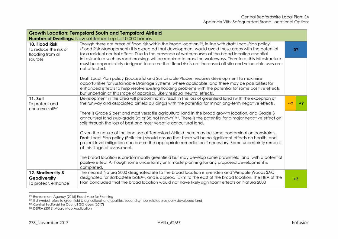
Central Bedfordshire Local Plan: SA Appendix VIIb: Safeguarded Broad Locational Options
278_November 2017 AVIIb_62/67 Enfusion
Growth Location: Tempsford South and Tempsford Airfield Number of Dwellings: New settlement up to 10,000 homes
10. Flood Risk To reduce the risk of
flooding from all sources
Though there are areas of flood risk within the broad location159, in line with draft Local Plan policy (Flood Risk Management) it is expected that development would avoid these areas with the potential for a residual neutral effect. Due to the presence of watercourses at the broad location essential
infrastructure such as road crossings will be required to cross the waterways. Therefore, this infrastructure must be appropriately designed to ensure that flood risk is not increased off site and vulnerable uses are not affected. Draft Local Plan policy (Successful and Sustainable Places) requires development to maximise opportunities for Sustainable Drainage Systems, where applicable, and there may be possibilities for
enhanced effects to help resolve existing flooding problems with the potential for some positive effects but uncertain at this stage of appraisal. Likely residual neutral effects.
0?
11. Soil To protect and conserve soil160
Development in this area will predominantly result in the loss of greenfield land (with the exception of the runway and associated airfield buildings) with the potential for minor long-term negative effects.
There is Grade 2 best and most versatile agricultural land in the broad growth location, and Grade 3 agricultural land (sub-grade 3a or 3b not known)161. There is the potential for a major negative effect on soils through the loss of best and most versatile agricultural land. Given the nature of the land use at Tempsford Airfield there may be some contamination constraints.
Draft Local Plan policy (Pollution) should ensure that there will be no significant effects on health, and project level mitigation can ensure the appropriate remediation if necessary. Some uncertainty remains at this stage of assessment. The broad location is predominantly greenfield but may develop some brownfield land, with a potential positive effect Although some uncertainty until masterplanning for any proposed development is
completed.
--? +?
12. Biodiversity &
Geodiversity To protect, enhance
The nearest Natura 2000 designated site to the broad location is Eversden and Wimpole Woods SAC, designated for Barbastelle bats162, and is approx. 15km to the east of the broad location. The HRA of the Plan concluded that the broad location would not have likely significant effects on Natura 2000
+?
159 Environment Agency (2016) Flood Map for Planning 160 first symbol refers to greenfield & agricultural land qualities; second symbol relates previously developed land 161 Central Bedfordshire Council GIS layers (2017) 162 DEFRA (2016) Magic Map Application

Central Bedfordshire Local Plan: SA Appendix VIIb: Safeguarded Broad Locational Options
278_November 2017 AVIIb_63/67 Enfusion
Growth Location: Tempsford South and Tempsford Airfield Number of Dwellings: New settlement up to 10,000 homes and manage biodiversity & geodiversity
designated sites for air quality, recreational disturbance, changes to water levels and quality, or habitat loss.
The broad location is not located in the Nature Improvement Area, however there are a number of nationally designated sites to the east. Weaveley & Sand Woods SSSI is to the east of the growth location163, and contains Ancient Woodland with a mix of species, and an additional interest due to the underlying geology164; also, Gamlingay Wood SSSI165, which holds well developed plant and animal communities166. Possible impacts on these SSSI sites could occur through noise and light pollution caused by new development, increased recreation use from future residents and possible loss of ecological
corridors. However, due to the distance of the SSSIs from the growth option these negative effects would be minimal, and mitigation is provided through draft Local Plan policy (Nature Conservation) with a likely residual neutral effect. Within the growth location option there is a County Wildlife Site (CWS) and some small areas of Deciduous Woodland Priority Habitat, with additional CWSs a short distance to the east. Potential
negative effects are mitigated through draft Local Plan policy (Nature Conservation) and draft Local Plan policy (Enhancing Ecological Networks) that further seeks to ensure that development positively contributes to biodiversity. The option is not located within the biodiversity elements of the Priority Corridors as set out in the Central
Bedfordshire Nature Conservation Strategy167 & Strategic Green Infrastructure Plan. Whilst new development can provide biodiversity enhancements, these would not progress strategic aims with less possibilities for positive effects. Therefore, there is the potential for minor positive effects in the longer term but uncertain at this stage until more detailed studies.
163 Ibid. 164 Weaveley & Sand Wood Citation (1983) [Online 2016] http://www.sssi.naturalengland.org.uk/citation/citation_photo/1003181.pdf 165 DEFRA (2016) Magic Map Application 166 Gamlingay Wood Citation (1983) [Online 2016] http://www.sssi.naturalengland.org.uk/citation/citation_photo/1001138.pdf 167 Central Bedfordshire Council (2015) Central Bedfordshire Nature Conservation Strategy
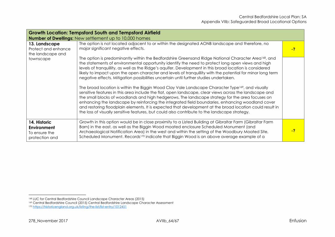
Central Bedfordshire Local Plan: SA Appendix VIIb: Safeguarded Broad Locational Options
278_November 2017 AVIIb_64/67 Enfusion
Growth Location: Tempsford South and Tempsford Airfield Number of Dwellings: New settlement up to 10,000 homes
13. Landscape Protect and enhance
the landscape and townscape
The option is not located adjacent to or within the designated AONB landscape and therefore, no major significant negative effects.
The option is predominantly within the Bedfordshire Greensand Ridge National Character Area168, and the statements of environmental opportunity identify the need to protect long open views and high levels of tranquillity, as well as the Ridge’s aquifer. Development in this broad location is considered likely to impact upon the open character and levels of tranquillity with the potential for minor long term negative effects. Mitigation possibilities uncertain until further studies undertaken.
The broad location is within the Biggin Wood Clay Vale Landscape Character Type169, and visually sensitive features in this area include the flat, open landscape, clear views across the landscape and the small blocks of woodlands and high hedgerows. The landscape strategy for the area focuses on enhancing the landscape by reinforcing the integrated field boundaries, enhancing woodland cover and restoring floodplain elements. It is expected that development at the broad location could result in the loss of visually sensitive features, but could also contribute to the landscape strategy.
-?
14. Historic
Environment To ensure the protection and
Growth in this option would be in close proximity to a Listed Building at Gibraltar Farm (Gibraltar Farm Barn) in the east, as well as the Biggin Wood moated enclosure Scheduled Monument (and Archaeological Notification Area) in the west and within the setting of the Woodbury Moated Site,
Scheduled Monument. Records170 indicate that Biggin Wood is an above average example of a
-?
168 LUC for Central Bedfordshire Council Landscape Character Areas (2015) 169 Central Bedfordshire Council (2015) Central Bedfordshire Landscape Character Assessment 170 https://historicengland.org.uk/listing/the-list/list-entry/1012451
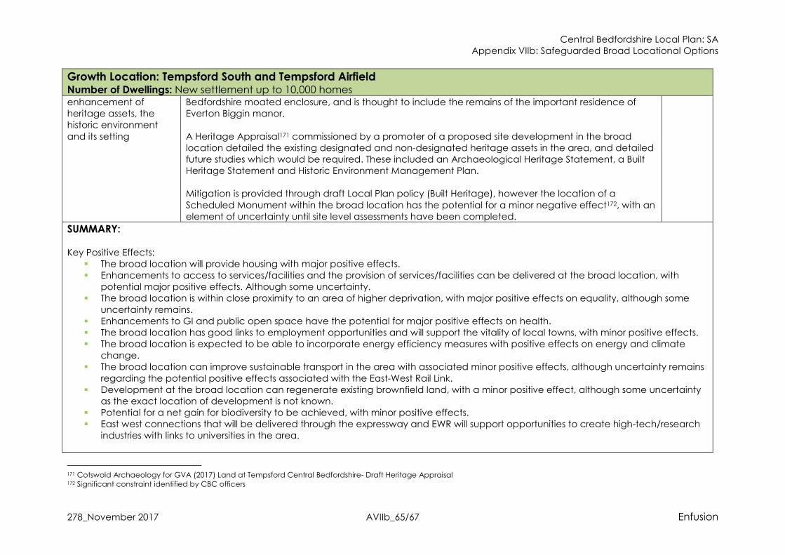
Central Bedfordshire Local Plan: SA Appendix VIIb: Safeguarded Broad Locational Options
278_November 2017 AVIIb_65/67 Enfusion
Growth Location: Tempsford South and Tempsford Airfield Number of Dwellings: New settlement up to 10,000 homes enhancement of heritage assets, the historic environment
and its setting
Bedfordshire moated enclosure, and is thought to include the remains of the important residence of Everton Biggin manor.
A Heritage Appraisal171 commissioned by a promoter of a proposed site development in the broad location detailed the existing designated and non-designated heritage assets in the area, and detailed future studies which would be required. These included an Archaeological Heritage Statement, a Built Heritage Statement and Historic Environment Management Plan. Mitigation is provided through draft Local Plan policy (Built Heritage), however the location of a
Scheduled Monument within the broad location has the potential for a minor negative effect172, with an element of uncertainty until site level assessments have been completed.
SUMMARY:
Key Positive Effects: � The broad location will provide housing with major positive effects. � Enhancements to access to services/facilities and the provision of services/facilities can be delivered at the broad location, with
potential major positive effects. Although some uncertainty. � The broad location is within close proximity to an area of higher deprivation, with major positive effects on equality, although some
uncertainty remains. � Enhancements to GI and public open space have the potential for major positive effects on health. � The broad location has good links to employment opportunities and will support the vitality of local towns, with minor positive effects. � The broad location is expected to be able to incorporate energy efficiency measures with positive effects on energy and climate
change. � The broad location can improve sustainable transport in the area with associated minor positive effects, although uncertainty remains
regarding the potential positive effects associated with the East-West Rail Link. � Development at the broad location can regenerate existing brownfield land, with a minor positive effect, although some uncertainty
as the exact location of development is not known. � Potential for a net gain for biodiversity to be achieved, with minor positive effects. � East west connections that will be delivered through the expressway and EWR will support opportunities to create high-tech/research
industries with links to universities in the area.
171 Cotswold Archaeology for GVA (2017) Land at Tempsford Central Bedfordshire- Draft Heritage Appraisal 172 Significant constraint identified by CBC officers

Central Bedfordshire Local Plan: SA Appendix VIIb: Safeguarded Broad Locational Options
278_November 2017 AVIIb_66/67 Enfusion
Growth Location: Tempsford South and Tempsford Airfield Number of Dwellings: New settlement up to 10,000 homes Key Negative Effects:
� There is the potential for the loss of best and most versatile agricultural land with major negative effects, and some uncertainty regarding potential contaminated land.
� There is the potential for a minor negative effect on landscape due to the loss of visually sensitive features for the local landscape.
SA Recommendations for the Tempsford Broad Location: � Landscaping and design should ensure there is no risk of coalescence with Everton or Sandy, protect settlement identities and
contribute to achieving aims and objectives within the Ivel River Valley GI network. � Development should provide services/facilities to support local communities and address any existing lack of services/facilities or
capacity issues for the local area. � The broad location is well located to provide strategic green infrastructure benefits, Specifically, development should be required to
contribute towards the Ivel River Valley GI Strategy, and this can include enhancing connections between settlements, providing accessible greenspace and contributing towards the proposed cycle route in the GI area.
� Development should be required to provide strategic infrastructure improvements to the local road network to mitigate against any increase in traffic.
� Development should provide sustainable transport improvements to address the existing lack of sustainable transport links in the broad location. This should include new bus services which can link with the nearby settlement of Sandy and the railway station. Further enhancements should focus on new cycle routes and the PRoW network, possibly linking these with the railway station at Sandy for cumulative positive effects.
� Require development at the broad location to maximise opportunities for Sustainable Drainage System, including connectivity with
the GI aspirations for the Ivel River Valley GI network. � Development should achieve a net gain for biodiversity. Development should retain existing CWS sites and enhance these by
providing connections between Priority Habitats and the wider biodiversity network. Visitor studies for the nearby SSSI sites and the should be required to better understand the effect of increased recreational pressure. Enhancements to biodiversity should be in-line with aspirations for Central Bedfordshire as a whole, and due to the broad locations location, can link in with biodiversity in surrounding authorities.
� Landscape enhancement should contribute to the landscape strategy and environmental opportunities for the area, and where possible link with the Ivel River Valley GI network.

Central Bedfordshire Local Plan: SA Appendix VIIb: Safeguarded Broad Locational Options
278_November 2017 AVIIb_67/67 Enfusion