20121129-5156 ferc pdf (unofficial) 11/29/2012 3:48:20 pm€¦ · · 2016-08-02license...
TRANSCRIPT
United StatesDepartment ofAgriculture
ForestService
Alaska Region P.O. Box 21628Juneau, AK 99802-1628
Caring for the Land and Serving People Printed on Recycled Paper
File Code: 2770Date: November 29, 2012
Ms. Kimberly D. Bose, SecretaryFederal Energy Regulatory Commission888 First Street, NEWashington, DC 20426
Preliminary Section 4(e) Terms and Conditions and Comments
Sweetheart Lake Hydroelectric Project, FERC No. 13563-001
Dear Ms. Bose:
We regret that we are unable to file Preliminary Terms and Conditions for the Sweetheart Lake Hydroelectric Project, FERC No. 13563-001, pursuant to Section 4(e) of the Federal Power Act at this time.
The Forest Service review of the Draft License Application (DLA) and Preliminary Draft Environmental Assessment (PDEA) finds that the documents are incomplete. The PDEA fails to clearly display the issues and disclose the direct, indirect, and cumulative effects of the proposed action and the no action alternative. Effects analyses are lacking and conclusions are either lacking or unsubstantiated. The documents lack key information needed for the drafting of meaningful preliminary terms and conditions.
The Forest Service is recommending to Juneau Hydropower, Inc. that it prepare a revised and complete preliminary environmental document and circulate it for review before filing the Final License Application and Draft Environmental Assessment with FERC. If this occurs and is acceptable to FERC, we would then be able to submit Preliminary 4(e) Terms and Conditions based upon the revised documents. The Forest Service will file Final 4(e) Terms and Conditions necessary for the protection and utilization of the Tongass National Forest whenever they are requested by FERC.
We plan to continue working with Juneau Hydropower, Inc. and other licensing participants to ensure that accurate resource and operations information is used in determining the project effects and needed mitigation. This on-going work will also include discussion of resource-specific plans that can be referenced or included in the Final 4(e) conditions.
20121129-5156 FERC PDF (Unofficial) 11/29/2012 3:48:20 PM
Ms. Kimberly D. Bose, Secretary 2
Enclosure 1 contains our schedule for submitting the Final 4(e) Terms and Conditions. Forest Service comments regarding the DLA and PDEA are in Enclosure 2. Enclosure 3 contains a recent letter to Juneau Hydropower, Inc. and the Certificate of Service is included as Enclosure 4.
Please contact Barbara Stanley, Regional Energy Coordinator, at (907) 228-6262 or [email protected] with any questions.
Sincerely,
/s/ Ruth M. Monahan (for):BETH G. PENDLETONRegional Forester
Enclosures (4)
cc: Mr. Duff Mitchell
20121129-5156 FERC PDF (Unofficial) 11/29/2012 3:48:20 PM

______________________________________________________________________________________Forest Service Schedule for Submitting 1 of 1 November 29, 2012Final 4(e)s for Sweetheart Lake Hydro Project
Enclosure 1
SCHEDULE FOR SUBMITTING FINAL 4(e) TERMS AND CONDITIONS
Sweetheart Lake Hydroelectric ProjectP-13563
USDA Forest ServiceAlaska Region
Tongass National Forest
The following schedule is submitted pursuant to 18 CFR 4.34(b)(1)(i).
Document Date To Be Submitted To FERC
Forest Plan Consistency Finding Within 60 days of publication in the Federal Register that the DEA or DEIS is available for public comment
Final 4(e) Terms and Conditions Within 60 days of publication in the Federal Register that the DEA or DEIS is available for public comment
Modified 4(e) Terms and Conditions
Within 60 days of publication in the Federal Register that the FEA or FEIS is available for public comment.
20121129-5156 FERC PDF (Unofficial) 11/29/2012 3:48:20 PM
______________________________________________________________________________________________Forest Service Comments on Sweetheart Lake 1 of 37 November 29, 2012Hydroelectric Project DLA and PDEA
Enclosure 2
Forest Service CommentsOn Draft License Application
andPreliminary Draft Environmental Assessment
for the Sweetheart Lake Hydroelectric Project
FERC Project P-13563
Forest Service reviewers fully appreciate the difficulty of analyzing and presenting the effects of this projecton the environment. The following comments and suggestions are meant to be constructive and helpful to the applicant in improving the adequacy and clarity of the documents.
NEPA
Several of the comments below reference Forest Service NEPA procedures and requirements. We recognize that FERC’s NEPA direction and required document formats may differ from those of the Forest Service.
The Forest Service’s review is based on the current documents, as submitted, and is irrespective of any future planned or potential additional fieldwork. Our review focused on the DLA and PDEA but was in no way complete or exhaustive. Based on our review, the DLA and PDEA are incomplete and fail to clearly display the issues, and disclose the direct, indirect, and cumulative effects of the proposed action and no action. Effects analyses are lacking and conclusions are either lacking or unsubstantiated. The Forest Service recommends that a revised and complete preliminary environmental document be prepared and circulated for review before the Final License Application and Draft EA/EIS are filed with FERC.
In general, the current version of the PDEA does not allow the reader to easily:
Determine the issues. This document does not adequately describe the issues. There is no discussion of what issues, if any, came out of scoping or how they are being addressed. We realize that issues are listed in SD2 but the connection between SD2 and the PDEA is not apparent. Please expand upon this and clearly track the issues.
Obtain a clear, concise, and accurate picture of existing conditions.
20121129-5156 FERC PDF (Unofficial) 11/29/2012 3:48:20 PM

______________________________________________________________________________________________Forest Service Comments on Sweetheart Lake 2 of 37 November 29, 2012Hydroelectric Project DLA and PDEA
The affected environment sections often contain irrelevant and extraneous material and do not clearly describe the existing conditions. More is not always better. Much of the general background information could be deleted. Please focus on information that is essential to understanding the existing conditions and the potential effects. Include and/or reference relevant information from the Resource Reports.
Obtain a clear and accurate picture of the potential effects of the Alternatives. It is not apparent whether the direct/indirect effects for each resource have been analyzed. There are no cumulative effects analyses for any of these resources. Are there any cumulative effects? Section 3.2 on page 14 seems to indicate that no cumulative effects have been identified. Please clarify.
Assess consistency with the Forest Plan and the Roadless Rule.The Forest Service has previously commented (PAD,SD1) that these analyses must be included and the Applicant was provided a copy of the Forest Plan with Land Use Designation (LUD) maps, descriptions, and applicable Standards and Guidelines. Information has also been provided for the Roadless Rule.
Documents
Organization and Readability
Forest Service reviewers found the documents to be incomplete with much additional work required. It appears that the documents were somewhat hastily-prepared and perhaps submitted prematurely. A thorough editing is needed -- not only for content, but also for organization, clarity, and readability. Many of the maps, figures, and tables are poorly reproduced and are unreadable due to small font size or fuzziness of the image. Several of the figures are clipped on the right side, titles are on different pages thanthe associated figures, and legends/labels are missing units of measurement. Formatting of the documents is inconsistent and typographical errors are common.
Study Plans and Technical Reports
We object to numerous resource reports being submitted with the DLA and PDEA and during the review period. Forest Service reviewers were unable to carefully review most of these documents. In addition, we are unsure about the status of several of the study plans. Have all of them been finalized? Please provide a status update on all draft/final study plans and draft/incomplete/final resource reports.
General Resource Comments
20121129-5156 FERC PDF (Unofficial) 11/29/2012 3:48:20 PM
______________________________________________________________________________________________Forest Service Comments on Sweetheart Lake 3 of 37 November 29, 2012Hydroelectric Project DLA and PDEA
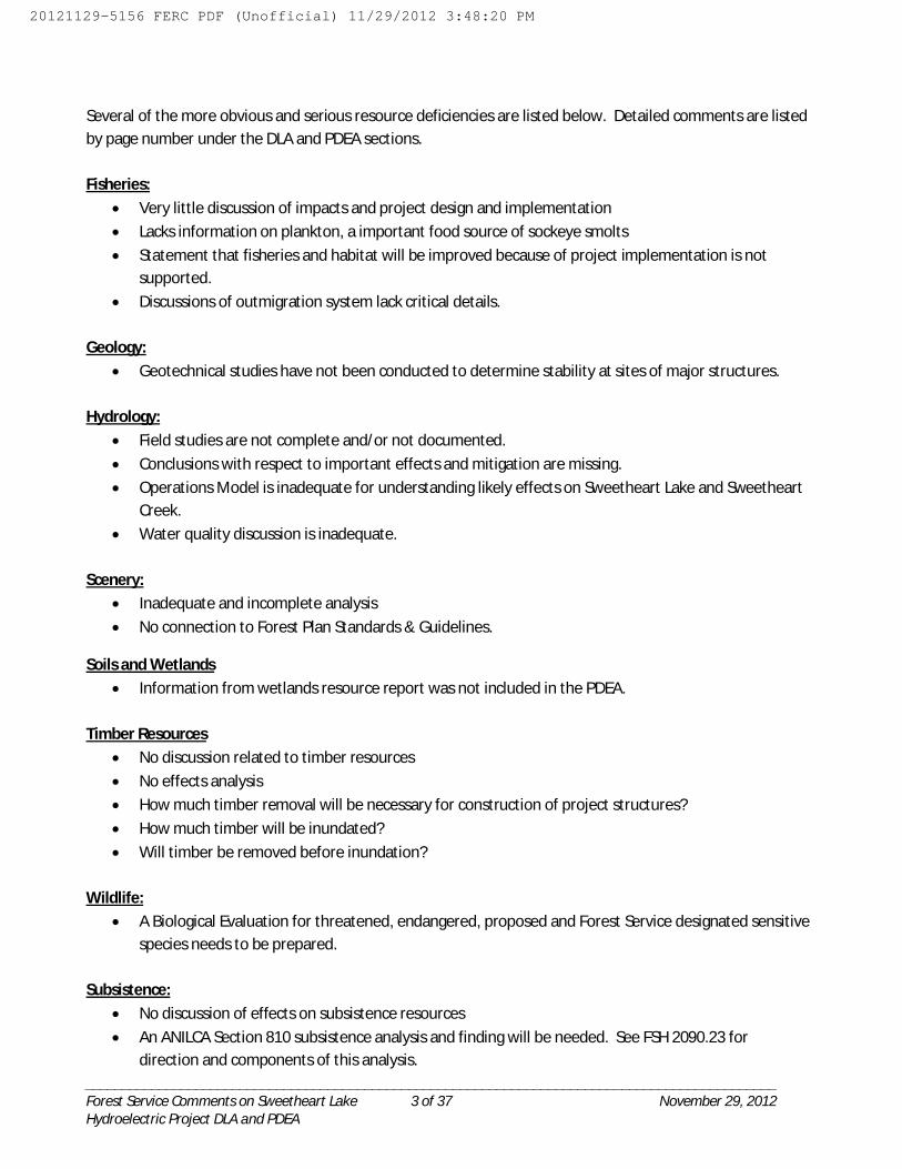
Several of the more obvious and serious resource deficiencies are listed below. Detailed comments are listed by page number under the DLA and PDEA sections.
Fisheries: Very little discussion of impacts and project design and implementation Lacks information on plankton, a important food source of sockeye smolts Statement that fisheries and habitat will be improved because of project implementation is not
supported. Discussions of outmigration system lack critical details.
Geology: Geotechnical studies have not been conducted to determine stability at sites of major structures.
Hydrology: Field studies are not complete and/or not documented. Conclusions with respect to important effects and mitigation are missing. Operations Model is inadequate for understanding likely effects on Sweetheart Lake and Sweetheart
Creek. Water quality discussion is inadequate.
Scenery: Inadequate and incomplete analysis No connection to Forest Plan Standards & Guidelines.
Soils and Wetlands Information from wetlands resource report was not included in the PDEA.
Timber Resources No discussion related to timber resources No effects analysis How much timber removal will be necessary for construction of project structures? How much timber will be inundated? Will timber be removed before inundation?
Wildlife: A Biological Evaluation for threatened, endangered, proposed and Forest Service designated sensitive
species needs to be prepared.
Subsistence: No discussion of effects on subsistence resources An ANILCA Section 810 subsistence analysis and finding will be needed. See FSH 2090.23 for
direction and components of this analysis.
20121129-5156 FERC PDF (Unofficial) 11/29/2012 3:48:20 PM

______________________________________________________________________________________________Forest Service Comments on Sweetheart Lake 4 of 37 November 29, 2012Hydroelectric Project DLA and PDEA
Land Status
Power Site Classification 221
The DLA refers to Power Site Classification 221 and indicates that these lands are withdrawn for hydropower development.
Background
During the 1920-30s, the United States Geologic Survey (USGS) inventoried potential hydropower sites in southeast Alaska. Those sites with hydropower potential were classified as Power Site Classifications (PSCs) and were withdrawn by administrative orders under the authority of the Organic Act of March 3, 1879. (This is the USGS Organic Act; in 1983, authority for these withdrawals was transferred to the Bureau of Land Management (BLM). The intent was to set aside and protect those lands with potential water power value, until that potential could be realized or developed.
The Sweetheart Lake area was identified as having potential water power value and was withdrawn asPower Site Classification 221 on May 14, 1929. In accordance with the provisions of Section 24 of the Federal Power Act of June 10, 1920, these lands are reserved from entry, location, or other disposal under the public land laws until otherwise directed by FERC or by Congress.
Current Situation and Management
A Power Site Classification withdrawal identifies an area as having water power potential but it does not authorize water power development. It serves as an identifier for possible development and not as a right for development. The withdrawal in no way overrides Forest Service management discretion under the Tongass National Forest Land and Resource Management Plan. While the actual withdrawal has no expiration date, these are not necessarily permanent withdrawals. There is a process by which a Power Site Classification withdrawal can be revoked, if it is later determined that the area lacks water power development potential or if the PSC is incompatible with multiple use objectives. Several of the PSCs on the Tongass NF have been revoked or relinquished over the years. At present, there are an estimated 20-25 PSCs in effect on the Tongass National Forest.
The Forest Service continues to have jurisdiction over the management and resources of these lands while recognizing that the withdrawn areas have power values which should be protected to the greatest extent possible, consistent with other land-use requirements. Forest Plan Standards and Guidelines fully apply to these lands.
20121129-5156 FERC PDF (Unofficial) 11/29/2012 3:48:20 PM
______________________________________________________________________________________________Forest Service Comments on Sweetheart Lake 5 of 37 November 29, 2012Hydroelectric Project DLA and PDEA
Roadless Area Conservation Rule (2001 Roadless Rule)
The Roadless Area Conservation Rule (2001 Roadless Rule) was adopted on January 12, 2001 and has been the subject of numerous lawsuits since that time. At the time of adoption, the Tongass was exempted from the 2001 Roadless Rule. In May 2011, the order was vacated and the Tongass is no longer exempt. The Tongass National Forest continues to be under active Roadless litigation.
The proposed Sweetheart Lake Hydroelectric Project is located within the Taku Snettisham Inventoried Roadless Area (IRA) 302 and may be inconsistent with the Roadless Rule. Currently, all projects involving road construction or reconstruction and the cutting, sale, or removal of timber in inventoried roadless areas are reviewed by the Chief of the Forest Service.
The 2001 Roadless Rule (Federal Register / Vol. 66, No. 9 / Friday, January 12, 2001) needs to be cited in this document, and provided as a reference. The Roadless Rule applies to all projects on the Tongass National Forest.
Draft License Application (DLA)
DLA Initial Statement
Page 7: Table 1 E -- Essential Fish Habitat is not a “permit” – it is a consultation process.
Page 8: 7. Brief description of the Project -- “(1)…existing… surface area of 1,414 acres… new surface … 1,702 acres.” Doesn’t match PDEA; 2.2.1 Proposed Project Facilities; Reservoir, which says 1,260 acres and 1,439 acres. Which is correct?
Page 8: 7. Brief description of the Project -- “(2) a new… 278-foot-long… concrete dam.” Doesn’t match PDEA; 2.2.1 Proposed Project Facilities; Reservoir, which says the dam will be 275 feet long. Which is correct? Also, there’s a parenthesis typo in the sentence.
Page 9: Tongass NF LUD direction -- It appears that the Applicant has relied on selective LUD direction for the project area by using language from the Forest Plan EIS instead of the Forest Plan. In particular, Semi Remote Recreation LUD desired condition includes “ecological processes and natural conditions are only minimally affected by past or current human uses or activities.” (Forest Plan page 3-63). Applicant should be able to demonstrate how the project will meet these conditions, as well as all the relevant forest wide standards and guidelines.
20121129-5156 FERC PDF (Unofficial) 11/29/2012 3:48:20 PM
______________________________________________________________________________________________Forest Service Comments on Sweetheart Lake 6 of 37 November 29, 2012Hydroelectric Project DLA and PDEA
Page 9: 8. Lands of the United States affected -- “The Tongass… lands around and within… as Semi Remote Land Use Designation and Timber Harvest… “ Incorrect terms. Correct terms are Semi-Remote Recreation and Timber Production. Also, in addition to the Land Use Designations you’ve listed, it would be prudent to identify that the proposed project is within an Inventoried Roadless Area. This may be covered in the document, but should also be documented in the initial statement.
Page 10: 1st paragraph -- Suggest you delete this paragraph or re-word.
Page 12: Other Information, part c -- “U.S. Forest Service – Ketchikan Ranger District.” Typo. Change “Ketchikan” Ranger District to “Juneau” Ranger District.
DLA, Exhibit A – Project Description
The Project description has changed since Scoping Document 2 (lake elevation increase was 85 ft.--now 25 ft., capacity was 30 MW--now 19.8 MW, access road was 0.6 miles long—now 0.85 miles long.
General comment: Please add page numbers to this section.
Page ?: Project Description (1), (i) Marine Access Facilities – “A dual height marine ramp for loading and unloading freight barges…width of 50 feet… toe of ramp…near El. 15… slope up to El. 25…” In the PDEA there is no discussion of a marine access ramp, temporary or otherwise. Is this the site where the proposed dock is located? This impact should be addressed in the PDEA. Where are these quarries the shot rock will come from? How visible will they be? How will they be “put to bed” when closed? You may want to start the ramp at a lower elevation (i.e. +5 or +10).
Page ?: Project Description -- Quarries for marine access facilities. No information about quarry locations. Quarry sites must be located on the ground for FS approval. BMPs apply.
Page ?: Project Description -- Coastal Road. Will the transmission line from powerhouse to marine be buried under the road (within the 25 ft. corridor) or will it require additional disturbance?
Page ?: Project Description -- Coastal Road. No reference to BMPs for road. Field survey will be necessary for any un-mapped streams and other resource protection needs. It appears that portions of the road would be regularly inundated at high tide and would also require forest clearing. Additional information is needed. Provide additional information about road, including relevant BMPs for drainage, stream crossings, erosion control, etc.
Page ?: Project Description -- Primary Transmission Line. No references to construction methods or clearing required for line. As shown on Exhibit G-4 it will cross at least two known fish streams and probably others that have not been mapped. Provide additional information, including relevant BMPs for stream protection.
20121129-5156 FERC PDF (Unofficial) 11/29/2012 3:48:20 PM

______________________________________________________________________________________________Forest Service Comments on Sweetheart Lake 7 of 37 November 29, 2012Hydroelectric Project DLA and PDEA
Page ?: Project Description -- Primary Transmission Line. It appears that sections of this document were copied from documents for the Soule River Hydroelectric project (4th line from bottom of page). Please verify that the information in this section is for Sweetheart Lake, not Soule.
Page ?: Project Description -- Reservoir Outlet Works. No references to location and design of intake structure. Please specify location (elevation, etc.) of intake structure. A more detailed drawing of the dam and its features to scale would be helpful.
DLA, Exhibit B – Project Operation and Resource Utilization
Page B-8: 1st Paragraph -- This is the first occurrence of a discussion of the possibility of humpback whale entanglement with lost longline gear. This problem is inconsistently discussed throughout Volumes 1 and 2. Please be consistent in what you address in each section.
Page B-2: Project Operation -- Reservoir elevations. Typo?: minimum 677 ft. elevation should be 576 ft.elevation to match project description.
Page B-4: (iii) Alternative Access Road Alignments ,first paragraph -- “Although hydropower developments are an approved road building activity in the Tongass National Forest… “…Nothing in this judgment shall be construed to prohibit any person or entity from seeking, or the U.S. Department of Agriculture from approving, otherwise lawful road construction, road reconstruction, or the cutting or removal of timber for hydroelectric development pursuant to the standards and procedures set forth in the Federal Power Act, 16 U.S.C. §§ 791-823d”. Incorrect interpretation. Judge Sedwick’s order does not indicate that hydropower developments are an approved road building activity in inventoried roadless areas. The order merely states that nothing (in the order) prohibits any person/entity from seeking or USDA from approving lawful road construction or the cutting/removal of timber for hydroelectric development. Approval is not automatic. These projects are reviewed by the Chief of the Forest Service. See page 5 of Forest Service Comments under Roadless Area Conservation Rule (2001 Roadless Rule).
Page B-6: 2nd line -- Missing text?
Page B-9: Project Operation --The Operations Model should show how water will be managed throughout the year, incorporating Sweetheart Lake inflow magnitude and timing, Sweetheart Lake levels, amount diverted year-round, magnitude and timing of release and spill from Sweetheart Lake into Sweetheart Creek. Currently Exhibit B contains some of this information, but it is not clearly presented in an operations model context and quantified for adverse, mean and high water years. Please provide a complete operations model on a monthly basis for adverse, mean, and high water years. Monthly flow duration curves should clearly display withdrawal amounts for comparison.
No information is provided about management of the reservoir, specifically, how will submerged timber and floating debris be handled? Please provide this information. A reservoir management plan may be necessary.
20121129-5156 FERC PDF (Unofficial) 11/29/2012 3:48:20 PM

______________________________________________________________________________________________Forest Service Comments on Sweetheart Lake 8 of 37 November 29, 2012Hydroelectric Project DLA and PDEA
Page B-11: Project Operation -- Table B-2 Apparently foot notes are missing from this table? Please explain the difference between recorded flows and extended flows.
Page B-12: Project Operation -- Flow accretion in bypass reach. Are there any tributaries within the bypass reach?
Page B-12: Project Operation -- USGS record classified as “excellent” Is this the Applicant’s opinion or USGS’s? Please provide a reference for this rating. It is especially relevant to describe the rating for winter flows.
Page B-12: Project Operation -- Extended flow record. Water Supply Paper 1529 (USGS 1962) contains the results of the original Sweetheart Creek record extension using Long River records, but doesn’t provide the actual correlation used. Please provide a reference that documents the methods used for the Civil Science Inc. record extension.
Page B-12: Project Operation -- “no fish with commercial or recreational value” utilize the bypass reach. This conclusion is not supported by the Applicant’s PDEA or Fish Report (8-24-2012). Regardless, the Tongass Forest Plan Forest wide Fish Standards and Guidelines include “maintain or restore the natural range and frequency of aquatic habitat conditions…to sustain the diversity and production of fish and other freshwater organisms.” There is no inherent preference given to fish with commercial or recreational value.
The creek is indeed utilized by fish and quite necessary for both sockeye, Dolly Varden, and rainbow trout to access salt water. It is highly likely that the Sweetheart watershed is a consistent and perhaps even substantial producer of sea-run Dolly Varden and steelhead to the numerous fisheries found along the east and west sides of Stephens Passage. The Applicant must demonstrate the effects of flow diversion on fish habitat in the bypass reach, addressing the Forest Plan Standards and Guidelines, forest-wide and for this particular LUD.
Page B-12: Project Operation -- Instream flows. The conclusion that no instream flows will be necessary is premature, and not supported by the available study results. The Applicant must demonstrate the effects of the flow diversion on the bypass reach and consider instream flows as a potential mitigation measure.
DLA, Exhibit C – Proposed Construction Schedule
General comment: Please include page numbers in this section.
Page ?: Figure C-1 Design and Construction Schedule -- Timeline conflict. Figure shows construction activities commencing prior to permit processing end date. Please note that no construction activities will commence until Forest Service special use authorization is in place.
Page ?: Figure C-1 Design and Construction Schedule -- Power House Construction. No timeline shown for power house construction. Please add.
20121129-5156 FERC PDF (Unofficial) 11/29/2012 3:48:20 PM

______________________________________________________________________________________________Forest Service Comments on Sweetheart Lake 9 of 37 November 29, 2012Hydroelectric Project DLA and PDEA
Page ?: Figure C-1 Design and Construction Schedule -- Geotechnical Investigations proposed to be conducted between August 2013 and November 2013. A lot of geotechnical assumptions are made in the proposal with regard to the feasibility of the construction of almost all the facilities (Float plane dock, power house, access road, and dam). Has there been any consideration to the variance in costs/time associated with adverse geotechnical findings?
Page ?: Figure C-1 Design and Construction Schedule -- “Final Design by Infrascture component”“Infrastructure” is spelled Incorrectly.
DLA, Exhibit D – Project Costs and Financing
Page D-1: (1) Costs of New Construction-- The Forest Service requires applicants to pay costs associated with processing special use applications under our cost recovery regulations at 36 CFR §251.58. Cost recovery fees are separate from fees charged for the use and occupancy of National Forest System lands.
Preliminary Draft Environmental Assessment (PDEA)
Executive Summary
Page 5: Conclusions -- The conclusion that the project would not significantly affect the environment is not supported by the PDEA, due to missing information and lack of supported conclusions. Much more information and analysis is needed before this statement can be made.
1.0 Introduction
1.2 Purpose of Action and Need for Power
Page 8: -- There is a map showing Land Use Designations (LUDs), but not one showing Inventoried Roadless Area boundaries. Suggest adding map showing Inventoried Roadless Area boundaries.
1.3 Statutory and Regulatory Requirements
20121129-5156 FERC PDF (Unofficial) 11/29/2012 3:48:20 PM
______________________________________________________________________________________________Forest Service Comments on Sweetheart Lake 10 of 37 November 29, 2012Hydroelectric Project DLA and PDEA
Page 16: 1.3.2 Clean Water Act -- No reference to Best Management Practices (BMPs) to maintain water quality, which must be incorporated into project plans. Refer to Best Management Practices from 1) National BMPs for Water Quality Management on National Forest System Lands (FS-990a, April 2012) and 2) Forest Service Handbook 2509.22, Alaska Region amendment effective July 14, 2006.
Page 16: 1.3.5 National Historic Preservation Act -- The Archaeologist designated by the proponent can make recommendations regarding eligibility of properties, but the Agency is the only one that can make determinations of eligibility. These recommendations have been reviewed by the Agency Archaeologist and the Agency has made determination of eligibility for historic properties on National Forest Systems lands. We have invited the SHPO to concur or comment on our determinations but this has not yet been completed.
Page 16: 1.3.3 -- This section states that there are no TES species at the project site. This contradicts Vol.1 page B 8 and Vol. 2 page 224, which discuss the possible impacts to humpback whales from tangling on long line gear caught on the underwater transmission lines. Please discuss the whales tangling consistently throughout the document – you brought it up, make sure it is discussed in the appropriate sections. The‘project area’ should be defined consistently throughout the documents. In this case, the project area seems to be only the foot print of the dam and power station. In other sections, the project area includes the dam, power station, lake, and transmission lines. This is confusing.
Page 17: 1.3.7 Magnuson-Stevens Fishery Conservation and Management Act -- “Evidence to date may support there being EFH at the Sweetheart Creek mouth….” By definition, Class I anadromous habitat is considered EFH. This is not subject to interpretation by the project proponent. Statement requires revision.
Page 17: 1.3.8 Other Regulatory Requirements -- “The USFS controls subsistence hunts… “ The Federal Subsistence Board (FSB) is authorized by the Secretaries of the Interior and Agriculture to promulgate rules for subsistence take on Federally managed lands, not the USFS. Re-word this sentence and the following sentence that starts with “The Alaska Department of Fish and Game…” to clarify the agencies’ roles.
Page 18: 1.3.8 Other Regulatory Requirements -- Forest-wide Standards and Guidelines. List of applicable forest-wide standards and guidelines is incomplete. Also, Applicant’s attempts to explain how they achieve the standards and guidelines here are insufficient. For example, the fact that the beach is rocky does not demonstrate that the project meets the standards and guidelines. Please add references to Soil and Water, Riparian, and Transportation standards and guidelines. Explanations of how the standards and guidelines apply should refer to more detailed discussions of those resources later in the EA, where specific trade-offs and effects can be described and quantified.
Page 18: 1.3.8 Other Regulatory Requirements -- Fish. “The Applicant believes that their plan extends and enhances fish habitat.” Difficult to support this statement by the applicant given the lack of data provided to analyze. Initial assessment of fisheries impacts from this proposal appears that most, if not all, spawning and rearing habitat for resident fish in Lower Sweetheart Lake will be lost. Given this very general assessment of the impacts, how does the project proponent then make the claim that their plan “extends
20121129-5156 FERC PDF (Unofficial) 11/29/2012 3:48:20 PM

______________________________________________________________________________________________Forest Service Comments on Sweetheart Lake 11 of 37 November 29, 2012Hydroelectric Project DLA and PDEA
and enhances fish habitat”? The FS Standards and Guidelines for fish are very specific and when these cannot be met, the results should be considered, quantified, and presented as impacts to the resource.
Page 18: 1.3.8 Other Regulatory Requirements -- Beach and Estuary. “The analysis with shore zone photos… access road infrastructure. “ Delete this sentence, it is irrelevant to the Forest Plan standard and guideline which makes no distinction by habitat class within the beach fringe.
1.4 Public Review and Comment
Page 19: First paragraph -- “Agencies and federal recognized are listed as… “ Seems like there is a word missing here. Insert “tribes”?
2.0 Proposed Action and Alternatives
2.2 Proposed Action
Page 21: -- “…the Project Boundary ceases to overlap onto the Tracy Arms [sic] Wilderness area…” Thank you. This change alleviates a concern (pertaining to effect upon wilderness character) FS expressed earlier in the process. Please correct name of wilderness: Tracy Arms – Ford’s Terror Wilderness.
Page 21: 2.2.1 Proposed Project Facilities -- See relevant comments on DLA requesting additional information on project facilities and construction methods.
Page 21: 2.2.1 Proposed Project Facilities -- Where is the discussion of the road and dock under project facilities? Add a section about the proposed road and dock in this section.
Pages 21-22: 2.2.1 Proposed Project Facilities -- Provide clear information about minimum and maximum lake levels, maximum fluctuation, and normal ranges. What is the maximum drawdown? Expand the discussion regarding lake levels and fluctuation.
Page 22: 2.2.1 Proposed Project Facilities -- The powerhouse will be located in a deep excavation approximately 600 feet northwest of the anadromous barrier on Sweetheart Creek, and approximately2,000 feet east of the confluence of Sweetheart Creek and Gilbert Bay. Good location for powerhouse so it’s farther from view of the fishing area at the falls and up high enough to return flow to the anadromous portion of the stream to help maintain the fishery there.
Page 22: 2.2.1 Tunnel and Penstock -- “…tunnel portal at elevation 550 feet….” Where would this intake be in relation to the bottom of the lake? How will the intake be designed to prevent fish intake and mortality? Much more discussion is needed regarding this structure relative to existing conditions, minimum water levels, and design.
Page 23: Tailrace – “…constructed by DBM” Spell out this term when first used (here).
20121129-5156 FERC PDF (Unofficial) 11/29/2012 3:48:20 PM

______________________________________________________________________________________________Forest Service Comments on Sweetheart Lake 12 of 37 November 29, 2012Hydroelectric Project DLA and PDEA
Page 24: Proposed Project Access Generating Facilities -- “A new approximately 4400-mile-long road…”Typo. Replace “mile” with “foot”.
Page 25: 2.2.2 Project Safety -- Bullet list of safety-related plans. Will need to address waste and its disposal at the project construction site – i.e. construction debris, sewage, garbage, trash, etc. Add to bullet list: plan for management of solid waste & waste water.
Page 25: 2.2.3 Proposed Project Operation -- Reservoir management, etc. See relevant comments on DLA requesting additional information about the Operations Model and water management. The DLA states that the project will be operated to provide firm power. This paragraph implies a more variable rule curve and seasonal approach to power generation. Is this a contradiction? Please provide requested information and clarify.
Page 25: 2.2.4 Proposed Environmental Measures -- Aquatic Resources. No reference to BMPs related to reservoir management, access road construction and maintenance, transmission line construction and maintenance. Provide additional environmental measures.
In addition to plans already noted on page 25, proponent will need to prepare the following… -Environmental Compliance Monitoring (ECM) Plan -Road Mgt & Maint. Plan -Spoils Disposal Plan -Revegetation Plan -Rec/Trails Mgt & Maint. Plan
Page 25: 2.2.4 Proposed Environmental Measures -- Geologic and Soil Resources. An erosion control plan will not prevent erosion and sedimentation. Measures from the plan can minimize erosion and sedimentation and prevent effects to downstream resources. Consider rephrasing.
Page 26: 2.2.4 -- Terrestrial Resources. Include bullet that APLIC designs for mitigating raptor impacts will be incorporated. This is mentioned later in the EA but it would be good to include it here.
Page 26: 2.2.4 -- Threatened and Endangered Species. When discussing TES species, raptors (goshawks) are mentioned and not whales. Goshawks are not discussed in previous TES paragraphs. Please be consistent in what you address in each section.
Page 26: 2.2.4 -- Recreation and Land Use. “…for seasonal sport and subsistence fishermen… “The state has designated this a personal use fishery, not a subsistence fishery. Some folks would be offended by the discussion of subsistence under recreation. Replace “subsistence” with “personal use”.
Page 26: 2.2.4 -- Recreation and Land Use. “…lowering bear interactions with bears…” Change to “human interactions with bears”.
Page 26: 2.2.4 -- Recreation and Land Use “Construct or refurbish trails to and around the Sweetheart Creek anadromous reach from rock removed from the tunnel construction for seasonal sport and subsistence fishermen harvesting Sweetheart Lake sockeye.” The existing trails along the creek are over used relative to the capacity of the native tread. Soils are badly degraded and trails are braided. Hardening of the tread on the fishing access trails along Sweetheart Creek would be a benefit to the users of the area.
20121129-5156 FERC PDF (Unofficial) 11/29/2012 3:48:20 PM

______________________________________________________________________________________________Forest Service Comments on Sweetheart Lake 13 of 37 November 29, 2012Hydroelectric Project DLA and PDEA
Hardened trails would provide easier and safer access to the fishing holes along the creek, while protecting the soil and water resources. While a primitive level of development to stabilize the trails and prevent further erosion can provide benefits, a higher level of development may have unintended consequences that should be considered when making decisions about development level of recreation improvement at the site. For example, a wide trail, 3’ or 4’ wide with staircases over steep rocky areas may attract more people to the area. Combined with a dock and a road, the improved access resulting from the improvements could lead to the area becoming popular for bear viewing which would require additional management of the area. Discuss in the effects analysis, maybe in section 2 or 3, the possible impacts of over-developing the trails.
Page 26: 2.2.4 -- Cultural Resources. Please note that the presence or absence of historic properties that need to be considered has not yet been determined by the Agency, who is currently consulting with the SHPO regarding the status of sites.
2.6 Alternatives Considered but Eliminated from Detailed Study
Page 27: 1st paragraph, last sentence -- “However, this alternative… eliminated from consideration.” This is an awkwardly worded, run-on sentence. Please reword/clarify.
Page 28: 1st sentence -- “This access road… would traverse roadless wilderness and…” Untrue – perhaps a misuse or misunderstanding of the term “wilderness.” Rewrite to eliminate the term “wilderness.”
3.0 Environmental Analysis
3.3.1 Geologic and Soil Resources
Page 38: Figure 13. Geologic Map from USGS in miles -- This figure is more complex than a basic geologic map. There are two layers of contour lines; the base contours are topographic, but the overlying contours are undefined. They might be structural contours. The map needs a more descriptive label.
Page 38: 1st paragraph -- “The Project lies within Seismic Zone …” Modern earthquakes are measured with the moment magnitude scale, not the Richter scale. Remove all references to “Richter magnitude” and “Richter scale” and use just “magnitude” instead.
Page 40: Soils, 3rd paragraph -- This paragraph was lifted from a 1980 NEPA document with dated soil information (page 3 Gilbert Bay FEIS). The Forest Service has completed a soil inventory for the project area and current information is available from the USFS. The USFS has a soil inventory, NWI coverage, and a landslide inventory for the project area Replace this paragraph with accurate soil info from either the correct GIS layers or the Wetland report. Any Tongass soil scientist can provide the appropriate soil/wetland/landslide GIS information.
20121129-5156 FERC PDF (Unofficial) 11/29/2012 3:48:20 PM

______________________________________________________________________________________________Forest Service Comments on Sweetheart Lake 14 of 37 November 29, 2012Hydroelectric Project DLA and PDEA
Page 40: Soils, 3rd paragraph -- “Sideslope soils, other than clay soils, pose few hazards to developmental activities.” This was taken from a 1980 USFS NEPA document and this phrase is not true. A cursory look at the air photos reveal several landslides along the lake. Remove this sentence. Was a landslide/slope stability investigation conducted?
Page 40: Soils, 4th paragraph -- According to the US Fish and Wildlife Service digital wetlands mapper, there is no digital data for Sumdum Quadrants D-5, D-6 which encompasses Gilbert Bay, Sweetheart Creek, and Sweetheart Lake. There is an exceptionally good wetland report for this project. This should be used here rather than the NWI wetland mapper.
The USFS also has a complete NWI layer for the entire Tongass and can provide it upon request. Please rewrite this section using the completed wetland report or just refer to the wetland section in the document.
Page 40: Soils -- JHI may request the non-digital data available from the USFWS through its private contractor. Please refer to the wetland report for this section.
Page 42: 2nd sentence at top -- “Fracture sets are oriented at N25W/81SW, N48E/83SE, and N38/37SE.”The third quadrant bearing in this sentence, N38/37SE”, needs a direction off of the north reference meridian.
Page 42: 2nd complete paragraph -- Entire paragraph beginning with: “Potential for large scale slope instability…” The Tongass landslide inventory identified no landslides near the proposed facilities but there are at least 5 landslides that currently terminate along the lake shore. Most of the area is a stable bedrock type but shallow landslides are common across the Tongass and are common in the project area. This also contradicts the statement above about stability/development. Consider discussing the types of landslides/mass wasting events that are expected, based on what occurs naturally. The USFS has a landslide inventory that may be helpful here.
Page 42: Existing mineral claims and mining areas -- “Mining claims AKAA 092856/SJ and AKAA 09857/SK boundaries are located some distance away and downslope of the proposed dam, with additional adjacent claims extending to the southwest.” Change “09857/SK” to “092857/SK”. Change “southwest” to “southeast”. Quantify “some distance away.”
Page 43: Borrow and Waste Rock, 2nd paragraph -- Entire paragraph. Suggest referencing BMPs here or any specific soil and water quality controls. (FSH 2509.22)
Page 43: Borrow and Waste Rock -- “Rock excavated from access road alignment…” The use of these materials will require sale through a Mineral Materials contract. Mineral Material sites will be developed according to CFR 228 C, FSM 2850, and Tongass Land and Resource Management Plan Standards and Guidelines MG2 V.
Page 44: Transmission Line Construction, 1st paragraph -- “Ground disturbance and effects on geology and soils are anticipated at the tower foundations and at the overhead/underground transition points.” Which
20121129-5156 FERC PDF (Unofficial) 11/29/2012 3:48:20 PM

______________________________________________________________________________________________Forest Service Comments on Sweetheart Lake 15 of 37 November 29, 2012Hydroelectric Project DLA and PDEA
Effects? It is unclear what effects could occur under transmission towers? Are they a slope stability concern? There needs to be a bit more specificity here.
Page 44: Erosion Control, 1st paragraph -- “Discussions of sediment and erosion control are addressed in the sections above related to specific project features.” Where is this discussed? It certainly isn’t in the soils/geology section.
Page 44: Erosion Control, 1st paragraph -- “No significant impacts to the soil resource are anticipated. Localized short-term impacts associated with soil surface disturbance and attendant increased soil erosion would occur.” Why are there no significant impacts to soil? Are impacts the same as effects? Saying there aren’t any impacts is a start but there should be a “because” at the end of that. Suggestions: Because of: an erosion control plan; State of Alaska Clean Water Act requirements; this is a dedicated use and isn’t a detrimental soil disturbance (should reference USFS manual 2554 for detrimental soil effects).
Page 44: Geologic Resource Issues -- Is there any potential for landslides/slope stability problems in the project area? Landslides/slope stability concerns occur across a variety of landscapes. It would be good to address if the transmission line, road, or other infrastructure would undergo rigorous geotechnical review under the following “Geologic Resource Solutions” section.
Page 44: Geologic Resource Solutions -- “A well developed Erosion and Sediment Control Plane (ESCP) will also prevent or minimize sedimentation.” Is this a typo and should it be a Control Plan? Plans can’t prevent/minimize anything but their actions/requirements can. This would be a good place to note how the project/plan would adhere to BMPs, the Clean Water Act, and obtain all necessary permits.
Page 44: Geologic Resource Solutions -- “A well developed Erosion and Sediment Control Plane (ESCP)…” Change “Plane” to “Plan”.
Page 44: Geologic Resource Solutions -- The Erosion and Sediment Control Plan must be approved by the Forest Service prior to construction. Further testing for Acid Rock Drainage potential must be completed prior to construction. If potential is found to exist, a plan to address ARD must be approved by the Forest Service prior to ground disturbance.
Page 45: -- Figure 15: Sample of Hornblende Schist Ledge Rock tested for determination of Los Angeles Abrasion. What is the significance of this table? There is no reference to it in the text.
3.3.2 Aquatic Resources
A review of the Applicant’s Draft Aquatic Studies (dated 4-5-2012) suggests that many studies specified in this document have not been completed to date, or at least the relevant results were not reported in the Fish Report (dated 8-31-2012) or in the PDEA. For example, the Draft Aquatic Studies (page 30) describes analysis and PM&E for “effects of project…on nutrients, water temperature, dissolved oxygen, dissolved gas levels” of Sweetheart Lake and Creek.
20121129-5156 FERC PDF (Unofficial) 11/29/2012 3:48:20 PM
______________________________________________________________________________________________Forest Service Comments on Sweetheart Lake 16 of 37 November 29, 2012Hydroelectric Project DLA and PDEA
The EA is lacking information on plankton. Plankton is a major food source for sockeye salmon smolts as well as other fry/smolt species. How will the water level changes affect plankton numbers and species composition? How will the water level changes affect water quality?
How will the water level changes affect water quality? Information on dissolved oxygen is missing in the EA. It discusses temperature, salinity, turbidity, and currents, but not dissolved oxygen. Is there a depth where the dissolved oxygen is zero? Has a dissolved oxygen profile been completed on the lake?
Page 46: 2nd sentence -- Streamflow extension. Please cite the USGS publication providing the record extension. Please also provide a report that describes the Applicant’s stream flow instrumentation, discharge measurements, analysis, and quality control procedures.
Pages 46-48: -- Tables 5 and 6. Table 5 displays the summary for streamflow data collected by USGS at Sweetheart Creek, not the streamflow extension from USGS 1962. Table 6 displays the record extension and includes the Applicant’s data. Please correct references and table titles and provide units for Table 6.
Page 49: -- Compatibility of project with ADFG’s instream flow reservation application. Applicant’s statement is not supported by any analysis in the PDEA. Please provide additional information to demonstrate compatibility of project with instream flow through the bypass reach.
Page 50: -- Water quality standards. Applicant has misinterpreted Alaska’s water quality standards, which are independent of any actual water use. Please refer to 18 AAC 70.040 (in Alaska’s Water Quality Standards). If a waterbody is protected for more than one use class (such as Sweetheart Creek), the most stringent water quality criteria for all use classes applies.
Page 52: -- Water Temperature. The PDEA does not include any meaningful analysis of lake and stream temperatures and how they would be affected by the project, as described in the Applicant’s Draft Aquatic Studies document (4-5-2012). Please provide analysis of the effects of the project on 1) lake thermoclines (including potential seasonal changes responding to reservoir fluctuations), 2) stream temperature changes in the bypass reach responding to seasonal withdrawals, spills, and/or instream flows, and 3) stream temperature changes below the tailrace. In addition, provide analysis of the effects of such temperature changes on the affected aquatic habitats and fish life stages.
Page 52: -- Water Temperature. Water temperatures are displayed for existing conditions, but what will happen to these temps if the dam is built? This would be an excellent location to discuss predicted temperatures after implementation of the proposed action.
Page 54: -- Figure 18 Legend. The descriptions of the lines are incomplete and unclear. Please provide complete descriptions.
Page 54: -- Tidewater Study. Thank you for providing the updated Tidewater Study. Note that the PDEA needs to incorporate this information in a way that is relevant to the effects analysis.
Page 60: Sweetheart Creek Habitat Surveys -- Note that the Applicant’s Draft Aquatic Studies (4-5-2012) proposed to use USFS protocols for habitat survey (page 34). It is apparent that these protocols were not
20121129-5156 FERC PDF (Unofficial) 11/29/2012 3:48:20 PM
______________________________________________________________________________________________Forest Service Comments on Sweetheart Lake 17 of 37 November 29, 2012Hydroelectric Project DLA and PDEA
used, or at least results are not provided in the PDEA. More importantly, the PDEA does not include quantified conclusions about the project’s effects on stream habitat at lake inlets and in the bypass reach. Please provide succinct conclusions about types and quantities of stream habitats that will be lost or otherwise changed by lake level fluctuations and stream withdrawals.
Page 61: 1st paragraph -- “The Applicant has researched two other Alaska salmon outmigration system developed and used at the Deer Lake Hatchery…” The applicant has not explained in detail how this is going to work. Currently the applicant does not know the timing of outmigration. How is he going to resolve this lack of knowledge? Why does the applicant think his airlift downstream fish passage method is improved compared to the current outmigration? This is a bold statement and it needs to be explained. For instance, where is the information on the current survivability of the smolt outmigration? The nextparagraph states that the smolt will only be moved twice a week to a pool below the barrier falls. What is the expectant mortality of the smolts if they are held in this type of system for this time period? What happens if you get a large number of smolts in a short period of time?
Much more information and discussion is needed. Has DIPAC or ADF&G indicated to the proponent a need for more sockeye? Perhaps with a decrease in mortality DIPAC/ADF&G will simply decrease yearly fry production if they are happy with current escapement figures so they can save funds. It would be good to include an assessment or statement from cooperators regarding this concept before touting it as an enhancement.
Pages 69-70: -- Tables 12 and 13. These tables cannot easily be read and contribute to the overall excess of data but lack of meaningful conclusions in the PDEA. Please reserve them for the appendices or supporting studies.
Page 73: Bypass Reach -- There is no summary of withdrawal or spill effects on fish and fish habitat in the bypass reach, or relevant mitigation measures such as instream flows. Please provide this information in the context of the Operations Model.
The PDEA contains no information about effects of the dam and withdrawal on sediment supply and stream channel stability in the bypass reach or in the reach below the tailrace. Please provide this information in the context of the Operations Model.
Page 73: Impact of Lake level Change -- There is no summary of lake level effects on fish and fish habitat in the lake or in lake inlet streams. Please provide this information in the context of the Operations Model.
Page 74: 1st complete paragraph -- “Inlet 3C has a low gradient reach that is less than 6.6 feet (2m) wide and contains mostly riffle habitat with temporary barriers …” How will the inundation replenish the Dolly Varden Population? This makes no sense as it is stated. More explanation is needed.
Page75: -- Table 15. Table is unreadable due to fuzziness and font size. This table is poorly reproduced and needs x-axis labels.
20121129-5156 FERC PDF (Unofficial) 11/29/2012 3:48:20 PM

______________________________________________________________________________________________Forest Service Comments on Sweetheart Lake 18 of 37 November 29, 2012Hydroelectric Project DLA and PDEA
Pages 75-78: Instream Flow Analysis -- The Applicant’s Draft Aquatic Studies (4-5-2012) proposed instream flow analysis, but it is not presented in the Fish Report (8-24-2012) or the PDEA. Please provide this information as proposed, in the context of the Operations Model.
3.3.3 Terrestrial Resources 3.3.3.1 Wetlands, Riparian, and Littoral Habitat
Page78: --The entire wetland section was very well done. I appreciate the geomorphology discussion. (Although it could be moved into the above soil section.) Use this info in the soil section instead of the wetland mapper.
Page 78: -- “…increase in lake elevation will increase the fisheries habitat…” Quite preemptive to make such a statement. There is nothing in the document to support this. More water does not equal more habitat. Consider removing or revising the statement if no evidence to support it can be included in the document.
Page 82: Hydrology -- “Boulderfield Creek, Contact Creek, ….” Why suddenly name the streams whereas previously all drainages into the lake were given Inlet numbers? This leads to confusion when trying to keep the streams, locations, and size straight.
Page 89: Wetland Conclusion for Sweetheart Lake -- “….rise in lake level of twenty-five feet permanently and up to an additional sixty feet seasonally….” Statement is confusing as written.
Pages 92-93: Gilbert Bay Wetlands -- “….Sedge Creek and Canyon Creek.” Perhaps the reason for describing these streams relates to the potential impact from a road or transmission line. However, there is no discussion about potential impacts for this action to be found in the document. Discussion about all environment-altering actions need to be addressed in the PDEA, not just what will happen to water levels once the dam is built.
Page 100: Aquatic Resource Solutions -- “A thorough ESCP will significantly reduce the potential for erosion and sedimentation to affect fish habitat.” Where’s the “P” portion of the ESCP? This statement seems strangely out of place in this section. Stating with one sentence that you have an ESCP is not sufficient for this document. Where is it? What is it? It needs to be included to be evaluated.
Page 100: Aquatic Resource Solutions -- “…will be operated only for the outmigration window of stocked sockeye.” What about the rainbow trout and Dolly Varden that migrate downstream? How will they make it down to saltwater under the Proposed Action? Insufficient discussion regarding the predicted impacts to native fish once a dam is built.
Page 100: Aquatic Resource Solutions -- “…will be operated only for the outmigration window of stocked sockeye.” How many trips a year? How many fish at a time? How many fish can the “recovery location” handle at one time? What happens to the early or late arrivals? How is predation in the holding pen avoided? Insufficient discussion of this very important aspect of the proposed action.
20121129-5156 FERC PDF (Unofficial) 11/29/2012 3:48:20 PM
______________________________________________________________________________________________Forest Service Comments on Sweetheart Lake 19 of 37 November 29, 2012Hydroelectric Project DLA and PDEA
Page 101: 1st complete paragraph -- “….natural salmon habitat is to be enhanced by employing a natural like tailrace that will feature increased spawning and life cycle habitat.” Such a claim needs to be supported. There is nothing in the document to convince or at least help the reader believe this is even feasible. I am quite skeptical on the feasibility of creating spawning and rearing habitat for salmon in a raceway which carries an average of 300cfs.
3.3.3.2 Wildlife Resources
Page 101: -- General comments. This whole section can be made more concise and needs to be made more consistent in the information presented for individual species. There is much redundancy and the discussion often bounces around from background information to analysis and back. Since wildlife are not a major issue with this project, I recommend a separate report that meets FS standards for analysis for MIS and migratory bird species (required analyses for any NEPA project). This can be summarized and referenced in the EA. References can be provided for content and standards for these analyses.
In addition, the analysis needs to provide more project scale information e.g., habitats present in analysis area, habitats affected by the project. Habitat type information can be easily obtained from a GIS analysis using FS data.
For MIS species, the analysis inappropriately uses determination language for TES species and sometimes states “no effect” when in fact, effects (albeit relatively minor) have been identified. Disclosure of these effects will not necessarily derail the project.
There is very little discussion of disturbance impacts to wildlife, especially during construction. Please include.
References are inadequate and are missing from some critical information. References cited are not in the Literature Cited section. Where information is being pulled from the literature, it should be cited. It’s obvious in many places that this wasn’t done. This is especially critical when making statements important to the logic of the effects determinations.
Page 101: 1st paragraph -- “There are no formally…”. Delete this paragraph. It is, and should be in the TES section. It is out of place and redundant here.
Page 102: Survey Objectives and Methodology, 2nd paragraph -- “…North side of Sweetheart Creek and in the general facility of the … “ Change to “…general vicinity…”.
Page 102: Survey Objectives and Methodology, 2nd paragraph -- “The study took into account associate Wildlife…” Delete “associate”
Page 103: Habitat Characteristics -- Quantitative information on habitat/vegetation types would be very helpful to the analysis. One of the main arguments in the analysis is that not much habitat would be affected. However, there is no basis presented for this rationale.
20121129-5156 FERC PDF (Unofficial) 11/29/2012 3:48:20 PM
______________________________________________________________________________________________Forest Service Comments on Sweetheart Lake 20 of 37 November 29, 2012Hydroelectric Project DLA and PDEA
Page 103: Habitat Characteristics, 1st sentence -- Reference to Figure 8. This figure neither provides the project area boundary or any vegetation information. Reference to a better figure would be helpful.
Page 103: Habitat Characteristics -- “ …second growth forest…” Suggest changing to young-growth forest
Page 103: Habitat Characteristics , 3rd paragraph, 1st sentence -- Delete; it is redundant as info is presented in previous paragraph.
Page 105 -- “Doerr et al (2005) found… elevation (<152m), aspect (south) and proximity to the coast (152 horizontal meters)… “ It is not clear what the information in parentheses means. Please clarify.
Page 105: -- Tables 22 and 23. What are the units for the numbers in the table? Please provide.
Page 106: -- Figure 45. This large scale map of deer habitat is of little use for a project level effects analysis. Delete or provide a more site specific map. This comment also applies to similar maps that are provided for other species.
Page 107 -- “With the proposed coastal road of rock that avoids clearing the forest...” Delete reference to an alternative that is not being considered. It is irrelevant to the analysis. What is relevant is how much habitat will be impacted. That information is not presented and needs to be. This sentence is used for every species and needs to be deleted and replaced with species specific information about habitat affected and disturbance effects that will clearly identify the impacts to the species.
Page 107 -- “Pending the final wildlife report…” What wildlife report is being referred to here? If it is the survey report by Kai Environmental, that is not an analysis, only a report of survey results. This sentence is used repeatedly for other species and needs to be clarified in those instances as well.
Page 107 – “and a finding of “no effect” will be recommended. “ This is an example of the inappropriate determination language for MIS mentioned earlier. The standard for MIS analysis is basically viability. Since projects areas are too small for viability analysis, we tier to the Forest Plan viability analyses. We maintain MIS viability if we adhere to the Forest Plan species conservation plan (i.e. are consistent with FP standards and guidelines). The analysis should determine the intensity of project effects to the species and consistency with FP S&Gs. This comment applies to all MIS species in the document.
Page 107 -- “The 2012 study season…“ This has already been stated.
Page 108 -- “There were no direct observations or indices noted of mountain goats using the project area…” Indices are mathematical constructs, but the word appears to be used here to refer to “signs” of species presence such as tracks, scat etc. Please use more appropriate wording. This usage is repeated frequently in the wildlife section and should be addressed throughout.
Page 109: Brown bear -- There is no discussion of impacts to brown bear. Please include.
Page 111, 1st line: -- “green vegetation, ants, grubs bear frequent and live in and insects.” Typo. Delete “bear frequent and live in”.
Page 112: Entire paragraph -- Awkward, unclear, wordy sentences. Please reword.
20121129-5156 FERC PDF (Unofficial) 11/29/2012 3:48:20 PM

______________________________________________________________________________________________Forest Service Comments on Sweetheart Lake 21 of 37 November 29, 2012Hydroelectric Project DLA and PDEA
Page 112: Entire paragraph -- “With the proposed coastal road… future runs of returning salmon.” Bears use shorelines even if rocky. This alternative would impact bears. Reference to a nonexistent alternative is irrelevant. The basis for claiming that bear habitat will be improved is not clear. “…eliminating surface disturbance and eliminates bear habitat…” This seems to suggest the power tunnel would eliminate habitat. This whole paragraph needs re-working.
Page 113: “Brown bear are most likely summer seasonal inhabitants of Gilbert Bay…” This is conjecture and I’m not sure what information this is based on. Certainly they are most visible during the salmon run, but the area provides suitable habitat for year round presence and we have insufficient survey data to suggest they are not in the forests of the area at other times of year.
Page 114: Moose -- Delete this paragraph unless there is a desire to make moose a project level MIS, in which case the rationale should be provided.
Page 114: Furbearers -- Delete this paragraph, it should be covered under the marten and river otter MIS.
Pages 114-115: Rodents -- Delete this section unless there is a desire to make the species project level MIS in which case the rationale should be provided.
Page 116: River otters -- “(N.B.)” Please clarify what this means.
Page 116: River otters -- “personal communication, Date?)” Please insert appropriate date.
Page 116: River otters -- “The reasons for this are the Applicants efforts…tailrace discharge point.” This analysis seems incongruous. The power tunnel site is mostly out of otter habitat and would have minimal effect on otter habitat. The coastal road location is directly in otter habitat and as is mentioned in a previous paragraph ,otter sign was located along the road route.
Page 116: Mink -- Delete this section unless there is a desire to make them a project level MIS, in which case the rationale should be provided.
Page 117: Wolverine -- Delete this species unless there is a desire to make the species a project level MIS, in which case the rationale should be provided.
Page 119: Deer Mouse -- Delete this species unless there is a desire to make the species a project level MIS, in which case the rationale should be provided.
Page 119: Bald Eagle -- Figure 48 indicates there are existing bald eagle nests in the vicinity of the project. Yet there is no discussion of them. Also, bald eagle management is subject to the USFWS National Bald Eagle Management Guidelines which should be mentioned and project consistency with the guidelines determined.
Page 120: Queen Charlotte goshawk -- Delete this paragraph here since goshawks are covered later in the TES section.
Page 121: Waterfowl and Shorebirds -- “Great blue herons were commonly seen…” Please discuss howthe project is consistent with the Forest Plan S&G for heron nest protection.
20121129-5156 FERC PDF (Unofficial) 11/29/2012 3:48:20 PM
______________________________________________________________________________________________Forest Service Comments on Sweetheart Lake 22 of 37 November 29, 2012Hydroelectric Project DLA and PDEA
Page 121: Vancouver Canada goose -- “…a continued food source of smolts and fry will be available for geese. “ These geese are well known to be vegetarians and would not be affected by the Applicant’s salmon habitat changes. If you have a reference showing VC geese to be fish eaters please provide it.
Page 122: Marbled murrelet -- “…the number of marbled murrelets in this single fjord is 2-3 times…” While it’s a nice comparison, it would be better to reference the actual numbers. The numbers of murrelets in California , Washington and Oregon aren’t really relevant to this project.
Page 122: Marbled murrelet -- “Finally, with the Applicants proposed efforts…providing a food source for the murrelet.” Marbled murrelets do eat fish, but if you have a reference that indicates salmonids are an important part of that diet, it would help the argument that this would be good for murrelet foraging.
Page 122: Marbled murrelet -- “However, the proposed coastal road…” As mentioned before for other species, this is an irrelevant comparison, but some indication of the amount of habitat affected would help provide a basis for the conclusion.
Page 122: Marbled murrelet -- It might be helpful to note that Port Snettisham is designated as an Important Bird Area based on its importance to this species.
Page 123: Red-breasted sapsucker -- “ There are about 9.9 million acres of forested land…” It is good to include information about available habitat but this is too general to be of use. Project area specific information would be much more useful. This comment also applies to the discussions for hairy woodpecker (pages 123-124) and brown creeper (page 124).
Page 125: Ornithological Summary -- This section indicates the importance of the area to waterfowl and shorebirds. Discuss how the project is consistent with the Forest Plan S&G for Waterfowl and Shorebird Habitat.
Page 127: Amphibians -- Table 24. Correct footnote numbers in the table. , There are 2- #1’s, change 2nd to #2, change 2 to 3 etc.
Pages 127-128: Summary of Survey Results -- There is nothing technically wrong with including this section, but it would be preferable to move the information to the individual species accounts.
3.3.3.2 Botanical Resources
Page 135: Invasive Plants -- Table 26. Several invasiveness ranks have been added or changed and need to be updated in the table. Please update table as follows:
Hieracium lachenalii Change rank from NR² to 57Sonchus arvensis Change rank from 61 to 73Brassica rapa Change rank from NR² to 50Crepis tectorum Change rank from 54 to 56Galeopsis bifida Change rank from 40 to 50Hieracium umbellatum Change rank from 46 to 51Melilotus alba Change rank from 80 to 81
20121129-5156 FERC PDF (Unofficial) 11/29/2012 3:48:20 PM

______________________________________________________________________________________________Forest Service Comments on Sweetheart Lake 23 of 37 November 29, 2012Hydroelectric Project DLA and PDEA
Melilotus officinalis Change rank from 65 to 69Polygonum convolvulus Change rank from NR² to 50Tanacetum vulgare Change rank from 57 to 60Lythrum salicaria Change rank from 78 to 84Zostera japonica Change rank from 51 to 53
Page 136: 2nd paragraph -- Perennial sowthistle. Please change ranking from 72 to 73.
Page 136: 3rd paragraph -- Italicize Taraxacum officinale, Rumex acetosella, Trifolium repens, and Lolium perenne. Scientific names are italicized.
Page 136: Survey Results – Formatting. “One TNF-listed rare plant found…” Align this statement with the other results. “The following information….” should begin the next paragraph. This section may not need to be included in the PDEA, but if it stays, the wording should be changed. These bulleted items are the way these activities are conducted, according to FS and Army Corps direction – not “proposed” to be done.
Page 137: Botanical Study Results -- Table 27. It appears the table is referring to sensitive, rare and invasive plants. Please correct the title for clarity. Direct Effects column -- What rare plants might be affected in the habitats that are mentioned? This information should come from the Botany Resource Report.
Page 140: Table 29. This table should be #28. Does the table display survey levels for invasive species? If so, please re-word the title for clarity.
142-143: Terrestrial Resource Issues, Terrestrial Resource Solutions -- placed here but refer to wildlife and should be moved to that section.
Page 143: Mitigation Measures -- “Monitoring of the beach areas….” Replace all of this bullet point with: Triennial monitoring surveys of hydro project activity areas and roads for high priority invasive plant introductions for the life of the project. The District Botanist will receive a copy of each monitoring report for data entry in the NRIS database.
Add new bulleted items:
Project proponent will eradicate any newly introduced high priority invasive plant infestations in the project area for the life of the project following FS and NEPA guidelines for treatments. Pesticide use permits will be approved by the Regional Forester or delegate (USDA 1994). The District Botanist will receive a copy of each treatment report for data entry in the FACTS database.
Annual monitoring of high priority treatment sites to facilitate adaptive management decisions on future treatments. The District Botanist will receive a copy of each treatment monitoring report for data entry in the FACTS database.
Erosion control measures should use weed seed free materials, such as jute matting or synthetic sediment fence. Avoid use of hay or straw bales. Re-vegetation seed mixtures should be compliant with Tongass National Forest guidelines for re-vegetation (USDA. 2011.). USDA. 2011.
20121129-5156 FERC PDF (Unofficial) 11/29/2012 3:48:20 PM

______________________________________________________________________________________________Forest Service Comments on Sweetheart Lake 24 of 37 November 29, 2012Hydroelectric Project DLA and PDEA
Forest Service Handbook, Tongass National Forest, Ketchikan, Alaska. FSM 2000, chapter 2080: Supplement No. R10-TNF-2000-2007-1.
3.3.4 Threatened, Endangered, Species of Concern
Page 144 -- Table 30. There are additional Forest Service sensitive species that should be included in this table even if they aren’t addressed in the document. Or clarify they are the ones addressed here but additional information is contained in the Biological Evaluation. The goshawk is not an endangered species.
Page 144 -- Table 31. This is an incomplete listing of T&E species. It is unclear what rationale was used to determine which species to include and which to exclude. Please include all or maybe include only those addressed in this document with information provided to clarify that. Also, the marine mammals and turtles are under NMFS jurisdiction not USFWS.
Page 145: Avian TES Species --“There are … Hydroelectric Project: 07CAJN00-2012-SL-0065” These paragraphs appear on both page 144 and on 145. The paragraphs could be deleted in one place or the other to decrease redundancy and improve readability and conciseness. It could be summarized in a sentence or two.
Page 146: 2nd full paragraph -- “As candidates, these species have … Endangered Species.” Insert the word “Act” at the end. Also, this statement is correct but as Candidate species they are designated as Forest Service sensitive species and need to be analyzed as such in the Biological Evaluation (BE) for this project.
Page 146: Queen Charlotte Goshawk -- “Queen Charlotte goshawks nest and forage… old growth is limited. “ Consider moving this paragraph to the following section: “Nesting”, and delete duplicate information.
Page 147: Conservation Status of Queen Charlotte Goshawk – “…while the U.S. Fish and Wildlife Service consider it to be a sensitive species (ADF&G 2008).” Change to US Forest Service. The ADF&G reference seems inappropriate but since it’s not in the Literature Cited, the reference cannot be checked.
Page 147: Conservation Status of Queen Charlotte Goshawk -- “Survey results from 2012 found no Goshawks in the affected area e are not yet in.” Typo. Delete “e are not yet in”.
Page 147: Conservation Status of Queen Charlotte Goshawk -- “…a finding of “no effect” is expected…“ Since some suitable habitat is likely to be cleared, a “may affect or “not likely to adversely affect” determination is more appropriate.
Page 147: Kittlitz’s murrelet -- This section contains information that appears to be cut and pasted from a reference document that is not cited. Please provide the reference.
20121129-5156 FERC PDF (Unofficial) 11/29/2012 3:48:20 PM

______________________________________________________________________________________________Forest Service Comments on Sweetheart Lake 25 of 37 November 29, 2012Hydroelectric Project DLA and PDEA
Page 148: 3rd full paragraph, last sentence -- “However, the species nests throughout its range during the summer breeding season and is not only associated with marine waters currently affected by glaciers. “ Please reword for clarity.
Page 151: Candidate Listing -- “no effect” This determination seems incongruous given that the analysis describes an impact in the previous paragraph.
Page 151: Yellow-billed loon -- “…but the more common loon observed was the Pacific loon.” This isn’t really relevant. The important point is that yellow-billed loons were present.
Page 153: Humpback Whales -- “…should not impact critical habitat for Humpback’s…” While this is true, the analysis has made no mention of where critical habitat is located and if it is even in the project area. This is important baseline information for setting up the rationale for the determination.
Page 153: Humpback Whales -- “…laying of submarine cable across Gilbert Bay…” There is scientific literature about the effects of underwater cable on whales. It would be good to reference some of this in the analysis.
Page 153: Humpback Whales -- “The electromagnetic field in these multiphase cables … eliminating impacts to aquatic life… “ Again, please include a reference for this.
Page 153: Humpback Whales -- There should be some discussion on the effects of boat traffic associated with the project. This would also apply to Steller sea lions.
Page 154: Steller sea lion – “The western species are unlikely…“ The western population is not a separate species or subspecies. It would be more correct to refer to the “western distinct population segment” . Also, provide the rationale for this statement.
Page 156: Table 32 – Please update table by Inserting “Botrychium spathulatum Spathulate moonwort”between Aphragmus and Botrychium tunux. This species is suspected on the Juneau Ranger District in habitats present in the project area.
Page 157: Suspected Plant Species in the Area -- Insert before Botrychium tunux: “ Botrychium spathulatum – Human disturbance/historic well drained, maritime beach, upper beach meadow, well drained open areas, alpine/subalpine, calcareous. Known on Kruzof Island and w Chichagof Island.”
Page 157: Suspected Plant Species in the Area -- “B. tunux-…NE & W Chichagof Island” It has also been found on Admiralty. Please add: “and N Admiralty Island.”
Page 157: Suspected Plant Species in the Area – “Cypripedium montanum-….” Delete: “…just north of the mouth of Endicott River, Chilkat Peninsula,” Change based on new information.
Page 158: Plant species Not Suspected in the Area -- “Botrychium spathulatum - …. W Chichagof Island.”Delete this description. The description has been moved to “Suspected plants….” section.
Page 159: Botanically Rare, 1st paragraph -- Consider moving this paragraph to page 160 after #4 under Rare plants.
20121129-5156 FERC PDF (Unofficial) 11/29/2012 3:48:20 PM
______________________________________________________________________________________________Forest Service Comments on Sweetheart Lake 26 of 37 November 29, 2012Hydroelectric Project DLA and PDEA
Page 159: Botanically Rare -- Insert this sentence as the the beginning of first paragraph: “A botany resource report is part of the planning record for the NEPA process that analyzes proposed activities on NFS lands in relation to general vegetation and rare plants. “
{It will then be followed by the 4-part definition of TNF rare plants under “Rare Plants” p. 160 - after the next 3 changes below are accomplished.} This statement reveals the purpose of a botany resource report, that differs from a BE which addresses sensitive plants.
Pages 159-160: “Lichen (Lobaria…. “ Please delete all references to and the description of the lichen (Lobaria amplissima). This level of detail is not needed in the EA. Such descriptions of Sensitive plants known or suspected of being in the project area should appear in the Biological Evaluation (BE) and the risks to each be analyzed by alternative.
Page 159: -- “In addition to the vascular plants listed above….”; “Table 33”; and “Aleutian Shield Fern….”Delete any references to the lichen, and move the endangered species part to the T & E section.This material is in the middle of the discussion of rare plants and does not apply. Also, check the table numbers for consistency.
Page 160: Rare plants -- Delete the heading “Rare plants”. Redundant.
Page 161: Field Survey for Rare Plants, Last sentence on page -- Typo. Delete 1 “d” from “Siddalcea”. Should be Sidalcea.
Page 161-162: Field Survey for Rare Plants -- This whole section discusses sensitive plant species but includes nothing on rare plants. The habitat descriptions are informative but do not specifically address rare plants. Three rare plants were found in the botany surveys as listed in the species list. These should be addressed. Only one element occurrence report accompanied the BE.
Page 162: Rare Plant Survey Results – “One TNF-listed rare plant was found.” Change “One” to “Three” and add info on the other 2 rare plants found.
Pages 162-163: TES Resource Solutions -- Please include a section regarding botanical resources. There is no consideration of flooding and water level fluctuation effects on plants related to the lake impoundment. Some analysis of that aspect should be included.
3.3.5 Recreation and Land Use
Biologic effects may not be the only source of negative impacts to the fishery. Have you considered the possibility that conflicts might arise between the power generation facilities and the recreation use of the area that could result in the closure of the fishery? How would these user conflict be mitigated without the closing the fishery? Might recreationists be viewed as a security threat to the power generation operation? Will vandalism of the facilities be a concern that could ultimately result in the closure of the fishery if conflicts are not effectively managed?
20121129-5156 FERC PDF (Unofficial) 11/29/2012 3:48:20 PM
______________________________________________________________________________________________Forest Service Comments on Sweetheart Lake 27 of 37 November 29, 2012Hydroelectric Project DLA and PDEA
Page 163: Existing Information -- The 1980 FEIS for Proposed Recreational Development and IndependentTimber Sale in the Gilbert Bay/Holkham Bay Area may be useful for background and historic information. This document is practically irrelevant to the current project. Please rely upon and reference current forest planning documents.
Page 165: -- “Shoreline Outfitter/Guide Analysis 2001” The document was published in 2004 (not 2001).
Page 167: -- Figure 56: Juneau State Land Map. The map resolution is so fuzzy that a reader can’t determine what the dots key to on the legend, even when viewing on a computer screen. Please display the map at a better resolution and explain how the information is useful to the analysis or delete the map.
Page 167: The sections and headers are confusing in this section. “Nexus between project construction, operations, …” Consider substituting “Relationship” for “Nexus. ” Improve clarity. Or like the Geology section, just say, “Effects of project construction, operations, and maintenance on the recreation resource.”
Page 168: -- “The Applicant has interviewed fishermen and fishing organizations related to the commercial use of Gilbert Bay.” Please clarify whether the Applicant interviewed commercial fishing operations or commercial recreation fishing operations. In other words: did you survey the fishing industry or the tourism industry, or both? Furthermore – did you survey other commercial recreation users such as big game hunters, sightseeing vessels?
Page 168: -- There seem to be no conclusions regarding the adequacy of the existing facilities and access.This would be a good spot to mention the heavily degraded nature of the existing pathways and the braiding of routes used to access the fishing holes. The current pathways are not adequate for the present use level.
Page 169: -- Figure 57: Recreational Resource Survey Data Chart. Labels are needed for the the numbers on left side. Are these the numbers of respondents? Do the numbers indicate percentage of total respondents? Smaller text is fuzzy. Same comment for Figures 59 & 61.
How does the chart indicates the “status” of semi-remote recreation and what are the “implications” it raises about semi-remote recreation. Label the y-axis. Clarify the meaning of the comment “The semi-remote recreation status and implications are detailed above in Figure 57.” or remove it.
Pages 168-169: -- General comment. Where is the analysis that describes project effects to recreation special use permittees or independent recreationists? How does the proposed action (or alternatives) affect recreation use of public land? Conclusions seem to be lacking.
Page 171: 1st full paragraph -- “As earlier noted, the section from the powerhouse to the far shore…” Typo. Replace “powerhouse” with “dock” or similar
Page 171: -- Thank you for considering the effects on recreational boaters and commercial fishing boats when choosing the location for the submarine line.
Page 171: -- “Bird interactions with power lines may cause bird injuries and mortalities, which, in turn, mayresult in outages, violations of bird protection laws, grass and forest fires, or raise concerns by employees,
20121129-5156 FERC PDF (Unofficial) 11/29/2012 3:48:20 PM
______________________________________________________________________________________________Forest Service Comments on Sweetheart Lake 28 of 37 November 29, 2012Hydroelectric Project DLA and PDEA
resource agencies and the public….”. None of the effects or discussion is related to the recreation resource. Is this section intended to address the possible effect on recreational bird watching? To what extent is there an effect on recreational bird watching? Is data available on average bird kills per length of transmission line in similar habitat types? Something like that could be used to estimate effects on bird populations which might have an effect on bird watching. On the other hand, perhaps the transmission lines would provide perches that would make birds more visible for bird watchers.
Pages 172-172: This section contains incorrect information regarding the Roadless Rule and Power Site Classification 221. Refer to earlier discussions on pages 4 and 5 of Forest Service Comments.
Page 173: Hunting Opportunities and Harvest Records -- It might also useful to include harvest and hunting effort information in the appropriate wildlife species accounts.
Page 173: 7). Effects of project construction, operation and maintenance… -- The section only discusses effects to hunting and trapping. Remove “other land use activities, including” from the heading. Or, add a discussion of effects on “other land use activities” and indicate what they are.
Page 174: Bears – “…Speel Arm and Whiting River Moose and Deer” It appears “Moose and Deer” should be the next heading. Please correct.
Page 175: Projected Effects on Hunting and Trapping -- What is the term of impact from construction? Is it one season, two seasons? Will the impact occur all season long? Will there be any breaks in construction during fish runs? How will the diversion of water for dam construction be timed to allow for smolt outmigration? Provide the detail indicated.
Page 175: Projected Effects on Hunting and Trapping -- “Introduced species have for all purposes, integrated well with the indigenous species of salmon and Varden.” Change the reference “Varden” to specifically Dolly Varden, or generally Char.
Page 175: Projected Effects on Hunting and Trapping -- “On April 11, 2011…met with USFS personnel for the purpose to discuss to discuss…” Typo. Strike one “to discuss,” but also might read better to say, “met with USFS personnel to discuss…” (drop “for the purpose to discuss”)
Page 176: 1st line: -- “Timber Production (TM).” This fragment, and in fact the top two paragraphs (above Purpose & Methodology) seem out of place. Typo? Do these paragraphs belong elsewhere?
Page 176: Purpose & Methodology; Methodology – “Electronic surveys for Personal Use Fishermen…had 140 participants.” This is 13 pages into the Recreation analysis, and the earlier Figures finally begin to make sense. This whole section should be closer to the beginning of “Recreation & Land Use,” to help the reader better understand the Figures. The organization of the Rec & Land Use section seems confusing. Please consider reorganizing the entire section to improve clarity and readability.
Pages 175-176: “The Gilbert Bay Sweetheart Creek area…(through to the end of the section on page 176). …. a popular tourist destination for charter vessels operating out of Juneau during the summer tourist season. “ None of this text is related to project effects on hunting or trapping. Remove the text or develop it to relate to project effects on hunting and trapping.
20121129-5156 FERC PDF (Unofficial) 11/29/2012 3:48:20 PM

______________________________________________________________________________________________Forest Service Comments on Sweetheart Lake 29 of 37 November 29, 2012Hydroelectric Project DLA and PDEA
Page 176: Purpose and Methodology -- It seems that this section should have preceded all the other information in the Recreation discussion. Please consider inserting this section before the “Existing Information” section.
Page 177: -- “For the aesthetic analysis…” This paragraph belongs in the Aesthetic (or Scenery) Resource section.
Page 178: -- “For greater detail refer back to §3…” Unclear reference. Please write out the reference more clearly (i.e. “Section 3”). On p.167 these numbered items are referred to as “issues.” Maybe this should read, “refer back to Issue 3, Effects on recreation resources…”
Page 178: -- “Visitors to this area can be described as light in the peak season…” Word usage. “Visitation” or “Visitor use of this area” would be better.
Page 179: -- There are no conclusions regarding the probable effects of development on Recreation & Land Use? A summary of JHI’s findings would be helpful here.
3.3.6 Cultural Resources
Pages 179-180: Much of this section is redundant with the section that starts on page 182. Revise.
Page 182: -- “The routes for tunnel and the submarine transmission lines have been dropped from the area of potential effect for this study as no ground surface disturbance will take place as the result of these components.” The definition of a tunnel seems to imply ground disturbance. While the surface ground will not be disturbed, deeper deposits will potentially be disturbed. Please clarify.
Page 191: -- Figure 63. Site specific information is usually not displayed on maps or provided in the text of documents provided for the general public. Please consider eliminating this figure from your document ormake it more general.
Page 196: -- Figure 64. Same comment as above.
Page 196: Lower Access Route Alternative and Dock Area -- “The road would be a shot-rock road… Material for constructing the road would likely come from rock pits located within the right-of-way.” There’s no mention of these rock pits in the Aesthetic Resources section. What will these rock pit sites look like post-construction? Is mitigation needed? Please discuss.
Page 197: Lower Access Route Alternative and Dock Area -- “At the time of the survey ground visibility was poor”. This is in an area of high probability for cultural resources and yet no soil probes or subsurface testing was documented? This is a data gap that needs to be addressed if this alternative is selected. Additional sub-surface testing must be conducted in high probability areas for the presence of cultural resources, especially in areas of planned extensive ground disturbance.
Page 203: Discussion and Conclusions -- “Of all the historical and archaeological properties that have been discussed in this study, the three most potentially significant properties, the Friday Mine, the Crystal Mine,
20121129-5156 FERC PDF (Unofficial) 11/29/2012 3:48:20 PM

______________________________________________________________________________________________Forest Service Comments on Sweetheart Lake 30 of 37 November 29, 2012Hydroelectric Project DLA and PDEA
and the community of Snettisham, are all well outside this undertaking’s area of potential effect, and they will not be affected by this undertaking.” This is not true if contractor is making a recommendation ofeligible for the Sweetheart Stone Fish Trap. eligible = significant
Page 206: -- Table 37. Again, the contractor and the proponent may make recommendations regarding eligibility and effect. However the Agency managing the lands on which those resources occur has the right and responsibility to make the determination of effect and eligibility in consultation with SHPO. The Agency has not yet made these determinations.
3.3.7 Aesthetic Resources
Pages 207-215: -- General Comment. Organization and writing style. The Aesthetic Resource section in general (like much of the document) is poorly organized, and this section in particular is poorly (or too hastily) written, containing multiple typos. Reorganize for a logical presentation; edit for grammar and spelling; remove duplicate paragraphs and words (“The following … include the following:” – p.207, par.2, last sentence).
Pages 207-215: -- General comment. The applicant chose to use a BLM system rather than the Forest Service’s Scenery Management System. (SMS) The Aesthetic resources section contains inadequate analysis. In addition, there is no connection to Forest Plan standards and guidelines. For a project taking place on NFS lands, and reviewed by FS personnel, it would seem that the Contractor would use the FS Scenery Management System (SMS).
The BLM system (if used) is more than just the Degrees of Contrast rating. From the web page referenced in the PDEA: “BLM’s VRM system consists of two stages: Inventory (Visual Resource Inventory) and Analysis (Visual Resource Contrast Rating).
JHI missed the analysis step entirely, which leads to determining management direction for the project area, after which the project’s compliance / noncompliance with management direction can be evaluated and appropriate mitigation measures designed. However, if JHI uses the FS’ SMS and Forest Plan direction, the analysis step is already completed, and management direction is set. The LUD Standards and Guidelines provide the management direction is for Scenery in the project area, based on FS inventories.
Page 207: Aesthetics Quality Goals -- “…the Applicant endeavored to assess the current aesthetic qualities…” JHI presents no assessment of the area’s aesthetic qualities. An aesthetic quality analysis should discuss landscape characteristics or character types, their relative uniqueness (how special is this place?), where the area is seen from and the relative importance of the viewpoints &/or travel routes it’s seen from – elements which lead up to establishing aesthetic quality goals for a project.
Page 207: Aesthetics Quality Goals -- “The following recreational and aesthetic guidance…” “1. …has minimal impact on the recreational and aesthetic values…” “…we endeavored to consider the possible visual and sound incursions…” Analysis of and impacts to the recreation resource belong in 3.3.5 Recreation and Land Use. Discussion of noise level issues belong elsewhere as well. Focus this discussion on the scenery resource, and only discuss recreation as it relates to user groups who are viewing the area.
20121129-5156 FERC PDF (Unofficial) 11/29/2012 3:48:20 PM
______________________________________________________________________________________________Forest Service Comments on Sweetheart Lake 31 of 37 November 29, 2012Hydroelectric Project DLA and PDEA
Page 207: Aesthetics Quality Goals -- “1. The recreation use of…(Sweetheart Lake) for impoundment has minimal impact…as there are is not (sic) used by the public.” Unclear sentence structure (recreational use for impoundment?) and typos. If the intent is to say that Sweetheart Lake is not used by the public, then this contradicts p.142 which refers to a small number of fisherman and goat hunters who access the lake.Edit for clarity; say the lake receives very little use by the public, if correct.
Page 207: Aesthetics Quality Goals -- General organization. This, the beginning of the Aesthetic Resource section, jumps directly into a laundry list (1-9) of proposed design elements. There needs to be an analysis of the resource such as existing conditions, travel routes and use areas, what portion of the landscape is seen, etc. There are no statements of aesthetic quality goals based on analysis.
Page 208: 1st paragraph-- “…this will require an expensive conveyor system…the tunnel conveyance system mitigates…” Where is this conveyor system described in detail? Describing this as an “expensive” system seems out of place for an environmental document. Can JHI describe this conveyor or conveyance system? Consider dropping the word “expensive.”
Page 208: First paragraph -- “This preserves the unique quality of the Semi-Remote LUD…” Should be Semi-Remote Recreation LUD. Add “Recreation”
Page 209: -- Table 38: Comparison of Proposed Forest Road versus Coastal Road. Typos. 1. Third line up from bottom in green (on left): “A costal road…” 2. Bottom line in tan (on right): “…(beach, trials, and falls). Typos
Pages 210-211: -- BLM VRM Assessments and Table 39: VRM Degrees of Contrast. On p.210, “Point of reference was chosen from most likely view point.” On p.211, Table 39, Point of Reference heading only lists Gilbert Bay. It is why JHI used Gilbert Bay as their only viewpoint when on p.207 they state, “…our goal was to focus… primarily on the Sweetheart Creek and Gilbert Bay areas.” Confusing analysis.
Page 212: -- “A sockeye smolt pen transfer system eliminates the need…” A photo is shown of the above ground smolt line that this system would take the place of, but the pen transfer system is not described here in terms of appearance and function. Please describe and explain.
Page 213: Conclusions and Recommendations -- The Recreational Conclusions belong in the Recreation section. Remove.
Pages 211 and 213: Aesthetic Conclusions sections -- Duplicate sections on page 211 and 213. From “Maintaining the natural prestige…” through “The Applicant is committed to developing …in an aesthetically responsible manner.” These are duplicate sections, and they read like a sales pitch. Please read & edit.
Page 214: 3rd bullet statement -- “The dam itself will not be visible from…” Good - This is closer to what’s needed. State clearly what will or won’t be seen; where will it be seen from; if seen from an important (to the public) viewpoint then how will it look? How can it be mitigated and how will it look when mitigated? Instead of a sales pitch (applicant will endeavor to… is committed to…) or vague statements (…a natural appearing earth and rock barrier will lessen the aesthetic disruption), state the probable outcome. What
20121129-5156 FERC PDF (Unofficial) 11/29/2012 3:48:20 PM
______________________________________________________________________________________________Forest Service Comments on Sweetheart Lake 32 of 37 November 29, 2012Hydroelectric Project DLA and PDEA
will the disruption look like? Will it meet management objectives for the area or not? Reference LUD Standards & Guidelines. Show visual simulations of key project elements (powerhouse, dock, coastal road).
Page 214: Last bullet statement -- “…the following measures are to be implemented:” “Mitigation through over nine million dollars of investment in other aesthetic environmental issues.” What “other” aesthetic environmental issues are being mitigated, and how? Be more specific please.
Pages 213-215: Aesthetic Conclusions -- There are no real conclusions to help a deciding officer understand the impacts of development on the scenic integrity of the area and that the dock and coastal road (according to Table 39) may not meet Forest Plan direction. Will or won’t the project meet management direction as proposed? How well can material types or colors, and/or facility orientation and size minimize visual impacts? State the trade-offs.
4.0 Developmental Analysis
4.2 Comparison of Alternatives
Page 219: -- “….preserving the environmental attributes of the ecosystem in maintaining required stream flows necessary for anadromous salmon.” and further down “…optimized efficiency that provides stable stream flows…” More discussion will be necessary on the required instream flows for analysis. The applicant supports the design of their proposed action with regard to “preserving the environmental attributes” so they must have some information/data on minimum stream flows they are using as guidance. Where is it?
Page 223: (iv) 4) Alternative Powerplant Locations. “This location provides an opportunity to (sic) for the Project to expand the natural spawning habitat…” Unsupported statement. Unless a great deal of additional details are brought forward regarding how this monumental task would be achieved, this aspect of the proposal needs to be removed.
Page 223: (v) Alternative Transmission Line Types and Alignments. “This alternative would require a large scare (sic) on the aesthetic appearance on the eastern shore of Gilbert Bay of a similar terrain scarred nature that is current with the Snettisham transmission line.” Very poorly written. This type of writing makes it impossible to conduct a thorough review because there are too many errors to list. The poor writing distracts the reader from the content.
Page 224: Last sentence -- This section discusses the concerns with humpback whales a TES species. “…4) Lost gear and entangled gear on an all submarine cable could ghost fish but lost longline gear is known to tangle with humpback whales, an endangered species that frequents Gilbert Bay.” Whale tangling is not discussed consistently throughout the document and it needs to be consistent.
20121129-5156 FERC PDF (Unofficial) 11/29/2012 3:48:20 PM
______________________________________________________________________________________________Forest Service Comments on Sweetheart Lake 33 of 37 November 29, 2012Hydroelectric Project DLA and PDEA
5.0 Conclusions and Recommendations
Page 227: 2nd paragraph -- “An access road to the lake site that would allow the building of run of the river project and a storage project that would maximize winter energy production.” This is not written as a bullet statement or part of a list, it’s the beginning sentence in a paragraph. What does it even mean?Please provide understandable content.
5.3 Unavoidable Adverse Impacts
Page 228: 5.3 Unavoidable Adverse Effects -- There is an irreversible, irretrievable loss of soil function and productivity in all inundated areas, under any constructed features, and under the road. This could also be considered an “unavoidable adverse effect.” This is not a problem and is completely acceptable but it should be noted somewhere.
Page 228: 5.3 Unavoidable Adverse Effects -- “The Applicant did not identify any unavoidable adverse effects associated with the following resource areas.” Readers need to see discussion regarding unavoidable adverse effects. This section provides essentially nothing in terms of discussion on this topic. The proponent has failed to provide adequate data to support their claim of no unavoidable adverse effects.
Technical and Study Plan Documents
1. Aquatics Report: Fisheries
The JHI ASI Fish Report that is part of Sweetheart Lake Hydroelectric Project is a good field report of what was looked at on site; however, there is no analysis completed for what is expected to happen if the proposed action occurs. The report was somewhat difficult to read and comprehend due to the inconsistencies in the units of measure (metric and non-metric). One unit of measure should be used throughout the document. Fisheries publications are usually reported using metric units.
1. All spawning habit for resident fish will be inundated if the proposed action is to occur. How will this affect the resident fish recruitment. Please discuss.
2. This report mentions that sockeye fry is stocked in the lake every year, but it doesn’t discuss the effects of the proposed action on these fry.
a. How will the proposed action affect their food source (phytoplankton)? b. Will the vacillation of lake depths change the species composition of the phytoplankton?
20121129-5156 FERC PDF (Unofficial) 11/29/2012 3:48:20 PM

______________________________________________________________________________________________Forest Service Comments on Sweetheart Lake 34 of 37 November 29, 2012Hydroelectric Project DLA and PDEA
c. How will it affect the outmigration of the sockeye? d. Will they be going over the spillway or through the tunnel or other?e. How will it affect the numbers of sockeye able to rear in Sweetheart Lake?
3. The figures and tables in the report are inconsistently titled and labeled within the same figure/table. Figure 21A has six graphs, all say Inlet 1 Dolly Varden, Length, and Frequency; five of the graphs have months in the title but one just only a year in the title. Please clarify if this graph refers to the entire year. Please edit the figure and tables for consistency and clarity. In addition, titles sometimes appear at the top of the graph and sometimes at the bottom. It is difficult to tell which titles go with which table. Please correct.
4. How will the hydroelectric dam affect the number of personal use fish?
9. Terrestrial Report – Invasive Species Risk Assessment
Pages 4-5: Table 1. High Priority. Revise rankings as described in comments for PDEA p. 135, Table 26.
Pages 13-15: Increased Vectors… table. This table needs to be revised to better reflect the impacts, direct and indirect effects, and potential increased vectors for introducing invasive plants. See comments and examples below.
Direct effects are what happens to the environment when (or soon after) an activity occurs: i.e.; road construction could expose bare mineral soil; bury plants with fill; crush plants. Indirect effects are those that are “reasonably likely” to occur later: i.e., change hydrology by blocking or re-routing water flow; cause more solar radiation exposure by removing vegetation; introduce invasive plants which could outcompete or alter reproductive capacity of native plants.
Example of Project impact Examples of Direct effects : Examples of indirect effects:
Dam/tunnel constr. sites Exposure of bare mineral soils Increase in solar radiation due to veg. Removal or crushing of vegetation removal; Changes in chemistry or
hydrology; Contaminated equipment and materials may introduce invasive plants which could outcompete natives.
Statements in the “Direct Effects” column should not refer to rare plants or their habitat; this report is about invasive plants. They would be more appropriate in Project Impacts column: Flooding, clearing and filling of dam, dewatering of channel, road fill, etc. are all “impacts”. Effects (direct and indirect) are what happens as a result of those impacts.
20121129-5156 FERC PDF (Unofficial) 11/29/2012 3:48:20 PM

______________________________________________________________________________________________Forest Service Comments on Sweetheart Lake 35 of 37 November 29, 2012Hydroelectric Project DLA and PDEA
Page 15: F. Mitigation Measures – Delete the last 2 bullet statements: “Ensure that visiting...” and “Monitoring…” and insert these 4 mitigation measures as bullet items after: “Ensure that construction equipment……”:
Erosion control measures should use weed seed free materials, such as jute matting or synthetic sediment fence. Avoid use of hay or straw bales. Re-vegetation seed mixtures should be compliant with Tongass National Forest guidelines for re-vegetation (USDA. 2011.).
Triennial monitoring surveys of hydro project activity areas and roads for high priority invasive plant introductions for the life of the project. The District Botanist will receive a copy of each monitoring report for data entry in the NRIS database.
Project proponent will eradicate any newly introduced high priority invasive plant infestations in the project area for the life of the project following FS and NEPA guidelines for treatments. Pesticide use permits will be approved by the Regional Forester or delegate (USDA 1994). The District Botanist will receive a copy of each treatment report for data entry in the FACTS database.
Annual monitoring of high priority treatment sites to facilitate adaptive management decisions on future treatments. The District Botanist will receive a copy of each treatment monitoring report for data entry in the FACTS database.
Page 17: References -- Dillman, Karen….. Re-align “Cynthia Sever,…..” to follow on same line after “Manager,” and insert “, TNF internal document, 10pp.” after USDA Forest Service (in the same citation).
Pages 19-20: Appendix A - TNF high priority invasive plant table -- Revise invasiveness ranks as advised in comments for PDEA p. 135, Table 26 .
10. Terrestrial Report – Botany Resource Report for Plants
Pages 7-9: 3.1 General Vegetation -- Figures on pp. 8-9. None of these maps are labeled and are not referred to specifically in the narrative. Please add the necessary information.
Pages 17-18: : 8.0 Survey Results – “One TNF-listed plant was found:…” Replace “One” with “Three”. The species list from the surveys show 3 rare plants: Carex bicolor, Chrysosplenium tetrandrum, and Galium kamchaticum. Only one EO report (element occurrence form) was included – Carex bicolor. EO’s need to be written for the other 2 rare plants, as well.
In the “Guidance for Preparing a Botany Resource Report, TNF March 2009” it states on p. 6 under the Rare Plant Surveys bullet: “Discuss the rare plants found in the project area. This includes the known range on the Forest, and any information about the status of the known populations (such as if they are in other project areas). State if no rare plants were found during the surveys.”
20121129-5156 FERC PDF (Unofficial) 11/29/2012 3:48:20 PM
______________________________________________________________________________________________Forest Service Comments on Sweetheart Lake 36 of 37 November 29, 2012Hydroelectric Project DLA and PDEA
If possible, please include an estimate of the amount of appropriate habitat for each of the 3 rare plants present in the project area; the % of that habitat surveyed; and the % of the suitable habitat that may be impacted by the project activities should be included.
This information will be helpful for the analysis of direct, indirect, and cumulative effects which should be discussed in the Resource Report and EA, by species (sensitive plant habitat and rare plants present)/by alternative. This can be done in table format, but needs to be more specific than in the current table (Table 27, pp. 137-138, PDEA and 9.0 Environmental Consequences table, pp. 18-21 in the Resource Report).
This discussion should be included in the Botany Resource Report and alsoin the EA under the survey results section. (Koren has the “Guidance” document). The information should also be carried into the Table 27: Project Potential effects on botanicals, p. 137 in PDEA.
References:
Dillman, K.L, P.C. Krosse. 2009. Guidance for Preparing a Botany Resource Report; Tongass National Forest. USDA Forest Service, Tongass National Forest, internal document. 20p.
Nowacki, G., M. Shephard, P. Krosse, W. Pawuk, G. Fisher, J. Baichtal, D. Brew, E. Kissinger, and T. Brock. 2001. Ecological Subsections of Southeast Alaska and Neighboring Areas of Canada. USDA Forest Service, Alaska Region, Technical Publication No. R10-TP-75. 306pp.
In addition, please refer to the earlier comments on actions, impacts, direct and indirect effects relating to the EA and botanical reports.
Cumulative effects include an estimate of the effects on the TNF population as a whole (individually, collectively) of the past, present, and reasonably foreseeable actions within the project’s spatial and temporal boundaries on each plant analyzed. Ideally, the cumulative effects analysis area should be based on the plant’s natural known or suspected range within the TNF, such as some geographic boundary that has some ecological relationship to the plant(s) including a major island, a suite of islands, or an Ecological Subsection (Nowacki et al 2001.) A clear documentation of the rationale used to choose cumulative effects area for rare plants should be stated.
11. Terrestrial Report – Biological Evaluation for Sensitive Plant Species
Please add a map to the BE that shows the survey routes.
Page 6: 3. Sensitive Species table. Insert “Botrychium spathulatum Spathulate moonwort” between Aphragmus and Botrychium tunux.
Page 8: -- Delete entire first sentence under Cypripedium montanum. Corrected text will bein with “Known in…”
20121129-5156 FERC PDF (Unofficial) 11/29/2012 3:48:20 PM

______________________________________________________________________________________________Forest Service Comments on Sweetheart Lake 37 of 37 November 29, 2012Hydroelectric Project DLA and PDEA
Page 9: 6.3 Not Suspected -- Change sentence to read “SE Alaska or not suspected…”.
Page 9: Move “Botrychium spathulatum – human disturbance……” from the 6.3 Not Suspected section atthe bottom of the page to the top of the page as first item before “Botrychium tunux -…”.
Page 10: 8.0 Sampling Methods -- “…expected to have no impact on sensitive plants.” Replace with: “not expected to adversely impact sensitive plants.”
Jurisdictional Wetland Delineation Report -- Sweetheart Lake Areas
General comment: Very thorough delineation. Thank you.
Page 21: “Subgroup - Dystic Typic Cryohemist” -- Typo. Should be Dysic.
20121129-5156 FERC PDF (Unofficial) 11/29/2012 3:48:20 PM

20121129-5156 FERC PDF (Unofficial) 11/29/2012 3:48:20 PM

Enclosure 4
UNITED STATES OF AMERICAFEDERAL ENERGY REGULATORY COMMISSION
IN THE MATTER OF PRELIMINARY ) Project Number: P-13563-0014(e) TERMS AND CONDITIONS )AND COMMENTS FOR THE )SWEETHEART LAKE ) HYDROELECTRIC PROJECT )
CERTIFICATE OF SERVICE
I HEREBY CERTIFY that I have served the U.S.D.A. Forest Service’s comments on Scoping Document 1 by electronic filing, with the Federal Energy Regulatory Commission, at www.ferc.gov, and a copy of said documents by electronic mail to the following listed parties:
Party Primary Person or Counsel of Record to be Served
Other Contact to be Served
Juneau Hydropower, Inc.
Duff Mitchell, Business ManagerJuneau Hydropower, Inc.PO Box 22775Juneau, ALASKA [email protected]
National Marine Fisheries Service
Susan WalkerMarine Resources SpecialistNational Marine Fisheries ServicePO Box 21668Juneau, ALASKA 99802-1668UNITED [email protected]
Thomas MeyerGeneral CounselNOAA General CounselPO Box 21109Juneau, ALASKA [email protected]
AlaskaElectric Light & Power Company
Scott WillisAlaska Electric Light & Power Company5601 Tonsgard CtJuneau, ALASKA 99801-7201UNITED [email protected]
U.S. Fish and Wildlife Service
Richard EnriquezJuneau Fish and Wildlife Field OfficeU.S. Fish and Wildlife Service3000 Vintage Blvd., Suite 201Juneau, ALASKA [email protected]
20121129-5156 FERC PDF (Unofficial) 11/29/2012 3:48:20 PM
2
United States Department of Agriculture
Dawn M CollinsworthOffice of the General CounselU.S. Department of AgriculturePO Box 21628Juneau, ALASKA 99802-1628UNITED [email protected]
Marti Marshall, District RangerJuneau Ranger DistrictTongass National Forest8510 Mendenhall Loop RoadJuneau, Alaska [email protected]
United States Department of Agriculture
Roger BirkAlaska Region - Public ServicesPO Box 21628Juneau, ALASKA [email protected]
U.S. Fish and Wildlife Service, Juneau Fish and Wildlife Field Office
Steve BrockmannFish & Wildlife Service, Region 13000 Vintage Blvd.#201Juneau, ALASKA 99801UNITED [email protected]
Dated this 29th day of November 2012 /s/ Barbara A. Stanley
USDA Forest Service Federal Building Ketchikan, Alaska 99901-6591
(907) 228-6262
20121129-5156 FERC PDF (Unofficial) 11/29/2012 3:48:20 PM

Document Content(s)
FS letter to FERC.DOC.................................................1-2
Encl 1 -- Schedule Final 4(e)s Sweetheart Lake.DOC....................3-3
Encl 2 -- FS Comments Sweetheart Lake DLA and PDEA.DOC................4-40
Encl 3 -- FS letter to JHI.PDF........................................41-41
Encl 4 -- Certificate of Service Sweetheart_Lake.DOC..................42-43
20121129-5156 FERC PDF (Unofficial) 11/29/2012 3:48:20 PM