3.2 spaces and gateways - cheshire west and chester...6 roman amphitheatre 7 the groves 8 grosvenor...
TRANSCRIPT
80
Canal Side
Abbey
George Street
White Friars
The Headl
Bridge Street
Abbey Street
Love Street
Lower Bridge Street
'Lan
e
Trinity StN
icholas StreetW
eaver Street
Canal Side
City
Roa
d
Wal
ls A
v
Castle Street
Hool
e W
ay
Square
Water Tower Street
lamere Street
Foregate Street
Watergate Street
Station Road
Tower Ro
t John Street
astgate Street
Pepper Street
Egerton Street
Grosvenor Park
Road
York Street
Cuppin St
St Martin's W
ay
Francis Streetath Street
Union Stre
Foregate St
Union Terrace
Gorse Stacks
Canal Street
Brook Street
Leadworks Lane
Seller Street
Gros
veno
r d
Northg
e
Queen Street
sven
or S
treet
City W
alls Road
St Oswalds Way
Russell St
Milton Street
Black Friars
New Crane Street
New Crane Street
peorthgat
tree
Werb
n S
South View Roa
Hunter Street
Princess Street
Hamilton Place
Commonhall St
King Street
Charles Street
Castle
Driv
e
Nun’s Road
Frod
sham
et
St Oswolds Way
Canal Side
Abbey
George Street
White Friars
The Head
Bridge Street
Abbey Street
Love Street
Lower Bridge Street
' Lane
Trinity StN
icholas StreetW
eaver Street
Canal Side
City
Roa
d
Wal
ls A
v
Castle Street
Hool
e W
ay
Square
Water Tower Street
lamere Street
Foregate Street
Watergate Street
Station Road
Tower Ro
t John Street
astgate Street
Pepper Street
Egerton Street
Grosvenor Park
Road
York Street
Cuppin St
St Martin's W
ay
Francis Streetath Street
Union Str
Foregate St
Union Terrace
Gorse Stacks
Canal Street
Brook Street
Leadworks Lane
Seller Street
Gros
veno
r d
North
Queen Street
sven
or S
treet
City W
alls Road
St Oswalds Way
Russell St
Milton Street
Black Friars
New Crane Street
New Crane Street
peorthgat
tree
Werb
n S
South View Roa
Hunter Street
Princess Street
Hamilton Place
Commonhall St
King Street
Charles Street
Castle
Driv
e
Nun’s Road
Frod
sham
et
St Oswolds Way
N0 100 200 metres
© Crown copyright. All rights reserved. 2010.cwac os licence number 100049046
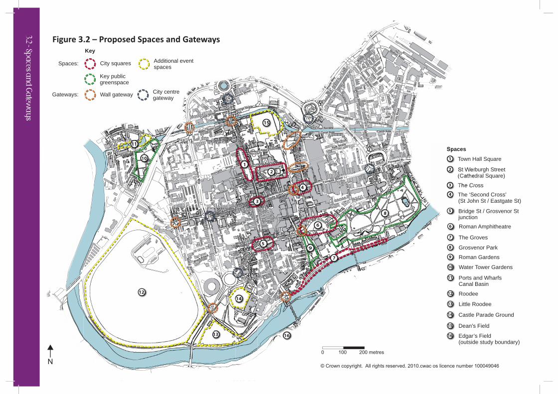
Key
Spaces:
Gateways:
City squares
Wall gateway City centre gateway
Key public greenspace
Additional eventspaces
Spaces
Town Hall Square1
St Werburgh Street2
(Cathedral Square)
The Cross3
The ‘Second Cross’4
(St John St / Eastgate St)
Bridge St / Grosvenor Stjunction
5
Roman Amphitheatre6
The Groves7
Grosvenor Park8
Roman Gardens9
Water Tower Gardens10
Ports and Wharfs Canal Basin
11
Roodee12
Little Roodee13
Castle Parade Ground14
Dean’s Field15
Edgar’s Field(outside study boundary)
16
59
7
16
14
13
12
3
6
4
21
15
8
10
11
Figure 3.2 – Proposed Spaces and Gateways
3.2 - Spaces an
d G
ateway
s
81
3.2 Spaces and G ateways...
City Squares
Seven city squares have been identified in Figure 3.2. These are either existing hard landscaped spaces that should be strengthened and enhanced or key street nodes or settings to key landmarks that should be developed as squares.
Overarching Principles:
• The city squares form a network of spaces that will help to define a city centre core area.
• The distinctive design and individual qualities of these spaces, informed by the character of the surrounding built form, will assist in orientating users and drawing visitors through the city centre from the Town Hall/Cathedral to the river.
• The primary function of these squares must be as social places for people and settings for the surrounding historic buildings.
• Each of these squares should be designed to accommodate events throughout the year. The varying scale and types of spaces will support a range of different events from small-scale performance through to larger gatherings and festivals.
• Squares will take different forms to accommodate movement and non-movement functions. These functions are likely to change over time as Chester’s public realm moves toward the aspirational street hierarchy shown in Figure 3.4.
• City Squares• Public Greenspaces• City Wall Gateways• City Centre Gateways
Public Realm Framework
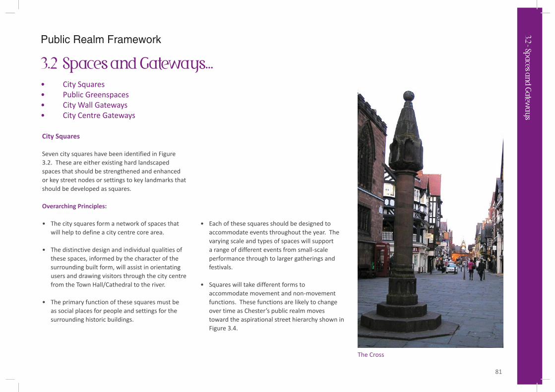
The Cross
3.2 - Spaces an
d G
ateway
s
82
The Seven City Squares
The following provides outline design brief criteria and principles for each of the city squares to guide their future design and development:
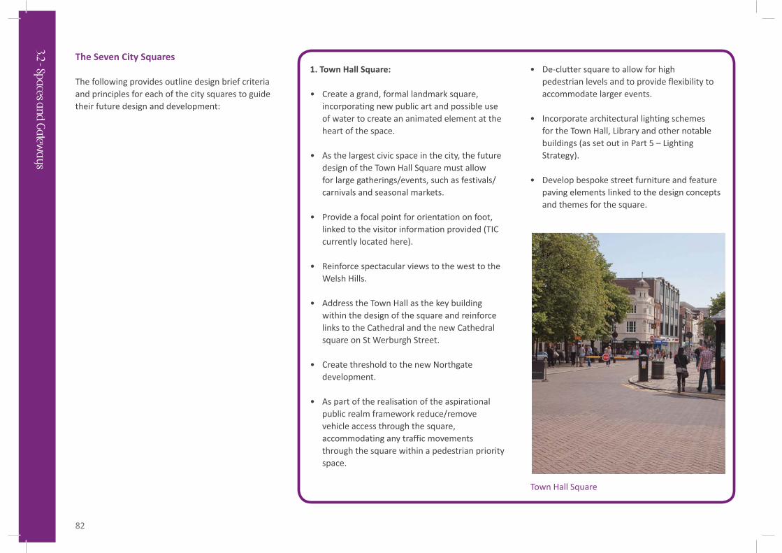
1. Town Hall Square:
• Create a grand, formal landmark square, incorporating new public art and possible use of water to create an animated element at the heart of the space.
• As the largest civic space in the city, the future design of the Town Hall Square must allow for large gatherings/events, such as festivals/carnivals and seasonal markets.
• Provide a focal point for orientation on foot, linked to the visitor information provided (TIC currently located here).
• Reinforce spectacular views to the west to the Welsh Hills.
• Address the Town Hall as the key building within the design of the square and reinforce links to the Cathedral and the new Cathedral square on St Werburgh Street.
• Create threshold to the new Northgate development.
• As part of the realisation of the aspirational public realm framework reduce/remove vehicle access through the square, accommodating any traffic movements through the square within a pedestrian priority space.
• De-clutter square to allow for high pedestrian levels and to provide flexibility to accommodate larger events.
• Incorporate architectural lighting schemes for the Town Hall, Library and other notable buildings (as set out in Part 5 – Lighting Strategy).
• Develop bespoke street furniture and feature paving elements linked to the design concepts and themes for the square.
Town Hall Square
3.2 - Spaces an
d G
ateway
s
83
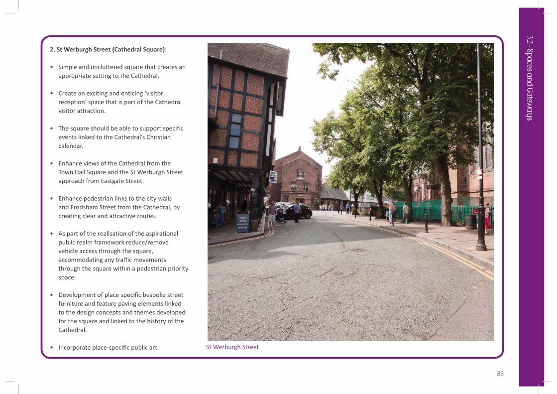
2. St Werburgh Street (Cathedral Square):
• Simple and uncluttered square that creates an appropriate setting to the Cathedral.
• Create an exciting and enticing ‘visitor reception’ space that is part of the Cathedral visitor attraction.
• The square should be able to support specific events linked to the Cathedral’s Christian calendar.
• Enhance views of the Cathedral from the Town Hall Square and the St Werburgh Street approach from Eastgate Street.
• Enhance pedestrian links to the city walls and Frodsham Street from the Cathedral, by creating clear and attractive routes.
• As part of the realisation of the aspirational public realm framework reduce/remove vehicle access through the square, accommodating any traffic movements through the square within a pedestrian priority space.
• Development of place specific bespoke street furniture and feature paving elements linked to the design concepts and themes developed for the square and linked to the history of the Cathedral.
• Incorporate place-specific public art. St Werburgh Street
3.2 - Spaces an
d G
ateway
s
84
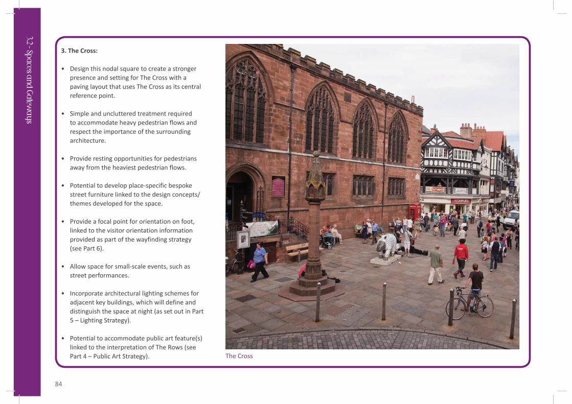
3. The Cross:
• Design this nodal square to create a stronger presence and setting for The Cross with a paving layout that uses The Cross as its central reference point.
• Simple and uncluttered treatment required to accommodate heavy pedestrian flows and respect the importance of the surrounding architecture.
• Provide resting opportunities for pedestrians away from the heaviest pedestrian flows.
• Potential to develop place-specific bespoke street furniture linked to the design concepts/themes developed for the space.
• Provide a focal point for orientation on foot, linked to the visitor orientation information provided as part of the wayfinding strategy (see Part 6).
• Allow space for small-scale events, such as street performances.
• Incorporate architectural lighting schemes for adjacent key buildings, which will define and distinguish the space at night (as set out in Part 5 – Lighting Strategy).
• Potential to accommodate public art feature(s) linked to the interpretation of The Rows (see Part 4 – Public Art Strategy). The Cross
3.2 - Spaces an
d G
ateway
s
85
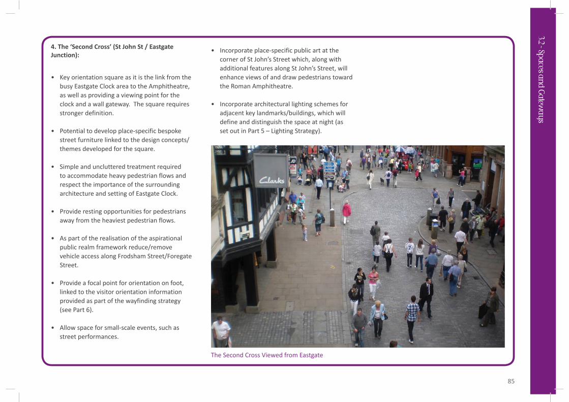
4. The ‘Second Cross’ (St John St / EastgateJunction):
• Key orientation square as it is the link from the busy Eastgate Clock area to the Amphitheatre, as well as providing a viewing point for the clock and a wall gateway. The square requires stronger definition.
• Potential to develop place-specific bespoke street furniture linked to the design concepts/themes developed for the square.
• Simple and uncluttered treatment required to accommodate heavy pedestrian flows and respect the importance of the surrounding architecture and setting of Eastgate Clock.
• Provide resting opportunities for pedestrians away from the heaviest pedestrian flows.
• As part of the realisation of the aspirational public realm framework reduce/remove vehicle access along Frodsham Street/Foregate Street.
• Provide a focal point for orientation on foot, linked to the visitor orientation information provided as part of the wayfinding strategy (see Part 6).
• Allow space for small-scale events, such as street performances.
• Incorporate place-specific public art at the corner of St John’s Street which, along with additional features along St John’s Street, will enhance views of and draw pedestrians toward the Roman Amphitheatre.
• Incorporate architectural lighting schemes for adjacent key landmarks/buildings, which will define and distinguish the space at night (as set out in Part 5 – Lighting Strategy).
The Second Cross Viewed from Eastgate
3.2 - Spaces an
d G
ateway
s
86
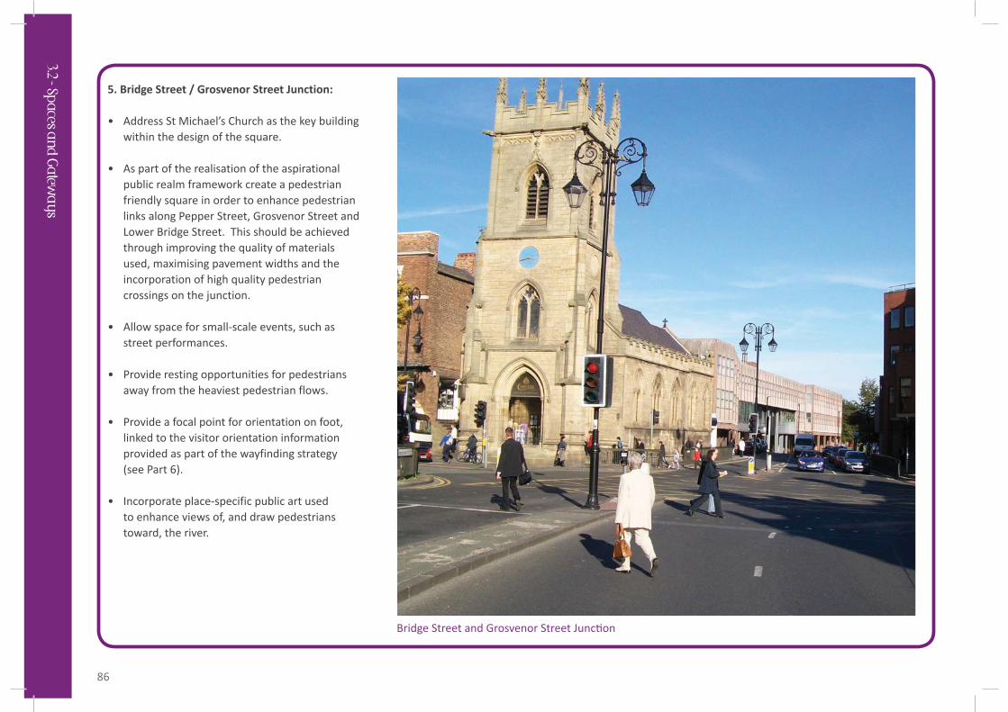
5. Bridge Street / Grosvenor Street Junction:
• Address St Michael’s Church as the key building within the design of the square.
• As part of the realisation of the aspirational public realm framework create a pedestrian friendly square in order to enhance pedestrian links along Pepper Street, Grosvenor Street and Lower Bridge Street. This should be achieved through improving the quality of materials used, maximising pavement widths and the incorporation of high quality pedestrian crossings on the junction.
• Allow space for small-scale events, such as street performances.
• Provide resting opportunities for pedestrians away from the heaviest pedestrian flows.
• Provide a focal point for orientation on foot, linked to the visitor orientation information provided as part of the wayfinding strategy (see Part 6).
• Incorporate place-specific public art used to enhance views of, and draw pedestrians toward, the river.
Bridge Street and Grosvenor Street Junc on
3.2 - Spaces an
d G
ateway
s
87
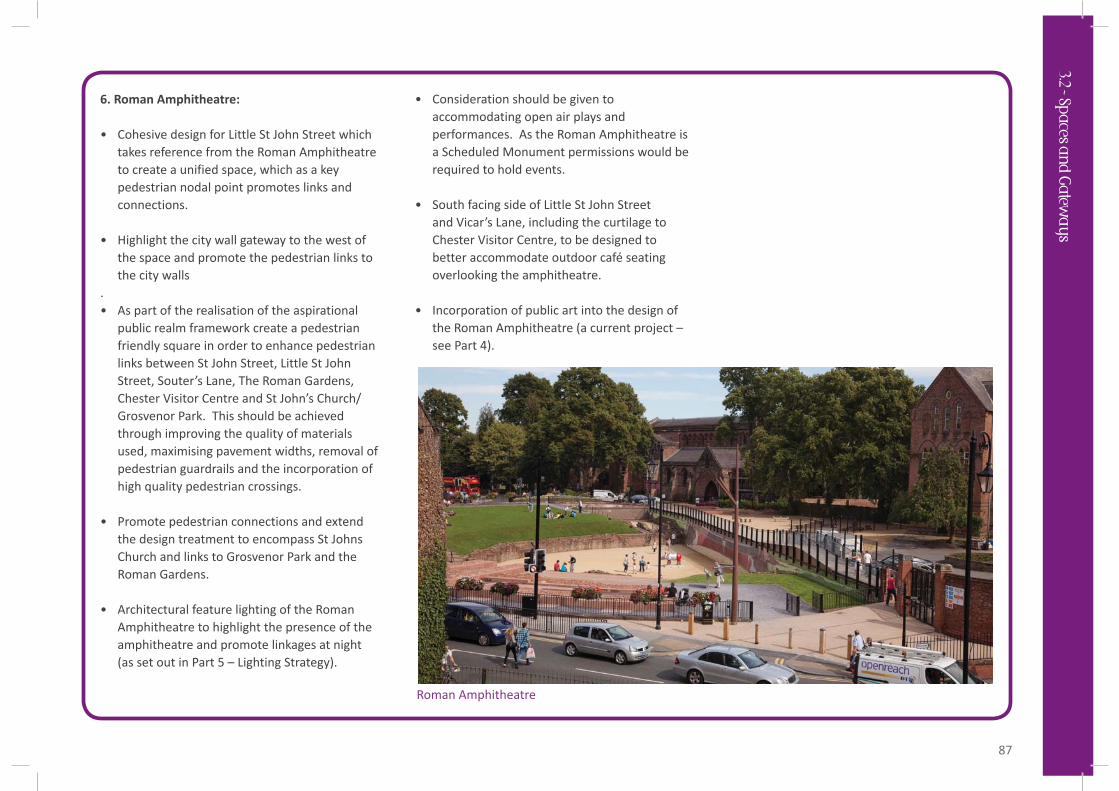
6. Roman Amphitheatre:
• Cohesive design for Little St John Street which takes reference from the Roman Amphitheatre to create a unified space, which as a key pedestrian nodal point promotes links and connections.
• Highlight the city wall gateway to the west of the space and promote the pedestrian links to the city walls
. • As part of the realisation of the aspirational
public realm framework create a pedestrian friendly square in order to enhance pedestrian links between St John Street, Little St John Street, Souter’s Lane, The Roman Gardens, Chester Visitor Centre and St John’s Church/Grosvenor Park. This should be achieved through improving the quality of materials used, maximising pavement widths, removal of pedestrian guardrails and the incorporation of high quality pedestrian crossings.
• Promote pedestrian connections and extend the design treatment to encompass St Johns Church and links to Grosvenor Park and the Roman Gardens.
• Architectural feature lighting of the Roman Amphitheatre to highlight the presence of the amphitheatre and promote linkages at night (as set out in Part 5 – Lighting Strategy).
• Consideration should be given to accommodating open air plays and performances. As the Roman Amphitheatre is a Scheduled Monument permissions would be required to hold events.
• South facing side of Little St John Street and Vicar’s Lane, including the curtilage to Chester Visitor Centre, to be designed to better accommodate outdoor café seating overlooking the amphitheatre.
• Incorporation of public art into the design of the Roman Amphitheatre (a current project – see Part 4).
Roman Amphitheatre
3.2 - Spaces an
d G
ateway
s
88
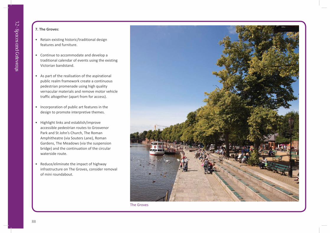
7. The Groves:
• Retain existing historic/traditional design features and furniture.
• Continue to accommodate and develop a traditional calendar of events using the existing Victorian bandstand.
• As part of the realisation of the aspirational public realm framework create a continuous pedestrian promenade using high quality vernacular materials and remove motor vehicle traffic altogether (apart from for access).
• Incorporation of public art features in the design to promote interpretive themes.
• Highlight links and establish/improve accessible pedestrian routes to Grosvenor Park and St John’s Church, The Roman Amphitheatre (via Souters Lane), Roman Gardens, The Meadows (via the suspension bridge) and the continuation of the circular waterside route.
• Reduce/eliminate the impact of highway infrastructure on The Groves, consider removal of mini roundabout.
The Groves
3.2 - Spaces an
d G
ateway
s
89
Public Greenspaces
Three key public greenspaces have been identified within the city centre in Figure 3.2. These provide important amenity for residents, workers and visitors. The greenspaces are strategically connected to city walking routes (i.e the waterside circular route and the city walls) and should be designed and developed as visitor attractions in their own right.
Overarching Principles:
• The public greenspaces sit outside the city core and provide important pedestrian connections between the core and periphery of the city centre. These should be enhanced to encourage pedestrian movement.
• The distinctive features and individual qualities of these public greenspaces will assist in orientating users.
• The primary function of these spaces must be as social and amenity places for people, providing a setting for recreational activities and events.
• Each of these spaces should be designed to accommodate seasonal events. The varying scale of the greenspaces will support a range of different events from small-scale interventions through to larger gatherings.
• Chester’s city centre public greenspaces are of historic significance and the design of public art and other features should be developed to support their interpretation.
The following provides outline design brief criteria and principles for each of the public greenspaces to guide their future design and development:
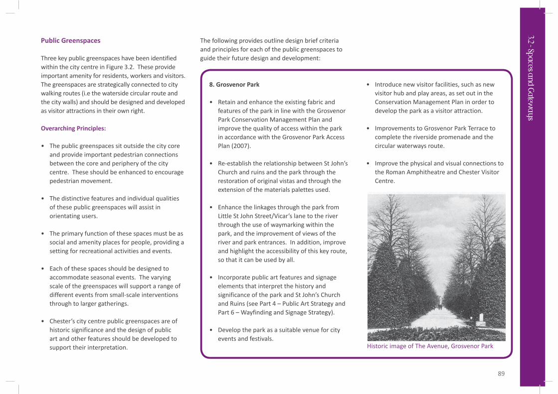
8. Grosvenor Park
• Retain and enhance the existing fabric and features of the park in line with the Grosvenor Park Conservation Management Plan and improve the quality of access within the park in accordance with the Grosvenor Park Access Plan (2007).
• Re-establish the relationship between St John’s Church and ruins and the park through the restoration of original vistas and through the extension of the materials palettes used.
• Enhance the linkages through the park from Little St John Street/Vicar’s lane to the river through the use of waymarking within the park, and the improvement of views of the river and park entrances. In addition, improve and highlight the accessibility of this key route, so that it can be used by all.
• Incorporate public art features and signage elements that interpret the history and significance of the park and St John’s Church and Ruins (see Part 4 – Public Art Strategy and Part 6 – Wayfinding and Signage Strategy).
• Develop the park as a suitable venue for city events and festivals.
• Introduce new visitor facilities, such as new visitor hub and play areas, as set out in the Conservation Management Plan in order to develop the park as a visitor attraction.
• Improvements to Grosvenor Park Terrace to complete the riverside promenade and the circular waterways route.
• Improve the physical and visual connections to the Roman Amphitheatre and Chester Visitor Centre.
Historic image of The Avenue, Grosvenor Park
3.2 - Spaces an
d G
ateway
s
90
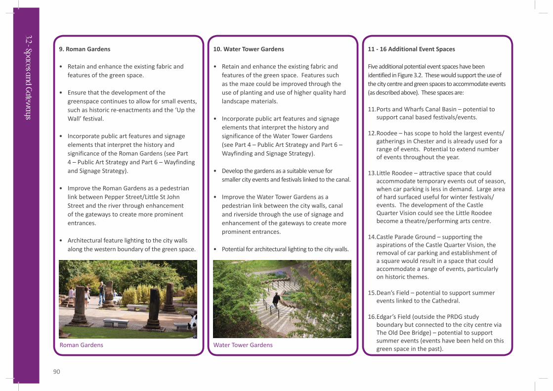
9. Roman Gardens
• Retain and enhance the existing fabric and features of the green space.
• Ensure that the development of the greenspace continues to allow for small events, such as historic re-enactments and the ‘Up the Wall’ festival.
• Incorporate public art features and signage elements that interpret the history and significance of the Roman Gardens (see Part 4 – Public Art Strategy and Part 6 – Wayfinding and Signage Strategy).
• Improve the Roman Gardens as a pedestrian link between Pepper Street/Little St John Street and the river through enhancement of the gateways to create more prominent entrances.
• Architectural feature lighting to the city walls along the western boundary of the green space.
10. Water Tower Gardens
• Retain and enhance the existing fabric and features of the green space. Features such as the maze could be improved through the use of planting and use of higher quality hard landscape materials.
• Incorporate public art features and signage elements that interpret the history and significance of the Water Tower Gardens (see Part 4 – Public Art Strategy and Part 6 – Wayfinding and Signage Strategy).
• Develop the gardens as a suitable venue for smaller city events and festivals linked to the canal.
• Improve the Water Tower Gardens as a pedestrian link between the city walls, canal and riverside through the use of signage and enhancement of the gateways to create more prominent entrances.
• Potential for architectural lighting to the city walls.
11 - 16 Additional Event Spaces
Five additional potential event spaces have been identified in Figure 3.2. These would support the use of the city centre and green spaces to accommodate events (as described above). These spaces are:
11. Ports and Wharfs Canal Basin – potential to support canal based festivals/events.
12. Roodee – has scope to hold the largest events/gatherings in Chester and is already used for a range of events. Potential to extend number of events throughout the year.
13. Little Roodee – attractive space that could accommodate temporary events out of season, when car parking is less in demand. Large area of hard surfaced useful for winter festivals/events. The development of the Castle Quarter Vision could see the Little Roodee become a theatre/performing arts centre.
14. Castle Parade Ground – supporting the aspirations of the Castle Quarter Vision, the removal of car parking and establishment of a square would result in a space that could accommodate a range of events, particularly on historic themes.
15. Dean’s Field – potential to support summer events linked to the Cathedral.
16. Edgar’s Field (outside the PRDG study boundary but connected to the city centre via The Old Dee Bridge) – potential to support summer events (events have been held on this green space in the past). Roman Gardens Water Tower Gardens
3.2 - Spaces an
d G
ateway
s
91
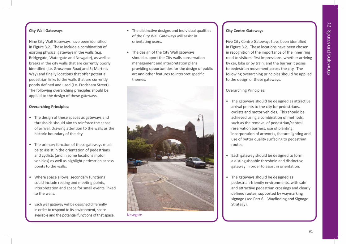
City Wall Gateways
Nine City Wall Gateways have been identified in Figure 3.2. These include a combination of existing physical gateways in the walls (e.g. Bridgegate, Watergate and Newgate), as well as breaks in the city walls that are currently poorly identified (i.e. Grosvenor Road and St Martin’s Way) and finally locations that offer potential pedestrian links to the walls that are currently poorly defined and used (i.e. Frodsham Street). The following overarching principles should be applied to the design of these gateways.
Overarching Principles:
• The design of these spaces as gateways and thresholds should aim to reinforce the sense of arrival, drawing attention to the walls as the historic boundary of the city.
• The primary function of these gateways must be to assist in the orientation of pedestrians and cyclists (and in some locations motor vehicles) as well as highlight pedestrian access points to the walls.
• Where space allows, secondary functions could include resting and meeting points, interpretation and space for small events linked to the walls.
• Each wall gateway will be designed differently in order to respond to its environment, space available and the potential functions of that space.
• The distinctive designs and individual qualities of the City Wall Gateways will assist in orientating users.
• The design of the City Wall gateways should support the City walls conservation management and interpretation plans providing opportunities for the design of public art and other features to interpret specific themes.
City Centre Gateways
Five City Centre Gateways have been identified in Figure 3.2. These locations have been chosen in recognition of the importance of the inner ring road to visitors’ first impressions, whether arriving by car, bike or by train, and the barrier it poses to pedestrian movement across the city. The following overarching principles should be applied to the design of these gateways. Overarching Principles:
• The gateways should be designed as attractive arrival points to the city for pedestrians, cyclists and motor vehicles. This should be achieved using a combination of methods, such as the removal of pedestrian/central reservation barriers, use of planting, incorporation of artworks, feature lighting and use of better quality surfacing to pedestrian routes.
• Each gateway should be designed to form a distinguishable threshold and distinctive gateway in order to assist in orientation.
• The gateways should be designed as pedestrian-friendly environments, with safe and attractive pedestrian crossings and clearly defined routes, supported by waymarking signage (see Part 6 – Wayfinding and Signage Strategy).
Newgate
3.2 - Spaces an
d G
ateway
s