5 benefits of gis apps dev

1
GIS applications are contributing greatly in the real world. There is a growing interest and awareness in the value of GIS; companies with expertise in Gis are now growing rapidly. Cost effective and time saving Made mapping very easy and affordable for everyone. Optimized routes, reducing costs of carrying goods and fuel consumption, Improving delivery time and happy customers. Better decision making GIS apps have made decision making process a lot more easier, common examples includes real estate site selection, route planning, natural resource extractions and disaster management. Improved communication GIS apps and visuals, are greatly assisting in understanding the situation on ground with accuracy. It makes communication easier between the departments, teams and organizations. Managing Geography at a Country level Govt officials can use GIS apps to communicate by visuals and maps. It could help in maintaining land acquisitions, Crime Rate, Security and safety situations, Flood managements, resources allocations etc. Geographic Record Keeping GIS apps can show before and after affects of the changes made in the environment, buildings, constructions, and roads maps during the span of 10 to 100 years or more based on the data availability. This analysis can help them monitor and prepare them for future. Prepared by WWW.ONECLOUT.COM

Upload: usman-khan

Post on 13-Apr-2017

45 views

Category:

Technology


0 download

TRANSCRIPT

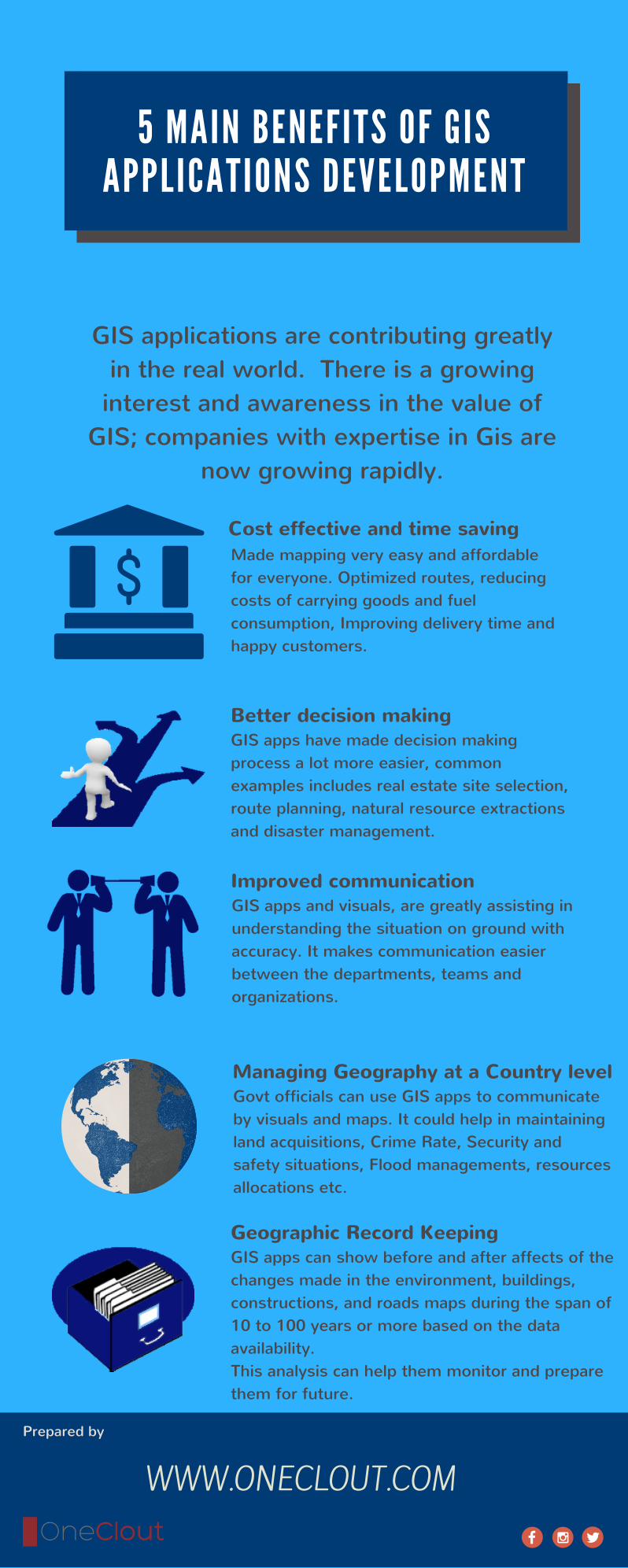
5 MA IN BENEFITS OF GISAPPLICATIONS DEVELOPMENT

GIS applications are contributing greatlyin the real world. There is a growing

interest and awareness in the value ofGIS; companies with expertise in Gis are

now growing rapidly.

Cost effective and time savingMade mapping very easy and affordablefor everyone. Optimized routes, reducingcosts of carrying goods and fuelconsumption, Improving delivery time andhappy customers.

Better decision making GIS apps have made decision makingprocess a lot more easier, commonexamples includes real estate site selection,route planning, natural resource extractionsand disaster management.

Improved communication GIS apps and visuals, are greatly assisting inunderstanding the situation on ground withaccuracy. It makes communication easierbetween the departments, teams andorganizations.

Managing Geography at a Country levelGovt officials can use GIS apps to communicateby visuals and maps. It could help in maintainingland acquisitions, Crime Rate, Security andsafety situations, Flood managements, resourcesallocations etc.

Geographic Record KeepingGIS apps can show before and after affects of thechanges made in the environment, buildings,constructions, and roads maps during the span of10 to 100 years or more based on the dataavailability.This analysis can help them monitor and preparethem for future.

Prepared by

WWW.ONECLOUT.COM