69832084 oklahoma transit supportive development guidelines
TRANSCRIPT

8/3/2019 69832084 OKLAHOMA Transit Supportive Development Guidelines
http://slidepdf.com/reader/full/69832084-oklahoma-transit-supportive-development-guidelines 1/29
1 | P a g e
Transit SupportiveDevelopmentGuidebook Central Oklahoma
2010
Technical/Land Use SubcommitteeRegional Transit Dialogue
7/7/2010

8/3/2019 69832084 OKLAHOMA Transit Supportive Development Guidelines
http://slidepdf.com/reader/full/69832084-oklahoma-transit-supportive-development-guidelines 2/29
2 | P a g e
Table of Contents
Table of Contents ............................................................................................ 2
Introduction................................................................................................... 4
Purpose Statement ........................................................................................ 4
TLUS Mission ............................................................................................... 4
TLUS Committee Description ............................................................................ 5
TLUS Committee Staff .................................................................................... 5
Meeting Timeline .......................................................................................... 6
2030 Fixed Guideway Study System Plan Vision ...................................................... 7
Transit Considerations ...................................................................................... 8
Community Considerations ................................................................................. 9
No/Limited Public Transit ............................................................................... 9
Municipal Public Transit .................................................................................. 9
Modes ......................................................................................................... 10
Commuter Rail ............................................................................................ 10
Modern Streetcar ......................................................................................... 10
Bus Rapid Transit ......................................................................................... 11
Bus .......................................................................................................... 11
Paratransit ................................................................................................ 12
Bicycle and Pedestrian .................................................................................. 12
System Stations/Stops ..................................................................................... 13
Commuter Rail ............................................................................................ 13
Bus/BRT .................................................................................................... 13
Transit Supportive Development Recommendations .................................................. 16
Land Use ................................................................................................... 16
Urban Design .............................................................................................. 16
Housing .................................................................................................... 17
Parking ..................................................................................................... 17
Connectivity............................................................................................... 18
Economic Development ................................................................................. 19
Accessibility and Health ................................................................................. 19

8/3/2019 69832084 OKLAHOMA Transit Supportive Development Guidelines
http://slidepdf.com/reader/full/69832084-oklahoma-transit-supportive-development-guidelines 3/29
3 | P a g e
Transit Oriented Development ......................................................................... 20
Transit Oriented Development Principles ............................................................ 20
TOD Districts .............................................................................................. 21
Form Based Code ......................................................................................... 21
Next Steps .................................................................................................... 23
TOD Development Tool-Kit ............................................................................. 23
Strategic Regional Plan for Transit .................................................................... 23
Regional Transit Dialogue 2 ............................................................................ 23
Glossary of Transit Terms ................................................................................. 24
Resources .................................................................................................... 28
References ................................................................................................... 29

8/3/2019 69832084 OKLAHOMA Transit Supportive Development Guidelines
http://slidepdf.com/reader/full/69832084-oklahoma-transit-supportive-development-guidelines 4/29
4 | P a g e
Introduction
This document represents the beginning of a journey to bring a regional transit system to
Central Oklahoma. The benefits of such a system are numerous, giving Central Oklahomans
access to a better, more livable lifestyle, while decreasing air pollutants and driving
economic development.
Now is an exciting time to look at Central Oklahoma’s future. The region is in a better
position now, than just a few years ago. Advancements in livability concepts, community
dialogue on health, transit options and connectivity, and a burgeoning awareness of the
legacy we will leave to future generations have increased ten-fold.
This document represents a consensus of the Technical/Land Use Subcommittee’s discussions
on transit supportive development, but it is only a small step towards a bigger, brighter
future.
Purpose Statement
This guidebook is intended to illustrate the Regional Transit Dialogue -Technical/Land Use
Subcommittee’s vision of how to assemble a regional transit system and create necessary
transit supportive development policies. The process began over a year ago and focused on
different modes of transportation and land uses that could be successfully utilized in the
Central Oklahoma region. The subcommittee’s overall recommendation for a regional
approach includes municipal adoption in order for the process to be successful. The
guidebook provides a current public transit system snapshot of Oklahoma City and its
surrounding suburbs. The guidebook also defines Transit Oriented Development (TOD) and its
benefits, in addition to identifying the key elements and factors for its success.
TLUS Mission
The Technical/Land Use Subcommittee (TLUS) explored and introduced land use and planning
policies that encourage transit and mobility-oriented development throughout Central
Oklahoma. The subcommittee reviewed and recommended corridors and technologies that
support a regional approach to public transportation.
8/3/2019 69832084 OKLAHOMA Transit Supportive Development Guidelines
http://slidepdf.com/reader/full/69832084-oklahoma-transit-supportive-development-guidelines 5/29
5 | P a g e
TLUS Committee Description
The TLUS committee is made up of several voluntary public officials, planners, engineers,
architects, community organizers, and health officials. The committee has been tasked with
providing information regarding the technical and land use aspects of a potential regional
transportation system.
Hanz E. Butzer – Professor, OU College of
Architecture
Susan Connors – Planning and Community
Development Director, City of Norman
Randy Entz – Transportation Planner, City
of Oklahoma
Shannon Entz, Chair - Community
Development Manager, City of Edmond
Nathaniel Harding – Founder, Harding &
Shelton, Inc
Billy Harless – Community Development
Director, City of Midwest City
John Hasley – Chairman of the Board,
Capital Chamber of Commerce, Oklahoma
City
Larry Hopper – Planning Manager, COTPA
Grant Humphreys – CEO, The Humphreys
Company
Marion Hutchison – ONTRAC
Kyran Mish – Professor, OU Civil
Engineering
Cody Ponder – Planning and Grants
Administrator, CART
Mark Seibold, Vice Chair - City Planner,
City of Choctaw; Architect
Anais Starr – Comprehensive Planner, City
of Midwest City
Doug Tennant – Senior Planner, Jacobs
Marisa New Wells - Director, Health Equity
& Resource Opportunities, Oklahoma State
Department of Health
TLUS Committee Staff
Ryan Billings – Transportation Planner, ACOG
Daniel Fazekas – Transportation Planner, ACOG

8/3/2019 69832084 OKLAHOMA Transit Supportive Development Guidelines
http://slidepdf.com/reader/full/69832084-oklahoma-transit-supportive-development-guidelines 6/29
6 | P a g e
Meeting Timeline
During the past year, the TLUS committee has been hard at work exploring, analyzing, and
developing land use and mobility-oriented-development planning policy recommendations.

8/3/2019 69832084 OKLAHOMA Transit Supportive Development Guidelines
http://slidepdf.com/reader/full/69832084-oklahoma-transit-supportive-development-guidelines 7/29
7 | P a g e
2030 Fixed Guideway Study System Plan Vision
The 2030 System Plan Vision was developed in 2005 as part of the Fixed Guideway Study,
identifying transportation solutions for the Oklahoma City Metropolitan Area. The 2030
System Plan Vision* illustrates the study’s final recommendations for Commuter Rail, Modern
Streetcar, Bus Rapid Transit, and Enhanced Bus alignments. The TLUS committee utilized the2030 System Plan Vision as the basis for the exploration of land use planning and mobility-
oriented-development policy recommendations.
* The above map illustrates potential transit corridors and alignments.

8/3/2019 69832084 OKLAHOMA Transit Supportive Development Guidelines
http://slidepdf.com/reader/full/69832084-oklahoma-transit-supportive-development-guidelines 8/29
8 | P a g e
Transit Considerations
Based on the District Model, the following communities will potentially be members of a
Regional Transit Authority (RTA). The below ―System Snapshot‖ illustrates the current level
of public transit service and transit-related development planning. While these considerations
are not mandatory, communities should strive to have them in place before/during the
development of the RTA.
*Denotes service provided by Metro Transit (Oklahoma City)
The system snapshot serves as a guideline for communities to better understand where they
stand and what pieces of the puzzle are needed for future development of a regional
transportation system.

8/3/2019 69832084 OKLAHOMA Transit Supportive Development Guidelines
http://slidepdf.com/reader/full/69832084-oklahoma-transit-supportive-development-guidelines 9/29
9 | P a g e
Community Considerations
The following represents areas of consideration for communities with no/limited or municipal public
transit. Suggestions provided offer guidance to communities in evaluating current service, assessing
needs, and developing policies for an efficient transit system.
No/Limited Public Transit
Evaluate current services provided
Create a simple spreadsheet of all taxis, volunteer groups, government-funded, non-
profits, ambulatory – do you see a gap in service that will help justify the study expense?
Highlight applicable FGS recommendations in relation to your community.
Transit study/Needs assessment
Outreach to local groups, such as schools, businesses, social service agencies, medical
centers, services for people with disabilities, neighborhood associations, churches, and
developers.
Build public leadership understanding of basic transit terms and needs.
Provide data and modeling to determine best solutions.
Identify potential locations for bus transfer center or commuter rail terminal.
Develop short and long range goals and strategies.
Instill trust, sense of ownership and confidence that the service created is great and the
expense is justified.
Develop Policies
Determine if local zoning, infrastructure, traffic and growth patterns enhance or impede
your ability to accomplish your transit goals listed in the study.
Find pockets of community that may be conducive to higher density and pedestrian activity
with access to day-to-day amenities.
Preserve existing workforce housing and support quality, new affordable housing located
adjacent or near transit, especially multifamily and mixed-use.
Preserve and integrate community character and identity.
Enhance employment opportunities at or near transit stations.
For those that interface with interstate and/or rail, look at potential hubs and platform
locations.
Create policies that promote accessibility, connectivity to medical services and
employment centers, outreach to underserved, green space preservation, bike and
pedestrian paths, safe travel, overall health, and quality of life.
Municipal Public Transit
Evaluate the service. Transit should: Provide for needs and demand.
Be cost effective to operate.
Enable service provider to be more responsive to customer service needs.
Be accessible to all mobility levels.
Connect to other communities in the metro area.
Be affordable for targeted users.
Positively impact the health of communities.

8/3/2019 69832084 OKLAHOMA Transit Supportive Development Guidelines
http://slidepdf.com/reader/full/69832084-oklahoma-transit-supportive-development-guidelines 10/29
10 | P a g e
Modes
Commuter Rail
Passenger capacity, development costs,
train speeds and access to central citiesare the primary advantages of commuter
rail. Trains can comfortably accommodate
a
large number of seated passengers over a
long distance. Where existing track and
signal systems are in good condition,
service can be implemented at a relatively
low cost and within a short time frame.
Advances in diesel-electric engines for
commuter rail locomotives provide for
faster acceleration and allow for closer
station spacing.
Commuter rail serving Del City, Edmond,
Moore, Midwest City, and Norman can
penetrate the core of a central business
district (CBD) or entertainment district.
Existing rail infrastructure and track
alignments provide the opportunity for the
development of a commuter rail system,
centered on a downtown hub and
extending to surrounding communities andemployment centers.
Development of commuter rail may not
always be feasible due to limitations on
existing rail infrastructure, geometric
constraints, conflicts with freight traffic,
and problematic access for vehicles and
pedestrians. Grade separation of
commuter rail, especially in downtown
areas, can be advantageous but costly to
develop. In Oklahoma City the grade
separation is already present.
Modern Streetcar
Modern streetcar technology is a low-floor
vehicle with no steps which typically
operates in an urban or downtown setting
on rails embedded in the road or other
right-of-way. The vehicles have a modern
streamline appearance and typically travelin the flow of mixed traffic, have a much
higher passenger capacity than a bus, and
feature more room for standing passengers
and bicycles. A streetcar is usually only
one car long, powered by overhead
electricity via unobtrusive cable strands,
and is articulated. Articulated means the
car has subsections that bend much like an
accordion so that it can turn on a short
radius. Streetcars typically have a lowaverage speed and are generally used as
circulators to connect destinations in
walkable, higher density, mixed use
districts.
The flexibility and relative low cost
compared to some rail alternatives could

8/3/2019 69832084 OKLAHOMA Transit Supportive Development Guidelines
http://slidepdf.com/reader/full/69832084-oklahoma-transit-supportive-development-guidelines 11/29
11 | P a g e
allow a modern streetcar system to emerge
as a viable alternative in various high-
capacity transit corridors. The streetcar
stop platforms are relatively small, ADA
accessible for level boarding, require
minimal passenger shelters, and usuallyseparated by only a couple of blocks.
Oklahoma City voters approved modern
streetcar in MAPS3, which can complement
and be used in conjunction with other
forms of bus, rail, and paratransit.
Bus Rapid Transit
Bus Rapid Transit (BRT) on busways provide
the speed and guideway advantages
typically attributed to rail transit in high-
capacity transit corridors but a fraction of
the capital cost. BRT has the added
advantage of circulation within local areas.
BRT and busways allow higher-speed
operation, express/non-stop service and
one-seat rides. BRT vehicles are visually
more streamlined to look more like rail
vehicles and may be articulated due to
being nearly twice the length of some
buses. BRT buses are more accessible andconvenient than standard buses due to the
wide doors, large windows, low floor
access, and technologies like wi-fi and on-
board stop announcements. BRT stops are
spaced several blocks apart, and service is
more frequent than typical bus routes. BRT
stops are also designed to resemble
smaller-scale streetcar stations with off-
vehicle fair collection, and intelligent
transportation systems (ITS) that show the
arrival time for the next bus.
Although not presently in operation within
the region, BRT operates effectively in
various urban settings. For an at-grade
busway to be effective and provide faster
operating speeds the numbers of grade
crossings should be limited. BRT vehicles
often operate in the flow of mixed traffic,
but may have their own dedicated lane for
a substantial part of the route. BRT routes
could service areas of Central Oklahoma
where existing infrastructure or capitalcosts prohibit rail transit.
Bus
The primary advantages of bus operations
are low cost and high flexibility. Buses do
not require a significant initial investment
in infrastructure. Capital costs are
primarily limited to vehicles and
maintenance facilities. Operating costs per
passenger are also on the lower side when
compared with those for most other
alternatives. Routes can be flexible.
Routing changes can be implemented, for
all practical purposes, immediately. Buses
can serve a wide range of passenger

8/3/2019 69832084 OKLAHOMA Transit Supportive Development Guidelines
http://slidepdf.com/reader/full/69832084-oklahoma-transit-supportive-development-guidelines 12/29
12 | P a g e
demand and bus size can be adapted to
passenger loads. Small or mid-sized buses
can be assigned to routes with lower peak
demand. For high ridership routes with
frequent service, economies of scale can
be realized with articulated buses whichcan accommodate 50 percent more
passengers with one bus operator.
Buses are compatible with the existing
transit system. However, the efficiency
and effectiveness of additional routes in
attracting ridership and providing a
significant improvement in travel time
would be less than that of a fixed guideway
option. Operating costs would also rise
substantially to provide significantlyincreased capacity. Bus stops are typically
low cost and easily accessible since stop
spacing is close. Buses on streets and
roadways are subject to traffic delays.
Diesel emissions create a localized
environmental impact, but use of
alternative fuel buses may reduce bus
emissions.
Paratransit
Paratransit is an alternative mode of
flexible passenger transportation that
operates in parallel with the fixed route
buses and is typically used by persons with
limited mobility. Paratransit does not
follow
fixed routes or schedules. Paratransit
services may vary considerably on the
degree of flexibility they provide their
customers. Paratransit offers on-demand,
call-up, door-to-door, and even through-
the-door service from any origin to anydestination in a service area. Paratransit
services are typically funded by public
transit agencies, but are sometimes
operated by not-for-profit organizations
and by for-profit private companies like
taxicab operators.
Bicycle and Pedestrian
Bicycle and Pedestrian facilities integrated
into the transportation system are a
necessity. Bicycle lanes, routes, and
multi-use trails connecting communities
with transit stations and stops provide
added transportation options for citizen
trips. Bike-on-Bus and Bike-on-Rail
programs give riders increased travel
distances, while providing additional
linkages to their origin and destination.
Pedestrian facilities must be madeavailable within and adjacent to transit
stations and stops. Stops should have
benches and sidewalks connecting to other
pedestrian infrastructure. Sidewalks
should be required within in all
development near transit stations.

8/3/2019 69832084 OKLAHOMA Transit Supportive Development Guidelines
http://slidepdf.com/reader/full/69832084-oklahoma-transit-supportive-development-guidelines 13/29
13 | P a g e
System Stations/Stops
A robust transit system utilizes multiple modes to provide service to as many people as
possible. With each mode there is the opportunity for several types of stations and stops.
Commuter Rail and Bus/BRT will serve as the backbone for a Central Oklahoma transit
system. Both have unique station/stop configurations and possibilities. The Station Types
graphic on page 15 illustrates potential transit stations along hypothetical commuter rail or
enhanced bus/BRT lines.
Commuter Rail
Downtown Hub: A downtown transit hub consists of several transportation modes and routes
(spokes) all converging at one centralized station (hub). The downtown hub would
serve as the central access point for downtown employment/residential and the main
transfer location for all modes.
Neighborhood Station: A neighborhood station consists of a commuter rail platform, covered
shelter, and ticket kiosks strategically placed within an established neighborhood
providing citizens direct access to public transportation while maintaining the
character and scale of that neighborhood. The neighborhood station could be the
start of a feeder bus route to areas of the neighborhood too far for walking or riding a
bicycle.
Transit Oriented Development (TOD) Station: A TOD neighborhood typically has a center
with a transit station or stop (train station, metro station, tram stop, or bus stop),
surrounded by relatively high-density development with progressively lower-densitydevelopment spreading outwards from the center. TOD generally radiates one-
quarter to one-half mile from the TOD station, as this is considered to be an appropriate scale
for pedestrians.
Park and Ride Station: Park and Ride stations consist of a station platform, platform shelter,
and ticket kiosks surrounded by ample parking. Park and Ride stations should utilize
shared parking principles when available and maximize land efficiency by
constructing parking garages.
Bus/BRT
Park and Ride Station: This is a Commuter Town Center with ample amounts of land for
parking or a shared parking arrangement. Such arrangements must be approved
under local zoning to share spaces with a temporally compatible use such as a church
or movie theater.

8/3/2019 69832084 OKLAHOMA Transit Supportive Development Guidelines
http://slidepdf.com/reader/full/69832084-oklahoma-transit-supportive-development-guidelines 14/29
14 | P a g e
Commuter Town Center (CTC): Facilities that may be integral to a planned unit
development with that allow several bus and BRT routes to meet for an easy
exchange of passengers. Express buses will be a key type of route that stops here.
These may be developed at the outskirts or core of an office, shopping, housing or
other area as part of a Common Lot improvement and can be dedicated to the municipality as
a public improvement. They will have many of the features of the Neighborhood Stops butmay also involve a rail stop, restrooms, vending machines, and security cameras. The can
also be developed with public funds, as though a G.O. bond issue.
Junction Station: Such locations are where two or more bus or BRT routes intersect,
sometimes from perpendicular roadway directions. These may involve any of the
improvements of a neighborhood stop, but may involve having shelter at all four
intersections of major arterial intersection. These may be designed with
landscaping, banners or matching elements to reinforce the identity of both the area and the
transit station. Zoning codes can be written so that Junction Stations or a fee-in-lieu-of are
mandatory for developments of a certain size. These can be ―sponsored‖ by abutting
businesses.
Neighborhood Stop: These are key locations along bus rapid transit (BRT), express buses,
and local bus routes. These can be rather simple stops installed and sponsored by
municipalities and private businesses that have a bench (sheltered or unsheltered)
and ADA landing pad. All must have a connecting sidewalk sufficient that the
passenger need not walk or roll along any unpaved walkway to reach the abutting business
housing or other land use. The stop may or may not feature real time bus arrival L.E.D.
displays, three-minute-limit radiant heaters, a trash
receptacle, emergency call box, commercial
advertising, bicycle rack, night time lighting, or
a shopping cart corral. The stop may have an
easement and walkway extending
approximately perpendicular to the curb to
enable immediate connectivity to the abutting
land use. The stop may or may not have a bus
pull-off lane so that the bus, paratransit van,
and social service van, does not stop any
traffic. In areas without benches a stop will
have be at an area where there is an ADA 5’x8’ landing pad and the sidewalk paved out to the
actual street curb. All of a neighborhood stop can be placed on private property or in the
public right-of-way (R-O-W), or a combination of the two. Those put on the public R-O-W canbe privately developed and potentially dedicated to the municipality as a public
improvement, much like other infrastructure is. Zoning codes can be written so that
Neighborhood Stops or fee in-lieu-of are mandatory for developments of a certain size.

8/3/2019 69832084 OKLAHOMA Transit Supportive Development Guidelines
http://slidepdf.com/reader/full/69832084-oklahoma-transit-supportive-development-guidelines 15/29
15 | P a g e
8/3/2019 69832084 OKLAHOMA Transit Supportive Development Guidelines
http://slidepdf.com/reader/full/69832084-oklahoma-transit-supportive-development-guidelines 16/29
16 | P a g e
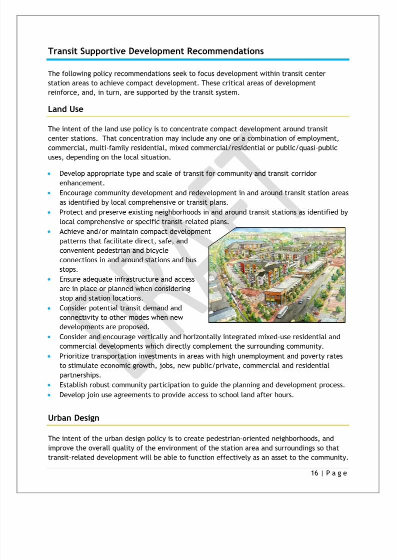
Transit Supportive Development Recommendations
The following policy recommendations seek to focus development within transit center
station areas to achieve compact development. These critical areas of development
reinforce, and, in turn, are supported by the transit system.
Land Use
The intent of the land use policy is to concentrate compact development around transit
center stations. That concentration may include any one or a combination of employment,
commercial, multi-family residential, mixed commercial/residential or public/quasi-public
uses, depending on the local situation.
Develop appropriate type and scale of transit for community and transit corridor
enhancement.
Encourage community development and redevelopment in and around transit station areasas identified by local comprehensive or transit plans.
Protect and preserve existing neighborhoods in and around transit stations as identified by
local comprehensive or specific transit-related plans.
Achieve and/or maintain compact development
patterns that facilitate direct, safe, and
convenient pedestrian and bicycle
connections in and around stations and bus
stops.
Ensure adequate infrastructure and access
are in place or planned when considering
stop and station locations.
Consider potential transit demand and
connectivity to other modes when new
developments are proposed.
Consider and encourage vertically and horizontally integrated mixed-use residential and
commercial developments which directly complement the surrounding community.
Prioritize transportation investments in areas with high unemployment and poverty rates
to stimulate economic growth, jobs, new public/private, commercial and residential
partnerships.
Establish robust community participation to guide the planning and development process.
Develop join use agreements to provide access to school land after hours.
Urban Design
The intent of the urban design policy is to create pedestrian-oriented neighborhoods, and
improve the overall quality of the environment of the station area and surroundings so that
transit-related development will be able to function effectively as an asset to the community.

8/3/2019 69832084 OKLAHOMA Transit Supportive Development Guidelines
http://slidepdf.com/reader/full/69832084-oklahoma-transit-supportive-development-guidelines 17/29
17 | P a g e
The unique cultural and physical identity of each community should be reflected in station
area art, architecture, planning and design. The impact of building facades at the street level and focus design on features should be
human in scale and comprehensible to pedestrians.
Design bus stops and junction stations that are safe, accessible, dignified, and
aesthetically pleasing for people of all ages andabilities.
Develop safe and attractive streetscapes
which preserve views and landscapes, and
incorporate existing green spaces.
Incorporate crime prevention through
environmental design principles.
Incorporate facilities for bicycles and
signage which describe connections and
destinations for those on foot, bicycle or
transit.
Housing
The intent of the housing policy is to provide a mix of housing products and prices within
walking distance of transit center stations.
Encourage a diversity of housing prices and accessible residential development in and
around transit station areas, through districts, overlay zones, or comprehensive plans.
Near stations, utilize redevelopment, mixed-use projects and locally designated incentives
to stimulate and preserve a broad range of housing choices.
Support the character and age of the area bylocating, designing or maintaining quality
housing development.
Provide affordable senior and special needs
housing where feasible and appropriate.
Incorporate sidewalks, trails, schools,
parks, and other ―smart growth‖ amenities
in transit supportive housing.
Incorporate low maintenance regional
landscaping and green building principles
when feasible.
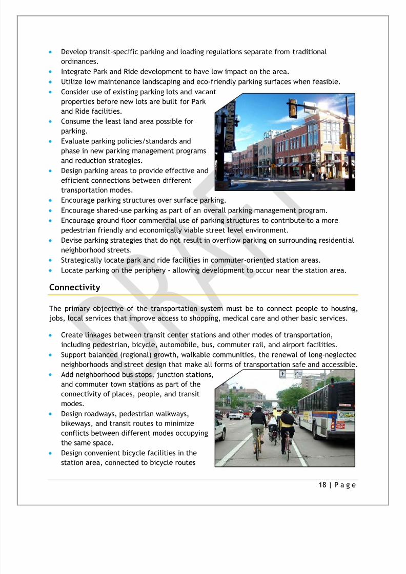
Parking
The intent of the parking policy is to encourage parking location and design within the station
area that provides for shared or joint-use parking, allows for the productive reuse of land,
and integrates parking in an unobtrusive manner.
8/3/2019 69832084 OKLAHOMA Transit Supportive Development Guidelines
http://slidepdf.com/reader/full/69832084-oklahoma-transit-supportive-development-guidelines 18/29
18 | P a g e
Develop transit-specific parking and loading regulations separate from traditional
ordinances.
Integrate Park and Ride development to have low impact on the area.
Utilize low maintenance landscaping and eco-friendly parking surfaces when feasible.
Consider use of existing parking lots and vacant
properties before new lots are built for Parkand Ride facilities.
Consume the least land area possible for
parking.
Evaluate parking policies/standards and
phase in new parking management programs
and reduction strategies.
Design parking areas to provide effective and
efficient connections between different
transportation modes.
Encourage parking structures over surface parking.Encourage shared-use parking as part of an overall parking management program.
Encourage ground floor commercial use of parking structures to contribute to a more
pedestrian friendly and economically viable street level environment.
Devise parking strategies that do not result in overflow parking on surrounding residential
neighborhood streets.
Strategically locate park and ride facilities in commuter-oriented station areas.
Locate parking on the periphery - allowing development to occur near the station area.
Connectivity
The primary objective of the transportation system must be to connect people to housing,
jobs, local services that improve access to shopping, medical care and other basic services.
Create linkages between transit center stations and other modes of transportation,
including pedestrian, bicycle, automobile, bus, commuter rail, and airport facilities.
Support balanced (regional) growth, walkable communities, the renewal of long-neglected
neighborhoods and street design that make all forms of transportation safe and accessible.
Add neighborhood bus stops, junction stations,
and commuter town stations as part of the
connectivity of places, people, and transit
modes.Design roadways, pedestrian walkways,
bikeways, and transit routes to minimize
conflicts between different modes occupying
the same space.
Design convenient bicycle facilities in the
station area, connected to bicycle routes
8/3/2019 69832084 OKLAHOMA Transit Supportive Development Guidelines
http://slidepdf.com/reader/full/69832084-oklahoma-transit-supportive-development-guidelines 19/29
19 | P a g e
serving the surrounding areas.
Improve the connection to station areas with neighboring parks, residential areas,
commercial districts, and transportation corridors.
Develop sidewalk transition and trail plans providing adequate safety features for
pedestrians and bicyclists to connect with existing systems.
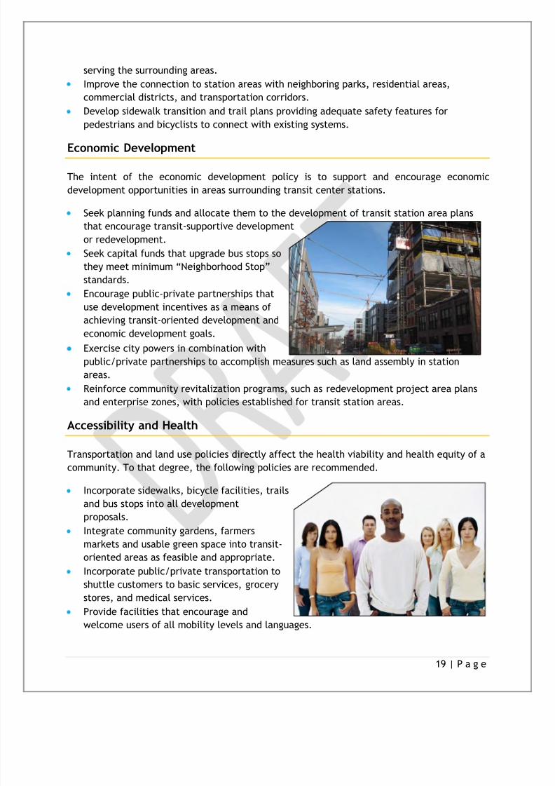
Economic Development
The intent of the economic development policy is to support and encourage economic
development opportunities in areas surrounding transit center stations.
Seek planning funds and allocate them to the development of transit station area plans
that encourage transit-supportive development
or redevelopment.
Seek capital funds that upgrade bus stops so
they meet minimum ―Neighborhood Stop‖
standards.
Encourage public-private partnerships that
use development incentives as a means of
achieving transit-oriented development and
economic development goals.
Exercise city powers in combination with
public/private partnerships to accomplish measures such as land assembly in station
areas.
Reinforce community revitalization programs, such as redevelopment project area plans
and enterprise zones, with policies established for transit station areas.
Accessibility and Health
Transportation and land use policies directly affect the health viability and health equity of a
community. To that degree, the following policies are recommended.
Incorporate sidewalks, bicycle facilities, trails
and bus stops into all development
proposals.
Integrate community gardens, farmers
markets and usable green space into transit-
oriented areas as feasible and appropriate.
Incorporate public/private transportation to
shuttle customers to basic services, grocery
stores, and medical services.
Provide facilities that encourage and
welcome users of all mobility levels and languages.

8/3/2019 69832084 OKLAHOMA Transit Supportive Development Guidelines
http://slidepdf.com/reader/full/69832084-oklahoma-transit-supportive-development-guidelines 20/29
20 | P a g e
Increase opportunities for physical activity by devoting increased resources to non-
motorized transportation options.
Explore opportunities to increase funding to strengthen the positive health impacts
associated with expanded public transportation options.
Promote safe and convenient opportunities for physical activity by supporting active
transportation infrastructure.
Transit Oriented Development
Transit Oriented Development (TOD) is the functional integration of land use and transit via
the creation of compact, walkable, mixed-use communities within walking distance of a
transit stop or station. A TOD brings together people, jobs, and services and is designed in a
way that makes it efficient, safe, and convenient to travel on foot or by bicycle, transit, or
car.
Transit Oriented Development Principles
Recognizing that each TOD in Central Oklahoma will have its own unique character and
that the districts will vary with respect to layout, design, land use composition and
function, the following principles are presented to provide an understanding of the
essential elements and characteristics of TOD. They will serve as the foundation for the
station area planning process:
Create TOD plans that are flexible so they can respond to changing conditions.
Create a compact development within an easy walk of public transit and with
sufficient density to support ridership.
Make the pedestrian the focus of the development strategy without excluding theauto.
Create active places and livable communities that service daily needs and where
people feel a sense of belonging and ownership.
Include engaging, high quality public spaces (e.g. small parks or plazas) as organizing
features and gathering places for the neighborhood.
Encourage a variety of housing types near transit facilities available to a wide range of
ages and incomes.
Incorporate retail into the development if it is a viable use at the location without the
transit component, ideally drawing customers both from both the TOD and a major
street.Ensure compatibility and connectivity with surrounding neighborhoods.
Introduce creative parking strategies that integrate, rather than divide the site and
reduce the sense of auto domination.
Strive to make TODs realistic, economically viable and valuable from a diversity of
perspectives (city, transit agency, developer, resident, and employer).
8/3/2019 69832084 OKLAHOMA Transit Supportive Development Guidelines
http://slidepdf.com/reader/full/69832084-oklahoma-transit-supportive-development-guidelines 21/29
21 | P a g e
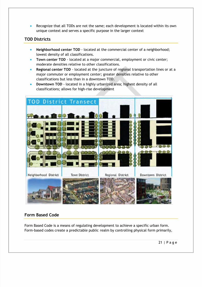
Recognize that all TODs are not the same; each development is located within its own
unique context and serves a specific purpose in the larger context
TOD Districts
Neighborhood center TOD - located at the commercial center of a neighborhood;lowest density of all classifications.
Town center TOD - located at a major commercial, employment or civic center;
moderate densities relative to other classifications.
Regional center TOD - located at the juncture of regional transportation lines or at a
major commuter or employment center; greater densities relative to other
classifications but less than in a downtown TOD.
Downtown TOD - located in a highly urbanized area; highest density of all
classifications; allows for high-rise development
Form Based Code
Form Based Code is a means of regulating development to achieve a specific urban form.
Form-based codes create a predictable public realm by controlling physical form primarily,

8/3/2019 69832084 OKLAHOMA Transit Supportive Development Guidelines
http://slidepdf.com/reader/full/69832084-oklahoma-transit-supportive-development-guidelines 22/29
22 | P a g e
with a lesser focus on land use, through city or county regulations. Form-based codes are a
new response to the modern challenges of urban sprawl, deterioration of historic
neighborhoods, and neglect of pedestrian safety in new development. Tradition has declined
as a guide to development patterns, and the widespread adoption by cities of single-use
zoning regulations has discouraged compact, walkable communities. Form-based codes are a
tool to address these deficiencies, and to provide local governments the regulatory means toachieve development objectives with greater certainty.

8/3/2019 69832084 OKLAHOMA Transit Supportive Development Guidelines
http://slidepdf.com/reader/full/69832084-oklahoma-transit-supportive-development-guidelines 23/29
23 | P a g e
Next Steps
The Technical/Land Use Subcommittee understands that the Regional Transit Dialoguerepresents one of the first steps in developing a Regional Transit Authority along with acomprehensive regional plan for transit supportive development. TLUS recommends the
continuation of this process through several implementable mechanisms.
TOD Development Tool-Kit
Developed with the cooperation of the Areawide Planning and Technical Advisory
Committee (APTAC)
Comprehensive how-to of transit oriented development for various Central Oklahoma
communities.
Provides detailed ordinance samples, steps for inclusion in city’s comprehensive plan,
and guidance for public support.Includes template for community resolution supporting TOD guidelines.
Strategic Regional Plan for Transit
Comprehensive Transit Study implemented on a regional scale
Communities develop study in coordination with the RTA.
Address individual city needs and regional desires.
Regional Transit Dialogue 2
Continued coordination and discussion with identified participating communities.
Additional support for communities seeking TOD ordinance inclusion.

8/3/2019 69832084 OKLAHOMA Transit Supportive Development Guidelines
http://slidepdf.com/reader/full/69832084-oklahoma-transit-supportive-development-guidelines 24/29
24 | P a g e
Glossary of Transit Terms
The terms below are used throughout the Fixed Guideway Study. The Technical landUse Subcommittee has added additional terminology.
A
Accessible Service — Buses operating in regular service with wheelchair lifts, kneeling functions or other
devices that permit disabled passengers to use the service.
Accessibility — (1) The extent to which facilities are barrier free and useable by disabled persons, including
wheelchair users. (2) A measure of the ability or ease of all people to travel among various origins and
destinations.
Activity Center — An area with high population and concentrated activities which generate a large number
of trips (e.g., CBD, shopping centers, business or industrial parks, recreational facilities (also known as trip
generator).
Alignment — The horizontal and vertical ground plan of a roadway, railroad, transit route or other facility.
AMTRAK (National Railroad Passenger Corporation) — A quasi-public corporation created by the federal
Rail Passenger Service Act of 1970 to improve and develop intercity passenger rail service throughout the
United States.
Americans with Disabilities Act of 1990 (ADA) — The law passed by Congress in 1990 which makes it illegal
to discriminate against people with disabilities in employment, services provided by state and local
governments, public and private transportation, public accommodations and telecommunications.
B
Bus — A rubber-tired road vehicle designed to carry a substantial number of passengers (i.e., 10 or more),
commonly operated on streets and highways for public transportation service.
Bus Hours — The total hours of travel by bus, including both revenue service and deadhead travel.
Bus Lane — A lane of roadway intended primarily for use by buses, either all day or during specified periods.
Bus Stop — A curbside place where passengers board or alight transit.
Bus Miles — The total miles of travel by bus, including both revenue and deadhead travel.
Bus Rapid Transit (BRT) - A Bus that provides the speed and fixed guideway advantages typically attributed
to a rail line but on an existing road network. BRTs allow higher-speed operation, express/non-stop service
and one-seat rides. BRT vehicles are designed to look more like rail vehicles with wide doors, large windows,
and low floor access.
Bus Shelter — A structure constructed near a bus stop to provide seating and protection from the weather
for the convenience of waiting passengers.
Bus Turnout — Cutout in the roadside to permit a transit vehicle to dwell at a curb.
Busway — A special roadway designed for exclusive use by buses. It may be constructed at, above, or below
grade and may be located in separate rights-of-way or within highway corridors.

8/3/2019 69832084 OKLAHOMA Transit Supportive Development Guidelines
http://slidepdf.com/reader/full/69832084-oklahoma-transit-supportive-development-guidelines 25/29
25 | P a g e
C
Central Business District (CBD) — An area of a city that contains the greatest concentration of commercial
activity, the ―Downtown‖. The traditional downtown retail, trade, and commercial area of a city or an area
of very high land valuation, traffic flow, and concentration of retail business offices, theaters, hotels and
services.
Commuter Rail — Local and regional passenger train service between a central city, its suburbs and/or
another central city, operating primarily during commutes hours. Designed to transport passengers from
their residences to their job sites. Differs from rail rapid transit in that the passenger cars generally are
heavier, the average trip lengths are usually longer, and the operations are carried out over tracks that are
part of the railroad system.
Complete Streets- Policies designed to enable safe access for all users of a road network. Pedestrians,
bicyclists, motorists and transit riders of all ages and abilities must be able to safely move along and across a
complete street. These policies ensure municipalities and transportation agencies to think of a road/street
network more than primarily automotive uses.
Corridor — A broad geographical band that follows a general directional flow or connects major sources of
trips. It may contain a number of streets and highways and many transit lines and routes.
E
Express Service — Express service is deployed in one of two general configurations: (1) A service generally
connecting residential areas and activity centers via a high speed, non-stop connection, e.g., a freeway, or
exclusive right-of-way such as a dedicated busway with limited stops at each end for collection and
distribution. Residential collection can be exclusively or partially undertaken using park-and-ride facilities.
(2) Service operated non-stop over a portion of an arterial in conjunction with other local services.
F
Federal Transit Administration (FTA, formerly UMTA, Urban Mass Transit Administration) — A part of the
U.S. Department of Transportation (DOT) which administers the federal program of financial assistance to
public transit.
Fixed-Guideway System — A system of vehicles that can operate only on its own guideway constructed for
that purpose (e.g., rapid rail, light rail). Federal usage in funding legislation also includes exclusive right-of-
way bus operations, trolley buses, and ferryboats as ―fixed-guideway‖ transit.
Fixed Route — Transit service provided on a repetitive, fixed-schedule basis along a specific route, with
vehicles stopping to pick up passengers at and deliver passengers to specific locations.
Form Based Codes (FBC) - a planning tool regulating development to achieve a specific urban form/design.
Form-based codes can be used by controlling physical form primarily of façades and streetscapes. Generally
FBCs are successfully applied in district/corridor areas of municipality or a main street/town centerlocation.
H
Health Equity — highest attainable level of health for all people. Achieving health equity requires valuingall individuals and populations equally, developing societal efforts to address avoidable inequalities, andrecognizing those who have experienced historical or contemporary injustices or socioeconomicdisadvantages.

8/3/2019 69832084 OKLAHOMA Transit Supportive Development Guidelines
http://slidepdf.com/reader/full/69832084-oklahoma-transit-supportive-development-guidelines 26/29
26 | P a g e
Heavy Rail — An electric railway with capacity for a ―heavy volume‖ of traffic, and characterized by
exclusive rights-of-way, high speed and rapid acceleration. Heavy rail is different from commuter rail and
light rail.
I
Intercity Rail — A long distance passenger rail transportation system between at least two central citiesthat, in California, traditionally has been provided by AMTRAK either directly or through a local Joint Powers
Authority.
Intermodal — Switching from one form of transportation to another.
Intermodal Facility — A building or site specifically designed to accommodate the meeting of two or more
transit modes of travel.
K
Kiss and Ride — A place where commuters are driven and left at a station to board a public transportation
vehicle.
L
Light Rail Transit (LRT) — An electric railway with a ―light volume‖ traffic capacity compared with heavy
rail.
Light Rail Vehicle (LRV) — Modern-day term for a streetcar type of transit vehicle, e.g., tram or trolley car.
Limited Service — Higher speed train or bus service where designated vehicles stop only at transfer points or
major activity centers, usually about every 1/2 mile. Limited stop service is usually provided on major trunk
lines operating during a certain part of the day or in a specified area in addition to local service that makes
all stops. As opposed to express service, there is not usually a significant stretch of non-stop operation.
Linked Passenger Trips — A linked passenger trip is a trip from origin to destination on the transit system.Even if a passenger must make several transfers during a one way journey, the trip is counted as one linked
trip on the system. Unlinked passenger trips count each boarding as a separate trip regardless of transfers.
Local Service — A type of operation that involves frequent stops and consequent low speeds, the purpose of
which is to deliver and pick up transit passengers as close to their destinations or origins as possible.
M
Mixed Use Development- a practice of mixing different land uses and varied building types creates vibrant,
pedestrian-friendly, and diverse communities
Mode — A particular form of travel (e.g., bus commuter tail, train, bicycle, walking or automobile.
P
Paratransit — Transportation service required by ADA for individuals with disabilities who are unable to use
fixed-route transit systems. The service must be comparable to the fixed-route service.
Park-and-Ride — A parking area for automobile drivers who then board vehicles, shuttles or carpools from
these locations.

8/3/2019 69832084 OKLAHOMA Transit Supportive Development Guidelines
http://slidepdf.com/reader/full/69832084-oklahoma-transit-supportive-development-guidelines 27/29
27 | P a g e
Passenger — A person who rides a transportation vehicle, excluding the driver.
R
Ridesharing — A form of transportation, other than public transit, in which more than one person shares in
the use of the vehicle, such as a van or car, to make a trip.
Right-of-Way (ROW, R/W) — The land over which a public road or rail line is built. An exclusive right-of-way
is a road, lane, or other right-of-way designated exclusively for a specific purpose or for a particular group
of users, such as light rail vehicles or buses..
Route — A specified path taken by a transit vehicle usually designated by a number or a name, along which
passengers are picked up or discharged.
S
Schedule — From the transit agency (not the public timetable), a document that, at a minimum, shows the
time of each revenue trip through the designated time points. Many properties include additional
information such as route descriptions, deadhead times and amounts, interline information, run numbers,
block numbers, etc.
Service Area — A geographic area which is provided with transit services. Service area is now defined
consistent with ADA requirements.
Smart Growth- concentrates growth in the center of a city/town to avoid urban sprawl; and advocates
compact, transit-oriented, walkable, bicycle-friendly land use, including neighborhood schools, complete
streets, and mixed-use development with a range of housing choices.
T
Transit Center — A fixed location where passengers transfer from one route to another.
Transit Corridor — A broad geographic band that follows a general route alignment such as a roadway of railright-of-way and includes a service area within that band that would be accessible to the transit system.
Transit Oriented Development (TOD) - A mixed-use of residential and commercial area designed to
maximize access to public transport, and encourages transit ridership. A TOD is typically around a train or
bus stations. A TOD is generally higher density development which surrounds the station locations.
Transit Study- To assess transit service needs in a municipality and/or region relative to mobility, economic
vitality and overall quality of life. The study will articulate a transit vision for a municipality and/or region
that encompasses a variety of transit technologies that are serving and/or technologies that could serve in
future regional transit connections.
Transportation Equity Act for the 21st Century (TEA-21) — The 1998 law that reauthorizes federal surface
transportation programs for six years (FY 1998 to FY 2003). TEA-21 preserves much of the basicprogrammatic structure of its predecessor, the Intermodal Surface Transportation Efficiency Act (ISTEA).

8/3/2019 69832084 OKLAHOMA Transit Supportive Development Guidelines
http://slidepdf.com/reader/full/69832084-oklahoma-transit-supportive-development-guidelines 28/29
28 | P a g e
Resources
―Case Studies for Transit Oriented Development‖ LISC Phoenix.
http://www.lisc.org/phoenix/assets/easset_upload_file551_10792_e.pdf , March 2009.
―CDC Recommendations for Improving Health through Transportation Policy,‖ Center for
Disease Control and Prevention. www.cdc.gov, April 2010.
―Fastracks TOD: Lessons Leaned Report‖. RTD Fasttracks. http://www.rtd-
fastracks.com/media/uploads/main/Master_Lessons_Learned_ReportFINAL.pdf . March
2010.
―Fixed Guide Way Study‖ Central Oklahoma Transportation and Parking Authority (COTPA –
METROTransit)
http://acogok.org/Programs_and_Services/Transportation_and_Data_Services/fixedguideway.a
sp.2005 .
Form Based Codes Institute. http://www.formbasedcodes.org/.2008.
―Getting To Smart Growth‖. International City/County Management Association (ICMA)/Smart
Growth Network. http://www.smartgrowth.org/pdf/gettosg.pdf . 02/2002.
―Getting To Smart Growth II‖. International City/County Management Association (ICMA)/SmartGrowth Network. http://www.smartgrowth.org/pdf/gettosg2.pdf . 10/2003.
―Healthy Planning Guide‖. Barhil/PHLP.
http://www.barhii.org/resources/downloads/barhii_healthy_planning_guide.pdf . 02/10/2010.
Moudon, Anne Vernez, ―Strategies and Tools to Implement Transportation-Efficient
Development: A Reference Manual‖. WSTC, FHA.
http://depts.washington.edu/trac/bulkdisk/pdf/574.1.pdf. September 2010.
Neilson, Kevin AICP. ―Essential Smart Growth Fixes For Urban and Suburban Zoning Codes‖.
United States Environmental Protection Agency (EPA).
http://www.epa.gov/livability/pdf/2009_essential_fixes.pdf . November 2009.
Spiller, Robert J. ―Park – and – Ride Planning and Design Guidelines‖. Parsons/Brinckerhoff.
http://www.pbworld.com/library/fellowship/spillar/cv.pdf . October 1997.―Strategic Plan for Transit Oriented Development‖, RTD FASTRACKS. http://www.rtd-
fastracks.com/media/uploads/main/TODStrategicPlanR.pdf , June 2006.
―Sustain: a Journal of environmental and sustainability issues‖. The Kentucky Institute for the
Environmental and Sustainable Development.
http://sun.louisville.edu/sustain/SUSTAIN%2021.pdf . Fall/winter 2010.
―The Transportation Prescription‖
http://www.policylink.org/site/apps/nlnet/content2.aspx?c=lkIXLbMNJrE&b=5136581&ct=7290
885
―TOD Guidebook: Transit – Oriented Development‖ City Of Austin Neighborhood Planning and
Zoning Department, http://www.ci.austin.tx.us/planning/tod/. November 2006.
―TOD Planning Framework Policies for Transit-Supportive Development‖ Western RiversideCouncil of Governments (WRCOG), CA. www.wrcog.cog.ca.us/downloads/todstudy.doc.
12/10/2009.
Zimmerman, Sara. Public Health Law & Policy
http://www.nplanonline.org/system/files/nplan/Zimmerman%20--
%20Complete%20Streets%20for%20Healthy%20Communities.pdf
8/3/2019 69832084 OKLAHOMA Transit Supportive Development Guidelines
http://slidepdf.com/reader/full/69832084-oklahoma-transit-supportive-development-guidelines 29/29
References
―Fixed Guide Way Study‖ Central Oklahoma Transportation and Parking Authority
(COTPA – METRO Transit)
http://acogok.org/Programs_and_Services/Transportation_and_Data_Services/fixedguideway.a
sp.2005.
Form Based Codes Institute. http://www.formbasedcodes.org/. 2008.
―Healthy Planning Guide‖. Barhil/PHLP.
http://www.barhii.org/resources/downloads/barhii_healthy_planning_guide.pdf .
02/10/2010.
―TOD Guidebook: Transit – Oriented Development‖ City Of Austin Neighborhood
Planning and Zoning Department, http://www.ci.austin.tx.us/planning/tod/.
November 2006.
―TOD Planning Framework Policies for Transit-Supportive Development‖ Western
Riverside Council of Governments (WRCOG), CA.
www.wrcog.cog.ca.us/downloads/todstudy.doc. 12/10/2009.