a geoportal for the scheldt estuary - powered by · pdf filea geoportal for the scheldt...
TRANSCRIPT
1
A GeoPortal for the
Scheldt Estuary
Nathalie De Hauwere, Annelies Goffin, Francisco Hernandez
Flanders Marine Institute - VLIZ - InnovOcean Site
Wandelaarkaai 7, B-8400 Oostende
2
Outline
• Introduction
• The dataportal
• Demonstration
• INSPIRE
• Problems and solutions
• Conclusion

3
Introduction
Netherlands
Belgium
4
Introduction
• Scheldt Estuary
– Tidal river
– Excess value for economy, recreation and
nature rehabilitation
– Monitoring for
• Safety
• Accessibility
• Natural quality

5
6
Introduction
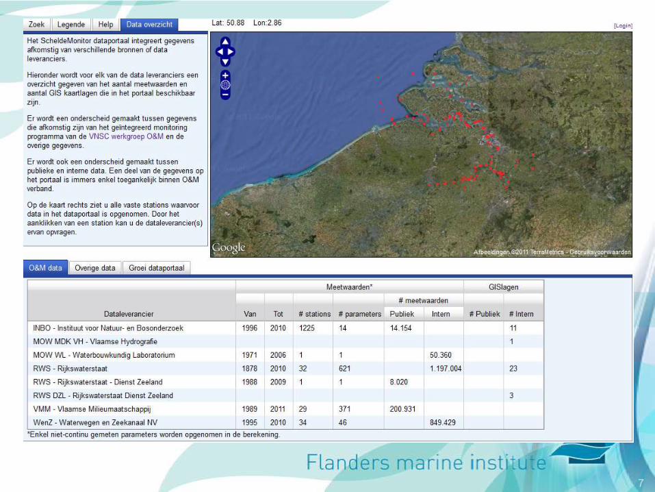
• Dataportal
– Past: catalogue of metadata
– Since 2008: data portal
• Different sources
• Storage & harvesting of data & GIS layers
• Higher visibility for data providers/originators
• Access data at different levels
– Metadata level (datasets description)
– Data visualisation
– Download average or original data
7

8
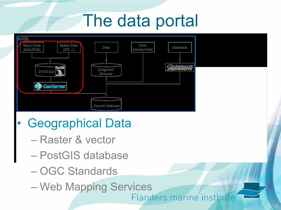
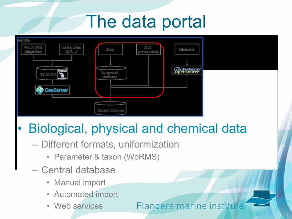
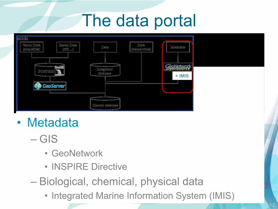
The data portal
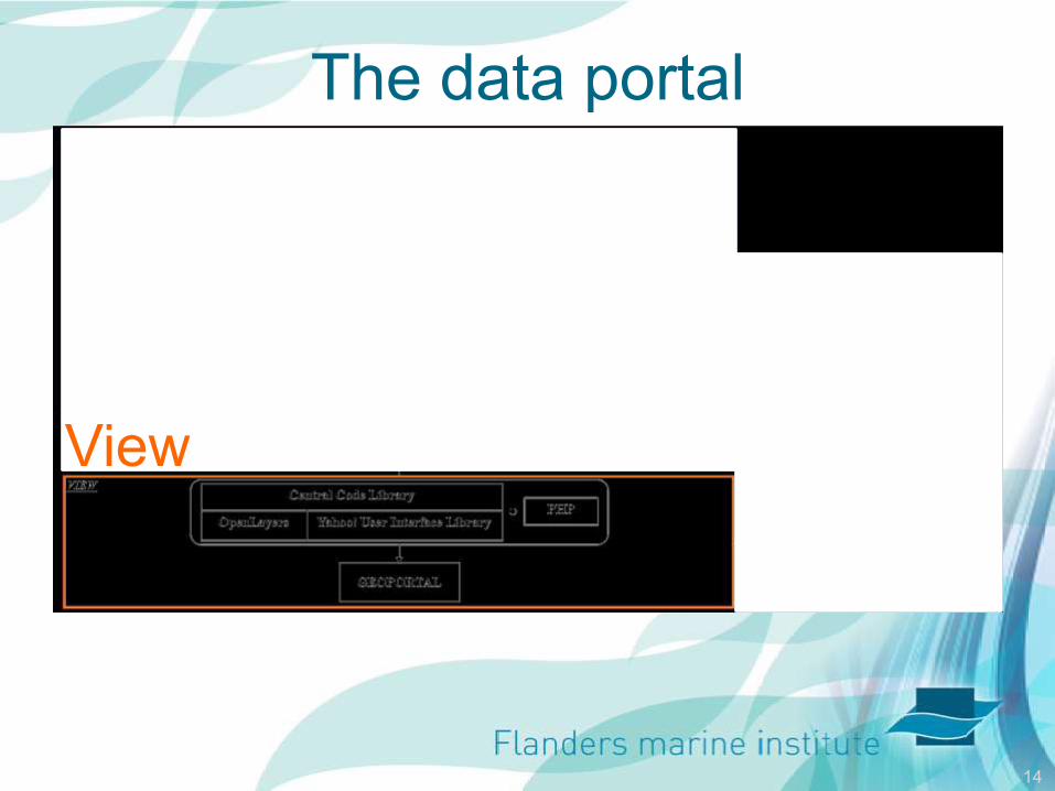
Model
View
Controller

9
The data portal
Model
10
The data portal
• Geographical Data
– Raster & vector
– PostGIS database
– OGC Standards
– Web Mapping Services
11
The data portal
• Biological, physical and chemical data – Different formats, uniformization
• Parameter & taxon (WoRMS)
– Central database
• Manual import
• Automated import
• Web services
12
The data portal
• Metadata
– GIS
• GeoNetwork
• INSPIRE Directive
– Biological, chemical, physical data
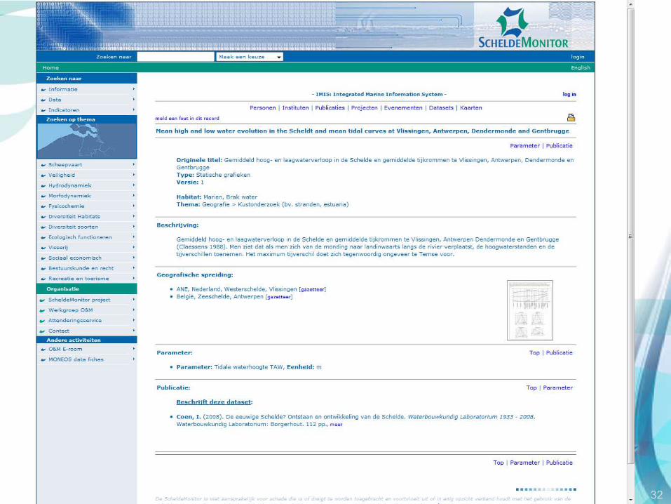
• Integrated Marine Information System (IMIS)
+ IMIS

13
The data portal
• 191 Geografical data
layers
– Ecotopes, navigation,
nature, fisheries,
morphodynamics, …
• Web Services
• Physical, chemical
and biological data
– Over 26 000 000
measurements
14
The data portal
View
15
View
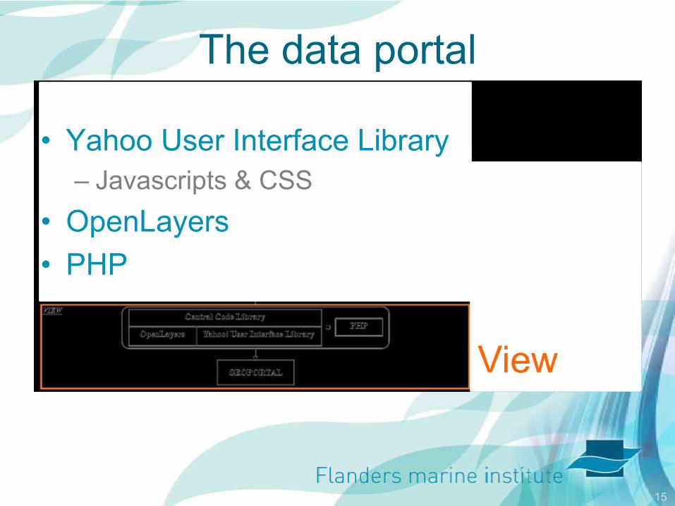
The data portal
• Yahoo User Interface Library
– Javascripts & CSS
• OpenLayers
• PHP
16
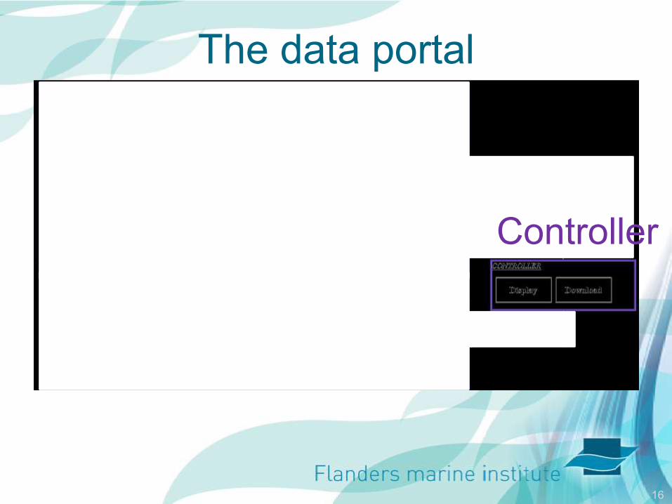
The data portal
Controller
17
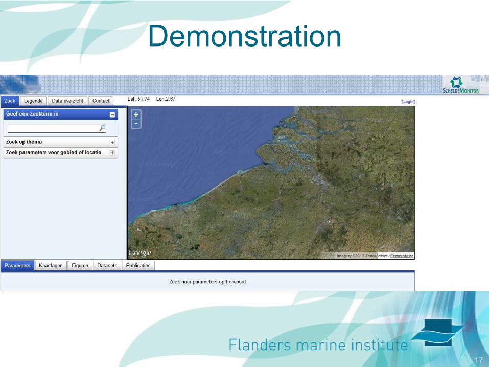
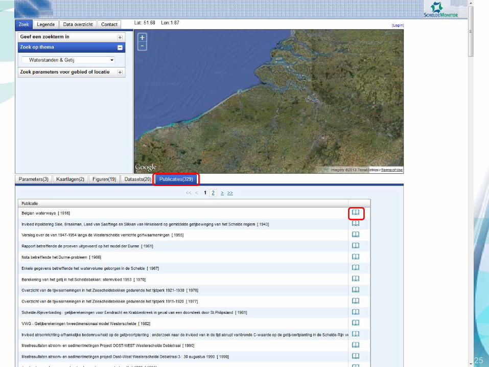
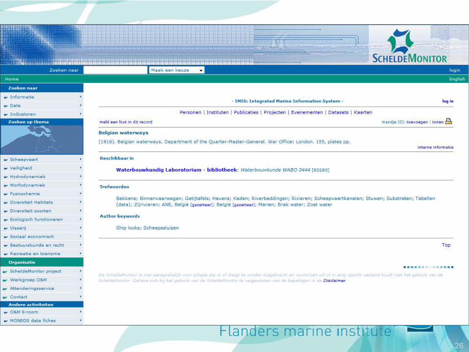
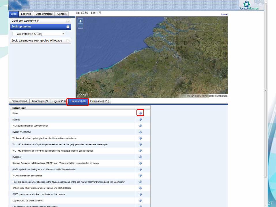
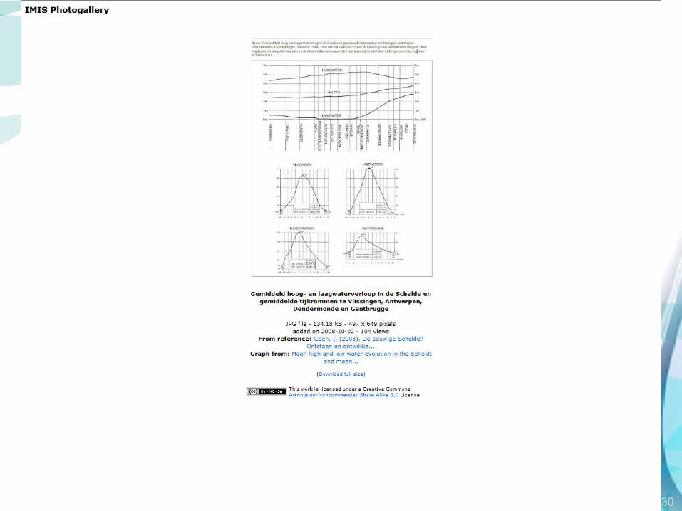
Demonstration

18
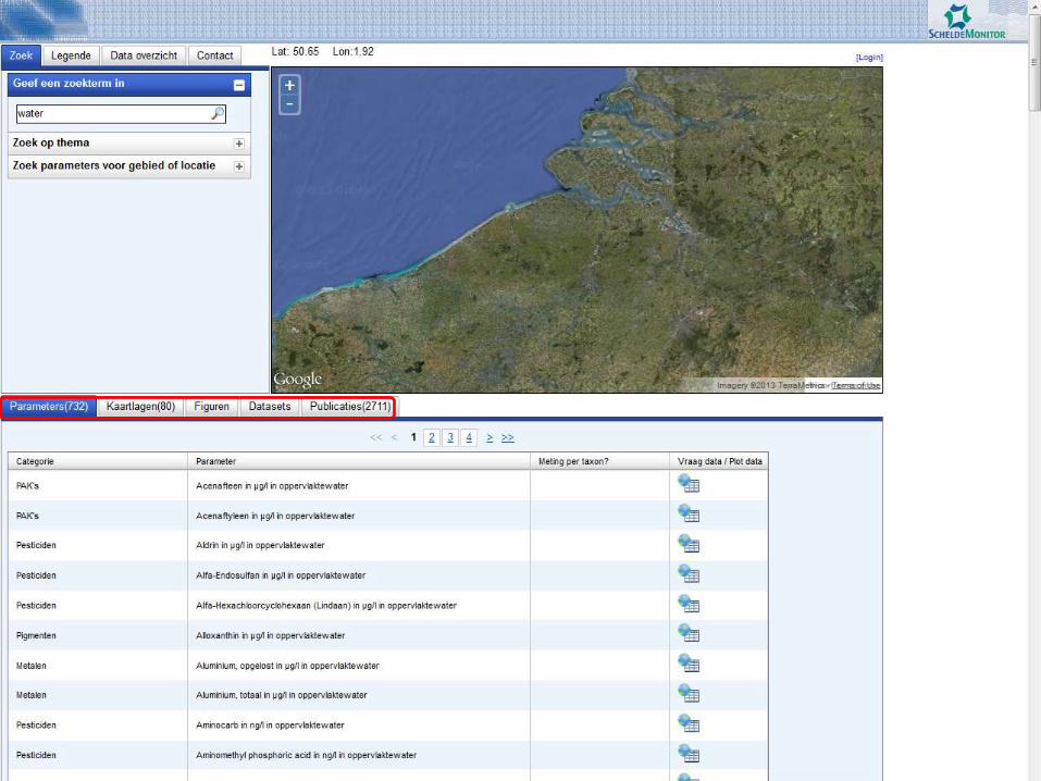
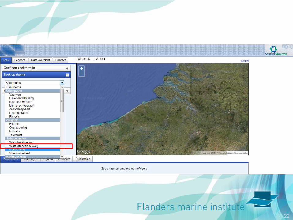
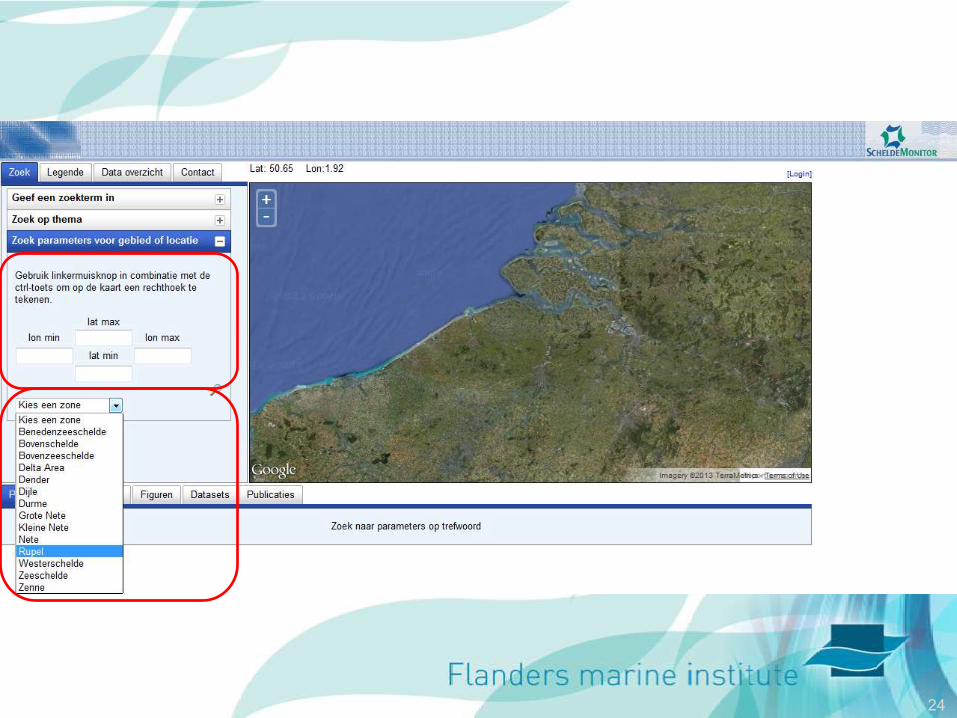
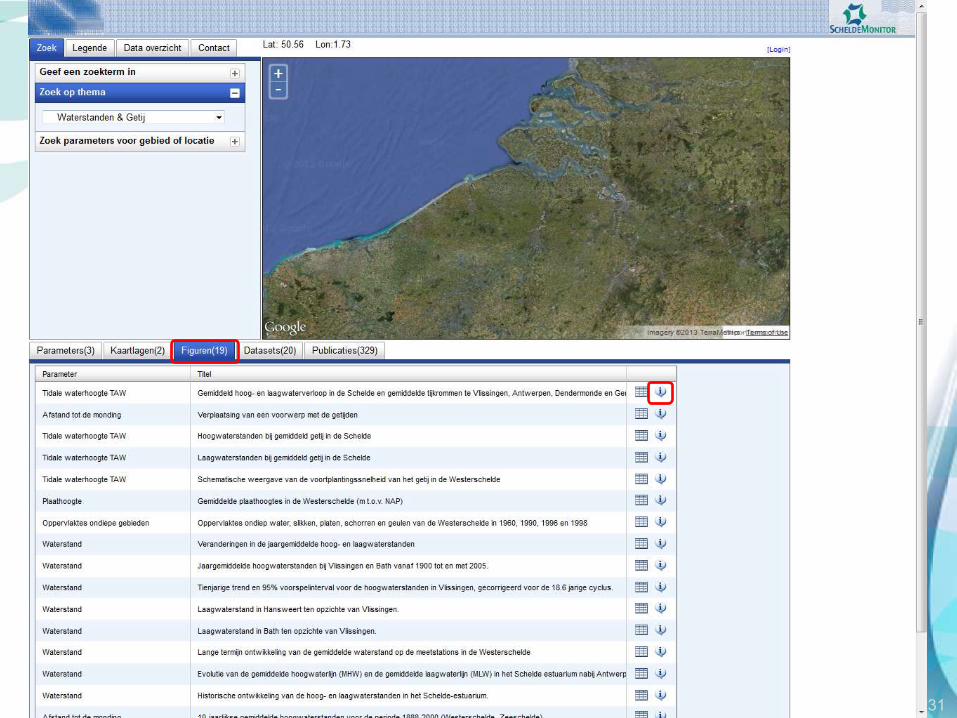
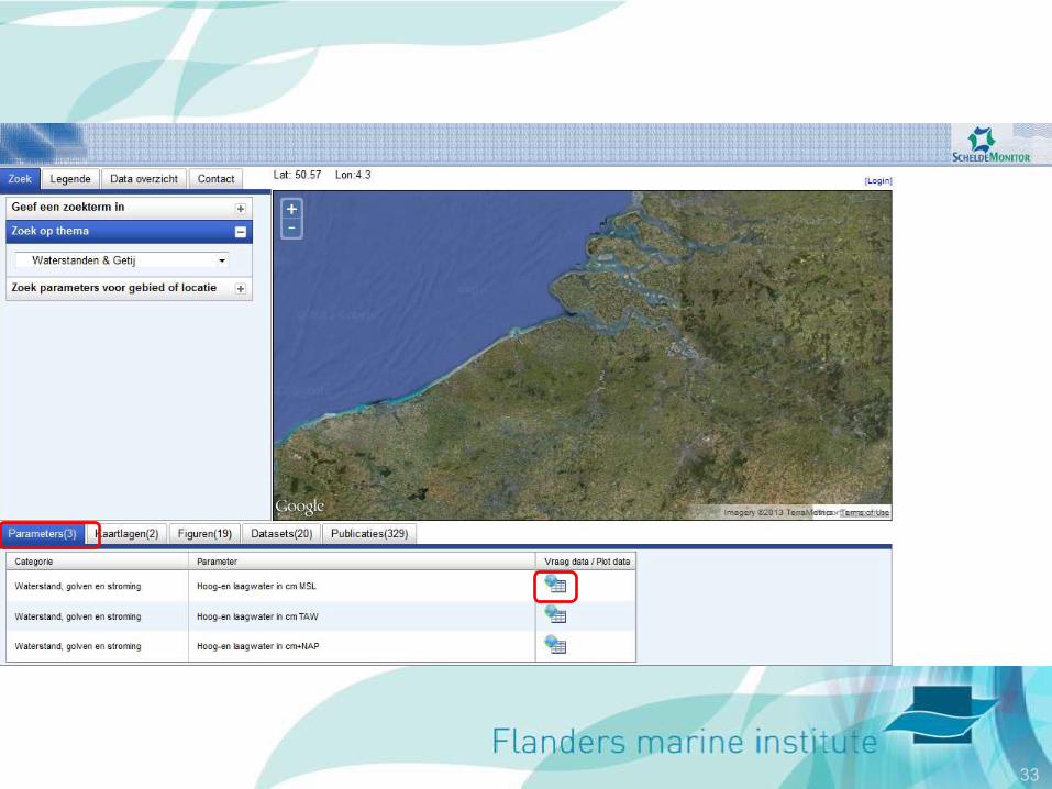
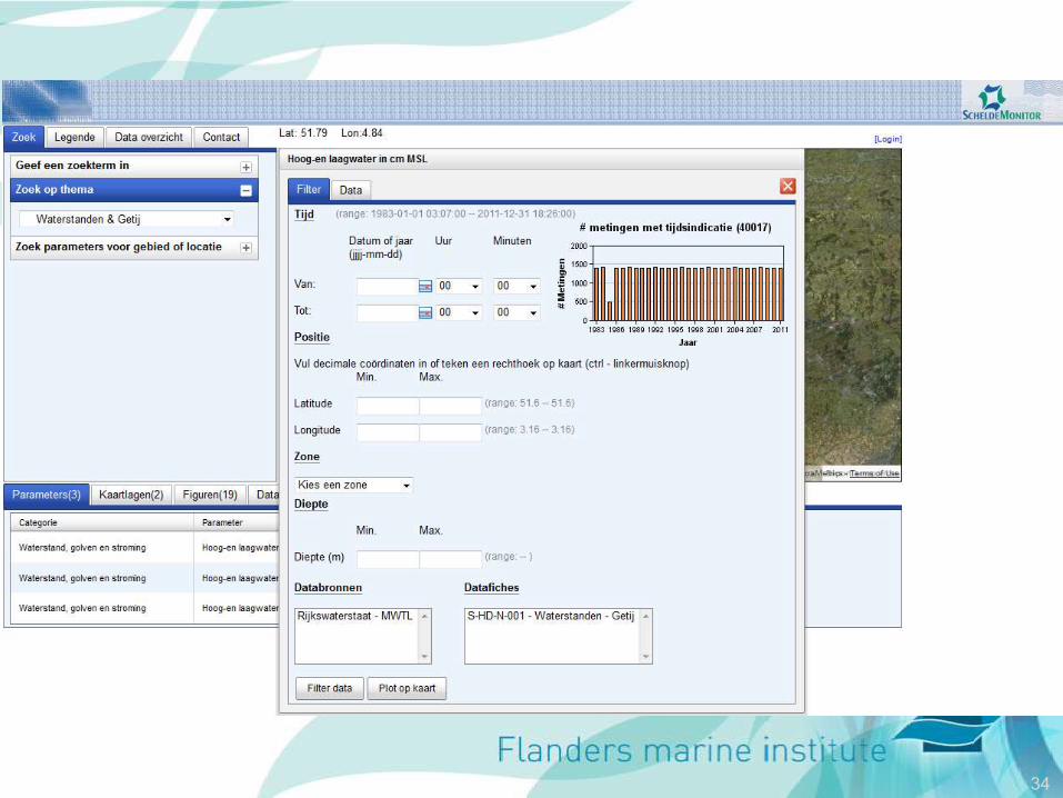
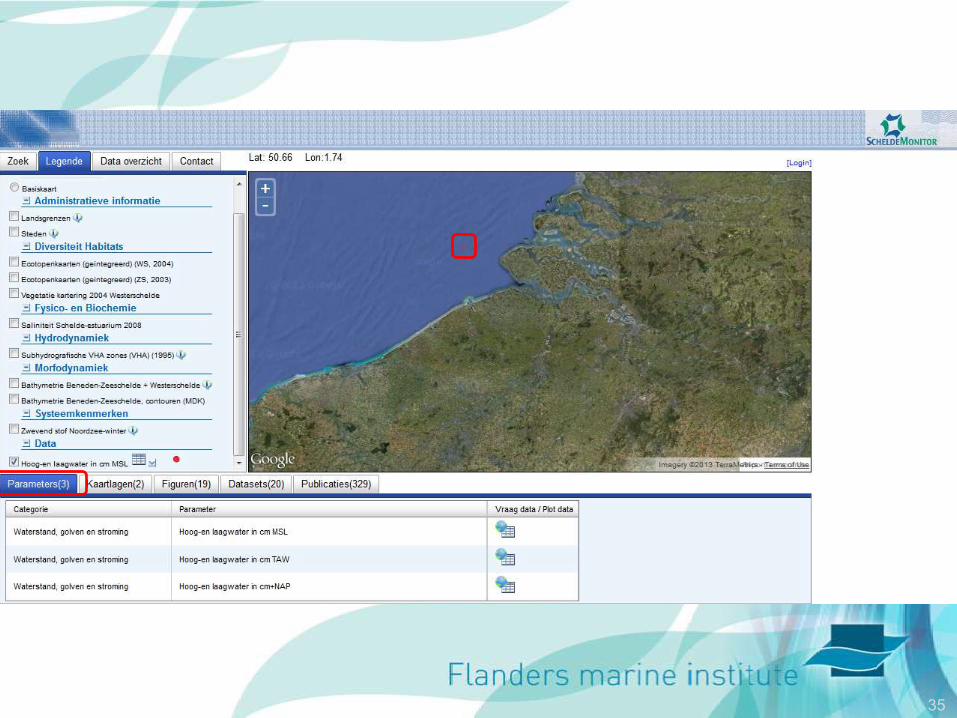
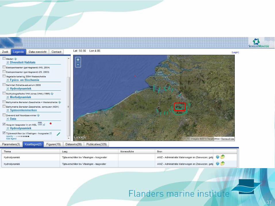
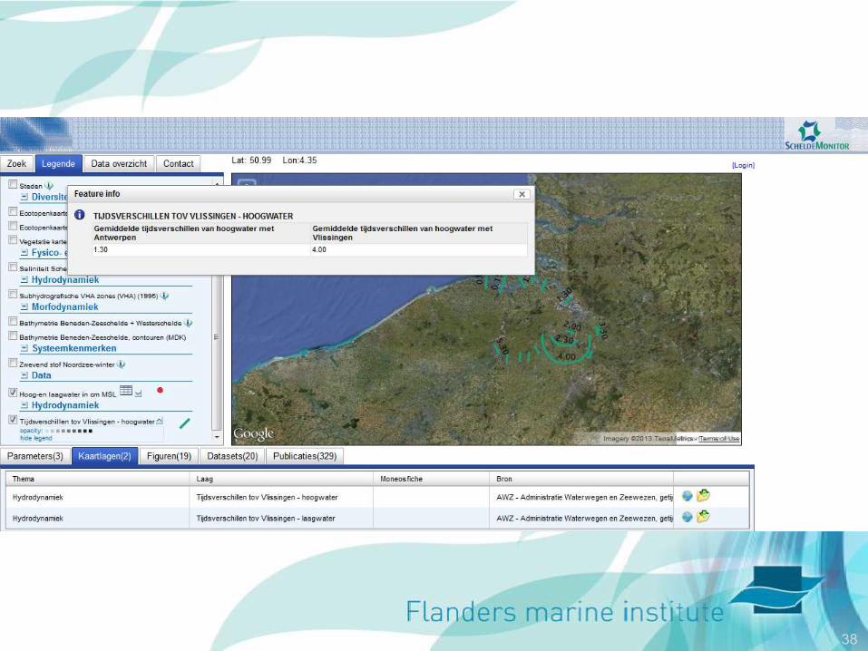
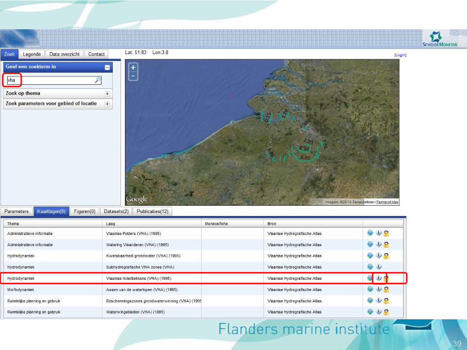
http://www.scheldemonitor.be/dataportal/
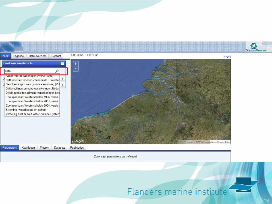
19
20

21
22

23
24
25
26
27

28

29
30
31
32
33
34
35

36
37
38
39
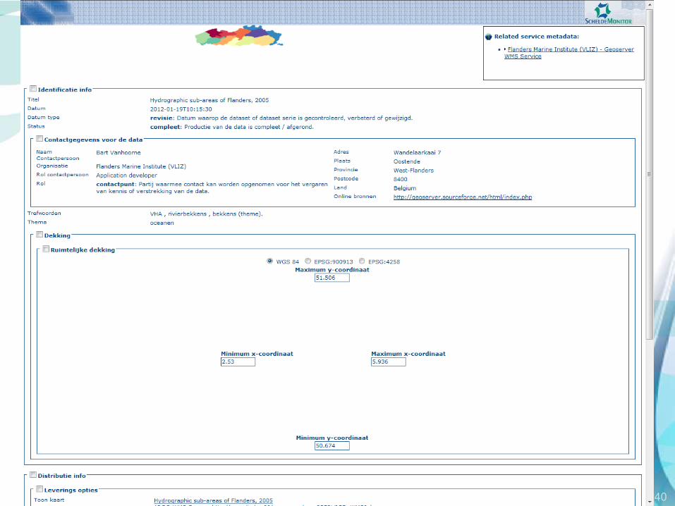
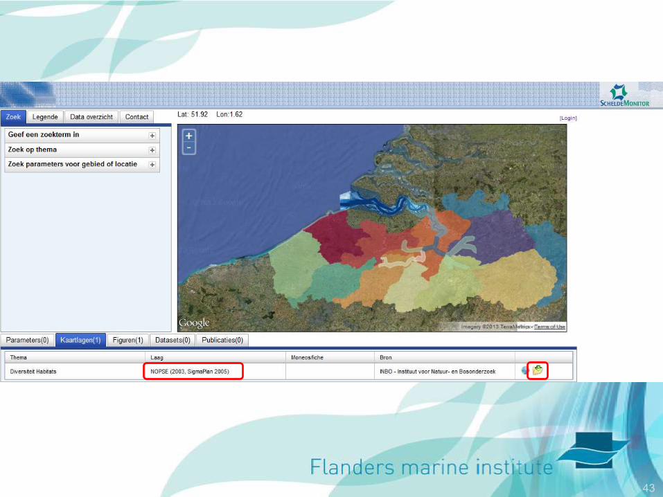
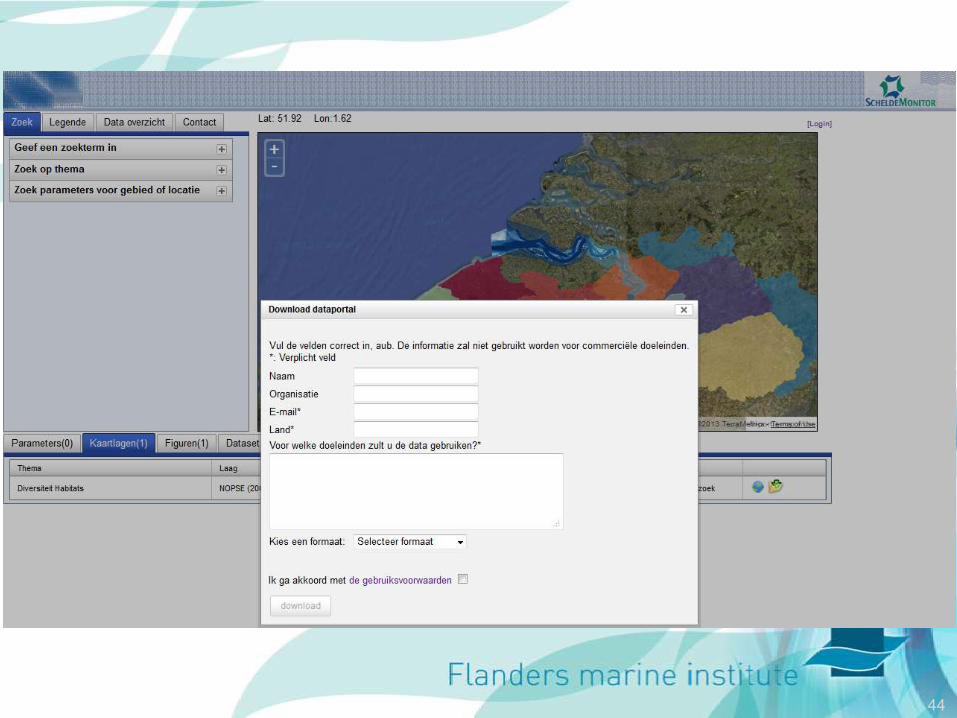
40

41

42
43
44

45
46
Metadata & INSPIRE
• Availability of metadata, uniform standard
• Harmonization of geoinformation
• Efficient access to geoinformation
• In metadata link to keywords other
systems developed by VLIZ – WoRMS
– Marine Regions
– IMIS
47
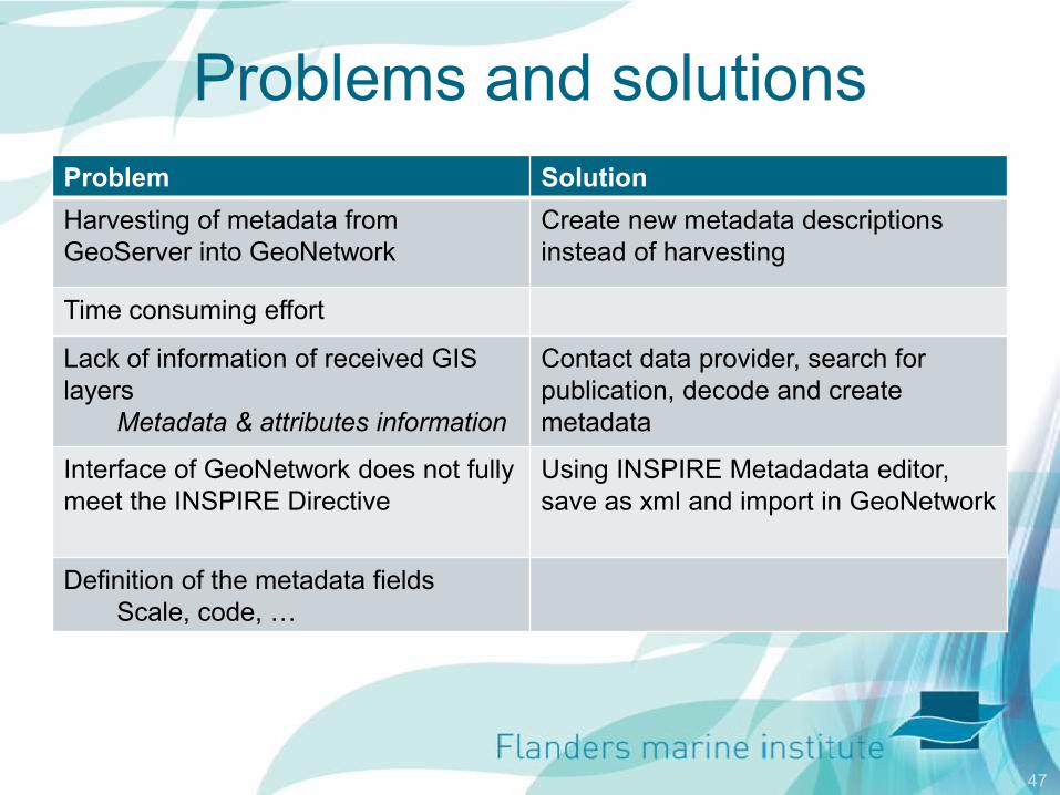
Problems and solutions
Problem Solution
Harvesting of metadata from
GeoServer into GeoNetwork
Create new metadata descriptions
instead of harvesting
Time consuming effort
Lack of information of received GIS
layers
Metadata & attributes information
Contact data provider, search for
publication, decode and create
metadata
Interface of GeoNetwork does not fully
meet the INSPIRE Directive
Using INSPIRE Metadadata editor,
save as xml and import in GeoNetwork
Definition of the metadata fields
Scale, code, …

48
Summary
• Facilitate search tasks
• Open-source tools
• Standards
– OGC
– INSPIRE
• Integration and standardisation
49