a map is a 2 dimensional drawing or picture of an area. maps can vary from… a simple sketch...
TRANSCRIPT

A map is a 2 dimensional drawing or picture of an area. Maps can vary from…
A simplesketch (mental maps)
to……
A complexOrdnanceSurveyMap.
What are maps?

What do maps show
us?
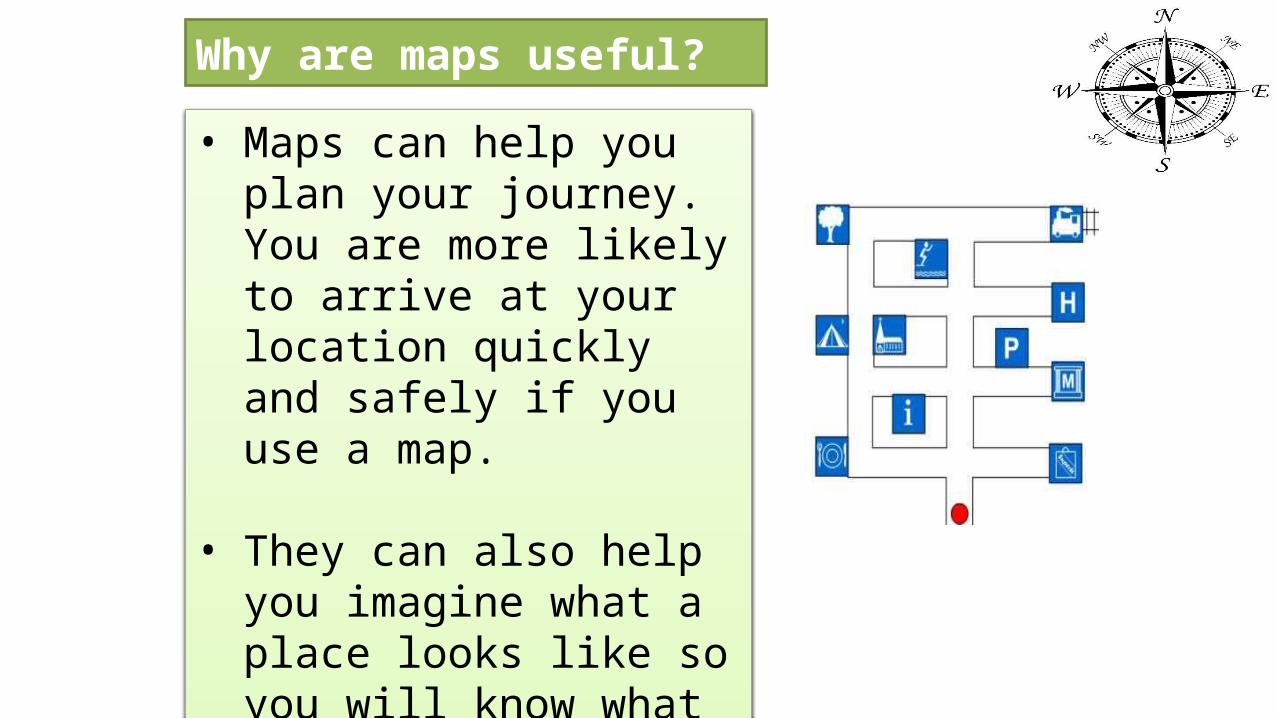
• Maps can help you plan your journey. You are more likely to arrive at your location quickly and safely if you use a map.
• They can also help you imagine what a place looks like so you will know what to expect.
Why are maps useful?

Title(so we know what the map is for)
Scale(So we know the actual size and distance between places)
Compass Point(So we know which way is north and follow directions)
Key(So we know what the symbols mean)
A map always needs a:
Map rules
Title1 : 10

Q2.What’s a Title?

Q3.What’s a Scale?

Q4.What’s a Key?

Q5.What’s a Compass?

Definitions• What do these words mean?...• LOCAL: In the same area / city (close to home)• NATIONAL : In the same country (Qatar)• INTERNATIONAL : To do with other countries, around the world
• Nandos is international because it is all over the world.• The Pearl is National because people from all over Qatar go there.• Our house is local because this is where we live.
• Can you give different examples, using people, clothing, things in this classroom?

How Am I connected to the world?Place Connection Local / National / International
1. India I eat food from here International
2. London This is where I went for an interview International
3. Doha This is where I live Local
4. Brazil I love this football team and buy the shirt International
5. Qatar I enjoy going to places in Qatar National
6. Ain-Khalid This is where I work Local
7. Villagio I go here for shopping Local
8. U.S.A I watch Hollywood movies International
9. Aspire I pray Jummah here every Friday. Local
10. Qatar I have a Qatari driving License National

How Am I connected to the world?Connection Place Local / National / International1. I live here Local2. I went to this country for a holiday International3. This is where I go to school. Ain-Khalid4. I love this football team and buy the shirt International5. I enjoy going to the beach in Qatar Qatar National6. I pray Jummah here on Friday7. My clothes are from this country International8. I order food form here Local9. I was born here Qatar10.

Ya-Qool Park Map
P
Key
P
Road
Entrance
QOOLPlay Area
Lake
Parking
Footpath
Flower Garden
Picnic Benches

Keywords:
Grid lines:These are lines on a map which divide the map in to squares.
Grid references:These are co-ordinates (numbers or numbers and letters) which tell us where to find something on the map.

• Parking• School• Place of Worship
(church/mosk)• Post Office• Nature Reserve• Caravan/Camping Site• Museum• Trees/Woodlands• Cycle Route• Information (help)• Telephone• Motorway• Railway station• Footpath• Sports Centre• Castle• Site of Battle (war
happened)

Grid ReferencesWhat are grid references?
Grid references are co-ordinates which tell us a specific point on a map
They can help us to find a place
They are useful for us to tell other people about where a place/building/road is located

Along the corridor...
Up the stairs!

Remember....!
The square you are looking for is
UP and RIGHT
4 figure grid-reference:1010
Up the stairs: 10Along the corridor: 10
10
10
20
20
30
3000


Cartography The science or practice of drawing maps.
Compass An instrument which uses a magnetised needle to point north
Contour line Line on a map, joining places on a map that are the same height
Distance The amount of space between two lines or places.
Environment The things (air, climate, people, plants ) surrounding a person.
Equator Imaginary line around the middle of the earth
Globe The earth (a round ball shape)
Grid Lines The lines which divide a map in to squares
Grid reference A set of numbers and letters that tell you where to find something on a map.
Key (for maps) A table which explains the symbols on a map
Landforms The features of the earth (grass, mountains, valleys, plains)
Latitude How far a place is north or south of the equator
Longitude How far a place is east or west along the prime meridian
Ordnance Survey Detailed maps of places, drawn to scale.
Plan A map of a small area (school / room) drawn to scale.
Prime meridian An imaginary line that circles earth from north pole to south pole.
Scale The ratio of the distance on a map compared to the real distance.
Sketch map A simple map which shows what a place is like or how to get there
Spot Height The exact height of a spot on the OS map.
Symbol Letter, number or picture used to represent something.
Transport The method used to travel (car, horse, plane etc.)
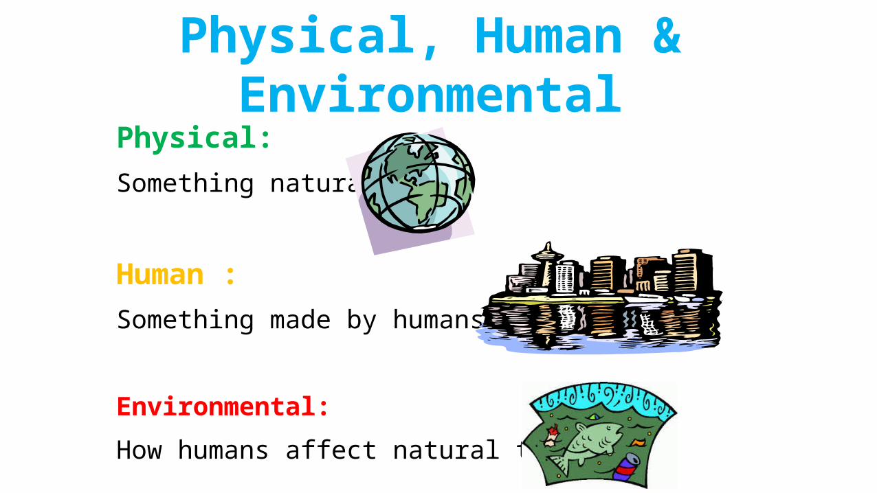
Physical:
Something natural
Human :
Something made by humans
Environmental:
How humans affect natural things
Physical, Human & Environmental

Physical Human Environmental
a) How clouds form b) Where coffee is grown
c) Pollution that kills fish

Physical Human Environmental
A B C
E D F
G I H
J K N
L M P
O Q
a) how clouds formb) how coffee is grownc) protecting pandasd) where trainers are madee) cavesf) pollution that kills fishg) the longest riverh) what is causing global warmingi) how many people do farming
j) weather in Qatark) what language people speakl) size of the continentsm) population of the continentsn) gasses from machineso) natural disastersp) Ozone layer destroyedq) Civil war