a n n u a l r e p o r t - iris consortium · james gaherty • felix waldhauser university of...
TRANSCRIPT

INC
OR
PO
RATE
D R
EA
SE
AR
CH
INS
TITUTIO
NS
FOR
SE
ISM
OLO
GY
I R I S A N N U A L R E P O R T
2 0 1 0

2
The ConsortiumThe IRIS management structure is an interface between the scientific community, funding agencies, and IRIS programs. The structure is designed to focus scientific talent on common objectives, encourage broad participation, and efficiently manage IRIS programs.
IRIS VOTING MEMBERSUniversity of Alabama Andrew Goodliffe • Antonio Rodriguez
University of Alaska Douglas H. Christensen • Roger Hansen
University of Arizona Susan Beck • George Zandt
Arizona State University Matthew J. Fouch • Ed J. Garnero
University of Arkansas at Little Rock Haydar J. Al-Shukri • Hanan Mahdi
Auburn University Lorraine W. Wolf
Baylor University Robert Jay Pulliam • Vince Cronin
Boise State University Lee M. Liberty • John Bradford
Boston College John Ebel • Alan Kafka
Boston University Colleen Dalton • Ulrich Faul
Brown University Donald Forsyth • Karen Fischer
California Institute of Technology Donald Helmberger • Thomas Heaton
University of California, Berkeley Barbara Romanowicz • Lane Johnson
California State Polytechnic University, Pomona Jascha Polet • Jonathan Nourse
California State University, East Bay Mitchell Craig • Joshua Kerr
University of California, Los Angeles Paul Davis
University of California, Riverside Elizabeth Cochran • David D. Oglesby
University of California, San Diego Gabi Laske • Jon Berger
University of California, Santa
Barbara Chen Ji • Toshiro Tanimoto
University of California, Santa Cruz Thorne Lay • Susan Schwartz
Carnegie Institution of Washington Paul Silver • Selwyn Sacks
Central Washington University Timothy Melbourne • Charles Rubin
University of Colorado, Boulder Anne Sheehan • Mike Ritzwoller
Colorado School of Mines Roel Snieder • Thomas Boyd
Colorado State University Derek Schutt • Dennis Harry
Columbia University James Gaherty • Felix Waldhauser
University of Connecticut Vernon F. Cormier • Lanbo Liu
Cornell University Muawia Barazangi • Larry Brown
University of Delaware Susan McGeary
Duke University Eylon Shalev
Florida International University Dean Whitman
University of Florida Raymond Russo • Joseph Meert
University of Georgia Robert Hawman • James Whitney
Georgia Institute of Technology Zhigang Peng • Andrew V. Newman
Harvard University Miaki Ishii • Adam Dziewonski
University of Hawaii at Manoa Robert A Dunn • Milton Garces
University of Houston Aibing Li
Idaho State University
IGPP/Lawrence Livermore National Laboratory William Walter • Peter Goldstein
IGPP/Los Alamos National Laboratory Hans Hartse • Leigh House
University of Illinois at Urbana Champaign Wang-Ping Chen • Xiaodong Song
Indiana University Gary L. Pavlis • Michael Hamburger
Indiana Univ/Purdue Univ at Fort Wayne Dipak Chowdhury
James Madison University Anna Courtier • Steven Whitmeyer
Kansas State University Charles Oviatt
University of Kansas Ross A. Black
University of Kentucky Edward W. Woolery • Zhenming Wang
Lamar University Joseph Kruger • James Jordan
Lawrence Berkeley National Laboratory D.W. Vasco • E.L. Majer
Lehigh University Anne Meltzer
Louisiana State University Juan Lorenzo • Roy Dokka
Macalester College John P. Craddock • Karl R. Wirth
Massachusetts Institute of Technology Robert Dirk van der Hilst • Bradford H. Hager
University of Memphis Heather DeShon • Beatrice Magnani
University of Miami Tim Dixon • Falk Amelung
Miami University, Ohio Michael Brudzinski • Brian Currie
University of Michigan Jeroen Ritsema • Larry Ruff
Michigan State University Kazuya Fujita • David W. Hyndman
Michigan Technological University Wayne D. Pennington • Gregory P. Waite
University of Minnesota Justin Revenaugh • Val Chandler
University of Missouri at Columbia Eric Sandvol • Mian Liu
Missouri University Of Science & Technology Stephen S. Gao • Kelly H. Liu
Montana Tech of the University of Montana Michael Stickney • Marvin Speece
University of Nevada, Las Vegas Catherine Snelson
University of Nevada, Reno Glenn Biasi • John Louie
New Mexico Institute of Mining & Technology Richard C.Aster • Susan Bilek
New Mexico State University James Ni • Thomas Hearn
University of New Orleans Abu K.M. Sarwar
State University of New York at Binghamton Francis T. Wu • Jeff Barker
State University of New York at Stony Brook William Holt • Daniel Davis
North Carolina State University DelWayne Bohnenstiehl • James Hibbard
University of North Carolina, Chapel Hill Jonathan Lees • Jose Rial
Northern Illinois University Paul Stoddard • Philip Carpenter
Northwestern University Suzan van der Lee • Seth Stein
Oklahoma State University Ibrahim Cemen
The University of Oklahoma G. Randy Keller • Roger Young
University of Oregon Eugene Humphreys • Doug Toomey
Oregon State University Anne Trehu • John Nabelek
Pennsylvania State University Charles Ammon • Andrew Nyblade
Princeton University Frederik Simons • Robert Phinney
University of Puerto Rico, Mayagüez Christa von Hillebrandt • Eugenio Asencio
Purdue University Lawrence W. Braile • Robert Nowack
Rensselaer Polytechnic Institute Steven Roecker • Robert McCaffrey
Rice University Alan R. Levander • Dale Sawyer
University of Rochester Cynthia Ebinger • John Tarduno
Rutgers University Vadim Levin • Michael J. Carr
Saint Louis University Lupei Zhu • Keith Koper
San Diego State University Robert Mellors • Steven Day
San Jose State University Donald L. Reed • Richard Sedlock
University of South Carolina Tom Owens • Pradeep Talwani
University of Southern California David A Okaya • Thomas H. Jordan
Southern Methodist University Brian Stump • Eugene Herrin
Stanford University Simon Klemperer • Jesse Lawrence
Syracuse University Jeffrey A. Karson
University of Tennessee Richard T. Williams
Texas A&M University Richard Gibson • Philip D. Rabinowitz
Texas Tech University Harold Gurrola • Calvin Barnes
University of Texas at Austin Clifford A. Frohlich • Stephen P. Grand
University of Texas at Dallas George McMechan • John Ferguson
University of Texas at El Paso Kate Miller • Aaron Velasco
University of Tulsa Kumar Ramachandran • Peter J. Michael
University of Utah Robert B. Smith • Gerald T. Schuster
Virginia Polytechnic Institute John Hole • Ying Zhou
University of Washington Kenneth Creager • John Vidale
Washington University, St. Louis Douglas Wiens • Michael Wysession
West Virginia University Thomas H. Wilson • Robert Behling
Western Washington University Jackie Caplan-Auerbach • Juliet Crider
University of Wisconsin, Madison Clifford Thurber • Lutter William
University of Wisconsin, Milwaukee Keith A. Sverdrup • Brett Ketter
University of Wisconsin, Oshkosh Timothy Paulsen
Woods Hole Oceanographic Institution
Ralph Stephen • Alan Chave
Wright State University Ernest C. Hauser • Paul J. Wolfe
University of Wyoming Scott Smithson • Ken G. Dueker
Yale University Jeffrey J. Park
U.S. AFFILIATESNaval Air Weapons Station, Geothermal Program Office Francis Monastero
Maryland Geological Survey James P. Reger
EDUCATIONAL AFFILIATESArizona Western College Michael Conway
Augusta State University Christian Poppeliers
Aurora University Richard Polad
Bridgewater State College Robert Cicerone
California State University, Northridge Gerry Simila
Central Wyoming College Suzanne M. (Suki) Smaglik
College of Charleston Steven Jaumé
Diné College Margaret Mayer
Eckerd College Laura Beiser Wetzel
Imperial Valley College Kevin Marty
Island Wood Greg Geehan
University of Missouri, Kansas City
Tina Niemi
Moravian College Kelly Krieble
University of New Hampshire Margaret Boettcher

IRIS
A
NN
UA
L
RE
PO
RT
2
01
0
3
Educational and not-for-profit institutions in the United States, with a major commitment to research in seismology and related fields, may become Voting Members of IRIS. Each Voting Member appoints a Representative to receive notices and represent its interests at IRIS meetings. Each Representative, or appointed Alternate, of a Voting Member is entitled to vote at the annual meeting of Members and in elections of the Board of Directors.
The Voting Members or the Board of Directors may elect not-for-profit organizations in the United States that are engaged in seismological research and development as US Affiliates, not-for-profit institutions in the United States with a commitment to teaching in Earth science including seismology as Educational Affiliates, and institutions outside of the United States as Foreign Affiliates. Each Affiliate may send a nonvoting Representative to IRIS Member meetings.
The College of New Jersey Margaret Benoit
State University of New York at Potsdam Frank Revetta
University of Pittsburgh William Harbert
University of Portland Rev. Ronald Wasowski
Trinity University Glenn C. Kroeger
Waubonsee Community College David Voorhees
Westminster College Alan Goldin
University of Wisconsin, Whitewater Prajukti Bhattacharyya
FOREIGN AFFILIATESAcademy of Sciences, Seismological Center, Albania Betim Muço
Instituto Nacional de Prevención Sísmica, Argentina Patricia Alvarado
Central Queensland University, Australia Mike Turnbull
Australian National University Hrvoje Tkalcic
The University of Queensland, Australia Peter Mora
Azerbaijan Republic Center of Seismic Service Gurban Yetirmishli
University of Dhaka, Bangladesh Syed Humayun Akhter
Royal Observatory of Belgium Michel van Camp
Universidade de Brasilia, Brazil Joao Willy Rosa
Observatório Nacional, Brazil Jorge Luis de Souza
Univ. Federal do Rio Grande do Norte, Brazil Joaquim Mendes Ferreira
Universidade de São Paulo, Brazil Marcelo Assumpção
Institute of Geophysics of the Bulgarian Academy of Sciences Svetlana Nikolova
University of Alberta, Canada Jeff Gu
University of Calgary, Canada David Eaton
University of British Columbia, Canada Michael G. Bostock
Ecòle Polytechnique, Canada
GEOTOP, Universitè du Quebec à Montreal, Canada Fiona Darbyshire
Geological Survey of Canada, Continental Geoscience Division Isa Asudeh
Simon Fraser University, Canada Andrew Calvert
University of Saskatchewan, Canada Igor B. Morozov
University of Toronto, Canada
University of Chile Sergio Barrientos
Universidad de los Andes, Colombia German Prieto
Universidad Nacional de Colombia, Medellín Gaspar Monsalve
Universidad Nacional, Costa Rica Marino Protti-Quezada
Geophysical Institute, Academy of Sceinces, Czech Republic Jan Zednik
Masaryk University, Czech Republic Jan Svancara
Geological Survey of Denmark & Greenland Soren Gregersen
Univ. Autonoma de Santo Domingo, Dominican Republic Eugenio Polanco Rivera
Escuela Polytécnica Nacional, Ecuador Mario Ruiz
National Research Institute of Astronomy and Geophysics, Egypt Amin Ibrahim Hussein
University of Helsinki, Finland Pekka Heikkinen
University of Oulu, Finland Elena Kzlovskaya
Institut de Physique du Globe de Paris, France Geneviève Roult
Geosciences Azur, France Guust Nolet
Universite Montpellier II, France Goetz Bökelmann
Seismological Monitoring Center of Georgia Tea Godoladze
Aristotle University of Thessaloniki, Greece Constantinos Papazachos
Eötvös Loránd Geophysical Institute of Hungary Tamás Fancsik
Indian Institute of Technology, Kharagpur, India Supriyo Mitra
Dublin Institute for Advanced Studies, Ireland Sergei Lebedev
International Institute of Earthquake Engineering and Seismology, Iran Manouchehr Bahavar
Geophysical Institute of Israel Rami Hofstetter
Instituto Nazionale di Geofisica e Vulcanologia, Italy Salvatore Mazza
National Institute of Oceanography and Experimental Geophysics, Italy Enrico Priolo
Jordan Seismological Observatory Tawfiq Al-Yazjeen
Korean Meteorological Administration, Korea Young-Soo Jeon
Hanyang University, Korea So Gu Kim
Centro de Investigacion Cientifica y de Educacion Superior de Ensenada, Mexico Cecilio J. Rebollar
Universidad Nacional Autónoma de México Carlos Mendoza
KNMI /ORFEUS, Netherlands Bernard Dost
Technical University of Delft, Netherlands Kees Wapenaar
Utrecht University, Netherlands Hanneke Paulssen
Institute of Geological & Nuclear Sciences, New Zealand Mark Peter Chadwick
University of Otago, New Zealand Andrew Gorman
Victoria University, New Zealand Martha Kane Savage
University of Bergen, Norway Eystein S. Husebye
Quaid-i-Azam University, Pakistan Mona Lisa
Instituto Geofisico del Peru Edmundo Norabuena
Centro Regional de Sismología para América del Sur, Peru Daniel Huaco Oviedo
Institute of Earthquake Science, CEA, PRC Qi-fu Chen
China Earthquake Networks Center, CEA, PRC Ruifeng Liu
Institute of Geology, Beijing, CEA, PRC Qiyuan Liu
Institute of Geomechanics, Chinese Academy Geological Sciences, PRC Meijian An
Institute of Geology and Geophysics, Chinese Academy of Sciences, PRC Ai Yinshuang Institute of Geophysics, CEA, PRC Gongwei Zhou
China University of Geosciences, PRC Xinfu Li
Nanjing University, PRC Liang-shu Wang
Harbin Institute of Technology, PRC Hengshan Hu
Hong Kong Observatory, PRC Wong Wing Tak
University of Hong Kong, PRC Lung Sang Chan
Peking University, PRC Shao Xian Zang
Tongji University, PRC Kin-Yip Chun
University of Science and Technology of PRC Sidao Ni
Institute of Geophysics, Polish Academy of Sciences, Poland Pawel Wiejacz
University of Coimbra, Portugal Susana Custodio
Instituto Superior Tecnico, Portugal Joao F.B.D. Fonseca
Universidade do Porto, Portugal Rui Carneiro-Barros
National Institute for Earth Physics, Romania Andrei Bala
University of Bucharest, Romania Marian Ivan
Geophysical Survey of the Russian Academy of Sciences, Russia Alexey A. Malovichko
Institute of Dynamics of Geospheres, Russian Academy of Sciences, Russia Vitaly V. Adushkin
Kuban State University, Russia Vladimir A. Babeshko
Council for Geoscience, South Africa Artur Cichowicz
King Fahd University Petroleum and Minerals, Saudi Arabia
Instituto de Ciències de la Terra "Jaume Almera", Spain Antonio Villaseñor
Universidad Complutense de Madrid, Spain Elisa Buforn
Swiss Federal Institute of Technology, Switzerland Domenico Giardini
Academia Sinica, Institute of Earth Sciences, Taiwan Bor-Shouh Huang
National Central University, Taiwan Kuo-Fong Ma
National Cheng Kung University, Taiwan Ruey-Juin Rau
National Taiwan University Shu-Huei Hung
Kasetstart University, Thailand Passakorn Pananont
Mahidol University, Thailand Passakorn Pananont
AWE Blacknest, United Kingdom Sheila Peacock
British Geological Survey, United Kingdom Brian Baptie
University of Bristol, United Kingdom George Helffrich
University of Cambridge, United Kingdom Keith Priestley
University of Leeds, United Kingdom Roger Clark
University of Leicester, United Kingdom Alex Brisbourne
University of Southampton, United Kingdom Nick Harmon
General Directorate of Disaster Affairs, Turkey Yildiz Iravul
Istanbul Technical University, Turkey Tuncay Taymaz
Kandilli Observatory, Bogazici University, Turkey Nurcan Özel
Süleyman Demirel University, Turkey Sakir Sahin
Tubitak-Marmara Research Center, Turkey M. Namik Yalçin
ICSU World Data Center for Geoinformatics, Ukraine Liudmyla Farfuliak
University of the West Indies Richard Roberts
*New members in bold

4
Special Activities and Initiatives
Statement from the Chair
Susan Beck, University of Arizona
During the July 2009 to July 2010 fiscal year, IRIS and the community have been busy pushing forward on a number of exciting fronts.
In June 2010, we held the IRIS Workshop in Snowbird, UT, where we recognized 25 years of “Facilitate Collaborate Educate.” This 25th
anniversary celebration reminded us of how much IRIS has accomplished for the seismological community and the incredible science made possible through use of the IRIS facility. Another very important accomplishment was the preparation of the NSF proposal for the IRIS core support. The proposal was strongly tied to the Seismological Grand Challenges in Understanding Earth’s Dynamic Systems document and highlighted IRIS accomplishments as well as exciting new IRIS initiatives. I want to thank the community, the IRIS Board of Directors, the IRIS staff, and Brian Stump (Editor) for all their work on the proposal.
IRIS core programs and EarthScope are thriving. The roll out of the new Q330 data loggers at GSN stations continued at a rapid pace. GSN initiated some new and improved data quality measures to ensure that the GSN stations were producing the highest quality data possible. PASSCAL was involved in a 58-station aftershock deployment in Chile following the Mw=8.8 earthquake. These data are open and available at the DMC, and I urge everyone to use them. The E&O program supplied us with impressive teachable moments for our classrooms. The DMS program held a metadata workshop in Cairo and continued to develop new data products. The International Development Seismology Committee met with CERESIS in Peru, which has led to some to some joint activities. The IDS Committee also hosted a workshop in Miami following the devastating Haiti earthquake. Polar programs worked with international partners to deploy the Greenland Ice Sheet Monitoring Network, a real-time seismic network for studying ice sheet dynamics. EarthScope’s Transportable Array is successfully moving across the country, and more and more Flexible Array deployments are in progress. Overall, it was a very successful year for IRIS and the seismological community.
I thank all of the partners that work with IRIS, committee members, IRIS staff, and NSF program managers for another successful year.
IRIS is a university consortium sponsored by the National Science Foundation (NSF) that is dedicated to the operation of scientific facilities for the acquisition, management, and distribution
of freely available seismic data. The IRIS Consortium serves as a forum for exchanging ideas, setting community priorities, and fostering cooperation. There are seven key IRIS program areas (Global Seismographic Network, Program for Array Seismic Studies of the Continental Lithosphere, Data Management System, Education and Outreach, USArray, Polar Operations, and International Development Seismology) and this report addresses each of them. Below we discuss IRIS activities and initiatives that are outside of these key program areas.
Seismic Instrumentation Technology Symposium – November 10–11, 2009
The first joint seismology/earthquake engineering/Department of Defense symposium on seismic instrumentation technology called “Spectral Extremes – Pushing the Limits of Sensing Ground Motion” was held at Miramonte Resort in Palm Springs Valley, CA, in November 2009. The symposium was sponsored by NSF, IRIS, the Network for Earthquake Engineering Simulation (NEES), and the US Geological Survey (USGS), and convened by Bob Nigbor (UCLA) and John Collins (WHOI). More information, including copies of presentations, is available at http://www.
iris.edu/hq/instrumentation_meeting/.
Ground Based Geophysics on the Moon – January 21–22, 2010IRIS co-sponsored a meeting on “Ground-Based Geophysics on the Moon” in Tempe, AZ. The meeting brought together planetary and terrestrial
IRIS ManagementOlga Cabello David Simpson Ray Willemann Rob Woolley

IRIS
A
NN
UA
L
RE
PO
RT
2
01
0
5
geophysicists to review the current state of knowledge of the Moon and past geophysical studies, to discuss current plans, and to begin planning for the future. More information is available at http://www.lpi.usra.edu/meetings/lunargeo2010/.
IRIS Community Instrument Deployment in Chile – March 20 – October 15, 2010NSF, using its Rapid Response Research funding mechanism, supported a project to collect an open community data set from a portable seismograph deployment in an aftershock study following the magnitude 8.8 earthquake that occurred off the coast of Chile on February 27, 2010. The IRIS Consortium, on behalf of its member institutions, worked with scientists from US universities and the University of Chile to deploy 58 broadband seismic instruments to record aftershocks for approximately six months. This community-wide, coordinated approach provided a high-quality data set that was used immediately by a wide range of researchers from around the world.
Data from the Chile deployment are available at the IRIS DMC. Details can be found at http://www.iris.edu/hq/chile/data.
IRIS Workshop – June 9–11, 2010The 2010 IRIS Workshop celebrated the 25th anniversary of IRIS—and looked ahead to an exciting future for the Earth sciences.
The workshop included plenary presentations on cutting-edge investigations related to many of the Seismological Grand Challenges, organized into sessions on:
• Exploration and Near-Surface Seismology
• The Science of Fault Slip and Earthquake Rupture
• Mantle Dynamics
• The Science and Policy of Deadly Earthquakes
Over 225 people attended the workshop, which was organized by Mike Brudzinski, Ed Garnero, and Stéphane Rondenay.
Publications• IRIS Newsletter
• IRIS At a Glace
Date Sponsor Subject
8/09 NSF Young Investigators Pool of Instrumentation12/09 NSF Mid-America Workshop (held 10/24-28/10)1/10 NSF Discovery Research K-122/10 NSF OBS Workshop (held 9/26-28/10)2/10 USAID Mid-America Workshop3/10 NSF Haiti Workshop (held 3/22-23/10)3/10 NSF Chile RAPID3/10 NSF Pan-American Advanced Studies Institute5/10 DOE GSN Modernization
Proposals Submitted:The following table includes proposals prepared by IRIS during this fiscal year. Successful proposals are in black, unsuccessful ones in grey.
Attendees at the IRIS Workshop held in Snowbird Resort, Utah, from June 9-11, 2010.

6
GSNStanding CommitteeXiaodong Song (Chair) University of Illinois at Urbana-ChampaignCaroline Beghein University of California, Los AngelesColleen Dalton Boston UniversityAdam Dziewonski Harvard UniversityGavin Hayes US Geological SurveyWilliam Leith US Geological SurveyJeff McGuire Woods Hole Oceanographic InstitutionMeredith Nettles Lamont-Doherty Earth Obsv. of Columbia UniversityGerardo Suarez Instituto de Geofisica, UNAM
The Global Seismographic Network (GSN) is a permanent network of state-of-the-art seismological and geophysical sensors connected by telecommunications
to serve the scientific research and monitoring requirements of our national and international communities. All GSN data are freely and openly available to anyone via the IRIS Data Management Center. Installed to provide broad, uniform global Earth coverage, 153 GSN stations are now sited from pole to pole on all seven continents, in cooperation with over 100 host organizations and seismic networks in 70 countries worldwide. GSN coordinates closely with other international networks through the International Federation of Digital Seismograph Networks. The GSN is primarily operated and maintained through the USGS Albuquerque Seismological Laboratory (ASL) and through an IRIS subaward to the University of California at San Diego IRIS/IDA group. Twenty GSN Affiliate stations and arrays contribute to the network, including the nine-station USGS Caribbean Network. The GSN, in collaboration with the US National Earthquake Information Center (NEIC), are principal global sources of data and information for earthquake locations, earthquake hazard assessment, and earthquake emergency response. In collaboration with National Oceanic and Atmospheric Administration tsunami warning centers, the GSN provides essential data for tsunami warning response globally. The GSN participates within the Global Earth Observing System of Systems. The GSN also works closely with the International Monitoring System (IMS) for the Comprehensive Nuclear Test Ban Treaty Organization (CTBTO). Thirty-one GSN stations and seven GSN Affiliates
are now linked directly to the CTBTO International Data Centre, mostly via their global communication infrastructure.
GSN Data Quality InitiativeDuring 2010, IRIS, in collaboration with the USGS/GSN, the GSN Standing Committee, and the GSN network operators at ASL and UCSD, reviewed GSN data quality and quality-control procedures, and assessed how this information is shared within the operations community and is conveyed to the data user community. The review of current quality-control procedures included all IRIS programs (including USArray) as well those of our GSN partners at the USGS. This effort was undertaken to ensure the highest possible GSN data quality and that the quality status of each station is openly represented to the data user community.
This review was conducted this year for a number of reasons:
• Reports from the Lamont-Doherty Earth Observatory’s Waveform Quality Center (WQC – Columbia University) in 2010 and studies by ASL and IDA document a number of significant problems with the long-period response of some of the aging STS-1 seismometers. The WQC reports also document a number of other problems with completeness and accuracy of metadata for some GSN stations.
The February 27, 2010 M8.8 earthquake in Chile as recorded in Albuquerque, New Mexico, at the GSN station ANMO. The seismogram is unfiltered and is 1.5 hours long. Seismometers have been operating continuously at the ANMO location since 1961. The largest amplitude portion of the seismogram is surface waves, and provides a nice illustration of dispersion – the long period energy contained within the surface waves (wider spacing from one peak to the next) arrives at ANMO before the shorter period energy (smaller spacing between peaks).
ASL engineer upgrades GSN station in Wyandotte Cave, Indiana.
IRIS ManagementKent Anderson Rhett Butler

IRIS
A
NN
UA
L
RE
PO
RT
2
01
0
7
• With completion of the GSN’s major installation phase, and receipt of funding for recapitalizing the network’s recording equipment and adding secondary broadband sensors where before there were none, our ability to remotely calibrate all sensors and provide intersensor comparisons will greatly improve. Procedures are being developed to exploit this enhanced capability to routinely calibrate and report on full instrument response.
• As a result of the increasing similarities between the instrumentation technologies used by the GSN and other IRIS programs, there is an opportunity to establish “pan-IRIS” metrics and procedures for tracking and reporting on data quality.
The review team was comprised of representatives from GSN, PASSCAL, DMS, and USArray, as well as ASL and NEIC. The report (issued in August 2010) was approved by the GSN Standing Committee and was presented to the IRIS Board of Directors and the GSN Data Quality Review Panel. This panel, consisting of members of the GSN data user community (including past Board of Directors and GSN Standing Committee chairs), reviewed this document and is working with the Quality Assessment Team to establish or update procedures and reporting mechanisms for GSN data quality to benefit GSN operators and users. Development of implementation plans for these new procedures is underway. Information and updates on the GSN Quality Initiative can be found at http://www.iris.edu/hq/programs/gsn/quality.
Next Generation UpgradesThe GSN is continuing the major overhaul and upgrade of the stations and field equipment. Begun last year, the network upgrade is now over 53% completed (see map) and we expect to have most of the network improved to next generation equipment by the end of 2013. The systems installed across the network are based on the Quanterra Q330HR (high resolution) acquisition system and marks a new era in the GSN with standardized data collection systems between the network operators of the GSN. Both UCSD IDA and USGS ASL have collaborated in the design and development of standard interface boxes for both sensor interfaces and power distribution subsystems. These upgrades are complemented by Q330 installations by GSN Affiliates. In addition to NGS upgrades, the GSN has used the opportunity afforded by these visits to maintain critical infrastructure, repair sensors, install or repair secondary broadband and strong-ground motion sensors and microbarographs, and embark on a systematic analysis of sensor calibration and azimuth. Supplementing yearly relative calibration procedures, network operators now measure in situ calibrations with portable equipment verifying sensor and system responses, orientation, and location of deployed GSN sensors.
Left: Staff at the UCSD IDA Facility.
GSN Stations Upgraded to Next Generation System
Q330 Upgrades by GSN Affiliates
WANT
UOSS
COR
TARA
CMBPASCPFO TUC
RSSD
FFC
COLA
KDAK
ANMOHKT
CCM
TEIGSJG
DWPFBBSR
WCI
WVTSSPA
KIP
POHAJOHN
XMAS
RARPTCN RPN
MSEY
DGAR
PALK
CHTOTATO
MIDWMAJO
PET
BILLTIXI YAK MA2TLY
ULN
LSA
HIA
BJTXAN SSE
MDJ
KMI
INCN
YSSERM
ENH
COCO
SBA
CTAORAO
HNR
BTDF
KAPI
MSVF
GUMO
WAKE
KWAJ
FUNA
AFI
DAV
QSPA
CASY
SURLBTB
LSZ
MSKU
FURI
MBAR
KMBO
NWAOTAU
WRAB
SNZO
EFI
PMSA
HOPE
ASCN
SHEL
TRQALCO
NNA
PAYGOTAV
PTGA
JTSSDV
LVC
SAML
SACV
CMLAHRV PAB
SFJD BORG
ESK
TRIS
RCBR
TSUM
KOWA
ALEKBS
NRIL
ARU
BRVKKURK
MAKZ
WMQNIL
RAYN
ABKT
LVZ
OBN
KEVKONO
KIEVBFO
GRFO
GNIANTO
AAK
PMG
KIV
QIZ
MBWA
ILAR
PDARNVAR
ADK
ATTU
VNDA
s
TXAR
SDDRBCIPTGUH BBGH
GRGR
ANWBGTBY
ABPO
MCQ
KBL
GRTKMDTJSLBS
MACI
KNTN
HKPS
��
�
�
��
��
�
�
��
�
� ��
��
�
�
� ��� �
�
���
�
��
�
�
�
�
�
�
�
�
�
�
�
��
�
� �
�
�
�
� �� �
�
�
�
�
��
�
�
�
�
��
��
�
��
�
�
� �
�
�
�
�� �
�
�
�
�
�
�
�
��
��
�
��
�
�
�
�
��
�
�
��
�
�
�
��
�� ��
��
� �
�
�
� �
�
� ��
�
�
�
�
�
�
�
��
� �
�
�
�
� �
�
�
�
�
�
��
�
�
�
�
�
�
��
�
�
��
�
�
� IRIS / IDA Stations � IRIS / USGS Stations � Affiliate Stations�� Planned Stations
1/2011
GLOBAL SEISMOGRAPHIC NETWORK
GSN Network with highlighted stations upgraded to the next generation.
Below: Staff at the USGS Albuquerque Seismological Laboratory.

8
Since 1984, global ground motions recorded by the GSN have led to improved images of Earth’s interior, the quantification of seismic source parameters for hundreds
of thousands of events (USGS), the estimation of source mechanisms for more than 30,000 earthquakes (Global Centroid-Moment-Tensor Project), and the identification of unusual climate-related signals. The GSN has recorded more than 120 large (Mw ≥ 7.5) earthquakes, including recent megathrust events near Sumatra and along the coast of central Chile. GSN data provide an essential resource for ongoing and future studies of Earth’s interior, tectonics, and earthquake processes, and serve as primary signals for global earthquake monitoring operations of the USGS and the National Oceanic and Atmospheric Administration tsunami warning centers, and complement the nuclear test monitoring operations of the International Monitoring System.
A long-standing challenge for earthquake scientists is the rapid assessment of large earthquake rupture characteristics as necessary for timely appraisal of the event’s likely societal impact. Earthquake location, seismic magnitudes measured over a range of periods, faulting geometry, and slip distribution are key inputs for rapid estimation of ground shaking that underlie impact assessments. The expansion of GSN’s real-time telemetry (and complementary digital seismic networks) over the past 25+ years and parallel advances in rapid seismological analysis have enabled faster, more detailed, and more accurate characterization of earthquakes. This has been transformative for earthquake monitoring operations, with society now receiving far more quantitative information about large events soon after they occur than was possible just a few decades ago. GSN observations also provide the basis for detailed follow-up studies by the research community, which play an important role in fundamental investigations of the tectonic processes and earthquake physics.
GSN installation occurred at an opportune time with regard to the natural fluctuations of large-earthquake activity. During the early 1980s, as the analog WWSSN was phased out and the GSN was planned and deployment was begun, large earthquakes occurred globally at a lower rate than had been experienced in the previous five decades. As the GSN approached its design goal for number of stations, there was a steady increase in the number of large earthquakes, with the last decade having a higher rate of great events than at any prior time in the seismological record. The data collected during this recent active period provide a wealth of information
on large-earthquake processes, including patterns of slip distribution, rupture propagation, and earthquake interactions such as triggering. The network has also provided information on special classes of events, such as the deep Bolivia and Tonga earthquakes of 1992, great earthquakes rupturing within subducting plates in the trench-wall/outer-rise region, and the slow-rupturing tsunami earthquakes.
Tsunami earthquakes are a class of events that rupture the shallow regions of subduction zone plate boundaries, producing much larger tsunami than would be expected based on the event’s standard body- and surface-wave magnitudes. Unusually low rupture speed and low moment-scaled energy release are common attributes of these events, accounting for relatively low magnitudes measured with shorter-period waves. Examples include the September 1992 Nicaragua and July 2006 Java earthquakes, both of which produced weak ground shaking on nearby coasts, but large and deadly tsunami. The most recent tsunami earthquake occurred off the coast of
The GSN and Large EarthquakesGavin Hayes, US Geological Survey • Hiroo Kanamori, California Institute of Technology • Thorne Lay, University of California, Santa Cruz • Charles J. Ammon, Pennsylvania State University
ULN(00,LHE)
-0.21-0.14-0.070.000.070.140.21
mm
0 1000 2000
(φ,Δ) = 6.0º, 51.5º
LSZ(00,LHZ)
-0.12
-0.06
0.00
0.06
0.12
0.18
mm
0 1000 2000time, sec
time, sec
time, sec
(φ,Δ) = 255.1º, 71.7º
KEV(00,LHZ)
-0.06
-0.04
-0.02
0.00
0.02
0.04
0.06
mm
0 1000 2000
(φ,Δ) = 340.5º, 87.5º
KAPI(00,LHZ)
-0.24-0.16-0.080.000.080.160.24
mm
0 1000 2000
(φ,Δ) = 95.1º, 19.6º
time, sec
MAJO(00,LHZ)
-0.24
-0.16
-0.08
0.00
0.08
0.16
0.24
mm
0 1000 2000
(φ,Δ) = 38.3º, 53.4º
time, sec
DGAR(00,LHZ)
-0.32-0.24-0.16-0.080.000.080.160.24
mm
0 1000 2000
(φ,Δ) = 260.8º, 27.8º
TATO(00,LHZ)
-0.30
-0.20
-0.10
0.00
0.10
0.200.30
mm
0 1000 2000
(φ,Δ) = 35.1º, 35.1º
time, sec
time, sec
CTAO(00,LHN)
-0.20-0.15-0.10-0.050.000.050.100.15
mm
0 1000 2000
(φ,Δ) = 114.0º, 47.9º
time, sec
HKPS(00,LHE)
-0.28-0.21-0.14-0.070.000.070.140.21
mm
0 1000 2000
(φ,Δ) = 27.6º, 29.0º
time, sec
wCMT solutionMw = 7.79
gCMT solutionMw = 7.82
Figure 1: W-phase source inversion results for the 10/25/2010 Mentawai earthquake offshore Sumatra. W-phase CMT (red) and global CMT (blue) solutions (top left) are very similar. Examples of observed waveforms (black lines) and corresponding predictions (red) computed for the W-phase solution are shown for a selection of representative, globally distributed stations, listed by station name, channel and component. The station azimuth and epicentral distance are listed; the W-phase time window is indicated and bounded by the red circles.

IRIS
A
NN
UA
L
RE
PO
RT
2
01
0
9
Sumatra on 25 October 2010. A key strategy to quickly identify such earthquakes is to use long-period seismic observations, which convey information regarding the complete seismic moment, rather than just short-period characteristics of the rupture. Typically, however, long-period surface waves travel slowly compared to short-period body waves, thus their use in analyzing tsunami earthquakes is delayed. A recent effort to reduce the time for such characterizations involves W-phase inversion. The W-phase, first identified after the 1992 Nicaragua tsunami earthquake, is very long-period energy. It arrives during the body waves and has high group velocity surface wave overtones. The long-period energy propagates predominantly through the mantle, thus it is insensitive to shallow heterogeneity. These qualities make the W-phase ideal for rapid and accurate characterization of the earthquake centroid moment tensor, especially for extremely large events such as the 2004 Sumatra earthquake for which ordinary surfaces waves go off scale and are unusable (Figure 1). W-phase inversion can exploit the GSN global station distribution and reliability estimate the seismic moment tensor for large events within 15 to 30 minutes, and has now been used in real-time operations at the USGS for over two years. Combined with other measures such as traditional seismic magnitudes, the tsunami-generating potential of large events, including tsunami earthquakes, can be rapidly assessed.
Rapid event characterization and timely hazard assessment are only the initial use of GSN data for earthquake quantification. Research efforts that use all seismic signals, combined with other information such as geodetic, geological, and tsunami records, are subsequently pursued to characterize the source process. Short-period and broadband signals are used to image the rupture-front propagation and the space-time variability in slip along the fault. Figure 2 shows the slip distribution estimated using teleseismic body and surface waves radiated from the 25 October Sumatra tsunami earthquake. The observations favor a low rupture propagation speed, similar to other tsunami earthquakes. Comparison of the 2010 slip region to those of two large earthquakes in 2007 shows that the ruptures are adjacent, with little overlap. Establishing kinematic constraints on ruptures and the relationships between ruptures are important steps toward understanding the dynamics of subduction earthquakes and earthquakes interactions in general.
Looking forward, the long-term continued operation, archiving, and open access of GSN (and many other network) observations are important tasks facing earthquake seismologists. Many fundamental discoveries may only yield to future investigations based on the growing archive of seismic observations provided by the GSN and similar seismic networks that it helped inspire.
References
Ammon, C.J., T. Lay, and D.W. Simpson (2010). Great earthquakes and global seismic networks. Seism. Res. Lett., 81, 965–971.
Hayes, G.P., L. Rivera, and H. Kanamori (2009). Source inversion of the W-phase: Real-time implementation and extension to low magnitudes. Seism. Res. Lett., 80, 817–822.
Kanamori, H., and L. Rivera (2008). Source inversion of W-phase: Speeding up seismic tsunami warning. Geophys. J. Int., 175, 222–238.
98° 100° 102° 104°-6°
-5°
-4°
-3°
-2°
-1°
-6000 -4000 -2000 0 2000
3.52.30 1.0Slip (m)
12 September2007 (Mw 8.4)
12 September 2007 (Mw 7.9)
25 October2010 (Mw 7.7)
Depth and Elevation (m)
Sumatra
Figure 2: Map showing slip distribution of the Mentawai earthquake (yellow-red shading, scaled by slip magnitude), obtained by the inversion of P, SH, and R1 source time functions. The base map shows the large-slip regions of the 12 September 2007 Kepulauan (pink) and Sumatran (blue) earthquakes, overlain on the source region bathymetry and topography. Blue stars show the epicentral locations of each event, and red circles show aftershocks of the 2010 earthquake. The orange star depicts the upper left corner of the fault model.

10
PASSCAL Standing CommitteeRichard Allen (Chair) University of California, BerkeleyPaul Davis University of California, Los AngelesJesse Lawrence Stanford UniversityLee Liberty Boise State UniversityDoug MacAyeal University of ChicagoBeatrice Magnani University of MemphisSeth Moran USGS, Cascades Volcano ObservatoryArthur Rodgers Lawrence Livermore National LaboratoryLara Wagner University of North Carolina, Chapel Hill
IRIS ManagementMarcos AlvarezBruce Beaudoin Jim Fowler James Gridley
The ability to configure portable sensors as networks and arrays anywhere in the world has enabled seismologists to focus measurements on specific sources of interest and bring scientific
understanding of Earth to new levels. The Program for Array Seismic Studies of the Continental Lithosphere (PASSCAL) facilitates geophysical investigations by supporting a pool of portable seismographic instrumentation for loan to diverse scientific and educational communities. Access to professionally supported state-of-the-art equipment and standardized archived data has revolutionized the way US investigators conduct seismological research. PASSCAL provides turnkey instrumentation and data services, including the integration of experiment planning, logistics, training, and field support. Its staff also provides hardware, software, and engineering services, which enable the seismological community to conduct numerous customized scientific investigations each year. Over its history, PASSCAL has supported more than 600 deployments to image plate boundaries, cratons, orogenic systems, rifts, faults, and magmatic systems.
PASSCAL experiments range from small classroom exercises to large-scale global investigations. Collaborative studies like the Bighorn Arch Seismic Experiment (BASE), and program-level efforts such as PASSCAL Polar activities, demonstrate how PASSCAL exceeds the data-collection capability of any individual research group. Scientists and project teams can focus on optimizing science productivity, rather than supporting basic technology and engineering. Departments and institutions of various sizes and capacities can compete on equal footing in seismic instrumentation and measurement capabilities. Because of PASSCAL’s experiment support, scientists working outside of traditional seismological subfields can undertake new and multidisciplinary investigations. PASSCAL continues to play a substantial roll in enabling international seismologists to collaborate
University of Colorado PI Anne Sheehan buries a Texan geophone for the Bighorn Arch Seismic Experiment (BASE). The data logger is bagged and also buried to reduce temperature fluctuations inside the unit. This seismometer is powered by two D-cell batteries. (Photo: Anne Sheehan)
Jeremy Silver (CU) digging a trench for the short period seismometer’s cables. The seismometer, in the pink box, will be buried at the end of the trench. The battery, GPS, and data logger are in the box with the solar panel and will be left on the ground all summer. (Photo: Anne Sheehan)
Recording of an aftershock of the great Maule, Chile, earthquake of 2010. The recording was made as part of the IRIS CHAMP deployment—an NSF-RAPID-sponsored community effort that deployed 58 seismic stations in Chile in the weeks following the February, 2010 M8.8 Chile earthquake. The recording shown here was made at station QC10 just 16 days after the mainshock, at which point 13 of the 58 CHAMP stations were already installed and recording data. The CHAMP stations were installed by PASSCAL staff along with volunteers from the US and Chilean scientific communities. The stations used a combination of PASSCAL and EarthScope Flexible Array instrumentation managed by the PASSCAL Instrument Center, and recorded thousands of aftershocks during their seven-month deployment in Chile. The aftershock shown here was an M6.1 event, just 190 km from the station. The seismogram is 200 seconds long and is unfiltered.

IRIS
A
NN
UA
L
RE
PO
RT
2
01
0
11
and to facilitate studies by either initiation or augmentation of experiments.PASSCAL supports an open data policy, and the principal investigators
agree to archive all data collected with PASSCAL instruments at the IRIS Data Management Center (DMC) within a prescribed period. Standardized equipment and data formats greatly advance long-term data archiving and data re-use for novel purposes. Many groups in the United States have adopted the IRIS standards for instrumentation facilities, data archival, and the open exchange of information. The scientific success of “open exchange” by seismological networks has inspired other US data collection groups to embrace the open data culture. As a result, obligatory data archival requirements and standards have increasingly been stipulated by federal agencies.
During the 2010 field season, PASSCAL supported 70 new experiments and 40 ongoing experiments carried over into 2010 from previous years. Experiments recording natural sources amounted to roughly 1175 broadband and short-period stations (PASSCAL: 480 broadband, 280 short-period, and 45 polar broadband; USArray Flexible Array: 220 broadband and 150 short-period). Ten experiments used single-channel “Texans” to record man-made sources, accounting for over 5000 stations deployed in 2010. PASSCAL Instrument Center (PIC) staff sent to the DMC for archiving over 4 TB of data from 51 unique PASSCAL-supported experiments.
In 2010, PASSCAL Polar Support Services supported 19 new and ongoing
experiments in the Antarctic and Arctic. PASSCAL Polar Support Services continues to provide support for the POLENET and AGAP stations that comprise a total of 46 broadband stations. These two networks operated year-round for three years with better than 90% data return. This year also marks the first field season for the Greenland Ice Sheet Monitoring Network (GLISN), with the acquisition, fabrication, and installation of seven new seismic stations. PIC staff is providing network installation, monitoring, and data archiving support for a portion of GLISN. The Polar Support Services group has also worked closely with the ANDRILL project and RefTek to develop two hydrophones that were successfully deployed under the Ross Ice Shelf, Antarctica.
The PIC supported the NSF-funded Rapid Array Mobilization Program (RAMP) response to the magnitude 8.8 earthquake that occurred off the coast of Chile on February 27, 2010. PASSCAL staff provided logistics, field, and data support for the 60-station broadband array. The project collected an open, community data set that is available from the DMC.
BASE project members on the east side of the Bighorns lived in a five-bedroom rental house on the outskirts of Buffalo, WY. Photo shows stacks of geophones on the porch. (Photo: Anne Sheehan)
Volunteers spent one to two weeks helping BASE by deploying portable seismometers in and around the Bighorn Mountains of northern Wyoming. Along with other field adventures, volunteers helped program the seismometers, and in pairs deployed 30-40 seismometers per day. Shown here is a completed broadband installation. (Photo: Anne Sheehan)
A solar panel provides sufficient power to keep the seismometer and telecommunications working, even in cold weather. (Photo: Anne Sheehan)

12
The Bighorn Arch Seismic Experiment (BASE): A Multifaceted Investigation into Foreland ArchesMelissa Dozier and Will Yeck, University of Colorado
Many a happy family vacation has begun
by packing up the station wagon and traveling west along I-90 from the eastern plains. Excited to leave the plains and explore the beautiful topography of the western United States, these families are first greeted by the magnificent Big Horn Mountains of north central Wyoming. A precocious and budding young geologist in the back seat might raise the question: “how could the Big Horn range form not only so far away from a tectonic margin, but so distinctly from the rest of the Rocky Mountains?” Though she probably gets punched by her brother, she raises one of the fundamental questions that the Bighorn Arch Seismic Experiment (BASE) was designed to untangle. The Big Horn Mountains are a Laramide foreland arch whose formation history, like most basement-controlled foreland arches, remains mysterious. BASE combines structural studies with both passive- and active-source seismic experiments in an effort to understand the tectonic processes that control the formation of these basement-cored arches, and the formation of foreland arches worldwide.
BASE commenced answering this question in the summer of 2009 by
densifying the region’s extant USArray Transportable Array grid with 38 broadband stations. These stations remained in place until the fall of 2010. One hundred seventy-two intermediate-period stations (CMG40T-1s and L22) were deployed in the spring of 2010 along five transects that cut across and alongside the Big Horns. These instruments were spaced at intervals ranging from 4–10 km. The primary purpose of the intermediate-period stations was to ensure quality, 2D cross sections of the Big Horns’ subsurface structures. This large-scale deployment of intermediate-period instruments was made feasible by PASSCAL’s development of quick-deploy boxes. Each box is shipped with all of the necessary equipment for a station to run, including a RefTek RT130 data logger, solar panel, GPS, seismometer (depending on type), and power regulator. All that the user needs to do is direct bury the sensor, place the solar panel
Map of BASE-deployed three-component instruments. Green squares show broadband stations emplaced to densify the preexisting Transportable Array backbone. Blue dots represent intermediate-period station placement along five main transects. Purple squares show locations of five-station short-period mini arrays.
P-wave arrivals from a magnitude 6.4 Alaskan earthquake were clearly recorded across the entire passive Texan array. Filtering showed clear teleseismic arrivals on Texan instruments.
IRIS
A
NN
UA
L
RE
PO
RT
2
01
0
13
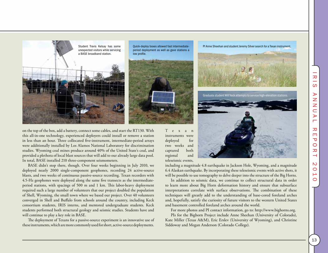
on the top of the box, add a battery, connect some cables, and start the RT130. With this all-in-one technology, experienced deployers could install or remove a station in less than an hour. Three collocated five-instrument, intermediate-period arrays were additionally installed by Los Alamos National Laboratory for discrimination studies. Wyoming coal mines produce around 40% of the United State’s coal, and provided a plethora of local blast sources that will add to our already large data pool. In total, BASE installed 210 three-component seismometers.
BASE didn’t stop there, though. Over four weeks beginning in July 2010, we deployed nearly 2000 single-component geophones, recording 24 active-source blasts, and two weeks of continuous passive-source recording. Texan recorders with 4.5-Hz geophones were deployed along the same five transects as the intermediate-period stations, with spacings of 500 m and 1 km. This labor-heavy deployment required such a large number of volunteers that our project doubled the population of Shell, Wyoming, the small town where we based our project. Over 40 volunteers converged in Shell and Buffalo from schools around the country, including Keck consortium students, IRIS interns, and mentored undergraduate students. Keck students performed both structural geology and seismic studies. Students have and will continue to play a key role in BASE.
The deployment of Texans for a passive-source experiment is an innovative use of these instruments, which are more commonly used for short, active-source deployments.
T e x a n instruments were deployed for two weeks and captured both regional and teleseismic events, including a magnitude 4.8 earthquake in Jackson Hole, Wyoming, and a magnitude 6.4 Alaskan earthquake. By incorporating these teleseismic events with active shots, it will be possible to use tomography to delve deeper into the structure of the Big Horns.
In addition to seismic data, we continue to collect structural data in order to learn more about Big Horn deformation history and ensure that subsurface interpretations correlate with surface observations. The combination of these techniques will greatly add to the understanding of base-cored foreland arches and, hopefully, satisfy the curiosity of future visitors to the western United States and basement controlled foreland arches around the world.
For more photos and PI contact information, go to: http://www.bighorns.org.PIs for the Bighorn Project include Anne Sheehan (University of Colorado),
Kate Miller (Texas A&M), Eric Erslev (University of Wyoming), and Christine Siddoway and Megan Anderson (Colorado College).
Graduate student Will Yeck attempts to service high-elevation stations.
Student Travis Kelsay has some unexpected visitors while servicing a BASE broadband station.
Quick-deploy boxes allowed fast intermediate-period deployment as well as gave stations a low profile.
PI Anne Sheehan and student Jeremy Silver search for a Texan instrument.

14
DMSStanding CommitteeKeith Koper (Chair) Saint Louis UniversityHarley Benz US Geological Survey, DenverElizabeth Cochran University of California, RiversideMatt Fouch Arizona State UniversityMike Ritzwoller University of Colorado, BoulderCatherine Snelson National Center for Nuclear SecurityBill Walter Lawrence Livermore National Laboratory Dayanthie Weeraratne California State University, Northridge
IRIS ManagementTim AhernChad Trabant
DMS Core ServicesThe heart of the Data Management System (DMS) is the Data Management Center (DMC) located near the University of Washington in Seattle. The DMC has evolved into the largest seismological data center of its kind in the world. Central to the DMC is the large archive of waveform data. Figure 1 shows the locations of all stations that have contributed data to the IRIS DMC. The DMC archive includes data from 127 permanent networks and, perhaps more impressively, 288 temporary experiments from programs such as PASSCAL (USA), SEIS-UK (United Kingdom), SEISMOB-FR (France), as well as the Ocean Bottom Seismometer Instrumentation Program OBSIP (USA). As of July 1, 2010, the DMC managed approximately 120 TB of waveform data (Figure 2) and it was growing at about 20 TB per year.
Unlike many scientific data centers, a large international community actively uses the IRIS DMC. In fact, 4.5 times more data are distributed each year than new data received from operating networks. In 2010, the DMC shipped more than 90 TB of data to data requestors (Figure 3).
Regional Exchange of Earthquake Data (REED)For the past three years, the DMS has been developing the REED project. This project focuses on helping seismic networks acquire the capability to transmit data in real time to neighboring countries and to international data centers such as the DMC. Generally, the REED project supports networks’ acquisition of telemetry equipment or, in some cases, the small costs of data telemetry. During the 2010 fiscal year, the REED project supported data exchange from the Tajik
180�
180�
240�
240�
300�
300�
0�
0�
60�
60�
120�
120�
180�
180�
GSN + FDSN (202 stations)USArray TA + RefNet (2,217 stations)
IRIS DMC Data Holdings by Station Network A�liation
PASSCAL (5,879 stations) Other (4,095 stations)
August 2010
M7.6 2009-09-30 10:16:17 UTC, southern Sumatra, IndonesiaIU ANMO: recorded (blue) and Princeton 3D synthetic (red).
Figure 1. This map shows all of the stations that have contributed data to the IRIS DMC in SEED format and covers the time range 1970 until present. The color coding is green for USArray stations, yellow for PASSCAL stations, red for GSN and FDSN stations, and blue for all other stations. There are a total of 14,000 stations that have data at the DMC.

IRIS
A
NN
UA
L
RE
PO
RT
2
01
0
15
National Seismic Network (TJ), the Kazakh National Network (KZ), and the new Kyrgyz National Network (KR). The next focus area for the REED project is in the Southwest Pacific as island nations in that region are interested in data sharing and data management, usually through the DMC. Interested groups include Vanuatu, New Caledonia, and Tonga, and some data exchange has already started. The REED project helps make valuable data available to the seismological research community.
Products and ServicesThe DMC now offers higher-order data products that complement the raw time-series data traditionally managed by it. These data products are either submitted by the community to the DMC or generated at the DMC. The nomenclature for data products includes: Level 0 – raw waveforms, Level 1 – quality assured data, Level 2 – derived information (noncontroversial processing), Level 3 –seismological research products, and Level 4 – integrated research products. While Level 0 and 1 products have been the traditional output of the DMC, Levels 2–4 are new. Level 2 products include such things as Ground Motion Visualizations, event plots (a suite of figures automatically generated following all M6.0+ events, including phase-aligned record sections, global body wave envelope stacks, and regional-scale vespagrams) receiver functions from the University of South Carolina-developed EARS (EarthScope Automated Receiver Survey) system, calibration information for GSN stations,
USArray magnetotelluric transfer functions, USArray phase picks, global CMTs, and SAFOD spectrograms. Level 3 products include tomographic models with visualization capability and synthetic seismograms computed as part of Jeroen Tromp’s research efforts at Princeton University (see pages 16–17). The DMC developed a system to manage these various products. The Searchable ProdUct Depository (SPUD) is the DMC’s answer to product management and discovery. SPUD can be accessed at http://www.iris.edu/spud. These higher-level products are expected to become available in 2011, but much of the groundwork has been done this year. As the type and number of products continue to grow at the DMC, we believe SPUD will become a valuable resource that will enable research within the Earth science community.
The DMC has also been actively working on the development of a variety of web services, including data access services that will allow programmatic access to waveforms, metadata about the waveforms, as well as event information from USGS and ISC catalogs. The DMC is also developing processing services that will enable users to preprocess waveforms through digital signal processing techniques such as filtering, instrument correction, and rotation of components. More information about these web services can be found at http://www.iris.edu/ws. While these services are intended to be accessed by client applications, for small requests they can be accessed through a web browser.
Figure 2. The DMC archive. The archive grew to just under 120 TB by the end of June 2010. The contributions are from the bottom to the top: (1) GSN, (2) FDSN, (3) JSP, (4) miscellaneous networks, (5) US regional networks, (6) engineering Networks, (7) PASSCAL and other temporary networks, and (8) EarthScope. The largest data contributors are US regional networks funded primarily by the USGS.
Figure 3. Volume of data shipped from the DMC. The DMC shipped roughly 90 TB of waveform data in 2010 to thousands of seismologists worldwide. Fifty TB were sent via traditional request mechanisms such as NetDC and BreqFast, 30 TB were sent using SeedLink real-time feeds, and roughly 10 TB were sent using the Data Handling Interface (DHI) and through web services.
0
10,000
20,000
30,000
40,000
50,000
60,000
70,000
80,000
90,000
100,000
2001 2002 2003 2004 2005 2006 2007 2008 2009 2010 (projected)
gigabytes
DMC Shipments by Request Type
DHI-‐Archive
DHI-‐IRISDC
DHI-‐POND
DHI-‐BUD
Wiggles
SeedLink
LISS
AutoDRM
Archive
As of January 1, 2011

16
Synthetic Seismograms for Global CMT EarthquakesJeroen Tromp, Princeton University, Department of Geosciences and Program in Applied & Computational Mathematics
Prompted by a notification from the Global Centroid Moment Tensor
Project (globalCMT.org; Dziewoński et al., 1981), Princeton University now routinely calculates normal-mode synthetic seismograms for the Preliminary Reference Earth Model (PREM; Dziewoński and Anderson, 1981) and spectral-element synthetic seismograms for 3D mantle model S362ANI (Kustowski et al., 2008), in combination with crustal model Crust2.0 (Bassin et al., 2000). One- and three-dimensional synthetics for more than 1800 seismographic stations operated by members of the International Federation of Digital Seismograph Networks (FDSN) are provided via the Internet (http://global.shakemovie.princeton.edu; Tromp et al., 2010) and will soon also be available via the IRIS DMC. The record length is 100 minutes for earthquakes with magnitudes less than 7.5, such that the first-arriving Love and Rayleigh waves are included at all epicentral distances. For earthquakes with magnitudes of 7.5 and greater, the record length is 200 minutes, thereby incorporating one complete surface-wave orbit at all epicentral distances. The synthetic seismogram data base currently contains more than 1000 events.
For PREM, the system calculates normal-mode synthetics accurate at periods of 8 s and longer (e.g., Gilbert, 1971; Dahlen and Tromp, 1998). Three-dimensional synthetics for mantle model S362ANI in combination with Crust2.0 are calculated
based on a spectral-element method (SEM; Komatitsch and Vilotte, 1998; Komatitsch and Tromp, 1999, 2002a,b; Chaljub et al., 2003). SEM synthetics are accurate between periods from 17 s to 500 s. Simulations incorporate effects due to attenuation, rotation, and self-gravitation in the Cowling approximation. The spectral-element mesh honors all first- and second-order mantle discontinuities in 1D
Snapshot of a spectral-element simulation of the January 12, 2010, Mw = 7.1 Haiti earthquake. The near-real-time system produces animations of all earthquakes reported by the Global CMT Project. The animations show the velocity wavefield on Earth’s surface as a function of time. Red: upward motion; Blue: downward motion.
17
IRIS
A
NN
UA
L
RE
PO
RT
2
01
0
reference model STW105 (Kustowski et al., 2008). Ellipticity is accommodated by transforming all first- and second-order discontinuities in the 1D reference model into ellipsoids. Surface topography and bathymetry are incorporated in the mesh using model ETOPO1 (Amante and Eakins, 2009), which has a resolution of one arc minute.
Lateral variations in crustal thickness are provided by model Crust2.0 (Bassin et al., 2000), a 2° × 2° block model that is smoothed with a 1° Gaussian cap. The crust of the 1D reference model is removed and replaced by mantle, which is subsequently overprinted by Crust2.0. Sedimentary layers in Crust.2.0 are incorporated if sediment thickness is 2 km or greater. The spectral-element mesh honors the Moho if crustal thickness is less than 15 km (oceans) or greater than 35 km (continents). In transition regions, the Moho runs across the mesh and is captured by the numerical integrations points, as in a finite-difference method.
In addition to synthetic seismograms, the system produces a number of earthquake animations, as well as various record sections comparing simulated and observed seismograms. The duration of the animation scales linearly with the size of the earthquake. The movies show the velocity wavefield on Earth’s surface as a function of time, as illustrated by the snapshot shown in Figure 1 for the January 12, 2010, Haiti earthquake.
Time permitting, the system will be used to analyze past earthquakes. The CMT catalog contains tens of thousands of entries, and any available spare compute cycles will be used for the analysis of past events, such that, ultimately, 1D and 3D synthetics for all earthquakes in the CMT catalog will be available. When the Global Centroid Moment Tensor Project “upgrades” to a new 3D model, so will the near-real-time system. Soon synthetics will also be available from the IRIS DMC via the same request and access mechanisms as recorded data.
References
Amante, C., and B. Eakins (2009). ETOPO1 1 Arc-minute global relief model: Procedures, data sources and analysis. NOAA technical report.
Bassin, C., G. Laske, and G. Masters (2000). The current limits of resolution for surface wave tomography in North America. in EOS Trans. Am. Geophys. Union, F897, 81.
Chaljub, E., Y. Capdeville, and J.P. Vilotte (2003). Solving elastodynamics in a fluid-solid heterogeneous sphere: A parallel spectral-element approximation on non-conforming grids. J. Comp. Phys., 187(2), 457–491.
Dahlen, F. A., and J. Tromp (1998). Theoretical Global Seismology. Princeton U. Press, New Jersey, USA.
Dziewoński, A., and D. Anderson (198). Preliminary reference Earth model. Phys. Earth Planet. Inter., 25, 297–356.
Dziewoński, A., T.-A. Chou, and J.H. Woodhouse (1981). Determination of earthquake source parameters from waveform data for studies of global and regional seismicity. J. Geophys. Res., 86(B4), 2825–2852.
Gilbert, F. (1971). Excitation of normal modes of the Earth by earthquake sources. Geophys. J. R. Astron. Soc., 22, 223–226.
Komatitsch, D., and J. Tromp (1999). Introduction to the spectral element method for three-dimensional seismic wave propagation. Geophys. J. Int., 139, 806–822.
Komatitsch, D., and J. Tromp (2002a). Spectral-element simulations of global seismic wave propagation—I. Validation, Geophys. J. Int., 149, 390–412.
Komatitsch, D., and J. Tromp (2002b). Spectral-element simulations of global seismic wave propagation—II. Three-dimensional models, oceans, rotation and self-gravitation. Geophys. J. Int., 150, 308–318.
Komatitsch, D., and J.-P. Vilotte (1998). The spectral element method: An efficient tool to simulate the seismic response of 2D and 3D geological structures. Bull. Seismol. Soc. Am., 88, 368–392.
Kustowski, B., G. Ekström, and A.M. Dziewoński (2008). Anisotropic shear-wave velocity structure of the Earth’s mantle: A global model. J. Geophys. Res., 113, B06306, doi:10.1029/2007JB005169.
Tromp, J., D. Komatitsch, V. Hjörleifsdóttír, Q Liu, H. Zhu, D. Peter, E. Bozdag, D. McRitchie, P. Friberg, C. Trabant, and A. Hutko (2010). Near real-time simulations of global CMT earthquakes. Geophys. J. Int., 183, 381–389.

18
E&OStanding CommitteeGlenn Kroeger (Chair) Trinity UniversityBob Butler University of PortlandMaggie Benoit The College of New JerseyKaz Fujita Michigan State UniversityJuan Lorenzo Louisiana State UniversityGary Pavlis Indiana UniversityWayne Pennington Michigan Technological UniversitySuzan van der Lee Northwestern UniversityChrista von Hillebrandt University of Puerto Rico
IRIS ManagementJohn Taber
The IRIS Education and Outreach (E&O) program is committed to advancing awareness and understanding of seismology and Earth science while inspiring careers in geophysics. The E&O
program develops and disseminates a suite of educational activities designed to have an impact on 5th grade students to adults in a variety of settings, ranging from self-exploration in front of one’s own computer, to the excitement of an interactive museum exhibit, to a major public lecture, or to in-depth exploration of Earth’s interior in a formal classroom.
In the past year, the efforts of the E&O program have focused primarily on expanding the impact of existing activities. A major new addition is the production of Teachable Moment (TM) presentations following major earthquakes. TM presentations, produced in collaboration with the University of Portland, are generally posted to the IRIS web site within 24 hours of the event. Each presentation is formatted in a way that allows a middle school through college educator to tailor the materials to their particular audience and time frame. Common elements include USGS earthquake and volcano information, plate tectonic and regional tectonic maps and summaries, custom-generated computer animations, seismograms, photos, speaker notes, and other event-specific information, some of which is contributed by IRIS consortium members.
Our summer internship program (14 students in 2010) continues to thrive via a Research Experiences for Undergraduates grant from NSF and through positions funded by IRIS community research programs (see pages 20–21). IRIS is a partner with UNAVCO’s RESESS program that is designed to provide multiyear research experiences for students from underrepresented groups, with some students joining the IRIS student cohort in their final year. IRIS interns began the summer with a one-week orientation hosted by New Mexico Tech and then spent the rest of the
Simple animations help teachers and college faculty convey complex topics.
Seismogram of the destructive magnitude 7 Haiti earthquake on January 12, 2010 as recorded on an AS1 educational seismograph, station CHCA, at Calavera Middle School, Carlsbad, CA. The earthquake focused global attention on the need to provide seismic hazards education.
Using a hammer seismograph at the Intern orientation.

IRIS
A
NN
UA
L
RE
PO
RT
2
01
0
19
summer engaged in research at 12 different IRIS institutions, where they kept in touch with each other via Internet blogs and discussion boards. Of the 99 students who have participated in the program since 1998, over 85% of those who have completed their undergraduate degree have gone on to graduate school in the geosciences, often at school where they did their internship.
The E&O web pages are the primary means of dissemination of information and resources and we continue to add new material, with an emphasis on animations and short instructional videos. A significant increase in the number of visitors to the site has been achieved by examining all of the delivery venues for educational content, followed by revisions and reorganizations across the web site, increased use of social networking sites, and encouraging other groups to link to our materials. Our newest poster featuring wave propagation across the USArray Transportable Array is also linked to a new student-centered web entry point.
Millions of people have interacted with IRIS/USGS museum displays, many of them at the American Museum of Natural History in New York and the Smithsonian Institution National Museum of Natural History in Washington, DC. However, a growing number of people explore seismological concepts through our newest display, the Active Earth Display (AED). The AED is a smaller, more flexible version of the museum display, and is now in use at universities and visitor centers throughout the United States. Served via a web browser, the display is customizable and the software is available to anyone who applies via the IRIS E&O web pages.
Touch screens provide an interactive experience and new content continues to be developed, including a new set of pages focusing on the Basin and Range region. Another program aimed at general audiences is the IRIS/SSA Distinguished Lecture Series, where two speakers are selected each year from a pool of nominees generated from the IRIS community. These lectures reach a broad sector of the public through venues that often have a well-established lecture series.
The E&O program provides professional development experiences designed to support the needs of formal educators. For example, a 2.5-day workshop is held in collaboration with Penn State and North Carolina A&T as part of the AfricaArray project. In addition, a series of short workshops are held each year as part of the National Science Teachers Association annual meeting and a 2.5-day operators workshop is offered to teachers who use AS1 seismographs in their classroom. More than 170 such seismographs have been distributed by IRIS E&O to schools around the United States, and over 375 users of educational seismographs from 42 states and 16 countries have at some time registered their station in the IRIS Seismographs in Schools database. The Seismographs in Schools web site helps teachers make use of seismic data and communicate with the growing global community of educational seismograph users.
Left: Teachers conduct an experiment modeling the recurrence behavior of earthquakes.
Images at right: Educational seismographs have been provided to schools throughout the United States, where they often attract the attention of the community. The web interface allows educational stations and networks throughout the world to share data and ideas.
Clas
sroo
m p
hoto
cou
rtes
y of
Tim
es-N
ews,
Tw
in F
alls
.
20
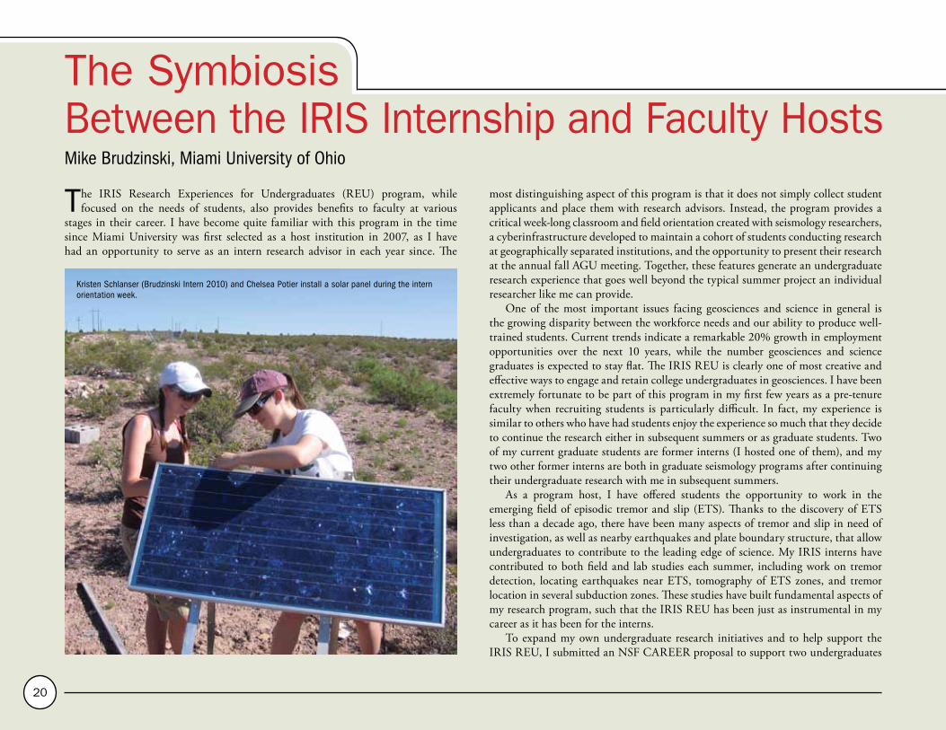
The Symbiosis Between the IRIS Internship and Faculty HostsMike Brudzinski, Miami University of Ohio
The IRIS Research Experiences for Undergraduates (REU) program, while focused on the needs of students, also provides benefits to faculty at various
stages in their career. I have become quite familiar with this program in the time since Miami University was first selected as a host institution in 2007, as I have had an opportunity to serve as an intern research advisor in each year since. The
most distinguishing aspect of this program is that it does not simply collect student applicants and place them with research advisors. Instead, the program provides a critical week-long classroom and field orientation created with seismology researchers, a cyberinfrastructure developed to maintain a cohort of students conducting research at geographically separated institutions, and the opportunity to present their research at the annual fall AGU meeting. Together, these features generate an undergraduate research experience that goes well beyond the typical summer project an individual researcher like me can provide.
One of the most important issues facing geosciences and science in general is the growing disparity between the workforce needs and our ability to produce well-trained students. Current trends indicate a remarkable 20% growth in employment opportunities over the next 10 years, while the number geosciences and science graduates is expected to stay flat. The IRIS REU is clearly one of most creative and effective ways to engage and retain college undergraduates in geosciences. I have been extremely fortunate to be part of this program in my first few years as a pre-tenure faculty when recruiting students is particularly difficult. In fact, my experience is similar to others who have had students enjoy the experience so much that they decide to continue the research either in subsequent summers or as graduate students. Two of my current graduate students are former interns (I hosted one of them), and my two other former interns are both in graduate seismology programs after continuing their undergraduate research with me in subsequent summers.
As a program host, I have offered students the opportunity to work in the emerging field of episodic tremor and slip (ETS). Thanks to the discovery of ETS less than a decade ago, there have been many aspects of tremor and slip in need of investigation, as well as nearby earthquakes and plate boundary structure, that allow undergraduates to contribute to the leading edge of science. My IRIS interns have contributed to both field and lab studies each summer, including work on tremor detection, locating earthquakes near ETS, tomography of ETS zones, and tremor location in several subduction zones. These studies have built fundamental aspects of my research program, such that the IRIS REU has been just as instrumental in my career as it has been for the interns.
To expand my own undergraduate research initiatives and to help support the IRIS REU, I submitted an NSF CAREER proposal to support two undergraduates
Kristen Schlanser (Brudzinski Intern 2010) and Chelsea Potier install a solar panel during the intern orientation week.

IRIS
A
NN
UA
L
RE
PO
RT
2
01
0
21
The Symbiosis Between the IRIS Internship and Faculty Hosts annually, one selected from Miami University and one from the IRIS REU
applicant pool. Both students are integrated into the orientation, online discussions, subsequent AGU presentations, and overall structure of the IRIS REU. The IRIS REU–Miami University collaboration leverages the infrastructure developed to serve undergraduates through IRIS REU site funding as well as the in-kind contributions of the IRIS E&O staff to manage and staff the program, and senior scientists from within the IRIS community to provide instruction during the week–long orientation. The extra funding at Miami University ensures that the student cohort can grow to impact a larger set of undergraduates, and serves as a model for other research universities and institutions. This past summer marked the first year of implementing this approach, and I’m happy to report that both students successfully presented new observations of tremor in Mexico and Alaska at the fall AGU meeting while enjoying the camaraderie of their fellow interns.
Above: IRIS Interns set off to make connections between the macroscale processes being studied in the classroom and the local- and regional-scale geology visible from the peaks along the Rio Grande Rift.
Right: New Mexico Tech faculty lead a field trip to the Socorro Fault.
Mike Brudzinski with grad students Hector Hinojosa-Prieto and Devin Boyarko and summer intern Stefany Sit (now a grad student with Brudzinski) taking a break from Cascadia Subduction Zone field work to pose for pictures at Crater Lake.

22
USArray Advisory CommitteeMatt Fouch (Chair) Arizona State UniversityLarry Brown Cornell UniversityKarl Karlstrom University of New MexicoCharles Langston The University of MemphisMaureen Long Yale UniversityGuy Masters University of California, San DiegoDavid Snyder Geological Survey of CanadaJoann Stock CaltechRob van der Hilst Massachusetts Institute of TechnologyChester Weiss Virginia Tech
IRIS ManagementBob BusbyKatrin HafnerBob Woodward
USArray, the seismic and magnetotelluric component of EarthScope (http://www.earthscope.org), continued to make significant progress in the past year. At the
end of June 2010, the Transportable Array had commissioned about 950 seismic stations, more than half the stations planned for the contiguous United States, and was operating in a region extending from North Dakota south to Texas. Approximately 500 locations had been vacated. The legacy of the Transportable Array also expanded with the adoption of about 10 additional stations, bringing the total to more than 40 transfers through the NSF-approved "Adopt A Station" program. Field crews continued to work at full operational levels, constructing, installing, and removing about 18 stations each month. With additional funding from the National Science Foundation, the Transportable Array also returned to Cascadia in FY2010. A total of 27 Transportable Array stations were deployed that will operate for five years and will complement other geophysical instruments being installed both onshore and offshore.
Several enhancements were introduced to the Transportable Array station design, including a package of basic environmental monitoring sensors and a vault interface enclosure that provides power regulation, protection for electronics, and uniform cable connectors. Station reliability and data quality have remained high as the array moves into different geologic regions. Transportable Array construction and data collection and distribution from the network depends on a wide range of dedicated personnel from IRIS as well as from Honeywell Technology Solutions Inc., Coastal Technologies, the Transportable Array Coordinating Office (at New Mexico Tech), the
Array Operations Facility (at New Mexico Tech), the Array Network Facility (at the University of California, San Diego) and the IRIS Data Management Center.
Demand for USArray data by scientists from the United States and throughout the world has grown considerably. All USArray data, as well as PBO and SAFOD seismic data, are archived at the IRIS Data Management Center and are freely available to scientists and the public via the Internet. Nearly 27 TB of EarthScope data have been archived to date, and about 8.5 TB of data have been shipped in the past year.
The Transportable Array Student Siting Program continues to be a successful way to engage students in EarthScope. This summer, student teams identified about 130 sites for future stations on the eastern side of the Mississippi River. Since 2005, about 970 Transportable Array sites in 26 states have been identified by approximately 100 students from more than 35 universities. USArray also conducted a data processing short course for 22 advanced graduate students. Hosted by Northwestern University, the week-long course delved into the history, intricacies, and current practices for seismic data processing and examined the handling of large volumes of data from USArray stations.
The Siting Outreach component of USArray facilitates siting of USArray stations and works with numerous state and local organizations to raise awareness of EarthScope and USArray. For instance, many universities participating in the Student Siting Program have issued a news release about their role in EarthScope. In the past year, this has generated nearly two dozen stories in local newspapers and on local and regional television programs. In April, the project was featured in a USA Today
Station B27A in Glenburn, North Dakota, was the 812th Transportable Array station commissioned. The station was installed in September 2009. This marks the half-way point of the Transportable Array in the contiguous United States.
A vertical component recording of the M7.2 El Mayor-Cucapah earthquake that struck northern Baja California, Mexico, on April 4, 2010. This seismogram was recorded by USArray Transportable Array station Q28A in Sharon Springs, Kansas. At the time of the earthquake, this station was located roughly in the middle of the Transportable Array's rolling 400 station footprint. The seismogram shows an unfiltered long-period recording 1,800 seconds long.

IRIS
A
NN
UA
L
RE
PO
RT
2
01
0
23
article. Other outreach activities and products include the development of regional content sets for the Active Earth Display in partnership with EarthScope and UNAVCO, the creation of wave visualization movies, and a publication for landowners issued twice per year.
The Flexible Array, consisting of about 326 broadband, 140 short-period, and 1700 active-source instruments, continued to be fully utilized by principal investigators to conduct high-resolution studies that address EarthScope’s scientific goals. At the end of June, there were more than 500 Flexible Array stations in the field actively recording data for six experiments. This spring, the Bighorns teams used the Flexible Array's new integrated enclosures for the deployment of 170 short-period instruments, enabling them to install as many as 14 stations in a day. These “quick-deploy” enclosures, used for both shipping and deployment, contain an entire short-period station within a single box. For deployment, the seismometer is moved outside the box and buried. The enclosures were based on a design developed by the IRIS Polar Operations team and were fabricated by the Array Operations Facility.
These "quick-deploy" boxes are expected to be heavily used in future Flexible Array experiments.
The seven stations comprising the permanent magnetotelluric (MT) observatory were equipped with telemetry systems that send raw data in near-real time to the MT facility at Oregon State University. MT systems measure the natural electric and magnetic fields at Earth’s surface that are caused by electromagnetic waves radiated from the sun and from distant electrical storms. These observations constrain the electrical conductivity of Earth’s lithosphere and asthenosphere, and provide an excellent complement to the seismic tomography of the structure beneath North America. During the 2009 summer field season, crews placed the 20 campaign MT instruments in more than 50 locations across Montana and Wyoming. Sites were located on a 70-km × 70-km grid and were occupied for two to three weeks before being moved to the next site. More than 220 temporary sites have been occupied during the past four summers. The 2010 field campaign has already begun and will cover northern California, Nevada, and Utah.
A student team installs a transportable magnetotellurics system in the shadows of the Grand Tetons during the 2009 summer field season.
The first Bighorns short period station was installed in April 2010 using a "quick-deploy" box. These boxes greatly reduced the time needed to deploy a station.
Transportable ArrayReference NetworkFlexible ArrayMagnetotelluricTA Legacy Stations

24
Imaging Lithospheric Structure in the Western United States Using S Receiver Functions Meghan S. Miller, University of Southern California • Alan Levander, Rice University
A fundamental concept of plate tectonics is the presence on Earth of a strong, largely coherent outer layer, the lithosphere, moving over a weaker layer, the
asthenosphere. The lithosphere forms the outer chemical, mechanical, and thermal boundary layer(s) of the convecting mantle. Both the thickness of the lithosphere and how the lithosphere is modified over time by tectonic processes are under widespread investigation. To address the debate over the lithosphere-asthenosphere boundary’s (LAB’s) existence and true definition, this study used signals from distant earthquakes, as recorded by the USArray Transportable Array, to create images of the LAB.
The western United States is divided into a small number of physiographic provinces (Basin and Range, Cascadia, Sierra Nevada, Colorado Plateau, and the Rocky Mountains), and each of them owes at least their most recent structure to Mesozoic-Cenozoic interactions of the Farallon, Pacific, and North American plates. However, significant deformation of these provinces has resulted from processes that deviate greatly from simple models of plate interactions. The late Cenozoic history of the western United States was shaped by the transition to transform motion (plates sliding past one another) following the northward migrating Mendocino Triple Junction and the subduction of the young Gorda and Juan de Fuca plates to the north. Southern California and the Basin and Range have experienced various degrees of extension as a result of orogenic collapse and the transition of the plate boundary from convergence to transform motion. Deformation and volcanism still occur at great distances from the plate boundary, through the Basin and Range, around the edges of the Colorado Plateau, and in the Rocky Mountains.
We produced common conversion point (CCP) S receiver function image volumes of the lithosphere beneath the western United States using teleseismic data recorded by the USArray Transportable Array. The S receiver functions were made from 57 earthquakes at 55° < ∆ < 85°; the data were recorded at 556 stations from 2005 to 2009. S receiver functions are well suited to the study of the LAB, more so than conventional P-receiver functions (PRFs), because the latter often suffer from strong crustal multiple reflections following the P arrival. The use of S receiver functions
alleviates concerns about crustal reverberations and allows for interpretation of boundaries in the depth range expected for the bottom of the lithosphere.
The receiver function image volumes are bounded by the Pacific coast to the west, by the longitude of central Colorado to the east, and by the Canadian and Mexican borders to the north and south, respectively. The large area allows us to investigate the
235˚
-120˚
240˚
-115˚
245˚
-110˚
250˚
-105˚
255˚
-100˚
260˚
30˚ 30˚
35˚ 35˚
40˚ 40˚
45˚ 45˚
50˚ 50˚
-10000-9000-8000-7000-6000-5000-4000-3000-2000-1000
010002000300040005000600070008000
Elevation (m)
-125o
235˚ 240˚ 245˚ 250˚ 255˚ 260˚
30˚ 30˚
35˚ 35˚
40˚ 40˚
45˚ 45˚
50˚ 50˚
Transportable Array stations (red triangles) used to study lithospheric structure in the western United States. The dark black lines outline the major physiographic provinces.

IRIS
A
NN
UA
L
RE
PO
RT
2
01
0
25
structure of a variety of tectonic provinces influenced by Farallon plate subduction and its aftermath. The stacked receiver function volumes clearly image the Moho (the discontinuity between the crust and upper mantle) as a positive amplitude (red-orange) signal, where the S wave converts to P at the crust-mantle high-to-low velocity discontinuity. We interpret the LAB as the negative (blue) signal, where the S-to-P wave conversion occurs at this high-to-low seismic velocity discontinuity. The Moho forms a nearly continuous surface, between ~22–52 km, under most of the western United States, except in the coastal regions and areas experiencing convective removal of the lowermost crust and upper mantle. In contrast, the LAB has significant depth variation (~45–150 km) and cannot be described as a single continuous surface.
As the volume we are imaging is large, it is useful to create cross sections
through a few areas of interest. We interpret areas of bright negative amplitudes as regions of partial melt in the asthenosphere. We see a strong correlation between analyses of primitive basalt whole rock samples (Lee et al., 2009; NAVDAT database: http://www.navdat.org) and our LAB depths beneath the southern Basin and Range, Colorado Plateau, Cascadia, and the Snake River Plain. The depth estimates from the geochemistry data provide an independent estimate on LAB depth that compares well with our receiver function estimates.
References
Lee, C.-T.A., P. Luffi , T. Plank, H. Dalton, and W.P. Leeman (2009). Constraints on the depths and temperatures of basaltic magma generation on Earth and other terrestrial planets using new thermobarometers for mafic magmas. EPSL, 279, 20–33.
Map of the western United States showing the location of three profiles through the stacked receiver functions. Rock samples taken at the locations indicated by the green symbols on the map provide additional, independent estimates of LAB depth (as indicated by the blue symbols on the profiles on the right).
48°46°
36°34°
-108°
-116°
-112°
32°
Moho
LAB
0
50
100
km
44°
38°
42°40°
-120°
-124°
Receiver function volume beneath the western United States. The warm (red-orange) colors show positive signals indicative of wave conversion at the crust-mantle (Moho) boundary. The cool (green-blue) colors show negative signals indicative of wave conversion at the LAB. The Moho forms a nearly continuous boundary at depths of ~22–52 km. In contrast, the LAB varies in depth from ~45–150 km and is intermittent.
location of basaltwhole rock samples
Cascade volcanoes
48
44
40
36
32
-124 -120 -116 -112 -108
AA
A’
BB’
C
C’
0
50
100
km
48°
36°
32°
44°
40° -118°
-114°
-122°
-110°
0
100
km
-110°-120°-115°
0
50
100
km
-110°-118° -116°-120°-122°-114°
A-A’
B-B’
C-C’

26
Polar Operations
Polar Networks Science Committee (joint with UNAVCO)Doug Wiens (Chair) Washington UniversitySridhar Anandakrishnan Pennsylvania State UniversityMeredith Nettles Lamont-Doherty Earth Obsv. of Columbia UniversityMark Fahnestock University of New HampshireCarol Raymond Jet Propulsion LaboratoryMike Ritzwoller University of ColoradoLeigh Stearns University of KansasTerry Wilson Ohio State University
IRIS has long recognized the extra effort and specialized equipment required to field temporary and permanent seismic experiments successfully in the Arctic and
Antarctic, and continues to develop and expand its capabilities in the world’s coldest regions through the Polar Operations Group (POG). Through support of permanent observatories (GSN) in the polar regions for the past 20 years and the buildup of portable polar instrument support (PASSCAL) over the same time frame, the POG brings together the technical and managerial expertise required for these unique environments. The result is a vast improvement in IRIS facility capabilities, allowing the seismological community to record high-fidelity, robust data sets from these extreme environments. The POG consists of a pan-IRIS management team, with the primary implementation of engineering and fieldwork accomplished by PASSCAL Polar Support Services (PSS) at the PASSCAL Instrument Center. The new capabilities IRIS has developed provide the ability to study, with high resolution, seismological phenomena associated with the delicate polar regions, allowing further understanding of bi-polar climate-related seismological phenomena as well as improving constraints on shallow and deep structure in these sparsely covered areas of Earth.
During 2010, the POG staff supported 19 PI-lead projects in the polar regions (more details are provided in the PASSCAL section of this report). In addition to supporting individual PI work, the POG is tasked with installing and operating a permanent network in Greenland, with the joint goals of monitoring glaciogenic and tectonic seismicity and improving knowledge of seismic structure beneath the ice sheet. At the request of the community, IRIS has been asked to establish
and operate the Greenland Ice Sheet Monitoring Network (GLISN; http://www.iris.edu/hq/programs/glisn). This past year, the POG worked with international partners to install seven stations in Greenland (Thule, Narsarsuaq, Nuuk, Tasiilaq, Ittoqoortoormiit, Daneborg, and Station Nord), and our Swiss colleagues installed a station in Nuugaatsiaq. With contributions from all our international partners, there are now 27 stations on and around Greenland contributing data to the IRIS DMC under the _GLISN virtual network.
While the POG has enhanced the IRIS facility for polar-related work, we continue to coordinate and take guidance from the seismological community on their scientific requirements for these new capabilities. The polar community is represented through two advisory committees: (1) the Polar Network Science Committee (reporting to both the IRIS and UNAVCO Boards of Directors), and (2) the GLISN Science Advisory Committee. The POG also interacts with the GSN and PASSCAL standing committees and provides status reports to the IRIS Board of Directors.
The emphasis on supporting climate research has created a new need for seismic instrumentation that can work in cold regions, and function in the wet environments found in the ablation zone of Earth’s polar regions. In addition, work on rapidly moving ice requires equipment to operate in highly tilting environments. Developments to address these requirements are underway and will continue in the coming years. Complementing our wet-system development, we continue to update and refine our designs for enclosures, power systems, and real-time telecommunications.
Fishtail Point, Antarctica (Photo by Gut Tytgat, PIC)
Seismogram from a glacial earthquake in Greenland as recorded by the new GLISN station at Nuuk (Station NUUK located in the capital of Greenland).
POLENET station at Lone Wolf, Antarctica. (Photo by Gut Tytgat, PIC)
IRIS ManagementKent Anderson

IRIS
A
NN
UA
L
RE
PO
RT
2
01
0
27
International Development Seismology
IDS CommitteeAnne Meltzer (Chair) Lehigh UniversitySusan Beck (Board Liaison) University of ArizonaSergio Barrientos Universidad de ChileNoel Barstow PASSCAL Instrument CenterKaren Fischer Brown UniversityArt Lerner-Lam Lamont-Doherty Earth Obsv. of Columbia Univ.Andy Nyblade Pennsylvania State UniversityEric Sandvol University of MissouriNiyazi Türkelli Kandilli Observ., Bogazici Univ., Turkey
International Development Seismology (IDS) constitutes an interface between the IRIS NSF-sponsored scientific mission and the need to ensure that scientific progress
enables socially important outcomes. This effort responds to the recognized importance of developing the partnerships, technical infrastructure, and human capacity required for effective international cooperation as an instrument to accelerate scientific progress through collaboration with technologically equal partners, and as an essential element of various other modes of US foreign engagement, including foreign assistance and science diplomacy. NSF-sponsored IDS activities serve as seeding efforts or pilot projects targeted toward achieving two synergistic goals: to aggressively promote strategies that support fundamental research and exploration through wide and reliable geographic coverage, and to contribute to reducing global population exposure to seismic hazards through broad education of scientific and technical principles that have an impact on societal resilience through increased awareness, preparedness, and accountability.
IDS initiated activities in September 2009. Through June 2010, these activities have included exploratory meetings, collaborative projects, and multidisciplinary activities in response to destructive earthquakes. One of these activities was a joint meeting of the Centro Regional de Sismología para América del Sur (CERESIS) and the IRIS IDS Committee in Lima, Peru. The outstanding finding was the remarkable heterogeneity of conditions for conducting geophysical research, as well as earthquake monitoring and preparedness, among individual countries in South America, suggesting that effective seismological development in the region requires strategies tailored to these unique national conditions.
The devastating earthquakes in Haiti and in Chile in 2010 dramatically highlighted the significance of socially responsible scientific foreign engagement. In light of the enormous post-earthquake challenges in Haiti, the US National Science and Technology Council’s Subcommittee on Disaster Reduction requested IRIS assistance in convening an international, multidisciplinary and cross-sector workshop to outline the role of science and engineering in reconstruction efforts. Another significant achievement was an agreement for free and open access to data from multinational deployments in response to the Chile earthquake. IDS contributed to this aftershock monitoring effort by securing supplemental support from the US Department of Defense Southern Command in the form of no-cost transportation of equipment, and assisting with in-field logistic arrangements during service runs.
The main focus of IDS is to support and facilitate activities of transitional nature between scientific progress, impact, and development. This requires the consolidation of resources derived from diverse stakeholders, and is consistent with current emphasis in scientific capacity as an integral component of economic development.
IRIS received support through the NSF RAPID funding mechanism to install a portable network of 60 stations in the aftershock zone of the Chile earthquakes and closely collaborated with Chilean, French, German, and British groups in coordinating site selection and data exchange. IDS Director Olga Cabello and George Slad during service run.
The workshop “Rebuilding for Resilience: How Science and Engineering Can Inform Haiti’s Reconstruction” was organized by IRIS IDS and cosponsored by the US Department of State, the US Agency for International Development, and the United Nations International Strategy for Disaster Reduction. It was held at the University of Miami on its Coral Gables, Florida, campus.
Recordings of two devastating earthquakes that occurred in 2010. The recordings were made at GSN station KMBO, Kilima Mbogo, Kenya. The top recording is from the February 27, 2010 M8.8 earthquake in Chile. The bottom recording is from the January 12, 2010 M7.0 earthquake in Haiti. Both earthquakes were located roughly 11,000 km from Kenya. The seismograms are unfiltered, 1.5 hours long, and are plotted on approximately the same amplitude scale—illustrating the dramatic difference in energy radiated from a M8.8 earthquake relative to a M7.0 quake. However, the smaller earthquake had a much greater human impact, due to the characteristics of man-made structures in the region of the epicenter.
IRIS ManagementOlga CabelloRay Willemann
28
Financial Overview
The Incorporated Research Institutions for Seismology (the IRIS Consortium) is a 501(c)(3) nonprofit consortium of research institutions
founded in 1984 to develop scientific facilities, distribute data, and promote research. IRIS is incorporated in the State of Delaware.
GSNThe Global Seismographic Network is operated in partnership with the USGS. Funding from NSF for the GSN supports the installation and upgrade of new stations, and the operation and maintenance of stations of the IDA Network at University of California, San Diego, and other stations not funded directly within the budget of the USGS. Operation and maintenance of USGS/GSN stations is funded directly through the USGS budget. Subawards include the University of California, San Diego, the University of California, Berkeley, the California Institute of Technology, Columbia University, and the USGS (Albuquerque Seismological Laboratory).
PASSCALFunding for PASSCAL is used to purchase new instruments, support the Instrument Center at the New Mexico Institute of Mining and Technology,
Budget and Finance SubcommitteeSteve Grand (Chair) University of Texas at AustinDon Forsyth Brown UniversityDoug Wiens Washington University in St. LouisRay Willemann IRISCandy Shin IRIS
Program Coordinating Committee (CoCOM)Jim Gaherty (Chair) Lamont-Doherty Earth Obsv. of Columbia UniversityRichard Allen University of California, BerkeleyMatt Fouch University of ArizonaKeith Koper Saint Louis UniversityXiodong Song University of Illinois, Urbana ChampaignGlenn Kroeger Trinity UniversityRobert Busby IRISRhett Butler IRISJames Fowler IRISCandy Shin IRISDavid Simpson IRISJohn Taber IRISRobert Woolley IRISBob Woodward IRISTimothy Ahern IRIS

IRIS
A
NN
UA
L
RE
PO
RT
2
01
0
29
train scientists to use the instruments, and provide technical support for instruments in the field. Subawards include the New Mexico Institute of Mining and Technology (New Mexico Tech), and University of Texas at El Paso.
DMSFunding for the Data Management System supports data collection, data archiving, data distribution, communication links, software development, data evaluation, and web interface systems. Major subawards include the University of Washington, the University of California, San Diego, Columbia University, and the Institute for Geophysical Research, Kazakstan.
Education and OutreachFunding for the Education and Outreach Program is used to support teacher and faculty workshops, undergraduate internships, the production of hardcopy, video and web-based educational materials, a distinguished lecturer series, educational seismographs, and the development of museum displays. Subawards are issued to IRIS institutions for software and classroom material development and support of educational seismology networks.
EarthScopeEarthScope awards include funding for USArray activities. Subawards include the University of California, San Diego, New Mexico Tech, Oregon State University, and other siting and partnership subawards. Contracts for USArray Transportable Array station construction and installation are to Honeywell and Coastal Technical Services.
Indirect ExpensesCosts include corporate administration and business staff salaries; audit, human resources and legal services; general headquarters and Seattle office expenses; insurance; and corporate travel costs.
Other ActivitiesOther activities include IRIS workshops, publications, and International Development Seismology.
A complete copy of IRIS’ financial statements and auditor’s reports are available from the IRIS business office by contacting [email protected].
2010 IRIS Budgets Core program budgets*(July 1, 2009-June 30, 2010)
FY2010 Augmentation Total
GSN 2,652,627 4,671,795 7,324,422PASSCAL 3,343,165 500,000 3,843,165DMS 3,157,954 3,157,954E&O 731,253 731,253Community Activities 474,207 474,207
Indirect Costs 1,640,794 331,445 1,972,239
Total 12,000,000 5,503,240 17,503,240
* Budgets are for core IRIS programs from the NSF Earth Sciences Division Instrumentation & Facilities Program, and does not include additional funding from other sources, such as NSF Polar Programs, DOE, CTBTO, SCEC, JPL, etc.
2010 EarthScope Awards(Oct. 1, 2009 - Sept. 30, 2010) USArray (O&M Year 7) 12,438,286EarthScope Science Plan Workshop 175,952Cascadia (Year 1) 1,670,009 Indirect Costs 1,733,603
Total 16,017,850
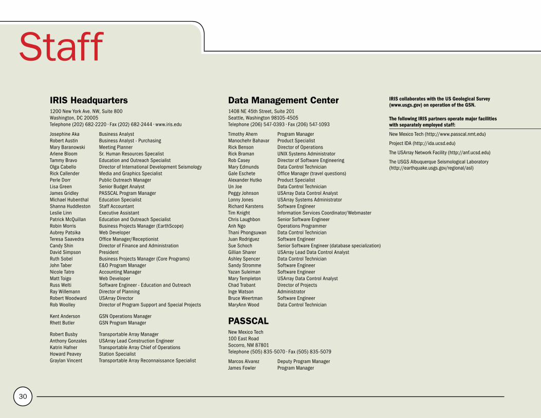
30
StaffIRIS Headquarters1200 New York Ave. NW, Suite 800Washington, DC 20005Telephone (202) 682-2220 • Fax (202) 682-2444 • www.iris.edu
Josephine Aka Business AnalystRobert Austin Business Analyst - PurchasingMary Baranowski Meeting PlannerArlene Bloom Sr. Human Resources SpecalistTammy Bravo Education and Outreach SpecialistOlga Cabello Director of International Development SeismologyRick Callender Media and Graphics SpecialistPerle Dorr Public Outreach ManagerLisa Green Senior Budget AnalystJames Gridley PASSCAL Program ManagerMichael Hubenthal Education SpecialistShanna Huddleston Staff AccountantLeslie Linn Executive AssistantPatrick McQuillan Education and Outreach SpecialistRobin Morris Business Projects Manager (EarthScope)Aubrey Patsika Web DeveloperTeresa Saavedra Office Manager/ReceptionistCandy Shin Director of Finance and AdministrationDavid Simpson PresidentRuth Sobel Business Projects Manager (Core Programs)John Taber E&O Program ManagerNicole Tatro Accounting ManagerMatt Toigo Web DeveloperRuss Welti Software Engineer - Education and OutreachRay Willemann Director of PlanningRobert Woodward USArray DirectorRob Woolley Director of Program Support and Special Projects
Kent Anderson GSN Operations ManagerRhett Butler GSN Program Manager
Robert Busby Transportable Array ManagerAnthony Gonzales USArray Lead Construction EngineerKatrin Hafner Transportable Array Chief of OperationsHoward Peavey Station SpecialistGraylan Vincent Transportable Array Reconnaissance Specialist
Data Management Center1408 NE 45th Street, Suite 201Seattle, Washington 98105-4505Telephone (206) 547-0393 • Fax (206) 547-1093
Timothy Ahern Program ManagerManochehr Bahavar Product SpecialistRick Benson Director of OperationsRick Braman UNIX Systems AdministratorRob Casey Director of Software EngineeringMary Edmunds Data Control TechnicianGale Eschete Office Manager (travel questions)Alexander Hutko Product SpecialistUn Joe Data Control TechnicianPeggy Johnson USArray Data Control AnalystLonny Jones USArray Systems AdministratorRichard Karstens Software EngineerTim Knight Information Services Coordinator/WebmasterChris Laughbon Senior Software EngineerAnh Ngo Operations ProgrammerThani Phongsuwan Data Control TechnicianJuan Rodriguez Software EngineerSue Schoch Senior Software Engineer (database specialization)Gillian Sharer USArray Lead Data Control AnalystAshley Spencer Data Control TechnicianSandy Stromme Software EngineerYazan Suleiman Software EngineerMary Templeton USArray Data Control AnalystChad Trabant Director of ProjectsInge Watson AdministratorBruce Weertman Software EngineerMaryAnn Wood Data Control Technician
PASSCALNew Mexico Tech100 East RoadSocorro, NM 87801Telephone (505) 835-5070 • Fax (505) 835-5079
Marcos Alvarez Deputy Program ManagerJames Fowler Program Manager
IRIS collaborates with the US Geological Survey (www.usgs.gov) on operation of the GSN.
The following IRIS partners operate major facilities with separately employed staff:
New Mexico Tech (http://www.passcal.nmt.edu)
Project IDA (http://ida.ucsd.edu)
The USArray Network Facility (http://anf.ucsd.edu)
The USGS Albuquerque Seismological Laboratory (http://earthquake.usgs.gov/regional/asl)

IRIS
A
NN
UA
L
RE
PO
RT
2
01
0
31
The following IRIS partners operate major facilities with separately employed staff:
New Mexico Tech (http://www.passcal.nmt.edu)
Project IDA (http://ida.ucsd.edu)
The USArray Network Facility (http://anf.ucsd.edu)
The USGS Albuquerque Seismological Laboratory (http://earthquake.usgs.gov/regional/asl)
The IRIS mission, actively supported by each Member and Affiliate Institution, is to:
• Facilitate and conduct geophysical investigation of seismic sources and Earth properties using seismic and other geophysical methods
• Promote exchange of geophysical data and knowledge, both through use of standards for network operations, data formats and exchange protocols, and through pursuing policies of free and unrestricted data access
• Foster cooperation among IRIS Members, Affiliates, and other organizations in order to advance geophysical research and convey benefits from geophysical progress to all of humanity The Board of Directors, selected by the Voting Members of IRIS
in annual elections, is vested with full power in the management of IRIS’s affairs. The Board appoints members to the Planning Committee, the Program Coordination Committee, the USArray Advisory Committee, and four Standing Committees that provide oversight of the Global Seismographic network (GSN), the Program for Array Seismic Studies of the Continental Lithosphere (PASSCAL), the Data Management System (DMS), and the Education and Outreach Program (E&O). For special tasks, the Board of Directors or President may convene special advisory committees and working groups, which currently include the Instrumentation Committee and working groups for the Transportable Array and the Magnetotellurics components of USArray. IRIS committees and working groups develop recommendations for consideration by the Board of Directors.
Board of DirectorsSusan Beck (Chair) University of ArizonaJim Gaherty (Vice Chair) Lamont-Doherty Earth Obsv. of Columbia UniversitySusan Bilek New Mexico TechDon Forsyth Brown UniversityEd Garnero Arizona State UniversitySteve Grand University of Texas, AustinJohn Hole Virginia TechSteven Roecker Rensselaer Polytechnic InstituteDoug Wiens Washington University, St. Louis
Planning CommitteeThorne Lay (Chair) University of California, Santa CruzChuck Ammon Pennsylvania State UniversitySusan Beck University of ArizonaEmily Brodsky University of California, Santa CruzDavid Okaya University of Southern CaliforniaJeffrey Park Yale UniversityLarry Braile Purdue UniversityDavid Simpson IRISRay Willemann IRIS
The Annual Report was assembled by Rick Callender, Perle Dorr, and Ellen Kappel.
Founded in 1984 with support from the National Science Foundation, IRIS is a consortium of over 100 US universities dedicated to the operation of science facilities for the acquisition, management, and distribution of seismological data. IRIS programs contribute to scholarly research, education, earthquake hazard mitigation, and the verification of a Comprehensive Test Ban Treaty.
IRIS is a 501 (c) (3) nonprofit organization incorporated in the state of Delaware with its primary headquarters office located in Washington, DC.
1200 New York Avenue, NW, Suite 800 • Washington, DC 20005202-682-2220 • www.iris.edu