a successful public-private conservation partnership jens c. hilke integrating natural resource and...
TRANSCRIPT

A SUCCESSFUL PUBLIC-PRIVATE CONSERVATION
PARTNERSHIP
Jens C. Hilke
Integrating natural resource and transportation agencies into the Staying
Connected InitiativeVT Fish & Wildlife
Department

Today Vermont Is 80% Forested
81% of Land in Vermont Is Private.

Climate Change Forecasts
From Union of Concerned Scientists – Confronting Climate Change in the Northeast (NECIA 2007)
Current: Temperatures have increased 1.8°F since 1970, with winter rising faster.
Projected: Average temperatures are projected to rise 9°F to 13° F in winter by late-century.
Current: Precipitation has increased 15-20% over the past 50 years with 67% of this falling in heavy precipitation events.
Projected: Winter precipitation will increase on the order of 20-30% with less snow - more rain.
Projected: Short-term summer droughts are projected to occur 2x as often

Map: Progress Report of the Interagency Climate Change Adaptation Task Force: Recommended Actions in Support of a National Climate Change Adaptation Strategy, October 5, 2010.
Changes in Precipitation
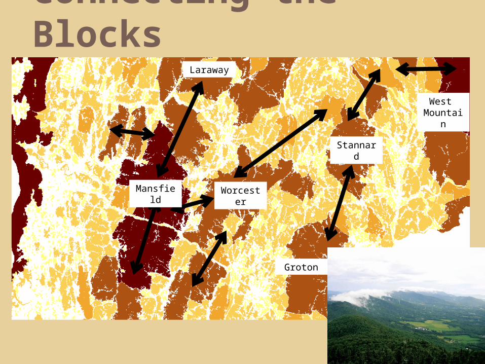
Connecting the Blocks
Mansfield
Worcester
Groton
West Mountai
n
Stannard
Laraway

Landscape Scale
EcoRegional Vision to Local Implementation

Connectivity at Multiple Scales
Regional
Local

Many ways of moving forward
Range of options
No one tool is right for every landowner or town
Byl
aws
Tow
n Pl
an
Zon
ing
Educ
atio
n &
O
utre
ach
Municipal
Inve
ntor
y
Con
serv
atio
n Pl
an
Land
Ac
quis
ition
Land
owne
r
Man
agem
ent
deci
sion
s
Man
agem
ent
Agr
eem
ents
Ince
ntiv
e Pr
ogra
ms
Con
serv
ati
on
Ease
men
ts
Educ
atio
nLandowner

Staying Connected
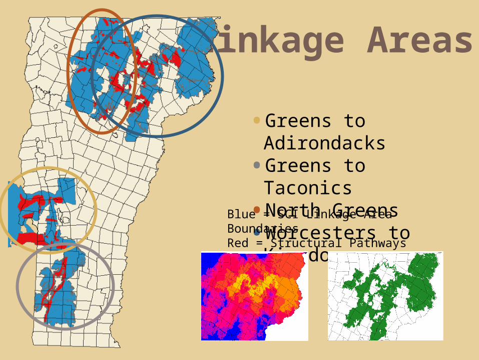
Linkage Areas
• Greens to Adirondacks
• Greens to Taconics• North Greens• Worcesters to
KingdomBlue = SCI Linkage Area BoundariesRed = Structural Pathways

Primary Strategies
Conservation Science
Land-Use Planning
Road Barrier Mitigation
Land Protection
• Structural Connectivity Modeling
• Functional Connectivity Analysis
• Roadside Tracking• Tech. assistance on town plans & bylaws
• Work with Regional Planning Commissions
• Outreach and Education• Providing science to Transportation Agencies
• Project Review (FWD)• Identification of problem
infrastructure• Retrofits• New targets – roadsides &
connecting land• Adding on to core habitats• Landscape Scale

Convergent Strategies?
Transportation Case Study• Significant Investment in over-
sizing a box culvert to allow for deer movement to wintering ground
• Subsequent residential development (In accordance with Town Plan and Zoning)

Coordination at Multiple Scales
Maine Audubon Maine Department of Inland Fisheries and
Wildlife Maine Department of Transportation National Wildlife Federation New Hampshire Audubon New Hampshire Department of
Transportation New Hampshire Fish and Game Department New York Department of Transportation New York Department of Environmental
Conservation Northeast Wilderness Trust The Nature Conservancy (NY, VT, NH, and
ME) Trust for Public Land Tug Hill Commission Tug Hill Tomorrow Land Trust Two Countries, One Forest Vermont Agency of Transportation Vermont Department of Fish and Wildlife Vermont Land Trust Vermont Natural Resource Council Wildlands Network Wildlife Conservation Society (Adirondacks)

Local Collaboration

Place-Based
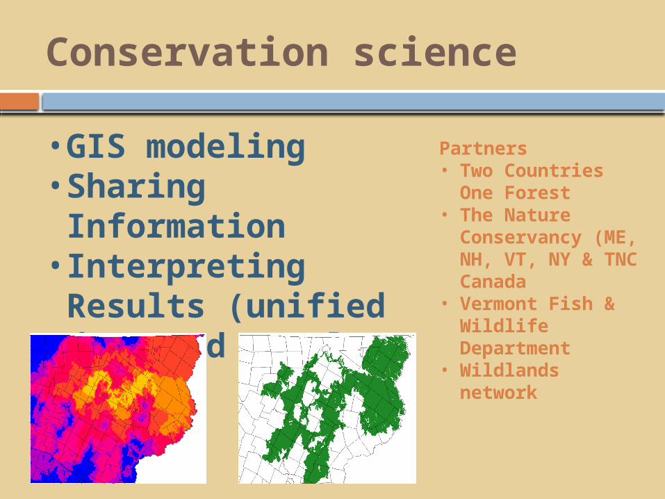
Conservation science
• GIS modeling• Sharing Information
• Interpreting Results (unified data and results)
Partners• Two Countries
One Forest• The Nature
Conservancy (ME, NH, VT, NY & TNC Canada
• Vermont Fish & Wildlife Department
• Wildlands network

Land protection
• 79 permanent land protection projects (more than 288,000 acres)
• Ten projects covering more than 43,000 additional acres (pending)
Partners• The Nature
Conservancy • Trust for Public Land• Vermont Land Trust• The Conservation Fund• Northeast Wilderness
Trust• Vermont Fish &
Wildlife Department
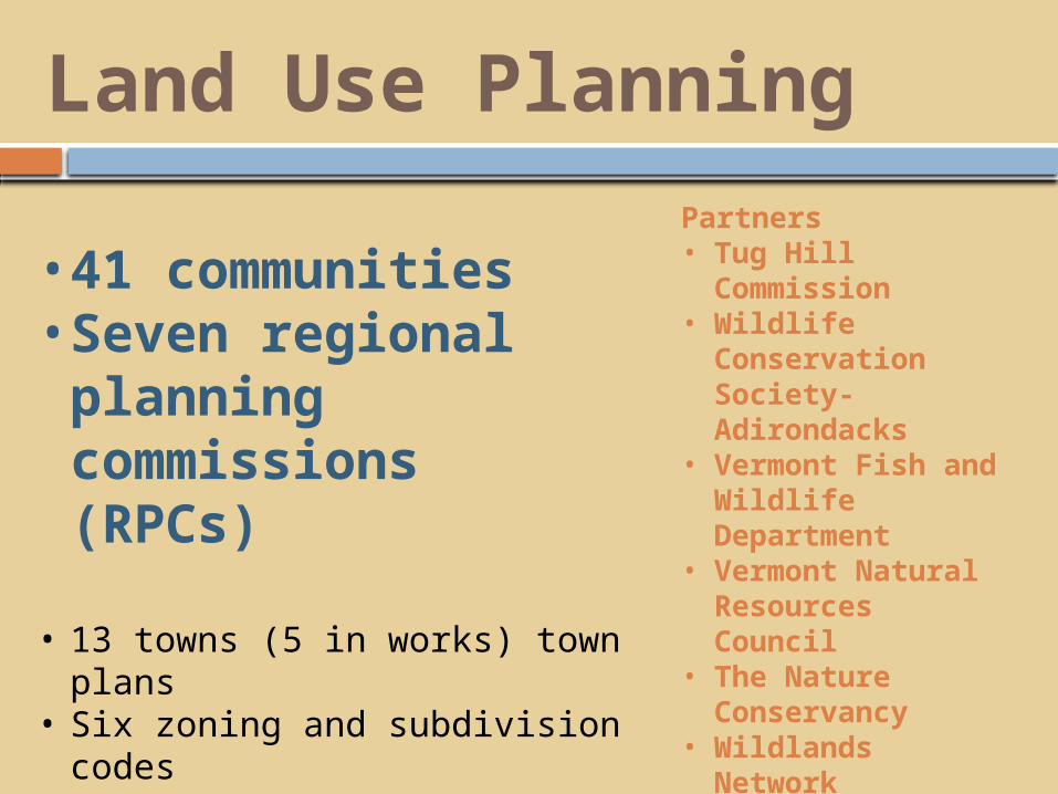
Land Use Planning
• 41 communities • Seven regional planning commissions (RPCs)
• 13 towns (5 in works) town plans
• Six zoning and subdivision codes
• One (Three in works) regional plan
• Two new Conservation Commissions;
• One new Conservation Fund.
Partners• Tug Hill
Commission• Wildlife
Conservation Society-Adirondacks
• Vermont Fish and Wildlife Department
• Vermont Natural Resources Council
• The Nature Conservancy
• Wildlands Network
• National Wildlife Federation
• Maine -Beginning with Habitat
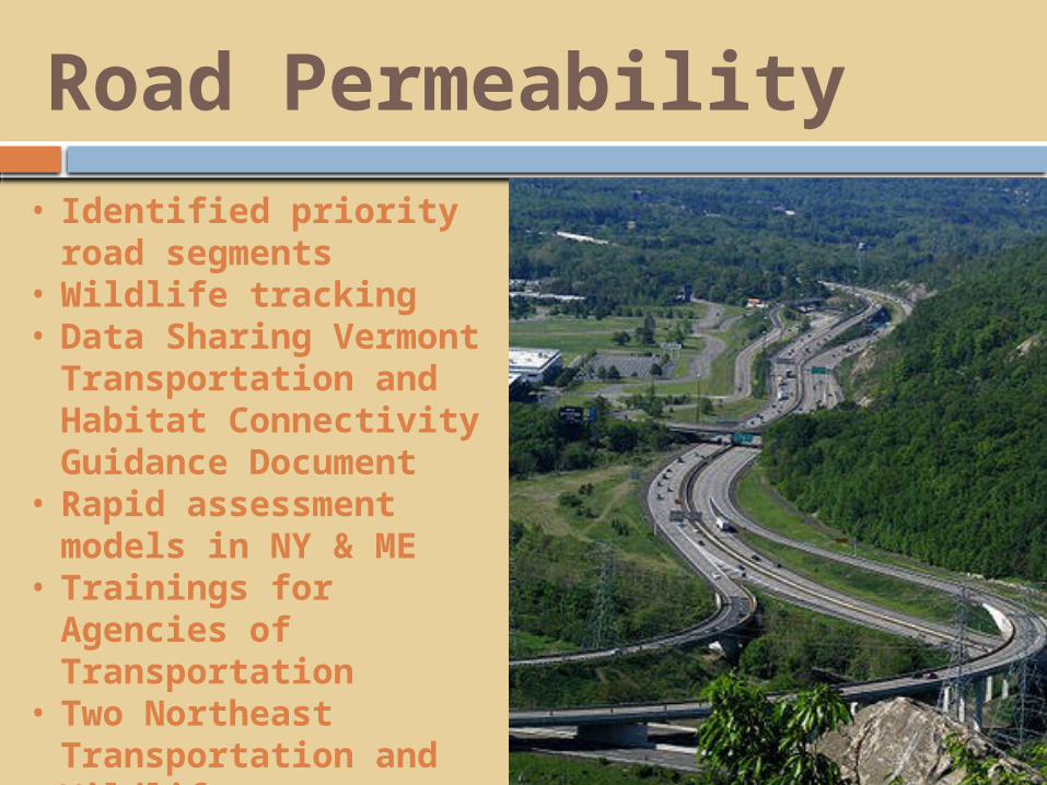
Road Permeability• Identified priority
road segments • Wildlife tracking • Data Sharing
Vermont Transportation and Habitat Connectivity Guidance Document
• Rapid assessment models in NY & ME
• Trainings for Agencies of Transportation
• Two Northeast Transportation and Wildlife Conferences.
Partners• Maine Department of Inland
Fisheries and Wildlife• Maine Department of
Transportation• National Wildlife Federation• New Hampshire Department of
Transportation• New Hampshire Fish and Game
Department• New York Department of
Transportation• New York Department of
Environmental Conservation• The Nature Conservancy (NY, VT,
NH, and ME)• Vermont Agency of Transportation• Vermont Department of Fish and
Wildlife• Vermont Natural Resource Council• Wildlands Network

Context for Restoration

Thank You
www.stayingconnectedinitiative.org