a woodland history of glen nevis, lochaber · 1. 1 introduction . this report details brief...
TRANSCRIPT
REPORT FOR NEVIS LANDSCAPE PARTNERSHIP
A Woodland History of Glen Nevis, Lochaber
HISTORICAL DOCUMENTARY EVIDENCE
Mairi Stewart
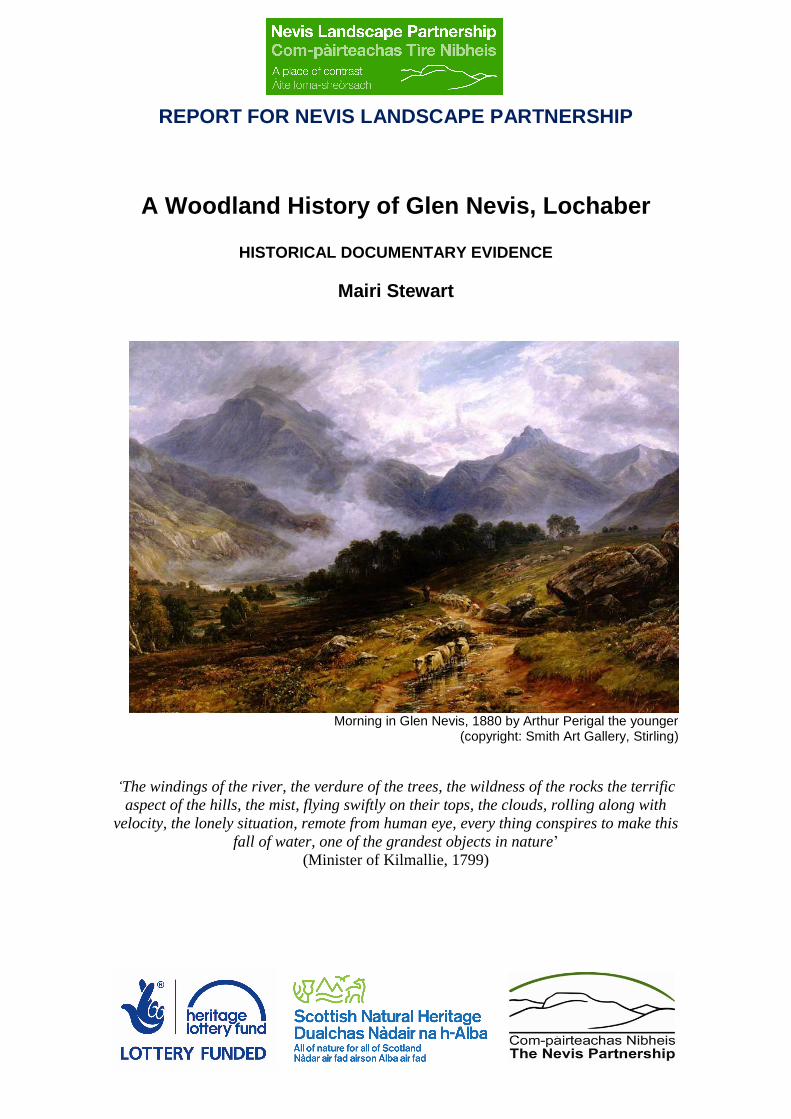
Morning in Glen Nevis, 1880 by Arthur Perigal the younger (copyright: Smith Art Gallery, Stirling)
‘The windings of the river, the verdure of the trees, the wildness of the rocks the terrific
aspect of the hills, the mist, flying swiftly on their tops, the clouds, rolling along with
velocity, the lonely situation, remote from human eye, every thing conspires to make this
fall of water, one of the grandest objects in nature’
(Minister of Kilmallie, 1799)

ACKNOWLEDGEMENTS
This work was commissioned by the Nevis Landscape Partnership as part of the Future Forests Project (LP.A3 Future Forests Project), an HLF-funded project. I would like to thank Lewis Pate (Nevis Partnership) for initiating this work. I would also like to thank Chris Smout for providing information on Cameron of Glenevis’s involvement in woods in Lochaber and commercial exploitation of woods on Locheil. I am grateful to Simon Taylor for advising on a selection of Glen Nevis place-names and to Siriol Davies for access to selected Gordon estates muniment transcriptions. Peter Quelch, as ever, was very helpful in making an assessment of the on-line map resource and providing helpful comments on past woodland management. I would also like to thank Jonathan Wordsworth for providing information about the charcoal platforms in Glen Nevis and for giving me access to his forthcoming article about west Highland platforms. I am grateful to the staff of the National Records of Scotland. Finally, I would like to thank the Native Woodlands Discussion Group committee for suggesting me for this work.
1
1 INTRODUCTION
This report details brief historical research carried out for the Nevis Landscape Partnership, the overall aim of which is to create a blueprint for enhancing woodland habitat connectivity, and more specifically to inform interpretation of the historic woodlands of Glen Nevis. The focus for this element of the project is to provide documented evidence to give an historic context for the interpretation of the surviving woods and trees of the glen and to provide an understanding of how the locality and its woodlands were utilised in the past. In the limited time available, the focus has necessarily been on published primary and secondary sources. Archival work was limited to cartographic sources and some accessible archival material. The following report provides an insight into the kind of information provided by documentary sources which, alongside the existing archaeological evidence, will point the way to achieving a better understanding of the present landscape and woodland of Glen Nevis. This will provide a good knowledge base from which to build future interpretation and management strategies.
2 METHODOLOGY The aim of this project was to determine, in as much detail as possible, the past management and utilisation of the land and particularly the woods in Glen Nevis. This was mainly achieved by means of a literature review (e.g. statistical accounts, improver and traveller literature), which helped place the woods’ history in a wider context, including the specific social and economic history of Lochaber. Time precluded a full search of the public archives in Edinburgh, i.e. the National Records of Scotland (NRS) and National Library of Scotland (NLS), for estate papers relating to Glen Nevis; however the catalogues were checked to establish the range of documents available to future documentary research. One day was spent in the NRS examining documents which relate to the Camerons of Glenevis.1 Given the time constraint, it was decided to focus on sources that would shed as much light as quickly as possible on the glen. Both generalised historical, county and district-level publications and papers specifically relating to the parish and the glen were used. Historical landownership in the study area was assessed using standard reference works such as Timperley (1976). Glen Nevis falls within the parish of Kilmallie, which formerly extended over 300,000 acres of Lochaber in both the counties of Inverness and Argyll. It was the largest parish in Scotland with its centre in Caol; the south and east portion includes the Mamores, south from Ben Nevis to the north shore of Loch Leven and east as far as the Blackwater. From the middle ages, Glen Nevis was held by the MacSorlie-Camerons of Glenevis, first under the Lordship of the Isles and then under a feu-charter from the earls of Huntly and dukes of Gordon, until 1851, when the estate was sold to neighbouring landowner, Sir Duncan Cameron of Fassifern, whose descendants, the Fairfax Lucy family continued to own much of the glen (including the Ben) until recently. In the early 20th century the North British Aluminium Company (now Rio Tinto Alcan) bought the lower portion of Glen Nevis, while the Forestry Commission acquired the west side of the lower glen in the 1920s. Archival records relating to the Camerons of Glenevis are scattered among various collections, principally the extensive archive of the Gordon estates,2 which makes it difficult to identify papers that specifically document how the woods of Glen Nevis were managed. There is a small section of Cameron documents (98 items) in the Fraser MacIntosh Collection. Cameron of Glenevis also appear in the papers of the Forfeited Estates. A survey of the papers in the various archives was made and a wish-list of documents most likely to provide direct evidence of woodland management was produced. The findings presented are therefore subject to potential revision in the light of a more all-inclusive survey and research.
1 NRS: GD128/60/1 includes 98 documents relating to the Camerons of Glenevis, the earliest a copy of a
charter from 1456, but mainly the papers relate to the 19th century. 2 NRS: GD44: Papers of the dukes of Gordon (Gordon Muniments); 12th century-20th century.

2
With regard to the cartographic evidence, extant maps available on-line were examined and are listed in Appendix 2. Unfortunately, because Glen Nevis was out with the direct control of the major local landowners (principally Cameron of Locheil and the duke of Gordon), 18th and early 19th century surveys and plans which exist for the Lordship of Lochaber and for Locheil do not appear to cover Glen Nevis, but it was not possible to view them as they are not digitised and are not held within Register House. Such detailed plans, which many large estates commissioned in the late 18th century, are invaluable for this kind of research, as they are often of a scale which allows detailed depiction of the land-use and settlement pattern.
3 RESULTS 3.1 General Historical Overview Historically, the Nevis area belonged to the MacSorlie branch of Clan Cameron. The MacSorlies was one of the earliest tribes of Lochaber. They are said to have originally descended from the same "stock" as the MacDonalds and for some time were ruled over by the Lord of the Isles. During the 13th and 14th centuries, the most important tribes in Lochaber were the Clan Donald, the Clan Chattan, and the Mael-anfhaidh. The Mael-anfhaidh consisted of three main tribes; the MacMartins of Letterfinlay; the Macgillonies (Mac ghille-anfhaidh); and the MacSorlies of Glenevis. The MacMartins are said to have provided the Chief of this confederation of tribes. By the 15th century, after the Mael-anfhaidh chiefship had passed into the Cameron family, the local families of MacMartin of Letterfinlay, MacGillonie of Strone and MacSorlie of Glen Nevis were absorbed within the incoming Clan Cameron so that by the end of the fifteenth century they came under the leadership of Clan Cameron, although they seemingly didn't adopt the name of Cameron until the early seventeenth century. It is said that relations between the MacSorlie Camerons and Camerons of Locheil were not always good and that they were know to be at feud with them on numerous occasions.3 The civil and religious wars of the 17th century resulted in considerable disruption to Lochaber. Much of the military campaigning in the Civil Wars occurred in the Highlands. The marquis of Argyll's raids into Atholl in 1640, the Montrose Campaigns of 1644-5, which included the battle of Inverlochy (1645) and the Glencairn Rebellion of 1653-4 all caused massive destruction and major dislocation of the highland economy and plunged many chiefs who were already substantially in debt into severe financial difficulties. In 1654, the fort of Inverlochy (later Fort William) was built of timber and garrisoned until the restoration of the monarchy in 1660, when, on the army’s departure, it was razed. It was rebuilt in 1689, when it was reinforced with stone. The building and quartering of a garrison would have required considerable amounts of timber for construction and maintenance of its non-farming occupants. Around Fort William, a settlement grew, encouraged by the government, but with a requirement that the houses should be built of wood and turf, so that they could easily be destroyed, as happened in 1746 during the Jacobite rebellion. In the 1745 Jacobite Rebellion the MacSorlie Camerons were not "out" under their leader, Alexander Cameron, 11th chief of Glenevis, however, many joined Lochiel's regiment and Alexander's brother Angus "brought out" the Rannoch Camerons to join the regiment. The clan system, with its patriarchal organisation dependant on a largely subsistence type agriculture, was dealt a fatal blow after the '45. In Lochaber, perhaps more than in any other part of Jacobite-supporting Scotland, great distress resulted among the inhabitants, uncertainty, with the removal at least for a time of their clan chiefs and tacksmen, and it left the country divided and in disarray. The estates of Cameron of Locheil, Cameron of Callart and MacDonald of Keppoch were forfeited after the ’45. Although Glen Nevis was not forfeited, Alexander was imprisoned until 1747 and his home and lands were systematically destroyed in 1746 by the notorious Captain Caroline Scott, commander of Fort William.
3 Much information about the history of the clan can be gleaned from: http://www.clan-
cameron.org/history.html.
3
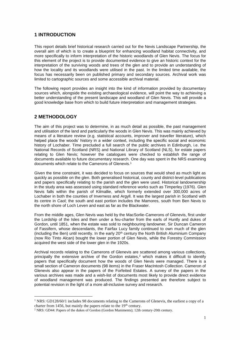
The Fort William Garrison by the Shores of Loch Linnhe, nd.4
Commercial interests had already become important In Lochaber by the 17th century with the opening up of the chiefly economy to outside influences. Part of the Highlands’ recovery after Culloden was the success of the cattle trade, which had began to assume importance in the late 17th and early 18th century, but as demand grew from Britain’s involvement in the Imperial Wars, the trade became a crucial element of the Lochaber economy. The associated droving trade developed in the 1760s and flourished through to the Napoleonic Wars (1793-1815). Furthermore, part of the change that swept away the old subsistence agriculture, based on livestock, crops and the use of hill ground as summer shielings, came about with the re-structuring of farms to allow for the introduction of lowland breeds of sheep from around 1764. The result was the break in territorial continuity that had held sway for centuries, which tied clans or kinsfolk to a piece of land – the duthchas. Chiefs became landlords. Ancestral lands became estates and rents increased. Many of the senior tenants – the tacksmen – left; often emigrating to the Americas, joining the army, or taking up positions in the Colonial trade. However, it was not until the nineteenth century that widespread agrarian change was effected. Reform eventually became inevitable with the reversal of the upward trend in cattle prices and the collapse of the kelp market after the Napoleonic Wars. Agriculture, organised on the old system, could no longer contain the upward spiral of rent increases. New tenants took over the re-organised farms and small tenants were moved off the land in order to pave the way for commercial sheep-farming (Dodgshon, 1998). However, on account of the limited opportunities for replacement occupation, the displaced tenants either remained land-based with their activities restricted to limited areas on each estate and dependant potato for subsistence, moved to towns (like Fort William) or emigrated.
‘Everything is turned upside down since you left Lochaber, and the remainder of the unfortunate people you see emigrating, or at least as many of them as have the means in their power. Families who had not been disturbed for 4 or 500 years are turned out of house and their possessions given to the highest bidders. So much for the Highland attachment between Chief and clans. But my own opinion is that the great gentlemen alluded to are doing a general good without any intention of doing so, by driving those people to desperation and forcing them to quit their country. (Duncan Cameron of Fassifern, in a letter, 1804 to Alexander MacMillan)5
Land management in Lochaber in the 19th century can be characterised as one almost entirely focused on the development of extensive sheep farming (although cattle remained a feature), followed by the gradual development of deer forests, particularly in the last quarter of the century, when large tracts of land were given over to game shooting and estates were sold and reorganised into large sporting estates. Glen Nevis initially continued to be managed for sheep, but by 1865, it too had become focused on sport although it seems likely that sheep farming continued at least in part of the glen.
4 http://www.visitfortwilliam.co.uk/history-and-culture-of-fort-william-in-the-highlands-of-
scotland/chronological-list-of-historical-events-in-fort-william 5 E. Richards, 2008, The Clearances, p148.

4
3.2 Early Glen Nevis Very little is known about the early history of Glen Nevis although the archaeological record (see Robertson, 2003) identifies some prehistoric sites. For example, the vitrified fort, Dun Deardail and also Dun Dige, the flat topped mound surrounded by a ditch and external bank, which is thought to have been an early home of the MacSorlie chiefs, but may have had an earlier origin. The historical significance of nearby Inverlochy castle, which is said to have been built in the late 13th century by John Comyn, Lord of Badenoch and Lochaber and supporter of Edward I, will doubtless have influenced the social and economic development of the locality. Archaeological excavations have shown that the site was occupied from an even earlier date. Following Robert the Bruce's succession to the crown in 1306, the Comyns were ousted and the castle fell into decay. There followed a period when the Lords of the Isles controlled Lochaber and the remainder of the western seaboard from their Hebridean stronghold. It was during these turbulent times, in 1456, that John the last MacDonald, Lord of the Isles, granted ‘to Somerled McEan McSorle of one davach of Glen nevys and office of Tocheachdeora of Lochaber ‘.6 After the fall of the Lordship, Inverlochy was repaired by the 2nd Earl of Huntly, who garrisoned it in 1505 and received a charter from James IV. This marked the ascendancy of the Gordon family in the locality, which was only broken when much of Lochaber was sold by them in the 1830s. In 1563, Donald, son of Alexander, son of Somerled, was granted a Feu-Charter for Glen Nevis from George, 4th Earl of Huntly. Inverlochy was one of the most important castles in Scotland, forming the backdrop for two battles. The first, fought, in January 1431 was one of a series of battles in which James I attempted to break the power of Alexander, Lord of the Isles. In their maritime domain the Lords of the Isles used the galley (birlinn) for both warfare and transport. These ships had developed from the Viking longships and knarrs, clinker-built with a square sail and rows of oars. It is known that Alexander MacDonald had two galleys based at Inverlochy Castle in 1297 (per com D McWhannell). However, the Camerons were essentially a land-based militarised clan rather than a seagoing one and there is no suggestion that boat-building was a major activity at or near Inverlochy. However Lochaber was famed for its woods ‘B'e sin fiodh a chur do Loch Abar’ is a proverb about wood equivalent to "Taking coals to Newcastle". Certainly the famed Mac Gille Chonaill hereditary Argyllshire boatwrights cut or obtained wood from Lochaber under agreements or deals between the Campbells and Cameron of Locheil. The woods belonging to Locheil, especially around Loch Arkaig, were renowned. The earliest written clues to the landscape history come from medieval charters, which for Lochaber date from the 14th century. There was a royal forest of Lochaber, which is thought to have dated from 1372 when it entered royal hands and when the forest may have been in existence (Gilbert, 1979). The bounds of this forest are unknown, but it is possible that it was linked with Inverlochy, which may have acted as a base for hunting parties. In 1500 the grant of Lochaber to Alexander, Lord Gordon ‘unacum forestis et silvis dictis terries spectantibus’ [along with the forests and forest belonging to the said earth] could refer either to hunting reserves and woods or to woods alone. Hunting forests may, or may not have supported woodland, but it is likely that much of the hunting grounds of Lochaber supported extensive woodland. This can be seen from the earliest maps, particularly of the Pont maps from the closing years of the 1500s. In particular, Pont 13 (Loch Eil and Loch Leven) and also Robert Gordon’s map (Gordon 37 Lochabre Glencooen) which was made c.1636-52.
6 GD128/60/1/1. Copy of charter. The title of Tocherdeorda was described in a later document as Governor, or High
Sheriff of Lochaber. A ‘davach’ or ‘davoch’ is an ancient Scottish land measurement.

5
Robert Gordon’s map of Lochabre Glencoen (NLS)
Site specific evidence for woodland use in the Middle Ages is extremely scarce. However, the fact that this area was at times under royal control and included areas of hunting forest, suggests that forest laws would apply to parts of the locality. Gilbert (1979) suggests that such areas, if not already hunting reserves, became such later in the 15th century. Essentially, Scottish forest regulations were about managing competing priorities among different levels of society – the grazing of animals; the use of timber and other forest resources; and the need to maintain deer and bird populations, as well as the environment in which they lived, for hunting. Hunting did not preclude agriculture or the use of woods for timber etc, but as hunting began to wane as a lordly pursuit in the 17th century and commercial influences began to increase the importance of the cattle trade, incursions into forests became more marked, especially from livestock and the use of sheilings. In Scotland, although the concept of hunting reserves was well-established, there seems to have been an acceptance of the need to accommodate other uses. Regulation was thus intended to permit entry into the forests for, among other things, fuel, building materials and grazing while ensuring that the well-being of the trees, deer and game was not jeopardised (Stewart & Watson, 2004). This is likely to have been the case in relation to Glen Nevis. With the removal of the Scottish royal family to London at the Union of the Crowns in 1603, Scotland’s social and economic situation changed. With regard to forests, the first obvious impact was the fact that the king was rarely in residence in Scotland to go hunting. His forests, usually ‘managed’ by a senior nobleman like the earl of Huntly, were less likely to be kept in readiness for a royal visit. The other uses – predominantly pasture and for small-scale building and fuel purposes – now assumed a greater importance and the regulations to protect the deer (and, by extension, the trees) were less likely to be enforced. That there was still a hunting function in the hills around Glen Nevis in the 17th century is suggested in a poem composed around 1600 by Domhnall mac Fhionnlaigh nan Dan (Donald son of Finlay of the Songs) who spent most of his life on the shores of Loch Treig. His poem, Oran na Comhachaig (The Song of the Owl) contemplates old age and looks back at his youth, describing both wildlife and landscape.
Mi ‘m shuidhe air siobhbrugh nam beann Ag coimhead air cean Loch Treig, Creag Guanach mu ‘n iadh an t-sealg, Crianan ard am biodh na feidh I am sitting on the fairy-knoll of the mountains Looking at the head of Loch Treig, Creag Guanach round which the hunt wheels, The lofty sun-chamber where the deer dwelt7
7 Koch, J T., (ed.) 2005, Celtic Culture: A Historical Encyclopedia, p1581, Oxford, ABC-Clio.

6
Around the same time as Domhnall was praising the hills of Lochaber, Pont was surveying the district and we have from him the outsider’s perspective. Of Mamore, Pont wrote:
Mamoir is a cowntrey of Lochabyr, it hath Lochlieven upon one syd, the long bay of Lochyell upon another syd, then the river Nevesh and upon the last syd ar the hills, looking the way to Rennach far of, and all betuix wast grownd taken up with hills mossis and deserts.’
He also briefly described Glen Nevis:
Glen-Neves lyeth along the river nevess, plentifull according to the cowntrey and litle inferior, it is ten merk land (for al Lochabyr is onlie 160 merk land altho the cowntrey be both good and large) and is devyded in twa parochins. the southsyd of the river is of the paroch of Iland Mown, and the northsyd is of the paroch of Kil-ma-nevag which is at the end of Loch lochy.8
These are just snapshots, but nevertheless illuminating. The hills described as waste, moss and desert may suggest barren and uninhabited. However, the term ‘waste’ might indicate that this extensive hill ground was used as a hunting forest (see Gilbert for description of ‘forest in waste’). Furthermore, as can be seen from Gordon’s map there were woods throughout the hills from Mamore to Rannoch and at least seasonal occupation of sheilings may have taken place. At the same time, Glen Nevis is described as ‘plentiful’ suggesting that the glen is able to sustain a reasonable level of agriculture. It is described as a ten merkland, which is a unit of land measurement with medieval origins (Bil p132). This land unit was also consistently used throughout the 18th century in rentals for Glen Nevis, although the actual rent associated with the 10 merkland of Glen Nevis changed.9 The assessment may have related to the amount of cultivatable land (infield and outfield) within the Cameron holding in Glen Nevis, but it might also have determined the amount of pasture (Dodgshon, 1998). Another 17th century description of Lochaber puts in a nutshell the advantages and disadvantages of the locality:
‘Lochaber enjoys pastures and woods, does not lack veins of iron, is not particularly fertile for corn, but yields to scarcely any in fish-bearing lochs and rivers …’10
Thus, by the middle of the 17th century, it is possible to discern a district supporting a population which focused on pastoral farming, but also producing crops, with the many corries and hill glens supporting extensive woodlands, where, at least until then, hunting took place. 3.3 The Pastoral Economy – Seventeenth and Eighteenth Centuries The civil and religious wars of the 1640s caused social disruption, the devastation of landholdings and the indebtedness of the chiefs. The woods around Inverlochy must have been exploited to provide fortifications and to sustain the garrison. However, once things settled down, it was a period when reconstruction and the Union of 1707 brought more settled conditions and allowed the cattle trade to develop. Commercial interests found sources of investment in Lochaber, including the woods and cattle. For example an ‘iron mill’ was established at Achnacarry in the late 17th century most probably by Irishmen utilising Lochiel’s extensive woods (Smout et al, 236). This was followed by further Irish involvement in the early 18th century. A document cataloguing the abuses made upon the locality by the garrison of the fort around 1715 suggested that the Governor of the fort monopolised all imports and that there were so few ships that came into Fort William, except ‘a few small vessells from Irland to buy timber.’11
8 http://maps.nls.uk/pont/texts/transcripts/ponttext85v-86r.html 9 (e.g. NRS GD44/25/4/33; NRS GD44/25/2/45) 10 http://maps.nls.uk/atlas/blaeu/page.cfm?id=962 11 NRS: GD44/26/1

7
By the middle of the century, the traveller, Thomas Pennant, made the following observation:
‘The great produce of Lochaber is cattle: that district alone sends out annually 3,000 head … There are also a few horses bred here, and a very few sheep, but of late several have been imported. Scarce any arable land, for the excessive wet which reigns here almost totally prevents the growth of corn, and what little there is fit for tillage sets at ten shillings an acre. The inhabitants of this district are therefore obliged, for their support, to import 6000 bolls of oatmeal annually, which cost about £4,000 the rents are about £3,000 per ann. The return for their cattle is about £7,500 the horses may produce some trifle; so that the tenants must content themselves with a very scanty subsistence, without the prospect of saving the rest against unforeseen accidents.’ (Thomas Pennant, 1769)
The climate of the west highlands has always made arable farming difficult and during episodes of bad weather, failure of crops invariably precipitated famine, as happened during the so-called ‘seven ill years’ of the 1690s, when Scotland’s population is thought to have dropped (either through death or out-migration) by 15% (Cullen, 2010). Edmund Burt, an engineer working on military road construction in the late 1720s described the dire straits of the inhabitants of Maryburgh (now Fort William) and the garrison because a ship carrying provisions had become wind-bound in Orkney (Burt 1998). He wrote: ‘About the time of one scarcity here, the garrison of Fort William … was very low in oatmeal, and the little hovel town of Maryburgh, nearly adjoining it, was almost destitute.’ This susceptibility to the vagaries of climate was not helped by the aftermath of the Jacobite rising, which saw destruction of homes, crops and livestock. Historically, Highland society is often described in terms of the importance of ‘feasting and feuding’ whereby the clans competed with each other for land and tribute, and in that regard Lochaber was particularly noted and cattle raids were often made into neighbouring territories. The accounts of the feuds and the associated incursions, when cattle and horses were stolen and crops destroyed are part of the mythology of Lochaber. Glen Nevis, with its rugged terrain, high corries and secretive tracks leading to Rannoch moor was ideal territory for such activities and it is likely that the upper glen was utilised for this aspect of clan society. However, that is not to say that a more mundane subsistence agriculture was not carried on in the glen in these far-off pre-Clearance times. Burt described many aspects of Highland life, including how the people subsisted. Spring was the most problematic time of year. He wrote:
‘This is a bad season for them (the lower order of Highlanders), for then their provision of oatmeal begins to fail, and, for a supply, they bleed their cattle, and boil the blood into cakes, which, together with a little milk and a short allowance of oatmeal, is their food.’
He also described the sheiling system:
‘In summer the people remove to the hills, and dwell in much worse huts than those they leave below; these are near the spots of grazing, and are called ‘shealings’, scattered from one another as occasion requires. Every one has his particular space of pasture … Here they make their butter and cheese … When the grazing fails, the Highlanders return to their former habitations and the cattle to pick up their sustenance among the heath, as before … the children share the milk with the calves, lambs and kids … About the latter end of August, or the beginning of September, the cattle are brought into good order by their summer feed, and the beef is extremely sweet and succulent, which I suppose, is owing in good part to their being reduced to such poverty in the spring, and made up again with new flesh. Now, the drovers collect their herds, and drive them to the fairs and markets on the borders of the lowlands, and sometimes to the north of England; and in their passage they pay a certain tribute, proportionable to the number of cattle, to the owner of the territory they pass through, which is in lieu of all reckonings for grazing.’
This is the system of agriculture that prevailed in Glen Nevis during much of the 18th century. In the Old Statistical Account of Scotland, written in the 1790s (OSAS,p.443), the Minister of Kilmallie, Alexander Fraser, summarised the subsistence agriculture that existed prior to 1764, when lowland sheep breeds were introduced:

8
‘All the arable ground was carefully cultivated, and sowed, mostly with oats. If the returns were few, the rents were low. Farms were divided into small proportions among the occupants; yet their cattle were grazed in common, every tenant having cattle in proportion to the share of rent which he paid. The cattle were nevertheless appropriated, and each had his own, and their fruits. Besides black cattle, they had a few sheep and goats; out of which, they could, at any time, afford to take part for the use of their families. And, as they had plenty of milk, butter and cheese, and a good deal of oats, they lived very comfortably.’
Goats were common in the Highlands up until the 19th century and provided an important source of milk, meat and hides, but they were readily reckoned to be inimical to woods and trees. Although livestock such as cattle and sheep were herded and often wintered in houses, goats and hill horses were probably less assiduously regulated. Goats were therefore one of the major causes for concern for the improvers and they were systematically removed. The following excerpts from the surveyor, John Williams who was engaged by the duke of Gordon around 1770 to advise on improvements in Lochaber, provide an indication of the goat issue and how it was dealt with.
‘It is certainly necessary for the benefit of the woods to stick to the resolution of banishing the goats; at least out of the part of the country the woods are in, but I beg leave to suggest that I am of opinion the goats may be allowed to live on both sides Lochtrieg, and in that vast extent of hills that lies between the head of Lochtried (sic) and Glenevis and south towards Kinlochleven, without the least hurt to any useful woods, and it will be of great service to the tennants, their milk being a relief to them in spring, and beginning of summer, when they can spare none from the calves.’12
Williams understood the value of goats for the farming community and though there were woods in the high parts of Glen Nevis and around Loch Treig, these woods were clearly not of commercial interest and could be sacrificed. Nevertheless, goats were eradicated from the hills and glens and the people had no choice but to accept this edict, if lamentably:
‘Methinks I foresee Lochaber all bathed in tears, and hear the rocks echoing back the voice of their wailings, for the loss of their goats, their beloved goats; when the proper care is taken of the woods; great will be the lamentation in Achnacoichan, and the slaughter in the valley of Speyan. Glenevis will be fat with the flesh, and drunk with the blood of goats.’13
As it was, the agricultural system, which Williams surveyed in Lochaber was not to last for much longer and within 30 or 40 years, those who would have lamented the loss of the goats were themselves removed from the townships of Lochaber. The shieling system was also dismantled although we can see from Williams’s reports that in 1770, it was still an accepted part of farming life. He wrote of the shieling system:
‘There is one hint I have given the highlanders these five or six years past, I fear to little purpose, by which they may in the course of time increase their grass indefinitely, without any expence, and very little trouble; by removing their sheel-booths onto a hethery know, or spot, every two, or at most three years. The cattle being milked, and lying two, or at most three summers, will sufficiently tathe any piece of hether, and make it as good grass as any; whereas the universal practice is, to have the sheel-booth forever in the same place.’14
3.4 Am Baile – The Township The basic socio-economic unit in the Highland landscape prior to the changes of the late 18th century, the unit around which the vast majority of society was organised, was the farming
12 NRS: GD44/28/34/406 13 NRS: GD44/28/34/101 14 NRS: GD44/28/34/101
9
township – am baile. How it was organised and who controlled it varied throughout the Highlands. In some cases, these townships were held by tacksmen, often a member of the principal landowner’s family, or one of its cadet branches (Dodgshon 1998). This was clearly the case in Lochaber, however, Cameron of Glen Nevis was not a tacksman, but a chief, who held a feu-charter to his lands under the superiority of the duke of Gordon. As landholders in their own right, the Camerons will have raised rents from the townships in the glen, which will have been composed of tenants and sub-tenants, each perhaps supporting perhaps 3 or 4 families. However, because of the lack of documentary evidence relating specifically to Glen Nevis, we can only surmise that land organisation would have been similar to that found on the neighbouring lands of Locheil and on Gordon estate lands in Lochaber. Certainly, both the mid-17th century Gordon map and the military survey of General Roy (1747-52) depict settlement clusters. The Gordon map appears to depict 5 settlements (Achlagan, Achintuy, Achnacon, (?)Binivzait, Lefinn); the latter located at least as far as east as Steall. The Roy map depicts 7 clusters, 3 of which are named (Achany?, Achlaggan, Achviach). Robertson (2003) discusses how these relate to later placenames. On Roy, the most easterly settlement appears to be east of modern-day Achriabhach, but west of Steall, however, the accuracy of Roy has been questioned (Whittington, Stewart), so it is not possible to say with certainly if Roy’s depiction is correct and therefore how many people lived in Glen Nevis in the 18th century. However, taking a typical family size of the time (say 8-9), and the likelihood that 3 or perhaps 4 families lived in each township, the figure could be over 100. Without access to rental documents or inventories of tenants no definitive figure can be given. What is clear is that the glen was more populated at this time in comparison with 100 years later, when the census provides accurate figures. 3.5 The Coming of the Sheep Cattle continued to be important for the Lochaber economy into the 19th century15, but by then, the winds of improvement were about to sweep through the western Highlands and sheep farming using the larger Lowland breeds began to assume dominance in Highland agriculture. One of the important influences on change during the latter half of the 18th century was the management policies brought in by the Commissioners for the Annexed Estates through the appointment of a factor for Locheil and Callart. Both estates were ultimately returned to the original families (Smith 1982), however, the forfeited estates were the focus of government-enforced improvement and rationalisation, which entailed the introduction of new crops and new forms of animal husbandry, as well as the development of industries such as kelp and the construction of new roads and the like. Change was not confined to the Lochaber forfeited estates. The 1760s and 1770s were a period of great activity on the Gordon estates, when surveys were made, the boundaries of farms redrawn and competitive bidding for leases encouraged. Rents rose as a result, and tenants were expected to improve their properties. Arable was reduced in favour of cattle grazing and pastures, which had formerly been shared by small joint-tenants, were taken over by larger farmers, able to invest in stock. MacKillop (1999) has shown that rents in Lochaber increased by a staggering 655% between 1754 and 1800, perhaps the highest increase in the Highlands. Sheep production, from the 1760s onwards, required townships to forgo much or all of their low arable ground and literally displace human inhabitants. This period marked the beginning of ‘The Clearances’. At the same time, the British army recruiting within the Highlands for a series of Imperial wars,16 had an impact on the social structure and the development of sheep farming. By furnishing recruits, landlords were able to financially prop up their estates as a result of the income for sons of tenants becoming soldiers. Several of the Camerons took up military posts as well as
15 In 1792, a quarter of the parish was still devoted to black cattle farming (OSAS). 16 These included the Seven Years’ War (1754-63), the American War of Independence (1775-83) and the
Napoleonic Wars (1784-1815).
10
their tenants. Alexander Cameron, the 12th chief (died 1774) gained the rank of Colonel. His second son, John was a Lieutenant Colonel in the American Wars of Independence and his grandson was an Ensign in the 21st regiment. In 1777, Cameron of Glenevis was noted as being extremely reluctant to lease his farms under sheep as he was aware this would entail the loss of his population. Instead he became a prominent recruiter for the duke of Gordon and was awarded the farm of Achtriachtan to accommodate some of his dependants (McKillop, p160) The Kilmallie minister wrote about the impact of the introduction of sheep-farming:
‘The sheep were first introduced into the parish in the year 1764. They have since increased so much that about three fourths of the country are occupied by them. Wherever they are, there is not above the 1300dth acre in tillage. Hence the quantity of hill ground may be conceived. But, indeed, the vallies are mostly pasture walks, for the winter and spring retreat of the sheep, as well as of the black cattle. All the hills, below the perpendicular altitude of 600 yards, are lined with beautiful, soft and rich heath; but above that height, they are mostly barren.’(OSAS, p.423)
He explains why this has resulted in a diminishing population:
‘There is an absolute necessity of preserving the grass, during summer and harvest, upon the low grounds, for the use of the sheep in winter and spring; for otherwise, they run a risk of perishing. This could not be done, were the same number of people, as formerly, to live there, and to cultivate lands for their own subsistence. Besides the number of cows and horses, they would require, would entirely consume the grass … The fact is, that sheep farms cannot be let with prudence, or advantage to a number of tenants; and the introduction of sheep, must, of course, diminish the number of tenants.’ (OSAS p.427)
He also describes the lifestyle of the new shepherding class:
‘The people subsist as may naturally be expected, in a great measure, upon the offals of the flock. If they live apart, as herds, they have each a stone of oatmeal per week, from the possessor, together with grass for 2 cows and 70 sheep; and they may plant as much potatoes for their own use, as they can cultivate. They live very comfortably, and generally save some money. They are well accommodated in clothes and bedding; which is a consequence of their more extensive commerce with the world, and of the abundance of wool. Travelling the hills, to look after the sheep, is their usual employment; excepting at the smearing and shearing seasons, when they gather them all down to the low grounds … Shepherds, who live in their masters houses, have their maintenance, and grass for 70 sheep, or so. Their allowance and profits are far superior to those of domestic work servants. Their sheep are marked for themselves and the produce sold commonly with the master’s, and at the same price.’ (OSAS, p.444)
By the mid-19th century sheep farming was the main economic driver in the parish and the restructuring of society had been effected, resulting in much less people living off the land and an increasing population living in Fort William (1,200 in 1840), many of whom took to fishing for herring, which became an important, if uncertain, economic activity prone to failure. Emigration either to the newly developing industrial areas and cities of the Lowlands or farther afield to the Americas, Australia and New Zealand was the only alternative for some poor families.

11
Tourists visiting Glen Nevis, 1890s (copyright Am Baile QZP40_CARD_0280)
The potato blight, which struck in 1846 and lasted almost a decade, turned an already impoverished population into one riven with despair, desperation and disease. It became for many an indescribable horror, which it is thought affected around 150,000 people, with the number of deaths resulting from famine diseases such as typhus and diarrhoea increasing considerably. For some landlords, it was the last straw; they emerged broke from this crisis and forced to sell all or part of their estates. For others, it prompted efforts to accelerate ‘assisted’ emigration, often of the poorest and most destitute of their estates’ inhabitants, resulting in some of the most notorious clearances of this period.17 It was during this time that John Cameron of Glenevis, a planter in the West Indies, who had inherited the estate from his older brother, Patrick, sold the estate in 1851 to his neighbour, Sir Duncan Cameron of. Fassifern. The estate was put up for sale in 1848 and included 40,000 acres, including the farm of Achintee, Achnacon, a house in Fort William and the lands of Kinlochleven were also part of the sale. There had been a protracted period of negotiations during which Cameron had to prove ancestral right to the land. The estate was sold for £31,700, but Cameron only received £12,100. The estate had nearly £20,000 of heritable debt, which was paid off by Fassifern, as part of the deal. In the event, the sale also took place in the same year as the death of John Cameron’s wife, who was born in the West Indies and died in Glen Nevis. The sale marked the break of the family’s ancestral ties with the glen, which may have existed for a thousand years.18 A period of relative stability came to an end in the late 1870s in the Highlands. Bad weather, at its worst in the winter of 1878/9, combined with structural changes in the global supply of food resulting in the importation of refrigerated beef and lamb from North America and Australasia, brought forth an agricultural depression, which particularly affected sheep farming. Around this time, deer forests and the exploitation of large tracts of land for the purpose of commercialised sport was becoming one of the most visible aspects of landholding in the Highlands. The valuation roll of 1865 shows that the owner of Glen Nevis was the representatives of the late Sir Duncan Cameron of Fassifern and the tenant of what was referred to as ‘Glen Nevis Shootings’, was Alexander Campbell (probably his son-in-law).19
17 T. M. Devine, Clanship to crofters' war: the social transformation of the Scottish Highlands (Manchester, 1994,
151; Richards, 2008, Highland Clearances, chpt 13. 18 NRS: GD128/60/1/9-11. In the 20th century, the connection was again renewed when a related Cameron acquired
Glen Nevis House and lands in the lower glen. 19 NRS: Valuation roll, 1865, Parish of Kilmallie, County of Inverness-shire.
12
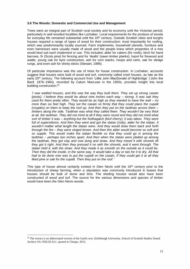
3.6 The Woods: Domestic and Commercial Use and Management Trees were an integral part of Scottish rural society and its economy until the Victorian period, particularly in well wooded localities like Lochaber. Local requirements for the produce of woods for everyday life remained substantial until the 20th century. Outside Scottish cities and burghs houses required a range of types of wood for their construction; most importantly for roofing, which was predominantly locally sourced. Farm implements, household utensils, furniture and even harnesses were usually made of wood and the people knew which properties of a tree would best suit each implement or use. This included; alder for cabers (for roofs), birch for hand barrows, fir (Scots pine) for fencing and for 'dealls' (sawn timber planks), hazel for firewood and wattle, young oak for byre construction, ash for corn stacks, hoops and carts, oak for sledge rungs, and even ash for shinty sticks (Stewart, 1996). Of particular importance was the use of trees for house construction. In Lochaber, accounts suggest that houses were built of wood and turf, commonly called creel houses, as late as the early 20th century. The following account from ‘Little John MacDonald of Highbridge’ (‘John the Bard: 1876–1964), recorded by Calum MacLean in the 1950s, provides insight into local building construction:20
‘I saw wattled houses, and this was the way they built them. They set up strong casain (posts). I believe they would be about nine inches each way – strong. It was oak they used for them pretty often. They would be as high as they wanted to have the wall – no more than six feet high. They set the casain so firmly that they could place the cupaill (couples) on them to keep the roof up. And then they put on the taobhan across them – timbers along the side. Taobhan was what they called them. They wouldn’t be very thick at all, the taobhan. They did not mind at all if they were round and they did not mind what sort of timber it was – anything but the fiodhagaich (bird cherry); it was taboo. They were full of superstitions. And then they went and got the slatan (rods), alder for the slatan. It wouldn’t matter what length the slatan were. And they would draw them back and forth through the fire – they were singed brown. And then this alder would become so soft and so supple. This would make the slatan flexible so that they could go in among the taobhan – perhaps two inches apart. And then when the slatan were plaited up among the taobhan, they got clay and cow dung and straw. And they mixed it with shovels till they got it right. And then they pressed it on with the shovels, and it went through. The slatan held it, with the straw. And they made it as smooth on the outside as it could be. Then they did the inside, in the same way. It would take a day or two for it to dry. All that had to be done now was to put the cupaill on the casain. If they could get it at all they liked pine or oak for the cupaill. Then they put on the roof.’
This type of house almost certainly existed in Glen Nevis until the 19th century prior to the introduction of sheep farming, when a stipulation was commonly introduced in leases that houses should be built of stone and lime. The sheiling houses would also have been constructed of wood and turf. The source for the various dimensions and species of timber would have been the Glen Nevis woods.
20 The extract is an abbreviated version of the Gaelic text: (Edinburgh University, School of Scottish Studies Sound
Archive SA 1958.20.A11. quoted in Cheape, 2013.

13
A turf house in early 20th century Lochaber (©Highland Folk Museum/SCRAN)
As the commercial value of woods increased from the 17th century, and particularly in the late 18th century, owners sought to find markets and exploit their woods. Oak-dominated woods were the most commercially valuable, primarily for bark but also for charcoal. These woods were generally managed as coppice. However, brush or 'barren' species (birch, alder, and hazel) were also sold for charcoal and other uses. The rising value of woods led to increasing conflict between the needs of the people – for pasture and wood products – and the needs of the commercialising landowners. Pilfering had always been part and parcel of the way woods were used and was sometimes unofficially sanctioned, as long as fines might be extracted for illegal felling and use. The only direct evidence for the commercial exploitation of the Glen Nevis woods found so far appears in 2 documents from the 1820s in relation to barrel production. This was probably linked to the herring industry, which was becoming increasingly important for Fort William in the 19th century (NSAS, 124),21 but may also have been for use in the salmon fishing, which was very productive in the late 18th century, when up to 6,000 salmon and grilse were exported each year from Fort William (OSAS, 411), requiring perhaps as many as 200 barrels. In 1826, the trustees of the estate were considering 2 offers for the birch woods and an alder wood in Glen Nevis, in four lots. It was considered that after the expense of cutting, cross-cutting and floating the wood to a downstream sawmill, there could be a profit of between £2,000 and £4,500. This depended on the accuracy of the estimate of the number and dimension of trees available for manufacture into slabs and staves. A figure of 44,471 trees is given, but the final volume that these trees would yield varied between the two estimates. Nevertheless, this appears to suggest that a healthy profit was possible. It is not clear if the sale was completed and in 1828 an offer was made by Robert Sinclair and Finlay MacDonald of Invermoriston of £2:10 per 1,000 staves ‘for all the staves that can be manufactured from the Glenevis woods’ to be carried out over 3 years. Again, there is no evidence that this offer was accepted. However, in 1829 the estate agreed to the construction of a walking and carding mill on the Nevis, on the basis that it was ‘not to interfere with the sawmill at present established upon said water’. This suggests that timber was being processed on the Nevis at that time. (NRS: GD128/60/1/36 & GD128/60/1/41)
21 ‘The people of Fort-William, (where the greatest number of boats are,) reckon that a good fishing-season, in which
they catch about 2000 barrels: last year (1791) there were about 3000 caught.’ (OSAS, 412).

14
Although the use of pine from Glen Nevis is not documented, it is possible that the sawmill mentioned as being in existence in 1829 was also cutting pine timber. Interestingly, the above mentioned document relating to the 4 lots of birch and alder, is titled (apparently wrongly), ‘list of the average sizes of Glenevis Fir woods’. Bark was another important woodland product and at times was more valuable than the timber itself. The Scottish tanbark trade gradually developed in the early 1700s, stimulated at first by the Irish, who came from a country by then largely deforested, but which still required bark for a burgeoning tanning industry. A succession of Irishmen became involved in commercial (although not entirely successful) exploitation, particularly along Scotland’s western seaboard, from the Solway to Fort William and even as far inland as the Trossachs (Smout et al., 2005). In Lochaber, bark appears to have been used for tanning leather for local use rather than for export. There is no mention of a tannery in the statistical accounts, but in the 1790s, there were 18 shoemakers in Fort William. Reference is made to the use of bark for tanning brogues. In 1791, there were also 11 carpenters, 1 ship-wright, 3 boat-wrights, 3 wheel-wrights, 2 cart-wrights, 6 sawers and 2 coopers (OSAS, 429). This amounted to a good number of wood users and although it is known that timber was imported to Fort William (OSAS, 441) and sawn locally, it is likely that locally-produced timber was also supplying the above mentioned trades. Bark was often sold to help offset the cost of felling and transporting timber, but the method of stripping the bark was frowned upon by estate advisers. In 1769, John Williams noted that ‘it is too much the practice in Scotland, especially in the Highlands, to cut down young oak clean away, for sake of the bark. I look upon this as a very bad practice proceeding from greed of a little more immediate gain, without the least regard to posterity.’22 Bark was certainly a part of the proposed sale of the Glen Nevis woods in 1828, whereby ‘the priviledge of barking and produce of the bark is given up to the superintendants.’ In this case, the role of superintendants in the sale process is not clear, but it may relate to payment in-kind for supervision of the sale contract. Archaeological survey has identified over 50 charcoal platforms in the glen, in two main groups, where today there are few trees; mainly scattered or growing along rocky burns (Robertson, 2003). None of the limited number of documents examined as part of this study throws any light on the production of charcoal from the Glen Nevis woods. That charcoal production took place in the glen seems likely, however, without dates from excavation of these platforms, it cannot be said with certainty that the deciduous woods of Glen Nevis were utilised during the 18th and 19th century when industrial-scale charcoal production took place in the west Highlands to feed the iron works at Bonawe, near Oban. The debate among archaeologist about the origins and use of west Highland platforms also leaves a question mark about those in Glen Nevis (Wordsworth, in preparation; Robertson, 2003). It is possible that these platforms date from the Middle Ages or earlier and were constructed for other purposes. However, we know from John Williams’ reports of 1769 and 1770 on the Gordon lands in Lochaber that charcoal production was being considered. From these reports we gain an insight into the assessment of the commercial importance of woodland and charcoal. He wrote:
‘The great demand for wood fit for charcoal in that country makes any sort within a few miles of the sea worth taking care of. I am told there is a great scarcity of charcoal at the two iron works in the West Highlands ... there is a very great extent of old decaying scroggie birch, aller and hazle woods in many parts of Lochaber good for nothing for any country use, but is in fact a great nuisance, as it hinders the young wood and grass to grow … The manner of selling wood to these people, is to allow them to take all the refuse and useless parts of the wood, and to leave growing all you incline; to take off any part of the wood to be cut down, that is judged fit for any other purpose and they cut down and burn only what part they are allowed, and pay so much the dozen of sacks of charcoal of such a dimension, I have been told they pay from 3 to 5/- the dozen of sacks according to the distance from the sea, ease or difficulty of manufacturing. The woods of
22 NRS:GD44/28/34/41.
15
Lochaber that are absolutely useless and cumbering the ground would amount to a deal of money in this way.’23
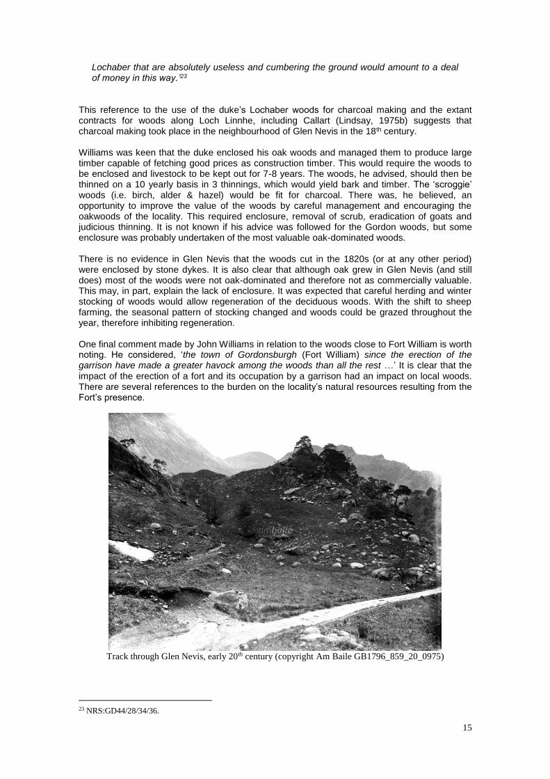
This reference to the use of the duke’s Lochaber woods for charcoal making and the extant contracts for woods along Loch Linnhe, including Callart (Lindsay, 1975b) suggests that charcoal making took place in the neighbourhood of Glen Nevis in the 18th century. Williams was keen that the duke enclosed his oak woods and managed them to produce large timber capable of fetching good prices as construction timber. This would require the woods to be enclosed and livestock to be kept out for 7-8 years. The woods, he advised, should then be thinned on a 10 yearly basis in 3 thinnings, which would yield bark and timber. The ‘scroggie’ woods (i.e. birch, alder & hazel) would be fit for charcoal. There was, he believed, an opportunity to improve the value of the woods by careful management and encouraging the oakwoods of the locality. This required enclosure, removal of scrub, eradication of goats and judicious thinning. It is not known if his advice was followed for the Gordon woods, but some enclosure was probably undertaken of the most valuable oak-dominated woods. There is no evidence in Glen Nevis that the woods cut in the 1820s (or at any other period) were enclosed by stone dykes. It is also clear that although oak grew in Glen Nevis (and still does) most of the woods were not oak-dominated and therefore not as commercially valuable. This may, in part, explain the lack of enclosure. It was expected that careful herding and winter stocking of woods would allow regeneration of the deciduous woods. With the shift to sheep farming, the seasonal pattern of stocking changed and woods could be grazed throughout the year, therefore inhibiting regeneration. One final comment made by John Williams in relation to the woods close to Fort William is worth noting. He considered, ‘the town of Gordonsburgh (Fort William) since the erection of the garrison have made a greater havock among the woods than all the rest …’ It is clear that the impact of the erection of a fort and its occupation by a garrison had an impact on local woods. There are several references to the burden on the locality’s natural resources resulting from the Fort’s presence.
Track through Glen Nevis, early 20th century (copyright Am Baile GB1796_859_20_0975)
23 NRS:GD44/28/34/36.
16
4 DISCUSSION Few conclusions can be drawn about the nature of past wood use and management in Glen Nevis in the past, not least because the scope of this contract is too limited to allow a detailed examination of the relevant archives, which if examined may cast light on the history of the woods. The other issue limiting the ability of documentary evidence to provide insight into wood use, not only for Glen Nevis, but indeed, any woods in Scotland, is the extent to which peasant practices are rarely documented in archives, quite simply because pasturing of woodland was largely the preserve of tenants, whose voice is often unrecorded in the written record. From the evidence gathered, it seems clear that Glen Nevis has long been suited to, and therefore used for grazing, providing pasture for both deer and livestock. It is possible that the upper Glen was part of a more extensive hunting forest, perhaps the Forest of Lochaber, which dated from at least the 14th century. Further research of medieval sources might uncover more of that important history. There is currently no evidence to pinpoint when the glen was first farmed, but the archaeological evidence suggests a long, if not necessarily continuous, period of occupation (Robertson, 2003). The 15th century reference to the davach of Glenevis and late 16th century reference to the 10 merkland, point to agricultural production and therefore we can assume that at least from that time arable and livestock farming took place, probably with an emphasis on livestock. This type of farming continued until the mid- to late-18th century, when lowland breeds of sheep were introduced. There is no doubt that the people who lived in the glen would have depended upon the woods for their everyday lives. Commercial exploitation of Lochaber’s woods is recorded from the late 17th century, but the evidence relates to neighbouring Locheil estate, however, the Camerons of Glenevis were involved in the timber trade, at least in the 1760s (Smout, 120), so it is entirely possible that they were exploiting their woods for commercial gain, probably at a local level, and perhaps in relation to the garrison, but conceivably, like Locheil, dealing with outsiders like the Irish. Glen Nevis appears to have supported extensive, although not necessarily compact, woodland, at least until the 19th century, when map evidence suggests that the woods began to decline, although by no means did they disappear. With agricultural change, particularly the emphasis on sheep and the abandonment of transhumance, the traditional reservation of low pasture during summer was often no longer possible; valley land and lower parts of hill pasture, which often supported some form of woodland, were pressed in to service in summer to accommodate the new breeds of sheep. The decline of woodland during the 19th century therefore became inevitable, though it must have been a slow process, given the enduring nature of trees and woodland. It is interesting that the Glen’s wooded pastures have been predominantly utilised as such for several hundred years and even the relatively new form of husbandry based on sheep has been practised in the glen for over 200 years. What impact this might have had on the ecology of the woods and pastures of this area could only be explained, in part at least, by pollen analysis. The lack of evidence for enclosure suggests that pasture was valued above the woodland. It is perhaps no coincidence that this 19th century deterioration coincided with the reduction in the population living in the glen. This may seem counter-intuitive, however, it could be argued that while people lived in the glen and were engaged in subsistence agriculture, the woods provided an important natural resource for their everyday lives, for their grazing animals, for furnishing utensils and implements and importantly for providing the necessary building material for their homes, so while they were of use, they were valued and conserved. When the people left and only a few shepherds or gamekeepers remained, living in stone buildings and tending flocks and herds, which stretched the carrying capacity of the land, the woods suffered and declined, but endured, so that from the mid-20th century, regeneration could take place as the pressure on the land eased with reductions in deer and sheep and a revival in the value placed on native woods.
17
Documentary history alone cannot provide the answer to the complex questions of the origins and longevity of woodland in the Scottish context, particularly those located in the uplands. Site evaluations based on synthesis of the various strands of evidence available - field, archaeological, maps, documents, pollen and tree-ring counts - would be informative and of material value to the verification of past use and management. Such a detailed, multi-discipline approach would significantly increase our understanding of the nature of historical woodland and land management and, as a result, help inform current management strategies and provide material to support interpretation of the Glen’s land use.
5 SOURCES Abbreviations NLS National Library of Scotland NRS National Records of Scotland NSAS Gordon, J. (ed) 1845. The new statistical account of Scotland. Edinburgh, William Blackwood & Sons. OSAS Sinclair, J. (ed) 1791-1799. The statistical account of Scotland, 1791-1799. Edinburgh, Wm. Creech.
Bil A., 1990, The Shieling, 1600-1840. Edinburgh: John Donald (Burt, E) 1754, Letters from a Gentleman in the North of Scotland to his Friend in London, 2 vols. London. Reprinted 1998 by Birlinn, Edinburgh. Cheape, H., 2013, ‘Every timber in the forest for MacRae’s House’: Creel Houses in the Highlands.’ In Vernacular Building 37. Essays in memory of Sandy Fenton Scottish Vernacular Buildings Working Group 2013-2014, 31-50 Cullen, K. J., 2010, Famine in Scotland – the ‘Ill Years’ of the 1690s, Scottish Historical Review Monograph Series. Edinburgh University Press. Devine T. M., 1994, The transformation of rural Scotland: Social change and the agrarian economy, 1660-1815. Edinburgh Devine, T. M. 1994, Clanship to crofters' war: the social transformation of the Scottish Highlands Manchester Dodghson, R. A., 1998, From chiefs to landlords: social change in the Western Highlands and Islands, c 1493-1820. Edinburgh: Edinburgh University Press. Gilbert, J. M., 1979, Hunting and hunting reserves in Medieval Scotland. Edinburgh. Gordon, J. (ed) 1845. The new statistical account of Scotland. Edinburgh, William Blackwood & Sons. New Statistical Account, (NSAS ) Vol XIV, Inverness-shire Lindsay J M 1974 The use of woodland in Argyllshire and Perthshire between 1650 and 1850. Unpublished University of Edinburgh PhD thesis Lindsay J M 1975 a ‘The history of oak coppice in Scotland’, Scottish Forestry 29, 87-95. Lindsay, J. M. 1975 b. Charcoal iron smelting and its fuel supply; the example of Lorn furnace, Argyllshire, 1753-1876. Journal of Historical Geography 3, 283-298 Macfarlane W 1905 Geographical collections relating to Scotland. Scottish History Society. MacKillop, A., 2000, More Fruitful than the Soil: army, empire and the Scottish highlands, 1715-1815, East Linton, Tuckwell Press.

18
Pennant, T 1774, A Tour in Scotland 1969, 3rd ed, Warrington Richards, E., 2013, A History of the Highland Clearances 2nd edition, Edinburgh, Birlinn Robertson,J.G., 2003, An Archaeological Survey of Part of Gen Nevis, Lochaber, Highland, For Bidwells Property Consultants. Sinclair, J. (ed) 1791-1799. The statistical account of Scotland, 1791-1799. (OSAS) Vol XIII Edinburgh, Wm. Creech. Smith A M 1982 Jacobite Estates of the Forty-Five . Edinburgh: John Donald. Smout, T. C., 1997, ‘Cutting in to the Pine: Loch Arkaig and Rothiemurchus in the 18th century’, in Scottish Woodland History ed. T. C. Smout, Scottish Cultural Press, Edinburgh. Smout, T. C., MacDonald, A. R. & Watson, F. J. 2005 A History of the Native Woodlands of Scotland 1500-1920. Edinburgh University Press, Edinburgh. Stewart, M. J., 1996, The utilisation and management of Lochtayside’s semi-natural woodlands between 1650 and 1850 (Unpublished MPhil thesis, St Andrews University). Stewart, M. J., 2003, ‘Using the Woods, 1600-1850 (1) The Community Resource and Using the Woods, 1600-1850’ (2) ‘Managing for Profit’, in People and Woods in Scotland A History, ed. T. C. Smout. Edinburgh: Edinburgh University Press Stewart M. J. & Watson F., 2004 ‘Preserve of the few - used by all. Scotland’s woodland history 1500 - 1850’, Scottish Forestry 58, 4. Timperley, L., (ed) 1976 A directory of land ownership in Scotland c1770. Scottish History Society. Whittington G. and Gibson, A. J. S., (1986) The Military Survey of Scotland 1747-55: A Critique, Historical Geography Research Series Number 18, Aberdeen. Wordsworth, J., in prep, ‘The archaeological evidence for charcoal burning in Scotland - with particular reference to Arienas & Rahoy, Morvern’, Scottish Woodland History Conference Notes 19.
APPENDICES 1 NRS National Records of Scotland consulted GD128/60/1: 73 of 98 documents relating to the Camerons of Glenevis, the earliest a copy of a charter from 1456, but mainly the papers relate to the 19th century. GD44/25/4/33: Rental with some observations upon the lordship of Lochaber. 1769 GD44/25/2/45: Rentals of the dukes of Gordon's lands in Lochaber.October 1649 GD44/26/1: Representation by Inverlochy anent abuses committed by the governors of Fort William GD44/28/34: 36-52 1769-70, Further reports by John Williams: woods in Lochaber [36-7]; clay from Badenoch [38-9]; report of his survey of Lochaber [40-8] his journal from July to December 1769 [49]; and his journal in Badenoch, May and June 1770 GD44/28/34/101: Letter from John Williams to Duke of Gordon Sep 1st 1769. Valuation roll, 1865, Parish of Kilmallie, County of Inverness-shire, Glen Nevis. 2 Maps Consulted
Pont 13 (Loch Eil and Loch Leven) Available at www.nls.uk/maps.
Robert Gordon’s map (Gordon 37 Lochabre Glencooen) Available at www.nls.uk/maps.

19
Military Survey of Scotland, 1747 – 1755 (Roy Maps) (original at c.1:36000 scale.), © The British Library. Available at and licensed via www.scran.ac.uk.
John Thomson’s Map of Scotland, 1832. Northern part of Inverness-shire (south part).
Ordnance Survey 6” County Series: Inverness-shire, Sheets: CL, CLI, CLX, CLXI, 1870. Available at www.nls.uk/maps.
The Roy Map, Upper Glen Nevis, (1747-52)
Ist edition OS, 1870, Upper Glen Nevis

20
Excerpt from Ist edition OS, 1870, Lower Glen Nevis
3 Selected Placenames Evidence from Simon Taylor, Glasgow University Coille Loisgte (not mapped by Roy but in the lower glen) – loisgte - standard Gaelic word for 'burnt' so ‘burnt wood’. Leth Tir Airigh - Slope of sheiling Coire nan each – Corrie of the of the horses (pl.) Allt a’ bheithe – Burn of the birch Lethcheann na Coille Fearna = Side/cheek of the wood of the alder Eilean a’Ghuibhais – Island of the pine Coire a’ Ghamhna – coire of the stirk [of the stirk, one year-old calf; also yearling deer] Coire Ghiubhais – Pine corrie 4 Notes from Peter Quelch regarding the map evidence ‘The first of note is Gordon 1636-52 which shows the geography of Glen Nevis nicely but tree symbols look a bit randomised. Shows a few woods in the glen.

21
Roy 1747-52 shows the glen very clearly and in detail with lots of farm names, as one might expect in country so close to Fort William itself. However the lower glen is clearly unwooded, with only riverside trees amongst small fields shown downstream of Polldubh, then both sides of the glen are thickly wooded to just past Steall, with natural looking woods on the slopes with no enclosures visible. Thomson 1832 is very good, as usual I think. He shows a range of natural unenclosed woods from Polldubh to Steall on both sides of the river much as does Roy. But by the first ed OS surveyed in 1870 the woods above Polldubh have declined greatly, though significant relict pasture woodlands remain in a couple of places on the south side, around the Allt a Choire Dearg, and also high up on the Allt Coire nan Feusgan at about 1400’. I don’t know what species these were but probably mainly birch and alder and perhaps some pine. That upper wood in a bowl is very like several high level birchwoods in Glen Falloch, which is also the southern-most outpost of natural pinewood. Falloch has the same story of decline in that period. Ironically though some oakwoods were expanded, enclosed and even created in Falloch, after Roy and before the first Ed OS – they are the ones that are now SSSIs, despite being pretty artificial compared to the hill woods. The OS shows 3 small landscaping type woods in the designed landscape around Glen Nevis House, including the named Coille Loisgte but those could all be planted on previous croft lands. Also the OS shows on the north side of the river east of Polldubh a pathetic scatter of surviving trees on the crags, but which I would think has been enough to allow regeneration once sheep levels came down. Regen happens easily in craggy country but not so in the wet upper corries. There is no sign of fixed enclosures in the upper glen and anyway in that terrain that would be unlikely. The lairds’ duty would be to control grazing after felling but somehow I doubt that happened, hence the decline with sheep and deer. Stake and rice fencing would have been the most likely option but unless it is kept up carefully it won’t last long. It would be good to date the hearths in the way they have done in Italy to know what date the felling and coaling took place.’ 5 Potential sources for further investigation GD44/25/4/20: Use of wood for cartwheels & oak bark, 1770 GD44/25/4/3: Judgement against tenants re. destruction of woods, 1770 GD44/28/34/96-103: includes reference to enclosing fir woods near Maryburgh to protect them from the goats,1769 E768/35: Forfeited Estates: Lochiel: Petitions and Memorials: regarding the sale of the fir woods on the estate 1760-1768 From: Francis Grant; John Godsman, merchant at Inverlochy; James Lindsay and Company, wood merchants in Glasgow; and Ewen Cameron younger of Glenevis and Duncan Stewart in Banavie. CS96/4433-4435: Estate papers for Glenevis, 1827-39 RHP2493: Plan of the lordship of Lochaber, Inverness-shire 1831 RHP 35981: Draft plan of Gordon estate in Lochaber by William Anderson, 1767 RHP 31718-31753: Plans of Lochaber farms by William Anderson, 1767 RHP 86199: Plan of shootings of farms in Lochaber, showing location of types of game and forests, 1860 Other sources that would be well worth examining include the census from 1841-1911 and the valuation rolls for the Glen from 1855 to 1957, all of which are digitised and available either on-line, at a cost or in the NRS historical search room and Scotland’s People search room in Edinburgh. The OS name books would also be a useful source. I was unable to access some of these on-line sources due to the NRS and associated websites being down during my research.