advanced field applications with arcgis · dashboards story maps design apps viewer apps social...
TRANSCRIPT

Advanced Field Applications with ArcGIS
GIS Solution Engineers, Esri
Scott Moore [email protected]
John Sharrard [email protected]
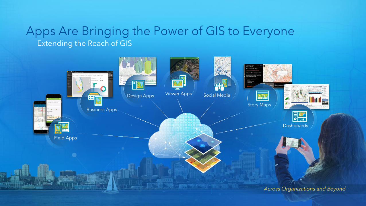
Apps Are Bringing the Power of GIS to EveryoneExtending the Reach of GIS
Dashboards
Story Maps
Social MediaViewer AppsDesign Apps
Business Apps
Field Apps
Across Organizations and Beyond
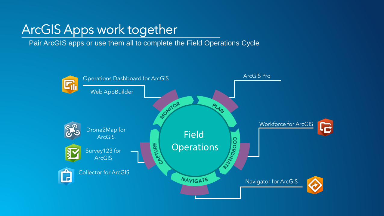
ArcGIS Pro
Workforce for ArcGIS
Navigator for ArcGIS
Survey123 for
ArcGIS
Collector for ArcGIS
Drone2Map for
ArcGIS
Operations Dashboard for ArcGIS
Field Operations
Web AppBuilder
ArcGIS Apps work togetherPair ArcGIS apps or use them all to complete the Field Operations Cycle

Workforce for ArcGISAn Introduction
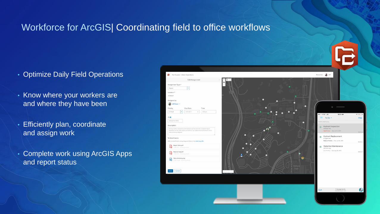
• Optimize Daily Field Operations
• Know where your workers are
and where they have been
• Efficiently plan, coordinate
and assign work
• Complete work using ArcGIS Apps
and report status
Workforce for ArcGIS| Coordinating field to office workflows
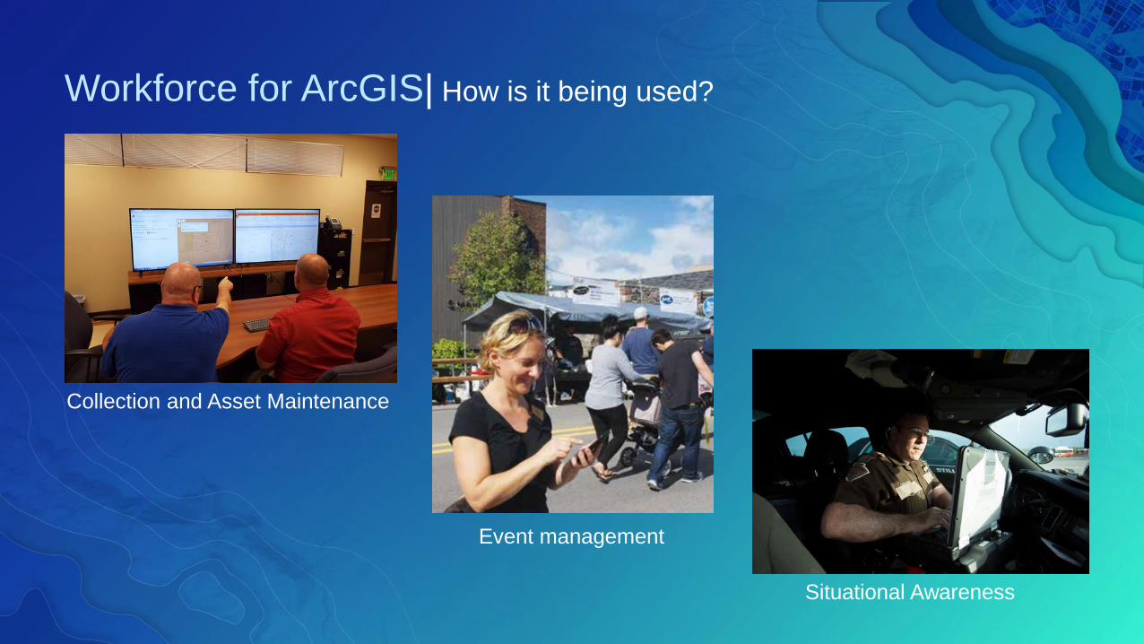
Workforce for ArcGIS| How is it being used?
Collection and Asset Maintenance
Situational Awareness
Event management
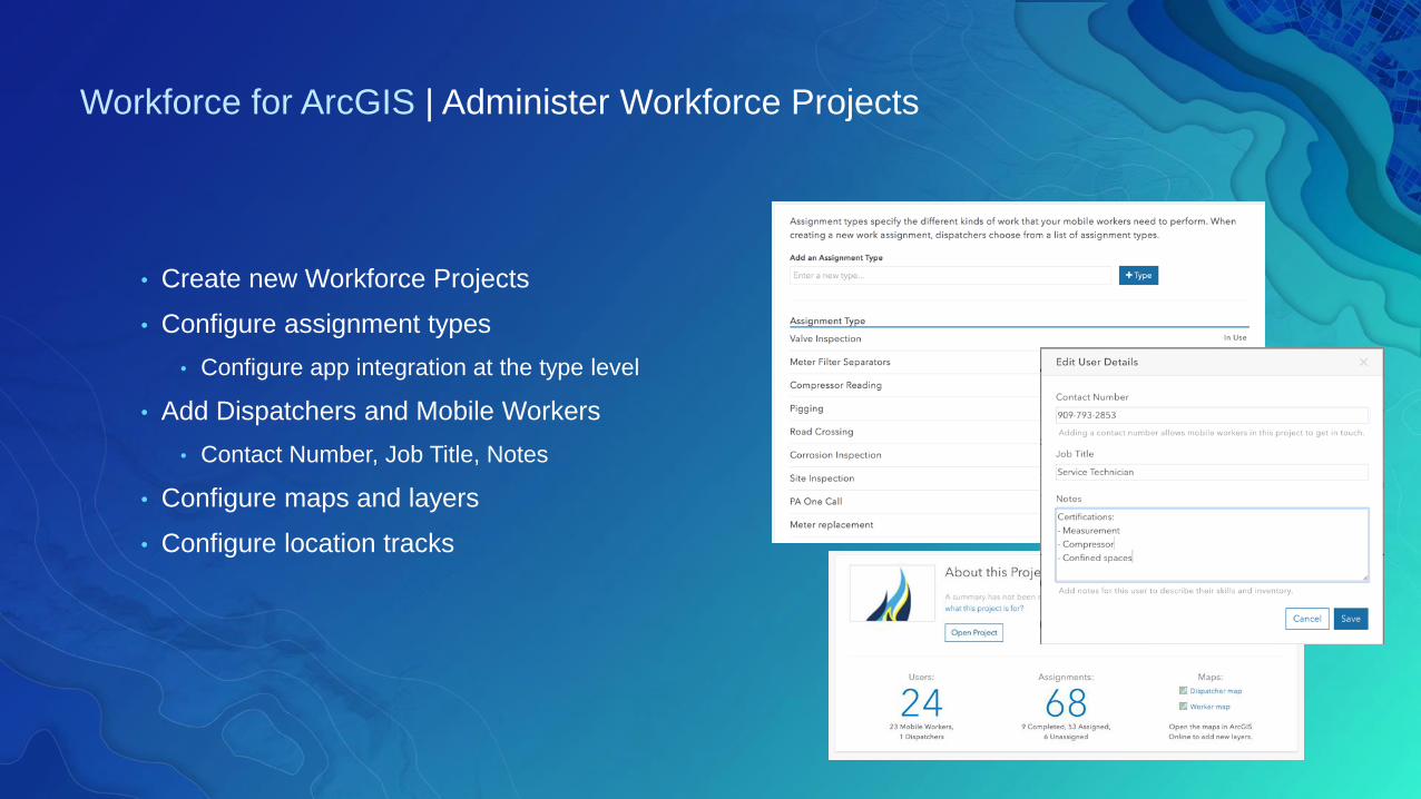
• Create new Workforce Projects
• Configure assignment types
• Configure app integration at the type level
• Add Dispatchers and Mobile Workers
• Contact Number, Job Title, Notes
• Configure maps and layers
• Configure location tracks
Workforce for ArcGIS | Administer Workforce Projects
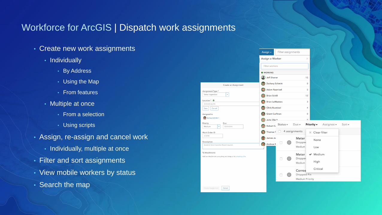
• Create new work assignments
• Individually
• By Address
• Using the Map
• From features
• Multiple at once
• From a selection
• Using scripts
• Assign, re-assign and cancel work
• Individually, multiple at once
• Filter and sort assignments
• View mobile workers by status
• Search the map
Workforce for ArcGIS | Dispatch work assignments
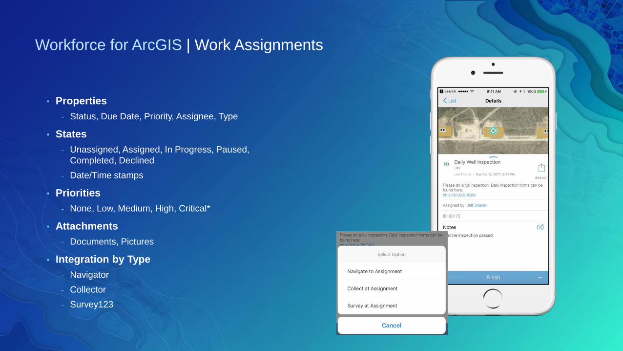
Workforce for ArcGIS | Work Assignments
• Properties
- Status, Due Date, Priority, Assignee, Type
• States
- Unassigned, Assigned, In Progress, Paused,
Completed, Declined
- Date/Time stamps
• Priorities
- None, Low, Medium, High, Critical*
• Attachments
- Documents, Pictures
• Integration by Type
- Navigator
- Collector
- Survey123
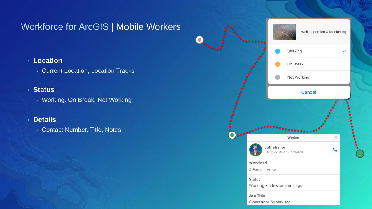
Workforce for ArcGIS | Mobile Workers
• Location
- Current Location, Location Tracks
• Status
- Working, On Break, Not Working
• Details
- Contact Number, Title, Notes
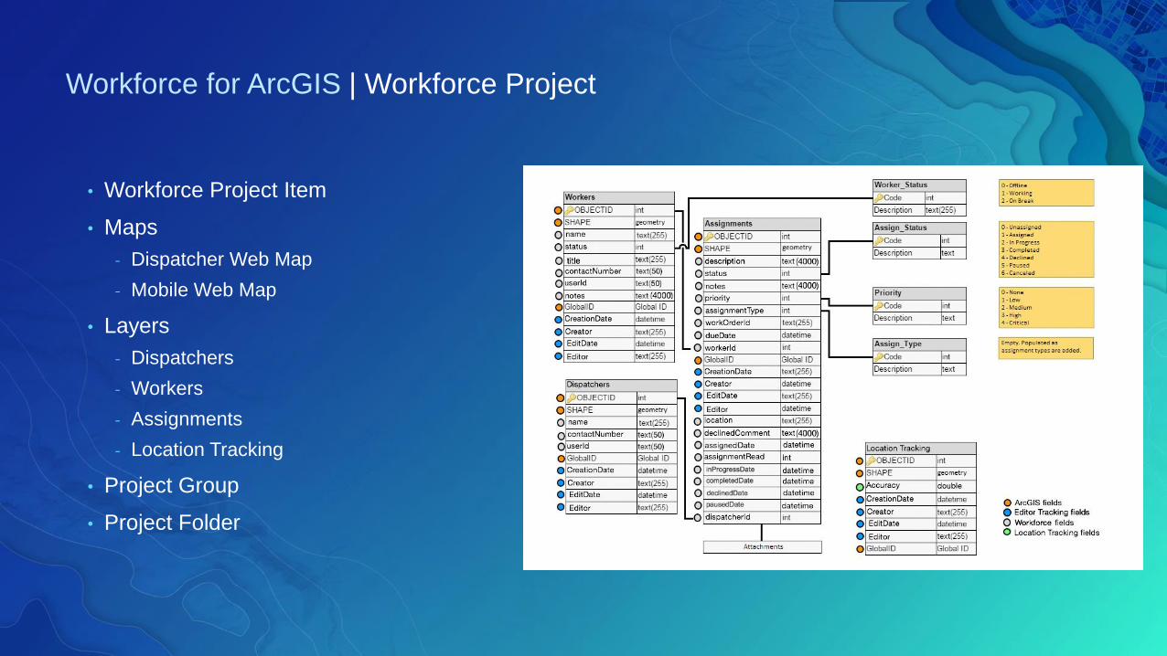
Workforce for ArcGIS | Workforce Project
• Workforce Project Item
• Maps
- Dispatcher Web Map
- Mobile Web Map
• Layers
- Dispatchers
- Workers
- Assignments
- Location Tracking
• Project Group
• Project Folder

January 8-12, 2018 | Redlands, CA
2018 ArcGIS Tech Transfer
What’s new in Workforce
What’s new in Workforce
Break
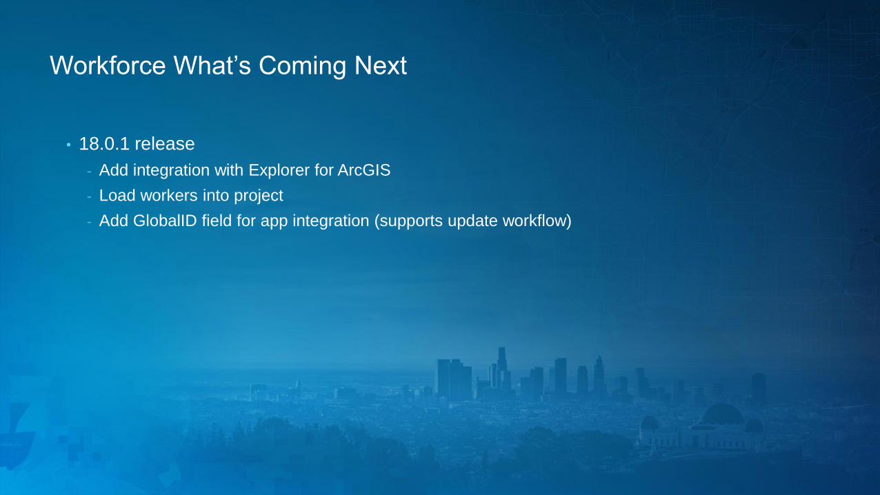
Workforce What’s Coming Next
• 18.0.1 release
- Add integration with Explorer for ArcGIS
- Load workers into project
- Add GlobalID field for app integration (supports update workflow)
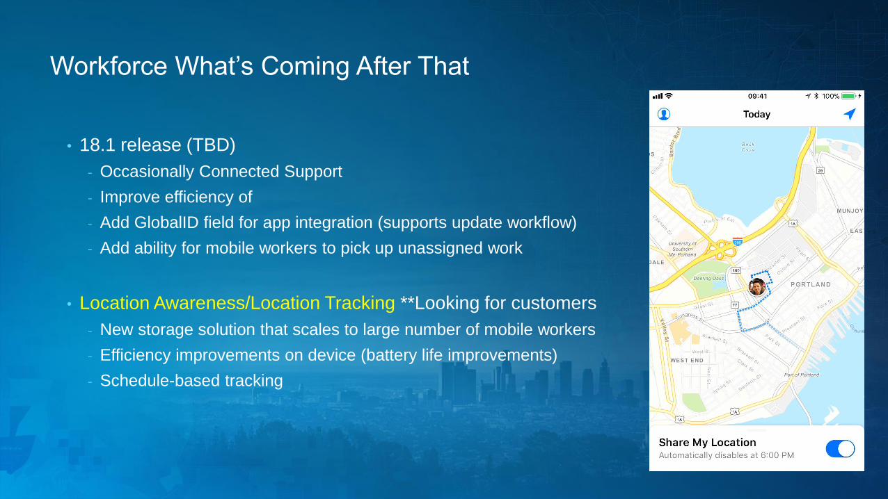
Workforce What’s Coming After That
• 18.1 release (TBD)
- Occasionally Connected Support
- Improve efficiency of
- Add GlobalID field for app integration (supports update workflow)
- Add ability for mobile workers to pick up unassigned work
• Location Awareness/Location Tracking **Looking for customers
- New storage solution that scales to large number of mobile workers
- Efficiency improvements on device (battery life improvements)
- Schedule-based tracking

Navigator for ArcGIS:An Introduction
John Sharrard
Scott Moore
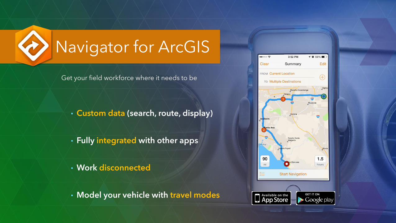
Navigator for ArcGIS
• Custom data (search, route, display)
• Fully integrated with other apps
• Work disconnected
• Model your vehicle with travel modes
Get your field workforce where it needs to be
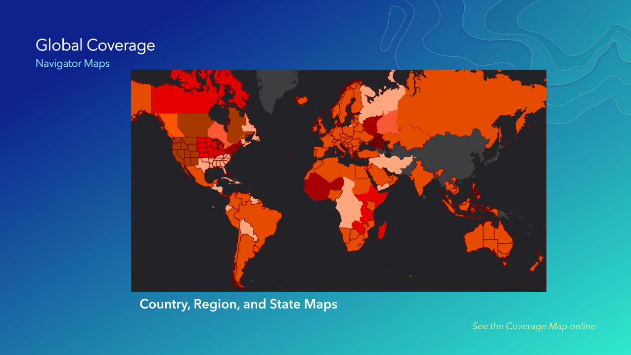
Global CoverageNavigator Maps
See the Coverage Map online
Country, Region, and State Maps
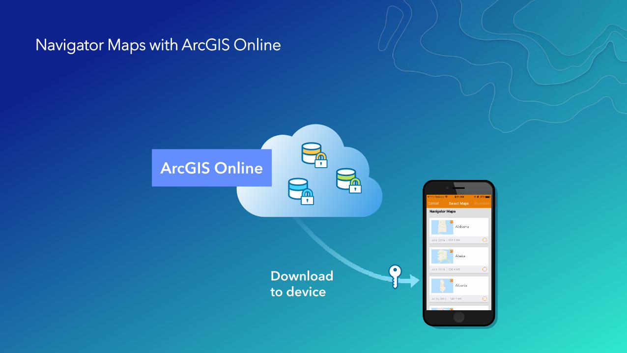
Navigator Maps with ArcGIS Online
ArcGIS Online
Download to device
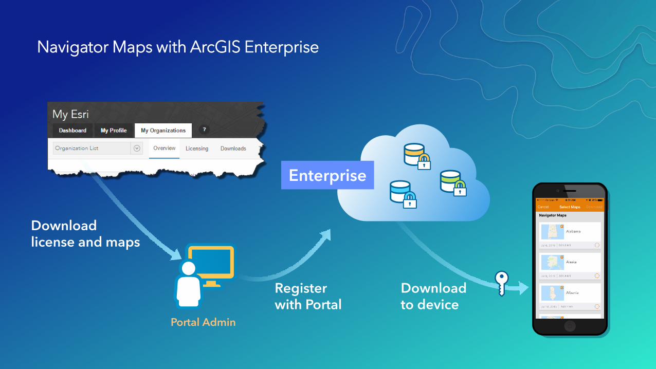
Navigator Maps with ArcGIS Enterprise
Portal Admin
Enterprise
Download to device
Register with Portal
Download license and maps
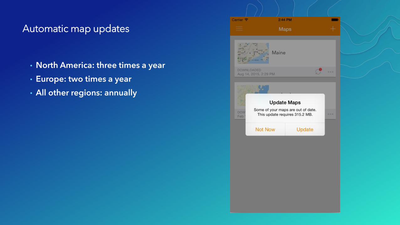
Automatic map updates
• North America: three times a year
• Europe: two times a year
• All other regions: annually
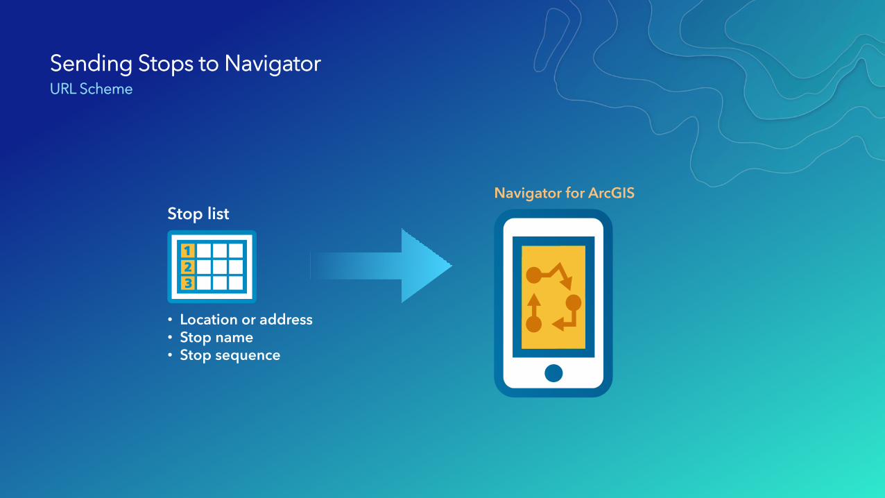
Sending Stops to NavigatorURL Scheme
Stop list
Navigator for ArcGIS
• Location or address• Stop name• Stop sequence
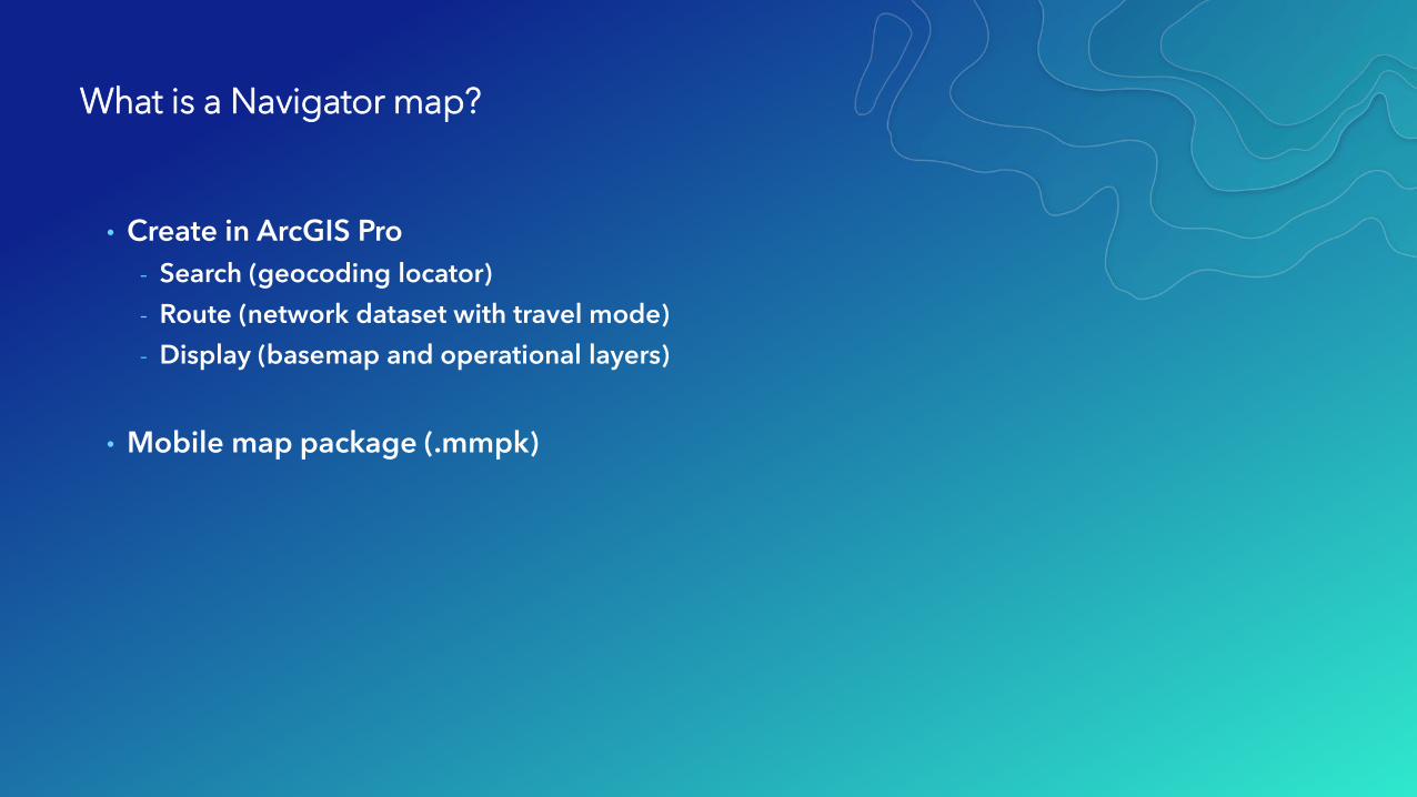
What is a Navigator map?
• Create in ArcGIS Pro
- Search (geocoding locator)
- Route (network dataset with travel mode)
- Display (basemap and operational layers)
• Mobile map package (.mmpk)
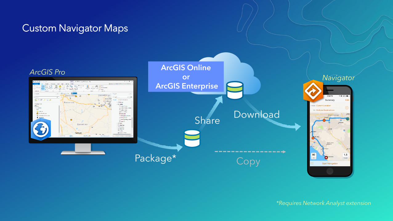
Custom Navigator Maps
*Requires Network Analyst extension
Package* Copy
ArcGIS Onlineor
ArcGIS Enterprise
Download Share
ArcGIS ProNavigator
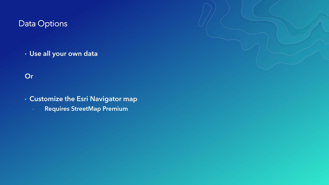
Data Options
• Use all your own data
Or
• Customize the Esri Navigator map
- Requires StreetMap Premium
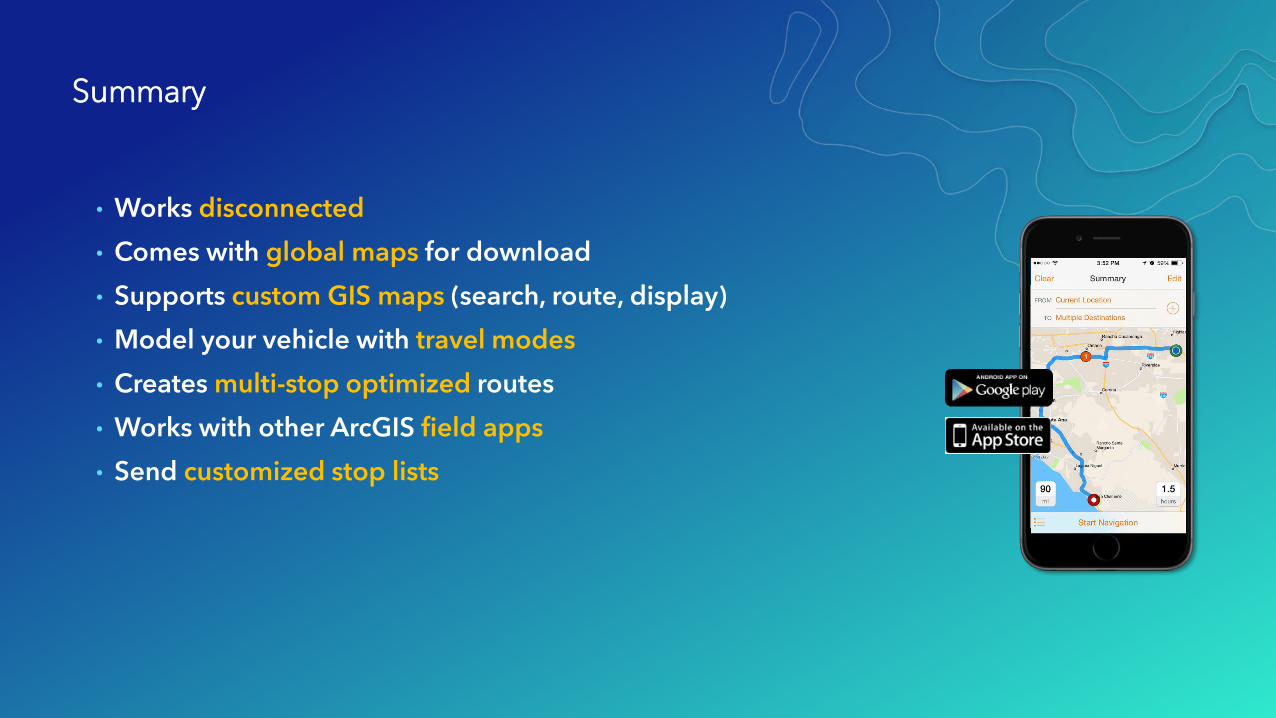
• Works disconnected
• Comes with global maps for download
• Supports custom GIS maps (search, route, display)
• Model your vehicle with travel modes
• Creates multi-stop optimized routes
• Works with other ArcGIS field apps
• Send customized stop lists
Summary
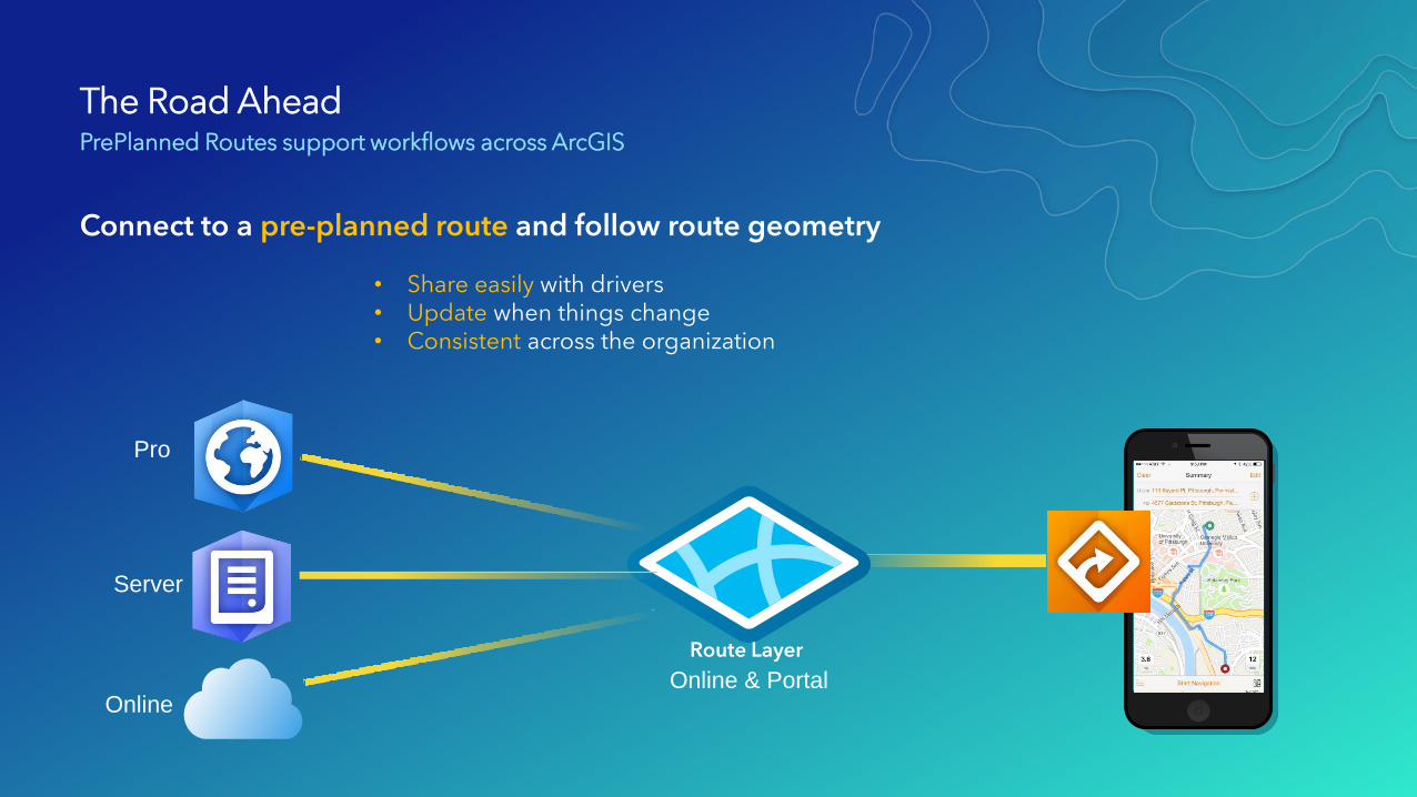
The Road AheadPrePlanned Routes support workflows across ArcGIS
Connect to a pre-planned route and follow route geometry
Pro
Server
OnlineOnline & Portal
Route Layer
• Share easily with drivers• Update when things change• Consistent across the organization
Resources
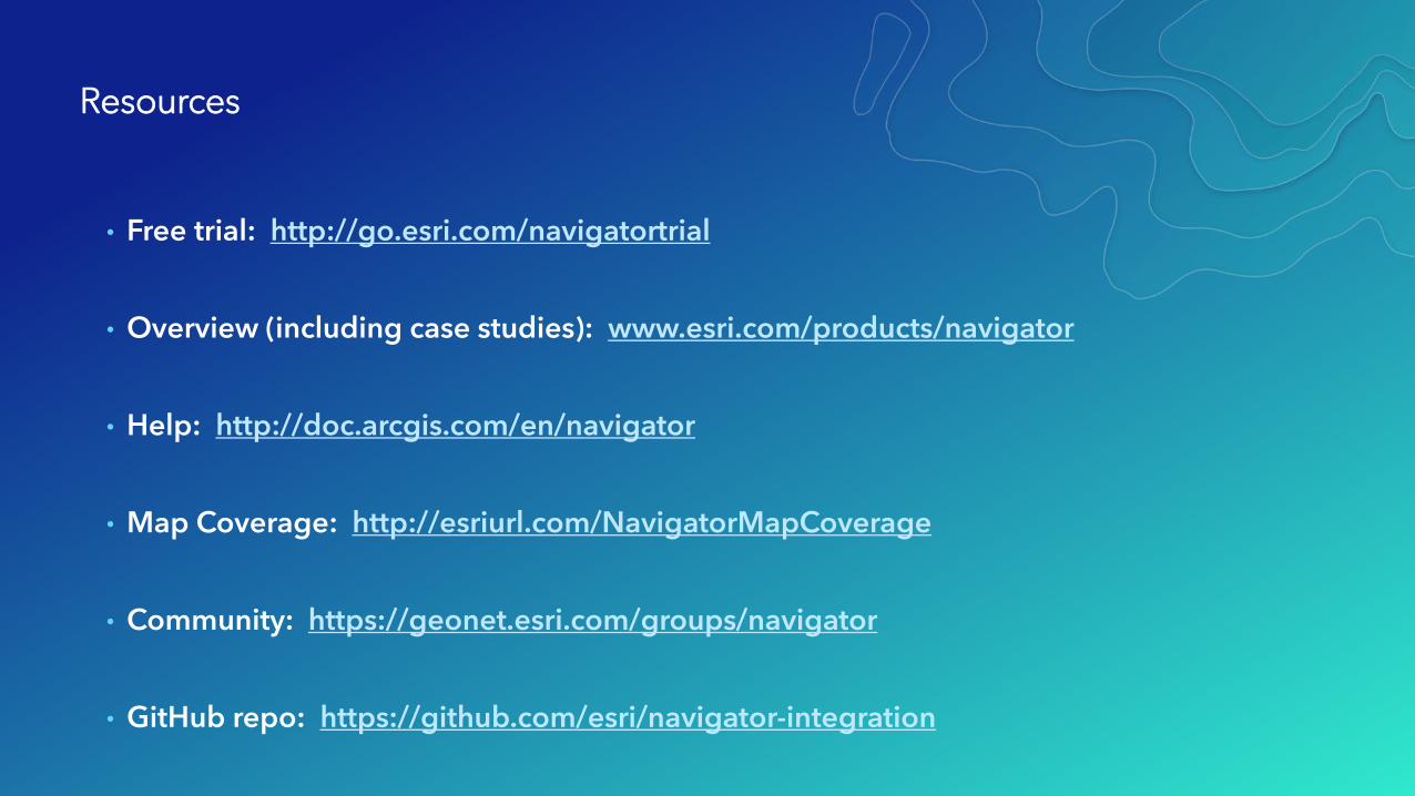
• Free trial: http://go.esri.com/navigatortrial
• Overview (including case studies): www.esri.com/products/navigator
• Help: http://doc.arcgis.com/en/navigator
• Map Coverage: http://esriurl.com/NavigatorMapCoverage
• Community: https://geonet.esri.com/groups/navigator
• GitHub repo: https://github.com/esri/navigator-integration

January 8-12, 2018 | Redlands, CA
2018 ArcGIS Tech Transfer
What’s new in Collector
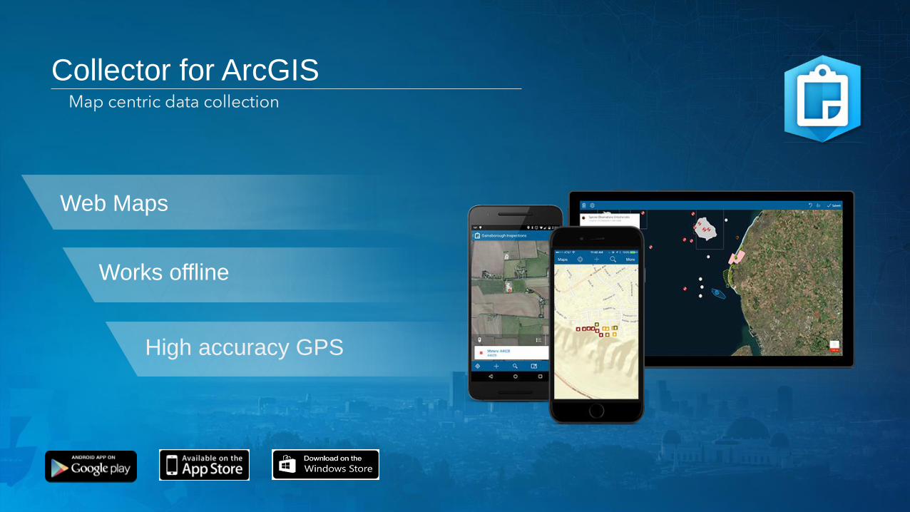
Collector for ArcGIS
Web Maps
High accuracy GPS
Works offline
Map centric data collection

Collector for ArcGIS – 2017
• High accuracy data collection
- GPS averaging
- 95% confidence interval
- Trimble Catalyst (Android only)
• Improved deployment
- External SD card support
- MDM configuration
• App integration
- Workforce for ArcGIS
- 3rd Party apps

What’s Coming Next
• 18.0.1 release (bug fix - Feb)
- Minor bug fix release
- Support for Leica GG04 Plus bluetooth GNSS receiver
The Aurora Project
• Better maps
- Labels, advanced symbology
- Vector basemaps
• Improved Collect Experience
- Cursor on target
- Reduced taps for photo attachments
- Required Fields support
• Improved User Experience
- New sliding panel (same feel as Explorer)
- Portrait mode for tablets feels like a clipboard
• New Capabilities
- Unit settings (USNG, Decimal Degrees, MGRS, etc)
- Compass Navigation

The Aurora Project
• Offline
- Greatly simplified Ad-hoc experience
- Pre-planned offline support
- Referenced basemaps
- Side-loaded basemaps
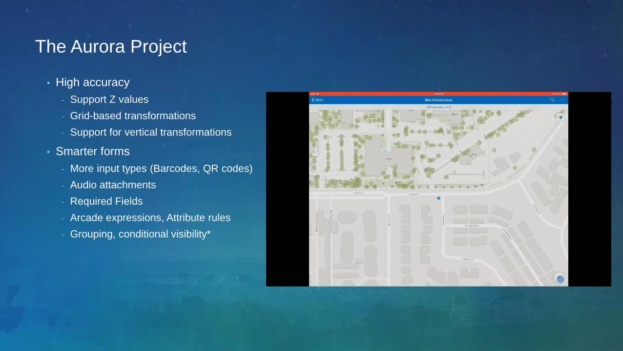
The Aurora Project
• High accuracy
- Support Z values
- Grid-based transformations
- Support for vertical transformations
• Smarter forms
- More input types (Barcodes, QR codes)
- Audio attachments
- Required Fields
- Arcade expressions, Attribute rules
- Grouping, conditional visibility*

Survey123 for ArcGIS: An Introduction
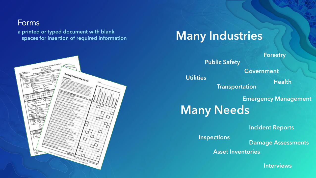
Formsa printed or typed document with blank
spaces for insertion of required information
Inspections
Asset Inventories
Incident Reports
Interviews
Damage Assessments
Many Needs
Many Industries
Utilities
Transportation
Government
Health
Emergency Management
Public SafetyForestry
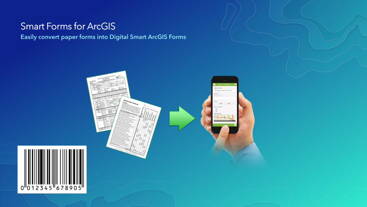
Smart Forms for ArcGISEasily convert paper forms into Digital Smart ArcGIS Forms
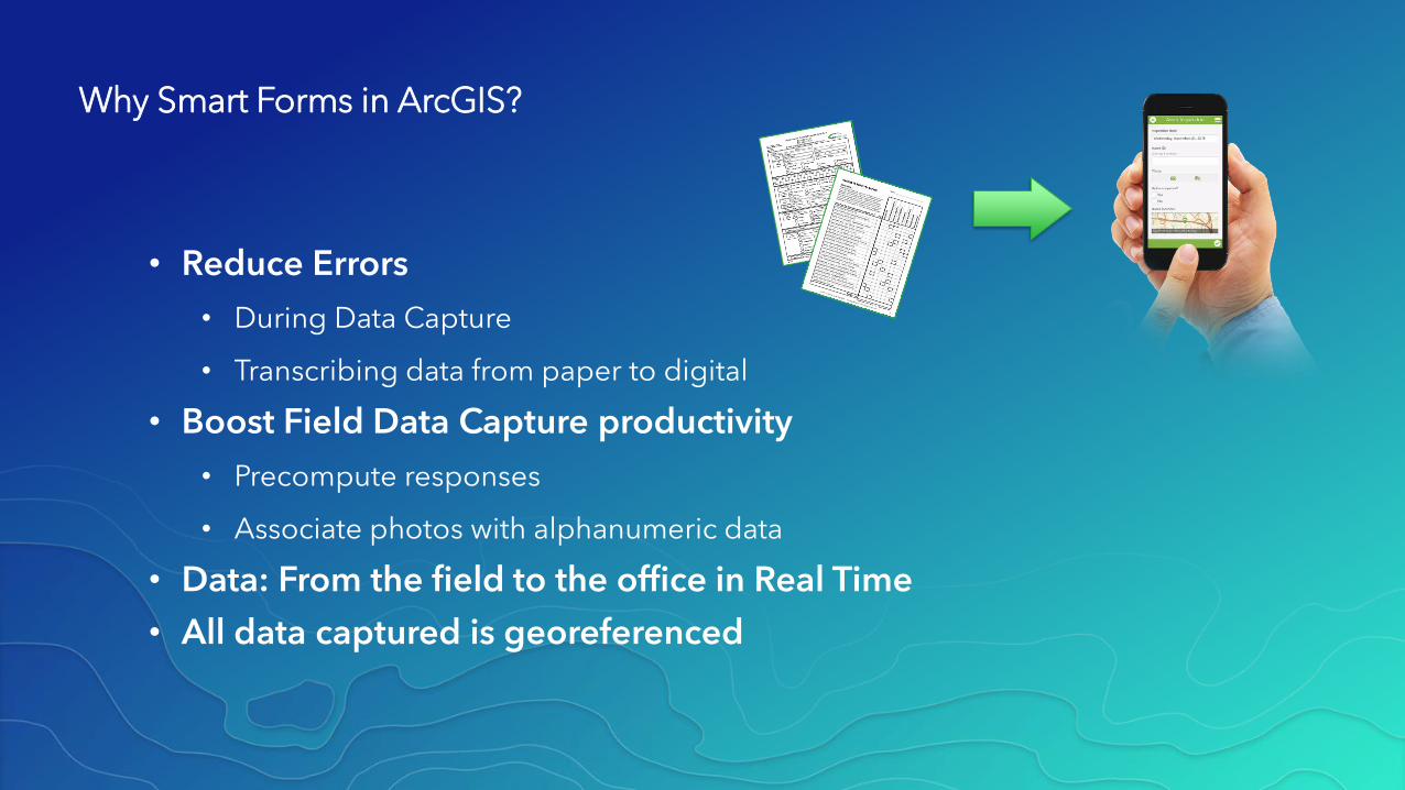
Why Smart Forms in ArcGIS?
• Reduce Errors
• During Data Capture
• Transcribing data from paper to digital
• Boost Field Data Capture productivity
• Precompute responses
• Associate photos with alphanumeric data
• Data: From the field to the office in Real Time
• All data captured is georeferenced
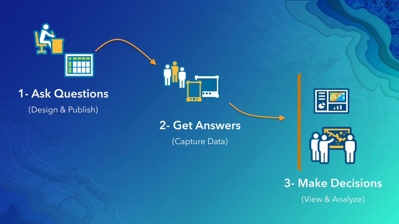
1- Ask Questions
(Design & Publish)
2- Get Answers
(Capture Data)
3- Make Decisions
(View & Analyze)
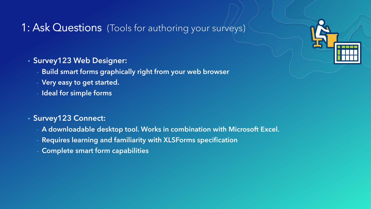
1: Ask Questions (Tools for authoring your surveys)
• Survey123 Web Designer:
- Build smart forms graphically right from your web browser
- Very easy to get started.
- Ideal for simple forms
• Survey123 Connect:
- A downloadable desktop tool. Works in combination with Microsoft Excel.
- Requires learning and familiarity with XLSForms specification
- Complete smart form capabilities
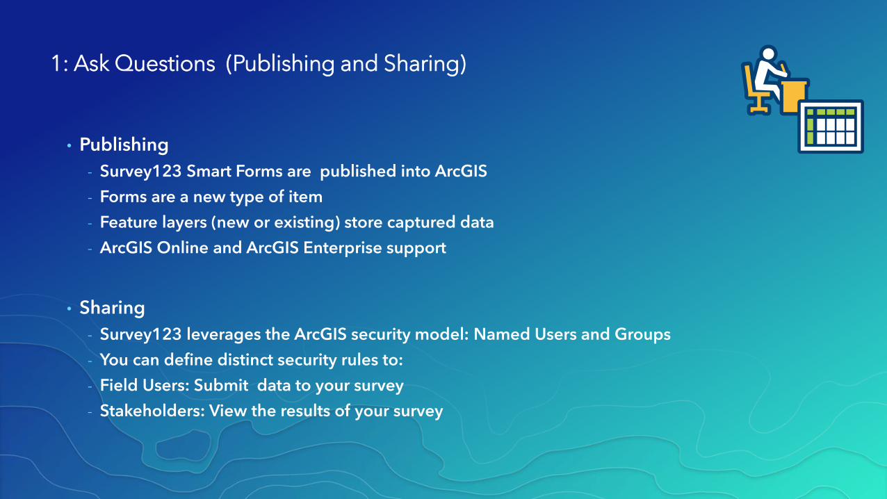
1: Ask Questions (Publishing and Sharing)
• Publishing
- Survey123 Smart Forms are published into ArcGIS
- Forms are a new type of item
- Feature layers (new or existing) store captured data
- ArcGIS Online and ArcGIS Enterprise support
• Sharing
- Survey123 leverages the ArcGIS security model: Named Users and Groups
- You can define distinct security rules to:
- Field Users: Submit data to your survey
- Stakeholders: View the results of your survey
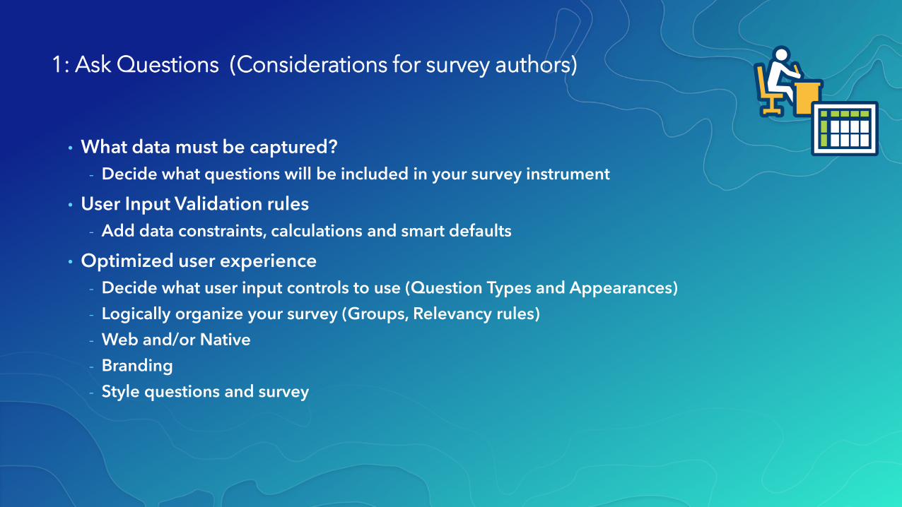
1: Ask Questions (Considerations for survey authors)
• What data must be captured?
- Decide what questions will be included in your survey instrument
• User Input Validation rules
- Add data constraints, calculations and smart defaults
• Optimized user experience
- Decide what user input controls to use (Question Types and Appearances)
- Logically organize your survey (Groups, Relevancy rules)
- Web and/or Native
- Branding
- Style questions and survey
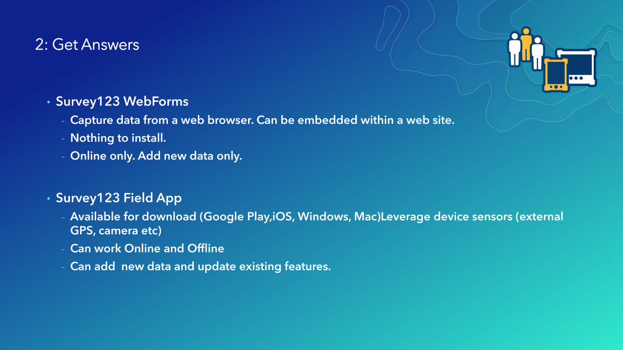
2: Get Answers
• Survey123 WebForms
- Capture data from a web browser. Can be embedded within a web site.
- Nothing to install.
- Online only. Add new data only.
• Survey123 Field App
- Available for download (Google Play,iOS, Windows, Mac)Leverage device sensors (external GPS, camera etc)
- Can work Online and Offline
- Can add new data and update existing features.
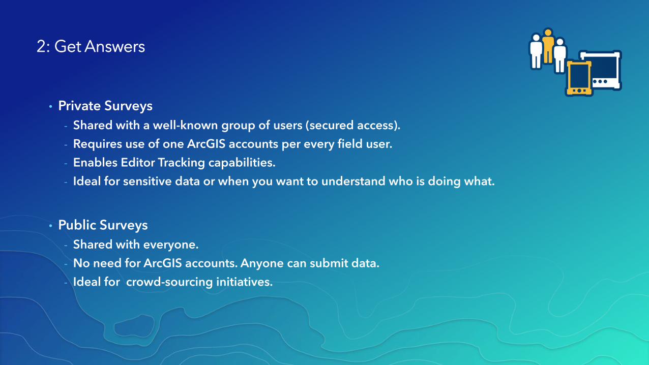
2: Get Answers
• Private Surveys
- Shared with a well-known group of users (secured access).
- Requires use of one ArcGIS accounts per every field user.
- Enables Editor Tracking capabilities.
- Ideal for sensitive data or when you want to understand who is doing what.
• Public Surveys
- Shared with everyone.
- No need for ArcGIS accounts. Anyone can submit data.
- Ideal for crowd-sourcing initiatives.
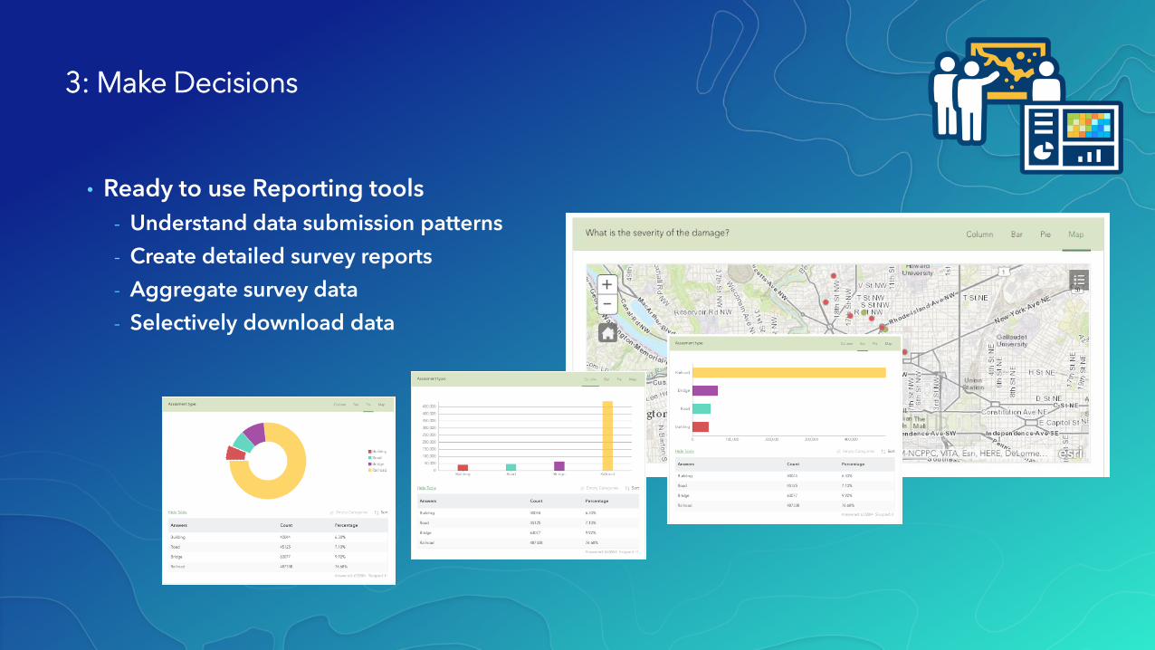
3: Make Decisions
• Ready to use Reporting tools
- Understand data submission patterns
- Create detailed survey reports
- Aggregate survey data
- Selectively download data
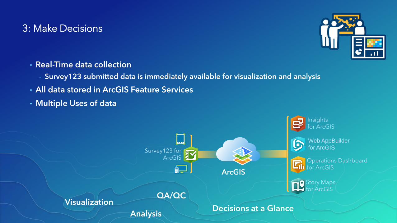
ArcGIS
Operations Dashboardfor ArcGIS
Insights for ArcGIS
Story Mapsfor ArcGIS
Web AppBuilder
for ArcGISSurvey123 for
ArcGIS
Visualization
Analysis
QA/QC
Decisions at a Glance
3: Make Decisions
• Real-Time data collection
- Survey123 submitted data is immediately available for visualization and analysis
• All data stored in ArcGIS Feature Services
• Multiple Uses of data

January 8-12, 2018 | Redlands, CA
2018 ArcGIS Tech Transfer
What’s new in
Survey123 for ArcGIS

5 New Things
• Modify Table Layout
• Edit Existing Data
• Draw
• Record Audio
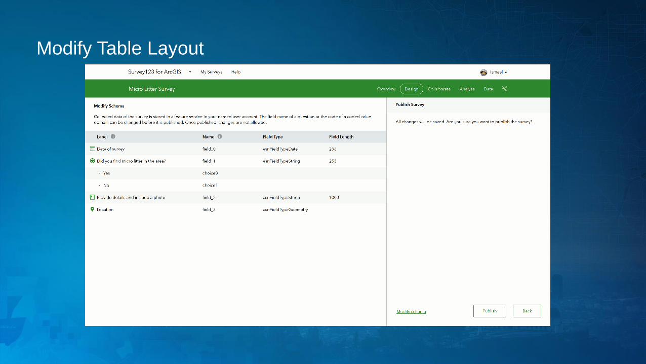
Modify Table Layout
Inspection Workflows (Editing)
• Work with existing data (federated services)
• Support for controlling the editing experience
- Add new records or update existing records?
- Define which features to update
- Control which fields are updated
• Related Record Support
- General asset information / individual inspection
- Overall condition/component condition
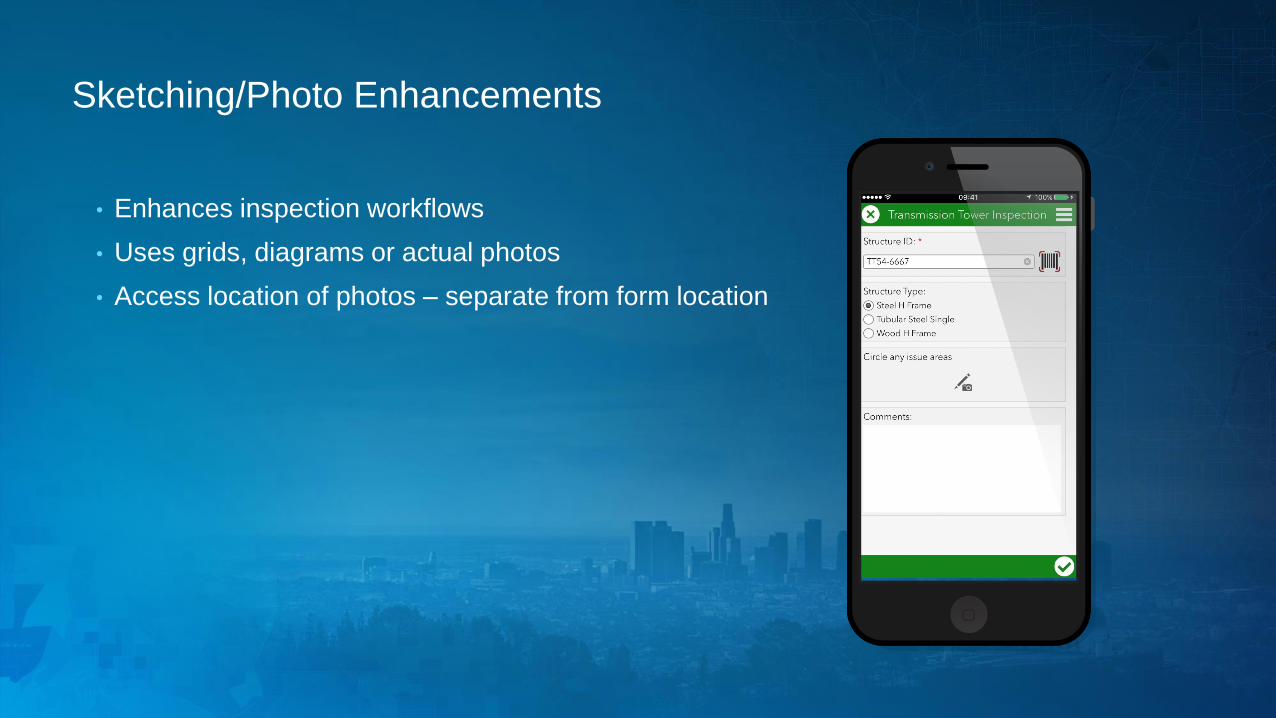
Sketching/Photo Enhancements
• Enhances inspection workflows
• Uses grids, diagrams or actual photos
• Access location of photos – separate from form location
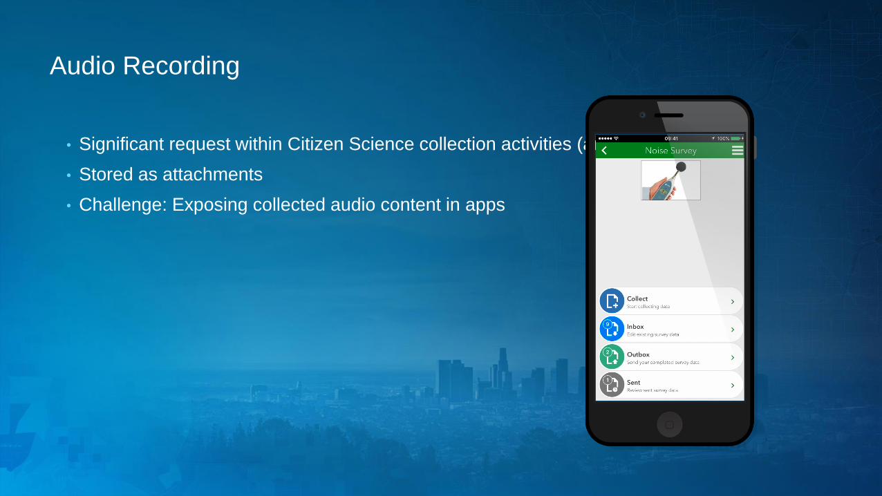
Audio Recording
• Significant request within Citizen Science collection activities (animal calls)
• Stored as attachments
• Challenge: Exposing collected audio content in apps
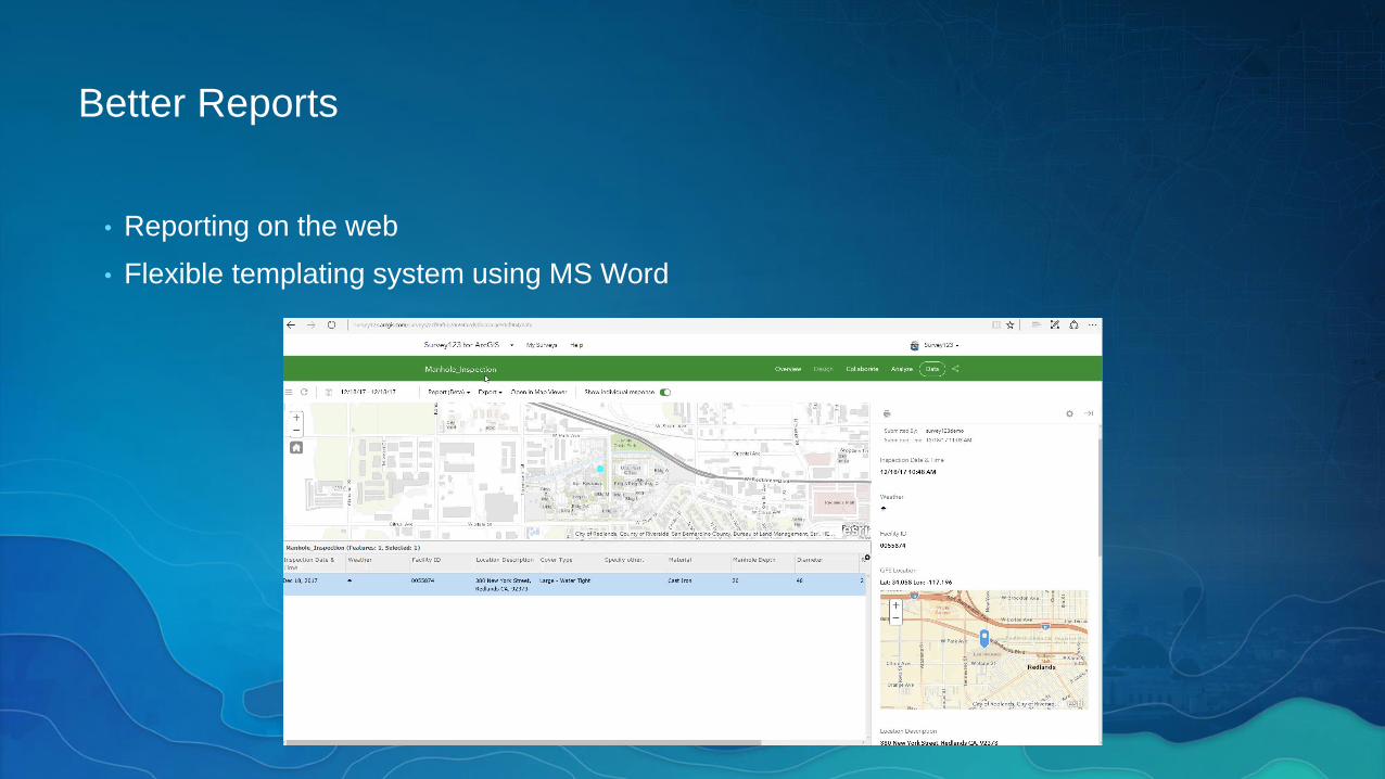
Better Reports
• Reporting on the web
• Flexible templating system using MS Word
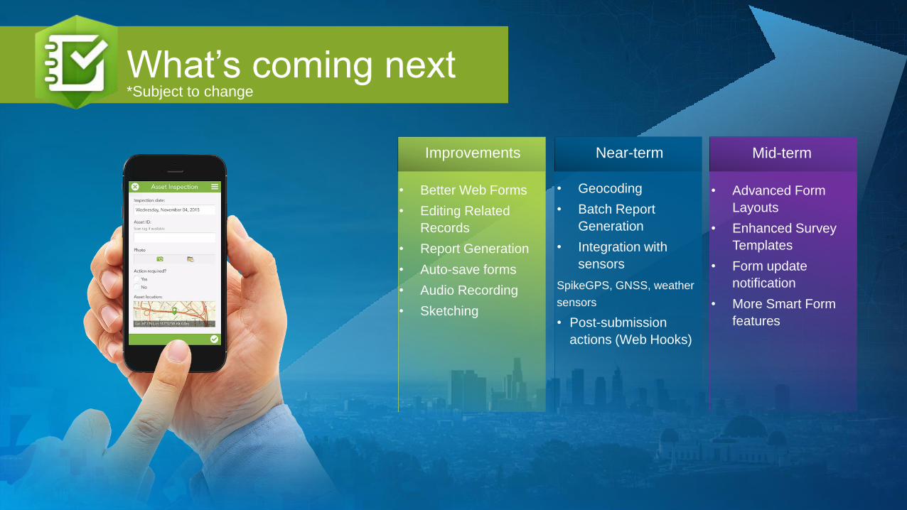
What’s coming next
• Geocoding
• Batch Report
Generation
• Integration with
sensors
SpikeGPS, GNSS, weather
sensors
• Post-submission
actions (Web Hooks)
Near-term Mid-termImprovements
• Better Web Forms
• Editing Related
Records
• Report Generation
• Auto-save forms
• Audio Recording
• Sketching
• Advanced Form
Layouts
• Enhanced Survey
Templates
• Form update
notification
• More Smart Form
features
*Subject to change

External Devices: Spike
• Rangefinder + Device’s Camera
• Measure
- Distances
- Length/Area in photo
• Ex: Video demonstration
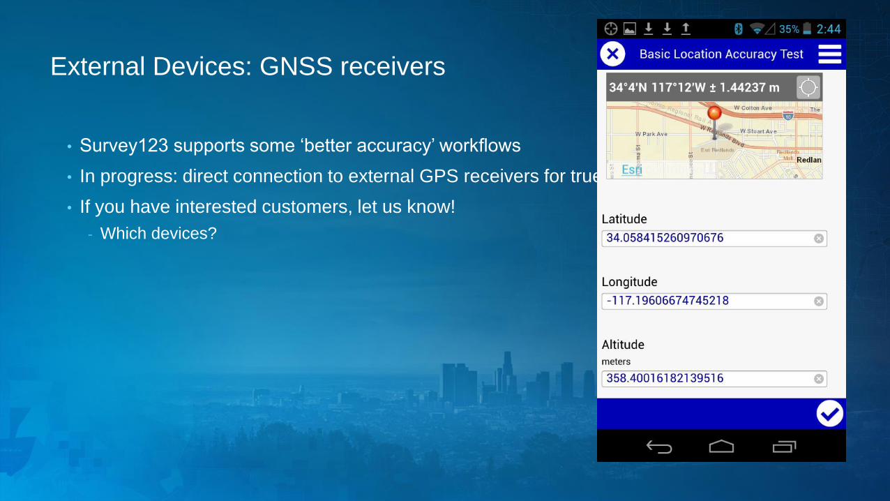
External Devices: GNSS receivers
• Survey123 supports some ‘better accuracy’ workflows
• In progress: direct connection to external GPS receivers for true high accuracy workflows
• If you have interested customers, let us know!
- Which devices?
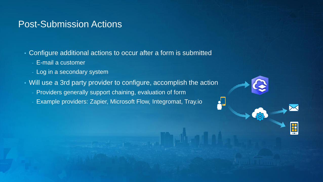
Post-Submission Actions
• Configure additional actions to occur after a form is submitted
- E-mail a customer
- Log in a secondary system
• Will use a 3rd party provider to configure, accomplish the action
- Providers generally support chaining, evaluation of form
- Example providers: Zapier, Microsoft Flow, Integromat, Tray.io

2018 Priorities
• Post-submission actions
• External sensor support
• Geosearch & coordinate lookup
• Line & polygon support
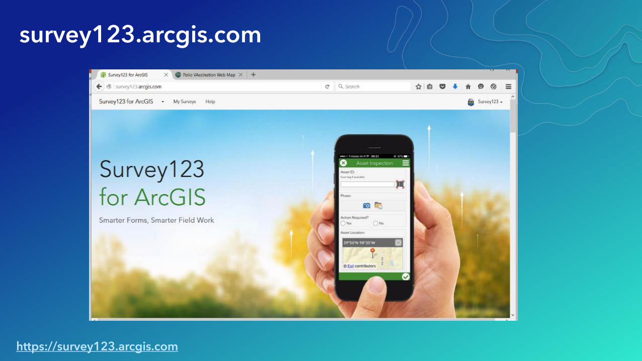
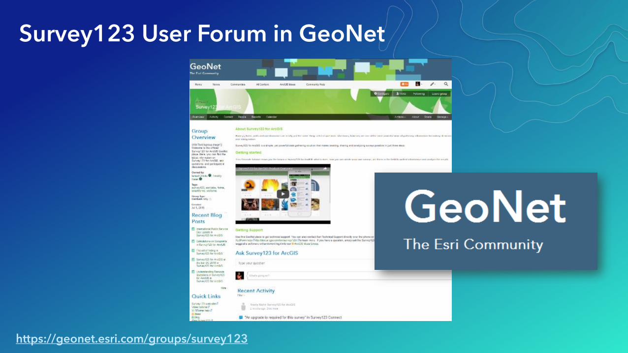
Survey123 User Forum in GeoNet
https://geonet.esri.com/groups/survey123
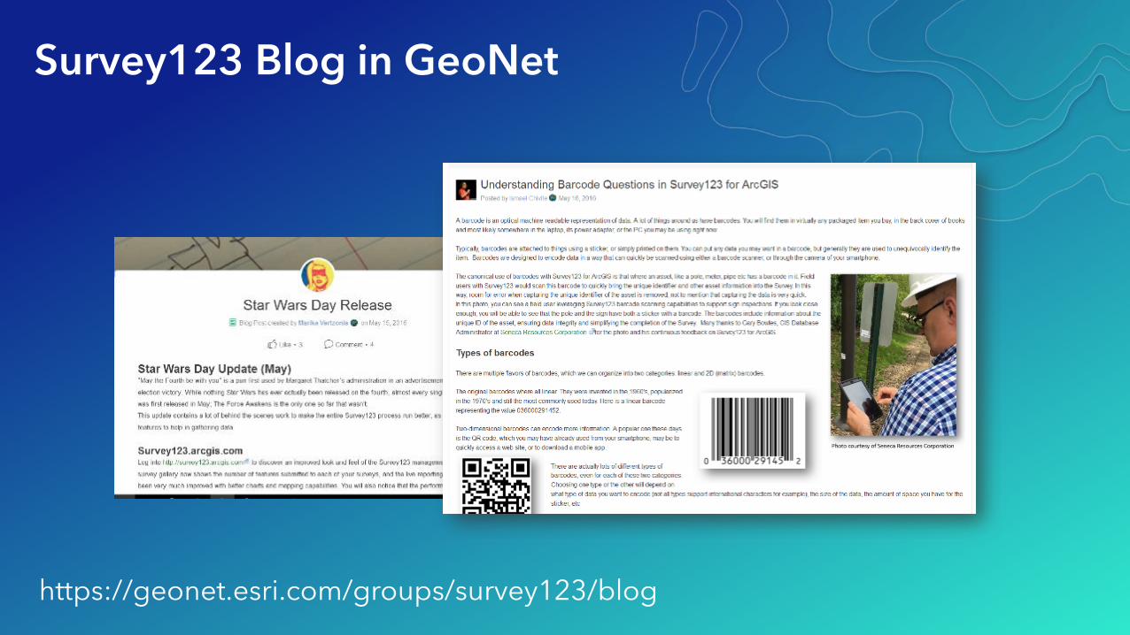
Survey123 Blog in GeoNet
https://geonet.esri.com/groups/survey123/blog
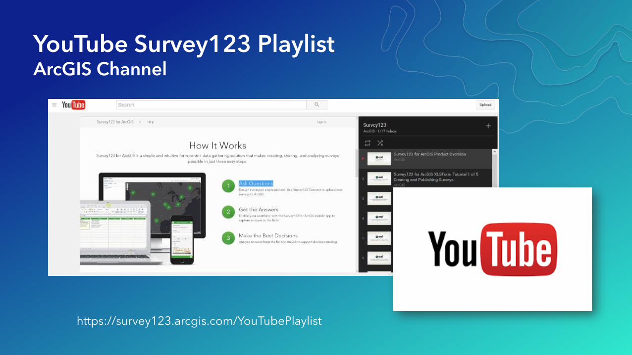
YouTube Survey123 PlaylistArcGIS Channel
https://survey123.arcgis.com/YouTubePlaylist
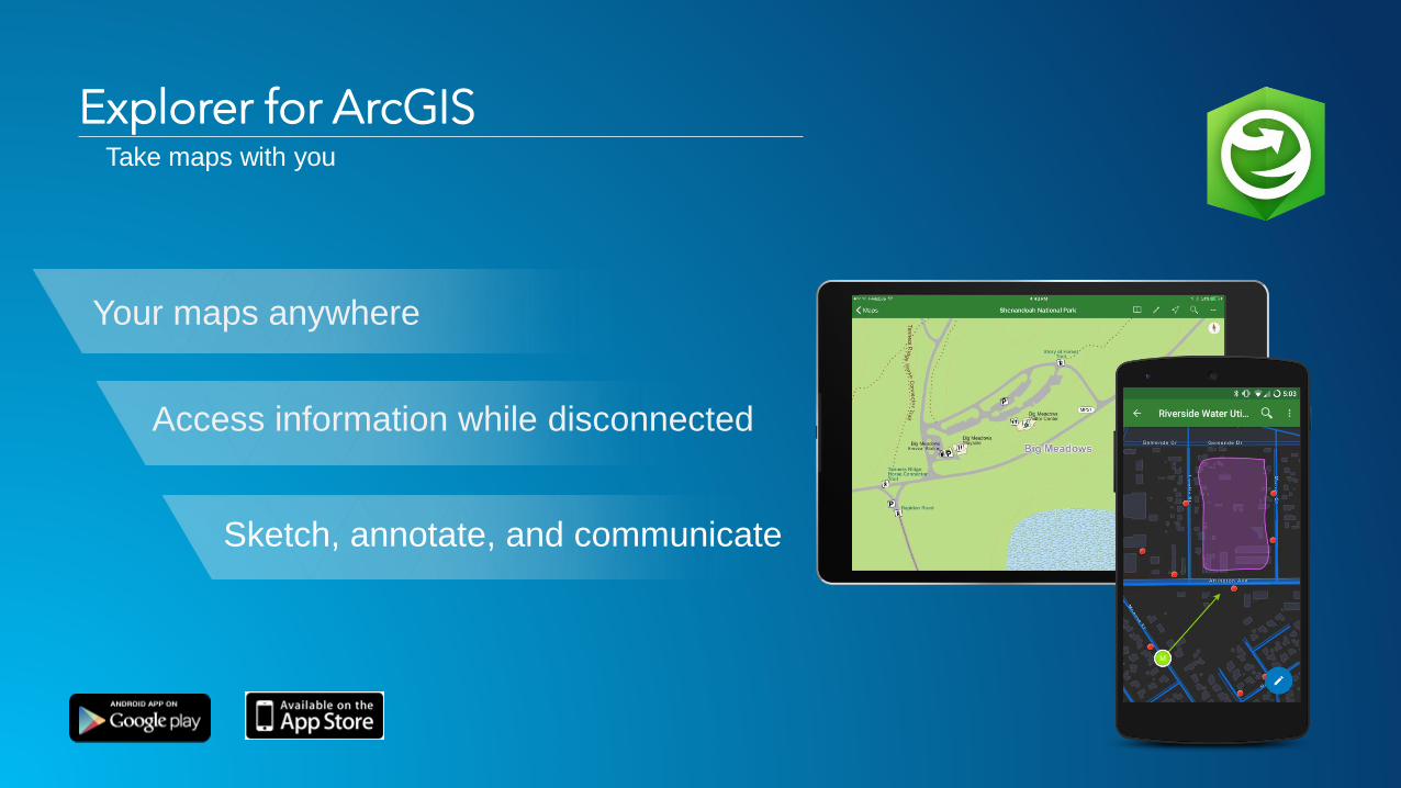
Explorer for ArcGIS
Your maps anywhere
Sketch, annotate, and communicate
Access information while disconnected
Take maps with you

January 8-12, 2018 | Redlands, CA
2018 ArcGIS Tech Transfer
What’s new in Operations
Dashboard
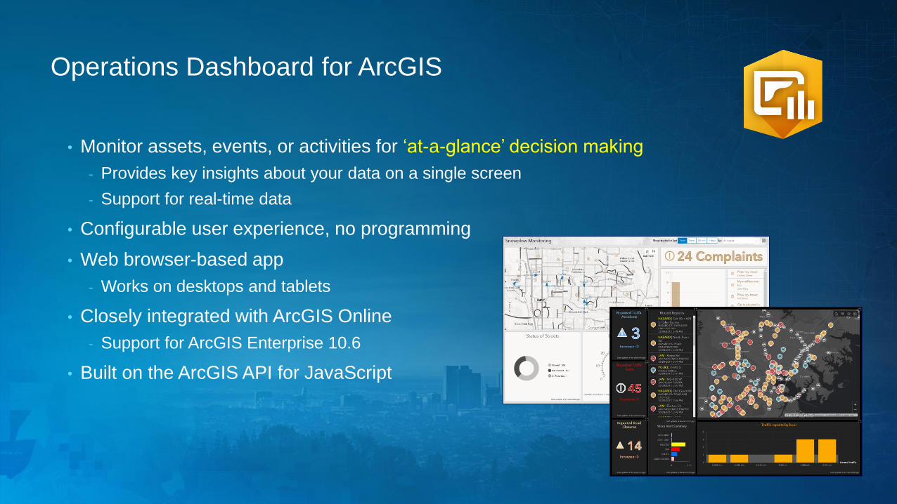
Operations Dashboard for ArcGIS
• Monitor assets, events, or activities for ‘at-a-glance’ decision making
- Provides key insights about your data on a single screen
- Support for real-time data
• Configurable user experience, no programming
• Web browser-based app
- Works on desktops and tablets
• Closely integrated with ArcGIS Online
- Support for ArcGIS Enterprise 10.6
• Built on the ArcGIS API for JavaScript
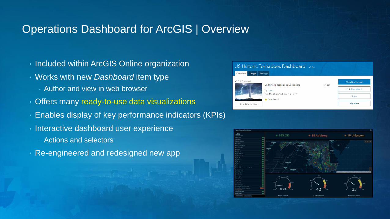
Operations Dashboard for ArcGIS | Overview
• Included within ArcGIS Online organization
• Works with new Dashboard item type
- Author and view in web browser
• Offers many ready-to-use data visualizations
• Enables display of key performance indicators (KPIs)
• Interactive dashboard user experience
- Actions and selectors
• Re-engineered and redesigned new app
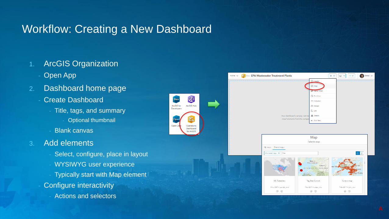
Workflow: Creating a New Dashboard
1. ArcGIS Organization
- Open App
2. Dashboard home page
- Create Dashboard
- Title, tags, and summary
- Optional thumbnail
- Blank canvas
3. Add elements
- Select, configure, place in layout
- WYSIWYG user experience
- Typically start with Map element
- Configure interactivity
- Actions and selectors
A
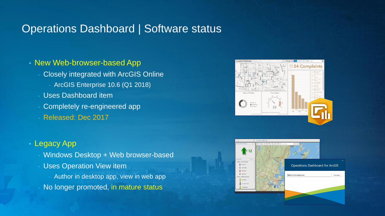
Operations Dashboard | Software status
• New Web-browser-based App
- Closely integrated with ArcGIS Online
- ArcGIS Enterprise 10.6 (Q1 2018)
- Uses Dashboard item
- Completely re-engineered app
- Released: Dec 2017
• Legacy App
- Windows Desktop + Web browser-based
- Uses Operation View item
- Author in desktop app, view in web app
- No longer promoted, in mature status