an assessment of climate change impacts and adaptation for the torres strait islands, australia
TRANSCRIPT

Climatic Change (2010) 102:405–433DOI 10.1007/s10584-009-9756-2
An assessment of climate change impactsand adaptation for the Torres Strait Islands, Australia
Donna Green · Lisa Alexander · Kathy Mclnnes ·John Church · Neville Nicholls · Neil White
Received: 6 October 2008 / Accepted: 7 October 2009 / Published online: 11 December 2009© Springer Science + Business Media B.V. 2009
Abstract Adaptive practices are taking place in a range of sectors and regionsin Australia in response to existing climate impacts, and in anticipation of futureunavoidable impacts. For a rich economy such as Australia’s, the majority of humansystems have considerable adaptive capacity. However, the impacts on humansystems at the intra-nation level are not homogenous due to their differing levels ofexposure, sensitivity and capacity to adapt to climate change. Despite past resilienceto changing climates, many Indigenous communities located in remote areas arecurrently identified as highly vulnerable to climate impacts due to their high levelof exposure and sensitivity, but low capacity to adapt. In particular, communitieslocated on low-lying islands have particular vulnerability to sea level rise andincreasingly intense storm surges caused by more extreme weather. Several TorresStrait Island community leaders have been increasingly concerned about these issues,and the ongoing risks to these communities’ health and well-being posed by directand indirect climate impacts. A government agency is beginning to develop short-term and long-term adaptation plans for the region. This work, however, is beingdeveloped without adequate scientific assessment of likely ‘climate changed futures.’This is because the role that anthropogenic climate change has played, or will play,
D. Green (B)Climate Change Research Centre, University of New South Wales, Sydney 2052, Australiae-mail: [email protected]
L. Alexander · N. NichollsSchool of Geography and Environmental Science, Monash University,Clayton, Victoria, Australia
K. Mclnnes · J. Church · N. WhiteCentre for Australian Weather and Climate Research—A partnership between CSIROand the Australian Bureau of Meteorology, CSIRO Marine and Atmospheric Research,Private Bag 1, Aspendale, Victoria, 3195 Australia
K. Mclnnes · J. Church · N. WhiteAntarctic Climate and Ecosystems Cooperative Research Centre, Hobart, Tasmania, Australia

406 Climatic Change (2010) 102:405–433
on extreme weather events for this region is not currently clear. This paper drawstogether regional climate data to enable a more accurate assessment of the islands’exposure to climate impacts. Understanding the level of exposure and uncertaintyaround specific impacts is vital to gauge the nature of these islands’ vulnerability,in so doing, to inform decisions about how best to develop anticipatory adaptationstrategies over various time horizons, and to address islanders’ concerns about thelikely resilience and viability of their communities in the longer term.
1 Introduction
In order to facilitate risk assessments and the design of anticipatory adapta-tion strategies, a number of regional climate change projections and impactassessments have been carried out in Australia over the last few years (Hennessyet al. 2004; PIA 2004; Australian Greenhouse Office 2006; CSIRO and BoM 2007;Johnson and Marshall 2007). The majority of these studies have prioritised geo-graphic areas with large infrastructural investments (e.g. Cairns and the Gold Coast,Queensland); sensitive industries (e.g. in the Murray Darling Basin, New SouthWales and Victoria); dense populations (e.g. Sydney Coastal Councils, New SouthWales) or coastal locations (e.g. Western Port, Victoria; the Great Barrier Reef,Queensland). However, there are some regions of Australia that are identified ashaving highly vulnerable human and natural systems, but which have had limitedclimate impact assessment work performed in them (Hennessy et al. 2007). A numberof small coastal communities in northern Australia fall into this category. Many ofthese communities are predominantly Indigenous, and the majority of them havelow socio-economic indicators (AIHW 2008:67).
The Torres Strait Islands are a specific and geographically bounded example ofsuch ‘highly vulnerable’ communities. These remote islands are located betweenPapua New Guinea and Cape York, Australia. Over 7,000 people live in 18 com-munities on these islands, several of which are only a couple of metres above localmean sea level.
The Torres Strait rose to prominence on mainland Australia in 1992 when theMeriam people successfully fought to gain native title (recognition of the continuedownership of land by local Indigenous Australians) over Mer Island. This decisionsubsequently paved the way for native title claims to be made by Aboriginal peopleon mainland Australia.
Having successfully won native title over all the inhabited islands in the TorresStrait, Islanders are quite reasonably concerned that the impacts and risks associatedwith climate change may, amongst other things, affect their ability to continue livingon their land in the longer term, and carrying out traditional subsistence harvestingfrom surrounding seas. These concerns have been raised in a number of nationaland international fora, including the most recent United Nations’ Permanent Forumon Indigenous Issues that was focused on climate change. A major concern ishow the unique Ailan Kastom, (Island Custom) that is the link between land, sea,environment and Torres Strait Islander culture, would be affected if Torres StraitIslanders were forced to move off their land (AHRC 2009).
Islanders’ resilience to climate change is limited by pre-existing social and eco-nomic disadvantage that reduces these communities’ capacity to adapt to rapid

Climatic Change (2010) 102:405–433 407
environmental change (Green 2006a). Similar to mainland Aboriginal communities,their sensitivity to relatively rapid change such as an increase in natural disasters,is compounded by inadequate transport and communications infrastructure, andhealth services (Ring and Brown 2002). In addition, specific cultural issues need to beconsidered. These include Islanders’ belief in the connection between the health oftheir land and sea country, with their communities’ and their own individual well-being (Green 2006b; Oliver-Smith 2008). This cultural dimension adds increasingcomplexity to comprehending the full impacts of climate change in this location.The following sections detail what is currently known about this region to enablean assessment of the exposure of the islands to climate impacts to be made.
1.1 The Torres Strait Islands
The Torres Strait region encompasses about 48,000 km2 of open sea, including ashallow continental shelf between Papua New Guinea and Cape York, Australiaand connecting the Arafura Sea with the Coral Sea. Protected from high swells bythe northern-most extension of the Great Barrier Reef, the shelf itself has strongtidal currents and an irregular bathymetry, with numerous reefs and islands. Theclimate of the Torres Strait is characterised by two seasons, the monsoonal wetseason (December to April), which is dominated by prevailing north-westerly winds,and the dry season (May to November), when south-easterly trade winds dominate.
Communities living on small low-lying islands, such as those in the Torres Strait,are particularly vulnerable to physical impacts of weather (Mulrennan 1992; Bessen2005; ARUP 2006). Over 150 islands are located in the region, with about 17permanently inhabited by Aboriginal and Islander communities (see Fig. 1). Theislands can be roughly grouped due to their location and island form. These groupsare: the eastern volcanic islands (Ugar, Erub and Mer), northwestern islands (Boigu,Dauan and Saibai), central islands (Iama, Masig, Poruma and Warraber), nearwestern islands (Mabuiag, Badu and Moa) and inner islands (Hammond, Thursday,Prince of Wales and Horn). Of these inhabited islands the four central coral cayislands, and two low-lying, coral-based islands with sedimentary overlay have initiallybeen identified as most vulnerable to climate impacts due to their generally lowelevation above sea level.
About one fifth of Australia’s total Torres Strait Islander population live on theislands in the Torres Strait. The island population is about 7,000. The majority ofthe mainland Torres Strait Island population lives in Queensland and the NorthernTerritory. The population growth rate for Indigenous Australians is significantlyhigher than the national average, for example, between 2001 and 2006, the estimatedIndigenous resident population increased by 13% (AIHW 2008:68). There arehowever, many complexities in identifying the various components of this increase,for example the relatively recent phenomenon of increasing self-identification asIndigenous, and the relatively young profile of Indigenous Australians in comparisonto the non-Indigenous population. In the short-term, this factor may cause difficultiesfor some islands (e.g. Poruma) that are already experiencing overcrowding in existingavailable housing, and lack land on which to build new houses. In addition, a largenumber of mainland Torres Strait Islanders regularly travel back and forwards to theislands to visit family and to maintain ties with their land. These activities can placefurther temporary strain on infrastructure at various times of the year.

408 Climatic Change (2010) 102:405–433
Fig. 1 Torres Strait region
In order to assess climate impacts from which adaptation strategies can bedeveloped and then implemented, it is important to gauge whether existing scientificdata for this region are adequate to plan adaptation strategies and to underpinreliable future climate projections. The following sections provide an overview ofthe state of this knowledge.
2 Changes in average climate conditions
The tropical location of the Torres Strait Islands means that average temperaturesvary little throughout the year. The mean maximum (and minimum) temperaturesvary from about 28 (22)C to 32 (25)C. Annual rainfall is approximately 1,800 mm,the vast majority of which falls during the monsoonal wet season. A key question ishow these climate variables might change in the future due to climate change, andhow this change might directly, and indirectly, impact the communities living there.
Climate models are the basis of most estimates of future climate change. To under-stand how future climate change might impact Torres Strait Islander communities,it is important to understand how the observed climate of the islands varies, and

Climatic Change (2010) 102:405–433 409
determine whether climate models are able to adequately simulate these changesand if not, why not.
Some of the uncertainties associated with simulating the climate of the islandsare related to the inability of currently available global climate models (GCMs) torepresent atmospheric and ocean features on a spatial scale less than several hundredkilometres. While regional climate model (RCM) simulations are able to resolvesmaller scales (e.g. Whetton et al. 2001), even the coarser resolution GCMs maystill provide useful information for impact assessments if used in conjunction withdownscaling techniques (e.g. Wang et al. 2004).
Only a small amount of research focused specifically on climate change in theTorres Strait appears in scientific literature. Some climate change projections havebeen calculated for a wider area encompassing the region (e.g. Dunlop and Brown2008; Sharing Knowledge 2008). These studies include the Interim BiogeographicRegionalisation for Australia (IBRA) region of ‘Cape York Peninsula’ (CYP) whichis the IBRA region closest to the Torres Strait Islands. These reports projectincreases in average temperature, relative to the climate of 1990, of 0.5 to 1.2Cby 2030 and 1.0 to 4.2C by 2070. Other regional studies have been performed inneighbouring Far North Queensland (Suppiah et al. 2007). The CSIRO is in theprocess of analysing the output from some high resolution (approximately 25 km)model runs covering the Torres Strait for a selection of future emissions scenarios(McGregor personal communication 2008). Preston et al. (2006) also developedprojections for the Asia/Pacific region, including northern Australia, based uponIntergovernmental Panel on Climate Change Fourth Assessment Report (IPCCAR4) models.
The average dry-season rainfall for the CYP region is projected to decrease by1% to 6% by 2030 and by 2% to 23% by 2070 (Sharing Knowledge 2008). Theaverage wet-season rainfall is projected to increase by 0% to 4% by 2030 and by1% to 13% by 2070. However, it is possible that these ranges may underestimate themagnitude of likely changes. Recent studies (e.g. Canadell et al. 2007; Raupach et al.2007) show that recent rates of greenhouse gas emissions are currently above thoseconsidered by Dunlop and Brown (2008) and Sharing Knowledge (2008) in the formof the commonly used Special Report on Emissions Scenarios (SRES), described inNakicenovic and Swart (2000).
Projected changes to average wind speeds based on the simulations of 19 globalclimate models are presented in CSIRO and BoM (2007). Figure 2 (reproducedfrom CSIRO and BoM 2007), indicates that there is a better than even chance thatmean wind speeds will increase in both the summer and winter seasons by 2070,although it should be noted that the magnitude is small for medium to high emissions(approximately 2%) and the uncertainty is large (±12%). The reason for the increasein wind speeds (either through increase in frequency of strong wind events or anincrease in the average strength of the wind) is not certain without further analysisof the climate model output.
Increasing sea surface temperature (SST) threatens corals with regular coralbleaching anticipated south of the Torres Strait, in the Great Barrier Marine Park,within one to two decades (Hughes et al. 2003). The impacts of increasing SSTon wider marine ecosystems are, however, not completely understood at this point(Johnson and Marshall 2007). Neither are the subsequent indirect impacts they

410 Climatic Change (2010) 102:405–433
Fig. 2 Shaded areas show the risk (probability in per cent) that wind speed will increase in 2070 fora summer and b winter. Source (CSIRO and BoM 2007). Also shown are the wind vectors based onan average of the 1961 – 1999 10 m NCEP reanalyses (Kalnay et al. 1996)
create from, for example, changes in availability of sea grass meadows or mangrovedevelopment and the marine ecosystems that are dependent on them.
One of the significant consequences of climate change is an increase in the globalaveraged sea level. This increase comes principally from expansion of ocean watersas they warm (thermal expansion) and increases in ocean mass from melting of non-polar glaciers and ice caps, with additional contributions from the major ice sheets ofGreenland and Antarctica.
Over the last century, global mean sea level has been rising at a rate of 1.7 ±0.3 mm/year, about an order of magnitude larger than the rate of rise over previouscenturies (Bindoff et al. 2007). Since 1870, global mean sea level has increased byabout 0.2 m with the satellite–altimeter record indicating a faster rate of sea level risefrom 1993 to the present (more than 3 mm/year). Whether this is a further sustainedincrease in the rate of rise or a part of natural temporal variability is not yet clear.
Projections of future sea level rise (SLR) have been published by the IPCC(Solomon et al. 2007). These include an increase of between 0.18 and 0.59 m by 2100(2090–2099) relative to 1980–1999, based on the SRES scenarios. The projectionsdo not include uncertainties in climate–carbon cycle feedbacks or the full effects ofchanges in ice sheet flow, therefore the upper values of the ranges should not beconsidered upper bounds for sea level rise. Solomon et al. (2007) advise that if icesheet flow were to grow linearly with global average temperature then the upperbound of the SLR projections could be raised by a further 0.1–0.2 m, giving a rangeof 0.18–0.79 m, with larger allowances unable to be ruled out. However, limitationswith their projections prevent definitive quantification at present.
The upper end of the IPCC AR4 projections is very similar to the IPCC ThirdAssessment Report (TAR) projections, and observations indicate that sea level hasbeen rising at close to the upper limit of the TAR projections since their start in 1990(Rahmstorf et al. 2007). The upper limit of the TAR projections is for a 0.88 m risebetween 1990 and 2100 (Church et al. 2001). However, it is not clear that the sea levelwill continue to track this upper limit; it could diverge either above or below it.
Sea level rise is an ongoing phenomenon. The IPCC 2001 Assessment gave atime series of changes in global mean sea level for various greenhouse gas emission

Climatic Change (2010) 102:405–433 411
scenarios. Similar time series were not given in the 2007 assessment, but it possibleto scale the AR4 results to the TAR results if intermediate estimates are required(Hunter 2009). Of course, sea level rise will not stop in 2100 but will continuefor centuries to millennia as a result of ongoing ocean thermal expansion and thepotential contribution of melting of the Greenland and West Antarctic Ice Sheets,and on greenhouse gas emission pathways followed.
In addition to global average sea level rise, there will be significant regionalvariations associated with changes in ocean circulation. Examination of Figure 10.32from IPCC 2007 which presents the mean local sea level variation from the globalaverage from 16 global climate models for the twenty-first century for the SRESA1B scenario, suggests the Torres Strait may experience slightly greater (0.05 m)than global average sea level rise to 2090. A further issue in adapting to sea level riseis that variability in regional changes in sea level may mask the long-term sea levelrise signal, a point discussed further in the following section.
In conclusion, changes in average climate conditions will likely have significantimpacts on the Torres Strait Islands as the twenty-first century progresses, andbeyond. However, the vulnerability of communities to climate variability and changeover coming decades is likely to be even more dependent on changes in the intensityand frequency of weather and climate extremes (Lynch and Brunner 2007; ACECRC2008).
3 Changes in climate extremes
Although there have been significant advances in our understanding of changes inextreme events over the past 15 years (Nicholls and Alexander 2007), knowledgegaps still remain, especially in relation to the detection and attribution of changesin extremes. By definition, extremes occur infrequently and so are difficult to studyfrom a statistical point of view. Furthermore, some types of weather and climateextremes (e.g. extreme rainfall events and tropical cyclones) are not well simulatedby GCMs. An added difficulty for both GCMs and RCMs is that there are complexinteracting mechanisms, such as coupled ocean-atmosphere processes and large-scale circulation changes that drive change in climate extremes. These are not fullyunderstood, and therefore difficult to simulate in climate models. For example,the interdecadal variability and associated teleconnections of the El-Niño SouthernOscillation (ENSO) that is a major influence on tropical cyclone frequency, windsand rainfall in the Australian region (Nicholls 1992), are not well simulated bymost state-of-the-art climate models (Lin 2007). Understanding these processes andhow they behave under current and future climate conditions would help scientistsimprove prediction, and subsequently aid policy-makers in developing beneficialadaptation strategies.
3.1 Temperature and precipitation extremes
Analysis of changes in temperature and precipitation extremes requires access todaily data as a minimum requirement, and in some situations, such as flooding,even higher temporal resolution data. There are a variety of sources that couldbe accessed for such analysis e.g. in-situ observations, reanalyses (data based onobservations and model output), and satellite data. However, these methods all
412 Climatic Change (2010) 102:405–433
have various complications or downfalls. For example, reanalyses are known to beinhomogeneous around 1979 due to the introduction of satellite data at that time(Kalnay et al. 1996) making them unreliable for studying some long-term climatetrends. Surface meteorological observations, which can span a much longer periodthan either reanalyses or satellite data, can have many periods of missing data andmay not have been sufficiently quality controlled.
The Bureau of Meteorology (BoM) holds weather records for Torres Strait Islandstations. In the past there have been up to 28 rainfall stations and five observingstations that also hold other records including temperature and wind speed. Of thesehowever, only three rainfall and two temperature stations are still operating and mostof the data records are only approximately 10 years in length. Thursday Island hasdaily rainfall data as far back as 1888, and daily temperature records from 1953 to1996, but many of these data are missing. The lack of a high-quality, long-runningmeteorological records for the region is one reason why there have been no studiesof temperature and precipitation extremes in the Torres Strait to date.
While it is not clear how long-term increases in average temperatures would affecttemperature extremes in the Torres Strait Island region, there is evidence from otherparts of Australia (and the Asia–Pacific region) that there have been significantincreases in occurrences of hot days, warm nights and heat waves, and decreases inoccurrences of cool days and cold nights over the past few decades (e.g. Collins et al.2000; Manton et al. 2001; Griffiths et al. 2005; Tryhorn and Risbey 2006). An increasein temperature extremes can have significant impacts on human health (Nichollset al. 2007; Loughnan 2008), these indirect health impacts are briefly discussed inSection 5.1. Bearing in mind that there are limited observed climate extremes dataavailable for the region for validating climate models, some studies covering a widerregion have been assessed.
Future projections for Australia as a whole show that changes in temperature andprecipitation extremes, such as heat waves and rainfall intensity, are set to increasesignificantly in the future (Alexander and Arblaster 2009). In general, these changesin temperature and precipitation extremes scale with human-induced forcing i.e.the greater the increase in atmospheric greenhouse gas concentrations, the greaterthe response of the change in a particular extreme event. This is particularly trueof northern Australia where multiple model simulations indicate more warming oftemperature extremes and enhanced ‘dry’ and ‘wet’ extremes. Except for changesin heat waves and warm nights, there is little consistency between the model runsregarding whether these changes are significant.
CSIRO has also analysed the output of four GCMs in an investigation of futurechanges in extreme temperature over tropical Australia associated with climatechange (CSIRO and BoM 2007). The four models show that hot spells (defined as3 days in a row over 35C) increase from 6 to 50 days by 2070.
While there is some evidence that Australia as a whole might experience changesin temperature and precipitation extremes, there is no specific information for theTorres Strait Islands. Given that GCMs cannot resolve climate changes at this localscale, it would seem that changes projected over Cape York would be a reasonablyvalid proxy for the region.
Given the health risks particularly that may be associated with changes in thesetypes of extremes, it is clear that more work needs to be done on (1) monitor-ing temperature and precipitation extremes on the islands using high quality and

Climatic Change (2010) 102:405–433 413
homogeneous data records and (2) assessing how these variables might change in thefuture through targeted modelling studies in the region.
3.2 Tropical cyclones
There is no definitive evidence of a global trend in tropical cyclone frequency(Solomon et al. 2007), however, the frequency of the most severe tropical cyclonesappears to have increased globally since the 1970s (Emanuel 2005; Webster et al.2005). There are questions surrounding this evidence in regards to whether the dataare sufficiently accurate to be credible, and if such an increase is part of a naturalcycle in cyclone behaviour.
In the north-east of Australia, tropical cyclones tend to centre south of the TorresStrait Islands (around latitudes of 14–15C south), in the Gulf of Carpentaria and offnorthern Queensland. Six cyclones have tracked directly through the Torres Straitsince 1906 (BoM 2008). This is a relatively small number in relation to the totalnumber of cyclones that have been recorded in north-east Australia over the sameperiod. However, many more tropical cyclones have passed across Cape York (seeFig. 3) close enough to the Torres Strait to cause concern amongst Islanders. A studyby Puotinen (2007) indicated that the potential for damage from tropical cyclonesalong the Great Barrier Reef was much less in the far northern region (i.e. the areaclosest to the Torres Strait) than elsewhere on the reef over the past 35 years.
In recent decades, the apparent increase in cyclone activity seen in Fig. 3 rep-resents advances in technology e.g. satellite measurements and better observingpractices rather than an actual increase in cyclone numbers in northern Australia.
Even low intensity, relatively distant cyclones or even tropical lows in the Gulfof Carpentaria can cause problems when they occur in conjunction with the season
Fig. 3 Tropical cyclone tracks in the Australian region for each 25 year period since 1906 source:BoM (2008)

414 Climatic Change (2010) 102:405–433
of prevailing north-west winds (during January and February) and at high tide. Theimpacts of a tropical cyclone are a serious concern to Islanders due to the amount ofcoastal damage caused by the energy of the waves during stormtides on some islands.These high energy waves can cause severe erosion to an island coastline in a matterof hours.
While tropical cyclones remain a major threat to northern Australia, the frequencyof these events may have decreased somewhat in the region in recent decades, partlydue to changes in the influence of the ENSO. However, this decrease may also bepartly artificial, caused by changes in the ability of meteorologists to discriminatebetween tropical cyclones and other low-pressure systems, and to changes in thefacilities available for observing cyclones (Nicholls et al. 1998; Buckley et al. 2003).
Paleoclimatic studies using the isotopic signature of tropical cyclone rains trappedin annually-layered limestone cave stalagmites and sediments of coral shingle, shelland sand ridges and sheets, have provided evidence of long-term changes in tropicalcyclone activity around northern Queensland (Nott and Hayne 2001; Nott et al.2007). The modern (post-1800) level of cyclone activity has been relatively quiet,compared to much more active periods from AD 1400 to 1800. Therefore, evenwithout a human influence, it is possible to see a change in tropical cyclone activityas a result of natural climate variability affecting the Torres Strait in the future.
The detection and attribution of the possible effects of anthropogenic climatechange on tropical cyclones is a controversial topic in current climate science (Walshet al. 2008) and it is especially challenging to estimate future changes of cycloneactivity in a projected warming world. If the intensity or frequency of tropicalcyclones were to increase in a globally warmed world, there would be a significantincrease in risk from more damaging storm surges and stormtides (see Section 3.3;Kossin et al. 2007; Landsea 2007; Emanuel et al. 2008; Knutson et al. 2008).
Solomon et al. (2007) consider it likely that due to climate change, tropicalcyclone intensity will increase somewhat in the future, but a lack of regionallyspecific information means it is difficult to state how any change in tropical cycloneactivity may impact the Torres Strait region. Therefore more research is needed toimplement appropriate model experiments over the region to properly assess the riskfrom these types of extremes.
3.3 Extreme sea levels
Changes in extreme sea levels are a result of the combination of short-term variabilitysuch as storm surge and severe wind driven waves, interannual changes in sea levelassociated with climate variability, such as the ENSO, and other climate phenomenaand ongoing sea level rise.
3.3.1 Stormtides
Wind waves and storm surge occur as a result of severe winds acting on the oceansurface. For storm surges, changes in atmospheric pressure also contribute to thesea level increases such that a decline in atmospheric pressure of 1 hPa relative toambient pressure in the region leads to a 1 cm rise in sea level (the so-called inversebarometer effect). Storm surges in the Torres Strait are further exacerbated by theshallowness of the Torres Strait particularly to the west of about 144 E where water
Climatic Change (2010) 102:405–433 415
depths are typically less than about 15 m. Extreme sea levels from a storm surgeare most severe when the surge combines with a positive astronomical tide. Thecombination of the waves, storm surge and astronomical tide is usually referred toas a stormtide.
Tropical cyclones are a major cause of severe storm surges and wind waves inthe tropics, although other weather conditions such as sustained strong winds fromdistant weather events can also cause stormtides in the Torres Strait. As well ascausing storm surges and waves, the wind stress from cyclones and other severeweather events acting on the surface of the ocean may enhance the current flowaround the islands which, in combination with waves, can lead to significant coastalerosion.
Tides in the Torres Strait are a result of a complex interaction between the diurnaltides of the Gulf of Carpentaria (Church and Forbes 1981) and the semi-diurnal tidesof the Coral Sea (Amin 1977; Church et al. 1985; Wolanski et al. 1988; Saint-Cast andCondie 2006). There is a strong demarcation in the phase and amplitude of the tidesin Torres Strait that is concentrated along a north–south line between the northernmost tip of Cape York and the southern most tip of Papua New Guinea. The tidalrange between 142 and 143 E is typically between 4 and 5 m. Tidal currents arestrong peaking at 1.5–3.0 ms−1 in shallow water, around the islands and in the narrowchannels.
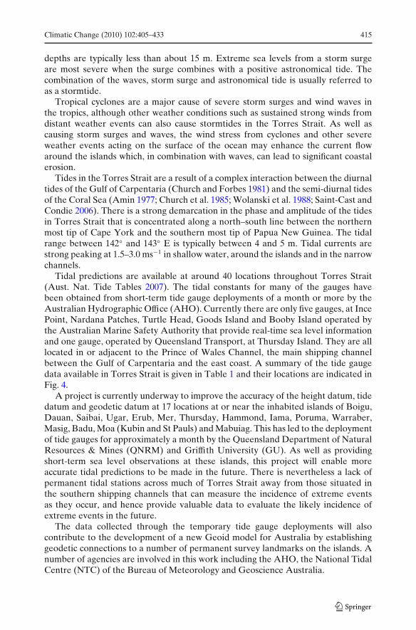
Tidal predictions are available at around 40 locations throughout Torres Strait(Aust. Nat. Tide Tables 2007). The tidal constants for many of the gauges havebeen obtained from short-term tide gauge deployments of a month or more by theAustralian Hydrographic Office (AHO). Currently there are only five gauges, at IncePoint, Nardana Patches, Turtle Head, Goods Island and Booby Island operated bythe Australian Marine Safety Authority that provide real-time sea level informationand one gauge, operated by Queensland Transport, at Thursday Island. They are alllocated in or adjacent to the Prince of Wales Channel, the main shipping channelbetween the Gulf of Carpentaria and the east coast. A summary of the tide gaugedata available in Torres Strait is given in Table 1 and their locations are indicated inFig. 4.
A project is currently underway to improve the accuracy of the height datum, tidedatum and geodetic datum at 17 locations at or near the inhabited islands of Boigu,Dauan, Saibai, Ugar, Erub, Mer, Thursday, Hammond, Iama, Poruma, Warraber,Masig, Badu, Moa (Kubin and St Pauls) and Mabuiag. This has led to the deploymentof tide gauges for approximately a month by the Queensland Department of NaturalResources & Mines (QNRM) and Griffith University (GU). As well as providingshort-term sea level observations at these islands, this project will enable moreaccurate tidal predictions to be made in the future. There is nevertheless a lack ofpermanent tidal stations across much of Torres Strait away from those situated inthe southern shipping channels that can measure the incidence of extreme eventsas they occur, and hence provide valuable data to evaluate the likely incidence ofextreme events in the future.
The data collected through the temporary tide gauge deployments will alsocontribute to the development of a new Geoid model for Australia by establishinggeodetic connections to a number of permanent survey landmarks on the islands. Anumber of agencies are involved in this work including the AHO, the National TidalCentre (NTC) of the Bureau of Meteorology and Geoscience Australia.

416 Climatic Change (2010) 102:405–433
Table 1 Locations of tidal data in Torres Strait
Name Longitude Latitude Year(s) in which data Agencywas collected
Alert Patches 142 21′ −10 29′ 2000 HYDROAshmore Reef 144 30′ −10 5′ 1999 HYDROAureed Is. 143 17′ −9 57′ 1994 HYDROBampfield Head 142 6′ −10 42′ 1921 HYDUKBooby Is. 141 55′ −10 36′ 1972 onwards MSQCarpentaria 141 18′ −10 44′ 2000 HYDROCoconut Is. 143 4′ −10 3′ 1992 HYDROCrab Is. 142 7′ −10 58′ 1977 HYDRODarnley Is. 143 46′ −9 34′ 2005/2006 HYDRODugong Is. 143 6′ −10 31′ 1997 HYDRODungeness Reef 142 58′ −9 58′ 1941 HYDROEast Cay 144 16′ −9 23′ 1996 HYDROEast Strait 142 27′ −10 30′ 1971 HYDROGabba Is. 142 37′ −9 46′ 1999 HYDROGoods Is. 142 9′ −10 34′ 1974 onwards MSQHawkesbury Is. 142 8′ −10 23′ 1971 HYDROInce Point 142 18′ −10 31′ 1971 onwards AMSAKirkaldie Reef 142 48′ −10 19′ 1988 HYDROMaer Is. 144 2′ −9 54′ 1995 HYDROMoa Is. 142 13′ −10 14′ 1978 NATMAPNardana Patches 142 14′ −10 30′ 2005 onwards AMSAPapou Point 142 20′ −10 37′ 1994 HYDROPearce Cay 143 18′ −9 31′ 2005 HYDROPhipi Reef 142 32′ −9 36′ 1995 HYDROPoll Is. 142 49′ −10 15′ 1994/1995 AMSAProudfoot Shoal 141 28′ −10 31′ 1997 AMSARed Wallis Is. 142 2′ −10 51′ 1994 HYDRORennel Is. 143 16′ −9 46′ 2005/2006 HYDRORound Is. 142 12′ −10 33′ 1944 HYDUKSaibai Is. 142 37′ −9 23′ 1967 HYDROStephens Is. 143 33′ −9 30′ 2005/2006 HYDROSuarji Is. 142 31′ −10 10′ 1941 HYDROTalab Is. 142 13′ −9 58′ 1997 HYDROTarilag Is. 142 14′ −10 45′ 1994 HYDROThursday Is. 142 13′ −10 35′ 1983–2002 MSQTurtle Head 142 13′ −10 31′ 1989 onwards AMSATwin Is. 142 26′ −10 28′ 1974/1975 MSQUnnamed Cay 143 20′ −9 22′ 2005/2006 HYDROVarzin Shoal 141 55′ −10 33′ 2002 HYDROWarrior Reef East 143 9′ −9 35′ 1997 HYDROWhite Rocks 142 1′ −10 31′ 2000 HYDROYam Is. 142 54′ −9 54′ 1994 HYDROZagai Is. 142 54′ −9 52′ 1994 HYDRO
Only five of the locations are currently monitoring tides in real time. The majority of the remainderof locations consist of short-term deployments of a tide gauge for a month or more to establish tidalconstants for ongoing tidal predictionHYDRO Australian Hydrographic Office, MSQ Maritime Safety Queensland, HYDUK The Hy-drographer of the UK Navy, AMSA Australian Maritime Safety Authority, NATMAP NationalMapping (source: Aust. Nat. Tide Tables 2007)
Climatic Change (2010) 102:405–433 417
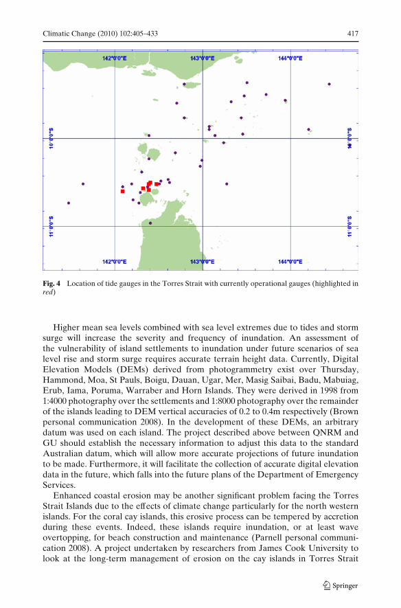
Fig. 4 Location of tide gauges in the Torres Strait with currently operational gauges (highlighted inred)
Higher mean sea levels combined with sea level extremes due to tides and stormsurge will increase the severity and frequency of inundation. An assessment ofthe vulnerability of island settlements to inundation under future scenarios of sealevel rise and storm surge requires accurate terrain height data. Currently, DigitalElevation Models (DEMs) derived from photogrammetry exist over Thursday,Hammond, Moa, St Pauls, Boigu, Dauan, Ugar, Mer, Masig Saibai, Badu, Mabuiag,Erub, Iama, Poruma, Warraber and Horn Islands. They were derived in 1998 from1:4000 photography over the settlements and 1:8000 photography over the remainderof the islands leading to DEM vertical accuracies of 0.2 to 0.4m respectively (Brownpersonal communication 2008). In the development of these DEMs, an arbitrarydatum was used on each island. The project described above between QNRM andGU should establish the necessary information to adjust this data to the standardAustralian datum, which will allow more accurate projections of future inundationto be made. Furthermore, it will facilitate the collection of accurate digital elevationdata in the future, which falls into the future plans of the Department of EmergencyServices.
Enhanced coastal erosion may be another significant problem facing the TorresStrait Islands due to the effects of climate change particularly for the north westernislands. For the coral cay islands, this erosive process can be tempered by accretionduring these events. Indeed, these islands require inundation, or at least waveovertopping, for beach construction and maintenance (Parnell personal communi-cation 2008). A project undertaken by researchers from James Cook University tolook at the long-term management of erosion on the cay islands in Torres Strait
418 Climatic Change (2010) 102:405–433
notes that the impact of climate change on the overall sediment budget is not wellunderstood. Along some coastlines, stronger waves and currents during extremeweather conditions may lead to net erosion while other coastlines may experienceaccretion (Parnell personal communication 2008).
Although storm surges occurring at the beginning of the year (January andFebruary) cause the most concern on the islands due to the co-incidence of the strongnorth-westerly winds with high tides, these are not the only times that extreme eventscause inundation. Strong sustained south-easterlies can also produce storm surgesand significant stormtides in the region during high tides in July and August.
A recent example occurred on the 21st and 22nd of July 2005, where an exception-ally strong anticyclone, centred on Canberra, produced gale force south-easterliesthrough the Torres Strait causing higher than normal sea levels, leading to coastalinundation and damage to hundreds of houses in the Western and Gulf Provinces ofPapua New Guinea (Callaghan personal communication 2008). The combination ofhigh tides and strong winds inundated several houses on Mer Island.
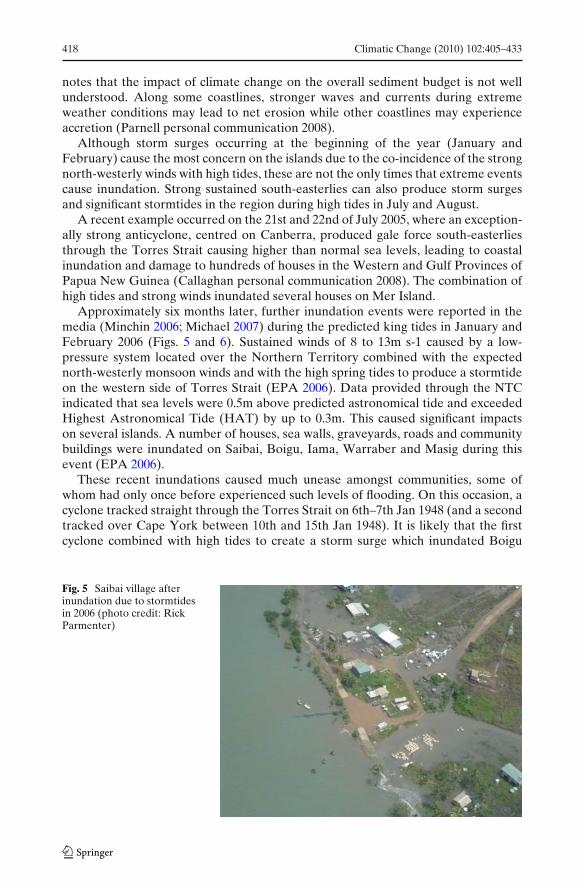
Approximately six months later, further inundation events were reported in themedia (Minchin 2006; Michael 2007) during the predicted king tides in January andFebruary 2006 (Figs. 5 and 6). Sustained winds of 8 to 13m s-1 caused by a low-pressure system located over the Northern Territory combined with the expectednorth-westerly monsoon winds and with the high spring tides to produce a stormtideon the western side of Torres Strait (EPA 2006). Data provided through the NTCindicated that sea levels were 0.5m above predicted astronomical tide and exceededHighest Astronomical Tide (HAT) by up to 0.3m. This caused significant impactson several islands. A number of houses, sea walls, graveyards, roads and communitybuildings were inundated on Saibai, Boigu, Iama, Warraber and Masig during thisevent (EPA 2006).
These recent inundations caused much unease amongst communities, some ofwhom had only once before experienced such levels of flooding. On this occasion, acyclone tracked straight through the Torres Strait on 6th–7th Jan 1948 (and a secondtracked over Cape York between 10th and 15th Jan 1948). It is likely that the firstcyclone combined with high tides to create a storm surge which inundated Boigu
Fig. 5 Saibai village afterinundation due to stormtidesin 2006 (photo credit: RickParmenter)

Climatic Change (2010) 102:405–433 419
Fig. 6 Damage to the sea wallcaused by a stormtides onSaibai in 2006 (photo credit:Donna Green)
and Saibai. At least two elderly Islanders on Boigu still remember this incident.In response to this event, some of the community decided to move off the islandand onto mainland Australia. Many of the inhabitants of the Bamaga and Seisiacommunity on the tip of Cape York are descendents of these relocated Islanders(Ober et al. 2000). However, this relocation did not take account of the potentialcultural sensitivities of moving Islanders on to what is now recognised as Aboriginalland. These concerns would need to be at the forefront of any relocation negotiationsin the future (Warusam personal communication 2006).
Although the recent inundation events have not been linked to climate change,they serve as an indication of the kind of events that may occur more frequently inthe future as a result of mean sea level rise. In view of the potential coastal impacts,most notably inundation and erosion, that are caused by strong currents, waves andstormtides, that are generated by a range of weather events described in this section,further analysis of the likely changes to the frequency and intensity of severe windassociated with weather events such as tropical cyclones, monsoon depressions andintense wintertime anticyclones. Climate projections of changes in future wind speed,an example of which is shown in Fig. 2, are relevant to determining how the stormsurges that occur due to severe and sustained winds may change, either during themonsoon or the trade wind seasons in the future. However, analysis of such changesto date have been limited.
3.3.2 Sea level rise
As with other aspects of climate change, the impact of rising sea levels will be feltmost acutely through extreme events. Even if the variability of sea level about themean does not change, an increase in mean sea level would likely result in an increasein the frequency of high (flooding) sea level events. This change can be estimatedfrom multi-decadal sea level records (Church et al. 2008a). However, the sea levelrecords from the Torres Strait are too short and fragmented to complete this analysis.Any increase in intensity of weather events will further exacerbate the impacts ofextreme sea level events.
Satellite altimeter data indicate significant regional variations in the rate of sealevel rise since the start of the record in January 1993 (see Fig. 7). The faster rate ofrise in the western Pacific/eastern Indian Oceans since 1993 (more than double the

420 Climatic Change (2010) 102:405–433
20S
10
EQ
120 140 160E
SSH trend, mm/year
2 3 4 5 6 7 8 9 10 11 12
Fig. 7 Sea level trends in the region estimated from satellite altimeter data from January 1993 toDecember 2007. Sea level trends from tide gauge data from the National Tidal Centre are indicatedby the coloured dots. The sea level data have been corrected for vertical land motion associated withglacial isostatic adjustment but not for changes in atmospheric pressure
global average at about 8 mm/yr in the Torres Strait region) is primarily a result ofinterannual climate variability associated with the ENSO phenomenon. Time seriesof altimeter measured sea level at individual locations in the Torres Strait regionand near Darwin also demonstrate this rapid rate of rise from 1993 to 2007 (about 9and 8 mm/yr, respectively; Fig. 8b and c) and that sea level rises and falls by up toabout 0.1 m during an El Niño event. Examination of the longer Darwin tide gaugerecord (Fig. 8a) shows similar variability to the shorter altimeter records but a muchsmaller trend (about 1.6 mm/yr from 1960 to 2007). Smaller trends over longer (multi-decadal) time spans would be expected due to averaging over a few cycles, ratherthan getting a trend for a fraction of a cycle. On decadal periods, the only study ofthe historical regional distribution of sea level rise to date (Church et al. 2004) alsoindicates a non-uniform distribution of sea level rise but with much smaller spatialvariability than the shorter satellite altimeter record.
To estimate statistical extremes for flooding, a minimum of about 30 years of(near) continuous data is required (Hunter personal communication 2008). Giventhis data requirement is problematic for the Torres Strait region, one option toconsider is the effect sea level rise on the distribution of extremes for floodingvulnerability at nearby locations. Darwin and Cairns are the closest of the 29 stationswith data records of this length, and Church et al. (2008a, b) shows that a sea levelrise of 0.1 m would lead to around a threefold increase in the frequency of extremehigh events (this is close to the Australian average which is a factor of 3.1 for 0.1 msea level rise). For a 0.5 m rise, which is roughly the centre of the IPCC projectedrange for 2100, this translates to an increase of frequency by a factor of about 240.This increase in frequency of extreme events means that an inundation event of aparticular magnitude that currently happens every few years might happen everyfew days in 2100 (Church et al. 2008b).

Climatic Change (2010) 102:405–433 421
Fig. 8 Monthly averaged sea levels as measured by a tide gauge at Darwin (a), and as measured bysatellite altimeter in Torres Strait (b) near Darwin (c)
In addition to changing sea level, the land itself can move vertically as a result oflarge-scale changes in the loading of the Earth’s surface from changes in the mass ofglaciers, ice sheets and oceans, and local tectonic motions. These large-scale changesare likely to be small for the Torres Strait and little is known about local tectonicmotions.
4 Data requirements
While climate model projections are needed to indicate what the future climate mightbe like in the Torres Strait, ensuring that they adequately represent the currentclimate is important to build confidence in these projections. In addition to theuncertainties in climate projections derived from climate models that are forced bydifferent scenarios of greenhouse gas emissions into the future, is the lack of direct

422 Climatic Change (2010) 102:405–433
Tab
le2
Sum
mar
yof
avai
labl
ecl
imat
ech
ange
data
and
its
prio
rity
for
futu
reim
pact
sre
sear
ch
Fac
tor
Aa
Bb
Cur
rent
lyav
aila
ble
data
Dat
ane
eded
toim
prov
ele
velo
fO
bser
vati
ons
Mod
els
know
ledg
e
Cha
nge
inM
edM
edT
heB
urea
uof
Met
eoro
logy
(BoM
)IP
CC
mod
elru
ns(f
rom
PC
MD
I)H
igh
qual
ity
and
hom
ogen
eous
data
aver
age
clim
ate
has
met
eoro
logi
calr
ecor
dsfo
rfr
om>
20m
odel
s.C
SIR
Oan
dB
oMfr
omob
serv
ing
stat
ions
for
cond
itio
ns3
rain
fall
and
2te
mpe
ratu
rere
sult
sus
ing
19m
odel
s.C
CA
MR
CM
mon
itor
ing
clim
ate
vari
able
s.st
atio
nsw
hich
are
still
oper
atin
g(2
5km
)ru
ns(1
951–
2000
Impr
ovem
ento
fGC
Ms
and
RC
Ms
dow
nsca
ling
from
NC
EP
,and
thro
ugh
bett
erun
ders
tand
ing
of19
61–2
100
dow
nsca
ling
from
Mk
3.0
larg
esc
ale
proc
esse
sw
hich
affe
ctfo
rA
2an
dA
1Bth
eis
land
se.
g.E
NSO
.RC
Man
dG
CM
runs
whi
chta
keac
coun
tof
abov
eim
prov
edun
ders
tand
ing
wit
hta
rget
edm
odel
ling
expe
rim
ents
for
the
regi
onC
hang
ein
Med
Low
As
abov
eIP
CC
mod
elru
nsfr
oma
sele
ctio
nA
sab
ove
incl
udin
gdy
nam
ical
clim
ate
extr
emes
:of
mod
els
for
ase
lect
ion
ofin
dice
s.do
wns
calin
gst
udie
sto
esti
mat
eth
eT
empe
ratu
reO
utpu
tfro
m4
mod
elru
ns(C
SIR
Ofu
ture
risk
ofex
trem
esw
ith
mul
tipl
ean
dB
OM
)re
alis
atio
nsto
give
prob
abili
stic
esti
mat
esC
hang
ein
Med
Low
As
abov
eIP
CC
mod
elru
nsfr
oma
sele
ctio
nA
sab
ove
clim
ate
extr
emes
:of
mod
els
for
ase
lect
ion
ofin
dice
sP
reci
pita
tion
Tro
pica
lcyc
lone
sH
igh
Low
Tro
pica
lcyc
lone
str
acks
reco
rded
No
know
nsp
ecifi
cT
orre
sSt
rait
Bet
ter
unde
rsta
ndin
gof
the
natu
ral
for
Aus
tral
iaar
eav
aila
ble
from
mod
ellin
gst
udie
s.M
odel
ling
for
proc
esse
sw
hich
driv
ech
ange
sin
1906
topr
esen
tfro
mB
oMtr
opic
alot
her
regi
ons,
alth
ough
still
trop
ical
cycl
ones
and
ther
efor
ea
bett
ercy
clon
ew
ebpa
ges
(BoM
2008
)so
mew
hatr
udim
enta
ry,s
ugge
sts
esti
mat
ion
ofw
hatr
ole
hum
anfa
ctor
san
incr
ease
inth
em
osti
nten
sem
aypl
ayin
futu
rech
ange
s.sy
stem
sin
the
futu
reth
roug
hout
Impl
emen
tati
onof
appr
opri
ate
mod
eltr
opic
sex
peri
men
tsov
erth
ere
gion
topr
oper
lyas
sess
the
risk
from
thes
ety
pes
ofex
trem
es

Climatic Change (2010) 102:405–433 423
Tab
le2
(con
tinu
ed)
Fac
tor
Aa
Bb
Cur
rent
lyav
aila
ble
data
Dat
ane
eded
toim
prov
ele
velo
fO
bser
vati
ons
Mod
els
know
ledg
e
Stor
msu
rge
Hig
hL
owA
MSA
,Nat
iona
lTid
alC
entr
ean
dN
ost
orm
surg
em
odel
ling
stud
ies
Lon
g-te
rmti
dega
uge
data
for
QD
NM
-GU
(see
Tab
le1)
perf
orm
edye
tfor
the
regi
onim
prov
emen
tsto
stor
msu
rge
mod
ellin
g.L
ong-
term
,hig
hqu
alit
yti
dega
uge
data
for
benc
hmar
king
stor
msu
rge
mod
els.
Stor
msu
rge
mod
ellin
gst
udie
sof
the
Tor
res
Stra
itSe
ale
velr
ise
Hig
hL
owA
MSA
,Nat
iona
lTid
alC
entr
ean
dC
oars
ere
solu
tion
clim
ate
mod
els
Lon
g-te
rm,h
igh-
qual
ity
tide
gaug
eda
taQ
DN
M-G
U(s
eeT
able
1).
ofoc
ean
ther
mal
expa
nsio
nar
efo
rm
ore
accu
rate
sea
leve
lest
imat
ion.
Glo
bals
atel
lite
alti
met
erda
taav
aila
ble.
Ahi
gher
reso
luti
onM
odel
expe
rim
ents
toes
tim
ate
the
futu
reis
avai
labl
efr
om19
93m
odel
ofoc
ean
cond
itio
nsfr
omri
skof
very
high
sea
leve
leve
nts
1993
toth
epr
esen
tis
avai
labl
efo
rth
eA
ustr
alia
nre
gion
a Use
fuln
ess
offa
ctor
inim
pact
asse
ssm
ent
bL
evel
ofkn
owle
dge
424 Climatic Change (2010) 102:405–433
observations in the Torres Strait with which to validate climate models. This mayalso decrease confidence in future projections in the region.
The importance of observations, whether they are related to ecosystem changeand function, climatological, meteorological, topographic, bathymetric, land motionor sea level cannot be underestimated. For example, while some long meteorologicalrecords exist, they have not been quality controlled and would therefore not be reli-able for climate change studies or model validation (Trewin personal communication2008). In addition, storm surge modelling could only be reliable if the bathymetry ofthe region was sufficiently well known, and there remain large regions of the Straitwhere bathymetric data are sparse (Hemer et al. 2004).
There are projects underway to enhance monitoring of the region such as theshort-term tide gauge project mentioned previously (QDNMS/GU), although atpresent there does not appear to be a concerted plan to use this information todevelop resilience-building activities, nor have resources yet been earmarked at stateor federal government levels to carry such activities out. The most recent naturaldisaster risk management study performed for the islands highlights the seriousnessof any potential increase in inundation incidents. This report qualifies the use ofisland inundation maps contained within it due to the lack of accuracy of the dataused to make them (ARUP 2006). Despite the short term tide gauge deployments,there remains a lack of permanent tidal stations in the Torres Strait to providecontinuous sea level monitoring across a more extensive region.
Projects that use local knowledge about weather and climate observations, such asphenological data that may be useful in identifying climate trends, are just beginningin this region (Sharing Knowledge 2008). The Sharing Knowledge project directlyengages with Islanders, identifying their local observations of environmental change.It is currently documenting phenological observations through video documentationon seven of the Torres Strait Islands. This recording work is part of a processdeveloped by an Indigenous organisation that incorporates techniques to maximisecapacity building within the community relating to data management and storageas well as from the material itself (for further information on these techniques seeTKRP (2009)).
Observations that have been noted include the changing flowering times of certaintrees; changes in weather patterns, specifically that the winds and rain are nolonger following the ‘traditional’ seasonal calendar as passed on through generations;and also a change in the abundance and mating of turtles and dugong (SharingKnowledge 2009). A more in depth discussion of this local knowledge is beyond thescope of this paper, although ongoing project updates will be made available at theSharing Knowledge website.
From the review performed here on the status of climate change informationcurrently available for the Torres Strait Islands, it is clear that there are several areasof research that require urgent attention if we are to properly assess the risk posedfrom potential changes in climate in the future. In Table 2, we identify the climatevariables that pose a present and future ‘threat’ to the islands and identify possibleareas for further research.
It is obvious that our knowledge is severely limited regarding the current orfuture impact of most of these climate variables on the Torres Strait. However,GCM and/or RCM runs already exist which would allow a study to be performedon the likely future changes in temperature and precipitation specifically focussed

Climatic Change (2010) 102:405–433 425
on the islands. It may also be possible to use existing data to estimate the futurerisk of very high sea level events. In addition, current storm surge models could beused to focus specifically on the Torres Strait region. Again, testing the quality of,and building confidence in, these simulations requires long-term tide gauge data,bathymetry and digital elevation data. Whatever models are used, their ability torepresent the relevant physical process in the Torres Strait, would also have to beproperly assessed in order to make accurate uncertainty estimates of the risks posedfrom future climate change. In all cases, continued improvements to monitoring andassessment of the quality of data is essential. It is clear though that there are alreadyrisks to the community from their current exposure to extreme weather regardless ofhow much climate change factors into these events.
What is much more certain is that increases in sea level, leading to a subsequentincrease in extreme sea level events as well as possible increases in the severityof tropical cyclones caused by climate change will occur regardless of immediategreenhouse gas mitigation efforts. Failure to mitigate will result in even largerimpacts.
5 Island vulnerability
The previous section identified the data requirements, and subsequent analysis,which is needed to undertake a comprehensive assessment of the Torres StraitIslands’ exposure to climate change impacts. Without this, identifying the nature andextent of the Islands’ vulnerability to climate impacts is extremely difficult. However,not withstanding this lack of information, it is clear that these communities areconcerned about their vulnerability to climate change. Some likely areas of concernin relation to climate impacts are outlined below to help prioritise further researchneeds as well as to inform adaptation discussions.
5.1 Human health
Across Australia, changes in precipitation extremes, such as the occurrence of heavyrainfall events, are regionally dependent (e.g. Hennessy et al. 1999; Haylock andNicholls 2000; Gallant et al. 2007). There is some evidence that the trends of the mostextreme events of both temperature and precipitation are changing more rapidlythan are the trends for more moderate extreme events (Alexander et al. 2007). Thisis problematic because more extreme rain in the monsoon season could increase thechance of injury (McMichael et al. 2003). This is particularly the case if the increasesin rainfall at this time are linked to increases in the number and/or intensity oftropical cyclones, which is likely to increase the risk of injuries and accidental death.Due to the extremely remote nature of the region, emergency rescues are particularlydifficult to perform in short timeframes and thus further exacerbate the potentialrisks associated with more extreme weather in the future.
The combined impact of precipitation and temperature changes on a range ofinfectious disease transmission rates is complex because those rates tend to be verylocally specific, depending on a combination of several physical factors and thepresence of the necessary ‘vector’ host (for example: fleas, mosquitoes, birds ormammals). Increasing temperature and humidity is also likely to impact on the time
426 Climatic Change (2010) 102:405–433
taken for the pathogens to develop to an infectious stage in the vector host (Currie2001; Patz and Olson 2006).
Increases in extreme temperatures can lead to health concerns including increasesin incidence of heat rashes, heat exhaustion and even heat stroke (McMichael et al.2003). In the worst-case scenarios, increases in heat waves and particularly warm,humid nights can cause heart attacks and death (Nicholls and Alexander 2007;Loughnan 2008). Elderly people and those with poor cardiovascular health and lowphysical fitness are at highest risk (McMichael et al. 2003). The latter concerns aredisproportionately prevalent in Indigenous communities, such as those of the TorresStrait (McMichael et al. 2008).
Dengue fever is already a major concern on many of the islands, and increasesin extreme weather, in combination with the prevalence of water tanks near houses(that can facilitate mosquito breeding if they are not covered), may make this diseasean increasing problem if adequate preventative measures are not taken.
The remoteness of the islands, the difficulty and expense of transportation, limitedhealth services, and in at least one case, competing demands on health services (e.g.use of health services on Boigu by Papua New Guinean nationals) all contribute to ahigh level of stress on medical practitioners on the islands.
The psychological effects of climate impacts on Islander culture have not beenconsidered to date. Despite this, it is clear that the cultural impacts of relocatingfrom the Islands would cause significant concern amongst Islanders (Beckett 1987).
5.2 Inundation and changing shorelines
As noted in the previous section, a key short-term concern of Islanders relates toextreme weather and storm surge events generated by tropical cyclones, particularlyif they occur simultaneously with high tide. The impacts of these events will slowlybe exacerbated as sea level rises. Some data is captured on the topographic mapsof areas prone to inundation in the sustainable land use plans, although thesehave primarily been designed to inform future development patterns on the islands(Conics 2009).
Adaptation to rising seas by retreating from the shoreline is not an option on someof the islands due either to limited land (e.g. Poruma) or lack of high land (e.g. Saibai,Boigu). Other islands that do have higher land which could potentially be subdividedfor relocation of infrastructure is in some cases limited either due to its extreme slope,or a lack of resolution over how to deal with the intricacies of land ownership andpermission to subdivide or gain access to potential areas for subdivision (e.g. Mer,Iama).
Saibai is currently susceptible to inundation due to the location of its builtinfrastructure that is largely located on the only high strip of land lying between theseawall and marshes towards the interior of the island. The existing culvert under themain road, along with main road itself, is unlikely to be adequate to cope with anyfuture increases in extreme weather.
The existing built infrastructure on Boigu gains some protection from marsh waterby the higher land of the airstrip that runs parallel to the coastline, but behind themajor area of built infrastructure (unlike Saibai the airstrip is built roughly parallel—not perpendicular—to the main coast road). Much of the sea wall on Boigu is also of amuch stronger construction than on Saibai, however it appears that several sections

Climatic Change (2010) 102:405–433 427
of this wall are not built high enough to withstand current HAT (Doust personalcommunication 2008) and Akiba (2009).
There are several aspects of reef-island topography that affect an island’s sus-ceptibility to sea level rise, and a great number of complications in identifying theexact nature of the relationship of the land to the highest water level (Woodroffe2007). Woodroffe (2007) suggests a ‘morphodynamic approach’ to identify coralisland resilience to enable a framework in which human activity (which may haveconflicting impacts on natural shoreline dynamics) could be modelled. This wouldbe an important activity prior to designing significant adaptation activities suchas re-vegetation of beaches or of mangrove areas, nourishment of shorelines orconstruction of seawalls or break waters for the central coral cay islands.
5.3 Water shortage
All inhabited islands are currently facing water shortages; the most significant factorcontributing to this problem is changes in usage habits and possibly, to some degree,changing climate (Lui personal communication 2008). As the climate projectionsindicate greater extremes in precipitation that may lead to longer dry seasons and/ormore intense downpours, future considerations about water management need to bediscussed.
It is important to note that water shortages are not a new problem in the TorresStrait. In the early 1940s, it was necessary for islanders to row from Poruma toWarraber to collect water (Billy personal communication 2008). In recent yearsthough, many of the islands have become dependent on water desalinators. Withever increasing fuel prices, this option will become increasingly expensive for theIsland councils.
6 Discussion
As previously identified, Islanders may be less resilient to the impacts of climatechange than other communities in parts of Australia due to the combined riskfrom multiple interacting weather and climate extremes, low social and economicindicators and their cultural sensitivity to the health of their land and sea ‘country’.
Torres Strait Islanders’ response to climate change is, however, just as likelyto be determined by social processes (e.g. decision-making) as scientific ones (e.g.what will happen with sea level). In coming years Torres Strait Island communitiesmust attempt to prioritise a number of competing concerns of which the impacts ofclimate change are just one of many pressing problems requiring financial and humanresources.
Like many other remote Indigenous communities, it is the community itself that isin the best position to judge what are the key priorities and to understand the contextin which these decisions must be made. In the past, Torres Strait Islanders adaptedto changing climate and resource constraints through various practices includingtemporary or permanent relocation—either on the same island, to other islands, orto the mainland (Billy and Lui personal communication 2008). This approach wouldbe difficult today for various reasons. Relocation to other areas of an island wouldbe extremely expensive due to major re-investment in infrastructure that would be
428 Climatic Change (2010) 102:405–433
needed, if the space was there to do so. Relatively recent land claim settlementswould also make subdivisions on new areas of some islands difficult to negotiate.Relocation to other islands would not only encounter financial and land rightsdifficulties, but also significant cultural problems. Islanders do not want to move offtheir islands, and it is clear that the impact of just one community moving wouldimpact the region by affecting the cultural, social and economic resilience of otherisland communities.
These kinds of adaptation strategies raise issues of equity in adaptation andclimate policy more generally. For further discussion of procedural and distributiveequity see Preston (2008) or Davies and Hossain (1997). It is worth noting thatthere are both positive adaptation activities as well as maladaptive practices thatcan unintentionally occur. Overlaying western concepts of community participation,for example, can lead to unreasonable expectations about community inclusion indecision-making for some Indigenous communities (see for example the Borroloolacase study in Green et al. (2009)) for a discussion about problems relating to differentperceptions of what can be understood as a ’community’ and how this relates toself-identified community identity based upon cultural group). Despite this, thereare several existing levels of formal organisation that could be engaged with tofurther discussions about adaptation priorities. These include: clan leaders for eachisland, Prescribed Body Corporates (the holders of the Native Title for the respectiveIsland), Island Councillors, the Torres Strait Island Regional Council (TSIRC—statelevel government) and the Torres Strait Regional Authority (TSRA—federal levelgovernment).
Despite the identification of the Torres Strait as one voice through the TSIRCand TSRA, each island in the Torres Strait has a unique set of circumstancesand needs. Concern over the differing needs and priorities between communitiesliving on different islands and concerns over whether resources are being distributedappropriately is an ongoing source of concern for many Island councillors.
While there is currently not enough information to assess how significant the directand indirect impacts will be on each island, it is clear that risk management strategiesin the absence of scientific certainty need to be developed. However, there arelimits and barriers to adaptation that are being faced. These include severe resourcelimitations that constrain the ability of Islanders to be able to engage appropriateconsultants to provide them with knowledge and recommendations about prioritiesand risks due to climate change.
In the short to medium term, alternative strategies for reducing risk could include‘climate proofing’ significant public service infrastructure and buildings, increasingcommunication infrastructure and transport infrastructure on the islands. But possi-bly the most important strategy is to increase social and economic resilience of thecommunities themselves. This strategy would serve to reduce the chronic economicstress and social disadvantage that has previously been highlighted as a major barrierto responding to climate impacts.
Many Pacific Island communities have begun discussions about relocating com-munities off their Islands in the mid term (50–60 years). They have been workingthrough bilateral relations with neighbouring countries with immigration requests aswell as through more formal UN channels (Kelman 2008; Sercombe and Albanesend). For some of the low-lying communities in the Torres Strait, a similar activity inthis timeframe might be one option ACECRC (2008). Consideration of a relocation

Climatic Change (2010) 102:405–433 429
strategy as one of several options needs to begin now given the expense and planningthat would be involved in such an endeavour.
Such an activity would in no way suggest that infrastructure and other governmentservice investments in the communities should not be maintained or expanded, butwould rather allow communities the opportunity to discuss options and alternativesfor their long-term future. These decisions could only be made after adequateinformation is provided to Island leaders about climate impacts so that they candiscuss with their community the likely risks, and come to consensus and an informeddecision about their preferences for future planning and development.
At this point, there is no specific federal policy framework for these kinds ofdiscussions to be initiated. The Torres Strait Coastal Management Committee (runthrough the TSRA’s Land and Sea Unit) has made two submissions to the House ofRepresentatives Standing Committee on Climate Change, Water, Environment andthe Arts (Inquiry into climate change and environmental impacts on coastal com-munities) relating to the problems of coastal erosion and climate change. However,one of the most difficult questions to address relates to where the responsibility ofdecision-making actually lies. This question has not adequately been addressed todate.
One issue is clear: community-level discussions about adaptation preferences needto be clearly informed by the best available climate science as well as understandingthe resources that might be available to carry out activities. Complexities occurwith respect to whose expertise to rely on given the differences in culture andresources amongst the stakeholder groups (see Dessai et al. 2004). Initial studiesin other regions of Australia have attempted to move beyond top-down assessments,including focus group discussions that include community participation (Kinrade andJustus 2008). Where policy is currently unclear, albeit sorely needed, it is importantto ensure that once those preferences are established, there is a system by whichTorres Strait Islanders are able to call upon the necessary resources to implementtheir decisions.
Acknowledgements The authors would also like to thank David Hanslow, Ian Macadam, KevinParnell, Benjamin Preston, Sam Reuben, Peter Todd and Penny Whetton for valuable comments.They would also like to thank the many conversations with Councilors, Island Managers andTraditional Owners of the Islands discussed above. This research was conducted with the supportof funding from the Australian Government’s Marine and Tropical Sciences Research Facility (DG& LA).
This paper is a contribution to the CSIRO Climate Change Research Program and Wealth fromOceans Flagship and was supported by the Australian Government’s Cooperative Research CentresProgramme through the Antarctic Climate and Ecosystems Cooperative Research Centre. KLM,JAC and NJW were partly funded by the Australian Climate Change Science Program. NN wasfunded by an Australian Research Council Professorial Fellowship through the project DP0877417.
References
ACECRC (2008) Position analysis: climate change, sea level rise and extreme events: impacts andadaptation issues. Antarctic Climate and Ecosystems Cooperative Research Centre, Tasmania
AHRC (2009) Native title report 2008. Aboriginal and Torres Strait Islander Social JusticeCommissioner. http://www.humanrights.gov.au/social_justice/nt_report/ntreport08/
430 Climatic Change (2010) 102:405–433
AIHW (2008) Australia’s health 2008. Australian Institute of Health and Welfare. Cat. no.AUS 99
Akiba T (2009) Saibai regional council environmental health worker report 2009. Saibai Council,Saibai
Alexander LV, Arblaster JM (2009) Assessing trends in observed and modelled climate extremesover Australia in relation to future projections. Int J Climatol. doi:10.1002/joc.1730
Alexander LV, Hope P, Collins D, Trewin B, Lynch A, Nicholls N (2007) Trends in Australia’sclimate means and extremes: a global context. Aust Meteorol Mag 56(1):1–18
Amin M (1977) Investigation of storm surges in the Torres Strait. Inst Oceanogr Sci Rep 50, p 40ARUP (2006) Natural disaster risk management study. Consultant report, BrisbaneAustralian Greenhouse Office (2006) Assessing and mapping Australia’s coastal vulnerability to
climate change: expert technical workshop. AGO, CanberraAust. Nat. Tide Tables (2007) Australian national tide tables. Commonwealth of Australia, CanberraBeckett J (1987) Torres Strait Islanders: custom and colonialism. Cambridge University Press, UKBessen (2005) Land and sea management strategy for Torres Strait, Torres Strait NRM reference
group, report for the Torres Strait regional authority. TSRA, QldBindoff NL, Willebrand J, Artale V, Cazenave A, Gregory J, Gulev S, Hanawa K, Le Quéré C,
Levitus S, Nojiri Y, Shum CK, Talley LD, Unnikrishnan A (2007) Observations: oceanic climatechange and sea level. In: Solomon S, Qin D, Manning M, Chen Z, Marquis M, Averyt KB,Tignor M, Miller HL (eds) Climate change 2007: the physical science basis. Contribution ofworking group I to the 4th assessment report of the intergovernmental panel on climate change.Cambridge University Press, Cambridge
BoM (2008) Cyclone tracks. Tropical cyclone information for the Australian region. http://www.bom.gov.au/cgi-bin/silo/cyclones.cgi
Buckley B, Leslie L, Speer M (2003) The impact of observational technology on climate databasequality: tropical cyclones in the Tasman Sea. J Clim 16:2640–2645
Canadell J, Le Quere C, Raupach M, Field C, Buitenhuis E, Ciais P, Conway T, Gillett N, HoughtonR, Marland G (2007) Contributions to accelerating atmospheric CO2 growth from economicactivity, carbon intensity, and efficiency of natural sinks. Proc Natl Acad Sci 104(47):18866–18870
Church J, Forbes A (1981) A non-linear model of the diurnal and semi-diurnal tides in the Gulf ofCarpentaria. Aust J Mar Freshw Res 32:685–697
Church J, Andrews J, Boland F (1985) Tidal currents in the outer Great Barrier Reef. Cont ShelfRes 4:515–531
Church J, White N, Coleman R, Lambeck K, Mitrovica J (2004) Estimates of the regional distributionof sea level rise over the 1950 to 2000 period. J Clim 17:2609–2625
Church J, White N, Aarup T, Wilson W, Woodworth P, Domingues C, Hunter J, LambeckK (2008a) Understanding global sea levels: past, present and future. Sustain Sci 3:9–22.doi:10.1007/s11625-008-0042-4
Church J, White N, Hunter J, McInnes K, Cowell P, O’Farrell S (2008b) Sea level rise, chapter 12.In: Newton P (ed) Transitions: pathways towards sustainable urban development in Australia.CSIRO, Melbourne
Church J, Gregory J, Huybrechts P, Kuhn M, Lambeck K, Nhuan MT, Qin D, Woodworth PL.(2001) Changes in sea level. In: Houghton JT, Ding Y, Griggs DJ, Nouger M, van der LindenPJ, Dai X, Maskell K, Johnson CS (eds) Climate change 2001: the scientific basis. Contributionof working group I to the third assessment report of the intergovernmental panel on climatechange. Cambridge University Press, Cambridge
Collins D, Della-Marta P, Plummer N, Trewin B (2000) Trends in annual frequencies of extremetemperature events in Australia. Aust Meteorol Mag 49:277–292
Conics (2009) Torres Strait sustainable land use plan. http://tsra.qld.wdg.com.au/media/63380/00%20%20%20torres%20strait_part%201%20intro.pdf
CSIRO and BoM (2007) Climate change in Australia. CSIRO and Bureau of Meteorology, CanberraCurrie B (2001) Environmental change, global warming and infectious diseases in Northern
Australia. Environ Health 1:34–43Davies S, Hossain N (1997) Livelihood adaptation, public action and civil society: a review of the
literature. IDS working paper no. 57. Institute of Development Studies, SussexDessai S, Adger N, Hulme M, Turnpenny J, Köhler J, Warren R (2004) Defining and experiencing
dangerous climate change. Clim Change 64:1–2Dunlop M, Brown P (2008) Implications of climate change for the national reserve system. CSIRO,
Canberra

Climatic Change (2010) 102:405–433 431
Emanuel K (2005) Increasing destructiveness of tropical cyclones over the past 30 years. Nat 436:686–688. doi:10.1038/nature03906
Emanuel K, Sundararajan R, Williams J (2008) Hurricanes and global warming: results from down-scaling IPCC AR4 simulations. Bull Am Meteorol Soc 89:347–367
EPA (2006) 2006 King Tides in Torres Strait. Queensland Government Environmental ProtectionAgency Fact Sheet. http://www.epa.qld.gov.au/publications?id=1864
Gallant A, Hennessy K, Risbey J (2007) Trends in rainfall indices for six Australian regions: 1910–2005. Aust Meteorol Mag 56(4):223–239
Green D (2006a) Climate change and health: impacts on remote indigenous communities in NorthernAustralia. CSIRO, Melbourne
Green D (2006b) How might climate change affect island culture in the in the Torres Strait? CSIRO,Melbourne
Green D, Jackson S, Morrison J (2009) Risks from climate change to indigenous communities in thetropical North of Australia: a scoping study. Department of Climate Change, Canberra
Griffiths G, Chambers L, Haylock M, Manton M, Nicholls N, Baek H, Choi Y, Della-Marta P, GosaiA, Iga N, Lata R, Laurent V, Maitrepierre L, Nakamigawa H, Ouprasitwong N, Solofa D, TahaniL, Thuy D, Tibig L, Trewin B, Vediapan K, Zhai P (2005) Change in mean temperature as apredictor of extreme temperature change in the Asia-Pacific region. Int J Climatol 25:1301–1330
Haylock M, Nicholls N (2000) Trends in extreme rainfall indices for an updated high quality data setfor Australia: 1910–1998. Int J Climatol 20:1533–1541
Hemer M, Harris P, Coleman R, Hunter J (2004) Sediment mobility due to currents and waves inthe Torres Strait–Gulf of Papua region. Cont Shelf Res 24:2297–2316
Hennessy K, Suppiah R, Page C (1999) Australian rainfall changes, 1910–1995. Aust Meteorol Mag48:1–13
Hennessy K, Pittock A, Walsh K, Suppiah R, McInnes K, Bathols J (2004) Climate change in theNorthern Territory: consultancy report for the northern territory department of infrastructure,planning and environment. CSIRO, Melbourne
Hennessy K, Fitzharris B, Bates B, Harvey N, Howden M, Hughes L, Salinger J, Warrick R (2007)Australia and New Zealand. Climate change 2007: impacts, adaptation and vulnerability. In:Parry M, Canziani O, Palutikof J, Hanson C, Van der Linden P (eds) Contribution of workinggroup II to the fourth assessment: report of the intergovernmental panel on climate change.Cambridge University Press, Cambridge
Hughes T, Baird A, Bellwood D, Card M, Connolly S, Folke C, Grosberg R, Hoegh-GuldbergO, Jackson J, Kleypas J, Lough J, Marshall P, Nystrom M, Palumbi S, Pandolfi J, Rosen B,Roughgarden J (2003) Climate change, human impacts, and the resilience of coral reefs. Sci301:929–933
Hunter J (2009) Estimating sea-level extremes under conditions of uncertain sea-level rise. ClimChange. doi:10.1007/s10584-009-9671-6
Johnson J, Marshall P (2007) Climate change and the great barrier reef. Commonwealth of Australia,Canberra
Kalnay E, Kanamitsu M, Kistler R, Collins W (1996) The NCEP/NCAR 40-year reanalysis project.Bull Am Meteorol Soc 77(3):437–471
Kelman I (2008) Island evacuation. Forced Migr 31:20–21Kinrade P, Justus M (2008) Impacts of climate change on settlements in the western port region.
Climate change risks and adaptation. Department of Climate Change, CanberraKnutson T, Sirutus J, Garner S, Vecchi G, Held I (2008) Simulated reduction in Atlantic hurricane
frequency under twenty-first century warming conditions. Nat Geosci. doi:10.1038/ngeo202Kossin J, Knapp K, Vimont D, Murnane R, Harper B (2007) A globally consistent reanalysis of
hurricane variability and trends. Geophys Res Lett 34:L04815. doi:10.1029/2006GL028836Landsea C (2007) Counting Atlantic tropical cyclones back to 1900. Eos Trans AGU 88(18):197–202Lin J (2007) Interdecadal variability of ENSO in 21 IPCC AR4 coupled GCMs. Geophys Res Lett
34:L12702. doi:10.1029/2006GL028937Loughnan M (2008) The heart of the matter: geographical insights into the environmental and
social epidemiology of acute myocardial infarction in Melbourne, Australia. PhD thesis, MonashUniversity
Lynch A, Brunner R (2007) Context and climate change: an integrated assessment for Barrow,Alaska. Clim Change 82:93–111
Manton M, Della-Marta P, Haylock M, Hennessy K, Nicholls N, Chambers L, Collins D, Daw G,Finet A, Gunawan D, Inape K, Isobe H, Kestin T, Lefale P, Leyu C, Lwin T, Maitrepierre L,Ouprasitwong N, Page C, Pahalad J, Plummer N, Salinger M, Suppiah R, Tran V, Trewin B,

432 Climatic Change (2010) 102:405–433
Tibig I, Yee D (2001) Trends in extreme daily rainfall and temperature in southeast Asia and theSouth Pacific: 1916–1998. Int J Climatol 21:269–284
McMichael A, Woodruff R, Whetton P, Hennessy K, Nicholls N, Hales S, Woodward A, KjellstromT (2003) Human health and climate change in Oceania: a risk assessment 2002. Department ofHealth and Ageing, Canberra
McMichael A, Berry H, Beggs P, Currie B, Kelly J, McDonald J, Saverimuttu T, Tong S, Blashki G,Dear K, Green D, Hall G, Harley D, Kjellstrom T, Nicholls N, Strazdins L (2008) National adap-tation research plan (Human health). National Climate Change Adaptation Research Facility,Queensland
Michael P (2007) Rising seas threat to Torres Strait Islands. Courier Mail, Brisbane, 2 August 2007Minchin L (2006) Going under. Sydney Morning Herald, Sydney, weekend edn, 12–13 August 2006Mulrennan M (1992) Coastal management: challenges and changes in the Torres Strait Islands,
Northern Australia Research Unit, ANU, DarwinNakicenovic N, Swart R (2000) Special report on emissions scenarios. Cambridge University Press,
UKNicholls N (1992) Historical El Nino/Southern Oscillation variability in the Australian region. In:
Diaz HF, Margraf V (eds) El Nino, historical and paleoclimatic aspects of the Southern Oscilla-tion, pp 151–174. Cambridge University Press, Cambridge
Nicholls N, Alexander L (2007) Has the climate become more variable or extreme? Progress 1992–2006. Prog Phys Geogr 31:77–87
Nicholls N, Landsea C, Gill J (1998) Recent trends in Australian region tropical cyclone activity.Meteorol Atmos Phys 65:197–205
Nicholls N, Skinner C, Loughnan M, Tapper N (2007) A simple heat alert system for Melbourne,Australia. Int J Biometeorol. doi:10.1007/s00484-007-0132-5
Nott J, Hayne M (2001) High frequency of ‘super-cyclones’ along the Great Barrier Reef over thepast 5,000 years. Nature 413:508–512
Nott J, Haig J, Neil H, Gillieson D (2007) Greater frequency variability of landfalling tropicalcyclones at centennial compared to seasonal and decadal scales. Earth Planet Sci Lett 255:367–372
Ober D, Sproats J, Mitchell R (2000) Saibai to Bamaga: the migration from Saibai to Bamaga on theCape York Peninsula. Joe Sproats, Townsville
Oliver-Smith A (2008) Climate change and population displacement: disasters and diasporas inthe twenty-first century. In: Crate S, Nuttall M (eds) Anthropology and climate change: fromencounters to actions. Left Coast Press, US
Patz J, Olson S (2006) Malaria risk and temperature: influences from global climate change and localland use practices. Proc Natl Acad Sci 103:5635–5636
PIA (2004) Sustainable regional and urban communities adapting to climate change. Planning Insti-tute Australia, Report, Brisbane
Preston B (2008) Equitable climate policy in a dangerous world. In: Moss J (ed) Soc justice and climchang. Melbourne University Press, Melbourne
Preston B, Suppiah R, Macadam I, Bathols J (2006) Climate change in the Asia/Pacific Region.A consultancy report prepared for the climate change and development roundtable. CSIRO,Aspendale
Puotinen M (2007) Modelling the risk of cyclone wave damage to coral reefs using GIS: a case studyof the Great Barrier Reef, 1969–2003. Inl J Geogr Inf Sci 21:97–120
Rahmstorf S, Cazenave A, Church J, Hansen J, Keeling R, Parker D, Somerville R (2007) Recentclimate observations compared to projections. Sci 316:709
Raupach M, Marland G, Ciais P, Le Quere C, Canadell J, Klepper G, Field C (2007) Global andregional drivers of accelerating CO2 emissions. Proc Natl Acad Sci 104(24):10288–10293
Ring I, Brown N (2002) Indigenous health: chronically inadequate responses to damning statistics.Med J Aust 177:629–631
Saint-Cast F, Condie S (2006) Circulating modelling in Torres Strait. Geoscience Australia, report2006 18:91
Sercombe B, Albanese A (nd) Our drowning neighbours. Labor’s policy discussion paper on climatechange in the Pacific. Canberra
Sharing Knowledge (2008) Regional climate impacts. UNSW, Sydney, http://www.sharingknowledge.net.au. Accessed 4 August 2008
Sharing Knowledge (2009) Video recordings for elders speaking on traditional knowledge of climateand environmental change for Mer, Saibai and Boigu Islands. Recorded in 2008-9. Archived atTKRP and UNSW

Climatic Change (2010) 102:405–433 433
Solomon S, Qin D, Manning M, Chen Z, Marquis M, Averyt K, Tignor M, Miller H (2007) Climatechange 2007: the physical science basis. Contribution of working group I to the fourth assess-ment report of the intergovernmental panel on climate change. Cambridge University Press,Cambridge
Suppiah R, Hennessy K, Whetton P et al (2007) Australian climate change projections derived fromsimulations performed for the IPCC 4th assessment report. Aust Meteorol Mag 56(3):131–152
TKRP (2009) Traditional knowledge revival pathways project. http://www.tkrp.com.auTryhorn L, Risbey J (2006) On the distribution of heat waves over the Australian region. Aust
Meteorol Mag 55:169–182Walsh K, Karoly D, Nicholls N (2008) The detection and attribution of climate change effects on
tropical cyclones. In: Elsner J (ed) Hurric and clim. Springer, HeidelbergWang Y, Leung L, McGregor J, Lee D, Wang W, Ding Y, Kimura F (2004) Regional climate
modelling: progress, challenges, and prospects. J Meteorol Soc Jpn 82(6):1599–1628Webster P, Holland G, Curry J, Change H (2005) Changes in tropical cyclone number, duration, and
intensity in a warming environment. Sci 309:1844–1846. doi:10.1126/science.1116448Whetton P, Katzfey J, Hennessy K, Wu X, McGregor J, Nguyen K (2001) Developing scenarios
of climate change for Southeastern Australia: an example using regional climate model output.Clim Res 16(3):181–201
Wolanski E, Ridd P, Inoue M (1988) Currents through Torres Strait. J Phys Oceanogr 18:1535–1545Woodroffe C (2007) Reef-island topography and the vulnerability of atolls to sea level rise. Glob
Planet Change 62:77–96