an imagery dossier on chinese test facilities near 40.5 n
TRANSCRIPT
An Imagery Dossieron
Chinese Test Facilities near 40.5 N, 93.5 E
Version of 2009-05-03
Additional information or opinion concerning these facilities would be welcome.
Please send it to [email protected]
Foreword
The introduction of historical imagery in Google Earth in early 2009 made it possible to trace the development of many facilities. One such set of facilities is located in western China and appears to be a set of test areas for weapons trials. While the type of weapon being tested have not been determined with any certainty, it seems possible that they are conventionally armed ballistic missiles.
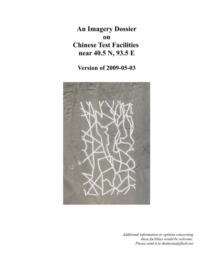
Although the historical imagery available as of the date of this dossier is limited (2003 to 2007), it is sufficient to show that considerable development of the facilities took place in that span of time. New facilities were built and considerable weapons testing was done against both old and new facilites. Two large reticulated patterns, one apparently quite old and the other constructed in 2005, are somewhat enigmatic.
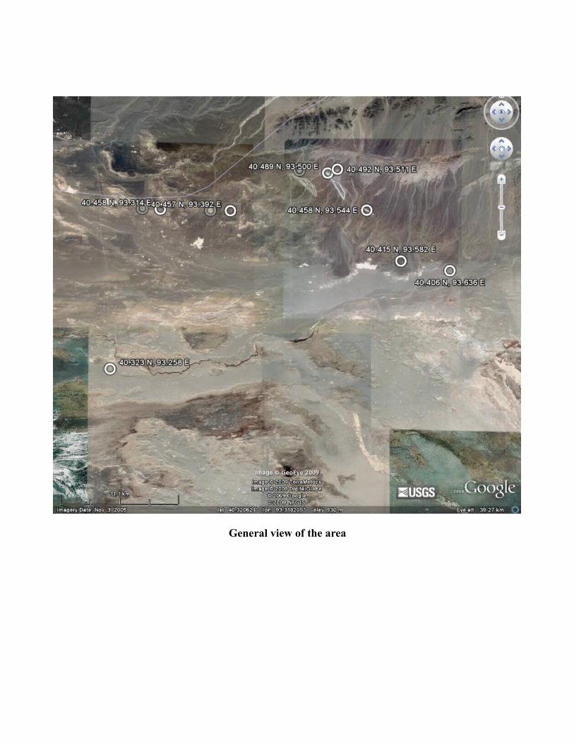
General view of the area
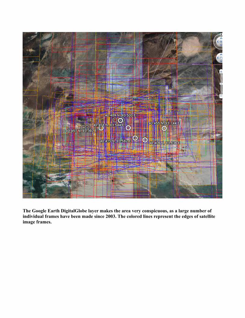
The Google Earth DigitalGlobe layer makes the area very conspicuous, as a large number of individual frames have been made since 2003. The colored lines represent the edges of satellite image frames.
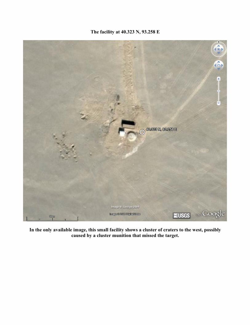
The facility at 40.323 N, 93.258 E
In the only available image, this small facility shows a cluster of craters to the west, possibly caused by a cluster munition that missed the target.
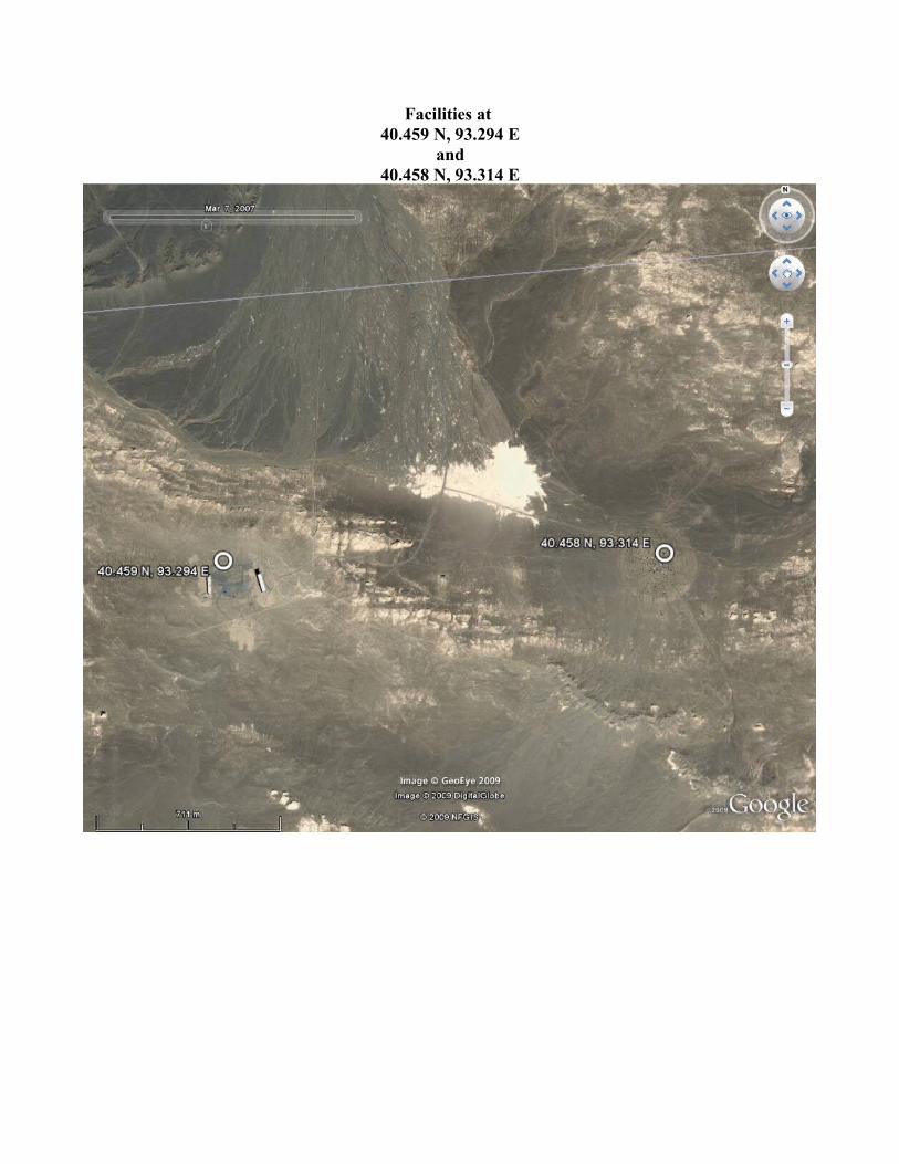
Facilities at 40.459 N, 93.294 E
and40.458 N, 93.314 E
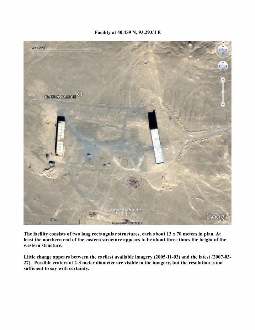
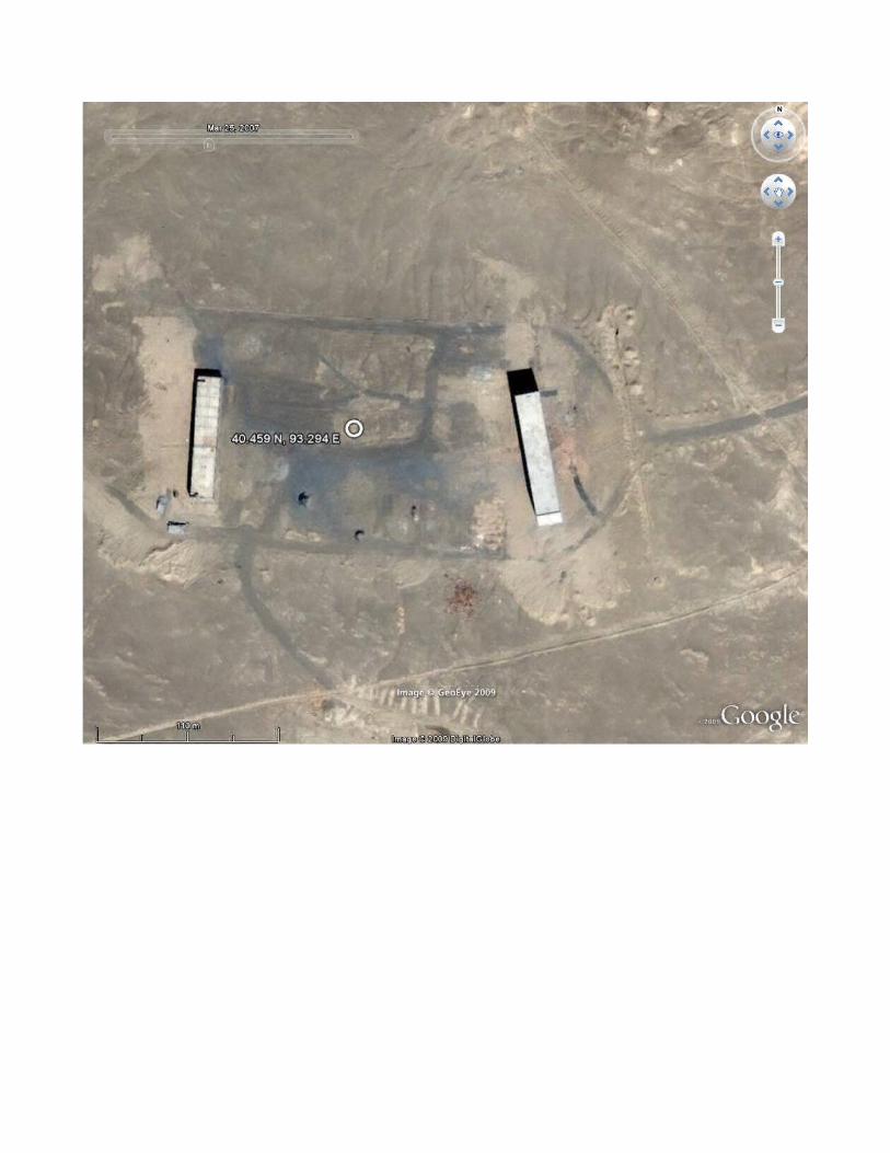
Facility at 40.459 N, 93.293/4 E
The facility consists of two long rectangular structures, each about 13 x 70 meters in plan. At least the northern end of the eastern structure appears to be about three times the height of the western structure.
Little change appears between the earliest available imagery (2005-11-03) and the latest (2007-03-27). Possible craters of 2-3 meter diameter are visible in the imagery, but the resolution is not sufficient to say with certainty.
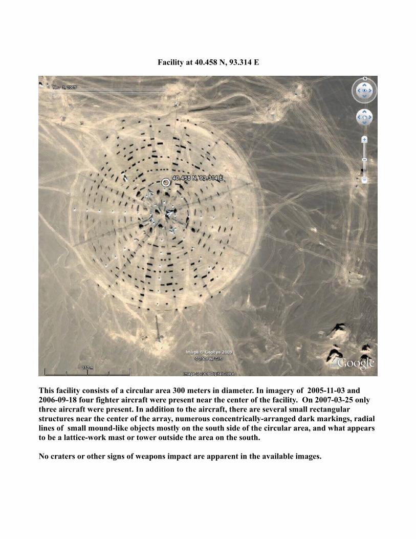
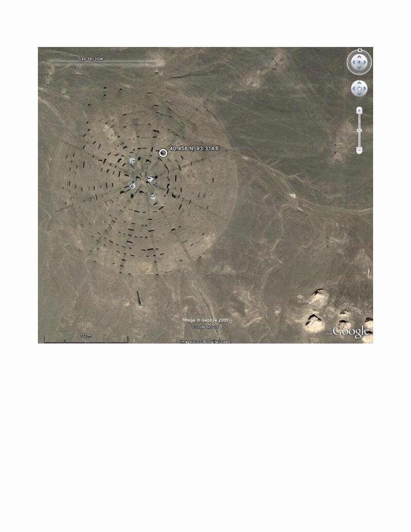
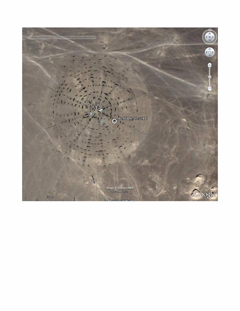
Facility at 40.458 N, 93.314 E
This facility consists of a circular area 300 meters in diameter. In imagery of 2005-11-03 and 2006-09-18 four fighter aircraft were present near the center of the facility. On 2007-03-25 only three aircraft were present. In addition to the aircraft, there are several small rectangular structures near the center of the array, numerous concentrically-arranged dark markings, radial lines of small mound-like objects mostly on the south side of the circular area, and what appears to be a lattice-work mast or tower outside the area on the south.
No craters or other signs of weapons impact are apparent in the available images.
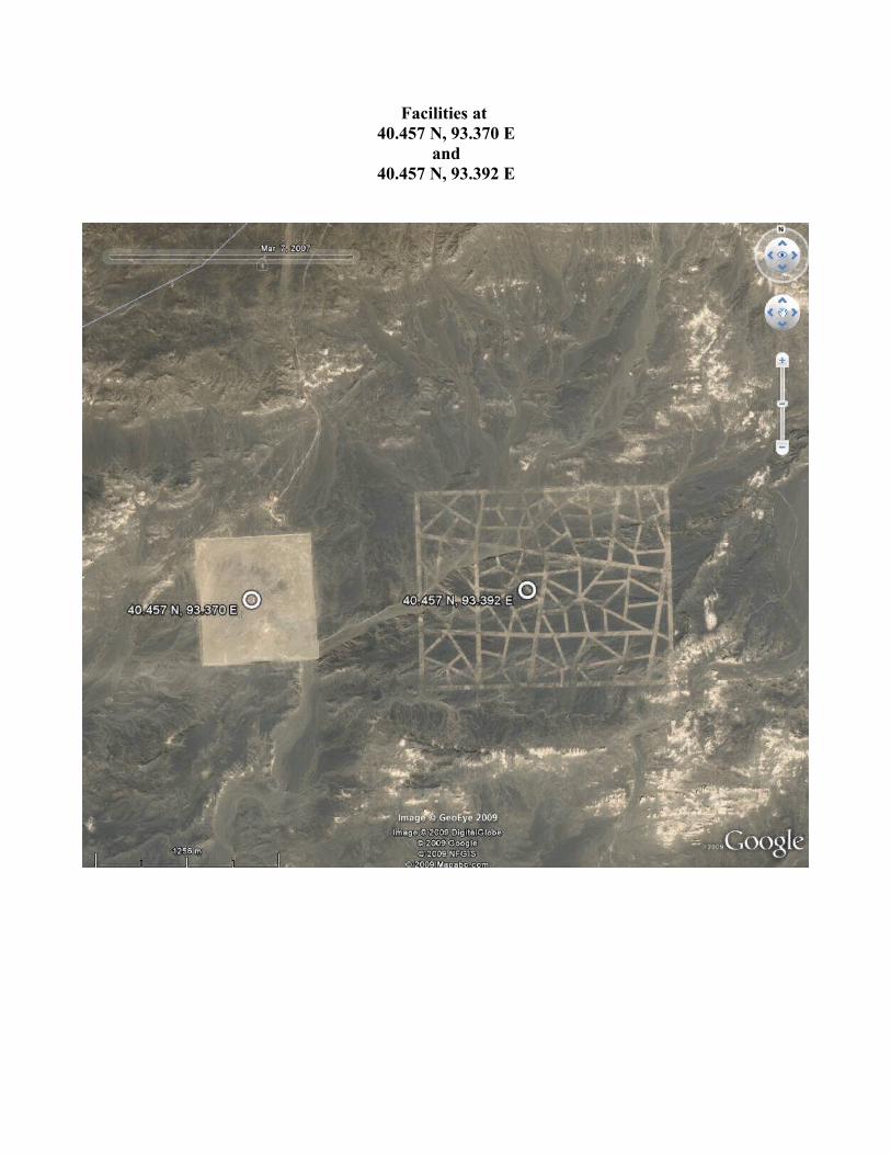
Facilities at 40.457 N, 93.370 E
and40.457 N, 93.392 E
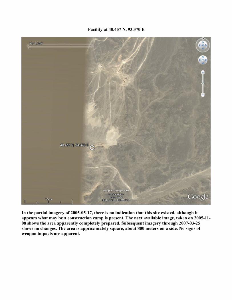
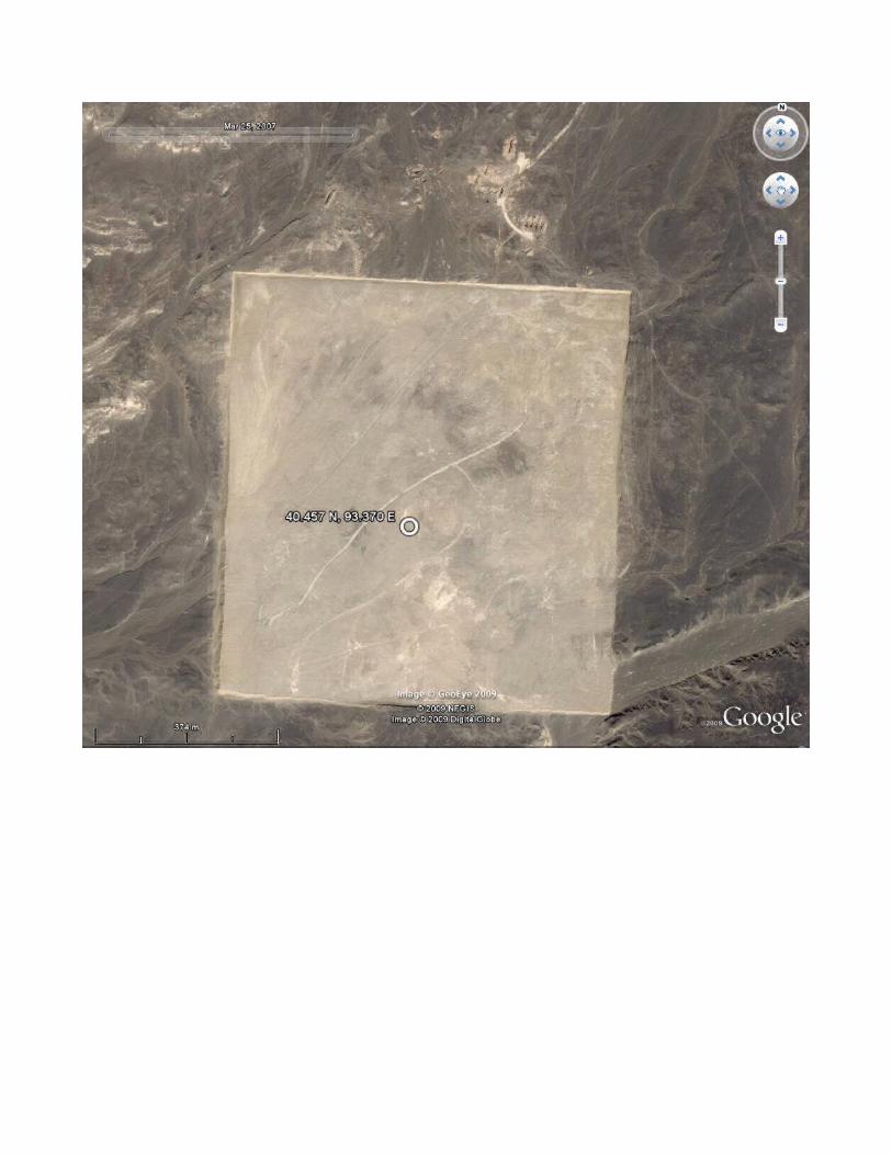
Facility at 40.457 N, 93.370 E
In the partial imagery of 2005-05-17, there is no indication that this site existed, although it appears what may be a construction camp is present. The next available image, taken on 2005-11-08 shows the area apparently completely prepared. Subsequent imagery through 2007-03-25 shows no changes. The area is approximately square, about 800 meters on a side. No signs of weapon impacts are apparent.
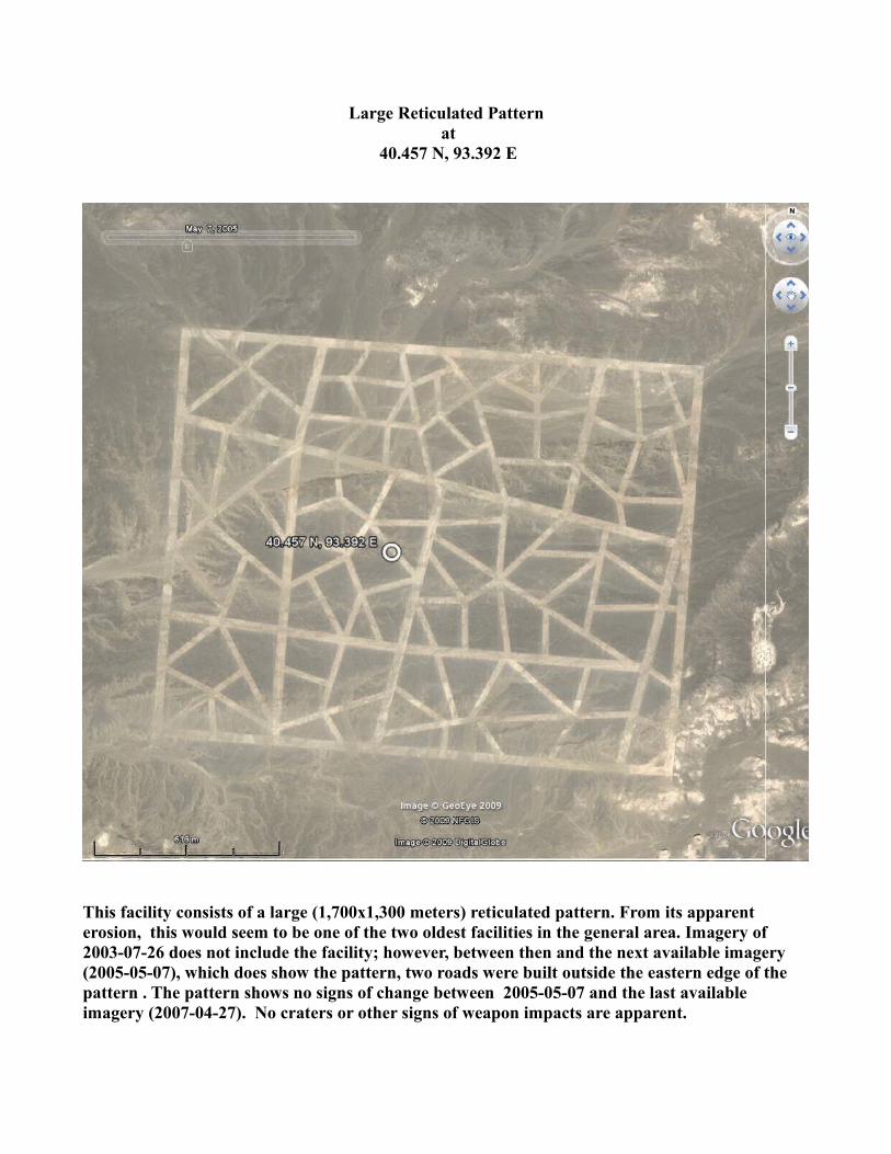
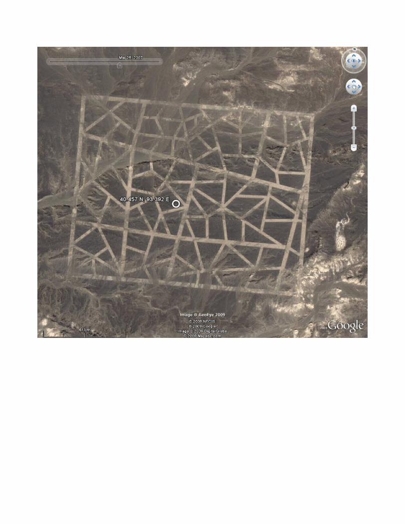
Large Reticulated Pattern at
40.457 N, 93.392 E
This facility consists of a large (1,700x1,300 meters) reticulated pattern. From its apparent erosion, this would seem to be one of the two oldest facilities in the general area. Imagery of 2003-07-26 does not include the facility; however, between then and the next available imagery (2005-05-07), which does show the pattern, two roads were built outside the eastern edge of the pattern . The pattern shows no signs of change between 2005-05-07 and the last available imagery (2007-04-27). No craters or other signs of weapon impacts are apparent.
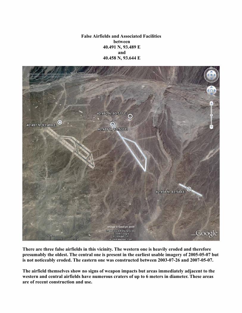
False Airfields and Associated Facilities between
40.491 N, 93.489 E and
40.458 N, 93.644 E
There are three false airfields in this vicinity. The western one is heavily eroded and therefore presumably the oldest. The central one is present in the earliest usable imagery of 2005-05-07 but is not noticeably eroded. The eastern one was constructed between 2003-07-26 and 2007-05-07.
The airfield themselves show no signs of weapon impacts but areas immediately adjacent to the western and central airfields have numerous craters of up to 6 meters in diameter. These areas are of recent construction and use.
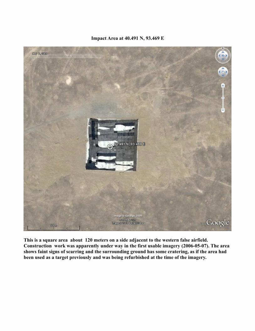
Impact Area at 40.491 N, 93.469 E
This is a square area about 120 meters on a side adjacent to the western false airfield. Construction work was apparently under way in the first usable imagery (2006-05-07). The area shows faint signs of scarring and the surrounding ground has some cratering, as if the area had been used as a target previously and was being refurbished at the time of the imagery.
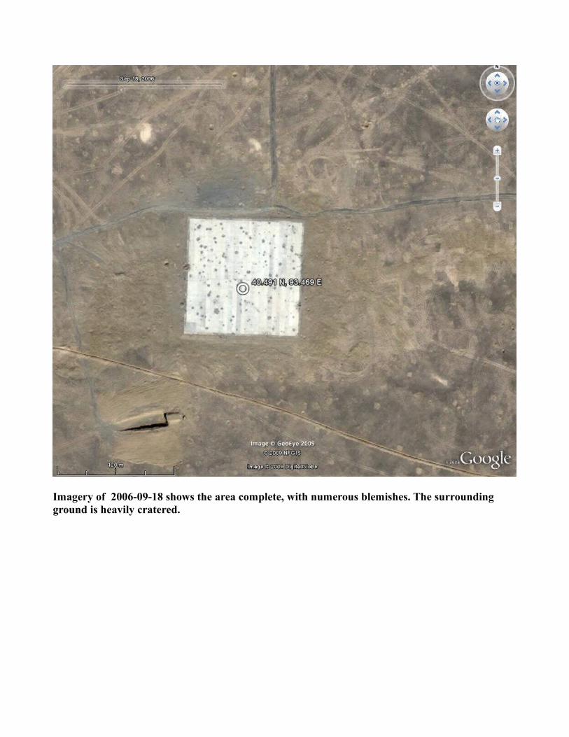
Imagery of 2006-09-18 shows the area complete, with numerous blemishes. The surrounding ground is heavily cratered.
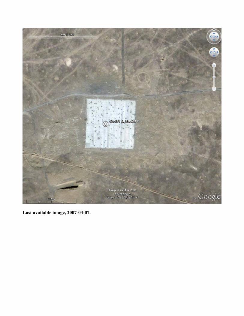
Last available image, 2007-03-07.
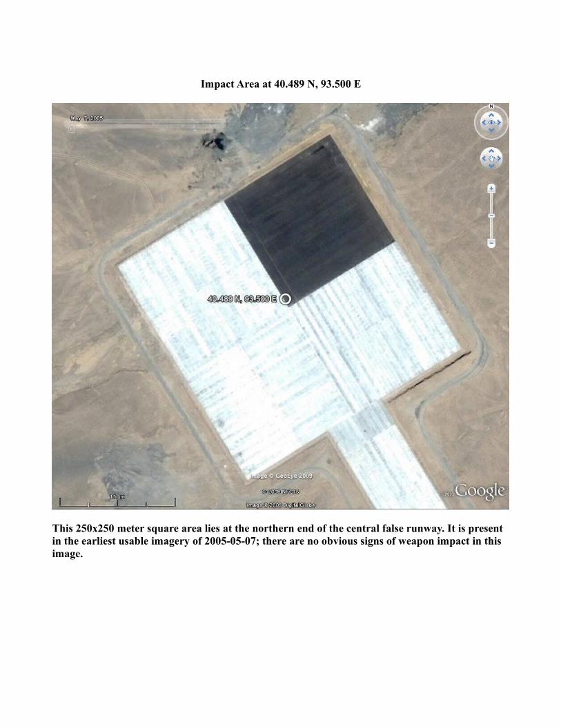
Impact Area at 40.489 N, 93.500 E
This 250x250 meter square area lies at the northern end of the central false runway. It is present in the earliest usable imagery of 2005-05-07; there are no obvious signs of weapon impact in this image.
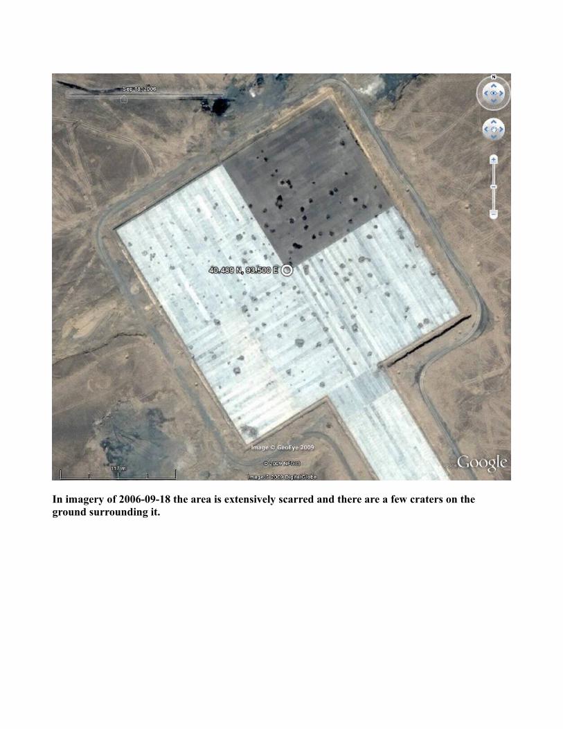
In imagery of 2006-09-18 the area is extensively scarred and there are a few craters on the ground surrounding it.
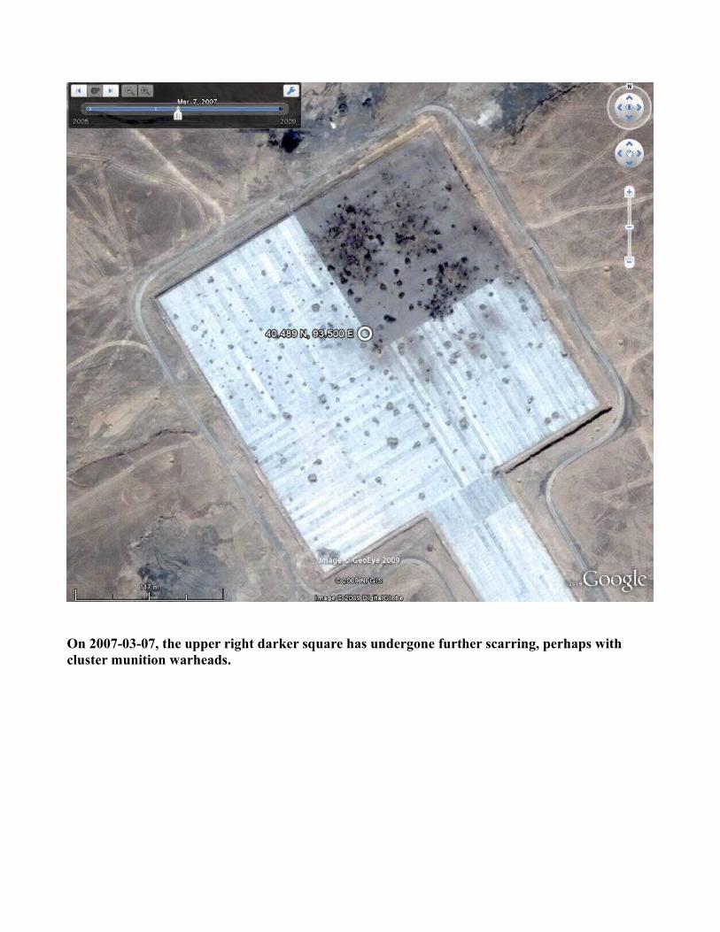
On 2007-03-07, the upper right darker square has undergone further scarring, perhaps with cluster munition warheads.
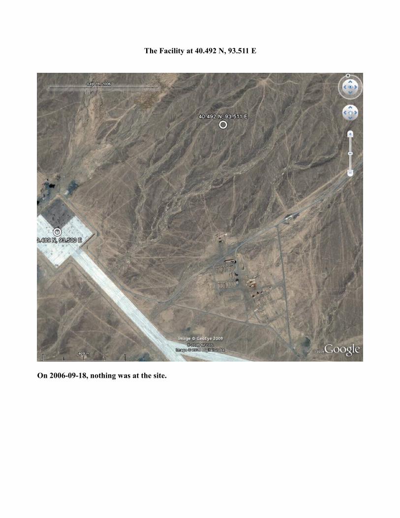
The Facility at 40.492 N, 93.511 E
On 2006-09-18, nothing was at the site.
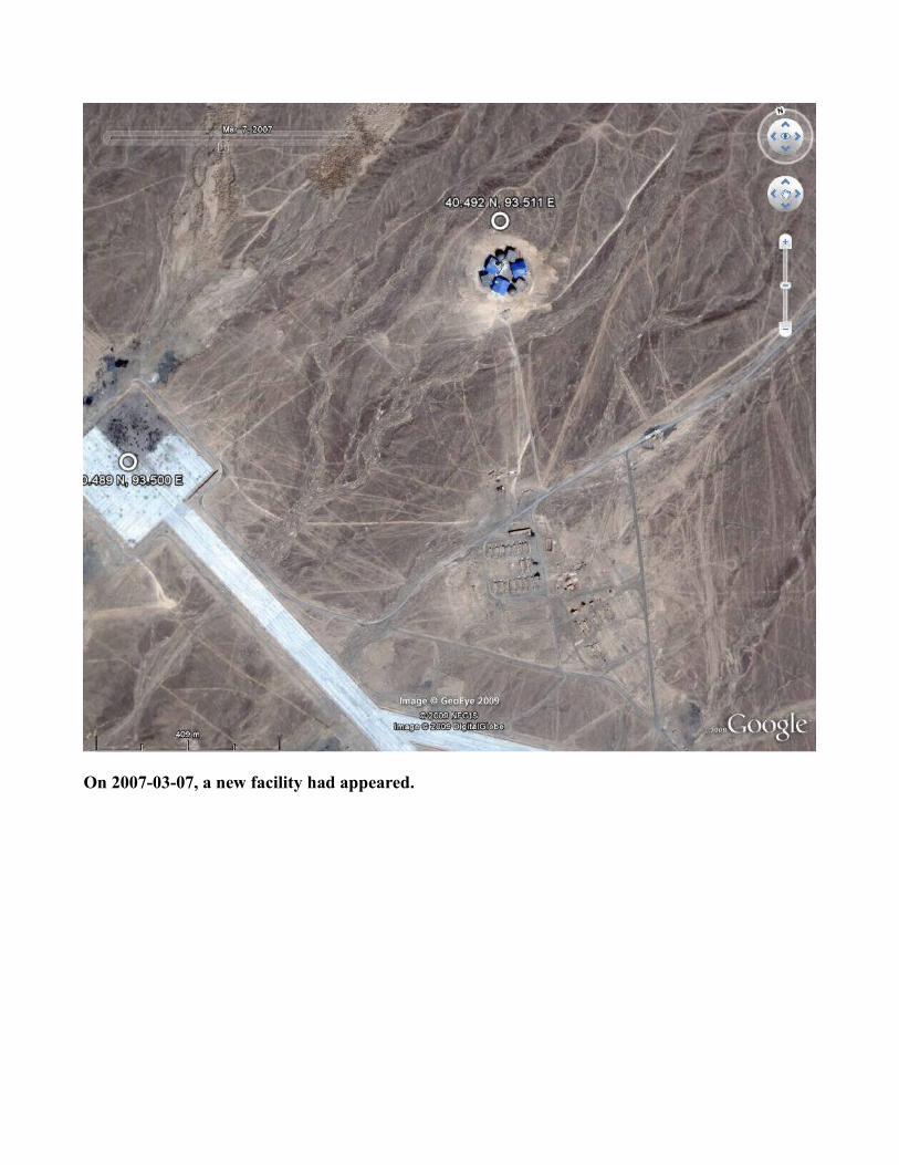
On 2007-03-07, a new facility had appeared.
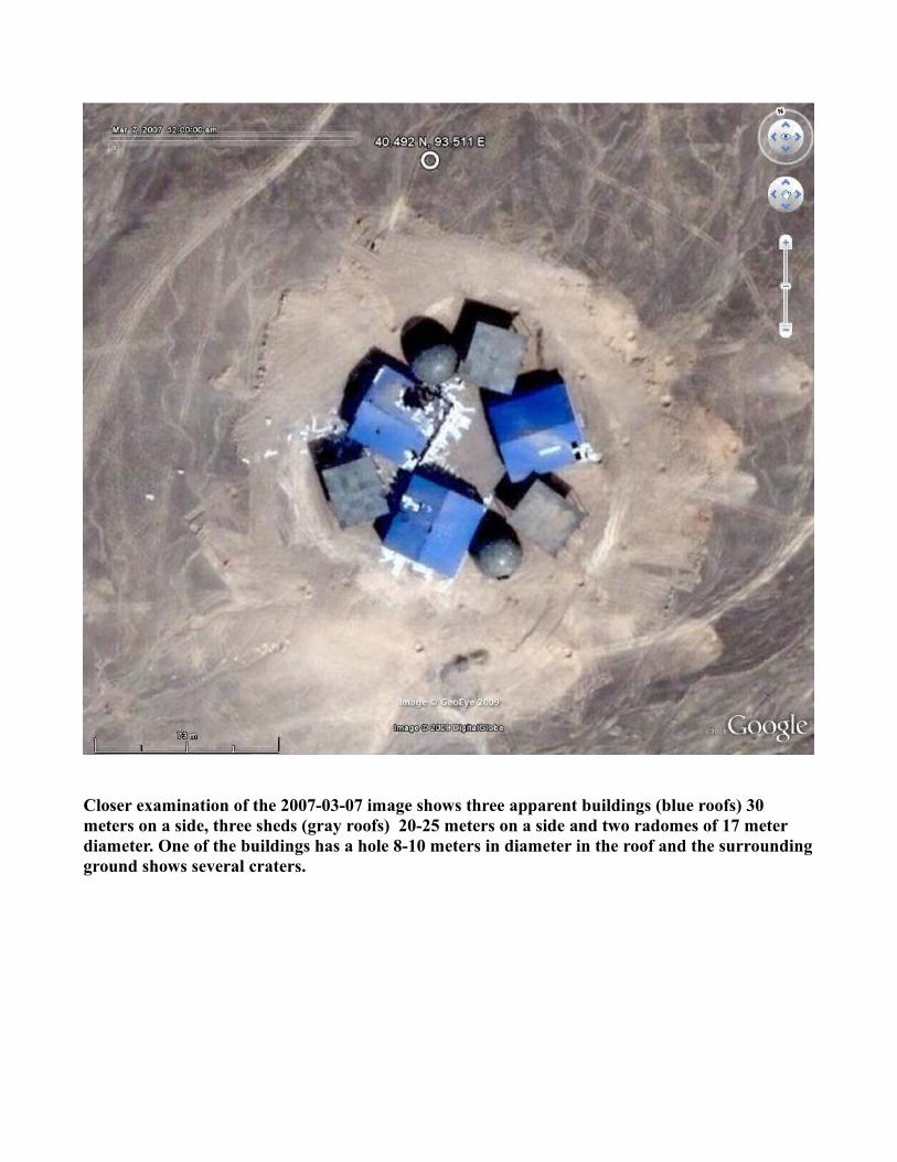
Closer examination of the 2007-03-07 image shows three apparent buildings (blue roofs) 30 meters on a side, three sheds (gray roofs) 20-25 meters on a side and two radomes of 17 meter diameter. One of the buildings has a hole 8-10 meters in diameter in the roof and the surrounding ground shows several craters.
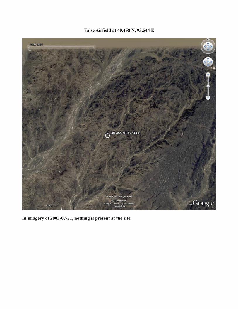
False Airfield at 40.458 N, 93.544 E
In imagery of 2003-07-21, nothing is present at the site.
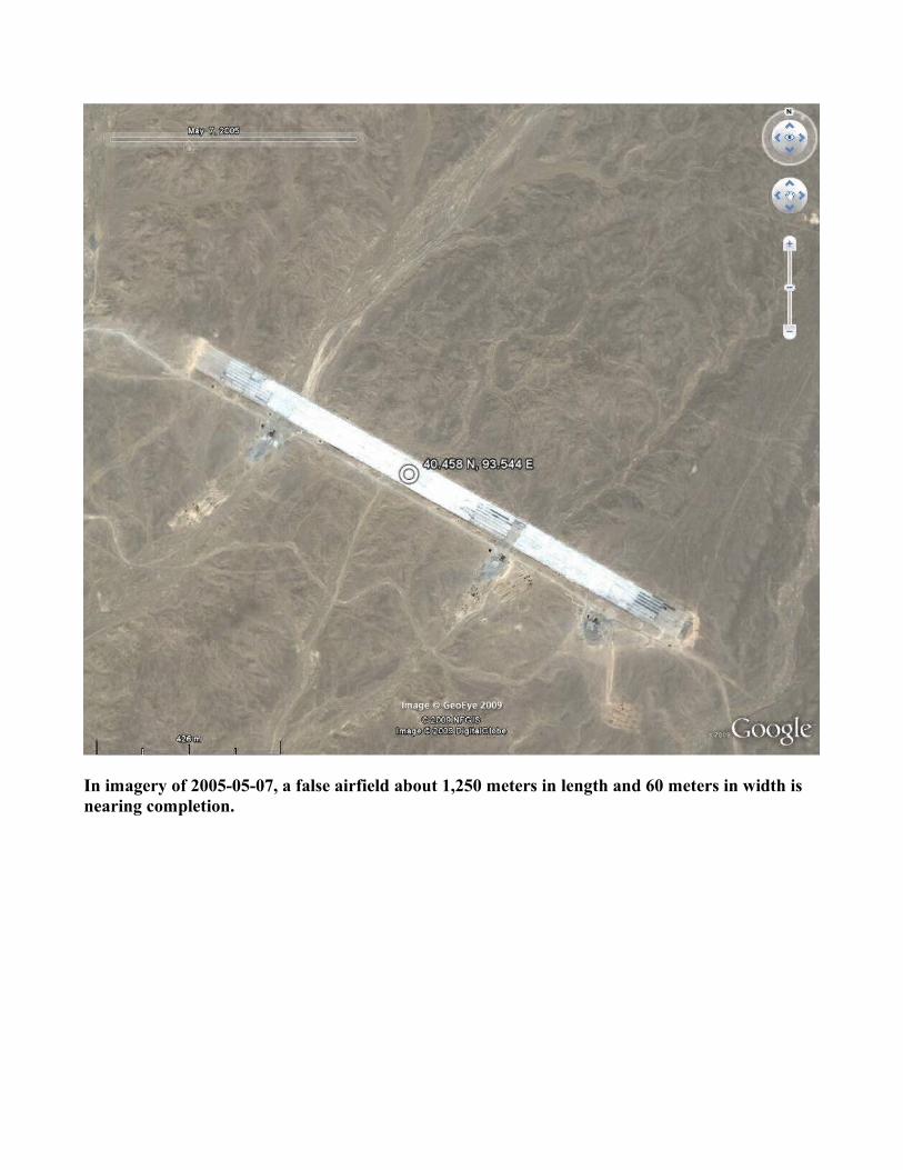
In imagery of 2005-05-07, a false airfield about 1,250 meters in length and 60 meters in width is nearing completion.
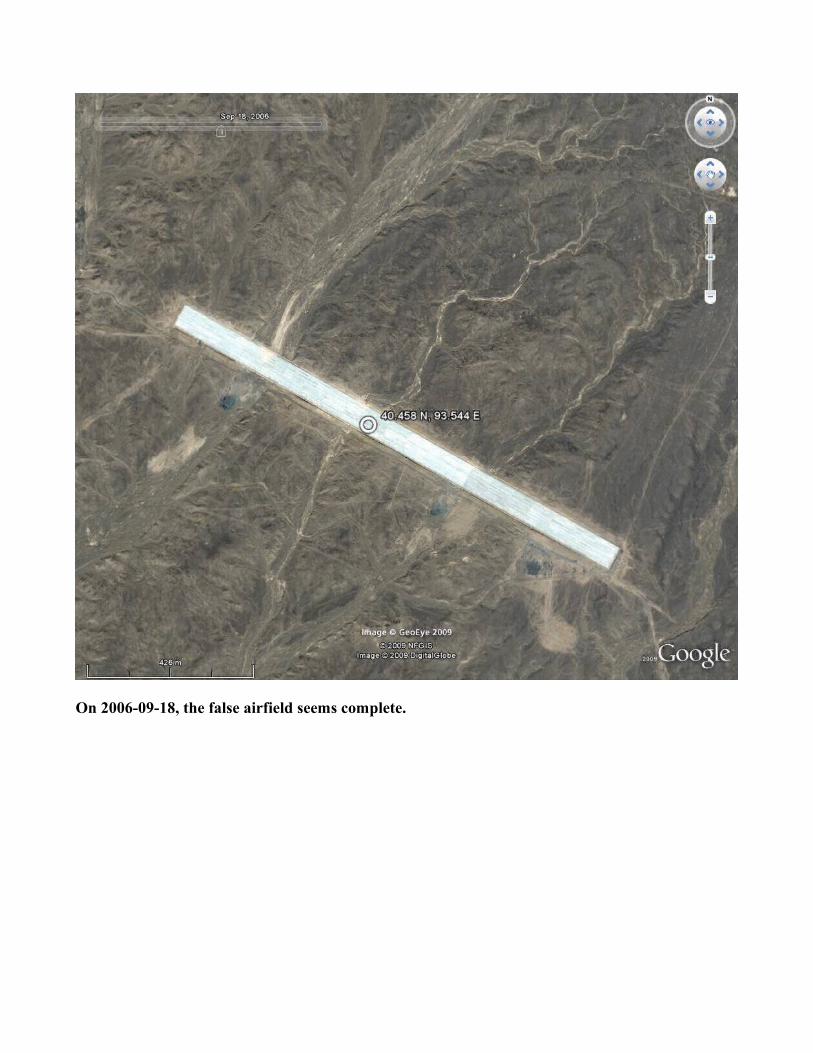
On 2006-09-18, the false airfield seems complete.
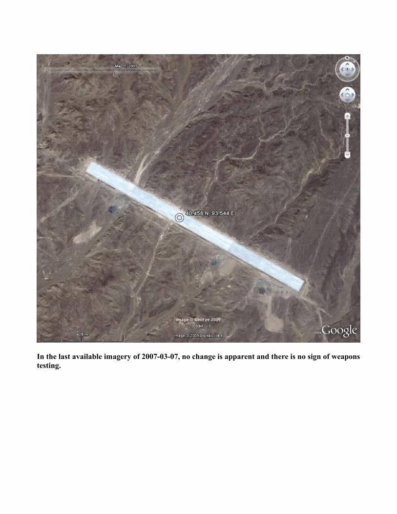
In the last available imagery of 2007-03-07, no change is apparent and there is no sign of weapons testing.
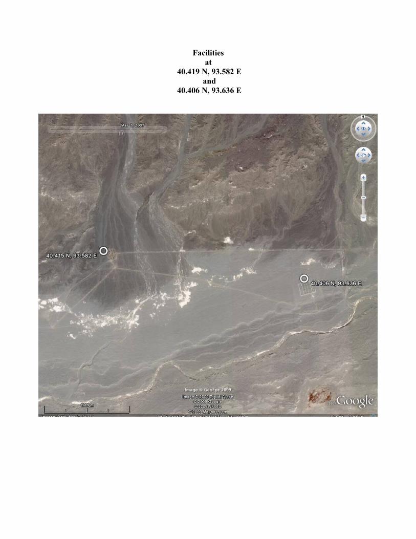
Facilitiesat
40.419 N, 93.582 E and
40.406 N, 93.636 E
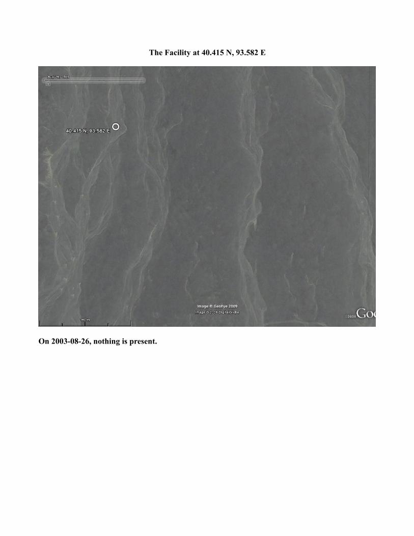
The Facility at 40.415 N, 93.582 E
On 2003-08-26, nothing is present.
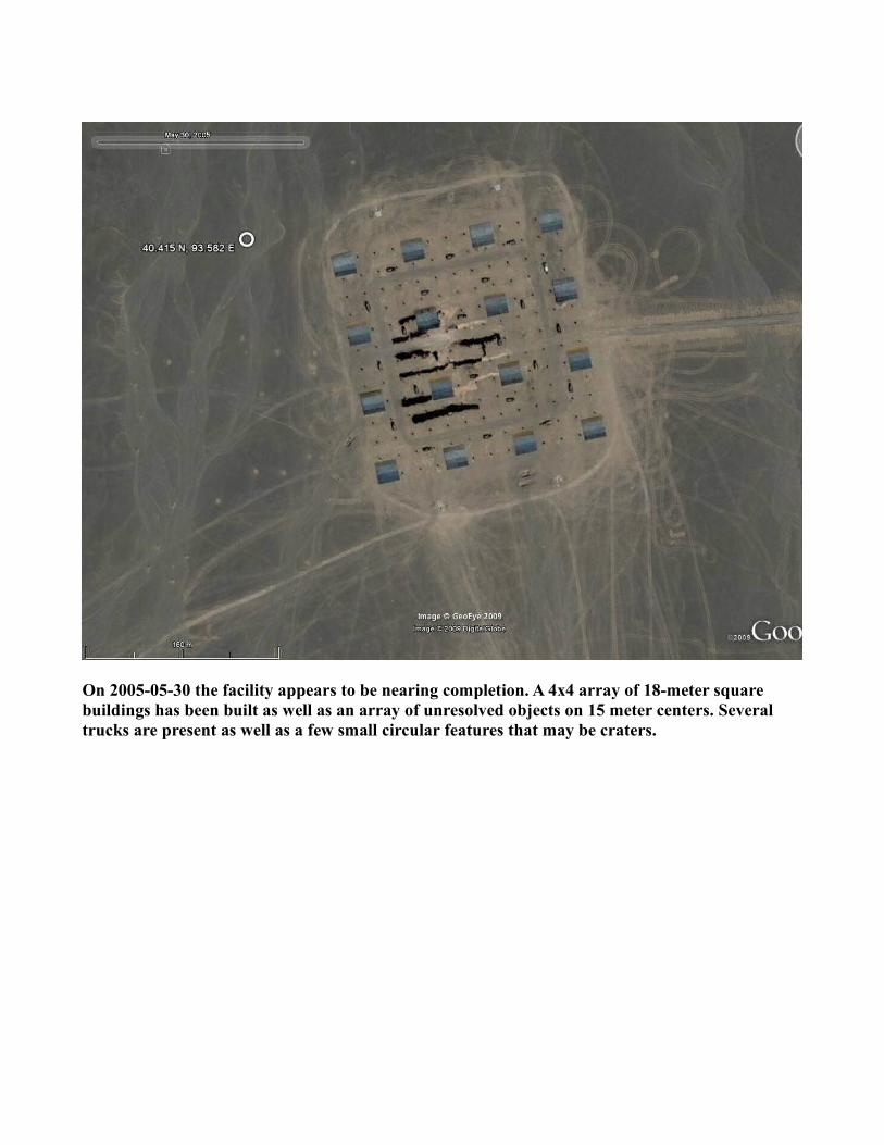
On 2005-05-30 the facility appears to be nearing completion. A 4x4 array of 18-meter square buildings has been built as well as an array of unresolved objects on 15 meter centers. Several trucks are present as well as a few small circular features that may be craters.
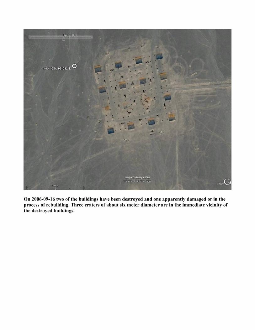
On 2006-09-16 two of the buildings have been destroyed and one apparently damaged or in the process of rebuilding. Three craters of about six meter diameter are in the immediate vicinity of the destroyed buildings.
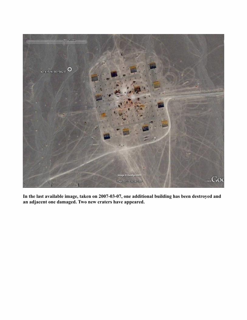
In the last available image, taken on 2007-03-07, one additional building has been destroyed and an adjacent one damaged. Two new craters have appeared.
Simulated Electrical Substationat
40.406 N, 93.636 E
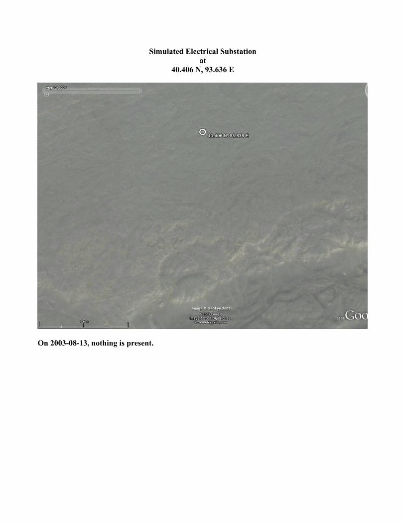
On 2003-08-13, nothing is present.
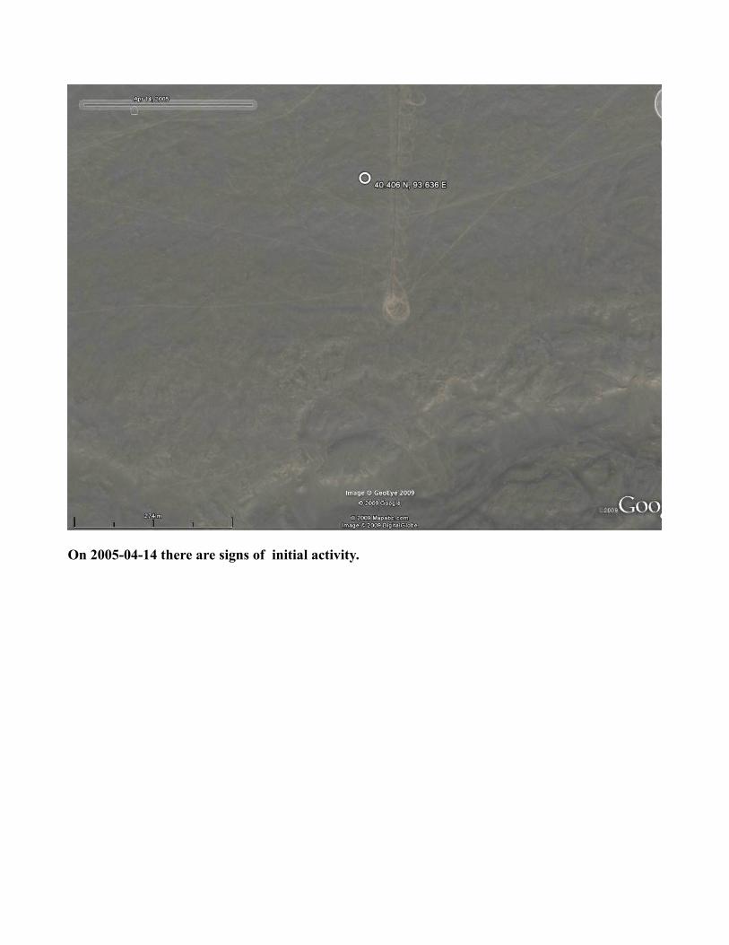
On 2005-04-14 there are signs of initial activity.

On 2005-05-30 preparations for construction are well along.
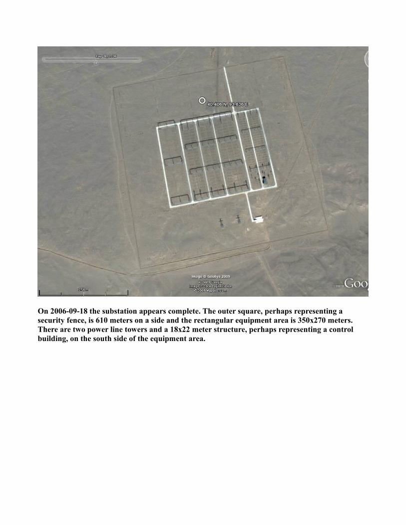
On 2006-09-18 the substation appears complete. The outer square, perhaps representing a security fence, is 610 meters on a side and the rectangular equipment area is 350x270 meters. There are two power line towers and a 18x22 meter structure, perhaps representing a control building, on the south side of the equipment area.
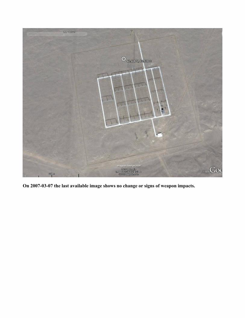
On 2007-03-07 the last available image shows no change or signs of weapon impacts.
Large Reticulated Pattern at
40.455 N, 93.744 E
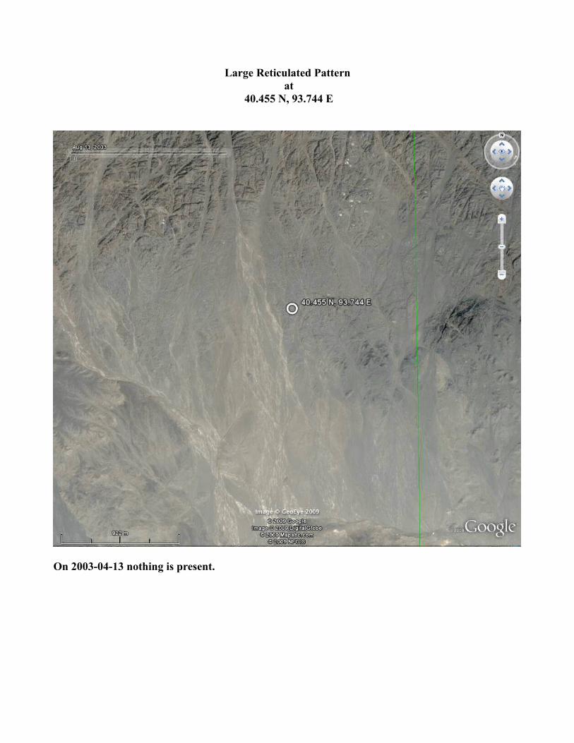
On 2003-04-13 nothing is present.
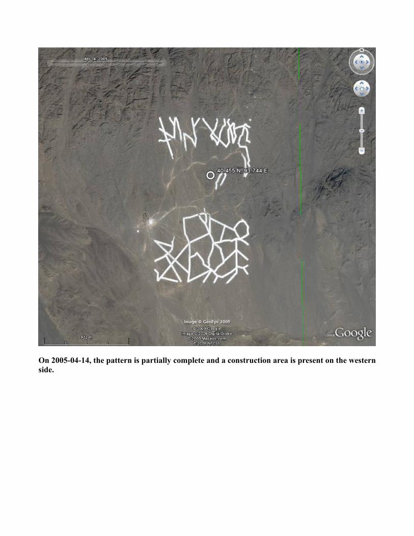
On 2005-04-14, the pattern is partially complete and a construction area is present on the western side.
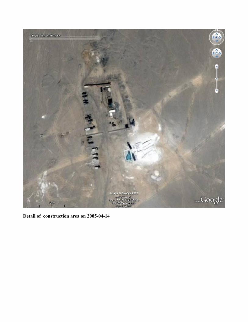
Detail of construction area on 2005-04-14
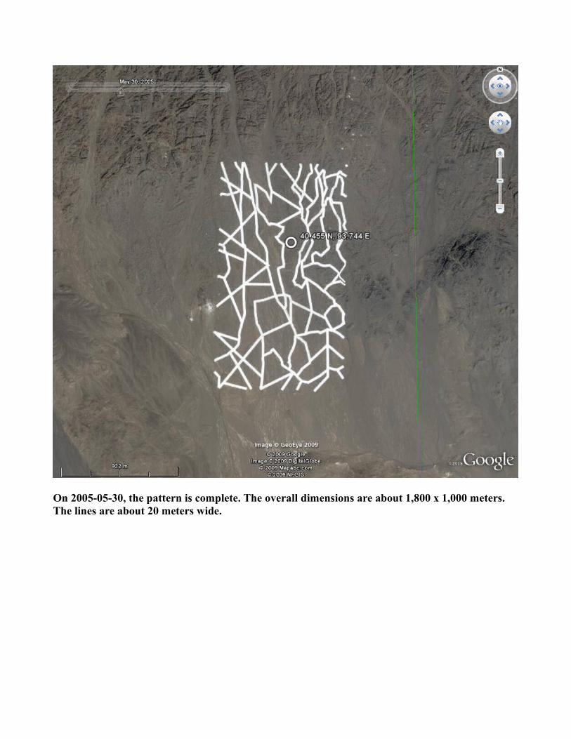
On 2005-05-30, the pattern is complete. The overall dimensions are about 1,800 x 1,000 meters. The lines are about 20 meters wide.
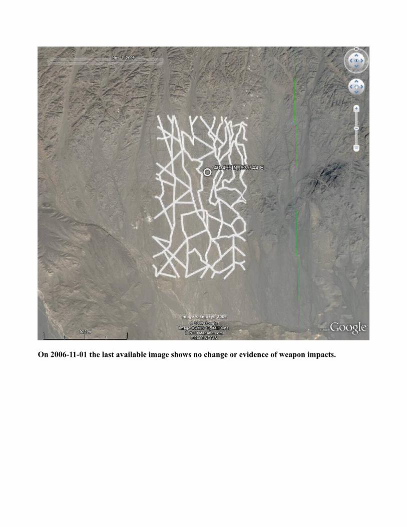
On 2006-11-01 the last available image shows no change or evidence of weapon impacts.