arcgis: extending the reach of geospatial intelligence
TRANSCRIPT

ArcGIS: Extending The Reach Of
India’s Security Forces
John Day
Esri, Washington DC, USA
14 June 2012
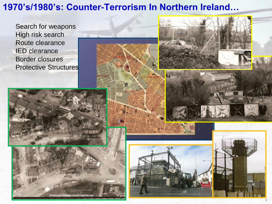
1970’s/1980’s: Counter-Terrorism In Northern Ireland…
2
Search for weapons
High risk search
Route clearance
IED clearance
Border closures
Protective Structures
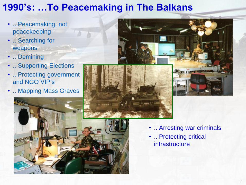
1990’s: …To Peacemaking in The Balkans
• .. Arresting war criminals
• .. Protecting critical
infrastructure
3
• .. Peacemaking, not
peacekeeping
• .. Searching for
weapons
• .. Demining
• .. Supporting Elections
• .. Protecting government
and NGO VIP’s
• .. Mapping Mass Graves
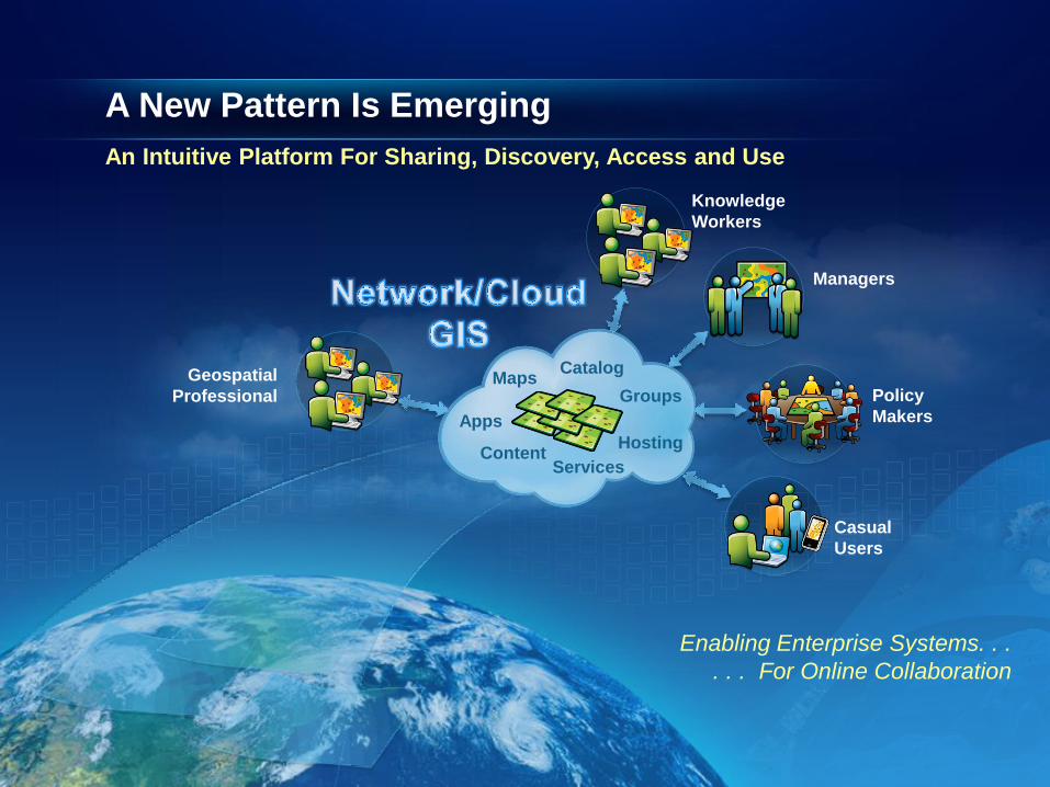
A New Pattern Is Emerging
An Intuitive Platform For Sharing, Discovery, Access and Use
Knowledge
Workers
Managers
Policy
Makers
Casual
Users
Geospatial
Professional
Content
Catalog
Groups
Hosting
Apps
Maps
Services
Enabling Enterprise Systems. . .
. . . For Online Collaboration
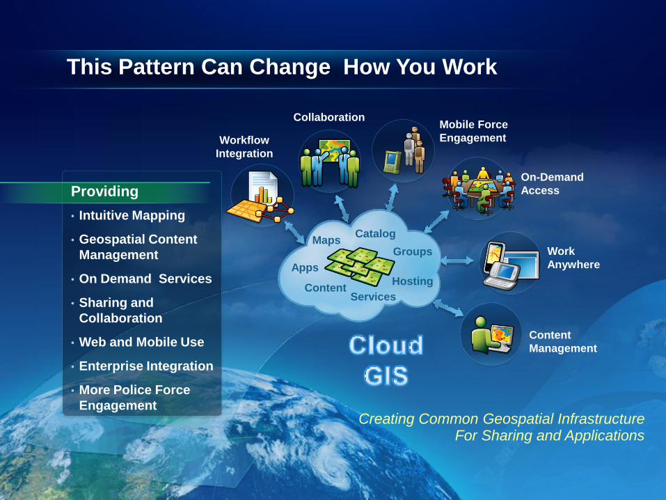
This Pattern Can Change How You Work
Mobile Force
Engagement
On-Demand
Access
Work
Anywhere
Content
Management
Workflow
Integration
Content
Catalog
Groups
Hosting
Apps
Maps
Services
Collaboration
Providing
• Intuitive Mapping
• Geospatial Content
Management
• On Demand Services
• Sharing and
Collaboration
• Web and Mobile Use
• Enterprise Integration
• More Police Force
Engagement
Creating Common Geospatial Infrastructure
For Sharing and Applications
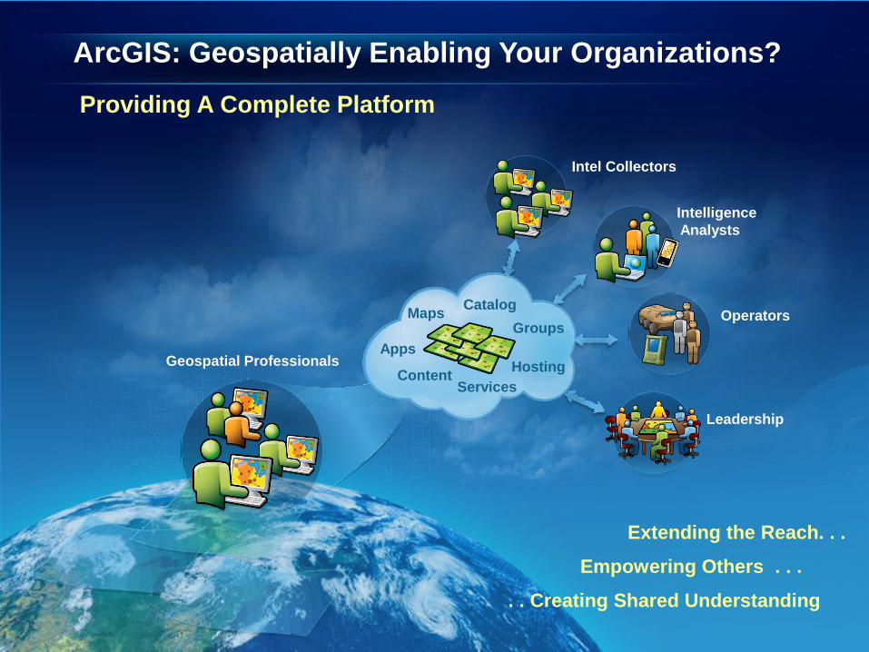
ArcGIS: Geospatially Enabling Your Organizations?
Providing A Complete Platform
Extending the Reach. . .
Empowering Others . . .
• . . Creating Shared Understanding
Geospatial Professionals
Intelligence
Analysts
Operators
Leadership
Intel Collectors
Content
Catalog
Groups
Hosting
Apps
Maps
Services
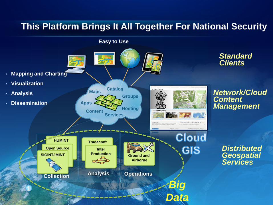
• Mapping and Charting
• Visualization
• Analysis
• Dissemination
Analysis
Tradecraft
Intel
Production
Standard Clients
Content
Catalog
Groups
Hosting
Apps
Maps
Services
Network/Cloud Content Management
This Platform Brings It All Together For National Security
HUMINT
Open Source
1
SIGINT/IMINT
Collection Operations
Ground and
Airborne
Distributed Geospatial Services
Big
Data
Easy to Use
Military

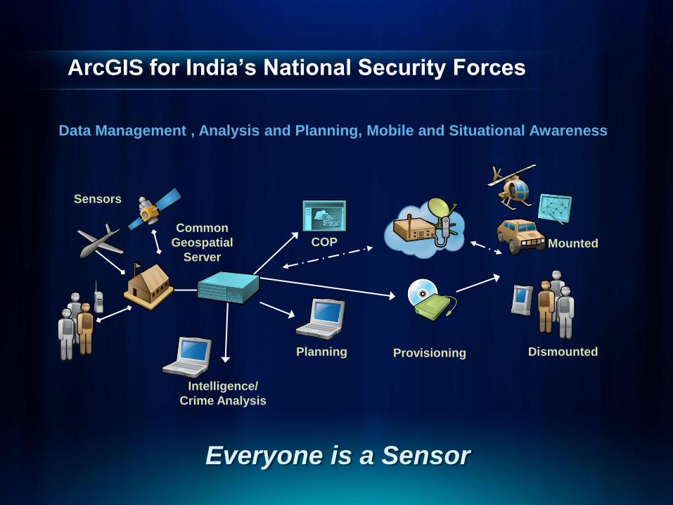
ArcGIS for India’s National Security Forces?
COP Common
Geospatial
Server
Provisioning
Data Management , Analysis and Planning, Mobile and Situational Awareness
Intelligence/
Crime Analysis
Planning
Sensors
Mounted
Dismounted
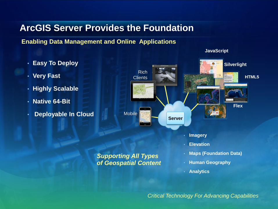
ArcGIS Server Provides the Foundation
Enabling Data Management and Online Applications
• Easy To Deploy
• Very Fast
• Highly Scalable
• Native 64-Bit
• Deployable In Cloud
Critical Technology For Advancing Capabilities
Silverlight
Flex
Rich
Clients
Mobile
Server
JavaScript
HTML5
Supporting All Types of Geospatial Content
• Imagery
• Elevation
• Maps (Foundation Data)
• Human Geography
• Analytics
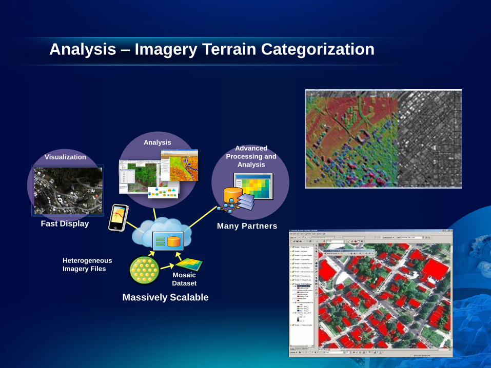
Analysis – Imagery Terrain Categorization
Advanced
Processing and
Analysis
Heterogeneous
Imagery Files Mosaic
Dataset
Visualization
Fast Display
Analysis
Massively Scalable
Many Partners
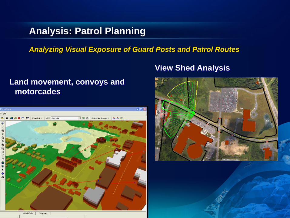
Analysis: Patrol Planning
Land movement, convoys and
motorcades
View Shed Analysis
Analyzing Visual Exposure of Guard Posts and Patrol Routes

Mounted/In-Vehicle Systems - ArcGIS Runtime
Embeddable Anywhere . . .
• Easy to Deploy
• Fast
• Small Footprint
• Windows/Linux
Runtime
Local Data
Server
US Army JBC-P Mounted Program
Evaluating Use of ArcGIS Runtime SDK
Connecting The Field To The Enterprise. . .
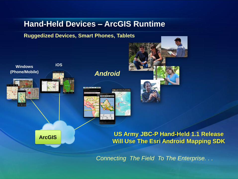
Hand-Held Devices – ArcGIS Runtime
Ruggedized Devices, Smart Phones, Tablets
Connecting The Field To The Enterprise. . .
ArcGIS
Windows
(Phone/Mobile)
iOS
Android
US Army JBC-P Hand-Held 1.1 Release
Will Use The Esri Android Mapping SDK
ArcGIS for India’s National Security Forces
COP Common
Geospatial
Server
Provisioning
Data Management , Analysis and Planning, Mobile and Situational Awareness
Mounted
Dismounted
Intelligence/
Crime Analysis
Planning
Sensors
Everyone is a Sensor
