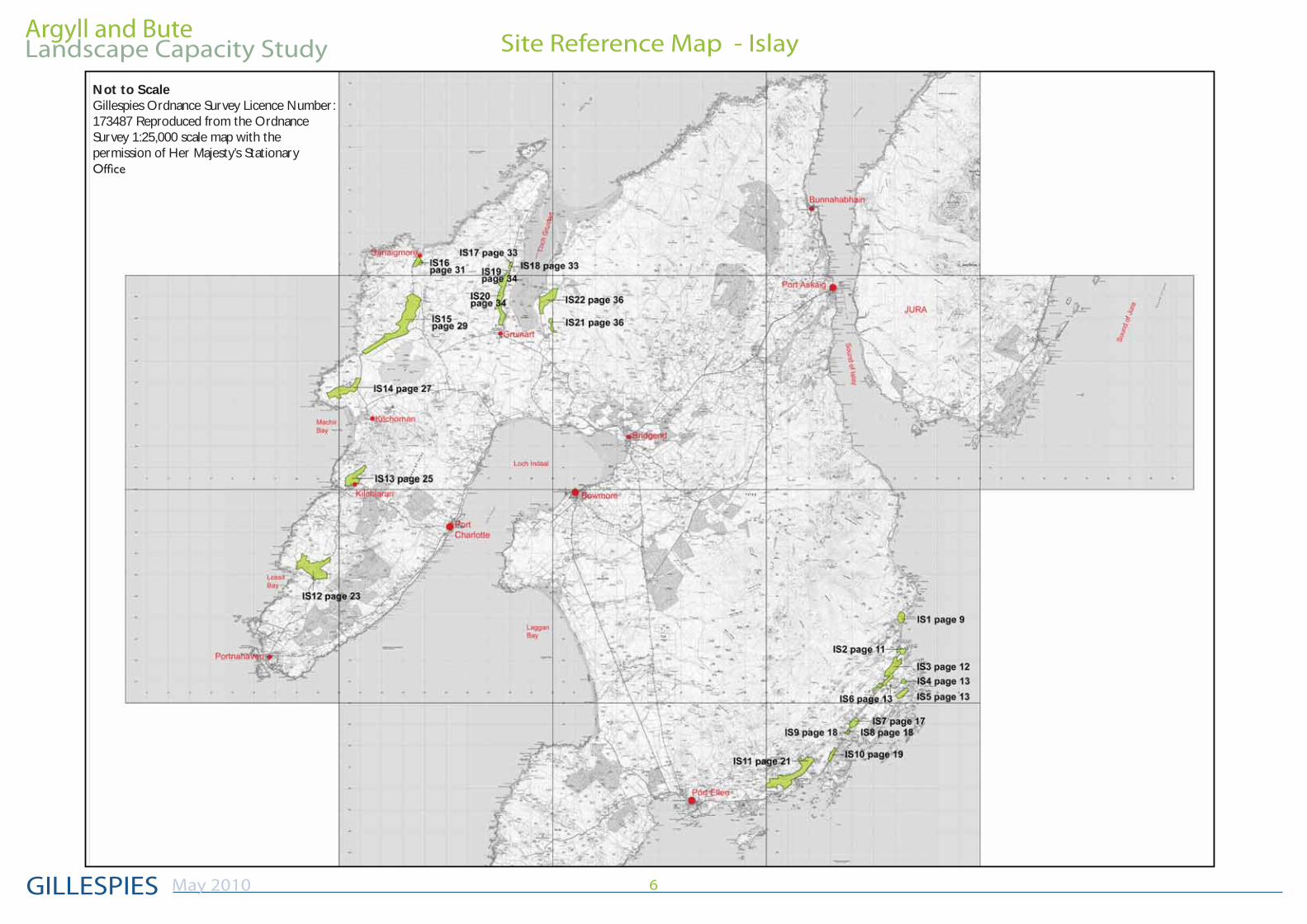
argyll and bute site reference map - islay landscape ... · landscape capacity study may 2010 6...
TRANSCRIPT
Argyll and Bute
GILLESPIES
Landscape Capacity Study
May 2010 6
Site Reference Map - Islay
Not to ScaleGillespies Ordnance Survey Licence Number: 173487 Reproduced from the Ordnance Survey 1:25,000 scale map with the permission of Her Majesty’s Stationary
Argyll and Bute
GILLESPIES
Landscape Capacity Study
May 2010 7
Map Key
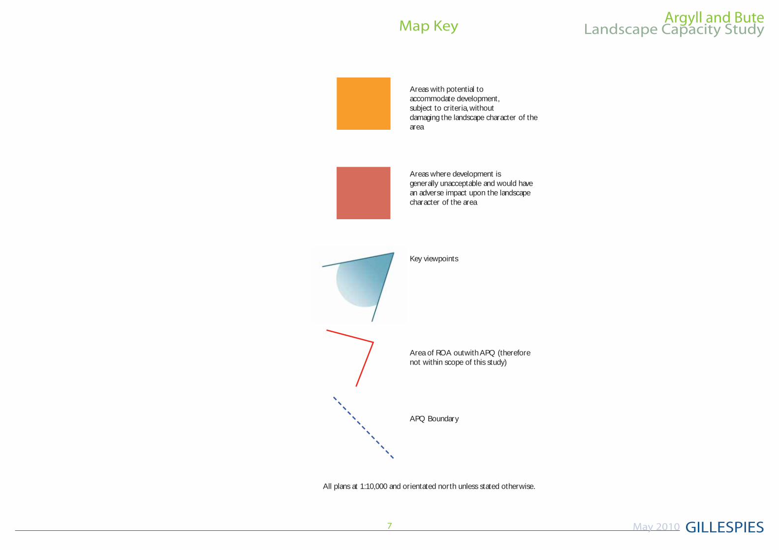
Areas with potential to accommodate development, subject to criteria, without damaging the landscape character of the area
Areas where development is generally unacceptable and would have an adverse impact upon the landscape character of the area
Key viewpoints
Area of ROA outwith APQ (therefore not within scope of this study)
APQ Boundary
All plans at 1:10,000 and orientated north unless stated otherwise.
Argyll and Bute
GILLESPIES
Landscape Capacity Study
May 2010 24
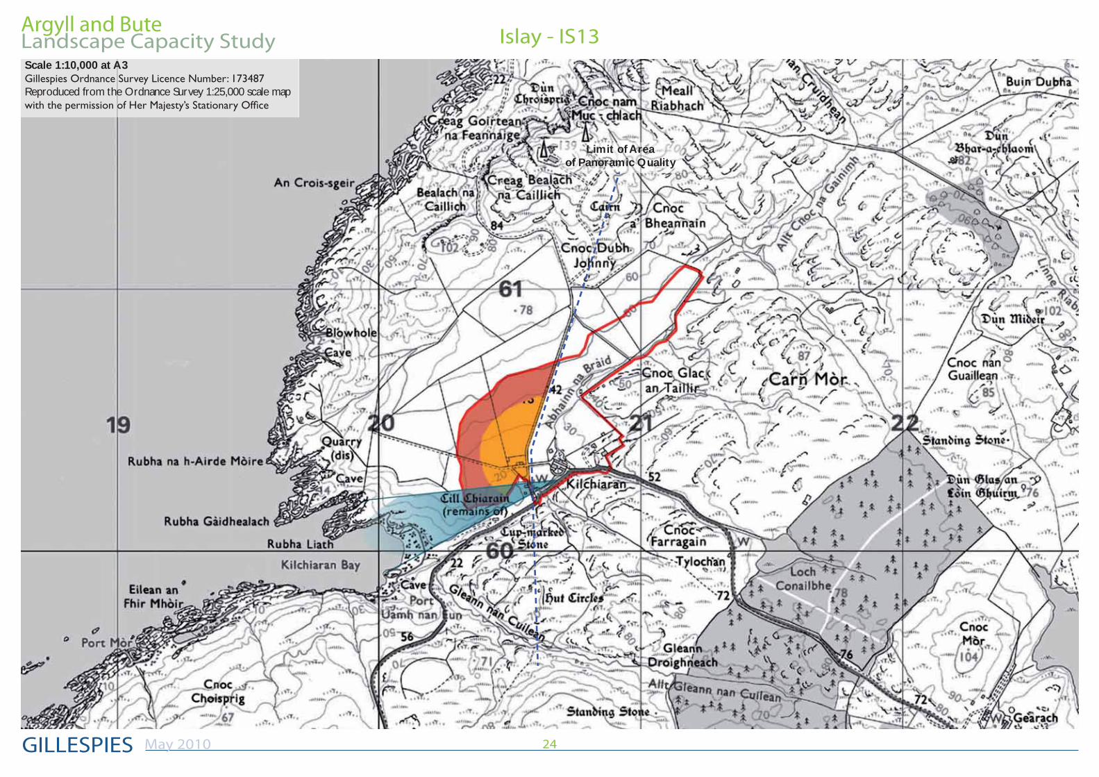
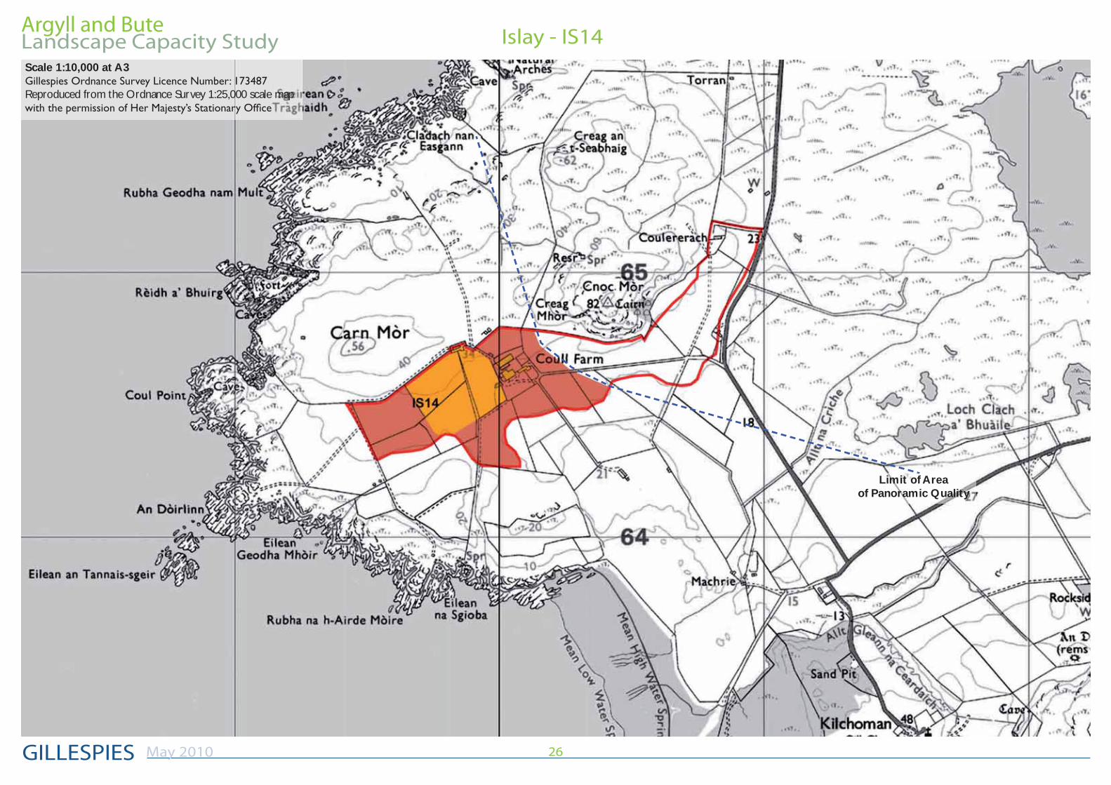
Islay - IS13Scale 1:10,000 at A3
Reproduced from the Ordnance Survey 1:25,000 scale map
Limit of Area of Panoramic Quality
Argyll and Bute
GILLESPIES
Landscape Capacity Study
May 2010 25
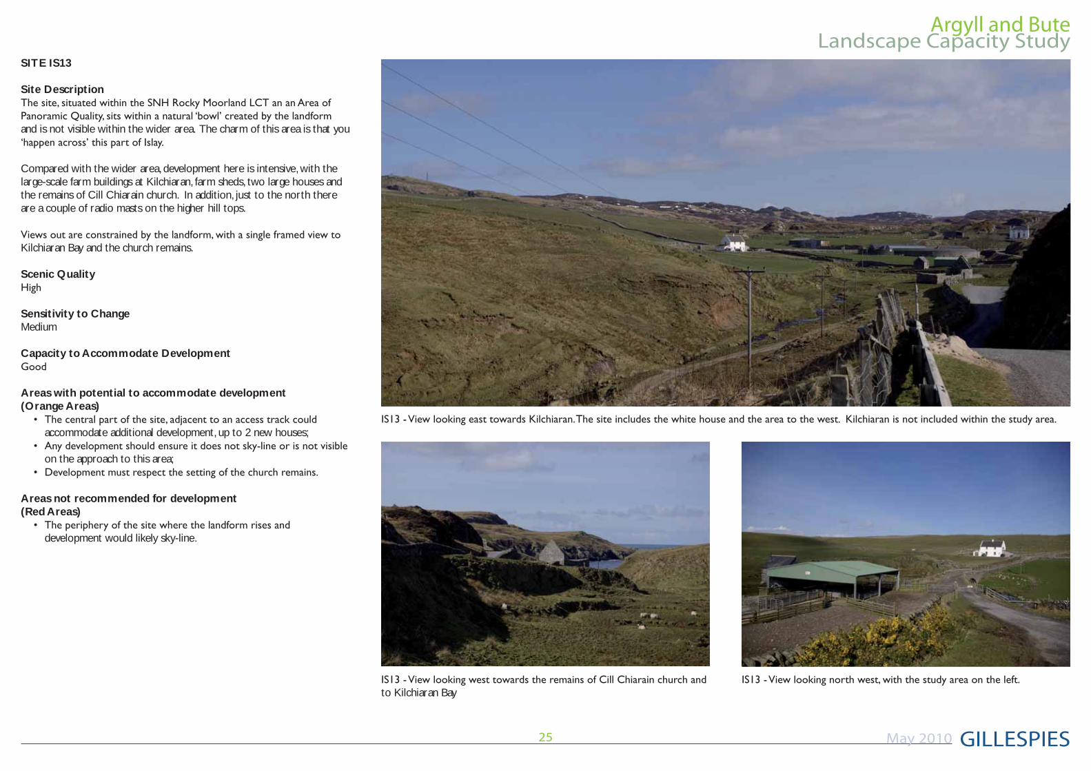
to Kilchiaran Bay
SITE IS13
Site Description
and is not visible within the wider area. The charm of this area is that you
Compared with the wider area, development here is intensive, with the large-scale farm buildings at Kilchiaran, farm sheds, two large houses and the remains of Cill Chiarain church. In addition, just to the north there are a couple of radio masts on the higher hill tops.
Kilchiaran Bay and the church remains.
Scenic Quality
Sensitivity to ChangeMedium
Capacity to Accommodate Development
Areas with potential to accommodate development(Orange Areas)
accommodate additional development, up to 2 new houses;
on the approach to this area;
Areas not recommended for development(Red Areas)
development would likely sky-line.
Argyll and Bute
GILLESPIES
Landscape Capacity Study
May 2010 26
Islay - IS14Scale 1:10,000 at A3
Reproduced from the Ordnance Survey 1:25,000 scale map
Limit of Area of Panoramic Quality
Argyll and Bute
GILLESPIES
Landscape Capacity Study
May 2010 27
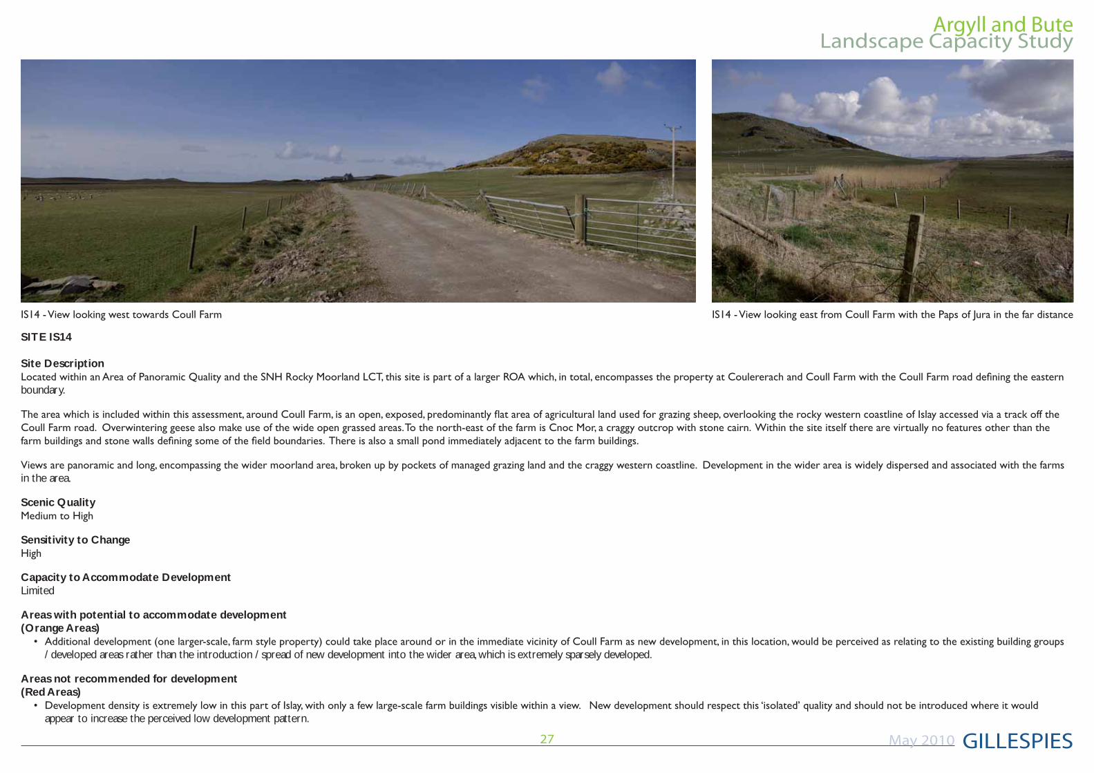
SITE IS14
Site Description
boundary.
in the area.
Scenic Quality
Sensitivity to Change
Capacity to Accommodate DevelopmentLimited
Areas with potential to accommodate development(Orange Areas)
/ developed areas rather than the introduction / spread of new development into the wider area, which is extremely sparsely developed.
Areas not recommended for development(Red Areas)
appear to increase the perceived low development pattern.
Argyll and Bute
GILLESPIES
Landscape Capacity Study
May 2010 28
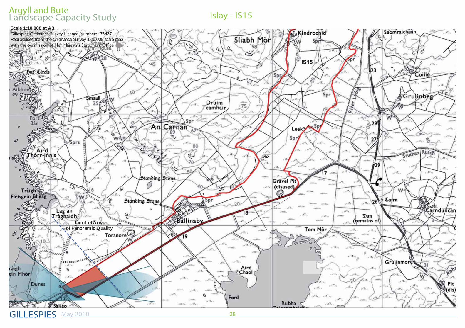
Islay - IS15Scale 1:10,000 at A3
Reproduced from the Ordnance Survey 1:25,000 scale map
Limit of Area of Panoramic Quality
Argyll and Bute
GILLESPIES
Landscape Capacity Study
May 2010 29
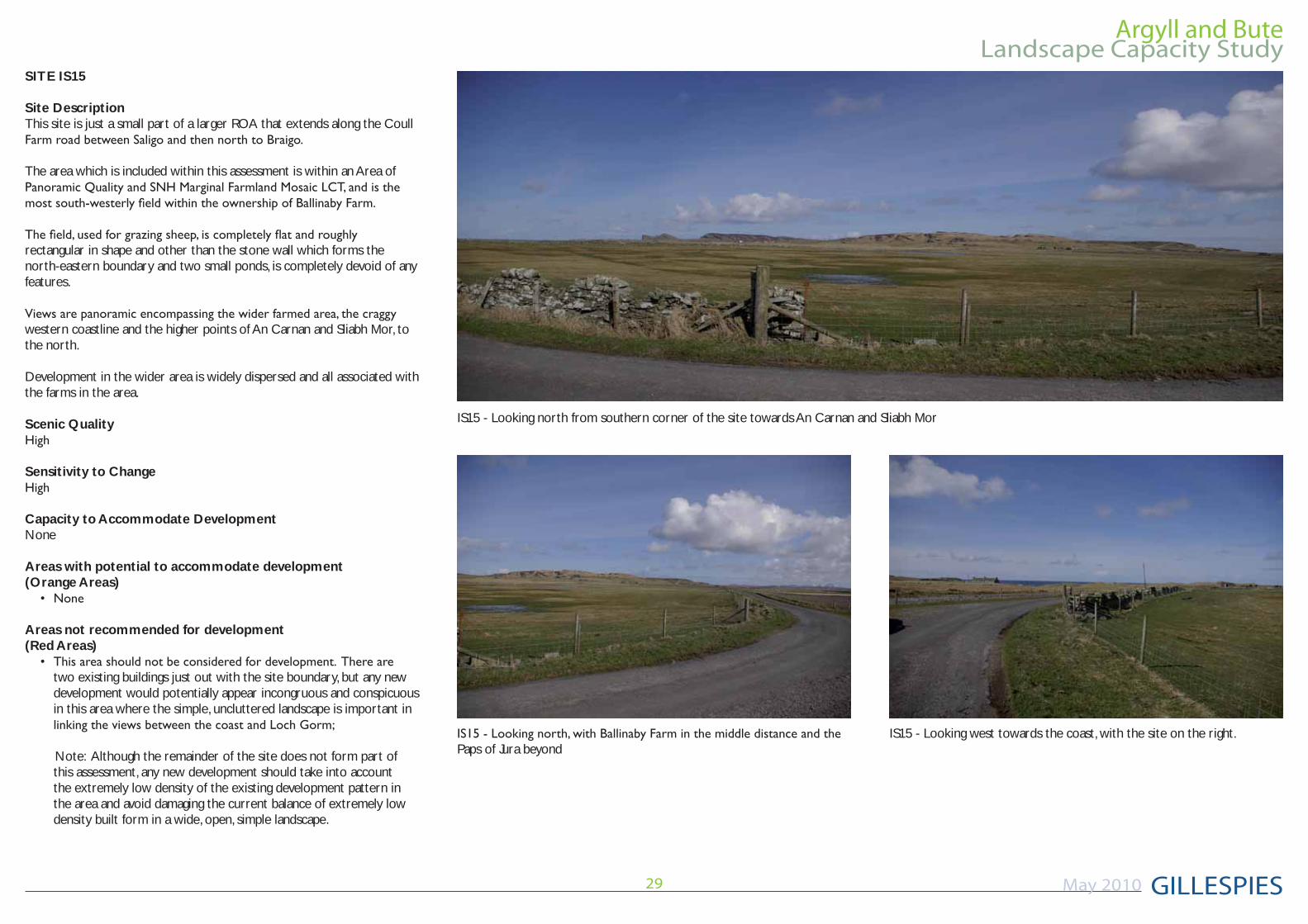
IS15 - Looking north from southern corner of the site towards An Carnan and Sliabh Mor
IS15 - Looking west towards the coast, with the site on the right.
SITE IS15
Site DescriptionThis site is just a small part of a larger ROA that extends along the Coull
The area which is included within this assessment is within an Area of
rectangular in shape and other than the stone wall which forms the north-eastern boundary and two small ponds, is completely devoid of any features.
western coastline and the higher points of An Carnan and Sliabh Mor, to the north.
Development in the wider area is widely dispersed and all associated with the farms in the area.
Scenic Quality
Sensitivity to Change
Capacity to Accommodate DevelopmentNone
Areas with potential to accommodate development(Orange Areas)
Areas not recommended for development(Red Areas)
two existing buildings just out with the site boundary, but any new development would potentially appear incongruous and conspicuous in this area where the simple, uncluttered landscape is important in
Note: Although the remainder of the site does not form part of this assessment, any new development should take into account the extremely low density of the existing development pattern in the area and avoid damaging the current balance of extremely low density built form in a wide, open, simple landscape.
Paps of Jura beyond
Argyll and Bute
GILLESPIES
Landscape Capacity Study
May 2010 30
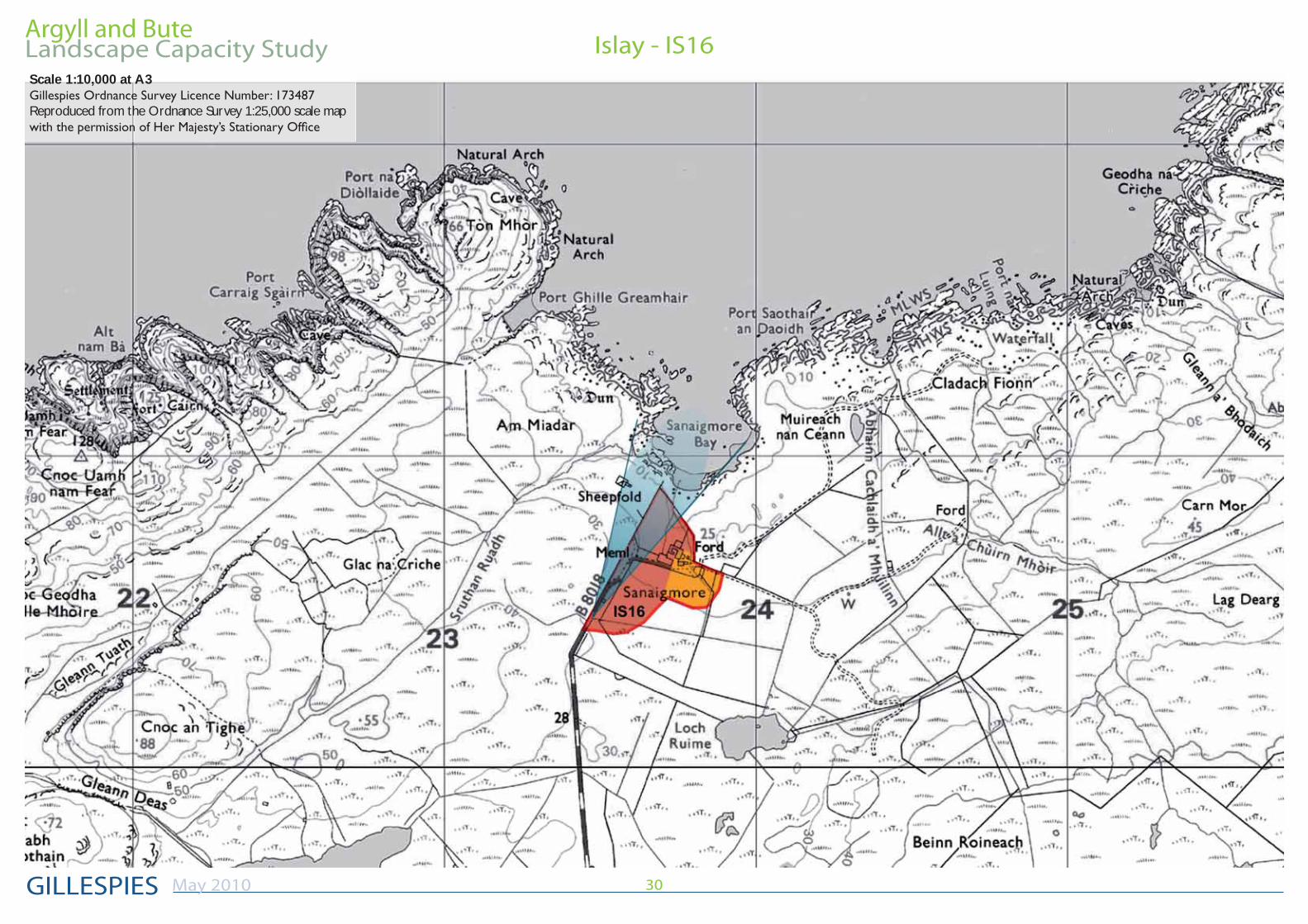
Islay - IS16Scale 1:10,000 at A3
Reproduced from the Ordnance Survey 1:25,000 scale map
Argyll and Bute
GILLESPIES
Landscape Capacity Study
May 2010 31
SITE IS16
Site Description
of Panoramic Quality. It is roughly triangular in shape, overlooking the picturesque, wide u-shaped Sanaigmore Bay, accessed via the B8018. The
the recently renovated farm buildings at Sanaigmore, which now comprise
no features of note.
expansive coastal views and views to Jura.
Scenic Quality
Sensitivity to Change
Capacity to Accommodate DevelopmentLimited
Areas with potential to accommodate development(Orange Areas)
existing buildings would be possible as this would be perceived as relating to the existing building groups / developed areas, rather than the introduction / spread of new development into the wider area, which is extremely sparsely developed.
Areas not recommended for development(Red Areas)
spoiling the views and the landscape setting of the bay;
the farm to ensure views to the bay are not blocked / marred, on the approach along the B8018;
area that is so sparsely settled.
Argyll and Bute
GILLESPIES
Landscape Capacity Study
May 2010 32
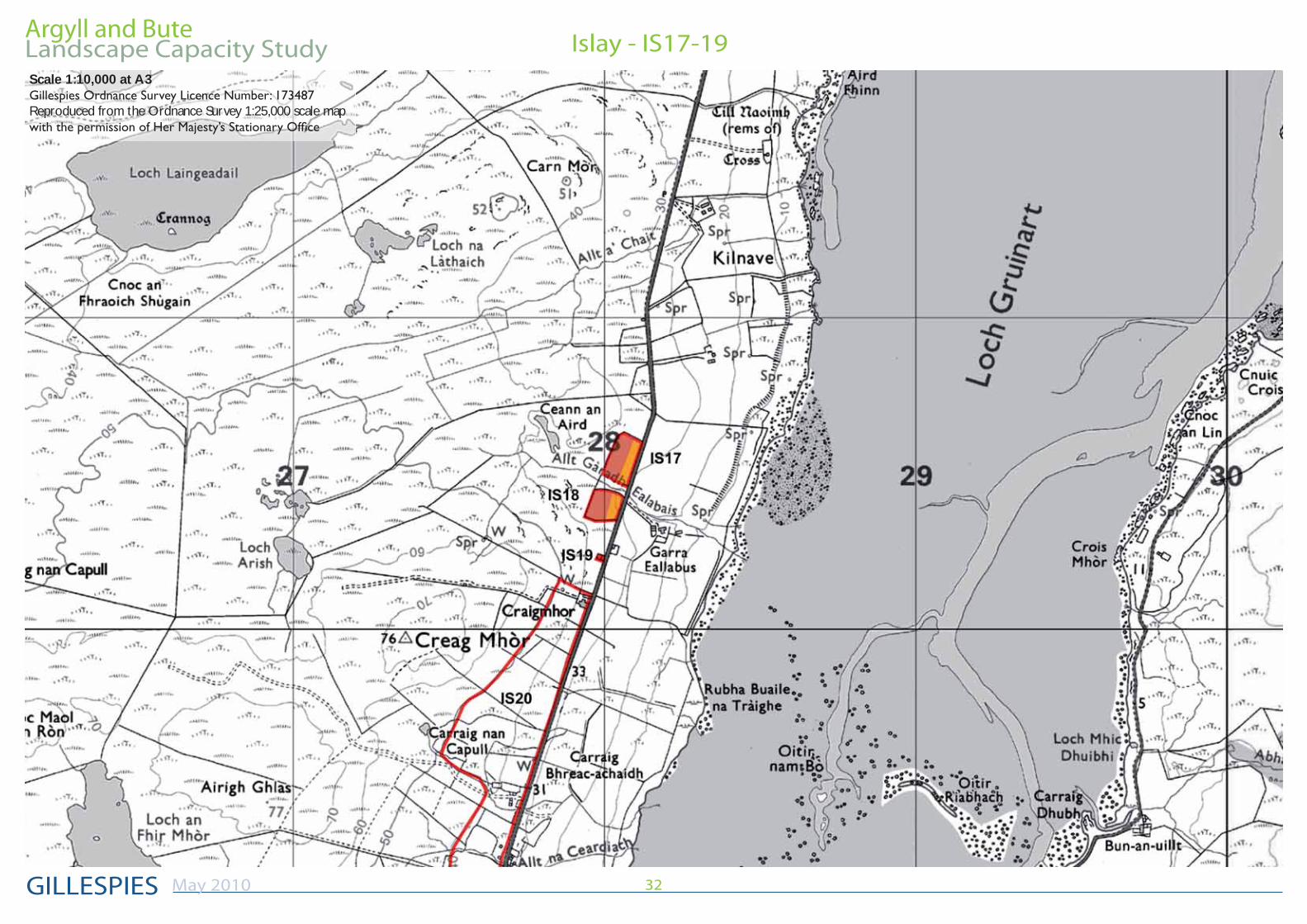
Islay - IS17-19Scale 1:10,000 at A3
Reproduced from the Ordnance Survey 1:25,000 scale map
Argyll and Bute
GILLESPIES
Landscape Capacity Study
May 2010 33
SITE IS17
Site Description
from rough grassland to a more moorland character.
Other than a number of small, deciduous trees which also denote the
does enjoy panoramic views west over the moorland and east over Loch
Within the wider area there are a few, mainly small properties located
road. Overall, the area is only very sparsely settled.
Scenic Quality
Sensitivity to Change
Capacity to Accommodate DevelopmentLimited
Areas with potential to accommodate development(Orange Areas)
arrangement to the properties in the local area would be acceptable;
similar spacing between properties to those that already exist;
consideration the general sparsely settled character;
relevant if both Site IS17 and IS18 were to be developed.
Areas not recommended for development(Red Areas)
adjacent to the road to match the settlement arrangement of the existing properties in the local area.
SITE IS18
Site Description
by the change in vegetation from previously managed grassland to a moorland character.
Other than a number of gorse bushes which are situated to the north
Scenic Quality
Sensitivity to Change
Capacity to Accommodate DevelopmentLimited
Areas with potential to accommodate development(Orange Areas)
arrangement to the properties in the local area would be acceptable;
similar spacing between properties to those that already exist;
consideration the general sparsely settled character;
relevant if both Site IS17 and IS18 were to be developed.
Areas not recommended for development(Red Areas)
adjacent to the road to match the settlement arrangement of the existing properties in the local area.
Argyll and Bute
GILLESPIES
Landscape Capacity Study
May 2010 34
development, in the form of an extension or garage would be possible within the front garden.
SITE IS19
Site Description
house and has already been developed. The style, scale and boundary treatment of the small cottage property is sympathetic with the other properties in the area and with the wider landscape.
Scenic Quality
Sensitivity to Change
Capacity to Accommodate DevelopmentLimited to None. An extension to the existing property or a garage would be possible, as this site only covers the area of the existing house and garden.
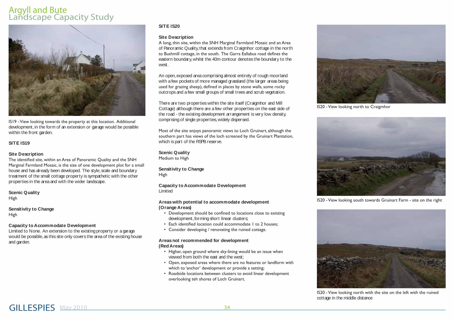
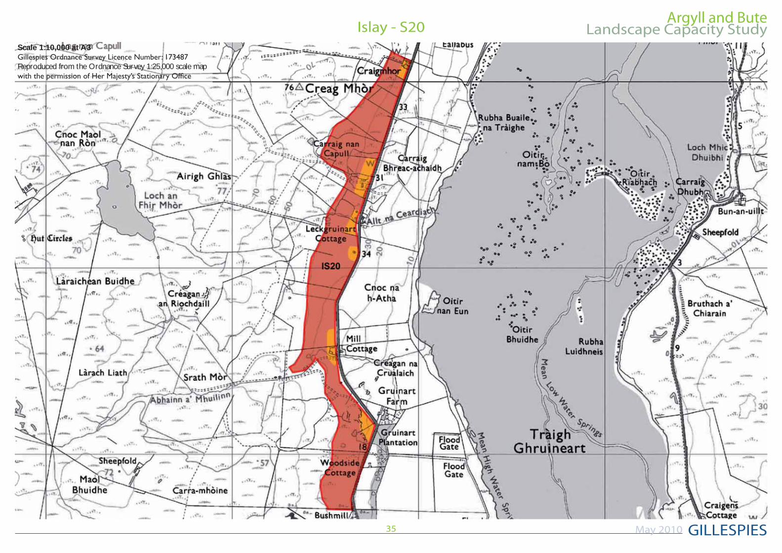
SITE IS20
Site Description
of Panoramic Quality, that extends from Craigmhor cottage in the north
eastern boundary, whilst the 40m contour denotes the boundary to the west.
An open, exposed area comprising almost entirely of rough moorland with a few pockets of more managed grassland (the larger areas being
outcrops and a few small groups of small trees and scrub vegetation.
There are two properties within the site itself (Craigmhor and Mill Cottage) although there are a few other properties on the east side of the road - the existing development arrangement is very low density, comprising of single properties, widely dispersed.
which is part of the RSPB reserve.
Scenic Quality
Sensitivity to Change
Capacity to Accommodate DevelopmentLimited
Areas with potential to accommodate development(Orange Areas)
development, forming short linear clusters;
Areas not recommended for development(Red Areas)
viewed from both the east and the west;
cottage in the middle distance
Argyll and Bute
GILLESPIES
Landscape Capacity Study
May 2010 35
Islay - S20Scale 1:10,000 at A3
Reproduced from the Ordnance Survey 1:25,000 scale map
Argyll and Bute
GILLESPIES
Landscape Capacity Study
May 2010 36
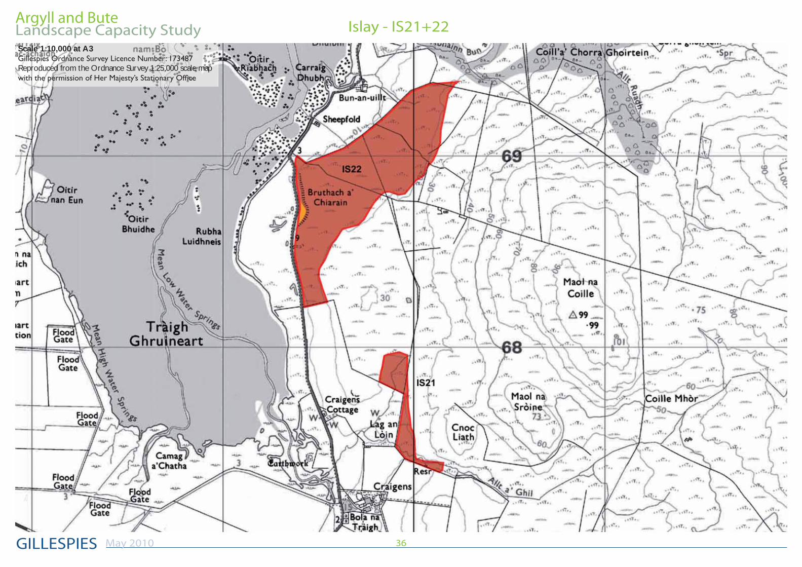
Islay - IS21+22Scale 1:10,000 at A3
Reproduced from the Ordnance Survey 1:25,000 scale map
Argyll and Bute
GILLESPIES
Landscape Capacity Study
May 2010 37
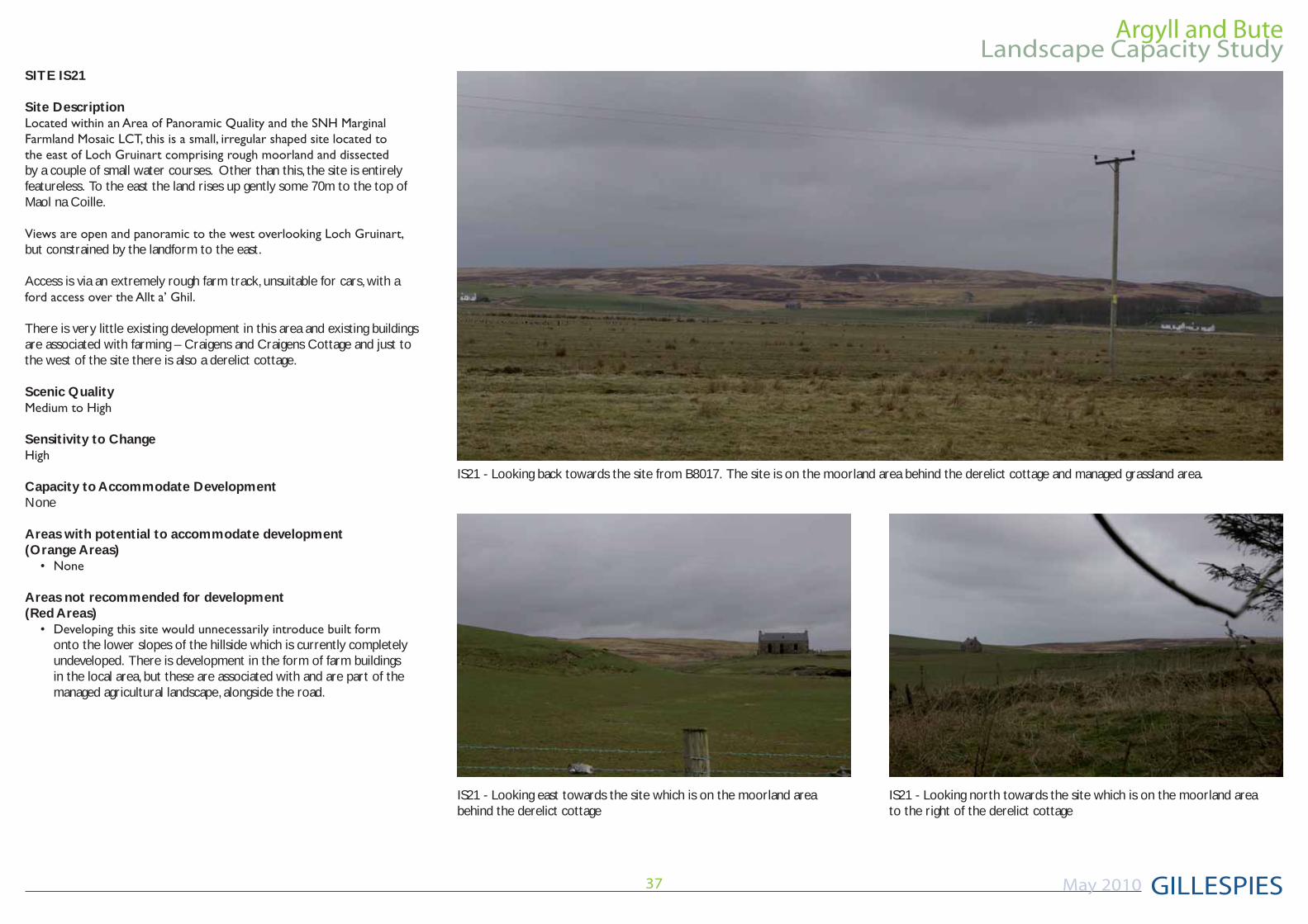
SITE IS21
Site Description
by a couple of small water courses. Other than this, the site is entirely featureless. To the east the land rises up gently some 70m to the top of Maol na Coille.
but constrained by the landform to the east.
Access is via an extremely rough farm track, unsuitable for cars, with a
There is very little existing development in this area and existing buildings are associated with farming – Craigens and Craigens Cottage and just to the west of the site there is also a derelict cottage.
Scenic Quality
Sensitivity to Change
Capacity to Accommodate DevelopmentNone
Areas with potential to accommodate development(Orange Areas)
Areas not recommended for development(Red Areas)
onto the lower slopes of the hillside which is currently completely undeveloped. There is development in the form of farm buildings in the local area, but these are associated with and are part of the managed agricultural landscape, alongside the road.
IS21 - Looking back towards the site from B8017. The site is on the moorland area behind the derelict cottage and managed grassland area.
IS21 - Looking east towards the site which is on the moorland areabehind the derelict cottage
IS21 - Looking north towards the site which is on the moorland areato the right of the derelict cottage
Argyll and Bute
GILLESPIES
Landscape Capacity Study
May 2010 38
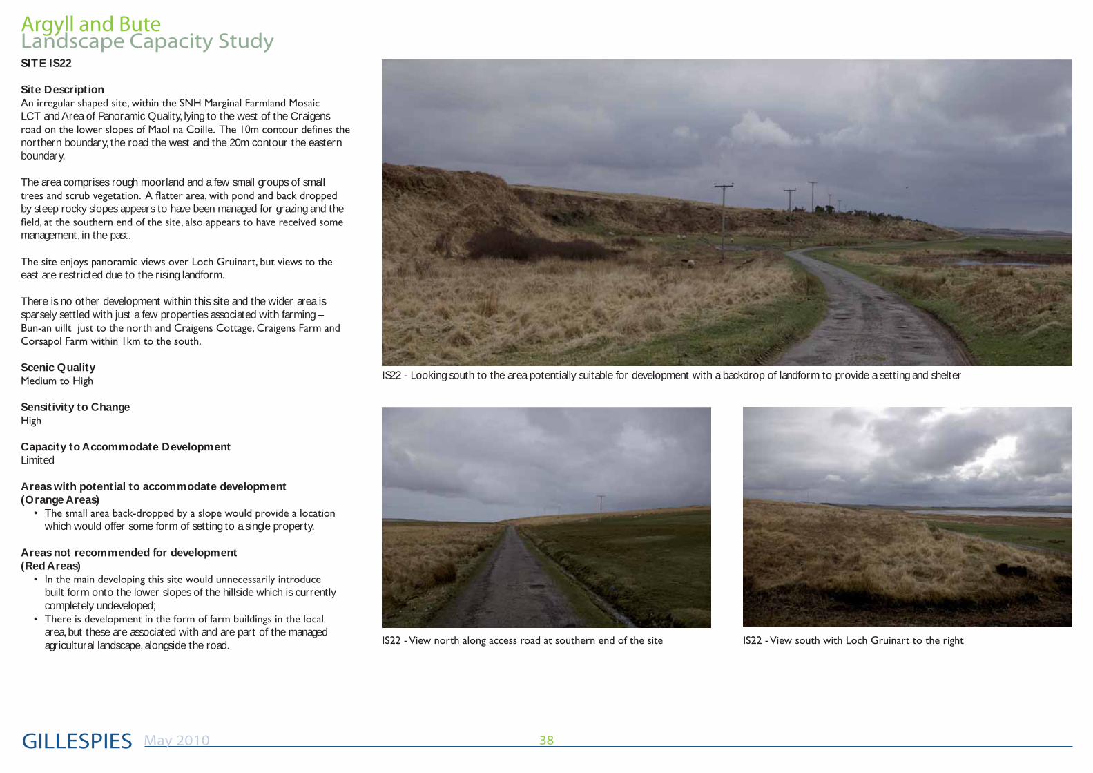
IS22 - Looking south to the area potentially suitable for development with a backdrop of landform to provide a setting and shelter
SITE IS22
Site Description
LCT and Area of Panoramic Quality, lying to the west of the Craigens
northern boundary, the road the west and the 20m contour the eastern boundary.
The area comprises rough moorland and a few small groups of small
by steep rocky slopes appears to have been managed for grazing and the
management, in the past.
east are restricted due to the rising landform.
There is no other development within this site and the wider area is sparsely settled with just a few properties associated with farming –
Scenic Quality
Sensitivity to Change
Capacity to Accommodate DevelopmentLimited
Areas with potential to accommodate development(Orange Areas)
which would offer some form of setting to a single property.
Areas not recommended for development(Red Areas)
built form onto the lower slopes of the hillside which is currently completely undeveloped;
area, but these are associated with and are part of the managed agricultural landscape, alongside the road.
Argyll and Bute
GILLESPIES
Landscape Capacity Study
May 2010 39
Argyll and Bute Landscape Capacity Study
May 2010
GILLESPIES21 Carlton Court,
Glasgow, G5 9JP
Tel: 0141 420 8200
Fax:0141 429 8796
e-mail:[email protected]
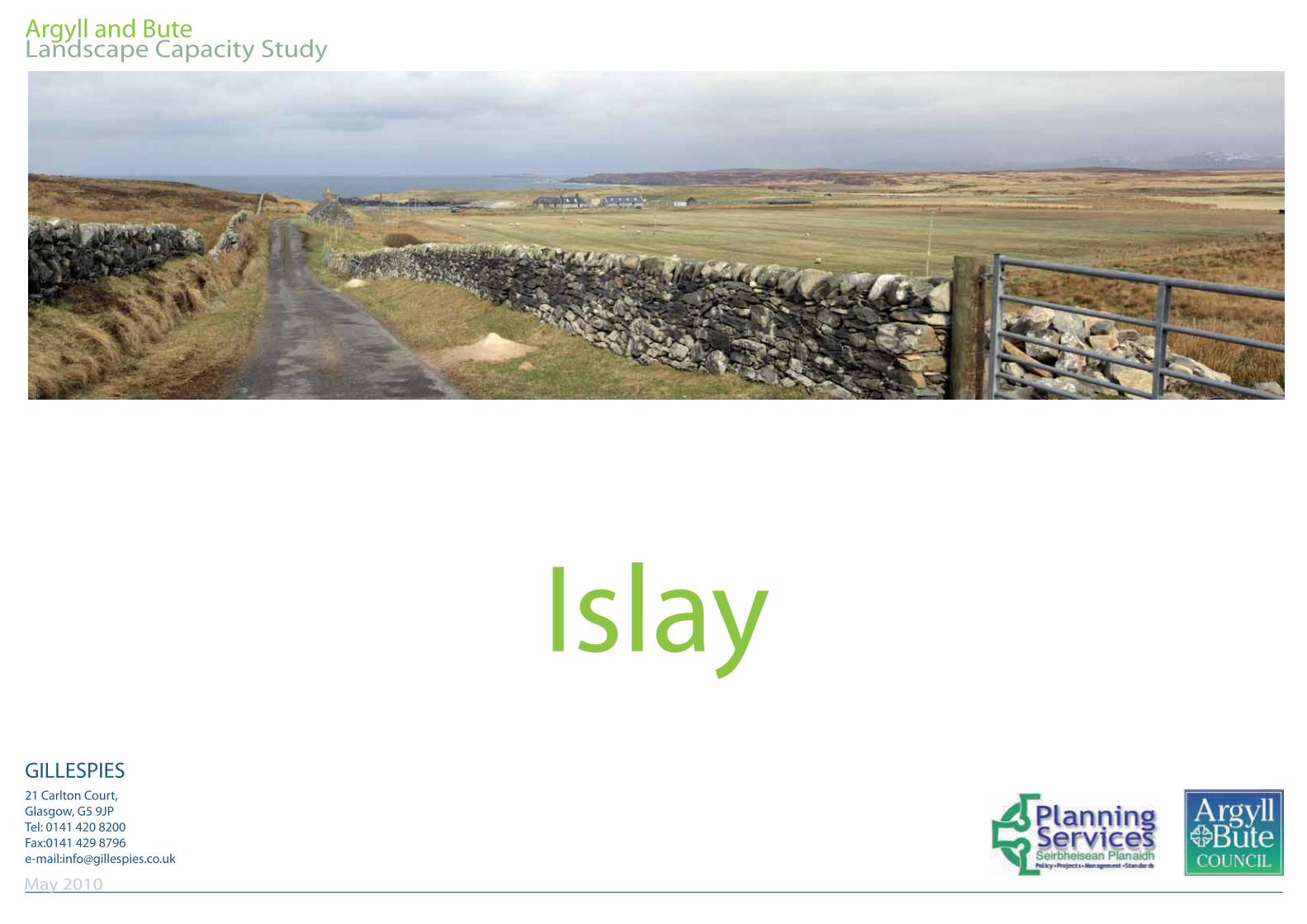
Islay