attachment 2: less than 9% impervious cover …. (2006). stormwater tmdl implementation support...
TRANSCRIPT

Attachment 2:
Less than 9% Impervious Cover Assessments

06/08/12
Impaired Waters Assessment for Pathogen Impaired Waters Page 1 of 5
Impaired Waters Assessment for
Impaired Waters with <9% Impervious Cover in
Contributing Watershed
Impaired Water Bodies The list of impaired water bodies covered by this assessment is included in Table 1.
Impairments Impairments included under this assessment methodology include those typically associated with storm water runoff from impervious cover. Impairments for specific water bodies are listed in Table 1 for each water body as listed on MassDEP’s Massachusetts Year 2010 Integrated List of Waters (MassDEP, 2011).
Relevant Water Quality Standards This assessment covers a wide range of impairments related to a variety of water quality standards. Relevant Water Quality Standards can be found on MassDEP’s website: http://www.mass.gov/dep/service/regulations/314cmr04.pdf
Site Description
This assessment applies to the water bodies listed in Table 1. These water bodies are located across the state and have various impairments that could potentially be related to storm water. They potentially receive direct discharge from MassDOT urban roadways.
Assessment under BMP 7U
A Total Maximum Daily Load (TMDL) has not been developed for the impairments for the water bodies listed in Table 1. Therefore, MassDOT assessed these impairments using the approach described in BMP 7U of MassDOT’s Storm Water Management Plan. As described in BMP 7U’s Description of MassDOT’s Application of Impervious Cover Method (MassDOT Application of IC Method, MassDOT 2011), impervious cover (IC) provides a measure of the potential impact of storm water on many impairments.
MassDOT’s Application of the Impervious Cover Method
MassDOT’s IC Method applies many aspects of USEPA Region I’s Impervious Cover Method described in USEPA’s Stormwater TMDL Implementation Support Manual (ENSR, 2006) to MassDOT’s Impaired Waters Assessment Program. The MassDOT IC method assesses potential storm water impacts on the impaired water and evaluates the impervious cover reduction required to ensure that storm water is not the cause of the impairments. Consistent with findings of USEPA and others, when the impervious cover for a watershed exceeds 10% a decline in stream quality occurs and that severe impairment can be expected when the IC exceeds 25%. Alternatively, the Center for Watershed Protection states that the influence of IC on the receiving waters when the

06/08/12
Impaired Waters Assessment for Pathogen Impaired Waters Page 2 of 5
watershed is in the range of 1-10 percent impervious “is relatively weak compared to other potential watershed factors”. Therefore USEPA chose a 9% target (1 point less than 10%) as the value at which storm water impairments are no longer a significant source of pollutants (CWP, 2003). MassDOT also chose to use the 9% impervious cover target for its IC Method analysis. Additional information regarding this method is provided in MassDOT’s Application of IC Method document.
Figure 1 illustrates the flow chart steps from the MassDOT’s Application of IC Method document that are addressed by this assessment. To be conservative, MassDOT did not rule out water bodies based on the IC value of the total watershed and instead based Table 1 on those water bodies where the local watershed contributing to the impaired segment (referred to as the subwatershed in this analysis) is equal to or less than the 9% target (Step 2).
The subwatershed to the impaired water body was delineated using the USGS Data Series 451. When USGS Data Series did not delineate the subwatershed of the water body under review, the GIS shapefiles were modified based on USGS topography to add specificity. Impervious cover data was available as part of the USGS data layers Data Series 451 and MassGIS’s impervious surfaces data layer. For the water bodies listed in Table 1, MassDOT calculated that each subwatershed had less than 9% impervious cover. Therefore, as described in the MassDOT IC Method storm water is not a likely cause of the impairments to these water bodies.
Conclusions
MassDOT has concluded, using the IC Method, that there is no required reduction in impervious area for the water bodies listed in Table 1 because the percent of impervious cover within the subwatershed is equal to or less than the 9% maximum IC target. This indicates that storm water from this watershed is not likely the cause of the impairments. Therefore, further assessment of these water bodies is not warranted under the Impaired Waters Program.
MassDOT will continue to identify opportunities to implement additional structural BMPs to address pollutant loading when road work is conducted under MassDOT’s Programmed Projects Initiative portion of the Impaired Waters Program. Work on programmed projects, which often include broader scale road layout changes, may provide additional opportunities for construction of new treatment BMPs. This is consistent with an iterative adaptive management approach to address impairments. Furthermore, MassDOT will continue to implement the measures outlined in its Storm water Management Plan (SWMP) to minimize the impacts of storm water from its property.

06/08/12
Impaired Waters Assessment for Pathogen Impaired Waters Page 3 of 5
References
CWP, Center for Watershed Protection. 2003. Impact of Impervious Cover on Aquatic Systems. Watershed Protection Research Monograph No. 1. Ellicot, MD.
ENSR. (2006). Stormwater TMDL Implementation Support Manual for US Environmental
Protection Agency Region 1. ENSR International & USEPA Region 1, Boston, MA. Project No.: 10598-001-500. Retrieved from: http://www.epa.gov/region1/eco/tmdl/pdfs/Stormwater-TMDL-Implementation-Support-Manual.pdf
Massachusetts Department of Environmental Protection (MassDEP). (2011). Massachusetts Year
2010 Integrated List of Waters - Final Listing of the Condition of Massachusetts’ Waters Pursuant to Sections 305(b), 314 and 303(d) of the Clean Water Act. Retrieved from: http://www.mass.gov/dep/water/resources/10list6.pdf
Massachusetts Department of Transportation (MassDOT). (2011). Description of MassDOT’s Application of Impervious Cover Method in BMP 7U (MassDOT Application of IC Method).

06/08/12
Impaired Waters Assessment for Pathogen Impaired Waters Page 4 of 5
Figure 1 MassDOT's Application of the IC Method
Step 1: Calculate % IC of Total Contributing Watershed
Stop Analysis under this program.
Revisit during programmed
projects
Step 3: Calculate Amount of Effective IC Reduction Required
in Subwatershed
Step 4: Apply Target Percent Reduction of IC Needed in Subwatershed to MassDOT ‘s Urban
Directly Discharging Areas
Watershed 9% IC
Step 5: Calculate Effective IC Reduction Credit from
Existing MassDOT BMPs
BMPs Provide Target Effective IC Reduction
Step 6: Recommend Additional BMPs to Extent
Practicable to Reduce Effective IC to Target
BMPs Do Not Provide Target Effective IC Reduction
Stop Analysis: Storm Water
from MassDOT is not causing the
Impairment
Forward Analysis and BMP
Recommendations to Designers for BMP Design and Permitting
Watershed > 9% IC
Stop Analysis under this program.
Revisit during programmed
projects
Step 2: Calculate % IC of
Subwatershed
Subwatershed >
Subwatershed 9% IC

06/08/12
Impaired Waters Assessment for Pathogen Impaired Waters Page 5 of 5
Table 1. Impaired Waters Addressed by IC Method with <9% IC in Watershed
Waterbody ID Waterbody Name Impairments of Concern (2010)**% IC in
SubwatershedMA35-07 Otter River Turbidity, Nutrient/Eutrophication Biological Indicators,
Fishes Bioassessments, Aquatic Macroinvertebrate Bioassessments
8.0%
MA36-11 Sevenmile River NA 7.3%
MA36056 Eames Pond Oxygen, Dissolved 6.9%
MA41-06 Cady Brook (Low flow alterations*), Nutrient/Eutrophication Biological Indicators
8.8%
MA81-07 Nashua River Phosphorus (Total), Aquatic Macroinvertebrate Bioassessments
8.6%
MA81-19 Squannacook River NA 5.3%
MA91-08 Mill River Aquatic Macroinvertebrate Bioassessments 7.6%
MA94-18 Bound Brook (Fish-Passage Barrier*), Turbidity 5.9%
MA94-28 Aaron River (Fish-Passage Barrier*), Excess Algal Growth, (Non-Native Aquatic Plants*)
5.0%
MA11019 Cheshire Reservoir, South Basin
(Non-Native Aquatic Plants*), Excess Algal Growth, (Eurasian Water Milfoil, Myriophyllum spicatum*)
3.6%
MA32021 Congamond Lakes Oxygen, Dissolved, (Eurasian Water Milfoil, Myriophyllum spicatum*)
7.7%
MA72122 Uncas Pond Oxygen, Dissolved, (Non-Native Aquatic Plants*) 7.0%
MA81098 Partridge Pond Aquatic Plants (Macrophytes), Turbidity, (Non-Native Aquatic Plants*)
3.4%
MA93080 Upper Banjo Pond Turbidity, Aquatic Plants (Macrophytes) 0.4%
*Non-pollutant according to MA DEP 303d Year 2010 Integrated List of Waters **Impairments listed on the MA DEP 303d Year 2010 Integrated list of Waters
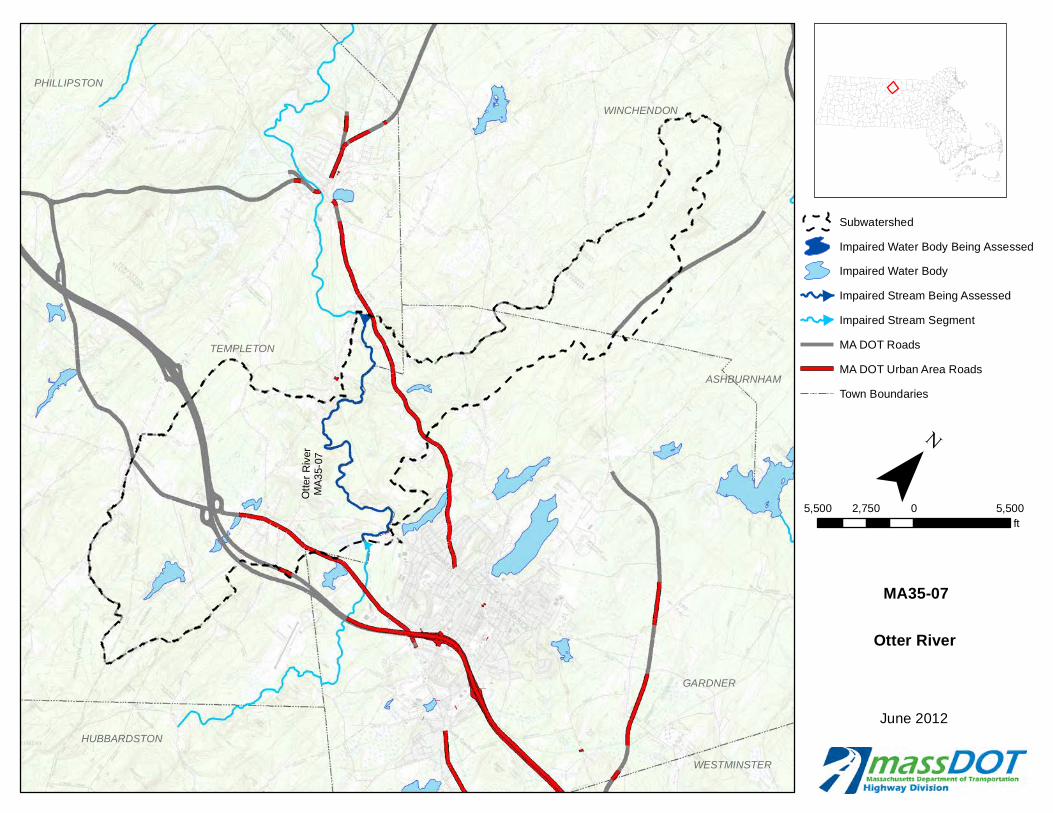
Ott
er R
iver
MA
35-
07
WINCHENDON
ASHBURNHAM
GARDNER
WESTMINSTER
TEMPLETON
PHILLIPSTON
HUBBARDSTON
June 2012
Subwatershed
Impaired Water Body Being Assessed
Impaired Water Body
Impaired Stream Being Assessed
Impaired Stream Segment
MA DOT Roads
MA DOT Urban Area Roads
Town Boundaries
Otter River
MA35-07
5,500 0 5,5002,750ft
¯

Eames PondMA36056
Sevenmile
River MA36-11
RUTLAND
HOLDEN
OAKHAM
NEWBRAINTREE
PAXTON
SPENCERNORTHBROOKFIELD
LEICESTER
EASTBROOKFIELD
June 2012
Subwatershed
Impaired Water Body Being Assessed
Impaired Water Body
Impaired Stream Being Assessed
Impaired Stream Segment
MA DOT Roads
MA DOT Urban Area Roads
Town Boundaries
Sevenmile Riverand Eames Pond
MA36-11 and MA36056
5,500 0 5,5002,750ft
¯

Cad
y B
roo
kM
A4
1-06
CHARLTON
STURBRIDGE
SOUTHBRIDGE
DUDLEY
June 2012
Subwatershed
Impaired Water Body Being Assessed
Impaired Water Body
Impaired Stream Being Assessed
Impaired Stream Segment
MA DOT Roads
MA DOT Urban Area Roads
Town Boundaries
Cady Brook
MA41-06
4,000 0 4,0002,000ft
¯

Nas
hua
Riv
erM
A8
1-07
SquannacookRiver MA81-19
TOWNSEND
PEPPERELL
DUNSTABLE
GROTON
LUNENBURG
SHIRLEYAYER
June 2012
Subwatershed
Impaired Water Body Being Assessed
Impaired Water Body
Impaired Stream Being Assessed
Impaired Stream Segment
MA DOT Roads
MA DOT Urban Area Roads
Town Boundaries
Squannacook Riverand Nashua River
MA81-19 and MA81-07
6,500 0 6,5003,250ft
¯

Mill RiverMA91-08
WESTNEWBURY
NEWBURYGROVELAND ROWLEY
GEORGETOWN
BOXFORD
IPSWICH
TOPSFIELD
June 2012
Subwatershed
Impaired Water Body Being Assessed
Impaired Water Body
Impaired Stream Being Assessed
Impaired Stream Segment
MA DOT Roads
MA DOT Urban Area Roads
Town Boundaries
Mill River
MA91-08
4,000 0 4,0002,000ft
¯

Aaro
n River
MA
94-28
Bound Brook
MA94-18
HULL
HINGHAM
COHASSET
SCITUATE
NORWELL
HANOVER
June 2012
Subwatershed
Impaired Water Body Being Assessed
Impaired Water Body
Impaired Stream Being Assessed
Impaired Stream Segment
MA DOT Roads
MA DOT Urban Area Roads
Town Boundaries
Aaron River andBound Brook
MA94-28 and MA94-18
4,000 0 4,0002,000ft
¯

Cheshire Reservoir,South Basin MA11019
CHESHIRE
LANESBOROUGH
DALTON
PITTSFIELD
June 2012
Subwatershed
Impaired Water Body Being Assessed
Impaired Water Body
Impaired Stream Being Assessed
Impaired Stream Segment
MA DOT Roads
MA DOT Urban Area Roads
Town Boundaries
Cheshire Reservoir(South Basin)
MA11019
3,750 0 3,7501,875ft
¯

CongamondLakes
MA32021
SOUTHWICK
June 2012
Subwatershed
Impaired Water Body Being Assessed
Impaired Water Body
Impaired Stream Being Assessed
Impaired Stream Segment
MA DOT Roads
MA DOT Urban Area Roads
Town Boundaries
Congamond Lakes
MA32021
2,500 0 2,5001,250ft
¯

Uncas PondMA72122
NORFOLK
FRANKLIN
WRENTHAM
June 2012
Subwatershed
Impaired Water Body Being Assessed
Impaired Water Body
Impaired Stream Being Assessed
Impaired Stream Segment
MA DOT Roads
MA DOT Urban Area Roads
Town Boundaries
Uncas Pond
MA72122
2,500 0 2,5001,250ft
¯

PartridgePond
MA81098
GARDNER
WESTMINSTER
HUBBARDSTON
June 2012
Subwatershed
Impaired Water Body Being Assessed
Impaired Water Body
Impaired Stream Being Assessed
Impaired Stream Segment
MA DOT Roads
MA DOT Urban Area Roads
Town Boundaries
Partridge Pond
MA81098
2,500 0 2,5001,250ft
¯

UpperBanjo PondMA93080
GLOUCESTER
GLOUCESTER
MANCHESTER
June 2012
Subwatershed
Impaired Water Body Being Assessed
Impaired Water Body
Impaired Stream Being Assessed
Impaired Stream Segment
MA DOT Roads
MA DOT Urban Area Roads
Town Boundaries
Upper Banjo Pond
MA93080
2,500 0 2,5001,250ft
¯