attachments for 15015 -...
TRANSCRIPT

Attachments for 15015.1 Geography In the subject major curriculum, the program requires the study of people, places, environments, and global connections. The study of a second social science beyond the introductory level is also required. The program uses a variety of performance assessments of candidates’ understanding and ability to apply that knowledge. Items: GEOG 151 AP Pre-test which has been used intermittently in the past and will be used starting in Sp08 with a post-test as part of developing assessment data for the course. GEOG 151 SAE1 and Rubric which deals with the push-pull model of migration, a key theoretical model in human geography. Students first learn how to apply it to their own circumstances and then use it at an expanding set of scales so that we can examine intercontinental migration and intracontinental migration in the context of the movements of various ethnic groups and types of migration movements, e.g., that of refugees. GEOG 151 Urban Geography Assignment is one that focuses upon the notion of the city having certain key functions in the sense of political, economic, and social welfare attributes. This is another key concept in teaching about urban places. GEOG 151 Popular Culture Exercise is used as the starting point for the students to understand what is popular culture, how do we study it, and what are its implications before they are introduced to the global connections of popular culture. GEOG 151 Internet Radio Alternative to International/Multicultural Activities is an assignment that takes the students into the use of internet radio for cross-cultural study. It is one of the more innovative ways that other parts of the world have become better known to students in teacher education social studies plus serves as a model for the teacher candidates to use themselves. GEOG 262 SAE3 and Rubric looks at the importance of understanding the concept of tour circuit overload and how that affects a place, notably a national park in the Rocky Mountain region of North America. It is tied to issues of global connections because of the serious impact upon the natural environment associated with tourists coming from outside North America to the four national parks (Banff, Jasper, Rocky Mountain, and Yellowstone) being used as case studies.
1
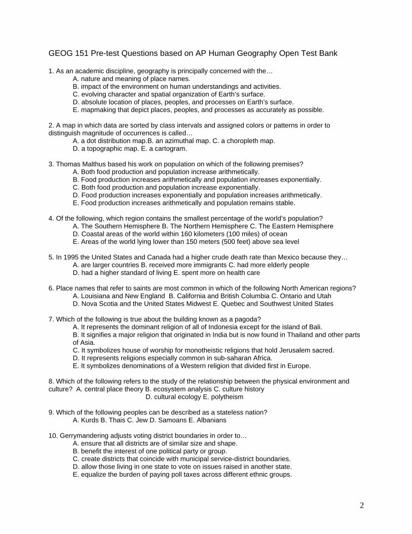
GEOG 151 Pre-test Questions based on AP Human Geography Open Test Bank 1. As an academic discipline, geography is principally concerned with the… A. nature and meaning of place names. B. impact of the environment on human understandings and activities. C. evolving character and spatial organization of Earth’s surface. D. absolute location of places, peoples, and processes on Earth’s surface. E. mapmaking that depict places, peoples, and processes as accurately as possible. 2. A map in which data are sorted by class intervals and assigned colors or patterns in order to distinguish magnitude of occurrences is called… A. a dot distribution map.B. an azimuthal map. C. a choropleth map. D. a topographic map. E. a cartogram. 3. Thomas Malthus based his work on population on which of the following premises? A. Both food production and population increase arithmetically. B. Food production increases arithmetically and population increases exponentially. C. Both food production and population increase exponentially. D. Food production increases exponentially and population increases arithmetically. E. Food production increases arithmetically and population remains stable. 4. Of the following, which region contains the smallest percentage of the world’s population? A. The Southern Hemisphere B. The Northern Hemisphere C. The Eastern Hemisphere D. Coastal areas of the world within 160 kilometers (100 miles) of ocean E. Areas of the world lying lower than 150 meters (500 feet) above sea level 5. In 1995 the United States and Canada had a higher crude death rate than Mexico because they… A. are larger countries B. received more immigrants C. had more elderly people D. had a higher standard of living E. spent more on health care 6. Place names that refer to saints are most common in which of the following North American regions? A. Louisiana and New England B. California and British Columbia C. Ontario and Utah D. Nova Scotia and the United States Midwest E. Quebec and Southwest United States 7. Which of the following is true about the building known as a pagoda? A. It represents the dominant religion of all of Indonesia except for the island of Bali.
B. It signifies a major religion that originated in India but is now found in Thailand and other parts of Asia.
C. It symbolizes house of worship for monotheistic religions that hold Jerusalem sacred. D. It represents religions especially common in sub-saharan Africa. E. It symbolizes denominations of a Western religion that divided first in Europe. 8. Which of the following refers to the study of the relationship between the physical environment and culture? A. central place theory B. ecosystem analysis C. culture history
D. cultural ecology E. polytheism 9. Which of the following peoples can be described as a stateless nation? A. Kurds B. Thais C. Jew D. Samoans E. Albanians 10. Gerrymandering adjusts voting district boundaries in order to… A. ensure that all districts are of similar size and shape. B. benefit the interest of one political party or group. C. create districts that coincide with municipal service-district boundaries. D. allow those living in one state to vote on issues raised in another state. E. equalize the burden of paying poll taxes across different ethnic groups.
2
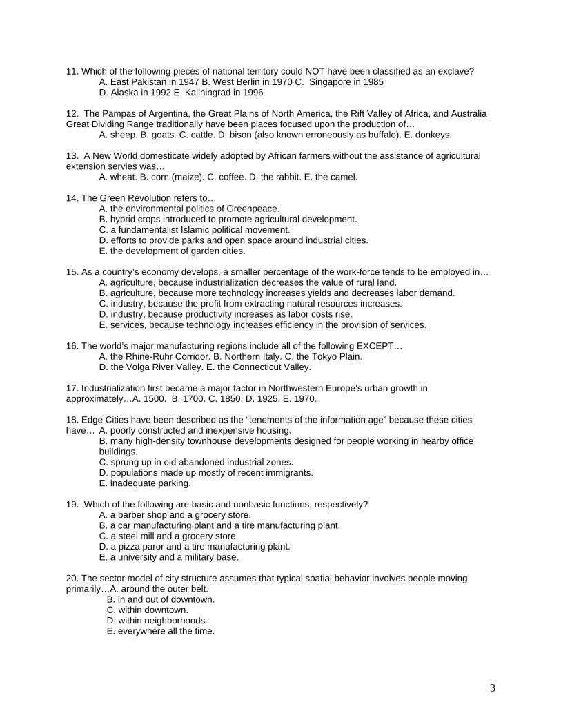
11. Which of the following pieces of national territory could NOT have been classified as an exclave? A. East Pakistan in 1947 B. West Berlin in 1970 C. Singapore in 1985
D. Alaska in 1992 E. Kaliningrad in 1996 12. The Pampas of Argentina, the Great Plains of North America, the Rift Valley of Africa, and Australia Great Dividing Range traditionally have been places focused upon the production of… A. sheep. B. goats. C. cattle. D. bison (also known erroneously as buffalo). E. donkeys. 13. A New World domesticate widely adopted by African farmers without the assistance of agricultural extension servies was… A. wheat. B. corn (maize). C. coffee. D. the rabbit. E. the camel. 14. The Green Revolution refers to… A. the environmental politics of Greenpeace. B. hybrid crops introduced to promote agricultural development. C. a fundamentalist Islamic political movement. D. efforts to provide parks and open space around industrial cities. E. the development of garden cities. 15. As a country’s economy develops, a smaller percentage of the work-force tends to be employed in… A. agriculture, because industrialization decreases the value of rural land.
B. agriculture, because more technology increases yields and decreases labor demand. C. industry, because the profit from extracting natural resources increases. D. industry, because productivity increases as labor costs rise. E. services, because technology increases efficiency in the provision of services. 16. The world’s major manufacturing regions include all of the following EXCEPT… A. the Rhine-Ruhr Corridor. B. Northern Italy. C. the Tokyo Plain. D. the Volga River Valley. E. the Connecticut Valley. 17. Industrialization first became a major factor in Northwestern Europe’s urban growth in approximately…A. 1500. B. 1700. C. 1850. D. 1925. E. 1970. 18. Edge Cities have been described as the “tenements of the information age” because these cities have… A. poorly constructed and inexpensive housing. B. many high-density townhouse developments designed for people working in nearby office
buildings. C. sprung up in old abandoned industrial zones. D. populations made up mostly of recent immigrants.
E. inadequate parking. 19. Which of the following are basic and nonbasic functions, respectively? A. a barber shop and a grocery store. B. a car manufacturing plant and a tire manufacturing plant. C. a steel mill and a grocery store. D. a pizza paror and a tire manufacturing plant. E. a university and a military base. 20. The sector model of city structure assumes that typical spatial behavior involves people moving primarily…A. around the outer belt. B. in and out of downtown. C. within downtown. D. within neighborhoods. E. everywhere all the time.
3

GEOG 151 Sp06 One-page Writing Assignment Series USING THE PUSH-PULL MODEL OF MIGRATION INSTRUCTIONS AND RUBRIC
This is a formal exercise in which you prepare a one-page case study using the push-pull
model of migration on your movement from your hometown to the campus that you are a
student this semester. If you are at UND, your document will be submitted as follows: two
copies will be handed-in to your instructor plus one copy will be sent as an attachment to an
e-mail message to that faculty member. If you are at NDSU or MaSU, you only need to send
it as an attachment to an e-mail message to your instructor. PLEASE NOTE THE
DIFFERENCES IN PROCEDURES DEPENDING UPON YOUR CAMPUS. However,
students from all three campuses must have completed their respective tasks no later than. on
Wednesday, February 8, 2006. You are to use the push-pull model of migration as the
organizing theme for your writing. Your essay is to have an introductory paragraph, a
paragraph for each of the parts of the model (origin, obstacles, and destination), and a
concluding paragraph. If your hometown is in the Grand Cities and the immediate environs
of Grand Forks County, North Dakota, or Polk County, Minnesota, a personal migration
story may be awkward to prepare for attending the University of North Dakota, so a family-
related or friend-related or ethnic group oriented case study would be an acceptable
alternative activity. Similarly, if you are a lifelong resident of the Fargo-Moorhead area and
attending North Dakota State University or a lifelong resident of the Mayville-Portland area
and attending Mayville State University, you should follow the option cited above as it
would pertain to you, too.
The format of the essay is to be a simple, one-page Word (or Word Perfect) document
based upon the template which you can obtain in the Assignments section of the GEOG 151.01
Blackboard. The margins are to be one inch on all sides, the font size is to be 12 point with a font
type such as Times New Roman or Arial at 11 point (this is a sample of that font at that font size
and is used on page two of this document). The template provides a space for your name, your
section, and score, so use it to maintain course uniformity. It would be best to use double or 1.5
spacing between lines, to indent each paragraph using a standard indentation, and to full justify
the document as exemplified by this document.
The rubric for this 25 point assignment is based upon splitting the points into three
categories. You receive five points automatically for having participated in the free-style
4

writing activity about your personal migration story that was done at the beginning of the
semester. Then, there are three points maximum for each part of the essay (introduction,
origin, obstacles, destination, and conclusion). The number of points awarded for each part
will depend upon how well you present and support your case; the better you meet the
rubric, the higher the points. The remaining five points are for following the instructions,
having good mechanics (spelling, grammar, and punctuation), and using an electronic
medium for delivery. The due date for this assignment has been announced and will be
posted, so if your essay has not been sent and received, you will lose a percentage of the
25 points. Finally, keep a copy of your document for your own files. If you need any help on
this assignment, contact your instructor as soon as possible, especially if the explanation of
the model that follows is confusing.
Model Explanation. The push-pull model of migration is an extremely simple migration
model. It has three components: origin, obstacles, and destination(s). At the origin are pulls
(+) to stay and pushes (-) to leave. What is a pull to one person might be a push for
somebody else. That aside, when the pulls to stay are outweighed by the pushes to leave,
then a person is going to undertake a migration movement to a destination provided that the
obstacles between these two places can be overcome. The obstacles can be physical,
political, economic, or a combination of things which make it difficult for the potential migrant
to move between an origin and a possible destination. Each destination has pulls (+) to
come and pushes (-) to avoid, and what may be a pull for one person could be a push for
another person. A potential migrant often has one or more destinations from which to
choose, so the destination which has the greatest pulls to come is the new home for the
migrant. The figure below is a graphic illustration of the basic principles of the model.
5

Origin Destination
Figure 1. Destination A will be the migrant’s selection instead of Destination B because the pulls to come to Destination A are more than at Destination B and the pushes to avoid Destination A are less than for Destination B. [Materials originally prepared by D.C. Munski on 9/13/03 plus revised on 1/16/05 and 1/23/06 with copyright for educational use only.]
A
Obstacles + + --- --- + + + + + + -- --- + ---
B + + --- --- + --- --- + + + --- ---
+ + --- --- --- --- --- + --- --- --- ---
6

GEOG 151 Urban Geography Assignment Sp06 TASK: This assignment is intended to be handled in an extremely concise but well-written fashion. It focuses upon demonstrating that you are making the connection between three concepts and how those concepts are expressed on the cultural landscape. It is based upon the notion that the city as an urban settlement form is characterized as having three key functions throughout time: political, economic, and social welfare. During different periods of historical geography, each of these primary functions has been expressed in various ways as we have discussed in class. Select a modern city of your choice; it could be your hometown or the town in which your campus is located or somewhere else. Your graded task is to provide an appropriate example for each key function and to explain how that particular example is reflected physically in the cultural landscape of that city. Your response is to be transmitted electronically within the body of an e-mail message to be sent to your instructor. The format of the response is to include as headers your name, the name of your institution, and each of the concepts (political, economic, and social welfare) with the appropriate examples. It is anticipated that you can complete this task successfully in less than the equivalent of one page of hard copy. The deadline for this activity is Wednesday, April 19, 2006. RUBRIC: The 25 points for this assignment are divided as follows. Five points for transmitting the document successfully. Three points are for each of the concepts having an example and three points are for each example being explained. The breakdown on the three points for each of the concepts having an example is the full set of points for clearly identifying and locating what is the example and one point for a poorly identified or located example; zero points are marked if there is no specific example (notice it is either three points or one point or a zero). The breakdown on the three points for the explanation of each example relative to the concept is the full set of points for a well-written and insightful set of statements and one point for any answer that is less than well-written and insightful; zero points are marked if there is no explanation at all (again, note that the range is three, one, and zero for points). The remaining two points are distributed such that two points are for a set of answers which are devoid of mechanical errors in terms of spelling, punctuation, and grammar but no points for entries which are marred by misspelled words, incorrect punctuation, and bad grammar. NOTE: YOU MAY CHOOSE TO DO THIS ASSIGNMENT OR THE POLITICAL GEOGRAPHY ASSIGNMENT. YOU DO NOT HAVE TO DO BOTH ASSIGNMENTS. IF YOU DO BOTH ASSIGNMENTS, THE ASSIGNMENT WHICH HAS THE LOWER OF THE TWO SCORES WILL BE USED AS BONUS POINTS.
7
Popular Culture Exercise for GEOG 151, Fa06 Why are you being asked to sit in a place of your choosing, e.g., the UND Student Memorial Union or the Food Court at Columbia Mall, and watch people passing by for 30 minutes? There are three reasons. First, to help you to focus upon concepts of popular culture as exhibited at your own campus and the Grand Forks community. Second, to provide your instructor and you with a data base of popular culture examples that we will use when we discuss the topic. Finally, an underlying purpose of this exercise is to promote critical thinking and creative thinking. Please use the accompanying headings as the template for your written part of this assignment. 1. Name (last name first, please) 2. Location (full name and address, please) 3. Date of Observations and Specific Time 4. Describe, please, as specifically as you can, where you took your observations within (or for
hardy people, outside) your fieldwork site. 5. Summarize, please, in no more than two paragraphs what general observations you can make
about how popular culture is expressed at the fieldwork site. 6. Knowing what you know about your hometown, what would be one thing you observed in
your fieldwork which would be found there and what would be one thing you would not find there.
7. Based upon your current knowledge of popular culture, explain in no fewer than one paragraph nor more than three paragraphs how you believe that the place you visited is representative of what is perceived as the national popular culture to be found in communities hosting a college campus elsewhere in the United States.
Rubric. This exercise is worth 25 points. The maximum number of points would be obtained if you were to have the template reproduced properly and under each heading an appropriate entry. What constitutes an appropriate entry and the scoring levels for each heading is presented here. For the first three headings, you must properly record the information requested (one point each). For the fourth heading, the site and situation of your place of observation ought to given and a description of your setting within that place (two points for completeness but only one point otherwise). For the fifth heading, you need to provide specific examples to support your general observations (five points for solid examples and logical conclusions, three points for fair examples and weaker conclusions, and one point for weak examples and poor conclusions). For the sixth heading, you need to provide a full explanation for your stance for the full five points (three points if you provide a less complete explanation and only a point for just “filling in” a response). For the seventh heading, you need to make connections to the key concepts and have a rationale for the reply you give (five points for strong ties and well documented rationale, three points for a fair “tie-in” and partially documented rationale, and one point for a poor “tie-in” and undocumented rationale). The remaining five points are divided among good mechanics and style (five points for proper grammar, error-free spelling, proper grammar, and correct punctuation, three points for less well-handled mechanics and style, and one point for poorest handling of mechanics and style). Please prepare your materials using Word or WordPerfect (Works seems to not work for me!). Save it as a computer file but do NOT send it as an attachment to e-mail or use the digital drop box. You will hand-in your work as hard copy but be prepared to submit it electronically when requested; watch Blackboard for details, please.
8

GEOG 151 Internet Radio Alternative to International/Multicultural Activities Your instructor recognizes that there have been many difficulties with people scheduling attendance at international or multicultural events. In order to determine, however, if you are learning about cultures other than your own, here is an alternative activity. You may uses these as two of your three international/multicultural activities. The deadline for these two items is Friday, December 8, 2006. EXERCISE 1 This exercise is designed to have you demonstrate that you can use successfully an Internet resource in order to have more up-to-date information on a topic of your choice regarding a culture other than your own. It will be one of the foremost Internet radio connections regarding Subsaharan Africa: Channel Africa. Start by going to this Internet address: http://www.channelafrica.org/ and clicking on English at the top of the screen. There are numerous programs from this radio station of South Africa, but focus upon one of these two under the Programmes link: Africa This Week or Dateline Africa. After selecting the program, download it and listen to the presentation; expect to spend approximately 30 minutes listening to the broadcast. It would be useful to take some notes on the program and, if necessary, listen to it again. Then, respond to these interrelated questions: What stories were covered in the broadcast? Which of those news reports would you be interested in learning more about and why? What is your overall reaction to having listened to the Internet radio station? Your response should be sent as an e-mail message to your instructor. NOTE. Sometimes, Channel Africa seems to experience more than the usual technical glitches. If you should run into problems, let us substitute the African coverage from British Broadcasting Corporation at http://www.bbc.co.uk/worldservice/. This is the front page for the World Service channel. When you reach it, click on "Africa" in the box on the left side of the page under ". That should get you to this page: http://news.bbc.co.uk/2/hi/africa/default.stm. On the right side of that page there is a box "BBC Video and Audio" that has a set of different broadcasts about Africa. I suggest clicking on "Focus on Africa" and following that news show. EXERCISE 2 This second exercise is designed to have you demonstrate that you again can use successfully an Internet resource in order to have more up-to-date information on a topic of your choice for a part of the world with a culture other than your own. Now, you will be using the Internet radio connections for Japan via Japan’s national broadcasting corporation, NHK. Start by going to this Internet address: http://www.nhk.or.jp/english/index.html. It would be appropriate to listen to the broadcast, Japan and the World and you might want to watch one of the short “Feature” television broadcast clips. It again would be useful to take some notes on the program and, if necessary, listen to it again. Then, respond to these interrelated questions: What stories were covered in the broadcast? Which of those news reports would you be interested in learning more about and why? What is your overall reaction to having listened to this Internet particular radio station?
9

GEOG 262 IVN (Geography of North America) Fa07 Version Short Answer Essay 3 Assignment and Rubric Assignment One region of the United States and Canada which relies heavily upon tourism for its economic success is that of the Rocky Mountains. On both sides of the 49th Parallel national parks are highlighted as tourist destinations. However, can these natural heritage sites survive the various environmental impacts of current and future tourist visitors? This is the question for you to approach in this assignment by preparing a short vignette of a specific national park in the region in which you address the issue of handling tour circuit overload. Your choice of a particular national park is limited to selecting only one from this listing: Banff, Jasper, Rocky Mountain, or Yellowstone. The first two are in the Canadian Rockies with Jasper being a bit difficult to reach while Banff is quite accessible to Calgary. Rocky Mountain is within the short-range trade hinterland of Denver, but Yellowstone is much more isolated and in a rural setting. The specific objectives for this assignment are four-fold. First, for you to demonstrate that you understand what is a vignette and comprehend how to produce such a short case study for a particular part of the United States or Canada. Second, have you be able to understand and explain what is tour circuit overload plus apply that concept to a specific recreational-oriented place in the Rocky Mountains. Third, for you to become more familiar with a natural park in either the United States or Canada that interests you as a means to introduce you to a subfield of geography: recreational geography. Finally, have you synthesize these concepts and the appropriate information into an acceptable essay using a geographic perspective. So, select a national park from the list of four such places found in either Canada or the United States. Using the vignette approach, explain in your essay how that location is possibly subject to tour circuit overload and what that means for this national park in the future. This particular assignment is oriented toward assessing your ability to communicate the manner in which you think creatively and think critically about the consequences of people’s decision-making regarding recreation in a national park setting. Therefore, write your essay keeping in mind the following rubric. Rubric This assignment is worth 25 points toward your overall grade in the course. You will be judged upon five elements in your paper. Opening and Closing Statements. Five points if both statements are an effective and strong introduction and summation regarding the national park in the context of possible tour circuit overload. Three points if one or both statements are merely appropriate in introducing and summarizing your effort. One point if an ineffective and weak introduction and summation regarding the topic for the vignette. Content of the Vignette. Seven points if the information is well-documented and tied properly to an appropriate map that you have cited correctly. Please use maps from
10

appropriate web sites. Your instructor will be verifying such URLs as part of assessing your work and awarding points. Four points if the content is explained just barely and only loosely tied to the supporting map(s). Two points if the examples for the vignette are weakly-documented and not connected to any appropriate map. Concept of Tour Circuit Overload. Seven points if the concept is well-documented and tied properly to an appropriate map. Be aware that references to a map should focus upon a particular route or area within the particular park, e.g., traffic congestion in the vicinity of Estes Park in Rocky Mountain National Park. Four points if tour circuit overload is explained just appropriately and only loosely tied to the supporting map(s). Two points if the concept is weakly-documented and not connected to an appropriate map. Format, Mechanics, and Delivery. The format for this essay is not to exceed two, double-spaced word-processed or typed pages using font at 12 pt. and having margins of one inch on each side. Because this is a course that is taught over IVN and shared between two campuses, the heading for the paper is to be in the upper right-hand corner of the paper with the student’s last name first and first name last plus the student’s institutional affiliation identified. There should be a title for the essay. Also, the map for the essay should not exceed the space of a separate sheet of 8.5”x11” paper and either should be a photocopied map with an appropriate citation for the source(s) or a sketch map by the student with a reference to its source(s). The map is considered a vital appendix to the essay. A student’s score will be dependent upon the proper use of spelling, grammar, and punctuation, Six points for no improper spelling, grammar, or punctuation. Three points if there are some spelling, grammatical, or punctuation errors. One point for serious spelling, grammar, or punctuation problems. The delivery of materials in an IVN course is problematic using the GEOG 262 digital drop box on Blackboard. If that is not feasible, send the material as an e-mail attachment to the faculty member; use [email protected]. If these two options should not work, the material can be turned-in to the instructor at class per the deadline in the syllabus. NDSU students will have more flexibility on this option than the UND students because of the instructor’s travel schedule to/from Fargo but will not benefit so much from it. Any later deadline and/or delivery for the NDSU students compared to the UND students simply means that the papers from the Fargo campus will receive more intensive scrutiny and be held to a more rigorous implementation of the rubric because of the longer length of time to produce a superior product. Questions regarding this assignment should be directed to the instructor either through e-mail or in class.
11
Attachments for 15020.3, 15007.3, 15010.3, 15015.3, 15040.3, 15030.3, 15035.3 The program requires study of multi-cultural, cross-cultural, diversity, global issues, and multiple perspectives. The program uses a variety of performance assessments of candidates’ understanding and ability to apply that knowledge. The attachments for the previous section are being used for this section, too, per the protocol that an assessment may cover more than one category. Items: GEOG 151 Videotape Critique on the film, The Ties that Bind, which examines issues of legal/illegal immigration from Mexico to the United States, the role of maquiladoras in the local, regional, and national economies of the United States and Mexico vis-à-vis NAFTA, and the the notions of what constitutes social justice. GEOG 151 Internet Radio Alternative to International/Multicultural Activities is an assignment that takes the students into the use of internet radio for cross-cultural study and is used under this category as well as a previous one. Again, it is one of the more innovative ways that other parts of the world have become better known to students in teacher education social studies plus serves as a model for the teacher candidates to use themselves. GEOG 151 International Perspective Videotape Critique on the film, “We Are Guatemalans”, which examines the concept of ethnic cleansing, community reconstruction, and social justice. The second part of the assignment is for the students to update the topic per using the Internet in a somewhat guided fashion.
12

GEOG 151 Videotape Critique Name: Sp06 Version Campus: The Ties that Bind When did you see it? APRIL 19, 2006 Using only the top half of the backside of this paper, outline the main points presented in the two videotape segments which you have viewed. What is the major idea or concept that you believe is intended to be understood by the audience about this topic based upon the segments of the film that you watched. Why do you think that? NOTE: PLEASE IDENTIFY EACH SEGMENT BEFORE YOU WRITE YOUR RESPONSE. How do the segments of the videotape provide you insights, if any, into labor migration and political issues along the USA-Mexico in the vicinity of El Paso-Ciudad Juarez ? Focus upon what is your main reason to take that position regarding this videotape, please. Has seeing these two segments given you exposure to a culture other than your own? If so, how so? You may continue your answer on the back of this page if necessary using the lower half of the backside of this paper. If you were to rate this film for determining if it should be shown in the future, what rating would you give it?
___Definitely Show ___Maybe Show __Either Way___Maybe Not Show ___Definitely Do Not Show Why?
13
GEOG 151 Internet Radio Alternative to International/Multicultural Activities Your instructor recognizes that there have been many difficulties with people scheduling attendance at international or multicultural events. In order to determine, however, if you are learning about cultures other than your own, here is an alternative activity. You may uses these as two of your three international/multicultural activities. The deadline for these two items is Friday, December 8, 2006. EXERCISE 1 This exercise is designed to have you demonstrate that you can use successfully an Internet resource in order to have more up-to-date information on a topic of your choice regarding a culture other than your own. It will be one of the foremost Internet radio connections regarding Subsaharan Africa: Channel Africa. Start by going to this Internet address: http://www.channelafrica.org/ and clicking on English at the top of the screen. There are numerous programs from this radio station of South Africa, but focus upon one of these two under the Programmes link: Africa This Week or Dateline Africa. After selecting the program, download it and listen to the presentation; expect to spend approximately 30 minutes listening to the broadcast. It would be useful to take some notes on the program and, if necessary, listen to it again. Then, respond to these interrelated questions: What stories were covered in the broadcast? Which of those news reports would you be interested in learning more about and why? What is your overall reaction to having listened to the Internet radio station? Your response should be sent as an e-mail message to your instructor. NOTE. Sometimes, Channel Africa seems to experience more than the usual technical glitches. If you should run into problems, let us substitute the African coverage from British Broadcasting Corporation at http://www.bbc.co.uk/worldservice/. This is the front page for the World Service channel. When you reach it, click on "Africa" in the box on the left side of the page under ". That should get you to this page: http://news.bbc.co.uk/2/hi/africa/default.stm. On the right side of that page there is a box "BBC Video and Audio" that has a set of different broadcasts about Africa. I suggest clicking on "Focus on Africa" and following that news show. EXERCISE 2 This second exercise is designed to have you demonstrate that you again can use successfully an Internet resource in order to have more up-to-date information on a topic of your choice for a part of the world with a culture other than your own. Now, you will be using the Internet radio connections for Japan via Japan’s national broadcasting corporation, NHK. Start by going to this Internet address: http://www.nhk.or.jp/english/index.html. It would be appropriate to listen to the broadcast, Japan and the World and you might want to watch one of the short “Feature” television broadcast clips. It again would be useful to take some notes on the program and, if necessary, listen to it again. Then, respond to these interrelated questions: What stories were covered in the broadcast? Which of those news reports would you be interested in learning more about and why? What is your overall reaction to having listened to this Internet particular radio station?
14
GEOG 151 International Perspectives Activity Sp06 Version Your name: Name of your teammate(s): Your campus: This is a two-part assignment. The first part involves you seeing and reacting to the 1995 Maryknoll World Productions video, “We Are Guatemalans”. The second part requires that you look at one older web-based item and two contemporary web-based items that deal with Guatemala. The instructions for that part of the assignment continue on the next page. Watching and reacting to the videotape. Before you watch the videotape, you should decide with whom you will form a team when it comes to sharing observations and, if appropriate, any notes that you write while watching “We Are Guatemalans”. Your team should be no more than yourself and two partners; pairs of individuals working together is the best arrangement. Next, watch the videotape. Be prepared that the subject matter is of a somewhat grim and grisly nature because it deals with conditions related to the 36-year long Guatemalan civil war that ended officially in 1996. After watching the video, work with your teammate(s) to respond to these questions: 1. What is the most important idea or concept that you and your teammate believe is intended to be understood by the audience about this topic after viewing this videotape? Why do you and your partner(s) think that? Now, resume working individually. How do this videotape provide you insights, if any, into the historical context of political issues about the 36-year long Guatemalan civil war? Focus upon what is your main reason to take that position regarding this videotape, please. You may continue your answer on the back of this page. Has seeing these video given you exposure to a culture other than your own? If so, how so? If not, why not? You may continue your answer on the back of this page.
15
Your name:
Your campus:
Looking at web-based items on Guatemala. After today’s class, use a computer to access the Internet and to reach the following web site: http://www.bethelks.edu/mennonitelife/2005Mar/hart.php. Please read the article by Julie Hart. After reading her commentary, respond to the following scenario: Hart indicated that there are three models of grassroots peacebuilding in post civil war Guatemala. Imagine you are in Cuarto Pueblo in 1995 as part of the film crew making the videotape, “We Are Guatemalans”, and knew about these three models at that time. If someone from Cuarto Pueblo had asked for your opinion about which of these models would you consider the best to apply to use in Cuarto Pueblo to restore peace to this village, which model would you recommend and why would you recommend it? Now go to the web site http://www.unhcr.org/cgi-bin/texis/vtx/publ/opendoc.htm?tbl=PUBL&id=3b5694d54&page=publ. Which of the three models noted by Hart seem to have been adopted at Cuarto Pueblo or is there a mix of those models being used or does it appear that an entirely different model is being followed? Briefly explain why you come to this conclusion. Now go to the web site http://www.alertnet.org/thenews/emergency/CA_POS.htm. Once there, click on the item, “Guatemala recruits ex-soldiers to fight gang crime”. Read the article. How does or does not this web site give you cause to believe that a remake of the video, “We Are Guatemalans”, will be necessary in the future regarding another civil war in this part of Central America and state how do you think current conditions in Guatemala might or might not be affecting the United States. You may continue your response on the back of this page.
16

Attachments for 15020.4, 15007.4, 15010.4, 15015.4, 15040.4, 15030.4, 15035.4 The program requires study of current events including controversial issues. The program uses a variety of performance assessments of candidates’ understanding and ability to apply that knowledge.
Items:
GEOG 151 Videotape Critique on the film, The Ties that Bind, already has been cited for an earlier category, but it is an assignment which also is used under this set of requirements. Please review how the activity is one which examines issues of legal/illegal immigration from Mexico to the United States, the role of maquiladoras in the local, regional, and national economies of the United States and Mexico vis-à-vis NAFTA, and the the notions of what constitutes social justice. GEOG 151 International Perspective Videotape Critique on the film, “We Are Guatemalans”, also has been used for an earlier category, but it is another “dual-purpose” assignment falling under this category because it examines the concept of ethnic cleansing, community reconstruction, and social justice. The second part of the assignment is for the students to update the topic per using the Internet in a somewhat guided fashion. GEOG 262 SAE2 and Rubric is an assignment looking at the St. Lawrence Seaway which requires the students to think about the pros/cons of this particular transportation system in terms of its effect upon the physical environment and economic conditions of the Great Lakes Region of North America and the relationship of that part of the world to places elsewhere on the globe.
17
GEOG 151 Videotape Critique Name: Sp06 Version Campus: The Ties that Bind When did you see it? APRIL 19, 2006 Using only the top half of the backside of this paper, outline the main points presented in the two videotape segments which you have viewed. What is the major idea or concept that you believe is intended to be understood by the audience about this topic based upon the segments of the film that you watched. Why do you think that? NOTE: PLEASE IDENTIFY EACH SEGMENT BEFORE YOU WRITE YOUR RESPONSE. How do the segments of the videotape provide you insights, if any, into labor migration and political issues along the USA-Mexico in the vicinity of El Paso-Ciudad Juarez ? Focus upon what is your main reason to take that position regarding this videotape, please. Has seeing these two segments given you exposure to a culture other than your own? If so, how so? You may continue your answer on the back of this page if necessary using the lower half of the backside of this paper. If you were to rate this film for determining if it should be shown in the future, what rating would you give it?
___Definitely Show ___Maybe Show __Either Way___Maybe Not Show ___Definitely Do Not Show Why?
18

GEOG 151 International Perspectives Activity Sp06 Version Your name: Name of your teammate(s): Your campus: This is a two-part assignment. The first part involves you seeing and reacting to the 1995 Maryknoll World Productions video, “We Are Guatemalans”. The second part requires that you look at one older web-based item and two contemporary web-based items that deal with Guatemala. The instructions for that part of the assignment continue on the next page. Watching and reacting to the videotape. Before you watch the videotape, you should decide with whom you will form a team when it comes to sharing observations and, if appropriate, any notes that you write while watching “We Are Guatemalans”. Your team should be no more than yourself and two partners; pairs of individuals working together is the best arrangement. Next, watch the videotape. Be prepared that the subject matter is of a somewhat grim and grisly nature because it deals with conditions related to the 36-year long Guatemalan civil war that ended officially in 1996. After watching the video, work with your teammate(s) to respond to these questions: 1. What is the most important idea or concept that you and your teammate believe is intended to be understood by the audience about this topic after viewing this videotape? Why do you and your partner(s) think that? Now, resume working individually. How do this videotape provide you insights, if any, into the historical context of political issues about the 36-year long Guatemalan civil war? Focus upon what is your main reason to take that position regarding this videotape, please. You may continue your answer on the back of this page. Has seeing these video given you exposure to a culture other than your own? If so, how so? If not, why not? You may continue your answer on the back of this page.
19

Your name:
Your campus:
Looking at web-based items on Guatemala. After today’s class, use a computer to access the Internet and to reach the following web site: http://www.bethelks.edu/mennonitelife/2005Mar/hart.php. Please read the article by Julie Hart. After reading her commentary, respond to the following scenario: Hart indicated that there are three models of grassroots peacebuilding in post civil war Guatemala. Imagine you are in Cuarto Pueblo in 1995 as part of the film crew making the videotape, “We Are Guatemalans”, and knew about these three models at that time. If someone from Cuarto Pueblo had asked for your opinion about which of these models would you consider the best to apply to use in Cuarto Pueblo to restore peace to this village, which model would you recommend and why would you recommend it? Now go to the web site http://www.unhcr.org/cgi-bin/texis/vtx/publ/opendoc.htm?tbl=PUBL&id=3b5694d54&page=publ. Which of the three models noted by Hart seem to have been adopted at Cuarto Pueblo or is there a mix of those models being used or does it appear that an entirely different model is being followed? Briefly explain why you come to this conclusion. Now go to the web site http://www.alertnet.org/thenews/emergency/CA_POS.htm. Once there, click on the item, “Guatemala recruits ex-soldiers to fight gang crime”. Read the article. How does or does not this web site give you cause to believe that a remake of the video, “We Are Guatemalans”, will be necessary in the future regarding another civil war in this part of Central America and state how do you think current conditions in Guatemala might or might not be affecting the United States. You may continue your response on the back of this page.
20

GEOG 262 IVN (Geography of North America) Short Answer Essay 2 Assignment and Rubric Fall of 2007 Assignment The St. Lawrence Seaway is a complex waterborne transportation system that includes several different components, some of which are natural waterways and others which are the product of human engineering. Its overall planning, construction, and usage not only has had significant economic importance for the North American region known as the Heartland, but it has been a valuable import/export route indirectly for other parts of the United States and Canda, too. Yet, is the St. Lawrence Seaway going to be as crucial a part of the North American transportation infrastructure in the future? This assignment is intended to emphasize your critical thinking and creative thinking when using your ability to determine the relationship among people, places, and events when it comes to communicating your position on whether or not you believe that the St. Lawrence Seaway will continue to be a vital transportation asset to Canada and the United States. The specific objectives for this assignment are three-fold. First, for you to demonstrate that you can provide a concise synopsis of why and how the St. Lawrence Seaway came into existence. Second, having you succinctly identify what role this waterborne transportation system plays in the current economies of the United States and Canada relative to trade within and beyond North America. Third, for you to present a coherent but brief discourse on whether or not you foresee the St. Lawrence Seaway remaining a crucial part of the transportation geography of Canada and the United States for domestic and international trade. Because you are going to synthesize a wide range of information into an acceptable essay using a geographic perspective, it will be important to start with some basic sources readily available through the Internet. The first two objectives can accomplished by using the website mentioned in class which is documented in the PowerPoint slides. However, you should be cognizant that this website is pushing a particular agenda in terms of supporting a particular viewpoint regarding the future of the St. Lawrence Seaway. It does not necessarily consider issues such as the consequences of the dropping water levels of the various Great Lakes, e.g., the two-foot drop in Lake Superior during the ongoing drought in that region of North America. Also, there are some people who have raised questions about the cost of maintenance and the need to change the size and depth of the locks because of shifts in the tonnages and lengths of ocean-going vessels. Then, too, the length of the shipping season is cited as a complex variable in the success or failure of this inland-oriented, international waterway because of matters of global warming still to be resolved. Such questions above regarding the St. Lawrence Seaway require you to look at more than the website mentioned in class. What you find that supports or contradicts the
21

website suggested to be your starting point might influence your argument for the position you take, so be sure to look for at least three other websites when you write your essay. Once you have identified your sources, prepare your essay keeping in mind the following rubric. Rubric This assignment is worth 25 points toward your overall grade in the course. You will be judged upon five elements in your paper. Opening and Closing Statements. Five points if both statements are an effective and strong introduction and summation regarding your particular position on the topic. Three points if one or both statements are merely appropriate in introducing and summarizing your effort. One point for an ineffective and weak introduction and summation regarding the stance you take on the future importance of the Great Lakes-St. Lawrence Seaway to North America’s transportation geography. Synopsis on why and how the St. Lawrence Seaway came into existence. Five points if the case study is well-documented and tied properly to an appropriate map. Three points if the background is explained just appropriately and loosely tied to the supporting map. One point if the case study is weakly-documented and not connected to an appropriate map. The current role of the St. Lawrence Seaway in the economy of the United States and Canada. Five points if the examples are well-documented and tied properly to an appropriate map. Three points if there are examples that are explained just appropriately and loosely tied to the supporting map. One point if the examples are weakly-documented and not connected to an appropriate map. Your position on the question for the assignment. Five points if the argument is well-presented and tied properly to an appropriate map. Three points if the position taken is explained just appropriately and loosely tied to the supporting map. One point if the argument is weakly-presented and not connected to an appropriate map. Format, Mechanics, and Delivery. The format for this essay is not to be less than two nor to exceed four, double-spaced word-processed or typed pages using font at 12 pt. and having margins of one inch on each side. Because of the higher level of complexity for this assignment compared to your first essay, you will be allowed double the space for your response. However, a well-written essay does not necessarily have to use all four pages, so aim for conciseness. Because this is a course that is taught over IVN and shared among three campuses, the heading for the paper is to be in the upper right-hand corner of the paper with the student’s last name first and first name last plus the student’s institutional affiliation identified. There should be a title for the essay. Also, you do not need to supply any of the map(s) for the essay, merely cite the sources that you use. Furthermore, there must be citations for the Internet resources and any other references which will be organized into a short bibliography for this essay.
22

Consequently, a student’s score will be dependent upon the proper use of citations, spelling, grammar, and punctuation, Five points for correct use of citations and improper spelling, grammar, or punctuation. Three points if there are some citation, spelling, grammatical, or punctuation errors. One point for serious citation, spelling, grammar, or punctuation problems. The delivery of materials in an IVN course is problematic, particularly when maps are involved and a person may not have access to a scanner. The student should submit the essay to the GEOG 262 digital drop box on Blackboard. If that is not feasible, sending the material as an attachment to e-mail to the faculty member is an alternative; use [email protected]. If these two options should not work, the material can be turned-in to the instructor at class per the deadline revised from the syllabus date. NDSU students probably will have more flexibility on this option than the UND students because of the instructor’s travel schedule to/from Fargo but will not be at an advantage because of it. Any later deadline and/or delivery for the NDSU students compared to the UND students simply means that the papers from that campus will receive more intensive scrutiny and be held to a more rigorous implementation of the rubric because of the longer length of time to produce a superior product. Questions regarding this assignment should be directed to the instructor either through e-mail or in class.
23

Attachments for 15020.5, 15007.5, 15010.5, 15015.5, 15040.5, 15030.5, 15035.5 The program requires studying methods of teaching social studies including current trends in social studies with an examination of various teaching methods and techniques. The program uses a variety of performance assessments of candidates’ understanding and ability to apply that knowledge. Items: The GEOG 319 Mini-Reaction Paper which is focused upon the Teacher’s Roundtable is an assessment of student participation in a setting working with master teachers who introduce key current trends of social studies/geography classroom teaching as associated with developing a scope and sequence. GEOG 319 Videotape Critique of Mapping the World By Heart is an assignment that introduces the social studies majors to one of the more prevalent instructional strategies of map creation and map interpretation for middle school students. The set of materials that help students learn how to do a transect for landscape interpretation are characteristic of the type of fieldwork that is done in both GEOG 319 and GEOG 419 as a technique of teaching field observation as a pedagogy for middle school and high school students. The emphasis is upon using the local community as a living laboratory in historical geography as well as economic geography.
24
GEOG 319 Mini-Reaction Paper Name: This form is going to be used as a mini-reaction paper to the TEACHER’s ROUNDTABLE held at Red River High School on October 8, 2007. While you are attending and participating in that event, be sure to take sufficient notes to be able to respond to the set of questions below. Also, before you fill-in the blank spaces on this form, be certain to look at the rubric on the back of the page. This item should be delivered by the next class meeting.
1. Concisely summarize what took place during this event.
2. What seemed to you to be the most important concept, idea, or procedure to emerge from the presentation or discussion at this event? Why is that your reaction?
3. How does participating in this event for both the master teachers and the teacher candidates reflect the INTASC Principle 10: Partnerships?
25

4. What is one question that you wanted to ask but either did not have time to ask it or were not sure at the time how to phrase it?
5. What, if anything, would you do differently, if GEOG 319 could have a second TEACHERS ROUNDTABLE and why would or would not you want those changes?
RUBRIC
This exercise has a two-fold purpose. First, to assess how you reacted to what you experienced at the TEACHERS ROUNDTABLE. Second, to assess your basic communication skills in critical thinking and creative thinking.
This exercise is worth 30 points. You will receive ten points for having attended and participated at the TEACHERS ROUNDTABLE. Your remaining twenty points are distributed as such:
Twenty points for answering each of the five questions with at least one well-crafted sentence or paragraph written neatly so that it can be read by a faculty member whose eyesight is not good. The writing should include specific examples where appropriate and emphasize thoughtful reflection upon what transpired. The writing should be without spelling, punctuation, or grammatical errors.
Seventeen points for answering each of the five questions with at least one well-crafted sentence or paragraph written neatly so that it can be read by a faculty member whose eyesight is not good. The writing does not include specific examples where appropriate or does not emphasize thoughtful reflection upon what transpired but does definitely cover the question’s theme. The writing has a few spelling, punctuation, or grammatical errors.
Fifteen points for answering each of the five questions with at least one well-crafted sentence or paragraph written not so neatly that it is difficult to be read by a faculty member whose eyesight is not good. The writing does not include specific examples where appropriate and does not emphasize thoughtful reflection upon what transpired; it loosely covers the question’s theme. The writing has a few spelling, punctuation, or grammatical errors.
26

Ten points for answering only some of the five questions with at least one well-crafted sentence or paragraph and written in a sloppy handwriting. The writing does not include specific examples where appropriate and does not emphasize thoughtful reflection upon what transpired; it loosely covers the question’s theme. The writing has many spelling, punctuation, or grammatical errors.
Five points for answering only some of the five questions with at least one well-crafted sentence or paragraph and written in a sloppy handwriting. The writing not only does not have appropriate examples, it neglects to incorporate thoughtful reflection plus does not cover the question’s theme. The writing has many spelling, punctuation, or grammatical errors.
27

GEOG 319 Videotape Critique of Mapping the World By Heart Name: Fa07 Version When did you see it? Briefly outline the main points of the videotape in terms of what was the producer covering as the content on this topic. What is the major idea or concept that you believe is intended to be understood by the audience about this topic based upon your viewing of the videotape. Why do you think that? Does this videotape help or hinder your understanding of the connection between your readings on this topic in Geography for Life and with what is being presented in the classroom? Focus upon what is your main reason to take that position regarding this videotape, please. If you were to rate this film for determining if it should be shown in the future, what rating would you give it?
___Definitely Show ___Maybe Show __Either Way___Maybe Not Show ___Definitely Do Not Show Why?
28

Geography Teaching Method: Transect Field Work Activities along Third Street in Grand Forks, North Dakota.
29
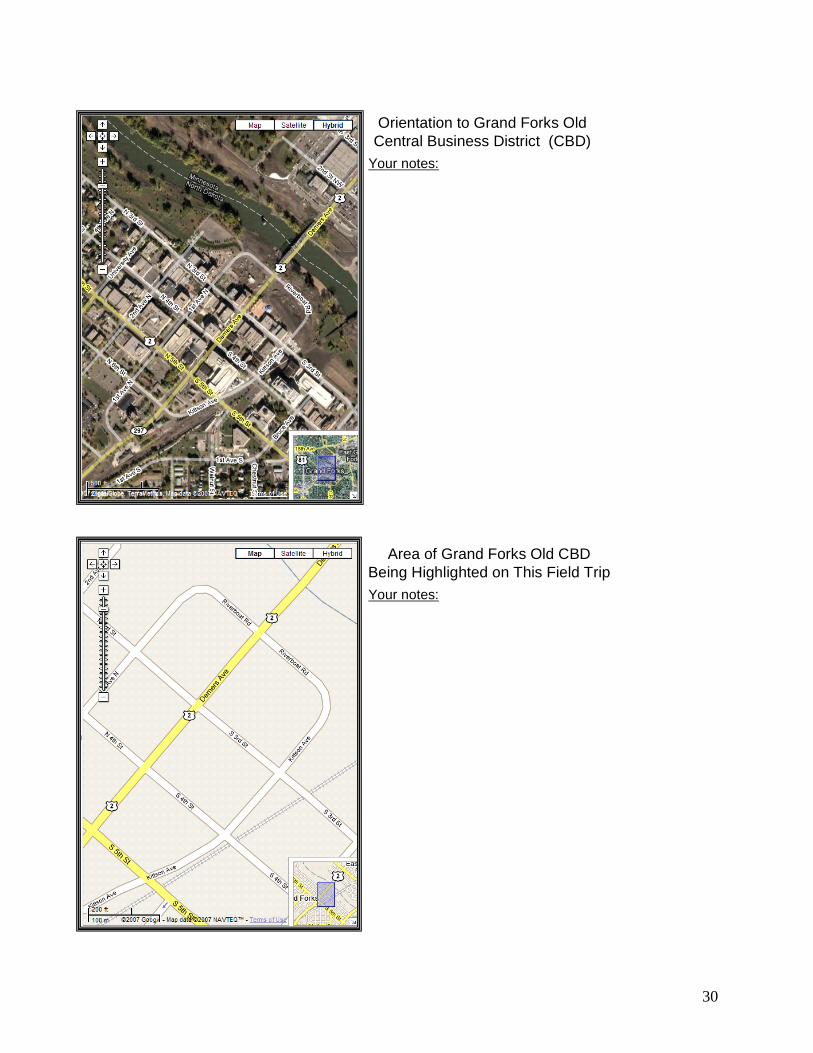
Orientation to Grand Forks Old Central Business District (CBD)
Your notes:
Area of Grand Forks Old CBD Being Highlighted on This Field TripYour notes:
30

Your notes:
Recording Economic Functions for This Transect on North Third Street
Your notes:
Recording Economic Functions for This Transect on North Third Street
31

Recording Economic Functions for This Transect on North Third StreetYour notes:
32

15020.6, 15007.6, 15010.6, The program requires the study of current, appropriate instructional technologies. The program uses varied assessments of candidates’ understanding and abilities to apply that knowledge. Items: Summer 2007 YSA Geography Activity: Google Earth and Remote Sensing was an activity commissioned for the Young Scientists Academy that operated in the summer of 2007 at the University of North Dakota by the Dakota Science Center. The students in that camp were drawn from middle school and high school grades, so this exercise is used now with the teacher candidates because it fits well into determining how well they can handle the techniques of using Google Earth and remote sensing imagery before they work with their own middle school and high school classrooms. During the summer of 2007, the Dakota Science Center working through NDView and the UND Geography Department created a geocaching activity geared specifically for middle school students that is now being adopted for use in the geographic education courses. The premise is that because the department hosts visits of middle school students to learn about geospatial technologies, teacher candidates should know how to use these instructional technologies and help conduct the exercises similar to what was held on October 17, 2007 for sixth graders from Valley Middle School of Grand Forks. GEOG 419 Regular Mapmaking Exercise is an example of a practice activity which students in geographic education have utilized in conjunction with the GIS textbook, Mapping Our World, the now standard work in GIS for middle school and high school geography classes. Because the State of North Dakota has a statewide license for ArcGIS 9, a powerful GIS platform, for grades K-12 in North Dakota, it is essential that the undergraduates in teacher education have some familiarity with this tool of geospatial analysis.
33

Summer 2007 YSA Geography Activity Google Earth and Remote Sensing (Nucech 2007, Wetherholt 2007, & Vandeberg 2006)
Google Earth is a world wide web-based interactive remote sensing (RS) and Geographical Information System (GIS) program that provides images of the Earth's surface. The images vary in scale from course and medium resolution imagery such as from Landsat (30 meter spatial resolution), to fine resolution imagery such as from aerial photos (down to 1 meter spatial resolution). Spatial resolution refers to the amount of information in a single pixel. So, a 30 m spatial resolution means that each pixel contains 30 m of land, whereas a 1m spatial resolution means that that same pixel only has about three feet of information contained within it. The better the resolution (1 m has a better resolution than 30 m), the more detail that can be obtained in the imagery. The images are not real time, but are from satellite and aircraft imagery collected over the last three years. GIS layers can also be added to the imagery such as boundaries, roads and other features. International efforts by groups such as the United Nations Environmental Program (UNEP) are using Google Earth to show the impact that humans have made upon the Earth by activities such as deforestation, urban development, and the loss of glaciers all over the world due to global warming. Google Earth must be downloaded from the web at http://earth.google.com/, and requires an internet connection to load the Images.
Type in "Mount Saint Helens". Zoom out so that you can find this volcanic mountain that had a major eruption on May 18, 1980. It is north-northeast of where you are now. You will notice a large crater that resulted from the eruption. When the volcano erupted, the snow and ice on the mountain combined with other debris to form a large avalanche which flowed out along the landscape.
What is the main direction that this debris traveled based on the image? (use the compass under the View menu, and the tilt menu).
Using the measure tool, what is the approximate area of the mountain crater? Width: ____________m, Length: ________ m
34

In the Search box ("fly to"), type 36 05 57 N, 112 08 06 W. Make sure that you include a space between the degrees and minutes.
What features are visible at this location? Use the tilt feature on the navigation panel at the bottom of the screen to get a better idea of where you are. Add the Borders, Roads, Populated Places and Parks and Recreation layers. Zoom out until you can see more of the surrounding area. What state are you in, and what National Park? Fly to "N. Roman St. New Orleans, LA." What do you think the blue colored features are on some of the rooftops?
Fly to "Pasadena Rose Bow1”. Zoom in until you can see the names of the universities in the end-zones. What two schools played in the Rose Bowl the year this image was taken.
Fly to "Grand Forks, ND." Compare the length (using the measure tool) of the longest runway at both the Grand Forks International Airport and the Grand Forks Air Force Base which are located west of the city of Grand Forks. Which one is longer? By how far in feet?
Zoom to the Ralph Engelstad Arena. What words are spelled out in the garden just east of the arena?
Fly to your address (e.g. 715 N. 40th, Grand Forks, ND). Google Earth should now zoom in to this location on the Earth's surface. Can you see your house or building clearly? If not, why?
35

Now that you have had a basic introduction to Google Earth and a few of the functions that can be performed with it, can you think of any ways in which this tool can be used in the real world? What kind of people or organizations could use this tool?
36

Geocaching
The word Geocaching broken out is GEO for geography, and CACHING for the process of hiding a cache. A cache in computer terms is information usually stored in memory to make it faster to retrieve, but the term is also used in hiking/camping as a hiding place for concealing and preserving provisions.
Geocaching is a developing recreational activity. To find caches in a particular area check the www.geocaching.com webpage. You will need to register with the webpage – registration is free. The webpage is a good resource for learning about geocaching. The following information is from the webpage.
A cache can come in many forms but the first item should always be the logbook. In its simplest form a cache can be just a logbook and nothing else. The logbook contains information from the founder of the cache and notes from the cache's visitors. The logbook can contain much valuable, rewarding, and entertaining information. A logbook might contain information about nearby attractions, coordinates to other unpublished caches, and even jokes written by visitors. If you get some information from a logbook you should give some back. At the very least you can leave the date and time you visited the cache.
Larger caches may consist of a waterproof plastic bucket placed tastefully within the local terrain. The bucket will contain the logbook and any number of more or less valuable items. These items turn the cache into a true treasure hunt. You never know what the founder or other visitors of the cache may have left there for you to enjoy. Remember, if you take something, it’s only fair for you to leave something in return. Items in a bucket cache could be: Maps, books, software, hardware, CD's, videos, pictures, money, jewelry, tickets, antiques, tools, games, etc. It is recommended that items in a bucket cache be individually packaged in a clear zipped plastic bag to protect them.
• Offset Caches - They're not found by simply going to some coordinates and finding a cache there. With the Offset Cache the published coordinates are that of an existing historical monument, plaque, or even a benchmark that
37

you would like to have your cache hunter visit. From this site the cache hunter must look around and find offset numbers stamped/written in or on some part of the marker site, or continue based on instructions posted to www.geocaching.com
• Multi-caches - The first cache gives coordinates (or partial coordinates) to the next location, or multiple caches have hints to the final cache.
• Virtual caches - A cache is actually an existing landmark, such as a tombstone or statue. You have to answer a question from the landmark and let the "cache" owner know as proof that you were there.
Geocaching has 3 simple rules: 1. Take something from the cache, 2. Leave something in the cache, 3. Write about it in the logbook
University of North Dakota
Geography Department
To share geospatial technology with the community the UND Geography Department has partnered with the Dakota Science Center to design a temporary geocaching course on the UND campus. Each cache has a log book to write in and a souvenir to take.
Geocaching is today’s treasure hunt. Have Fun!
38
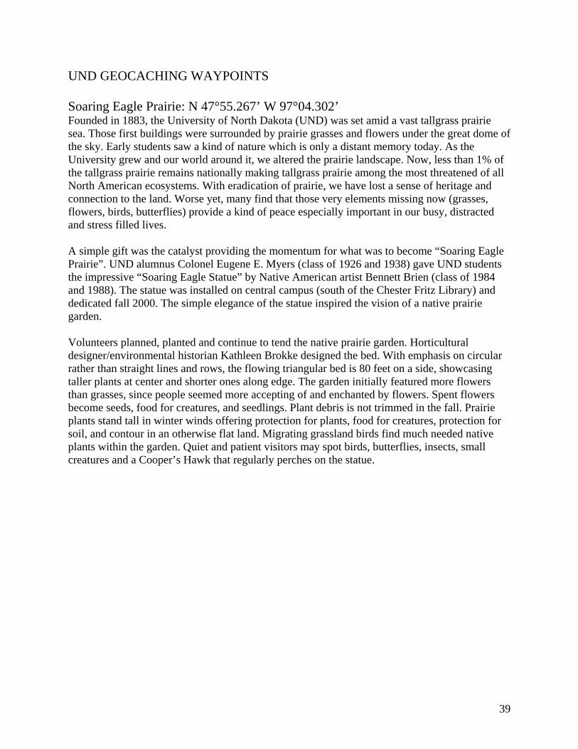
UND GEOCACHING WAYPOINTS Soaring Eagle Prairie: N 47°55.267’ W 97°04.302’ Founded in 1883, the University of North Dakota (UND) was set amid a vast tallgrass prairie sea. Those first buildings were surrounded by prairie grasses and flowers under the great dome of the sky. Early students saw a kind of nature which is only a distant memory today. As the University grew and our world around it, we altered the prairie landscape. Now, less than 1% of the tallgrass prairie remains nationally making tallgrass prairie among the most threatened of all North American ecosystems. With eradication of prairie, we have lost a sense of heritage and connection to the land. Worse yet, many find that those very elements missing now (grasses, flowers, birds, butterflies) provide a kind of peace especially important in our busy, distracted and stress filled lives. A simple gift was the catalyst providing the momentum for what was to become “Soaring Eagle Prairie”. UND alumnus Colonel Eugene E. Myers (class of 1926 and 1938) gave UND students the impressive “Soaring Eagle Statue” by Native American artist Bennett Brien (class of 1984 and 1988). The statue was installed on central campus (south of the Chester Fritz Library) and dedicated fall 2000. The simple elegance of the statue inspired the vision of a native prairie garden. Volunteers planned, planted and continue to tend the native prairie garden. Horticultural designer/environmental historian Kathleen Brokke designed the bed. With emphasis on circular rather than straight lines and rows, the flowing triangular bed is 80 feet on a side, showcasing taller plants at center and shorter ones along edge. The garden initially featured more flowers than grasses, since people seemed more accepting of and enchanted by flowers. Spent flowers become seeds, food for creatures, and seedlings. Plant debris is not trimmed in the fall. Prairie plants stand tall in winter winds offering protection for plants, food for creatures, protection for soil, and contour in an otherwise flat land. Migrating grassland birds find much needed native plants within the garden. Quiet and patient visitors may spot birds, butterflies, insects, small creatures and a Cooper’s Hawk that regularly perches on the statue.
39

Wellness Center: N 47°55.640’ W 97°04.553’ The state-of-the–art center opened in the fall of 2006 and has locker rooms, a running track, studios, fitness floor, cardio deck, courts, a rock wall and a nutrition wing. Tabula Coffeehouse: N 47°55.356’ W 97°04.313 The Christus Rex Lutheran Campus Center and Tabule Coffeehouse is a place of hospitality, conversation, prayer and study. It is a ministry outreach of the Evangelical Lutheran Church in America. Era Bell Thompson Cultural Center: N 47°55.344’ W 97°04.096’ Era Bell Thompson grew up near Driscoll, ND. After studying at UND she became an editor of Ebony magazine, and served as managing editor from 1951-1964. Era Bell wrote many books including American Daughter, which tells the story of her youth in ND. North Dakota Museum of Art: N 47°55.151’ W 97°04.423’ This Colonial Revival style building was built in 1907 as an armory and gymnasium. The Women’s physical Education Department was located in the building from 1919- 1952. In the fall of 1989, the building became the ND Museum of Art. The garden surrounding the museum is the style reminiscent of an ancient Chinese Peony garden. Adelphi Fountain: N 47°55.198’ W 97°04.475’ Located near the Fox Bridge on the English Coulee this cast iron foundation was presented by the Adelphi Literary Society in 1907. The Fox bridge was designed and constructed by UND alums in memory of Alice C. Fox. Old Main Memorial Sphere: N 47°55.210’ W 97°04.395’ Designed by Stanley Johnson the iron globe has 29 figures representing the educational development of humans. Engraved on the star beneath the globe are the names of the 8 presidents that served in the Old Main building until the building was razed in 1962.
40

Leonard Hall: N 47°55.191’ W 97°04.089’ On the east side of the building are impressions in the sidewalk that resemble the footprints of the allosaurus, a carnivorous dinosaur. Nearby are 2 petrified stumps of giant redwood trees from western ND. The exterior walls of the building feature figures representing the geologic past; including dinosaurs, a mammoth and a volcano. The 70-million-year-old skull of a triceratops (the 3-horned dinosaur) is located in the main floor lobby along with other displays. Chester Fritz Library: N 47°55.314’ W 97°04.294’ The largest library in ND the building is distinguished by the 82-foot tower facing University Avenue. Chester Fritz was a UND alumnus and an international investment banker. A stained-glass and metal sculpture designed by Stanley Johnson is located on the east wall of the foyer of the north entrance. A large oil mural depicting symbols of North Dakota’s heritage, painted by Robert Nelson is located in the Reading Room of the second floor. One of the finest stamp collections in the Midwest donated by Senator Bryce Streibel is also located on the second floor. The Oriental Room on the fourth floor features an oriental collection of the late Chester Fritz. Traveling exhibits of regional and historic interest as well as genealogy resources are found in the Elwyn B. Robinson Department of Special Collections on the fourth floor. Newman Center: N 47°55.424’ W 97°04.221’ Home of the Catholic Campus Ministry the Center provides Mass, Christian education and fellowship. UND Barnes & Nobel’s Bookstore: N 47°55.613’ W 97°04.156’ Celebrated Fountain: N 47°55.209’ W 97°04.517’ N 47°55.267’ W 97°04.302’ N 47°55.640’ W 97°04.553’ N 47°55.356’ W 97°04.313’ N 47°55.344’ W 97°04.096’ N 47°55.151’ W 97°04.423’ N 47°55.198’ W 97°04.475’ N 47°55.210’ W 97°04.395’ N 47°55.191’ W 97°04.089’ N 47°55.314’ W 97°04.294’ N 47°55.424’ W 97°04.221’ N 47°55.613’ W 97°04.156’ N 47°55.209’ W 97
41

Regular Mapmaking Exercise This exercise is to familiarize you with the very basic elements in mapmaking (Cartography) and analytic mapping (GISc). Keep in mind that GIS is one method of cartography. In cartography, the output (map) is emphasized. In GISc, the emphasis is upon analyzing spatial relationships, but GIS can also be used as a tool to create a map of those relationships. This exercise will familiarize you with:
• Adding data • Isolating specific attributes and specific locations • Viewing specific attributes • Changing the look of the displayed attributes • Creating an output (map)
Add Data
- Open an empty map in ArcMap then add data (right click/add data or use the toggle button)
- From the ‘C’ drive follow this path: C/ ESRI/ ESRIDATA/ USA and then select the shapefile COUNTIES.shp. Add this shapefile to your empty map.
Isolate a Specific State - Open the attribute table (right click on the COUNTIES layer/open attribute table) then
select the ‘Options’ toggle then ‘select by attributes’. You will be selecting all the counties that are associated with a specific state.
- Make sure you are ‘creating a new selection’ in the first dropdown box at the top of the dialog box then double click on ‘STATE_NAME’ from the available options window. STATE_NAME should appear in the selection box at the bottom.
- Type or select the equals sign and then select ‘Get Unique Values’. This provides a list of all the values associated with STATE_NAME (meaning all the state names). Double click on any state you wish to work with. That state name should appear in the selection box at the bottom.
- Your query language should read in this format: “STATE_NAME” = ‘Alabama’
- Select ‘Apply’ then close the attribute table. The counties that are associated you’re your selected state should appear highlighted on the map.
- To remove the rest of the United States and focus only on that state, right click on the COUNTIES layer, select ‘Data’ then ‘Export Data’.
- Make sure you are exporting the selected features in the first drop down box at the top of the dialogue box, keep ‘this layer’s data source’, and save the output to the desired location and rename it.
- A window will appear asking you if you want to save the export as a layer, select ‘yes’. - Turn off or delete your COUNTIES layer and zoom in on your state.
View Specific Attributes in the Mapped Area - Right click on your state layer and select ‘Properties’ (you can also double click on the
state layer name) and then go to the ‘Symbology’ tab. - In the ‘show’ window select ‘Quantities’ then graduated color (graduated color schemes
are called choropleth maps and they are the most commonly used mapping technique)
42

43
- In the ‘Fields’ section, use the drop down box in the ‘Value’ box to find an attribute that you want to map. Leave ‘Normalization’ with none for the time being, then select ‘Apply’ or ‘Okay’. The mapped area should appear color graduated according to the values by county
Change the Look - To change the colors of your map, you go back into the ‘Symbology’ tab, and where you
see the color ramp, use the drop down box to choose a new color scheme. - You can also change the number and method of classes displayed by using the drop down
box in the ‘Classification’ area on the right side of the dialogue box. - If you rather use symbols to represent your attributes, rather than select graduated colors
in the under the ‘Quantity tab’ select one of the other options. - To change symbols (in Graduated Symbols for example) select the ‘Template’ toggle and
use the scroll function to select a desired symbol. From here you can also change the size and the colors of the symbol in their respective toggle areas. You can also add thematic symbols by selecting ‘More Symbols’ and then a theme—you’ll then have to scroll to the bottom of the window to see your new thematic options.
- You can change the background colors and features by selecting the ‘Background’ toggle from the ‘Symbology’ main dialogue box and change the features by using their respective toggles.
Creating an Output - When you are satisfied with what you mapped, switch to the “Layout View” (select that
toggle located at the bottom of the mapped area that looks like a sheet of paper or select ‘View’ then ‘Layout’ from the main toolbar)
- Add mapped elements: Title, Neatline, Legend, North Arrow, and Source by selecting ‘Insert’ and then the respective element from the main toolbar
- Each map element can be modified using steps similar to modifying the colors and symbols on the mapped layers.
- Additionally, write your name, and the research question your map answers by inserting a text box.
You’ve created a map and used it to answer a geographic question.