australian height datum (ahd) j nu la rbo plain … pew luck s ring 2 0 2 0 0 2 0 2 0 0 g amb nc l...
TRANSCRIPT
Geoscience Australia gratefully acknowledges contributions to map content. Information is
supplied by the Australian Government, State and local governments, private sector agencies and
individuals. A comprehensive list is available from our web site.
Acknowledgments
The 1:1 000 000 map series consists of derived from the 1:250 000 map series. These maps
are available both flat and folded. For more information contact Geoscience Australia.
50 maps
About the NATMAP Series
Your feedback is Welcome
If you discover errors or omissions on the map, please let us know via the map amendments page on our website or send your annotated map to us.
We will replace your map with the corresponding current edition.
We value your assistance for the next edition.Email: [email protected]
Topographic information checked from multiple sources including satellite imagery. This map was not field checked. Every effort has been made to
make the map a useful reference.
Map Reliability
Geoscience AustraliaGPO Box 378 Canberra ACT 2601
Tel: 02 6249 9966 Fax: 02 6249 9960NATMAP Freecall: 1 800 800 173
Web: www.ga.gov.au
The Australian Government agencyAPPLYING GEOSCIENCE TO AUSTRALIA’S
MOST IMPORTANT CHALLENGES
Contact
© Commonwealth of Australia (Geoscience Australia) 2012Creative Commons Attribution 3.0 Australia Licence
METRES
BATHYMETRICTINTS
HYPSOMETRICTINTS
1500
2000
500
1000
200
SEA LEVEL
100
200
500
1000
3000
SEA LEVEL
200
500
Fence; Open cut mine ........................................
Isolated offshore rock; Saline coastal flat .......
Foreshore flat; Lighthouse
Shoal; Tidal ledge or reef; Mangrove
..................................
Centres of population are classified by their importance. A very small settlement may be shown in larger type in sparsely settled areas.
SYDNEYBATHURSTGOULBURNOBERONBRAIDWOOD
JERILDERIE
Nevertire
Watercourse (presence of water not implied)...........
Contour
Contour, bathymetric
..................................................................
...........................................
.................................................
.......................................................
.........................................
....................................................
...........
Railway; Station or siding ..................................
Dual carriageway
Secondary road
Other road (access & condition not assured)
Principal road
Spot elevation ...................................................... 305
International boundary
International maritime boundary
Landing ground; Airport; Heliport
........................................
.......................
.....................
State or territory border
Powerline (110kV and over)
......................................
..............................
Homestead; Building/s; Ruin
Silo; Grain storage
Tower; Wind turbine
Chimney; Yard
.............................
...............................................
............................................
......................................................
National route marker
Legend
�Hp p�
sealed unsealed
1
Mine; Gas or oilfield ............................................
�
�
Sand; Sand ridges ...............................................
Cliff, bluff or escarpment ....................................
Canal or channel..................................................
Subject to inundation; Swamp ..........................
........................Lake: Perennial; Non-perennial
Bore or well; Spring .............................................
Tank or small dam; Waterhole...........................
..............
Index to Adjoining Sheets
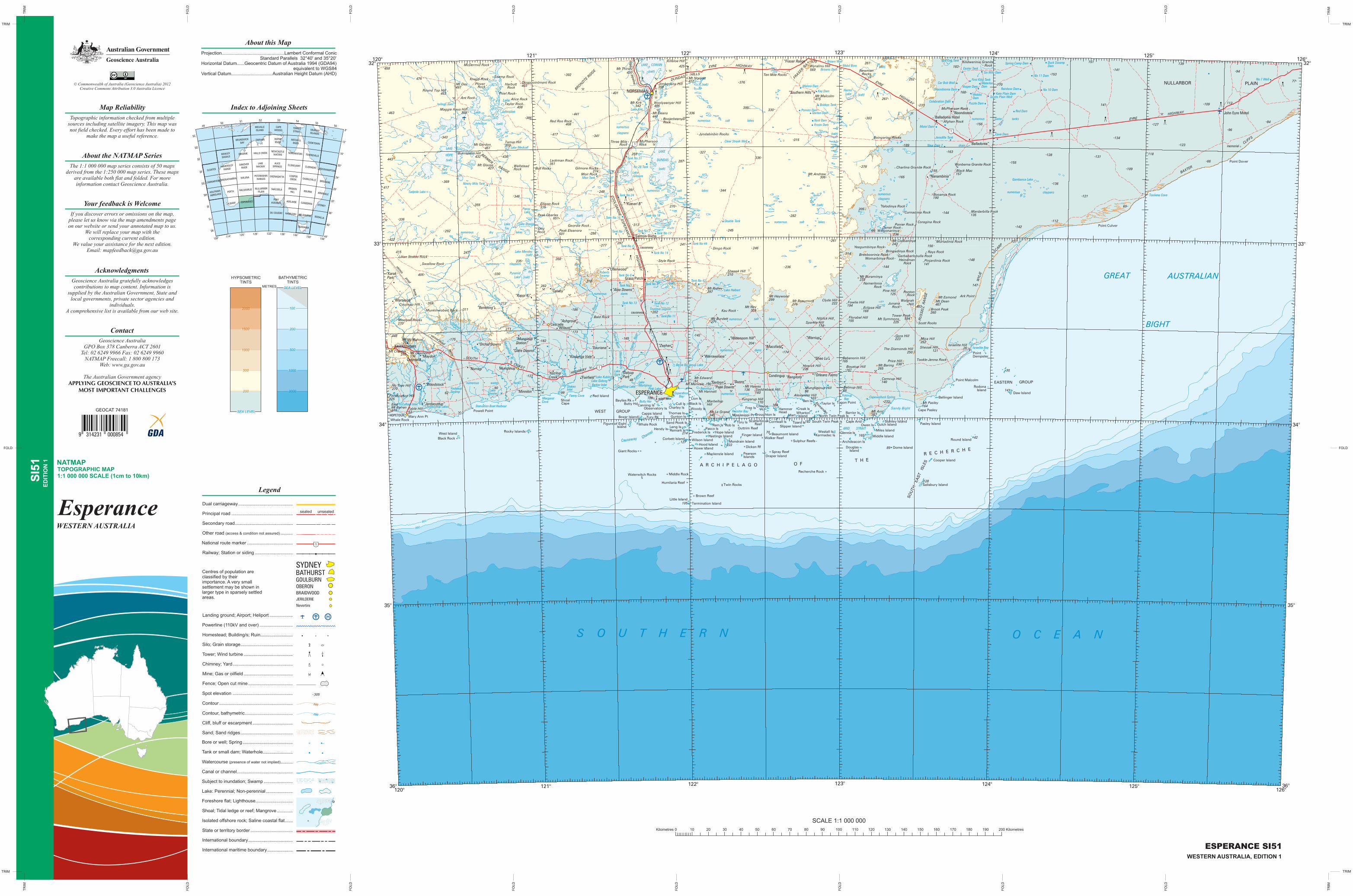
1:1 000 000 SCALE (1cm to 10km)
NATMAP TOPOGRAPHIC MAP
ED
ITIO
N 1
WESTERN AUSTRALIA
SI5
1
Esperance
Projection.................................................Lambert Conformal Conic Standard Parallels 32°40' and 35°20' Horizontal Datum......Geocentric Datum of Australia 1994 (GDA94) equivalent to WGS84Vertical Datum................................ Australian Height Datum (AHD)
About this Map
Kilometres 0 70 80 90 100 110 120 130 140 150 160 170 180 190 200 Kilometres10 20 30 40 50 60
SCALE 1:1 000 000
ESPERANCE SI51WESTERN AUSTRALIA, EDITION 1
9 314231 0008549 314231 000854
GEOCAT 74181
52
ALBANY ESPERANCE
PERTH
MEEKATHARRA
HAMERSLEY
RANGE
NULLARBOR
PLAIN
PETERMANN
RANGES
LAKEMACKAY
HALLS CREEK
DARWIN
MELVILLEISLAND
CAPEWESSEL
TORRESSTRAIT
MITCHELLRIVER
NORMANTON
COOKTOWN
TOWNSVILLE
CLERMONT
CHARLEVILLE
BOURKE
CANBERRA
TASMANIA
ROCKHAMPTON
BRISBANE
ARMIDALE
SYDNEY
BODALLA
CLONCURRY
COOPERCREEK
BROKENHILL
ADELAIDE
HAMILTONDU COUEDIC
PORTAUGUSTA
TARCOOLA
OODNADATTA
ALICESPRINGS
NEWCASTLEWATERS
ROPERRIVER
ROWLEY
SHOALS
BRUNSWICK
BAY
OAKOVER
RIVER
BROOME
WILUNA
KALGOORLIEHOUTMAN
ABROLHOS
CARNARVON
CLOATES
156°150°
144°138°132°126°120°114° 44°
40°
36°
32°
28°
24°
20°
16°
8°
12°
4950
51 53 5455
56
MELBOURNE
MURRAYISLANDS
SC
SD
SE
SF
SG
SH
SJ
SI
SK
108°
FOLD FOLD
FO
LD
FO
LD
FO
LD
FO
LD
FO
LD
FO
LD
FO
LD
FO
LD
FO
LD
FO
LD
FO
LD
FO
LD
FO
LD
FO
LD
TRIM TRIM
TRIMTRIM
TR
IM
TR
IMT
RIM
TR
IM
((((((((((((
$
$
$
$
$
$
$ $
$ $
$ $
$ $
$ $
$ $$ $
$ $
$ $
$ $
$ $
$ $
$ $
$ $
^^^^
^^^^^^
^^^^^^
^^^^^^
^^^^
(($$$$$$
$$
$ $
$ $
$
^^^^^^^^
^^^^
(((($
$$$
$$
(((($$$$$
$
$$$
$ $
$ $
$ $
$ $
(((((($$ $$ $$ $$ $$ $$ $$ $
$ $ $$ $
^^^^
(((($$$$$ $
$ $
$ $$ $
''''''''''''''''''''''''''''
''''''''''''''''''''''''''''
''''''''
''''''''''''
''''''''''''''''
1
1
1
1
1
1
1
1
1
1
1
1
1
1
1
1
1
1
1
1
1
1
1
1
1
1
1
1
1
1
11
1
1
1
1
1
11
1
1
1
1
1
1
1
1
1
1
1
''
''
''
''''
''''
''''
''
''''
''''
''''''
'''''''''''''''''''
''''
''
''''
''''
''
''''
''''''
''''
''''
''''
''
''
''''
''''''
''''
''''''''''''
''
'''''''''
''''
''''
''
''
''''
''''
''''''
'''''''''
''
''''
''
''
''''''
''''
''
''''
''''
''''
''''
''''
''
''''
''''''''''''
''
'''
''
''
''''
''''
''
''''
''''
''
''
''''''''''''''''''''''''
''''
''''
''
''''
''
''''
'''''''''
'''' ''
''
'''
'
''''
''''
''''
''''
''''
''''
''
'''' ''
''
''
''
''
''''
''''
''''
''''''''
''''''''''''
''''
''''
'
''
''''''
''
''''
''''
''''''
''''
''''
''''
''''
''
''''
'''''''''''''''
''''
'''''''''''
''
''''
''''
''
''
''''
'''' ''
''
''''
'''''''''
''''
''
''''
''''''''''''''''''''''''
'''''''''''''''''''''''''''''''''''''''''''''''''
''''''''''''''''''''''''''''
''''''''''''''''''''''''''''''''''''''''''''''''''''''
''
''
''''
''''
''''
''''
''''
''''''
''''
''
''''
''
''
''''
''''
''''''
''
''''''
''''
''''''
''
''''
''''
''''''
''''
''''
''
''''
''''
''''
''''''
''''''
''''
''''
''''''
''''
''''''''''''''''''''''''''''''''''''''''''''''''''''''''''''''''''''''''''''''''''''
''''''
''
'
'
''''''
''''
''''
''''
''
''''
''
'
''
''''''
''''
''
''
'''''''''
''''
''''''
''
''
''''
'
''
''
''
''''
''''
''''''
''''
''''''
''
''''
''''
''
''
''''
''''''
''
''''''''''''''''''''''''''''''
''''
''''
''
''''
''''''
''
''
''''
''
''
''''
''''''''''''''''''''
''''
''''
'
''''
''''''
''
''
''
''''
''''
''''
''
''
'
''''
''''
''''
'
''
''''
''''
''
''''''''
'''''''''''''''''''''''''''''''''''
''''
''''
''''
''''
'
''''
''''
''''
''''
''''
''''
''
''''''
''''
''''
''''
''''
''''
'''''''''
''
''
''''
''
''''
''
''
''''
''
''''
''''''
'' ''
''
''
''''
''''
''''
''''
'
'
''
''
''
''''''
'
''''
''
''''
''
''''
''
''''
''''
'''
'''''''''
''
''''
''''
''
''''
''''
''''
''''''''''''''''''
''''
''''''
''''''''''''''''''''''''''''''''''''''''''''''''''''''''''''''''
''
''''
''
''''''
''''
''
''
''''
''
''
''''
''
''
''''''
''
''''
''''
''''''
'''' ''
''''
''''
''''''''''''''''
''
'
''''
'
''''
''''
''''''''''''
''''
''''
''''
''''
''''
''''
''
''''''''''
''''
''
''''
''''''
''
''
''
''''
''''''''
''
''''
''''
''''
''''
''''''
''''
''''
''
''''''
'
''
''
''
''''
''''''
''
''
''''
''''
''
'''
''''
''''
''''
''
''''
''''
''
''''''''
''''
''
''''
''
''''
''''
''
''
''
''''
''
''''''
''''
''
''
''
''''''''
''''
''
''''''
''''
''''''
''''
''''
''''
''''''''''''''''''
''''
''''
'''''''
'''
'
''
''
'''''''''''''''''''' '
''''
''
''
''''
''
''''''
''
''''
''''
''''''
''
''''''
''''''
''''
'''''''''
''''''''''''''''
''''''''''''
'''''''''
''''''
''''''
''''
''
''
''''''
''
''''''
''
''''
''''''''''''''''''''
''
''
''''
''''''''''''
'''''''''
''''
''''''
''''
''''
''''
''
'''''''''
''
''''
''
''
''''
''''
''
'
''''
''''''
'
''''
''
''
.. .
..
.
.
..
.
.
..
.
.
.
..
H
r
r
rr
r
r
r
r
r
r
r
r
rr
r
r r
r
,
, ,
,
,
,
,
,
,
,
,
,
,
,
,
,
,
,
,
,
,
,
,
,
,
,,
,
,
,
,
,,
,
,
,
,,
,,
,
,
,
,
,
,
,
,
,
,
,
,
,
,
,
,
,
,
,
,
,
,
,
,
,
,
,
,
,
,
,
,
,
,
,
,
,
,
,
,
,
,
,
,
,
,
,
,
''
L
L L
LL
L
L
L
LL
L
L
L
L
L
L
L
L
LL
L
L
L
LL L
L
LL
LL
L
.
.
.
.È
.Ê
.È
.È.È
.È
.È
p¬
p
p¬
p
p¬p
p
ww
£
£
£
£
£
£
£ £
£
££
£
£
££ £
£
£
t
££ £
u
£
£
©
©
JJ
J
J
J
J
J
J
J
J
JJ
J
J
J
J
J
J
J
J
J
J
J
J
J
J
,,
,
,
,
,
,
,
,
,
,
,
,
,
,
,
,
,
,
,
,
v
, ,
,
,
,
, ,
,
,
,
,
,
,
,
,
,
,
,
,
,
,
,
,
,
,
,
,
,
,
,
,
,
,
, ,
,
,
,
,,
,
,
,,
,
,
,
,
,
,,
,
,
,,
,
,
,
,
,,
,,
,
,
,
v
, ,
,
,
,
,
,,
v
,
,
,
,
,
,
,
,
,
,
,
,
,
,
,
,
, ,
,
,
,
,
v
,
,
,
,
,
,
v
,
,
,
,,
,
,
,
,
,
v,
,
v
,
,,
,
,
,
,
,
,,
,
,
,
,
,
,,
,
,
,
,
,,
,
,
,
,
,,
,
,
,
,
,
,
,
,
,,
,
,
,
,
,
,
.
..
.
.
.
.
.
.
.
.
.
.
.
.
.
.
.
.
.
.
.
.
.
.
.
...
.
.
.
.
.
.
.
.
.
.
.
..
..
.
.
.
..
...
.
.
.
.
.
.
.
.
.
.
.
.
.
.
.
.
.
.
.
.
.
.
.
.
.
.
.
.
.
.
.
.
.
.
.
.
.
.
.
.
.
.
.
.
.
.
.
.
.
.
.
.
.
.
.
.
.
.
.
.
.
.
.
.
.
.
.
.
.
.
.
.
.
..
.
.
.
.
.
.
.
.
.
.
.
.
.
.
.
.
.
.
.
.
.
.
.
.
.
.
.
.
.
.
.
.
.
.
.
.
.
..
.
.
.
..
.
.
.
..
.
.
.
.
.
.
.
.
.
.
.
.
.
.
.
.
.
.
.
.
.
..
.
.
.
.
.
.
.
.
.
..
.
.
.
.
.
.
.
.
.
.
.
.
.
.
.
.
.
.
.
.
.
.
..
.
.
.
.
.
.
.
.
.
..
.
.
.
.
.
.
.
.
.
.
.
.
.
.
.
.
.
.
.
.
.
.
.
.
.
.
.
.
.
.
.
.
.
.
.
.
.
cC
cC
cC
4
62
260
69
48
94
26
96
98
84
66
77
127
131
246
118
342
236
145
405
175
137
155
392
261
408
336
330
214
163
311 186
210
441
241
306
136
336
141
212
430
165
336
128
151
401
204
170
247 214
134
330
341
268
267
141
109
144
315
174
355
417
170
425
156
125
139
344
287
386
222
256
105
235
346
168
190
270
109
211
121
376
651
248
368
148
189 123
255
303
112
183
144
205
417
70
90
53
6699
89
51
399
238
223
155
594
261422
463
233
443
458
467
432
270
277
169
194
343
252
245
569
127
328
276
164
501
174
451
282
153
226
135
297
271
243
369
202
128
140
359
359
222
315
415
453
441
311
233
483
448
427
136
497
106
252
142
165
147
297
415
112
225
327
190
182
165
357
278
292
210
299
156
265
186
233
155
236
486
282
142
579
313
131
345
225
173
103
182
351
141
330
127
121
395
270
291
476
161
421
157
310
436
274
30
141
42
250
160
168
274
403
408
Kay Dam
Red Dam
Kent Dam
Cave Dam
Pomms Dam
No 7 Well
New Dam 2
Tank No 6
WebbsDam
Tank No 4
Moir Tank
No 10 Dam
Motel Dam
Tank No 1
No 11 Dam
Tank No 2
Tank No 7
Tank No 16
No 28 Tank
Tank No 42
Tank No 31
Puzzle Dam
Tank No 44
Gordon Dam
Frosts Dam
Tank No 14
Malora Dam
Tank No 12
Tank No 24
Tank No 11
Tank No 17
Tank No 18
Tank No 13
Vosper Dam
Browns Dam
Rainbow Dam
Easter Tank
Bobbys Tank
Double Tank
Six Mile Dam
WaterlooDam
Car Bob Well
Bull Oak Tank
Jeradilla Tank
Noondoonia Dam
Duck SwampDam
Kate Plain Dam
Spring Camp Dam
Celebration Dam
Ninety Mile Tank
Scotts Plain Well
Clear Streak Well
Tank No 8
First King Tank
Brown WellMobil Bore
Capewelluck Spring
200
200
200
200
Gambanca Lake
numerous claypans
HarmsLake (salt)
(salt)
(salt)
(salt)
numerousclaypans
LAKE COWAN
(salt)
(salt)
numerous salt lakes
DUNDAS
(salt)
LAKE
Lake Kirk
Lake Gilmore
saltnumerous lakes
Johnston
Lake
(salt)
Lake
Johnston
tailings dam
LAKE
HOPE(salt)
RedLake
Tadpole Lake
Lake Medcalf
numerous salt lakes
(salt)
Toolinna Cove
GREAT AUSTRALIAN
Lake Sharpe
Lake
lakes
Pansy
LakeTay
drynumerous
(salt)
Pyramid
Lake Mendes
Lake
(salt)
(salt)
Young
River
Oldfield
Coujinup
Lake Halbert
(salt)
Rive
r
(salt)
Young
River
Lort
Dalyup
Dalyu
p
(West Branch)
Rive
r
Ck
Kateu
p
MortijinupLake
Quallilup LakePink Lake
Lake KubitchLake GidongBarker Inlet
GoreLake
Fanny Cove
StokesInlet
Margaret Cove Butty Har
BayEsperance
Benie Benjenup Lake
Moolyall
Ck
Bandalup
Ck
River
Burla
bup
Cree
k
Ck
Rive
r
Jerd
acut
tup
Munglinup
R
LakeShaster
Starvation Boat HarbourCulham InletJerdacuttup Lakes
Causeway Channel
Bannitup L
salt lakesnumerous
Rossiter Bay
YokinupBay
ARID STRAIT
Sandy Bight
Israelite Bay
BIGHT
200
100
3000
1000
500
200
100
3000
1000
500
S O U T H E R N
PLAINNULLARBOR
RANGE
BERMER
BRONZITE
RIDGE
Grass Patch
Salmon Gums
ESPERANCE
NORSEMAN
HOPETOUN
Cascade
Desmond
O C E A N
EYRE
HIGHWAY
SOUTH
COAST
ESPER
AN
CE
EYRE
HIG
HW
AY
EYREHIGHWAY
HIGHWAY
HIGHWAY
COO
LGA
RD
IE
Black Rock
Pine Hill
Kermadec Is
Twin Rocks
Remark Is
Lackman Rock
YoulabupSwamp
“Jerdacuttup”
“Lauriana”
Afghan Rock
Coragina Rock
wind farm
memorial
Bald Rock
Mt Day
Mt Ney
Mt Arid
“Gerbryn” “Dunns”
Mt Kirk
Mt Dean
Mt Hawes
Mt Deans
Mt Glasse
Mt Andrew
Mt Edward
Gora Hill
Mt Gordon
Mt Pasley
Mt Baring
Mica Hill
Black Mac
Mt Esmond
Mt Ridley
Clyde Hill
Brook Peak
Table Hill
Tower Peak
Mt Malcolm
Mt Symmons
Mt Chester
Mt McMahon
Tamar Hill
Price Hill
Mt Hannett
Mt Thirsty
Mt Heywood
Fowlie Hill
Sheoak Hill
Mt Le Grand
Howick Hill
Sheoak Hill
Mt Merivale
Mt Beaumont
Peak Charles
Sparkle Hill
No Tree Hill
Boyatup Hill
Eclipse Hill
Niblick Hill
Mt Buraminya
Carncup Hill
Belinup Hill
HillCoujinup Hill
Wyralinu Hill
Peak Eleanora
Mt Coobaninya
Yungarup Hill
Israelite Hill
Bebenorin Hill
Round Top Hill
Marbellup
Alexander Hill
Burmiester Hill
Saddleback Hill
Jimberlana Hill
Mungliginup Hill
Maggie Hays Hill
Woolyeenyer Hill
Mt Willgonarinya
The Diamonds Hill
East
Fortification Hill
Mt Barren
BAXTER
Ellison Rock
Geordie Rock
Florabel Hill
HeadPt
Point
CheyneHammer
Dempster
Cape Arid
Alexander
PtButty HdShoal
Tagon Point
Cape Pasley
Point Dover
Point Culver
Powell Point
Point Malcolm
Mary Ann Pt Mississippi Pt
Ant Rock
Moolyall Rocks
Kau Rock
Dog
Style Rock
Dingo Rock
Swallow Rock
Wellstead
McPherson
Ten Mile Rocks
Murtadinia Rock
Three Mile
Pinjardinia Rock
Jyndabinbin Rocks
BoojerbeenyerRock
Lilian Stokes Rock
Munglinup
Condingup
RAVENSTHORPE
Reef
Mart
Island
IslandSand Hook Is
Gunton Is
DUNDAS
Owen Is
Island
Douglas
Is
Pasco Is
IslandsPearson
Tory Is
Westall Is
WhartonWoody Is
Taylor Is
Tizard Is
Fury Rk
Brown Reef
Spray Reef
Whale Rock
Ben Is
Daw Island
Ram Is
Red Island
Rob Is
Dicken Rf
Walker Reef
Cull Is
Dome Island
Free Is
Hood Island
Hope Island
Howe Island
Lion Is
Long Is
West Island
Bayliss Rk
Outtrim Reef
Black Is
Boxer IslandCapps Island
Creak Is
Gulch IslandHendy Is Miles Island
Round IslandSulphur Reefs
Cooper IslandDraper Island
Finger Island
Little Island
Middle Island
Pasley Island
Rocky Islands
Rodona
Wilson Island
Humilaria Reef
Recherche Rock
Barrier Is
Canning IsCharley Is
Corbett Island
Glennie Is
Slipper Island
Beaumont Island
Cornwall IsFigure of Eight
Hastings Island
Mondrain Island
Waterwitch Rocks
Bellinger Island
Broughton Is
Frederick Is
Mackenzie Island
Salisbury Island
Archdeacon Is
Observatory Is
Termination Island
North Twin Peak Is
Hill
WEST GROUP
GROUPEASTERN
O FT H E
R E C H E R C H E
A R C H I P E L A G O
Ark Point
RA
NG
E
RU
SS
ELL
vermin proof
vermin proof
Munkinwobert Rock
Rock
fence
causeway
causeway
Mt Burdett
SOU
TH
EAST
IS
LES
Mt Norcott
Rock
Rock
Rock
Cape
Wonberna Granite Rock
South Twin Peak Is
HILLS
FRASER
Bringadinya Rock
RA
fence
Thomas Is
Giant Rocks
River
Whale Rock
Middle Rock
Scatterbreak Stanley Island
CLIFFS
SCARP
WYL
IE
Island
Bull Rocks
Mardarbilla Rock
Charlina Granite Rock
PloverKnapp Rock
Scamp Rock
“Woodstock”
Rock
NewmanRocks
Curnadinia Rock
Ponier RockDoner Rock
Gilmore Rocks
Moir Rock
Womarbinya RockBreeboorinia Rock
Yeagumbinya Rock
Heinsman Rock
McDermid Rock
“Maydon”
“Orchid Downs”
HarbuttRock
Disappointment Rock
Taylor Rock
Thiel Rock
Alice Rock
Red Roo Rock
Killaloe Hill
Boingaring Rocks
Kilidwerinia GraniteRock
McPherson Rock
Garbabarlobulla Rock
numerous water tanks
“Noondoonia”
Namerlonia
Rock
Rays Rock
Scott Rocks
Tookle-Jenna Rock
Yalodinya Rock
Booanya Rock
Rock
WolgrahJunana
PontonRock
Mt Desmond
“Nurragi”
“Minnikin”
“Clare Downs”
“MunginupStation”
numerous water tanks
“Yerritup Creek”
“Koolunga Vale”
“Ashgrove”
“Fairfield”
“Zeehan”
“Dalyup Park”
“Warrawoona”
“Wittenoom Hill”
numerous dams
numerous swamps
“Warriup”
“Macsfield”
“Rangitoto” “Orleans Farms”
“Shao Lu”
Truslove Lagoon
numerous dams“Aloa Downs”
RobertsSwamp
“Cataby”
“Wilaust”
numerous claypans
“Kappi Ki”
“Benelong”
“Karak Park”
“Maroleigh”
“Ullenwood”
“Kumarl B”
“Nanambinia”
drain “Balladonia”
John Eyre MotelBalladonia Hotel
“Fraser Range”
“Southern Hills”
numerous
claypans
(ugd)pipeline
1
1
1
“Peak Downs”
33°
34°
35°
36° 36°
35°
34°
33°
32°32°
120°121° 122° 123° 124° 125°
126°
126°125°124°123°122°121°
120°