available property pleasants county … pdf broch… · wv flood tool is supported by fema, wv nfip...
TRANSCRIPT

ST. MARYS, WEST VIRGINIALOCATIONLocated in City Limits - No Zoning - NoneCounty - PleasantsFlood Hazard Zone - Partially located in Zone AE
SIZETotal Acreage - 70 (Two 35 acre parcels)Will Owner Subdivide the Property - Yes Acreage Range That Owner Will Subdivide - Negotiable
TRANSPORTATIONInterstate/4 Lane Highway - 6 miles to I-77 Interchange Exit 179 Commercial Airport - 5 miles to Mid-Ohio Valley Regional AirportRailroad - CSX Railroad Siding - No Navigable River - Ohio River On-Site Barge Facility - Yes
UTILITIESElectricity - Mon Power Proximity to Power Line - On site Voltage - 10 kV sub-station located on site Phase - 3
Gas - Dominion Proximity to Gas Main - On siteSize of Gas Main - Gas Pressure -
Water - Union Williams PSD Proximity to Water Main - On site Size of Water Main -
Water Pressure (Static) - Water Pressure (Residual) - Excess Capacity of Treatment Plant -
Sewer - Union Williams PSD Proximity to Sewer Main - On site Size of Sewer Main - Excess Capacity of Treatment Plant -
Telephone - Frontier Switching - Digital Broadband Service - Yes
SALE/LEASESale Price - Negotiable Lease Price - Available Purchase or Lease Date - Immediately
FOR FURTHER INFORMATION CONTACTJames McGoldrick, Executive DirectorPleasants County Development AuthorityPO Box 339Saint Marys, WV 26170Phone: (304) 684-1220 Email: [email protected] REMARKSFive wells located next to the river supplies 300 to 400 gpm of water.
Disclaimer: The information contained herein is from multiple sources and is provided as a convenient guide. It is deemed reliable, but is not guaranteed, and is subject to change without notice. It is your responsibility to independently confirm its accuracy and completeness.
AVAILABLE PROPERTYPLEASANTS COUNTY INDUSTRIAL CENTER
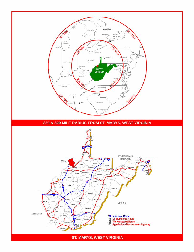
250 & 500 MILE RADIUS FROM ST. MARYS, WEST VIRGINIA
ST. MARYS, WEST VIRGINIA
HANCOCK
BROOKE
OHIO
WETZEL
MARION PRESTON
DODDRIDGE
BARBOUR RITCHIE
WIRT
TUCKER
GILMER CALHOUN
CLAY WEBSTER
ROANE
KANAWHA
GREENBRIER
MASON
WYOMING
BOONE
LINCOLN
McDOWELL
SUMMERS
HARDY
PENDLETON
GRANT
UPSHUR
PUTNAM
RALEIGH
FAYETTE
MONROE
MERCER
WAYNE
MINGO
68
LEWIS
22
70 470
TYLER
PLEASANTS
WOOD 340
9 MORGAN
220
2
LOGAN
50
460
19
219
35
CABELL
2
77
POCAHONTAS NICHOLAS
L
D
H
JACKSON
81
33
Interstate Route US Numbered Route WV Numbered Route Appalachian Development Highway
64
33
9
H
OHIO
KENTUCKY
MARYLAND
VIRGINIA
PENNSYLVANIA
30
MONONGALIA
MARSHALL
52
I-73/74 NHS Corridor King Coal Highway
Q
77
10
G
119
64
Coalfields Expressway
64
RANDOLPH
BRAXTON
BERKELEY
522
JEFFERSON
Charleston
HARRISON
I-73/74 NHS Corridor Shawnee Highway
7
250
79
TAYLOR 219
MINERAL HAMPSHIRE 50 50
COLUMBUS
CINCINNATI
CLEVELAND NEW YORK
TORONTO
LAKE ERIE
LAKE ONTARIO
LAKE HURON
LAKE MICHIGAN
CANADA
ST. LOUIS
MEMPHIS
BIRMINGHAM ATLANTA COLUMBIA
CHARLESTON
NASHVILLE
CHARLOTTE
GREENSBORO
LEXINGTON
NORFOLK
PITTSBURGH
CHICAGO
CHATTANOOGA
WEST VIRGINIA
BUFFALO
FRANKFORT
INDIANAPOLIS PHILADELPHIA
HARRISBURG
DETROIT
RICHMOND
LOUISVILLE
BALTIMORE
WASHINGTON D.C.
KNOXVILLE

TRANSPORTATION INFRASTRUCTURE AND HIGHWAY MAP

USGS TOPOGRAPHIC MAP

FLOODPLAIN MAP
This map is not the official regulatory FIRM or DFIRM. Its purpose is to assist with determining potential flood risk for the selected location.
WV Flood Map
Map Created on 3/14/2014
User Notes:Pleasants County Industrial Center105 Total Acres50 Acres Located in Flood Hazard Zone
Disclaimer:The online map is for use in administering the National Flood Insurance Program. It does notnecessarily identify all areas subject to flooding, particularly from local drainage sources of small size.To obtain more detailed information in areas where Base Flood Elevations have been determined,users are encouraged to consult the latest Flood Profile data contained in the official flood insurancestudy. These studies are available online at www.msc.fema.gov.
WV Flood Tool is supported by FEMA, WV NFIP Office, and WV GIS Technical Center(http://www.MapWV.gov/flood)
Flood Hazard Area: Selected site is WITHIN theFEMA 100-year floodplain.Elevation: About 612 feetLocation (long, lat): 81.357382 W, 39.339307 NLocation (UTM 17N): (469202, 4354492)FEMA Issued Flood Map: Contacts: Pleasants CountyCRS Information: No CRS information availableParcel Number:
Zone AE
Zone X

UTILITY MAP