aviation hazards. what we must consider: forms of icing packed snow hoar frost rain ice engine /...
TRANSCRIPT
Aviation Hazards

What we must consider:forms of icing
Packed snow
Hoar frost
Rain ice
Engine / airframe icing

Icing
Engine Icing - can occur when the environment is above zero and is due to the intake of air cooling adiabatically
Airframe Icing (our main concern)- supercooled droplets freeze on the aircraft body

Engine Ice
Due to:
1. Decrease of pressure inside engine manifold
2. Extraction of latent heat due to vaporisation

ICING TYPES:
• Rime Ice: Rough, milky, opaque ice formed by the instantaneous freezing of small supercooled water droplets.
• Clear Ice: A glossy, clear, or translucent ice formed by the relatively slow freezing of large supercooled water droplets.

Airframe Icing
Small supercooled water droplet
• Freezes quickly on contact with airframe
Large supercooled water droplet
• Begins to freeze on initial impact
• Latent heat release as droplet freezes

Rime Ice
WhiteWhiteOpaqueOpaquePorousPorousBrittleBrittle


Clear Ice
ClearClearToughToughDenseDenseAdhesiveAdhesive

Icing
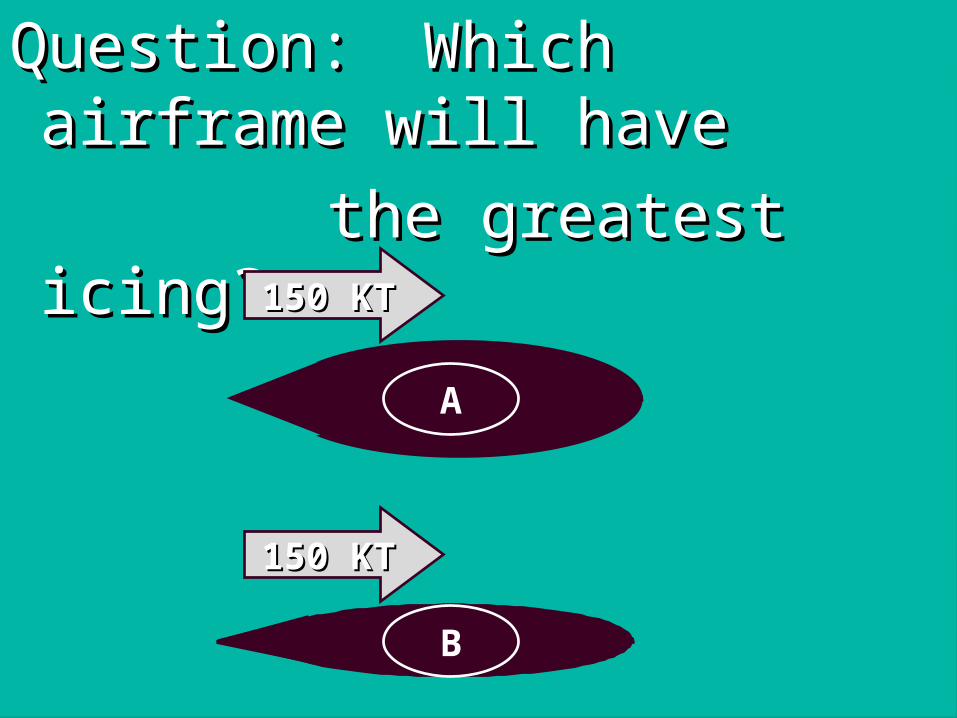
Question:Question: Which airframe will Which airframe will havehave
the greatest icing?the greatest icing?
A
150 KT150 KT
B
150 KT150 KT

A
150 KT150 KT
B
150 KT150 KT
Answer B Answer B

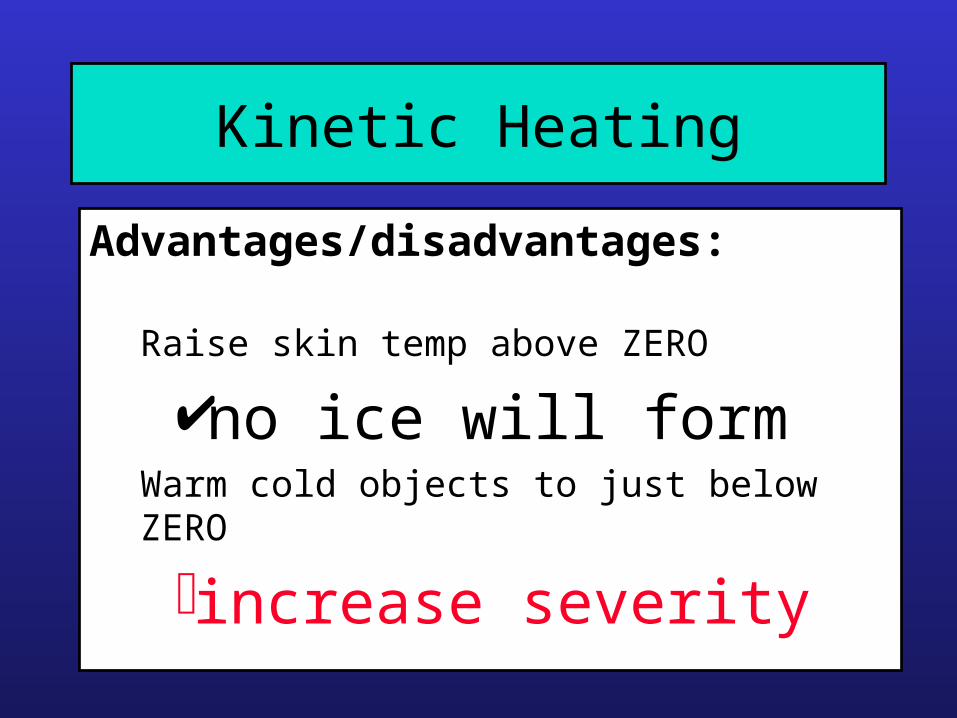
Kinetic Heating
Generated by:
Increased pressure at leading edges
Frictionbetween aircraft skin and atmosphere
Kinetic Heating
Advantages/disadvantages:
Raise skin temp above ZERO
no ice will formWarm cold objects to just below ZERO
increase severity
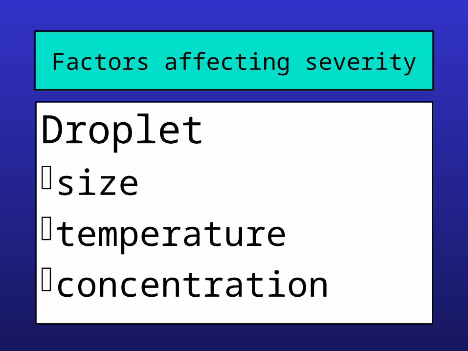
Factors affecting severity
Dropletsizetemperatureconcentration

Factors affecting severity
Aerofoilshapespeedtemperature

Effects on Aircraft
AerodynamicsAerodynamics - shape altered
All up weight All up weight - increases
EngineEngine - intakes may become blocked
UndercarriageUndercarriage - retraction problems
Control surfaces Control surfaces - may jam or become stiff
Pitot tubes Pitot tubes - blocked
CommunicationsCommunications - affected
VisionVision - impaired
VibrationVibration - due to uneven loading

Category Description
Trace Ice becomes perceptible. Rate of accumulation slightlygreater than rate of sublimation. It is not hazardous eventhough de icing/anti-icing equipment is not utilized, unlessencountered for an extended period of time (over 1 hour).
Light The rate of accumulation may create a problem if flight isprolonged in this environment (over 1 hour). Occasional useof de icing/anti-icing equipment removes/preventsaccumulation. It does not present a problem if the deicing/antiicing equipment is used.
Moderate The rate of accumulation is such that even short encountersbecome potentially hazardous and use of deicing/anti-icing ordiversion is necessary.
Severe The rate of accumulation is such that deicing/anti-icingequipment fails to reduce or control the hazard. Immediatediversion is necessary.

Airframe Icing
• Requires supercooled droplets• Airframe icing is most efficient when the cloud
droplets are between 0 0C and -15 0C• Below -20 0C only very small supercooled
droplets can exist• Large supercooled droplets are a greater
hazard as they spread out to a greater extent

Icing probability in stratiform cloud

Icing reports vs temperature

Icing in stratiform cloud
-3 C
0 C
4 C

AccretionDepends on:
• Aircraft characteristics
• Cloud type
• Length of time flying through the cloud, (especially significant for layered cloud)

Forecasting icing
• Types of cloud
• Temperature of cloud
• Horizontal extent of cloud
• Changes in airmass characteristics

Icing• Entrainment of dry air at the top of a cloud will
reduce the water content and therefore its icing ability
• Vertical motion within cloud will increase the liquid water content significantly
• Strong vertical motion in convective clouds produce the most severe icing
• Vertical motion due to fronts or orography can also give severe icing problems

Cloud Types and Icing
Cloud Type Probability of Icing
CB, CU, NS High
SC, AC, ACAS 50%
AS Low
ST Low

Cloud Types and Icing
Cloud Type Severity of Icing
CB, CU, NS May be severe
SC, AC, ACAS Rarely more thanmoderate
AS Moderate or light
ST Light

Further points
• Maritime clouds have fewer, larger droplets
• LWC in stratiform cloud can be up to 10X lower than in convective cloud
• Icing layer usually around 2-3000ft thick and is seldom >5000ft
• Autopilots can mask the effect of icing until it is too late!

Packed Snow
Leading Leading edgesedges
Air intakesAir intakes
Affects:Affects:

flying through wet snowflying through wet snow in or beneath cloudsin or beneath clouds
with temperature near with temperature near ZEROZERO
Packed Snow
Occurs when:Occurs when:

Hoar Frost
SoftSoftWhiteWhiteLightLight
CrystallineCrystalline

Hoar Frost
Forms in clear air when:Forms in clear air when:
Airframe temperature below Airframe temperature below ZEROZERO
Air is cooled below dew pointAir is cooled below dew point

Hoar Frost can occur
11.. Aircraft parked outside on Aircraft parked outside on clear winter nights.clear winter nights.
2.2. Rapid descent into warmer Rapid descent into warmer (clear), moist air, (cold soak).(clear), moist air, (cold soak).
3.3. Frosty morning with warmer, Frosty morning with warmer, moist air above.moist air above.

Rain Ice
ClearClearToughToughDenseDenseAdhesiveAdhesive

Result of freezing drizzle Result of freezing drizzle on approach to Ganderon approach to Gander

Rain Ice
Occurs whenOccurs when::
•Airframe temp. below ZEROAirframe temp. below ZERO
•Rain is falling from aboveRain is falling from above
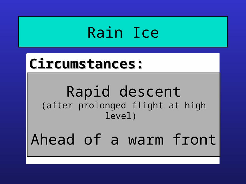
Rain Ice
Circumstances:Circumstances:
Rapid descentRapid descent(after prolonged flight at high level) (after prolonged flight at high level)
Ahead of a warm Ahead of a warm frontfront

Plan viewPlan view
Cross SectionCross Section
Warm AirWarm Air
Cold AirCold Air
0 C isotherm0 C isotherm
0 C 0 C isothermisotherm

0 C isotherm0 C isotherm
0 C 0 C isothermisotherm
TT
HTHT
Melting Melting ZoneZone
Super Super CooledCooledRainRain

Rain Ice
ClearClearToughToughDenseDenseAdhesiveAdhesive
AccumulatesAccumulatesquickly!quickly!

Moderate or Severe Icing may be expected in:Moderate or Severe Icing may be expected in:
Cumuliform clouds Cumuliform clouds
NimbostratusNimbostratus
Active cold frontsActive cold fronts
Stratocumulus formed from CuStratocumulus formed from Cu
Over hills and mountains Over hills and mountains
Ahead of some warm frontsAhead of some warm fronts

Summary• Be thoroughly aware of customer practices
• Examine cloud type / structure carefully
• Main concern- helicopters / light aircraft
• Good communication with flyers helps
