backyard tracks
DESCRIPTION
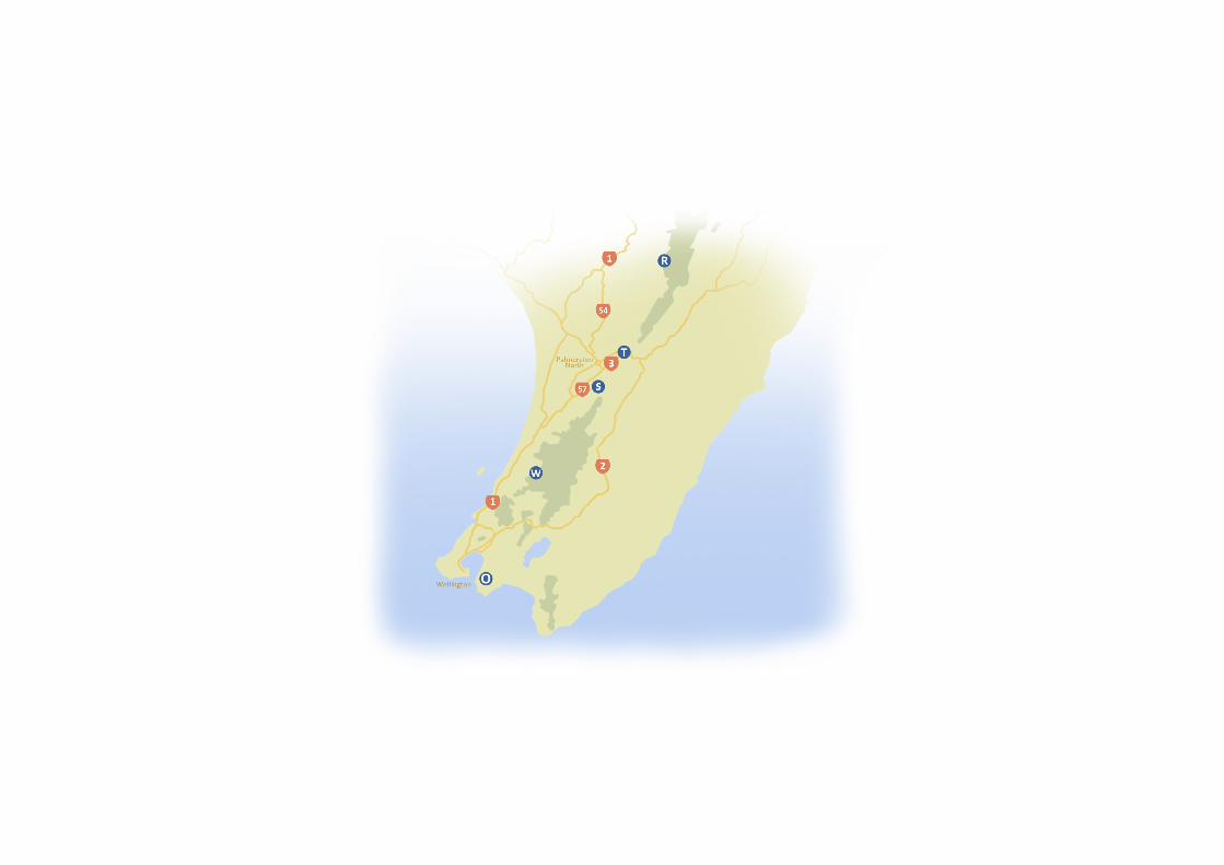
A small sample of Tracks in the lower North Island of New Zealand. Keep an eye out for this project growing over the next few months and yearsTRANSCRIPT

Backyard Tracks
Written and photographed byJanelle O’Connor


Forward
For many years, New Zealander’s have been venturing into the outdoors. Whether it’s for a bushwalk or a multi-day tramp; from hunting to a gentle stroll, escaping from your city life and take a breath of fresh air. This book contains a sample of tracks situated in the lower north island of New Zealand. Showing a variety of tracks from short bushwalks taking only a couple of hours to multi-day tramps, following rivers through the bush to alpine areas with extensive views. There is a little something for everyone to enjoy, while not having to travel too far from home.

Contents
Sledge Track
Tawa Loop Track
Waitewaiwai track
Orongorongo Track
Rangiwahia Track

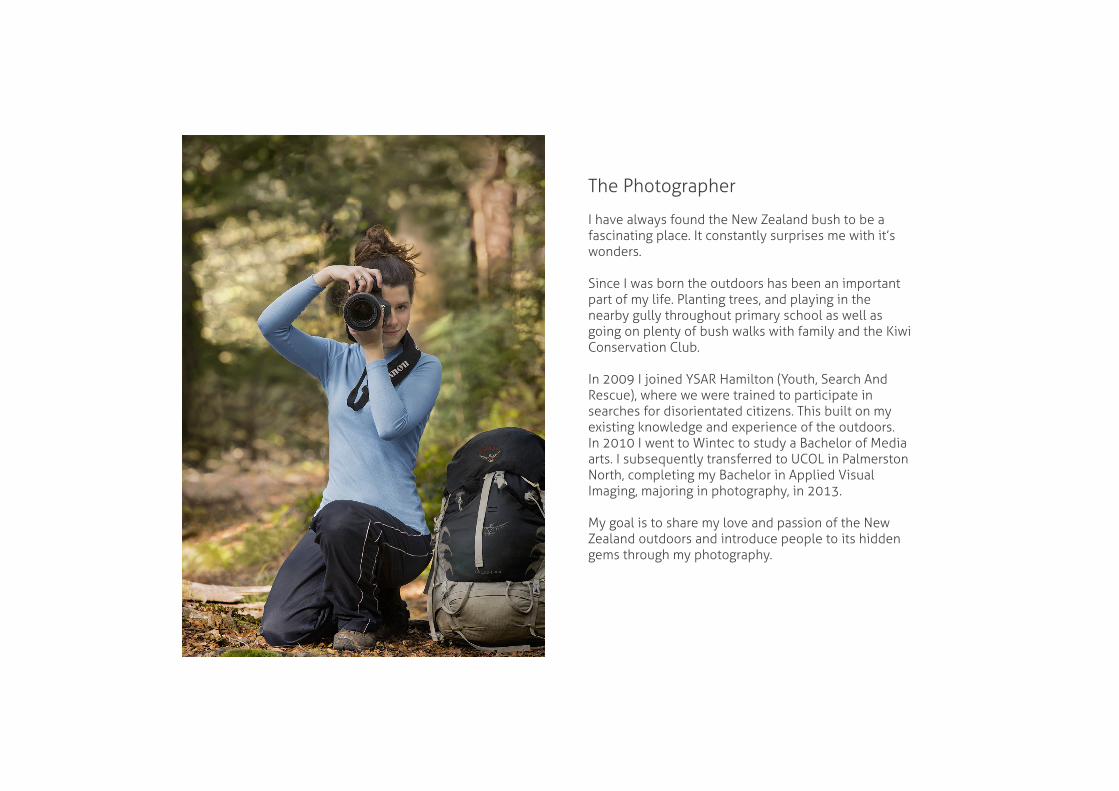
The Photographer
I have always found the New Zealand bush to be a fascinating place. It constantly surprises me with it’s wonders.
Since I was born the outdoors has been an important part of my life. Planting trees, and playing in the nearby gully throughout primary school as well as going on plenty of bush walks with family and the Kiwi Conservation Club.
In 2009 I joined YSAR Hamilton (Youth, Search And Rescue), where we were trained to participate in searches for disorientated citizens. This built on my existing knowledge and experience of the outdoors. In 2010 I went to Wintec to study a Bachelor of Media arts. I subsequently transferred to UCOL in Palmerston North, completing my Bachelor in Applied Visual Imaging, majoring in photography, in 2013.
My goal is to share my love and passion of the New Zealand outdoors and introduce people to its hidden gems through my photography.
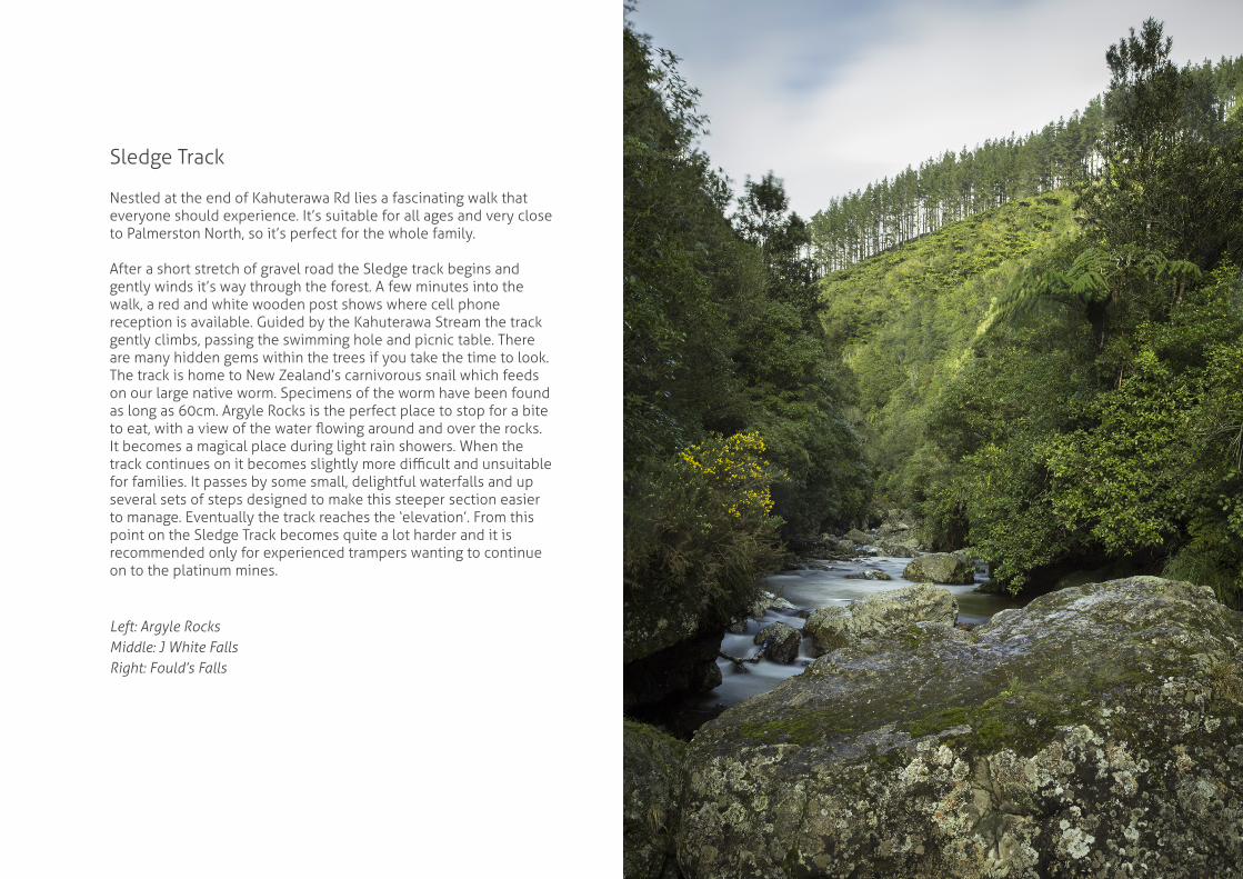
Sledge Track
Nestled at the end of Kahuterawa Rd lies a fascinating walk that everyone should experience. It’s suitable for all ages and very close to Palmerston North, so it’s perfect for the whole family.
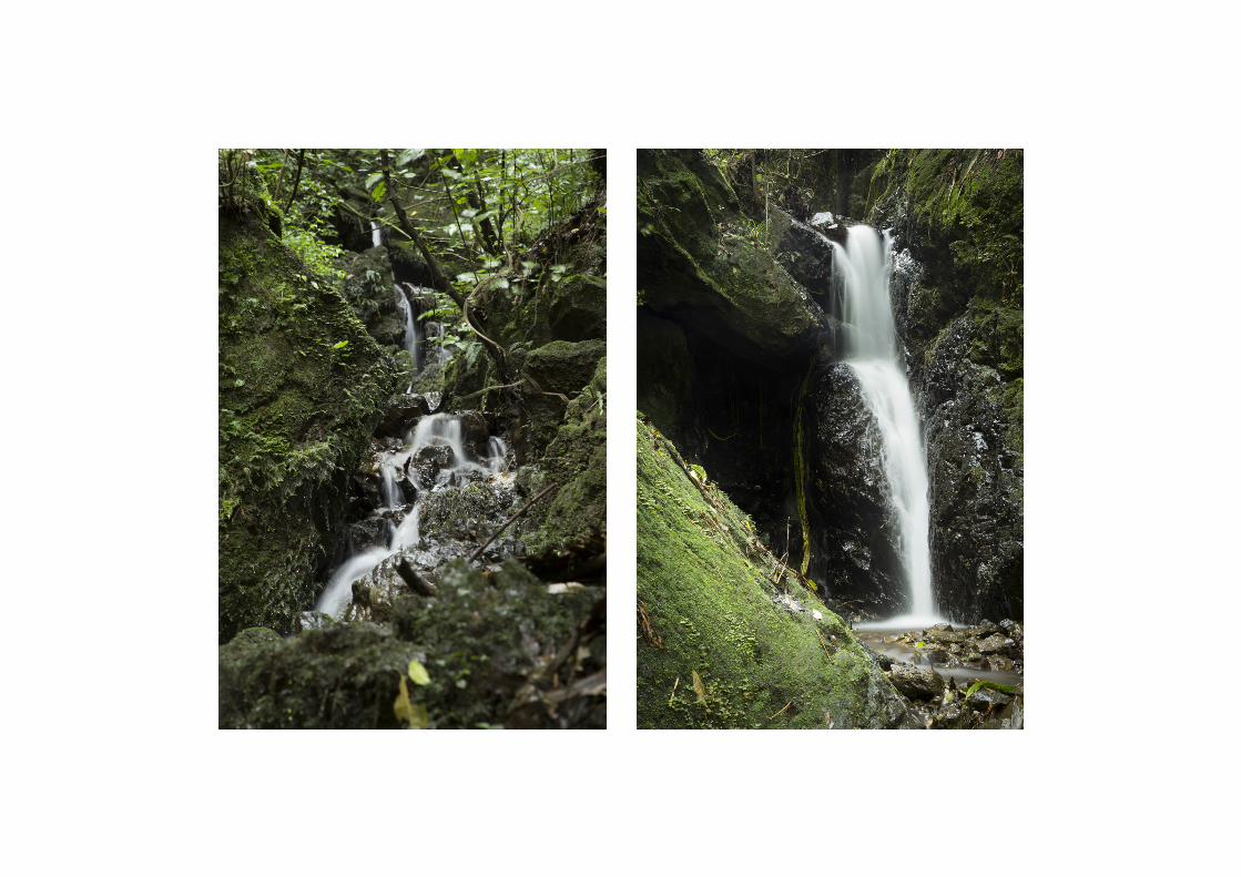
After a short stretch of gravel road the Sledge track begins and gently winds it’s way through the forest. A few minutes into the walk, a red and white wooden post shows where cell phone reception is available. Guided by the Kahuterawa Stream the track gently climbs, passing the swimming hole and picnic table. There are many hidden gems within the trees if you take the time to look. The track is home to New Zealand’s carnivorous snail which feeds on our large native worm. Specimens of the worm have been found as long as 60cm. Argyle Rocks is the perfect place to stop for a bite to eat, with a view of the water flowing around and over the rocks. It becomes a magical place during light rain showers. When the track continues on it becomes slightly more difficult and unsuitable for families. It passes by some small, delightful waterfalls and up several sets of steps designed to make this steeper section easier to manage. Eventually the track reaches the ‘elevation’. From this point on the Sledge Track becomes quite a lot harder and it is recommended only for experienced trampers wanting to continue on to the platinum mines.
Left: Argyle RocksMiddle: J White FallsRight: Fould’s Falls
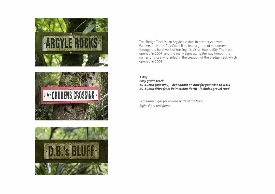
The Sledge Track is Ian Argyle’s vision. In partnership with Palmerston North City Council he lead a group of volunteers through the hard work of turning his vision into reality. The track opened in 2003, and the many signs along the way honour the names of those who aided in the creation of the Sledge track which opened in 2003.
1 dayEasy grade track30-40min (one way) - dependant on how far you wish to walk20-30min drive from Palmerston North - includes gravel road
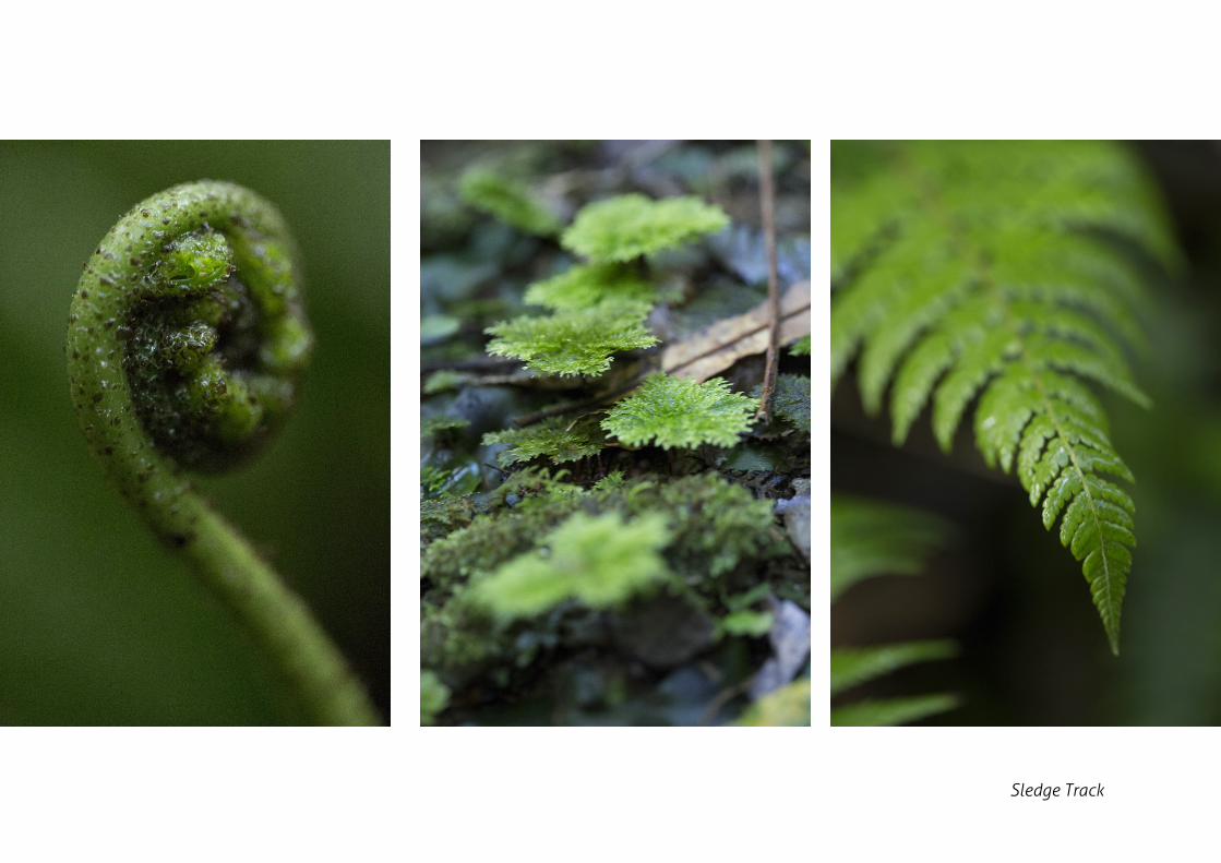
Left: Name signs for various parts of the trackRight: Flora and fauna
Sledge Track
Tawa Loop Track
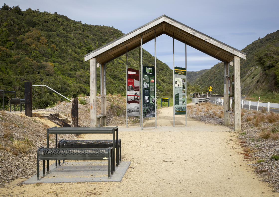
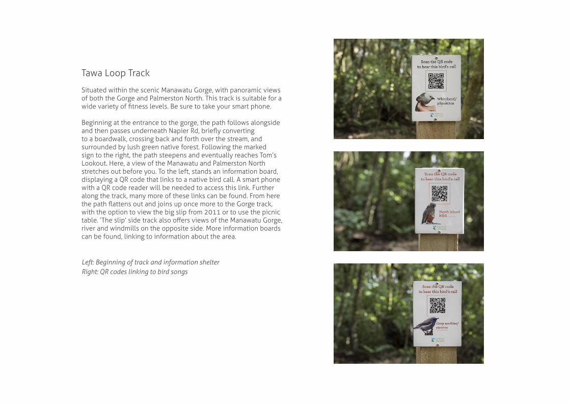
Situated within the scenic Manawatu Gorge, with panoramic views of both the Gorge and Palmerston North. This track is suitable for a wide variety of fitness levels. Be sure to take your smart phone.
Beginning at the entrance to the gorge, the path follows alongside and then passes underneath Napier Rd, briefly converting to a boardwalk, crossing back and forth over the stream, and surrounded by lush green native forest. Following the marked sign to the right, the path steepens and eventually reaches Tom’s Lookout. Here, a view of the Manawatu and Palmerston North stretches out before you. To the left, stands an information board, displaying a QR code that links to a native bird call. A smart phone with a QR code reader will be needed to access this link. Further along the track, many more of these links can be found. From here the path flattens out and joins up once more to the Gorge track, with the option to view the big slip from 2011 or to use the picnic table. ‘The slip’ side track also offers views of the Manawatu Gorge, river and windmills on the opposite side. More information boards can be found, linking to information about the area.
Left: Beginning of track and information shelterRight: QR codes linking to bird songs
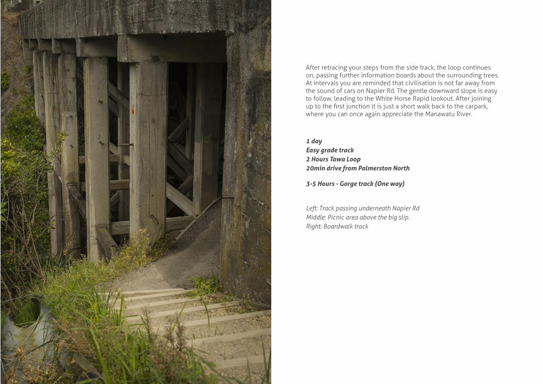
After retracing your steps from the side track, the loop continues on, passing further information boards about the surrounding trees. At intervals you are reminded that civilisation is not far away from the sound of cars on Napier Rd. The gentle downward slope is easy to follow, leading to the White Horse Rapid lookout. After joining up to the first junction it is just a short walk back to the carpark, where you can once again appreciate the Manawatu River.
1 dayEasy grade track2 Hours Tawa Loop20min drive from Palmerston North
3-5 Hours - Gorge track (One way)
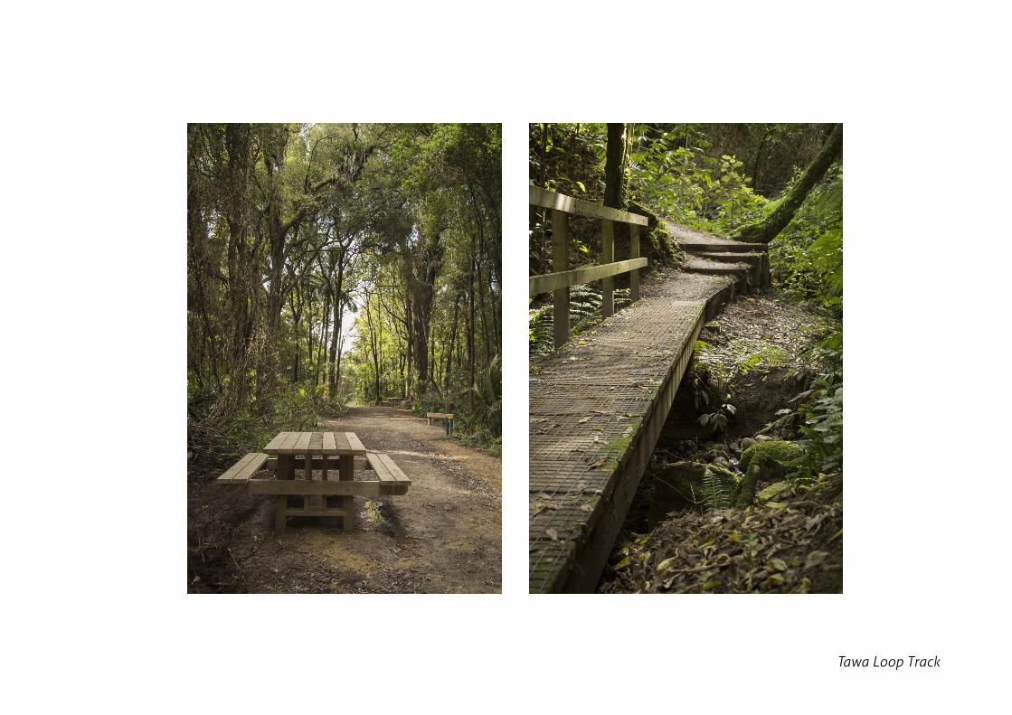
Left: Track passing underneath Napier RdMiddle: Picnic area above the big slip.Right: Boardwalk track
Tawa Loop Track
Waitewaiwai Track
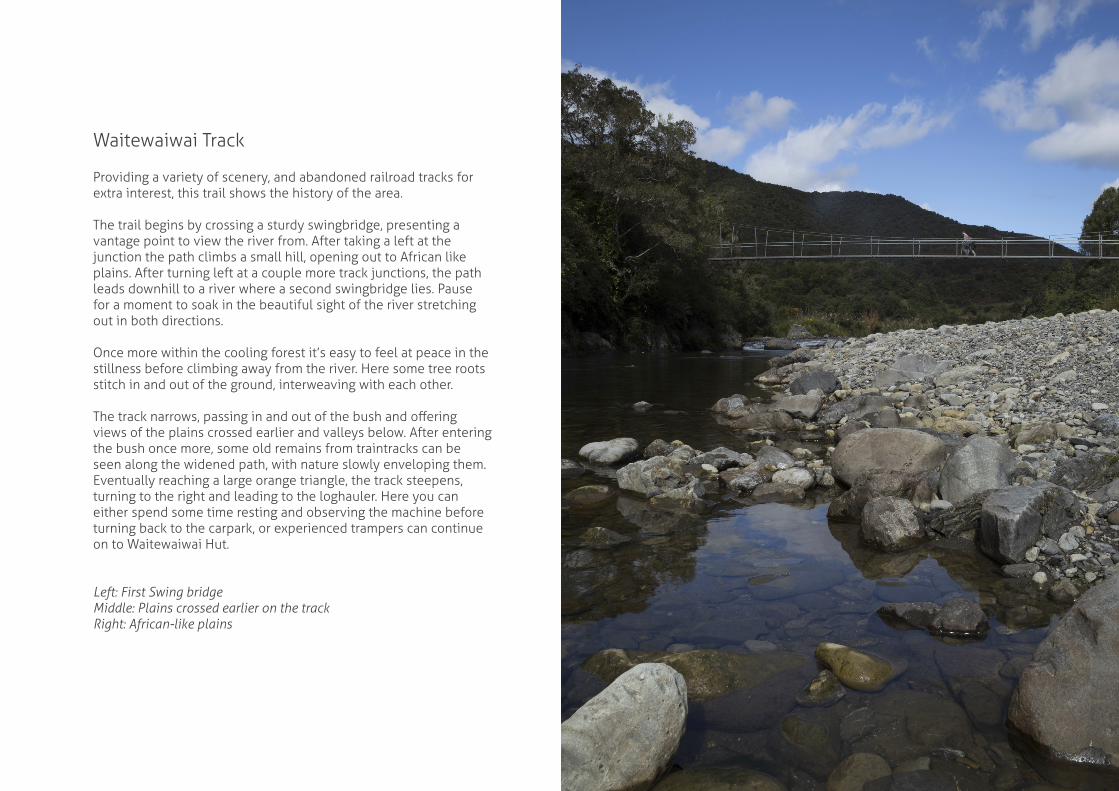
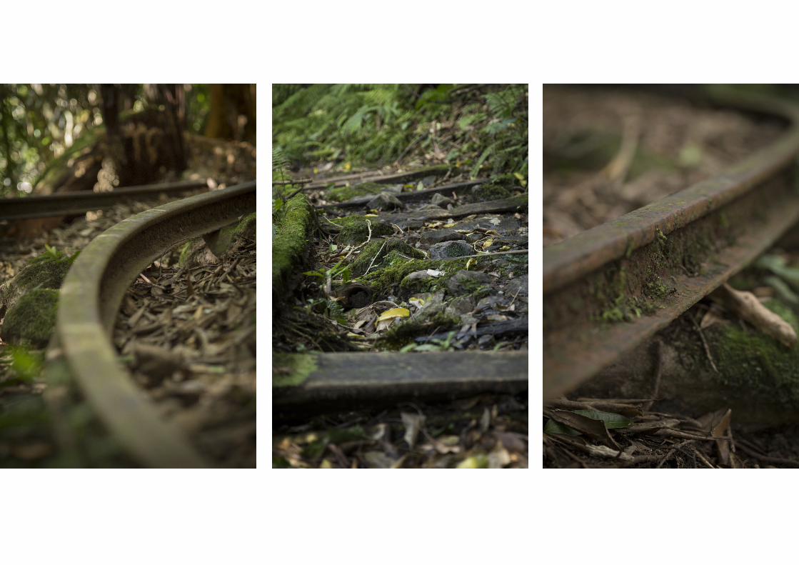
Providing a variety of scenery, and abandoned railroad tracks for extra interest, this trail shows the history of the area.
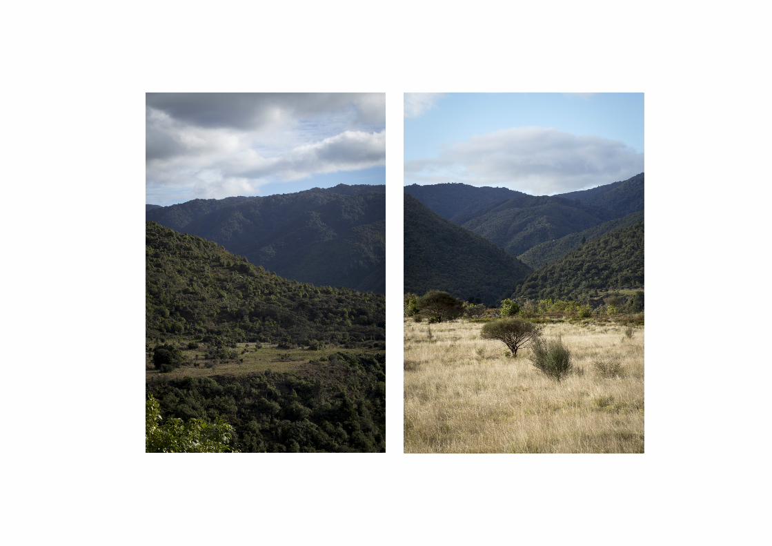
The trail begins by crossing a sturdy swingbridge, presenting a vantage point to view the river from. After taking a left at the junction the path climbs a small hill, opening out to African like plains. After turning left at a couple more track junctions, the path leads downhill to a river where a second swingbridge lies. Pause for a moment to soak in the beautiful sight of the river stretching out in both directions.
Once more within the cooling forest it’s easy to feel at peace in the stillness before climbing away from the river. Here some tree roots stitch in and out of the ground, interweaving with each other.
The track narrows, passing in and out of the bush and offering views of the plains crossed earlier and valleys below. After entering the bush once more, some old remains from traintracks can be seen along the widened path, with nature slowly enveloping them. Eventually reaching a large orange triangle, the track steepens, turning to the right and leading to the loghauler. Here you can either spend some time resting and observing the machine before turning back to the carpark, or experienced trampers can continue on to Waitewaiwai Hut.
Left: First Swing bridgeMiddle: Plains crossed earlier on the trackRight: African-like plains
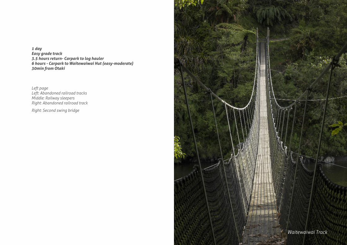
1 dayEasy grade track3.5 hours return- Carpark to log hauler6 hours - Carpark to Waitewaiwai Hut (easy-moderate)30min from Otaki
Left pageLeft: Abandoned railroad tracksMiddle: Railway sleepersRight: Abandoned railroad track
Right: Second swing bridge
Waitewaiwai Track
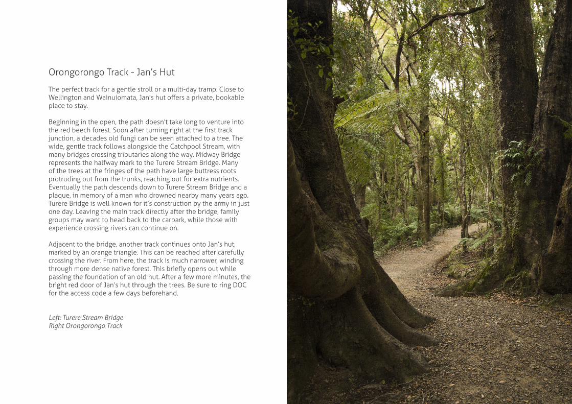
Orongorongo Track - Jan’s Hut
The perfect track for a gentle stroll or a multi-day tramp. Close to Wellington and Wainuiomata, Jan’s hut offers a private, bookable place to stay.
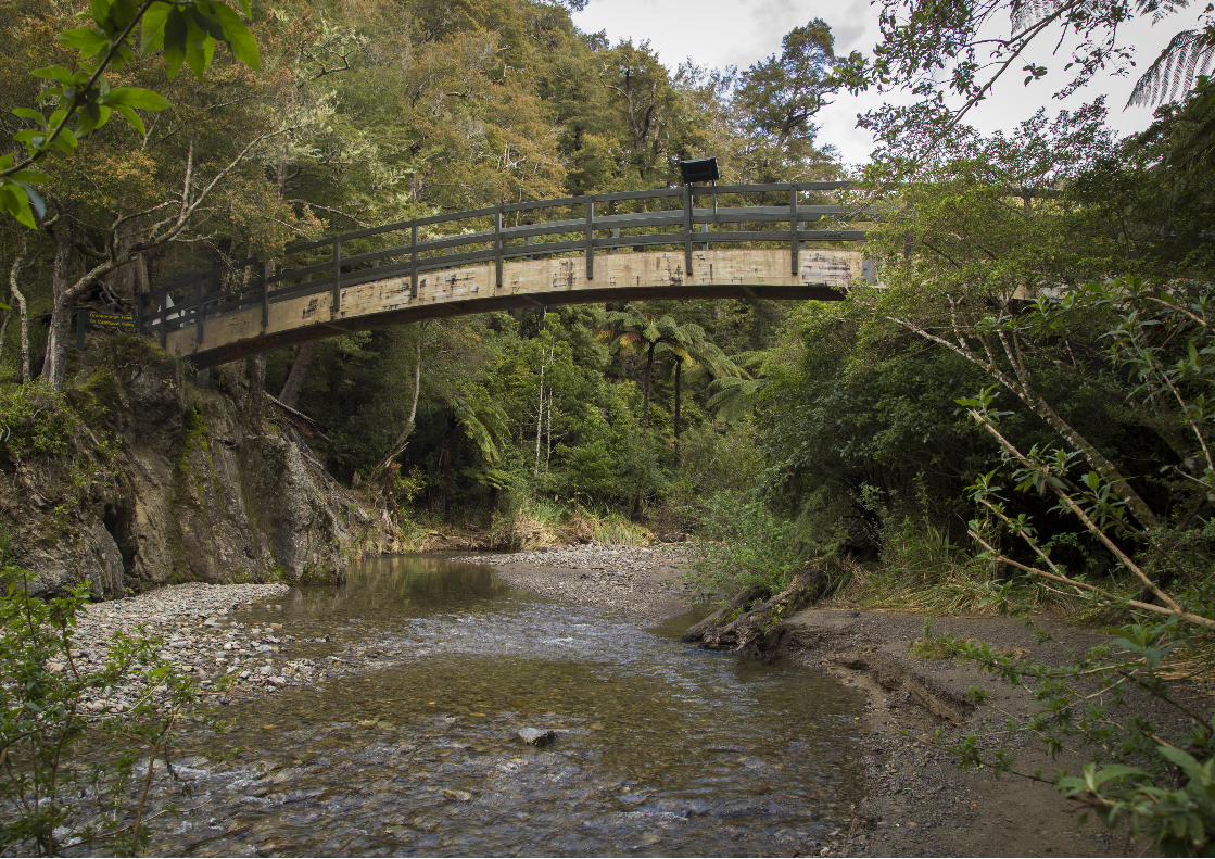
Beginning in the open, the path doesn’t take long to venture into the red beech forest. Soon after turning right at the first track junction, a decades old fungi can be seen attached to a tree. The wide, gentle track follows alongside the Catchpool Stream, with many bridges crossing tributaries along the way. Midway Bridge represents the halfway mark to the Turere Stream Bridge. Many of the trees at the fringes of the path have large buttress roots protruding out from the trunks, reaching out for extra nutrients. Eventually the path descends down to Turere Stream Bridge and a plaque, in memory of a man who drowned nearby many years ago. Turere Bridge is well known for it’s construction by the army in just one day. Leaving the main track directly after the bridge, family groups may want to head back to the carpark, while those with experience crossing rivers can continue on.
Adjacent to the bridge, another track continues onto Jan’s hut, marked by an orange triangle. This can be reached after carefully crossing the river. From here, the track is much narrower, winding through more dense native forest. This briefly opens out while passing the foundation of an old hut. After a few more minutes, the bright red door of Jan’s hut through the trees. Be sure to ring DOC for the access code a few days beforehand.
Left: Turere Stream BridgeRight Orongorongo Track
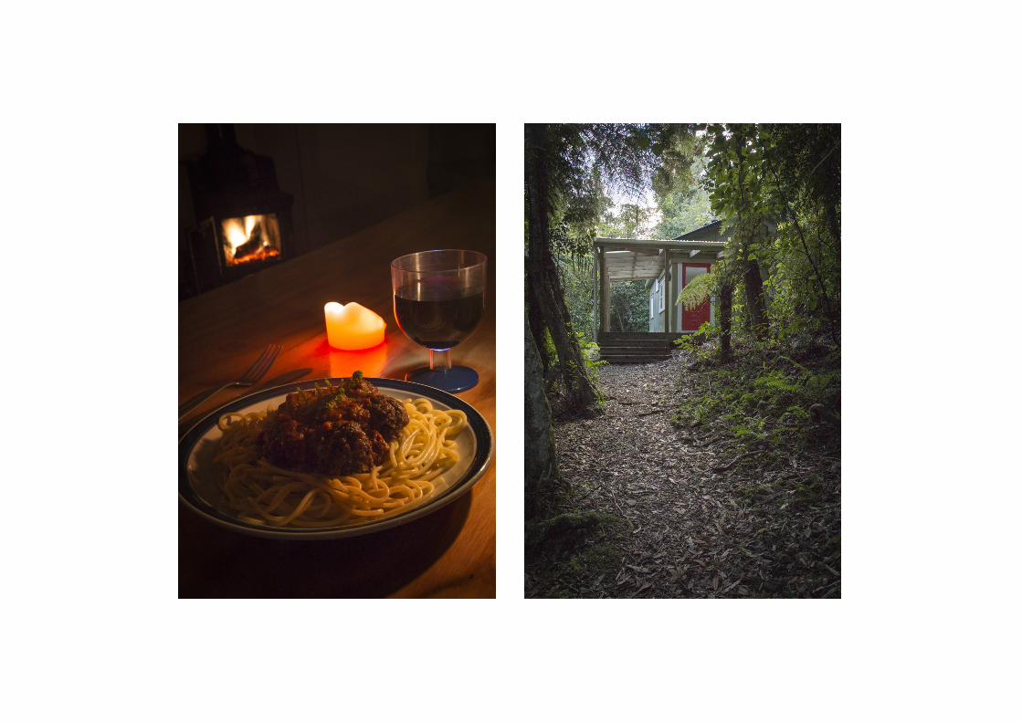

There are many places to rest beside the track where you can fully appreciate your surroundings, breathing in the fresh air. There are several information boards along the length of the path, explaining the surrounding trees and plants. Jan’s hut is only available for private bookings. For a backcountry hut, it contains everything you could need, with 9 bunks, a wetback shower and a flushing toilet. With everything from pots to wine glasses, it’s easy to make a delicious meal for everyone with a coal fire to keep your toes warm.
2 daysEasy/Medium Grade Track2 Hours - Carpark to Turere Stream bridge30min - Turere Stream bridge to Jan’s hut50min from Wellington
Left: Orongorongo TrackMiddle: Jan’s hutRight: Spaghetti and meatballs, created from cooking utensils from Jan’s hut
Orongorongo Track

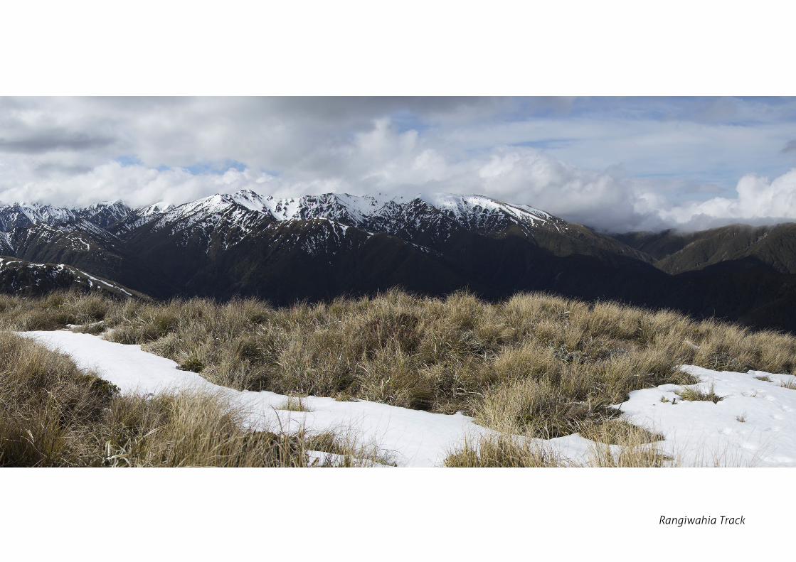
Rangiwahia Track
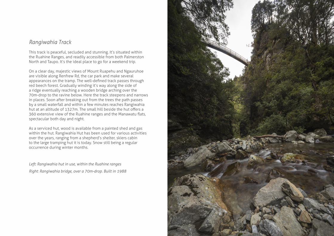
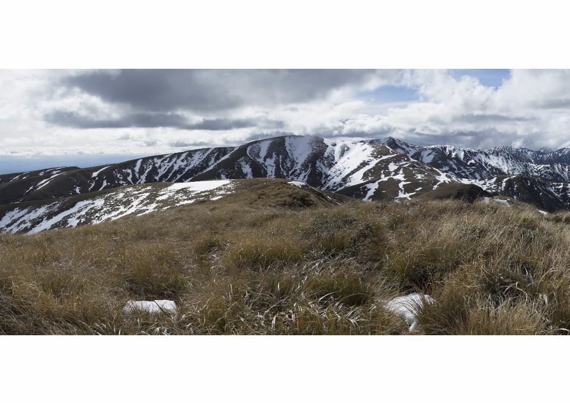
This track is peaceful, secluded and stunning. It’s situated within the Ruahine Ranges, and readily accessible from both Palmerston North and Taupo. It’s the ideal place to go for a weekend trip.
On a clear day, majestic views of Mount Ruapehu and Ngauruhoe are visible along Renfrew Rd, the car park and make several appearances on the tramp. The well-defined track passes through red beech forest. Gradually winding it’s way along the side of a ridge eventually reaching a wooden bridge arching over the 70m-drop to the ravine below. Here the track steepens and narrows in places. Soon after breaking out from the trees the path passes by a small waterfall and within a few minutes reaches Rangiwahia hut at an altitude of 1327m. The small hill beside the hut offers a 360 extensive view of the Ruahine ranges and the Manawatu flats, spectacular both day and night.
As a serviced hut, wood is available from a painted shed and gas within the hut. Rangiwahia Hut has been used for various activities over the years, ranging from a shepherd’s shelter, skiers cabin to the large tramping hut it is today. Snow still being a regular occurrence during winter months.
Left: Rangiwahia hut in use, within the Ruahine ranges
Right: Rangiwahia bridge, over a 70m-drop. Built in 1988
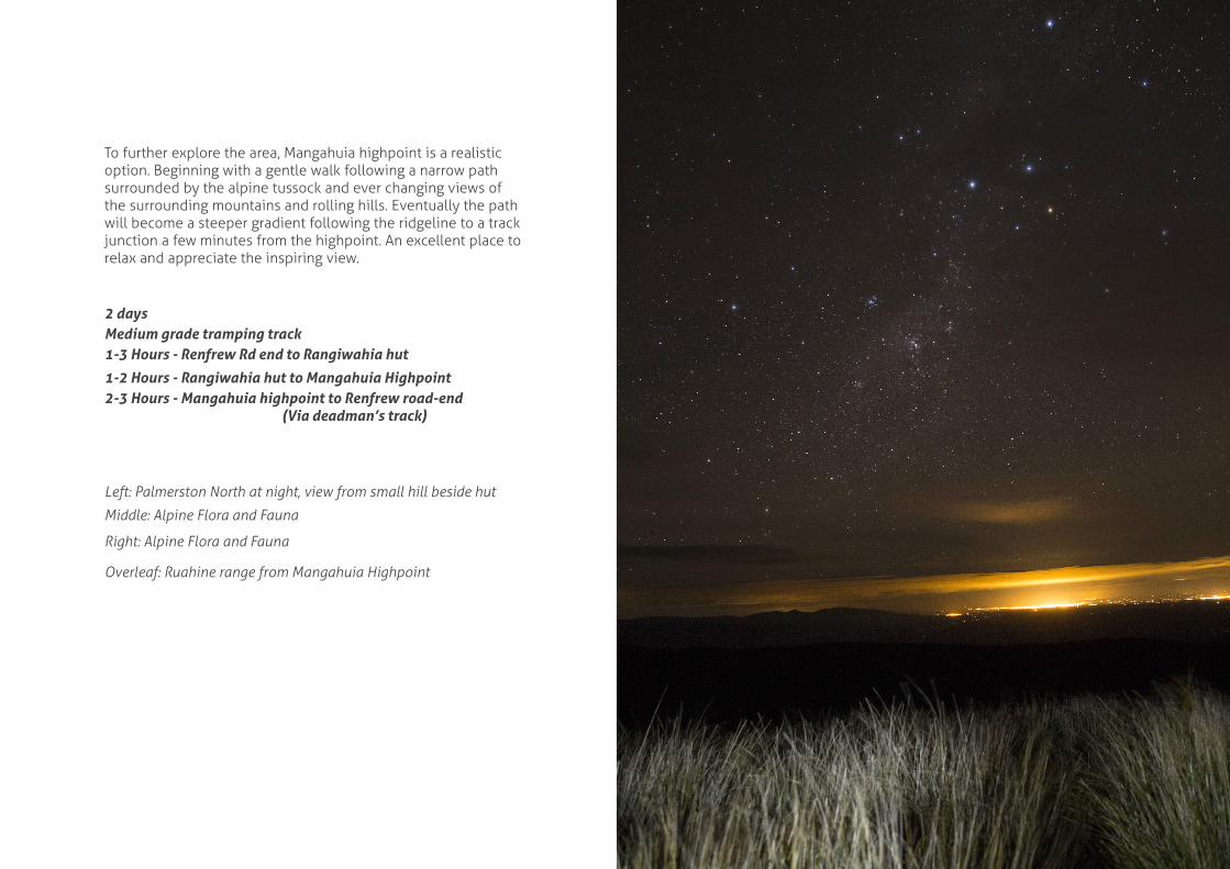
To further explore the area, Mangahuia highpoint is a realistic option. Beginning with a gentle walk following a narrow path surrounded by the alpine tussock and ever changing views of the surrounding mountains and rolling hills. Eventually the path will become a steeper gradient following the ridgeline to a track junction a few minutes from the highpoint. An excellent place to relax and appreciate the inspiring view.
2 daysMedium grade tramping track1-3 Hours - Renfrew Rd end to Rangiwahia hut
1-2 Hours - Rangiwahia hut to Mangahuia Highpoint2-3 Hours - Mangahuia highpoint to Renfrew road-end (Via deadman’s track)
Left: Palmerston North at night, view from small hill beside hut
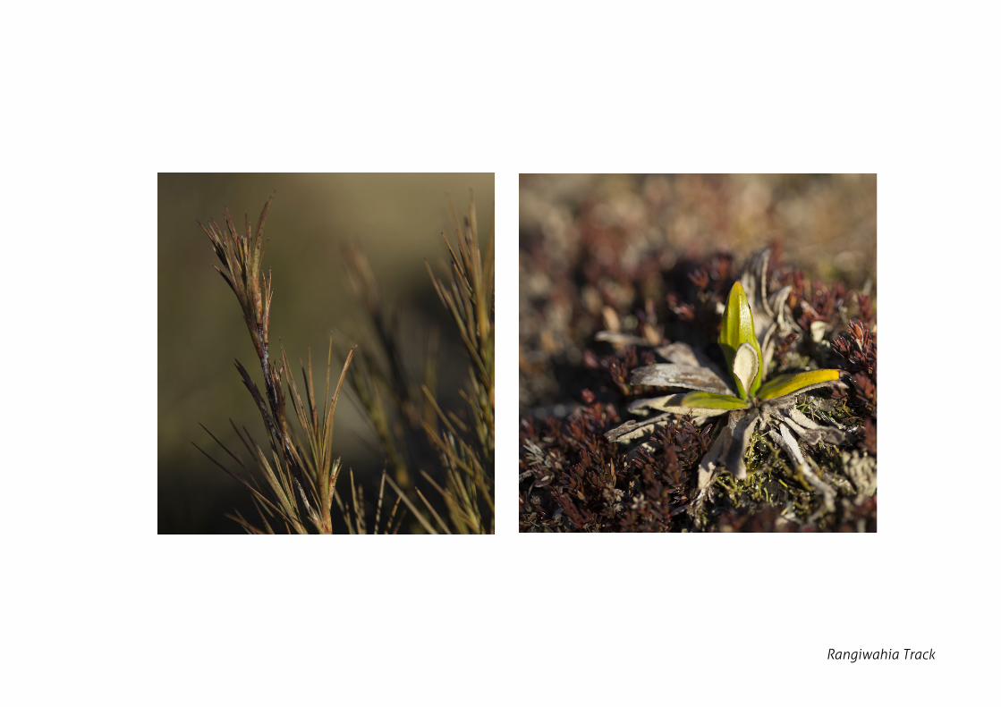
Middle: Alpine Flora and Fauna
Right: Alpine Flora and Fauna
Overleaf: Ruahine range from Mangahuia Highpoint
Rangiwahia Track
Rangiwahia Track