baseline marine benthic surveys in the maltese islands ... · proceedings of the third...
TRANSCRIPT

Proceedings of the Third international Conference on the Mediterranean Coastal Environment, MEDCOAST97, November Jl~J4, 1997; Qawra, MaltQ, EGzhan (Editor)
Baseline Marine Benthic Surveys in the Maltese
Islands (Central Mediterranean)
Je A. Borg\ S. A. MicaIler,
K. Pirotta3, P.J. Schemhri4
IDepartment of Biology, Faculty of Science, University of Malta, Msida,
Malta. Tel: 356342488, Fax: 356312110, E-mllil:[email protected].
2Malta University Services Ltd., University Campus, Msida, Malta.
Te!: 356343572, Fax: 356340979.
3Department of Biology, Faculty ojScience, University of Malta, M'tida,
Malta. Tel: 356342488, Fax:-356 312110, E-mail: kpi/@cis.unt.edu.mt.
4Department of Biology, Faculty of Science, University of Malta,
. Msida,Malta. TeI: 35632902789, Fax: 356312110,
E-mail: [email protected].
Abstract
During the period 1991 to 1997, extensive baseline studies of the submarine geomorphology, infralittoral habitats, macrobenthic assemblages, and demersal fish fauna, were carried out in 14 different sites around the Maltese Islands, using conventional SCUBA diving techniques. These were made as part of assessments of the environmental impact of existing or proposed projects , or in order to produce an inven-
")
tory of coastal resources. In total, these surveys covered a sea-bed area of ca. 7.55k.m-and a coastline length of ca 24 km, and represent the most extensive biological surveys of the marine environment carried out to date in the Maltese Islands. The results of these surveys have been presented as maps showing the type, location, and spatial extent of these physical and biological features. The Peres & Picard (1964) scheme, as adapted by Pen~s (1967; 1982) was used to classify and characterize the benthic assemblages recorded during the surveys.

2 MEDCOAST'97
Our results show that, in tenus of spatial extent, the most important macrobenthic assemblages are the communities of photophilic 'algae on hard substrata, meadows of the sea-grass Posidonia oceanica and communities of bare well-sorted sand. For all these, many subtypes and facies exist, depending on the light intensity, hydrodynamic conditions, microtopography, sediment granulometry and other edaphic factors, and anthropic influences, including pollution.
Other assemblages with a limited spatial distribution include meadows of the sea-grass (vmodocea nodosa and of the Lessepsian immigrant Halophila stipu/acea on sandy bottoms, the assemblages of boulder fields which are complexes of photophilic and sciaphilic communities, and those of marine caves. Our maps are supplemented by descriptions of the different habitats and macrobenthjc assemblages, species lists, and semi-quantitative data on percentage cover for the dominant macroalgae, shoot density counts for sea-grass meadows, and popUlation density counts for the main macrofaunal species.
These maps and data-sets are intended to be used (i) for assessing the status of habitats, species assemblages, and individual species, around the Maltese Islands in order to recommend appropriate m.easures for their conservation, including inclusion in red data lists; (ii) for designation of marine protected areas; and (iii) as baselines against which future monitoring studies and surveys can be compared.
Introduction
Up to 1991, basic ecological data on the type and distribution of marine benthic assemblages of the Maltese Islands were lacking and what little infonnation was available was mainly the result of a small number of autecological studies carried out by the Department of Biology of the University of Malta. Small-scale maps of the Maltese Islands showing the distribution of some of the main types of infralittoral habitats and benthic assemblages were published in the Malta Structure Plan (1990) and by Anderson et ai, (1992). However, these maps were drawn using infonnation obtained from interviews with local SCUBA divers, rather than being constructed using directly obtained field data, and therefore serve as a general indication of the type and distribution of benthic habitats and biota present in the Maltese infralittoral. With the exception of Role (1991), no large scal e maps of individual areas existed.
Until recently, most coastal development projects in the Maltese Islands have been undertaken without a prior assessment of the marine benthic resources present in the proposed deve \opment site, or of the potential impact of the project on these resources. As a result, it has not been possible to ,assess the effect of any development project on the marine environment. Malta's resulting haphazard coastal development, ,and the Jack of coastal management and planning, have been pointed out by Anderson et aJ. (1992) . With the publication of the Malta Structure Plan (1990), it became increasingly evident that there was an urgent need for accurate marine bcnthic ecological data for environmental impact assessments in connection with coastal development activities, and for assessing the suitability of a number of specific coastal sites as marine protected areas.
MEDCOAST 3
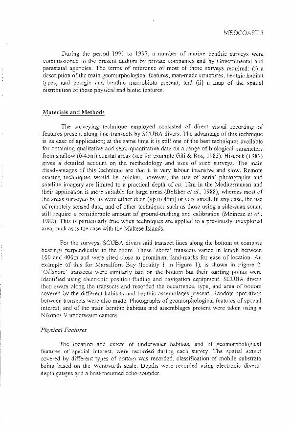
During the period 1991 to 1997, a number of marine benthic surveys were commissioned to the present authors by private companies and by Governmental and parastatal agencies. The tenns of reference of most of these surveys required: 0) a description of the main geomorphological features, man-made structures, benthic habitat types, al1d pelagic and benthic macrobiota present; and (ii) a map of the spatial distribution of these physical and biotic features ..
Materials and .Methods
The surveying technique employed consisted of direct visual recording of features present along line-transects by SCUBA divers. The advantage of this technique is its ease of application; at the same time it is still one of the best techniques available for obtaining qualitative and semi-quantitative data on a range of biological parameters from shallow (0-4Sm) coastal areas (see for example Gili & Ros, 1985). Hiscock (1987) gives a detailed account on the methodology and uses of such surveys. The main disadvantages of this technique are that it is very labour intensive and slow. Remote sensing techniques would be quicker, however, the use of aerial photography and satellite imagery are limited to a practical depth of ca. 12m in the Mediterranean and their application is more suitable for large areas (Belsher et al., 1988), whereas most of the areas surveyed by us were either deep (up to 45m) or very small. In any case, the use of remotely sensed data, and of other techniques such as those using a side-scan sonar, still require a considerable amount of ground-trutbing and calibration (Meinesz et al., 1988). This is particularly true when techniques are applied to a previously unexplored area, such as is the case with tbe Maltese Islands.
For the surveys) SCUBA divers laid transect lines along the bottom at compass bearings perpendicular to the shore. These 'shore' transects varied in length between 100 and 400m and were sited close to prominent land-marks for ease of location. An example of this for Marsalforn Bay (locality I in Figure 1), is shown in Figure 2. 'Offshore' transects were similarly laid on the bottom but their starting points were identified using electronic position-finding and navigation equipment. SCUBA divers then swam along the transects and recorded the occurrence, type, and area of bottom covered by the different habitats and benthic assemblages present. Random spot~dives between transects were also made. Photographs of geomorphological features of special interest, and of the main benthic habitats and assemblages present were taken using a Nikonos V underwater camera.
Physical Features
The location and extent of underwater habitats, and of geomorphological features of special interest, were recorded during each survey. The spatial extent covered by different types of bottom was recorded, classification of mobile substrata being based on the Wentworth scale. Depths were recorded using electronic divers' depth gauges and a boat-mounted echo-sounder.

4 MEDCOAST 97
Biological Features
Characterization of the benthic communities was based on indicator species and the nomenclature used follows the scheme of Pe res & Picard as revised by Peres (1967; 1982). Although the benthic assemblages and most of the species were identified in situ, samples were also collected for later identification in the laboratory. Semi-quantitative data on species abundance, in the form of percentage cover of bottom for macroalgae and of density per square meter for macrofauna, were also recorded for the most abundant and characteristic species. In the case of Posidonia oceanica meadows, shoot density, mean leaf length and mean no of leaves per shoot, were recorded from random quadrats. A record was also kept of all demersaI and pelagic fauna encountered during the surveys.
The surveys made (table 1) covered a total area of 7.55 krn2 and a coastline length of ca.' 24 km. Figure 1 gives the location of the sites surveyed. The results of these surveys have been presented in the fonn of detailed reports accompanied by maps and charts .describing the type, location, and spatial extent of the various physical and biological features assessed during the surveys. Only few of these reports have been published, however (e.g. Borg & Schembri, ] 993; Borg & Schembri, 1995b; 1995c). As an example of the output of these surveys, a bathymetric map, a physical map, and a benthic assemblages map for Marsalfom Bay, . Gozo, surveyed in 1995 (Borg & Schembri, 1995a) are presented in Figures 3-5).
Localirv Al1DrOximate area Position on locali!Y surveyed (km2
) maQ (Fi£!Ure 1 J
Pretty Bay 0.36 13 Hondoq ir-Rummien 0.04 2 Mellieha Bay 0.15 7 Il-Kalanka tal-Gidien 0.07 12 Xrobb I-Ghagin 0.02 11 \Vied Ternu 0.04 5 Mistra Bay 0.29 8 Marsalfom Bay 0.12 Mellieha Bay 0.03 7 St Paul 's Islands 0.98 9 St lulian ' s Bay .. St George's Bay & Pembroke areas 4.72 10 Cirkewwa 0.18 6 MgaJr ix-Xini 0.07 3 QawraIDwejra 0.48 4
Ta bIe 1. List of localities surveyed and the area of bottom covered at each site.

MEDCOAST 5
The more important marine geomorphological features recorded included dropoffs, boulder fields, caves, tunnels, arches and associated fonnatlons. The infralittoral zones at QawralDwejra in Gozo and at Cirke\\'Wa in Malta were particularly rich in these features.
Six main benthic assemblages were recorded from the areas surveyed:
(i) The community ofphotophiljc algae on hard substrata (PA) Cii) The community of semi-obscure caves (SOC) (iii) The community of Posidonia oceanica meadows (POM) (iv) The community of well sorted sand (WSS) Cv) The community of superficially muddy sands in sheltered areas (SMSSA) (vi) The community of highly polluted sediments (HPS)
Three others: a community of accumulations of small boulders and cobbles (ASBC), a community of accumulations of small cobbles and pebbles (ASCP), and a community of accumulations of pebbles and gravel (APG), were also recorded, however, each 'of these was only encountered once and the bottom on which they occurred is suspected to have been modified through anthropogenic activities.
In terms of cover, the most important assemblages, in shallow inshore waters (O-30m), were the community of photophilic algae on hard substrata and the community of PosidOl1ia ocea17ica meadows. In deeper offshore waters (30-4Sm), the most extensive assemblage was the community of well sorted sand. Overall, the spatial distribution and occurrence of the main assemblage types appeared to be primarily determined by substratum type (see also Borg & Schembri, 1995b; 1995c).
A long most of the open north-eastern coast of the Maltese Islands, the gently sloping shore continued underwater as an equally gently sloping rocky bottom, mainly supporting the community of photophilic algae. This assemblage also covered the surface of large bou lders, wherever these occurred on the bedrock. In some places, panicularly along the Pembroke coast, large areas of the bedrock were covered by P. oceanica meadows. _ Further offshore, a change in bottom type from rock to sand occurred. The bottom here supported a complex of different assemblages as a result of substratum heterogeneity. These areas, which were characterized by patches of bare
. sand intennixed with cobbles/pebbles/shingle, small boulders and small patches of bedrock covered with a thin layer of sand, supported a patchwork of assemblages of photophilic algae on hard substrata, those of well sorted sand, and small stands of P. oceanicQ. Further away from the shore this he1erogeneous bottom was replaced by extensive P. oceanica meadows and by the assemblage of well sorted sand, the former extending to depths of ca. 40m and the latter to depths of 45m and deeper. This same dislribution pattern also occurred inside bays. and inlets; with the difference that at the head of the bay or inlet, large stretches of sand or other mobile sediments, with an impoverished epibiota, usually extended from the mediolittoral to the infralittoral (see, for example, Marsalfom. Bay; Figures 4 & 5).
In contrast, most of south-western coast of the Maltese islands is characterized by cliffs and boulder screes. Only two sites (the Qawra/Dwejra area and Mgarr ix-Xini ,

6 MEDCOAST'97
both on Gozo) which are quite representative oftrus coastal area, were surveyed (Figure 1). In these two sites, the infralittoral bottom consisted of bedrock fonning vertical dropoffs with boulder fields occurring at their base; both bottom types supported extensive communities of photophilic algae on hard substrata. Since relatively great depths (25-80rn) were frequently reached wi.thin small horizontal distances C5-200m) from the shoreline, these communities of photophilic algae consisted mainly of sciaphilic facies. Communities of semi-obscure caves were sometimes recorded from caves and cave-like biotopes present in these areas . Seagrass meadows were rarely encountered in these sites .
A number of facies were also recorded, the principal ones being:
(i) Facies of the seagrass Cymodocea nodosa, which were mainly recorded from the sandy bottom at the head of bays and inlets.
(ii) Facies of the seagrass Halophila slipulacea, which were mainly re.corded from inside St. Julian's Bay from the community of highly polluted sedifnents, and from Cirke"WWa.
(iji) facies of free-living calcareous algae, dominated by Lithothamnion coralloides and Phymatolithon calcareum, which were mainly recorded from offshore sandy bottoms in deeper (35-45m) waters.
The most diverse macrobenthic assemblages and demersal and pelagic fauna were recorded off St. Julian's Bay, off St George's Bay, off Pembroke, from the QawraIDwejra area, from Mgarr ix-Xini and from Cirkewwa.
Anthropogenic Impact
The majority of the localities surveyed appeared to be under considerable pressure from anthropogenjc activities including: fishing; bathing, boating and other coastal recreational activities; from coastal touristic resorts, and from fish-farming. In the QawralDwejra area, frequent visits in caves by SCUBA divers have resulted in mass destruction of fragile bryozoan colonies growing on the roof of the caves . P. oceanica meadows lying directly below offshore fishfarrn cages bave been completely decimated, while seagrass beds situated in the vicinity of the cages have undergone gross alterations in meadow morphology.
Discussion
The marine benthic surveys carried out by the present authors represent the largest biological surveys of the marine environment carried out to date in the Maltese Islands. Tbese surveys have shown that very large areas of the infralittoral are occupied by m'o very important community types: the community of photophilic algae on hard substraia and the community of P. oceanica meadows. The maps drawn using data acquired from these surveys are the first of their type for the Maltese Islands . The detailed reports which accompany these maps also include species lists for the most abundaqt mega and macrobenchos, demersal fish fauna and pelagic macrofauna, and semi-quantitative phenological data for P. oceanica, percentage cover of boL1om by macroalgae and density of macrofauna. These maps and data-sets can be used for Ci)

MEDCOAST7
assessing the status of habitats, species assemblages, and individual species, around the Maltese Islands in order to recommend appropriate measures for their conservation and possible inclusion in red data lists; (ii) the designation of marine protected areas; and (iii) as baselines against which future monitoring studies and surveys can be compared.
Of the sites surveyed to date, the most important from the point of view of the presence of (j) interesting geomorphological features; (ii) diversity of habitats and the species they support; (iii) assemblages of high ecological importance; (iv) rich demersal and peJagic fauna; and (v) species of international conservation· value, are the
. QawralDwejra area, Mgarr ix-Xinj and Cirkewwa. These areas have already been listed as sites having potential as marine conservation areas (Malta Structure Plan, 1991) and our surveys have confirmed their immense ecological value.
Acknowledgements
This work would not have been possible without the funding and logistic assistance received from the following agencies: The Malta Planning Authority; The Council for Science and Technology; Malta University Services Ltd, The EuroMediterranean Centre for Insular Coastal Dynamics; The University of Malta; The Malta Maritime Authority; Pisciculture Marine de Malte Ltd.; Malta Mariculture Ltd; and Malta Fishfarming Ltd. We are very grateful to Mr Edwin Lanfranco (Dept. of Biology, University of Malta) for identification of algae. Our thanks also go to all the divers who have assisted us in the surveys.
References
Anderson, E ., Role, A . & Schembri, P. J., (1992) . Coastal zone surveys of the Maltese Islands: onshore and offshore. In: 1. L. Suarez de Vivero (ed) The oeean change: management patterns and the environment. University of Seville, Spain, pp 139-152.
Belsher, T., Meinesz, A., Lefevre , J. R. & Boudouresque, C. F., (1988). Simulation of SPOT satellite imagery for charting shallow-water benthic communities in the Mediterranean. P.S.Z.N.L lvfarine Ecology 9 (2): 157-165.
Borg, 1. A. & Schembri, P. l, (1993a). Changes in marine benthic community types in a Maltese Bay foJ1owing beach rehabilitation works. Conference Proceedings, Clean Seas Conference '93, Valletta, Malta: 4pp.
Borg J. A. & Schembri, P. J., (1995a). Report on a survey of the marine benthic assemblages in .A1arsalforn Bay (Gozoj made prior to beach rehabilitation works in the area. Unpublished repOIi, Malta Coastal Environment Research Project, 29pp.
Borg, J. A. & Schembri , P. 1, (l995b). The state of Posidonia oeeanfea CL.) Delile meadows in the Maltese Islands (Central Mediterranean). Rapp. Comm. 1nl. Aier 1l1edit. 34: 123.

8 MEDCOAST'97
Borg, 1. A ., & Schembri, P . J., (1995c). Epibenthic macrofaunal assemblages and bottom heterogeneity in the shallow infralittoral of the Maltese Islands. Rapp. Comm. 1nl Mer 1I1edit. 34: 20.
Gili, J. M., & Ros, J. , (1985). Study and cartography ofthe benthic assemblages of the Medes Islands (NE Spain). P.SZN.J. _Marine Ecology 6 (3): 219-238. Hiscock, K., (1987). Subtidal rock and shaJIow sediments' using diving. In Baker J. M. & WolffW. 1. (eds) 'Biological surveys of estuaries and coasts'. Cambridge; Cambridge University Press. xx + 449pp.
lVlalta Structure Plan, (1990). Report of survey: Vol 1. Colin Buchanan & Partners and GeneraJe Progetti S.p.a., in association with the Planning Services Division, Government of Malta.
1v1alta Structure Plan, (1991). Final written statement and key diagram. Malta; Malta Planning Authority. xiii + 125pp.
Meinesz, A ., Boudouresque, C. F., & Lefevre, 1. R., (1988). A map of the Posidonia oceanica beds of Marina d 'Elbu (Corsica, Mediterranean). P.S.ZN.J. Jvfarine Ecology 9 (3): 243-252.
Peres, J. M. , & Picard, J., (1964). Nouveau manuel de binomie benthiques de la mer Mediterranee. Rec. Trav. Sia .. Aiar. Endoume 31 (47),5-137.
Pen~s, 1. M., (1967). The Mediterranean benthos. Oceanogr .. Mar. BioI. Ann. Rev. 5: 449-533 .
Pert~s , J. IvI., (1982). Zonations and organismic assemblages. In: O. Kinne (ed,) Aiarine ecology, Vo] 5 (1): Ocean JvJanagemenl, pp 9-642, New York: J. WHey & Sons .
. Rolc, A., (1991). Report of survey: marine parks and reserves potential. [Malta Structure Plan Technical Report 5.2]. Colin Buchanan & Partners, Generale Progetti S.p.a., Planning Services Division Government of Malta.

~:-< ~ ;:t>o.. . §-. to '""' 0 ~~ ~ ~ ;::l . ~e:<~ e.ttf ~ P'
S ~ ~ ::::: ...... ;::3
u ~
'"Cl '? a 7'~ 00 _.
;::l (t>
er ~ ::s Go" ~ ~ Cb '< III
5" ..... t:T' Cb
:s: e:o en Cb
>-( Cl)
~ ;::l a. ell
".-... () Cb ;::l .......
~
KEY 1: Mnrsulforn Ba.y 2: Hondoq ir-Rummien 5: Mga.rr ix-Xini 4:: Qa.wra./Dwejro.. 5: Wied Ternu 6: CirkeV\TV\Ta. 7: Mellieha. Ba.y 8: Mistro.. Bc,"" 9: St. Pa.ul's islcmds
"~ COMINO
MALTA
10: St. Julia.n's Boy, St. George's Bo-y & Pembroke o.reo.s
11: Xrobb 1- Gho.gin 12: ·Ko.lo.nka. to.l-Gidien 13: Pretty Bny
N
w+£ s
o 3 I I
KM
Figure 1: Map of the MaJtese Archipelago showing the localities surveyed (numbered boxes).

Figure 2: Map of Marsalfom Bay (locality 1 in Figure 1) showing the position of nine underWater transects used to map submarine features in the study area.

N
~+E S
8
10 12 Gna.r
7 9
10 4 9 4:
10 5
4 7 ~
9 8
~ 5
7 I)
6 5
~
3 5 4 2
Figure 3: Bathymetric map of Marsalfom Bay (locality 1 in Figure 1). The numbers represent the depth in metres.

tQ' So.nta. Mo.ria.
N
~+E s
KEY
o Bedrock
~ ~
D·· ... .. .
Do,
0' . ", ... . . '
CIIill
Large boulders
SlD.QU boulders: and cobbles
Pebbles/shingle} gravel
Medi UIXl to coa.rse sa.nd
Figure 4: Physical map of Marsalfom Bay (locality 1 in Figure 1) showing the different bottom types present.