basic premise of plate tectonics - glg310--structural geology
TRANSCRIPT
1
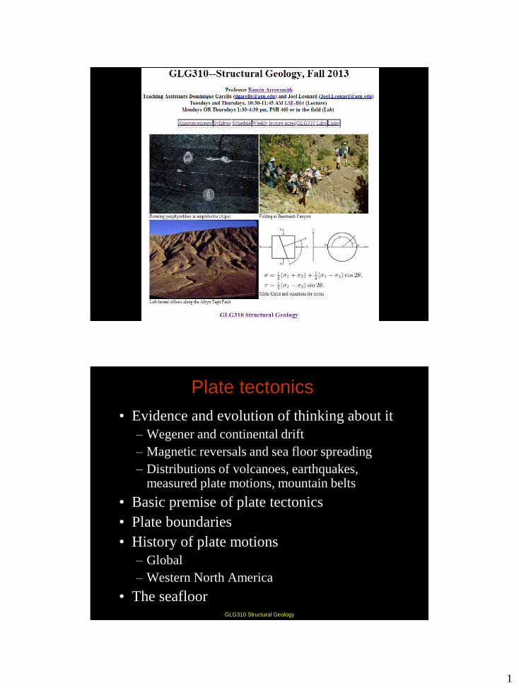
GLG310 Structural Geology
GLG310 Structural Geology
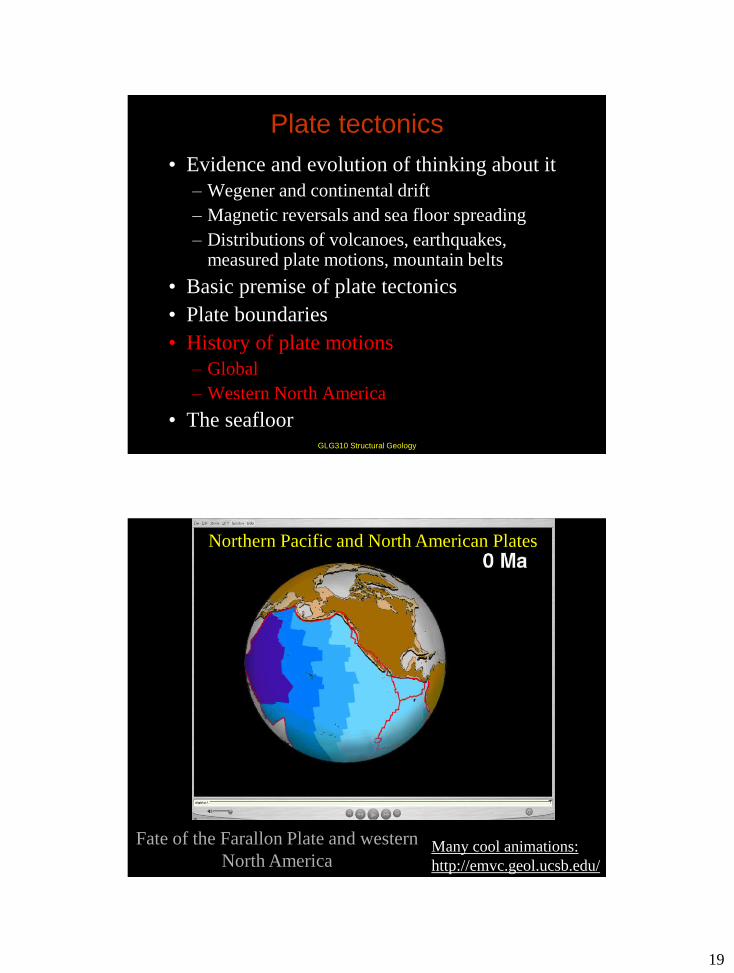
Plate tectonics
• Evidence and evolution of thinking about it
– Wegener and continental drift
– Magnetic reversals and sea floor spreading
– Distributions of volcanoes, earthquakes, measured plate motions, mountain belts
• Basic premise of plate tectonics
• Plate boundaries
• History of plate motions
– Global
– Western North America
• The seafloor
2
GLG310 Structural Geology
http://emvc.geol.ucsb.edu/index.htm
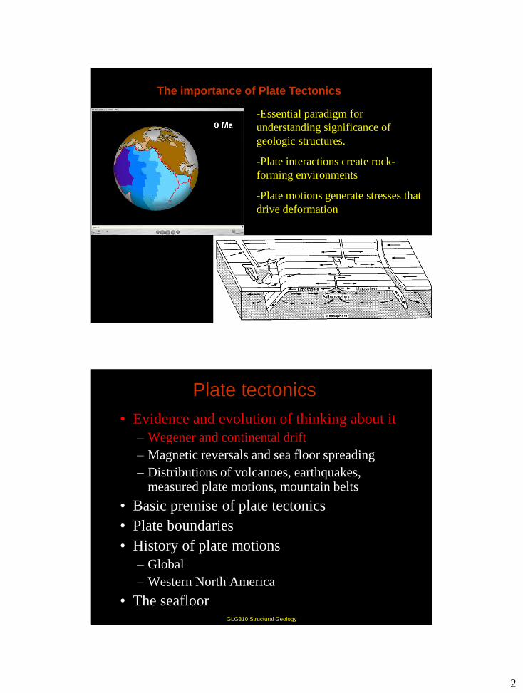
-Essential paradigm for
understanding significance of
geologic structures.
-Plate interactions create rock-
forming environments
-Plate motions generate stresses that
drive deformation
The importance of Plate Tectonics
GLG310 Structural Geology
Plate tectonics
• Evidence and evolution of thinking about it
– Wegener and continental drift
– Magnetic reversals and sea floor spreading
– Distributions of volcanoes, earthquakes, measured plate motions, mountain belts
• Basic premise of plate tectonics
• Plate boundaries
• History of plate motions
– Global
– Western North America
• The seafloor
3
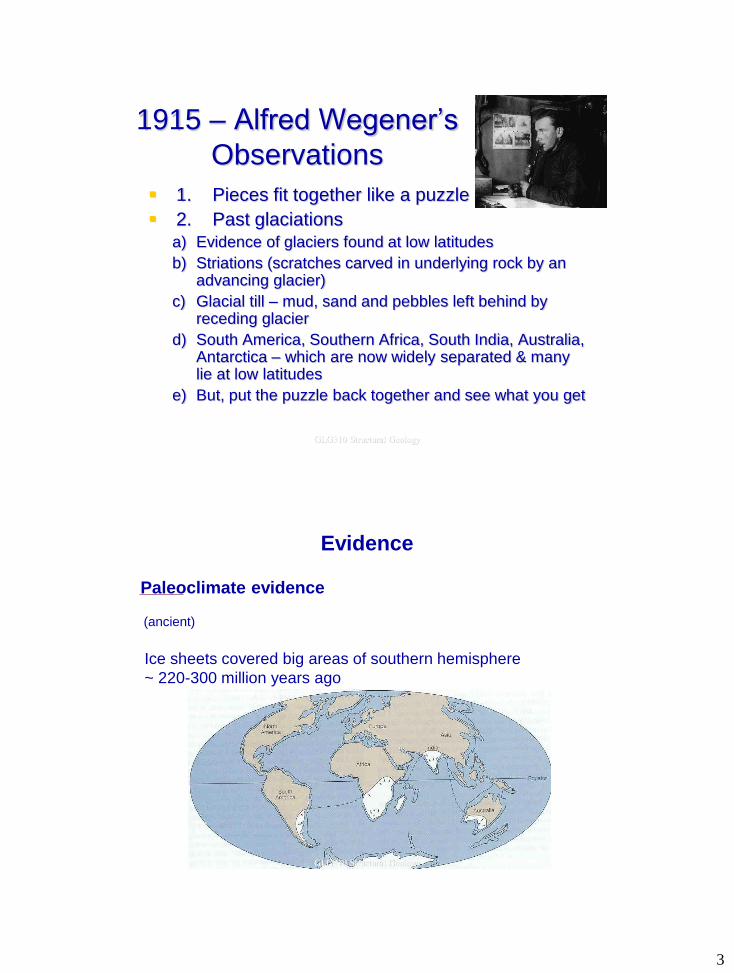
1915 – Alfred Wegener’s
Observations
1. Pieces fit together like a puzzle
2. Past glaciations a) Evidence of glaciers found at low latitudes
b) Striations (scratches carved in underlying rock by an advancing glacier)
c) Glacial till – mud, sand and pebbles left behind by receding glacier
d) South America, Southern Africa, South India, Australia, Antarctica – which are now widely separated & many lie at low latitudes
e) But, put the puzzle back together and see what you get
GLG310 Structural Geology
Evidence
Paleoclimate evidence
Ice sheets covered big areas of southern hemisphere
~ 220-300 million years ago
(ancient)
GLG310 Structural Geology
4
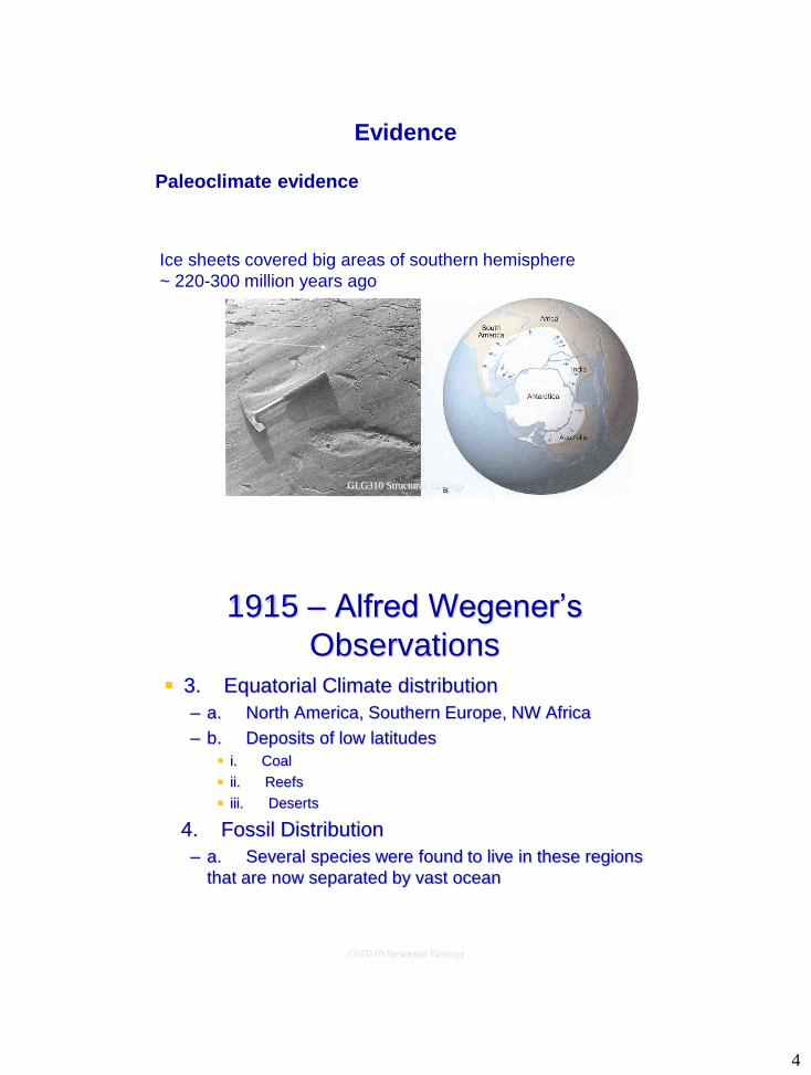
Paleoclimate evidence
Glacial
striations
Ice sheets covered big areas of southern hemisphere
~ 220-300 million years ago
Evidence
GLG310 Structural Geology
1915 – Alfred Wegener’s
Observations 3. Equatorial Climate distribution
– a. North America, Southern Europe, NW Africa
– b. Deposits of low latitudes
i. Coal
ii. Reefs
iii. Deserts
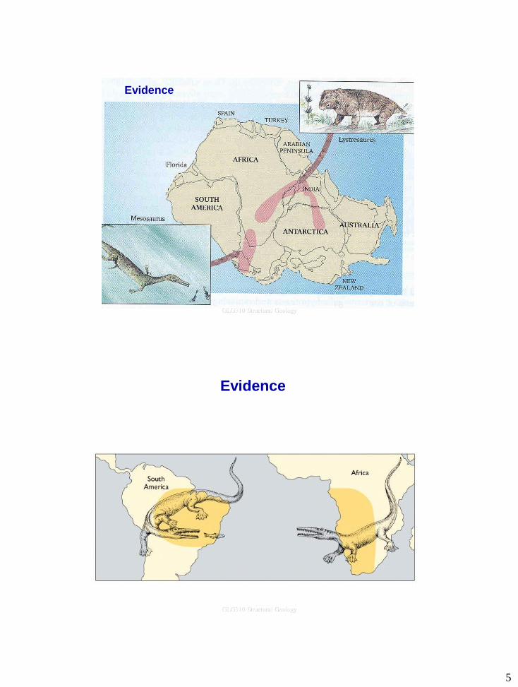
4. Fossil Distribution
– a. Several species were found to live in these regions
that are now separated by vast ocean
GLG310 Structural Geology
5
Evidence
GLG310 Structural Geology
Evidence
GLG310 Structural Geology
6
1915 – Alfred Wegener’s
Observations
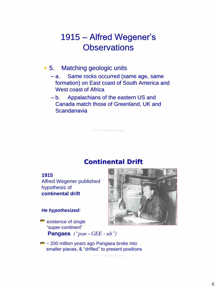
5. Matching geologic units
– a. Same rocks occurred (same age, same
formation) on East coast of South America and
West coast of Africa
– b. Appalachians of the eastern US and
Canada match those of Greenland, UK and
Scandanavia
GLG310 Structural Geology
Continental Drift
1915
Alfred Wegener published
hypothesis of
continental drift
He hypothesized:
existence of single
“super-continent”
Pangaea (“pan - GEE - uh”)
~ 200 million years ago Pangaea broke into
smaller pieces, & “drifted” to present positions
GLG310 Structural Geology
7
Continental Drift
1924
Wegener’s book translated to English
& met with hostile criticism
Main objection: no way to explain continental drift.
No one believed his explanation (Continental
Drift) because he did not come up with a
mechanism for driving the motion, nor did he
explain a few minor problems (ie Do the
continents just plough through the sea floor?).
GLG310 Structural Geology
GLG310 Structural Geology
Plate tectonics
• Evidence and evolution of thinking about it
– Wegener and continental drift
– Magnetic reversals and sea floor spreading
– Distributions of volcanoes, earthquakes, measured plate motions, mountain belts
• Basic premise of plate tectonics
• Plate boundaries
• History of plate motions
– Global
– Western North America
• The seafloor
8
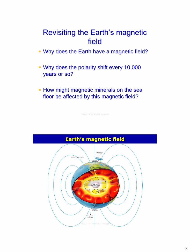
Revisiting the Earth’s magnetic
field
Why does the Earth have a magnetic field?
Why does the polarity shift every 10,000
years or so?
How might magnetic minerals on the sea
floor be affected by this magnetic field?
GLG310 Structural Geology
p.42-43bc
Earth’s magnetic field
GLG310 Structural Geology
9
Earth’s magnetic Field and paleomagnetism
Wegener’s idea died until 1950’s.
Renewed interest from rock magnetism
Paleomagnetism: ancient magnetic field of Earth recorded
and frozen into rocks
How? Need to know about 2 things:
- Earth’s magnetic field
- Magnetism in rocks
GLG310 Structural Geology
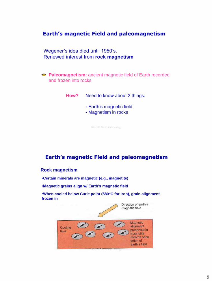
Earth’s magnetic Field and paleomagnetism
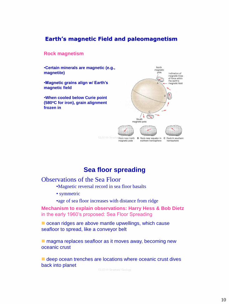
Rock magnetism
•Certain minerals are magnetic (e.g., magnetite)
•Magnetic grains align w/ Earth’s magnetic field
•When cooled below Curie point (580oC for iron), grain alignment
frozen in
GLG310 Structural Geology
10
Rock magnetism
•Certain minerals are magnetic (e.g.,
magnetite)
•Magnetic grains align w/ Earth’s
magnetic field
•When cooled below Curie point
(580oC for iron), grain alignment
frozen in
Earth’s magnetic Field and paleomagnetism
GLG310 Structural Geology
Sea floor spreading
Observations of the Sea Floor •Magnetic reversal record in sea floor basalts
• symmetric
•age of sea floor increases with distance from ridge
ocean ridges are above mantle upwellings, which cause
seafloor to spread, like a conveyor belt
magma replaces seafloor as it moves away, becoming new
oceanic crust
deep ocean trenches are locations where oceanic crust dives
back into planet
Mechanism to explain observations: Harry Hess & Bob Dietz
in the early 1960’s proposed: Sea Floor Spreading
GLG310 Structural Geology
11
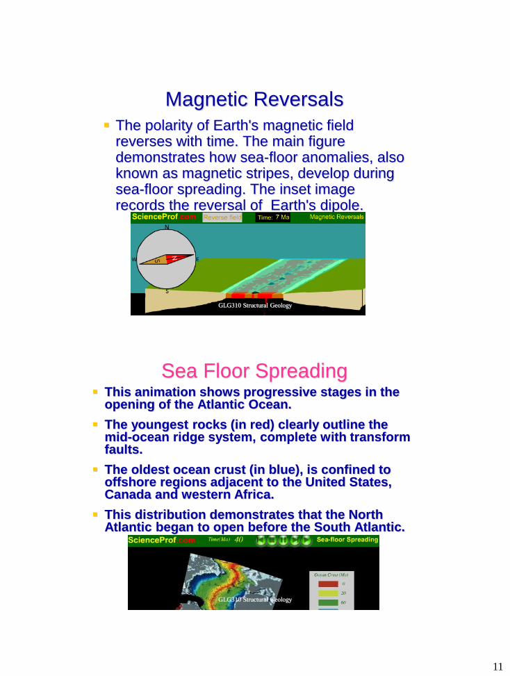
Magnetic Reversals
The polarity of Earth's magnetic field reverses with time. The main figure demonstrates how sea-floor anomalies, also known as magnetic stripes, develop during sea-floor spreading. The inset image records the reversal of Earth's dipole.
GLG310 Structural Geology
Sea Floor Spreading This animation shows progressive stages in the
opening of the Atlantic Ocean.
The youngest rocks (in red) clearly outline the mid-ocean ridge system, complete with transform faults.
The oldest ocean crust (in blue), is confined to offshore regions adjacent to the United States, Canada and western Africa.
This distribution demonstrates that the North Atlantic began to open before the South Atlantic.
GLG310 Structural Geology
12
GLG310 Structural Geology
Plate tectonics
• Evidence and evolution of thinking about it
– Wegener and continental drift
– Magnetic reversals and sea floor spreading
– Distributions of volcanoes, earthquakes, measured plate motions, mountain belts
• Basic premise of plate tectonics
• Plate boundaries
• History of plate motions
– Global
– Western North America
• The seafloor
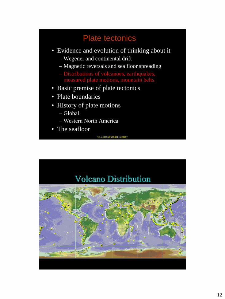
Volcano Distribution
GLG310 Structural Geology
13
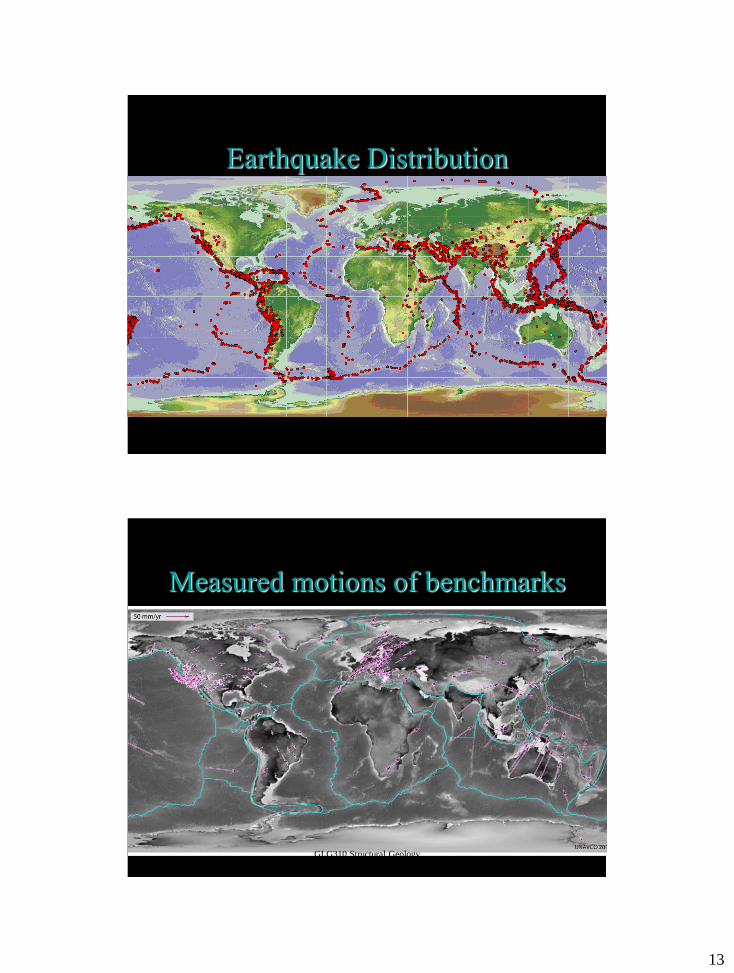
Earthquake Distribution
GLG310 Structural Geology
Measured motions of benchmarks
GLG310 Structural Geology
14
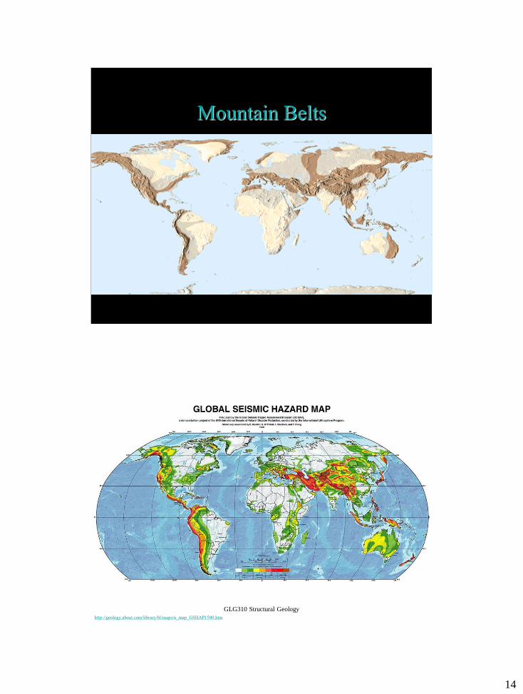
Mountain Belts
GLG310 Structural Geology
http://geology.about.com/library/bl/maps/n_map_GSHAP1500.htm
GLG310 Structural Geology
15
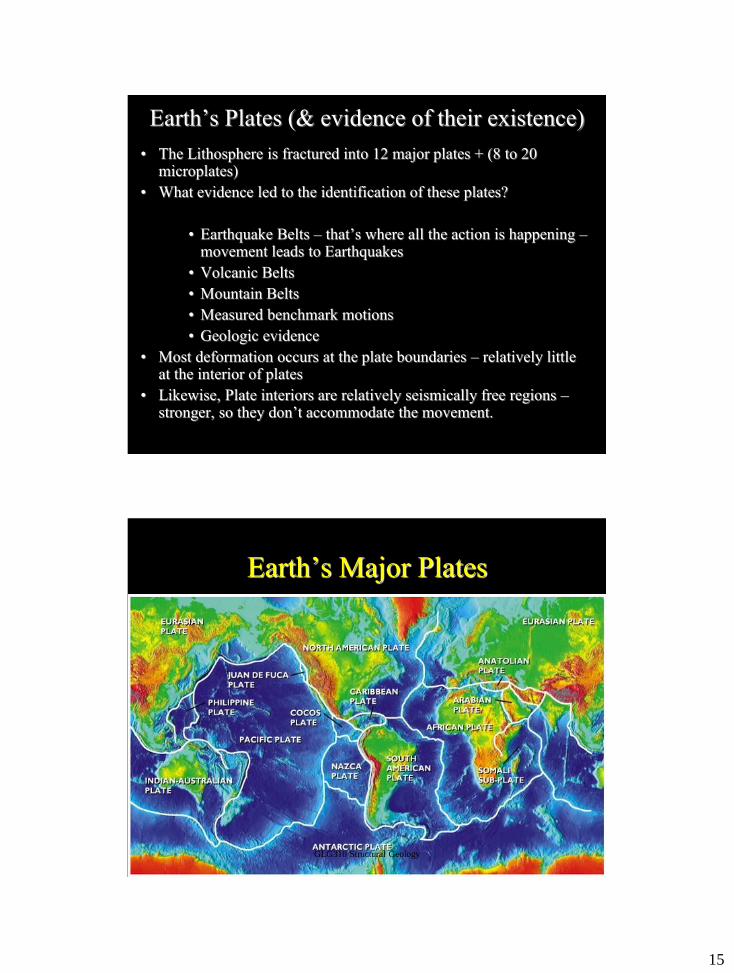
Earth’s Plates (& evidence of their existence)
• The Lithosphere is fractured into 12 major plates + (8 to 20 microplates)
• What evidence led to the identification of these plates?
• Earthquake Belts – that’s where all the action is happening – movement leads to Earthquakes
• Volcanic Belts
• Mountain Belts
• Measured benchmark motions
• Geologic evidence
• Most deformation occurs at the plate boundaries – relatively little at the interior of plates
• Likewise, Plate interiors are relatively seismically free regions – stronger, so they don’t accommodate the movement.
GLG310 Structural Geology
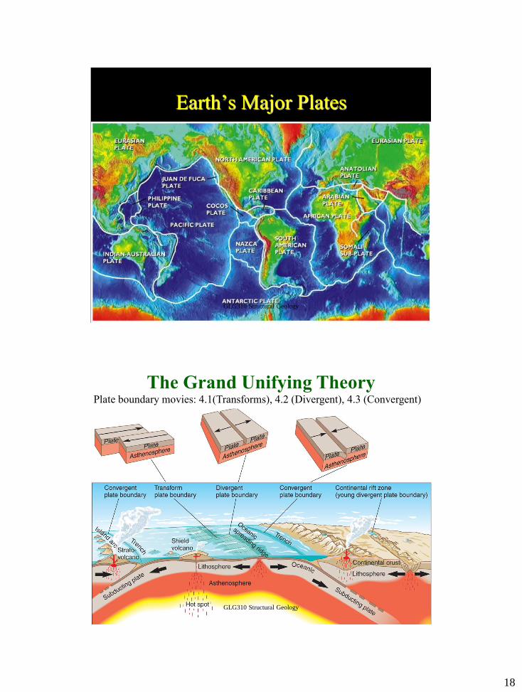
Earth’s Major Plates
GLG310 Structural Geology
16
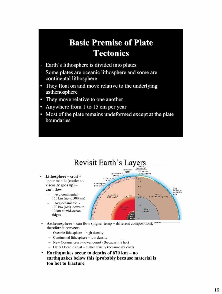
Basic Premise of Plate
Tectonics
• Earth’s lithosphere is divided into plates
• Some plates are oceanic lithosphere and some are continental lithosphere
• They float on and move relative to the underlying asthenosphere
• They move relative to one another
• Anywhere from 1 to 15 cm per year
• Most of the plate remains undeformed except at the plate boundaries
GLG310 Structural Geology
• Asthenosphere – can flow (higher temp + different composition), therefore it convects
– Oceanic lithosphere – high density
– Continental lithosphere – low density
– New Oceanic crust –lower density (because it’s hot)
– Older Oceanic crust – higher density (because it’s cold)
• Earthquakes occur to depths of 670 km – no earthquakes below this (probably because material is too hot to fracture
• Lithosphere – crust + upper mantle (cooler so viscosity goes up) – can’t flow
– Avg continental – 150 km (up to 300 km)
– Avg oceanianic - 100 km (old) down to 10 km at mid-ocean ridges
Revisit Earth’s Layers
17
Fig.4.26
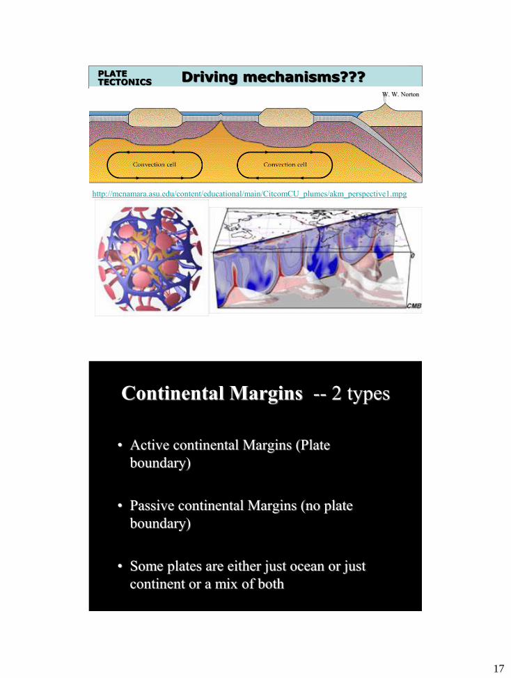
Driving mechanisms??? PLATE TECTONICS
http://mcnamara.asu.edu/content/educational/main/CitcomCU_plumes/akm_perspective1.mpg
W. W. Norton
Continental Margins -- 2 types
• Active continental Margins (Plate
boundary)
• Passive continental Margins (no plate
boundary)
• Some plates are either just ocean or just
continent or a mix of both
GLG310 Structural Geology
18
Earth’s Major Plates
GLG310 Structural Geology
The Grand Unifying Theory
Insert revised figure 3.16 here
Plate boundary movies: 4.1(Transforms), 4.2 (Divergent), 4.3 (Convergent)
GLG310 Structural Geology
19
GLG310 Structural Geology
Plate tectonics
• Evidence and evolution of thinking about it
– Wegener and continental drift
– Magnetic reversals and sea floor spreading
– Distributions of volcanoes, earthquakes, measured plate motions, mountain belts
• Basic premise of plate tectonics
• Plate boundaries
• History of plate motions
– Global
– Western North America
• The seafloor
Many cool animations:
http://emvc.geol.ucsb.edu/
Northern Pacific and North American Plates
Fate of the Farallon Plate and western
North America
20
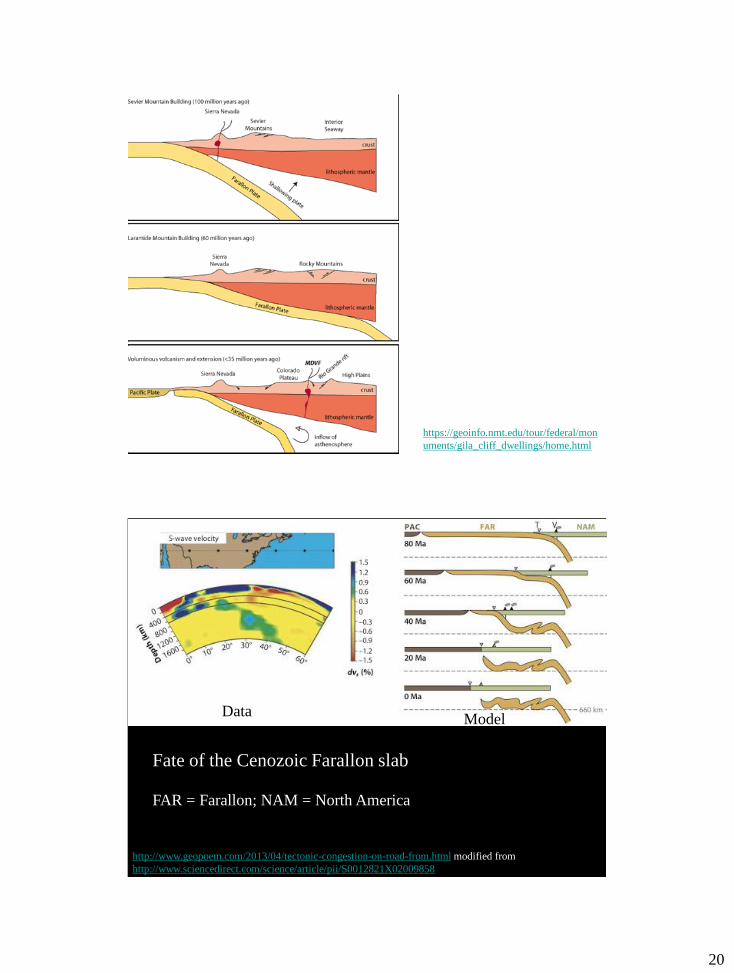
https://geoinfo.nmt.edu/tour/federal/mon
uments/gila_cliff_dwellings/home.html
http://www.geopoem.com/2013/04/tectonic-congestion-on-road-from.html modified from
http://www.sciencedirect.com/science/article/pii/S0012821X02009858
Fate of the Cenozoic Farallon slab
FAR = Farallon; NAM = North America
Data Model
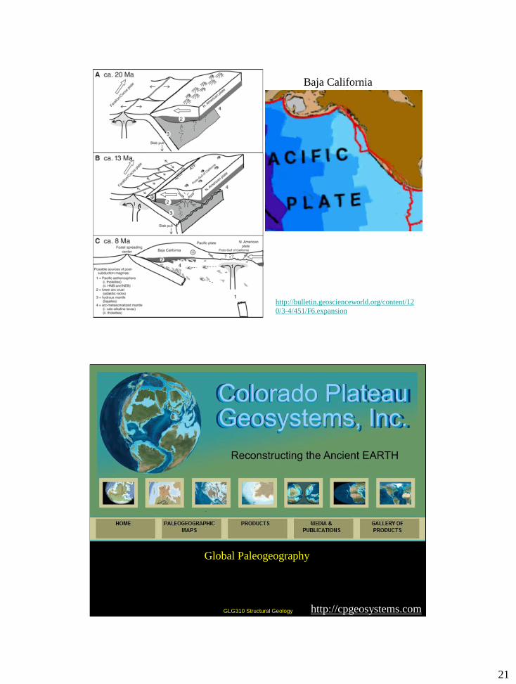
21
http://bulletin.geoscienceworld.org/content/12
0/3-4/451/F6.expansion
Baja California
GLG310 Structural Geology
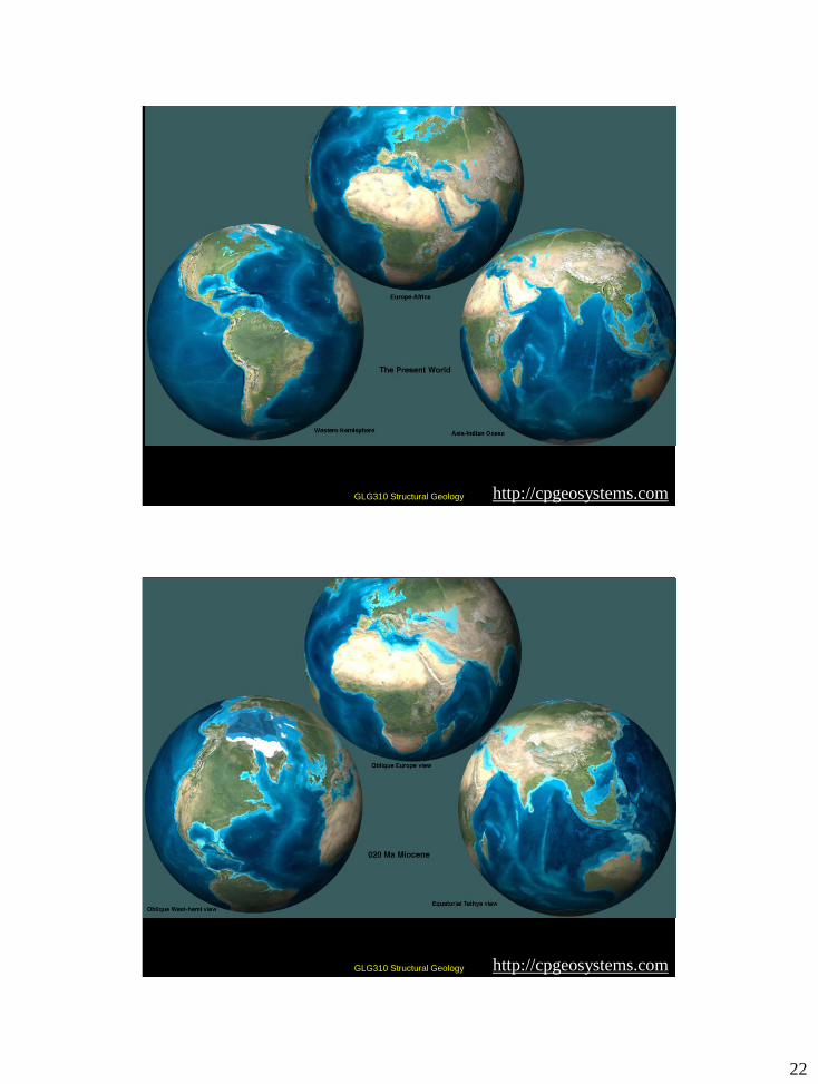
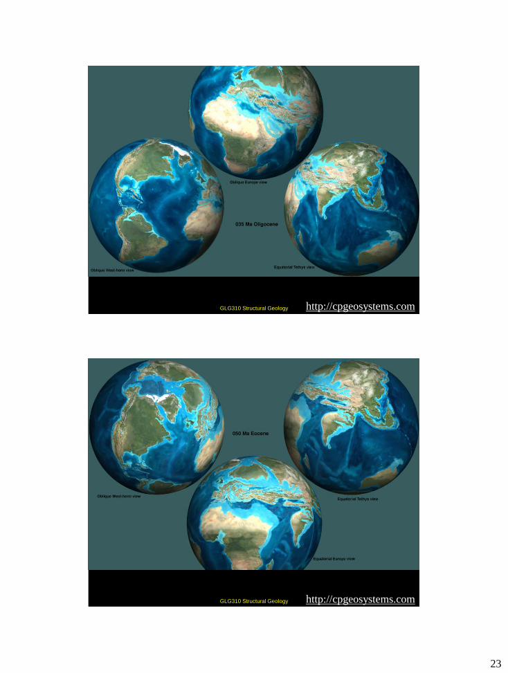
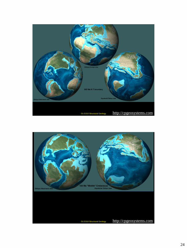
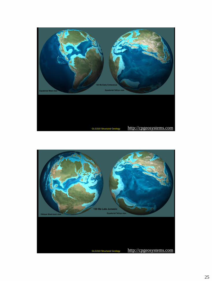
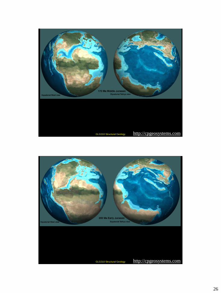
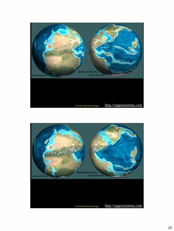
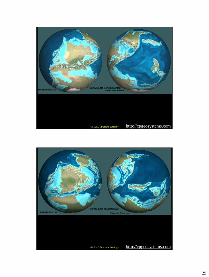
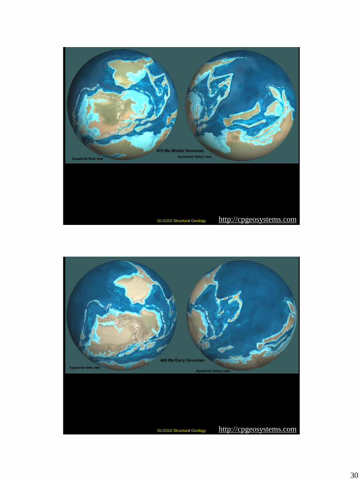
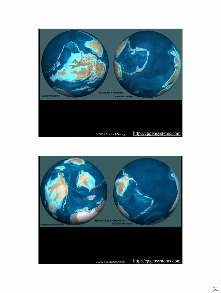
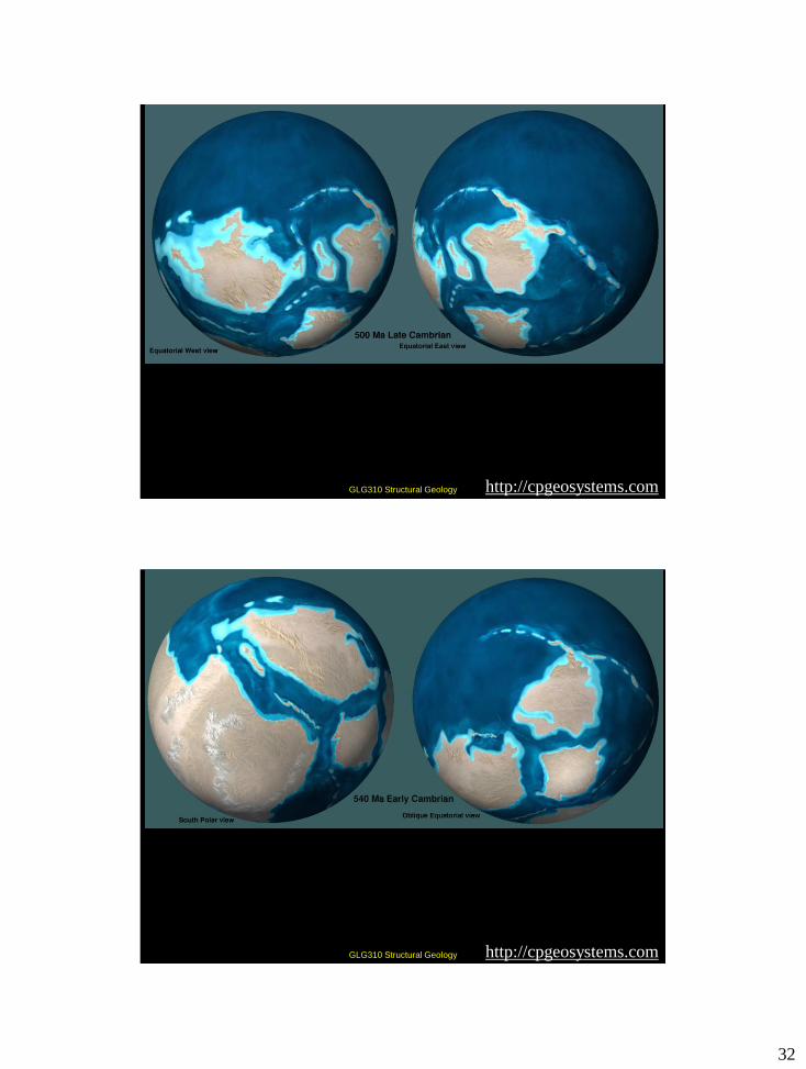
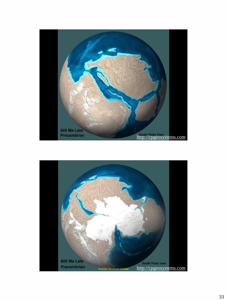
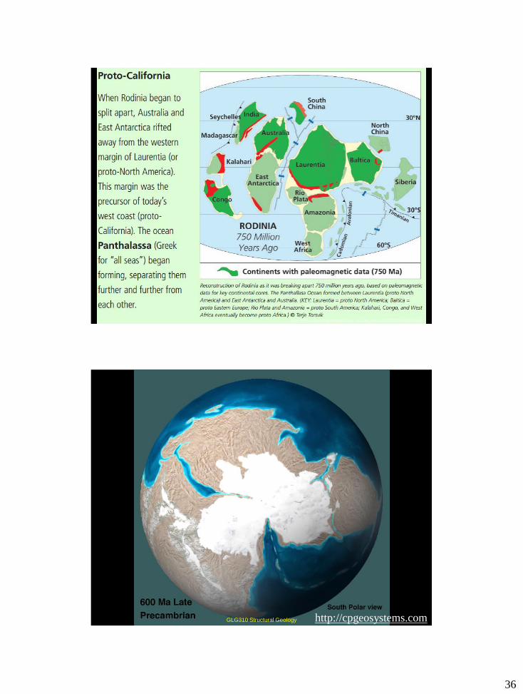
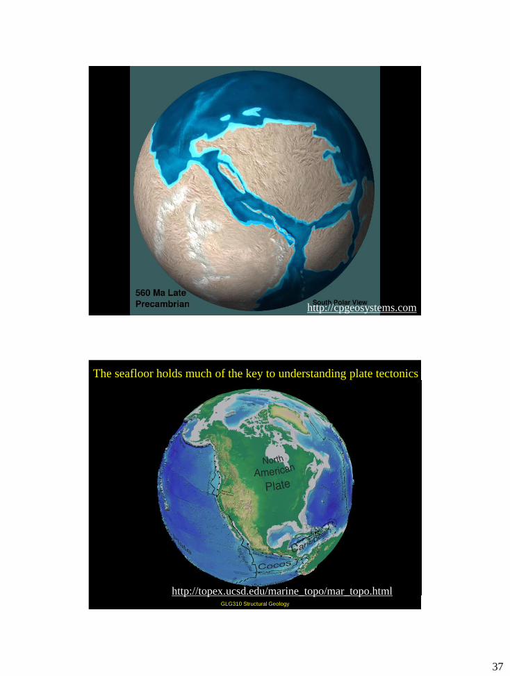
Global Paleogeography
http://cpgeosystems.com
22
GLG310 Structural Geology http://cpgeosystems.com
GLG310 Structural Geology http://cpgeosystems.com
23
GLG310 Structural Geology http://cpgeosystems.com
GLG310 Structural Geology http://cpgeosystems.com
24
GLG310 Structural Geology http://cpgeosystems.com
GLG310 Structural Geology http://cpgeosystems.com
25
GLG310 Structural Geology http://cpgeosystems.com
GLG310 Structural Geology http://cpgeosystems.com
26
GLG310 Structural Geology http://cpgeosystems.com
GLG310 Structural Geology http://cpgeosystems.com

27
GLG310 Structural Geology http://cpgeosystems.com
GLG310 Structural Geology http://cpgeosystems.com
28
GLG310 Structural Geology http://cpgeosystems.com
GLG310 Structural Geology http://cpgeosystems.com
29
GLG310 Structural Geology http://cpgeosystems.com
GLG310 Structural Geology http://cpgeosystems.com
30
GLG310 Structural Geology http://cpgeosystems.com
GLG310 Structural Geology http://cpgeosystems.com
31
GLG310 Structural Geology http://cpgeosystems.com
GLG310 Structural Geology http://cpgeosystems.com
32
GLG310 Structural Geology http://cpgeosystems.com
GLG310 Structural Geology http://cpgeosystems.com
33
GLG310 Structural Geology http://cpgeosystems.com
http://cpgeosystems.com GLG310 Structural Geology
34
GLG310 Structural Geology
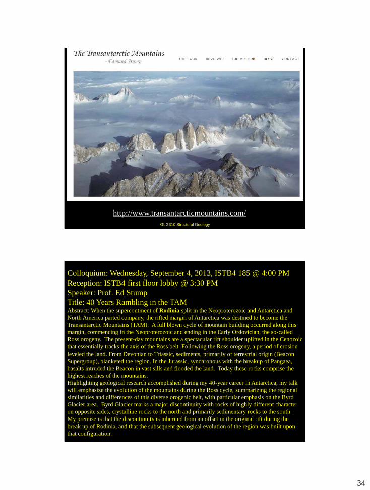
http://www.transantarcticmountains.com/
Colloquium: Wednesday, September 4, 2013, ISTB4 185 @ 4:00 PM
Reception: ISTB4 first floor lobby @ 3:30 PM
Speaker: Prof. Ed Stump
Title: 40 Years Rambling in the TAM Abstract: When the supercontinent of Rodinia split in the Neoproterozoic and Antarctica and
North America parted company, the rifted margin of Antarctica was destined to become the
Transantarctic Mountains (TAM). A full blown cycle of mountain building occurred along this
margin, commencing in the Neoproterozoic and ending in the Early Ordovician, the so-called
Ross orogeny. The present-day mountains are a spectacular rift shoulder uplifted in the Cenozoic
that essentially tracks the axis of the Ross belt. Following the Ross orogeny, a period of erosion
leveled the land. From Devonian to Triassic, sediments, primarily of terrestrial origin (Beacon
Supergroup), blanketed the region. In the Jurassic, synchronous with the breakup of Pangaea,
basalts intruded the Beacon in vast sills and flooded the land. Today these rocks comprise the
highest reaches of the mountains.
Highlighting geological research accomplished during my 40-year career in Antarctica, my talk
will emphasize the evolution of the mountains during the Ross cycle, summarizing the regional
similarities and differences of this diverse orogenic belt, with particular emphasis on the Byrd
Glacier area. Byrd Glacier marks a major discontinuity with rocks of highly different character
on opposite sides, crystalline rocks to the north and primarily sedimentary rocks to the south.
My premise is that the discontinuity is inherited from an offset in the original rift during the
break up of Rodinia, and that the subsequent geological evolution of the region was built upon
that configuration.
35
Rodinia — Russian for
“homeland”
Sometime between 1.2 and 1
billion years ago, the
supercontinent Rodinia formed.
It was surrounded by an ocean
called Mirovia. Three or four
existing continents collided
in a large mountain-building
episode, called the Grenville
Orogeny. When two continents
collide, neither will sink (as they
are both low-density continental
crust, like corks bobbing in the
ocean). Instead, they thrust over
one another near the surface and
fold at depth (where rocks are
hotter) to form fold-and-thrust
mountains. Rocks trapped
in this collision or suture zone
are highly metamorphosed by
high temperatures and
pressures.
Modern example = India-Eurasia
collision and the Himalaya
http://www.ccsf.edu/Departments/History_of_Time_and_Life/PDFs/Rodinia36x36.pd
f
Rodinia begins to break up
at about 800 Ma. This
causes thinning of Western
North America and also a
failed rift in the middle of
North America
Modern
Analog: East
Africa
http://www.ccsf.edu/Departments/History_of_Time_and_Life/PDFs/Rodinia36x36.pdf
36
http://www.ccsf.edu/Departments/History_of_Time_and_Life/PDFs/Rodinia36x36.pdf
http://cpgeosystems.com GLG310 Structural Geology
37
GLG310 Structural Geology http://cpgeosystems.com
GLG310 Structural Geology
http://topex.ucsd.edu/marine_topo/mar_topo.html
The seafloor holds much of the key to understanding plate tectonics