bc dcfc gap analysis fbc aug2015v2 - plug in bc · this report assesses the ... c. recommendations...
TRANSCRIPT
A Gap Analysis For B.C.’s Electric Vehicle Direct Current Fast Charging Network
A report prepared by Fraser Basin Council
Funded by the
B.C. Ministry of Energy and Mines
August 31, 2015 CONTACT: Charlotte Argue Assistant Manager, Climate Change & Air Quality Program E: [email protected] T: 604-‐488-‐5369

A Gap Analysis for B.C.’s Electric Vehicle Direct Current Fast Charging Network, 2015
2
Table of Contents
Executive Summary ..................................................................................................... 3
Key Acronyms .............................................................................................................. 4
Introduction ................................................................................................................ 4
Gap Analysis Approach ................................................................................................ 4 A. Guiding Principles ................................................................................................................................................ 5 B. Existing and Planned Stations — Phase One ............................................................................................ 5 C. Stakeholder Feedback: Gap Analysis Workshop ..................................................................................... 6 D. EV Owner Survey .................................................................................................................................................. 8 E. Mapping the Gaps: EV Infrastructure Planning Assistant ............................................................... 13
Conclusions ............................................................................................................... 16
Next Steps ................................................................................................................. 17
A Gap Analysis for B.C.’s Electric Vehicle Direct Current Fast Charging Network, 2015
3
Executive Summary
The Province of British Columbia has renewed funding for the Clean Energy Vehicle Program, which includes an investment for up to twenty new direct current fast-charging (DCFC) stations in the province. This is in addition to thirty stations already planned from the first phase of Clean Energy Vehicle infrastructure investments. This report assesses the critical gaps in the existing and scheduled DCFC network in B.C., and provides recommendations for the second phase of station deployment. This analysis is primarily informed by consultations with industry stakeholders, survey results from plug-in electric vehicle (EV) drivers, and by a comprehensive EV mapping tool. Evidently, there is no perfect solution for DCFC placement, particularly as existing resources fall far short of the numbers needed to satisfy electric travel throughout the entire province. In addition, the range capabilities of electric vehicles vary, which makes ideal station spacing more challenging. To most effectively serve EV drivers and enable future EV uptake, it is recommended to focus on high EV adoption regions in B.C. and connect them to strategic neighbouring destinations, allowing for inter-city travel, or an “EV Tourism” approach.
The following priority routes have been identified for the Phase 2 DCFC deployment:
• South Coast Ferries: Near Southern Ferry Terminal routes (Tsawwassen, Swartz Bay, Horseshoe Bay, Nanaimo) (4 stations)
• Highway 5: (“Coquihalla”) Hope to Kamloops via Merritt (3 stations) • Metro Vancouver: Add density (2-4 stations) • Highway 99: USA Border to Vancouver Airport / Vancouver (2 stations) • Highway 4: Qualicum Beach to Tofino (3 stations) • Highway 7: North of Fraser River, Vancouver to Hope (4 stations) • Highway 19: North of Qualicum Beach to Campbell River (2 stations) • Highway 1: Cache Creek to Kamloops (2 stations) • Highway 97: Vernon to Kamloops. (1 station) • Highway 3: Hope to Princeton (1 station)
This report represents a planning document, and does not confirm the final number or locations to be implemented, which will also depend on the availability of hosts and partners, technical capabilities of locations, leveraged funding, and suitable business models.
Fraser Basin Council recognizes that servicing the priority routes listed requires an estimated 24-26 stations, which exceeds the twenty stations (maximum) allotted for this phase of investments. However, we anticipate that once additional work is done to assess technical and business barriers, that the one or more of the routes may drop from the next phase of implementation. Details on the feasibility and prioritization across these routes are in the analysis. More work is needed to assess any technical and business barriers to the priority routes above, and further mapping assessments must be made before final locations are selected.

A Gap Analysis for B.C.’s Electric Vehicle Direct Current Fast Charging Network, 2015
4
Key Acronyms B.C. – The Province of British Columbia
CHAdeMo – Japanese standard of electric vehicle fast-charging station. DCFC – Direct Current Fast-Charging. Refers to 400 volt, 50+kW charging that takes approximately 20min to charge an electric vehicle to 80%. EV – Plug-in electric vehicle. Refers to both battery electric and plug in hybrid electric vehicles. Also may be interchanged with PEV. SAE Combo – North American standard of electric vehicle fast-charging station.
Introduction The purpose of this gap analysis is to evaluate current geographic gaps in British Columbia’s direct current fast-charging (DCFC) network, and to provide recommendations for the next phase of station deployment, taking into consideration existing and planned stations, user demand, real-world factors that impact electric vehicle (EV) range, and stakeholder recommendations.
This phase of infrastructure deployment is funded by the Province of British Columbia’s renewed Clean Energy Vehicle Program, introduced on April 1 2015, to encourage and accelerate the adoption of clean energy vehicles in British Columbia. A maximum of $630,000 has been approved to support up to 20 new dual-standard stations, if matching funding goals can be met. The Clean Energy Vehicle Charging Program, a component of the Clean Energy Vehicle Program, is administered and implemented through a partnership between the B.C. Ministry of Energy and Mines and Fraser Basin Council.
Gap Analysis Approach This gap analysis and recommended strategy for the next phase of DCFC deployment has been primarily informed by the following:
A. Overarching guiding principles for a B.C. fast-charging network, provided by the Province of B.C.
B. Existing and planned stations from BC Hydro’s Critical EV Infrastructure Project (Phase One).
C. Recommendations by key stakeholders through a gap analysis workshop held June 15, 2015.
D. Survey results from EV owners, prioritizing routes and locations. E. The EV Infrastructure Planning Assistant: a mapping tool to understand range
limitations and capabilities of plug-in electric vehicles (EVs) based on real-world factors.
The following sections will go through lessons and insights from each of the above items.
A Gap Analysis for B.C.’s Electric Vehicle Direct Current Fast Charging Network, 2015
5
A. Guiding Principles
The B.C. Ministry of Energy and Mines has identified the following four guiding principles for DCFC deployment.
1. Connect priority travel corridors across the province, where “priority travel corridors” are defined as travel corridors that either have a large volume of commuter traffic, support cross jurisdictional travel, or support tourism within B.C.
2. Ensure infrastructure deployment allows for safe travel in the province. 3. Support regions with dense plug-in electric vehicle (EV) adoption. 4. Maximize population areas served.
While it is unreasonable to expect that every station in B.C.’s fast-charging network will meet all four principles, these guiding principles should be referenced and balanced whenever new locations are considered, in the context of the network as a whole. These principles were presented to stakeholders at the June 15th gap analysis workshop, and there was a consensus that they were appropriate to guide the planning process.
B. Existing and Planned Stations — Phase One
Phase One of B.C.’s fast-charging infrastructure deployment for thirty DCFC stations was launched in 2012, known as the Critical EV Infrastructure Project. The project is led by BC Hydro, and supported by the Province of British Columbia, the Government of Canada, municipalities and the private sector. The first fifteen stations were tendered with the CHAdeMO standard, which primarily supports Japanese-built vehicle makes and models. The remaining 15 stations are tendered for dual CHAdeMO and SAE Combo Charging System (North American) standards. A separate project will support future retrofitting for many of the first 15 CHAdeMO station locations, to add the SAE Combo charger standard.
Site selection for Phase One was partially informed by a planning framework study provided by the University of British Columbia’s Transportation Infrastructure & Public Space (TIPS) Lab.1 The deployment followed general guidelines to meet a corridor (as opposed to a cluster) approach, focusing on town centers close to highway corridors, and distancing stations 50 – 70 km apart. Additionally, the first few stations in B.C. served to complete the West Coast Electric Highway, a cross-border initiative of the Pacific Coast Collaborative2 to allow electric transportation from Whistler, British Columbia to Baja, California (BC to BC).
A map of existing and planned stations for the Critical EV Infrastructure Project is here: http://bit.ly/1PTT6Vy. While the factors guiding station selection for Phase Two of deployment will be different than that of Phase One, it is imperative that the two networks work as one. Thus, site selection for new infrastructure must consider both existing and planned locations. For any locations that have not yet been confirmed for Phase One, it is recommended that BC Hydro, Fraser Basin Council and the Province of
1 UBC Tips Lab Report http://www.tipslabubc.com/images/documents/EVFC_Provincial_120523_WEB.pdf 2 For information on the Pacific Coast Collaborative West Coast Electric Highways, see: http://www.pacificcoastcollaborative.org/priorities/transportation/Pages/GreenHighways.aspx

A Gap Analysis for B.C.’s Electric Vehicle Direct Current Fast Charging Network, 2015
6
B.C. consult to maximize the effectiveness of their placement within context of the next phase of deployment.
C. Stakeholder Feedback: Gap Analysis Workshop
A workshop was organized to bring together thirty key stakeholders representing industry, EV drivers, station site hosts, EV researchers and experts, and funders, with the following objectives:
a. Information sharing to bring all participants up to speed on fast-charging station locations, gaps, and current tools
b. Define and agree on minimum acceptable requirements for a fast charging station network
c. Identify priority routes/corridors for future investments in fast charging stations and locations within those routes/corridors
Approach for the DCFC Network Deployment The group discussed optimal strategies for planning for B.C.’s fast-charging network, and what standards should be met. While ideally a network would be planned for all vehicle types to reach all parts of the province, realistically there are limitations on what can be serviced today and within the scope of the next phase of deployment. Considerations for planning a DCFC network include:
Charger spacing The range of an EV depends on many factors, including make/model/year of the vehicle, vehicle age, terrain, weather conditions, starting state of charge, vehicle load, and driving habits. Therefore, defining ideal spacing between fast chargers for corridor routes is not a simple undertaking. Many early-market EVs are designed for urban use, and aren’t ideal for long distance travel. It was generally agreed that DCFC spacing should not cater to early generation and urban EVs, such as the 2011 Leaf or the Smart EV. Rather, the core network should aim to serve current generation EVs, up to five years old (e.g. a five-year-old 2013 Leaf), with secondary routes servicing second generation EVs (e.g. rated with 200km+ range). It was also agreed that while the DCFC network will be accessible to Tesla owners, it would not be designed for them, as Tesla’s vehicles don’t face the same range limitations, and the Tesla Supercharger network is currently being deployed to help serve this niche.
Corridor vs. Cluster Approach
There are good arguments for both adding density within cities (a cluster approach), and for prioritizing inter-city routes (a corridor approach). The average trip in B.C. is well within the range of electric cars today3. Adding density in urban regions makes EVs an option for a greater number of drivers. Particularly, DCFC stations within cities will help serve drivers who may not have access to charging at home or at work, and will also serve to extend the range of fleet
3 About 95% of all car trips in B.C.’s urban areas are less than 30km – See BC Hydro www.bchydro.com/ev
A Gap Analysis for B.C.’s Electric Vehicle Direct Current Fast Charging Network, 2015
7
vehicles in the area, supporting the majority of usage needs. Experience from existing DCFC networks shows that the most highly used stations tend to be within urban cores, or dense metropolitan locations (see the West Coast Electric Highway Project usage results4).
However, high usage rates do not necessarily mean these urban-based stations are more critical, or that they will result in higher rates of EV adoption. Drivers will view EVs as impractical if inter-city travel is not feasible. EV drivers primarily charge at home, and can top up at level 2 charging stations during the day. Without adequate fast-charging support between cities, travelling between cities or regions can be challenging at best. Comments from the EV owners survey, and from the Victoria Leaf Club emphasize the need to support inter-city travel, which will be covered further in following sections.
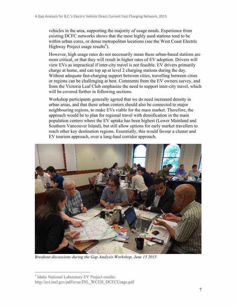
Workshop participants generally agreed that we do need increased density in urban areas, and that these urban centers should also be connected to major neighbouring regions, to make EVs viable for the mass market. Therefore, the approach would be to plan for regional travel with densification in the main population centers where the EV uptake has been highest (Lower Mainland and Southern Vancouver Island), but still allow options for early market travellers to reach other key destination regions. Essentially, this would favour a cluster and EV tourism approach, over a long-haul corridor approach.
Breakout discussions during the Gap Analysis Workshop, June 15 2015
4 Idaho National Laboratory EV Project results: http://avt.inel.gov/pdf/evse/INL_WCEH_DCFCUsage.pdf
A Gap Analysis for B.C.’s Electric Vehicle Direct Current Fast Charging Network, 2015
8
Route Prioritization
A break-out exercise helped identify priority routes and locations based on the guiding principles, and building on the existing and planned network. The following list shows the highest-ranked corridors; the numbers indicate how many groups out of six identified this route as a priority. Additional corridors and locations were identified in individual groups, but these are not included in the list below.
• Highway 4: Qualicum Beach or Coombs to Tofino (5) • Highway 7: North of Fraser River, Vancouver to Hope (4) • Highway 99 S: USA Border to YVR/Vancouver (4) • Southern Ferry Terminals (or nearby towns) (3) • Densification of Metro Vancouver (3) • Highway 97C: Kelowna to Merritt (2) • Highway 3: Hope to Osoyoos (2) • Highway 5: Hope to Kamloops via Merritt (2) • Highway 97 S: Kamloops to Vernon (2)
Standard for the DCFC Network
A discussion of minimum acceptable standards for a fast-charging network resulted in the following brainstormed list.
NETWORK a. Plan for future technology, but consider current fleet b. Desire to enable cross-BC travel (big picture) c. Don’t prioritize first generation (Mitsubishi iMiEV/2011 Nissan Leaf) outside of
urban areas d. Use mapping tool to consider: elevation, weather, driving style, vehicle age, etc. e. No EVdriver should i. Fall below 17% charge
ii. Experience max _[x]_ hrs/year uncharged INDIVIDUAL STATIONS
a. Have performance goals (e.g. maximum [x] conflicts/site/week) b. At least one DCFC per site, and have Level 2 available for redundancy c. High level of reliability and good servicing (Mean time between shutdowns > 1
month, worst case); serviced within 24hrs d. Near amenities; not isolated (consider: lighting, restroom facilities, open hours of
operation, proximity to food and refreshments) e. Visible and easy to find f. Route map and info on charging at each station for easy trip planning (i.e. identify
where the next DCFC is located on major routes)
D. EV Owner Survey
FBC distributed a survey to EV owners and drivers to validate the routes and approach identified at the stakeholder workshop, and to help prioritize location deployment. The survey was distributed among EV owners associations (Vancouver Electric Vehicle

A Gap Analysis for B.C.’s Electric Vehicle Direct Current Fast Charging Network, 2015
9
Association, Victoria Leaf Club, and several smaller community EV enthusiast groups), as well as to recipients of the CEVforBC vehicle incentives. Survey Results:
FBC received a total of 197 responses to the survey, with 94.5% being current owners of at least one plug-in electric vehicle.
Survey participants were asked to rank their top ten of fourteen routes or areas in B.C. The following chart shows the routes with the highest number of top 5 Rankings: Chart 1: Priority routes by top 5 rankings
When assigning a number to all rankings, the order slightly changes, as can be seen in Chart 2.
The biggest discrepancy from the survey, as compared to the stakeholder workshop was the relative importance of Highway 5 “The Coquihalla”. This route was most frequently selected as a top 5 ranking in the survey. The Coquihalla wasn’t prioritized as high in the workshop in part due to the geographic and technical barriers to electrify this route. Therefore, emphasis was placed on Highways 1 and 3 to connect the Lower Mainland with the Okanagan, rather than Highway 5.
Another interesting discrepancy is that while half of the survey respondents indicated they would prefer a corridor over cluster approach (see next section), the rankings of routes do not necessarily reflect this sentiment, as Metro Vancouver density and routes within Metro Vancouver were consistently highly ranked.
0 20 40 60 80 100 120
Hwy 97 (N) -‐ Kamloops to Prince George
Hwy 1 (N) -‐ Spences Bridge to Kamloops via CC
Hwy 1 (E) -‐ Revelstoke to Alberta
Hwy 97 (S) -‐ Kamloops to Vernon
Hwy 97C -‐ Connector Merritt to Kelowna
Hwy 19 -‐ Qualicum Beach to Campbell River
Hwy 3 -‐ Hope to Osoyoos (through Manning Park)
Hwy 99 (N) -‐ Whistler to Lilloet and Cache Creek
Hwy 7 -‐ Vancouver to Hope
Hwy 4 -‐ Qualicum Beach to To^ino
Hwy 99 (S) -‐ USA Border to Vancouver
Metro Vancouver: Add density
South Coast ferries: Near Terminals
Hwy 5 -‐ Hope to Kamloops via Merritt
Count by Top 5 Rankings

A Gap Analysis for B.C.’s Electric Vehicle Direct Current Fast Charging Network, 2015
10
Chart 2: Total relative ranking of routes
*Units intentionally not shown. Each ranking was assigned 1 (highest priority) to 10 (lowest priority) and unranked routes received an 11. The inverse of the sum of rankings was graphed to show relative popularity. While the Southern B.C. Ferry terminals was also ranked quite high, it is not recommended that stations are sited at the terminals themselves, due to logistics for waiting in the designated queues, and the fact that the terminals are not always accessible. Instead, it has been recommended that stations are sited in the nearest town centers, or off main highways going to/leaving from the ferries. This reflection came up both at the workshop and in comments from the EV owners’ survey. This includes potentially adding a station in Nanaimo on Highway 19, as the existing station is not sited to serve this purpose for through-traffic.
There were also sections in the Southern Interior / Okanagan that didn’t rank high in the survey results, but did show up as priorities from the workshop and from mapping the routes with the EV Planning Assistant tool. These may be necessary to complete routes from the first phase of deployment. (For example, Hwy 1: Cache Creek and Walhachin, connecting Spences Bridge with Kamloops, and Hwy 97: Westwold to connect Vernon with Kamloops).
Respondents were also asked to identify any routes that were not listed as part of the ranking options, that they view as a priority. Many routes listed were in fact replicas of routes already in the list provided. However, some new routes that were frequently cited included Highway 3 East of Osoyoos to Cranbrook, Highway 16 Prince Rupert to Prince George, Highway 19 North of Campbell River to Port Hardy, Highway 1 from Victoria to Nanaimo, and locations on the Sunshine Coast.
Two questions were posed in an attempt to assess the general sentiment from current EV owners on the corridor versus cluster approach. The results show there is a fairly even
Hwy 1 (N) -‐ Spences Bridge to Kamloops via CC Hwy 1 (E) -‐ Revelstoke to Alberta
Hwy 97 (N) Kamloops to Prince George Hwy 97 (S) -‐ Kamloops to Vernon
Hwy 99 (N) -‐ Whistler to Lilloet and Cache Creek Hwy 97C -‐ Connector Merritt to Kelowna
Hwy 3 -‐ Hope to Osoyoos Hwy 19 -‐ Qualicum Beach to Campbell River
Hwy 7 -‐ Vancouver to Hope Hwy 99 (S) -‐ USA Border to Vancouver
Hwy 4 -‐ Qualicum Beach to To^ino Metro Vancouver: Add density
Hwy 5 -‐ Hope to Kamloops via Merritt South Coast ferries: Near Terminals
Low High
Total Ranking*

A Gap Analysis for B.C.’s Electric Vehicle Direct Current Fast Charging Network, 2015
11
split among drivers, with a slight preference for prioritizing longer distances travel over increased density of urban cores. Chart 3: Survey results for density vs. distance preference
However, when asked directly which of three approaches would they prioritize, nearly half of respondents chose an EV tourism approach, with long-haul a distant second, followed by the urban commuter, densification approach. Definitions of each approach were included in the question, as listed in Chart 4. Chart 4: Survey results for preference on network planning approach
19.7% 26.9% 11.4% 17.6% 24.4%
0% 10% 20% 30% 40% 50% 60% 70% 80% 90% 100%
A BC fast charge network should prioritize increased density of urban areas over the ability to
travel longer distances throughout BC.
Strongly Disagree Disagree Neutral Agree Strongly Agree
23.6%
46.7%
29.7%
If you had to choose, which approach would you prioritize for the DC fast-‐charge network?
(%)
Commuter approach (clustered in higher density, urban areas)
EV Tourism (connecting neighbouring regions, focusing on key destination areas)
Long-‐Haul (corridor approach for extended travel)

A Gap Analysis for B.C.’s Electric Vehicle Direct Current Fast Charging Network, 2015
12
There was a slight preference for prioritizing second-generation vehicles for long-distance travel when asked whether it is better to plan for second-generation (longer-range) vehicles over the current generation. This is somewhat surprising, as outside of Tesla owners, the majority of respondents are in possession of the current, more range-limiting generation of EVs. This result could reflect the recognition that many early generation EVs are primarily designed for short-distance urban use. Chart 5: Survey results for preference on current- vs. second-generation EV planning
Respondents were given the opportunity to provide written comments or feedback at the end of the survey, and some provided additional feedback in the form of emails or letters. Some themes in the comments emerged, as follows.
1. Prioritize locations that will extend range for inter-city travel. Interestingly, there were by far more comments suggesting not to focus on the urban approach, and to instead focus on weekend getaway or inter city connections. Such statements included reference to the fact that charging in urban settings should be satisfied by level 2 public stations, and most often, residential charging. Ideally, a fast-charge network would be built for weekend getaways, very close to highways (e.g. rest stops), with an initial focus on EV tourism corridors, and a long-term goal for long-haul travel across the province. There were a few counter-arguments to this, suggesting that fast-chargers in urban cores are important for the quick in-and-out trips (e.g. airport pickups). It’s worth noting that about 80% of EV owners in B.C. currently live in single detached housing, and so have ready access to home charging5.
2. Ensure reliability and redundancy. The issue of out-of-service incidents for DCFCs in B.C. was an often-cited concern. FBC received feedback on the importance of having
5 Axsen et al, 2015. Electrifying Vehicles: Insights from the Canadian Plug-in Electric Vehicle Study. Simon Fraser University, Vancouver, Canada
16.1% 21.8% 16.1% 26.9% 19.2%
0% 10% 20% 30% 40% 50% 60% 70% 80% 90% 100%
Given limited resources, it is better to plan for second generation (longer-‐range) electric vehicles
over current generation electric vehicles for longer-‐distanced travel. (%)
Strongly Disagree Disagree Neutral Agree Strongly Agree
A Gap Analysis for B.C.’s Electric Vehicle Direct Current Fast Charging Network, 2015
13
a reliable network. For a DCFC network to successfully lead to widespread adoption of PEVs, the reliability of the network is paramount, and extended out-of-service periods should be considered unacceptable. Many EV owners also suggested to plan for redundancy: invest in more than one charging station for each location, as well as have level 2 chargers as a back-up option for when stations are out of service, in use, or for vehicles without the fast-charge capability. The level 2 chargers or additional DCFC at any location should have separate power connections to avoid them being affected or down at the same time.
3. Plan for future expansion. Wherever possible, install necessary conduit and power upgrades to allow for future expansion of DCFC. This was also a key lesson-learned from the DCFC deployment in Oregon6, and should be considered for all new locations.
4. Space stations conservatively. Several EV owners didn’t agree with planning for the next generation of longer-range EVs, and thought that distances should be spaced tightly, with a good margin of error, to avoid risk of drivers of any EV make, model or age running out of charge.
5. Support all models. A few EV owners brought up the need for deploying SAE Combo Chargers in addition to CHAdeMO stations, both at existing and for future locations. Only about 6% of responders were BMW i3 owners (that use the SAE Combo Chargers), and this issue will of course become more of a concern as the prevalence of models using SAE Combo Chargers increases.
6. Ensure adequate power. Some EV drivers, particularly Tesla owners argue that fast-charging needs to be as speedy as possible so that wait times are minimized. Therefore, they argued anything under 100kW is not suitable for a DCFC network.
E. Mapping the Gaps: EV Infrastructure Planning Assistant
Kelly Carmichael, Research Analyst with the British Columbia Institute of Technology (BCIT) has developed a comprehensive model to factor in real-world elements that impact EV range, for mapping out how charging location scenarios would meet the needs of EVs available today. This tool (the “EV Infrastructure Planning Assistant”) factors in station type, roads (speed, elevation, distance), EV energy consumption, temperature adjustments, battery capacity, battery aging, and battery charging curves, to more realistically understand range limitations for the various models7.
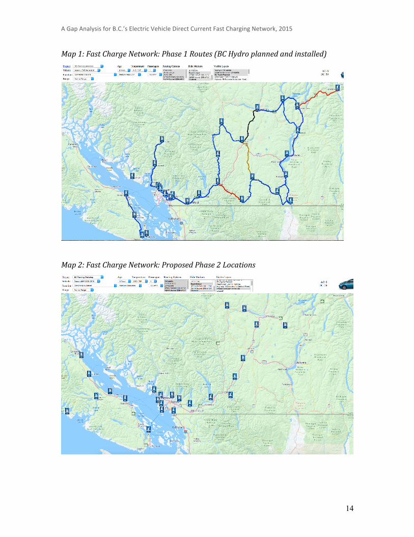
Based on the priority routes and corridors identified in the workshop and in the EV survey, different scenarios for EV station placement were mapped out. The following maps are a result of this mapping exercise to help guide planning decisions. However, it’s recommended that when determining the site-specific locations for actual deployment, this mapping tool should be consulted further, before seeking out station hosts. The design vehicle for the following maps is a 5-year-old 2013 Nissan Leaf, in ideal weather conditions. The blue icons represent DCFCs, the blue lines indicate the route is within range both ways, red lines indicate a very low battery warning, yellow lines indicate a low battery warning, and black lines indicate you can only travel in one direction successfully. 6 Feedback from A.Horvat, previous Chief EV Officer for Oregon State 7 For more details on the EV Infrastructure Planning Assistant, contact [email protected]
A Gap Analysis for B.C.’s Electric Vehicle Direct Current Fast Charging Network, 2015
14
Map 1: Fast Charge Network: Phase 1 Routes (BC Hydro planned and installed)
Map 2: Fast Charge Network: Proposed Phase 2 Locations

A Gap Analysis for B.C.’s Electric Vehicle Direct Current Fast Charging Network, 2015
15
Map 3: Fast-‐Charge Network: Phase 1 and Proposed Phase 2 Routes
Map 4: Fast-‐Charge Network: Lower Mainland Phase 1 and Proposed Phase 2 Stations

A Gap Analysis for B.C.’s Electric Vehicle Direct Current Fast Charging Network, 2015
16
Conclusions A network of 50 DCFC stations in B.C. is clearly not enough to satisfy electric travel throughout the province. However, locating stations to serve key regions and routes will better support existing EV drivers, and promote future uptake of EVs.
There is no real consensus on the best approach for DCFC deployment – increasing density in urban regions, or extending long-haul corridors – except to say that likely a combination of both is needed. Generally, current EV owners want better options for inter-city travel, favouring an EV tourism approach that focuses on connecting urban metropolis areas — where EV adoption is currently highest — with major travel destinations and regions. Given the other constraints (limited financial resources and the need to ensure that the charging network is robust) we would recommend that the focus be on growing the next “ring” of travel destinations outside of the urban Metro Vancouver and Greater Victoria areas, rather than stretching the network too quickly with inadequate resources. This matches the top 6 routes identified in the focus group and EV owner survey (these are the same regardless of ranking method):
• South Coast Ferries: Near Southern Ferry Terminals (Tsawassen, Swartz Bay, Horseshoe Bay) (3 stations)
• Highway 5 (Coquihalla): Hope to Kamloops via Merritt (3 stations)* • Metro Vancouver: Add density throughout region (2-4 stations8) • Highway 99: USA Border to Vancouver Airport / Vancouver (2 stations) • Highway 4: Qualicum Beach to Tofino (3 stations) • Highway 7: North of Fraser River, Vancouver to Hope (4 stations)
Additional locations to consider: • Highway 19: Nanaimo – add a second station in Nanaimo, off Highway 19 to
serve the Island Highway travellers (1 station) • Highway 19: North of Qualicum Beach to Campbell River (2 stations) • Highway 1: Linking Spences Bridge to Kamloops (1 in Cache Creek and 1 in
Walhachin) (2 stations)** • Highway 97: Westwold, connecting Vernon to Kamloops. (1 station)** • Highway 3: Hope to Princeton. (1 station)**
The recommended routes of this report does not confirm the final number or locations to be implemented, which will also depend on the availability of hosts and partners, technical capabilities of locations, leveraged funding, suitable business models, and other factors that may not have been considered at this time.
* The Coquihalla: Highway 5 - Hope to Kamloops route is a very challenging route from a technical and siting perspective, and so if these barriers cannot be overcome as this project moves into implementation, it is recommended that another route between the lower mainland and the interior be the focus of additional stations (e.g. Hwy 3 or Hwy 1).
** On their own, these locations may not be high priorities, however, they are needed to complete routes that will only be partially served from Phase One deployment. 8 Note that there is overlap from other priority routes for the Metro Vancouver region.
A Gap Analysis for B.C.’s Electric Vehicle Direct Current Fast Charging Network, 2015
17
FBC recommends that when determining site-specific locations for any new DCFC station, the EV Infrastructure Planning Assistant (mapping tool) should be consulted before finalizing any agreements with station hosts. It is essential that new stations consider existing and planned stations in the province, as well as in neighbouring jurisdictions (Washington and Alberta), to ensure an integrated network is offered. Serviceability, reliability and redundancy are critical, and FBC recommends that the existing service model for B.C.’s DCFC network be re-examined. The ongoing operation of DCFC stations must be addressed before entering into any new agreement with station hosts. The business model of the DCFC program is out of scope for this gap analysis.
Next Steps Once accepted by the Province of B.C., the Fraser Basin Council proposes the next steps in order to meet the obligations under the Clean Energy Vehicle Charging Station Program:
• Based on the gap analysis, develop a final recommended list of locations. This list will be used for a preliminary identification of prospective station hosts, and may evolve depending on technical and economic viability of proposed locations.
• Work closely with the Province of BC, BC Hydro, BC Ministry of Transportation and Infrastructure, and BC Parks and other relevant stakeholders to determine the feasibility of station siting on the Coquihalla Highway 5 between Hope and Kamloops.
• Develop a business model for seeking private and public sector partnerships for the new stations that are being added to B.C.’s DCFC Network.