beaver county, pennsylvania county, pennsylvania gis data dictionary geodatabase design and feature...
TRANSCRIPT

BEAVER COUNTY, PENNSYLVANIA
GIS DATA DICTIONARY
Geodatabase Design and Feature Definition
Public GIS Data
Prepared by:
Michael Baker International
Moon Township, Pennsylvania
March 28, 2016
Beaver County
Michael Baker International Page I

Beaver County
Michael Baker International Page II
Contents
INTRODUCTION............................................................................................................. 1
SHAPEFILE NOTES ....................................................................................................... 1
DISCLAIMER................................................................................................................... 2
COORDINATE SYSTEM................................................................................................ 2
ASSESSMENT / OWNER ............................................................................................... 3 Current Owner ................................................................................................................ 3
CADASTRAL .................................................................................................................... 5 Cadastral Line ................................................................................................................. 6
Property Line .............................................................................................................. 7
Lot Line ....................................................................................................................... 7 Former Property Line .................................................................................................. 7 Property Line Out ....................................................................................................... 7
Hidden Property Line .................................................................................................. 7 Rights of Way ............................................................................................................. 7
Road Right of Way Line ......................................................................................... 7 Railroad Right of Way Line .................................................................................... 7 Hidden Road Rights of Way Line ........................................................................... 7
Hidden Railroad Rights of Way Line ..................................................................... 7 Easement ..................................................................................................................... 7
Paper Street Right of Way Line .................................................................................. 8 Hydro Property Line ................................................................................................... 8
State Line .................................................................................................................... 8 County Line ................................................................................................................ 8 Township Line ............................................................................................................ 8
City Line ..................................................................................................................... 8 Borough Line .............................................................................................................. 8
Ward Line ................................................................................................................... 8 Warrant ....................................................................................................................... 8 Building Line .............................................................................................................. 8
Hydro Only Line ......................................................................................................... 8 Former Municipal Line ............................................................................................... 8
Annexation Line.......................................................................................................... 8 US Buffer Line ............................................................................................................ 8
Deed Overlap Line ...................................................................................................... 9 Parcel Polygon .............................................................................................................. 10 Miscellaneous Line ....................................................................................................... 11 Lease Point .................................................................................................................... 11 Annotation..................................................................................................................... 12
Acres ......................................................................................................................... 12 Hydrography Name ................................................................................................... 13
Beaver County
Michael Baker International Page III
Lot Number ............................................................................................................... 14 Miscellaneous Annotation ........................................................................................ 15 Municipal Name........................................................................................................ 16 Parcel Number .......................................................................................................... 17
Parcel Line Dimension .............................................................................................. 18 Parcel Road Right of Way Frontage Dimension ....................................................... 19 Tax Map Road Name ................................................................................................ 20 Tax Map Paper Road Name ...................................................................................... 21 Tax Map Private Road Name .................................................................................... 22
Subdivision Name ..................................................................................................... 23
POLITICAL .................................................................................................................... 24 Political Polygon ........................................................................................................... 24
Ward Polygon ............................................................................................................... 25
ROAD CENTERLINE ................................................................................................... 26 Road Centerlines ........................................................................................................... 26
ADDRESS ........................................................................................................................ 30 Address_Pnts................................................................................................................. 30
LANDMARKS ................................................................................................................ 31 Landmark_Area ............................................................................................................ 31 Landmark_Point ............................................................................................................ 31
River_Ports ................................................................................................................... 32 RR_Crossing ................................................................................................................. 33
WATER ........................................................................................................................... 36 Water_Area ................................................................................................................... 36
Water_Line ................................................................................................................... 36
DISTRICT NUMBERS .................................................................................................. 37 District Numbers and Political Subdivision .................................................................. 37
DOMAIN LISTS ............................................................................................................. 38 CountyName ................................................................................................................. 38 IsConstructed ................................................................................................................ 38 IsMileMarker ................................................................................................................ 38 IsTunnel ........................................................................................................................ 38
MuniName .................................................................................................................... 38 MuniType ...................................................................................................................... 39 RoadClass ..................................................................................................................... 39
StateName ..................................................................................................................... 40 StreetDir ........................................................................................................................ 40 StreetType ..................................................................................................................... 40

Beaver County
Michael Baker International Page IV

Michael Baker International Page 1
INTRODUCTION
This Data Dictionary defines the features that are included with the Beaver County GIS
data that is available to the general public. It outlines the structure for storage of graphic
data and database attribute information.
The storage format of the data is an ESRI Personal Geodatabase. Optionally the GIS data
can be exported in ESRI shapefile format.
The purpose of this document is to define the structure for all point, line, polygon and
annotation features that are included in the Beaver County GIS data set available to the
public in ESRI Personal Geodatabase format.
The annotation data provided in this data set was created to support the creation of
Beaver County Tax Maps. Since the tax maps have been created at various map scales,
the annotation is created at various scales based on the scale of the tax map the annotation
will support.
SHAPEFILE NOTES
As noted, the Beaver County GIS is designed for use in an ESRI Personal Geodatabase
but can be delivered in ESRI shapefile format. The delivery of shapefiles will have
several limitations on the data.
Shapefiles do not support annotation. The annotation is included in the shapefiles as a
polygon feature where the polygon shows the placement of the annotation. Other
information concerning the annotation in a shapefile can be obtained from the attribute
information in the polygon shapefile.
Domain lists are not supported by shapefiles and are not included as part of the shapefile
format of the GIS.
Shapefiles have a maximum field length of 10. Any field names in the layers and tables
that are longer than 10 will be truncated.

Michael Baker International Page 2
DISCLAIMER
The Beaver County GIS data is available to the public for a fee and is subject to the
following terms and conditions:
1. The information is to be used only by the purchaser and may not be duplicated,
reproduced, assigned, transmitted, or delivered in whole or in part, in any form, to
any other person, party, organization, entity, or successor.
2. The County of Beaver makes no warranty whatsoever, neither expressed nor
implied, with respect to the accuracy of the GIS data or fitness for use of the
information by the purchaser.
3. The purchaser releases the County of Beaver, its officers, departments,
authorities, agencies, and employees from any and all claims and liability
associated any way whatsoever with the GIS data or the purchaser’s use thereof.
4. The parcel boundary information should not be interpreted or accepted as an
individual property survey for deed transfers or other legal transactions.
COORDINATE SYSTEM
The coordinate system for all map data is:
Pennsylvania State Plane South Zone 3702
North American Horizontal Datum (NAD) 1983
Lambert Conformal Conic Projection
U.S. Survey Foot
False Easting: 1,968,500.0
False Northing: 0.0
Central Meridian: -77.75 degrees West
Standard Parallel: 39.93333333333333 degrees North
Standard Parallel: 40.96666666666667 degrees North
Latitude of Origin: 39.33333333333334 degrees North

Michael Baker International Page 3
Tables
ASSESSMENT / OWNER
The assessment / owner table lists ownership information for each parcel. When this
table is joined to the parcel polygon table the ownership information can be viewed. The
join is created based on Parcel_Polygon.PIN = Current_Owner.Assessment_ID.
Table Name: Current_Owner
Description: This table lists ownership information for the parcels in Beaver County.
Current Owner
Database Fields
Field Name Data Type Description
OBJECTID Object ID ESRI Unique ID
Assessment_ID Text – 12 Parcel Number
Owner_Name1 Text – 26 Name of owner
Owner_Name2 Text – 26 Name of additional owner
Book Text – 10 Deed Book Number
Page Text – 10 Deed Book Page Number
Sale_Date Text – 10 Date of the last sale of the parcel
Sale_Amount Long Integer Amount paid for the parcel
Total_Acres Text – 15 Acreage of the parcel
Landuse_Code Text – 15 Numeric code that defines the type of
land use:
1xx series = Residential Use
2xx series = Manufacturing
3xx series = Manufacturing
4xx series = Transportation,
Communication, and
Utilities
5xx series = Commercial/Professional
Trade
6xx series = Commercial/Professional
Services
7xx series = Cultural, Entertainment,
and Recreational
8xx series = Resource Production and
Extraction
9xx series = Undeveloped Land Areas
Note1 Text – 60 Tax Assessment Department notations
Location_Number Text – 15 Address Number of the parcel
Location_Street Text – 21 The street name for the parcel
Mail_Address Text – 22 The mailing address of the owner
Michael Baker International Page 4
Mail_City Text – 19 The address city of the owner
Mail_Zipcode Text – 9 The address zip code of the owner
Property_Description1 Text – 24 General description of the parcel
Property_Description2 Text – 24 Additional description
Ratio Text – 5 Assessment vs. Market Value for Base
Year of 1982
Land_Value Long Integer Market value of the land
Building_Value Long Integer Market value of the building
Total_Value Long Integer Market value of the land and building
Year_Built Text – 15 The year the building was erected
Landuse Text – 75 Description of the landuse
Neighborhood_Code Text – 4 Numeric code assigned to the
neighborhood
Neighborhood_Name Text – 100 The name of the municipality
MASCARD Text – 2

Michael Baker International Page 5
Feature Dataset: Cadastral
CADASTRAL
The Cadastral Feature Dataset contains information concerning the location of parcels
and other features, such as Road Rights of Way, that affect a parcel.
The parcel polygons in this dataset are divided according to the Beaver County Tax
Assessor assigned Parcel Number.
The bounding lines used for the creation of Parcel Polygons include Parcel Lines, Road
Rights of Way Lines, Railroad Rights of Way Lines, and also may include Water
(Hydrography) Lines as well as Municipal Lines including State Lines, County Lines,
Township Lines, City Lines, Borough Lines and Ward Lines. Since the Municipal Lines
are needed to properly display the parcel data, they are being included in the Cadastral
Feature Dataset.
Multiple Parcel Polygons have been created to show parcels that extend beyond the limits
of a Municipal line. Each Parcel Polygon of the parcel that extends beyond the
Municipal limit is assigned the Parcel Number according to the Tax Map data and may be
duplicated for each supporting polygon.
According to Pennsylvania law, the legal description for a property boundary is the
property deed. The parcel data represented in this GIS should be viewed as a graphical
representation of the property’s location, not the legal description.

Michael Baker International Page 6
Feature Class: Cadastral_Line
Feature Type: Linear
Alias: Cadastral Line
Description: The Parcel Line Feature Class contains lines that create and effect
individual parcels.
Cadastral Line
Linear Database Fields
Field Name Data Type Description
OBJECTID Object ID ESRI Unique ID
SHAPE Geometry ESRI Data
SHAPE_Length Double ESRI Assigned
LineType Short Integer - Subtype Type of Parcel Line
101. Property Line
102. Lot Line
103. Former Property Line
104. Property Line Out
105. Hidden Property Line
106. Road Right of Way
Line
107. Railroad Right of Way
Line
108. Hidden Road Right of
Way Line
109. Hidden Railroad Right
of Way Line
110. Easement
111. Paper Street Right of
Way Line
112. Hydro Property Line
113. Township Line
114. Ward Line
115. County Line
116. State Line
117. Borough Line
118. City Line
119. Warrant
120. Building Line
121. Hydro Only Line
122. Former Municipal
Line
123. Annexation Line
125. US Buffer Zone Line
126. Deed Overlap Line

Michael Baker International Page 7
The Parcel Line feature Class contains the following line categories:
Property Line
A Parcel Line is the bounding-lines for a Parcel Area, not including Road Right of Way
lines.
Lot Line
A Lot is any one of the marketable parcels into which a tract of land is divided upon
platting. Lot Lines are shown only when they do not coincide with a Parcel Line.
Former Property Line
When two (2) or more adjoining parcels are combined into one (1) parcel, the original
Parcel Lines are categorized as Former (Old) Parcel Lines
Property Line Out
Portions of a parcel may be included as part of the Road Right of Way. The boundary of
a parcel inside of a Road Right of Way is categorized as Property Line Out.
Hidden Property Line
A Parcel Line that is hidden by an overhead obstruction, such as a bridge.
Rights of Way
The right given by one landowner to another to pass over the land, construct a roadway,
or use as a pathway, without actually transferring ownership.
Road Right of Way Line
This is the boundary of land owned by the municipality, county, or state for the
purpose of maintaining a road. The Road Right of Way line, along with the Parcel
Line, creates the boundary for a Parcel Polygon.
Railroad Right of Way Line
The bounding lines for a strip of land traversed by a railroad, whether owned by the
railroad or used under an easement agreement.
Hidden Road Rights of Way Line
A Road Rights of Way that is hidden by overhead obstructions
Hidden Railroad Rights of Way Line
A Railroad Rights of Way that is hidden by overhead obstructions.
Easement
A line showing easements. An easement is the right held by one person or organization
to use the land of another for a specific purpose, such as access to another property or
access to utilities on a property.

Michael Baker International Page 8
Paper Street Right of Way Line
A street that exists only on paper, such as the tax map. A Paper Street is a street that has
been recorded but never constructed.
Hydro Property Line
The boundary for water features such as rivers, lakes and ponds which define the
boundary of a parcel.
State Line
The line locating the boundary of the State
County Line
The line locating the boundary of the County
Township Line
The line locating the boundary of a Township
City Line
The line locating the boundary of a City
Borough Line
The Line locating the boundary of a Borough
Ward Line
The line locating the boundary of a Ward
Warrant
An original survey line. These lines show the original survey of land as it was transferred
to private ownership.
Building Line
Used to create parcels by using the building footprints of condominiums in a subdivision.
Hydro Only Line
A line to show a water feature that does not create the boundary of a parcel.
Former Municipal Line
The line locating the old municipal border between two municipalities.
Annexation Line
The line that shows when a portion of a municipality is annexed to another.
US Buffer Line
The line that depicts a US Buffer Zone.
Michael Baker International Page 9
Deed Overlap Line
A line showing the overlap of a parcel onto an adjoining parcel based on the deed
description.

Michael Baker International Page 10
Feature Class: Parcel_Polygon
Feature Type: Polygon
Alias: Parcel Polygon
Description: A Parcel is a contiguous area of land described in a single legal
description or as one of a number of lots on a plat; separately owned,
either publicly or privately; and capable of being separately conveyed.
The database field PIN is used as the link between the GIS Parcel
Polygons and other databases, such as the Assessor’s database.
Parcel Polygon
Polygon Database Fields
Field Name Data Type Description Domain
Name
OBJECTID Object ID ESRI Unique ID
SHAPE Geometry ESRI Data
SHAPE_Length Double ESRI Assigned
SHAPE_Area Double ESRI Assigned
STF Text – 2 FIPS code for state.
COF Text – 3 FIPS code for county with taxing
jurisdiction.
MCF Text – 5 FIPS code for municipality with
taxing jurisdiction.
MCN Text – 35 Name of municipality which has
taxing jurisdiction.
MuniName
PIN Text – 12 Unique ID for the parcel. This is the
identifier assigned to the parcel by
the Assessor; the Parcel ID
CAMAKey Text – 30 Unique identifier (Primary Key) in
CAMA data extract table.
GIS_Ac Double The calculated acreage of the parcel.
Original_PIN Text – 12
IN_DATE Date The date the polygon added to the
Parcel Polygon feature class.

Michael Baker International Page 11
Feature Class: Misc_Line
Feature Type: Linear
Alias: Miscellaneous Parcel Line
Description: The Miscellaneous Parcel Line Feature Class contains lines for Land
Hooks, Leader Lines, Match Lines and Survey Station Lines.
Miscellaneous Line
Linear Database Fields
Field Name Data Type Description
OBJECTID Object ID ESRI Unique ID
SHAPE Geometry ESRI Data
SHAPE_Length Double ESRI Assigned
LineType Short Integer - Subtype Type of Line
201. Land Hook
202. Leader Line
203. Match Line
204. Survey Station Line
Feature Class: Lease_Point
Feature Type: Point
Alias: Lease Point
Description: The Lease point feature is placed on parcels that have a leased object on
them (such as a tower, building, etc).
The database field Lease_ID is used as the link between the Lease Points
and other databases, such as the Assessor’s database.
Lease Point
Polygon Database Fields
Field Name Data Type Description
OBJECTID Object ID ESRI Unique ID
SHAPE Geometry ESRI Data
Lease_ID Text – 12 Unique ID for point

Michael Baker International Page 12
Annotation
Feature Class: Anno_Acres
Feature Type: Annotation
Alias: Acres Annotation
Description: This annotation feature displays the Acres of the parcel.
Acres
Annotation Database Fields
Field Name Data Type Description
OBJECTID Object ID ESRI Unique ID
SHAPE Geometry ESRI Data
FeatureID Long Integer ESRI Assigned
ZOrder Long Integer ESRI Assigned
AnnotationClassID Long Integer ESRI Assigned
Element Blob ESRI Assigned
SymbolID Long Integer ESRI Assigned
Status Short Integer ESRI Assigned
TextString Text – 255 ESRI Assigned
FontName Text – 255 ESRI Assigned
FontSize Double ESRI Assigned
Bold Short Integer ESRI Assigned
Italic Short Integer ESRI Assigned
Underline Short Integer ESRI Assigned
VerticalAlignment Short Integer ESRI Assigned
HorizontalAlignment Short Integer ESRI Assigned
XOffset Double ESRI Assigned
YOffset Double ESRI Assigned
Angle Double ESRI Assigned
FontLeading Double ESRI Assigned
WordSpacing Double ESRI Assigned
CharacterWidth Double ESRI Assigned
CharacterSpacing Double ESRI Assigned
FlipAngle Double ESRI Assigned
Override Long Integer ESRI Assigned
SHAPE_Length Double ESRI Assigned
Shape_Area Double ESRI Assigned
Reference Scale: 1:1200 (1”=100’)
Font: Arial
Font Size: 4, 5, 6, 7, 8, 9, 10, 18, 22, 24, 26, 27, 28, 30, 32, or 36
Italic: No
Michael Baker International Page 13
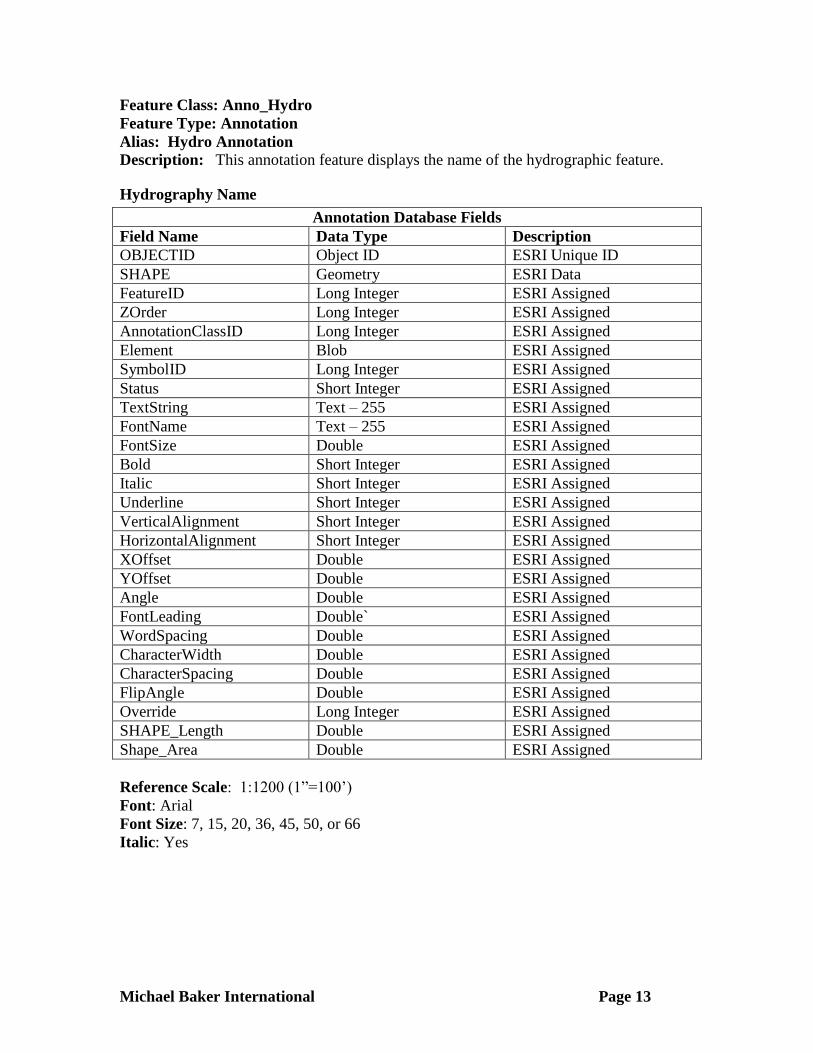
Feature Class: Anno_Hydro
Feature Type: Annotation
Alias: Hydro Annotation
Description: This annotation feature displays the name of the hydrographic feature.
Hydrography Name
Annotation Database Fields
Field Name Data Type Description
OBJECTID Object ID ESRI Unique ID
SHAPE Geometry ESRI Data
FeatureID Long Integer ESRI Assigned
ZOrder Long Integer ESRI Assigned
AnnotationClassID Long Integer ESRI Assigned
Element Blob ESRI Assigned
SymbolID Long Integer ESRI Assigned
Status Short Integer ESRI Assigned
TextString Text – 255 ESRI Assigned
FontName Text – 255 ESRI Assigned
FontSize Double ESRI Assigned
Bold Short Integer ESRI Assigned
Italic Short Integer ESRI Assigned
Underline Short Integer ESRI Assigned
VerticalAlignment Short Integer ESRI Assigned
HorizontalAlignment Short Integer ESRI Assigned
XOffset Double ESRI Assigned
YOffset Double ESRI Assigned
Angle Double ESRI Assigned
FontLeading Double` ESRI Assigned
WordSpacing Double ESRI Assigned
CharacterWidth Double ESRI Assigned
CharacterSpacing Double ESRI Assigned
FlipAngle Double ESRI Assigned
Override Long Integer ESRI Assigned
SHAPE_Length Double ESRI Assigned
Shape_Area Double ESRI Assigned
Reference Scale: 1:1200 (1”=100’)
Font: Arial
Font Size: 7, 15, 20, 36, 45, 50, or 66
Italic: Yes

Michael Baker International Page 14
Feature Class: Anno_Lot
Feature Type: Annotation
Alias: Lot Annotation
Description: This annotation feature displays the individual lot numbers.
Lot Number
Annotation Database Fields
Field Name Data Type Description
OBJECTID Object ID ESRI Unique ID
SHAPE Geometry ESRI Data
FeatureID Long Integer ESRI Assigned
ZOrder Long Integer ESRI Assigned
AnnotationClassID Long Integer ESRI Assigned
Element Blob ESRI Assigned
SymbolID Long Integer ESRI Assigned
Status Short Integer ESRI Assigned
TextString Text – 255 ESRI Assigned
FontName Text – 255 ESRI Assigned
FontSize Double ESRI Assigned
Bold Short Integer ESRI Assigned
Italic Short Integer ESRI Assigned
Underline Short Integer ESRI Assigned
VerticalAlignment Short Integer ESRI Assigned
HorizontalAlignment Short Integer ESRI Assigned
XOffset Double ESRI Assigned
YOffset Double ESRI Assigned
Angle Double ESRI Assigned
FontLeading Double` ESRI Assigned
WordSpacing Double ESRI Assigned
CharacterWidth Double ESRI Assigned
CharacterSpacing Double ESRI Assigned
FlipAngle Double ESRI Assigned
Override Long Integer ESRI Assigned
SHAPE_Length Double ESRI Assigned
Shape_Area Double ESRI Assigned
Reference Scale: 1:1200 (1”=100’)
Font: Arial
Font Size: 4, 5, 6, 7, 8, 10, 16, 20, 25, 27, 28, 30, or 36
Italic: Yes
Michael Baker International Page 15
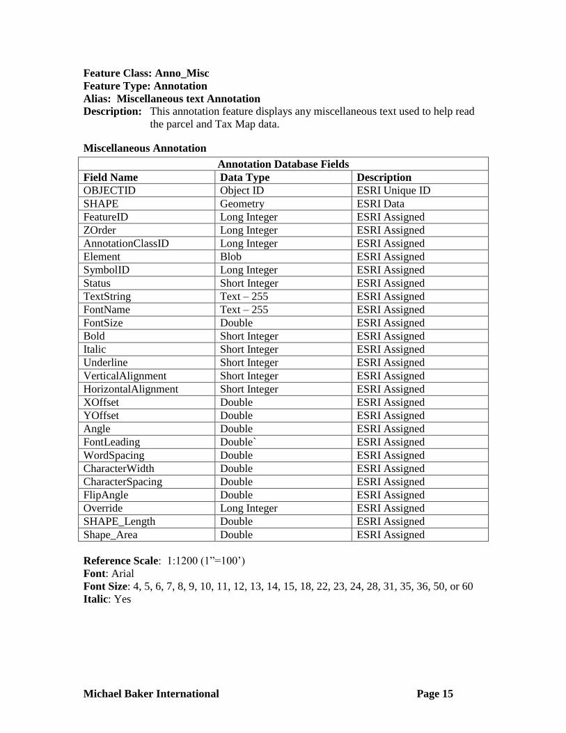
Feature Class: Anno_Misc
Feature Type: Annotation
Alias: Miscellaneous text Annotation
Description: This annotation feature displays any miscellaneous text used to help read
the parcel and Tax Map data.
Miscellaneous Annotation
Annotation Database Fields
Field Name Data Type Description
OBJECTID Object ID ESRI Unique ID
SHAPE Geometry ESRI Data
FeatureID Long Integer ESRI Assigned
ZOrder Long Integer ESRI Assigned
AnnotationClassID Long Integer ESRI Assigned
Element Blob ESRI Assigned
SymbolID Long Integer ESRI Assigned
Status Short Integer ESRI Assigned
TextString Text – 255 ESRI Assigned
FontName Text – 255 ESRI Assigned
FontSize Double ESRI Assigned
Bold Short Integer ESRI Assigned
Italic Short Integer ESRI Assigned
Underline Short Integer ESRI Assigned
VerticalAlignment Short Integer ESRI Assigned
HorizontalAlignment Short Integer ESRI Assigned
XOffset Double ESRI Assigned
YOffset Double ESRI Assigned
Angle Double ESRI Assigned
FontLeading Double` ESRI Assigned
WordSpacing Double ESRI Assigned
CharacterWidth Double ESRI Assigned
CharacterSpacing Double ESRI Assigned
FlipAngle Double ESRI Assigned
Override Long Integer ESRI Assigned
SHAPE_Length Double ESRI Assigned
Shape_Area Double ESRI Assigned
Reference Scale: 1:1200 (1”=100’)
Font: Arial
Font Size: 4, 5, 6, 7, 8, 9, 10, 11, 12, 13, 14, 15, 18, 22, 23, 24, 28, 31, 35, 36, 50, or 60
Italic: Yes
Michael Baker International Page 16
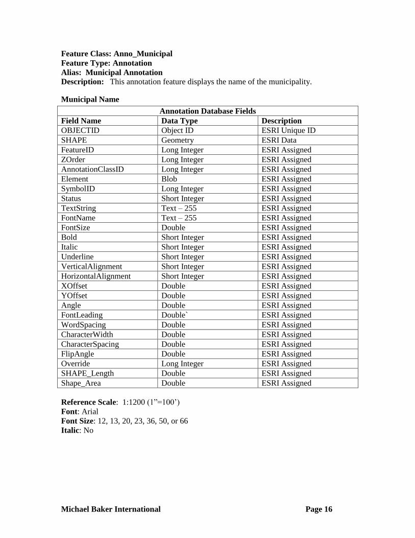
Feature Class: Anno_Municipal
Feature Type: Annotation
Alias: Municipal Annotation
Description: This annotation feature displays the name of the municipality.
Municipal Name
Annotation Database Fields
Field Name Data Type Description
OBJECTID Object ID ESRI Unique ID
SHAPE Geometry ESRI Data
FeatureID Long Integer ESRI Assigned
ZOrder Long Integer ESRI Assigned
AnnotationClassID Long Integer ESRI Assigned
Element Blob ESRI Assigned
SymbolID Long Integer ESRI Assigned
Status Short Integer ESRI Assigned
TextString Text – 255 ESRI Assigned
FontName Text – 255 ESRI Assigned
FontSize Double ESRI Assigned
Bold Short Integer ESRI Assigned
Italic Short Integer ESRI Assigned
Underline Short Integer ESRI Assigned
VerticalAlignment Short Integer ESRI Assigned
HorizontalAlignment Short Integer ESRI Assigned
XOffset Double ESRI Assigned
YOffset Double ESRI Assigned
Angle Double ESRI Assigned
FontLeading Double` ESRI Assigned
WordSpacing Double ESRI Assigned
CharacterWidth Double ESRI Assigned
CharacterSpacing Double ESRI Assigned
FlipAngle Double ESRI Assigned
Override Long Integer ESRI Assigned
SHAPE_Length Double ESRI Assigned
Shape_Area Double ESRI Assigned
Reference Scale: 1:1200 (1”=100’)
Font: Arial
Font Size: 12, 13, 20, 23, 36, 50, or 66
Italic: No
Michael Baker International Page 17
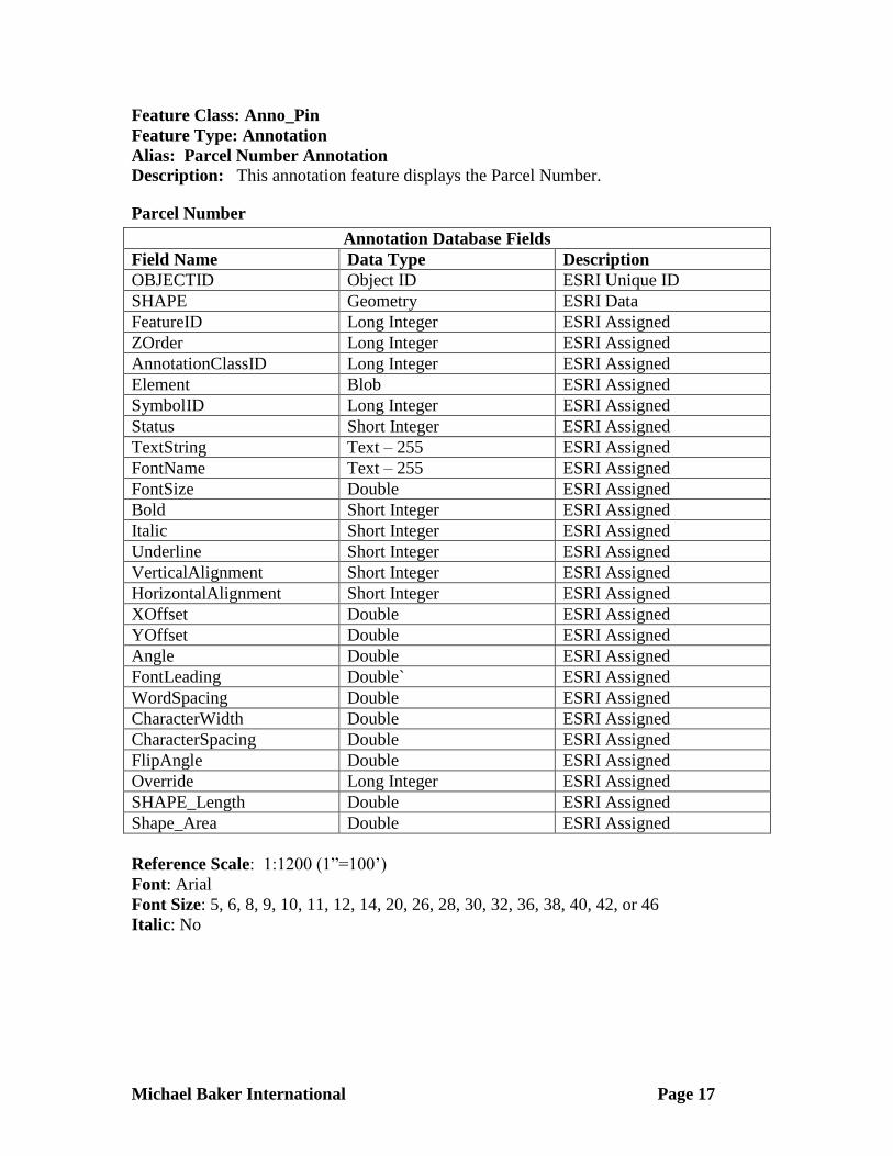
Feature Class: Anno_Pin
Feature Type: Annotation
Alias: Parcel Number Annotation
Description: This annotation feature displays the Parcel Number.
Parcel Number
Annotation Database Fields
Field Name Data Type Description
OBJECTID Object ID ESRI Unique ID
SHAPE Geometry ESRI Data
FeatureID Long Integer ESRI Assigned
ZOrder Long Integer ESRI Assigned
AnnotationClassID Long Integer ESRI Assigned
Element Blob ESRI Assigned
SymbolID Long Integer ESRI Assigned
Status Short Integer ESRI Assigned
TextString Text – 255 ESRI Assigned
FontName Text – 255 ESRI Assigned
FontSize Double ESRI Assigned
Bold Short Integer ESRI Assigned
Italic Short Integer ESRI Assigned
Underline Short Integer ESRI Assigned
VerticalAlignment Short Integer ESRI Assigned
HorizontalAlignment Short Integer ESRI Assigned
XOffset Double ESRI Assigned
YOffset Double ESRI Assigned
Angle Double ESRI Assigned
FontLeading Double` ESRI Assigned
WordSpacing Double ESRI Assigned
CharacterWidth Double ESRI Assigned
CharacterSpacing Double ESRI Assigned
FlipAngle Double ESRI Assigned
Override Long Integer ESRI Assigned
SHAPE_Length Double ESRI Assigned
Shape_Area Double ESRI Assigned
Reference Scale: 1:1200 (1”=100’)
Font: Arial
Font Size: 5, 6, 8, 9, 10, 11, 12, 14, 20, 26, 28, 30, 32, 36, 38, 40, 42, or 46
Italic: No

Michael Baker International Page 18
Feature Class: Anno_Pline
Feature Type: Annotation
Alias: Parcel Dimension Annotation
Description: This annotation feature displays the parcel dimension along the sides of a
parcel that do not border a Road Rights of Way.
Parcel Line Dimension
Annotation Database Fields
Field Name Data Type Description
OBJECTID Object ID ESRI Unique ID
SHAPE Geometry ESRI Data
FeatureID Long Integer ESRI Assigned
ZOrder Long Integer ESRI Assigned
AnnotationClassID Long Integer ESRI Assigned
Element Blob ESRI Assigned
SymbolID Long Integer ESRI Assigned
Status Short Integer ESRI Assigned
TextString Text – 255 ESRI Assigned
FontName Text – 255 ESRI Assigned
FontSize Double ESRI Assigned
Bold Short Integer ESRI Assigned
Italic Short Integer ESRI Assigned
Underline Short Integer ESRI Assigned
VerticalAlignment Short Integer ESRI Assigned
HorizontalAlignment Short Integer ESRI Assigned
XOffset Double ESRI Assigned
YOffset Double ESRI Assigned
Angle Double ESRI Assigned
FontLeading Double` ESRI Assigned
WordSpacing Double ESRI Assigned
CharacterWidth Double ESRI Assigned
CharacterSpacing Double ESRI Assigned
FlipAngle Double ESRI Assigned
Override Long Integer ESRI Assigned
SHAPE_Length Double ESRI Assigned
Shape_Area Double ESRI Assigned
Reference Scale: 1:1200 (1”=100’)
Font: Arial
Font Size: 4, 7, 10, 14, 18, or 22
Italic: No

Michael Baker International Page 19
Feature Class: Anno_Rfront
Feature Type: Annotation
Alias: Road Dimension Annotation
Description: This annotation feature displays the parcel dimension along the Road
Rights of Way.
Parcel Road Right of Way Frontage Dimension
Annotation Database Fields
Field Name Data Type Description
OBJECTID Object ID ESRI Unique ID
SHAPE Geometry ESRI Data
FeatureID Long Integer ESRI Assigned
ZOrder Long Integer ESRI Assigned
AnnotationClassID Long Integer ESRI Assigned
Element Blob ESRI Assigned
SymbolID Long Integer ESRI Assigned
Status Short Integer ESRI Assigned
TextString Text – 255 ESRI Assigned
FontName Text – 255 ESRI Assigned
FontSize Double ESRI Assigned
Bold Short Integer ESRI Assigned
Italic Short Integer ESRI Assigned
Underline Short Integer ESRI Assigned
VerticalAlignment Short Integer ESRI Assigned
HorizontalAlignment Short Integer ESRI Assigned
XOffset Double ESRI Assigned
YOffset Double ESRI Assigned
Angle Double ESRI Assigned
FontLeading Double` ESRI Assigned
WordSpacing Double ESRI Assigned
CharacterWidth Double ESRI Assigned
CharacterSpacing Double ESRI Assigned
FlipAngle Double ESRI Assigned
Override Long Integer ESRI Assigned
SHAPE_Length Double ESRI Assigned
Shape_Area Double ESRI Assigned
Reference Scale: 1:1200 (1”=100’)
Font: Arial
Font Size: 4, 5, 6, 7, 10, 12, 14, 18, or 22
Italic: No
Michael Baker International Page 20
Feature Class: Anno_Road
Feature Type: Annotation
Alias: Road Name Annotation
Description: This annotation feature displays the name of Tax Map Roads.
Tax Map Road Name
Annotation Database Fields
Field Name Data Type Description
OBJECTID Object ID ESRI Unique ID
SHAPE Geometry ESRI Data
FeatureID Long Integer ESRI Assigned
ZOrder Long Integer ESRI Assigned
AnnotationClassID Long Integer ESRI Assigned
Element Blob ESRI Assigned
SymbolID Long Integer ESRI Assigned
Status Short Integer ESRI Assigned
TextString Text – 255 ESRI Assigned
FontName Text – 255 ESRI Assigned
FontSize Double ESRI Assigned
Bold Short Integer ESRI Assigned
Italic Short Integer ESRI Assigned
Underline Short Integer ESRI Assigned
VerticalAlignment Short Integer ESRI Assigned
HorizontalAlignment Short Integer ESRI Assigned
XOffset Double ESRI Assigned
YOffset Double ESRI Assigned
Angle Double ESRI Assigned
FontLeading Double ESRI Assigned
WordSpacing Double ESRI Assigned
CharacterWidth Double ESRI Assigned
CharacterSpacing Double ESRI Assigned
FlipAngle Double ESRI Assigned
Override Long Integer ESRI Assigned
SHAPE_Length Double ESRI Assigned
Shape_Area Double ESRI Assigned
Reference Scale: 1:1200 (1”=100’)
Font: Arial
Font Size: 6, 7, 8, 10, 12, 13, 15, 18, 20, 23, or 45
Italic: No
Michael Baker International Page 21
Feature Class: Anno_Road_Paper
Feature Type: Annotation
Alias: Paper Road Name Annotation
Description: This annotation feature displays the name of Tax Map Paper Roads.
Tax Map Paper Road Name
Annotation Database Fields
Field Name Data Type Description
OBJECTID Object ID ESRI Unique ID
SHAPE Geometry ESRI Data
FeatureID Long Integer ESRI Assigned
ZOrder Long Integer ESRI Assigned
AnnotationClassID Long Integer ESRI Assigned
Element Blob ESRI Assigned
SymbolID Long Integer ESRI Assigned
Status Short Integer ESRI Assigned
TextString Text – 255 ESRI Assigned
FontName Text – 255 ESRI Assigned
FontSize Double ESRI Assigned
Bold Short Integer ESRI Assigned
Italic Short Integer ESRI Assigned
Underline Short Integer ESRI Assigned
VerticalAlignment Short Integer ESRI Assigned
HorizontalAlignment Short Integer ESRI Assigned
XOffset Double ESRI Assigned
YOffset Double ESRI Assigned
Angle Double ESRI Assigned
FontLeading Double` ESRI Assigned
WordSpacing Double ESRI Assigned
CharacterWidth Double ESRI Assigned
CharacterSpacing Double ESRI Assigned
FlipAngle Double ESRI Assigned
Override Long Integer ESRI Assigned
SHAPE_Length Double ESRI Assigned
Shape_Area Double ESRI Assigned
Reference Scale: 1:1200 (1”=100’)
Font: Arial
Font Size: 4, 6, 7, 8, 10, 12, 13, 18, 20, 23, or 45
Italic: Yes

Michael Baker International Page 22
Feature Class: Anno_Road_Private
Feature Type: Annotation
Alias: Tax Map Private Road Label
Description: This annotation feature displays the name of Tax Map Private Roads.
Tax Map Private Road Name
Annotation Database Fields
Field Name Data Type Description
OBJECTID Object ID ESRI Unique ID
SHAPE Geometry ESRI Data
FeatureID Long Integer ESRI Assigned
ZOrder Long Integer ESRI Assigned
AnnotationClassID Long Integer ESRI Assigned
Element Blob ESRI Assigned
SymbolID Long Integer ESRI Assigned
Status Short Integer ESRI Assigned
TextString Text – 255 ESRI Assigned
FontName Text – 255 ESRI Assigned
FontSize Double ESRI Assigned
Bold Short Integer ESRI Assigned
Italic Short Integer ESRI Assigned
Underline Short Integer ESRI Assigned
VerticalAlignment Short Integer ESRI Assigned
HorizontalAlignment Short Integer ESRI Assigned
XOffset Double ESRI Assigned
YOffset Double ESRI Assigned
Angle Double ESRI Assigned
FontLeading Double` ESRI Assigned
WordSpacing Double ESRI Assigned
CharacterWidth Double ESRI Assigned
CharacterSpacing Double ESRI Assigned
FlipAngle Double ESRI Assigned
Override Long Integer ESRI Assigned
SHAPE_Length Double ESRI Assigned
Shape_Area Double ESRI Assigned
Reference Scale: 1:1200 (1”=100’)
Font: Arial
Font Size: 8, 12, 20, 23, or 45
Italic: No
Michael Baker International Page 23
Feature Class: Anno_Subdivision
Feature Type: Annotation
Description: This annotation feature displays the name of the Subdivision.
Subdivision Name
Annotation Database Fields
Field Name Data Type Description
OBJECTID Object ID ESRI Unique ID
SHAPE Geometry ESRI Data
FeatureID Long Integer ESRI Assigned
ZOrder Long Integer ESRI Assigned
AnnotationClassID Long Integer ESRI Assigned
Element Blob ESRI Assigned
SymbolID Long Integer ESRI Assigned
Status Short Integer ESRI Assigned
TextString Text – 255 ESRI Assigned
FontName Text – 255 ESRI Assigned
FontSize Double ESRI Assigned
Bold Short Integer ESRI Assigned
Italic Short Integer ESRI Assigned
Underline Short Integer ESRI Assigned
VerticalAlignment Short Integer ESRI Assigned
HorizontalAlignment Short Integer ESRI Assigned
XOffset Double ESRI Assigned
YOffset Double ESRI Assigned
Angle Double ESRI Assigned
FontLeading Double` ESRI Assigned
WordSpacing Double ESRI Assigned
CharacterWidth Double ESRI Assigned
CharacterSpacing Double ESRI Assigned
FlipAngle Double ESRI Assigned
Override Long Integer ESRI Assigned
SHAPE_Length Double ESRI Assigned
Shape_Area Double ESRI Assigned
Reference Scale: 1:1200 (1”=100’)
Font: Arial
Font Size: 4, 6, 8, 10, 16, or 18
Italic: No

Michael Baker International Page 24
Feature Dataset: Political
POLITICAL
The Political Feature Dataset contains information for local, county and state boundaries.
Feature Class: Political_Polygon
Feature Type: Polygon
Alias: Political Polygon
Description: This Feature Class will show the political divisions in the County and
include reference to State Name, County Name, Township Name, City
Name, and Borough Name.
Political Polygon
Polygon Database Fields
Field Name Data Type Description Domain Name
OBJECTID Object ID ESRI Unique ID
SHAPE Geometry ESRI Data
SHAPE_Length Double ESRI Assigned
SHAPE_Area Double ESRI Assigned
STF Text – 2 FIPS code for state.
STN Text – 16 The name of the
State in which the
polygon resides.
StateName
COF Text - 3 FIPS code for
county with taxing
jurisdiction.
CON Text – 16 The name of the
County in which
the polygon resides.
CountyName
MCF Text - 5 FIPS code for
municipality with
taxing jurisdiction.
MCN Text – 30 The name of the
Township in which
the polygon resides.
MuniName
MCT Text - 50 Municipality type. MuniType
GIS_Sq_Mi Double The calculated area
of the political
boundary in square
miles.

Michael Baker International Page 25
Feature Class: Ward_Polygon
Feature Type: Polygon
Alias: Ward Polygon
Description: This Feature Class will show the ward divisions in the County and include
reference to State Name, County Name, Township Name, City Name, Borough Name
and Ward Name.
Ownership: Beaver County Assessment
Ward Polygon
Polygon Database Fields
Field Name Data Type Description Domain Name
OBJECTID Object ID ESRI Unique ID
SHAPE Geometry ESRI Data
SHAPE_Length Double ESRI Assigned
SHAPE_Area Double ESRI Assigned
STF Text – 2 FIPS code for state.
STN Text – 16 The name of the
State in which the
polygon resides.
StateName
COF Text - 3 FIPS code for
county with taxing
jurisdiction.
CON Text – 16 The name of the
County in which
the polygon resides.
CountyName
MCF Text - 5 FIPS code for
municipality with
taxing jurisdiction.
MCN Text – 30 The name of the
Township in which
the polygon resides.
MuniName
MCT Text - 50 Municipality type. MuniType
Ward Text – 2 Ward Number
GIS_Sq_Miles Double The calculated area
of the political
boundary in square
miles.

Michael Baker International Page 26
Feature Dataset: RoadCenterline
ROAD CENTERLINE
Feature Class: RoadCenterline
Feature Type: Linear
Alias: Road Centerline
Description: The Road Centerline dataset contains addressed road segments throughout
Beaver County, Pennsylvania.
Road Centerlines
Linear Database Fields
Field Name Data Type Description Domain Name
OBJECTID Object ID ESRI Unique ID
GIS_Length Double Geometry length of segment
in PA State Plane US Survey
feet, calculated by GIS.
STF Text – 2 Federal Information
Processing Standard (FIPS)
code for Pennsylvania is 42.
COF Text – 3 County FIPS code in which
road centerline is located
SegID Long Integer A unique value per segment
within a county.
NameID Text – 6 Numeric code assigned to
each unique road name
within a municipality.
LLO Double Low address on the left side
of the street segment
LHI Double High address on the left side
of the street segment
RLO Double Low address on the right side
of the street segment
RHI Double High address on the right
side of the street segment
PRD Text – 2 Pre-directional/ Leading
Primary Street Direction (N,
S, E, W, NE, NW, SE, SW)
StreetDir
STN Text – 30 Primary Street Name
STS Text – 4 Primary Street Name Suffix
Abbreviation
StreetType
POD Text – 2 Post Directional/Trailing
Primary Street Direction (N,
S, E, W, NE, NW, SE, SW)
StreetDir

Michael Baker International Page 27
StName Text – 68 Primary street name
concatenated from
PRD+STN+STS+POD with
trailing spaces trimmed and
one space separating
concatenated items.
MCL Text – 35 Municipal name on left side
of street in direction of
digitized segment.
MCR Text – 35 Municipal name on right side
of street in direction of
digitized segment.
ZipL Text – 5 Zip Code on left side of
street in direction of digitized
segment.
ZipR Text – 5 Zip Code on right side of
street in direction of digitized
segment.
ESNL Text – 5 Emergency Service Number
on the left side of street in
direction of digitized
segment.
ESNR Text – 5 Emergency Service Number
on the right side of street in
direction of digitized
segment.
Tunnel Short Integer Denotes if primary street
travels underground within a
tunnel (0= no tunnel, 1=
tunnel)
IsTunnel
Open_Trav Short Integer Road construction status at
time it was added.
IsConstructed
RdClass Short Integer Road classification code RoadClass
Date_Add Long Integer Date the road segment was
added during normal
maintenance.
Date_Align Long Integer Date a segment was either
verified as aligned to most
recent PAMAP imagery, or
was realigned to the image.
Remains null for new roads
added or edited that were not
visible in the image at time
they were added.

Michael Baker International Page 28
Traffic_Rt Text – 8 PennDOT’s state traffic
route numbers as shown on
highway signs to support
standardized map labels (e.g.
(US030, PA283, I076).
NLF_ID Long Integer PennDOT's unique route
identifier used for their LRS
model.
NLF_Bgn Long Integer PennDOT's cumulative
measure in feet.
NLF_End Long Integer PennDOT's cumulative
measure in feet.
St_Rt_No_1 Text – 4 The PennDOT state route
number designation.
St_Rt_No_2 Text – 4 The PennDOT state route
number designation.
US_Rt_No Text – 4 The US route number
designation.
Int_No Text – 4 The interstate route number
designation.
Tnnl_Nm Text – 100 USGS name for tunnel in the
USGS GNIS database found
in FEATURE_NAME
column.
CLID Text - 10 Planning’s Unique ID
P_Class Short Integer Planning’s road classification
code
P_ARange Text – 15 Primary Street Address
Range
P_ZipCode Long Integer Planning’s Zip Code
P_Owner Text – 8 Private or Government
Agency that owns road
P_TZone Long Integer Time Zone
P_Coverage Text – 50 Planning Coverage
P_Length_Mil Double Length in miles
P_Main_Roads Short Integer Number hierarchy. High
numbers are major routes
and low numbers are local
routes
P_SR Short Integer 4 digit State Route
designation
P_FMCDCCD90L Long Integer Planning Census date for the
left side of street in direction
of digitized segment.
Michael Baker International Page 29
P_FMCDCCD90R Long Integer Planning Census date for the
right side of street in
direction of digitized
segment.
P_Roads Double Planning road centerlines
P_Roads_Id Double Planning road centerline
unique identification number
LMATCH Text – 1
RMATCH Text – 1
AttTransfer Short Integer
P_LLO Long Integer Planning road centerline left
low address
P_LHI Long Integer Planning road centerline left
high address
P_RLO Long Integer Planning road centerline
right low address
P_RHI Long Integer Planning road centerline
right high address
CAD_Adjusted Short Integer
MSAG_LLO Long Integer
MSAG_LHI Long Integer
MSAG_RLO Long Integer
MSAG_RHI Long Integer
Speet_Lt Short Integer Designated Speed Limit by
Road Class Type
Shape_len Double ESRI Defined
Shape Geometry ESRI Data
Michael Baker International Page 30
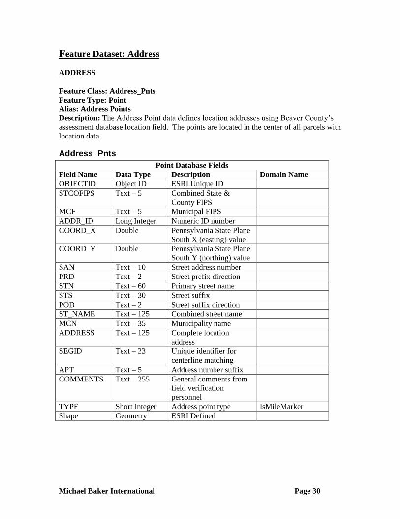
Feature Dataset: Address
ADDRESS
Feature Class: Address_Pnts
Feature Type: Point
Alias: Address Points
Description: The Address Point data defines location addresses using Beaver County’s
assessment database location field. The points are located in the center of all parcels with
location data.
Address_Pnts
Point Database Fields
Field Name Data Type Description Domain Name
OBJECTID Object ID ESRI Unique ID
STCOFIPS Text – 5 Combined State &
County FIPS
MCF Text – 5 Municipal FIPS
ADDR_ID Long Integer Numeric ID number
COORD_X Double Pennsylvania State Plane
South X (easting) value
COORD_Y Double Pennsylvania State Plane
South Y (northing) value
SAN Text – 10 Street address number
PRD Text – 2 Street prefix direction
STN Text – 60 Primary street name
STS Text – 30 Street suffix
POD Text – 2 Street suffix direction
ST_NAME Text – 125 Combined street name
MCN Text – 35 Municipality name
ADDRESS Text – 125 Complete location
address
SEGID Text – 23 Unique identifier for
centerline matching
APT Text – 5 Address number suffix
COMMENTS Text – 255 General comments from
field verification
personnel
TYPE Short Integer Address point type IsMileMarker
Shape Geometry ESRI Defined
Michael Baker International Page 31
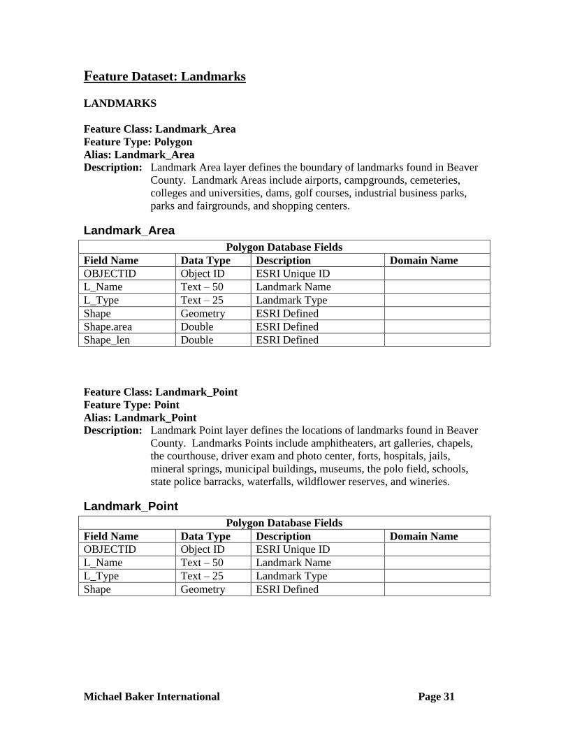
Feature Dataset: Landmarks
LANDMARKS
Feature Class: Landmark_Area
Feature Type: Polygon
Alias: Landmark_Area
Description: Landmark Area layer defines the boundary of landmarks found in Beaver
County. Landmark Areas include airports, campgrounds, cemeteries,
colleges and universities, dams, golf courses, industrial business parks,
parks and fairgrounds, and shopping centers.
Landmark_Area
Polygon Database Fields
Field Name Data Type Description Domain Name
OBJECTID Object ID ESRI Unique ID
L_Name Text – 50 Landmark Name
L_Type Text – 25 Landmark Type
Shape Geometry ESRI Defined
Shape.area Double ESRI Defined
Shape_len Double ESRI Defined
Feature Class: Landmark_Point
Feature Type: Point
Alias: Landmark_Point
Description: Landmark Point layer defines the locations of landmarks found in Beaver
County. Landmarks Points include amphitheaters, art galleries, chapels,
the courthouse, driver exam and photo center, forts, hospitals, jails,
mineral springs, municipal buildings, museums, the polo field, schools,
state police barracks, waterfalls, wildflower reserves, and wineries.
Landmark_Point
Polygon Database Fields
Field Name Data Type Description Domain Name
OBJECTID Object ID ESRI Unique ID
L_Name Text – 50 Landmark Name
L_Type Text – 25 Landmark Type
Shape Geometry ESRI Defined

Michael Baker International Page 32
Feature Class: River_Ports
Feature Type: Point
Alias: River_Ports
Description: River Ports layer defines the location of River Terminals in Beaver
County.
River_Ports
Point Database Fields
Field Name Data Type Description Domain Name
OBJECTID Object ID ESRI Unique ID
ID Text – 10 Terminal ID
DESCR Text – 60 River Terminal Name,
Description or Company
Name
OWNER Text – 60
USE_ Text – 10 Designation of Terminal -
TERMINAL, PRIVATE,
BARGE/TOW, or
TERM/BARGE
USENUM Short Integer Terminal Code –
0 = UNKNOWN
1 = TERMINAL
2 = PRIVATE
3 = BARGE/TOW
4 = TERM/BARGE
RAL_BRG Text – 1 Direct Rail to Barge
Transfer Code (Y=Yes,
Else Blank)
TRK_BRG Text – 1 Direct Truck to Barge
Transfer Code (Y=Yes,
Else Blank)
BRG_RAL Text – 1 Direct Barge to Rail
Transfer Code (Y=Yes,
Else Blank)
BRG_TRK Text – 1 Direct Barge to Truck
Transfer Code (Y=Yes,
Else Blank)
OPEN_STORE Long Integer Open Area Storage
Capacity in Acres
COVR_STORE Long Integer Covered Storage Capacity
in Square Feet
TANK_STORE Long Integer Tank Storage Capacity in
Barrels
Michael Baker International Page 33
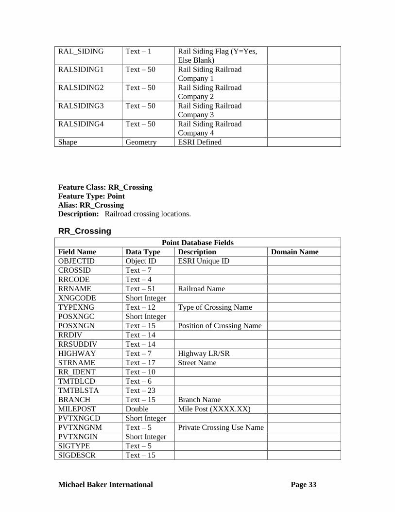
RAL_SIDING Text – 1 Rail Siding Flag (Y=Yes,
Else Blank)
RALSIDING1 Text – 50 Rail Siding Railroad
Company 1
RALSIDING2 Text – 50 Rail Siding Railroad
Company 2
RALSIDING3 Text – 50 Rail Siding Railroad
Company 3
RALSIDING4 Text – 50 Rail Siding Railroad
Company 4
Shape Geometry ESRI Defined
Feature Class: RR_Crossing
Feature Type: Point
Alias: RR_Crossing
Description: Railroad crossing locations.
RR_Crossing
Point Database Fields
Field Name Data Type Description Domain Name
OBJECTID Object ID ESRI Unique ID
CROSSID Text – 7
RRCODE Text – 4
RRNAME Text – 51 Railroad Name
XNGCODE Short Integer
TYPEXNG Text – 12 Type of Crossing Name
POSXNGC Short Integer
POSXNGN Text – 15 Position of Crossing Name
RRDIV Text – 14
RRSUBDIV Text – 14
HIGHWAY Text – 7 Highway LR/SR
STRNAME Text – 17 Street Name
RR_IDENT Text – 10
TMTBLCD Text – 6
TMTBLSTA Text – 23
BRANCH Text – 15 Branch Name
MILEPOST Double Mile Post (XXXX.XX)
PVTXNGCD Short Integer
PVTXNGNM Text – 5 Private Crossing Use Name
PVTXNGIN Short Integer
SIGTYPE Text – 5
SIGDESCR Text – 15

Michael Baker International Page 34
DAYTHUTN Short Integer
DAYSWTTN Short Integer
NITTHUTN Short Integer
NITSWTTN Short Integer
LT1_PDAY Short Integer
MAXTTSPD Short Integer
MIN_SPD Short Integer
MAX_SPD Short Integer
MAINTRAK Short Integer
OTHRTRAK Short Integer
OTHTKDES Text – 10
RRDIFTRK Short Integer
RRDIFNAM Text – 16
RRSAMTRK Short Integer
RRSAMNAM Text – 16
CBKREFR Short Integer
CBKNREFR Short Integer
STDHWYSP Short Integer
OTHSPSGN Short Integer
OTHRSGN1 Short Integer
DESCOTH1 Text – 10
OTHRSGN2 Short Integer
DESCOTH2 Text – 10
ACTR_W Short Integer
ACTOTHR Short Integer
FLHOVTR Short Integer
FLHNOVTR Short Integer
MASMTFLH Short Integer
OTHFLHLT Short Integer
OTHFLDES Text – 9
TRAFSIGN Short Integer
WIGWAGS Short Integer
BELLS Short Integer
SIGDESC Text – 20
NUMSIGNS Short Integer
COMMPOWR Short Integer
SIGNEQUP Short Integer
SPDSELCT Text – 1
TYPEDEVL Text – 5
HWYPAVED Short Integer
RRDNSTR Short Integer
PAVMRKGS Text – 6
HWYNEAR Short Integer
ADVRRSIG Text – 1
ANGLXNG Text – 5

Michael Baker International Page 35
XNGSURF Text – 10
NUMTRFLN Short Integer
TKPULOUT Short Integer
STHWYXNG Short Integer
HWYSYSTM Text – 7
FUNCCLAS Short Integer
ADDTVOLS Long Integer
PCTTRUCK Short Integer
Shape Geometry ESRI Defined
Michael Baker International Page 36
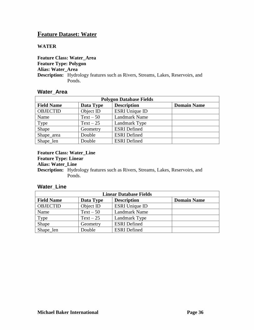
Feature Dataset: Water
WATER
Feature Class: Water_Area
Feature Type: Polygon
Alias: Water_Area
Description: Hydrology features such as Rivers, Streams, Lakes, Reservoirs, and
Ponds.
Water_Area
Polygon Database Fields
Field Name Data Type Description Domain Name
OBJECTID Object ID ESRI Unique ID
Name Text – 50 Landmark Name
Type Text – 25 Landmark Type
Shape Geometry ESRI Defined
Shape_area Double ESRI Defined
Shape_len Double ESRI Defined
Feature Class: Water_Line
Feature Type: Linear
Alias: Water_Line
Description: Hydrology features such as Rivers, Streams, Lakes, Reservoirs, and
Ponds.
Water_Line
Linear Database Fields
Field Name Data Type Description Domain Name
OBJECTID Object ID ESRI Unique ID
Name Text – 50 Landmark Name
Type Text – 25 Landmark Type
Shape Geometry ESRI Defined
Shape_len Double ESRI Defined

Michael Baker International Page 37
District Numbers
DISTRICT NUMBERS
District Numbers and Political Subdivision
District Number Political Subdivision 01-07 Beaver Falls, City of
08 Aliquippa, City of
09-12 Ambridge Borough
13 Baden Borough
14-16 Beaver Borough
17 Bridgewater Borough
18 Conway Borough
19 Darlington Borough
20 East Rochester Borough
21 Eastvale Borough
22 Ellwood City Borough
23 Fallston Borough
24 Frankfort Springs Borough
25-27 Freedom Borough
28 Georgetown Borough
29 Glasgow Borough
30 Homewood Borough
31 Hookstown Borough
32 Koppel Borough
33 Midland Borough
34-38 Monaca Borough
39-43 New Brighton Borough
44 New Galilee Borough
45 Patterson Heights Borough
46-49 Rochester Borough
50 Shippingport Borough
51 South Heights Borough
District Number Political Subdivision 52 West Mayfield Borough
53 Big Beaver Borough
54 Vanport Twp
55 Brighton Twp
56 Center Twp
57 Chippewa Twp
58 Darlington Twp
59 Daugherty Twp
60 Economy Borough
61 Franklin Twp
62 Greene Twp
63 Hanover Twp
64 Harmony Twp
65 Hopewell Twp
66 Independence Twp
67 Industry Borough
68 Marion Twp
69 New Sewickley Twp
70 North Sewickley Twp
71 Ohioville Borough
72 Patterson Twp
73 Potter Twp
74 Pulaski Twp
75 Raccoon Twp
76 Rochester Twp
77 South Beaver Twp
78 White Twp
Beaver County
Michael Baker International Page 38
Domain Lists
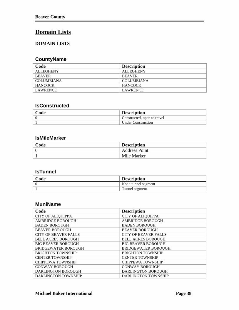
DOMAIN LISTS
CountyName
Code Description ALLEGHENY ALLEGHENY BEAVER BEAVER COLUMBIANA COLUMBIANA HANCOCK HANCOCK LAWRENCE LAWRENCE
IsConstructed
Code Description 0 Constructed, open to travel
1 Under Construction
IsMileMarker
Code Description
0 Address Point
1 Mile Marker
IsTunnel
Code Description 0 Not a tunnel segment 1 Tunnel segment
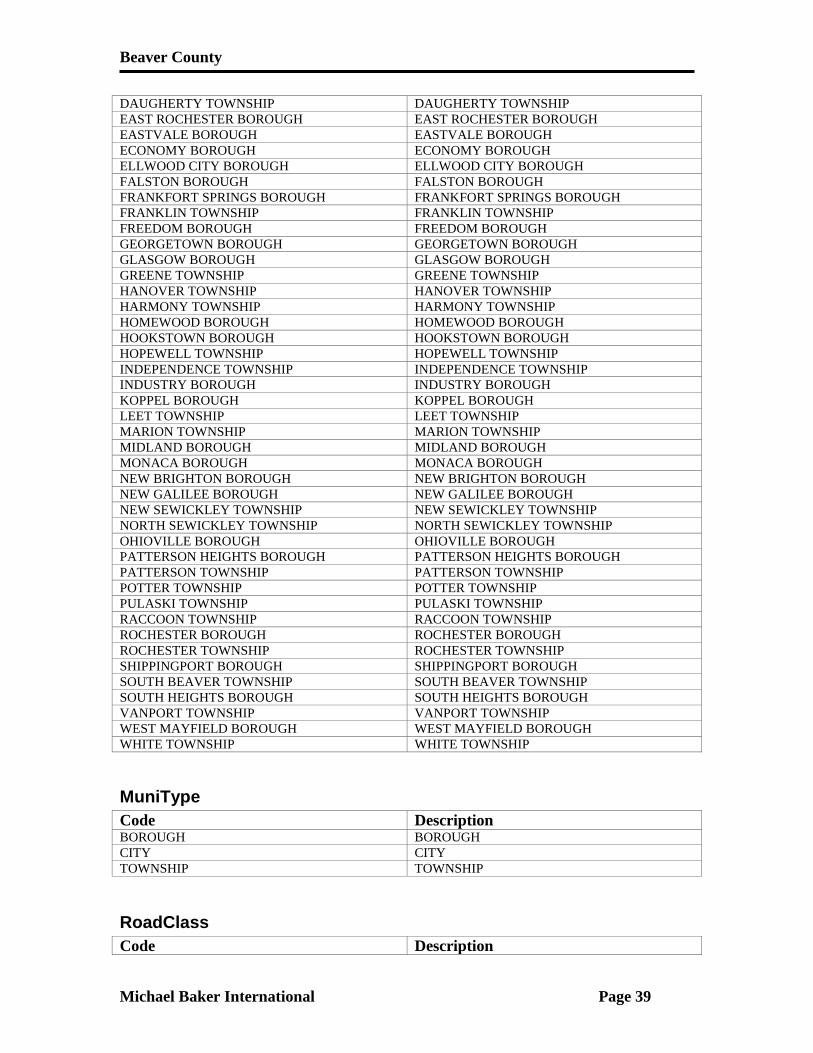
MuniName
Code Description CITY OF ALIQUIPPA CITY OF ALIQUIPPA AMBRIDGE BOROUGH AMBRIDGE BOROUGH BADEN BOROUGH BADEN BOROUGH BEAVER BOROUGH BEAVER BOROUGH CITY OF BEAVER FALLS CITY OF BEAVER FALLS BELL ACRES BOROUGH BELL ACRES BOROUGH
BIG BEAVER BOROUGH BIG BEAVER BOROUGH BRIDGEWATER BOROUGH BRIDGEWATER BOROUGH
BRIGHTON TOWNSHIP BRIGHTON TOWNSHIP
CENTER TOWNSHIP CENTER TOWNSHIP CHIPPEWA TOWNSHIP CHIPPEWA TOWNSHIP CONWAY BOROUGH CONWAY BOROUGH DARLINGTON BOROUGH DARLINGTON BOROUGH DARLINGTON TOWNSHIP DARLINGTON TOWNSHIP
Beaver County
Michael Baker International Page 39
DAUGHERTY TOWNSHIP DAUGHERTY TOWNSHIP EAST ROCHESTER BOROUGH EAST ROCHESTER BOROUGH EASTVALE BOROUGH EASTVALE BOROUGH ECONOMY BOROUGH ECONOMY BOROUGH ELLWOOD CITY BOROUGH ELLWOOD CITY BOROUGH FALSTON BOROUGH FALSTON BOROUGH FRANKFORT SPRINGS BOROUGH FRANKFORT SPRINGS BOROUGH FRANKLIN TOWNSHIP FRANKLIN TOWNSHIP FREEDOM BOROUGH FREEDOM BOROUGH GEORGETOWN BOROUGH GEORGETOWN BOROUGH GLASGOW BOROUGH GLASGOW BOROUGH GREENE TOWNSHIP GREENE TOWNSHIP HANOVER TOWNSHIP HANOVER TOWNSHIP HARMONY TOWNSHIP HARMONY TOWNSHIP HOMEWOOD BOROUGH HOMEWOOD BOROUGH HOOKSTOWN BOROUGH HOOKSTOWN BOROUGH HOPEWELL TOWNSHIP HOPEWELL TOWNSHIP INDEPENDENCE TOWNSHIP INDEPENDENCE TOWNSHIP INDUSTRY BOROUGH INDUSTRY BOROUGH KOPPEL BOROUGH KOPPEL BOROUGH LEET TOWNSHIP LEET TOWNSHIP
MARION TOWNSHIP MARION TOWNSHIP MIDLAND BOROUGH MIDLAND BOROUGH MONACA BOROUGH MONACA BOROUGH NEW BRIGHTON BOROUGH NEW BRIGHTON BOROUGH NEW GALILEE BOROUGH NEW GALILEE BOROUGH NEW SEWICKLEY TOWNSHIP NEW SEWICKLEY TOWNSHIP NORTH SEWICKLEY TOWNSHIP NORTH SEWICKLEY TOWNSHIP OHIOVILLE BOROUGH OHIOVILLE BOROUGH PATTERSON HEIGHTS BOROUGH PATTERSON HEIGHTS BOROUGH PATTERSON TOWNSHIP PATTERSON TOWNSHIP POTTER TOWNSHIP POTTER TOWNSHIP PULASKI TOWNSHIP PULASKI TOWNSHIP RACCOON TOWNSHIP RACCOON TOWNSHIP ROCHESTER BOROUGH ROCHESTER BOROUGH ROCHESTER TOWNSHIP ROCHESTER TOWNSHIP SHIPPINGPORT BOROUGH SHIPPINGPORT BOROUGH SOUTH BEAVER TOWNSHIP SOUTH BEAVER TOWNSHIP SOUTH HEIGHTS BOROUGH SOUTH HEIGHTS BOROUGH VANPORT TOWNSHIP VANPORT TOWNSHIP WEST MAYFIELD BOROUGH WEST MAYFIELD BOROUGH WHITE TOWNSHIP WHITE TOWNSHIP
MuniType
Code Description BOROUGH BOROUGH CITY CITY TOWNSHIP TOWNSHIP
RoadClass
Code Description

Beaver County
Michael Baker International Page 40
1 Interstate Highway 2 Federal Highway 3 State Highway 4 Street 5 Alley 6 Access ramp 7 Unpaved road
StateName
Code Description OHIO OHIO PENNSYLVANIA PENNSYLVANIA WEST VIRGINIA WEST VIRGINIA
StreetDir
Code Description N N W W NE NE NW NW SE SE SW SW S S E E EB EB
WB EB
NB NB
SB SB
StreetType
Code Description ALY ALY AVE AVE BCH BCH BND BND
BLVD BLVD BRG BRG
CIR CIR COR COR
CRES CRES CT CT CTR CTR
CV CV DR DR EST EST EXPY EXPY
EXT EXT GLN GLN GRV GRV HL HL

Beaver County
Michael Baker International Page 41
HTS HTS HVN HVN HWY HWY JCT JCT
KNLS KNLS LN LN LOOP LOOP MALL MALL MDWS MDWS MNR MNR PIKE PIKE PARK PARK
PL PL PLZ PLZ PT PT RAMP RAMP
RD RD RDG RDG RIV RIV
RUN RUN SHR SHR SQ SQ ST ST STA STA TER TER TPKE TPKE TRCE TRCE TRL TRL VLG VLG VLY VLY WAY WAY