beaverhead county master plan 7-1-11
TRANSCRIPT

Beaverhead County
Recreational Trails Master Plan
Prepared by:

Beaverhead County Recreational Trails Master Plan Prepared for: Beaverhead County Beaverhead County Commissioners
2 South Pacific Dillon, MT 59725
Prepared by: WWC Engineering 1275 Maple Street, Suite F Helena, MT 59601 (406) 443-3962 Fax: (406) 449-0056
i
TABLE OF CONTENTS
Executive Summary ...................................................................................................... 1 Overview ...................................................................................................................... 1
Public Involvement .................................................................................................... 1 Key Components of the Plan ..................................................................................... 1 Intent of the Plan ....................................................................................................... 1
Chapter 1 - Master Plan Overview................................................................................ 3 1.1 Introduction ........................................................................................................... 3
1.1.1 Project Location ............................................................................................... 3 1.2 Project Goals ......................................................................................................... 3
1.2.1 Variety of Uses ................................................................................................. 3 1.2.2 Improved Transportation Alternatives ............................................................... 4 1.2.3 Health Benefits ................................................................................................. 4 1.2.4 Connectivity to Other Trail Networks ................................................................ 4 1.2.5 Safety ............................................................................................................... 4
1.3 Public Consultation Process .................................................................................. 5 Chapter 2 - Site and Environmental Characteristics .................................................. 6
2.1 Terrain .................................................................................................................... 6 2.2 Geology .................................................................................................................. 6 2.3 Soils ....................................................................................................................... 6 2.4 Plants and Wildlife .................................................................................................. 6 2.5 Points of Interest .................................................................................................... 7
2.5.1 Beaverhead County Museum ........................................................................... 7 2.5.2 Dillon Public Library .......................................................................................... 7 2.5.3 Beaverhead Golf Course .................................................................................. 7 2.5.4 Parks and Schools ........................................................................................... 7
Chapter 3 - Existing Trails and Bicycle Facilities ....................................................... 9 3.1 Existing Trails ......................................................................................................... 9
3.1.1 City of Dillon ..................................................................................................... 9 3.1.2 Improved Beaverhead County Trails ................................................................ 9 3.1.3 Unimproved Trails .......................................................................................... 10
3.2 Local Parks .......................................................................................................... 11 Chapter 4 - Facility Design ......................................................................................... 12
4.1 Overview .............................................................................................................. 12 4.2 Trail Design .......................................................................................................... 12
4.2.1 Asphalt ........................................................................................................... 12 4.2.2 Gravel Surfacing and Subbase ....................................................................... 12 4.2.3 Subgrade ........................................................................................................ 12 4.2.4 Geotextile Fabrics .......................................................................................... 12 4.2.5 Benches ......................................................................................................... 13 4.2.6 Signage .......................................................................................................... 13 4.2.7 ADA Requirements ......................................................................................... 13
4.3 Trail Design Standards ......................................................................................... 13 4.3.1 Multi-Use Asphalt Trails ................................................................................. 13 4.3.2 Improved Hiking Trails .................................................................................... 13

ii
4.4 Trail Maintenance ................................................................................................. 14 4.4.1 Timing and Frequency of Inspections ............................................................. 14 4.4.2 Inspection Procedures .................................................................................... 14 4.4.3 Trail Infrastructure Items................................................................................. 15
Chapter 5 - Master Plan .............................................................................................. 16 5.1 County Multi-use Trails ......................................................................................... 16
5.1.1 Trail A ............................................................................................................. 16 5.1.2 Trail B ............................................................................................................. 16 5.1.3 Trail C ............................................................................................................. 16 5.1.4 Trail D ............................................................................................................. 17 5.1.5 Trail E ............................................................................................................. 17 5.1.6 Trail F ............................................................................................................. 18 5.1.7 Trail G ............................................................................................................ 19 5.1.8 Trail H ............................................................................................................. 19 5.1.9 Trail I .............................................................................................................. 20 5.1.10 Trail J ........................................................................................................... 22 5.1.11 Trail K ........................................................................................................... 22 5.1.12 Trail L ........................................................................................................... 22 5.1.13 Trail N ........................................................................................................... 22 5.1.14 Trail O........................................................................................................... 23 5.1.15 Trail P ........................................................................................................... 24
5.2 Hiking Trails ......................................................................................................... 24 5.2.1 Trail M ............................................................................................................ 24
Chapter 6 - Implementation ........................................................................................ 25 6.1 Overview .............................................................................................................. 25 6.2 Construction Phasing ........................................................................................... 25 6.3 Operation, Maintenance and Management .......................................................... 29
6.3.1 Adopt-a-Trail Policy ........................................................................................ 29 6.3.2 Trail Maintenance ........................................................................................... 29 6.3.3 Trail Ordinance and Etiquette ......................................................................... 29
Chapter 7 - Funding Options ...................................................................................... 30 7.1 CTEP Funding ...................................................................................................... 30 7.2 MFWP Recreational Trails Program Grant ........................................................... 30 7.3 Land and Water Conservation Fund Program ...................................................... 30
Chapter 8 - Conclusion ............................................................................................... 31 References ................................................................................................................... 32
List of Tables Table 1. Plant/Animal Species of Concern .................................................................. 7 Table 2. Trail Infrastructure Items .............................................................................. 15 Table 3. Trail Maintenance Costs .............................................................................. 29
List of Figures Figure 1. Clarks Lookout State Park View ....................................................................... 3

iii
Figure 2. Existing Highway 41 Trail ............................................................................... 10 Figure 3. Existing Laknar Lane Trail .............................................................................. 10 Figure 4. Overland Road Looking South ....................................................................... 16 Figure 5. Sweetwater Road Looking East ..................................................................... 17 Figure 6. Laknar Lane Looking South ........................................................................... 18 Figure 7. Freeman Lane Looking North ......................................................................... 18 Figure 8. Schuler Lane Looking West ........................................................................... 18 Figure 9. Highway 91 North Looking South ................................................................... 19 Figure 10. Highway 91 North/Lovers Leap Road .......................................................... 21 Figure 11. Cliff Road Looking North .............................................................................. 21 Figure 12. Trail I Private Property Connection .............................................................. 21 Figure 13. Highway 91 South Looking South ................................................................ 23 Figure 14. Trail P Crossing Private Property ................................................................. 24
Appendices
Appendix A – Soils Engineering Properties Appendix B – Existing and Proposed Trails Exhibits Appendix C – Typical Sections Appendix D – Trail Maintenance Form Appendix E – Trail Cost Estimates Appendix F – Adopt-a-Trail Volunteer Maintenance Form Appendix G – Trail Etiquette Brochure

1
Executive Summary
Overview The City of Dillon and Beaverhead County are located along the Beaverhead River in southwestern Montana. The Lewis and Clark Trail meanders through Beaverhead County from north to south and runs through the Dillon Growth Area. Corps of Discovery monuments located near the City of Dillon within Beaverhead County include Clarks Lookout State Park and Beaverhead Rock. Bannack State Park is located south and east of Dillon and is the site of the first capital of the Montana Territory. In April 2010, Dillon was listed as one of “America’s Prettiest Towns” according to Forbes Magazine, and the Beaverhead River is renowned for its blue ribbon fly fishing. The Beaverhead County Trails Master Plan proposes improvements to the area’s trail network within the Dillon Growth Area. Residents who partake in walking, jogging and bicycling will be the main focus groups in considering new trail development.
Public Involvement Public involvement has been crucial in the development of the Master Plan. Multiple public meetings were held with residents of the surrounding area as well as various interest groups that provided input on the routes and amenities that would best suit their needs. These groups included walkers, joggers and bicyclists.
Key Components of the Plan Chapter One introduces the overall goals of the Master Plan and provides a detailed look at the public involvement process. In Chapter Two the site and environmental characteristics are discussed, from terrain and geology to points of interest in the area. Chapter Three evaluates existing trail, bicycle, and park facilities. Chapter Four includes the technical specifications for the design of trails, on-road bike lanes, and sidewalks. Trail maintenance is also included in Chapter Four. Chapter Five addresses the different users in the area and how multi-use trails can be implemented. The implementation and phasing of construction are presented in Chapter Six. To determine the most appropriate phasing plan three key issues were addressed, including costs, benefits, and location. Chapter Seven concludes by describing funding options that are available for the implementation of the trails proposed in this plan.
Intent of the Plan The intent of the Beaverhead County Trails Master Plan is to provide the community with a logical and achievable approach to development of an improved multi-use trail system that caters to recreational pedestrian and bicycle users. This will give residents alternative transportation options, improve quality of life and exercise regimens, increase safety for pedestrians and bicyclists and provide more recreation-based
Key Components Goals Environmental
Characteristics Existing Trails Technical Specifications Trail Maintenance Multi-use Trails Building New Trails Construction Phasing Trail Construction Funding
Options

2
tourism that supports local businesses. This Master Plan identifies the locations and construction periods for each trail, along with proposed maintenance schedules.

3
Chapter 1 - Master Plan Overview
1.1 Introduction The Beaverhead County (BC) Recreational Trails Master Plan is a product of the collaboration of BC personnel, local residents, local clubs, and WWC Engineering. A multi-use trail network is the main focus of this Master Plan. The benefits enjoyed by users will consist of more outdoor recreational choices, increased exercise opportunities, safer routes, alternative transportation options and more recreation-based tourism. Primary funding for the recreational trails plan is provided by Beaverhead County. Implementation and construction of identified trail routes will be phased over a period of several years as funds become available.
1.1.1 Project Location The proposed recreational trails system is located in Beaverhead County, with the focus of this study being limited to the Dillon Growth Area. The Dillon Growth Area is defined in the Beaverhead County Dillon Growth Area Plan, July, 2010. Dillon is located approximately 60 miles south of Butte, Montana next to Interstate 15.
1.2 Project Goals Beaverhead County citizens have identified the following project goals:
1) Planning of a recreational trails system that will connect the City of Dillon with rural residential areas within the growth area adjacent to the City of Dillon.
2) Provide funding options for design and construction of the proposed recreational trials system.
3) Provide for maintenance of the trail system components.
1.2.1 Variety of Uses Meeting the needs of a broad range of inhabitants of the area was the general concern of the planning process. This was accomplished by incorporating the input from the public meetings and user-specific group meetings into the design. Multi-use trails will provide for a broader range of use while reducing the costs associated with building single-purpose trails. The different and varied needs identified during the public involvement process include: Older citizens who enjoy shorter scenic walking routes
Figure 1. Clarks Lookout State Park View

4
Typical bike/pedestrian road crossing.
Younger cross country hikers and bikers who want longer, more challenging routes
Parents who want safe routes for their children to be able to walk or bike to parks and schools
To loop, wherever possible, new routes into existing recreational trails To recognize inherent issues with some of the proposed routes concerning
construction costs and securing easements and/or rights-of-way across private property
1.2.2 Improved Transportation Alternatives A new trail network will provide residents with alternative transportation methods to travel to work, school or local businesses. By taking more motorized vehicles off the road and replacing them with foot and bicycle traffic, roads will see less congestion, infrastructure may see the need for less use-related maintenance and the environment will see a reduction in vehicle emissions.
1.2.3 Health Benefits The availability of fast food, the phasing out of gym classes in schools, the popularity of video games and the overall lack of physical activity in society has led to an increase in heart disease, obesity, diabetes, asthma and depression for all age groups (CDC July 2009). The Centers for Disease Control (Atlanta) recommends that individuals exercise at a moderate intensity for at least 30 minutes five or more times per week. A trail network and park facility will promote physical activity and give residents an alternative to existing exercise opportunities.
1.2.4 Connectivity to Other Trail Networks Connection to existing trails and other proposed trails is important to providing an enjoyable experience and practical application for users. If users can get from point A to point B entirely on the trail system, they will feel more inclined to utilize it. Integration of the City of Dillon’s existing trials and designated routes is part of this Master Plan.
1.2.5 Safety Safety is one of the most crucial aspects of design and implementation. Bicyclists and pedestrians that currently use existing roads for recreation or commuting must share the road with motorized vehicles. This often provides for an unsafe environment and deters many users from walking or biking. The proposed trail system will promote safe on-road use and provide trails that are independent of the roads altogether.

5
1.3 Public Consultation Process The input of local residents and organizations was helpful in the planning and design process of the parks and trails system. Public meetings for the recreational trails network were held at the Beaverhead County Court House on January 25th, 2011 and May 3, 2011. At these meetings BC and WWC personnel were available to take input and address questions and concerns. Along with residents, representatives of the local trails committee and the Dillon Rotary were present. Public input included comments from residents, BC government, and a variety of user-specific organizations, such as the Beaverhead Trails Coalition.

6
Chapter 2 - Site and Environmental Characteristics
2.1 Terrain The Beaverhead County Recreational Trails Master Plan area is located along the Lewis and Clark Trail and encompasses a 2 mile radius around the City of Dillon. The majority of the planning area is within the low lying areas surrounding the Beaverhead River, with limited access to the foothills of the surrounding mountain areas. Drainage features within the area include the Beaverhead River and its tributaries. The Beaverhead River runs from south to north along the western and northern sides of Dillon. Blacktail Deer Creek is a tributary to the Beaverhead River and flows through Dillon from south to north. There are also many side channels of the Beaverhead River as well as irrigation facilities, such as the East Bench Canal, within the project area. The majority of the area consists of rural residential development and agricultural land uses.
2.2 Geology Surficial geology of the Dillon Growth Area consists mainly of a heterogeneous mixture of sand, silt, clay, and organic matter. The site is located within Seismic Zone 3 (ground acceleration 0.30g) with no faults identified (International Building Code). The Seismic Zone presents a moderate hazard for damage from an earthquake.
2.3 Soils According to information provided by the Natural Resources Conservation Service (NRCS), the area surrounding the City of Dillon where the proposed paths are located consists of many different soil types. These include Thess loam with 0 to 4 percent slopes, Yamacall loam with 0 to 4 percent slopes, Kalsted loam with 0 to 4 percent slopes, Amesha loam with 0 to 4 percent slopes, Thess-Ashbough complex with 0 to 2 percent slopes, and Beavrock-Threeriv silt loams with 0 to 4 percent slopes. Specific soil engineering properties from the USDA soils survey are presented in Appendix A. With the majority of soils having moderate erosion characteristics, Best Management Practice (BMPs) will be used during and after construction to help prevent soil erosion and sediment transport to surrounding properties and surface water.
2.4 Plants and Wildlife A search was performed on the Montana Natural Heritage Program Website for plant and animal species of concern in the study area. The results are presented in Table 1.

7
Table 1. Plant/Animal Species of Concern
Plant/Animal Species Risk Factor* Pygmy Rabbit S3 Great Blue Heron S3
Ferruginous Hawk S3
Cassin’s Finch S3
Bald Eagle S3
Westslope Cutthroat Trout S2
Golden Eagle S3
Bobolink S3
*S1: At high risk because of extremely limited and/or rapidly declining numbers, range, and/or habitat, making it highly vulnerable to extirpation in the state. *S2: At risk because of very limited and/or declining numbers, range, and/or habitat, making it vulnerable to extirpation in the state. *S3: Potentially at risk because of limited and/or declining numbers, range, and/or habitat, even though may be abundant in some areas of the state.
2.5 Points of Interest The Beaverhead County planning area provides many outdoor recreational facilities and other points of interest such as school playgrounds, parks, streams, and museums that would benefit from access to a trail network.
2.5.1 Beaverhead County Museum The Beaverhead County Museum is located in a log building complex in downtown Dillon, next door to the restored Depot/Theatre. Visitors can view an authentic homesteader’s cabin, mining and agricultural equipment, and a one room school house that is being restored.
2.5.2 Dillon Public Library The Dillon Public Library is located in downtown Dillon on the corner of Glendale and Idaho Streets. It is a Romanesque revival structure completed in 1902 using local stone and is one of the few unchanged Carnegie Libraries in America.
2.5.3 Beaverhead Golf Course The Beaverhead Golf course is on the outskirts of Dillon, northeast of downtown. The course was built in 1963 and offers 9 holes.
2.5.4 Parks and Schools Schools located in Dillon include Parkview Elementary School, Parkview Jr. High School, Beaverhead County High School, and the University of Montana Western. The University was founded in 1893 and was formerly known as Western Montana College before becoming part of the University of Montana System. They have developed Experience One, a scheduling model
Beaverhead Golf Course

8
emphasizing active, hands-on experiential learning. Currently, Montana Western is the only public higher education institution in the U.S. offering this scheduling model. Several parks are located throughout the Dillon area. The largest in size is Ray Lynch Park located northeast of downtown Dillon. Other parks to note are Cornell Park, Clarks Lookout State Park, Veterans Memorial Park, and Centennial Park.

9
Chapter 3 - Existing Trails and Bicycle Facilities
3.1 Existing Trails The following is a brief overview of the location and condition of existing trail/sidewalk/bike path facilities within the project area. Current trail facilities include on-street bike routes within the City of Dillon and improved trail routes within the City and County. Please refer to the Existing Trail Network in Exhibit 1, Appendix B.
3.1.1 City of Dillon Pedestrian and bicycle traffic is routed through the City of Dillon via sidewalks and on-street bicycle routes as part of the local street network. The on-street bicycle routes currently coexist with vehicle parking and travel lanes and are not designed with signage or striping. The City of Dillon has designated, by ordinance, a bike route through the City from the Parkview Jr. High School to Western Montana College. Although pedestrian traffic is typically safe due to an extensive sidewalk system, bicyclists that travel through the City must share the road with motorized and parked vehicles. This condition presents a hazardous situation for bicyclists. Although on road bicycle safety within the City of Dillon is a concern, improvements to these routes will not be discussed in this plan. The City of Dillon also has two multi-use trails that provide connectivity between schools and neighborhoods as well as recreational opportunities. There is an existing trail along the east side of the City that connects the residential neighborhoods with Parkview Elementary and Parkview Jr. High schools. This trail system is a combination of multi-use paved trail and residential neighborhood sidewalks. There is also an existing trail that runs adjacent to the YMCA on the west side of the City. This trail is primarily used for recreation as it winds around and through a riparian area and connects the YMCA to the kids fishing pond owned by Montana Fish, Wildlife and Parks. The focus of this master plan is not to provide additional trails within the City of Dillon, but rather to provide trails outside the City that will connect to existing trails, sidewalks and routes within the City. These additional trails will provide opportunities for rural residential areas around Dillon to access City services and recreational opportunities without the need to drive into town.
3.1.2 Improved Beaverhead County Trails There are several existing trails located in Beaverhead County that are within the Dillon Growth Area. These trails were constructed by the Montana Department of Transportation (MDT) during recent highway construction projects or by the county with MDT Community Transportation Enhancement Program (CTEP) funds. These trails include the Highway 41 trail and the Laknar Lane trail. The Highway 41 trail was constructed by MDT with the reconstruction of Highway 41 and Montana Avenue in 2006. The Highway 41 trail begins at the Laknar Lane/Highway 41 intersection on the east edge of Dillon and runs east, parallel to Highway 41, for approximately 0.85 mile to the Nissen Lane/Highway 41 intersection. The trail is a paved, 10-ft wide separated multi-use trail. The trail connects to a sidewalk along

10
Highway 41 at its intersection with Laknar Lane. The sidewalk along Highway 41 and Montana Avenue runs directly into downtown Dillon. The trail also runs along the north side of the Beaverhead Golf Course.
The Laknar Lane trail was constructed between 2009 and 2010 utilizing MDT CTEP funds. The trail begins at the Laknar Lane/Highway 41 intersection and runs north, parallel to Laknar Lane, for approximately 1.15 miles to the Schuler Lane/Laknar Lane intersection. The trail utilizes the existing 8-ft wide Laknar Lane shoulder for the first 0.40 mile of the trail and then transitions to a paved 8-ft wide separated trail. The trail connects to an extensive sidewalk system within the City of Dillon as well as a separated trail at its intersection with Highway 41. Both existing trails have been constructed in the last 5 years and are in good shape with no visible structural issues or damage. These trails should have many more years of life before major rehabilitation is necessary.
3.1.3 Unimproved Trails There is one unimproved trail that exists within the Dillon Growth Area. This trail connects a county road adjacent to the Beaverhead River with W Mountain. This trail is used to access the hill that displays the painted white rocks in the shape of a W. Currently this trail is a 2- to 3-foot wide, dirt hiking trail. The trail exists in natural steep and mountainous terrain.
Figure 2. Existing Highway 41 Trail
Figure 3. Existing Laknar Lane Trail
11
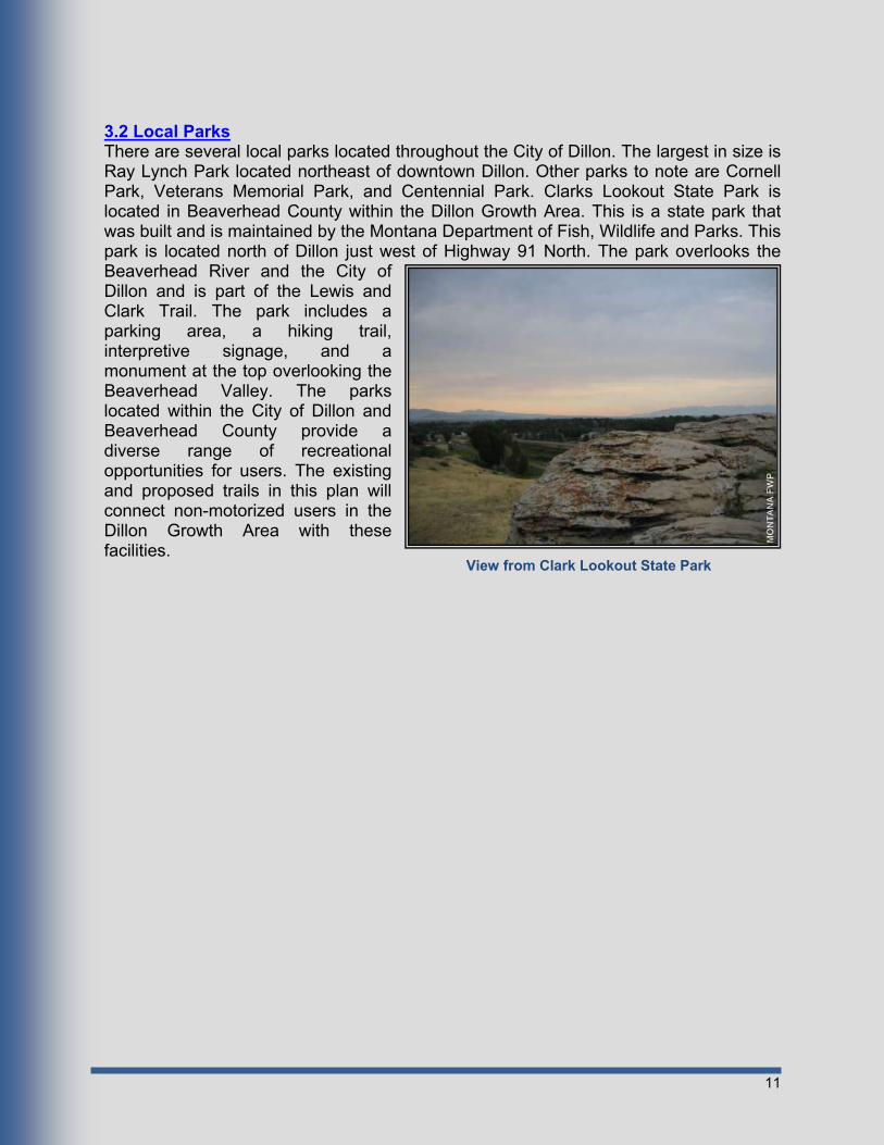
3.2 Local Parks There are several local parks located throughout the City of Dillon. The largest in size is Ray Lynch Park located northeast of downtown Dillon. Other parks to note are Cornell Park, Veterans Memorial Park, and Centennial Park. Clarks Lookout State Park is located in Beaverhead County within the Dillon Growth Area. This is a state park that was built and is maintained by the Montana Department of Fish, Wildlife and Parks. This park is located north of Dillon just west of Highway 91 North. The park overlooks the Beaverhead River and the City of Dillon and is part of the Lewis and Clark Trail. The park includes a parking area, a hiking trail, interpretive signage, and a monument at the top overlooking the Beaverhead Valley. The parks located within the City of Dillon and Beaverhead County provide a diverse range of recreational opportunities for users. The existing and proposed trails in this plan will connect non-motorized users in the Dillon Growth Area with these facilities.
View from Clark Lookout State Park

12
Chapter 4 - Facility Design
4.1 Overview This Beaverhead County Trails Master Plan will provide guidelines for the design of all trails within the Dillon Growth Area. These design guidelines will cover materials, dimensions, construction and maintenance for all trails.
4.2 Trail Design The proposed trails within the Dillon Growth Area will be primarily multi-use all-weather gravel- or paved-surface bike and pedestrian trails. All trails will interconnect to existing and proposed trails and will be designed to meet the accessibility guidelines of the Americans With Disabilities Act (ADA).
4.2.1 Asphalt Typical asphalt design for multi-use trails should be based upon the specific loading and soil conditions for each project. The minimum acceptable thickness of asphalt to be used on recreational trails is 2” Grade B Plant Mix Surfacing. This asphalt, along with a layer of gravel as a subbase, will provide for many years of use without major maintenance. For asphalt trails, a minimum subbase of 4” of gravel material will be placed directly under the asphalt. (See Typical Section No. 1, Appendix C)
4.2.2 Gravel Surfacing and Subbase Some trails may be surfaced with recycled gravel or asphalt millings from road rehabilitation projects. When constructed and compacted properly, gravel or asphalt milling surfaces can provide a cost-effective alternative to conventional asphalt and provide the same level of access for users. A minimum surfacing thickness of 6” will be implemented for all gravel trails. (See Typical Section No. 2, Appendix C)
4.2.3 Subgrade The subgrade serves as the foundation of the trail and consists of undisturbed earth or compacted fill. Topsoil is the top layer of undisturbed earth that contains a higher percentage of organic materials. The topsoil layer varies in thickness and must be removed prior to placing compacted fill or gravel. If the layer of topsoil is 6” or less, the gravel may be placed directly on soil after 6” of soil has been excavated. If the topsoil layer is greater than 6”, then additional excavation must occur to remove the entire topsoil layer and compacted select fill will need to be placed to raise the trail surface to an elevation that is at or above existing ground.
4.2.4 Geotextile Fabrics Geotextiles are fabric mats used to strengthen the subgrade, subbase and surface of a trail, especially in areas where soft soils are present. If soft soils are encountered, a geotechnical engineer should be consulted to assist in choosing the right geotextile product to use.

13
4.2.5 Benches Benches are planned at strategic locations to provide a place for users to rest and enjoy the scenic beauty of the surrounding area. Besides scenic overlooks, benches should be placed at the entryways to trail segments and should be set back three feet from the trail edge. Trail benches should be sized to comfortably accommodate the average adult.
4.2.6 Signage Signage provides users with information to use the facility effectively and safely. The bicycle and pedestrian facility design section of the U.S. Department of Transportation’s Manual on Uniform Traffic Control Devices (MUTCD) should be consulted when selecting regulatory signs to be placed along the routes. Informational signs should be placed at the start of each trail and should include a diagram showing trail length and the user’s location relative to points of interest and other trails in the area.
4.2.7 ADA Requirements As required by the Montana Department of Transportation, detectable warning devices, also known as truncated domes, and cross walk striping must be installed on all trails that cross public roads or approaches that provide access to more than one resident. The truncated domes must be installed on each side of the crossing for the full width of the trail. Several trails have been identified that will need truncated domes where they cross public roadways.
4.3 Trail Design Standards Trail design standards are classified based on location and type of use. Standards such as width, surface, and use are discussed in this section.
4.3.1 Multi-Use Asphalt Trails Multi-use asphalt trails will be designed to allow for use by pedestrians and bicyclists. An 8-ft to 10-ft all-weather surface width, as recommended by the American Association of State Highway and Transportation Officials (AASHTO), will be utilized by pedestrians and bicyclists. The asphalt surfaced trails will be constructed with a minimum 2” thick Type-B plant mix surfacing. A minimum thickness of 4” of crushed gravel base course will be provided under the paved section. Gravel or compacted asphalt milling surfaced trails shall have a 6” compacted thickness. Fill slopes of 3H:1V will extend from the edge of asphalt until intersection with the existing ground. Trails will be cleared of vegetation and obstacles 1-ft outside of the construction limits and a minimum of 10- ft high measured vertically from the top of surfacing.
4.3.2 Improved Hiking Trails “Recreational Trail Design and Construction” recommends a tread width of 4-ft to be used for improved hiking trails. Compacted native soil will be used as the base for these

14
trails. Trails will be cleared of vegetation and obstacles 1.5-ft horizontally from the edge of trail and a minimum of 10-ft high measured vertically from the top of surfacing. The natural terrain should be followed whenever possible and drainage crossings will be constructed as necessary utilizing appropriately sized culverts for minor drainage and irrigation crossings and pedestrian bridges for major crossing such as rivers and streams.
4.4 Trail Maintenance Trail maintenance is an important part of providing an aesthetically pleasing trail for users and extending the life of the trail. Regular maintenance inspections and physical cleanup schedules need to be established for the entire trail network. The objectives behind routine maintenance are to:
Ensure user safety, Maintain a high standard of quality, Preserve the aesthetic character of features to ensure user satisfaction, Prolong the life of existing trail segments.
4.4.1 Timing and Frequency of Inspections Inspections should occur a minimum of three (3) times a year for all trails at the following recommended intervals: spring, mid-summer and fall. Other inspections will occur following a report of damage or a major event such as a flood or intense thunderstorm.
4.4.2 Inspection Procedures Inspection procedures should follow the guidelines outlined in Appendix D. The inspector shall walk or travel the entire route, inspecting every feature along the trail. Inspectors will consider issues of safety and trail aesthetics while performing inspections. Inspectors shall record the following information on the inspection form: At the beginning of each inspection:
The trail name, The date and time, The type of inspection (routine vs. other).
If damage is identified and repairs are required: Note the damage type and location, If potentially hazardous to users, mark it with spray paint or flagging tape, Indicate the appropriate recommendations.
If a minor problem is encountered and can be remedied at the time of inspection, the inspector should take the appropriate actions to resolve the issue.
15
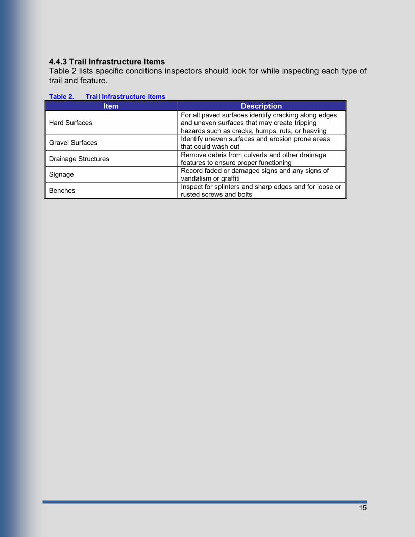
4.4.3 Trail Infrastructure Items Table 2 lists specific conditions inspectors should look for while inspecting each type of trail and feature. Table 2. Trail Infrastructure Items
Item Description
Hard Surfaces For all paved surfaces identify cracking along edges and uneven surfaces that may create tripping hazards such as cracks, humps, ruts, or heaving
Gravel Surfaces Identify uneven surfaces and erosion prone areas that could wash out
Drainage Structures Remove debris from culverts and other drainage features to ensure proper functioning
Signage Record faded or damaged signs and any signs of vandalism or graffiti
Benches Inspect for splinters and sharp edges and for loose or rusted screws and bolts
16
Chapter 5 - Master Plan This section of the report outlines the locations of proposed trails and routes. The attached exhibits, in Appendix B, show the proposed trail layouts along with existing trails. All proposed trails have been given a letter designation.
5.1 County Multi-use Trails Proposed trails within the Dillon Growth Area will connect to existing trails and sidewalks within the City of Dillon and surrounding area. The proposed and existing trails are shown in the exhibits contained in Appendix B. These trails will provide pedestrian and bicycle access to the City of Dillon services and amenities from rural residential areas as well as provide a safe place for recreational activities.
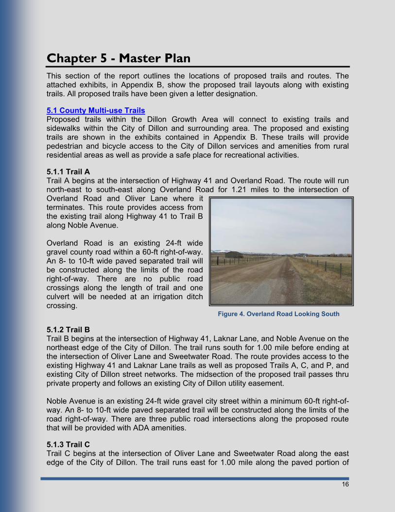
5.1.1 Trail A Trail A begins at the intersection of Highway 41 and Overland Road. The route will run north-east to south-east along Overland Road for 1.21 miles to the intersection of Overland Road and Oliver Lane where it terminates. This route provides access from the existing trail along Highway 41 to Trail B along Noble Avenue. Overland Road is an existing 24-ft wide gravel county road within a 60-ft right-of-way. An 8- to 10-ft wide paved separated trail will be constructed along the limits of the road right-of-way. There are no public road crossings along the length of trail and one culvert will be needed at an irrigation ditch crossing.
5.1.2 Trail B Trail B begins at the intersection of Highway 41, Laknar Lane, and Noble Avenue on the northeast edge of the City of Dillon. The trail runs south for 1.00 mile before ending at the intersection of Oliver Lane and Sweetwater Road. The route provides access to the existing Highway 41 and Laknar Lane trails as well as proposed Trails A, C, and P, and existing City of Dillon street networks. The midsection of the proposed trail passes thru private property and follows an existing City of Dillon utility easement. Noble Avenue is an existing 24-ft wide gravel city street within a minimum 60-ft right-of-way. An 8- to 10-ft wide paved separated trail will be constructed along the limits of the road right-of-way. There are three public road intersections along the proposed route that will be provided with ADA amenities.
5.1.3 Trail C Trail C begins at the intersection of Oliver Lane and Sweetwater Road along the east edge of the City of Dillon. The trail runs east for 1.00 mile along the paved portion of
Figure 4. Overland Road Looking South
17
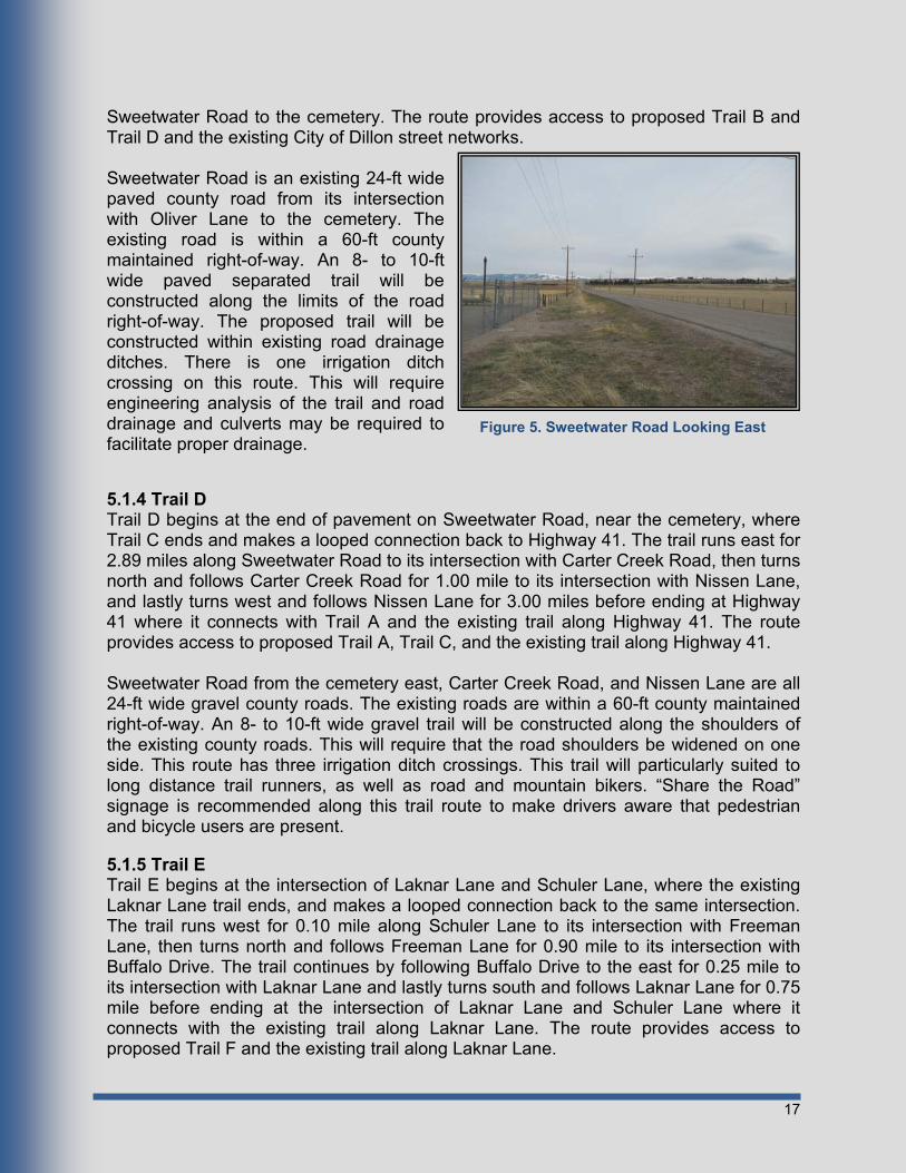
Sweetwater Road to the cemetery. The route provides access to proposed Trail B and Trail D and the existing City of Dillon street networks. Sweetwater Road is an existing 24-ft wide paved county road from its intersection with Oliver Lane to the cemetery. The existing road is within a 60-ft county maintained right-of-way. An 8- to 10-ft wide paved separated trail will be constructed along the limits of the road right-of-way. The proposed trail will be constructed within existing road drainage ditches. There is one irrigation ditch crossing on this route. This will require engineering analysis of the trail and road drainage and culverts may be required to facilitate proper drainage.
5.1.4 Trail D Trail D begins at the end of pavement on Sweetwater Road, near the cemetery, where Trail C ends and makes a looped connection back to Highway 41. The trail runs east for 2.89 miles along Sweetwater Road to its intersection with Carter Creek Road, then turns north and follows Carter Creek Road for 1.00 mile to its intersection with Nissen Lane, and lastly turns west and follows Nissen Lane for 3.00 miles before ending at Highway 41 where it connects with Trail A and the existing trail along Highway 41. The route provides access to proposed Trail A, Trail C, and the existing trail along Highway 41. Sweetwater Road from the cemetery east, Carter Creek Road, and Nissen Lane are all 24-ft wide gravel county roads. The existing roads are within a 60-ft county maintained right-of-way. An 8- to 10-ft wide gravel trail will be constructed along the shoulders of the existing county roads. This will require that the road shoulders be widened on one side. This route has three irrigation ditch crossings. This trail will particularly suited to long distance trail runners, as well as road and mountain bikers. “Share the Road” signage is recommended along this trail route to make drivers aware that pedestrian and bicycle users are present.
5.1.5 Trail E Trail E begins at the intersection of Laknar Lane and Schuler Lane, where the existing Laknar Lane trail ends, and makes a looped connection back to the same intersection. The trail runs west for 0.10 mile along Schuler Lane to its intersection with Freeman Lane, then turns north and follows Freeman Lane for 0.90 mile to its intersection with Buffalo Drive. The trail continues by following Buffalo Drive to the east for 0.25 mile to its intersection with Laknar Lane and lastly turns south and follows Laknar Lane for 0.75 mile before ending at the intersection of Laknar Lane and Schuler Lane where it connects with the existing trail along Laknar Lane. The route provides access to proposed Trail F and the existing trail along Laknar Lane.
Figure 5. Sweetwater Road Looking East

18
Schuler Lane and Laknar Lane are both 24-ft wide paved county roads along the trail route. Freeman Lane and Beaverhead Lane are both 24-ft wide public gravel roads along the proposed trail route. The existing roads are within a 60-ft county-maintained right-of-way. The proposed trail will be constructed as an 8- to 10-ft wide separated paved trail between the existing shoulder of the roads and the existing road right-of-way. It is important that this trail be separated due to its primary use by families with small children and recreational users. The public road intersections along the proposed route will be provided with ADA amenities.
5.1.6 Trail F Trail F begins at the intersection of Schuler Lane and Freeman Lane, at the point where Trail E turns north onto Freeman Lane. The trail follows Schuler Lane west for 0.60 mile to the intersection of Schuler Lane and Montana Highway 91 North. The route provides access to proposed Trail E and Trail G. Schuler Lane is a 24-ft wide paved county road within a 60-ft county maintained right-of-way. There are two irrigation ditch crossings on this route. The proposed trail will be constructed as an 8- to 10-ft wide separated paved trail between the existing shoulder of the road and the existing road right-of-way. It is important that this trail be separated due to its primary use by families with small children and recreational users. The public road intersections along
Figure 7. Freeman Lane Looking North Figure 6. Laknar Lane Looking South
Figure 8. Schuler Lane Looking West

19
the proposed route will be provided with ADA amenities.
5.1.7 Trail G Trail G begins at the intersection of Laknar Lane and Pioneer Drive. The trail follows Pioneer Drive west then north for 0.40 mile to its intersection with Highway 91 North, then follows Highway 91 North for 0.70 mile to its intersection with Schuler Lane. The route provides access to proposed Trails F, I and H and the existing Laknar Lane trail. Highway 91 North is an existing highway owned and maintained by the Montana Department of Transportation. Highway 91 North has a 26- to 28-ft paved width within a 80- to 100-ft right-of-way. There is a 4- to 6-ft wide gravel shoulder on the west side of the existing paved shoulder. The preferred alternative for a separated 8- to 10-ft paved trail along Highway 91 North- would be to expand the current widening on the west shoulder by 8- to 10-ft. This would provide for a 4-ft separation between the proposed trail and the traveled way. Further, expansion on the west side would reduce conflicts with utilities and road drainage facilities thereby substantially reducing the cost of the trail. There would be two crossings of Highway 91 North to facilitate this trail location, one at its intersection with Schuler Lane and another one at its intersection with Pioneer Drive. These crossings would be accomplished utilizing truncated domes, crosswalk striping and pedestrian crossing signage. Pioneer Drive is a 24-ft wide paved road within a 60-ft county maintained right-of-way. The proposed trail will be constructed as an 8- to 10-ft wide separated paved trail between the existing shoulder of the road and the existing road right-of-way. It is important that this trail be separated due to its primary use by families with small children and recreational users. The public road intersections along the proposed route will be provided with ADA amenities.
5.1.8 Trail H Trail H begins just north of the intersection of Pioneer Drive and Highway 91 North, where the gravel frontage road on the west side of the railroad tracks accesses Highway 91 North. The trail follows the gravel frontage road south for 0.40 mile to the its intersection with Lovers Leap Road, then goes east along Lovers Leap Road for 100 feet to its intersection with Highway 91 North and proceeds south along Highway 91 North for 0.70 mile to the intersection of Highway 91 North and North Montana Street
Figure 9. Highway 91 North Looking South
20
within the Dillon city limits. The route provides access to proposed Trails G and I and the existing sidewalk system along North Montana Street. The frontage road and Lovers Leap Road is a 24-ft wide gravel road within a 60-ft county maintained right-of-way. The proposed trail will be constructed as an 8- to 10-ft wide separated paved trail between the existing shoulder of the road and the existing road right-of-way. It is important that this trail be separated due to its primary use by families with small children and recreational users. The public road intersections along the proposed route will be provided with ADA amenities. Highway 91 North is an existing state highway operated and maintained by the Montana Department of Transportation. Highway 91 North has a 26- to 28-ft paved width within a 80- to 100-ft right-of-way. There is a 4- to 6-ft widened gravel shoulder on the west side of the existing paved shoulder. The preferred alternative for a separated 8- to 10-ft paved trail along Highway 91 North, would be to expand the current widening on the west shoulder by 8- to 10- ft. This would provide for a 4-ft separation between the proposed trail and the traveled way. Further, expansion on the west side would reduce conflicts with utilities and road drainage facilities thereby substantially reducing the cost of the trail. There is one existing bridge crossing over the Beaverhead River. This bridge is not currently wide enough to designate a trail along the shoulder. The trail will tie into the existing shoulder on each end of the bridge and pedestrians and bicyclists would need to utilize the existing bridge to cross the river. Signage will be provided on each end of the bridge to notify drivers and pedestrians that they must share the road at this location. The public road intersections along the proposed route will be provided with ADA amenities.
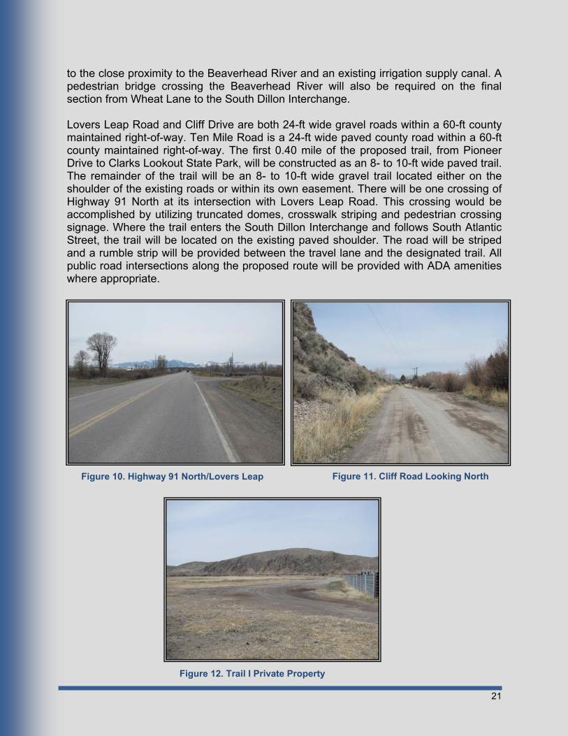
5.1.9 Trail I Trail I begins at Pioneer Drive, at the point where it turns east to follow the Beaverhead River. The beginning of the trail will connect to Trail G at this location then follow the Beaverhead River, on private property, west for 0.30 mile to where it will cross Highway 91 North at its intersection with Lovers Leap Road. The trail will continue following Lovers Leap Road for 1.40 mile to the end of the road, then across private property along the base of the foot-hills for 0.60 mile to Cliff Road. The trail will then follow Cliff Road for 0.20 mile to its intersection with Ten Mile Road, where it will follow Ten Mile Road for 0.50 mile to its intersection with Wheat Lane, then following Wheat Lane south for 0.10 mile where it will turn east and cross private property for 0.75 mile toward the existing South Dillon Interchange of I-15. At this point it will enter the I-15 right-of-way for the South Dillon Interchange, cross over I-15 on the existing interchange overpass shoulder and follow South Atlantic Street for 1.00 mile to the Dillon city limits. The route provides access to proposed Trail G, Trail H, Trail J, Trail K, Clarks Lookout State Park and existing City of Dillon streets and sidewalks. Several locations along this trail will cross private property where easements or right-of-way do not currently exist. Trail easements, a minimum of 20-ft in width, will need to be in place prior to construction of these portions of the trail. These portions of the trail are also outside of road drainage facilities. Therefore, a thorough design of the trail alignments and drainage appurtenances will need to be conducted in these areas, due
21
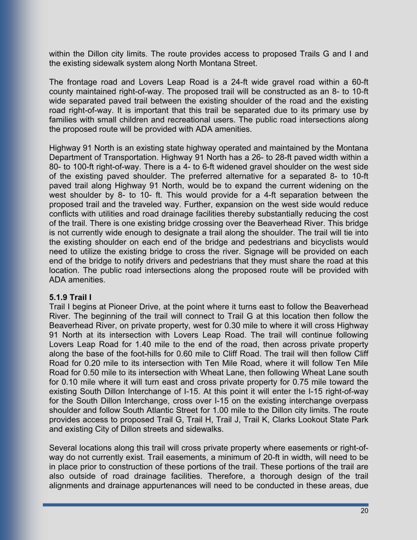
to the close proximity to the Beaverhead River and an existing irrigation supply canal. A pedestrian bridge crossing the Beaverhead River will also be required on the final section from Wheat Lane to the South Dillon Interchange. Lovers Leap Road and Cliff Drive are both 24-ft wide gravel roads within a 60-ft county maintained right-of-way. Ten Mile Road is a 24-ft wide paved county road within a 60-ft county maintained right-of-way. The first 0.40 mile of the proposed trail, from Pioneer Drive to Clarks Lookout State Park, will be constructed as an 8- to 10-ft wide paved trail. The remainder of the trail will be an 8- to 10-ft wide gravel trail located either on the shoulder of the existing roads or within its own easement. There will be one crossing of Highway 91 North at its intersection with Lovers Leap Road. This crossing would be accomplished by utilizing truncated domes, crosswalk striping and pedestrian crossing signage. Where the trail enters the South Dillon Interchange and follows South Atlantic Street, the trail will be located on the existing paved shoulder. The road will be striped and a rumble strip will be provided between the travel lane and the designated trail. All public road intersections along the proposed route will be provided with ADA amenities where appropriate.
Figure 10. Highway 91 North/Lovers Leap Figure 11. Cliff Road Looking North
Figure 12. Trail I Private Property

22
5.1.10 Trail J Trail J begins at the Dillon city limits on West Park Street, generally where the KOA campground accesses West Park Street. The trail follows West Park Street west for 0.50 mile (where it becomes Ten Mile Road at the Beaverhead River crossing), to its intersection with Cliff Road and will connect to Trail I. The route provides access to proposed Trail I and existing City of Dillon streets and sidewalks. West Park Street and Ten Mile Road are 24-ft wide paved roads within a 60-ft county maintained right-of-ways. The proposed trail will be constructed as an 8- to 10-ft wide gravel trail along the shoulder of the existing paved roadway.
5.1.11 Trail K Trail K begins on the south side of the University of Montana – Western Campus. The trail follows an existing access road across private property for 0.30 mile to where it crosses Highway 91 South to Southside Boulevard and along Southside Boulevard for 0.30 mile to its intersection with South Atlantic Street. The route provides access to proposed Trail I, Trail N and existing City of Dillon streets, sidewalks and designated bike routes. The existing access road is a 12- to 15-ft wide gravel road on private property. An easement will be required for this portion of the trail before it can be improved. This portion of the trail can be made part of the existing access road and the existing road graded and compacted with new gravel material. Southside Boulevard is a new road constructed within the last two years. This portion of the trail is located within the Dillon city limits and will be shown as a connection in the plan to Trail I. No actual trail will be constructed on this portion of the trail as the existing street and pedestrian facilities will be utilized. There will be one crossing of Highway 91 South at its intersection with the access road. This crossing would be accomplished utilizing truncated domes, crosswalk striping, and pedestrian crossing signage.
5.1.12 Trail L Trail L begins at the Dillon Intersection of Blacktail Road and Highway 91 South. The trail follows Blacktail Road east and the south for 2.50 miles to its intersection with Smith Road. The route provides access to proposed Trail N. Blacktail Road is a 24-ft wide paved road within a 60-ft county maintained right-of-way. The proposed trail will be constructed as an 8- to 10-ft wide gravel trail along the shoulder of the existing paved roadway.
5.1.13 Trail N Trail N begins at the intersection at Highway 91 South and Southside Boulevard. The trail will follow Highway 91 South for 2.30 mile to the turn off for Poindexter Slough. The trail will continue through the fishing access site at this location and cross an irrigation supply canal onto private property. The trail will follow the irrigation supply canal for 1.50 miles to where the canal empties into Blacktail Creek, then along Blacktail Creek for 1.00 mile to Southside Boulevard. The route provides access to proposed Trails I, K and Trail L.

23
Highway 91 South is owned and maintained by the Montana Department of Transportation. Highway 91 South has a 26- to 28-ft paved width within an 80- to 100-ft right-of-way. The preferred alternative is a separated 8- to 10-ft gravel trail along west side of Highway 91 South. Due to high speeds on this section of road it would be safest to put the proposed trail out along the right of way boundary. This would provide for maximum separation between the proposed trail and the traveled way. The public road intersections along the proposed route will be provided with ADA amenities where applicable. The last portion of this trail will cross private property where easements or right-of-way do not currently exist. Trail easements, a minimum of 20-ft in width, will need to be in place prior to construction of this portion of the trail. This portion of the trail also crosses Poindexter Slough once and Blacktail Creek once. Pedestrian bridges will be required at these water crossings.
5.1.14 Trail O Trail O begins at Poindexter Slough just after Trail N crosses the slough. Trail O crosses the railroad tracks and angles back over to Highway 91 South and follows Highway 91 South for 0.50 mile to the Jackson Interchange on I-15. The trail then follows Highway 278 west for 1.50 miles to its intersection with Downing Lane, then turns north and follows Downing Lane for 1.20 miles to the end of the road. The trail will continue east and the north through the foot hills across private property for 3.00 miles where it will connect with Trail I on Wheat Lane. The route provides access to proposed Trail N and Trail I. Highway 91 South and Highway 278 are existing state highways operated and maintained by the Montana Department of Transportation. Both highways have a 26- to 28-ft paved width within an 80- to 100-ft right-of-way. The preferred alternative is a separated 8- to 10-ft gravel trail along west side of Highway 91 South and the north side of Highway 278. Due to high speeds on these roads it would be safest to put the proposed trail out along the right-of-way boundary. This would provide for maximum separation between the proposed trail and the traveled way. The public road intersections along the proposed route will be provided with ADA amenities where applicable. Portions of this trail will cross private property where easements or right-of-way do not currently exist. Trail easements should be a minimum of 20-ft in width to construct an 8-
Figure 13. Highway 91 South Looking South
24
to 10-ft wide gravel trail and will need to be in place prior to construction of these portions of the trail.
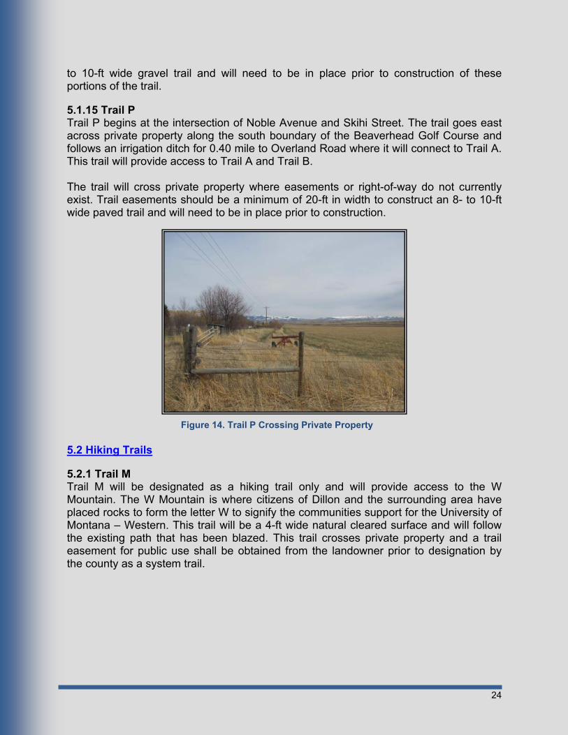
5.1.15 Trail P Trail P begins at the intersection of Noble Avenue and Skihi Street. The trail goes east across private property along the south boundary of the Beaverhead Golf Course and follows an irrigation ditch for 0.40 mile to Overland Road where it will connect to Trail A. This trail will provide access to Trail A and Trail B. The trail will cross private property where easements or right-of-way do not currently exist. Trail easements should be a minimum of 20-ft in width to construct an 8- to 10-ft wide paved trail and will need to be in place prior to construction.
5.2 Hiking Trails
5.2.1 Trail M Trail M will be designated as a hiking trail only and will provide access to the W Mountain. The W Mountain is where citizens of Dillon and the surrounding area have placed rocks to form the letter W to signify the communities support for the University of Montana – Western. This trail will be a 4-ft wide natural cleared surface and will follow the existing path that has been blazed. This trail crosses private property and a trail easement for public use shall be obtained from the landowner prior to designation by the county as a system trail.
Figure 14. Trail P Crossing Private Property
25
Chapter 6 - Implementation
6.1 Overview Residents of the City of Dillon and Beaverhead County, along with seasonal tourists will benefit from the proposed trails system. The trails system will improve access to outdoor resources, provide access to popular destinations, and help shape community growth. This will all be possible as the trails system is developed during the coming years. A successful implementation plan is the key to the overall success of the project.
6.2 Construction Phasing Each trail will be prioritized for construction as determined by public input and Beaverhead County. Items considered in the phasing process were cost, location, safety and community impact. Detailed cost estimates for each trail can be found in Appendix E. The overall phasing plan is as follows:
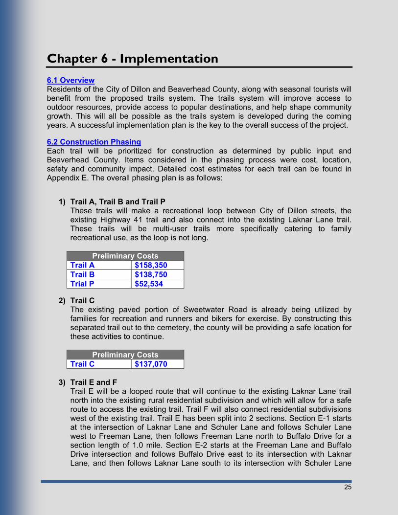
1) Trail A, Trail B and Trail P
These trails will make a recreational loop between City of Dillon streets, the existing Highway 41 trail and also connect into the existing Laknar Lane trail. These trails will be multi-user trails more specifically catering to family recreational use, as the loop is not long.
Preliminary Costs Trail A $158,350 Trail B $138,750 Trial P $52,534
2) Trail C
The existing paved portion of Sweetwater Road is already being utilized by families for recreation and runners and bikers for exercise. By constructing this separated trail out to the cemetery, the county will be providing a safe location for these activities to continue.
Preliminary Costs Trail C $137,070
3) Trail E and F
Trail E will be a looped route that will continue to the existing Laknar Lane trail north into the existing rural residential subdivision and which will allow for a safe route to access the existing trail. Trail F will also connect residential subdivisions west of the existing trail. Trail E has been split into 2 sections. Section E-1 starts at the intersection of Laknar Lane and Schuler Lane and follows Schuler Lane west to Freeman Lane, then follows Freeman Lane north to Buffalo Drive for a section length of 1.0 mile. Section E-2 starts at the Freeman Lane and Buffalo Drive intersection and follows Buffalo Drive east to its intersection with Laknar Lane, and then follows Laknar Lane south to its intersection with Schuler Lane

26
for a section length of 1.0 mile. Each section’s cost estimate is shown in the table below.
Preliminary Costs for Paving Trail Section E-1 $134,621 Trail Section E-2 $134,621 Trail F $83,069
4) Trail G and Trail H Trial G will provide a looped route from the end of Trail F to the existing Laknar Lane trail and provide recreational access to Clarks Lookout State Park. Trail H will provide even greater connectivity for users from the City of Dillon, as this will provide for a direct route from the City to Clarks Lookout State Park and Trail G. Trail G has been broken up into 2 sections. Section G-1 begins at the intersection of Laknar Lane and Pioneer Drive and follows Pioneer Drive west then north for 0.40 mile to its intersection with Highway 91 North. Section G-2 begins at the intersection of Highway 91 North and Pioneer Drive and follows Highway 91 North for 0.70 mile to its intersection with Schuler Lane. The estimated cost for each section is shown in the table below.
Preliminary Costs Remaining Graveled Portion
Trail Section G-1 $60,366 Trail Section G-2 $105,640 Trail H $161,281
5) Trail D
The existing gravel portion of Sweetwater Road is already being utilized by runners and bikers. By widening the gravel shoulder of the existing road, the county will be providing a safe location for these activities to continue. Trail D has been split into three sections. Section D-1 follows Sweetwater Road east for 3.0 miles to its intersection with Carter Creek Road, Section D-2 follows Carter Creek Road from its intersection with Sweetwater Road, north for 1.0 mile to its intersection with Nissen Lane, and Section D-3 follows Nissen Lane from its intersection with Carter Creek Road, west for 2.89 miles to its intersection with Highway 41 and Overland Road. The estimated cost for each section is shown in the table below.
Preliminary Costs Trail Section D-1 $190,385 Trail Section D-2 $63,462 Trail Section D-3 $183,404
6) Trail J Trail J will provide a short recreational trail for residents on the west side of Dillon to access the Beaverhead River, as well as visitors staying at the KOA campground. Although Trail J is shown in the corresponding maps as split into

27
two sections, the cost shown in the table below is for only the portion of Section J-2 that lies west of the KOA campground, which is the only portion of the trail that is within jurisdiction of Beaverhead County. The remaining portions of Section J-2 and all of Section J-1 are within the limits of the City of Dillon and therefore are shown on the map as a possible designated trail route, but nothing will be constructed by Beaverhead County.
Preliminary Costs Trail Section J-2 $30,948
7) Trail K
Trail K would provide a short connection between the college and the designated bike route within the City. This connection would create a looped route allowing for a longer recreational experience.
Preliminary Costs Trail K $3,780
8) Trail L
The existing paved portion of Blacktail Road is already being utilized by runners and bikers. By extending this separated trail out to rural residential areas along Blacktail Road, the county will be providing a safe location for these activities to continue.
Preliminary Costs Trail L $155,214
9) Trail N Trail N is an extensive looped route that will connect users of rural residential areas south of Dillon with the City of Dillon. This route will provide a safe separated trail along Highway 91 South and provide a natural setting along existing waterways. Trail N has been broken up into two sections. Section N-1 begins at the intersection at Highway 91 South and Southside Boulevard and follows Highway 91 South for 2.30 miles to Poindexter Slough. Section N-2 will begin at Poindexter Slough and will continue through the fishing access site at this location then follow the irrigation supply canal to where the canal empties into Blacktail Creek, then along Blacktail Creek for 1.00 mile to Southside Boulevard, this trail section is 2.5 miles long. The estimated cost for each section is shown in the table below.
Preliminary Costs Trail Section N-1 $153,643 Trail Section N-2 $287,003

28
10) Trail I Trail I follows a route that has been proposed by the Dillon Rotary Club for many years. This trail will loop around and connect many of the proposed and existing trails in this plan with areas north, west and south of Dillon. This trail has many recreational benefits as it winds along the Beaverhead River and its riparian areas as well as through the foot hills west of the river. This will offer a lot of opportunities for wildlife and scenic viewing. Trail I is broken up into 3 sections. Section I-1 begins at the Dillon City Limits on South Atlantic Street and proceeds west over I-15 onto private property, the section is 1.00 mile long. Section I-2 begins where section I-1 ends and continues west across provide property to Wheat Lane and follows Wheat Lane to its intersection with Ten Mile Road then follows Ten Mile Road to its intersection with Cliff Road, this section is 1.20 miles long. Section I-3 begins at the intersection of Cliff Road and Ten Mile Road and follows Cliff Road to its end where it continues on private property to the north till Lovers Leap Road, then follows Lovers Leap Road to its intersection with Highway 91 North crosses Highway 91 North onto private property where it follows the Beaverhead River till it intersects with Pioneer Drive. Section I-3 is 2.65 miles long. The estimated cost for each section is shown in the table below.
Preliminary Costs Trail Section I-1 $22,781 Trail Section I-2 $240,535 Trail Section I-3 $141,984
11) Trail O
Trail O will loop around and connect Trail N with Trail I by way of rural areas south and west of Dillon. This trail has many recreational benefits as it winds through the foot hills west of the Beaverhead River. This will offer a lot of opportunities for wildlife and scenic viewing. Trail O has been broken up into 4 sections. Section O-1 begins at the end of Wheat Lane and runs south then north through the foothills along an old wagon trail for 1.50 miles. Section O-2 begins at the end of Section O-1 and runs west to Downing Lane and follows Downing Lane south to its intersection with Highway 278, the section is 2.70 miles long. Section O-3 begins at the intersection of Highway 287 and Downing Lane and follows Highway 287 east 1.50 miles to its intersection with Highway 91 South. Section O-4 begins at the intersection of Highway 91 South and Highway 278 and follows Highway 91 South east and north for 0.5 mile to the turnoff to the Poindexter Slough turn off. The estimated cost for each section is shown in the table below.
Preliminary Costs Trail Section O-1 $84,202 Trail Section O-2 $151,563 Trail Section O-3 $84,202 Trail Section O-4 $28,067

29
6.3 Operation, Maintenance and Management Operating, maintaining and managing the proposed trails within this plan will require a joint effort between Beaverhead County officials, private organizations, and local residents.
6.3.1 Adopt-a-Trail Policy An Adopt-a-Trail Program should be established by Beaverhead County officials to encourage community groups, families, businesses, school groups and other organizations to join in managing the parks and trails system. Adopt-a-Trail participants will be assigned to clean up their “adopted” portion of the trail. Individuals involved in the cleanup process must obey all posted trail rules and act in a safe manner. An Adopt-a-Trail Volunteer Maintenance form is included in Appendix F
6.3.2 Trail Maintenance Trail maintenance includes the removal of debris, trash, litter, obnoxious and unsafe man-made structures, and other foreign matter so as to be safe for public use. Whenever noxious weeds are encountered along the trail, remove the weeds along with the entire root and dispose of properly. Trails should be repaired immediately whenever rough edges, severe heaves or depressions, cracked or uneven pavement and washed out surfaces are encountered. Table 3. Trail Maintenance Costs
Trail Type Annual Maintenance Cost per Year
(Per Mile)
Minor Rehabilitation
Costs 1
(Per Mile)
Major Rehabilitation
Costs 2
(Per Mile) 10’ Multi-use Asphalt Trails $1,500 $6,000 $14,000 10’ Multi-use Gravel Trails $1,000 $3,000 $10,000 Mountain Biking Trails $400 - - 1. Minor rehabilitation for asphalt trails should occur every 5 years or on an as needed basis and should consist of an oil seal coat. Gravel trails should be regraded every 3 years or as needed. On-Street Bike Lanes should be restriped every 5 years or as needed. 2. Major Rehabilitation for asphalt trails should occur every 20 years or on an as needed basis and should consist of a 1” asphalt overlay. Gravel trails should be resurfaced every 5 years or as needed.
6.3.3 Trail Ordinance and Etiquette With a large majority of the proposed trails for this project being multi-use trails there will be the potential for conflicts to occur. See Appendix G for user specific etiquette that will be posted on brochures and informational signs throughout the trail system in order to maintain the safety of all trail users.
30
Chapter 7 - Funding Options Described below are the allocated government funding and grants programs that can be utilized to facilitate the design and construction of the trails in this Master Plan. As future grants become available, they will be considered for application and applied for if deemed advantageous by Beaverhead County.
7.1 CTEP Funding The development of a trails system for Beaverhead County within the Dillon Growth Area can be achieved by utilization of yearly allocated funds to Beaverhead County through the Montana Department of Transportation Community Transportation Enhancement Program (CTEP). Beaverhead County gets approximately $26,000 dollars a year from the CTEP program.
7.2 MFWP Recreational Trails Program Grant A Recreational Trails Program (RTP) grant put out by Montana Fish Wildlife and Parks can be applied for by Beaverhead County. There are three funding categories small grants, standard grants and big grants. The Small Grant category comprises sponsors requesting $20,000 or less per grant application. This category assists grant applicants with fewer grant-writing resources or smaller projects. The Standard Grant category includes sponsors requesting $20,001-$45,000. FWP also offers Big Grants of $90,000 each RTP grant round. The deadline for submitting applications for RTP grant funding is June 1st of each year. The RTP grant will fund up to 80% of a project’s cost.
7.3 Land and Water Conservation Fund Program The Land & Water Conservation Fund (LWCF) is a federal grants program administered by Montana, Fish, Wildlife and Parks and can be applied for by Beaverhead County. The National Park Service must give its official approval to the sponsor before work on a project may begin. There are two finding categories for local governments. There are two separate grant categories so that small communities with fewer grant-writing resources do not have to compete directly with the larger metropolitan areas. The Small Grant category comprises sponsors requesting $24,999 or less per grant application. The Large Grant category includes sponsors requesting $25,000 or more, up to $75,000, per grant application. LWCF funds will only cover 50% of the total project cost.
31
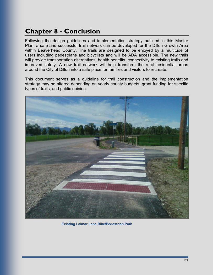
Chapter 8 - Conclusion Following the design guidelines and implementation strategy outlined in this Master Plan, a safe and successful trail network can be developed for the Dillon Growth Area within Beaverhead County. The trails are designed to be enjoyed by a multitude of users including pedestrians and bicyclists and will be ADA accessible. The new trails will provide transportation alternatives, health benefits, connectivity to existing trails and improved safety. A new trail network will help transform the rural residential areas around the City of Dillon into a safe place for families and visitors to recreate. This document serves as a guideline for trail construction and the implementation strategy may be altered depending on yearly county budgets, grant funding for specific types of trails, and public opinion.
Existing Laknar Lane Bike/Pedestrian Path
32
References American Association of State Highway and Transportation Officials. “Guide for the Development of Bicycle Facilities.” 1999. David M. Rathke and Melvin J. Baughman. “Recreational Trail Design and Construction.” http://www.extension.umn.edu/distribution/naturalresources/DD6371.html#step3. February 2009. Department of Conservation Bureau of Parks & Lands Off-Road Vehicle Division ATV Program. “ATV Trail Design and Construction Guidelines.” http://www.maine.gov/doc/parks/programs/ATV/documents/InfoGuide.pdf. February 2009. Hamilton Recreational Trails Master Plan. http://www.myhamilton.ca/NR/rdonlyres/071FAE16-9862-4038-9158-6AAED6A1524B/0/TRAILSMASTERPLANREPORT_Jan1508.pdf. February 2009. Oklahoma City Trails Master Plan. http://www.okc.gov/trails/trails_plan.pdf. February 2009. Wikipedia. “Dillon, Montana.” http://en.wikipedia.org/wiki/Dillon,_Montana. February 2009.
Centers for Disease Control and Prevention. “Recommended Community Strategies and Measurements
to Prevent Obesity in the United States.” http://www.cdc.gov/mmwr/pdf/rr/rr5807.pdf July 2009. http://www.cdc.gov/obesity/index.html December 2009

APPENDIX A
Soils Engineering Properties

Dillon Area - Part of Beaverhead County, Montana
Absence of an entry indicates that the data were not estimated. The asterisk '*' denotes the representative texture; other possible textures follow the dash.
Percent passing sieve number--
Map symboland soil name
Depth USDA texturePlasticity
indexLiquidlimit
FragmentsClassification
Unified AASHTO>10
Inches3-10
Inches4 10 40 200
In Pct Pct Pct
30B:
Thess 0-3 0 0 95-100 90-100 80-95 60-75 20-35 5-15Loam CL, CL-ML
A-4, A-6
3-21 0 0-5 90-100 85-95 80-95 60-80 20-35 5-15Loam, Silt loam CL, CL-ML
A-4, A-6
21-30 0 0-5 90-100 85-95 80-95 60-80 20-35 5-15Loam, Silt loam CL, CL-ML
A-4, A-6
30-60 0 0-15 20-35 15-30 10-20 0-10 --- NPVery gravelly loamy sand, Very gravelly sand, Extremely gravelly loamy sand
GW, GW-GM
A-1
32B:
Yamacall 0-4 0 0-5 85-100 80-100 65-85 55-75 25-30 5-10Loam CL-ML A-4
4-14 0 0-5 85-100 80-100 60-85 55-75 25-35 5-15Clay loam, Loam, Silt loam CL, CL-ML
A-4, A-6
14-26 0 0-5 85-100 80-100 60-85 55-75 25-35 5-15Clay loam, Loam, Silt loam CL, CL-ML
A-4, A-6
26-48 0 0-5 85-100 80-100 60-85 55-75 25-35 5-15Clay loam, Loam, Silt loam CL, CL-ML
A-4, A-6
48-60 0 0 70-100 65-100 60-90 40-70 20-35 NP-15Fine sandy loam, Gravelly loam, Loam
CL-ML, ML, SC-SM, SM
A-4, A-6
Engineering Properties
Tabular Data Version Date: 08/25/2010
Tabular Data Version: 8
Page 1 of 4
This report shows only the major soils in each map unit. Others may exist.

Dillon Area - Part of Beaverhead County, Montana
Percent passing sieve number--
Map symboland soil name
Depth USDA texturePlasticity
indexLiquidlimit
FragmentsClassification
Unified AASHTO>10
Inches3-10
Inches4 10 40 200
In Pct Pct Pct
35B:
Kalsted 0-3 0 0 80-100 75-100 45-70 25-40 20-25 NP-5Sandy loam SM A-2, A-4
3-22 0 0 80-100 75-100 45-70 25-40 20-25 NP-5Sandy loam SM A-2, A-4
22-52 0 0 60-80 50-75 30-55 15-30 20-25 NP-5Gravelly sandy loam SM A-1, A-2
52-60 0 0 60-100 50-90 30-55 15-30 20-25 NP-5Stratified gravelly sandy loam to loamy sand
SM A-1, A-2
36B:
Amesha 0-4 0 0 90-100 85-100 70-90 50-70 20-30 NP-10Loam CL-ML, ML
A-4
4-14 0 0-5 95-100 90-100 70-90 55-75 20-30 NP-10Loam, Silt loam CL-ML, ML
A-4
14-32 0 0-5 95-100 90-100 70-90 55-75 20-30 NP-10Loam, Silt loam CL-ML, ML
A-4
32-50 0 0-5 95-100 90-100 70-90 55-75 20-30 NP-10Loam, Sandy loam CL-ML, ML
A-4
50-60 0 0-10 65-100 55-100 45-85 25-65 20-30 NP-10Gravelly sandy loam, Loam CL-ML, ML, SC-SM, SM
A-2, A-4
Engineering Properties
Tabular Data Version Date: 08/25/2010
Tabular Data Version: 8
Page 2 of 4
This report shows only the major soils in each map unit. Others may exist.

Dillon Area - Part of Beaverhead County, Montana
Percent passing sieve number--
Map symboland soil name
Depth USDA texturePlasticity
indexLiquidlimit
FragmentsClassification
Unified AASHTO>10
Inches3-10
Inches4 10 40 200
In Pct Pct Pct
130A:
Thess 0-3 0 0 95-100 90-100 80-95 60-75 20-35 5-15Loam CL, CL-ML
A-4, A-6
3-21 0 0-5 90-100 85-95 80-95 60-80 20-35 5-15Loam, Silt loam CL, CL-ML
A-4, A-6
21-30 0 0-5 90-100 85-95 80-95 60-80 20-35 5-15Loam, Silt loam CL, CL-ML
A-4, A-6
30-60 0 0-15 20-35 15-30 10-20 0-10 --- NPVery gravelly loamy sand, Very gravelly sand, Extremely gravelly loamy sand
GW, GW-GM
A-1
Ashbough 0-4 0 0 90-100 85-100 75-95 60-90 25-30 5-10Silt loam CL-ML A-4
4-12 0 0 90-100 85-100 50-95 25-90 25-30 5-10Loam, Silt loam, Sandy loam CL-ML, SC-SM
A-2-4, A-4
12-22 0 0 90-100 85-100 70-95 30-90 25-35 5-15Sandy clay loam, Silty clay loam, Silt loam, Stratified loam to very fine sandy loam to sandy loam
CL, CL-ML, SC, SC-SM
A-2-6, A-6
22-43 0 0 90-100 85-100 70-95 30-90 25-35 5-15Sandy clay loam, Silty clay loam, Silt loam, Stratified loam to very fine sandy loam to sandy loam
CL, CL-ML, SC, SC-SM
A-2-6, A-6
43-51 0 0 85-100 80-100 50-95 25-90 25-30 5-10Loam, Sandy clay loam, Stratified sandy loam to silt loam
CL-ML, SC-SM
A-2-4, A-4
51-61 0 0 85-100 80-100 50-95 25-90 25-30 5-10Loam, Sandy clay loam, Stratified sandy loam to silt loam
CL-ML, SC-SM
A-2-4, A-4
61-84 0 0-25 30-60 20-50 10-40 5-15 0 NPVery gravelly loamy coarse sand, Very gravelly loamy sand, Extremely gravelly coarse sand, Extremely gravelly sand
GM A-1
Engineering Properties
Tabular Data Version Date: 08/25/2010
Tabular Data Version: 8
Page 3 of 4
This report shows only the major soils in each map unit. Others may exist.

Dillon Area - Part of Beaverhead County, Montana
Percent passing sieve number--
Map symboland soil name
Depth USDA texturePlasticity
indexLiquidlimit
FragmentsClassification
Unified AASHTO>10
Inches3-10
Inches4 10 40 200
In Pct Pct Pct
142B:
Beavrock 0-3 0 0 100 100 88-100 73-85 --- ---Slightly decomposed plant material
PT A-8
3-8 0 0 84-100 81-100 71-100 58-85 27-41 9-19Silt loam CL A-4, A-6, A-7-6
8-23 0 0 100 100 87-95 67-75 38-47 19-25Clay loam, Sandy clay loam CL A-6, A-7-6
23-28 0 0 100 100 95-100 83-91 37-46 19-25Silty clay loam CL A-6, A-7-6
28-60 0 12-21 45-64 17-43 12-35 1-7 0-23 NP-6Very gravelly loamy sand, Extremely gravelly sand
GW, SP-SC, SW
A-1-a, A-1-b
Threeriv 0-2 0 0 100 100 90-99 76-90 --- ---Moderately decomposed plant material
PT A-8
2-9 0 0 94-100 83-100 74-99 63-85 31-45 11-18Silt loam CL, ML
A-6, A-7-6
9-17 0 0 90-100 76-100 55-82 26-45 22-37 6-13Loam, Sandy loam SC, SC-SM
A-2-4, A-6
17-24 0 0 90-100 76-100 57-88 27-49 22-39 6-15Loam, Sandy clay loam, Sandy loam
SC, SC-SM
A-2-4, A-4, A-6
24-60 0 12-19 42-58 16-38 12-31 1-6 0-24 NP-6Very gravelly loamy sand, Extremely gravelly sand
GW, SP-SC
A-1-a, A-1-b
Engineering Properties
Tabular Data Version Date: 08/25/2010
Tabular Data Version: 8
Page 4 of 4
This report shows only the major soils in each map unit. Others may exist.

APPENDIX B
Existing and Proposed Trail Exhibits


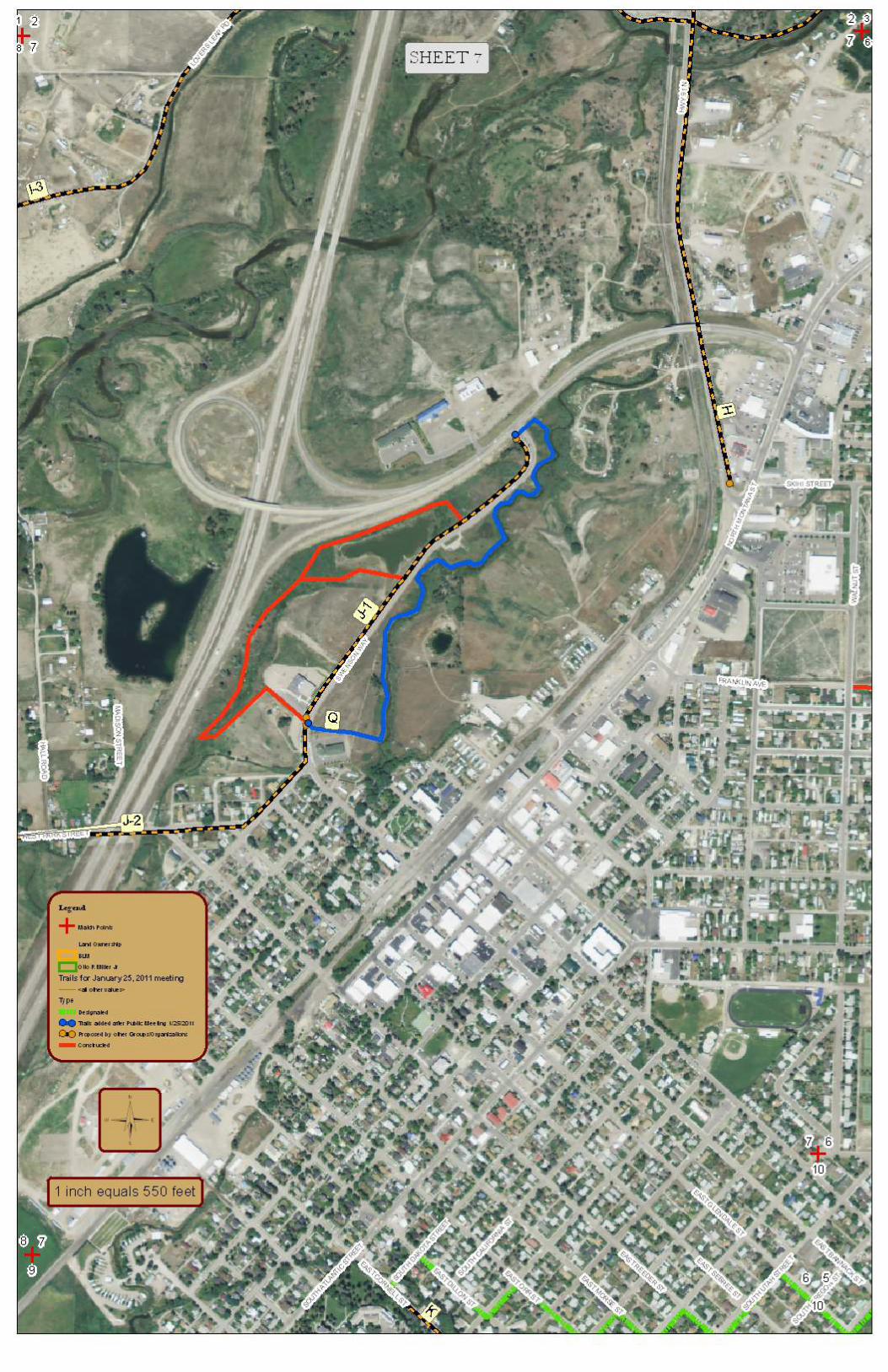


APPENDIX C
Typical Sections


APPENDIX D
Trail Maintenance Form

Beaverhead County Tri-Annual Trail Maintenance Report
Trail Inspection Form Page 1 of 3
Trail Inspector:
Please include as many details regarding your tri-annual trail inspection as possible.
Inspector’s Name: _____________________________ Date of Inspection:______________
Trail Section: _________________________________ Hours Worked on the Trail: ______
Asphalt Trail Surface
Did you notice any cracking along the edges of the trail surface?
Yes No
If yes, where did you notice these conditions?
Did you notice any uneven surfaces that may create a tripping hazard such as cracks, humps, ruts or heaving?
Yes No
If yes where did you notice these conditions?
Gravel Trail Surface
Did you notice uneven surfaces on the trail?
Yes No
If yes, where did you notice these conditions?
Did you notice any erosion prone areas that could wash on the trail?
Yes No
If yes, where did you notice these conditions?
Drainage Structures:
Remove debris from culverts and drainage structures to ensure proper functioning?
Yes No
Were there any culverts or drainage structures in need of repair or replacement?
Yes No If yes, where?

Beaverhead County Tri-Annual Trail Maintenance Report
Trail Inspection Form Page 2 of 3
Signage:
Check all signs for fading, damage, vandalism, or graffiti.
Please note any repair work completed and the location:
Please note any repair work needed but not completed and the location:
Benches:
Inspect all benches and rest areas for splinters and sharp edges and loose or rusted screws and bolts.
Please note any repair work completed and the location:
Please note any repair work needed but not completed and the location:
Overall Trail Condition:
Please note the overall condition of the trail and where any repairs need to be completed:
Work Completed on this Inspection:

Beaverhead County Tri-Annual Trail Maintenance Report
Trail Inspection Form Page 3 of 3
Weeds:
Please inspect for noxious weeds. Remove entire weed plant including the root and dispose of or spray for weeds.
Date Weeds were sprayed for: _______________
Were any noxious weeds found? Yes______ No________
If yes, describe where the noxious weeds were found and the weed type:

APPENDIX E
Trail Cost Estimate

Est. MDT Avg Unit
Description Units Qnty Bid Price Price Cost
20113005 CLEARING AND GRUBBING (14' WIDE) ACRE 2.10 $3,370.00 $7,077
203080100 TOPSOIL-SALVAGING AND PLACING (10' WIDE, 6" THK) CUYD 1,180 $3.50 $4,130
301020521 TOP SURF 3/4 IN GR 2A (4" THK) CUYD 790 $30.00 $23,700
401020490 PLANT MIX GR B - COMMERCIAL (2" THK) TON 760 $100.00 $76,000
603010522 CSP 18 IN LNFT 30 $40.00 $1,200
SIGNS EACH 2 $500.00 $1,000
Subtotal 113,107$
Mobilization: 11,311$
30% Contingency: 33,932$
Total Construction Cost: 158,350$
20113005 CLEARING AND GRUBBING (14' WIDE) ACRE 2.10 $3,370.00 $7,077
203080100 TOPSOIL-SALVAGING AND PLACING (10' WIDE, 6" THK) CUYD 980 $3.50 $3,430
301020521 TOP SURF 3/4 IN GR 2A (4" THK) CUYD 660 $30.00 $19,800
401020490 PLANT MIX GR B - COMMERCIAL (2" THK) TON 630 $100.00 $63,000
608010125 DETECTABLE WARNING DEVICES - TRUNCATED DOMES EACH 6 $800.00 $4,800
SIGNS EACH 2 $500.00 $1,000
Subtotal 99,107$
Mobilization: 9,911$
30% Contingency: 29,732$
Total Construction Cost: 138,750$
20113005 CLEARING AND GRUBBING (14' WIDE) ACRE 2.10 $3,370.00 $7,077
203080100 TOPSOIL-SALVAGING AND PLACING (10' WIDE, 6" THK) CUYD 980 $3.50 $3,430
301020521 TOP SURF 3/4 IN GR 2A (4" THK) CUYD 660 $30.00 $19,800
401020490 PLANT MIX GR B - COMMERCIAL (2" THK) TON 630 $100.00 $63,000
603010522 CSP 18 IN LNFT 90 $40.00 $3,600
SIGNS EACH 2 $500.00 $1,000
Subtotal 97,907$
Mobilization: 9,791$
30% Contingency: 29,372$
Total Construction Cost: 137,070$
20113005 CLEARING AND GRUBBING (12' WIDE) ACRE 10.00 $3,370.00 $33,700
203080100 TOPSOIL-SALVAGING AND PLACING (10' WIDE, 6" THK) CUYD 6,740 $3.50 $23,590
301020521 TOP SURF 3/4 IN GR 2A (6" THK) CUYD 6,740 $30.00 $202,200
203020375 EMBANKMENT CUYD 6,740 $6.80 $45,832
SIGNS EACH 14 $500.00 $7,000
Subtotal 312,322$
Mobilization: 31,232$
30% Contingency: 93,697$
Total Construction Cost: 437,251$
Beaverhead County Trails Master Plan
Proposed Trails
Prepared 6/11 by WWC Engineering
MDT Item
Number
PROPOSED TRAIL D (6.89 MILES)
PROPOSED TRAIL A (1.21 MILES)
PROPOSED TRAIL B (1.00 MILE)
PROPOSED TRAIL C (1.00 MILE)
Page 1 of 3

20113005 CLEARING AND GRUBBING (14' WIDE) ACRE 3.40 $3,370.00 $11,458
203080100 TOPSOIL-SALVAGING AND PLACING (10' WIDE, 6" THK) CUYD 1,965 $3.50 $6,878
301020521 TOP SURF 3/4 IN GR 2A (4" THK) CUYD 1,306 $30.00 $39,180
401020490 PLANT MIX GR B - COMMERCIAL (2" THK) TON 1,258 $100.00 $125,800
608010125 DETECTABLE WARNING DEVICES - TRUNCATED DOMES EACH 10 $800.00 $8,000
SIGNS EACH 2 $500.00 $1,000
Subtotal 192,316$
Mobilization: 19,232$
30% Contingency: 57,695$
Total Construction Cost: 269,242$
20113005 CLEARING AND GRUBBING (14' WIDE) ACRE 1.00 $3,370.00 $3,370
203080100 TOPSOIL-SALVAGING AND PLACING (10' WIDE, 6" THK) CUYD 590 $3.50 $2,065
301020521 TOP SURF 3/4 IN GR 2A (4" THK) CUYD 390 $30.00 $11,700
401020490 PLANT MIX GR B - COMMERCIAL (2" THK) TON 380 $100.00 $38,000
608010125 DETECTABLE WARNING DEVICES - TRUNCATED DOMES EACH 4 $800.00 $3,200
SIGNS EACH 2 $500.00 $1,000
Subtotal 59,335$
Mobilization: 5,934$
30% Contingency: 17,801$
Total Construction Cost: 83,069$
20113005 CLEARING AND GRUBBING (14' WIDE) ACRE 1.70 $3,370.00 $5,729
203080100 TOPSOIL-SALVAGING AND PLACING (10' WIDE, 6" THK) CUYD 1,080 $3.50 $3,780
301020521 TOP SURF 3/4 IN GR 2A (4" THK) CUYD 720 $30.00 $21,600
401020490 PLANT MIX GR B - COMMERCIAL (2" THK) TON 700 $100.00 $70,000
203020375 EMBANKMENT CUYD 690 $6.80 $4,692
608010125 DETECTABLE WARNING DEVICES - TRUNCATED DOMES EACH 12 $800.00 $9,600
SIGNS EACH 6 $500.00 $3,000
620013000 STRIPING - WHITE PAINT GAL 7 $25.00 $175
Subtotal 118,576$
Mobilization: 11,858$
30% Contingency: 35,573$
Total Construction Cost: 166,006$
20113005 CLEARING AND GRUBBING (14' WIDE) ACRE 1.70 $3,370.00 $5,729
203080100 TOPSOIL-SALVAGING AND PLACING (10' WIDE, 6" THK) CUYD 1,080 $3.50 $3,780
301020521 TOP SURF 3/4 IN GR 2A (4" THK) CUYD 720 $30.00 $21,600
401020490 PLANT MIX GR B - COMMERCIAL (2" THK) TON 700 $100.00 $70,000
203020375 EMBANKMENT CUYD 690 $6.80 $4,692
608010125 DETECTABLE WARNING DEVICES - TRUNCATED DOMES EACH 8 $800.00 $6,400
SIGNS EACH 6 $500.00 $3,000
Subtotal 115,201$
Mobilization: 11,520$
30% Contingency: 34,560$
Total Construction Cost: 161,281$
20113005 CLEARING AND GRUBBING (14' WIDE) ACRE 6.50 $3,370.00 $21,905
203080100 TOPSOIL-SALVAGING AND PLACING (10' WIDE, 6" THK) CUYD 3,770 $3.50 $13,195
301020521 TOP SURF 3/4 IN GR 2A (4" THK) CUYD 3,670 $30.00 $110,100
401020490 PLANT MIX GR B - COMMERCIAL (2" THK) TON 100 $100.00 $10,000
608010125 DETECTABLE WARNING DEVICES - TRUNCATED DOMES EACH 12 $800.00 $9,600
SIGNS EACH 6 $500.00 $3,000
620013000 STRIPING - WHITE PAINT GAL 40 $25.00 $1,000
623000000 RUMBLE STRIPS MILE 1 $700.00 $700
PEDESTRIAN BRIDGE LS 1 $120,000.00 $120,000
Subtotal 289,500$
Mobilization: 28,950$
30% Contingency: 86,850$
Total Construction Cost: 405,300$
PROPOSED TRAIL H (1.10 MILES)
PROPOSED TRAIL I (4.85 MILES)
PROPOSED TRAIL E (2.0 MILES)
PROPOSED TRAIL F (0.60 MILE)
PROPOSED TRAIL G (1.10 MILES)
Page 2 of 3

20113005 CLEARING AND GRUBBING (12' WIDE) ACRE 0.70 $3,370.00 $2,359
203080100 TOPSOIL-SALVAGING AND PLACING (10' WIDE, 6" THK) CUYD 490 $3.50 $1,715
301020521 TOP SURF 3/4 IN GR 2A (6" THK) CUYD 490 $30.00 $14,700
203020375 EMBANKMENT CUYD 490 $6.80 $3,332
Subtotal 22,106$
Mobilization: 2,211$
30% Contingency: 6,632$
Total Construction Cost: 30,948$
608010125 DETECTABLE WARNING DEVICES - TRUNCATED DOMES EACH 2 $800.00 $1,600
SIGNS EACH 2 $500.00 $1,000
620013000 STRIPING - WHITE PAINT GAL 4 $25.00 $100
Subtotal 2,700$
Mobilization: 270$
30% Contingency: 810$
Total Construction Cost: 3,780$
20113005 CLEARING AND GRUBBING (12' WIDE) ACRE 3.60 $3,370.00 $12,132
203080100 TOPSOIL-SALVAGING AND PLACING (10' WIDE, 6" THK) CUYD 2,450 $3.50 $8,575
301020521 TOP SURF 3/4 IN GR 2A (6" THK) CUYD 2,450 $30.00 $73,500
203020375 EMBANKMENT CUYD 2,450 $6.80 $16,660
SIGNS EACH 2 $500.00 $1,000
Subtotal 110,867$
Mobilization: 11,087$
30% Contingency: 33,260$
Total Construction Cost: 155,214$
20113005 CLEARING AND GRUBBING (14' WIDE) ACRE 8.10 $3,370.00 $27,297
203080100 TOPSOIL-SALVAGING AND PLACING (10' WIDE, 6" THK) CUYD 4,700 $3.50 $16,450
301020521 TOP SURF 3/4 IN GR 2A (6" THK) CUYD 4,700 $30.00 $141,000
608010125 DETECTABLE WARNING DEVICES - TRUNCATED DOMES EACH 10 $800.00 $8,000
SIGNS EACH 4 $500.00 $2,000
PEDESTRIAN BRIDGE LS 1 $120,000.00 $120,000
Subtotal 314,747$
Mobilization: 31,475$
30% Contingency: 94,424$
Total Construction Cost: 440,646$
20113005 CLEARING AND GRUBBING (14' WIDE) ACRE 10.50 $3,370.00 $35,385
203080100 TOPSOIL-SALVAGING AND PLACING (10' WIDE, 6" THK) CUYD 6,060 $3.50 $21,210
301020521 TOP SURF 3/4 IN GR 2A (6" THK) CUYD 6,060 $30.00 $181,800
608010125 DETECTABLE WARNING DEVICES - TRUNCATED DOMES EACH 4 $800.00 $3,200
603010522 CSP 18 IN LNFT 150 $40.00 $6,000
SIGNS EACH 2 $500.00 $1,000
Subtotal 248,595$
Mobilization: 24,860$
30% Contingency: 74,579$
Total Construction Cost: 348,033$
20113005 CLEARING AND GRUBBING (14' WIDE) ACRE 0.70 $3,370.00 $2,359
203080100 TOPSOIL-SALVAGING AND PLACING (10' WIDE, 6" THK) CUYD 390 $3.50 $1,365
301020521 TOP SURF 3/4 IN GR 2A (4" THK) CUYD 260 $30.00 $7,800
401020490 PLANT MIX GR B - COMMERCIAL (2" THK) TON 250 $100.00 $25,000
SIGNS EACH 2 $500.00 $1,000
Subtotal 37,524$
Mobilization: 3,752$
30% Contingency: 11,257$
Total Construction Cost: 52,534$
Abbreviations: CUYD=Cubic Yards; EA=Each; SQYD=Square Yards; LS=Lump Sum; AC=Acre; LNFT=Lineal Foot; LB=Pounds
PROPOSED TRAIL P (0.40 MILE)
PROPOSED TRAIL N (4.80 MILES)
PROPOSED TRAIL O (6.20 MILE)
PROPOSED TRAIL J (0.50 MILE)
PROPOSED TRAIL K (0.60 MILE)
PROPOSED TRAIL L (2.50 MILE)
Page 3 of 3

APPENDIX F
Adopt-a-Trail Volunteer Maintenance Form

Beaverhead County Adopt-a-Trail
Maintenance Activity Form
Trail Name: ____________________________ Phone: _____________________________
Team Captain: __________________________ Email: _____________________________
Total Hours: ______ X #of People who worked _________ = Total Hours ___________
(Example: # of Hours worked 5 hrs X # of People who worked 4 people = Total Hours 20
# of Volunteers: (List name of all volunteers on the back of this form.
We must document all VIP work with you on this A-A-T Project)
WORK ACTIVITIES COMPLETED
Dates Completed Activity Comments
Trash pick up
Clearing trail corridor
Excess brush cleared
Clearing/maintaining culverts
Sign Maintenance
Spray weeds
Miscellaneous Tasks
Additional Comments Concerning the Trail:
Signature of Team Captain Date:
Return all forms for Winter by ____ For Office Use Only:
For Spring by ____ & for Summer by _____ Copy to District Facility Man
TO: Beaverhead County 2 South Pacific Street, Suite F Beaverhead County, MT 59725 If you have any questions, please call us 406-683-3770

Beaverhead County Adopt-a-Trail
Maintenance Activity Form
LIST OF ALL ADOPT-A-TRAIL VOLUNTEERS
NAME
1
2
3
4
5
6
7
8
9
10
11
12
13
14
15

APPENDIX G
Trail Etiquette Brochure

1
All Users
1. Treat all trail users with respect and courtesy regardless of their sport, speed, or skill level.
2. Protect our environment. Stay on the trail. Do not cut switchbacks or use shortcuts.
3. Stay to the right and pass on the left. Always look before changing positions on the trail.
4. Share the trail, watch and listen for others.
5. Learn and use appropriate hand signals. Motorized users often cannot hear voice signals.
6. Respect trail closures; use only trails posted open. Obey posted signs.
7. Carry out all litter, including your pet’s waste.
8. All users yield to horseback riders.
9. When encountering a horse, speak in a calm, pleasant tone so the horse hears a human voice.
Do not hide.
10. The rider knows the horse the best. Expect the rider to advise you, not as a lack of courtesy, but
rather with knowledge of the horse’s temperament.
11. Downhill traffic yields to uphill traffic and faster users yield to slower users.
12. Do not approach, scare, harass, or feed wildlife or livestock.
13. Respect private property and the privacy of people living along the trail.
14. Leave flowers and plants for others to enjoy. Do not pull bark off of, cut or otherwise damage live
trees.
15. Practice low-impact trail use. Wet and muddy trails are more vulnerable to damage. When trail is
soft, consider other options.
16. Travel at a safe and controlled speed. Be especially careful when visibility is limited.
Walkers and Runners
1. Do not climb fences – use stiles 2. Always yield to equestrians. When a horse approaches, stop, and ask the rider for instructions.
3. Warn people when you are about to pass. Use your voice to warn equestrians.

2
Bicyclists
1. Ride single file. You can ride two or more abreast if you will not block other traffic. On curving or
hilly trails, ride single file. 2. Control your speed. Trails are not an appropriate place for high speed riding.
3. Obey traffic signs and signals. Use hand signals to indicate left or right turns, slowing or
stopping.
4. When passing, go slow and give an audible signal.
5. At night, use a headlight, taillight and reflectors.
CIVIL/WATER RESOURCE ENGINEERING PUMPS AND PIPELINES SURFACE AND GROUNDWATER MODELING EARTH DAM DESIGN AND REHABILITATION WATER SUPPLY, TREATMENT AND DISTRIBUTION WASTEWATER TREATMENT AND DISPOSAL IRRIGATION SYSTEMS GPS AND CONVENTIONAL SURVEYING CIVIL ENGINEERING DESIGN, PLANS AND
SPECIFICATIONS CONSTRUCTION ENGINEERING WATER RIGHTS COMPUTER-AIDED DESIGN AND DRAFTING (CADD) STORMWATER MANAGEMENT GEOTECHNICAL DRILLING AND SAMPLING
MINE SERVICES
MINING AND RECLAMATION DESIGN AND PERMITTING RESERVOIR AND DAM DESIGN HAULROADS AND STREAM CROSSINGS HYDROLOGIC CONTROL PLANS ANNUAL REPORTS AND BOND CALCULATIONS NEPA COMPLIANCE DOCUMENTS 404 PERMITS BASELINE STUDIES GPS AND CONVENTIONAL SURVEYING DRILLING AND MONITORING SERVICES BLAST MONITORING AND REPORTING ABANDONED MINE LAND RECLAMATION RECLAIMED STREAM CHANNELS ASSESSMENT OF PROBABLE HYDROLOGIC
CONSEQUENCES AVF ASSESSMENTS
TRANSPORTATION SERVICES RECONNAISSANCE REPORTS SURVEYS (RIGHT OF WAY, GROUND CONTROL,
CONSTRUCTION) BRIDGE HYDRAULICS, SCOUR ANALYSIS, STRUCTURE
SELECTION DESIGN OF URBAN STREETS, RURAL ROADWAYS AND
INTERSTATE RECONSTRUCTION STREETSCAPE ENHANCEMENTS UTILITY REPLACEMENT DRAINAGE DESIGN BICYCLE/PEDESTRIAN PATHWAYS PARKING FACILITIES CONSTRUCTION ADMINISTRATION
ENVIRONMENTAL SERVICES
ENVIRONMENTAL COMPLIANCE AND BEST MANAGEMENT PRACTICES
ENVIRONMENTAL IMPACT ANALYSIS AND REGULATORY PERMITTING
ENVIRONMENTAL SITE ASSESSMENTS GEOMORPHOLOGIC INVESTIGATIONS HYDROCARBON PRODUCT RECOVERY SYSTEM DESIGN HYDROLOGIC AND WATER QUALITY MONITORING HAZARDOUS AND NON-HAZARDOUS WASTE
MANAGEMENT PLANNING SITE REMEDIATION PLANNING AND DESIGN SOIL AND GROUNDWATER CLEANUP PLANS UNDERGROUND STORAGE TANKS INVESTIGATION AND
REMOVAL PLANS NEPA COMPLIANCE DOCUMENTS ENVIRONMENTAL AUDITS WETLAND DELINEATION AND MITIGATION DRILLING
1275 Maple Street Suite F Helena, MT 59601
(406) 443-3962 Fax: (406) 449-0056
611 Skyline Road Laramie, Wyoming 82070
(307) 742-0031 Fax: (307) 721-2913
6000 E 2nd Street, Ste 1004 Casper, Wyoming 82609
(307) 473-2707 Fax: (307) 237-0828
1849 Terra Avenue Sheridan, Wyoming 82801
(307) 672-0761 Fax: (307) 674-4265
Serving the Rocky Mountain region since 1980. www.wwcengineering.com