big bend: a land of change - u.s. fish and wildlife service
TRANSCRIPT

Big Bend:A Land of Change
An Educator’s Guide toBig Bend National Park’s
Sixth Grade Outreach Education Programs

Boiled down to its purest essence, the National Park Service’s Parks as Classrooms programis all about helping children understand their world. It is a concerted nationwide initiative toutilize the wonderful resources of the parks for teaching and learning purposes- in the process,education becomes active, experiential and fun.
The parks, after all, are classrooms. They are battlefields and Presidents’ houses, wherehistory was made. They are canyons and deserts, where geological processes have beenplayed out for eons. They are historic trails, over which pioneers migrated and intermingledand resettled. They are monuments to civil rights leaders, where the lessons of cultural heri-tage are real and vivid. They are seashores and preserves, where a million forms of life offerdaily lessons in biology, botany, evolution and survival amidst an endangered ecosystem. Thenational parks, in essence, help textbooks and lesson plans come to life. Parks as Class-rooms is an idea whose time has come. Visit the National Park Service’s homepage (http://www.nps.gov/) to explore these classrooms.
Big Bend’s ClassroomBig Bend National Park protects and preserves 801,000 acres of land in the State of Texas.The park, exhibiting the best Chihuahuan Desert expanse in the United States, shares a 118-mile border with the Mexican states of Coahuila and Chihuahua. Educating school childrenfrom the United States and Mexico on the importance of protecting this unique and fragileenvironment will encourage a sense of stewardship and ensure the protection of this ecosys-tem for future generations. The park preserves three distinct ecosystems; riparian, desert, andmountain. Differences in elevation, rainfall, and temperature throughout the park have createdthe biological diversity found here. There are 450 species of birds, 75 species of mammals,3600 species of insects and more than 1500 species of plants protected within the park’sboundaries.
Big Bend National Park has initiated an intensive environmental education outreach program,bringing to area classrooms programs designed to meet the Texas State Curriculum Guide-lines. This guide, one in a series, was developed to help you prepare your students for an in-class program by park staff. Through preparation, a student benefits much more from thisexperience. This guide includes background information to help you, the educator, understandmore about the subject matter being covered. The pre- and post-visit activities included in thisguide are an important component of the program. We hope this program will encourage youto bring your students to the park to experience and utilize this valuable resource as part ofyour teaching curriculum.
�I hear and I forget.I see and I remember.
I do and I understand.�
Parks as Classrooms

We look forward to visiting your classroom and introducing your students to “Parks as Class-rooms.” Big Bend’s outreach program is designed to encourage students to become activeowners of the National Park System and impart a sense of stewardship toward park re-sources. Through education, students will be inspired to learn more about the wonderfulresources available in our national parks
Each program has incorporated a variety of learning styles so that students may assimilateinformation using their preferred learning style. Learning styles include hands-on, seeing,hearing, reading and group discovery. Before our visit to your classroom, please review thebackground information provided and work with your students to complete the pre-visit activ-ity. By preparing your students before our visit, students will have a greater understanding ofthe information presented.
Teachers are expected to participate with students during the presentation and providediscipline as needed. It is helpful if the students have name tags or name plates. We haveincluded a list of the Texas Essential Knowledge and Skills (TEKS) covered in our programs.This list will help you meet the curriculum guidelines required by the state. Each program willlast approximately one hour.
Visiting Your Classroom

6.1 Scientific processes - Student will:(A) demonstrate safe practices during field and laboratory investigations.(B) make wise choices in the use and conservation of resources and the disposal orrecycling of materials.
6.2 Scientific processes - Student will:(A) plan and implement investigative procedures including asking questions, formulatingtestable hypotheses, and selecting and using equipment and technology.(B) collect data by observing and measuring.(C) analyze and interpret information to construct reasonable explanations from directand indirect evidence.(D) communicate valid conclusions.
6.3 Scientific processes - Student will:(C) represent the natural world using models and identify their limitations.(D) connect Grade 6 science concepts with the history of science and contributions ofscientists.
6.4 Scientific processes - Student will:(A) collect, analyze, and record information using tools including beakers, petri dishes,meter sticks, graduated cylinders, weather instruments, timing devices, hot plates, testtubes, safety goggles, spring scales, magnets, balances, microscope, telescopes, thermometers, calculators, field equipment, compasses, computers and computer probes.
6.6 Science concepts - Student will:(A) identify and describe the changes in position, direction of motion and speed of anobject when acted upon by a force.(B) demonstrate that changes in motion can be measured and graphically represented.(C) identify forces that shape the features of the Earth including uplift, movement ofwater, and volcanic activity.
6.7 Science concepts - Student will:(A) demonstrate that new substances can be made when two or more substances arechemically combined and compare the properties of the new substances to the originalsubstances.(B) classify substances by their physical and chemical properties.
6.12 Science concepts - Student will:(C) identify components of an ecosystem to which organisms may respond.
Texas Essential Knowledge and Skills (TEKS) Sixth Grade

GEOLOGY REVIEW
I. Introduction
II. Earth’s CompositionA. Layers of the EarthB.Types of Rock
III. Internal ProcessesA. Crustal Rearrangement
1. Continental Drift/Plate Tectonics2. Earthquakes
B. VulcanismC. Diastrophism
1. Folding2. Faulting
IV. External ProcessesA. Weathering
1. Physical2. Chemical
B. Mass MovementC. Erosion/Deposition
1. Running Water2. Ground Water3. Wind4. Ice (glaciers)5. Waves (currents)
V. Conclusion
VI. Big Bend Geology Tidbits
Background Information

GEOLOGY is the branch of science that studies the history of the earth and the natural processes that act onit. Bit by bit we learn about the earth and the forces effecting it. The science of geology continues to evolve.What we know about the earth is from the information recorded in the rocks. Scientists now agree that theearth formed from a fiery ball of dust and gases about 41/2 billion years ago. This figure is based on radiomet-ric dating of meteorites.
Geologists study the rocks on and in the earth. They use seismographs (that measure earthquakes) to obtaininformation about the layers of the earth. Seismic waves travel at different velocities depending on the nature ofthe layer they are passing through. We now know, that as the earth formed, the heaviest elements sank to thecore. The lighter elements rose to the surface. Gases, clinging to the surface, over time made the atmosphere.Later oceans, soils, plants and animals evolved.
THE EARTH’S COMPOSITIONThe outermost layer of the earth, the crust, is the layer we know the most about.
The crust is five to fifty miles deep (the average is twenty miles deep). It is theshallowest under oceans and the deepest under mountains. Scientists havedrilled down seven miles into the crust. It gets hotter the deeper they drill. Atseven miles the crust is 350°F.
The underlying layer is called the mantle. It is 1,800 miles thick andcontains a mixture of molten (liquid) rock and solid rock. The mantle rock is
more dense than crustal rock. The mantle could be described as similar to sillyputty in consistency. It is solid, but very plyable.
The innermost layer consists of two parts; the outer core is 1400 miles thick. It is a layer of dense moltenrock. Geologist believe this layer is composed of iron, nickel and silicon.The inner core is a ball of solid rock some 850 miles thick and 1540 miles across. It is composed of iron andnickel. The inner core is under such intense pressure from the other layers that the melting point of the rock isaffected. The pressure allows the rock to remain solid, even at temperatures around 3700°C.
TYPES OF ROCKSWhile studying the rocks on the earth’s crust, geologists noticed that the rocks vary greatly in size, shape andmineral proportions. The texture influenced by the origin, helps geologists classify rocks into three main groups:Igneous rocks have a “fiery inception”. In the beginning all rocks are igneous. Most have been formed by
magmatic cooling and are crystalline in structure. There are two ways igneous rocks appear on the earth’ssurface. They are either extrusive or intrusive in origin. Extrusive igneous rocks are spewed out (byvolcanoes) onto the earth’s surface while still molten. They solidify quickly in the open air. Basalt is anexample. Intrusive igneous rocks cool and solidify beneath the earth’s surface where surrounding,nonmagmatic material acts as insulation and slows the rate of cooling. Intrusive rocks may later be ex-posed by erosion or pushed upward to the surface. Granite is an example.
Sedimentary rocks are created when any pre-existing rocks go through mechanical and or chemical weather-ing processes. These processes reduce the rock to fragments. The fragments are then moved by an agentsuch as water, wind, ice, gravity or a combination. For example, water, the most common agent, picks upthe sediments and deposits it in a quiet body or water (lake or ocean). Layers build up and the weight
Background Information

of the layers exerts pressure that causes the water to be squeezed out. Cementation of the interlockingparticles occurs when silica, calcium carbonates and iron oxides fill the pores. Thus, the fragments aretransformed into sedimentary rocks. The fragments are usually sorted by size with the smallest particlesbeing carried the furthest and deposited horizontally. Sandstone forms from sand grains, shale from silt andclay sediments. Shale and sandstone are formed mechanically, where the large igneous rocks are brokendown into smaller pieces. Their composition is the same as the original rock. Limestone is also a sedimen-tary rock but it is formed through chemical weathering. When water and carbon dioxide combine theyform carbonic acid. This acid dissolves and chemically changes the original igneous rock. When the rock isredeposited, it is as the sedimentary rock limestone. Sedimentary rocks cover most of the ocean floor and3/4 of the land. The presence of layers, fossils and ripple marks are good clues that the rock is sedimen-tary. Sedimentary rocks can also form from plant and animal remains.
Metamorphic rocks originate from any type of rock. These rocks were changed by massive forces of heatand/or pressure working on them from within the earth. The rock changes in structure, texture, compositionand appearance. The metamorphism actually “cooks” the rock, melts it and causes recrystallization.Limestone changes into marble, sandstone becomes quartz, shale becomes slate and granite becomesgneiss. If a metamorphic rock melts it can be used again to form new igneous rock or beremetamorphosed.
INTERNAL PROCESSESThe earth appears to be a stable, steady and unchanging planet. However, since the beginning powerful forceshave been at work steadily altering the surface. Both internal and external processes are effecting the earth.There are three internal processes; Crustal rearrangement (earthquakes and plate tectonics), Vulcanism(volcanoes) and Diastrophism (folding and faulting). Our planet’s solid surface is actually a restless jigsaw ofabutting, diverging and colliding slabs called tectonic plates. How the plates behave forms the subject knownas Plate Tectonics.
In the early 1900’s a german scientistnamed Alfred Wegener, first proposed theContinental Drift Theory. He believed that300 million years ago the continents wereall joined together. He called this land massPangaea (Pan JEE a) which means “alllands”. He believed by 200 million yearsago there were two land masses; Laurasia(North America, Europe and Asia) andGondwanaland (India, South America,Australia, Africa and Antarctica). These twoland masses further split into the sevenseparate continents of today. Wegenerbased his theory on geographical, geologi-cal, climatic, biological and paleomagnetic clues. Even with all this evidence Wegener’s theory was not be-lieved. He could find no plausible explanation for the mechanism of breakup and movement of the continents.
Background Information

During World War II equipment was developed to locate submarines. After the war this same equipment wasutilized to map and explore the ocean floor. Scientists discovered a mid-ocean ridge where lava was coming upand creating new sea floor. A half inch to one inch of new floor was being added each year, spreading thecontinents apart. Scientists began plotting earthquakes and a pattern emerged, showing the location of severalplates. Today Wegener’s theory of continental drift is accepted as fact and has been expanded by the theory ofplate tectonics. We now know there are 7 major plates and 18 minor ones. Each plate is about 60 miles thickand made up of the crust and the upper solid part of the mantle. The Pacific Plate is 6000 miles wide. Theplates are like giant rafts carrying the continents and ocean basins slowly over the mantle. The valleys on theocean floor mark the edges of the plates. These plates cannot move without effecting other plates. There arethree types of boundaries:Divergent boundary occurs where 2 plates move away from each other. This movement creates valleys and
is associated with shallow earthquakes and volcanoes.Convergent boundary occurs where the plates are moving towards each other and meet. The older heavier
plate usually slides under the younger lighter plate. These boundaries are associated with deep earthquakesand volcanoes and create mountains. It is believed that 40 million years ago the plate with India collidedwith the Asian plate and created the Himalayan Mountains along a convergent boundary.
Transcurrent boundary occurs where two plates slide pass each other laterally. The San Andreas fault inCalifornia is located at transcurrent boundary.
Studying plate tectonics suggests that 50 million years from now Africa will split in two and California will pullaway from the minland and hit Alaska. Scientists also find that by studying plate tectonics and their boundarieswe are learning more about earthquakes and volcanoes.
EARTHQUAKESEarly earthquakes and volcanos were blamed on the anger of the gods. Greek legends claimed earthquakesoccurred because Atlas moved as he balanced the world on his shoulders. Today we know that along plateboundaries rocks are bent, compressed and stretched. The rocks give way by breaking or shifting position.This stress release occurs as vibrations or earthquakes. Earthquakes occur along plate boundaries and also atweak points in the crust called faults. When earthquakes occur the vibrations are in the form of waves -Seismic waves. Earthquakes are measured on a Richter Scale that determines magnitude. Quakes below 2.5can’t be felt by man. An 8.9 earthquake is the highest recorded to date. arthquakes can produce tsunami (SuNAM ee) or tidal waves in the ocean and trigger volcanoes. Today man is looking for ways to predict earth-quakes.
VOLCANOESOver 850 volcanoes have erupted in the last 2000 years. Volcanoes can be one ofnature’s most destructive forces. Eruptions have wiped out entire civilizations, turnedlandscapes into wastelands and may have caused the ice ages. However, volcanicactivity has also formed much of the earth’s dry land and scientists believe the air we
breathe and the water we drink may have first formed from gases given off by volcanoes. Volcanic ash andlava also enrich the soil.
Volcanoes do not erupt just anywhere. Nearly all volcanoes are formed at or near the edges of the 25 plates inthe earth’s crust. Here, the deep cracks and faults allow molten rock to rise to the earth’s surface. A very
Background Information

active area known as the ring of fire circles the Pacific Ocean. Not all volcanoes in the Pacific fire zoneerupt at the same time. They typically have brief active episodes and long periods of quiet. Most of the volca-noes in the ring are under the ocean. Over 10,000 of them are over 3000' high but not high enough to breakthe surface.They are called seamounts. Mount St. Helens and Mount Rainier are in the Cascade Volcano group in the ringof fire. Some volcanoes also form above a weak point in the crust called a hot spot. As the seafloor spreads,older volcanoes are moved away from the hot spot and new volcanoes form. Chains of islands like the Hawai-ian Islands are created this way. This type of volcano is more predictable than those in the ring of fire.
Volcanoes are classified many ways. An active volcano is one with frequent activity. A dormant volcano hasbeen quiet for a time but has erupted within recorded history and has the potential to erupt at any time. Anextinct volcano is not known to have erupted since it was discovered.
Volcanoes form when lava and rocks, from eruptions, pile up on the earth’s surface and form cones. At the topof each cone is a crater that formed when lava hardened around the vent. All volcanoes have vents or chan-nels that connects the source of magma to the volcano opening. If the vent becomes blocked, a buildup ofpressure occurs and the volcano may explode. Calderas, like Crater Lake in Oregon, form when an explo-sion blows off the top of the volcano or magma drains out of the crater.
Below ground volcanoes have two common features; A pool filled with magma and a passageway called achimney or pipe that carries magma to the surface. The magma consists of melted rock and gases. The type ofmagma effects eruptions. A quiet eruption has thin magma and little gas. A violent eruption has thick magma andlots of gas. When magma reaches the surface it is called lava. The lava can reach 2100 degrees Fahrenheit.The hottest lava is yellow and flows quickly. This hot thin lava is called pahoehoe (Pah HOH ee hoh ee) and ithardens with a wrinkled surface. Cooler thicker lava that forms a rough block like surface is called AA (ah ah).Volcanoes release not only lava but also gases (water vapor, carbon dioxide, sulfuric acid and sulfur dioxide)and rocks. The rocks vary in size from volcanic dust to ash to cinders to bombs to blocks.
Predictions of volcanic eruptions are based on several factors. Scientists look at a volcano’s eruption history,and for changes in behavior. Behavior changes could include changes in the types of gases released or in-creases in the temperature of the gases. Seismic activity (earthquakes) and physical changes in the volcano’sappearance are also monitored. Today infrared photography and remote sensing are being used to help furtherpredict volcanic eruptions.
DIASTROPHISMThe last internal process effecting the earth is Diastrophism or folding and faulting. The folding of rocks dependson pressure, temperature, strain rate and rock composition. Folding occurs along the edges of colliding continen-tal plates. Here the steady stress, high temperatures and pressures make normally brittle rock bend instead ofbreak.
While folding occurs deep in the earth, joints and faults are splits that form in stressed rock near the surface.Faults are breaks in the earth’s crust that involve movement vertically, horizontally or both. Rock is forcefully
Background Information
broken and displaced along the faults. Faulting occurs along zones of weakness in the crust and is associatedwith earthquakes and volcanoes. Joints are cracks with little movement of the rock. They open as coolingigneous rocks contract or as other rocks are subjected to compression. They occur in parallel sets and often atright angles.
EXTERNAL PROCESSESPlate tectonics, continental drift and earthquakes are types of crustal rearrangement. Folding, faulting andjointing are types of diastrophism. These processes along with vulcanism are the internal processes effectingour earth. The internal processes are major events but it is the external forces that are most effective in chang-ing the earth. Their cumulative effect is awesome. External forces are capable of wearing down anything theinternal forces erect. There are three types of external processes:Weathering is the breakdown of rock into smaller components by atmospheric and biotic agents. It is a slow
process, the rate is not constant and depends on the type of rock and climate. All rock exposed at thesurface will be weathered. Weathering is fastest in warm, humid climates. Continual weathering producessoil. Weathering occurs through physical (mechanical) or chemical means. Physical weathering destroysthe rock but leaves it chemically unchanged. Physical weathering is prominent in cold or dry climates.Methods include sharp temperature changes, frost, drought, crystallizing salts and biotic agents. Bioticagents include growing plant roots or burrowing animals. The freeze/thaw action of water is the mostimportant means of physical weathering. Chemical weathering is most active in humid climates. Theweathering process attacks the chemical ingredients of the rock. Rainwater and the chemicals it containscan dissolve some rocks or rot the natural cements. Examples include carbonation where water andcarbon dioxide bond to create carbonic acid. The acid can eat away at some rocks especially limestone.This process is important in cave formation. Hydration occurs where water combines with minerals in therocks. Oxidation occurs when oxygen combines with minerals. Rust is an example of oxidation. Acid rainand other pollutants also influence weathering.
Mass movement is caused by gravity. Gravity causes rocks to move downhill wherever there is a slope.Talus (piles of loose rocks) forms at the base of the slope. Wind and water can increase the action of massmovement. Landslides and mudflows are examples of mass movement.
Erosion/deposition. Erosion s the removal of fragments of rock and soil from its original position. Depositionis the relocation of the erosional materials. The two work together. The main agents of erosion are water,wind, ice (glaciers) and waves (currents). The various characteristics of the rocks and the underlyinggeologic structures influence the effectiveness of erosion. Erosional agents change the materials they erode.Many of our western national park units were set aside to preserve unique landforms created througherosion.
RUNNING WATERRunning water rounds and smoothes the rock materials it carries. Stream erosion is an important externalgeological process. It sculptures slopes and valleys and carves canyons. The Grand Canyon in Arizona is aprime example of stream erosion curtesy of the Colorado River. Running water causes most of the erosion onearth. It dissolves rock through carbonation, abrades the rock or just wears it away through force. Rivers drain70% of the dry land and each year dump 20 billion tons of eroded material into the seas and valleys.
Background Information
GROUND WATERBeneath the earth’s surface lies most of the world’s fresh water. The amount of water stored under the surfaceis 30 times the amount stored in all the rivers and lakes combined. More than half of the population of the USAdepends on ground water for drinking. Today man is often using the ground water faster than it can be re-placed. When this happens the ground above may lose the support the water once provided. The land maycollapse into a sinkhole. Ground water also often provides the water necessary for carbonation. Carbonationcan lead to the formation of caverns. Carlsbad Caverns, NM and Mammoth Cave, KY were set aside toprotect an example of ground water action.
WINDWind is moving air. Wind is nature’s attempt to balance out the uneven distribution of air pressure over the earth.Wind spreads heat more evenly across the world. Wind can make you feel comfortable on a hot day and cold ona winter day. Wind has a drying affect. In cold regions wind increases the loss of body temperature. Wind,however, also helps by carrying pollen, seeds, lightweight organisms and flying creatures. Wind is also used as asource of energy. The wind can be used to move the blades of a windmill to draw water up from a well or to runa generator to produce electricity.
Wind is not an effective agent of erosion on its own. It is not dense enough to carry much material. Wind is mosteffective in dry areas with limited vegetation to hold soil and rocks in place. Exposed areas such as deserts,beaches and plowed fields are vulnerable to wind deflation. Deflation creates desert pavement. Desert pave-ment is the layer of rocks and pebbles left after the connecting sand, clays and silts are blown away. Thepavement eventually forms a protective covering from further deflation.
Abrasion occurs when the wind picks up loose materials and sandblasts objects in its path. The finer particles likesand and dust can travel several feet above ground. The larger particles remain closer to the surface and arebounced and rolled along. Wind abrasion does not construct or shape a landform. It sculptures those already inexistence. Wind abrasion pits, etches, facets and polishes rock surfaces and further fragments rocks. How effec-tive wind erosion is depends on the size of particles being moved, the speed and duration of the wind and also theamount of resistance offered by the object being eroded. Wind erosion isa gradual process. Wind erosion helps sculpt such landforms as arches,hoodoos and dunes.
When the wind encounters a barrier, it slows down. As the wind slowsdown it can carry less material. The wind then drops its load at the base ofthe barrier. People take advantage of this process and erect windbreaks,like fences or plants, to the stop the wind and protect their crops andbuildings. In nature, plants and rocks act as a windbreak. The wind dropsits load at the foot of the windbreak. Each time this is done, the depositbuilds up. Finally, the deposits themselves, slow the wind. The depositsbuild up into mounds or small hills to form dunes. Sand dunes vary in sizeand shape. Usually the windward side (side facing the wind) has a gentleslope. Wind blows along this slope to the crest or top of the dunes. At the top, the sand is deposited on theleeward side (side facing away from the wind). Deposits slide down the back side and create a steep slope. This
Background Information
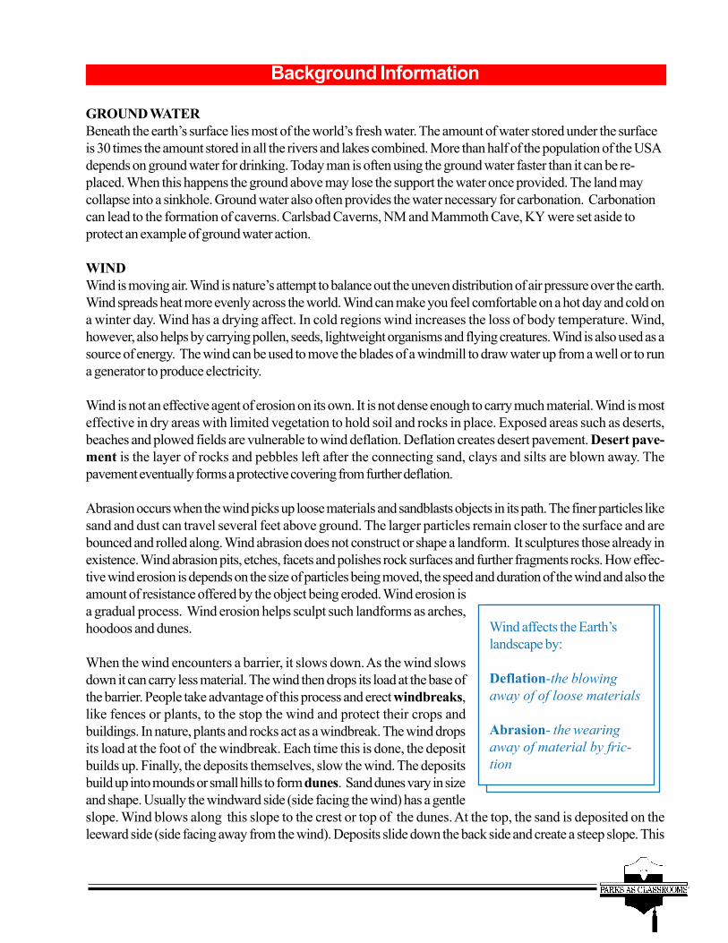
Wind affects the Earth’slandscape by:
Deflation-the blowingaway of of loose materials
Abrasion- the wearingaway of material by fric-tion

side is the slipface of the dune. Dunes are not fixed fea-tures. They move in the direction the wind blows. Oftenseveral feet a year, more if the wind is strong and steady.Dunes have been known to cover roads and structures.Dunes provide little nourishment or moisture for plantgrowth. Where vegetation does manage to gain a foot-hold, it may anchor the dunes so they move less or arestable. There is one area of unbroken dunes in the Sa-hara desert of Africa that is the size of Colorado.
ICE - GLACIERSIce moved rocks tend to keep their irregular shape. Icecovers 10% of the land and 12% of the oceans, mostly in the form of sea ice, polar ice sheets and caps andglaciers. 20,000 years ago 1/3 of the land was covered by ice. It caused the sea level to drop 100 meters andcreated many land bridges. There have been 10 ice ages in the last 2 million years. One-fourth of NorthAmerica and one-eighth of the world’s land surface is cloaked in debris shed by ice or its melt water. Glaciersare formed by snow that under pressure becomes ice. When the ice is thick enough, its weight will cause it tomove downhill (gravity). When the glacier moves downhill, heat caused by the ice scraping against rock causessome of the ice to melt. The layer of water under the glacier allows the glacier to slide easier over rock.Continental glaciers like those in Greenland and Antarctica cover large areas. When chunks of these glaciersreach the sea and break off, icebergs are created. Valley glaciers form in the mountains and move downtoward the valleys. The hollow where the glacier begins to form, and carves deeper as it grows is called thecirque. Frost from the glacier shatters rocks and the stones fall to the flanks or are pushed in front of theglacier creating moraines. A glacier can fill a mountain valley. As it moves it shoves the loose material aheadand plucks rocks from the valley sides. Thus a glacier deepens, widens and straightens a V shaped valley into aU shaped trough. Several Alaskan parks and Glacier N.P., MT have active glaciers in them.
WAVESThe final external process in erosion/deposition is the action of waves in oceans and currents in rivers andstreams. Waves are curving swells of water caused by wind, tides or earthquakes. They move along thesurface of the water. Strong winds create large waves. Waves reshape the shoreline where the water meets theland. The rate of erosion depends on the size and force of the wave, and the type of rock at the shore. Theaction of the waves can grind the rocks into sand and silt. Beaches form where these eroded materials aredeposited parallel to the shore.
The forces of nature have created some of the most beautiful landforms in the world. Many of these landforms(arches, canyons, hoodoos, glaciers, beaches, etc.) are now preserved in our National Park System. Thelandforms these processes have created greatly effect our life as well as the lives of plants and animals livingnear them. For instance, man rarely builds under an active volcano or moving glacier or on top of sand dunes.Plants and animals have evolved to be able to survive in those regions influenced by landforms. For instance, acactus could not live near a glacier but a polar bear could.
The spectular landforms of the Big Bend are one reason this park was set aside. Big Bend has canyons,mountains, volcanoes (extinct), and hoodoos and this is just a few geologic features found here.
Background Information
Sand dunes are one type of wind deposit.The other is loess (luhss). Loess is a finegrained wind deposited silt, found in exten-sive deposits in the mid - latitudes of theUSA, China, Argentina and the formerUSSR. It is believed to have come from siltproduced in association with Pleistoceneglaciers. Loess provides fertile soil for ag-riculture.

Background Informationrain is absorbed by vegetation or some other protective cover-ing, the direct collision of raindrops with the ground is strongenough to blast fine soil particles upward and outward. Thewater, that doesn’t sink in, proceeds to flow across the surfacein a thin sheet transporting the materials loosened by the drops.As this sheet is broken into narrow streams of water by ob-stacles in its path, the water carves out channels called rills.With more water the rills form gullies. Gullies becomestreams with even more water.
Streams sort the debris they transport. The finer, lighter materi-als move more rapidly than the coarser and heavier materials.Some minerals, largely salts are dissolved in the water andcarried in solution. Fine particles of silt and clay are carried in
suspension and move along with the flow, without touching the steambed. The sand, gravel and rock frag-ments or bed load move along in a series of jumps and bounces, rolling and sliding along the channel.Eventually, deposition or the settling of the rocks happens, usually in a response to a decrease in velocity orvolume of flow. Most water borne debris is dumped into a quiet body of water where massive deposits maydevelop. These deposits are usually sorted by size. Rivers drain 70% of the dry land and each year dump20 billion tons of eroded material into the seas and valleys. When a river enters another body of water andleaves its deposits behind a delta forms. When a mountain stream slows as it enters a valley and deposits itseroded material an alluvial fan is formed.
Stream erosion is an important external geologicalprocess. It sculptures slopes and valleys and carvescanyons. The erosional and depositional propertiesof running water create many different landforms.The Grand Canyon in Arizona is a prime example ofstream erosion curtesy of the Colorado River. TheRio Grande has carved Santa Elena, Mariscal, andBoquillas Canyons in Big Bend National Park.Many other national parks preserve features createdby running water.
Running water in streamsand rivers causes themost erosion on the
earth’s surface.
Water wears away rock three ways:
By dissolving rocks. Watercombines with carbon dioxidefrom the air and a weak acidforms that eats away somerocks, especially limestone.
By force. The force of thewater widens cracks andremoves pieces of rock fromthe channel.
By abrasion. Rocks scrapeagainst the rockbed of thechannel, chipping away rocksthat then bounce along in thestream with the water.

PARKS WITH CAVES:Carlsbad Caverns National Park, New Mexico
Great Basin National Park, Nevada (former Lehman Caves N. M.)Jewel Cave National Monument, South Dakota
Mammoth Cave National Park, KentuckyOregon Caves National Monument, OregonRussell Cave National Monument, AlabamaTimpanogos Cave National Monument, Utah
Wind Cave National Park, South Dakota
PARKS WITH GLACIERS OR EVIDENCE OF GLACIERS:Denali National Park and Preserve, Alaska
Gates of the Arctic National Park and Preserve, AlaskaGlacier National Park, Montana
Glacier Bay National Park and Preserve, AlaskaGreat Basin National Park, Nevada
Ice Age National Scenic Trail, AlaskaIsle Royale National Park, MichiganKenai Fjords National Park, AlaskaKobuk Valley National Park, Alaska
Mount Rainier National Park, WashingtonOlympic National Park, Washington
North Cascades National Park, WashingtonRocky Mountain National Park, Colorado
Wrangell- St. Elias National Park and Preserve, AlaskaYosemite National Park, California
Background Information

PARKS WITH EVIDENCE OF WATER EROSION:Arches National Park, Utah
Badlands National Park, South DakotaBig Bend National Park, Texas
Big Horn Canyon National Recreation Area, MontanaBlack Canyon of the Gunnison, Colorado
Bryce Canyon National Park, UtahCanyonlands National Park, UtahCapitol Reef National Park, Utah
Cedar Breaks National Monument, UtahChiricahua National Monument, ArizonaColorado National Monument, Colorado
Dinosaur National Monument, UtahGrand Canyon National Park, Arizona
Grand Tetons National Park, WyomingNatural Bridges National Monument, UtahRainbow Bridge National Monument, Utah
Yellowstone National Park, WyomingZion National Park, Utah
PARKS WITH HOODOOS:Arches National Park, Utah
Badland National Park, South DakotaBig Bend National Park, Texas
Chiricahua National Monument, ArizonaZion National Park, Utah
Background Information

PARKS WITH VOLCANOES AND EVIDENCE OF VOLCANOES:Anaikchak National Monument and Preserve, Alaska
Big Bend National Park, TexasCapulin Volcano National Monument, New Mexico
Crater Lake National Park, OregonCraters of the Moon National Monument, IdahoDevil’s Postpile National Monument, CaliforniaDevil’s Tower national Monument, WyomingEl Malpais National Monument, New Mexico
Haleakala National Park, HawaiiHawaii Volcanoes National Park, Hawaii
Hot Springs National Park, ArkansasKatmai National Park and Preserve, Alaska
Lake Clark National Park and Preserve, AlaskaLassen Volcanic National Park, CaliforniaLava Beds National Monument, CaliforniaMount Rainier National Park, Washington
Sunset Crater Volcano National Monument, ArizonaYellowstone National Park, Wyoming
NATIONAL LAKESHORES, SEASHORES & PARKS WITH SAND DUNES:Acadia National Park, Maine
Apostle Islands National Lakeshore, WisconsinAssateague Island National Seashore, Maryland & Virginia
Biscayne National Park, FloridaCape Cod National Seashore, Massachusetts
Cape Hatteras National Seashore, North CarolinaCape Lookout National Seashore, North CarolinaCumberland Island National Seashore, Georgia
Great Sand Dunes National Monument, ColoradoGulf Islands National Seashore, Florida
Indiana Dunes National Lakeshore, IndianaKenai Fjords National Park, AlaskaKobuk Valley National Park, Alaska
Padre Island National Seashore, TexasPictured Rocks National Lakeshore, Michigan
Point Reyes National Seashore, CaliforniaSleeping Bear Dunes National Lake Shore, Michigan
White Sands National Monument, New Mexico
Background Information

The United States of America was the very first country in theworld to develop the idea of national parks. It is an idea that hasbeen copied today throughout the world. Artist, George Catlin iscredited with the original idea. In 1832, in the Dakotas he worriedabout the effects of westward expansion on the American Indians,wildlife and wilderness. He suggested preserving them “by some greatprotecting policy of government...in a magnificent park...a nation’spark, containing man and beast in all the wildness and freshness of their
nature’s beauty!”
In 1864, Congress donated the land in Yosemite Valley and the MariposaBig Tree Grove to California for a state park. In 1872, after the encourage-
ment of several explorers and surveyors, Congress preserved the Yellowstonearea. President Grant signed the Yellowstone Park Act which preserved the
watershed of the Yellowstone River “for the benefit and enjoyment of the people.”Since this area was still a territory and there was no state government to which the
area could be entrusted, Yellowstone was placed in the custody of the federal government, as a national park -the world’s first area so designated. This land was put under the control of the Secretary of the Interior. Theact required the secretary to “make and publish such rules and regulations that would provide for thepreservation...wonders within said park and their retention in there natural condition.” Congress followed bycreating Sequoia, Mount Rainier, Crater Lake, and Glacier National Parks. Yosemite was returned from thestate of California to also become a national park. The idea to preserve nature was also connected with theidea of enjoying it. Tourism began to be promoted and railroads and hotels were brought into the parks.Campgrounds, trails and roads began to be built.
In 1906, the Antiquities Act was passed by Congress. This law established the federal policy for protectionand preservation of historic and prehistoric ruins, archeological sites and other scientific resources located onland owned by the federal government. This law established criminal penalties for looting and a permit systemto explore and excavate archeological sites. Finally, it authorized the President to establish National Monu-ments for lands of historic or scientific interest. Teddy Roosevelt took advantage of this act to proclaim 18national monuments before he left office. Many monuments like Petrified Forest and the Grand Canyon werelater converted into national parks. In fact, 100 monuments have been proclaimed through this act to date.Over half are still national monuments (58), 34 were converted into national parks, national battlefields, historicsites, etc. Only 8 have been abolished. Many of the Alaskan parks were set aside in 1978 when PresidentCarter used this law. In 1996, President Clinton used this law to create the Grand Staircase-Escalante nationalmonument in Utah. It will be operated by the BLM. Monument designation does not require Congress’sapproval like a National Park does.
Background Information
National Park Service History
Background InformationBy 1916, the national parks and monuments num-bered 33. The parks were being run without trueorganization capable of caring for the parks. TheSecretary of Interior was forced pre-1916 to askthe US Army to help care for the parks. The armyinfluence is still felt today in the National ParkService uniform and organizational structure. StephenMather and Horace Albright had been campaigningfor an organization to operate the parks. On August25, 1916, President Wilson signed the Organic Actwhich established the National Park Service (NPS).It mandated the NPS to “conserve the scenery, the
natural and historic objects and wildlife therein and to provide for the enjoyment of the same in such mannerand by such means as will leave them unimpaired for the enjoyment of future generations.” The act also statedmuseums, exhibits and other educational activities would be promoted. Further expansion of the park systemwas recommended. The act stated “In studying new park projects, seek to find scenery of supreme anddistinctive quality of some natural feature so extraordinary or unique as to be of national interest or impor-tance.
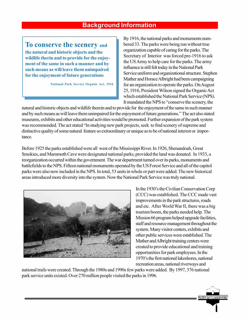
Before 1925 the parks established were all west of the Mississippi River. In 1926, Shenandoah, GreatSmokies, and Mammoth Cave were designated national parks, provided the land was donated. In 1933, areorganization occurred within the government. The war department turned over its parks, monuments andbattlefields to the NPS. Fifteen national monuments operated by the US Forest Service and all of the capitolparks were also now included in the NPS. In total, 53 units in whole or part were added. The new historicalareas introduced more diversity into the system. Now the National Park Service was truly national.
In the 1930’s the Civilian Conservation Corp(CCC) was established. The CCC made vastimprovements in the park structures, roadsand etc. After World War II, there was a bigtourism boom, the parks needed help. TheMission 66 program helped upgrade facilities,staff and resource management throughout thesystem. Many visitor centers, exhibits andother public services were established. TheMather and Albright training centers werecreated to provide educational and trainingopportunities for park employees. In the1970’s the first national lakeshores, nationalrecreation areas, national riverways and
national trails were created. Through the 1980s and 1990s few parks were added. By 1997, 376 nationalpark service units existed. Over 270 million people visited the parks in 1996.
Background Information
To conserve the scenery andthe natural and historic objects and thewildlife therin and to provide for the enjoy-ment of the same in such a manner and bysuch means as will leave them unimpairedfor the enjoyment of future generations
National Park Service Organic Act, 1916

The national parks today face many challenges. There are numerous rules and regulation that the parks mustfollow to help preserve and protect these special areas and yet still provide a means of enjoyment. The first lawthe parks’ answer to is the Organic Act of 1916. This legislation, although amended a few times, is the bible forthe NPS. The parks must also follow NPS 9 (law enforcement regulations) and the Code of Federal Regula-tions (CFR) in protecting the parks. Each park also has a superintendent’s compendium that gives special rulesfor that particular park. For instance, Big Bend’s superintendent’s compendium allows the park to close trails,roads and parts of the river to help protect the peregrine falcon.
J. Horace McFarland stated in 1916 to Congress “The parks are the nation’s pleasure grounds, the nation’srestoring places, recreation grounds...The national parks are an American idea...Each one of these nationalparks is the result of some great man’s thought of service to his fellow citizens. These parks did not justhappen...These great parks are a sheer expression of democracy.” McFarland was and is correct, the Na-tional Park System is among America’s proudest and best loved creations.
Background Information
Today, the parks are increasingly besieged by development and problems outside their park boundaries. TheNPS can no longer shoulder the burden of protecting the land without cooperation and partnerships withothers outside the system. Today the parks look more and more to wildlife organizations, friends groups andeducational organizations for grants and other means of support to continue to provide top rated services to thevisitors.

OTHER LAWS OF IMPORTANCE TO THE N.P.S.
Historic Sites, Buildings and Antiquities Act 1935Creates a national policy to preserve for public use historic sites, buildings and objects of national significance.Establishes National Historic Landmarks.
Wilderness Act 1964Established the National Wilderness Preservation System and the rules and regulations regarding wildernessuse.
Land and Water Conservation Act 1965Established a fund to assist states and federal agencies in meeting present and future outdoor recreationdemands and needs of American people. 40% of the funds are to go to land purchases.
Endangered Species Act 1966Provides for the protection, monitoring and recovery plans for species considered threatened or endangered.
National Historic Preservation Act 1966NPS required to assume responsibility for preservation of historic properties.
National Environmental Policy Act (NEPA) 1969Requires environmental impact statements prior to any building. Includes categorical exclusions, environmentalassessments, and environmental impact statements.
Clean Air ActProvides the framework to preserve and protect air quality.
Clean Water ActProvides framework to restore and maintain chemical, physical and biological integrity of Nation’s water.
Archeological Resource Protection Act (ARPA) 1979Addressed the weakness of the 1906 Antiquities Act. Provided protection of archeological resources onpublic and American Indian lands. Offered increased protection for historic and prehistoric resources of 100+years. Stiffened the criminal penalties for looting and damaging sites. Required surveys of the land to locatesites and provided an exemption to the Public Information laws. (Do not have to disclose location of culturalsites).
Federal Insecticide, Fungicide and Rodenticide Act 1988Regulates the manufacturing, labeling, sale and use of pesticides. Restricts their use and application.
Background Information

Visiting Your Classroom
The pre- and post-visit activites are an important component of theEducator's Guide. Students will retain more information during thein-class program if they have completed the pre-visit activity. Afterthe program, the post-visit activity will reinforce concepts andideas presented by the Ranger. Please insure your students havecompleted the pre-visit activities before the inclass visit.
Pre-activity 1: Word SearchPost-activity 1: Cross word
Pre-activity 2: Create a ParkPost-activity 2: Word Search

Geology and Landforms
J L T V S C A S U S A T L E DJ F E E S N X M G L V F I X AN U N N E G G U L L I E S C TE U Z T O M G U M I N K A X ND R O S L I V Z X R A L F U DO N O I T I S O P E D F Z I SN O I S A R B A R E O X F P RX I K L I S E B R N R L U R TT T F Z I O D A U B M E U O OC A N B K N N R M L A V A U NN L D J I K X O Z S N C O V AI F C W W U M J X V T L K R CT E Y U H G P P D I U U K J LX D T O S W R A V E A E P X OE W B F G M G E Q X M W X A V
ABRASIONACTIVE
ALLUVIAL FANCALDERA
DEFLATIONDELTA
DEPOSITION
DORMANTDUNES
EROSIONEXTINCTGULLIES
LAVALOESS
RILLSRUNOFF
STREAMSVENTS
WINDBREAKSVOLCANO
Pre-visit Activity 1
WORD SEARCHWORD SEARCHWORD SEARCHWORD SEARCHWORD SEARCH

Post-visit Activity 1
Geology Crossword
ACROSS1. A mound, ridge, or low hill of loose windblownsand.4. A landmass that projects conspicuously aboveits surroundings.6. The ejection of molten rock, water, and ash.7. The whole body of salt water that covers nearlythree-fourths of the surface of the Earth.9. An individual topographical region.12. A current of air, especially a natural one thatmoves parallel to the ground.14. A rock pillar or pedestal of unusual shape,formed by erosion.15. A person who studies physical or naturalsciences.17. Land set aside for recreation.18. A test, trial, or procedure for the purpose ofdiscovering the unknown or testing a theory.19. Melted rock which flows from an eruptingvolcano.
DOWN2. The process by which the earth’s surface isworn away.3. A deep, narrow valley with steep sides andoften with a stream flowing through it.5. The science that deals with physical historyand physical changes of the Earth.8. The dry beds of intermittent streams found indeserts.10. An arid landscape that usually receives lessthan ten inches of rainfall per year.11. A means of diversion, a hobby.12. Composed of two molecules of hydrogen andone molecule of oxygen.13. An opening in the Earth’s surface wheremagmatic gasses and lava are erupted.16. All of the animals in the world.

Post-visit Activity 1
Create a National ParkNational parks are special places. Parks conserve the scenery, theplants, and the animals that call them home. Parks provide a placefor us to play. Future generations will be able to enjoyparks just as we do today. Here’s your chance tocreate a national park.
Look up different nationalparks on the internet.Just go to www.nps.gov
Choose the location of yourpark in the world.
Choose a name for your park.
Pick the landforms and the cultural features in your park.
Decide what rules and regulations you need to protect your parkand the people who visit it.
Draw a map of your park and include campgrounds, hiking trails,roads, visitor centers, restrooms, restaurants, and any other facili-ties that might be appropriate.

BENEFITCAMPGROUND
CONGRESSCONSERVE
ENJOYMENTHISTORIC
IDEA
LAWSMAPPARK
PRESERVATIONPROTECT
RECREATION
REGULATIONSRULES
SCENERYTOURISM
TRAILSWILDLIFE
National Park Service
WORD SEARCHWORD SEARCHWORD SEARCHWORD SEARCHWORD SEARCH
Post-visit Activity 2

Suggested ReadingSixth Grade
Alessandrello, Anna. The Earth: Origins and Evolution.Raintree/Steck Vaughn; ISBN: 0811433315. Published 1994
Brooks, Susan. The Geography of Earth.Oxford University Press; ISBN: 0195212320. Published 1996.
Field, Nancy. Discovering Volcanoes.Dog Eared Publications; ISBN: 0941042030. Published 1996.
Gallant, Roy A. Sand on the Move: The Story of Dunes (First Books-Earth andSky Science). Franklin Watts, Inc.; ISBN 0531158896. Published 1998.
Grimshaw, Caroline. Earth (Connections).World Book, Inc.; ISBN 15684745339. Published 1995.
Pope, Joyce. Earthquakes (A Closer Look At).Copper Beach Books; ISBN: 0761308067. Published 1998.
Redfern, Martin. The Kingfisher Book of Planet Earth.Kingfisher Books; ISBN: 0753451808. Published 1999
Richardson, Hazel. Water (Against the Elements).Copper Beach Books; ISBN: 0761308016. Published 1998.
Stotsky, Sandra. Geology, The Active Earth (Ranger Rick’s Nature Scope).Chelsea House Publications; ISBN:0791048349. Published 1998.
Steedman, Scott. Our Planet (Worldwise).Franklin Watts, Inc.; ISBN: 0531153169. Published 1998.
Winner, Cherie. Erosion (Earthwatch).Carolrhoda Books; ISBN: 1575052237. Published 1999.