break out session on boundary layer convection in cold air ... · boundary layer convection in...
TRANSCRIPT

Break‐out session on boundary layer convection in cold‐air outbreaks
Co‐convenors: Greg McFarquhar, Pavlos Kollias, and Michael Jensen
• 1030 am: (15 min intro + 30 min discussion) Greg McFarquhar, University of Illinois: "Overview of the proposed Cold‐air Outbreak in the Marine Boundary Layer Experiment (COMBLE)”
• 1115 am: Steven Abel, UK Met Office (presented by Michael Jensen, BNL): "Observations and modeling of northern‐hemisphere cold‐air outbreaks”
• 1130 am: Ann Fridlind, NASA GISS: “Modeling challenges simulating the microphysics of cold air outbreak conditions versus other mixed‐phase shallow cloud conditions”
• 1145 am: (15 min intro + 30 min discussion) Mikhail Ovchinnikov, PNNL: “Modelling objectives in COMBLE"
Objective: survey ability of weather and climate models to capture dynamical and cloud microphysical properties of boundary‐layer convection in cold‐air outbreaks (CAOs) over open water, and to discuss plans for targeted observations aimed at reducing model uncertainties.
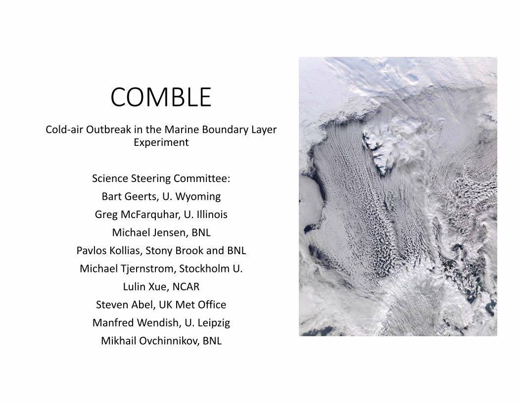
COMBLECold‐air Outbreak in the Marine Boundary Layer
Experiment
Science Steering Committee:Bart Geerts, U. Wyoming
Greg McFarquhar, U. IllinoisMichael Jensen, BNL
Pavlos Kollias, Stony Brook and BNLMichael Tjernstrom, Stockholm U.
Lulin Xue, NCARSteven Abel, UK Met OfficeManfred Wendish, U. LeipzigMikhail Ovchinnikov, BNL
Motivation•Boundary‐layer convective clouds are rather common off the boreal continents and the Antarctic ice sheet
• they are poorly documented• they are in the Grey Zone for weather and climate models
In its 2014 report, Dynamic Earth: Geo Imperatives & Frontiers 2015–2020(https://www.nsf.gov/geo/acgeo/geovision/start.jsp)
the NSF Geoscience Directorate outlines a plan for NSF‐supported geoscience research, and highlights “high‐latitude atmosphere‐ocean‐ice‐ecosystem interactions and processes”
as one of four high‐priority research areas.

Core science objectives
•describe fetch‐dependent mesoscale organization and vertical structure of BLC, including profiles of vertical velocity, liquid water and ice mass, surface heat and moisture fluxes, droplet and ice particle size distributions
•examine impact of varying aerosol in Arctic boundary layer, as well as marine aerosol sources and anthropogenic pollution, on these distributions in a range of wind and temperature regimes.
•enable evaluation and improvement of representation of shallow convection in cold‐air outbreaks over open water in weather and climate models

Relative frequency of organized convective patterns (cloud streets or cellular convection) (% of time) Brummer and Pohlman (2000)
Fletcher et al. (2016)
xx
x
xxxx
M = SST – 800mb
ERA Interim data
Location to Look at BLC
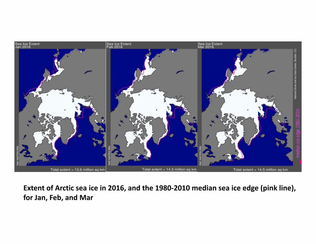
Extent of Arctic sea ice in 2016, and the 1980‐2010 median sea ice edge (pink line), for Jan, Feb, and Mar

80
70
60
65
75

Instruments at at Andenes: AMF1 incl. AOS
• a surface meteorological station (MET) with a precipitation gauge• Ka‐ and a W‐band scanning radars (Ka‐SACR and W‐SACR)• a Ka‐band zenith radar (KAZR)• an Atmospheric Emitted Radiance Interferometer (AERI)• a 1290‐MHz radar wind profiler (RWP)• a passive microwave radiometer (MWR)• a Micropulse lidar (MPL)• a Total Sky Imager (TSI)• a disdrometer (LDIS)• Aerosol Observing System (AOS)
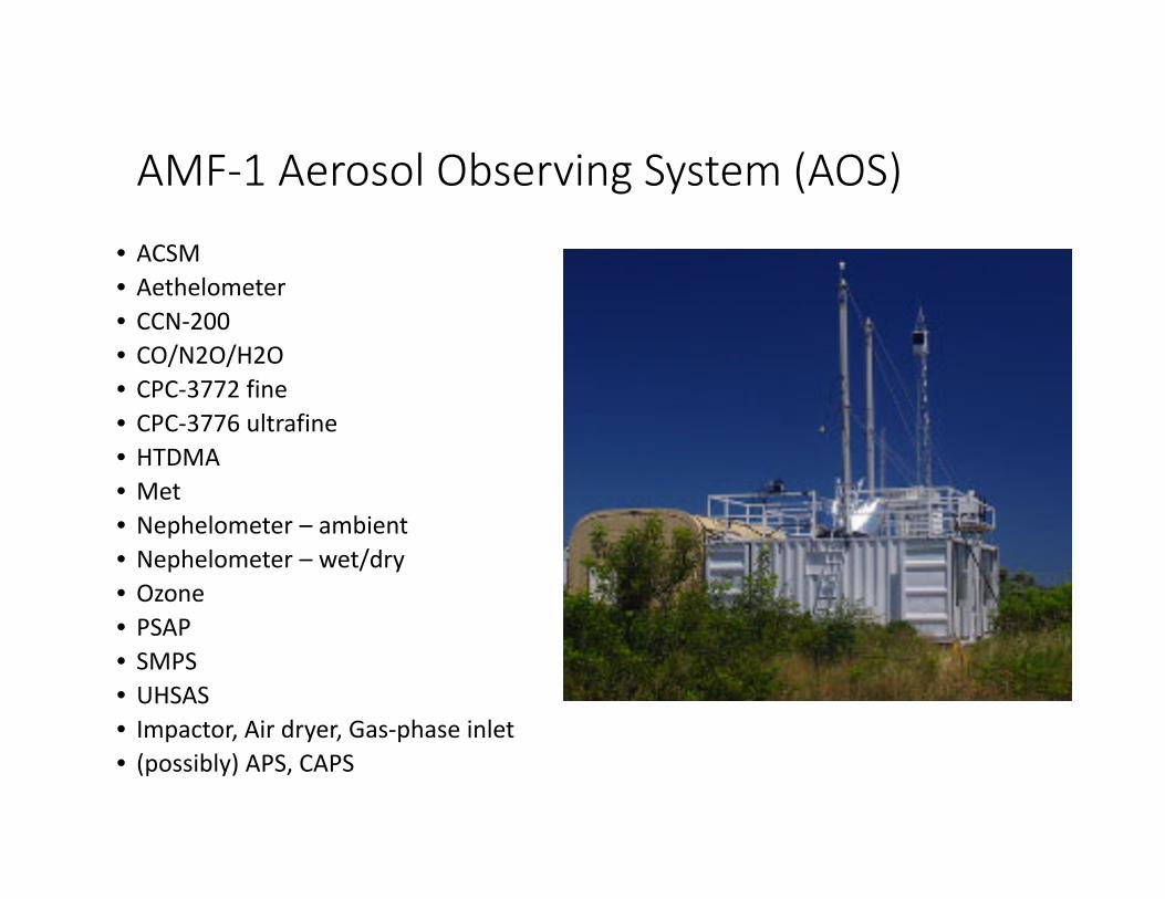
AMF‐1 Aerosol Observing System (AOS)
• ACSM• Aethelometer• CCN‐200• CO/N2O/H2O• CPC‐3772 fine• CPC‐3776 ultrafine• HTDMA• Met• Nephelometer – ambient• Nephelometer – wet/dry• Ozone• PSAP• SMPS• UHSAS• Impactor, Air dryer, Gas‐phase inlet• (possibly) APS, CAPS

Instruments at the AMF satellite on Bear Island
• a Micropulse lidar (MPL)*• a passive microwave radiometer (MWR)• a Total Sky Imager (TSI)• a disdrometer (LDIS)*• a surface meteorological station (MET) with a precipitation gauge• a Multi‐Filter Rotating Shadowband Radiometer (MFRSR)• a Ceilometer (CEIL)• an eddy correlation flux system (ECOR) along the upwind shore• a sun photometer for visible and infrared narrow field of view measurements• Broadband radiometer in the VIS and IR ranges.• user‐provided:
• (Met Norway) X‐band scanning dual‐pol radar (Meteor 60 DX)• (U Cologne) Ka‐ and W‐band profiling radars
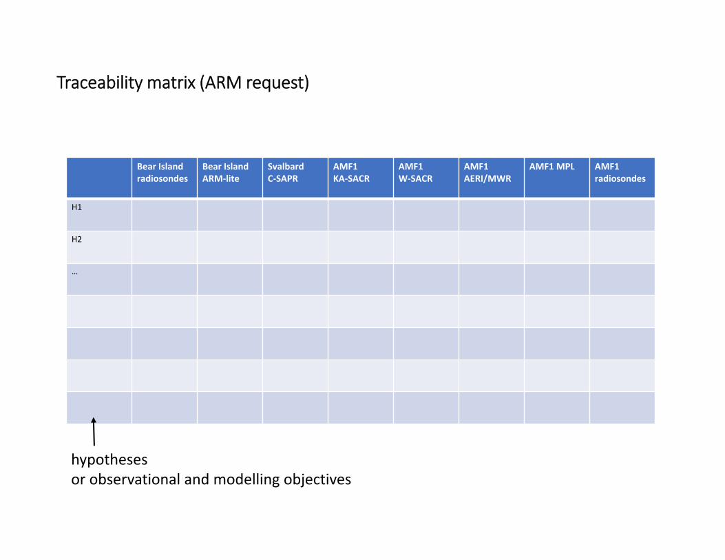
Traceability matrix (ARM request)
Bear Island radiosondes
Bear Island ARM‐lite
SvalbardC‐SAPR
AMF1KA‐SACR
AMF1W‐SACR
AMF1 AERI/MWR
AMF1 MPL AMF1 radiosondes
H1
H2
…
hypothesesor observational and modelling objectives
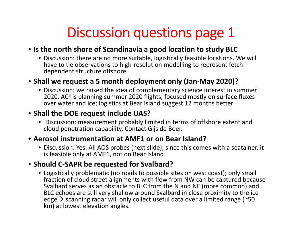
Discussion questions page 1• Is the north shore of Scandinavia a good location to study BLC
• Discussion: there are no more suitable, logistically feasible locations. We will have to tie observations to high‐resolution modelling to represent fetch‐dependent structure offshore
• Shall we request a 5 month deployment only (Jan‐May 2020)? • Discussion: we raised the idea of complementary science interest in summer 2020. AC3 is planning summer 2020 flights, focused mostly on surface fluxes over water and ice; logistics at Bear Island suggest 12 months better
• Shall the DOE request include UAS?• Discussion: measurement probably limited in terms of offshore extent and cloud penetration capability. Contact Gijs de Boer.
• Aerosol instrumentation at AMF1 or on Bear Island?• Discussion: Yes. All AOS probes (next slide); since this comes with a seatainer, it is feasible only at AMF1, not on Bear Island
• Should C‐SAPR be requested for Svalbard?• Logistically problematic (no roads to possible sites on west coast); only small fraction of cloud street alignments with flow from NW can be captured because Svalbard serves as an obstacle to BLC from the N and NE (more common) and BLC echoes are still very shallow around Svalbard in close proximity to the ice edge scanning radar will only collect useful data over a limited range (~50 km) at lowest elevation angles.
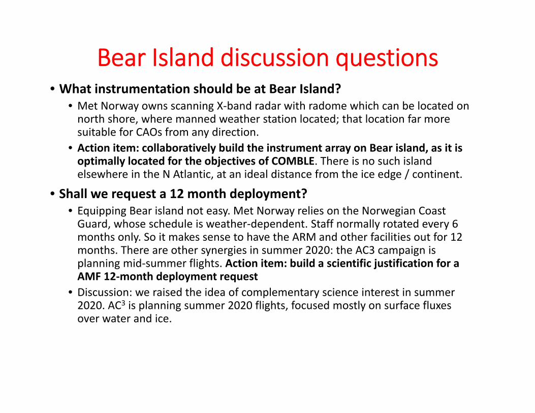
Bear Island discussion questions • What instrumentation should be at Bear Island?
• Met Norway owns scanning X‐band radar with radome which can be located on north shore, where manned weather station located; that location far more suitable for CAOs from any direction.
• Action item: collaboratively build the instrument array on Bear island, as it is optimally located for the objectives of COMBLE. There is no such island elsewhere in the N Atlantic, at an ideal distance from the ice edge / continent.
• Shall we request a 12 month deployment? • Equipping Bear island not easy. Met Norway relies on the Norwegian Coast Guard, whose schedule is weather‐dependent. Staff normally rotated every 6 months only. So it makes sense to have the ARM and other facilities out for 12 months. There are other synergies in summer 2020: the AC3 campaign is planning mid‐summer flights. Action item: build a scientific justification for a AMF 12‐month deployment request
• Discussion: we raised the idea of complementary science interest in summer 2020. AC3 is planning summer 2020 flights, focused mostly on surface fluxes over water and ice.
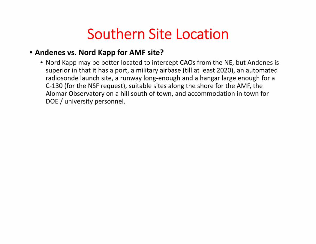
Southern Site Location• Andenes vs. Nord Kapp for AMF site?
• Nord Kapp may be better located to intercept CAOs from the NE, but Andenes is superior in that it has a port, a military airbase (till at least 2020), an automated radiosonde launch site, a runway long‐enough and a hangar large enough for a C‐130 (for the NSF request), suitable sites along the shore for the AMF, the Alomar Observatory on a hill south of town, and accommodation in town for DOE / university personnel.
Modelling Objectives
•enable the evaluation and improvement of the representation of shallow convection in cold‐air outbreaks over open water in weather and climate models
• see separate presentation by Mikhail Ovchinnikov
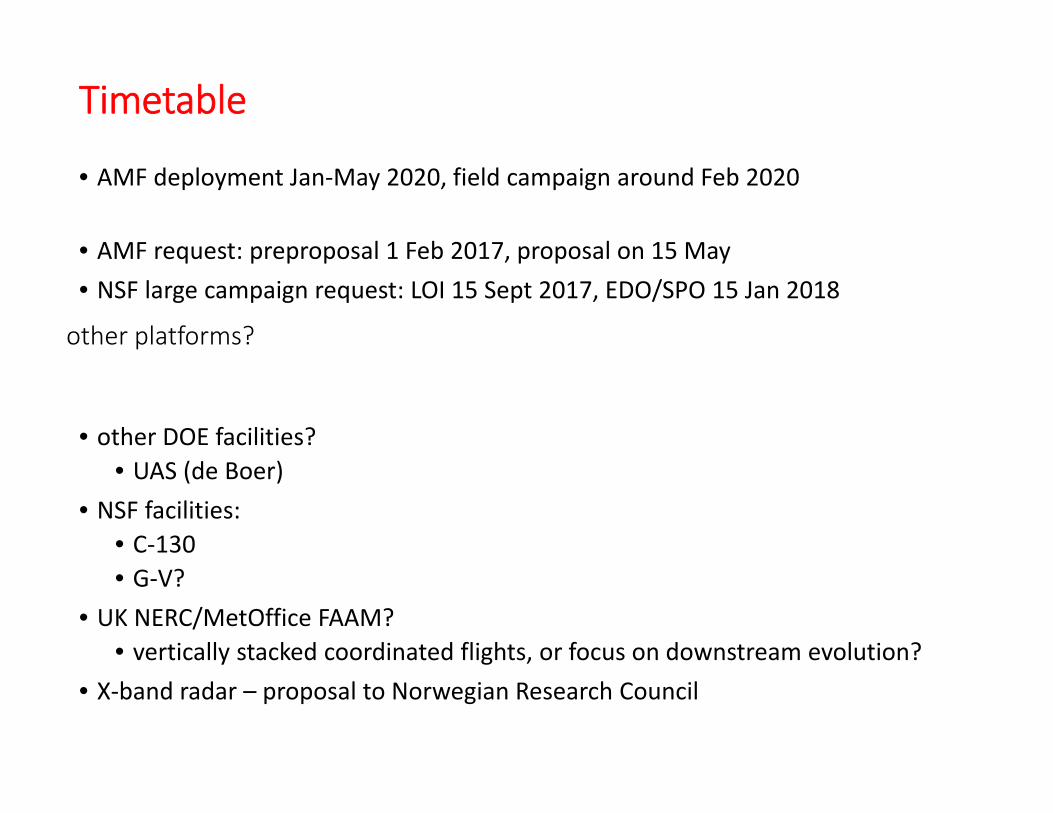
Timetable
• AMF deployment Jan‐May 2020, field campaign around Feb 2020
• AMF request: preproposal 1 Feb 2017, proposal on 15 May• NSF large campaign request: LOI 15 Sept 2017, EDO/SPO 15 Jan 2018
• other DOE facilities?• UAS (de Boer)
• NSF facilities:• C‐130• G‐V?
• UK NERC/MetOffice FAAM?• vertically stacked coordinated flights, or focus on downstream evolution?
• X‐band radar – proposal to Norwegian Research Council
other platforms?

support from Met Norway for COMBLE
Meteorologisk institutt
AROME Arctic model system
• balloon launches from Bear Island• scanning dual‐pol X‐band radar (if funded)• work with ARM to run all Bear Island operations:
instrument installation, maintenance, data collection, data and voice communication
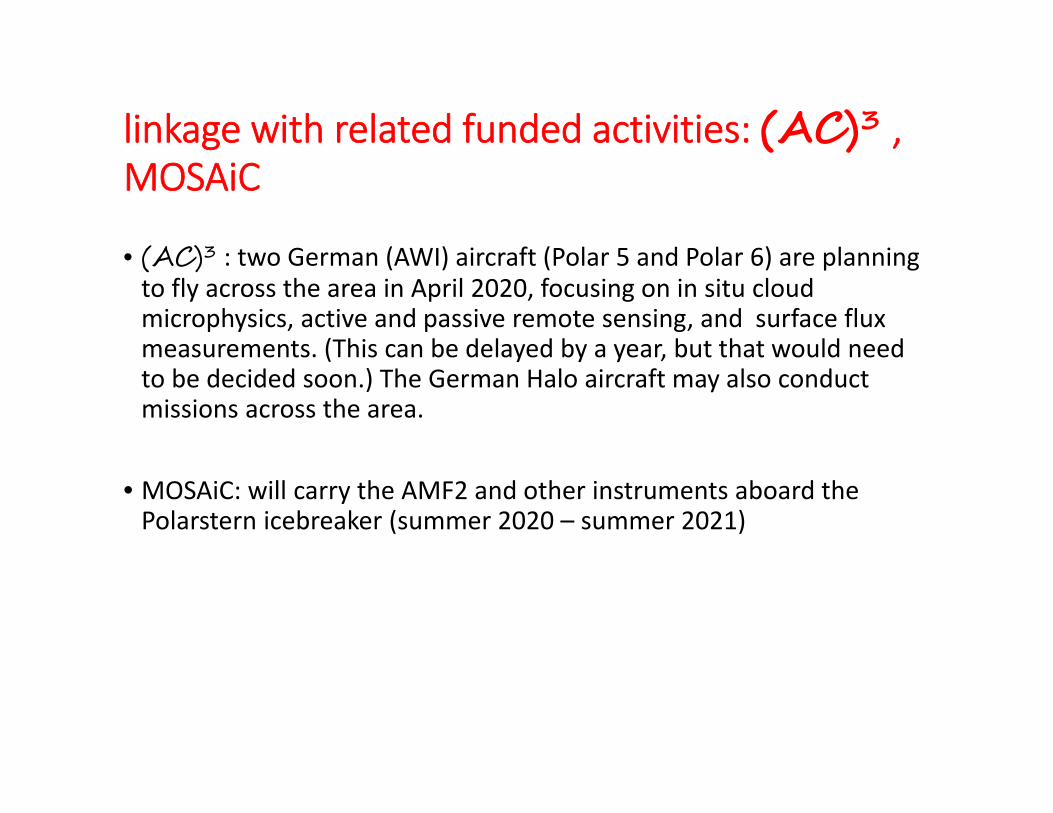
linkage with related funded activities: (AC)3 , MOSAiC
• (AC)3 : two German (AWI) aircraft (Polar 5 and Polar 6) are planning to fly across the area in April 2020, focusing on in situ cloud microphysics, active and passive remote sensing, and surface flux measurements. (This can be delayed by a year, but that would need to be decided soon.) The German Halo aircraft may also conduct missions across the area.
• MOSAiC: will carry the AMF2 and other instruments aboard the Polarstern icebreaker (summer 2020 – summer 2021)

deployment proposal plans beyond COMBLE (NSF, NERC, DFG …)
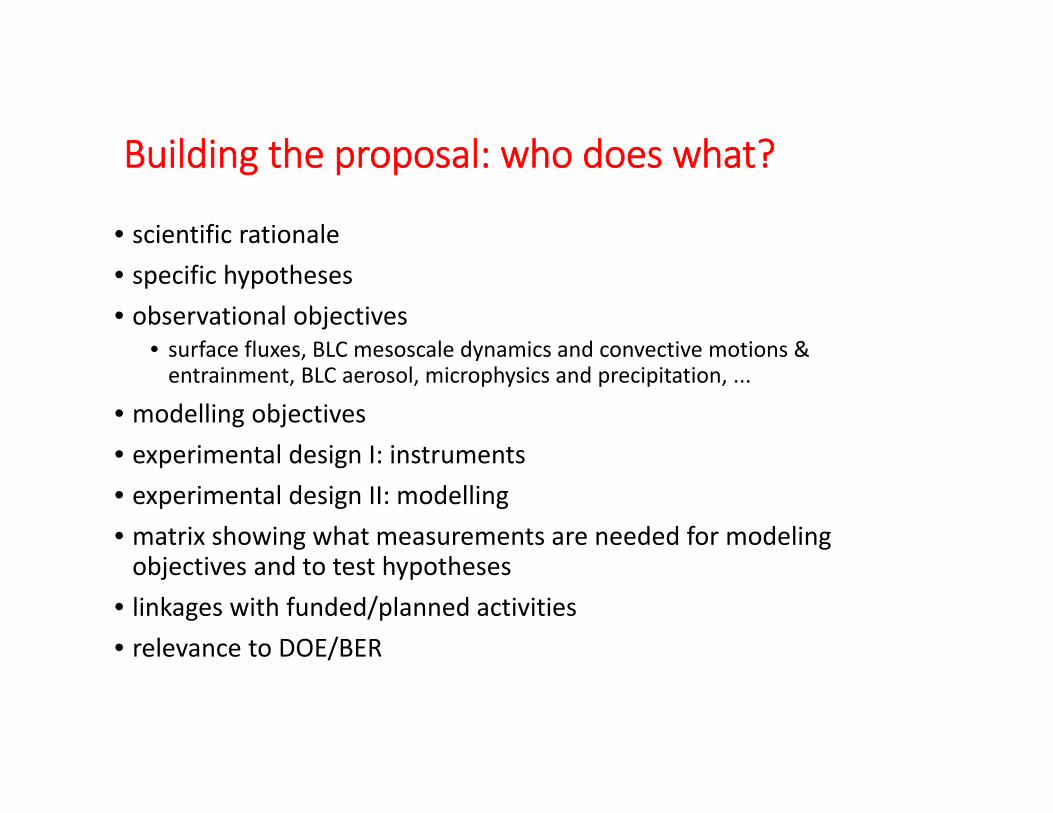
Building the proposal: who does what?
• scientific rationale• specific hypotheses• observational objectives
• surface fluxes, BLC mesoscale dynamics and convective motions & entrainment, BLC aerosol, microphysics and precipitation, ...
• modelling objectives• experimental design I: instruments• experimental design II: modelling • matrix showing what measurements are needed for modeling objectives and to test hypotheses
• linkages with funded/planned activities• relevance to DOE/BER