bristol, ri · take aways/lessons learned • very difficult forecast given p -type issues on the...
TRANSCRIPT

Bristol, RI
A Foot of Snow From An Ana-frontal Wave 2015 March 5

Observed Snowfall Last Forecast Issued Before Snow Began
• Very sharp south to north cutoff in snowfall • Heavy snow tracked farther north than expected
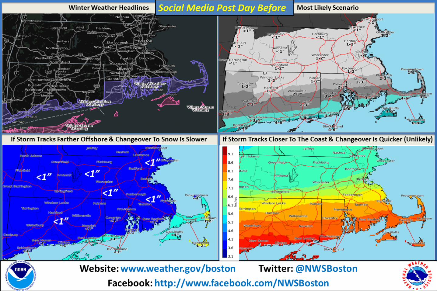
Social Media Post Day Before

Website: www.weather.gov/boston Twitter: @NWSBoston
Facebook: http://www.facebook.com/NWSBoston
• 700 mb Winds & Std. Anomaly PW (image) - GFS-based analysis images for 12Z 5 March 2015 • Strong Frontogenesis Over Southern New England Collocated with Subtropical Moisture Plume
Image – Courtesy of Lance Bosart

• Arctic High Pressure over the Plains with frontal boundary well south of New England
• Cold/dry airmass advecting southeast into New England
• Anafrontal – most if not all precipitation falling in the post frontal airmass
MSLP - 12z 20150305 925 mb Temps - 12z 20150305

• Anomalous 250 mb jet (+3 Std. deviation above climatology)
• Right Rear Quad of upper
jet eventually overspreads Southern New England during the day, enhancing upward vertical motion

Take Aways/Lessons Learned • Very difficult forecast given p-type issues on the front end (rain to snow)
along with duration & intensity of northern snow shield
• Sharp northern cutoff of snow shield was handled very well by forecasters
• Models struggled with northward extent of strong forcing (700 mb Frontogenesis & QG forcing from upper level jet streak) & southward extent/depth of low level dry arctic airmass with dew pts in the single digits
• 90% percentile Snow Amounts did offer some value especially along the South Coast but did not capture the sharp south to north gradient.