building disaster and climate resilient cities in …...1 building disaster and climate resilient...
TRANSCRIPT
1
Building Disaster and Climate Resilient
Cities in ASEAN (CN18)
JICA Project Team
December 8, 2016
0
1st Workshop for Urban Resilience in ASEAN
Orientation for Group work(Disaster Risk Reduction Measures, and
Example of Disaster Management Plan and Evacuation/Relief Plan)
Table of Contents
1
1. Disaster Risk Reduction Measures
2. Example of Disaster Management Plan and Evacuation/ReliefPlan
2.1 Map of Evacuation Area with Facilities Inventory
2.2 Plan of Evacuation/Relief Road
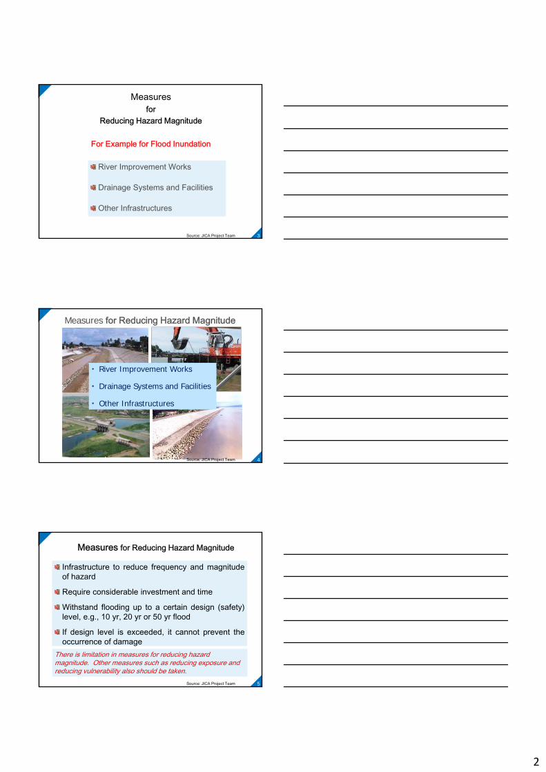
Agenda 1: Disaster Risk Reduction Measures(3 Measures before the Disaster by Prevention &
Mitigation/ Preparedness)
Measuresfor
Reducing Hazard Magnitude
Measures for
Reducing Vulnerability
Measures for
Reducing Vulnerability
Measuresfor
Reducing Exposure
Source: JICA Project Team 2
2
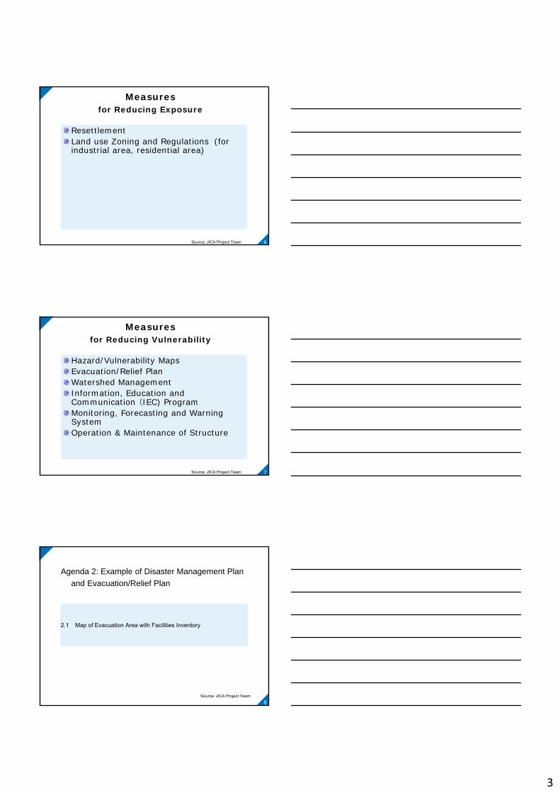
Measures for
Reducing Hazard Magnitude
For Example for Flood Inundation
River Improvement Works
Drainage Systems and Facilities
Other Infrastructures
Source: JICA Project Team 3
Measures for Reducing Hazard Magnitude
・ River Improvement Works
・ Drainage Systems and Facilities
・ Other Infrastructures
Source: JICA Project Team 4
Measures for Reducing Hazard Magnitude
Infrastructure to reduce frequency and magnitudeof hazard
Require considerable investment and time
Withstand flooding up to a certain design (safety)level, e.g., 10 yr, 20 yr or 50 yr flood
If design level is exceeded, it cannot prevent theoccurrence of damage
There is limitation in measures for reducing hazard magnitude. Other measures such as reducing exposure and reducing vulnerability also should be taken.
Source: JICA Project Team 5
3
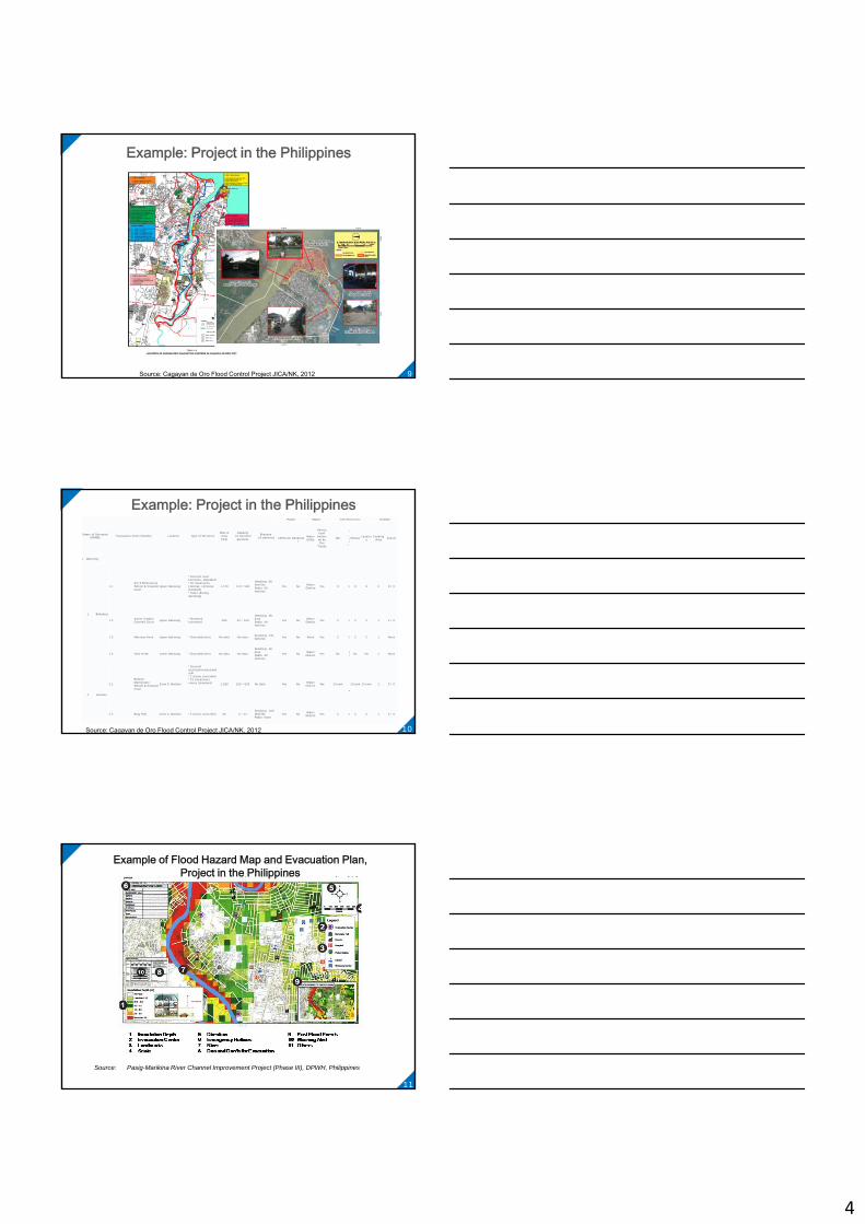
Measures for Reducing Exposure
Resettlement Land use Zoning and Regulations (for industrial area, residential area)
Source: JICA Project Team 6
Measures for Reducing Vulnerability
Hazard/Vulnerability MapsEvacuation/Relief PlanWatershed ManagementInformation, Education and Communication (IEC) ProgramMonitoring, Forecasting and Warning SystemOperation & Maintenance of Structure
Source: JICA Project Team 7
Agenda 2: Example of Disaster Management Plan
and Evacuation/Relief Plan
2.1 Map of Evacuation Area with Facilities Inventory
Source: JICA Project Team8
4
Example: Project in the Philippines
Source: Cagayan de Oro Flood Control Project JICA/NK, 2012 9
Example: Project in the Philippines
Name of Surveyed DRRMC Evacuation Center/Facility Location Type of Structure
Size of Area (m2)
Capacity(in families/ persons)
Evacuee(in persons)
Power Water Toilet/Washrooms Kitchen
CEPALCO Generator
Water Utility
Outsourced/
Delivered by Fire
Trucks
WC
Urinal
Shower Lavatory
Cooking Area Faucet
I. CDO City
1 Balulang
1.1Km 5 Elementary School & Covered Court
Upper Balulang
*Covered court (concrete, standard) *20 classrooms (1storey, concrete, standard)*Tents (during Sendong)
1,740 112 / 560
Sendong: 60 familiesPablo: 60 families
Yes No Water District Yes 9 5 9 9 5 9 / 0
1.2 Xavier hieghts Covered Court Upper Balulang *Standard
(concrete) 480 32 / 160
Sendong: No data Pablo: 39 families
Yes No Water District Yes 2 2 2 2 1 4 / 0
1.3 Manresa Farm Upper Balulang *Grounds(tents) No data No data Sendong: 131 families Yes No None Yes 2 2 2 2 1 None
1.4 Villa Verde Lower Balulang *Grounds(tents) No data No data
Sendong: No data Pablo: 40 families
Yes No Water District Yes No N
o No No 1 None
2 Bonbon
2.1
Bonbon Elementary School & Covered Court
Zone 5, Bonbon
*Covered court(concrete,standard) *2 storey (concrete)*23 classrooms rooms (standard) 1,929 124 / 620 No data Yes No Water
District Yes 1/room
1/room
1/room 1/room 1 5 / 0
2.2 Brgy Hall Zone 4, Bonbon *2 storey (concrete) 35 2 / 12Sendong: 100 families Pablo: None
Yes No Water District Yes 5 5 5 5 1 4 / 0
Source: Cagayan de Oro Flood Control Project JICA/NK, 2012 10
Source: Pasig-Marikina River Channel Improvement Project (Phase III), DPWH, Philippines
Example of Flood Hazard Map and Evacuation Plan, Project in the Philippines
11

5
Agenda 2: Disaster Management Plan and Evacuation/
Relief Road Plan
12
2.2 Plan for Evacuation/Relief Road (New Road Planning, Route Planning for Evacuation /Relief with Sign Board)
Source: JICA Project Team 12
Example: Road Classification Map, Project in Indonesia
Source: Aceh Tsunami Project JICA/NK, 2005 13
Example: Number of Road Lane, Project in Indonesia
Source: Aceh Tsunami Project JICA/NK, 2005 14
6
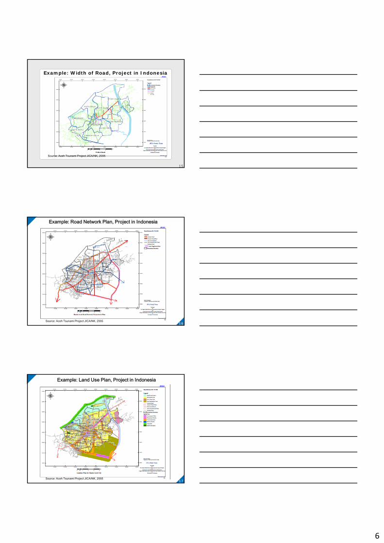
Example: Width of Road, Project in Indonesia
Source: Aceh Tsunami Project JICA/NK, 2005
15
Example: Road Network Plan, Project in Indonesia
Source: Aceh Tsunami Project JICA/NK, 2005 16
Example: Land Use Plan, Project in Indonesia
Source: Aceh Tsunami Project JICA/NK, 2005 17
7
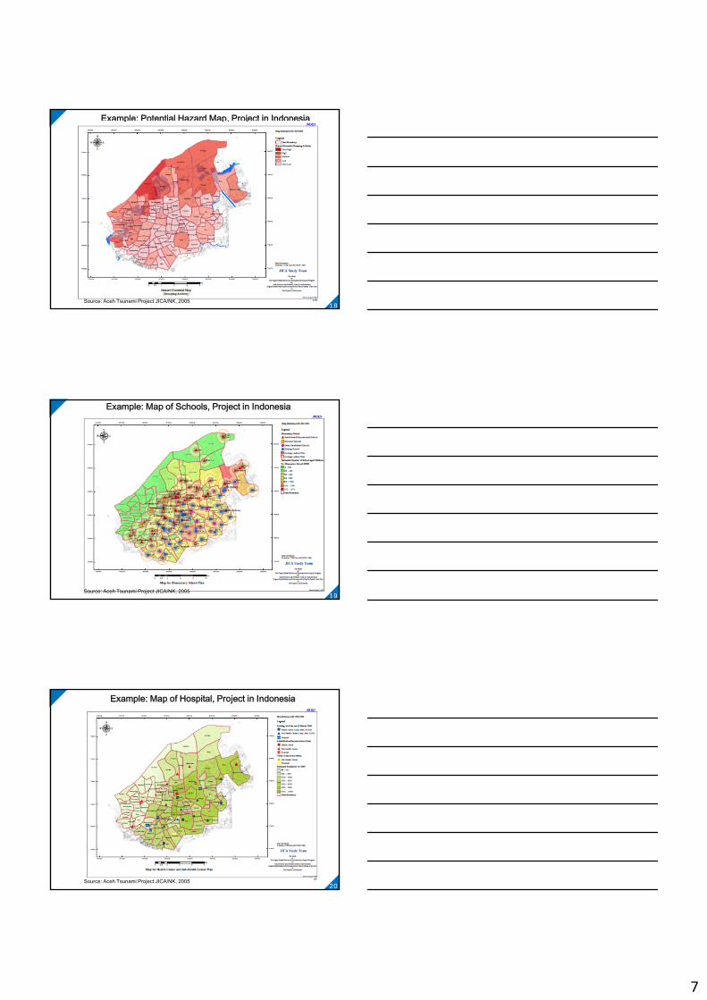
Example: Potential Hazard Map, Project in Indonesia
Source: Aceh Tsunami Project JICA/NK, 2005 18
Example: Map of Schools, Project in Indonesia
Source: Aceh Tsunami Project JICA/NK, 2005 19
Example: Map of Hospital, Project in Indonesia
Source: Aceh Tsunami Project JICA/NK, 2005 20
8
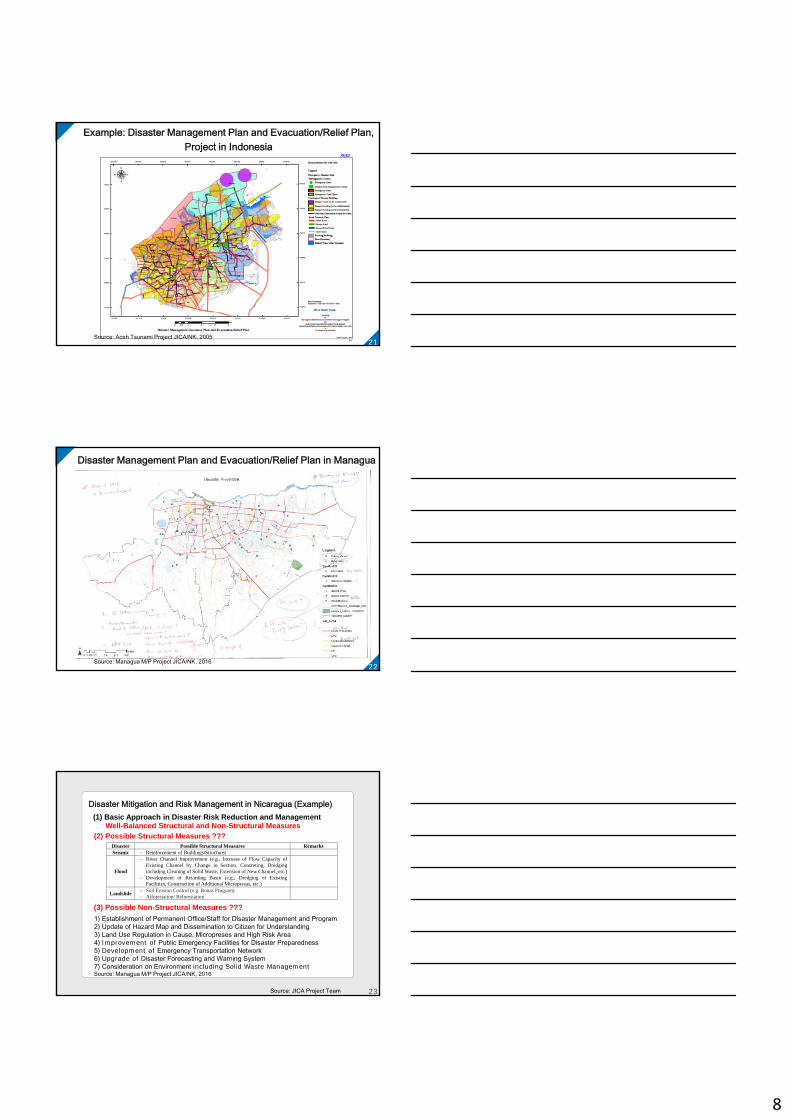
Example: Disaster Management Plan and Evacuation/Relief Plan, Project in Indonesia
Source: Aceh Tsunami Project JICA/NK, 2005 21
Disaster Management Plan and Evacuation/Relief Plan in Managua
Source: Managua M/P Project JICA/NK, 2016 22
(2) Possible Structural Measures ???
(3) Possible Non-Structural Measures ???
1) Establishment of Permanent Office/Staff for Disaster Management and Program2) Update of Hazard Map and Dissemination to Citizen for Understanding3) Land Use Regulation in Cause, Micropreses and High Risk Area4) Improvement of Public Emergency Facilities for Disaster Preparedness5) Development of Emergency Transportation Network6) Upgrade of Disaster Forecasting and Warning System7) Consideration on Environment including Solid Waste Management
Disaster Mitigation and Risk Management in Nicaragua (Example)(1) Basic Approach in Disaster Risk Reduction and Management
Well-Balanced Structural and Non-Structural Measures
Disaster Possible Structural Measures Remarks Seismic - Reinforcement of Buildings/Structures
Flood
- River Channel Improvement (e.g., Increase of Flow Capacity of Existing Channel by Change in Section, Concreting, Dredging including Cleaning of Solid Waste, Extension of New Channel, etc.)
- Development of Retarding Basin (e.g., Dredging of Existing Facilities, Construction of Additional Micropresas, etc.)
Landslide - Soil Erosion Control (e.g. Bonas Program) - Afforestation/ Reforestation
Source: Managua M/P Project JICA/NK, 2016
Source: JICA Project Team 23

9
22
CountryShort Listed Cities Candidate City
NameNumbe
r of Cities
NameNumbe
r of Cities
Cambodia Battambang (F) 1 Battambang (F) 1
Indonesia Bima (E), Semarang(F), Denpasar (T) 3 Denpasar (T) 1
Lao PDR Luang Prabang (F) 1 Luang Prabang (F) 1
Malaysia Kuala Terengganu (F) George Town (T) 2 Kuala Terengganu
(F) 1
MyanmarAmarapura (E), (F) Kyimyindaing (T), (C)to be internally discussed
2
Kyimyindaing (T), (C)
to be internally discussed
1
Philippines Butuan (F)Meycauayan (E) 2 Butuan (F) 1
Thailand Pathumthani (F)Rayong (F) 2 Pathumthani (F) 1
Viet Nam Qui Nhon(T), Hue(F),Ha Long (T) 3
Qui Nhon(T), (C)to be internally
discussed1
Total 16 Total 8
Results of 2nd Preliminary Risk Assessment and Selection of Cities
( ) shows the main disaster type for the cities. (C): Cyclone, (E): Earthquake, (F): Flood, (T): Tsunami
Source: JICA Project Team 24
Thank you very much!
25