business - gps worldgpsworld.com/wp-content/uploads/2014/08/business_may2014.pdf · trimble’s ux5...
TRANSCRIPT
Industry news and developments | GPS | Galileo | GLONASS
BUSINESSTHE
www.gpsworld.com May 2014 | GPS World 27
» AUTONOMOUS NAVIGATION
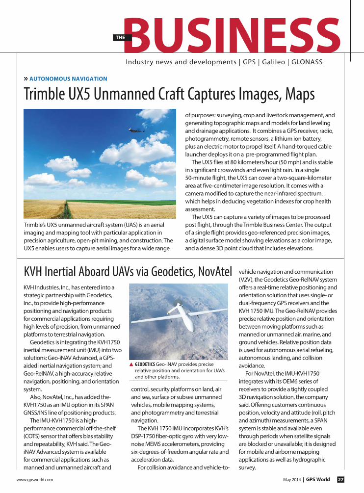
Trimble’s UX5 unmanned aircraft system (UAS) is an aerial
imaging and mapping tool with particular application in
precision agriculture, open-pit mining, and construction. The
UX5 enables users to capture aerial images for a wide range
of purposes: surveying, crop and livestock management, and
generating topographic maps and models for land leveling
and drainage applications. It combines a GPS receiver, radio,
photogrammetry, remote sensors, a lithium ion battery,
plus an electric motor to propel itself. A hand-torqued cable
launcher deploys it on a pre-programmed flight plan.
The UX5 flies at 80 kilometers/hour (50 mph) and is stable
in significant crosswinds and even light rain. In a single
50-minute flight, the UX5 can cover a two-square-kilometer
area at five-centimeter image resolution. It comes with a
camera modified to capture the near-infrared spectrum,
which helps in deducing vegetation indexes for crop health
assessment.
The UX5 can capture a variety of images to be processed
post flight, through the Trimble Business Center. The output
of a single flight provides geo-referenced precision images,
a digital surface model showing elevations as a color image,
and a dense 3D point cloud that includes elevations.
Trimble UX5 Unmanned Craft Captures Images, Maps
KVH Industries, Inc., has entered into a
strategic partnership with Geodetics,
Inc., to provide high-performance
positioning and navigation products
for commercial applications requiring
high levels of precision, from unmanned
platforms to terrestrial navigation.
Geodetics is integrating the KVH1750
inertial measurement unit (IMU) into two
solutions: Geo-iNAV Advanced, a GPS-
aided inertial navigation system; and
Geo-RelNAV, a high-accuracy relative
navigation, positioning, and orientation
system.
Also, NovAtel, Inc., has added the-
KVH1750 as an IMU option in its SPAN
GNSS/INS line of positioning products.
The IMU-KVH1750 is a high-
performance commercial off-the-shelf
(COTS) sensor that offers bias stability
and repeatability, KVH said. The Geo-
iNAV Advanced system is available
for commercial applications such as
manned and unmanned aircraft and
control, security platforms on land, air
and sea, surface or subsea unmanned
vehicles, mobile mapping systems,
and photogrammetry and terrestrial
navigation.
The KVH 1750 IMU incorporates KVH’s
DSP-1750 fiber-optic gyro with very low-
noise MEMS accelerometers, providing
six-degrees-of-freedom angular rate and
acceleration data.
For collision avoidance and vehicle-to-
vehicle navigation and communication
(V2V), the Geodetics Geo-RelNAV system
offers a real-time relative positioning and
orientation solution that uses single- or
dual-frequency GPS receivers and the
KVH 1750 IMU. The Geo-RelNAV provides
precise relative position and orientation
between moving platforms such as
manned or unmanned air, marine, and
ground vehicles. Relative position data
is used for autonomous aerial refueling,
autonomous landing, and collision
avoidance.
For NovAtel, the IMU-KVH1750
integrates with its OEM6 series of
receivers to provide a tightly coupled
3D navigation solution, the company
said. Offering customers continuous
position, velocity and attitude (roll, pitch
and azimuth) measurements, a SPAN
system is stable and available even
through periods when satellite signals
are blocked or unavailable; it is designed
for mobile and airborne mapping
applications as well as hydrographic
survey.
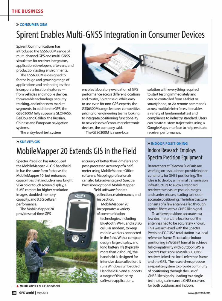
▲ GEODETICS Geo-iNAV provides precise
relative position and orientation for UAVs
and other platforms.
KVH Inertial Aboard UAVs via Geodetics, NovAtel
www.gpsworld.com May 2014 | GPS World 29
THE BUSINESS
29
THE BUSINESS
Applied EM Offers Anti-Jam Antenna
Applied
EM’s anti-jam
GPS antenna,
AJGPS045,
has achieved
a four-channel
Controlled
Radiation Pattern Antenna (CRPA) in
a very small size, weight and power
(SWAP) suitable for airborne platforms.
Its footprint is the same as a standard
GPS Fixed Radiation Pattern Antenna
(FRPA), the FRPA-3. This is a key enabler
to bringing greatly improved anti-jam
performance to smaller platforms
and to GPS-equipped platforms that
have inadequate anti-jam capability.
When integrated with appropriate
four-channel antenna electronics
and a military GPS receiver, the
AJGPS045 enables L1 and L2 anti-jam
performance of typically >80 dB. This
is achieved with a passive compact
antenna (0.7 x 4.6 x 4.6 inches) that
weighs 9 ounces.
Report Focuses on Global Military GNSS Market
A new defense market report from
Strategic Defence Intelligence has
been released. “GPS/GNSS Market
2013-2023 – SWOT Analysis: Market
Profile“ provides an analysis of industry
characteristics, determining strengths,
weaknesses, opportunities, and threats
faced by the military GPS/GNSS market.
The SWOT analysis is designed
for industry executives and anyone
looking to gain a better understanding
of the market.
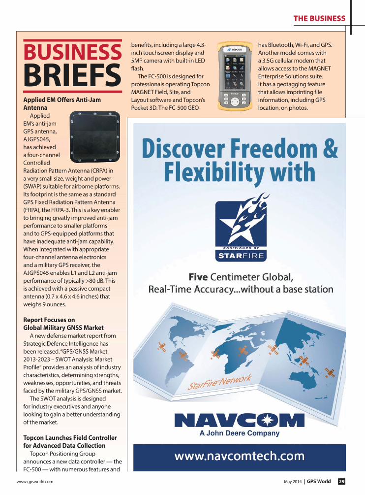
Topcon Launches Field Controller for Advanced Data Collection
Topcon Positioning Group
announces a new data controller — the
FC-500 — with numerous features and
benefits, including a large 4.3-
inch touchscreen display and
5MP camera with built-in LED
flash.
The FC-500 is designed for
professionals operating Topcon
MAGNET Field, Site, and
Layout software and Topcon’s
Pocket 3D. The FC-500 GEO
has Bluetooth, Wi-Fi, and GPS.
Another model comes with
a 3.5G cellular modem that
allows access to the MAGNET
Enterprise Solutions suite.
It has a geotagging feature
that allows imprinting file
information, including GPS
location, on photos.
BUSINESSBRIEFS

GPS World | May 2014 www.gpsworld.com30
THE BUSINESS
More Airports Across Europe Add EGNOS ApproachesFlight operators can now use EGNOS
approach procedures at airports in
the Czech Republic, Austria, Finland,
and Tunisia, all part of a growing list
of airports across Europe that have
implemented localizer performance
with vertical guidance (LPV) procedures.
The announcement was made by
European Satellite Services Provider
(ESSP), a Toulouse-based company
which has the contract for EGNOS
system operation and service
provision.
In all, 18 EGNOS Working Agreements
(EWA) with airports have been signed —
a key step for the implementation of LPV
procedures to be used. Also, 171 EGNOS-
based approach procedures have been
authorized for specific runways.
Most recently, ESSP signed EWAs with
both London Southend Airport and
Cambridge International Airport in the
United Kingdom.
The European GNSS Agency (GSA) is
launching the implementation of the
first LPV procedures in seven countries
this year, as an exercise to gain the
necessary competencies at national
level, leading to a further plan for EGNOS
adoption in the Perfromance-Based
Navigation (PBN) plans.
▲ London Southend Airport.
SatNav Can Make European Rail More AffordableCost-effective synergies between the
European Rail Traffic Management
System (ERTMS) and satellite
technologies such as Galileo can
make rail transport more efficient
and reliable, agreed European
authorities in February at a Rail Forum
Europe dinner in Brussels. But while
the technology is now available, its
implementation is still too slow due to
the long term return on investment.
Francesco Rispoli, manager of
satellite technologies at Ansaldo
STS, an Italian provider of rail-
traffic management, stressed that
satellite technology can improve the
penetration of ERTMS in the worldwide
market as well as on European local
and low-traffic lines. He predicted that
further synergies will be developed on
the SHIFT²RAIL initiative: “EGNOS and
Galileo are key enabling technologies
for a market-driven step change in the
rail sector” he concluded. In that light,
Ansaldo STS is developing an open
platform to allow the ERTMS to fully
exploit EGNOS and Galileo.
Olivier Onidi of the EC’s Directorate
General for Mobility and Transport,
highlighted the role of ERTMS in
achieving an interoperable Single
European Railway Area. “2014 is a key
year in terms of innovation for the rail
sector. Major progress is expected
on ERTMS, Galileo, and SHIFT²RAIL.”
SHIFT²RAIL is a European initiative to
double the capacity of the European
rail system, increase its reliability, and
half lifecycle costs.
Carlo des Dorides, executive
director of the European GNSS Agency,
applauded the ERTMS Memorandum
of Understanding envisaging the
future use of EGNOS and Galileo to
improve the competitiveness of train
control systems. “There are signs that
GNSS will be adopted globally as in the
aviation sector. In this scenario, Europe
now has the opportunity to exploit the
synergy between ERTMS and GNSS.”
» TRANSPORTATION
With the release of its 6.400 firmware,
NovAtel CORRECT positioning
technology is now available with
TerraStar’s precise point positioning
(PPP) corrections. Delivered via
L-band, TerraStar corrections provide
decimeter-level accuracy worldwide
on all NovAtel OEM6 high-precision
receivers without users having to add
base-station infrastructure.
NovAtel CORRECT combines
data from multiple GNSS satellite
constellations with corrections from a
variety of sources, to deliver the best
position solution possible. The strategic
importance of TerraStar’s decimeter-
level correction service to NovAtel’s
product offering is reflected in the
recent purchase of TerraStar parent
company Veripos by Hexagon. Veripos
operates a network of more than 80
GNSS reference stations.
NovAtel CORRECT is available for
land, air and sea applications, providing
customers with one-stop shopping
for receivers, antennas and correction
services. It provides integrators with
the opportunity to choose pricing and
subscription options that best match
their OEM business objectives.
NovAtel CORRECT with TerraStar PPP Service Now Available» SURVEY
Ratik
ova/
shut
terst
ock.
com

www.gpsworld.com May 2014 | GPS World 31
THE BUSINESS
31
THE BUSINESS
General Dynamics Awarded $26M for GPS III CommunicationsGeneral Dynamics Advanced
Information Systems has been
awarded a $26 million contract
from Lockheed Martin to support
the U.S. Air Force GPS III Network
Communications Element (NCE).
General Dynamics is already
under contract with Lockheed
Martin to produce the NCE for the
first four GPS III space vehicles
(SV01-SV04), as well as for the
procurement of long lead material
for the second set of four space
vehicles (SV05-SV08). This follow-on
contract provides General Dynamics
with the funding to complete the
NCE for SV05 and SV06.
General Dynamics’ NCE
components provide the
communications functions for
the GPS III satellites, including
the ground-to-space command
and control channel, the space-
to-space inter-satellite channel,
and the command and telemetry
communications channels within
each satellite. NCE components have
been delivered for SV01 and SV02. The
NCEs for SV03 and SV04 are scheduled
for delivery by June 2014.
» GPS MODERNIZATION
Braxton LADO System Supports 10th GPS Satellite InitializationGPS IIF-5 was launched on February
20 and turned over to the 2nd Space
Operations Squadron (2 SOPS) for
operations on March 5. This was the
10th successful launch and initialization
using Braxton Technologies‘ Launch,
Anomaly Resolution, and Disposal
Operations (LADO) system.
LADO has performed all the mission
planning, commanding, and telemetry
processing necessary to prepare all
GPS satellites for operational use since
October 2007.
Developed and sustained by Braxton
Technologies, LADO was built using
Braxton’s ACE Premier commercial-
off-the-shelf (COTS) product line for
spacecraft control, astrodynamics. and
simulation.
The GPS IIF-5 replaces the GPS IIA-15
satellite launched in 1994. The 19th
Space Operations Squadron (19 SOPS)
will control the GPS IIA-15 using LADO,
where the spacecraft will be stored as
a spare available for reactivation within
the x-plane for the remainder of its
useful life.
www.gpsworld.com May 2014 | GPS World 33
THE BUSINESS
33
THE BUSINESS
European Space Solutions 2014June 11–13, 2014; Prague
www.european-space-solutions.eu
The conference brings together
business and the public sector with
users and developers of space-based
solutions to explore how space can
make a difference to the lives and
livelihoods of people across Europe
and around the globe.
Applanix User Group MeetingJune 17–20, 2014, Toronto
www.regonline.com/register/checkin.
aspx?eventid=1463917
The Applanix User Group
Meetingwill have two main themes:
Advanced Product Training and New
Product Announcements. The program
will include opportunities for training
on Applanix products, addressing
business or operational challenges,
and learning about industry trends and
different customer experiences
2014 NIST Time and Frequency SeminarJune 3–6, 2014, Boulder, Colorado; www.tf.nist.gov/
timefreq/seminars/TFSeminar2014/Seminar39.html
The Time and Frequency Division
of the National Institute of Standards
and Technology is offering a course
on understanding clocks, oscillators,
atomic frequency standards, RF
and optical synchronization, optical
oscillators, quantum information,
optical cooling and heating; making
precise frequency, time, phase-
noise, and jitter measurements; and
establishing measurement accuracy
and traceability.
CERGAL 2014July 8–9; Dresden, Germany; www.dgon-cergal.org
The International Symposium on
Certification of GNSS Systems & Service
covers qualification and certification of
mission- and safety-critical applications
in the successful operational rollout of
satellite navigation systems.
Spirent Federal 2014 GNSS Technical MeetingJuly 15–16, 2014, Salt Lake City, Utah
www.spirentfederal.com/GPS/Meeting/Default.asp
The meeting features hands-on
training led by Spirent engineers on
state-of-the-art GNSS simulation
equipment. FOUO sessions will be held
on July 16 for U.S. citizens only.
GEO Business 2014May 28–29, 2014 , London
www.GeoBusinessShow.com
GEO Business is a major new
geospatial event for everyone
involved in the gathering, storing,
processing and delivering of
geospatial information. The
hands-on event includes an
international trade exhibition,
conference, and live workshops and
demonstrations.
Esri AEC SummitThe Forum for High Accuracy
July 12–15, 2014 Manchester Grand Hyatt
San Diego, CA
Explore and learn how technology is improving all
levels of the infrastructure lifecycle; plan, design, build,
and operate. This is the conference for all professionals
looking for high-accuracy in geospatial technology.
esri.com/aecsummit
Copyright © 2014 Esri. All rights reserved.
» EVENTS