c lyde river fish kill 2016 preliminary report · pdf filec lyde river fish kill 2016...
TRANSCRIPT
CLYDE RIVER FISH KILL 2016
PRELIMINARY REPORT
November 2016
CLYDE RIVER FISH KILL PRELIMINARY REPORT, NOVEMBER 2016
SUMMARY
• A fish kill on Clyde River was reported to the Prince Edward Island Department ofCommunities, Land and Environment on July 25, 2016. Representatives from the PEIDepartment of Communities, Land and Environment, PEI Department of Justice andPublic Safety, Environment Canada and PEI Department of Agriculture and Fisheriesresponded to the incident.
• There were 259 brook trout, 18 rainbow trout and 65 three-spined sticklebacks collectedduring the investigation and clean up.
• The Environment Canada Climate Data website indicates that 33.3 mm of rainfall fell inthe Elmwood area in the afternoon of July 24 , 2016.th
BACKGROUND
At 5:15 PM on July 25th, 2016, the project coordinator with the Central Queens WildlifeFederation discovered dead fish upstream from the Bannockburn Road in the West Branch of theClyde River. The discovery was reported to the Freshwater Fisheries Biologist with the PEIDepartment of Communities, Land and Environment (DCLE) who immediately notified officerswith the Department of Justice and Public Safety (PEIDJP) and Environment Canada. Once afish kill had been confirmed, the 1-800 Environmental Emergency number was called. FourEnvironment Canada Officers, the Chief Provincial Enforcement Officer, the FreshwaterFisheries Biologist and the on-call Environmental Emergency Response team member (DCLE)responded.
INSPECTION DETAILS
First responders observed that the water in the West Branch of the Clyde River upstream fromthe Bannockburn Road crossing was turbid. The water in the North Branch of the river whichjoins the West Branch immediately below the Bannockburn Road culvert was clear. Eight brooktrout were collected in approximately 60 m of stream upstream from the Bannockburn Road anda water sample taken. The Baltic Road tributary was checked but it was clear and only live fishwere observed. Responders checked two locations on the West Branch accessible via the BalticRoad and dead brook trout and sticklebacks were colleted at both locations. The next streamcrossing checked was at the Colville Road. Dead fish were seen immediately downstream fromthe crossing and additional trout were collected. Vegetation next to the stream was flattenedfrom previous higher water levels and there were some gullies visible between adjacent fieldsand the stream. The Chief Provincial Enforcement Officer and freshwater fisheries biologistchecked various locations upstream from the Colville Road but no dead fish were observed. TheWest Branch has its origins about 1.0 km upstream from the Colville Road, south of the
Kingston Road, but much of the upper reaches of this section is intermittent, thus little waterflow was present.
Water samples (both stream and standing water samples), soil, and vegetation samples, as well asfish samples, were collected and buffer zone measurements taken on July 25 . Additionalth
samples and measurements were obtained on July 26 . Some of the fish collected on July 25th th
were wrapped in tinfoil and transported to Moncton’s Environment Canada laboratory forpesticide analyses. Five brook trout and one three-spined stickleback were kept refrigerated untildelivered to the Atlantic Veterinary College for necropsy the following day.
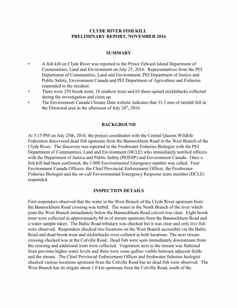
Figure 1. Location of the Clyde River fish kill,2016. The affected portion of stream on the WestBranch (5.8 km) is highlighted in red.
ENVIRONMENTAL CONDITIONS
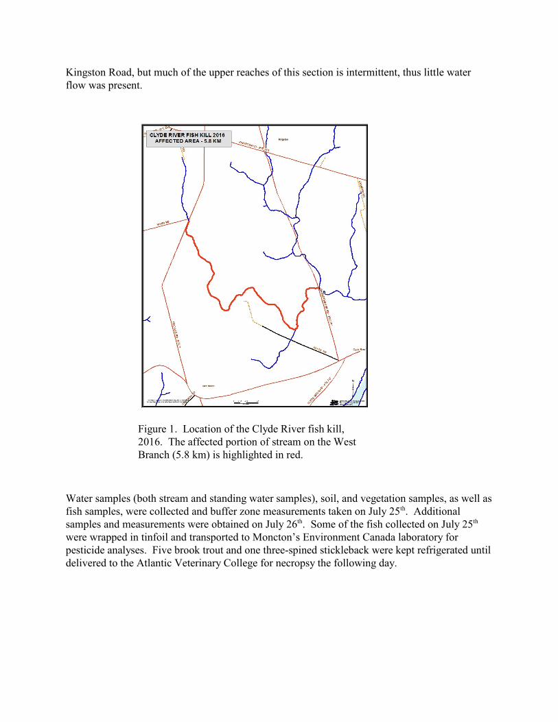
RAINFALLA weather station operated by a certified weather observer is located approximately 2.8 km fromthe stream crossing on the Colville Road (www.wunderground.com) where the fish killoriginated. A Davis Vantage Pro rain gauge recorded 33.3 mm of precipitation over three hours,with the most intense rainfall occurring between 2:30 and 3:30 PM. A Type B Manual gauge atthe same site recorded 39.6 mm of rainfall during this period. Environment Canada’s radarmodeling map shows heavy bands of precipitation in the Elmwood area in mid-afternoon on July24 , 2016.th
WATER QUALITYTemperature and oxygen readings were obtained at the Bannockburn Road on the West Branchof Clyde River on July 26 at 2:30 PM. Water temperature at that time was 13.6C with ath
dissolved oxygen concentration of 7.5 mg/L. These levels are within the optimum range forbrook trout (13-18EC and >5 mg/L of oxygen).
FISH CLEAN UP
Clean-up of dead fish was completed on July 27 , 2016 with the freshwater fisheries biologistth
assisted by Forests, Fish and Wildlife staff as well as representatives from the Central QueensWildlife Federation. There were 221 brook trout, 18 rainbow trout and 64 sticklebacks retrievedduring the clean-up, in addition to the 38 trout and one stickleback collected for analyses on July25th. All of the intact salmonids collected during clean-up were identified to species andmeasured.
Figure 2. Environment Canada weather radar for 2:30 PM on July24 , 2016.th
During the clean up, it was observed that the vegetation along the stream banks was flattened bya previous high water event. Some of the dead fish were recovered on the banks, well above thecurrent water level. Scavengers had already been in the stream, and some of the fish werepartially eaten. Raccoon tracks were evident in exposed soil in many locations. There was onefish recovered in the pool downstream from the Bannockburn Road but no other dead fish wereobserved in a 200 metre section downstream from the Forks of the West and North Branches. AFish and Wildlife Technician walked ~100 metres upstream from the Colville Road but no deadfish were found in this section.
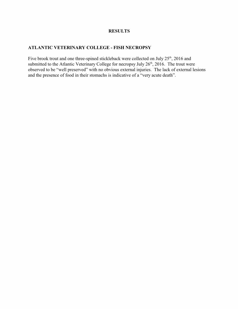
The mean length of brook trout collected was 15.7 cm, and mean length for the rainbow troutwas 12.1 cm (Figure 3). Very few young-of-the-year (YOY) trout were collected, even thoughthe YOYs make up the majority of the population of salmonids in PEI streams. The smallest fishtend to be under-represented in fish kill clean-up because they are more difficult to find in grass,sediment and debris.
SOIL AND WATER ENGINEER ASSESSMENT
As recommended by the 2012 Report of the Action Committee on Sustainable LandManagement, soil and water engineers arrived on site on July 26 , 2016. They assessed fields inth
row crops in the Colville Road area for signs of erosion. The engineers work with landowners toaddress any erosion issues identified and submit a report to the PEI Department of Agricultureand Fisheries, PEI Department of Communities, Land and Environment, and PEI Department ofJustice and Public Safety.
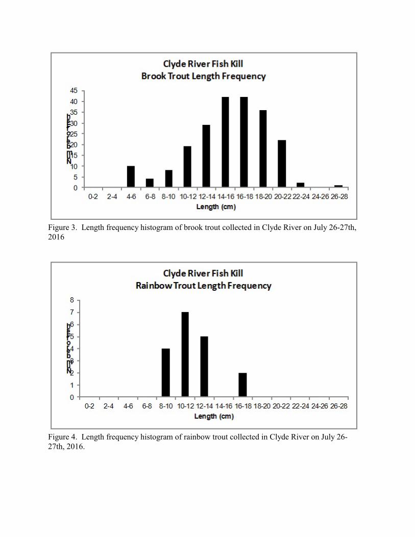
Figure 3. Length frequency histogram of brook trout collected in Clyde River on July 26-27th,2016
Figure 4. Length frequency histogram of rainbow trout collected in Clyde River on July 26-27th, 2016.
RESULTS
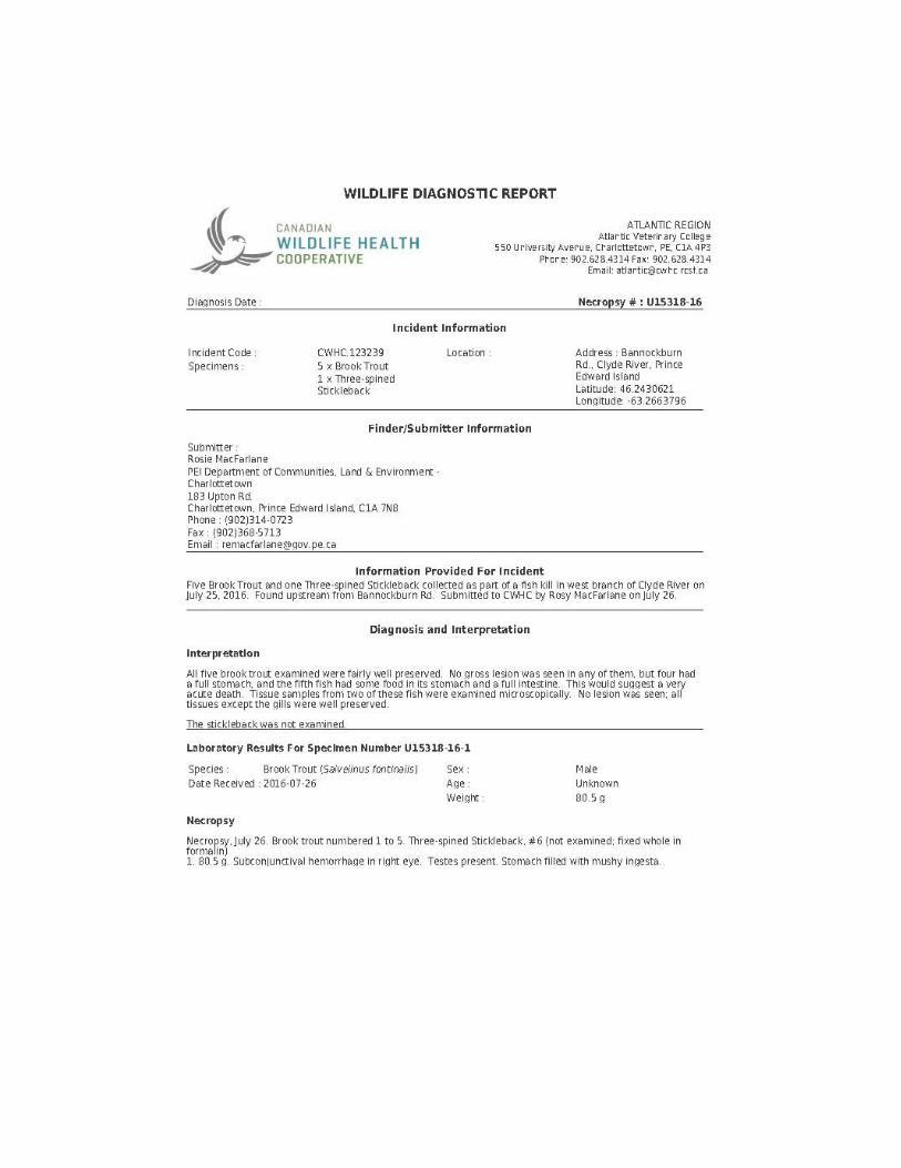
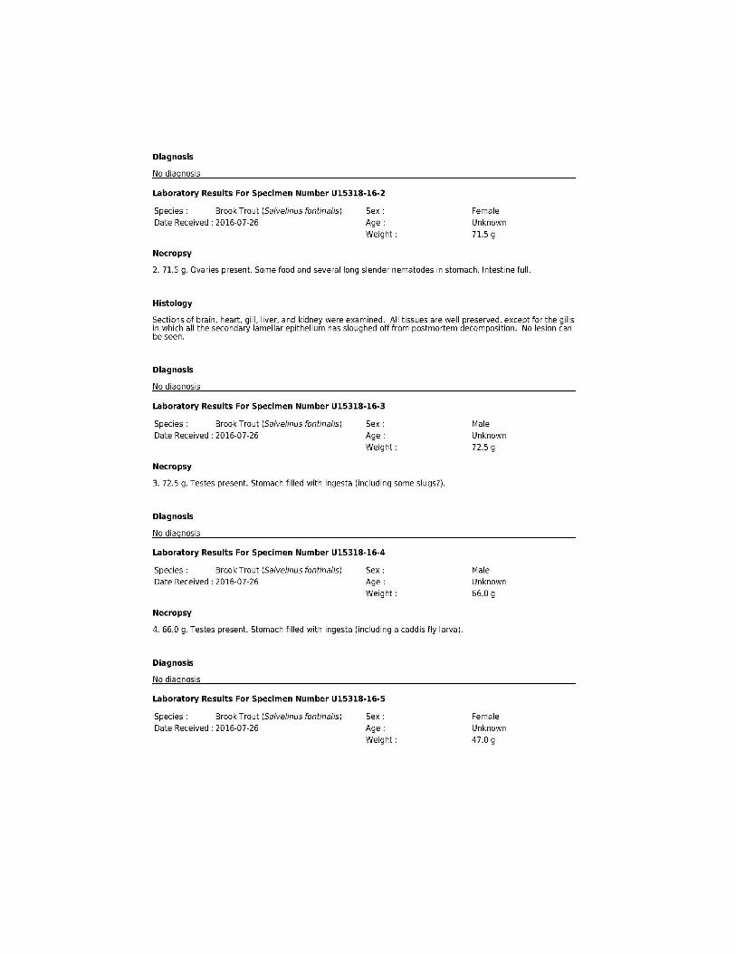
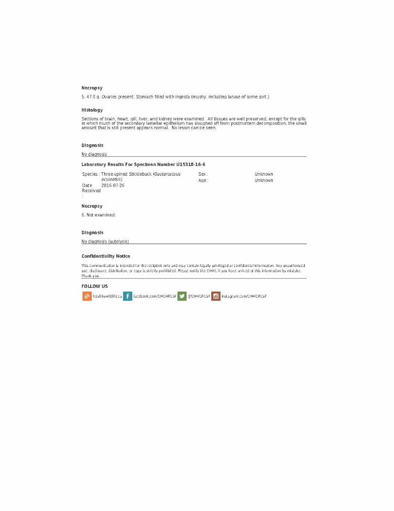
ATLANTIC VETERINARY COLLEGE - FISH NECROPSY
Five brook trout and one three-spined stickleback were collected on July 25 , 2016 andth
submitted to the Atlantic Veterinary College for necropsy July 26 , 2016. The trout wereth
observed to be “well preserved” with no obvious external injuries. The lack of external lesionsand the presence of food in their stomachs is indicative of a “very acute death”.

APPENDIX I
CLYDE RIVER FISHKILLJULY25-27, 2016
PHOTOS
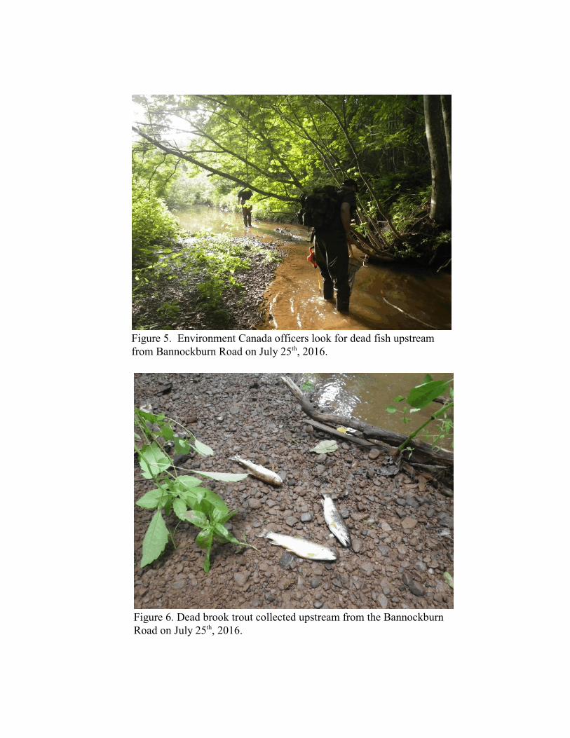
Figure 5. Environment Canada officers look for dead fish upstreamfrom Bannockburn Road on July 25 , 2016.th
Figure 6. Dead brook trout collected upstream from the BannockburnRoad on July 25 , 2016.th
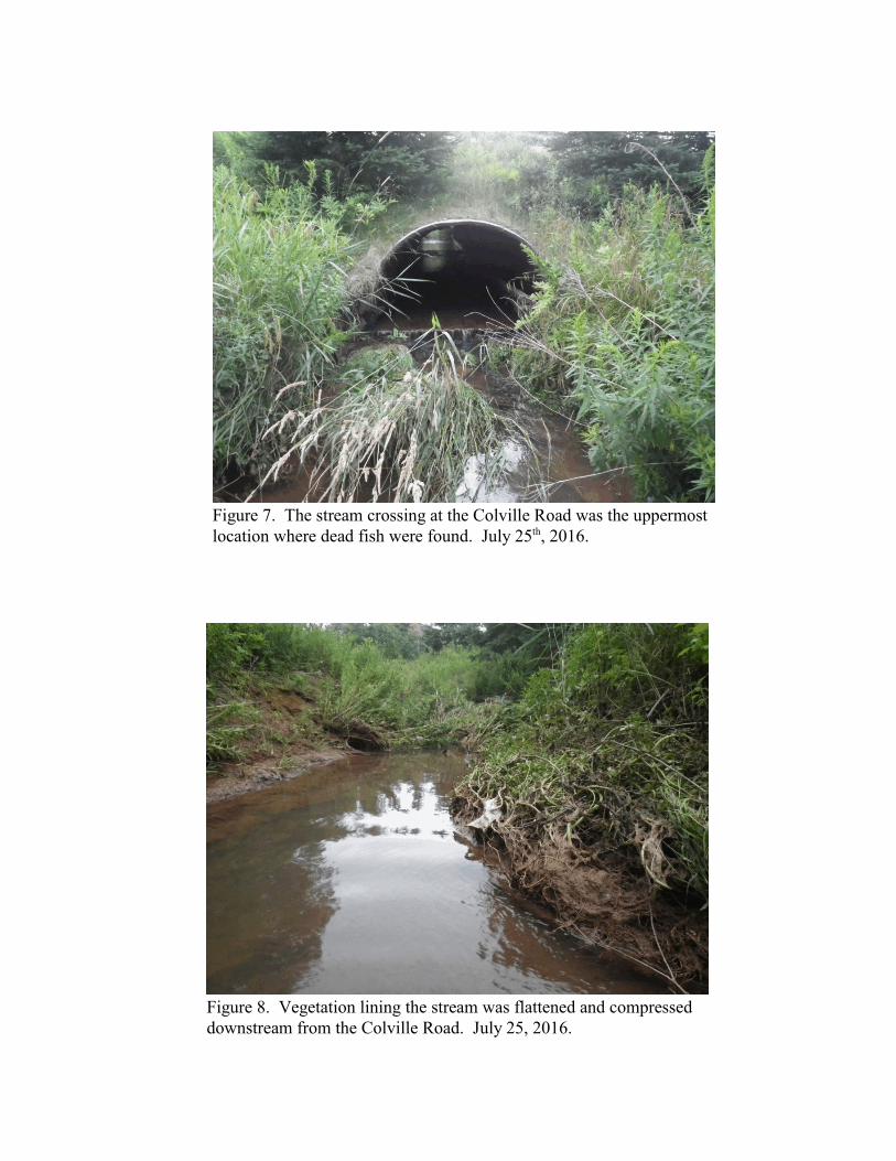
Figure 7. The stream crossing at the Colville Road was the uppermostlocation where dead fish were found. July 25 , 2016.th
Figure 8. Vegetation lining the stream was flattened and compresseddownstream from the Colville Road. July 25, 2016.
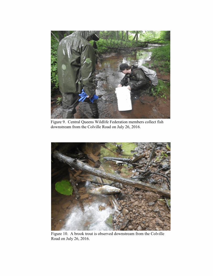
Figure 9. Central Queens Wildlife Federation members collect fishdownstream from the Colville Road on July 26, 2016.
Figure 10. A brook trout is observed downstream from the ColvilleRoad on July 26, 2016.
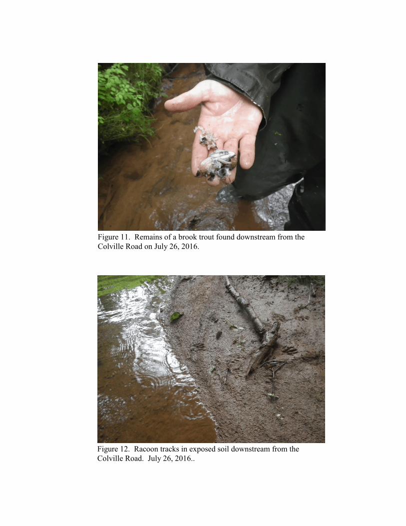
Figure 11. Remains of a brook trout found downstream from theColville Road on July 26, 2016.
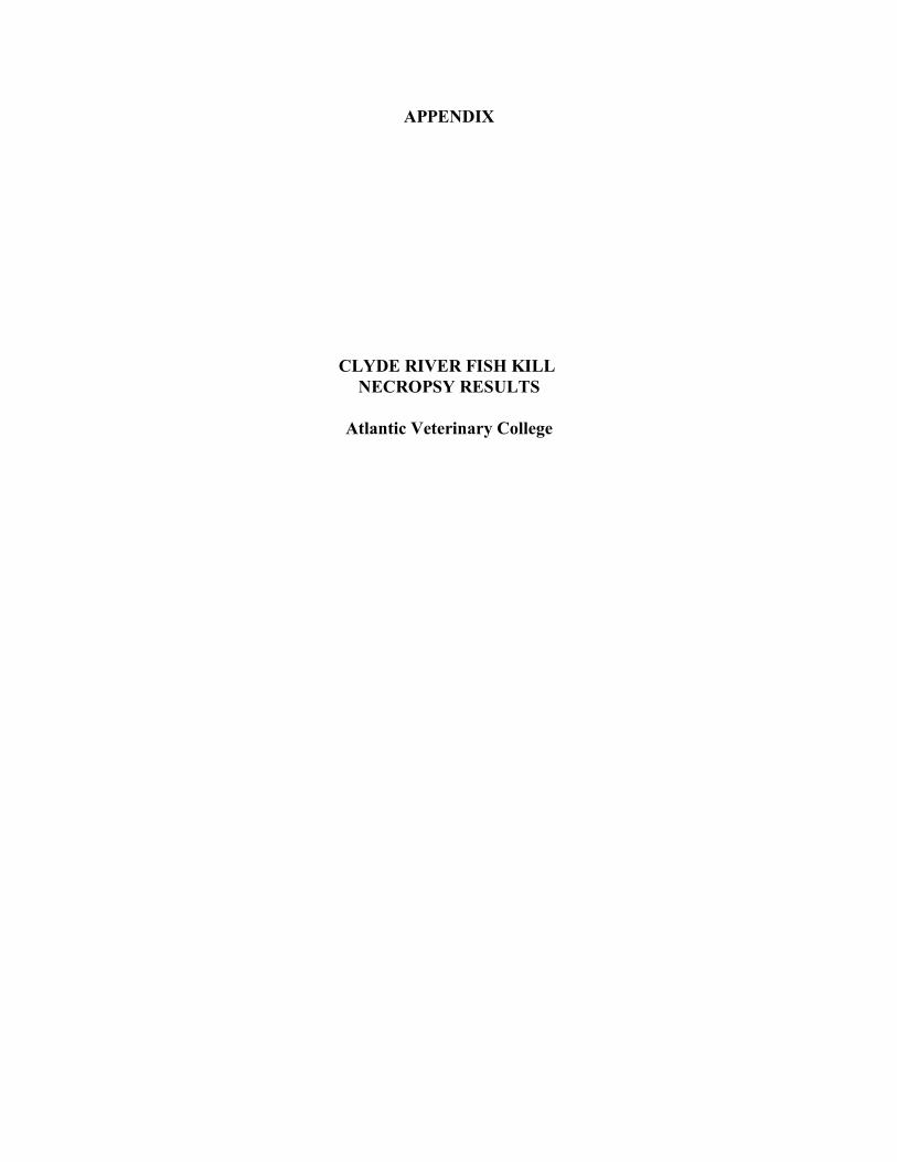
Figure 12. Racoon tracks in exposed soil downstream from theColville Road. July 26, 2016..
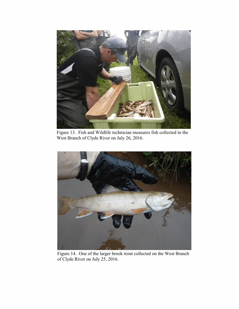
Figure 13. Fish and Wildlife technician measures fish collected in theWest Branch of Clyde River on July 26, 2016.
Figure 14. One of the larger brook trout collected on the West Branchof Clyde River on July 25, 2016.
APPENDIX
CLYDE RIVER FISH KILL NECROPSY RESULTS
Atlantic Veterinary College