campanian and maastrichtian depositional systems of the
TRANSCRIPT

CAROLINA GEOLOGICAL SOCIETY FIELD TRIP GUIDEBOOK
OCTOBER 28-19, 1989
CAMPANIAN AND MAASTRICHTIAN DEPOSITIONAL SYSTEMS OF THE BLACK CREEK GROUP
OF THE CAROLINAS
James P. Owens and Norman F. Soh1 U. S. Geological Survey, Reston, Virginia
Copies of this Guidebook can be obtained from North Carolina Geological Survey
Raleigh, N.C. 27611-7687

CONTENTS
Page
Introduction . . . . . . . . . . . . . . . . . . . . . . . 1 Black Creek Group . . . . . . . . . . . . . . . . . . 1
Age of the Black Creek Group . . . . . . . 3 Tar Heel Formation.............................................. 4
Introduction . . . . . . . . . . . . . . . . . . . . 4 Distribution and Lithology . . . . . . . . . . 4 Age . . . . . . . . . . . . . . . . . . . . . . . . . 7
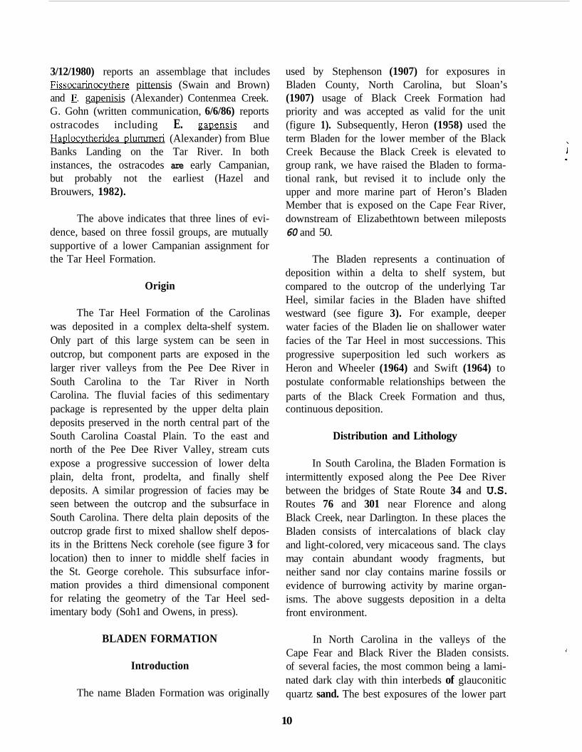
Bladen Formation . . . . . . . . . . . . . . . . . . 10 Introduction . . . . . . . . . . . . . . . . . . . . 10 Distribution and Lithology . . . . . . . . . . 10 Age . . . . . . . . . . . . . . . . . . . . . . . . . 11
origin . . . . . . . . . . . . . . . . . . . . . . . . 10
Figure 1 . 2 . 3 . 4 . 5 . 6 . 7 . 8 . 9 .
Page
I origin . . . . . . . . . . . . . . . . . . . . . . 12
' Donoho Creek Formation . . . . . . . . . . . . 12 Introduction . . . . . . . . . . . . . . . . . . 12 Distribution and Lithology . . . . . . . . . 12 Age . . . . . . . . . . . . . . . . . . . . . . . . 13 origin . . . . . . . . . . . . . . . . . . . . . . 13
Summary and Conclusions . . . . . . . . . . . . 13 Acknoaledgements . . . . . . . . . . . . . . . . . 14 References Cited . . . . . . . . . . . . . . . . . . . 14 Field Trip Itinerary . . . . . . . . . . . . . . . . . 17
Road Log for First Day . . . . . . . . . . 17 Road Log for Second Day . . . . . . . . . 22
I
I
ILLUSTRATIONS
Page
Chronologic development of lithostratigraphy . . . . . . . . . . . . . . . . . . . . . . . . . . 2 Delta to shelf lithofacies model . . . . . . . . . . . . . . . . . . . . . . . . . . . . . . . . . . . 4 Lithofacies map of the Black Creek Group . . . . . . . . . . . . . . . . . . . . . . . . . . . . 5 Photographs of Tar Heel Formation . . . . . . . . . . . . . . . . . . . . . . . . . . . . . . . . . 6 Biostratigraphic zonation and facies comparison . . . . . . . . . . . . . . . . . . . . . . . . 8
9
Field trip route. day 1 . . . . . . . . . . . . . . . . . . . . . . . . . . . . . . . . . . . . . . . . . 18 Field trip route. day 2 . . . . . . . . . . . . . . . . . . . . . . . . . . . . . . . . . . . . . . . . . 21
Photographs of Tar Heel Formation . . . . . . . . . . . . . . . . . . . . . . . . . . . . . . . . . Map of prodelta to shelf transition . . . . . . . . . . . . . . . . . . . . . . . . . . . . . . . . 14

CAMPANIAN AND MAASTRICHTIAN DEPOSITIONAL SYSTEMS OF THE BLACK CREEK GROUP
OF THE CAROLINAS
By James P. Owens and Norman F. Sohl U. S. Geological Survey, Reston, Virginia
INTRODUCTION
. Lithostratigraphic studies on the outcrop by Owens (1989). and Sohl and Owens (in press), in addition to regional surface to subsurface syn- thesis by Owens and Gohn (1985), suggest that the Cretaceous units of the Carolinas fit well into a deltaic to shelf model of sedimentation. Within such systems, lithofacies changes are rapid and interpretation of their spatial distribution must be done within a chrono- and biostratigraphic frame- work to avoid gross correlation errors. In partic- ular, correlation from marine to nonmarine facies is imperative. For such correlations we have relied heavily upon the analysis of pollen assem- blages. Our interpretations disagree with pre- viously advanced models such as that in which the Middendorf, Black Creek, and Peedee for- mations were interpreted as time-transgressive units representing a single cycle of marine trans- gression. We propose, in contrast, that a number of cycles of sedimentation can be recognized within the Cretaceous section. Most of these cycles are separated by disconformities, some of which are limited to the Carolinas, but others appear to be of regional extent and recognizable as far awa as the east Gulf Coastal Plain or along the Atlantic seaboard to New Jersey.
Recognition of these breaks in sequence, coupled with dramatic changes in lithology above and below such discontinuities, has necessitated a revision of stratigraphic nomenclature. Figure 1 presents a historical summary of the evolution of nomenclature of the Cretaceous lithostratigraphic units and their age assignments. We have attempted to be conservative by retaining terms
so ingrained in the literature as the Black Creek Formation by raising it to group rank to include three distinctive formational units.
During the course of this excursion we will concentrate primarily upon the lower unit of the Black Creek Group, the Tar Heel Formation. Beginning with exposures of the formation in the Cape Fear River Valley that represent delta front deposits, we will then traverse northeastward to the Neuse River tracing the Tar Heel through the prodelta into the shelfal facies. For detailed dis- cussion of the various other Cretaceous units the reader is directed to Sohl and Owens (in press) and references therein.
BLACK CREEK GROUP
The term Black Creek Marl or "Phase" (figure 1) was coined by Sloan (1907) for expo- sures occurring along Black Creek, a tributary of the Pee Dee River, near Darlington, South Carolina. The same year Stephenson (1907). pro- posed the name Bladen Formation for a similar unit especially well developed in Bladen County, North Carolina. Recognizing the priority of Sloan's name Stephenson (1912) redefined the unit as the Black Creek Formation. The charac- teristic thin, interbedded, black clays and light- colored sands of the Black Creek were traced, by subsequent workers, from the type area in the Pee Dee River Valley, northeastward into the river valleys of North Carolina. These investi- gations delineated a broad outcrop belt, ranging up to 50 miles across in the valley of the Cape Fear River. To the south and west of the Pee Dee River, stream banks lack Black Creek exposures
1


largely because of overlap of Paleogene units on the south flank of the Cape Fear Arch. This fact, coupled with the excellent exposures along the Cape Fear River, has resulted in most recent investigations of the Black Creek Formation shifting away from the type area in South Carolina to a concentration of work in North Carolina. Thus, the current concepts of the litho- logic character of the Black Creek are based in major part on its appearance along the Cape Fear River. Most of these studies have concentrated on the lithic characters of the unit without accom- panying modem biostratigraphic control. This has led to a number of erroneous correlations between as well as along the river systems. For example, along the Cape Fear River, Soh1 and Christopher (1983) demonstrated that the sug- gested equivalence of the Walkers Bluff and Donoho Creek sections (Brett and Wheeler, 1961) actually represent stratigraphically successive "Snow Hill Members" separated by typical thin- bedded, Black Creek clays and sands. These units, in spite of their lithic similarities, are of different ages.
The Black Creek differs from the older Cretaceous formations (Cape Fear and Middendorf) in that lithofacies pattems can be traced from one river valley to the next and also downdip into the subsurface. Based upon such a lithofacies analysis, Owens (1989) subdivided the Black Creek Formation of all previous studies into three units: Tar Heel Formation (oldest), Bladen Formation, and Donoho Creek Formation (youngest) and raised the Black Creek to group rank. The delta-shelf terminology used in the discussions to follow is portrayed on figure 2 and the distribution of lithofacies within the Black Creek Group units is schematically shown in fig- ure 3.
Age of the Black Creek Group
In his pioneering work on the-stratigraphy of the Carolina Coastal Plain, Stephenson (1907, 1912, 1923) traversed all the main watercourses and collected fossils from the Cretaceous expo-
sures in a consistent and downstream, or presum- ably upsection sequence. The framework that he developed of the stratigraphy and faunal suc- cession has been that followed by almost all sub- sequent investigators. In outline he recognized: 1) a lower unfossiliferous unit designated Cape Fear or Patuxent or Tuscaloosa (figure 1); 2) an over- lying unit designated as Bladen or Black Creek that became more marine and fossiliferous near its top; and 3) marine shelfal sands overlying all the preceding (the Peedee Formation). The fossil- iferous beds that Stephenson believed to be at the top of the Black Creek were considered by him to be coeval along all the various Carolina rivers, and he gave the name Snow Hill Calcareous Member to the unit (figure 1). Stephenson as- signed the included faunas to the upper part of the range zone of Eogyra ponderosa. Initially, Stephenson (1923) assigned the Snow Hill to the Santonian and earliest Campanian, but sub- sequently the upper part of th E. ponderosa Zone has become accepted as late Campanian and by default the member has been assumed to be of similar age. As will be shown in the fol- lowing discussions of age relationships of the units of the Black Creek Group, the type Snow Hill is placed in the early Campanian Tar Heel Formation while the unit previously identified as the Snow Hill on the Cape Fear River is late Campanian.
In sum, the Snow Hill, in the sense used by Stephenson in the original diagnosis of repre- sentative localities, includes beds that range from early through late Campanian, but excludes other beds that are coeval. The usage of the term Snow Hill Member seems unnecessary, whether as a lithostratigraphic unit, as originally defined, or as a biostratigraphic unit, as argued by Brett and Wheeler (1961), because its age range, at the various identified localities, encompasses the whole age range of the formation for which the member was erected.
As explained in the text that follows, a third unit is included in the Black Creek Group. This is a disconformity bounded unit, the Donoho
3

,......... 1-1 . _ _ . _ . _ _ . . Upper delta plain
Lower delta plain 1-1 Delta front A Pro delta
Shelf I Barrier -lagoon
* * * *
* * * *
Y * * *
* * * *
* * * * * * * *
t * * * k * Y * Figure 2. Generalized model of the delta to shelf lithofacies used in the analysis of the
Cretaceous formations in the Carolinas.
Creek Formation, which is lower Maastrichtian. Thus, the group ranges in age from early Campanian through early Maastrichtian.
TAR HEEL FORMATION
Introduction
The type area of the Tar Heel Formation (Owens, 1989) consists of exposures along the Cape Fear River from Tar Heel (milepost 61) to near Walkers Bluff (milepost 101) in Bladen County, North Carolina. The formation crops out in an area bounded on the south by the Pee Dee River in South Carolina and the Tar River in North Carolina. Beyond thes limits the for- mation is overlapped by younger deposits. Within the outcrop area, the unit exhibits a progression of lithofacies from a shelf regime to a delta sys-
tem. Figure 3 presents a view of the distribution of the various lithofacies, all interpreted as com- ponents of the delta to shelf model of deposition presented in figure 2. In overall plan, the Tar Heel shelfal deposits in the northem areas grade progressively southwestward to deltaic facies. It is obvious from figure 3 that without biostrat- igraphic control correlation based solely upon comparison of similar lithofacies could create an erroneous picture of depositional history. For example, correlating the prodelta deposits of the Bladen Formation along the Cape Fear River with those of similar facies in the Tar Heel Formation along the Neuse River to the north- east, mixes different depositional events.
Distribution and Lithology
In the southwestern-most outcrops of the
4

Figure 3. Outcrop distribution of the lithofacies of the formations in the Black Creek Group and the Peedee Formation.
Tar Heel, in the Pee Dee River Valley, the for- mation consists of intercalated beds of oxidized, red to brown, cross-bedded sands and variegated clays with minor amount of gravel. Lateral change of individual units is rapid with much lensing. The general lack of trace fossils, coupled with the bedding characteristics, suggest a dom- inantly upper delta plain environment of depo- sition.
To the east and northeast, toward the Cape Fear River Valley, the Tar Heel undergoes a facies change, becoming lithologically varied. Thin, horizontal beds of black, carbonaceous clay that are interbedded with micaceous, white- or buff-colored sands are the dominant lithology (figure 4A). Fossil wood is especially common in this facies with pyrite often coating the lignitized fragments. Locally, silicified logs that range to near a meter in length may be present. In the
5

A B
Figure 4. Tar Heel Formation: A. Delta front dark clays and interbedded sand at Courthouse Landing (milepost 77), Cape Fear River, North Carolina; B. Thin-bedded sands and clays of the prodelta facies at the Cliffs of the Neuse State Park (milepost 76.5), Neuse River, North Carolina.
upper part of the formation along the Cape Fear River, lignitized logs occur that contain borings of Teredolites. Aside from such borings no cal- careous fossils have been seen in any of the abundant outcrops of this part of the formation, but intermixtures of marine and nonmarine bone material may be found. In sum, the aforemen- tioned features suggest that the Tar Heel Forma- tion in the Cape Fear River area represents a del- ta front deposit with only local minor marine in- fluence.
Tar Heel deposits continue to change char- acter northeastward into the Neuse River Valley. Exposures near the base of the formation along
this river upstream of Goldsboro, North Carolina, show deposits of a mixed delta front and prodelta character. Here the Tar Heel consists mainly of interbedded, carbonaceous black clay and white sand units or thin-bedded, horizontally stratified, interbeds of clay and glauconitic, quam sand. Penecontemporaneous slump blocks occur locally and Teredolites bored wood may be common. Downstream along the Neuse River, and presum- ably upsection, the character of the Tar Heel changes. By the time the Cliffs of the Neuse is reached (milepost 76.5) the Tar Heel is pre- dominantly composed of horizontal, thinner-bed- ded sands (figure 4B). Within the approximately 15 meters of section exposed at this locality one
6

may also note some low amplitude cross-bedding in the sands and some thin bed of clay. Glau- conite is a common fraction in the sand and bur- rows are to be found at most levels, but body fossils are relatively rare and are found only near the base. These characters suggest a change from the mixed delta front - prodelta deposits near Goldsboro to a totally prodelta depositional regime at the Cliffs of the Neuse.
To the northeast of the Neuse River, expo- sures of the Tar Heel Formation are poor and mainly restricted to a few localities along Contenmea Creek and the Tar River. Brett and Wheeler (1961) traversed Contentnea Creek from Snow Hill (milepost 30) downstream toward Hookerton for a distance of 7.1 miles by river. They noted three localities at which dark grey, massive, micaceous, silty, fiie sand that locally contains fossils, were exposed. Mainly because of the massive nature of the sand, they argued that the deposits were more like the Peedee than they were like the intercalated thin-bedded, black clay and light-colored sands of the "normal" Black Creek and assigned these beds to the Peedee Formation (figure 1). Previously, Stephenson (1914, p.114) had noted that on the Carolina Rivers, the upper part of the Black Creek became intercalated with lenses of greensand and "marine clay". He regarded these beds first as transitional to the Peedee, but later proposed the Snow Hill Member of the Black Creek Formation for them. The type locality at Snow Hill, North Carolina, contained a well preserved molluscan fauna des- cribed by Conrad (1875) and by Stephenson (1923) that has been accepted, by subsequent authors, as representing the upper part of the Exogyra ponderosa Zone (see figure 5). Where such fossiliferous beds have been found in the Black Creek Formation on other rivers, they have automatically been deemed correlative with the type Snow Hill. Such an assumption is patently incorrect, as is demonstrated by the evidence pre- sented below on the age of the Black Creek Group units. In addition we have drilled a hole at Snow Hill and encountered the fossiliferous beds earlier described by Stephenson and unfossil-
iferous sands we interpret as belonging to the Middendorf Formation underlying the fossil- iferous type Snow Hill. If this interpretation is correct, the Snow Hill lies at the base of the Black Creek rather than at the top.
The northemmost outcrops of the Tar Heel Formation occur along the Tar River. The best exposure is at Blue Banks Landing, 7 miles above Greenville in Pitt County, North Carolina (figures 6A and 6B). The lower 3 meters of this river bluff exposure consists of massive, dark- grey, highly bioturbated, clayey, fine-grained, glauconitic, quartz sand that contains a cal- careous, mollusc-dominated fauna. The upper boundary of this shelly unit is burrowed, but sharp and is overlain by 3 to 3.5 meters of mas- sive, unfossiliferous, dark-grey, clayey, medium- grained quartz sand. This sand grades upward into 1.3 meters of horizontally stratified, thin interbeds of dark clay and light colored sand. The upper 5 meters of the bluff contains a yellow- brown sand. If this uppermost sand belongs in the Tar Heel, the upward succession of units in the bluff face parallels the description of a typi- cal Cretaceous coastal plain transgressive- regressive cycle of sedimentation (Owens and Sohl, 1969). The lower contact with the Cape Fear Formation is not present at this locality, but the formation is exposed upstream and thus, it is possible that the Blue Banks Landing locality represents almost the total early Campanian cycle of sedimentation. The available evidence suggests that the exposures of the "Snow Hill" both here and at Snow Hill are at the base of the Tar Heel Formation. That is they lie at the base of the Black Creek Group rather than the top (figure 1).
Previous age assignments of the beds here included in the Tar Heel Formation vary widely. Part of the discrepancy is related to conflicting evidence derived from marine invertebrates versus that from leaf floras. To Berry (1914) and Dorf (1952) the leaf floras suggested a late Cenomanian to Turonian age, but Stephenson
7

I - 1 7
w W
w w p
n
0 X E z g B o
z w
4 a m
a W " I Qc
ZONES
-7 CA6l MA1
CASB
CASA
?- CA4
CA3
CA2
MOLLUSC CAPE POLLEN RANGE PEEDEE ZONE:
2i I a
P
DF
DF
-
DP
-
'EAR BLACK NEUSE CONTENTNEA
S
P
P
DF
llVER RIVER RIVE
S
S
S
P-s
CREl
Figure 5. Comparison of the facies represented and the relative completeness of section of the Black Creek Group and the Peedee Formation on the major streams between the Pee Dee River in South Carolina and Contentnea Creek in North Carolina. Numbered range lines in the third column represent the following molluscs; 1) Exogyra ponderosa Roemer; 2) Belemnitella americana (Morton); 3) Exogyra cancellata Stephenson; 4) Flemingostrea Dratti (Forbes); 5) Flemingostrea SubsDatulata (Forbes), early form; 6) Fleminpostrea SubsDatulata (Forbes), normal form; 7) Haustator bilira (Stephenson); 8) Sphenodiscus spp. Letters in the representative river sections are: DP (delta plain); DF (delta front); P (prodelta); S (shelf).
-
8

I
Landing, seven miles above Greenville, Tar River, North Carolina. Figure 6. Tar Heel Formation: A and B. Massive, argillaceous, shelfal sands at Blue Banks
I A B
(1923) believed the marine faunas contained in the Black Creek to be much younger. Studies of the palynomorph floras by R. A. Christopher have shed much light on the age of the Tar Heel by providing a standard of comparison that links both the leaf-bearing beds and those containing shelled invertebrates. Tar Heel beds have yielded a flora assignable to pollen zones CA2 through CA4 of Wolfe (1976), according to Christopher (written communication, 1980). As indicated in figure5, this suggests an early Campanian range for the Tar Heel.
The well-preserved invertebrate fauna recovered from such localities as Blue Banks Landing on the Tar River and at Snow Hill on
Contenmea Creek support such an assignment. Stephenson (1923, p.44) mentioned similarities between the fauna at Snow Hill and that known from the Woodbury Formation of New Jersey, a unit accepted as early Campanian. However, because he was considering all of the faunas from so-called Snow Hill localities as coeval the relationships of the fauna from a single locality was obscured and precision of correlation was masked. The presence of the species Ostrea whitei Stephenson at Blue Banks Landing, by itself indicates a position low in the Campanian and other species show compatible ranges. Fur- ther confiiation of an early Campanian assign- ment comes from analyses of ostracode assem- blages. J.E. Hazel (written communication,
9
3/12/1980) reports an assemblage that includes Fissocarinocythere pittensis (Swain and Brown) and E. gapenisis (Alexander) Contenmea Creek. G. Gohn (written communication, 6/6/86) reports ostracodes including E. gapensis and Haplocvtheridea plummeri (Alexander) from Blue Banks Landing on the Tar River. In both instances, the ostracodes are early Campanian, but probably not the earliest (Hazel and Brouwers, 1982).
The above indicates that three lines of evi- dence, based on three fossil groups, are mutually supportive of a lower Campanian assignment for the Tar Heel Formation.
Origin
The Tar Heel Formation of the Carolinas was deposited in a complex delta-shelf system. Only part of this large system can be seen in outcrop, but component parts are exposed in the larger river valleys from the Pee Dee River in South Carolina to the Tar River in North Carolina. The fluvial facies of this sedimentary package is represented by the upper delta plain deposits preserved in the north central part of the South Carolina Coastal Plain. To the east and north of the Pee Dee River Valley, stream cuts expose a progressive succession of lower delta plain, delta front, prodelta, and finally shelf deposits. A similar progression of facies may be seen between the outcrop and the subsurface in South Carolina. There delta plain deposits of the outcrop grade first to mixed shallow shelf depos- its in the Brittens Neck corehole (see figure 3 for location) then to inner to middle shelf facies in the St. George corehole. This subsurface infor- mation provides a third dimensional component for relating the geometry of the Tar Heel sed- imentary body (Soh1 and Owens, in press).
BLADEN FORMATION
Introduction
The name Bladen Formation was originally
used by Stephenson (1907) for exposures in Bladen County, North Carolina, but Sloan’s (1907) usage of Black Creek Formation had priority and was accepted as valid for the unit (figure 1). Subsequently, Heron (1958) used the term Bladen for the lower member of the Black Creek Because the Black Creek is elevated to group rank, we have raised the Bladen to forma- tional rank, but revised it to include only the upper and more marine part of Heron’s Bladen Member that is exposed on the Cape Fear River, downstream of Elizabethtown between mileposts 60 and 50.
The Bladen represents a continuation of deposition within a delta to shelf system, but compared to the outcrop of the underlying Tar Heel, similar facies in the Bladen have shifted westward (see figure 3). For example, deeper water facies of the Bladen lie on shallower water facies of the Tar Heel in most successions. This progressive superposition led such workers as Heron and Wheeler (1964) and Swift (1964) to postulate conformable relationships between the parts of the Black Creek Formation and thus, continuous deposition.
Distribution and Lithology
In South Carolina, the Bladen Formation is intermittently exposed along the Pee Dee River between the bridges of State Route 34 and U.S. Routes 76 and 301 near Florence and along Black Creek, near Darlington. In these places the Bladen consists of intercalations of black clay and light-colored, very micaceous sand. The clays may contain abundant woody fragments, but neither sand nor clay contains marine fossils or evidence of burrowing activity by marine organ- isms. The above suggests deposition in a delta front environment.
In North Carolina in the valleys of the Cape Fear and Black River the Bladen consists. of several facies, the most common being a lami- nated dark clay with thin interbeds of glauconitic quartz sand. The best exposures of the lower part
10

of the formation are on the Black River, a tribu- tary of the Cape Fear River, at Sugar Loaf (Big Bend locality of Swift, 1964) at milepost 75. Here about 8 meters of horizontally bedded, black clay with interbeds of white sand are over- lain by 6 meters of irregularly bedded to cross- bedded, lensing, fine to coarse sands and dark, very carbonaceous to woody, leaf-bearing clay. Trace fossil burrows are common in the lower unit, but are absent from the upper beds. On the Cape Fear River the thickest exposure of the Bladen is at Walkers Bluff (milepost 60). Here Sohl and Christopher (1983) reported 9 to 10 meters of horizontal, interbeds of sand and clay that are overlain by a thin, lensing, fossiliferous sandstone. Upstream the section is capped by about 3 meters of interbedded sand and clays that, at the downstream end of the bluff, are cut out by a channel containing sands that are cross- bedded at the base, but become more massive upward.
The upper beds of the Bladen are exposed between Donoho Creek Landing (milepost 50.2) and Browns Landing (milepost 49.2). In all the bluffs along this portion of the river there is a persistent basal unit of laminated, dark, carbon- aceous clay and sand (Sohl and Christopher, 1983, figures 7, 8, and 9). At some localities this laminated sequence is overlain by a thin phos- phatic, reworked sand that contains phosphatic pebbles, bones and teeth and forms the base of the overlying Donoho Creek Formation. At other localities a fossiliferous coarser-grained sand unit lies between the laminated clays and the re- worked sand at the base of the Donoho Creek Formation. This contact can be traced into the stream valleys to the northeast. For example, on the Black River the contact appears to occur in the river bluff at Iron Mine Landing (milepost 50).
In sum, the Bladen of the Cape Fear River Valley is judged to have been deposited partially in a delta front setting, but with intervals, such as the Walkers Bluff sequence, representing prodelta interludes of deposition.
In the Neuse River Valley to the northeast, the Bladen is exposed at widely scattered local- ities from downstream of the Cliffs of the Neuse State Park to Near Kinston, North Carolina (mile- posts 76 to 52). Exposures are mainly low, water-level outcrops of dark-grey, glauconitic, argillaceous, fossiliferous, fine sand with a few thin clay beds. The sand component seems to coarsen upward through the formation. At Whit- ley Creek Landing (milepost 60). about 3 meters of a lower fossiliferous coarse sand is overlain by a coquinoidal sandstone, followed by a hash of wom shells in a coarse sand. The upper contact of the Bladen is exposed west of Kinston, just downstream of the bridge of U. S. Route 60. Here 0.5 meter of bioturbated ODhiomorpha-bear- ing thinly laminated sand and clay is overlain by a glauconitic sand that contains quartz gravel, phosphatic pebbles, and sharks teeth. The section is capped by discontinuous sandstone lenses. This reworked bed hasmuch the same characteristics as the Bladen - Donoho Creek contact on the Cape Fear River.
To the north on Contentnea Creek similar low water-level exposures of the Bladen occur between milepost 24 and Hookerton (milepost 21.5). Stephenson (1912) considered these expo- sures to be Peedee deposits, but these sands not only contain a Bladen fauna, but also show a few intervals of "Black Creek"-like laminated sand and clay interbedded with the more massive sand sections. A reworked sand bed containing a con- centration of phosphatic material and shark's teeth is reported by Stephenson to occur at milepost 19.6. This bed probably represents the same dis- conformity asseen on the rivers to the south.
The massive and fossiliferous character of the Bladen sands in these northem rivers suggest that they are dominantly deposited in a shallow shelf environment (figure 3).
The Bladen marine invertebrate
contains good calcareous faunas at many localities
11

along the major river systems in North Carolina south of the Tar River. However, correlation of this fauna southward into the Pee Dee River valley in South Carolina rests mainly upon the contained pollen assemblages. The character of the invertebrate assemblages change in harmony with the change in lithic facies mapped on figure 3. Marine invertebrate fauna is lacking in the delta front deposits in South Carolina, but from the Cape Fear River Valley northward to the Neuse River in North Carolina, the faunas show increasing shelfal character.
As indicated in figure 5, palynomorphs recovered from the Bladen outcrops are mainly assignable to zone CA5A of Wolfe (1976). but may also encompass the uppermost part of zone CA4 (Sohl and Christopher, 1983). Molluscan species, such as Flemingostrea pratti (Stephenson), E. blackensis (Stephenson), and Crenella mitchelli Stephenson, are restricted to the Bladen in North Carolina. Their occurrence in the lower part of the Cusseta Formation in Georgia and Alabama, suggests correlation with that unit. In molluscan terms, the Bladen can be assigned to the upper part of the ponderosa Zone and is late Campanian, a place- ment in harmony with the palynological evidence.
Origin
The Bladen Formation like all the under- lying units was deposited in a delta-shelf system. Only the delta front and prodelta facies are ex- tensively exposed in outcrop. Along the Neuse River and Contenmea Creek widely spaced expo- sures of shelfal facies are present, but they do not give a very complete picture of their develop- ment. A strong deltaic overprint to the deposits extends well into the subsurface in South Carolina as far as the area of the Brittens Neck Corehole (see figure 3 for location). The delta edge lay to the south of this site because, by the time the St. George Corehole area is reached, all Bladen deposits are shelfal.
DONOHO CREEK FORMATION
Introduction
The Donoho Creek Formation is the upper- most unit of the Black Creek Group. In the type area, along the Cape Fear River in Bladen County, North Carolina, it is well exposed in river bluffs from Donoho Creek Landing (mile- post 50.2) to Black Rock Landing (milepost 37). Disconformities at the base and top of the forma- tion bound the unit. In the past, the deposits in the area of outcrop of the Donoho Creek Forma- tion along the Cape Fear River, were considered as part of the Peedee Formation. Sohl and Chris- topher (1983) demonstrated a disconformity at the base of the unit, but retained it in the Peedee. Subsequently, Owens and Gohn (1985) examined coeval deposits in other parts of the Carolinas and concluded that the lower "Peedee" beds ex- hibited a facies distribution pattem that was more akin to the Black Creek than to the Peedee.
Distribution and Lithology
The distribution of facies within the Donoho Creek Formation is shown in figure 3. In South Carolina, the formation is overlapped by younger Tertiary units in the area between Florence and Columbia. In the northern end of the outcrop the Donoho Creek overlaps the Bladen and, in some areas, overlies the Tar Heel Formation.
In South Carolina, the Donoho Creek is ex- posed at a number of places along the Pee Dee River between mileposts 103 and 87.6 (Burches Ferry). The lower part of the unit is especially well exposed at Mars Bluff (milepost 102). These deposits consist of about 17 meters of inter- bedded black clay and light-colored sand beds that are intercalated with units of low amplitude, cross-bedded, micaceous, quartz sand. Burrows including Ophiomorpha are common in the lower part of the bluff and lag deposits of wom shells are common in the middle part of the bluff. Many units are lensoid in the upper part of the
12

bluff. The upper part of the formation is exposed at Burches Ferry where it is intercalated black clay and light-colored, micaceous sand that con- tains fossils in some beds. The contact with the Peedee is disconformable.
The lithic character of the formation changes greatly to the northeast in the Cape Fear River Valley of North Carolina. In this area the basal unit is a thin, coarse, sand that contains quartz pebbles, phosphate nodules, and abraded shells. The overlying unit is a dark grey, mas- sive, slightly, glauconitic, clayey, fine-grained, quartz sand that contains scattered fossils. Upward the unit maintains its massive bedding except for a few indurated sandstone beds. These massive shelfal sands stand in distinct contrast to the character of the unit in the Pee Dee River Valley. In the upper part of the formation grain size coarsens and bioturbation is evident. The uppermost bed is penetrated by burrows that pipe down sediment from the overlying unit which is a medium- to coarse-grained, clayey sand, with chaotically oriented concentrations of oyster shells and wom phosphatic molds. Thisi s the basal bed of the Peedee Formation. The discon- formity separating the Donoho Creek and Peedee Formations at Black Rock Landing (milepost 51.5) is the one recognized at Burches Ferry on the Pee Dee River and can be traced to the river valleys farther to the north and east. On these other North Carolina Rivers the Donoho Creek maintains its dominantly shelfal character and for details the reader is referred to Sohl and Owens (in press).
The Donoho Creek formation is virtually coeval with the Exogvra cancellata Zone (Stephenson, 1933). This zone (figure 5) is accepted as being lower Maastrichtian and planktic foraminifers and nannofossils compatible with such a range have been found in the for- mation. As indicated in figure 1, many authors have maintained that beds of E. cancellata Zone are absent in South Carolina, but Sohl and
Owens (1980) report the presence of species that are diagnostic of that zone, in the upper part of the formation at Burches Ferry on the Pee Dee River.
Origin
The existing outcrop of the Donoho Creek Formation consists principally of delta front-pro- delta to shelfal deposits. The delta front to pro- delta facies are mainly found in the Pee Dee River Valley and to the west in South Carolina. Downdip of the Pee Dee River, into the subsur- face, mainly shallow shelf conditions prevailed. Similar shelfal conditions prevailed to the north and east in North Carolina. If the Donoho Creek Formation was deposited in a delta-shelf system similar to that we have outlined for the other for- mations of the Black Creek Group, then it is obvious that much of the units former extent is now missing. It therefore seems likely that much of the Donoho Creek Formation deltaic facies has been stripped from the inland part of the Cape Fear Arch area and from much of the upper Coastal Plain of South Carolina. Only further work can demonstrate whether this episode of stripping occurred during deposition of the Tertiary or was a more recent event.
SUMMARY AND CONCLUSIONS
The Cretaceous rocks of the Carolinas consist of a succession of sands and clays depo- sited in a sequence of delta to shelf environments during the Coniacian to Maastrichtian. Most of the formations in outcrop are deltaic deposits that grade into shelfal deposits downdip in the sub- surface. The two oldest formations, the Cape Fear and the Middendorf contrast with the units of the Black Creek Group in having a cyclic pattem in which nonmarine deltaic deposits grade upward through delta front to prodelta facies and if marine units are present, they are at the top. In contrast, the cycles present in both the Black Creek Group and the Peedee Formation are asymmetrical, with the transgressive marine units at the base and regressive facies toward the top.
13

With each successive younger Cretaceous unit the delta-shelf transition zone moved farther inland across the coastal plain (figure 7). With the deposition of the middle to upper Maastrichtian shelfal sands and clays of the Peedee Formation, the shoreline may have lain as far inland as there are currently any outcrops of Cretaceous rocks in the Carolinas.
In sum, the presented subdivisions of the Cretaceous section of the Carolinas are a result of lateral tracing of coeval packages of sediments followed by interpretation of the observed facies changes. Previously most workers had looked at the vertical succession in each river valley sep- arately and then attempted to correlate the ob- served sequences primarily upon the basis of common lithologies. For the time this may have been the best that could have been done, espec- ially in the delta plain and prodelta facies, but the utilization of palynomorph zonation has pro- vided means of establishing relationships between marine and nonmarine units that were once un- recognizable. The Black Creek Group study that is outlined here is but one more example of the
NORTH CAROLINA
ATLANTIC OCEAN
Figure 7. Map showing the position of the prodelta to shelf transition for the Cape Fear through Donoho Creek For- mations of the Carolinas. Note landward progression with each successive for- mation.
necessity of integrating a lithostratigraphic with a biostratigraphic framework to provide a clearer picture of the depositional history of a sequence of rocks.
ACKNOWLEDGEMENTS
Our work in the Carolinas was greatly facilitated by many colleagues in both the U.S. Geological Survey and the Noah Carolina Geo- logical Surveys. Of special note is the significant contributions of Raymond C. Christopher and Jack A. Wolfe in providing the palynological determinations that so materially aided in cor- relation of the non marine deposits with marine units.
Lynn Wingard, of the U.S. Geological Survey, was of invaluable aid at all stages during the preparation of this guide.
REFERENCES CITED
American Association of Petroleum Geologists, Atlantic Coast-Plain: Tulsa, 1983,
Oklahoma: American Association of Peuo- leum Geologists, Correlation of Stratigraphic Units in North America (COSUNA) project sheet 1, 1 chart.
Berry, E.W., 1914, The Upper Cretaceous and Eocene floras of South Carolina and Georgia: U.S. Geological Survey Professional Paper 84, 200 p., 29 pl.
Brett, C.E., and Wheeler, W.H., 1961, A biostratigraphic evaluation of the Snow Hill Member, Upper Cretaceous of North Carolina: Southeastern Geology, v. 3, no. 2, p. 49-132.
Conrad, T. A., 1875, Descriptions of the new genera and species of fossil shells of Noah Carolina, &, Kerr, W. C., North Carolina Geological Survey Report, v. 1, appendix, p1-28.
14

Cooke, C.W., 1926, Correlation of the basal Cretaceous beds of the Southeastem States: U.S. Geological Survey Professional Paper 140, p. 137-139.
Cooke, C.W., 1936, Geology of the Coastal Plain U.S. Geological Survey of South Carolina:
Bulletin 867, 196 p.
Dorf, Erling, 1952, Critical analysis of Cretaceous stratigraphy, and paleobotany of the Atlantic Coastal Plain: American Associ- ation of Petroleum Geologists Bulletin, v. 36, p. 2162-2184.
Hazel, J.E., and Brouwers, E.M., 1982, Biostrat- igraphic and chrono-stratigraphic distribution of ostracodes in the Coniacian-Maastrichtian (Austinian-Navarroan) in the Atlantic and Gulf Coastal Province, b, Maddocks, R. F., ed., Texas Ostracode--Guidebook of excur- sions and related papers for the Eighth Inter- national Symposium on Ostracoda, Houston, Texas, University of Houston, Department of Geoscience, p. 166-198.
Heron, S.D., Jr., 1958, History of terminology and correlations of the basal Cretaceous for- mations of the Carolinas: South Carolina Division of Geology Bulletin 2, p. 77-88.
Heron, S.D., Jr., and Wheeler, W.H., 1964, The Cretaceous formations along the Cape Fear River, North Carolina: Atlantic Coastal Plain Geological Association field guide, FiFth annual field excursion, October, 1964, 55 p.
Owens, J.P., 1989, Geology of the Cape Fear Arch area (Florence and 1/2 Georgetown 2 degree sheets) : U. S. Geological Survey Map Series MI-1948A.
Owens, J.P., and Gohn, G.S., 1985, Depositional history of the Cretaceous Series in the U.S. Atlantic Coastal Plain: stratigraphy, paleo- environments, and tectonic controls of sedi- mentation, b, Poag, C. W., ed., Geologic
Evolution of the United States Atlantic Mar- gin: New York, Van Nostrand Reinhold, p. 25-86.
Owens, J.P., and Sohl, N.F., 1969, Shelf and deltaic paleoenvironments in the Cretaceous- Tertiary formations of the New Jersey Coastal Plains, h Subitzky, Seymour, editor, Geology of selected areas in New Jersey and eastem Pennsylvania and guidebooks of excursions: New Brunswick, N.J., Rutgers University Press, p. 235-278.
Sloan, Earle, 1907, Geology and mineral re- sources, ~, Handbook of South Carolina State: South Carolina State Department of Agriculture, Commerce and Immigration, series 2, p. 77-145.
Sohl, N.F., and Christopher, R.A., 1983, The Black Creek-Peedee formational contact in the Cape Fear River region of North Carolina: U.S. Geological Survey Profession- al Paper 1285, 37 p.
Sohl, N.F., and Owens, J.P., 1980, First recog- nition of the molluscan Exogra cancellata Subzone, South Carolina: U. S. Geological Survey Professional Paper 1175, p. 229.
Sohl, N.F., and Owens, J.P., in press, Cretaceous stratigraphy of the Carolina Coastal Plain: b Horton, J.W., Jr., and Zullo, V.A., editors, The Geology of the Carolinas (50th Anniver- sary Volume Carolina Geological Society): University Press, Knoxville, Tennessee.
Stephenson, L.W., 1907, Some facts relating to the Mesozoic deposits of the coastal plain of North Carolina: The Johns Hopkins Univer- sity circular: Notes from the Geological Lab- oratory 1906-07, p. 93-99.
Stephenson, L.W., 1912.. The Cretaceous for- mations: b Clarke, W. B., and others, The coastal plain of North Carolina: North
15

Carolina Geological Survey [Report], v. 3, p. 73-171.
Stephenson, L.W., 1914, Cretaceous deposits of the eastem Gulf region and species of Exogya from the eastem Gulf region and Carolinas: U. S. Geological Survey Profes- sional Paper 81, 77 p.
Stephenson, L.W., 1923, The Cretaceous for- mation of North Carolina; part 1, Invertebrate fossils of the Upper Cretaceous formations: North Carolina Geological Survey, v. 5, 604 P.
Stephenson, L.W., 1933, The zone of Exogyra cancellata traced twenty-five hundred miles: American Association of Petroleum Geolo- gists Bulletin, v. 17, no. 11, p. 1351-1361.
Stephenson, L. W., King, P.B., Monroe, W.H., and Imlay, R.W. 1942, Correlations of the outcropping Cretaceous formations of the Atlantic and Gulf Coastal Plain and Trans- Pecos, Texas: Geological Society of America Bulletin, v. 53, no. 3, p. 435-448.
Swift, D.J.P., 1964, Origin of the Upper Cretaceous Peedee Formation of the Carolina Coastal Plain: Chapel Hill, N.C.: University of North Carolina (Ph.D. thesis), 170 p.
Wolfe, J.A., 1976, Stratigraphic distribution of some pollen types from the Campanian and lower Maastrichtian rocks (Upper Cretaceous) of the Middle Atlantic States: U.S. Geo- logical Survey Professional Paper 977, 18 p.
16

Mileage Cumulative
0.00
1.10 3.10 3.35 5.80
16.00 18.65 18.09 19.02 20.90
Interval 0.00
1.10 2.00 0.25 2.50
10.20 2.65 0.25 0.30 1.70
FIELD TRIP ITINERARY ROAD LOG FOR FIRST DAY
Leave parking lot of Ramada Inn Fayetteville, North Carolina. Tum left onto U.S. Route 301 (Business Route 95). Tum right onto cloverleaf of NC Route 87. Right tum onto NC Route 87 South. Tum left at stoplight and continue on 87 South. Overpass at Route 95. Leave Cumberland County and enter Bladen County. Tum left onto State Route 1302. Turn left at stop sign onto State Route 1355. Turn right on unpaved road to William 0. Huskie Lock and Dam #1. Park in the designated parking area and gather for an orientation presentation before proceeding to the exposures of the Tar Heel Formation in the bluff downstream of the boat launch.
STOP 1. Exposure of the Tar Heel Formation on the right bank of the Cape Fear River at milepost 93. Stephenson (1912, p. 116) referred to this locality as Sykes Landing.
The Tar Heel Formation at this locality consists of almost 2 meters of horizontally-bedded, black, carbonaceous clay with thin partings of light-colored, micaceous, fine sand. The exposure is typical of many of the outcrops of the formation along this portion of the river. Lithologic variation from bluff to bluff consists mainly in the amount of clay versus sand content. In some exposures sand interbeds exceed those of clay. In other places thick lenses of cross-bedded, medium to fiine-grained, micaceous sand laterally replaces clay units such as those seen at this stop. The character of the carbonaceous component varies greatly ranging from beds with finely comminuted plant material through units containing worn fragments of lignitized wood or logs, either lignitized or silicified, that range to more than a meter in length. Pyrite is a common adjunct in the more carbonaceous intervals.
The best exposure of this part of the Tar Heel Formation formerly occurred at Prospect Landing, two miles below this stop. There, Stephenson (1912, p.117) described a 23 meter thick section of the Tar Heel that consisted of laminated sands and clays, cross-bedded sands, and thick lensoid bodies of black clay. Subsequent to his visit, the construction of the lock and dam system along the Cape Fear River may have prevented the bluffs from being swept clean by periodic flood events; consequently, only the lower units of his section are currently visible. In sum, the outcrops along this part of the river possess the characters of delta front deposits.
20.90 0.00 Board vehicles. Leave parking lot retracing route to North Carolina Route 87. 23.10 2.20 Tum left onto North Carolina Route 87. 38.85 15.75 45.10 6.25
70.40 25.30 71.60 1.20 Park vehicles in designated area. Proceed to the exposures of the Donoho
Intersection with North Carolina Route 41, continue on route 87/41. Elizabethtown, intersection with U.S. Route 701, continue on North Carolina Route 87. Turn left on access road for lock and dam number 1, State Route 1734.
Creek Formation at Kings Bluff, downstream of the boat launch.
17
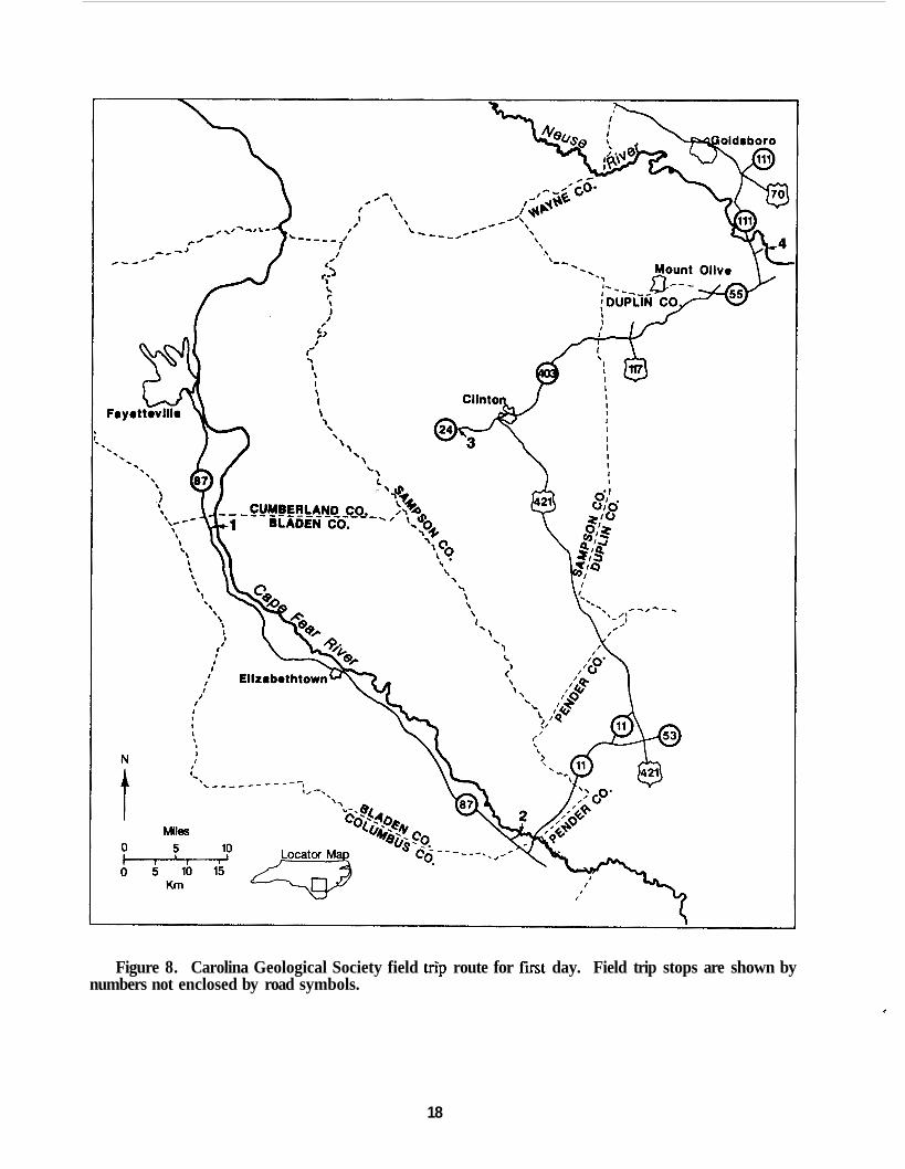
Figure 8. Carolina Geological Society field trip route for first day. Field trip stops are shown by numbers not enclosed by road symbols.
c
18

STOP 2. Kings Bluff, on right bank of the Cape Fear River (milepost 38.7) 0.2 mile downstream of lock and dam number 1.
TOP OF SECTION ALLUVIUM
Upper part of bluff mainly covered with vegetation, but occasional patches of gravel are visible.
1. Light grey, bioturbated, micaceous, medium-grained sandstone, that forms a resistant unit that may overhang the bluff face. 1 meter
2. Dark grey, massive, fossiliferous sparingly glauconitic, micaceous, clayey medium- grained sand. 6.7 meters
CRETACEOUS - DONOHO CREEK FORMATION
The massive, clayey, sand unit of the Donoho Creek Formation at this stop is representative of the shelfal facies of most units of the Black Creek Group and is lithically similar to the shelfal facies of many parts of the overlying Peedee Formation. The other stops on this excursion are in the Tar Heel Formation and designed to show the progression of facies in the unit. If it were possible to visit a Tar Heel shelfal facies, such as Blue Banks Landing (figure 6A, 6B), one would see a sequence like that visible here,
As discussed in the guidebook text, the base of the Donoho Creek is exposed upstream at Donoho Creek Landing (milepost 50.5), where it lies disconformably upon the Bladen Formation. The beds here at Kings Bluff, lie near the top of the formation. The sandstone at the top of the bluff is again exposed downstream at Black Rock Landing (milepost 36.8). There the formation is unconformably overlain by shelfal deposits of the Peedee Formation. This disconformity can be traced throughout the Carolina Coastal Plain and is coeval with a disconformity separating the Mount Laurel Sand and Navesink Formation in New Jersey and is thus of regional significance.
Fossils are most common in the lower part (2 meters) of Kings Bluff, but become less common upward along with a slight increase in grain size of the sand and a loss in the clay fraction. This subtle upward coarsening of sand is characteristic of cy~lic,~deposits. The majority of the fossils are surface dwelling (epifaunal) bivalve molluscs. A few infaunal molluscs, preserved mainly as phos- phatic intemal molds, are also present.
Among the fauna, the bivalves Exogvra cancellata, and Anomia tellenoides are especially significant. They are zonal markers whose stratigraphic ranges are virtually coincident with the lower Maasmchtian.
71.60 72.80 75.10 76.70
81.40 86.00 89.10
0.00 1.20 2.30 1.60
4.70 4.60 3.10
Retum to vehicles and retrace route to North Carolina Route 87. Turn left onto North Carolina State Route 87. Turn left onto North Carolina Route 11. Bridge over the Cape Fear River. The bluffs upstream and downstream of the bridge constitute the previously mentioned Black Rock Landing locality. These bluffs expose the disconformity between the Donoho Creek and Peedee Format ions. Turn right onto North Carolina State Route 210. Bridge over Black River. Moores Creek National Battlefield.
19

93.70 4.60 Tum left onto U.S. Route 421. 132.40 38.70
135.30 2.90 135.60 0.30 137.80 2.20
Intersection with U.S. Route 701. Clinton. Exit to right for North Carolina State Route 24. Tum left on State Route 24 West at stoplight. Park vehicles at parking lot of store on right and proceed to stop 3.
Continue on 421 / 701 bypass to east of
STOP 3. Road cuts along North Carolina State Route 24 on the west facing slope of Coharie Creek Valley.
About 8 meters of horizontally bedded, dark grey to black, carbonaceous clay and interbedded, white, micaceous, fine-grained sand of the Tar Heel Formation can be seen in these exposures. Sand comprises a greater proportion of the section than the Tar Heel deposits seen at stop 1. Although such comparisons are obvious they reflect the rapid lateral changes that can occur within the delta front facies.
137.80
139.80
140.70 141.90 142.30 143.00 169.80 175.20 177.70 178.70
0.00
2.20
0.90 1.20 0.40 0.70
26.80 5.40 2.50 1 .oo
Retum to vehicles and retrace route to the intersection of State Route 41 with U. S . 421. Turn right onto W.S. Route 421 / 701 South (State Route 24 East). Get into right lane. Exit bypass to left onto State Route 24 East. Tum left at stoplight onto State Route 24 East and business U.S. 701. At stoplight continue straight ahead on business U.S. Route 701. Turn right onto North Carolina State Route 403 at stoplight. Turn right onto North Carolina State Route 55. Turn left onto North Carolina State Route 11 1. Turn right at entrance to Cliffs of the Neuse State Park. Park vehicles in designated parking area and proceed to stop 4.
STOP 4. Cliffs of the Neuse State Park. Tar Heel Formation exposed in bluffs on the right side of the Neuse River at milepost 76.5.
Stephenson (1912, p. 134, 135) provided a detailed measured section of the bluff at this locality. He measured 20.5 meters of Tar Heel beds overlain by 4 meters of alluvial deposits consisting of a thin basal gravel overlain by light-yellow sand. Currently there are about 17 meters of Cretaceous deposits visible that belong to the upper part of the Tar Heel Formation.
The main feature to note in this bluff is the dominance of horizontal bedding and the propor- tionally greater amount of sand beds relative to the clays. The sands may be clayey and commonly contain glauconite. Some sand units show low amplitude cross-bedding. Burrows are common throughout the bluff, but body fossils are rare and mainly found only in the lower part of the exposure. The bedding of the units suggest deposition in a prodelta setting. These deposits contrast strongly with the massive bedding of the shelfal deposits seen at stop 2 and those present in the Tar Heel along the rivers to the north.
The molluscan fauna represented here consists mainly of shallow water, near shore molluscan species with epifaunal forms abundant and infauiial species fewer in numbers.
20

178.70 0.00
179.70 180.40 188.70 194.10 194.30 194.40 194.80 194.85
1 .OO 0.70 7.90 5.80 0.20 0.10 0.40 0.05
END OF DAY ONE
Return to vehicles and retrace route to the entrance to Cliffs of the Neuse State Park. Turn right onto road connecting with State Route 11 1. Turn right onto North Carolina State Route 11 1. Turn left onto U.S. Route 70. Exit bypass U.S. Route 70 to right. Turn left onto business U.S. Route 117, but stay in left lane. At stoplight turn left onto entrance to U.S. bypass 70. Tum right onto access road (Eldon Street). Holiday Inn, Goldsboro. Park vehicles in lot and proceed to rooms.
Figure 9. Carolina Geological Society field trip route for second day. Field trip stops are shown by numbers enclosed by road symbols.
21

ROAD LOG FOR SECOND DAY
0.00
0.50 0.60
4.50 6.20 6.50
7.00 7.10
0.00
0.50 0.10
3.90 1.70 0.30
0.50 0.10
8:OO A.M. Board vehicles. Leave motel parking lot, turning to left onto acc- ess road (Eldon Street). At stoplight, tum right onto business U.S. Route 117. Stay to right. At stoplight, tum right onto cloverleaf merging on to bypass U.S. Route 117 and U.S. 13 South. Junction with Business Route 117. Stay in right lane. Bridge over Neuse River. Tum right at traffic light. Remain in right lane to traffic island, then continue to right of traffic island and straight ahead on Loop Road, State Route 1222. Tum right continuing on State Route 1222. Turn right onto State Route 1247. Park cars and proceed to Stop 5.
STOP 5. Neuse River Cutoff, exposures both up and downstream of bridge of State Route 1222.
The man made cut at this locality exposes beds of the lower part of the Tar Heel Formation and representative of a delta front environment. A wide range of lithologies may be seen along the banks of the cutoff. These range from greyish, coarse-grained sand, to white or yellowish, fine-grained sand, and black to grey, carbonaceous clay. Units of thinly interbedded, carbonaceous clay and whitish sand is perhaps the dominant package. Cross-bedding of low amplitude is common locally in rather clean quartz sands that appear to occupy channel fills. Burrow structures are common features, and wood is locally abundant. Much of the wood contains Teredolites borings indicating marine influence. Pyrite coats many of the wood surfaces and may fill in the borings.
Lateral variation of all units is great.
Both upstream and downstream of the bridge, one may observe blocks of sediment oriented vertically or at high angles to the bedding of the surrounding deposits. In some areas, several blocks lie in chaotic orientation to one another. These represent penecontemporaneous slumping by incom- petent units.
Shortly downstream of the cutoff, on the right bank of the Neuse River, below the bridge of U.S. Route 117, Stephenson (1912, p.98, figure 6 and plate 3, figure B) noted a section he interpreted as representing the contact of the Patuxent (=Cape Fear) and the Black Creek Formation. The deposits he called Patuxent contain some glauconite and are lithically similar to beds exposed at stop 5. His disconformity probably represents only a channel deposit within the Tar Heel Formation.
7.10 7.60
8.80 12.50 13.50 15.50 15.90
0.00 0.50
1.20 3.70 1 .00 2.00 0.40
Retum to vehicles and proceed on Loop Road (State Route 1247). Stop sign at intersection with State Route 1222. through the intersection, joining State Route 1219. Turn right continuing on State Route 1219 (Grantham Road). Tum right onto State Route 1214. Turn left onto State Route 1008 (Stephens Mill Road). Turn right onto State Route 1224 (Ferry Bridge Road). Park vehicles and proceed to Stop 6.
Proceed straight ahead
22

STOP 6. Road cut and borrow pit along State Route 1224 southwest of Cox's Bridge over the Neuse River.
The Tar Heel Formation here consists of nearly 5 meters of laminated, pale-green clay and fine- to coarse-grained sand. The amount of glauconite is rather high compared to most of the Tar Heel outcrops in this area, but the heavy mineral suite is typical. Burrow structures may stand out in relief on many surfaces, or they lend the outcrop a mottled appearance because of their clay lining. The bedding features suggest a tidal flat environment of deposition.
Immediately west of this locality and at the lower elevation of the Neuse River, about 0.5 meters of interbedded, carbonaceous sand and clay occurs at water level; 2.5 meters higher on the bank more interbedded sand and clay is poorly exposed. The clay bears leaf imprints and the sand has a faint cross-bedding and includes clay rip-up clasts. Combined, these deposits demonstrate the shifting nature of the prodelta environment.
15.90 0.00 16.30 0.40 Turn right onto State Route 1008. 18.70 2.40 Turn right onto State Route 1200. 19.10 0.40 Park vehicles and proceed to Stop 7.
Retum to vehicles and retrace the route to State Route 1008.
Stop 7. Exposures of the lower part of the Tar Heel Formation along roadside of State Route 1200 south of the crossing over Mill Creek.
About 5 meters of Tar Heel deposits may be seen in the roadside banks and ditches at this stop. Here the Tar Heel consists of interbedded to laminated, dark grey clay, and thin beds of micaceous, silty to fine-grained sands. Carbonaceous material may be seen in both the sands and clay but it is a minor constituent in most parts of the section. The clays lower in the slope show color alteration because of weathering. This section lies very close to the base of the Tar Heel Formation. A few tenths of a mile to the north, and upstream of the bridge over Mill Creek, at about 10 meters below this section, there are poor exposures of compact clayey sands that appear to belong to the Cape Fear Formation.
The last three stops provide an indication of the lithic variability of the lower part of the Tar Heel Formation.
END OF TRIP
23