canada’s landform regions - mr. wetmore's website · •michigan •erie •superior •all...
TRANSCRIPT


Canada’s Landform Regions8 Regions with distinct physical geographic characteristics
• Appalachian Region
• Great Lakes/St. Lawrence Lowlands
• Canadian Shield
• Hudson Bay Lowlands
• Interior Plains
• Western Cordillera
• Arctic Lowlands
• Inuitian Mountains
1. Define and label on your map the 8 regions
2. Research and describe the general physical characteristics of each region

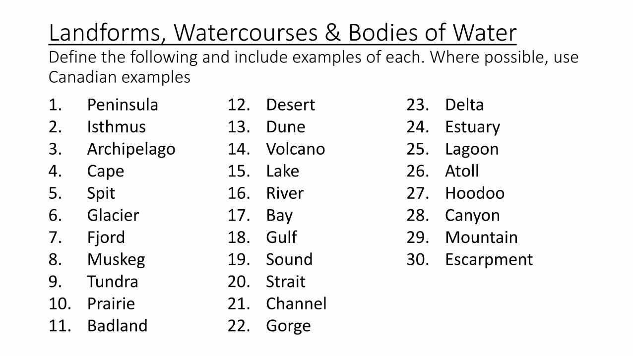
Landforms, Watercourses & Bodies of WaterDefine the following and include examples of each. Where possible, use Canadian examples
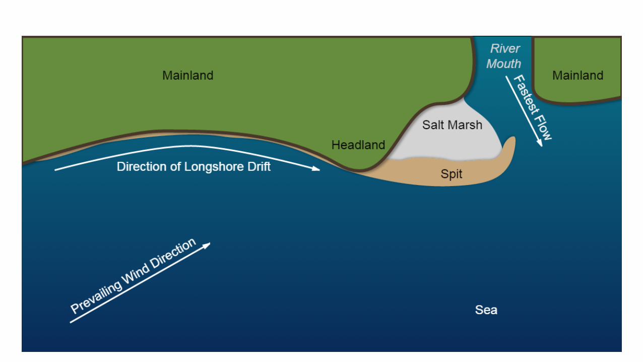
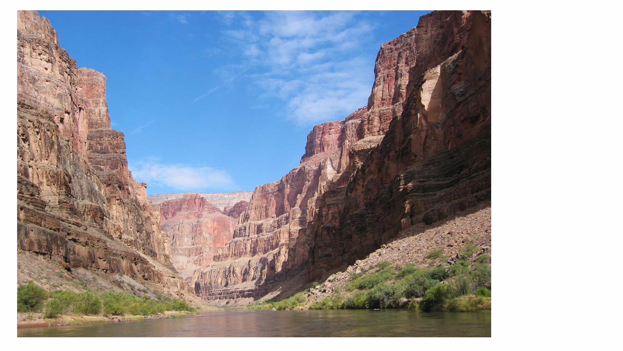
1. Peninsula2. Isthmus3. Archipelago4. Cape5. Spit6. Glacier7. Fjord8. Muskeg9. Tundra10. Prairie11. Badland
12. Desert13. Dune14. Volcano15. Lake16. River17. Bay18. Gulf19. Sound20. Strait21. Channel22. Gorge
23. Delta24. Estuary25. Lagoon26. Atoll27. Hoodoo28. Canyon29. Mountain30. Escarpment


Canada’s Landform Regions
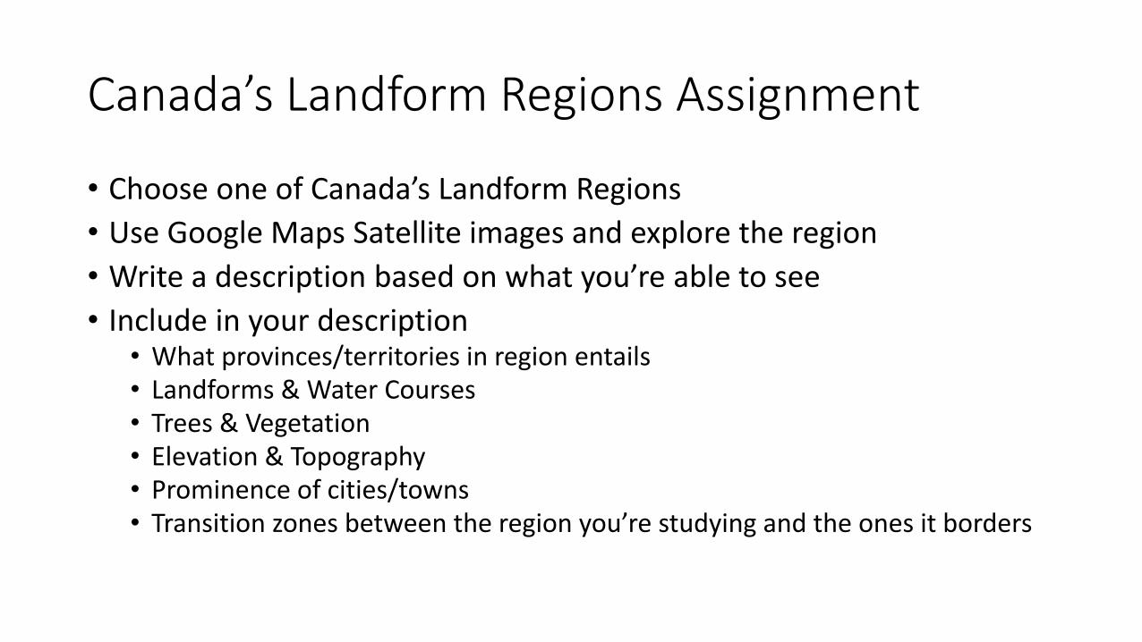
Canada’s Landform Regions Assignment
• Choose one of Canada’s Landform Regions
• Use Google Maps Satellite images and explore the region
• Write a description based on what you’re able to see
• Include in your description• What provinces/territories in region entails• Landforms & Water Courses• Trees & Vegetation• Elevation & Topography• Prominence of cities/towns• Transition zones between the region you’re studying and the ones it borders

The Appalachian Mountains
• Range extends from Nfldsouth to Georgia, USA
• Very old Mountains• (formed 375 Million Years ago)
• Have eroded over time; now rolling hills and valleys
• Highest mountain in NB – Mt. Carleton part of this range


The Appalachian Trail
• 2200 miles
• Georgia to Maine


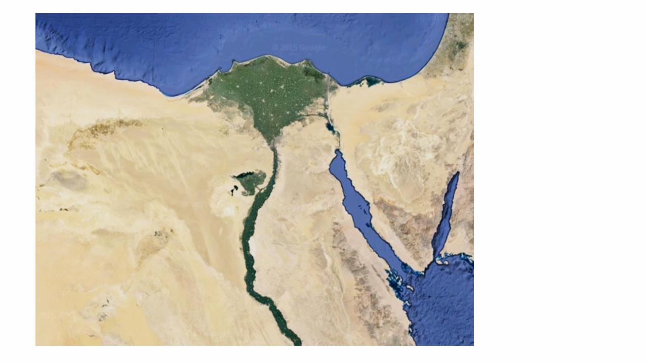
Great Lakes/St. Lawrence Lowlands

Great Lakes/St. Lawrence Lowlands• There are 5 Great Lakes
• Huron
• Ontario
• Michigan
• Erie
• Superior
• All form part of the border between Canada and the USA
• They are interconnected and drain into the St. Lawrence River, which flows into the Gulf of St. Lawrence and the Atlantic Ocean.
• Contain 1/5 of the planet’s freshwater

The Precambrian Shield
• The largest landform region in Canada
• Some of the oldest rock in North America –dating back to the Precambrian period (540 million years ago)
• Thin soil, conifer forests, poorly suited for agriculture
• Rich in mineral deposits

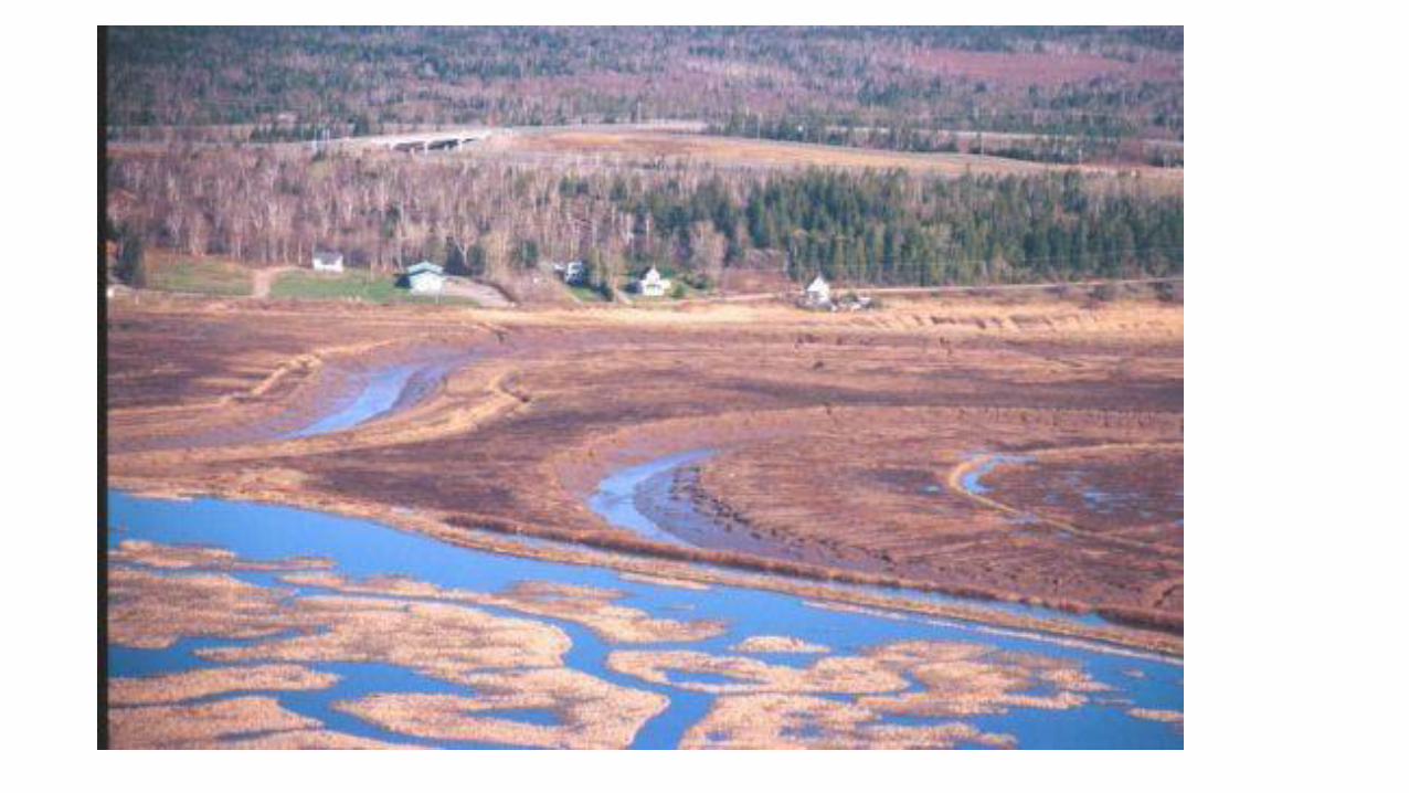
Hudson Bay Lowlands
• Northern Ontario/Manitoba
• Shores of the Hudson and James Bays
• Mostly Tundra, Muskeg andwetlands
• Largest wetlands in the world home to a wide diversity of flora and fauna

Interior Plains
• Wide open grasslands with rolling hills and little variation in geography
• AKA – The prairies
(Manitoba, Saskatchewan, Alberta)
• Were once shallow inland seas – covered with sediments from the Rocky Mountains and Canadian Shield
• Rich & fertile soil
• “The Breadbasket of Canada”

Western Cordillera
• Made up of a series of mountain ranges• The Coast Mountains
• Columbia Mountains
• Rocky Mountains
• Interior valleys around these mountains provide fertile farmland
• Giant old growth forests

Arctic Lowlands• Mostly in Nunavut
• Tundra and treeless plains
• Sparse vegetation –lichen and moss

Inuitian Mountains• No tree growth due to cold temperatures
• Massive, rugged mountains
• Steep barren valleys