canning bridge precinct vision - department of planning
TRANSCRIPT

CanningBridge Precinct Vision
June 2011

Disclaimer
This document and the information contained within has been published by the Western Australian Planning Commission for the purposes of public information and comment. Any representation, statement, opinion or advice expressed or implied in this publication is made in good faith and on the basis that the government, its employees and agents are not liable for any damage or loss whatsoever which may occur as a result of action taken or not taken, as the case may be, in respect of any representation, statement, opinion or advice referred to herein. Professional advice should be obtained before applying the information contained in this document to particular circumstances.
© State of Western Australia
Published by theWestern Australian Planning Commission140 William StreetPerth WA 6000
Locked Bag 2506Perth WA 6001
Published June 2011
Minister’s foreword
The Canning Bridge Precinct Vision presents a planning concept for the future.
The document considers the most appropriate way to utilise the land close to the Canning Bridge public transport infrastructure and the existing commercial centre located to the west of the river.
Canning Bridge has been identified as well placed to develop into an important strategic centre because of its accessibility and close proximity to the Perth central business district.
The State Government is committed to the creation of transit oriented developments that encourage sustainable, cohesive and connected communities.
It is envisaged that the Canning Bridge precinct will become a diverse community hub with a mix of office, retail, residential and recreational uses.
The Vision presents a number of opportunities for the Canning Bridge area including additional employment and diverse housing options.
The document gives a valuable insight into the opportunities associated with the Canning Bridge precinct and addresses the challenges that need careful management in order to improve the quality of our city for generations to come.
The Canning Bridge Precinct Vision will guide further technical studies on matters such as traffic management, environmental considerations and the built form, all of which will inform structure planning for the precinct.
I encourage the community and key stakeholders to continue to be involved in the evolution of the Canning Bridge Precinct.
Hon John Day, MLAMinister for Planning
website: www.planning.wa.gov.auemail: [email protected]
tel: 08 655 19000fax: 08 655 19001TTY: 08 655 19007infoline: 1800 626 477
Western Australian Planning Commission owns all photography in this document unless otherwise stated. This document is available in alternative formats on application to WAPC Communication Services.
The Canning Bridge Precinct Vision was prepared by GHD under the direction of the Canning Bridge Precinct Vision Project Management Group.

Canning Bridge Precinct Vision1
Chairman’s foreword
The Canning Bridge Precinct Vision considers the opportunities associated with the future development of this important strategic centre.
The Canning Bridge area has all the fundamentals of a sound transit orientated development, a good location, public infrastructure and the necessary public transport options.
Looking to the future, the Vision identifies the precinct’s potential to accommodate high quality development with a rich mix of land uses.
Across the State there is a strong focus on encouraging development that will activate areas and benefit to communities.
We want the public to be able to access these future developments. Appropriate planning guidance will encourage the provision of viewing decks, roof top gardens and restaurants.
It is also expected that the lower levels of developments will become well designed and active street frontages, ideal locations for coffee shops or retail boutiques.
The Canning Bridge Precinct Vision provides clarity to the future needs of the area and will be an important basis for moving forward.
The planning of the precinct will continue with both State and local government forming a working group to coordinate the progressive implementation of the Vision.
Gary PrattleyChairman Western Australian Planning Commission

Canning Bridge Precinct Vision 2
Contents
Summary 4
Canning Bridge precinct vision statement 5
Precinct vision 6
Critical initiatives 9
Short term initiatives 9
Medium term initiatives 10
Long term initiatives 11
Implementation framework 11
1. Introduction 12
1.1 Study area 12
1.2 Background 14
1.3 Transit oriented development principles 15
2. Precinct vision 16
2.1 Detailed features 17
3. Urban design framework 22
3.1 Optimal land use mix 22
3.2 Urban design principles 24
3.3 Development assessment unit 37
3.4 Capital improvements 37

Canning Bridge Precinct Vision3
4. Implementation 40
4.1 Funding opportunities 41
4.2 Capital improvements and future
planning requirements 42
4.3 Statutory requirements 46
4.4 Governance 46
4.5 Land assembly 47
4.6 Implementation action framework 48
Table 1 – Implementation action framework 48
Figure 1 – Master plan 7
Figure 2 – Building heights 8
Figure 3 – Location plan 13
Figure 4 – Study area 14
Figure 5 – Podium development examples 21
Figure 6 – Opportunities for new internal
road networks 43
Canning Bridge Precinct Vision 4
Summary
In August 2010 the West Australian Planning Commission
(WAPC) released Directions 2031 and Beyond: Metropolitan
Planning Beyond the Horizon to guide development within
the Perth Metropolitan Region and to manage the significant
population projections for Perth in the next 21 year period.
This policy document, based on the identified six key themes
of a liveable, prosperous, equitable, accessible, green and
responsible city, was developed with significant community
and stakeholder input.
Also released in 2010 was the WAPC’s State Planning Policy:
Activity Centres for Perth and Peel (SPP). This SPP emerged from
the previous Network City: Community Planning Strategy for
Perth and Peel (Network City) released in September 2004.
In 2007 the commencement of the Southern Suburbs railway
passenger service from Perth to Mandurah included a new
bus/rail interchange at Canning Bridge. This station has
now emerged as a significant node in the public transport
network servicing the highest frequency bus routes in the
metropolitan region and high frequency train services to and
from the Perth CBD.
With its high level of public transport service Canning
Bridge is identified in the SPP as a district town centre/
activity centre where community services, higher density
housing, employment and a range of mixed use activities
are encouraged to accommodate some of Perth’s expected
growth in the years to 2031 and beyond.
This planning analysis of the Canning Bridge precinct broadly
represents land within an 800m walk of the rail station and
includes the existing centre on the west side of the river.
The analysis was commissioned jointly by the City of
Melville (CoM), City of South Perth (CoSP) and the WAPC as a
response to the provision of the Perth-Mandurah rail line and
the new station at Canning Bridge.
The key focus of this project is to prepare a precinct vision
and implementation strategy for the Canning Bridge area to
facilitate the development of transit oriented development
that will take advantage of its strategic location and prime
regional access characteristics. The vision provides a non-
statutory planning framework for the future development
of the area as a major activity centre with significant
opportunity for additional employment.
A number of key issues identified by stakeholders at both a
local and State level have been considered in the preparation
of this precinct vision, including traffic concerns, built form,
open space, parking, safety and accessibility to the station.
Canning Bridge Precinct Vision5
Background reports Supporting reports have been produced which are to be
read in conjunction with this precinct vision report. The
supporting reports include;
• astrategicandstatutoryframeworkanalysis;
• consultationreportsundertakenaspartofthestudy;
• aprecinctanalysis;
• aneconomicanalysis;
• anurbangrowthanalysis;
• amovementnetworkanalysis;and
• areportonsubmissions.
The background reports are available at
www.planning.wa.gov.au
Canning Bridge precinct vision statement
The Canning Bridge precinct will evolve to become a
unique, vibrant, creative community centred on the
integrated transport node of the Canning Bridge rail station.
The precinct will be recognised by its unique location, its
integrated mix of office, retail, residential, recreational and
cultural uses that create areas of excitement, the promotion
of its local heritage and as a pedestrian friendly enclave
that integrates with the regional transport networks while
enhancing the natural attractions of the Swan and
Canning rivers.

Canning Bridge Precinct Vision
Summary
6
Precinct vision
The key elements of the precinct vision and proposed land
uses are shown in figures 1 and 2. The concepts depicted
in the vision have been developed through extensive
stakeholder consultation and are non-binding at this stage.
The key elements of the vision include:
• substantialredevelopmentopportunitieswithan
increase in residential densities and building heights
subject to performance based streetscape and built
form design guidelines;
• promotionofsustainablebuildingtypesanduses
which support the community;
• creationofatownsquareandcentralcommunityhub
in Applecross;
• opportunitiesfornewcommercialdevelopment
adjacent to the freeway in Como in the longer term,
including limited development on the foreshore;
• enhancementofstreetscapesandforeshorereserves,
including increasing the size of the foreshore recreation
areas;
• improvementinpedestrian,cyclistandkiss’n’ride
connections to a new bus/rail interchange and
improvement in general pedestrian accessibility within
each local government;
• allowanceforafutureferrystationintegratedwiththe
new bus/rail interchange;
• anewtrafficconnectionresultingfromthe
establishment of a third (replacement) structure over
the river;
• arelocated/improvedbusstationintheshortterm,
improved kiss’n’ride access and new bus routes from
both sides of the river in the long term utilising a local
connection through Como; and
• identificationofopportunitiesforimprovedtraffic
movement associated with the Canning Highway/
Kwinana Freeway interchange.
The final design of the Canning Highway/Kwinana Freeway
interchange will be subject to further detailed transport and
economic studies.
A detailed analysis of the concepts depicted in the precinct
vision can be found in section 3.
The following key actions are recommended to be
implemented within the timeframes suggested below in
order to improve the function and amenity of the precinct in
a coordinated manner.
The timeframes proposed are critical (immediate), short term
(1-5 years), medium term ( 6-10 years) and long term
(10+ years).
Canning Bridge Precinct Vision7
A3 MapFigure 1
Canning Bridge Precinct Vision
Summary
8
Figure 2
A3 Map

Canning Bridge Precinct Vision9
Critical initiatives
• Developamemorandumofunderstanding(MOU)
between the City of Melville and the City of South Perth
establishing their commitment to the vision for the
Canning Bridge area.
• Seektheestablishmentofadedicatedsteeringbody
with State and local government representation to
oversee development and implementation of the
vision.
• Establishcommunity/stakeholderliaisongroupsto
enable ongoing engagement with the community
• Initiatethepreparationofaneconomicdevelopment
strategy for the precinct to inform town planning
scheme and local planning strategy amendments.
• Developlandscapedesignguidelines,streetscape
design guidelines and built form design guidelines
(including performance based zoning guidelines)
– as part of an activity centre structure plan.
• Undertakeadetailedtransportplanninganddesign
study to assess the feasibility of the proposed
Canning Highway/Kwinana Freeway and bus/
rail interchange concept and consider design
solutions for the integration of the concept at Kintail
Road and connections through Como (including
recommendations for timing and staging of
infrastructure development).
• Identifyandseekfundingtoachievethetransport
improvements required – prepare a business case
for consideration by the Department of Treasury and
Finance.
• Undertakeadetailedparkingandaccessstrategy.
• Improvepedestrianandcyclistaccesstotheexisting
Canning Bridge rail station as an interim priority
measure; may include improved pedestrian phases at
traffic lights, new pedestrian overpasses etc.
Short term initiatives
• Establishabilateraldevelopmentassessmentunit
(DAU)withCoMandCoSP,supportedbychangesto
statutory planning controls, which will be responsible
for assessing significant developments within the study
area.
• Improvementstolocalroadssubjecttothetransport
planning study including alternative pavement
treatments.
• UpgradeCanningHighwaywithprioritybuslanes.
• Develop/constructproposednewbusandrailstation
interchange.
• Establishformalkiss’n’rideareasasperthevisionplan
and in line with the transport study outcomes.
• DesignandconstructtheManningRoadto
southbound Freeway on-ramp.
• Townplanningschemeamendmentstosupportfirst
stage land use and zoning changes.
• Undertakeadetaileddesignstudyanddevelopment
concept for the foreshore reserve between the freeway
and river.
• Developincentivesfornewbuildingstomeet
sustainable building objectives through built form
design guidelines.
• Investigateundergroundpowerandimproved
communications infrastructure options.
• Investigatewaterandsewerupgraderequirements.
• Investigateanddevelopacommunityhubinthe
Applecross/Mt Pleasant area.
• Developastrategytoimplemententrystatements,
public art, playgrounds, exercise features, public toilets,
water fountains, seats etc throughout the precinct.

Canning Bridge Precinct Vision
Summary
10
• Establishstatutorymechanismsfordeveloper’s
contributions for infrastructure upgrades for all new
development.
• Improvementstotheriverforeshore(bothsides)
including wetland enhancement and improved public
facilities.
Medium term initiatives
• Constructathirdbridge(newCanningHighway)
over the Canning River immediately to the south of
existing bridges to support long term replacement of
existing ageing infrastructure. Divert westbound traffic
movements to new bridge.
• RepairorreplaceexistingsouthernCanningBridge
for long term traffic use. Divert eastbound traffic
movements to existing/repaired/replaced southern
bridge.
• Repair/upgradeexistingnorthernCanningBridgefor
local and through bus, kiss’n’ride and pedestrian traffic
movements.
• (Ongoing)Developentrystatements,publicart,
playgrounds, exercise features, toilets, water fountains,
seats etc throughout the precinct.
• Establishnewroadswithintheprecinctasdevelopment
occurs in line with the vision.
• Investigatetheopportunityforaferryservice
connection.
• Developmentofpubliclandwithdemonstration
projects such as community buildings etc.

Canning Bridge Precinct Vision11
Long term initiatives
• FullupgradeofCanningHighway/KwinanaFreeway
interchange including consideration of an improved
Manning Road off-ramp/Canning Highway on-ramp
weave.
• Constructferryterminalbasedonpreviousstudies.
• Maintain/upgrade/replaceexistingnortherntimber
bridge for ongoing local traffic movements.
Implementation framework
The time frames in this document are indicative and
recommended from a planning viewpoint. The funding of
any regional infrastructure priorities will be a decision of the
State Government.
It is important that the implementation framework
recommended by this study be supported at the local
and State Government level by service providers and the
community to ensure the successful achievement of this
vision occurs progressively over time. The redevelopment
of established urban areas presents many challenges,
and influencing change in the urban fabric is affected
by development controls, land tenure, adequate service
provision, community acceptance and funding issues.
Consequently, the successful implementation of the Canning
Bridge precinct vision will rely on a close political and
technical relationship between the two local governments
and the State Government. A staged approach will be
required with a focus on providing achievable and effective
solutions in the short term, and the provision of higher
cost infrastructure solutions in the medium to long term. A
summary of the implementation framework can be found in
Table 1.

Canning Bridge Precinct Vision 12
1. Introduction
This study has been undertaken within the frameworks of the
WAPC’s Directions 2031 and Beyond: Metropolitan Planning
Beyond the Horizon (Directions 2031), the State Planning
Policy: Activity Centres for Perth and Peel and the previous
policy document Network City: Community Planning Strategy
for Perth and Peel (Network City).
Directions 2031 is proposed to guide development and to
manage the significant population projections for Perth
metropolitan region in the next 21-year period, and is
based around the six key themes of developing a liveable,
prosperous, equitable, accessible, green and responsible city.
1.1 Study area
The study area is broadly defined by an 800 metre radius
centred on the Canning Bridge train station, which represents
development within a short (approximately 10 minute) walk
to the station.
Immediately across the river from the Canning Bridge
rail station to the west is the Canning Bridge commercial
hub in Mt Pleasant/Applecross, comprising offices, retail,
restaurants/cafés, and several recreational uses. The area is
generally well developed, with several medium to high rise
developments, including the Raffles Hotel redevelopment,
and a significant number of established private homes.
To the east of the train station are the suburbs of Manning
and Como, which are generally established private residential
areas with generally low density housing.
Figure 3 shows the general boundaries for the Canning
Bridge precinct in its regional location, while Figure 4 shows
the area in more detail. The boundary is arbitrarily based,
and as such the scope of this study has not entirely excluded
consideration of relevant issues outside of the study
boundary.
This study comprised of the following key components.
• Engagementwithkeystakeholderstoidentifyissues,
opportunities and constraints within the study area.
• Aneconomicstudyoftheprecincttodeterminehowit
operates, to assist in identifying an appropriate land use
mix for the precinct.

Canning Bridge Precinct Vision13
Figure 3 – Location plan
Study Area
Base information supplied by:Western Australian Land Information Author tyLI 430-2009-2

Canning Bridge Precinct Vision
1. Introduction
14
• Aninvestigationintoimprovingaccessibilitywithinand
around the precinct; and particularly access to the train
station.
• ComprehensivecommunityconsultationbytheCities
of Melville and South Perth.
• Developmentofconceptplanstofacilitatean
improvement to the function and amenity of the
precinct.
• Identificationofrecommendedcapitalimprovements
and funding opportunities.
• Developmentofaplanningframeworkand
implementation guide to facilitate a staged approach to
improving the function, accessibility and amenity of the
precinct.
1.2 Background
Urbanrailisexperiencingarevivalonaworldwidebasis.
Experiencefromcitiesaroundtheworldsuggestthatthe
provision of modern and efficient suburban electric rail
systems provides a positive incentive for development of
land in close proximity to stations for a higher density of
housing, commercial, office and other relevant urban land
uses.
The Western Australian Government recognises that rail is
a particularly beneficial form of public transport because it
contributes minimal pollution and provides a fast, efficient
and comfortable service for commuters. The Western
Australian Government has recently finished construction
of the Southern Suburbs rail line from Perth to Mandurah,
which is now in full operation.
The new Canning Bridge rail station is located within the City
of South Perth (CoSP), directly under the Canning Highway
Bridge and within the Kwinana Freeway reserve. The location
is highly valued as a bus/rail transfer point, being the nexus
of the railway and major east-west bus routes. However, the
site for the rail station is highly constrained in a relatively
narrow portion of the Kwinana Freeway reserve, which limits
opportunities for associated urban development in close
proximity to the station and constrains pedestrian access to
the station.
Base information supplied by:Western Australian Land Information AuthorityLI 430-2009-2
Study Area
Figure 4 – Study area

Canning Bridge Precinct Vision15
1.3 Transit oriented development principles
Transitorienteddevelopment(TOD)canbedescribedas
planning for “moderate to higher density development, located
within an easy walk of a major transit stop, generally with a
mix of residential, employment, and shopping opportunities
designed for pedestrians, without excluding motor vehicles,
whose design and orientation facilitate transit use”. (Technical
AdvisoryCommitteeforthe“StatewideTODStudy:Factorsfor
Success in California”).
ThekeyelementsofTODareidentifiedbelow.
• Anintegratedandgoodqualitytransitsystem,that
combines multiple transport modes.
• ReduceddependencyoncarswithintheTODprecinct.
• Moderatetohighresidentialdensitieswithinwalking
and cycling distance to major transit stops.
• Mixedusesthatincludedestinationsandactivitiesthat
need to be accessed on a regular basis (eg live, work,
play, shop, civic).
• Maximisesafetytogenerateasafenighttimeeconomy
which can backload transit use.
• Hightransittripgeneratinglandusesnearmajortransit
stops.
• Creationofaqualitysenseofplacewithinthepublic
domain.
• Activestreetfrontagesthatpromotevibrancyand
safety with a legible street pattern and robust buildings
that may facilitate changing land uses over time.
This study will consider ways in which the above principles
ofTODcanbedeliveredeffectivelyandinatimelymannerto
the Canning Bridge precinct.

Canning Bridge Precinct Vision 16
2. Precinct vision
The concepts depicted in the precinct vision have been
developed through extensive stakeholder and community
consultation. The main concepts of the vision include:
• substantialredevelopmentopportunitieswithan
increase in residential densities and building heights
subject to performance based, streetscape and built
form guidelines;
• anewbusstationintegratedwiththetrainstation,
• promotionofsustainablebuildingtypesanduses;
• creationofatownsquareandcentralcommunityhub
in Applecross;
• opportunitiesfornewcommercialdevelopment
adjacent to the freeway in Como, including limited
development on the foreshore;
• enhancementofstreetscapesandforeshorereserves,
including increasing the size of the foreshore recreation
areas;
• improvementinpedestrianandkiss’n’rideconnections
to the bus/rail interchange and improved pedestrian
accessibility within each local government;
• allowanceforafutureferrystationintegratedwiththe
bus/rail interchange;
• anewtrafficconnectionresultingfromthe
establishment of a third (replacement) structure over
the river which supports the redeveloped bus station
and kiss’n’ride access from both sides of the river and
utilising a connection through local roads in Como; and
• identificationofopportunitiesforimprovedtraffic
movement associated with the Canning Highway/
Kwinana Freeway interchange.
The final concept for the design of the Canning Highway/
Kwinana Freeway interchange will be subject to substantial
transport planning studies in the immediate short term.
The precinct vision allows for substantial additional floor
space development for both commercial and residential uses
which will support a mix of uses and increased employment.
Key elements of the precinct vision are shown in Figure 1
and Figure 2.

Canning Bridge Precinct Vision17
2.1 Detailed features
2.1.1 Infrastructure requirements
The long term precinct vision includes a new traffic bridge
over the freeway to the north of the Canning Highway/
freeway interchange for all bus traffic and the bus/rail
interchange (the bus bridge). This bridge would provide
for bus, taxi, pedestrian and cyclist through traffic only, but
the connection into the bus bridge would allow for local
kiss’n’ride traffic or short term visitors to the foreshore from
the west. The bus bridge is proposed to connect into local
roads in the CoSP and at the Canning Beach Road/Canning
Highway intersection in the CoM.
The bridge is to be introduced in a staged manner with
the first stage including a bus station development on the
western side of the existing freeway/highway interchange to
support the immediate needs of bus and rail infrastructure
providers. The second stage includes development of a
connection into the CoSP to occur at such time as demand
exceeds the capacity of the existing road network.
The vision includes a priority bus lane along the Canning
Highway within the CoM heading east and the CoSP heading
both east and west.
The new bus bridge and station interchange will provide for
much better pedestrian and cyclist links to the rail and bus
station when designed appropriately.
The vision also includes a proposed Manning Road
southbound on-ramp, which has been the subject of much
community support over recent years.
The vision shows local roads that may be improved within
the precinct, with an improved intersection at Kintail Road
and Canning Beach Road and possible roundabouts on
Kishorn Road, Davilak Street and Cassey Street.
The vision proposes signalised intersections at Canning
Highway/Canning Beach Road and at Canning Highway/
Cassey Street intersections – subject to a more detailed traffic
study and design.
The vision indicates possible new roads in the precinct which
support improved accessibility and legibility, such as the road
shown between Kintail Road and Canning Highway at the
approximate location of the existing IGA supermarket.
Several roads have also been identified as having alternative
road pavement treatments to slow down traffic speeds and
signify the pedestrian nature of these areas as well as having
some areas as ‘kerbless’ to encourage pedestrian priority over
traffic.
Additional local roads have also been shown to reduce the
size of existing street blocks between Kintail Road and the
Canning Highway, Sleat Road and Kishorn Road and some
lanewaysbetweenOgilvieRoadandKishornRoadand
KishornRoadandtheEsplanade.Thiscanonlyoccursubject
to agreement with landowners in these areas through
integrated development plans.

Canning Bridge Precinct Vision
2. Precinct vision
18
The vision also indicates upgrade requirements to Canning
Bridge to replace the existing infrastructure comprising a
new bridge to the south of the existing bridges, potential
to either upgrade or replace the current southern bridge
and the reuse/upgrading of the existing northern bridge to
connect into the proposed bus station and bus bridge in the
long term.
The foreshore reserve between the freeway and river is
shown in the vision as having some development along the
river’s edge, a potential future ferry or boat dock, improved
facilities and strong links to the bus/rail area. The links can
be established by developing terraces or built form levels
below the level of the bus station or landscaping and fill
such that the level is eventually equal to the bus station level.
Future land use and development in this area will need to
be subject to further detailed planning and environmental
assessment.
An extended foreshore in the Applecross/Mt Pleasant area
is shown near the existing rowing clubs, which would allow
for the development of some additional community facilities
and created wetlands, as well as providing more open
space area for the community to enjoy recreational pursuits.
Likewise, foreshore enhancement on the eastern side of the
riverisillustratedandproposedinthevision.Enhancement
of this foreshore area will be subject to detailed discussions
with the Swan River Trust and further detailed design.
An investigation into the upgrade of the Manning Road off-
ramp Canning Highway on-ramp weave to improve regional
traffic efficiency and potentially support pedestrian and
cyclists’ activity and accessibility is also required.
2.1.2 Place activation
The precinct vision includes a number of place activation and
place management opportunities.
The vision allows for, and provides space for, entry statements
at strategic locations in and around the precinct and these
can be combined with public art, seating and adequate
signagefortheprecinctgenerally.Entrystatementsshould
clearly identify the precinct to visitors and users to encourage
a sense of place in the regional context.
Public art is one way of creating a ‘gateway’ entry point to
the precinct and may be used in conjunction with landscape
design and different road treatments. Public art in the
precinct should consider the river, the bridge and the city as
a source of inspiration.
Oncewithintheprecinct,itshouldbeclearlyidentifiable.
A vision for the precinct would include a consistent and
repeated palate of colours and design for street furniture,
signage and public places.

Canning Bridge Precinct Vision19
The existing open, tree lined streetscapes continue to be
shown in the precinct vision, with enhanced streetscapes
and additional street trees shown throughout. The vision
shows new parks along the Canning Highway, the Kwinana
Freeway and adjacent to the new Manning Road on-ramp.
A park/town square opportunity is also shown near the
intersection of Moreau Mews and Kishorn Road and this is
mirrored on the other side of the Canning Highway. This area
is intended to become the central crossing place between
the Mt Pleasant and Applecross sides of the highway, and
should be integrated with the existing pedestrian overpass
to encourage use of the overpass rather than crossing the
highway at ground level.
The vision allows for considerably more development along
Canning Highway, and this is expected to be supported by
private landowners by way of design outcomes that will
promote and encourage higher intensity activity and allow
greater interaction between people within the precinct.
The vision shows enhanced green edges along the river front
on both sides of the river. Generally it would be expected
that all landscaping or planting proposed within the precinct
will be of native species and that the river foreshore areas will
be designed generally to improve the riverscape, including
created wetland features like those seen at the foreshore
near Lake Vasto in the City of Perth. The enhanced wetland
would provide substantial additional areas and space for
community interaction and recreational activity.
2.1.3 Land uses
The land use vision recommends a mix of building heights
and land uses throughout the precinct. Greater intensity of
commercial and mixed uses is shown along the key transport
spines of Canning Highway and Manning Road, while higher
density residential uses are proposed to transition into the
surrounding traditional lower density neighbourhoods.
Urbandesignguidelineswillneedtobedevelopedtoensure
that the transition areas have high amenity and attractive
and equitable streetscapes.
To support and encourage interest and activity in the
precinct, the vision identifies an opportunity for some
limited development such as cafés, restaurants and retail
facilities along the path across the existing northern
Canning Bridge (subject to more detailed investigation) and
onto the foreshore reserve on the eastern side of the river.
OpportunitiesforsimilaractivitiesoccuratbothMcDougall
Park and on the Mt Pleasant/Apex reserve foreshore.
Some commercial/residential mixed use functions are also
shown in the CoSP in the area closest to the freeway, at the
Mt Henry Tavern site and at the corner of Ley Street and
Manning Road. These areas should be developed at a local
scale, although it is likely they will attract regional users
because of their strategic location close to high frequency
public transport routes.

Canning Bridge Precinct Vision
2. Precinct vision
20
2.1.4 Accessibility
Improved pedestrian and cyclist accessibility is shown
throughout the precinct based around key infrastructure
improvements. Key to the vision in the long term is the
inclusion of a dedicated pedestrian/cyclist path along the
bus bridge connecting, at a pedestrian/cyclist level, the
west and east parts of the study area. This path should
be designed to include weather protection for at least
some parts of the journey, integrated with built form and
activities of interest such as cafés where possible. Improved
accessibility features will also need to respond to the needs
of the elderly, disabled and children.
Areas designated as having alternative road surface
treatments to slow vehicle traffic will likewise improve the
pedestrian and cyclist environment in the precinct.
Removal of the existing bus/rail interchange from the
Canning Highway/freeway interchange will greatly reduce
the required number of phases (bus phase, traffic phase etc)
at the signals. Reduced on road vehicle phases will result
in greater allowances for pedestrian phases at signalised
intersections throughout the precinct.
Additional pedestrian phases will also result from the
proposed signalised intersections at Canning Highway/
Canning Beach Road and at Canning Highway/Cassey Street
when the long term development of the bus bridge is
completed.
All paths, existing and proposed, should be well lit, signed
and clearly identified.
2.1.5 Built form
Changes to the existing built form of the precinct are
proposed in the precinct vision including greater building
heights and increased residential density. The opportunity
for significant development should be based on the quality
of architectural design and community benefits proposed in
line with the performance standards outlined in section 3.2.7.
The major opportunities for built form changes are illustrated
along the spines of the precinct on Canning Highway and
Manning Road.

Canning Bridge Precinct Vision21
Figure 5 – Podium development examples
2.1.6 Building height
The land use vision shows a variety of building heights within
the precinct and an overall graduation of heights downwards
from main traffic routes towards the surrounding residential
areas.
Generally, taller buildings are to be located along the
Canning Highway spine of the study area, with some
additional taller development along Manning Road and the
freeway becoming progressively lower further away from
these areas.
2.1.7 Building setbacks
Limited front and side setbacks are envisaged for
development in the mixed use and performance based area,
with any tower elements being setback in podium form to
ensure the perception of human scale development at the
street level. Some developments are shown to provide public
spaces and plazas at ground level and these are encouraged.
Figure 5 provides an illustration of appropriate street front
development with podiums and setbacks.

Canning Bridge Precinct Vision 22
3. Urban design framework
3.1 Optimal land use mix
Transit oriented developments are characterised by a mixture
of land uses and activities that create vibrant, diverse centres
for people to live and work. The Canning Bridge area is
well suited to evolve and provide such opportunities for
development, predominantly on the Melville side of the
precinct.
It has the potential to become a significant employment
centre with close links to the Perth CBD, the Bentley
TechnologyPark(includingCurtinUniversity),new
regional facilities such as the Fiona Stanley Hospital and
the remainder of the metropolitan area generally. Also, its
location on the Southern Suburbs rail line and along the
major activity corridor of Canning Highway, serviced by the
metropolitan areas highest frequency bus route, places it in
the enviable position of being highly accessible.
The economic analysis undertaken as part of this precinct
vision illustrates that the Canning Bridge precinct is a
significant and desirable office space destination in the Perth
metropolitan area which could support a substantial increase
in office space. An increase in both residential and retail
uses would complement increased office development and
would allow for additional opportunities in the precinct to
diversify the employment generating capacity of the area.
Given the proximity to the Perth central business district, the
high amenity of the physical environment and the quantity
and quality of infrastructure and social services available in
the area, this precinct could support significant residential
growth.
3.1.1 Current land use zoningThe current land uses are split into two distinct areas, being
the commercial focus of the Applecross/Mt Pleasant areas
and the residential focus of the Como/Manning areas. The
detailed strategic and statutory framework report provides
more detail with regard to zoning of individual properties.
3.1.2 Appropriate land use mix Commercial growth in the Applecross/Mt Pleasant areas
should be encouraged in the short term, subject to
appropriate development standards being established. This
includes the development of both retail and office floor
space, with entertainment uses similarly being encouraged.
Commercial uses should first be encouraged along the
Canning Highway spine, complemented by residential uses
and improvements to movement networks within the area.
Encouragingthesedevelopmentsintheshorttermwill
ensure that landowners are aware of and can consider long
term options for their land holdings and this will potentially
lead to more efficient developments which consider the long
term planning for the precinct. Concessions based on high
quality built form and community based outcomes may be a
catalyst for the type of development being encouraged (see
more detail at section 3.2.7).
The development of a multi user community facility should
also be encouraged in the short term and has been identified
at a number of possible locations. The preferred locations
are adjacent to the Tivoli Hall or near to the Moreau Mews/
KishornRoad/OgilvieRoad/CanningHighwaynexus,wherea
new park area is proposed.
Canning Bridge Precinct Vision23
Specifically, the existing supermarket and service station
facilities should be maintained, albeit in an altered format.
Landowners in the area bounded by the Canning Highway,
Kintail Road and Moreau Mews have already identified
a possible way forward in this regard, in the form of a
memorandumofunderstanding(MOU)betweenthe
landowners.Opportunitiesforincreaseddevelopmentin
the area can be substantially improved by considering this
type of integrated redevelopment and this can be further
encouraged in the form of minimum lot size development
controls.
Increased residential densities should generally be
encouraged in the short term responding to the unique
opportunities afforded by the extensive public and private
transport networks in the area. Also, the opportunities to live,
work and play in the precinct encourage increased density.
Introducing commercial uses in the Como/Manning area
should be considered very carefully. A substantial commercial
floor space increase in this area could impact on the
commercial viability of the existing Applecross/Mt Pleasant
commercial precinct; nevertheless, the community in this
area has expressed some demand to be better serviced.
Several small commercial nodes could be developed as
follows (shown in blue on Figure 2):
• ClosetotherailstationalongCasseyStreetand
Robert Street.
• ThenortheastcornerofLeyStreetandManningRoad.
• AttheMtHenryTavernsite.
These specific locations are identified as they have strong
links to key road networks and public spaces associated with
proposed elements of the precinct vision.
Commercial development in these areas should be
characterised by mixed uses1 so as not to detract from the
predominantly residential nature of the area, should be local
in nature and should support the increased public transport
proposals of the precinct, particularly the area along Cassey
Street which may eventually be the closest access point to
the future bus/rail interchange.
The existing commercial centre at the corner of Canning
Highway and Henley Street should be maintained in its
current format, as it has been identified in the CoSP Local
Commercial Strategy that additional floor space here would
have traffic impacts that reach beyond the boundaries of this
study.
A small café or restaurant and community facilities are
suggested at McDougall Park.
Residential densities will be increased generally across the
precinct, with a focus on areas along the Canning Highway
and Manning Road, adjacent to public open spaces such
asOlivesReserve,McDougallParkandenhancingdensities
along Ley Street and Henley Street as the more significant
traffic routes in the area.
NB: It is recommended that an economic development strategy
form part of the planning for the precinct to inform the relevant
town planning schemes and local planning strategies.
1 Mixed use refers to sites which comprise development that combines residential, commercial, and/or office uses into one development or building. For example, a mixed-use building could have several floors. On the bottom floor, the space could be dedicated to retail or offices, while upper floors are solely residential.
Canning Bridge Precinct Vision
3. Urban design framework
24
3.2 Urban design principles
This section investigates the application of the following
elements to the Canning Bridge precinct.
• Placeactivationandplacemanagementstrategies.
• Integrationofcomplimentary(mixed)landusesinto
developments (both horizontally and vertically).
• Appropriateandsafeaccesstotheforeshore,key
activity nodes and the train station.
• Sustainabilityissuesastheyrelatetoplace,TODand
built form.
• Crimepreventionthroughenvironmentaldesign
(CPTED).
• Appropriatebuiltformfortheprecinct,including,but
not limited to identifying appropriate height, scale, bulk
and design elements.
• Optimumandappropriatelandusemixanddensity.
3.2.1 Place activation and place management
Place activation and place management will have a
significant role to play in improvements to the precinct. It
is understood from substantial community engagement
throughout this process that the precinct is generally not
considered to meet all the expectations of the users. This
section provides some ideas and opportunities to address
the activation and management of the precinct.
Key entry statementsEntrystatementsatkeystrategiclocationsinandaround
the precinct will help in identifying the precinct and will
contribute to the sense of place of the precinct both for the
local community and particularly for passing traffic.
Key entry statements to the precinct can be located along
the Canning Highway at Sleat Road heading east to define
the Applecross/Mt Pleasant area and at the corner of Henley
Street heading west and the corner of Ley Street and
Manning Road heading west to define the Como/Manning
area.
Entrystatementscanbecombinedwithpublicart,seating
and adequate signage for the precinct generally, or can
be stand alone features, but should clearly identify the
precinct. It is recognised also that the CoM and the CoSP
have different branding and would normally approach this
element in their own way; however, it is recommended that
the CoM and the CoSP consider a combined approach to
wayfinding throughout the precinct.
Public artPublic art is one way of creating a ‘gateway’ entry point to
the precinct and may be used in conjunction with landscape
design and different road treatments.
The provision of public art can assist in creating interesting
and interactive public spaces throughout the precinct by
developing unique spaces and areas of focus. Public art also
helps to create a sense of ownership in the precinct. Artwork
can be used to create and highlight pedestrian walkways and
the presence of the river. The bridge and the city could be
used to provide a source of inspiration. Students from local
schools and nearby universities (Curtin and Murdoch) should
be encouraged to create artwork for placement within the
community.

Canning Bridge Precinct Vision25
StreetscapesThe existing open, tree lined streetscapes should be
maintained, enhanced and expanded within the precinct to
promote the sense of place which many of the community
alreadyassociatewiththearea.Enhancementsandincreased
tree planting are supported. Measures should also be taken
to create streetscapes which encourage pedestrian activity,
such as street furniture, public art, shelter and a kerbless
environment in specific areas of the precinct such as along
KishornRoad,KintailRoad,MoreauMews,OgilvieRoad,
Cassey Street, Davilak Street, Robert Street and Clydesdale
Street.
Development along the Canning Highway frontage needs
to be improved for better activation and to allow greater
interaction with passing pedestrians, which includes more
visually interesting and permeable building frontages as well
Public art in many varieties

Canning Bridge Precinct Vision
3. Urban design framework
26
as features on paths which separate the highway physically
from the pedestrian area. Increasing the attractiveness of
the dominant street frontages and attracting the visual
interest of passers by within the centre along the highway
will also assist in slowing passing traffic by way of creating
‘visual friction’, establishing the sense of an urban area where
caution needs to be exercised rather than a highway for
through traffic.
Consistency in the design of streetscape furniture such as
seats, bins, light fittings, bollards, directional signage and
pavement types will further support a sense of place for the
community.
Form and characterReinforcing the unique identity of the precinct with entry
statements, public art and consistent streetscapes can
be supported by forming distinct urban landmarks and
vistas to key locations inside and outside the precinct. All
developments should be sympathetic to the surrounding
environment, particularly open spaces and the river by
supporting key vistas to the river, the city or open spaces.
Shopfronts at ground floor level should provide for attractive
window displays and active frontages, with limited reflective
glazing and/or obscured window painting.
LandscapingDevelopment of landscaping or planting proposed within
the study area should consider planting species native to
the study area. Native plantings can be tied into public
art through story boards or signs. While other, non-native
species can also be considered, native species can contribute
to habitat and feeding of native fauna and encourage
diversity in native species.
Physical features such as retaining walls throughout the
precinct should not be blank or support potential graffiti by
way of landscaping in front of retaining, street furniture and
articulation of the wall itself.
Landscaping features, such as hard landscape features of
furniture etc, should also be consistently designed.
3.2.2 Integration of complementary land uses
A mix of land uses should be encouraged within the precinct
that is appropriate to the primary function of the precinct.
Greater intensity of commercial uses is recommended for the
Applecross/Mt Pleasant area, while the inclusion of smaller
more local commercial areas is recommended in the Como/
Manning area. In both areas, increase in commercial intensity
should be supported by an increase in residential density.
A diverse mix of uses will encourage and have the ability to
extend the hours of activity within the centre. Residential
development can result in active places throughout the
day and into the evening. Mixed with the constant active
use of the commercial areas both during the day and in the
evening, residential development will support the vibrancy
and safety of the area.
A mix and variety of uses is also encouraged both vertically
and horizontally. In terms of design, developments which
propose a mix of uses or are designed in such a way that
supports building resilience (including the ability to convert
building uses over time) or development which proposes a
variety of community benefits as discussed in section 3.2.7
should be supported.

Canning Bridge Precinct Vision27
3.2.3 Accessibility
Accessibility to the foreshore and the rail station are
paramount to the success of the area as an ‘activity centre’.
Detailed infrastructure design must acknowledge the
important function that ‘people’ and ‘activity’ have to ‘place’.
Pedestrians and cyclists should be prioritised where it
is possible to do so without affecting the regional road
function of the Canning Highway and the Kwinana Freeway
and this could be achieved primarily by relocating the bus/
rail interchange away from the highway.
The new dedicated bus/rail interchange will provide for
an increased and more functional bus/rail interchange
service and will cater for the long term growth of the public
transport network.
The development of a third bridge to the south of the
existing Canning Bridge pair in the medium term would
allow for the re-use of the northern Canning Bridge as a local
access road which could include bus movements (subject
to additional traffic planning). The development of the bus
bridge over the freeway and connecting to Canning Highway
in the long term would provide for through bus, taxi, cycle
and pedestrian movements only.
Mix of uses vertically and horizontally
In the long term the proposed bus bridge would include
shared paths along the full length, supporting access from
both sides of the river and also allowing for the development
of kiss’n’ride drop off areas (accessed from each side
separately).
In the short term the bus/rail interchange (new bus station to
be built adjacent to train station on western side of Freeway)
would also allow for the possible development of some cafés
and kiosks in proximity to the bus station and would support
the redevelopment of the foreshore reserve on the eastern
side of the river (either landscaped/raised or built form with
landscaping above). This would ultimately see the pedestrian
path leading to the same level as the bus interchange and
the lifts to the rail station.
A relocated bus station away from Canning Highway would
improve the overall configuration of the Canning Highway/
freeway interchange and it should be fundamental to the
improved infrastructure that pedestrian lights and phasing
be integrated with the design, particularly at traffic lights
associated with the Cassey Street/Canning Highway and
Kintail Road/Canning Highway intersections. Pedestrian

Canning Bridge Precinct Vision
3. Urban design framework
28
light phasing will be critical in the future design of the
interchange.
Dedicated shared bicycle/bus lanes in both the Melville and
South Perth sides of the precinct have been indicated in
the precinct vision and are supported by PTA. The Canning
Highway road reserve currently allows for their development.
Improved pedestrian and cyclist accessibility could be
achieved in line with the improvements of the general traffic
infrastructure for the bus-rail interchange and an opportunity
exists to combine new infrastructure with improved
accessibility infrastructure and cyclist facilities. All paths,
existing and proposed, should be well lit, signed and clearly
identified.
Station environs and passenger facilitiesQuality public transport stops should be integrated into
the fabric of the precinct to encourage public transport
and pedestrian and cyclist activity within the area. Strong,
clear signage is encouraged to be incorporated within all
development to support wayfinding, with opportunities for
smart travelling systems such as electronic signage advising
of next trains being incorporated in the precinct.
The Canning Bridge rail station itself, or an area easily
accessible nearby, should provide improved facilities such as
toilets, signage and bike parking.
All new developments should include end of journey bicycle
parking facilities and change rooms or the like and these
facilities should be located in an area that allows for passive
surveillance and is well lit.
Additionally, development which includes community
facilities accessible to all precinct users such as public toilets
are encouraged and should be supported.
3.2.4 Sustainability
To achieve sustainable urban development is a challenge
in a city that has been characterised by urban sprawl since
the 1950s. The recent increased investment in Perth’s public
transport network provides an opportunity to focus on urban
consolidation around major transport nodes and along major
transport routes.
The objective is to create a more sustainable living
environment centred on these public transport routes and
to encourage more efficient travel habits and building
design. While some of this can be achieved through the
implementation of this precinct vision, ultimately it will fall to
local governments to develop appropriate design guidelines
or similar to incentivise sustainable building design and
community creation.
The CoM currently has some policies in relation to
sustainable development (see background report). These
policies provide ideas and guidelines for sustainable
residential design and development. The introduction of
incentives for efficient design and also water and energy
efficiency targets should be considered in the development
of specific guidelines for this precinct.
All new development should be designed to maximise
passive solar principles for heating, cooling, ventilation and
energy conservation. This can be achieved by designing for
the climate of the area through correct building orientation,
allowing access to natural light and achieving the correct
thermal performance of buildings and their materials. New
commercial development can achieve significant energy
savings by controlling solar gain through glass, particularly
from low angle sun from the east and west. Some design
factors are:

Canning Bridge Precinct Vision29
• orientation–northandsouthorientatedfacades
require less energy, minimise west and east facing glass;
• provideadequateshadingforallglassotherthansouth
facing glass;
• atriumsmaximisedaylightandcrossventilation;
• thermalmassincommercialandresidential
developments to improve temperature stability;
• naturalcross-ventilationtoreduceairconditioning
needs;
• lowenergylampsandcontrols;
• buildingenergymanagementsystems;
• incorporationofanupperfloorroof/ceiling
construction with a minimum thermal resistance value
of R1.5;
• usematerialsofacolourwhichreflectsratherthan
absorbs solar radiation, while ensuring reflective
material avoids transferring heat to adjoining
properties; and
• encouragedesignofbuildingstomeetminimum
standards of 4-Star Green Star Building and/or 4-Star
ratingusingtheNationalAustralianBuiltEnvironment
RatingSystem(NABERS).
3.2.5 Crime prevention through environmental design (CPTED)
Ensuringawellintegratedurbanformthatprovidesa
safe environment for all users by maximising visibility and
surveillance, increasing pedestrian activity, maximising
connections within the precinct and clearly defining private
and public space responsibilities will support an active and
vibrant precinct.
An opportunity exists to incorporate crime prevention
throughenvironmentaldesign(CPTED)ordesigningout
crime(DOC)principlesintothedesignofnewdevelopment,
facilities, streetscapes and buildings within the precinct
to assist in creating safer, more attractive spaces for the
community.
CPTEDstrategieswillassistinmanagementofcurrent
stakeholder concerns such as negative safety perception
and anti-social behaviours, and assist in providing a positive
safety perception for future residents and users of the
precinct.
CPTEDstrategiesshouldbeemployedasfaraspracticable
to enhance natural surveillance, natural access control and
territorialreinforcementaroundthesite.WhereCPTED
cannot provide the desired level of security, target hardening
strategies using security measures may be considered.
The following principles should be applied:
Natural surveillance
• Allpedestrianandvehicularentrypointsproviding
access to the site will be visible from adjacent
apartments (balconies/windows/doors) to provide
passive surveillance by residents, and deter offenders
by providing ‘perceived surveillance’.

Canning Bridge Precinct Vision
3. Urban design framework
30
• Buildingelementswillnotobscurenaturalsurveillance
of pedestrian routes, recreational and parking areas.
• Lightingwillbedesignedtoprovideuniform
illumination throughout the site to enhance natural
surveillance.Over-illuminationthatmakesadjacent
areas appear dark should be avoided.
Natural access control
• Facilities,suchasgarbagebinstorageareas,willbe
designed and located in areas where they cannot be
used to assist climbing walls or buildings.
• Sometypesoffloramaybeconsideredasableto
support security (eg creepers against blank walls
to hinder graffiti, thorny plants to deter climbing/
approach to windows etc).
Territorial reinforcement
• Differentmaterials/patternswillbeusedforon-site
roads and parking areas to enhance perception of
transition from public roads (off-site) to semi-private
roads (on-site) to semi-private parking.
• Theboundarybetweenprivateandpublicspacewill,
where possible, be marked with low walls and/or
fences, permitting a high degree of visibility from both
private and public areas.
In the design of any development, physical security measures
should not detract from the general appearance of the area.
However, recognised construction techniques for passive
resistance to forced entry are to be employed.
SpecificCPTEDstrategiesrecommendedforconsiderationfor
the precinct include:
• ensuringpedestrianaccessroutesto-and-frompublic
transport and main activity centres are designed with
the above principles in mind (eg good illumination,
bordered by active (safer) areas, clear indication of
recommended safer access routes, designed and
located to facilitate safety from vehicular access,
avoidance of location adjacent to higher-risk areas (eg
obscured or hidden areas or non-populated areas);
• mainpedestrianaccesswaysandpublictransport
facilities should be provided with weather protection to
encourage activity in all weather conditions;
• minimisetheuseofpotential‘movementpredictors’
which can assist offenders to predict the movement of
potential victims (eg access ways with walls on both
sides);
• concentrationofoverlappingCPTEDstrategiesin
identified areas of potential risk (eg movement
predictors, hotspots);
• illuminationofrecommendedsaferpedestrianaccess
routes, areas where night-time activity is encouraged
and areas with negative safety perception (note that
lighting design should consider surrounding areas and
potential effects of illumination on crime risk);
• encouragingtrafficpermeabilitytoenhancenatural
surveillance of streetscapes;
• promotingactivepedestrianstreetscapesthrough
strategic location of community activity areas, outdoor
facilities, improvement in streetscape aesthetics, and
design elements to encourage safer pedestrian activity
such as crosswalks;
• considerationofanti-graffitistrategiesindesignofnew
buildings/facilities, distribution of casual surveillance
opportunities, choice of building materials and surface
treatments;
• selectionofvegetationfornewdevelopmentand
upgrades to streetscapes should consider maintenance
and avoid obscuring pedestrian sightlines;

Canning Bridge Precinct Vision31
• streetfurnitureandlightingshouldbemadeofdurable
materials to a vandal-resistant design. Graffiti-resistant
materials and surface finishes are appropriate at street
level in all developments;
• tallerbuildingsprovideopportunitiestoenhance
natural surveillance; and
• accesswaysthathavewallsoneithersideshouldbe
minimised where possible. If unavoidable, these types
of access ways require consideration of measures to
manage crime and unwanted behaviour opportunities
3.2.6 Built form
Substantial changes to the existing built form of the precinct
are proposed in this precinct vision. The aim is to have a
variety of building heights within the precinct, and an overall
graduation of heights downwards from main traffic routes
towards the surrounding residential areas. The opportunity
for development of significant buildings on sites should be
based on the quality of architectural design and community
benefits proposed in line with section 3.2.7.
The taller built form should occur along the spines of the
precinct along Canning Highway and Manning Road. Taller
buildings will be encouraged to accommodate a mix of
commercial and residential use within the precinct.
Blank walls orientated towards public spaces limit natural surveillance
Windows orientated towards streets and public places provide natural surveillance

Canning Bridge Precinct Vision
3. Urban design framework
32
Building height Increased building height can be accommodated in the
study area, but buildings should be sensitive to the human
scale of the area at ground level. Podium development
should prevail in commercial/mixed use areas with tower
elements setback from the street frontages, as is illustrated in
Figure 5.
Generally, taller buildings should be located along the
Canning Highway spine of the study area, with some
additional taller development along Manning Road and the
freeway, becoming progressively lower further away from
these areas. This will also allow the majority of development
toaccesssomeviews.Overallheightatthestreetfrontage
should respond to the width of the street, with taller
elements set back, which would need to be considered
in greater detail during development of detailed design
guidelines.
The height of residential apartments should respond to the
surrounding development and can also include podium
elements and a variety of towers and articulated features. A
17 storey building already exists in the precinct at the Raffles
Hotel site.
The land use vision at Figure 2 also indicates suggested
height limits within the precinct. These heights are indicative
and will require careful consideration in the development
of detailed built form design guidelines for the area, but
generally follow these principles:
• Performancebaseddevelopmentwithbuildings
heights subject to development outcomes for
community benefit, primarily proposed along the
CanningHighwayspineintheeasternpartoftheCOM,
which have a podium style development at lower levels
to encourage human scale development at ground
level with residential building elements set back
from the podium edge. These developments should
demonstrate provision of benefits to a broader range of
users, such as public terraces and spaces and mid block
streets or malls to improve accessibility in the precinct.
• Mixedusedevelopmentofuptoapproximately10
storeys subject to detailed built form design guidelines
adjacent to the Canning Highway spine in the CoM,
along the freeway and near to the local traffic road
leading to the future bus bridge across the freeway in
the CoSP, with podiums at ground level and residential
building elements.
• SixstoreydevelopmentsintheCoSPalongthemajor
traffic routes and adjacent to the more intense nodes.
• Three,fourandfivestoreydevelopmentsareproposed
as specific transition heights from the higher intensity
central activity areas in the precinct to the low density
areas adjacent which have a predominant height of
one to three storeys. Design guidelines will specifically
address building bulk and setbacks to both ground
level and upper level development in these transition
zones.
It is important to recognise the role that appropriately
developed built form design guidelines will play in the
development of this precinct. The elements described in this
section will all need to be considered, however, transition
guidelines from the core activity centre to the surrounding
low density residential suburbs will be critical.
It is also noted that any development impacting on a State
Registered Place must be referred to the Heritage Council of
WA.

Canning Bridge Precinct Vision33
DensityGenerally, the residential land areas which are considered to
be transition areas to the surrounding established residential
suburbs are proposed to have a density code of R40-R60.
This density will need to be considered carefully in line with
design guidelines for overall built form to ensure a smooth
transition/interface.
The mixed use areas are proposed to have a residential
density equivalent to R80-100, although it is unlikely that
development would be guided specifically by the standard
R-Codes in this area.
Density shall be considered on a case by case basis for all
development in the performance based zone, but may be
guided by detailed built form guidelines.
Street setbacks and side and rear setbacks
Commercial/mixed use areas
Nil front setbacks from streets for the first 2-3 storeys should
be encouraged for all development of commercial areas, and
then further height should be setback back in a podium style
to retain the openness of the streets at the pedestrian scale.
Development is also encouraged to provide public spaces
and plazas and colonnades or awnings should be provided
for all new development at ground level, particularly
adjacent to corner truncations to contribute to pedestrian
flow and comfort.
Similarly, new development should be built up to both
side boundaries except where side boundaries abut a road
reserve or pedestrian path, in which case podium style
development is also encouraged. Development above the
podium height should complement adjacent properties and
be designed to allow for adequate access to sunlight and
ventilation for all developments, and to support pedestrian
activity, development should address all frontages adjacent
to pedestrian paths and roads as if they were primary
frontages.
Residential areas
Setbacks in residential areas should be designed to
encourage a neighbourhood feel without creating ‘gaps’ in
the flow of streets. Setbacks should be adequate to allow
for landscaping and parking, clear entrances and passive
surveillance of spaces.
Plot ratioVariations to the scale and intensity of development
throughout the precinct area are encouraged and there
is a need to consider performance based development in
line with section 3.2.7. An analysis of plot ratio should be
undertaken in more detail to determine if plot ratio is an
appropriate control for bulk and scale in the precinct, outside
of the residential areas.
Responsiveness to public spacesDevelopment with a focus on supporting public transport
and pedestrian/cyclist services, and which protects and
enhances pedestrian links while ensuring they are conducive
to social activity, safety, shelter and amenity, are encouraged.
Development proposed adjacent to bus stops should be
designed to provide enough physical space between the
building and the stop for comfortable pedestrian usage,
including where alfresco dining areas are proposed, and
should provide additional shelter for bus patrons.
Significant corner sites should be developed with landmark
features such as additional height for the corner element
or alternative articulation features. Development of feature
corners will further support wayfinding throughout the
precinct and should be encouraged to be developed to a
scale and in a manner that enhances the overall legibility and
amenity of the area.

Canning Bridge Precinct Vision
3. Urban design framework
34
Appearance/facadesDevelopments should respond sensitively to the site, should
be pleasing to the eye, be interactive, and provide definition
between public and private spaces.
Continuous frontages with large amounts of clear glazing to
promote visual interest, active windows and balconies above
ground level and development which proposes active uses
at podium levels is encouraged. Development of podiums
that are publicly accessible (cafés, restaurants, open spaces)
would be highly desirable, particularly in the Applecross/Mt
Pleasant commercial area and along the river fronts.
Developments should also discourage graffiti and vandalism
in their design and include a high level of lighting in all
pedestrian links.
Site coverageTo encourage intensity of development while also catering
for the wellbeing of precinct users it is proposed that
within individual sites in the commercial mixed use areas,
development may cover 100 per cent of the site. However, in
lieu of ground level open space in development, it would be
expected that developments provide adequate terraces and
public and private outdoor spaces. As previously identified,
public spaces at podium levels are encouraged.
Additional open spaces to cater for the needs of the
community are shown in Figure 1 along the foreshore
on both sides of the river, as well as in more dedicated
small parks. The enhancement of the foreshore is subject
to environmental investigation and detailed design with
the Swan River Trust but could contribute significantly to
the health of the river by incorporating natural drainage
‘filter’ ponds and other natural infiltration management
features. The development and ongoing management of
these areas can be supported by developer or development
contributions.
Site coverage in residential areas will generally be in
accordance with the relevant R-Codes, although some areas
will need to be provided with additional guidelines as the
R-Codes do not always address relevant higher density
development standards.
Landscaping design should be incorporated for all
developments that do not propose a nil setback, providing
that the landscaping maintains openness and visibility into
the development site. Water sensitive design should be
required for all landscaped areas in the precinct.
ParkingAdequate vehicle parking and access within and around
the precinct is fundamental from both an operational and
community perspective. However, generally it is expected
that the precinct will discourage excessive vehicle use,
and traffic calming and management measures as well as
parking policies that consider paid parking and reciprocal
arrangements are encouraged. It is unlikely that there will be
any long term car parking provided in association with the
station as a means of encouraging pedestrian, cycle and bus
access.
Public alfresco deck above lower level development

Canning Bridge Precinct Vision35
Parking for commercial uses will need to be considered
in line with the relevant state planning policy and the
provisions of the relevant town planning schemes would
not generally be applicable in this precinct. Detailed design
guidelines will need to provide parking requirements,
and it is expected that reduced parking provision would
be considered based on the numerous public transport
alternatives available to precinct users.
A CAT bus service, shuttle service or similar is highly desirable
and has been suggested in many of the community forums
held. This type of service may contribute to both the local
and regional efficiency of this precinct; however, the funding
and operational details of this, as well as any potential route,
will need to be considered in more detail beyond this study.
Adequate on site parking should be provided for all
multi-storey development and should be linked to
pedestrian routes and car parking should not dominate
thestreetfrontage.Effectivescreeningtechniquessuchas
planting, semi-transparent fences or screens should be used
to conceal large car parking areas, or active uses should
surround car parks.
OpportunitiesexistfortheCoMinparticulartoutiliseitsland
assets in the area to provide some public parking facilities.
Land at and adjacent to the Tivoli Theatre and along the
Esplanadecouldbemoreefficientlyutilisedtodevelopsome
parking facilities in conjunction with other uses such as
community or office spaces.
An access and parking strategy should be developed
specifically for the precinct, and this could be undertaken in
conjunction with the detailed traffic analysis and modelling
proposed in the implementation strategy.
LevelsPedestrians and users should at all times be visually
connected with the land uses that form part of the precinct.
Development should maintain a finished floor which ensures
interaction between pedestrians and the adjacent buildings.
Roof-scapePublic access to podiums and towers should be encouraged
and could incorporate uses such as community facilities and
restaurants and bars. Roof gardens or green roofs are also
encouraged and can contribute greatly to the amenity of the
area and the buildings’ immediate users. Additionally, all roof
plant (air conditioners, lift shafts, satellite dishes) should be
screened from public places by way of good design.
3.2.7 Performance based zoning
Focusing on development proposals generating community
benefits:
A relaxation of the residential density and building heights
applicable to the parts of the precinct identified in the land
use vision as ‘performance based zone’ may be achieved by
consideration of higher densities and a greater mix of uses
provided that proposed development plans can demonstrate
the provision of benefits to the community or the local
government such as:
• controlledpublicaccesstoupperlevelsofbuildings
(viewing deck, rooftop garden, restaurant, health studio,
clubs);
• commercialuse,hotelaccommodationandconference
facilities;
• diversityofresidentialproducts(smallsizeunitsto
maintain affordability);

Canning Bridge Precinct Vision
3. Urban design framework
36
• provisionofaffordableonebedroomapartmentstoa
maximum size of 55 m²;
• studentaccommodation;
• publiccarparks;
• landscapedpublicspacesatgroundandor
podium level;
• pedestrianconnectionsthroughthesite;
• enhancementofviewcorridors;
• exceptionalurbandesignstandards;
• exceptionalconsiderationofandrespectful
development adjacent to places on the State Heritage
Register;
• amalgamationoflandparcels;
• waterandenergyefficientbuildings;
• demonstrablecommitmenttosustainabilityprinciples;
• lowovershadowingofadjacentpropertiesduring
mid-winter;
• streetart,arbours,fountains,streetfurniture;
• welldesignedandactivestreetfrontages;and
• maintenanceofsecuritywithoutdiscouraging
pedestrian activity.
To achieve bonuses for height or density based on the
performance of the proposal, the developer would need
to demonstrate how any or all of the above elements have
been met. The establishment of a development assessment
unit (see section 3.3) would be required which would have
powers to make decisions and provide advice to Council
regarding applications in the area subject to appropriate
advertising and consultation occurring.
To promote the development of combined parcels of land
resulting in better built form outcomes, these performance
based controls should also include minimum lot size controls.
In addition, developers would be expected to provide a
detailed urban design statement which demonstrates and
explains the positive townscape contribution of the proposal
and which addresses compliance to the criteria above.
The statement should include the following in addition
to the standard requirement for site plans, floor plans and
elevations:
• drawingsoftheproposeddevelopmentinthecontext
of surrounding development, including the streetscape;
• drawingsoftheproposedlandscapearea,including
species selected and materials to be used, presented in
the context of the proposed building or buildings, and
the surrounding development and its context;
• photomontagesoftheproposeddevelopmentinthe
context of surrounding development;
• asampleboardoftheproposedmaterialsandcolours
of the façade;
• detailedsectionsofproposedfacades;and
• ifappropriate,ascalemodelthatincludesthecontext.
A more thorough analysis of the performance based zone is
required in the development of detailed design guidelines
for the precinct.

Canning Bridge Precinct Vision37
3.3 Development assessment unit
Adevelopmentassessmentunit(DAU)shouldbeestablished
which consists of members from both local governments
andwhererelevanttheStateGovernment.TheDAUwould
be used for all development proposals within the precinct
area and assess proposals against the design guidelines and
otherguidelineswhichwouldbecreated.TheDAUwould
provide advice and/or recommendations to the relevant
local government Council within which the proposed
development is located.
TheDAUwouldincludeexpertmemberswithabackground
in relevant disciplines such as urban design, town planning,
landscape architecture, architecture, built form sustainability
and interior design. It would also be expected that an elected
member from each local government Council would be
invited to participate.
TheDAUwouldneedtorecogniseandrelatetothe
processes and operations of the relevant Development
Assessment Panel (DAP) as created in the Approval and
Related Reforms (No. 4) (Planning) Act 2010 which commences
on 1 July 2011.
3.4 Capital improvements
A detailed description of capital improvements can be found
in section 4.2. However, within the context of the urban
design framework the following capital improvements
should be considered for the precinct:
3.4.1 Key infrastructure requirements
An upgrade of the Canning Highway/Kwinana Freeway
interchange to safely and efficiently accommodate
pedestrian and cyclists activity is required, including
consideration of an improved Manning Road off-ramp
Canning Highway on-ramp weave, Manning Road
southbound on-ramp and upgraded bicycle infrastructure.
The upgrade of the Canning Bridge should also be
considered now as it is reaching the end of its life cycle.
A traffic overpass (the bus bridge) over the freeway has
also been proposed in the long term to the north of the
Canning Highway/freeway interchange for an improved
bus/rail station interchange which is accessed via priority
bus lanes along the Canning Highway heading both east
and west. While the bus bridge is not proposed to support
private vehicular through movements, the infrastructure
may be utilised for local private traffic movements to access
kiss’n’ride facilities on both sides of the freeway. Vehicle turn
around areas are to be provided on each side of the station.
Local roads that may be upgraded include an improved
intersection at Kintail Road and Canning Beach Road,
signalised intersections at Canning Highway and Canning
Beach Road and Cassey Street and possible roundabouts on
Kishorn Road, Davilak Street and Cassey Street.
The northern foreshore reserve between the freeway and
river has been identified as an area of some limited tourism/
commercial/retail development opportunities and the

Canning Bridge Precinct Vision
3. Urban design framework
38
conceptual planning for this area has identified it as being
raised to connect more directly with the bus station and bus
bridge level. This may be achieved through development of
terraces or built form levels below, or landscaping and fill.
A future ferry terminal is also proposed at this location
and should integrate with the bus/rail interchange, as was
foreshadowed in the CoM Transport Strategy.
Improved power and communications infrastructure is
desirable to improve the appearance, functionality and
useability of the precinct, whilst the upgrade of other
essential infrastructure such as sewer and water will be
critical.
3.4.2 Key entry statements and public art
Key entry statements to the precinct should be located
along the Canning Highway at Sleat Road heading east to
define the Applecross/Mt Pleasant area and at the corner of
Henley Street heading west and the corner of Ley Street and
Manning Road heading west to define the Como/Manning
area.
Public art should be incorporated into entry statements and
should also be considered at the corner of Kishorn Road and
MoreauMews,OgilvieRoadandtheCanningHighway,near
Raffles close to the Canning Bridge, at the Mt Henry Tavern
site and in McDougall Park.
NB: Public art in some form is also encouraged in private
developments.
3.4.3 Parking opportunities
In addition to parking that can be provided by private
developments, it is recommended that the CoM and CoSP
consider the development of Council or State Government
owned land for parking (perhaps in the short term). As part
of the broader detailed traffic study, a parking and access
strategy should be developed for the precinct.
The parking and access strategy should be undertaken to
determine the appropriate number of parking bays within
the precinct based on public transport frequency and should
ensure that the road network does not become overly
congested by an increase in intensity in the precinct.
It is not recommended that large scale parking structures
be developed as these are considered by all stakeholders to
be unsightly. Rather, it is recommended that where parking
structures are proposed that these be either underground or
surrounded by office or retail uses so they are not obvious at
streetscape level.
Parking structures wrapped by retail, café or office uses

Canning Bridge Precinct Vision39
Where private development proposes to provide public
parking, it is recommended that the CoM and CoSP be
included in development discussions and consider the
management of parking areas by the local authority similar
to the management arrangements occurring at the
Raffles site.
3.4.4 Public/community outcomes
In addition to proposed improvements in infrastructure, the
improved landscape and built form throughout the precinct
has a substantial opportunity to provide improved public
facilities.
A community hub has been identified as a positive outcome
within the CoM. It is recommended that this be located
either at a CoM owned site in Canning Beach Road or closer
to the corner of Kishorn Road and Moreau Mews where
a new park is proposed. The community hub has been
described as being a single facility which encompasses all
of the existing Applecross/Mt Pleasant civic uses into one
facility, including the library and senior citizens’ centre.
3.4.5 Landscape/streetscape improvements
A consistent landscape and streetscape design should be
considered imperative to the building of sense of place
throughout the precinct. The CoM and CoSP should consider
consistent design requirements across local government
boundaries, albeit in separately branded forms.
Improvements to open space provision in the precinct are
necessary generally and an opportunity exists through the
increased development proposed within the precinct to
support the enhancement of the foreshore reserves and
rehabilitation of the wetland environment similar to that
exampled at Lake Vasto in the City of Perth.
An extended foreshore, subject to environmental
investigation and approvals, could also be designed to
support the Swan River Trust’s intent to better manage
sediment movement along the foreshore in this area, to
support improved ground and surface water infiltration into
the river, to possibly support improved feeding and habitat
grounds for native fauna and provide larger foreshore areas
for active and passive recreation use.
The foreshore area could include additional wayfinding,
signage and educational public art connected with the river
and the rehabilitated foreshore area.
Alternate/coloured street pavements in selected locations
throughout the precinct should be considered to support the
area as a pedestrian environment (along streets identified in
section 3.2.1 under streetscapes).
Foreshore areas with recreated and enhanced wetland areas with associated local networks and open space
Canning Bridge Precinct Vision 40
4. Implementation
It is important that the implementation framework
recommended by this study be supported by local and
State Government, service providers and the community to
ensure the successful implementation of this vision occurs
progressively over time.
The redevelopment of established urban areas presents
many difficulties and influencing change in the urban fabric
is affected by challenges in respect to land tenure, service
provision, community acceptance and funding issues.
It must be acknowledged that the successful implementation
of this study will involve a long term staged approach with
a focus on providing achievable, low cost and effective
solutions in the short term (ie additional dual use paths,
landscaping and zoning changes) with a view to providing
higher cost infrastructure solutions in the medium to long
term.
There are several key components of the implementation
process that are necessary to progress the implementation of
the recommendations of this study:
• adoptionofthepreferredprecinctvisionbytheCoM
and CoSP Councils and endorsement by the WA
Planning Commission following a suitable consultation
process with the community;
• seekagreementfromrelevantgovernmentagencies
and service providers for the additional studies, staged
funding and provision of key infrastructure;
• adoptionofdesignguidelinesbyeachlocal
government to provide appropriate development
control measures over areas of public domain;
• acomprehensivereviewoftownplanningscheme
provisions for the CoM and CoSP to incorporate
provisions required to facilitate the implementation of
the precinct vision; and
• setupadedicatedsteeringbodytofacilitatethe
development of the foreshore area near the train
station and Kwinana Freeway and the improved
freeway interchange, bus station, bus bridge and rail
station.
Major opportunities, ideas and implementation issues
have been identified throughout this study with both
stakeholder agencies and the community. The following
Implementation guide has been developed based on the
information obtained through this study. A summary of the
implementation framework can be found in Table 1.

Canning Bridge Precinct Vision41
4.1 Funding opportunities
Funding opportunities need to be identified to contribute
to the major infrastructure works that this vision proposes.
Features such as substantial upgrades of the Canning
Highway/Kwinana Freeway interchange, improvements to
the rail station and a new bus station and new bridges over
the Canning River all require significant public investment.
At the federal level, one avenue for funding the high cost
infrastructure requirements is the Australian Government’s
newly established Infrastructure Australia Fund (IAF)
and subsequent Building Australia Fund (BAF). A budget
allocation of $20 billion over four years was established
for the BAF to provide support for a national approach to
planning, funding and implementing the nation’s future
infrastructure needs. While the BAF funding has now been
allocated, it would be expected that the IAF program, or
similar programs, will continue to be available in the future.
The State Government, CoM and CoSP could also develop
a business case for development of major infrastructure in
the precinct for funding through the Department of Treasury
and Finance (DTF) as an ongoing budgetary consideration.
The business case would need to provide a clear economic
feasibility assessment of the alternatives for the precinct (‘do
nothing’/upgrades/significant infrastructure improvement)
as well as consider all the policy implications for the precinct
(ie Directions 2031).
Public private partnerships (PPP) may also be considered
appropriate in this precinct given the large areas of privately
owned land compared to Government managed assets.
At the local level, local governments can seek developer
contributions for community infrastructure, which is defined
as ‘the structures, systems and capacities which help
communities and neighbourhoods to function effectively’
(WAPC, 2008) using the framework of State Planning Policy
3.6: Development Contributions for Infrastructure (see the
background report).
Developers’ contributions from all new development
initiatives in the precinct should be required to establish
streetscapes, other public space improvements and required
infrastructure upgrades and infrastructure works.
Otherfundingsourcesforcapitalinfrastructureworksinclude
the State Government Perth Bicycle Network grants.
Additional planning studies may be funded through the
WAPC, Public Transport Authority (PTA), Main Roads WA
(MRWA) and the CoM and CoSP upon endorsement of the
Directions 2031 Framework. The Canning Bridge precinct
has been identified as a district centre in Directions 2031
and should be considered a key priority in the delivery of the
29 per cent growth expected to be achieved in the central
sub-region.

Canning Bridge Precinct Vision
4. Implementation
42
4.2 Capital improvements and future planning requirements4.2.1 Key infrastructure requirements
RoadsIn relation to improvements in the road network within the
precinct, the following actions are required.
• Acomprehensivetrafficplanningstudy,traffic
modelling and feasibility is required to further
investigate the preferred concept for the
redevelopment/improvement of the Canning Highway/
Kwinana Freeway interchange to support:
– pedestrian and cyclists’ activity, accessibility and
safety;
– consideration of an improved Manning Road off-
ramp Canning Highway on-ramp weave;
– upgraded/improved bus station facility to cater for
increased public transport activity in the short term;
– Manning Road southbound on-ramp;
– replacement of one or both of the Canning Bridges;
– traffic overpass over the freeway to the north of the
Canning Highway/freeway interchange in the long
term;
– Canning Highway priority bus lanes from Sleat Road
to Henley Street; and
– general improvement to the Canning Highway/
Kwinana Freeway interchange and the capacity of
the road network.
• ImprovementstotheCanningHighway/Kwinana
Freeway interchange to improve the safety and
accessibility of the station as a result of the above
transport study:
– improvements to the pedestrian and cyclist access;
– new bus bridge and bus/rail interchange;
– Manning Road off-ramp Canning Highway on-ramp
weave and improvement to the Canning Highway/
Kwinana Freeway interchange;
– Manning Road southbound on-ramp;
– kiss’n’ride facilities; and
– Canning Highway priority bus lanes.
• Improvementstolocalroadstosupporttheprecinct
as an active urban space including an improved
intersection at Kintail Road and Canning Beach Road,
a signalised intersection at Canning Highway and
Canning Beach Road, a signalised intersection leading
onto the Canning Highway from Cassey Street in the
long term and possible roundabouts on Kishorn Road
and Davilak Street (as indicated previously, these
intersections require detailed design).
• Newroadswhichmaybedevelopedorexistingroads
which may be upgraded include some additional roads
within the precinct resulting from redevelopment
of large blocks of land. These roads will support
improved and more efficient connections through
the precinct and are located in the CoM area within
the busy commercial centre. Nominally, these roads
are illustrated in Figure 6 and are subject to detailed
planning in the precinct.
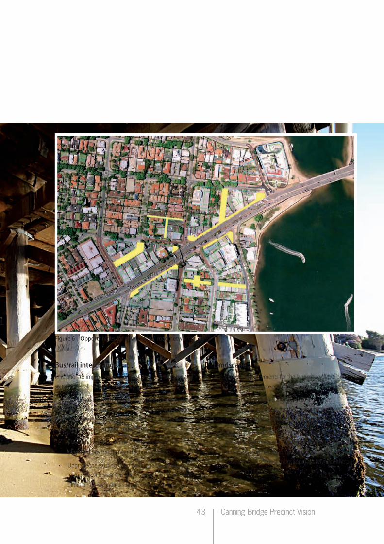
Canning Bridge Precinct Vision43
Bus/rail interchangeIn relation to improvements for the Canning Bridge bus/rail
station, the following actions are required.
• Designandconstructanewbusstationimmediately
west of the train station (short term) and bus bridge
over the freeway (long term) connecting to Canning
Highway as identified under ‘Roads’.
• Establishformalkiss’n’rideoneithersideofthe
proposed bus bridge near the bus/rail station.
• UpgradetheexistingCanningBridgerailstationto
include facilities such as toilets, more bike stores and
directional/wayfinding signage as a minimum.
Figure 6 – Opportunities for new internal road networks
LandscapeIn relation to improvements for the landscape of the precinct,
the following actions are required.
• Undertakeadetaileddesignstudyandurban
development concept for the northern foreshore
reserve between the freeway and river.
• Undertakethedevelopmentoftheforeshorereserve
between the freeway and river considering future
urban development and/or landscape development to
raise levels to connect more appropriately with the bus
station and bus bridge level.

Canning Bridge Precinct Vision
4. Implementation
44
• Undertakeimprovementstotheriverforeshore
generally, including placement of street furniture,
rubbish bins, public toilets etc.
• Considerrehabilitationprogramstoimprovethe
wetland environment of the river.
• Developlandscapedesignguidelinesforthewholeof
the precinct.
Service infrastructureIn relation to upgrades to service infrastrcuture of the
precinct, the following actions are required.
• Investigateoptionstoundergroundpowerthroughout
the precinct.
• Investigateimprovedcommunicationsinfrastructurefor
the precinct.
• Investigatecapacityofwaterandsewerinfrastructure
to determine required upgrades
Parking opportunitiesIn relation to opportunities for parking in the precinct, the
following actions are required.
• Undertakeadetailedparkingandaccessstrategy
to determine maximum and minimum parking
requirements for the precinct to sustain an acceptable
level of service without contributing undue congestion
into the road network.
• Utilisetheparkingandaccessstrategytodetermine
the appropriateness of development of Council or State
Government owned land for parking and to establish
on and off street parking policies.
• Preparebuiltformdesignguidelinesforprivate
development which encourages private developers to
provide public parking that may be managed by the
local government.
Built formThe following actions are required in relation to the built
form in the precinct.
• Developdetaileddesignguidelinesfortheprecinct
to ensure the highest quality and consistency of
development. Design guidelines may be developed
for specific areas separately (ie all areas identified as
commercial/mixed use and separate guidelines for
residential areas), or as a single document agreed to by
both CoM and CoSP.
• Incorporateguidelinesforbuiltform,streetscapeand
landscape in an ‘activity centre structure plan’ as per the
State Planning Policy 4.2.
• Developguidelinesincludingimplementationguides
for private landowners encouraging the establishment
ofmemorandumsofunderstanding(MOUs)that
will be acceptable to the CoM and CoSP, for future
development of combined land parcels.
• Improvetheamenityandthetransportconcerns
near the existing IGA supermarket and Kishorn
Road/Canning Beach Road intersection through
redevelopment of this super lot.
• Undertakeanassessmentofthelandredevelopment
opportunities that can be achieved based on the
current traffic infrastructure in the precinct. This should
occur in conjunction with the transport planning study.
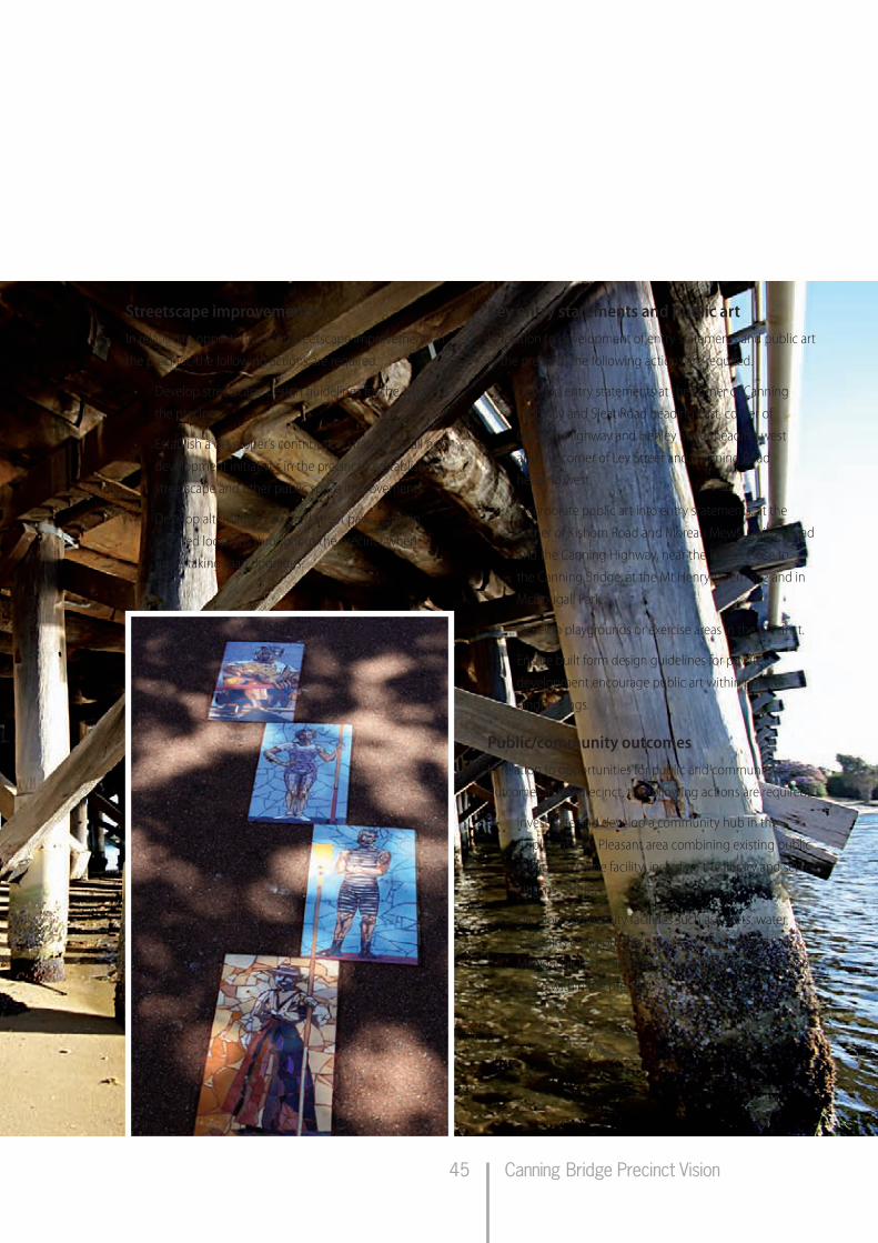
Canning Bridge Precinct Vision45
Streetscape improvementsIn relation to opportunities for streetscape improvements in
the precinct, the following actions are required.
• Developstreetscapedesignguidelinesforthewholeof
the precinct.
• Establishadeveloper’scontributionstrategyforallnew
development initiatives in the precinct to establish
streetscape and other public space improvements.
• Developalternative/colouredstreetpavementsin
selected locations throughout the precinct when
undertaking road upgrades.
Key entry statements and public artIn relation to development of entry statements and public art
in the precinct, the following actions are required.
• DevelopentrystatementsatthecornerofCanning
Highway and Sleat Road heading east, corner of
Canning Highway and Henley Street heading west
and the corner of Ley Street and Manning Road
heading west.
• Incorporatepublicartintoentrystatements,atthe
cornerofKishornRoadandMoreauMews,OgilvieRoad
and the Canning Highway, near the Raffles close to
the Canning Bridge, at the Mt Henry Tavern site and in
McDougall Park.
• Developplaygroundsorexerciseareasintheprecinct.
• Ensurebuiltformdesignguidelinesforprivate
development encourage public art within private
landholdings.
Public/community outcomesIn relation to opportunities for public and community
outcomes in the precinct, the following actions are required:
• Investigateanddevelopacommunityhubinthe
Applecross/Mt Pleasant area combining existing public
services into one facility, including the library and senior
citizens’ centre.
• Developcommunityfacilitiessuchastoilets,water
fountains etc in public spaces such as the foreshore,
McDougallPark,OlivesReserveandnewlycreatedopen
space within the precinct.

Canning Bridge Precinct Vision
4. Implementation
46
4.3 Statutory requirements
The implementation of this vision will require modifications
to both the CoM and CoSP town planning schemes. In the
short term these include:
• identifylandrequiredforinfrastructureimprovements
and reserve/protect it from future development;
• schemeamendmenttosupportlanduseand
development standards;
• introductionofincreasedresidentialdensitiesand
performance based zoning (relaxation of planning
requirements for proposed developments where
community benefits are provided) to achieve the
highest and best use of the land in the town planning
schemes;
• considerationofplotratiostoaccommodatethe
proposed building heights in non-performance based
areas;
• introductionofdevelopmentcontributionplansand
development contribution areas into both schemes as
per draft State Planning Policy 3.6; and
• theintroductionofincentivesfornewbuildingsto
meet sustainable building objectives (eg at a minimum,
a 4-Star Green Star Building and/or a minimum 4 Star
ratingusingtheNationalAustralianBuiltEnvironment
RatingSystem(NABERS).
4.4 Governance
The implementation of the precinct vision will require strong
governance and cooperation between both local Councils
and the State Government. The following actions and
concepts should be considered.
• Aseparatepartnershipbetweenthelocalgovernments
shouldbeinitiatedasaMOUoutliningtheir
commitment to the vision and to provide assurance to
developers of the future of the precinct.
• EstablishadedicatedsteeringgroupwithState
and local government representation to oversee
implementation of the vision (could be an existing
committee or group).
• Theestablishmentofajointdevelopmentassessment
unit(DAU)withinCoMandCoSPtoassessthe
performance of proposals in performance based zones.
• Thedevelopmentofaneconomicdevelopment
strategy for the precinct to inform town planning
scheme and local planning strategy amendments.
• Feasibilitystudiestoallowcommitmentstobemade
on major infrastructure issues and provide certainty to
potential private or public developers.
• SeekacommitmentfortheCanningHighway/Kwinana
Freeway interchange road, rail and pedestrian/cyclist
improvements between the WAPC, CoM, CoSP, PTA ,
DoT and MRWA.

Canning Bridge Precinct Vision47
4.5 Land assembly
The assembly of land and dealing with land tenure issues
that will arise during the implementation of this vision is
a critical factor that needs to be efficiently dealt with. The
following actions should be undertaken to assist in the
assembly of necessary land parcels and to deal with private
land tenure issues.
• Adevelopmentplanisrequiredfortheperformance
based zone areas in the precinct and the immediately
adjacent properties to facilitate the redevelopment of
the privately held land. Government demonstration
projects on State-owned land such as the land adjacent
to the Tivoli Theatre are recommended to catalyse
development and showcase what the objectives and
outcomes are to the residents.
• ThedialogueestablishedbyCoMandCoSPwith
the landowners in the area should be extended and
ongoing to support quality land development.
• TheredevelopmentofthelotsadjacenttotheCanning
Highway/Kwinana Freeway interchange, which are
constrained by and may be affected by any future
improvements to the interchange, could occur under
several scenarios:
– ‘improvement plan’ under Part 8 of the Planning
and Development Act;
– demonstration projects on land already in
Government ownership;
– public private partnerships involving a partnership
between land owners and Government.
• AnydevelopmentproposedovertheKwinanaFreeway
reservation and parks and recreation reserve will require
careful consideration in order to create an appropriate
land assembly framework. Consideration needs to
be given as to whether freehold lots are created or
leasehold arrangements are made.
• Separatetotheplanningprocess,thereistheneedto
review public owned and/or vested land (State and
local) within the study area in order to provide the
precinct with key infrastructure and services.
In residential transition areas development is unlikely
to occur in a sequential manner, but will occur as each
landowner decides. It may also be the case that development
consortiums will buy up land as it becomes available on
the market, in order to amalgamate small landholdings
to achieve a larger development. Staging of residential
development on privately owned land is expected to occur
gradually and progressively over a period of time.

Canning Bridge Precinct Vision
4. Implementation
48
4.6 Implementation action framework
The following table outlines the key actions, time frames and responsibilities to assist in the implementation of the Canning
Bridge precinct vision.
The timeframes in this document are indicative and are recommended from a planning viewpoint. Funding of any regional
infrastructure priorities will be a decision of the State Government.
The timeframes proposed are critical (immediate), short term (1-5 years), medium term (6-10 years) and long term (10+ years).
Table 1 – Implementation action framework
Action Time frame Responsibility
Governance (Critical, Short, Medium or Long Term)
(Lead agencies highlighted)
A separate partnership between the local governments should be initiated as a MOU outlining their commitment to the vision and to provide assurance to developers of the future of the precinct.
C CoM, CoSP
The establishment of a dedicated steering group with State and local government representation to oversee development and implementation of the vision.
C CoM, CoSP, DoP, DoT, MRWA, PTA
Initiate the preparation of an economic development strategy for the precinct to inform town planning scheme and local planning strategy amendments.
C CoM, CoSP, DoP
Establish a community/stakeholder engagement plan and community/stakeholder liaison groups to enable ongoing engagement with the community
C CoM, CoSP, DoP,
The establishment of development assessment units (DAU) within both COM and CoSP, or a combined DAU for both local governments to assess the performance of proposals in performance based zones.
ST CoM, CoSP
Seek a commitment for the Canning Highway/Kwinana Freeway interchange road, rail and pedestrian/cyclist improvements.
ST DoP, DoT, MRWA, PTA
Infrastructure improvements Roads:
A detailed traffic planning study is required to investigate the preferred concept for the redevelopment/improvement of the Canning Highway/Kwinana Freeway interchange including pedestrian and cyclist requirements. The study to include a full feasibility study to allow commitments to be made on major public infrastructure to provide certainty to potential private or public developers.
C MRWA, DoP, DoT, PTA, CoM, CoSP
Undertake parking and access strategy (having regard to staged development of the precinct). C CoM, CoSP, DoP, DoT, PTA
Improvements to the Canning Highway/Kwinana Freeway interchange as a result of the above transport study – develop new bus station interchange and upgrade existing rail station platform to encourage greater use and allow for increased capacity requirements.
C-ST MRWA, DoT, PTA, DoP, CoM, CoSP

Canning Bridge Precinct Vision49
Action Time frame ResponsibilityDevelop transitional access arrangements to the new bus station that can be integrated into the road network when the replacement southern Canning Bridge is developed.
ST MRWA, PTA, DoT, DoP, CoM, CoSP
Establish priority bus lanes along the Canning Highway heading both east and west. ST DoT, MRWA, PTA, DoP, CoM, CoSP
The provision of the proposed Manning Road to South-bound Freeway on-ramp. ST MRWA, PTA, DoT, DoP, CoSP
Improvements to local roads including an improved intersection at Kintail Road and Canning Beach Road and possible roundabouts on Kishorn Road and Davilak Street.
ST CoM, CoSP, MRWA
Develop new roads which support the road network in the COM as the result of private development.
ST-MT CoM, Private Developers
Construct a new Canning Bridge to the south of the existing bridges. Transition east bound traffic to the new bridge. Repair, upgrade or replace the existing southern Canning Bridge and transition west bound traffic to this bridge.
MT MRWA, DoP, CoM, CoSP
Repair and upgrade the existing northern Canning Bridge to accommodate bus and local traffic movements, maintain the heritage aspects of the bridge and facilitate development if agreed as an outcome of detailed urban design studies (cafés, kiosks etc). Transition bus traffic onto the bridge.
MT MRWA, PTA, DoP, CoM, CoSP
Left in left out intersection leading onto the Canning Highway from Cassey Street connecting into the bus bridge(greater consideration of this element in conjunction with local landowners is required).
LT MRWA, PTA, CoSP
Bus/rail interchange
Design and construct a proposed new bus station integrated with the rail station. ST DoT, PTA, MRWA, DoP, CoSP, CoM
Improve access to the Canning Bridge rail station as a priority – short term measures such as increased pedestrian phases at lights and new pedestrian overpasses etc.
C MRWA, CoM, CoSP, PTA, DoP,
Establish formal kiss’n’ride areas near the existing railway station and foreshore reserve. C-ST PTA, MRWA, DoP, CoM, CoSP
Upgrade the existing Canning Bridge rail station to include facilities such as toilets, more bike stores and directional/wayfinding signage as a minimum in the short term.
ST PTA, DoP
Develop an agreed strategy for wayfinding within the precinct (colours, palate of materials etc) and implement improvements.
ST CoM, CoSP, DoP, MRWA, PTA
Landscape
Undertake a detailed design study and urban development concept for the foreshore reserve between the freeway and river.
ST CoSP, DoP, DoT, MRWA, PTA, SRT, DIA
Develop landscape design guidelines for the whole of the precinct. C CoM, CoSP
Undertake the development of the foreshore reserve between the freeway and river considering future urban development and/or landscape development to raise levels to connect more appropriately with the bus station/bus bridge level.
ST for levels, M-LT for balance of development
CoSP, DoP, SRT, DEC

Canning Bridge Precinct Vision
4. Implementation
50
Action Time frame ResponsibilityUndertake improvements to the river foreshore generally including development of street furniture, rubbish bins and public toilets.
MT CoM, CoSP, DoP, SRT
Consider rehabilitation programs to improve the wetland environment of the river. MT SRT, CoM, CoSP, DoP, DEC, DIA
Service infrastructure
Investigate the feasibility of underground power throughout the precinct. ST CoM, CoSP, OOE
Investigate the feasibility of improved communications infrastructure for the precinct. ST CoM, CoSP
Investigate water and sewer capacity in the area to ensure upgrades can be planned to occur in line with staged development.
ST CoM, CoSP, WC
Parking
Undertake a parking and access strategy and community engagement to manage community expectations and user groups.
ST CoM, CoSP
Utilise the parking and access strategy to determine the appropriateness of development of Council or State Government owned land for parking and to establish on and off street parking policies.
ST CoM, CoSP, DoP
Ensure built form design guidelines for private development encourage private developers to provide public parking that may be managed by the local government.
ST CoM, CoSP
Built form
Develop design guidelines for the precinct to ensure high quality and consistent development including staging of development. Design guidelines may be developed for specific areas separately (ie all areas identified as commercial/mixed use and separate guidelines for residential areas), or as a single document agreed to by both CoM and CoSP.
C CoM, CoSP
Ensure adequate investigation of potential climate change impacts are considered in the development of detailed design guidelines.
C CoM, CoSP
Undertake a heritage plan for the precinct to protect, enhance or recognise heritage features unique to the area. Consider heritage elements in the development of detailed design guidelines.
C CoM, CoSP
Develop guidelines including implementation guides for private landowners to establish memorandums of understanding (MOU) that will be acceptable to the CoM and CoSP, for future development of combined land parcels.
ST CoM, CoSP, DoP
Improve the amenity and the transport concerns near the existing IGA supermarket and Kishorn Road/Canning Beach Road intersection (new development).
ST CoM
Undertake an assessment of the land redevelopment opportunities that can be achieved based on the current traffic infrastructure in the precinct. This should occur in conjunction with the transport planning study.
ST CoM, CoSP, DoP
Community outcomes
Investigate and develop a community hub in the Applecross/Mt Pleasant area combining existing public services into one facility, including the library and senior citizens’ centre.
ST CoM
Develop community facilities such as toilets, water fountains etc in public spaces such as the foreshore, McDougall Park, Olives Reserve and newly created open space within the precinct vision.
M-LT CoM, CoSP

Canning Bridge Precinct Vision51
CoM – City of Melville
CoSP – City of South Perth
DEC – Department of Environment & Conservation
DIA - Department of Indigenous Affairs
DoW – Department of Water
DoP – Department of Planning
Action Time frame ResponsibilityDevelop entry statements at the corner of Canning Highway and Sleat Road heading east, corner of Canning Highway and Henley Street heading west and the corner of Ley Street and Manning Road heading west.
S-MT CoM, CoSP
Develop playgrounds or exercise areas in the precinct. M-LT CoM, CoSP
Statutory requirementsDevelop an activity centre structure plan for the Canning Bridge commercial area in line with State Planning Policy 4.2: Activity Centres for Perth and Peel.
C CoM, CoSP, DoP
Identify land required for infrastructure improvements and reserve/protect it from future development.
C CoM, CoSP, DoP, DoT,
Scheme amendment to support proposed land use and development standards. ST CoM, CoSP
Introduction of increased densities and performance based zoning (relaxation of planning requirements for proposed developments where community benefits are provided) to achieve the highest and best use of the land in the town planning schemes.
ST CoM, CoSP
Consideration of plot ratios to accommodate the proposed building heights in non-performance based area.
ST CoM, CoSP
Introduction of development contribution plans and development contribution areas into both schemes as per draft State Planning Policy 3.6.
ST CoM, CoSP
The introduction of targets for key sustainability indicators within the precinct, including water usage and quality and the energy performance of buildings (targets should identify water reuse and energy efficiency percentages for buildings/land uses).
ST CoM, CoSP
Introduce incentives for new buildings to meet sustainable building objectives as identified in built form design guidelines (eg at a minimum, a 4-star Green Star building and/or a minimum 4-star rating using the Australian Building Greenhouse Rating (ABGR) scheme).
ST CoM, CoSP
Land assemblyEstablish a development plan for the performance based zone areas in the precinct and the immediately adjacent properties.
ST CoM, CoSP
Government demonstration projects to catalyse development and showcase objectives and outcomes.
S-LT CoM, CoSP
Extend the established dialogues with the landowners in the area to support quality land development.
ST CoM, CoSP
Review public owned and/or vested land (State and local) within the study area in order to provide the precinct with key infrastructure and services.
ST CoM, CoSP
Establish a working group to consider the appropriate land assembly framework for and potential development of land between the freeway and the river.
S-MT CoSP, DoP, MRWA, LandCorp
DoT - Department of Transport
OOE – Office of Energy
MRWA – Main Roads WA
PTA – Public Transport Authority
SRT – Swan River Trust
WC – Water Corporation