chapter 155: subdivision code
TRANSCRIPT
CHAPTER 155: SUBDIVISION CODE
General Provisions
155.001 Title 155.002 Purpose 155.003 Authority 155.004 Jurisdiction 155.005 Repeal of existing regulations 155.006 Interpretation and separability 155.007 Implementation and enforcement 155.008 Exceptions 155.009 Modifications 155.010 Definitions
Plat Procedure
155.025 General review procedure 155.026 Plat Review Committee 155.027 Pre-application plans and data 155.028 Preliminary plat 155.029 Final plat 155.030 Plats of vacation 155.031 General provisions
General Construction and Design Requirements
155.045 Lots 155.046 Blocks 155.047 Road dedication 155.048 Easements 155.049 Limitations and maintenance of easements 155.050 Watercourses 155.051 Sanitary sewers 155.052 Water
Road Construction and Design
155.070 General requirements for road construction 155.071 Standards for subdivision road construction 155.072 Classification of roads 155.073 Access 155.074 Road plans: development and approval 155.075 Roads: construction, maintenance, and acceptance by Commissioner 155.076 Underground utilities: installation and restoration of original grade, road surface, and sod 155.077 Alleys 155.078 Right-of-way 155.079 Street names and numbers
Plat Specifications
155.095 Preliminary plat specifications
Additional Requirements for Subdivisions to be Served by On-Site Waste Disposal Systems
155.110 General 155.111 Preliminary plan stage 155.112 Preliminary plat stage
Final Plat Specifications
155.130 General description 155.131 General final plat requirements 155.132 Final plat road requirements 155.133 Final plat lot requirements 155.134 Septic systems
Security Requirements
155.150 General 155.151 Amount of security 155.152 Release of security 155.999 Violations and penalties Appendix A: Minimum Road Design Standards Appendix B: Plat Certificates Editor’s note: Chapter 155 is taken from the Tazewell County Subdivision Code, current through September 1, 2018. The Subdivision Code was adopted July 1997, and amended on the following dates: June 24, 1998; September 26, 2001; April 30, 2003; June 29, 2005; February 22, 2006; March 29, 2006; July 26, 2006; March 26, 2008; February 25, 2009; and September 1, 2018. All amendments subsequent to September 1, 2018 will be noted immediately following each section.
GENERAL PROVISIONS § 155.001 TITLE. This chapter shall be known as and may be cited as "The Tazewell County Subdivision Ordinance." § 155.002 PURPOSE. In the subdivision and re-subdivision of land, a developer is required to comply with certain procedures outlined in state statutes. This chapter establishes additional procedures and requirements governing the platting of land in the county, and is adopted for the following purposes: (A) Establishing reasonable rules and regulations governing the location, width, and course of streets, highways, and
storm or floodwater runoff channels and basins; (B) Providing for necessary public grounds for schools, parks, or playgrounds in any map, plat, or subdivision; (C) Establishing reasonable requirements with respect to water supply and sewage collection and treatment; (D) Establishing reasonable requirements with respect to street drainage and surfacing; (E) Establishing reasonable requirements with respect to stormwater management and erosion control; (F) Guiding and facilitating the orderly beneficial development of the county and to implement the recommendations of
the comprehensive plan; (G) Establishing procedures for approving maps, plats, subdivisions, and re-subdivisions on any block, lot, or sublot, or
any part thereof, or any piece of parcel of land, not within any city, village, or incorporated town; and (H) Avoiding hazards to persons and damage to property resulting from flooding, as per Chapter 152. § 155.003 AUTHORITY. State statutes allow a county to provide for the public health, safety, and general welfare. This provision allows the county to establish reasonable standards of design for subdivisions, including requirements for roads and alleys, easements for public service facilities, surface drainage and stormwater control, sewer and water facilities, and public grounds such as parks and school sites.
§ 155.004 JURISDICTION. This chapter shall apply to any subdivision of land made within the borders of the county which does not fall within any city, village, or incorporated town, as provided by state statute. § 155.005 REPEAL OF EXISTING REGULATIONS.
The existing subdivision regulations of the county (known as Subdivision Regulations and Standards of Tazewell County, Illinois, adopted October 1967 and subsequently amended) are hereby repealed. The adoption of this chapter shall not affect or prevent any pending or future prosecution of, or action to abate, any existing violation of Tazewell County Subdivision Regulations and Standards, if the violation is also a violation of this chapter. § 155.006 INTERPRETATION AND SEPARABILITY. (A) When interpreting and applying the provisions of this chapter, they shall be held to be the minimum requirements
throughout unincorporated Tazewell County. (B) Where this chapter imposes greater restrictions or requirements than are imposed or required by other provisions of
the law or rules, regulations, covenants, or other agreements, the provisions of this chapter shall control. However, nothing herein shall interfere with or be construed to abrogate or annul any easements, covenants, deed restrictions or agreements between parties which impose restrictions greater than those imposed by this chapter.
(C) If any section, provision, or portion of this chapter is adjudged unconstitutional or invalid by a court of competent
jurisdiction, the remainder of this chapter shall not be affected thereby. § 155.007 IMPLEMENTATION AND ENFORCEMENT. (A) The County Board hereby establishes the Staff Plat Review Committee and grants that Committee the power and
authority to waive preliminary plat requirements and review and recommend approval or disapproval of plats for subdivision of land within the county.
(B) All laws of the state are made a part hereof, the same as if fully set forth herein, and all officers and employees of the
county, all township officials, and specifically those hereinafter referred to, are directed to compel compliance with such laws of the state.
(C) No plat of subdivision shall be approved which does not comply with all the provisions of this chapter. (D) The County Recorder of Deeds may not record any subdivision plat unless it has been approved by the Plat Officer,
the Land Use Committee, and any municipality which may be affected and has adopted an official city, village, or town plan.
(E) Whenever it shall come to the knowledge of the Recorder that any provisions of the state law governing plats have
been violated, it shall be his duty to notify the State's Attorney who may take appropriate action. (F) It shall be the duty of the Plat Officer or Community Development Administrator to enforce this chapter; to bring to
the attention of the County Board any violations or lack of compliance with this chapter; and to take appropriate action in the case of violations.
§ 155.008 EXCEPTIONS. (A) Specifically exempted from the provisions of this chapter are those instances enumerated in the Plat Act, 765 ILCS
205, wherein the provisions of the Act do not require platting of a subdivision. (B) This chapter shall not apply to plats of dedication prepared by or for the Illinois Department of Transportation, the
County Highway Department, and/or Township Highway Commissioner in connection with the improvement or vacation of any highway or road.
§ 155.009 MODIFICATIONS. Where the Land Use Committee finds that extraordinary hardships may result from strict compliance with this chapter, it may recommend to the County Board a modification of the regulations so that substantial justice may be done and the public interest secured, provided that such modification will not have the effect of nullifying the comprehensive land use plan or this chapter. A fee in the amount of $200 shall be paid for the processing of the application for each modification and shall be collected by the Plat Officer. § 155.010 DEFINITIONS. For the purpose of this chapter, the following definitions shall apply unless the context clearly indicates or requires a different meaning. ACCESS. The way over which traffic moves to and from the property abutting a street or alley and the way over which traffic moves to and from a major street to a minor street or from a street to an alley. ALLEY. A permanent service right-of-way which affords only a secondary means of access from such right-of-way to abutting property and is not intended for general traffic circulation. AREA, LOT. The total area within the lot lines. AUTHORIZED REPRESENTATIVE. The legally designated Administrator or Acting Administrator of the County Health Department and shall include those persons designated by the Administrator or Acting Administrator to enforce the provisions of this chapter. BASE FLOOD ELEVATION (BFE). The elevation in relation to mean sea level of the crest of the base flood. BLOCK. Property abutting on one side of a street and lying between the two nearest intersecting or intercepting streets or between the nearest intersection or intercepting street and railroad right-of-way, waterway, un-subdivided area, or other definite boundary. BOARD OF HEALTH. The Tazewell County Board of Health or it's authorized representative. BOND. A good and sufficient security meeting the requirements of §§ 155.150 through 155.152. CABLE TELEVISION (CATV) COMPANY. A person, firm, or corporation who has obtained a franchise from the appropriate unit of local government to provide television signals for public use via permanently installed coaxial cable. COMMUNITY DEVELOPMENT ADMINISTRATOR. The appointed head of the Tazewell County Community Development Department. COMPREHENSIVE PLAN. The complete plan or any of its parts for the development of the county as prepared by the Community Development Department or other planning agency and adopted by the County Board as the official plan. COUNTY. Tazewell County, Illinois. COUNTY BOARD. The elected, legislative body of Tazewell County, Illinois. COUNTY CLERK. The elected or appointed County Clerk of Tazewell County, Illinois. COUNTY HIGHWAY ENGINEER. The appointed head of the County Highway Department. EASEMENT. A right or privilege held by the public, a corporation, or person for the use of the land of another for specified purposes. ENVIRONMENTAL PROTECTION AGENCY (EPA). The Environmental Protection Agency for the State of Illinois. FINAL PLAT. The official graphic depiction of a subdivision which is ultimately filed for the record in the Recorder's Office. It shows all lots, easements, streets, and other dedicated areas. The final plat also indicates items such as building setback lines, restricted areas for septic systems and any ingress and egress restrictions.
FLOOD PROTECTION ELEVATION (FPE). The elevation of the base flood plus two feet of freeboard at any given location in the floodplain. GRADE. The ascending or descending inclination with the horizontal of a street, measured along the center line of the right-of-way, expressed by stating the vertical rise or fall as a percentage of the horizontal distance. HEALTH DEPARTMENT. The Tazewell County Health Department. HIGHWAY DEPARTMENT. The Tazewell County Highway Department. IDOT. The Illinois Department of Transportation. LAND DISTURBING ACTIVITY. Any change in land, which may result in soil erosion from water or wind and the movement of sediments into state or county waters or onto lands in the county, or a change in the amount and/or intensity of storm water run-off, including, but not limited to, the covering with an impervious surface, stockpiling, clearing, grading, excavating, rehabilitating, transporting, depositing, or filling of land. LAND SURVEYOR (LICENSED PROFESSIONAL). A surveyor who is licensed to practice professional surveying by the State of Illinois. LAND USE COMMITTEE. The Land Use Committee of the County Board, or any committee assigned its duties. LOT. A tract of land within a subdivision marked by a subdivider on the plat as a numbered, lettered, or other identified tract of land to be offered for sale, dedication, or development. LOT LINES. The lines bounding a lot. OWNER. An individual, firm, association, syndicate, partnership, corporation, company, organization, trust, or other legal entity having a proprietary interest in a use, structure, lot, or tract of land. PLAN COMMISSION. The Tri County Regional Planning Commission of Peoria, Tazewell, and Woodford Counties. PLAN DEVELOPMENT. A tract of land developed as a unit under single ownership or control which includes two or more main or principal structures. PLAT. A map, plan, or layout showing the subdivision of land into lots. PLAT ACT. An act to revise the law in relation to plats, approved March 21, 1874, as amended, 765 ILCS 205. PLAT OFFICER. The person designated by the County Board as administrator of this chapter. PLAT REVIEW COMMITTEE. An administrative unit established by this chapter for the purpose of performing technical review of proposed subdivisions. PLAT OF VACATION. Any recorded plat that is vacated by the owner of the premises before the sale of any lot therein. PROJECT. Any development involving modification to land which involves a land disturbing activity. PRELIMINARY PLAT. A graphic depiction of the proposed lot lines, streets, and other engineering improvements of a proposed subdivision superimposed on a map of the existing topography. PRIVATE WATER SYSTEM. Any supply which provides water for drinking, culinary, and sanitary purposes and serves an owner-occupied single-family dwelling. PROPERTY. The general term denoting either singularly or in combination, an area, lot, parcel, tract, plot, or otherwise designated portion of land. PUBLIC WATER SYSTEM. A system for the provision of the public of piped water for human consumption, if the system has at least 15 service connections or regularly serves an average of at least 25 individuals daily, at least 60 days per year. The term PUBLIC WATER SYSTEM includes any collection, treatment, storage, or distribution facilities under control of the operator of such system and used primarily in connection with such system, and any collection or pretreatment storage facilities not under such control which are used primarily in connection with such system.
REGISTERED PROFESSIONAL ENGINEER (LICENSED PROFESSIONAL ENGINEER). An engineer who is licensed to practice professional engineering by the State of Illinois, or who is allowed to practice by the State of Illinois under a reciprocity agreement with another state. RE-SUBDIVISION. The further division of lots or the relocation of lot lines of any lot or lots within a subdivision previously made and approved or recorded according to law. RIGHT-OF-WAY. The entire dedicated tract or strip of land which is to be used by the public for circulation or service. ROAD COMMISSIONER. The elected or appointed head of the local political township road district. SANITARY SEWER. A constructed conduit for the collection and carrying of liquid and solid sewage wastes, other than storm waters, to a sewage treatment plant. SEMI-PRIVATE SYSTEM. A water supply which is not a public water system, yet serves a segment of the public other than an owner-occupied single-family dwelling. SCHOOL. A building or group of buildings and all associated structures, facilities, and grounds in or on which instruction in subjects which are fundamental and essential in general education is offered under the supervision of the Regional Superintendent of Schools. SIDEWALK. That paved portion of the right-of-way designed and intended for the movement and use of pedestrian traffic. STATE. The State of Illinois. STORM SEWER. A constructed conduit for the collection and carrying of surface waters to a drainage course. STREET. A thoroughfare within the right-of-way which affords the principal means of access to abutting property. A STREET may be designated as an avenue, boulevard, drive, highway, lane, parkway, place, road thoroughfare, court, or other appropriate name. STREETS are identified according to type of use, as follows:
(1) Subdivision standard. A street which is located within the planning jurisdiction of an incorporated municipality with an adopted comprehensive plan, subject to their approval.
(2) Collector standard. A street which has the primary function of collecting traffic from a local area and moving
it to an arterial.
(3) Minor standard.
(a) Direct access. A street providing direct access to and/or from streets, alleys and abutting properties.
(b) Marginal access. A street parallel to a limited access street providing direct access to and/or from
streets, alleys, and abutting properties, and providing ways for traffic to reach access points along a limited access street.
STRUCTURE. Anything constructed or erected with a fixed location on the surface of the ground or underground, or affixed to something having a fixed location on the surface of the ground. SUBDIVIDER. An owner who presents a subdivision plat for approval hereunder. SUBDIVISION. Any division, development, or re-subdivision of any part lot, area or tract of land by the owner or agent, either by lots or by metes and bounds, into lots two or more in number for the purpose, whether immediate or future, of conveyance, transfer, improvement, or sale, with the appurtenant streets, alleys, and easements, dedicated or intended to be dedicated to public use or for the use of the purchasers or owners within the tract subdivided. The division of land for agricultural purposes not involving any new street, alley, or other means of access, shall not be deemed a SUBDIVISION for the purpose of the regulations and standards of this chapter. TCSWCD. The Tazewell County Soil and Water Conservation District. PLAT PROCEDURE
§ 155.025 GENERAL REVIEW PROCEDURE. The following procedure applies to subdivision plat review. All plats, unless specifically exempted, shall be subject to a three-step review procedure by the Plat Review Committee as established by this subchapter. The Plat Review Committee shall meet when necessary to consider sketches, plats, drawings and reports. The Community Development Department shall be responsible for coordinating the process, arranging meeting dates and times, and reporting to the Land Use Committee on the results of the Plat Review Committee meetings. § 155.026 PLAT REVIEW COMMITTEE. (A) The Plat Review Committee shall consist of the following county staff members:
(1) Community Development Department - Plat Officer;
(2) Health Department - Director of Environmental Health;
(3) Highway Department - County Highway Engineer;
(4) Township Road Commissioner;
(5) County Soil and Water Conservation District; and
(6) Land Use Planner. (B) If a Plat Review Committee member is unable to attend a scheduled Plat Review Committee meeting, they shall
submit, in writing, comments regarding the proposed plat. § 155.027 PRE-APPLICATION PLANS AND DATA. Prior to the filing of an application for conditional approval of the preliminary plat, the subdivider may submit to the Plat Officer, for consideration by members of the Plat Review Committee, the following: (A) General information, in the form of a location map and in writing, outlining existing covenants, zoning, land
characteristics, community facilities and utilities, streets, schools, parks, playgrounds, and commercial or industrial developments; and
(B) Sketch plan showing in simple sketch form the proposed layout of streets, lots, and other features in relation to
existing topographical conditions. § 155.028 PRELIMINARY PLAT. (A) Procedure for conditional approval of preliminary plat.
(1) The subdivider shall, after the above pre-application procedure, cause to be prepared a preliminary plat together with improvement plans and other supplementary material as specified in § 155.095.
(2) Eight copies of the preliminary plat, and all required supplementary material shall be submitted to the
County Community Development Department.
(3) At the time of application for preliminary approval, the subdivider shall pay a plat review fee in the amount of $25 for each lot in the proposed subdivision, with a minimum charge of $300 and a maximum charge of $1,000, such amount shall be paid into the general corporate fund of the county.
(4) If septic systems are to be used in the proposed subdivision, the subdivider must also meet the
requirements of the Health Department for on-site wastewater disposal systems as specified in §§ 155.110 through 155.112.
(5) Preliminary plats must be received at least nine working days prior to the Plat Review Committee meeting at
which they are to be considered.
(B) The Community Development Department shall distribute a copy of the preliminary plat, meeting agenda, and soils report (if one is required) to each member of the Plat Review Committee. The following individuals and organizations shall also be notified by the Community Development Department of the date of the meeting and the time at which the preliminary plat is to be considered:
(1) Owner or his designated representative;
(2) Owner’s engineer, planner, or surveyor;
(3) Fire Protection District;
(4) Adjacent property owners as a courtesy;
(5) Municipalities within one and one-half miles;
(6) School districts; and
(7) Land Use Committee Chairman.
(C) It shall be the developer's responsibility to contact the utility companies and the CATV company to obtain their
easement requirements and other appropriate utility information concerning the proposed subdivision. (D) The owner, or a designated representative, is required to be present when the Plat Review Committee evaluates the
preliminary plat. (E) After the preliminary plat has been reviewed at a scheduled Plat Review Committee meeting, minutes from that
meeting may be prepared by the Community Development Department. A copy of the minutes may be sent to the owner and/or representative, the Plat Review Committee members, and other parties requesting copies of these minutes.
(F) Approval of preliminary plat by Land Use Committee.
(1) It shall be the developer's responsibility to request the Community Development Department to submit the plat, as approved by the Plat Review Committee, to the Land Use Committee. However, if a plat has been conditionally approved by the Plat Review Committee all conditions of approval must be met and eight copies of the revised plat and drawings submitted to the Community Development Department before the preliminary plat shall be submitted to the Land Use Committee.
(2) Approval of the preliminary plat by the Land Use Committee is required prior to the submission of the final
plat.
(3) Approval of the preliminary plat by the Land Use Committee shall expire one year from the date of approval. When such approval has expired, the preliminary plat must again be reviewed and approved by the Plat Review Committee and the Land Use Committee before a final plat may be submitted.
§ 155.029 FINAL PLAT. Requirements for the submission of final plat. (A) Not later than one year after conditional approval of the preliminary plat, or such additional time as the Land Use
Committee may allow, the subdivider may submit to the Plat Officer an intended final plat of the subdivision, and three productions thereof, prepared in accordance with the requirements of §§ 155.130 through 155.134.
(B) The final plat shall conform to the preliminary plat as approved and it may constitute only that portion of the
approved preliminary plat which the subdivider proposes to record and develop at the time, provided, however, that such portion conforms to all requirements of this chapter.
(C) If conditional approval has not been obtained, a subdivider shall submit five copies of an intended plat and all
required supplementary material specified in §§ 155.130 through 155.134 to the Plat Officer for distribution.
(D) Within 15 working days after receipt of plats and supplementary material, the Plat Officer shall inform the subdivider that the plans and data as submitted or as modified do or do not meet the requirements of this chapter. When the plans and data do not meet such requirements, the Plat Officer shall state the reasons in writing and deliver a copy to the subdivider.
(E) Final approval of the final plat shall be granted by the Plat Officer on the basis of its conformity with a preliminary plat
as approved, and with all pertinent laws, rules, regulations, and particularly with the technical requirements of §§ 155.110 et seq., 155.130 et seq., and 155.150 et seq.
(F) In the event only a portion of an approved preliminary plat is presented for final approval, the Plat Officer may notify
the subdivider in writing whether or not the preliminary approval of the unrecorded portion has been renewed for one year. In the absence of such written notification, the subdivider may within one year after conditional approval of the preliminary plat, apply to the Land Use Committee for extension of the conditional approval of the preliminary plat without being required to pay additional fees.
(G) Approval of the final plat by the Plat Review Committee and completion of the requirements of Appendix B are
required prior to approval of the final plat by the Plat Officer. (H) Upon approval of the final plat by the Plat Officer, said plat shall be filed with the County Recorder and if not so filed
within 60 days, shall have no validity and shall not be recorded without re-certification by the Plat Officer. All plats after being recorded, shall become the property of the county.
(I) At the time of filing the final plat with the Plat Officer, the subdivider shall pay a fee of $150 plus $25 for each lot and
a maximum charge of $1,000. Such amount shall be paid to the corporate fund of the county. § 155.030 PLATS OF VACATION. Any plat of record that is to be vacated by the owner of the premises must comply with the procedures enumerated in the 765 ILCS 205. § 155.031 GENERAL PROVISIONS. (A) All federal, state, county, and other official bench marks, monuments, and triangulation stations in or adjacent to a
proposed subdivision shall be preserved. When a proposed improvement in a subdivision makes it necessary to move a bench mark, monument, or triangulation station, the authority having jurisdiction shall be notified and given sufficient time to take appropriate action.
(B) All dimensions, linear, curvilinear and angular, necessary to properly re-survey shall be shown, with linear
dimensions in feet and decimals of a foot. (C) Monumentation shall be in accordance with the procedures and requirements of the Plat Act. (D) The design of the subdivision shall be in harmony with and shall conform with the comprehensive plan and shall be
in accordance with good subdivision design principles not otherwise set forth herein. (E) Natural features, such as distinctive trees or vegetation, streams, ponds, hilltops, bluffs, creek bottoms, and outlook
views shall be preserved and enhanced wherever possible. In laying out a subdivision, due consideration shall be given to aesthetic features which exist within the tract being subdivided and which may add to the aesthetic quality of existing nearby subdivisions.
GENERAL CONSTRUCTION AND DESIGN REQUIREMENTS
§ 155.045 LOTS. (A) The lot arrangement shall be such that there will be no foreseeable difficulties in securing building permits to build
on all lots in compliance with Chapter 157 and Health Department regulations. (B) Lot dimensions, areas, and building setback lines shall conform to the requirements of Chapter 157. (C) The lot shape, size, and orientation shall be appropriate for the location of the subdivision and for the type of
development and use contemplated.
(D) All lots shall have 20 feet of frontage on a public road which is presently, or shall be upon completion of the subdivision, publically maintained, unless otherwise specified in Chapter 157. The road/street system of the subdivision shall access directly upon a dedicated road publicly maintained, or road/street which upon completion of the subdivision shall be publicly maintained.
(E) If any portion of a lot falls within the boundaries of critical soils as identified by the County Soil and Water
Conservation District for on-site wastewater disposal systems, that portion of such lot shall be designated as restricted for use of septic systems unless evidence can be produced that the soils can be managed by appropriate common engineering practices which would render the soils suitable. Soils removal and replacement are not considered a suitable management practice.
§ 155.046 BLOCKS. The length, width, and shape of blocks shall be determined with regard to: (A) Needs for convenient access and circulation of emergency vehicles and the general public with due regard to the
safety of vehicular and pedestrian traffic; (B) Limitations and capabilities of topography, soils, drainage and other natural features; (C) Provision of adequate building sites for the special type of use contemplated; and (D) Future access to adjacent properties and direct connection with the existing streets in adjoining subdivisions when
appropriate. § 155.047 ROAD DEDICATION. All roads created by a subdivision shall be shown on the plat as dedicated to public use. Rights-of-way shall be not less than 60 feet wide. A greater width may be required if deemed necessary by the Plat Review Committee, the Township Road Commissioner, or the County Highway Engineer. § 155.048 EASEMENTS. The following easements shall be required. (A) Utility easements. Easements of not less than seven feet shall be provided for utility services including, but not
limited to, sanitary sewer, storm water, water, gas, telephone, and electric. Location of easements shall be determined by the appropriate utility companies. The developer is encouraged to provide underground utilities where conditions permit.
(B) Cable television easements. An easement shall be provided for the installation of cable when requested by the
locally franchised CATV company. If the CATV company has negotiated an agreement for joint use of an easement with a utility company, the easement shall be designated as a joint-use easement on the final plat.
(C) Drainage easement. When a subdivision is traversed by a waterway, intermittent stream, or drainageway, there
shall be provided a stormwater easement or drainage easement conforming substantially with the lines of same. Such easement shall be of sufficient size to protect said waterway, intermittent stream, or drainage way, and to permit ingress and egress for maintenance.
(D) Stormwater retention and detention easements. All permanent drainage retention and detention features for
subdivisions shall be protected by drainage and/or maintenance easements. (E) Pedestrian way easements. Easements shall be provided for pedestrian ways where deemed appropriate by the
Plat Review Committee. § 155.049 LIMITATIONS AND MAINTENANCE OF EASEMENTS. (A) No construction of structures, dams, embankments, or channels (except as indicated on the engineering drawings),
and no planting of trees, shrubbery, or other flow-impeding vegetation, which hinders the flow of water or otherwise inhibits the intended purpose, shall be allowed within any drainage or stormwater retention or detention easements.
(B) Drainage easements must be separate and distinct from utility easements and the two shall not be combined.
(C) Drainage and stormwater retention and detention easements shall be adequately maintained so as to provide for removal and accumulation of vegetation, silt, debris or other material which may interfere with the flow characteristics of drainage ways or the essential features of retention or detention facilities.
(D) Pedestrian way easements shall be maintained to permit their continued use. (E) Provisions shall be made through a homeowner's association, deed restrictions, covenants, or other acceptable
means to provide for the maintenance all easements. § 155.050 WATERCOURSES. Prior to any alteration or relocation of watercourses, the subdivider shall secure any necessary permits or clearances from the State Department of Transportation, Division of Water Resources, the State Environmental Protection Agency, the U.S. Army Corps of Engineers, or other such agencies as may be required by law. The flood carrying capacity within the altered or relocated portion of any watercourse shall be maintained. § 155.051 SANITARY SEWERS. (A) In this section and §§ 155.052 and 155.070, the phrase "the subdivider shall provide" shall be interpreted to mean
that the subdivider shall install the facility referred to, or whenever a private sewage disposal system or an individual water supply is to be provided, that the subdivider shall require, as a condition of the sale of each lot in the subdivision, that the facilities referred to in these paragraphs shall be installed by the owner of the lot before occupation of the lot occurs.
(B) When a subdivision is reasonably accessible to a municipal sanitary sewer system, the subdivider shall provide the
subdivision with a complete sanitary sewer system to be connected to the municipal sanitary sewer system, if feasible. A subdivision is considered to be reasonably accessible if it is contiguous to the municipal limits such that it may be annexed to the municipality and/or it's property line is within 1,320 feet of a municipal sanitary sewer line, or the municipality is willing, at its expense, to extend a sanitary sewer line to within 1,320 feet of the subdivision property line.
(C) When no municipal sanitary sewer system is available or is not reasonably accessible to the subdivision, the
subdivider shall provide the subdivision with one of the following:
(1) A complete sanitary sewer system to convey the sewage to a treatment plant, to be provided by the subdivider in accordance with minimum requirements of the State Environmental Protection Agency and the County Health Department, with adequate provision for the maintenance of such plant; or
(2) Private sewage disposal systems on individual lots consisting of septic tanks and tile absorption fields or
other approved sewage disposal systems, where laid out in accordance with the provisions of the County Sanitary Health Ordinance and §§ 155.110 through 155.112.
(D) Upon completion of the sanitary sewer system installation a registered professional engineer shall certify that the
sanitary sewer system complies with all the standards required by the county and the State Environmental Protection Agency. Certified copies of the plans for such sanitary sewer system to be built shall be filed with Plat Officer, County Health Department, and the State Environmental Protection Agency.
(E) Storm sewers shall not be connected to sanitary sewers. § 155.052 WATER. (A) The subdivider shall provide the subdivision with a complete water main supply system which shall be connected to
a public water supply, or a community water supply approved by the State Environmental Protection Agency, with satisfactory provision for the maintenance thereof, except that when such community water supply is not available, the subdivider shall provide a private or semi-private water system on each lot of the subdivision in accordance with minimum standards as set forth in the Illinois Department of Public Health Water Well Construction Code.
(B) The plans for the installation of a water main supply system shall be prepared by the subdivider with the cooperation
of the applicable water utility company. Upon the completion of the water supply installation copies of the plans for such system as built shall be filed with the Plat Officer, the County Health Department, and the State Environmental Protection Agency.
ROAD CONSTRUCTION AND DESIGN § 155.070 GENERAL REQUIREMENTS FOR ROAD CONSTRUCTION. The developer shall grade, drain, surface, and otherwise improve the roadway of all streets shown on the plat so as to provide reasonable access for vehicular traffic to each lot of the subdivision in accordance with the requirements of this subchapter. § 155.071 STANDARDS FOR SUBDIVISION ROAD CONSTRUCTION. Subdivision road construction standards in the county shall conform to the most current edition of the Standard Specifications for Road and Bridge Construction adopted July 1, 1988, by the Illinois Department of Transportation (IDOT), as amended. § 155.072 CLASSIFICATION OF ROADS. The Plat Review Committee and Township Highway Commissioner shall classify each street shown on the plat of the subdivision as to its functional use as subdivision standard, collector standard, minor standard (direct access), or minor standard (marginal access). The minimum design requirements in this subchapter shall apply to subdivision roads in unincorporated Tazewell County. § 155.073 ACCESS. Access to an existing or proposed major street or a railroad right-of-way or rail crossing shall be limited to a minimum number of intersections and determined with due regard for sight distance, distance between intersections, approach grades, and requirements for future grade separations. § 155.074 ROAD PLANS: DEVELOPMENT AND APPROVAL. Before a preliminary plat may be approved by the Land Use Committee, the following procedure shall be completed: (A) Complete road plans, prepared by a professional engineer, shall be submitted. The road plans shall show sufficient
data to insure compliance with § 155.071. (B) A complete and detailed estimate of cost, prepared by a professional engineer, shall be submitted. The cost
estimate shall set forth all items of work to be performed and the estimated cost thereof. (C) The road plans and cost estimates shall be reviewed and approved by the Plat Review Committee, the Township
Highway Commissioner or the County Highway Commissioner. Plans which appear unworkable and estimates which appear inadequate will not be approved.
(D) After the road plans and cost estimates have been approved, and prior to submission to the Land Use Committee,
the owner shall obtain good and sufficient security to insure that the road construction will be completed and the roads will be maintained until accepted. The security furnished shall meet the requirements of §§ 155.150 through 155.152.
§ 155.075 ROADS: CONSTRUCTION, MAINTENANCE, AND ACCEPTANCE BY COMMISSIONER. (A) New road construction must comply with Chapter 151. (B) No road construction work shall be started until a final plat has been approved and recorded. (C) The subdivider shall be responsible for maintaining all roads in the subdivision until such roads have been accepted
by the appropriate highway authority. Maintenance, which shall include snow plowing, shall be adequate to insure ingress and egress to all lots which have been sold. Failure to ensure adequate ingress/egress shall be cause for withholding of building permits and the approval of additional units of the development.
(D) Subdivision roads will not be accepted by the Township Highway Commissioner until all construction detailed in the
plans has been completed. It is the responsibility of the subdivider to consult with the Township Highway Commissioner before the work has begun to afford the Township Highway Commissioner an opportunity to inspect the work as construction progresses.
(E) Prior to acceptance of streets in a subdivision, the shoulders and ditches must be smoothed by dragging and planted with a seed mixture appropriate to the time of year in accordance with the recommendations of the USDA - Soil Conservation Service.
(F) The subdivider shall furnish and erect all necessary signs, including street signs, as designated by the Township
Highway Commissioner. All signs shall be of a type approved by the Township Highway Commissioner. In addition, the subdivider shall consult with the Township Highway Commissioner during the preliminary plat stage to determine the appropriate size and placement of mail boxes in order to ensure for adequate road maintenance.
§ 155.076 UNDERGROUND UTILITIES: INSTALLATION AND RESTORATION OF ORIGINAL GRADE, ROAD SURFACE, AND SOD. (A) It is recommended that the developer keep all utility and CATV companies appraised of progress on the subdivision,
and coordinate construction activities with those of the utility and CATV companies. (B) If underground utility installation cannot be completed prior to final grading and seeding, it shall be the responsibility
of the developer to restore the ditches and turf following installation of underground utilities. (C) Utility companies shall not dig trenches across any roads after placement of the aggregate surface course unless
complete restoration meeting the approval of the Township Highway Commissioner is provided. § 155.077 ALLEYS. Alleys shall not be permitted in residential districts. § 155.078 RIGHT-OF-WAY. (A) Dead-end streets designed to be so permanently shall not be longer than 600 feet, unless limitation of site by reason
of topography or existing development makes development impractical except with a longer length. Such streets shall be provided with a circular turn-around having an outside surface diameter of at least 80 feet and right-of-way line diameter of at least 100 feet.
(B) All streets shall be public and must have a right-of-way width of at least 60 feet unless specified by the Township
Highway Commissioner. Any appeals to this requirement shall be made to the Land Use Committee for consideration.
(C) Reserved strips controlling access to street right-of-way shall not be permitted except upon approval of the Land
Use Committee and when control and disposition of the reserved strip is vested in the County Board. § 155.079 STREET NAMES AND NUMBERS. The continuation of an existing street shall have the same name. The name of a new street shall not duplicate the name of an existing street within the area served by the same post office or fire department.
PLAT SPECIFICATIONS § 155.095 PRELIMINARY PLAT SPECIFICATIONS. General requirements. The preliminary plat and all accompanying technical data shall be signed, sealed, and dated by the professional engineer or land surveyor who supplies it. A preliminary plat of the subdivision shall be accurately drawn to a scale of 100 feet to one inch, and show all proposals including, but not necessarily limited to, the following. (A) The plat shall contain the following information:
(1) Name of subdivision;
(2) Legal description;
(3) Township;
(4) Zoning classification;
(5) Total acreage;
(6) North arrow;
(7) Owner name and address;
(8) Certificate of registered professional engineer or surveyor;
(9) Scale of drawing;
(10) Benchmarks;
(11) Date of survey;
(12) Numbered lots; and
(13) Typical lot size. (B) The name of the subdivision shall not be a duplicate of any other in the county except in the case of additions. (C) All existing property lines, section and quarter section lines, and existing buildings. (D) Existing streets on and adjacent to the tract: by name, right-of-way width, location, type, width, and elevation of
surfacing, curbs, gutters, culverts, and sidewalks. (E) Existing utilities on and adjacent to the tract. Location, size, and invert elevation of sanitary sewers, storm sewers,
and where existing location and size of watermain, location of gas lines, fire hydrants, electric and telephone poles and street lights; and if any of the above are not available at site, indicate direction and distance to the nearest ones and furnish statement of availability.
(F) The names of all subdivisions within 300 feet shall be included, and property not subdivided shall be so marked. (G) The type of zoning shall be indicated for surrounding property within 300 feet. (H) Existing grade elevations and all changes proposed thereto. On tracts based on USGS datum (United States
Geological Survey), showing existing and proposed contours at vertical intervals as follows:
(1) Slope of 3% or less - one foot interval contour map;
(2) Slope of over 3% but less than 6% - two-foot interval contour map; and
(3) Slope of over 6% - five-foot interval contour map. (I) A list of all political and service districts such as fire protection, grade and high school, post office, park, library, and
the like shall be shown. (J) All special use areas which will be dedicated, such as parks, ponds, preserves, and school lots shall be shown. (K) All watercourses with their high and low water boundaries, all flood hazard areas and man-made drainage systems
such as ditches and tiles, showing locations and outlets shall be shown. (L) If the proposed subdivision lies within one and one-half miles of any municipality, the preliminary plat must be
approved by the Planning Commission of any municipality which will later be required to sign the final plat prior to the Plat Officer. A certificate shall be placed on the plat to indicate such approval (see Appendix B).
(M) Show locations of all existing wells and septic systems within 100 feet of the boundary and the proposed locations of
all wells, septic systems, and replacement systems when on-site systems are to be used. (N) Show all easements, location, width, and purpose. (O) Show 100-year flood base elevations limit lines.
(P) Draft of protective covenants, if applicable, whereby the subdivider proposes to regulate land use in the subdivision and otherwise protect the proposed development.
(Q) Show lot lines, number, and block numbers. (R) Show location of minimum setback lines. (S) Utilities. Location, type, and approximate size. This information may be shown on a separate exhibit. (T) Site data. Including number of residential lots, typical lot size, and acres in other public and non-public land uses. (U) Copy of the soil analysis as conducted by a soil scientist. This analysis shall also be provided to the Health
Department prior to submittal of the preliminary plat to the Community Development Department. (V) Four sets of complete road plans, prepared by a professional engineer with complete detailed estimate of cost,
prepared by a professional engineer. The cost estimate shall set forth all of items of work to be performed and cost estimates thereof.
(W) Show approximate location of dwellings to be constructed on each lot. (X) Show locations of all vertical closed loop wells.
ADDITIONAL REQUIREMENTS FOR SUBDIVISIONS TO BE SERVED
BY ON-SITE WASTE DISPOSAL SYSTEMS § 155.110 GENERAL. (A) There are some instances where the use of individual septic systems will be required to serve development
depicted on the land use map. However, the Board of Health or its authorized representative may refuse to grant a permit for the construction of a private sewage disposal system where public or municipal sewage systems are available and considered reasonably accessible. A sewer shall be deemed to be reasonably accessible when a public sewer line is in place within any street, alley, right-of-way, or easement that adjoins or abuts the premises for which the permit is requested, or when the improvement to be served is located within a reasonable distance of a public sewer to which connection is practical and is permitted by the controlling authority for the sewer. A reasonable distance for the purpose of this provision shall be deemed to not greater than 300 feet for a single-family residence and not greater than 1,320 feet for a commercial establishment, subdivision, or multi-family dwelling. The need to annex the commercial establishment, subdivision, or multi-family dwelling to the municipality in order to connect to the municipal sanitary sewer system does not make the municipal sanitary sewer system inaccessible within the meaning of this section.
(B) When it is proposed to utilize on-site disposal systems it is extremely important to determine which soils and their
characteristics are present on the proposed site. The purpose of this is to specify the requirements that must be met by the owner/developer at the concept and preliminary plan stages of the subdivision review process.
§ 155.111 PRELIMINARY PLAN STAGE. (A) The owner/developer must submit a land use opinion report, obtained from the County Soil and Water Conservation
District, showing the location of the property in question, types of soils found on the property and corresponding soil interpretive reports for water features, physical properties of soils and sanitary facilities.
(B) The owner/developer will submit information received from County Soil and Water Conservation District to the
Health Department for determination of type of septic systems and minimum size of lots. The size of each lot shall include an area for a replacement system similar to the proposed septic system.
§ 155.112 PRELIMINARY PLAT STAGE. When designing a subsurface seepage system the absorption capacity of the soil for each lot shall be determined by one of the methods described below. Lot boundaries must be located prior to on site soil investigations or percolation tests. (A) Soil investigations shall be conducted in the following manner:
(1) Determination of soil characteristics on sites proposed for development with private sewage disposal systems shall be based on soil boring data collected by a soil classifier or a state licensed professional engineer.
(2) There shall be a minimum of three borings per soil absorption system site. The soil borings shall be at least
50 feet apart, and the proposed subsurface seepage system shall be located within the area where the soil borings were located. More soil borings may be necessary for accurate and appropriate evaluation of a site where there is some concern about the consistency of the soil materials. One of the borings shall be made at the lowest elevation of the proposed absorption field area. Borings shall extend a minimum of 60 inches below the natural ground surface. An observation pit shall be used in gravelly materials.
(3) Observation and determination of soil characteristics may be also determined from a pit dug by a backhoe
or other excavating equipment. The Health Department may require soil bits (backhoe excavation) in cases where ground is frozen, where the soil materials are considerably varied in texture, where there has been previous or current fill material, cutting of soils, or where gravelly soils are encountered. Such soil pits shall be prepared at the perimeter of the expected soil absorption area to minimize damage to natural soil structure. Soil pits shall extend a minimum of 60 inches below the natural ground surface.
(4) Site characteristics to be described include zones of seasonal and permanent water saturation, USDA soil
textural changes, USDA soil structural features, slope, compaction and depth, soil coloration, depth of limiting layer, depth of soil mottling (depth of low chroma equal to or less than two and a value of four or more-Munsell Color system), internal drainage classification, and permeability range, and other limiting soil characteristics that may reduce permeability.
(B) Only those persons who meet the qualification as specified in the State Department of Public Health, Private
Sewage Licensing Act and Code can perform soil investigations. (C) Septic systems evaluation forms provided by the county must be completed and provided to the Health Department.
The Health Department will review and make final determination on type of septic systems and lot sizes.
FINAL PLAT SPECIFICATIONS § 155.130 GENERAL DESCRIPTION. (A) A final plat is the document which is ultimately filed for the record in the County Recorder's Office. It shows all lots,
easements, streets, and other dedicated areas. The final plat also indicates items such as building setback lines, restrictions for septic systems, and any ingress and egress restrictions.
(B) During construction of a subdivision, the information on the final plat will be supplemented by the engineering plans.
After construction has been completed, however, the only document which will be retained indefinitely is the final plat. Therefore, a final plat must indicate any information which may be needed in the future concerning a particular subdivision.
(C) Where unusual terrain or the existence of a lake, river, or railroad makes strict conformance with the requirements of
this chapter impractical, the Plat Review Committee may recommend minor deviations from those requirements. § 155.131 GENERAL FINAL PLAT REQUIREMENTS. A final plat shall be prepared in accordance with the following general requirements. (A) The final plat may include all or only a part of the area of the preliminary plat as proposed in the application. (B) The final plat shall be drawn in accordance with the approved preliminary plat. (C) The final plat shall be drawn in ink or linen tracing cloth or suitable mylar drafting film. A photo reproduction on mylar
is acceptable. (D) The plat shall be labeled as final plat, and show the name of the subdivision with the township name underneath. (E) The zoning classification of the property being subdivided shall be indicated on the plat.
(F) The plat shall be drawn to a scale of 100 feet to one inch. However, a larger scale may be used if desired for a proper exhibit of the subdivision. The maximum sheet size shall be 24 inches by 36 inches, but more than one sheet may be used if necessary. All hand lettering shall be legible and at least 1/10 inches high.
(G) The plat shall include a correct survey of the property being subdivided, including a legal description. (H) A north arrow, the scale, date, and all section and quarter-section lines shall be indicated on the plat. (I) The lines and dimensions of all adjoining properties, and the names, lines, and dimensions of all adjoining roads,
streets, and alleys shall be shown. (J) All dimensions, linear, curvilinear and angular, necessary to properly re-survey, shall be shown, with linear
dimensions in feet and decimals of a foot. (K) Subdivision monument requirements. Each new subdivision shall be provided with monuments located and
described on the final plat in the manner required by the Plat Act. (L) A certificate, to be signed by the surveyor, shall be placed on the final plat to indicate that all monuments required by
the Plat Act have been set and properly described on the final plat. (M) All required certificates shall be placed on the plat.
(1) Certificate indicating approval by municipality having jurisdiction;
(2) Owners certificate and notary certificate;
(3) Township Highway Commissioner's certificate;
(4) County Highway Engineer or State Department of Transportation certificate;
(5) Surveyor's certificate;
(6) Local Health Department certificate;
(7) County Clerk’s certificate;
(8) County Plat Officer's certificate;
(9) Flood hazard certificate; and
(10) Erosion, sediment, and storm water control statement. (N) The easement requirements of each utility and CATV company shall be determined, and all required utility and
CATV easements indicated on the plat. Other required easements such as drainage, stormwater detention and retention, road construction and maintenance, and pedestrian way easements (if needed) shall also be shown on the plat. Each easement shall be adequately dimensioned and its purpose clearly indicated.
(O) A list of all districts, such as post office, grade school, high school, fire protection, and the like, shall be placed on the
plat. (P) All non-road dedicated areas shall be indicated on the plat. The purpose of each such area, any restrictions on its
use, and conveyance of ownership to a property owners' association shall also be indicated on the plat. It is conventional to indicate each such area as hereby dedicated.
(Q) If a declaration of covenants and restrictions is prepared for the subdivision, it shall be filed in the Recorder's Office.
A reference to the declaration, including document number, shall be placed on the plat. In addition to other provisions, the declaration should specify:
(1) The obligation of the association to maintain the common properties;
(2) The mandatory membership of all property owners;
(3) The obligation of all owners to pay assessments;
(4) The right of the association to enforce any restrictions; and
(5) Automatic renewal of the covenants after a fixed period. (R) Subdivisions encompassing a flood hazard area shall show on the final plat the following: boundary of the flood
hazard area; boundary of the floodway, if shown on available flood hazard maps; the FPE for each building site. Where the base flood elevation is not available from an existing study filed with the State Water Survey, the applicant shall be responsible for calculating the FPE and submitting it to the State Water Survey for review and approval as best available elevation data.
(S) The final plat shall be signed and dated by the land surveyor who prepared it, and shall bear his official seal. No
additions or corrections shall be made on the final plat by anyone other than the surveyor or someone under his immediate supervision.
(T) Show approximate location of dwellings to be constructed on each lot. (U) Show locations of all existing wells and septic systems within 100 feet of the boundary, and the proposed locations
of all wells, septic systems and replacement systems when on-site systems are to be used. (V) Show locations of all vertical closed loop wells. (W) Where a lot has frontage on both an interior road and an existing main road, access shall be restricted to the interior
road. A note indicating such restriction shall be placed on the plat. (X) A street address in conformance with the numbering system adopted by the county shall be determined for each lot
and indicated on the plat. (Y) Four sets of completed erosion, sediment, and stormwater control plans in accordance with Chapter 151. In addition
to a complete detailed estimate cost prepared by a professional engineer for all control measures required. § 155.132 FINAL PLAT ROAD REQUIREMENTS. The final plat road arrangements shall be consistent with the approved preliminary plat. All requirements of Article Six must be met, except that a typical road cross-section is not required. § 155.133 FINAL PLAT LOT REQUIREMENTS. The final plat shall be consistent with the approved preliminary plat with regard to number of lots, configuration, setback lines, and the like. In addition, the following additional requirements shall be met: (A) A street address in conformance with the numbering system adopted by the county shall be determined for each lot
and indicated on the plat; and (B) Where a lot has frontage on both an interior road and an existing main road, access shall be restricted to the interior
road. A note indicating such restriction shall be placed on the plat. § 155.134 SEPTIC SYSTEMS. When septic systems are to be used in a subdivision, it is important that each lot has a suitable location for a septic system. See §§ 155.110 through 155.112 for the requirements which must be met prior to final plat approval.
SECURITY REQUIREMENTS § 155.150 GENERAL. Prior to approval of the final plat in order to insure that the work will be completed, all engineering improvements and erosion control methods which are proposed in conjunction with a new subdivision, the subdivider shall deliver to the Plat Officer a surety bond with corporate surety or other adequate security for 100% of the approved estimated cost of improvements.
§ 155.151 AMOUNT OF SECURITY. (A) The subdivider shall deliver to the Plat Officer a good and sufficient bond or other adequate security equal to 100%
of the amount estimated by the subdivider's registered professional engineer to be the present cost of roads and other required improvements to insure completion of the work. The bond or other adequate security shall be conditioned upon faithful adherence to the rules and regulations as contained within this chapter.
(B) Security shall be accompanied by an agreement executed by the subdivider, and approved in writing by the County
Highway Engineer, wherein the subdivider agrees to make and install the improvements in accordance with the final plat and specifying a completion date in accordance within this chapter.
§ 155.152 RELEASE OF SECURITY. (A) No portion of the road construction, maintenance, storm water and erosion control security will be released as the
work progresses. The entire amount posted/deposited shall be retained until all work covered by the security is satisfactorily completed and approved by the County Highway Engineer.
(B) Prior to the release of any bond or other adequate security for subdivision improvements, a letter of acceptance
from the Township Highway Commissioner and/or the County Highway Engineer shall be submitted to the Plat Officer. Additionally, a letter from the registered professional engineer in charge of construction of such improvements shall be required to certify that all improvements have been completed in accordance with the approved engineering plans and specifications on file in the County Community Development Department. Such certification shall cover all engineering aspects of the development, including, but not limited to, erosion control methods, roads, detention/retention, grading, filling, and any topographic changes or adjustments proposed.
(C) The subdivider shall have two years to complete all subdivision improvements after submittal of the good and
sufficient bond or other adequate security or the county shall have the right to the good and sufficient bond or other adequate security for completion of the subdivision improvements.
§ 155.999 VIOLATIONS AND PENALTIES. (A) No owner or agent of the owner of any land located in a proposed subdivision shall transfer, sell, lease, or offer for
sale or lease any such land before a final plat of such subdivision has been approved in accordance with the provisions of this chapter and recorded. Whoever shall sell or lease or offer for sale or lease, any lot or block in any subdivision before complying with all of the requirements of these regulations, shall be guilty of a "petty offense" and shall be subject to a fine of $25 a day for each lot so disposed of or offered until such final plat is recorded.
(B) The subdivision of any lot or any parcel of land by the use of metes and bounds descriptions for the purpose of sale,
transfer, or lease, with the intent of evading these regulations, shall not be permitted. All such described subdivisions shall be subject to all of the requirements in this chapter.

APPENDIX A: MINIMUM ROAD DESIGN STANDARDS
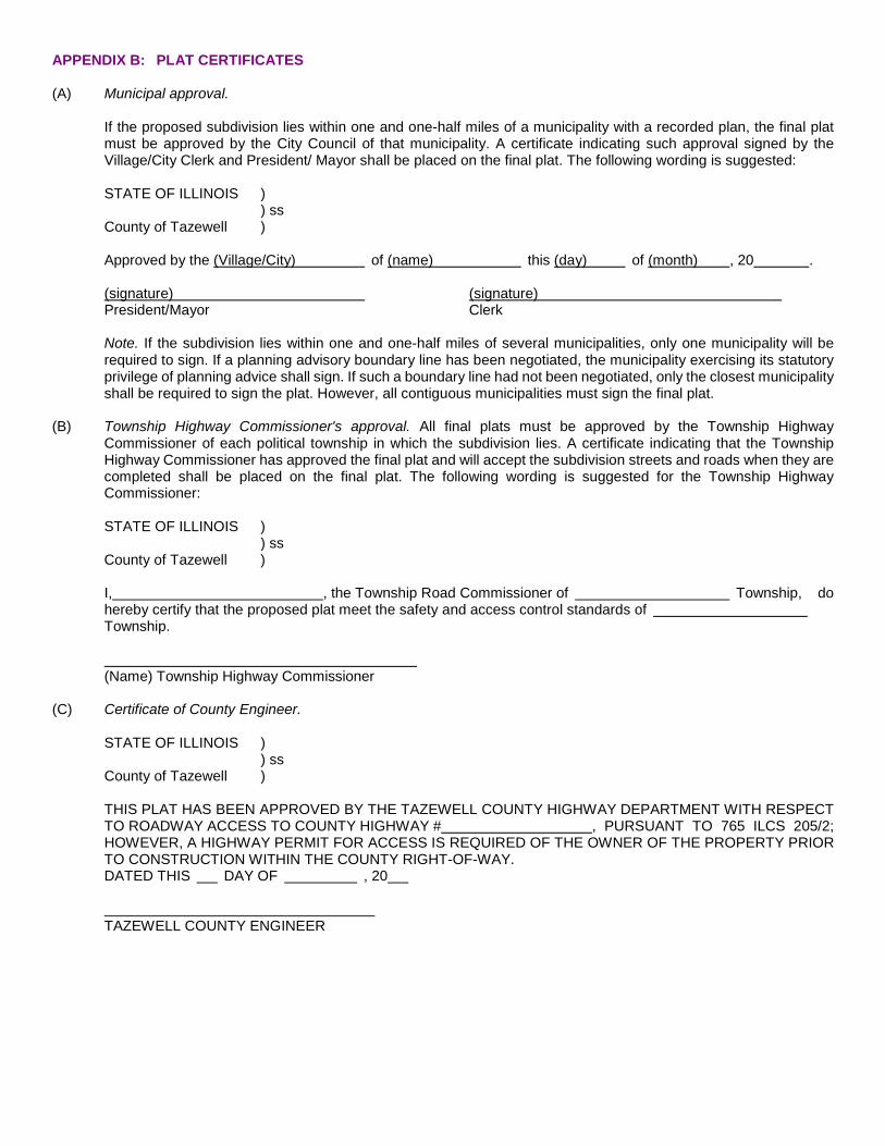
APPENDIX B: PLAT CERTIFICATES (A) Municipal approval.
If the proposed subdivision lies within one and one-half miles of a municipality with a recorded plan, the final plat must be approved by the City Council of that municipality. A certificate indicating such approval signed by the Village/City Clerk and President/ Mayor shall be placed on the final plat. The following wording is suggested:
STATE OF ILLINOIS )
) ss County of Tazewell )
Approved by the (Village/City) of (name) this (day) of (month) , 20 .
(signature) (signature) President/Mayor Clerk
Note. If the subdivision lies within one and one-half miles of several municipalities, only one municipality will be required to sign. If a planning advisory boundary line has been negotiated, the municipality exercising its statutory privilege of planning advice shall sign. If such a boundary line had not been negotiated, only the closest municipality shall be required to sign the plat. However, all contiguous municipalities must sign the final plat.
(B) Township Highway Commissioner's approval. All final plats must be approved by the Township Highway
Commissioner of each political township in which the subdivision lies. A certificate indicating that the Township Highway Commissioner has approved the final plat and will accept the subdivision streets and roads when they are completed shall be placed on the final plat. The following wording is suggested for the Township Highway Commissioner:
STATE OF ILLINOIS )
) ss County of Tazewell ) I, , the Township Road Commissioner of Township, do hereby certify that the proposed plat meet the safety and access control standards of Township. (Name) Township Highway Commissioner
(C) Certificate of County Engineer.
STATE OF ILLINOIS )
) ss County of Tazewell ) THIS PLAT HAS BEEN APPROVED BY THE TAZEWELL COUNTY HIGHWAY DEPARTMENT WITH RESPECT TO ROADWAY ACCESS TO COUNTY HIGHWAY # , PURSUANT TO 765 ILCS 205/2; HOWEVER, A HIGHWAY PERMIT FOR ACCESS IS REQUIRED OF THE OWNER OF THE PROPERTY PRIOR TO CONSTRUCTION WITHIN THE COUNTY RIGHT-OF-WAY. DATED THIS DAY OF , 20 TAZEWELL COUNTY ENGINEER
(D) Certificate of Illinois Department of Transportation.
STATE OF ILLINOIS ) ) ss
County of Tazewell ) THIS PLAT HAS BEEN APPROVED BY THE ILLINOIS DEPARTMENT OF TRANSPORTATION WITH RESPECT TO ROADWAY ACCESS PURSUANT TO 765 ILCS, ARTICLE 205, PARAGRAPH 2. HOWEVER, A PERMIT FOR ACCESS IS REQUIRED BY THE OWNER OF THE PROPERTY. A PLAN THAT MEETS REQUIREMENTS CONTAINED IN THE DEPARTMENTS "POLICY ON PERMITS FOR ACCESS DRIVEWAYS TO STATE HIGHWAYS" WILL BE REQUIRED BY THE DEPARTMENT. DATED THIS DAY OF , 20 DEPUTY DIRECTOR OF HIGHWAYS, REGION THREE ENGINEER
(E) Owner's certificate and notary certificate. A certificate shall be placed on the final plat indicating the ownership of the
land being subdivided. A notary certificate shall be placed beneath the owner's certificate in witness of the owner's signature. The following general wording of these two certificates is suggested:
OWNER'S CERTIFICATE STATE OF ILLINOIS )
) ss County of Tazewell ) This is to certify that the undersigned, (List Names) is (are) the legal owner(s) of record of the land described on the plat hereon drawn and shown hereon as subdivided, and that he (they) has (have) caused said land to be surveyed, subdivided, staked, and platted as shown hereon, for the purpose of having this plat recorded as provided by law. In witness whereof I (we) have hereunto set my (our) hand(s) and Seal(s) this day of , 20 (Seal) (Seal) NOTARY CERTIFICATE STATE OF ILLINOIS )
) ss County of Tazewell ) I , a Notary Public in and for said County and State aforesaid, do hereby certify that (List Names) , personally known to me to be said person(s) whose name(s) is (are) subscribed to the accompanying plat and certification, each appeared before me this day in person and acknowledged that he (she) signed and sealed the said plat and certification as his (her) free and voluntary act for the uses and purposes therein set forth. Given under my hand and seal this day of , 20 NOTARY PUBLIC
(F) Surveyor's certificate. The surveyor who prepared the final plat shall place thereon a certificate of substantially the following wording:
This is to certify that I, , an Illinois Land Surveyor, No. , have surveyed and subdivided the property as described and as shown by the annexed plat, which is a correct representation of said survey and subdivision. All distances are shown in feet and decimals thereof. Given under my hand and seal at , Illinois this day of , A.D., 20 Illinois Land Surveyor
G) Local Health Department certificate. If any part of the platted land will not be served by a public sewer system the
County Health Department is required to also sign the final plat. The following wording is suggested:
No public sewer system exists to serve this subdivision. This Plat is approved with respect to onsite sewage disposal and the acreage involved has been reviewed in accordance with established soil suitability evaluation procedures.
Public Health Administrator
(H) County Clerk's certificate. The County Clerk shall make a tax search of the land being subdivided. A certificate is
required on all final plats indicating that any back taxes have been paid. The following wording is suggested: STATE OF ILLINOIS )
) ss County of Tazewell ) I, , clerk of the aforesaid County, do hereby certify that I have this day examined the tax records of the property shown on the attached plat and find no delinquent general taxes, unpaid current general taxes, nor delinquent special assessments against the tract of land shown on said plat. Given under my hand and the seal of the said County this day of , 20 . County Clerk
(I) Plat Officer. A certificate shall be placed on the final plat to be signed by the County Plat Officer indicating all
requirements of the County Subdivision Regulations have been met. The following wording is suggested: STATE OF ILLINOIS )
) ss County of Tazewell ) I, , Tazewell County Plat Officer, do hereby certify that the above plat meets all requirements of the Tazewell County Land Subdivision Regulations and is hereby approved. This day of , 20 . Tazewell County Plat Officer
(J) Erosion statement. A statement, similar to the one below, shall be placed on the final plat recognizing the county's
most current Erosion, Sediment, and Storm Water Control Ordinance.
Any new construction of the land shown hereon will be required to adhere to the County Erosion Control Restrictions that are in affect at the time of said construction.
(K) Flood hazard certificate. The surveyor shall determine if any part of the proposed subdivision lies within a flood hazard area as identified by the Federal Emergency Management Agency. An appropriate certificate shall be placed on the plat and signed by the surveyor. The following wording is suggested, depending on which situation exists.
I certify that none of the above described property is located in a flood hazard area as identified by the Federal Emergency Management Agency.
Illinois Land Surveyor
OR
I certify that none of the above described property is located in a flood hazard area as identified by the Federal Emergency Management Agency except as indicated on (Community & Panel No.)
Illinois Land Surveyor