chapter 9 spatial reasoning and uncertainty. spatial reasoning uncertainty qualitative quantitative...
Post on 19-Dec-2015
230 views
TRANSCRIPT

Chapter 9
Spatial reasoning and uncertainty
© Worboys and Duckham (2004) GIS: A Computing Perspective, Second Edition, CRC Press
Spatial reasoning
Uncertainty
Qualitative
Quantitative
Applications
Summary
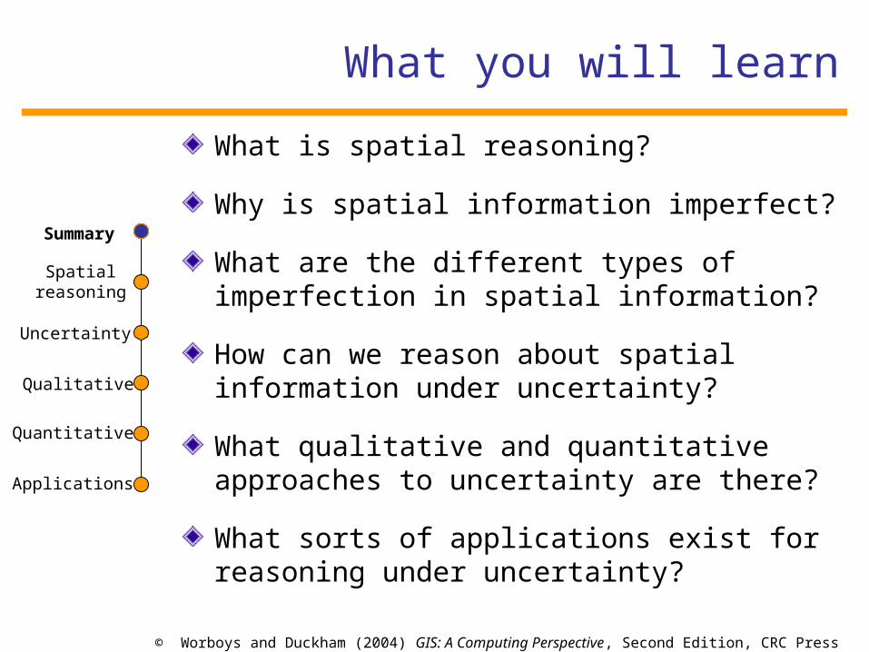
What you will learn
What is spatial reasoning?
Why is spatial information imperfect?
What are the different types of imperfection in spatial information?
How can we reason about spatial information under uncertainty?
What qualitative and quantitative approaches to uncertainty are there?
What sorts of applications exist for reasoning under uncertainty?
Summary

Section 9.1
Formal aspects of spatial reasoning
© Worboys and Duckham (2004) GIS: A Computing Perspective, Second Edition, CRC Press
Spatial reasoning
Uncertainty
Qualitative
Quantitative
Applications
Summary
Spatial reasoning
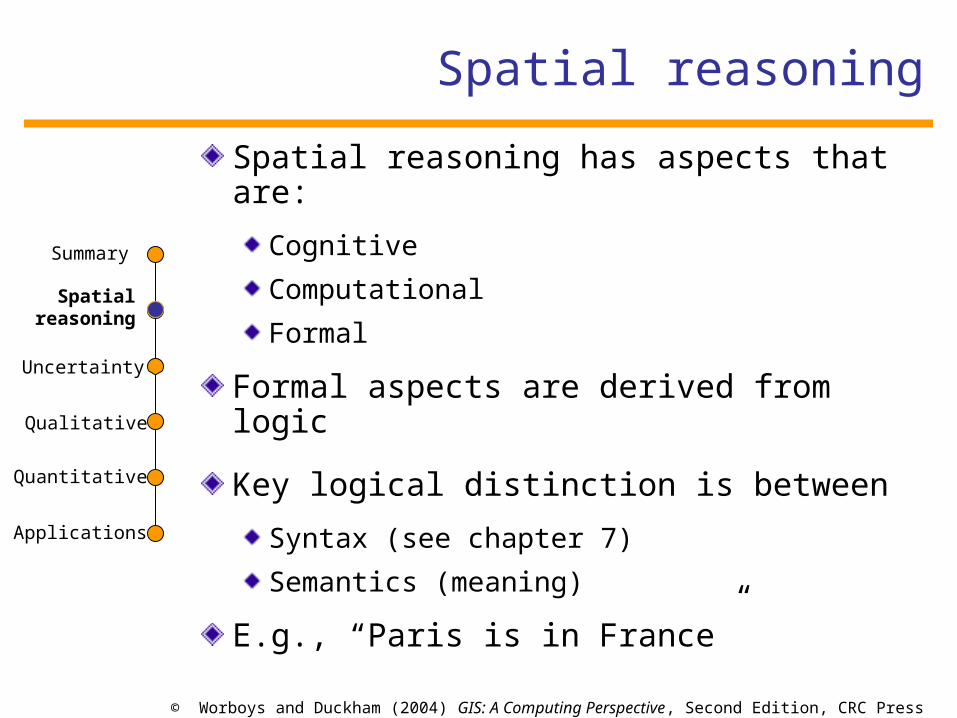
Spatial reasoning has aspects that are:
Cognitive
Computational
Formal
Formal aspects are derived from logic
Key logical distinction is between
Syntax (see chapter 7)
Semantics (meaning)
E.g., “Paris is in France”
Spatialreasoning

© Worboys and Duckham (2004) GIS: A Computing Perspective, Second Edition, CRC Press
Spatial reasoning
Uncertainty
Qualitative
Quantitative
Applications
Summary
Logic and deduction
Premises
Facts: “Paris is the capital of France”
Rules: “All oak trees are broadleaved”
Conclusions: deductive inferences
Soundness: All deductive inferences are true
Completeness: All true propositions may be deduced
Spatialreasoning
Paris is a city in France
All cities in France are European cities
Paris is a European city
x is a y
All y’s are z’s
x is a z

© Worboys and Duckham (2004) GIS: A Computing Perspective, Second Edition, CRC Press
Spatial reasoning
Uncertainty
Qualitative
Quantitative
Applications
Summary
If it is snowing then John is skiing
It is snowing
John is skiing
All men are mortal
Socrates is a man
Socrates is mortal
Every day in the past the universe existed
The universe existed last Friday
Every day in the past the universe existed
The universe will exist next Friday
Inferences
Spatialreasoning

© Worboys and Duckham (2004) GIS: A Computing Perspective, Second Edition, CRC Press
Spatial reasoning
Uncertainty
Qualitative
Quantitative
Applications
Summary
Spatial reasoning example
Suppose a knowledge base (KB) contains the following facts:
1. Aland, Bland, Cland, and Dland are countries.
2. Eye, Jay, Cay, and Ell are cities.
3. Exe and Wye are rivers.
4. City Eye belongs to Aland.
5. City Jay belongs to Bland.
6. City Cay belongs to Cland.
7. City Ell belongs to Dland.
8. Cities Eye, Ell, and Cay lie on the river Exe.
9. City Jay lies on the river Wye.
and rule:
10. Each river passes through all countries to which the cities that lie on it belong.
Spatialreasoning

© Worboys and Duckham (2004) GIS: A Computing Perspective, Second Edition, CRC Press
Spatial reasoning
Uncertainty
Qualitative
Quantitative
Applications
Summary
Spatial reasoning example
Aland
B landCland
Dland
Eye
Ell
Cay
J ay
River Exe
River Wye
Assume that this representation is accurate.
There are truths expressed by the map but not deducible from the KB. e.g. ALand and BLand share a common boundary.
But, restrict attention to facts about countries, cities, rivers, cities in countries, cities on rivers, rivers through countries.
The KB is sound (all the statements in the KB are true in the map). The KB is not complete: e.g.”River Exe passes through countries Aland, Bland, Dland, Cland”, is true but not deducible in the KB.
Spatialreasoning

© Worboys and Duckham (2004) GIS: A Computing Perspective, Second Edition, CRC Press
Spatial reasoning
Uncertainty
Qualitative
Quantitative
Applications
Summary
Spatial reasoning example
However, if we add a further city Em, and facts to the KB:
13. Em is a city.
14. Em belongs to the country Bland.
15. The river Exe passes through city Em.
Aland
B landCland
Dland
Eye
Ell
Cay
J ay
River Exe
River WyeEm
Then the revised KB is sound and complete with respect to map, because we can now deduce: River Exe passes through the country Bland.
Spatialreasoning

Section 9.2
Information and uncertainty

© Worboys and Duckham (2004) GIS: A Computing Perspective, Second Edition, CRC Press
Spatial reasoning
Uncertainty
Qualitative
Quantitative
Applications
Summary
Information “flow”
Information source produces a message consisting of an arrangement of symbols.
Transmitter operates on message to produce a suitable signal to transmit.
Channel the medium used to transmit the signal from transmitter to receiver.
Receiver reconstructs the message from the signal.
Destination for whom the message is intended.
Uncertainty

© Worboys and Duckham (2004) GIS: A Computing Perspective, Second Edition, CRC Press
Spatial reasoning
Uncertainty
Qualitative
Quantitative
Applications
Summary
Uncertainty
Uncertainty
May refer to state of mind: “I am unsure where the meeting will take place”
May be applied directly to data or information about the world: “The depth of the sea at a particular location is uncertain”
Uncertainty is an unavoidable property of the world, information about the world, and our cognition of the world
Uncertainty

© Worboys and Duckham (2004) GIS: A Computing Perspective, Second Edition, CRC Press
Spatial reasoning
Uncertainty
Qualitative
Quantitative
Applications
Summary
Spatial uncertainty example
Consider the capture of data about the boundary of a lake
Uncertain specifications: The lake’s boundary may not be completely specified, e.g.,
• temporal variation in water’s edge• lack of clarity in definition of lake (vagueness)
Uncertain measurements: The location of the lake’s boundary may be difficult to capture, e.g.,
• Incorrect instrument calibration (inaccuracy)• Mistakes in using the instruments• Lack of detail in measurement (imprecision)
Uncertain transformations: Transformation of the data may introduce further uncertainty, e.g.,
• Measured points may be interpolated between to produce complete boundary
Uncertainty

© Worboys and Duckham (2004) GIS: A Computing Perspective, Second Edition, CRC Press
Spatial reasoning
Uncertainty
Qualitative
Quantitative
Applications
Summary
Typology of imperfection
imperfection
error imprecision
vagueness
lack of correlation with reality
lack of specificity
“The Eiffel Tower is in
Lyons”
“The Eiffel Tower is in
France”
existence of borderline cases
“The Eiffel Tower is near the Arc de
Triomphe”
Uncertainty

© Worboys and Duckham (2004) GIS: A Computing Perspective, Second Edition, CRC Press
Spatial reasoning
Uncertainty
Qualitative
Quantitative
Applications
Summary
Granularity and indiscernibility
Granularity concerns the existence of “clumps” or “grains” in data, where individual element cannot be discerned apart
Indiscernibility is often assumed to be an equivalence relation (reflexive, symmetric, and transitive)Uncertainty

© Worboys and Duckham (2004) GIS: A Computing Perspective, Second Edition, CRC Press
Spatial reasoning
Uncertainty
Qualitative
Quantitative
Applications
Summary
Vagueness
Vagueness concerns the existence of boundary cases
Vague predicates and objects admit borderline cases for which it is not clear whether the predicate is true of false, e.g., “Mount Everest”
Some locations are definitely part of Mount Everest (e.g., the summit)
Some locations are definitely not part of Mount Everest (e.g., Paris)
But for some locations it is indeterminate whether or not they are part of Mount Everest
Vagueness is a pervasive feature of representations of the real world.
Vagueness is not easy to handle using classical reasoning approaches.
Uncertainty

© Worboys and Duckham (2004) GIS: A Computing Perspective, Second Edition, CRC Press
Spatial reasoning
Uncertainty
Qualitative
Quantitative
Applications
Summary
Reasoning with vagueness
Uncertainty
Portland is definitely in “southern Maine”
Presque Isle is definitely not in “southern Maine”
Because “southern Maine” has no precise boundary, a person’s single step cannot take you over the boundary
Therefore, a hiker walking from Portland to Presque Isle would (eventually) conclude that Presque Isle is in “southern Maine”
The sorites paradox

© Worboys and Duckham (2004) GIS: A Computing Perspective, Second Edition, CRC Press
Spatial reasoning
Uncertainty
Qualitative
Quantitative
Applications
Summary
Dimensions of data quality
Data quality refers to the characteristics of a data set that may influence the decision based on that data set
Uncertainty
Element Concise definitionaccuracy Closeness of the match between data and the things to which data
refersbias Existence of systematic distortions within data
completeness Exhaustiveness of data, in terms of the types of features that are represented in data
consistency Level of logical contradictions within datacurrency How “up-to-date” data is
format Structure and syntax used to encode datagranularity Existence of clumps or grains within data
lineage Provenance of data, including source, age, and intended use
precision Level of detail or specificity of datareliability Trustworthiness of degree of confidence a user may have in data
timeliness How relevant data is to the current needs of a user

© Worboys and Duckham (2004) GIS: A Computing Perspective, Second Edition, CRC Press
Spatial reasoning
Uncertainty
Qualitative
Quantitative
Applications
Summary
Consistency
Consistency is violated when information is self- contradictory
Bangor, Maine has a population of 31, 000 inhabitants.Only cites with more than 50,000 inhabitants are large.Bangor is a large city.
Inconsistency can arise with:
Inaccuracy
Imprecision
vagueness
Action prompted by inconsistency:
Resolve inconsistency
Retain inconsistency
Initiate dialog
Uncertainty

© Worboys and Duckham (2004) GIS: A Computing Perspective, Second Edition, CRC Press
Spatial reasoning
Uncertainty
Qualitative
Quantitative
Applications
Summary
Relevance
Relevance: the connection of a data set to a particular application
Relevance helps to assess fitness for use of a data set for a particular application
Study of habitat change in a national park
Tourist map to help inform and educate visitors
Role of metadata
Uncertainty

Section 9.3
Qualitative approaches to uncertainty
© Worboys and Duckham (2004) GIS: A Computing Perspective, Second Edition, CRC Press
Spatial reasoning
Uncertainty
Qualitative
Quantitative
Applications
Summary
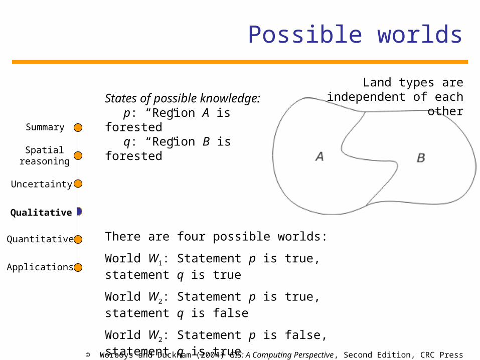
Possible worlds
Qualitative
States of possible knowledge:p: “Region A is forested”q: “Region B is forested”
There are four possible worlds:
World W1: Statement p is true, statement q is true
World W2: Statement p is true, statement q is false
World W2: Statement p is false, statement q is true
World W2: Statement p is false, statement q is false
Land types are independent of each other

© Worboys and Duckham (2004) GIS: A Computing Perspective, Second Edition, CRC Press
Spatial reasoning
Uncertainty
Qualitative
Quantitative
Applications
Summary
Possible worlds
Qualitative
States of possible knowledge:p: “Region A is forested”q: “Region B is forested”r: “ Region C is forested”
If region A is forested then region C, must also be forested
(converse need not be true)
There are six possible worlds:
World W1: p is true, q is true, r is true
World W2: p is true, q is false, r is true
World W3: p is false, q is true, r is true
World W4: p is false, q is false, r is true
World W5: p is false, q is true, r is false
World W6: p is false, q is false, r is false

© Worboys and Duckham (2004) GIS: A Computing Perspective, Second Edition, CRC Press
Spatial reasoning
Uncertainty
Qualitative
Quantitative
Applications
Summary
Belief and knowledge
Using modal operators, belief and knowledge can be related by formulas:
p: “Region A is forested”
Then:
Kp is the statement “I know that region A is forested”
Bp is the statement “I believe that region A is forested”
Qualitative
“If I don’t know that p is not the case, then I can believe p.”
: K : p ! Bp
“If I know p, then p must be true.”
“If I don’t know p, then p cannot be true.”
Kp ! p
: Kp ! : p

© Worboys and Duckham (2004) GIS: A Computing Perspective, Second Edition, CRC Press
Spatial reasoning
Uncertainty
Qualitative
Quantitative
Applications
Summary
Belief revision
Belief revision: If new information arises that contradicts our current beliefs, we may want to review, revise or retract our old beliefs so as to make way for the new information
Beliefs are often founded on other beliefs,
the effects of removing one belief may cascade through the knowledge base, in a way that is difficult to predict
Qualitative

© Worboys and Duckham (2004) GIS: A Computing Perspective, Second Edition, CRC Press
Spatial reasoning
Uncertainty
Qualitative
Quantitative
Applications
Summary
Example
The bird caught in the trap is a swan.The bird caught in the trap comes from Sweden.Sweden is part of Europe.All European swans are white.
We receive new information:
“The bird caught in the trap is black.”
Which beliefs do we retract in order to regain consistency?
Preference relation
Principle of minimal change
Nearness principle
Qualitative

© Worboys and Duckham (2004) GIS: A Computing Perspective, Second Edition, CRC Press
Spatial reasoning
Uncertainty
Qualitative
Quantitative
Applications
Summary
Default Reasoning
The fourth statement is difficult or impossible to verify
Maybe we want to say:
All European swans are white (except if we have definite evidence to the contrary in the case of a particular swan)
Default reasoning allows the possibility that some counterexamples may exist
The bird caught in the trap is a swan.The bird caught in the trap comes from Sweden.Sweden is part of Europe.All European swans are white.
Qualitative
© Worboys and Duckham (2004) GIS: A Computing Perspective, Second Edition, CRC Press
Spatial reasoning
Uncertainty
Qualitative
Quantitative
Applications
Summary
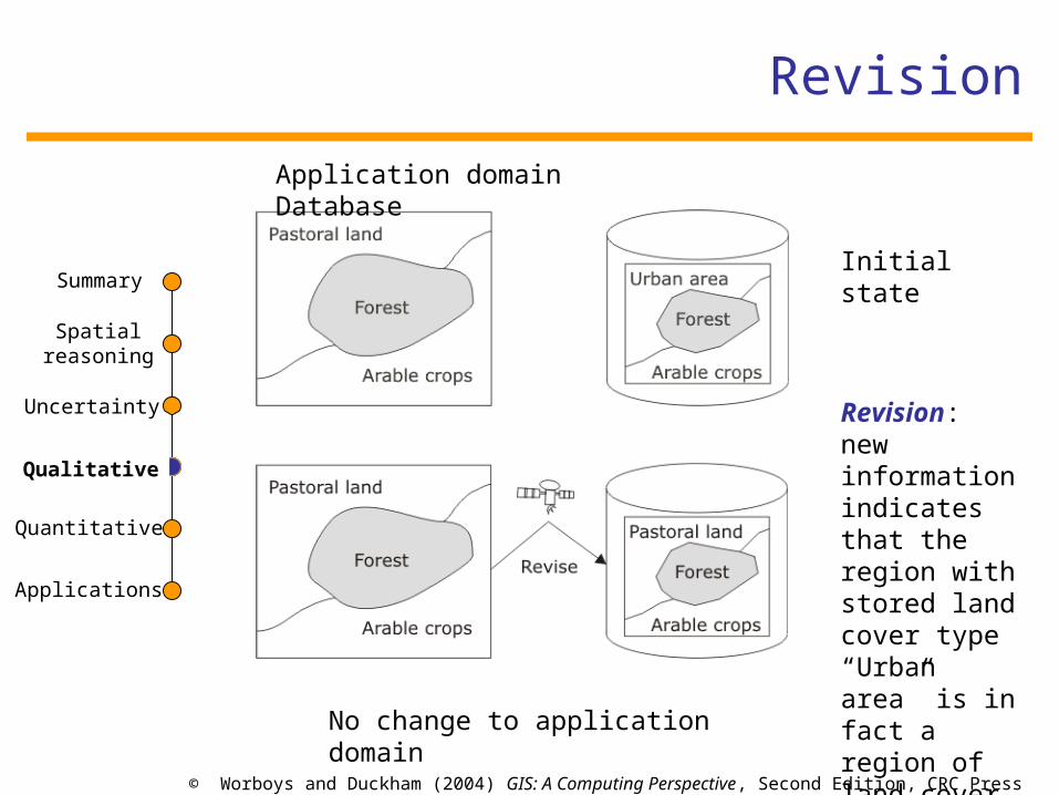
Revision
Qualitative
Application domain Database
Initial state
Revision: new information indicates that the region with stored land cover type “Urban area” is in fact a region of land cover type “Pastoral land”No change to application domain

© Worboys and Duckham (2004) GIS: A Computing Perspective, Second Edition, CRC Press
Spatial reasoning
Uncertainty
Qualitative
Quantitative
Applications
Summary
Update
Qualitative
Application domain Database
Initial state
Update: part of the forested region has now become agricultural land
Change to application domain

© Worboys and Duckham (2004) GIS: A Computing Perspective, Second Edition, CRC Press
Spatial reasoning
Uncertainty
Qualitative
Quantitative
Applications
Summary
Three-valued logic
Three truth values
> (True)
(False)
? (Undetermined)
Depending on the interpretation of “?”, we can arrive at different truth tables
Kleene logic
Uncertainty is interpreted as a limitation on reasoning or computing resources
Qualitative

© Worboys and Duckham (2004) GIS: A Computing Perspective, Second Edition, CRC Press
Spatial reasoning
Uncertainty
Qualitative
Quantitative
Applications
Summary
Three-valued logic
Both regions A and B are forested ?Either region A or B, or both, are forested >If region A is forested, then region B is forested >
Truth values of these statements can be determined from the following truth tables:
Qualitative

© Worboys and Duckham (2004) GIS: A Computing Perspective, Second Edition, CRC Press
Spatial reasoning
Uncertainty
Qualitative
Quantitative
Applications
Summary
Fuzzy set theory
A membership function that grades the level of belief in whether an element belongs to the set or not
usually uses real numbers between 0 and 1
Qualitative

© Worboys and Duckham (2004) GIS: A Computing Perspective, Second Edition, CRC Press
Spatial reasoning
Uncertainty
Qualitative
Quantitative
Applications
Summary
Fuzzy sets
Let X be a universe of discourse
Fuzzy membership function:
A function from X to the real interval [0,1],
: X ! [0,1]
Fuzzy set A in X is a set of ordered pairs(u, A(u)) for all x 2 X, where A is a fuzzy membership function
Qualitative

© Worboys and Duckham (2004) GIS: A Computing Perspective, Second Edition, CRC Press
Spatial reasoning
Uncertainty
Qualitative
Quantitative
Applications
Summary
Properties and operations
Fuzzy set A is empty if A (x) = 0 for all x 2 X
Fuzzy set A is contained in B if A(x) · B(x), for all x 2 X
Fuzzy sets A and B are equal if A(x) = B(x), for all x 2 X
The compliment of fuzzy set A is the set A' with membership function A' such that A'(x) = 1- A(x), for all x 2 X
The union of fuzzy sets A and B is the set A [ B with membership function max(A(u), B(u)), for all x 2 X
The intersection of fuzzy sets A and B is the set A Å B with membership function min(A(u), B(u)), for all x 2 X
The support of fuzzy set A is the crisp set containing all elements with non-zero membership of A, support(A) = {x j A(x) > 0}
For 0 · · 1, the –cut of fuzzy set A is the crisp set given by A = {x j A(x) > }
Qualitative

© Worboys and Duckham (2004) GIS: A Computing Perspective, Second Edition, CRC Press
Spatial reasoning
Uncertainty
Qualitative
Quantitative
Applications
Summary
Fuzzy regions
Fuzzy region: a fuzzy set whose support is a region
More structure than the fuzzy sets
Assuming regions are based on a square cell grid, then the cells have many topological and geometrical properties and relations, such as:
• Adjacency
• Area
• Distance
• Bearing
Qualitative

© Worboys and Duckham (2004) GIS: A Computing Perspective, Second Edition, CRC Press
Spatial reasoning
Uncertainty
Qualitative
Quantitative
Applications
Summary
Example
Let R be a fuzzy region based on a square cell grid with fuzzy membership function R
Then the fuzzy area of R, a(R) may be defined as the sum of the R(x), for all x 2 X
In this example the fuzzy area of the region is 14.1
Qualitative

© Worboys and Duckham (2004) GIS: A Computing Perspective, Second Edition, CRC Press
Spatial reasoning
Uncertainty
Qualitative
Quantitative
Applications
Summary
Rough Set theory
Represent subsets of X at the level of granularity imposed by the indiscernibility relation
Let set A be a subset of X
A is the upper approximation to set A
A is the lower approximation to set A
The pair is called the rough set
is always a subset of in X/
Qualitative

© Worboys and Duckham (2004) GIS: A Computing Perspective, Second Edition, CRC Press
Spatial reasoning
Uncertainty
Qualitative
Quantitative
Applications
Summary
Example
Subset A of X, points indicate the elements of X
Blocks of the partition induced by
Construction of A and A
A -darker grey A\A -lighter grey
A - darker grey
A - set of all blocks
Qualitative

Section 9.4
Quantitative approaches to uncertainty

© Worboys and Duckham (2004) GIS: A Computing Perspective, Second Edition, CRC Press
Spatial reasoning
Uncertainty
Qualitative
Quantitative
Applications
Summary
Probability
Random experiments
If X denotes the set of possible outcomes, we can specify a chance function
ch : X ! [0,1]
ch(x) gives the proportion of times that a particular outcome x 2 X might occur
• Frequency analysis
• The nature of the experiment
ch should satisfy the constraint that the sum of chances of all possible outcomes is 1
For a subset S µ X, ch(S) is the chance of an outcome from set S
Quantitative

© Worboys and Duckham (2004) GIS: A Computing Perspective, Second Edition, CRC Press
Spatial reasoning
Uncertainty
Qualitative
Quantitative
Applications
Summary
Rules
ch(;) = 0
ch(X) = 1
If A Å B = ;, then ch(A [ B) = ch(A) = ch(B)
Also, given n independent trials of a random experiment, the chance of the compound outcome chn (x1,…,xn) is given by:
chn(x1, …, xn) = ch(x1)*…*ch(xn)Quantitative

© Worboys and Duckham (2004) GIS: A Computing Perspective, Second Edition, CRC Press
Spatial reasoning
Uncertainty
Qualitative
Quantitative
Applications
Summary
Conditional Probability
Suppose a random experiment has been partly completed
Set V µ X
If U µ X is the outcome set under consideration, the chance of U given V is written:
ch(UjV)
Then:Quantitative

© Worboys and Duckham (2004) GIS: A Computing Perspective, Second Edition, CRC Press
Spatial reasoning
Uncertainty
Qualitative
Quantitative
Applications
Summary
Bayesian probability
A degree of belief with respect to a set X of possibilities
Bel : X ! [0,1]
Suppose we begin with the above belief function and then learn that only a subset of possibilities V µ X is the case
Quantitative

© Worboys and Duckham (2004) GIS: A Computing Perspective, Second Edition, CRC Press
Spatial reasoning
Uncertainty
Qualitative
Quantitative
Applications
Summary
Bayesian probability
We can manipulate the equation to get:
Posterior belief Bel(UjV) is calculated by multiplying our prior belief Bel(U) by the likelihood that V will occur if U is the case.
Bel(V) acts as a normalizing constant that ensures that Bel(UjV) will lie in the interval [0,1]
Quantitative

© Worboys and Duckham (2004) GIS: A Computing Perspective, Second Edition, CRC Press
Spatial reasoning
Uncertainty
Qualitative
Quantitative
Applications
Summary
Dempster-Shafter theory of evidence
Takes account of evidence both for and against a belief
Take the statement: p: “Region A is forested”
Credibility: the amount of evidence we have in its favor
credibility (p) = Bel (p)
Plausibility: the lack of evidence we have against it
plausibility (p) = 1 - Bel(: p)
Quantitative

© Worboys and Duckham (2004) GIS: A Computing Perspective, Second Edition, CRC Press
Spatial reasoning
Uncertainty
Qualitative
Quantitative
Applications
Summary
Dempster-Shafter theory of evidence
Case 1 (Information scarcity)
Credibility of both p and : p is small
Plausibility of both p and : p is large
Case 2 (Information glut)
Credibility of both p and : p is larger
Plausibility of both p and : p is smaller
Using Dempster’s rule of combination, evidence for and against a state of affairs can be combined
Quantitative

Section 9.5
Applications of uncertainty in GIS

© Worboys and Duckham (2004) GIS: A Computing Perspective, Second Edition, CRC Press
Spatial reasoning
Uncertainty
Qualitative
Quantitative
Applications
Summary
Uncertain Regions
Definition of coastal dune:
A continuous or nearly continuous mound or ridge of unconsolidated sand landward of, contiguous to, and approximately parallel to the beach, situated so that it may be, but is not necessarily accessible to storm waves and seasonal high waves. (source: Maui County code, Hawaii)
There will be location for which it is unclear whether they form part of the dune or not
Applications

© Worboys and Duckham (2004) GIS: A Computing Perspective, Second Edition, CRC Press
Spatial reasoning
Uncertainty
Qualitative
Quantitative
Applications
Summary
Fuzzy set theory
How do we assign membership functions?
Dunes
Elevation with respect to the beach
Forest
The existence and density of various tree species
Problem:
Applying the fuzzy intersection operator to construct an new region which is both forest and wetland
New region is not equivalent to a region derived from indicators of “wetland forest”
Applications

© Worboys and Duckham (2004) GIS: A Computing Perspective, Second Edition, CRC Press
Spatial reasoning
Uncertainty
Qualitative
Quantitative
Applications
Summary
Rough sets
Let R be an uncertain region
R consists of locations that can be said with certainty to be in the region R
R excludes all locations that can be said with certainty not be in the region R
Principled account of indeterminacy arising from change of granularity
If assignment of upper and lower approximations depends on level of belief, they are open to the same criticism as fuzzy sets
Applications

© Worboys and Duckham (2004) GIS: A Computing Perspective, Second Edition, CRC Press
Spatial reasoning
Uncertainty
Qualitative
Quantitative
Applications
Summary
Uncertain viewsheds
Viewshed: a region of terrain visible from a point or set of points
Probable viewshed:
Uncertainty arising through imprecision and inaccuracy in measurements of the elevation
Boundary will be crisp but its position uncertain
Fuzzy viewshed:
Uncertainty arising from atmospheric conditions, light refraction, and seasonal and vegetation effects
Boundary is broad and graded
Fuzzy regions are often used
Applications

© Worboys and Duckham (2004) GIS: A Computing Perspective, Second Edition, CRC Press
Spatial reasoning
Uncertainty
Qualitative
Quantitative
Applications
Summary
Spatial relations experiment
Sketch map of significant location on Keele University campus
Experiment
Human subjects were divided into two equal groups
• Truth group: when is it true to say that place x is near place y
• Falsity group: when is it false to say that place x is near place y
Applications

© Worboys and Duckham (2004) GIS: A Computing Perspective, Second Edition, CRC Press
Spatial reasoning
Uncertainty
Qualitative
Quantitative
Applications
Summary
Responses to questionnaire
Amalgamated responses to questionnaires concerning nearness to the library
Location T F
12. Horwood Hall 4 10
13. Keele Hall 8 2
14. Lakes 1 11
15. Leisure Center 0 11
16. Library 11 0
17. Lindsay Hall 2 8
18. Observatory 0 11
19. Physics 5 5
20. Reception 4 4
21. Student Union 10 0
22. Visual Arts 1 10
Location T F
1. Academic Affairs 5 2
2. Barnes hall 0 11
3. Biological Sciences 5 4
4. Chancellors Building 4 6
5. Chapel 10 0
6. Chemistry 4 6
7. Clock house 4 6
8. Computer science 1 10
9. Earth Sciences 7 0
10. Health Centre 1 11
11. Holy Cross 1 11
Applications

© Worboys and Duckham (2004) GIS: A Computing Perspective, Second Edition, CRC Press
Spatial reasoning
Uncertainty
Qualitative
Quantitative
Applications
Summary
Significance test
Statistical significance test
Possible to evaluate the extent to which the pooled responses indicate whether each location is considered near to the other locations.
Three valued logic
Applications
© Worboys and Duckham (2004) GIS: A Computing Perspective, Second Edition, CRC Press
Spatial reasoning
Uncertainty
Qualitative
Quantitative
Applications
Summary
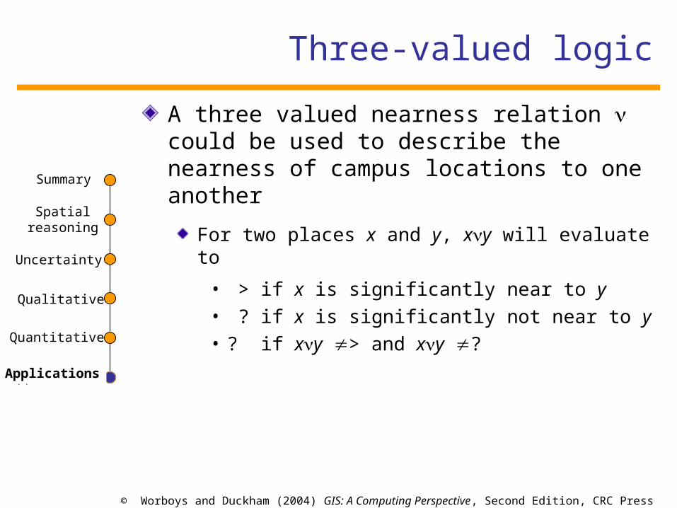
Three-valued logic
A three valued nearness relation could be used to describe the nearness of campus locations to one another
For two places x and y, xy will evaluate to
• > if x is significantly near to y• ? if x is significantly not near to y• ? if xy > and xy ?
Applications