chapter 15lynnrfuller.com/uploads/3/4/4/3/34433121/ch15keynotenewmodified...eruption and collapse of...
TRANSCRIPT

Chapter 15 Cenozoic Events

The Cenozoic Era
• 65.5 million years ago to the present
• Name "Cenozoic" = "new life" or "recent life"

• The Cenozoic Era followed a mass extinction of the dinosaurs and many other organisms
• Cenozoic rocks contain modern types of plants and animals, more advanced than those of Paleozoic and Mesozoic.
• Cenozoic is the era of:– Adaptive radiation of the mammals– Cooling of the Earth's climate resulting in the Ice
Ages – Evolution of humans

Periods of Cenozoic
• The Cenozoic Era consists of two periods:– Younger Neogene Period – Older Paleogene Period
• The Paris Basin is the type area for most of the stages with Cenozoic. There is a major unconformity in the basin that was chosen as the boundary between Cenozoic periods.

Periods of Cenozoic• Until 2003, the two periods of Cenozoic were Tertiary
and Quaternary. You will see these terms on older maps and in older publications.
• In 2003, the an international commission revised the nomenclature, dropping the terms Tertiary and Quaternary. The two new periods of the Cenozoic are now internationally recognized as Paleogene and Neogene.

Paleogene Period
Paleogene is divided into three epochs:
– Oligocene (youngest)– Eocene – Paleocene (oldest)

Neogene Period
Neogene is divided into four epochs:
– Holocene (the current epoch)– Pleistocene– Pliocene – Miocene (oldest)

Cenozoic Time Chart

Naming the Epochs
The meanings of the root words for the epochs refer to the proportions of fossil species that are still alive.
Pleist = most
Pleion = more
Meion = less
Oligos = few
Eos = dawn
Paleo = ancient

Paleogeography and Plate Tectonics
• During Cenozoic, the Atlantic and Indian Oceans widened, and the continents moved to their current positions.
• Half of the present ocean crust has formed at the mid-ocean ridges since the beginning of Cenozoic.

Position of the continents
during Eocene, about
50 m.y. ago.
Yellow = areas of major tectonic changes.

Position of the continents today .
Antarctica has completely separated from neighboring continents, and is surrounded by ocean.
Antarctica is centered on the South Pole.
Yellow = areas of major tectonic changes.

Eocene vs. Today
Yellow = areas of major tectonic changes.

Exotic Terranes As the North American
plate moved westward (accompanying the widening of the Atlantic Ocean), subduction of ocean crust and accretion of exotic terranes occurred along its western edge.

• The western edge of the North American plate came into contact with the northwestward-moving Pacific Plate, forming the San Andreas Fault system.
San Andreas Fault System

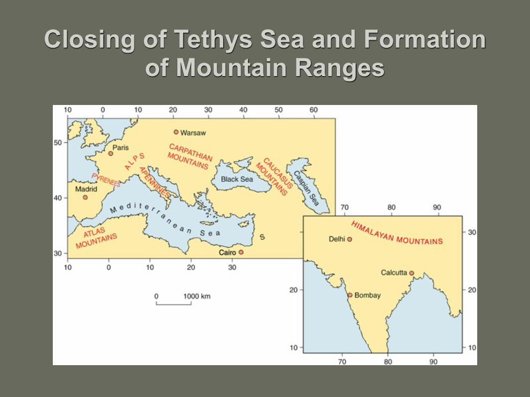
Closure of the Tethys Sea
• Collision of Africa and India with Eurasia, forming the Alps and Himalayas.
• Tethys Sea deposits were deformed into mountain ranges.

Tectonic and Paleographic Changes and Their Effects on Climate
• Orogenic and volcanic activity were intense along the western edge of the North and South American plates.
• This caused the formation of the Isthmus of Panama, a land bridge linking North and South America.
• The land bridge provided a path for plant, animal, and human migration between the Americas.

Tectonic and Paleographic Changes and Their Effects on Climate
• The Panama land bridge blocked the westward flow of the North Atlantic Current. The current was deflected to the north (turning to the right, as a result of the Coriolis Effect), and formed the Gulf Stream.
• The Gulf Stream transported warm water northward and resulted in bringing warmer climates to northwestern Europe.
• Gulf Stream also supplied warm, moist air toward the North Pole, which would ultimately result in precipitation which helped build the glacial ice sheets.

Important continental breakups: 1. North Atlantic rift separated Greenland from
Scandinavia2. Australia separated from Antarctica. Circumpolar
currents isolated Antarctica from warmer waters. Led to cooling of Antarctica.
3. Cold, dense ocean waters around Antarctica drifted northward along ocean floor, contributing to global cooling and the Ice Age.
4. Rifting occurred between Africa and Arabia, forming the Red Sea and the Gulf of Aden.

Tectonic and Paleographic Changes and Their Effects on Climate
• Glaciation led to regressions.• Continental interiors were not flooded by
epicontinental seas during Cenozoic.• Marine transgressions were limited. • Overall cooling trend during Cenozoic.
– Tropical and subtropical plants were replaced by temperate plants, such as grasses.
– Tropical plants retreated toward the equator.

North America During Paleogene
Paleogene was dominated by:
– The deposition of marine sediments in eastern and southeastern North America
– The presence of mountains and lakes in western North America.

Paleogene Period

Eastern and Southeastern North America
• Ridges and valleys of the Appalachian Mountains were carved by erosion. As erosion proceeded, gentle isostatic uplift occurred. This stimulated more erosion, as streams cut downward.

Eastern and Southeastern North America
Uplift in the eroding Appalachians was coupled with downward tilting and deposition of sediments on the Atlantic Coastal Plain and continental shelf.
Sediments thicken seaward forming a clastic wedge.

Eastern and Southeastern North America
• Carbonate sediments accumulated in Florida where less terrigenous clastic sediment was available.
• Eight marine transgressions and regressions are recorded in Cenozoic sediments on the Atlantic and Gulf Coastal Plains.
• On the Gulf Coastal Plain, transgressions brought Gulf of Mexico waters inland as far as southern Illinois.

Eastern and Southeastern North America
• During regressions, deltaic sands were deposited over offshore shales in the Gulf of Mexico region. These sediments provided ideal conditions for formation and entrapment of oil and gas. Much of the oil was trapped around salt domes.
• A clastic wedge of sediments thickens seaward in the Gulf of Mexico region, where Paleogene sediments are >10,000 m (>5.5 mi) thick.
• Gulf of Mexico region has been subsiding rapidly.

Rocky Mountains and High Plains
• Structural features of the Cordillera were created by Late Cretaceous and Paleogene deformation.
• Sediments eroded from the mountains were trapped in low areas between the mountains, or intermontane basins.
• Sediment from erosion of Rockies was spread over the plains to the east. Oligocene through Pliocene sands, shales, and lignites were deposited on western high plains.

Rocky Mountains and High Plains
• Beds of volcanic ash are interlayered with these sediments, indicating volcanic activity, and providing radiometric dates for correlation.
• Paleocene Fort Union Formation contains gray sandstones and siltstones, carbonaceous shales, lignites, and low sulfur coals, deposited in swamps in the intermontane basins.
• These coals are used for electricity generation and produce very little pollution because of the low sulfur content.

Rocky Mountains and High Plains
• Eocene Green River Formation is a lake deposit with fossil fish, insects, plants, varves, laminated oil shale, and limestone.
The Green River fish, Diplomystis The Green River Formation, Utah

Rocky Mountains and High Plains
• Late Eocene and Oligocene volcanic activity in Yellowstone National Park area.
• White River Formation contains well-preserved skeletons of Oligocene mammals. Also makes up the Badlands of South Dakota.

Rocky Mountains and High Plains
• Well preserved fossil insects and leaves are found at Florissant Fossil Beds National Monument in Colorado. They were buried when Oligocene volcanic ash settled into a lake. Large petrified stumps of sequoia trees are also present.

Rocky Mountains and High Plains
• Fluvial and lacustrine sedimentation continued in intermontane basins and on plains to east into the Miocene epoch.
• Climates had cooled by Miocene time.• As the climate cooled, the grasslands
expanded and were populated by Miocene camels, horses, rhinos, deer, and other grazing mammals.

Rocky Mountains and High Plains
• Volcanic activity occurred during Miocene in the central and southern Rockies.
• Gold deposits at Cripple Creek, Colorado formed in association with a Miocene volcano.
• Regional uplift of Rockies began in Miocene. – Increased erosion rates. – Sediment spread eastward, helping to build the
Great Plains.

Rocky Mountains and High Plains
• Fossils in Pliocene sediments indicate cooler and drier conditions.
• Normal faulting and volcanism accompanied Cenozoic uplifts and produced spectacular scenery.

Basin and Range Province
• The Basin and Range Province occupies a broad area in Nevada and western Utah, extending southward into Mexico.
• The province is dominated by up-faulted mountain ranges and down-faulted basins.

Basin and Range Province

The Basin and Range formed as follows:
1. The region was up-arched during Mesozoic.
2. Subsidence occurred along normal faults beginning during Miocene.
3. Up-faulted crustal blocks formed linear mountains that shed sediment into the adjacent down-dropped basins.

4. Faults opened conduits for igneous rock, producing lava flows and volcanism.
5. Erosion followed the volcanism. Sediments eroded from the mountains filled the down-faulted basins, clogged rivers, and caused closed-basin (no outlet) lakes to form.
6. Evaporite minerals (gypsum and salt) were deposited as the lakes evaporated.

Colorado Plateau Uplift
The Colorado Plateau is centered in the four-corners region, where Utah, Colorado, Arizona and New Mexico meet.

Colorado Plateau Uplift
The best-known feature in the Colorado Plateau is the Grand Canyon.
Eroded by the Colorado River to a depth of more than 1.6 miles.
The river eroded through Phanerozoic strata and into the Precambrian basement rocks.

Colorado Plateau Uplift• The rocks are relatively flat-lying. They were not
deformed during Mesozoic orogenies. • The Colorado Plateau has been subject to uplift and
erosion. Uplift occurred during Pliocene. • Faults formed locally, providing conduits for volcanic
rocks. – Example: San Francisco Peaks near Flagstaff,
Arizona.

Columbia Plateau and Cascade Range Volcanism
• Columbia Plateau is named for the Columbia River, between Washington and Oregon.
• Columbia Plateau was built by volcanic activity. • Basaltic lava poured out of deep fissures and buried
more than 500,000 km2 of land in Washington, Oregon, and parts of Idaho during Miocene, about 15 m.y. ago.
• Lava flows are more than 1.5 miles thick. • One of the largest volcanic regions on Earth.

Columbia Plateau and Cascade Range Volcanism
Left: Columbia Plateau basalts in a canyon of the Snake River.
Right: Mt. St. Helens, Washington, prior to eruption and during eruption (1980).

Columbia Plateau and Cascade Range Volcanism
• West of the Columbia Plateau, more viscous lava produced the volcanoes of the Cascade Range.
• Volcanism is caused by the North American plate overriding the Juan de Fuca plate in the eastern Pacific.
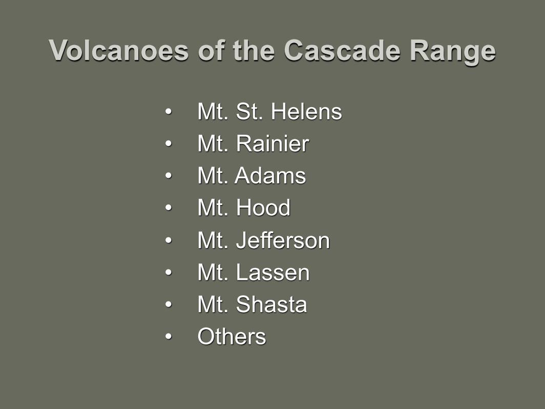
Volcanoes of the Cascade Range
• Mt. St. Helens• Mt. Rainier • Mt. Adams • Mt. Hood • Mt. Jefferson • Mt. Lassen • Mt. Shasta • Others

Crater Lake Crater Lake, Oregon formed from the
eruption and collapse of Mt. Mazama in the Cascade Range about 6000 years ago.

Origin of Crater Lake

Sierra Nevada Mountains
The Sierra Nevada mountains lie to the south of the Cascade Range. The
mountains belong to a large granite body called the Sierra Nevada batholith.

The Sierra Nevada batholith formed as the Farallon plate was being subducted under the western edge of the North American continental plate during Mesozoic.

Sierra Nevada Mountains Erosion during Paleogene removed the overlying
rocks and caused the granite batholith to be exposed at the surface.

Sierra Nevada Mountains
• During Pliocene and Pleistocene, the Sierra Nevada batholith was raised up along normal faults to a height of 4000 m (more than 2 miles) above the California trough to the west.
• Streams and glaciers carved the landscape. • Examples – Yosemite, Lake Tahoe

California• During Paleogene, the region west of the Sierra Nevada
was affected by subduction.• During Miocene, strike-slip movement replaced
subduction.• Faulting created islands and sedimentary basins. • Marine clastic sediments, diatomites, and bedded cherts
were deposited in the basins. • Folding and uplift led to regression.

New West Coast Tectonics • During most of Cenozoic, subduction occurred along
the west coast. • The Farallon plate was almost completely subducted
under North America. • Only the small Juan de Fuca plate remains as a
corner of the once much larger Farallon plate. • Part of the East Pacific rise spreading center was
subducted under North America.

New West Coast Tectonics• Once the Pacific plate came into contact with the
North American plate, the direction of movement changed.
• Instead of being subducted, the Pacific plate slid laterally along the edge of the North American plate.
• This formed the San Andreas fault with its strike-slip motion, and ended subduction in this area.

Around the World• Active volcanism in many areas
– New Mexico, Arizona, Idaho – Mexico – Iceland – Pacific rim
• Crustal uplift in many areas – Tetons of Wyoming – Sierra Nevada – central and northern Rockies – Alps – Himalayas

Eocene vs. Today
Yellow = areas of major tectonic changes.
Closing of Tethys Sea and Formation of Mountain Ranges

Basaltic lava flows in northern Europe and neighboring areas as Greenland separated from Europe
– Ireland - columnar basalts of Giant's Causeway – Scotland – Greenland – Baffin Island – Norway's Svalbard Islands

• Transgressions and regressions in the Paris Basin area and formation of evaporitic "Plaster of Paris" gypsum deposits during Paleogene (Eocene to Oligocene)
• Formation of rift valleys in East Africa, along with associated lakes and volcanoes
• Separation of Australia from Antarctica • Cooling and accumulation of snow and ice in
Antarctica