claim no, hole no, footage date note - ontario
TRANSCRIPT
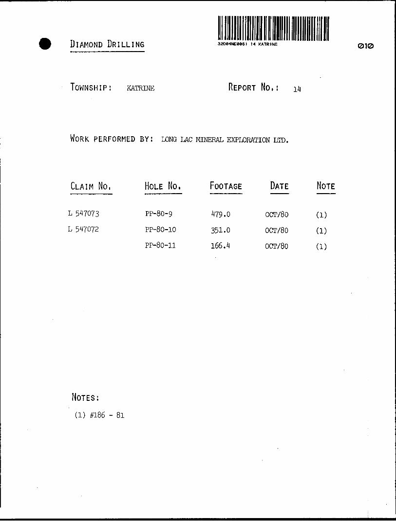
DIAMOND DRILLING 32De4NEM61 M KATRINE 010
TOWNSHIP: KATRINE REPORT No,:
WORK PERFORMED BY! LONG LAC MINERAL EXPLORATION LTD.
CLAIM No, HOLE No, FOOTAGE DATE NOTE
L 5^7073
L 547072
PP-80-9
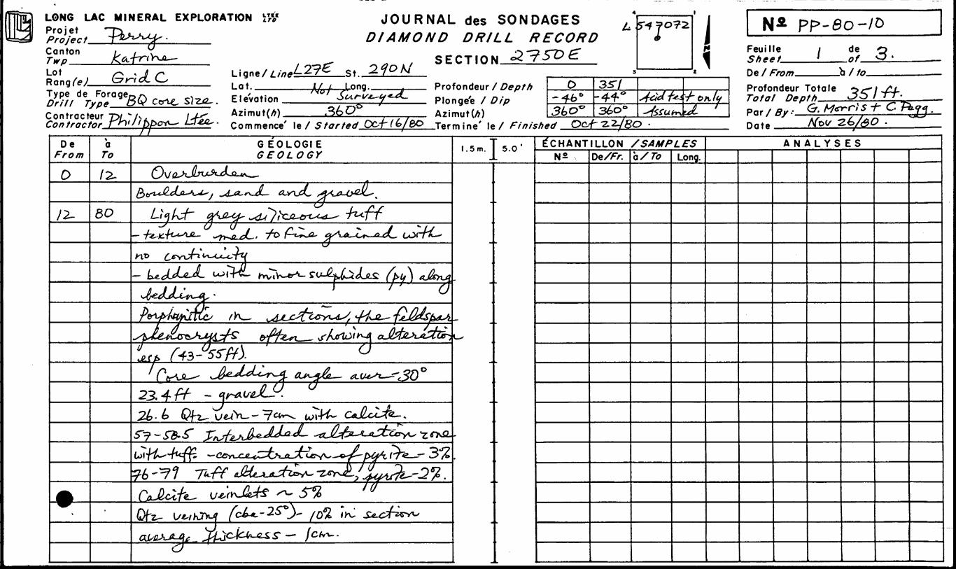
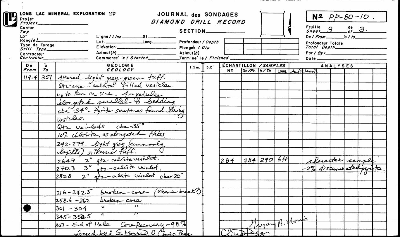
PP-80-10
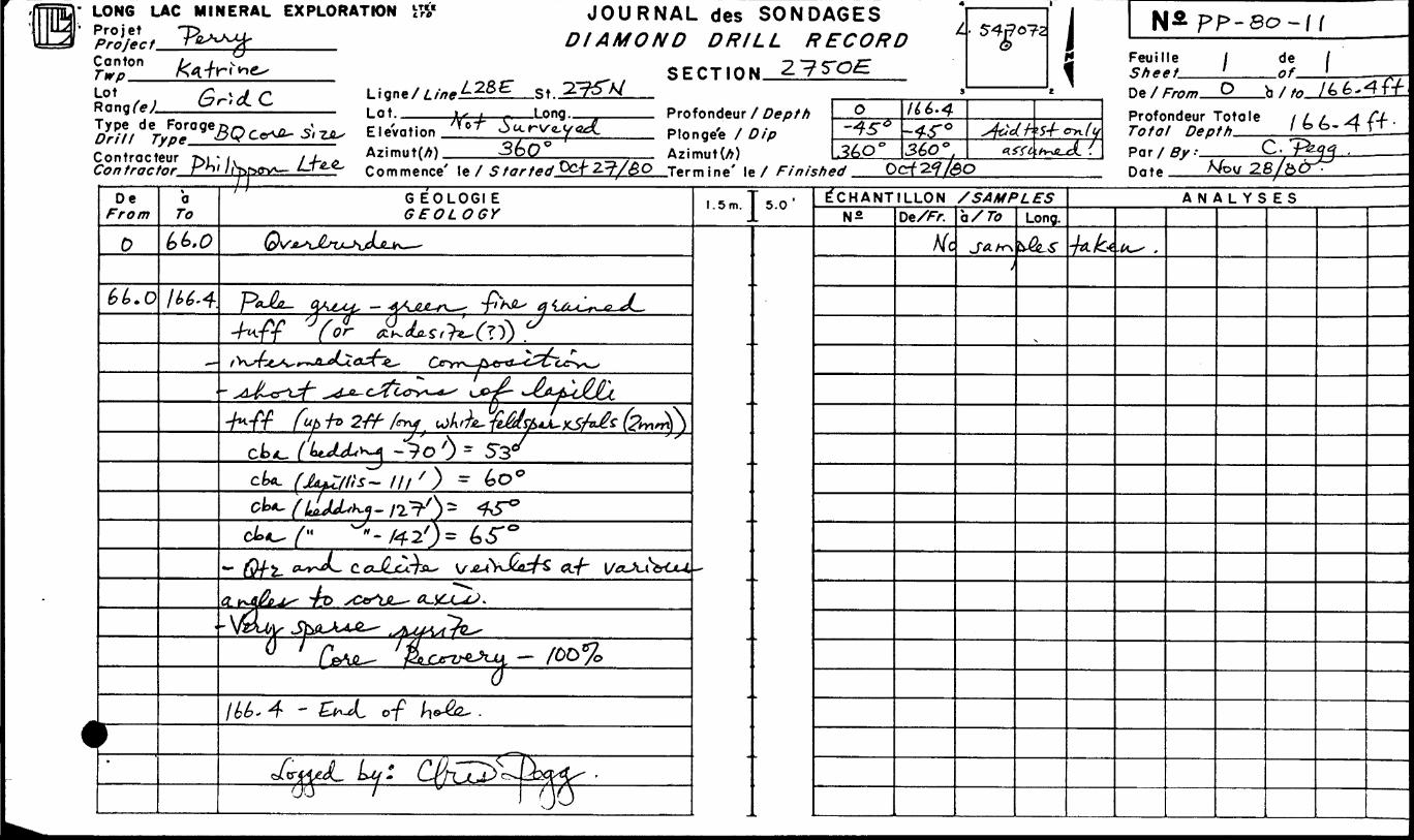
PP-80-11
479-0
351.0
166.4
OCT/80
OCT/80
OCT/80
(D
(D
(D
NOTES:
(1) #186 - 81
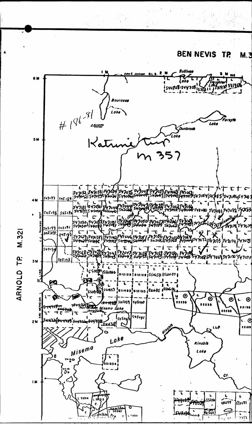
AR
NO
LD
TP
M
.32I
t
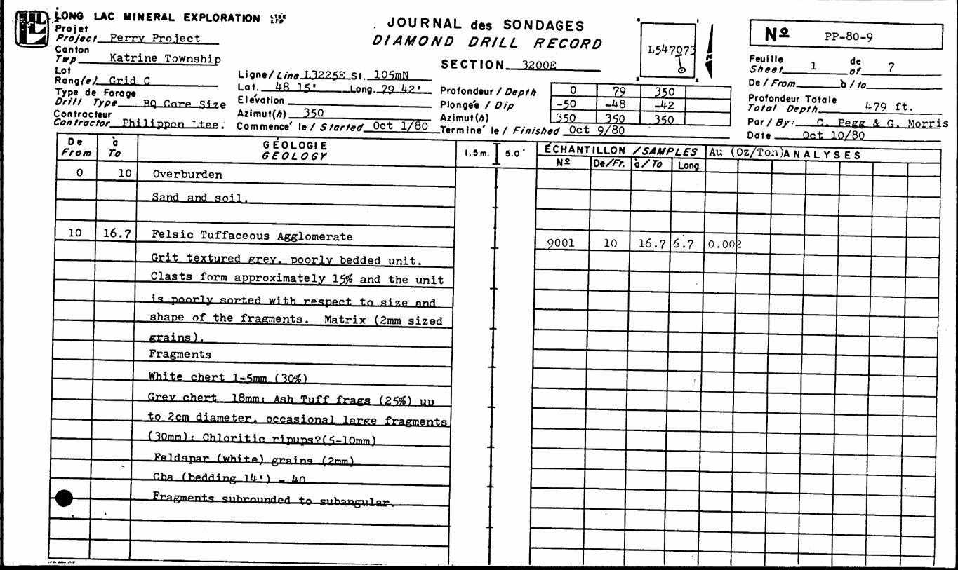
t-ONO LAC MINERAL EXPLORATIONProjet T, . * ' Projec t Perry Pro.iectCantonTwp^Lot
Katrine TownshipW Grid C 1Type de Forage
Drill Type RQ,———ContracteurCon tractor Ph i l i ppo n
7.P
La t.Elevation —-——— —Azimut(A) 350
DIAMOND DRILL
SECTION
Plonge'e X Dip Azimuth)
BONDAGES L RECORD
3200J5
Depth ip
f Finisht.
s0
-50350
79-^8350
L5^707:
350-42350
iP^ Oct 9/80
PP-80-9
Feuille Sheet.—De X /VTE7/77.
de
.b X to.Profondeur Totale Total Depth.^—Par X ^ H. G. Morris
Qct JLO/8000 ^/•0y77
0
10
-•-T
*o To
10
16.7
^
,
G EOLOGI E GEOLOGY
Overburden
Sand and soil.
Felsic Tuffaceous AgglomerateGrit textured crev. Doorlv bedded unit.C las t s form approximately 150 and the unit\f*. pnnTly qnf-fced with T*espftr*i: to size nndshape of the fragments. Matrix (2mm sizederains ) .FragmentsWhite chert l-5mm f 30*)Grey chert 18mm: Ash Tuff frags (2*#S) upto 2cm diameter, occasional large fragments(10mm): Chloritic ri pups'? ( *?-10mm)Ppi fi "spay fwhi^f*) pTpine* (9mm)f!ha (ViPHrling iZi') - Ztn
FT*SI OTnon+a ciiT^yrtiivx^ftrt ^/\ oiiVi^yicrnl Q**
l.5m.
-
5.0' E'CHANT LLON /SAMPLESN*
9001
DeX/r.
10
•BMMMI
a/ 7i?
16.7
••••MM
Long.
6'.?
•••••B
Au ( Oz/Ton )ANALYSES
0.00
•i^i^^B
3
^^^^ ^BHBHMI
M " iF t C7L F 1 iC t
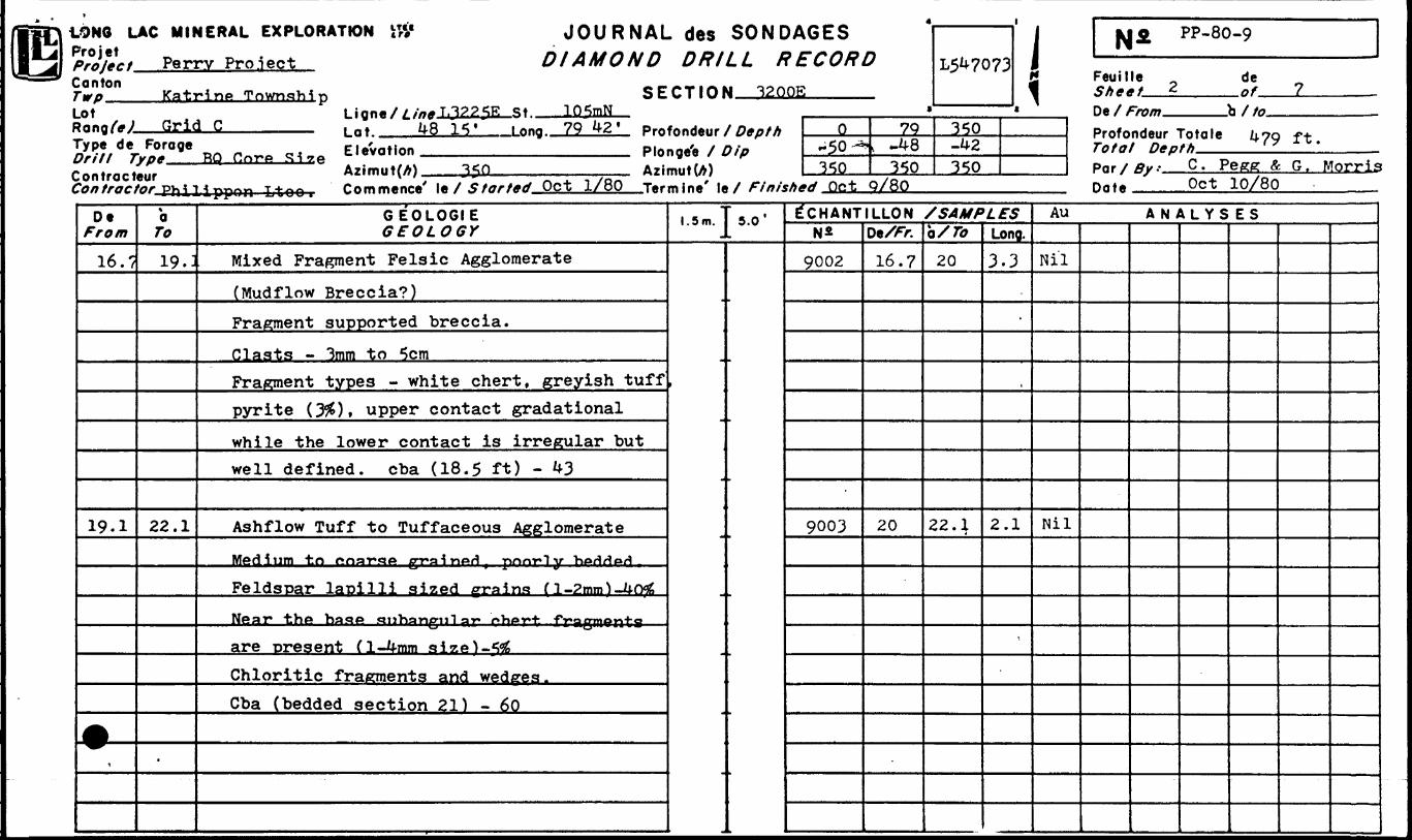
.QNO LAC MINERAL EXPLORATION i# JOURNAL d 6 S BONDAGES WjL, Perrv Prolect DIAMOND DRILL RECORD
4
t̂0n Katr^P Tnwn fl VH^ SFCTIOM 3200E.ot)angf*J Gritrype de 7/7/7 7 lontract70/7 /A(7C/
De T^Vtf/n
16.7
19.1
A,
Foragey/**eur'or PVi ^ l
1 ignfl/^c'ffff Iil.225F s * 105mNLfi ——————— , n't 4815' Long 7942' P™
- . Elevation , , PlmJ3L( ^rtr^A rs l y. f^
A*imMt(A) i-.,- .^^O A?i*, ———— T*^ — r n mm* ne A' 1* X .C farted Oct 1/80 Tar
a To
19.:
22.1
.
GEOLOGIE GEOLOGY
Mixed Fragment Felsic Agglomerate
(Mudflow Breccia?)Fragment supported breccia.Clasts - 3mm to 5cmFragment types - white chert, greyish tuffpyrite Ofi) , upper contact gradationalwhile the lower contact is irregular butwell defined, cba (18.5 ft) - 43
Ashflow Tuff to Tuffaceous Agglomerate
Medium to onaT*stP pr*sH n**H pnnrO y T"*AriHt*H
Feldspar lapilli sized grains (l-2mnO-4rwSNear the base 5* 1 1 ban/nil QT* ^^^7*-^ fragments
are present (l-4mm size) -5^Chloritic fragments and wedges .Cba (bedded section 21) - 60
Eondeur t ige'e / L mut(A) mine' le
1.5m.
-
-
' Depth -)ip
/ Fin/sht
5.0'
I
0^50^350
79n -48
350 d Oct Q/80
L547073
350-42350
1ECHANTILLON /SAMPLES
N*
9002
9003
De/Tr.16.7
20
a/ro
20
22.;
Long.3 .3
-
2 .1
*
ia^ PP-80-9
Feuille de
D* / f rf, m "h / ffi
Profondeur Totale 14.79 f -tTotal Hep f h
Par/
Au
Nil
Nil
By- C. Pegg ft G. MorrisOct 10/80
ANALYSES
.LONG LAC MINERAL EXPLORATION iTrVPro jet
Canton
Lot
Perry Pro.lect Katrine Township
Grid Cst 105mN
t at 48 15 79 42
ControcteurCore Size E.eVotion
Azimut(A) 350
SECTION
P Ion gee f Dip AzimutU)
Philippon Ltee. Commence' le X start** Oct 1/80 farming' | e X Finished Pet Q/8Q
BONDAGES .L RECORD
32 GOE
Depth ip
f Finisht
\0
-50350
79-48350
L547073
350-42350
i N^ PP-80-9
Feuille ~ de - S h gf t J af fDe / From b 7 tn
Profondeur Totale f, OQ fJfTotal n*pth *fV 1T -Par /ffi/.- C. Pegg Se G. Morris
•d Oct Q/80 Dn*. Oct 10/80
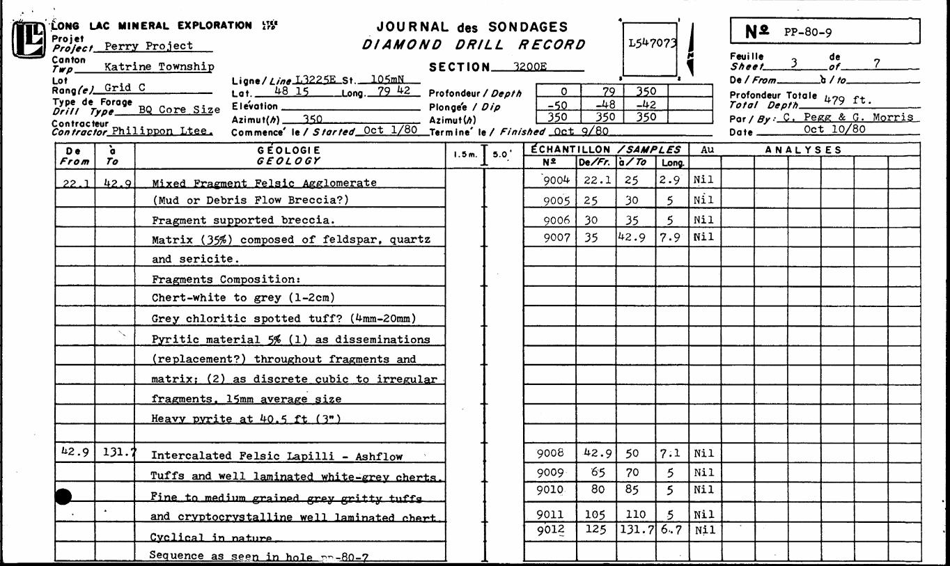
Oe From
22.1
42.9
9̂
\a To
42. Q
x x
131.1
A
GEOL06IE GEOLOGY
Mixed Fragment Felsic Agglomerate
(Mud or Debris Flow Breccia?)
Fragment supported breccia.
Matrix (35#) composed of feldspar, quartz
and sericite.
Fragments Composition:
Chert-white to grey (l-2cm)
Grey chloritic spotted tuff? (4mm-20mm)
Pyritic material 5# (1) as disseminations
(replacement?) throughout fragments and
matrix; (2) as discrete cubic to irregular
fragments. 15mm average size
Heavy pyrite at 40 . 5 ft ( 3" )
Intercalated Felsic Lapilli - Ashflow
Tuffs and well laminated white-grey chertst* * j.. ^ * *rine to medium *np*s^inoH Piroy Cri^'t-y tviffsf-
and crvctocrvstalline well laminated phAf-h
Cyclical in na-fcnrv*
Sequence as seen in hnlP r^-Ro-7
l.5m.5.0' E~CHANTILLON /SAMPLES
N*
"9004
9005
9006
900?
9008
9009
9010
90119012
DeX/r.
22.1
25
30
35
42.9
6580
105125
O/ To
2530
3542.9
507085
110131.7
Long.
2.9
5
57-9
7.1
55
56.7
Au ANALYSES
Nil
Nil
Nil
Nil
Nil
Nil
Nil
NilNil
*
*V'
K .LONG LAC MINERAL EXPLORATION ttV JOURNAL des SONDA6ES
*P?JfL, Perrv Proiect DIAMOND DRILL RECORD
5y*n Katrine Township SECTION 3200Elot l iqnt/Line L322.5E St 1QM *RonqfeJ Grid C , nf 4815* long 79^2' prn fnnti*ttr / n*f,fh^// de40:OQIo Core Size Elevation Plonge'e / DipContracteur A7imut(A) ^50 A?imut(A)
0-50^c;o
79-48
350
L54707J
350-42350
i \\SL pp-8o-9Feuille K de Shemt . of fO* / Fmm "h/fn
Profondeur Totale y. Oo -r^ Totoi n*Pth *fy i*.Pnr/fiir.- C. Pegg Se G. Morris
Contractor Philippon Ltee , r rtmm*ne*' l*/ Started Oct 1/80 T*rmin*' In 1 Finished Oct 9/80 Hnt* Oct 10/80
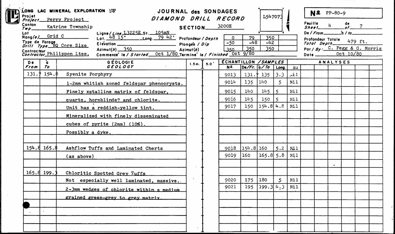
De From
131.'
154.6
165. e
tr.
a To
' 154.
165.*
199.:
-
GEOLOGIE GEOLOGY
S Syenite Porphyry
l-2mm whitish zoned feldspar phenocrysts.Finely xstalline matrix of feldspar.quartz, hornblinde? and chlorite.Unit has a reddish-yellow tint.Mineralized with finely disseminatedcubes of pyrite (2mm) (1095).Possibly a dyke.
Ashflow Tuffs and Laminated Cherts(as above)
Chloritic Spotted Grev TuffsNot especially well laminated, massive..
2— 3mm wedges of chlorite within a mediumgrained firreen-grey to grey ma-hi-iv.
l.5m.
-
-
5.0' E"CHANT LLON /SAMPLESN2
90139014
901590169017
90189019
90209021
De/FX131.'135140145150
154.8160
175195
b/ To
135140
145150
154.8
160165.8
180199.3
Long.3-3
5554.8
5.25.8
54.3
ANALYSESAu
.,ilNil
NilNilNil
NjLlNil
NilNil
*
LONG LAC MINERAL EXPLORATIONPro jet ^ -, . . Projec f Perry Pro.lect
ffi,*0" Katrine Township Lot
DIAMOND DRILL
SECTION
Type de Fora Drill Type,. Controcteur
L322SE s* IQfrnN^8 15' Inng 79
Core Size Elevation Plonge'e f Dip Azimut(A)
Philjppon Ltee. Commence' le 7 5X*7x-7^..QfiJLJ^M—Termine' le X Finishd
SONDAGESt f^ f^ j^ ̂ f ̂ ^ J^J
.L. /TCC't//!*/
3200E
Depth ip
f Finish*
*0
-50350
79-4 b350
^7073
350-H-2
350
i,^ Oct 9/80
pp-80-9
Feuille Sheet^^De l From.
Profondeur Totale Total Depth—--—par f Ru: C. Pegg
Date
de
X
ft.G. Morris
Oct 10/80_______
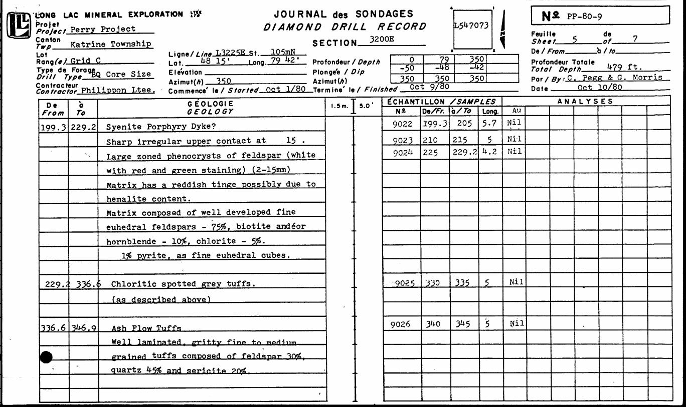
DeFrom
199.3
229J
336.6
fT
taTo
229.2
x
336.(
3^6.9
-
GEOL06IEGEOLOGY
Syenite Porphyry Dyke?Sharp irregular upper contact at 15 .Lar^e zoned phenocrysts of feldspar (white
with red and green staining) (2-15mm)Matrix has a reddish tinge possibly due tohemalite content.Matrix composed of well developed fineeuhedral feldspars - ?5#, biotite ande"orhornblende - 10# f chlorite - 5#.
1^ pyrite, as fine euhedral cubes.
) Chloritic spotted grey tuffs.
(as described above)
Ash Flow TuffsWell laminated, gritty fino t.n m**Hiyni
\
grained tuffs composed of feldspar "HfwS,
quartz 45# and serir-ltp ?ryjt
f
l.5m.
m
5.0' E"CHANTN*
9022
9023902*1-
-9025
9026
LLONDe/Fr.199-3
210225
J30
3^0
/SAMPa/ro
205215229.2
335
3^5
^f5Long.5-7
5U.2
5
i
AU
Nil
NilNil
Nil
Nil
A N iXL YS ES
.LONG LAC MINERAL EXPLORATION'Pro j e! Project Perry Project
Katrine Township
JOURNAL des SONDAGES DIAMOND DRILL RECORD
SECTION 3200ELot
Grid C
PP-80-9
Feuille Sh**t
Type de Forage48 15*
BQ Core Size Elevation
Sfffc^KphiliTOon Ltee.
i nnq 79 42 * Profondeur f Depth
Plonge'e f Azimut(A)
0-50350
79-4 b350
350-42350
f mm
de.Of-
/to.Profondeur Totale .Total Depth. 479 ft.
' le/ Started Oct 1/80 Tftrrntne' )e x Finished Qct Q/8Q Dn*.Chris Pegg A Greg
Oct 10/80
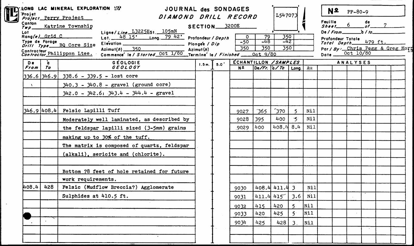
DeFrom
336.6\
3^6.9
U08.^
^
\aTo
3^6.9
408. k
^28
x
GEOLOGIEGEOLOGY
338.6 - 339-5 - lost core3^0.3 - 3^0.8 - gravel (ground core)3U2.0 - 3^2.6? 3^3.4 - 3^.4 - gravel
Felsic Lapilli TuffModerately well laminated, as described bythe feldspar lapilli sized (3-5mm) grainsmakine up to 30# of the tuff.The matrix is composed of quartz, feldspar(alkali), sericite and (chlorite).
Bottom 78 feet of hole retained for futurework requirements.Felsic (Mudflow Breccia?) AgglomerateSulphides at ^10.5 ft.
*
1.5 m.
\
5.0' E"CHANTN*
902?9028.9Q29
90309031
903290339034-
LLONDeX/r.
'365
395^00
408. k411.4
415420
425
/SAMPo/ To
"370
400408.4
411.*
4ir420425
428
'^fSLong.
55
8., 4
33.6
553,
Au
NilNilNil
Nil
Nil
NilNil
Nil
A N i\L Y S ES
'
LONG LAC MINERAL EXPLORATIONProjetProject^^^^.^.^.^^^^^^.
LotSECTION
Ligne//.//7ff. Lat. ————
-St..
ContractorAzimut(A) —M-1-—--———. Commence' le X Started.
BONDAGES .L RECORD
ip
f Finish t
i 1 N& PP-80-9
Feuille deSheet 7 nf 7 ——
O* 1 Fmm h f in
Profondeur To to le . nn .^ rata/ n*rth 479 ft.Pnr/p^.- G - Morris & c. Pegg
td Dn*- Oct 10/80
De From
428
A11
tQ
479
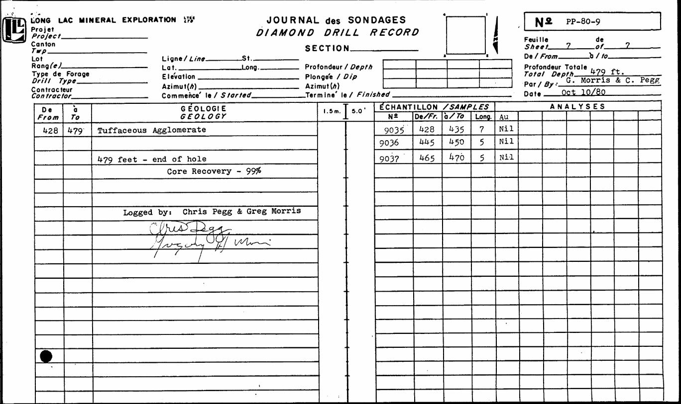
G EOLOGIE
Tuffaceous Agglomerate
479 feet - end of holeCore Recovery - 99#
Logged by: Chris Pegg & Greg Morris
C^JUZC
Y A^^1 v^U — .*1 / 1 "
,-
1.5m.
-
-
5.0 '
'
^CHANTILLON /SAMPLESN&
90359036
9037
DeX/V.428445
465
Q/ TO
43545-0
476
Long.
75
5
ANALYSESAuNilNilNi-1
LONG LAC MINERAL EXPLORATION \\ProjetProjectCantonTwp —-—LotRang/W———— - --- —_____ LatType de Forage
JOURNAL des SONDAGES DIAMOND DRILL RECORD
SECTION.
S)Z^2-. Elevationi/ i I ong 'xo/ TT. ^.fx.
Contracteur Co/? tractor.
^A * l i .
hb
Profondeur X Depth Plonge'e X
. Commence' le f Starred
3S-/
9 l Feuille de
-JLine' le X Finished OcJ"Z.?-S8O
De X -b XProfondeur Totale 'St-'I^U-Tatal Dfoth JO l TT-Total Df pt h Par/By-' Date __
De From
a To
GEOLOGIE 1.5m. 5.0 ^CHANT LLON /SAMPLESDe//^. c Long.
ANALYSES
O
J2- 60
— -h^)c^*^Ji~- ^r^cLJL, ~f~® A-*sJ2- 0f\aJLr~o-d^ cocT^--
A ̂ ^' '
/K..
' C
23.iJT-K-
as/iiXjiLjif .- f (fi

LONG LAC MINERAL EXPLORATIONProjetProject———————^^^^^—
Lot Line. .St..Lot.
JOURNAL des SONDAGES DIAMOND DRILL RECORD
SECTION
_____ Profondeur f
Contracteur Contractor^
Azimut(A) -—.^——^^ Commence' le f Started,
f Dip Azimut(A)
.Ter m i ne' le X Finished.
tGES ?CORL?
s1 PP-80-/0
Feuille de c?0-
De X -bXte.Profondeur Totale
Par X Date
De a To
GEOL06IE GEOLOGY
1.5 m. 5.0 ^CHANTILLON /SAMPLESDe/^r. e Long.
ANALYSES
m LONG LAC MINERAL EXPLORATION ft?ProjetPro fee t—M——^————-^^— Canton
JOURNAL des SONDAGES DIAMOND DRILL RECORD
SECTION.^^———^LotRanqfeJ—-——- Type de Forage Drill Type——Contracteur C0/7 tractor——-
Ligne/Z.//;*- Lot.^———
-St.— .Long..
Elevation ^—-——^-^— Azimut(A) ^...^^—-——— Commence' le 7 Started.
Profondeur f Depth Plonge'e / Dip Azimut(A)
.Ter m i ne" le X Finished
l Feuille de
De/Profondeur TotaleTo/ff/ Depth
Por/ffy -—————Date^^—-^-.
De From
a To
GEOLO6IE 1.5m. 5.0 E"CHANTILLON /SAMPLESDe/Fr. a/To Long.
ANALYSES
ilf-i- 357
2^2-
2^0-3 3 "2-"
2/4*- Z f 2.
-304
284 254-27-
-,
ri
LONG LAC MINERAL EXPLORATION i#Projet Project Canton Twp__ Lot
.-/- l L^/r^'CA- V^Lot.
de 7
Contracteur
JOURNAL des SONDAGES DIAMOND DRILL
SECTION 27S-Q/E
.Long.
Azimut(A) —--^ Commence' le f
360'Profondeur f Depth Plonge'e / Dip Azimut(A) .360
/i 6.4
360*. ei i y '4
Feuille Sheet.De X
de—— 0/-
.bX/c
.Ter m i ne' le X Finished.
Profondeur Totole Total Depth .Par/ffy t C-—
2S/&
De ^"/•0/n a To
G EOLOGIE GEOLOGY
l. 5 m. 5.0 E'CHANTILLON /SAMPLESN2 De/Fr. b X 77? Long
A N YS ES
-/K//l^^Mi \ u/* /?y f i /i
cfc- x) -53^
d*-
e-srJ*-
4 - f
H
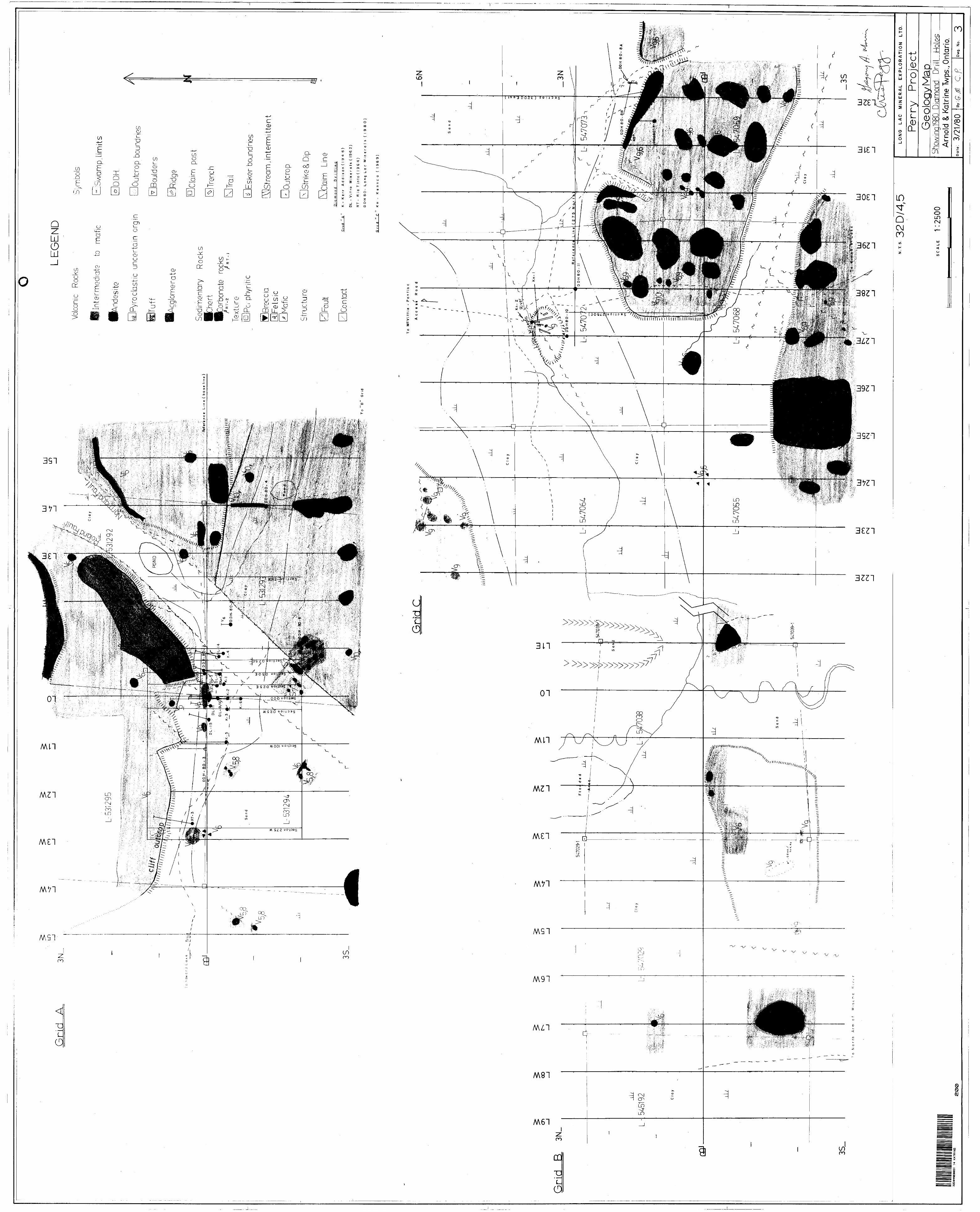
Grid
A
3N,.
o H
o* a
r j
L a
K e
T
Rei e
re n
ee
Lin
e (b
as
e l
ine
O
3S_
id
LEG
EN
D
Volca
nic
Rock
s
Inte
rrne
d at
e to
mat
e
'And
es i to
Pyro
clas
t c u
ncer
tain
org
in
Tuff
^glo
mer
ate
Sedi
men
tary
R
ocks
•Che
rt•C
arbo
nate
ro
cks
/RT
-2
/RT
-I
Text
ure
[1=1 P
orph
yriti
c
Brec
cia
Fels
icM
afic
Stru
ctur
e
Fault
Cont
act
o
Swam
p,lim
its
DD
K
Out
crop
bou
ndne
s
Boul
ders
Ridg
e
Clai
m
post
Tron
c h
Trail
boun
dnes
~
roam
jnte
rmitt
ent
Out
crop
Strik
e a
Dip
Claim
Li
neD
iam
ond
Drillin
g
Gri
d
"A"
K-
Kerr
A
dd
iso
n (1
94
6
)
DL
- V
i tr
o
M i
n e
r a
Is
( 19
6 2
)
RT
-
R io
T
into
(
l 9
6 4
J
DD
-H8
0-
Lo
ng
L
ac M
ine
rals
(1
980
Gri
d
"C "
K
n
- K
en
nco
(
1969)
Grid
C-6
N
To
M
CV
Mie
-
Po
nti
ac
7 '
Refe
ren
ce
Lin
e (2
75
M
art
OD
H 8
0-
8A
To
Nort
h
Arm
o
f M
isem
o
3S_
"—•3
20/4
,5
SCAL
E 1:
2500
14
KA
TRIN
E2
00
LON
G
LA
C
MIN
ER
AL
E
XP
LO
RA
TIO
N
LT
D.
Perr
y P
roje
ctG
eolo
gy M
apSh
owm
g198
Q Di
amon
d D
rill
Hole
s A
rnol
d 8.
Katri
ne T
wps.
, Ont
ario
.3/2
1/8
0C
.f.Dw
g,
No.
3