community-based action plan to adapt with … · adapt with climate change condition in binh giang...
TRANSCRIPT

COMMUNITY-BASED ACTION PLAN TO ADAPT WITH CLIMATE CHANGE
CONDITION IN BINH GIANG COMMUNE, HON DAT DISTRICT, KIEN GIANG
PROVINCE
SOUTHERN INSTITUTE OF WATER RESOURCES RESEARCH28 HAM TU STREET – DISTRICT 5 – HO CHI MINH CITY
Climate Change risk and vulnerability assessments in Kien Giang Province, Mekong Delta, Viet Nam

CONTENT
Overview of Binh Giang commune Community awareness about CC&SLR Community awareness about possible impactsAssistance needs for community Perception of trends to adapt with CC&SLR Community-based action plan to adapt with
CC&SLR Prioritized activities
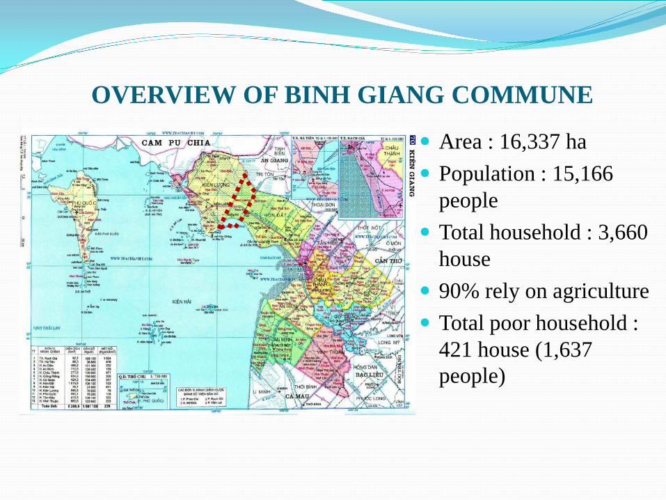
OVERVIEW OF BINH GIANG COMMUNE
Area : 16,337 ha Population : 15,166
people Total household : 3,660
house 90% rely on agriculture Total poor household :
421 house (1,637 people)
NATURAL CONDITIONS Topography: lowland, elevation ranger from 1.3–1.5m Geology: weak ground soil, inundated during flood season Soil condition: acid and saline soils Present landuse: 2 rice crops and rice combines with
aquaculture Average sunshine hours: 2400 hours/year, 7 hours/day. Average temperature: 27 – 27.50C, haven’t got directly
typhoon. Average rainfall:2000 – 2100mm, max: 2635 mm/year, 160
rainy days (rainy season from June-Nov).

HYDROLOGY Hydrological regime: affected by the diurnal tide of Tay
sea(Thailand Gulf) and the hydrological regime of Hau river.
Dry season: lack of fresh water from Hau river (Feb-Apr), severely salinity intrusion.
Rainy season: annual flooding(later of Aug-Oct); flood depth: 1-1.5m in Northern area of NR80; other area: under 0.6m; during the major 2000 flood, flood depth: 0.7 to 0.9m.
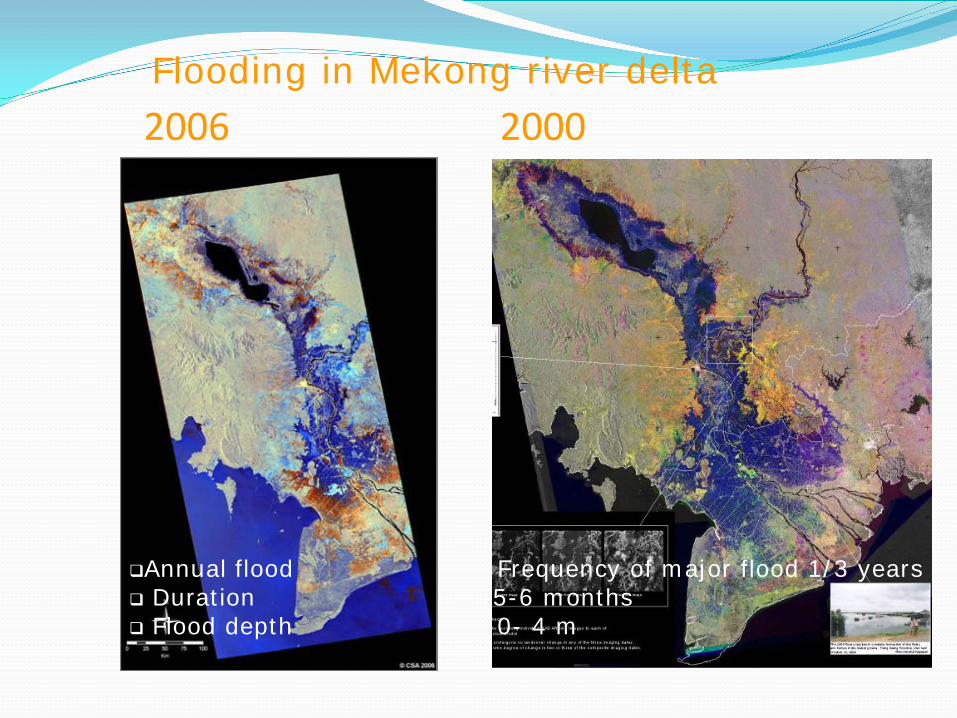
2006 2000
Annual flood Frequency of major flood 1/3 years Duration 5-6 months Flood depth 0- 4 m
Flooding in Mekong river delta
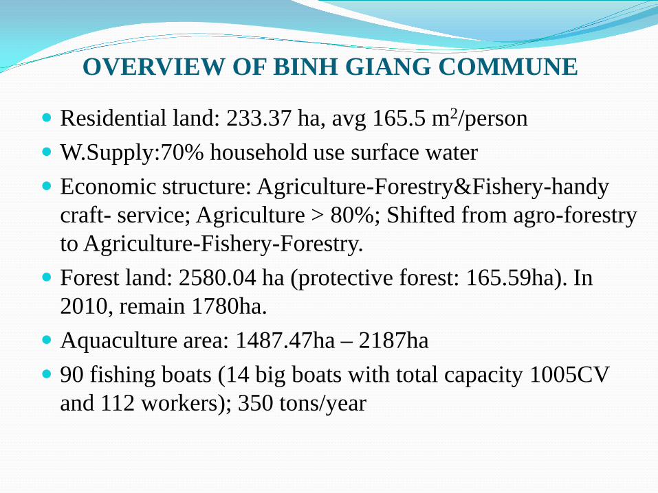
OVERVIEW OF BINH GIANG COMMUNE
Residential land: 233.37 ha, avg 165.5 m2/person W.Supply:70% household use surface water Economic structure: Agriculture-Forestry&Fishery-handy
craft- service; Agriculture > 80%; Shifted from agro-forestry to Agriculture-Fishery-Forestry.
Forest land: 2580.04 ha (protective forest: 165.59ha). In 2010, remain 1780ha.
Aquaculture area: 1487.47ha – 2187ha 90 fishing boats (14 big boats with total capacity 1005CV
and 112 workers); 350 tons/year
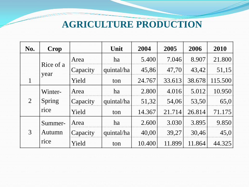
AGRICULTURE PRODUCTION
No. Crop Unit 2004 2005 2006 2010
1
Rice of a year
Area ha 5.400 7.046 8.907 21.800Capacity quintal/ha 45,86 47,70 43,42 51,15Yield ton 24.767 33.613 38.678 115.500
2Winter-Spring rice
Area ha 2.800 4.016 5.012 10.950Capacity quintal/ha 51,32 54,06 53,50 65,0Yield ton 14.367 21.714 26.814 71.175
3Summer-Autumn rice
Area ha 2.600 3.030 3.895 9.850Capacity quintal/ha 40,00 39,27 30,46 45,0Yield ton 10.400 11.899 11.864 44.325
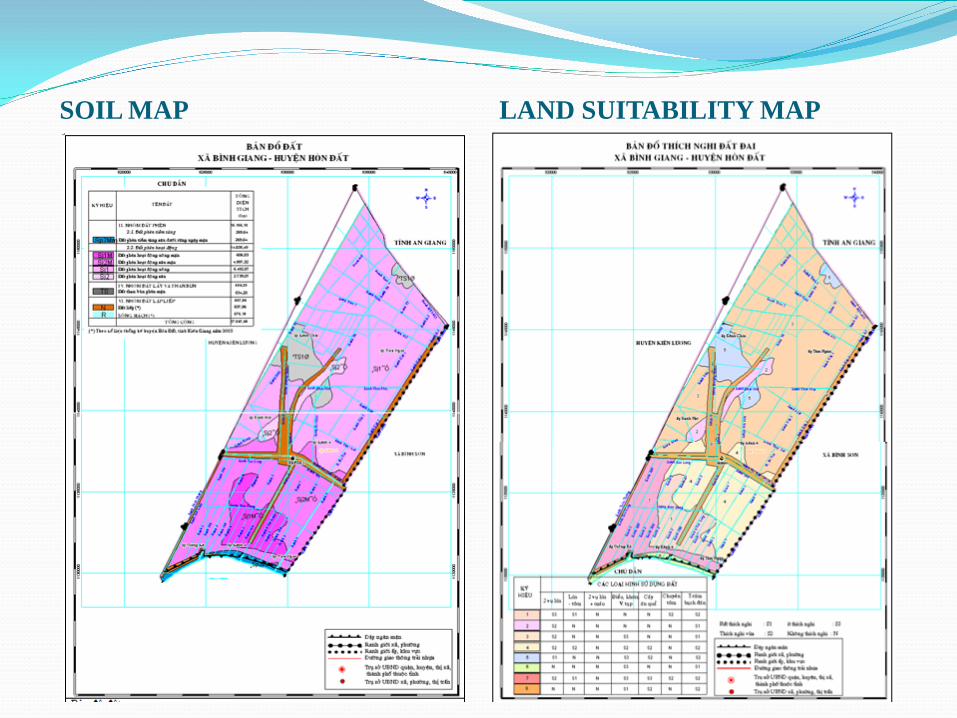
SOIL MAP LAND SUITABILITY MAP
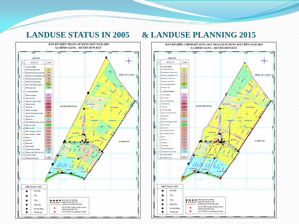
LANDUSE STATUS IN 2005 & LANDUSE PLANNING 2015
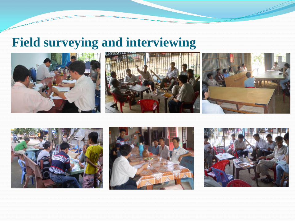
Field surveying and interviewing
Historical hydrological information in Binh Giang
2000 flood was historical high flood, caused a large flooded area; but inundated house only; minor damages was recorded (crop harvested before the flood).
After 2000, floods were considered as small and average. Sunshine (heavy), temperature(high & low) and rainfall
(pattern and density): unusual and return more often; Drought, salinity intrusion, acid water affect to agriculture
cultivation. No direct typhoon attacks to the area, less affected by
typhoons; storms cause some damage to crop and temporary house.
Decreasing trend of silt deposit .

MAN MADE CHANGE FOR WATER RESOURCE CONDITION
Before 1996, there was no flood control system and salinity intrusion prevention sluice gates: only 1 main rice crop/year. Salinity intrusion, acid water and drought caused significant impacts.
From 1996 to 2000, flood control system was implemented. T5, T6 and 8000 canals made much improvement of water resources and soil condition, however a late flood arrival.
To 2005, basically complete salinity prevention system, 2 rice crops/year started and expanded.
From 2006 until now, 2 rice crops/year expand to over 10.000ha. However, there are still a problem of salinity intrusion related to operation of sluice, cultivation, drought condition.

COMMUNITY AWARENESS ABOUT CC&SLR
Knowledge: limited awareness about CC&SLR (variation of floods, drought, temperature)- most thinking that a decreasing trend of flood.
Most people are un-awareness of SLR as well as its possible impacts
Awareness for possible impacts of CC&SLR to themselves is unclear (salinity intrusion, drought)
Main source of information: self-aware; from others, only a few has approach to official source
Received information about CC&SLR were not official, may cause misunderstanding about CC&SLR (flood, rainfall, temp., SLR)

AWARENESS ABOUT POSSIBLE IMPACTS
Flood: Subjective thinking about flood (decreasing trend of flood)
Temperature changes: increase, affect to children and elderly.
Insects and diseases: increase. Water resources: passive in prevention of salinity
intrusion (sluices gates were operated by provincial authority)
ASSISTANCE NEEDS FOR COMMUNITY Information supply:
flood, salinity intrusion forecasting; operation schedule of sluice gates.
Poverty Reduction: fund, career education, land Agricultural support: new variety, technique, marketing
and price control. Insect, disease management: technique, training, new
breed, pesticides. Other support: fund, career shifting, technology hand over Infrastructures: canals excavation, concrete roads, sea
dyke and water supply …
PERCEPTION OF TRENDS TO ADAPT CC&SLR 2 rice crops/year model Conversion: aquaculturerice, rice combines
aquaculture Shifting crop calendar Agricultural cultivated technique (land preparation,
fertilizer…) Aquaculture: reduce the size and non-intensive Consolidated and concreted roads Consolidated house Non-agriculturalized (change career) Accruement of land
EXISTING PROBLEMS Passive on operation of sluice gates (within commune
area and adjacent communes) Landuse planning in the south of road N-80 and
adjacent communes Waste water and solid waste come from breeding
households disposes to canal water Solid waste from agriculture (floating pesticide
bottles and plastic bags, fertilizer bags)
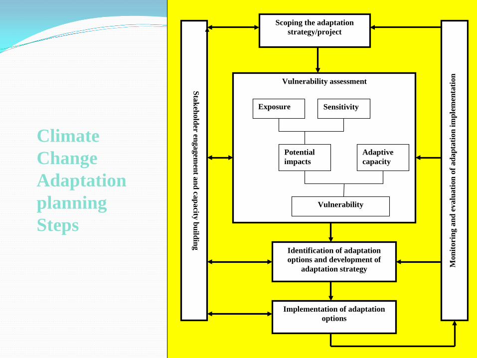
Climate ChangeAdaptation planningSteps
Scoping the adaptation
strategy/project
Vulnerability assessment
Sensitivity
Potential impacts
Adaptive capacity
Vulnerability
Exposure
Stakeholder engagement and capacity building
Mon
itori
ng a
nd e
valu
atio
n of
ada
ptat
ion
impl
emen
tatio
n
Identification of adaptation options and development of
adaptation strategy
Implementation of adaptation options
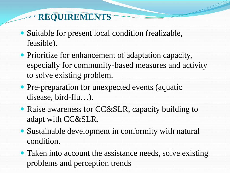
REQUIREMENTS
Suitable for present local condition (realizable, feasible).
Prioritize for enhancement of adaptation capacity, especially for community-based measures and activity to solve existing problem.
Pre-preparation for unexpected events (aquatic disease, bird-flu…).
Raise awareness for CC&SLR, capacity building to adapt with CC&SLR.
Sustainable development in conformity with natural condition.
Taken into account the assistance needs, solve existing problems and perception trends

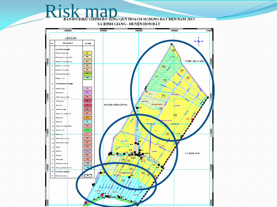
Risk map
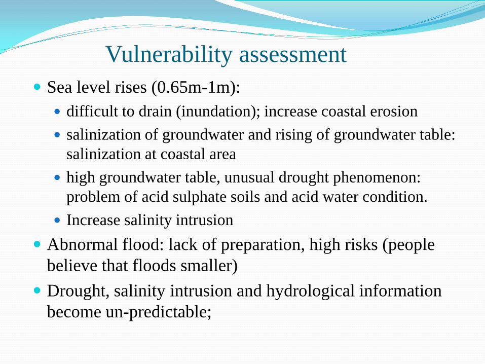
Vulnerability assessment Sea level rises (0.65m-1m):
difficult to drain (inundation); increase coastal erosion salinization of groundwater and rising of groundwater table:
salinization at coastal area high groundwater table, unusual drought phenomenon:
problem of acid sulphate soils and acid water condition. Increase salinity intrusion
Abnormal flood: lack of preparation, high risks (people believe that floods smaller)
Drought, salinity intrusion and hydrological information become un-predictable;

Vulnerability assessment Abnormal rainfall and SLR: increase inundation area Abnormal of high temperature and distributed rainfall:
unfavorable agricultural cultivation. increases investment cost (fertilizers, pesticides, irrigation
and drainage) insects and diseases increase: effect to agriculture and
aquaculture Rural water supply: salty contamination, acid water Infrastructure: roads, irrigation system (flood level,
operation conditions, stability) Hazard: fire and fire of forest may increase

FactorsVulnerability assessment
Areas Fields Object
Rising temperature Village
Agriculture and food security; Maritime products; Natural ecosystem, Biodiversity; Water resources; Energy; Community health
Poor families; ethnic; elder; children, patient and woman.
Flooding Hamlet: Channel 9, Eight thousand, Channel 4 Agriculture and food security;
Fishery; Natural ecosystem, Biodiversity; Water resources; Energy; Community health; Service; Water supply; drainage; Residence
Poor families; farmers (agri&fishery); ethnic; elder, children, woman .
Inundated by SLR and rainfall change
All hamlets in village
Drought in dry season All hamlets in village
Agriculture and food security; Water resources; Water supply; Waterway; Health and living
Farmers; ethnic; poor, woman and children
Salinity intrusion
Hamlets: Eight thousand, Channel 4, Giong Ke, Ranh Hat
Water resources; Water supply; Agricultural and food security; Community health
farmers; ethnic; poor
Erosion, silt deposit
Coastal area;Irrigation canal and drainage canal
Residence; Transport traffic; Water resources; Technical infrastructure; Health and living; Maritime products
Who live in riverside, littoral; Short of manpower family

Some pictures

Effect to the poor household
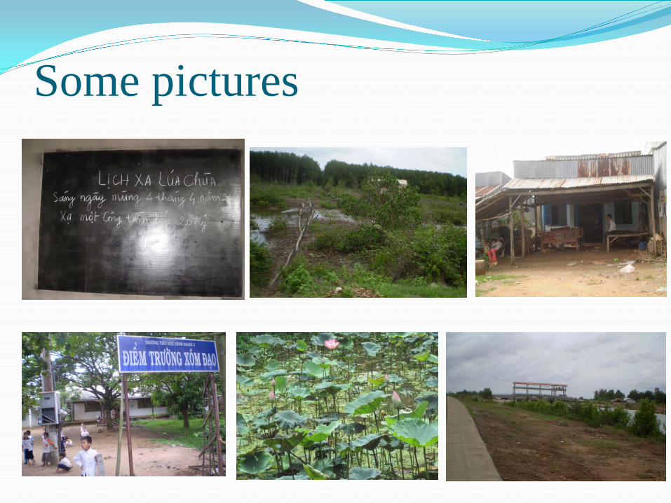
Some pictures
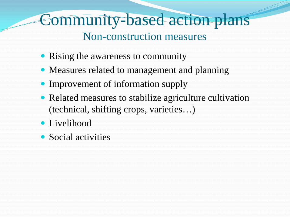
Community-based action plansNon-construction measures
Rising the awareness to community Measures related to management and planning Improvement of information supply Related measures to stabilize agriculture cultivation
(technical, shifting crops, varieties…) Livelihood Social activities

Rising the awareness to community Enhance community awareness to cope with climate
change Enhance awareness for solid waste disposal (agriculture
and breeding and aqua cultivation) Determining the impact of climate change to areas,
different sectors and different fields and vulnerability groups.
Strengthen public health services; prevention and disease control.
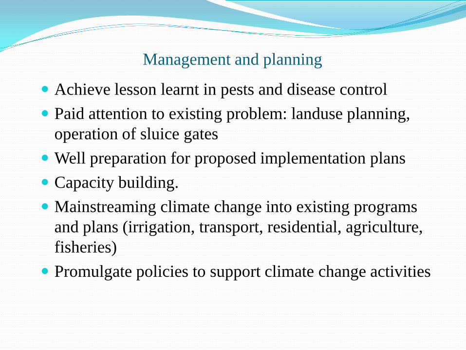
Management and planning
Achieve lesson learnt in pests and disease control Paid attention to existing problem: landuse planning,
operation of sluice gates Well preparation for proposed implementation plans Capacity building. Mainstreaming climate change into existing programs
and plans (irrigation, transport, residential, agriculture, fisheries)
Promulgate policies to support climate change activities
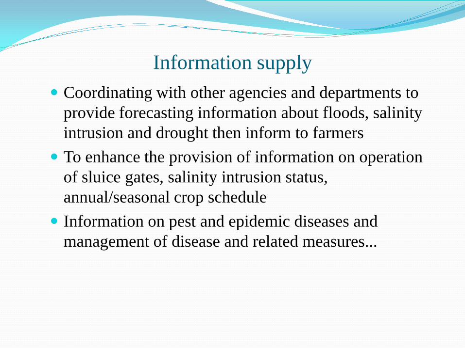
Information supply Coordinating with other agencies and departments to
provide forecasting information about floods, salinity intrusion and drought then inform to farmers
To enhance the provision of information on operation of sluice gates, salinity intrusion status, annual/seasonal crop schedule
Information on pest and epidemic diseases and management of disease and related measures...
Agriculture Adjust the crop calendar based on weather, hydrological
condition of season Suitable varieties: can stand the acidic, saline and drought
condition To manage and to supply concrete guidance: sowing date, using
fertilizer, training about new varieties, farming techniques, disease prevention
Strengthening agricultural training, practice IPM, pilot study Assisting hamlet to make agreement for crop calendar, landuse
and irrigation schedule (where have the same natural conditions or conflict in landuse and water use)
Training and practice to manage/control the shrimp disease at specific area

Livelihood Livelihood support to poor Promote effective models that adapting to the environment. 2
rice crops model is rather stable in Binh Giang Aquaculture model is unstable: inadequate infrastructure, so,
need to separate salt aqua cultivation with fresh water cultivation
Introduce other models to people.
Social activities More care in public health service and education, health
insurance for the elderly and children, facilities conditions, drinking water in schools
Concentrated to the poor: poverty reduction program, supporting with loans, technology, lands
Promote farmers to help each other with a proper assistance from youth associations, women and peasant association Land preparation, using fertilizer, seed, crop calendar Aqua cultural cultivation techniques, treatment of shrimp ponds, water
treatment tank, water quality management, density, care… Other techniques for dry crops, mushrooms ...
Recognizing and preventing epidemic diseases for rice and aquaculture...

Construction measure: at commune level Upgrading roads, schools, domestic water supply; and solid
waste treatment Dredging tertiary irrigation system (the request of residents) Separate aquaculture cultivation area and agriculture area
North and south of Dondong canal Proactive measures for irrigation and drainage to ensure
good conditions for cultivation Management, protection and extension of coastal forest area

Construction measure: integrated with higher level
To upgrade sea dikes and coast line erosion prevention
Upgrading the irrigation system and sluice gates and operation schedule
Landuse planning and addition construction to support the plan

Prioritize activity1) Provides appropriate information2) Treatment of solid waste from agriculture (collecting,
treating, manage of : pesticide bottles, fertilizer bags..)3) Treatment of waste from breeding households: Introduce
biogas model and technology transfer4) Improvement of landuse planning procedure: landuse
planning should have public participation;5) Separate aquaculture cultivation and agriculture cultivation
area6) Agricultural training should integrate with the specific
activities (practice with new varieties; implement pilot study)
7) Domestic water supply system