comprehensive management plan · this comprehensive management plan for the south shore estuary...
TRANSCRIPT

LONG ISLAND SOUTH SHOREESTUARY RESERVE
Comprehensive Management Plan
George E. Pataki, GovernorRandy A. Daniels, Secretary of State
Vers F cov CMP 8/30/01, 11:45 AM1
Preparation of this plan was nancially aided by: the New York State Environmental Protection Fund; New York State legislative member initiatives; and a grant from the U.S. Department of Commerce, National Oceanic and Atmospheric Administration, Ofce of Ocean and Coastal Resource Management, under the Coastal Zone Management Act of 1972, as amended.
South Shore Estuary Reserve Council Members/Designees
Randy A. Daniels, Council Chair/George R. Stafford Robert J. Gaffney, Suffolk County Executive/George Proios Thomas S. Gulotta, Nassau County Executive/Dan C. Fucci Edwin L. Eaton, City Manager, City of Long Beach/Joe FabrizioRichard V. Guardino, Supervisor, Town of Hempstead/ Ronald Masters/Mike FoleyJohn Venditto, Supervisor, Town of Oyster Bay/ James M. Byrne, P.E./Nancy KearneyRichard H. Schaffer, Jr., Supervisor, Town of Babylon/ Richard GrohPeter McGowan, Supervisor, Town of Islip/Alan Svoboda`John Jay LaValle, Supervisor, Town of Brookhaven/ Jeffrey KassnerVincent Cannuscio, Supervisor, Town of Southampton/ Marty SheaWilliam Glacken, Mayor, Village of Freeport Jeff Fullmer, Chair, Citizens Advisory Committee Cornelia Schlenk, Chair, Technical Advisory Committee Robert Grover, Great South Bay Audubon SocietyJill Ozarski, Long Island Chapter of the Nature ConservancyMarvin Geller, Dean, Marine Sciences Research Center, SUNY Stony Brook/William M. WisePatrick H. Augustine, New York Sportsshing FederationMitch Pally, Long Island Association/Marion Cohn Robert Wieboldt, Long Island Builders Institute, Inc.Christopher Squeri, New York Marine Trades AssociationCarole Neidich-Ryder, North Shore Audubon SocietyGregory LoVece, Brookhaven Bayman’s Association
Council Advisors
Erin M. Crotty, Commissioner, NYS Department of Environmental Conservation/Gordon Colvin/Karen ChytaloBernadette Castro, Commissioner, NYS Ofce of Parks, Recreation and Historic Preservation/Gary Lawton
New York State Department of StateDivision of Coastal Resources
George R. Stafford, DirectorRodney McNeil, Project ManagerDennis Mildner (Water Resources)Jeffrey Zappieri (Living Resources)Nancy Rucks (Land Use/Embayment Use/Underwater Lands)Peter Lauridsen (Geographic Information System)
Other Contributing Staff: Fred Anders; D. Peter Berical; Paul R. Churchhill; Fitzroy Collins; Susan DiDonato; John Herring; Jeffrey Herter; Charles McCaffrey; Nikifor Nikiforov; Laurissa Parent; Kenneth Smith; Lee York; and Thomas Zyskowski
Other Contributors
Patrick Dooley (Technical Advisory Committee support)Veronica Kemler (Citizens Advisory Committee support)
SUNY Albany: Floyd Henderson and Matthew Kohberger (Geographic Information System and Remote Sensing)
Previous Council Members/Designees: Ken Cynar (Nassau County); Felix J. Grucci (former Supervisor of the Town of Brookhaven); Anthony Limoli (Town of Islip); Nick Manzari (Captree Boatman’s Association); George Nussbaum (former Mayor of the Village of Massapequa Park); Bruce Nyman (former City Manager, City of Long Beach); and Adeline Quinn (City of Long Beach)
Former Department of State Staff: Robert Crafa; Diane Hamilton-Bell; Susan Dzurica; Thomas Hart; and Joseph Sicluna
The South Shore Estuary Reserve Council acknowledges the dedication of former Secretary of State Alexander “Sandy” Treadwell over the last ve years to bring the Plan to fruition.
Acknowledgements
This comprehensive management plan for the South Shore Estuary Reserve was prepared by the South Shore Estuary Reserve Council with assistance from the New York State Department of State, as provided in Article 46 of the Laws of 1993.
George E. Pataki, GovernorRandy A. Daniels, New York State Secretary of State
Vers F cov CMP 8/30/01, 11:45 AM2


ResolutionSouth Shore Estuary Reserve Council Adoption of theLong Island South Shore Estuary ReserveComprehensive Management Plan
WHEREAS, Article forty-six of the Executive Law declares it to be in the public interest to protect and manage the South Shore Estuary system as a single integrated estuary and in furtherance of that goal created the South Shore Estuary Reserve Council and directed it to prepare a comprehensive manage-ment plan and make recommendations to preserve, protect and enhance the natural, recreational, eco-nomic and educational resources of the Reserve; and
WHEREAS, the South Shore Estuary Reserve Council (“Council”) has undertaken those tasks, in accordance with such law; and
WHEREAS, the Council identied the extent of the South Shore Estuary Reserve as Long Island’s south shore bays and the adjacent upland areas draining into them, as described in the Long Island South Shore Estuary Reserve Comprehensive Management Plan; and
WHEREAS, the Council, in conjunction with its Citizens Advisory Committee and its Technical Advi-sory Committee reviewed data and prepared technical reports pertaining to the Reserve; and
WHEREAS, the Council prepared a draft South Shore Estuary Reserve Comprehensive Management Plan in accordance with Article forty-six of the Executive Law; and
WHEREAS, the Council submitted the draft Comprehensive Management Plan to public scrutiny and comment at public hearings held on the 28th day of February and the 1st day of March, 2001 and accepted written comments until the 28th day of March, 2001; and
WHEREAS, the Council has duly considered the oral and written comments submitted and has incor-porated the comments and its responses thereto in the Comprehensive Management Plan; and
WHEREAS, the Council has determined, after due deliberation, that the Comprehensive Management Plan meets the statutory criteria as well as the spirit of Article forty-six of the Executive Law;
NOW, THEREFORE, the South Shore Estuary Reserve Council does hereby ADOPT, the Compre-hensive Management Plan for the Long Island South Shore Estuary Reserve, and DIRECT that it be submitted herewith to each town and village within the reserve, the county executives of the counties of Nassau and Suffolk, and to the Governor and the Legislature of the State of New York.
DATED: April 12, 2001
f resolution 8/30/01, 11:50 AM1

Randy A. Daniels, New York State Secretary of State,Chair, South Shore Estuary Reserve Council
Robert J. Gaffney, Suffolk County Executive
Thomas S. Gulotta, Nassau County Executive
Edwin L. Eaton, City Manager, City of Long Beach
Richard V. Guardino, Supervisor, Town of Hempstead
John Venditto, Supervisor, Town of Oyster Bay
Richard H. Schaffer, Jr., Supervisor, Town of Babylon
Peter McGowan, Supervisor, Town of Islip
John Jay LaValle, Supervisor, Town of Brookhaven
Vincent Cannuscio, Supervisor, Town of Southampton
William Glacken, Mayor, Village of FreeportConference of Mayors
Jeff Fullmer, Chair, Citizens Advisory Committee
Cornelia Schlenk, Chair, Technical Advisory Committee
Robert Grover, Great South Bay Audubon Society
Jill Ozarski, The Nature Conservancy, Long Island Chapter
Dr. Marvin Geller, Dean, SUNY, Stony Brook, Marine Sciences Research Center
Patrick H. Augustine, New York Sportshing Federation
Christopher Squeri, New York Maritime Trades Association
Mitch Pally, Long Island Association
Robert Wieboldt, Long Island Builders Institute, Inc.
Carole Neidich-Ryder, North Shore Audubon Society
Gregory LoVece, Brookhaven Bayman’s Association
f resolution 8/30/01, 11:50 AM2

Under the leadership of Governor George E. Pataki, over 70 state-assisted projects have been completed or are underway to improve the health of the South Shore estuary. Nearly $10 million in Clean Water/Clean Air Bond Act grants and more than $6 million in Environmental Protection Fund grants have been awarded to Reserve communities to acquire open space, restore habitats and manage stormwater runoff. The South Shore Estuary Reserve Comprehensive Management Plan proposes steps to be taken over the next 5 years to continue these improvements.
Preface
At the urging of Long Islanders concerned with the future health of the South Shore estuary, the New York State Legislature passed the Long Island South Shore Estuary Reserve Act. The Act created the South Shore Estuary Reserve (Reserve) - Long Island’s South Shore bays and the adjacent upland areas draining to them - and called for the Reserve’s protection and prudent management. The Act also created the South Shore Estuary Reserve Council (Council), a group of representatives from South Shore towns and villages, Nassau and Suffolk counties and the City of Long Beach, and recreation, business, academic, environmental and citizens interests. The Act charged the Council with preparation of a comprehensive management plan for the Reserve.
Development of this comprehensive management plan has followed a process in which many individuals have had opportunities to participate. In 1994, the Council held a series of scoping meetings during which public views and concerns about the estuary and its management were received. Monthly meetings, open to the public, have allowed interested parties to learn about and participate in Council activities and those of its Technical Advisory Committee, Citizens Advisory Committee, and topic-based subcommittees and workgroups.
To assist the Council, the New York State Department of State’s Division of Coastal Resources, working through partnerships with local governments and federal agencies, gathered and analyzed information on land and embayment uses, the estuarine economy, water quality, living resources, and other aspects of the Reserve. Much of this information was analyzed by the Department of State through geographic information system technology, and the analyses have served as a basis for the implementation actions offered in the plan. Important data were also supplied by the six towns and two counties in the Reserve as part of assessments of their nonpoint source management practices conducted in conjunction with the Department. All of this information is presented in the series of technical reports and working papers referenced in Appendix A to the plan.
EXECUTIVE SUMMARYLong Island South Shore Estuary ReserveComprehensive Management Plan
Executive Summary Page iAccess the document on the Web at http://www.estuary.cog.ny.us
Vers F2 ex summ 8/30/01, 11:42 AM1

Executive Summary Page ii Access the document on the Web at http://www.estuary.cog.ny.us
Implementation actions identied in Chapter 7 address major issues in the Reserve as they relate to water quality and living resources, public access and open space, the Reserve’s maritime heritage, its economy, and education and outreach. Although much has been accomplished since 1995 by the State and its local government partners through the many Clean Water Clean Air Bond Act and Environmental Protection Fund projects, and by the Council’s Technical and Citizens Advisory committees, much remains to be done to assure the long-term health of the Reserve.
[Note to reader: An electronic version of the South Shore Estuary Reservecomprehensive management plan, with links to the technical report series and associated data sets and maps, can be accessed at: www.estuary.cog.ny.us.]
Chapter 1: The Region
Estuaries are coastal areas where fresh water mixes with salt water. Long Island’s South Shore estuary was formed during the last 5,000 years by the interaction of rising seas with the glacially deposited material that makes up Long Island. The interaction shaped the barrier islands to enclose 173 square miles
of bays characterized by tidal marshes, mud and sand ats, beds of underwater vegetation and extensive shallows ranging from 1 to 7 meters deep. The shallows support microscopic plants and animals which, in turn, support the nsh, shellsh, waterfowl and other wildlife that typify the South Shore estuary. This barrier/bays system continues to respond to wave action, the tides, coastal storms and a rising sea level. It is also affected by human actions.
The South Shore Estuary Reserve is home to about 1.5 million people. The anchor of the region’s tourism, seafood and recreation industries, the Reserve stretches from the western boundary of the Town of Hempstead to the middle of the Town of Southampton. South to north, the Reserve extends from the mean high tide line on the ocean side of the barrier islands to the inland limits of the mainland watersheds that drain into Hempstead Bay, South Oyster Bay, Great South Bay, Moriches Bay and Shinnecock Bay.
For purposes of planning and description, the South Shore Estuary Reserve is conveniently viewed as three subregions: the western bays, Great South Bay and the eastern bays.
The western bays subregion extends from the western boundary of the Town of Hempstead to
Vers F2 ex summ 8/30/01, 11:42 AM2-3
Executive Summary Page iiiAccess the document on the Web at http://www.estuary.cog.ny.us
the Nassau-Suffolk County line, and includes Hempstead Bay and South Oyster Bay and all the lands that drain into them. These embayments are an extensive area of shallow water and salt marsh islands connected by channels and tidal creeks. Its watershed is the most densely populated in the Reserve, with stormwater runoff from its developed landscape the most signicant source of pollution reaching the subregion’s tributaries and bays. Coliform bacteria, responsible for the closure of 14,155 acres of shellsh beds in the western bays and the periodic bathing closures of Zachs Bay and Biltmore Beach, is the principal pollutant carried by the runoff, but human waste discharges from vessels, excrement from waterfowl, and discharges from municipal wastewater treatment plant outfalls in the western bays are also contributing sources. This portion of the Reserve also contains the greatest concentration of salt marsh islands, most of which have been ditched through mosquito control programs.
Great South Bay is the largest shallow estuarine bay in New York State, with extensive back barrier and tidal creek salt marshes, eelgrass beds, and intertidal ats. Most marshes in the subregion are ditched, with many mainland marshes impaired by ll and bulkheads or restrictions to tidal ow. The watershed of Great South Bay can be described as “developing,” in contrast to the more fully “developed” western bays region, and development is generally less intense and open areas more extensive. Like the western bays subregion, Great South Bay has extensive impervious surfaces in its watershed. For this reason, nonpoint source pollution from stormwater runoff is the primary issue.
Nutrients, sediment and coliform bacteria are the principal pollutants carried by stormwater runoff into the subregion’s tributaries and ultimately Great South Bay. Vessel waste discharges and waterfowl are also contributors to the bacterial load. Elevated levels of coliform are responsible for the closure of 10,711 acres of shellsh beds in Great South Bay and the periodic
closure of three of its bathing beaches. Nutrients and sediments in stormwater runoff threaten shing, sh propagation and sh survival in the subregion’s tributaries and coves. Hydromodications - alterations of water level and stream ow - and lowering of groundwater levels also have signicant effects on shery resources in tributaries.
The shallow eastern bays - Moriches and Shinnecock - are distinguished by the presence of inlets, strong tidal exchanges between the ocean and the bays, and minor inows of lower salinity water from the Peconics through the Shinnecock Canal. Salt marshes and dredged material islands of the eastern bays support signicant nesting colonies of terns, gulls, and wading birds. Shallow water areas are highly productive, especially the salt marshes and intertidal ats that fringe the barrier islands and the estuarine habitats around the tributary mouths.
Although the watershed of Moriches and Shinnecock bays is the least developed in the Reserve, elevated levels of fecal coliform bacteria from polluted stormwater runoff have closed 6,075 acres of shellsh beds in the bays. Sediment and excessive nutrients in stormwater runoff have affected sh survival in tributaries, and organic nutrients play a role in the brown tide outbreaks in the subregion. Agriculture occurs in this subregion to some degree, with potential impacts on water quality from sediments, fertilizers and pesticides.
Chapter 2: Improve and Maintain Water Quality
Water quality in the South Shore Estuary Reserve is important to everyone on Long Island. Poor water quality diminishes recreational and economic opportunities.
Nonpoint source pollution is the primary water quality concern in the South Shore Estuary Reserve. Polluted stormwater runoff alone is the
Vers F2 ex summ 8/30/01, 11:42 AM2-3

Executive Summary Page iv Access the document on the Web at http://www.estuary.cog.ny.us
principal source of nonpoint pollution in 48 of the 51 waterbody segments in the Reserve with use impairments. Elevated levels of coliform bacteria in stormwater runoff, an indicator of the potential presence of pathogens, are responsible for the closures of shellsh beds and bathing beaches. Sediment and excessive nutrients in stormwater runoff have pronounced negative effects on the Reserve’s living resources.
Point sources of pollution - municipal wastewater treatment plants, inactive hazardous waste sites and active and inactive solid waste disposal facilities - are not as widespread and are comparatively less signicant sources of pollution than nonpoint sources, but still cause water quality degradation in their immediate areas. Point sources are regulated and monitored through the State Pollution Discharge Elimination System (SPDES) permit program.
Improving water quality in the Reserve is dependent on federal, State and local governments, and private sector partners, implementing a strategy that: 1) identies opportunities and develops schedules to protect lands that provide signicant pollutant abatement functions; 2) designs and undertakes projects that retrot existing storm sewer and other conveyance systems to remove pollutants from storm water; 3) adopts nonpoint source pollution best management practices; and 4) increases education and outreach to modify resident and user behavior.
This chapter identies recommendations to reduce and control nonpoint source pollution; enhance point source controls; implement the Environmental Protection Agency’s Storm Water Phase II Final Rule; and address scientic information needs.
Chapter 3: Protect and Restore Living Resources of the Reserve
The South Shore estuary is a rich and complex ecosystem. Its beaches, shallow bays, tidal marshes, tributaries and upland areas make the Reserve one of the most ecologically productive regions in the United States. In addition to providing the basic necessities for estuarine life, the estuary, its shoreline and upland areas provide open space, contribute to the scenic beauty of the region and support its tourism, recreation and seafood industries.
Human population growth and burgeoning development in the Reserve, especially since World War II, had and continues to have a dramatic effect on the estuary. Most habitat loss in the Reserve has been the result of the lling of low-lying lands in the western portion of the Reserve for residential and commercial uses. Other development activities, including construction of canals, roads and bridges, have also destroyed or degraded habitats. According to the NYS Department of Environmental Conservation 1996 Priority Waterbody List, stormwater polluted by elevated levels of fecal coliform bacteria, excessive nutrients and sediment has affected the viability of sh populations in the Reserve’s tributaries and has closed almost 31,000 acres of hard clam beds in its bays.
Regulations have slowed the loss of tidal and freshwater wetlands in the Reserve, but the remaining wetlands present both challenges and opportunities for management and restoration. The Reserve’s open bays have also undergone notable changes, inuenced chiey by inlet dynamics, while its upland forests seem to be experiencing a loss comparable to that of the region’s tidal wetlands.
Recommendations are offered to incorporate an ecosystem perspective into the management of the Reserve’s living estuarine resources; to increase wetland community values; to
Vers F2 ex summ 8/30/01, 11:42 AM4-5

Executive Summary Page vAccess the document on the Web at http://www.estuary.cog.ny.us
recognize, restore and protect tributary-based resource values; to protect and improve habitat conditions for estuarine bird species; to improve the productivity of important living resources; and to address scientic information needs.
Chapter 4: Expand Public Use and Enjoyment of the Estuary
The public’s ability to use and enjoy the natural resources of the South Shore estuary depends upon access to its tributaries, bays and shoreline. The supply of formal, dedicated shoreline public access sites and recreational facilities is nite, and opportunities to increase the supply will become fewer as private shoreline development continues. The more intensive and widespread such development becomes, the more valuable is the remaining open space. While generally important for retaining variety and visual interest in the pattern of development, open space is critical to the health of the estuary and its coastal habitats and the coastal character of Long Island’s South Shore. All levels of government must work together in cooperation with private development interests to preserve open space in the Reserve, buffer sensitive habitats, improve water quality and retain the visual landscape of the estuary.
Commercial shing, island bay houses, recreational boating, yacht clubs, boat repair shops, ferries and shoreline parks are all part of the region’s maritime heritage and dene its present-day culture. These traditional estuary-related uses are gradually being displaced by more economically competitive non-traditional uses. Concerted public and private efforts will be needed to perpetuate the region’s historical legacy.
Recommendations are offered to improve shoreline public access and estuary-related recreation; to retain open space within the Reserve; and to protect, maintain and enhance the Reserve’s maritime heritage.
Chapter 5: Sustain and Expand Estuary-related Economy
The relatively calm, protected waters and abundant natural resources of the South Shore estuary provide the basis for the water-related economic activities that have evolved from the harvesting of oysters, hard clams and salt hay, and boat building, to recreational boating, sport shing, waterborne transportation and tourism. Changes in the nature of these water-dependent businesses reect the inuence of a growing population and market demand, transportation improvements and increased recreational demands. Today, the estuary is home to the largest concentrations of commercial and recreational vessels, marinas and other water-dependent businesses in the State. The estuary supports, in whole or in part, about 3,000 water-dependent and water-enhanced businesses that employ nearly 30,000 people.
The amount of estuary shoreline suitable for establishing new water-dependent uses or expanding existing ones is limited, while, at the same time, some existing water-dependent businesses are gradually being displaced by more economically-competitive non water-dependent uses. This is of particular concern in maritime centers where water-dependent uses are concentrated and embody much of the estuary-related cultural heritage that supports local tourism. Recommendations are offered to support water-dependent businesses and to enhance maritime centers.
Chapter 6: Increase Education, Outreach and Stewardship
Academic institutions can be highly effective conduits of information on the South Shore estuary. Of the 124 public school districts on Long Island responsible for primary and secondary level education, nearly half (60) are located in whole or part within the Reserve
Vers F2 ex summ 8/30/01, 11:42 AM4-5
Executive Summary Page vi Access the document on the Web at http://www.estuary.cog.ny.us
and serve a major portion of the approximately 423,000 school age children on Long Island. Teachers have many sources of information at their disposal, and a number of nature centers and museums in the Reserve offer eld programs for school groups. Yet elementary, middle and high school teachers face various constraints in trying to raise student consciousness about the environment outside their classrooms.
People in the Reserve learn about their environment from a variety of sources: newspapers, magazines, television and radio, as well as from numerous public and private organizations, many of which are represented on the South Shore Estuary Reserve Council. Many organizations on Long Island are moving beyond education and outreach activities and are striving to motivate individuals to become active stewards of their environment. At the community level, local governments and neighborhood, civic and environmental groups are bringing citizens together in collective efforts to improve the environment.
This chapter identies recommendations to strengthen the mechanisms for raising awareness and understanding of the South Shore estuary; to nurture awareness and understanding on the part of young people through formal education activities that focus on the South Shore estuary; to increase public awareness and understanding through outreach activities geared to general and specic audiences; and to encourage people of all ages to become stewards of the estuary.
Chapter 7: Implementation
Building on what has already been accomplished since 1995 by the State, local governments and the Reserve’s Council, the implementation actions presented in this chapter provide the necessary road map to fullling the recommendations offered in the preceding chapters and assuring the long-term health of
the Reserve. The actions target effort where the greatest potential exists for halting further degradation of the Reserve’s natural resources and realizing improvements to them, and where multiple goals and objectives of the Council can be achieved.
The actions focus attention where problems have been clearly identied and where the existence of motivated partners assures a higher likelihood of success. They are organized and presented according to outcomes they will fulll.
In order to make signicant progress toward achieving these outcomes, funding will be necessary from a variety of governmental and non-governmental sources to meet the estimated $97.8 million ve year cost of implementing the actions called for in Chapter 7.
Outcome 1:
Reduced nonpoint source pollution.
1-1 Construction of stormwater abatement projects
in signicant nonpoint source contributing areas
associated with closed shellsh beds, impaired living
resources, and bathing beaches that experience
periodic closures due to water quality concerns.
1-2 Amendment of county and local government codes
and regulations to include best management practices.
1-3 Implementation of on-site wastewater treatment
(septic) system maintenance and upgrades.
1-4 Implementation of Agricultural Environmental
Management.
1-5 Completion of assessments of municipal nonpoint
pollution management practices.
1-6 Development of watershed action plans.
1-7 Preparation for compliance with the
Environmental Protection Agency’s Stormwater
Phase II Final Rule.
1-8 Exploring the feasibility of stormwater
management districts.
Vers F2 ex summ 8/30/01, 11:42 AM6-7
Executive Summary Page viiAccess the document on the Web at http://www.estuary.cog.ny.us
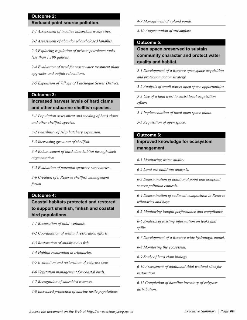
Outcome 2:
Reduced point source pollution.
2-1 Assessment of inactive hazardous waste sites.
2-2 Assessment of abandoned and closed landlls.
2-3 Exploring regulation of private petroleum tanks
less than 1,100 gallons.
2-4 Evaluation of need for wastewater treatment plant
upgrades and outfall relocations.
2-5 Expansion of Village of Patchogue Sewer District.
Outcome 3:
Increased harvest levels of hard clams
and other estuarine shellsh species.
3-1 Population assessment and seeding of hard clams
and other shellsh species.
3-2 Feasibility of Islip hatchery expansion.
3-3 Increasing grow-out of shellsh.
3-4 Enhancement of hard clam habitat through shell
augmentation.
3-5 Evaluation of potential spawner sanctuaries.
3-6 Creation of a Reserve shellsh management
forum.
Outcome 4:
Coastal habitats protected and restored
to support shellsh, nsh and coastal
bird populations.
4-1 Restoration of tidal wetlands.
4-2 Coordination of wetland restoration efforts.
4-3 Restoration of anadromous sh.
4-4 Habitat restoration in tributaries.
4-5 Evaluation and restoration of eelgrass beds.
4-6 Vegetation management for coastal birds.
4-7 Recognition of shorebird reserves.
4-8 Increased protection of marine turtle populations.
4-9 Management of upland ponds.
4-10 Augmentation of streamow.
Outcome 5:
Open space preserved to sustain
community character and protect water
quality and habitat.
5-1 Development of a Reserve open space acquisition
and protection action strategy.
5-2 Analysis of small parcel open space opportunities.
5-3 Use of a land trust to assist local acquisition
efforts.
5-4 Implementation of local open space plans.
5-5 Acquisition of open space.
Outcome 6:
Improved knowledge for ecosystem
management.
6-1 Monitoring water quality.
6-2 Land use build-out analysis.
6-3 Determination of additional point and nonpoint
source pollution controls.
6-4 Determination of sediment composition in Reserve
tributaries and bays.
6-5 Monitoring landll performance and compliance.
6-6 Analysis of existing information on leaks and
spills.
6-7 Development of a Reserve-wide hydrologic model.
6-8 Monitoring the ecosystem.
6-9 Study of hard clam biology.
6-10 Assessment of additional tidal wetland sites for
restoration.
6-11 Completion of baseline inventory of eelgrass
distribution.
Vers F2 ex summ 8/30/01, 11:42 AM6-7

Executive Summary Page viii Access the document on the Web at http://www.estuary.cog.ny.us
6-12 Undertaking research on ooding and erosion.
6-13 Expansion of brown tide research.
6-14 Analyzing duck sludge deposits as potential
pollutant sources.
Outcome 7:
Increased public use of the estuary and
expanded tourism.
7-1 Expanding public access and recreation facilities
at existing sites.
7-2 Creating new public access and recreation
opportunities.
7-3 Expansion of existing interpretive centers and
development of new ones.
7-4 Establishing a South Shore Estuary Reserve
Coastal Heritage Trail.
Outcome 8:
Water-dependent businesses sustained.
8-1 Provision of adequate infrastructure to support
existing and new water-dependent uses.
8-2 Development of a dredging and dredged materials
management plan.
8-3 Dredging for safe navigation.
8-4 Planning for local waterfront development.
8-5 Improving local waterfront regulation.
8-6 Facilitating public/private partnerships to support
water-dependent business.
8-7 Preparation of Local Harbor Management Plans.
Outcome 9:
Maritime centers thrive.
9-1 Preparation of maritime center action plans.
9-2 Implementation of maritime center action plans.
9-3 Promotion of maritime centers.
Outcome 10:
Heightened public awareness of
the estuary.
10-1 Supporting a Reserve web site.
10-2 Updating education resource directory.
10-3 Creation of an access guide.
10-4 Production of South Shore video.
10-5 Working with outreach partners.
10-6 Identication of professional development
opportunities for teachers.
10-7 Supporting the existing network of entities that
conduct education programs on board watercraft.
10-8 Identication of potential mentors.
10-9 Establishment of a clearinghouse for student
research.
10-10 Establishing an awards program.
10-11 Designation of bird conservation areas.
10-12 Undertaking a native landscaping pilot
program.
10-13 Creation of a homeowner certication program.
Outcome 11:
Actions advanced through Council
partnerships and ofce.
11-1 Promotion and oversight of plan implementation.
11-2 Establishment and operation of Reserve ofce.
Vers F2 ex summ 8/30/01, 11:42 AM8

Table of Contents
Page
Executive Summary i-viii
Preface ix
Chapter 1 The Region 1-8
Chapter 2 Improve and Maintain Water Quality 9-24
Chapter 3 Protect and Restore Living Resources of the Reserve 25-38
Chapter 4 Expand Public Use and Enjoyment of the Estuary 39-48
Chapter 5 Sustain and Expand the Estuary-related Economy 49-56
Chapter 6 Increase Education, Outreach and Stewardship 57-70
Chapter 7 Implementation 71-108
• Integrative Analysis and Implementation Map Series 109
Appendix A Abstracts of Technical Reports A1-A12
Appendix B State-assisted Projects to Benet the Estuary B1-B6
Appendix C Response to Public Comments C1-C20
F TOC 8/30/01, 11:51 AM1

F TOC 8/30/01, 11:51 AM2
Preface Page ixAccess the document on the Web at http://www.estuary.cog.ny.us
Preface
The New York State Legislature passed the Long Island South Shore Estuary Reserve Act in 1993 at the urging of Long Islanders concerned about the future health of the South Shore estuary. The Act declared the estuary to be a resource of unparalleled biological, economic and social value, created the South Shore Estuary Reserve (Reserve) and called for its protection and prudent management.
The Act also created the South Shore Estuary Reserve Council (Council), designated the New York Secretary of State as its Chair, and provided for membership representing six South Shore towns, thirty-one villages, Nassau and Suffolk counties, the City of Long Beach, and recreation, business, academic, environmental and citizen interests. The Act also charged the Council with the preparation of a comprehensive management plan for the Reserve.
Development of the plan has followed a process in which many individuals have had opportunities to participate. In 1994, the Council held a series of scoping meetings during which public views and concerns about the estuary and its management were received. Monthly meetings, open to the public, have allowed interested parties to learn about and participate in Council activities and those of its Technical Advisory Committee, Citizens Advisory Committee, and topic-based subcommittees and workgroups.
To assist the Council, the Department of State Division of Coastal Resources gathered information primarily through partnerships with local governments and federal agencies. The information addressed land and embayment uses, the estuarine economy, water quality, living resources, and other aspects of the Reserve. Much of this information was analyzed by the Department of State through geographic information system technology, and this analysis served as a basis for the implementation actions offered in the plan. All of this information is presented in the series of technical reports and working papers referenced in Appedix A to the plan.
The Council is pursuing multiple purposes in issuing this plan:
• to recommend management actions for protecting and improving the health of the South Shore estuary, and to expand such efforts;
• to sustain cooperation and commitment among all public and private interests with a stake in the estuary;
• to build public awareness and understanding about the estuary and the issues that affect its health and vitality, and to involve the public in its management; and
• to identify future research in areas where further scientic information is needed to improve management actions.
[Note to reader: An electronic version of the South Shore Estuary Reserve comprehensive management plan, with links to the technical report series and associated data sets and maps, can be accessed at: www.estuary.cog.ny.us.]
Vers F preface 8/30/01, 11:48 AM9

Access the document on the Web at http://www.estuary.cog.ny.us
Vers F preface 8/30/01, 11:48 AM10

CHAPTER 1
The Region
Vers f intr-1 8/30/01, 11:10 AM1

CHAPTER 1The Region
Access the document on the Web at http://www.estuary.cog.ny.usChapter 1 Page 2
This chapter provides a brief overview of the South Shore Estuary Reserve, characterizes the ve estuarine bays and the lands that drain to them, and introduces the many resource management concerns that relate to the different parts of the Reserve.
Estuaries are transition zones between the world’s freshwater and marine ecosystems where fresh water mixes with salt water. Long Island’s South Shore estuary is a dynamic ecosystem, formed during the past 5,000 years by the interaction of a rising sea level with the glacially-deposited material that makes up Long Island. The entire natural system, including the barrier islands and the 173 square miles of shallow bays behind them, is still changing and evolving in response to wave action, tides, coastal storms, and the continuing rise of sea level. In this estuarine environment, tidal marshes, mud and sand ats, underwater plant beds and broad shallows support microscopic plants and animals which, in turn, support the nsh, shellsh, waterfowl and other wildlife that typify the South Shore estuary.
Overview of the South Shore Estuary Reserve
The South Shore Estuary Reserve is home to about 1.5 million people. The anchor of the region’s tourism, seafood and recreation industries, the Reserve stretches from the western boundary of the Town of Hempstead to the middle of the Town of Southampton. South to north, the Reserve extends from the mean high tide line on the ocean side of the barrier islands to the inland limits of the mainland watersheds that drain into Hempstead Bay, South Oyster Bay, Great South Bay, Moriches Bay and Shinnecock Bay.
Human population growth and burgeoning development in the Reserve, especially since World War II, had and continues to have a dramatic effect on the estuary. Most habitat
The South Shore Estuary Reserve is the anchor of the region’s tourism, seafood and recreation industries, and is home to about 1.5 million people.
Vers f intr-1 8/30/01, 11:10 AM2-3

Chapter 1 Page 3Access the document on the Web at http://www.estuary.cog.ny.us
loss in the Reserve has been the result of the lling of low-lying lands in the western portion of the Reserve for residential and commercial uses. Other development activities, including construction of canals, roads and bridges, have also destroyed or degraded habitats. According to the NYS Department of Environmental Conservation’s 1996 Priority Waterbody List, stormwater polluted by elevated levels of fecal coliform bacteria, excessive nutrients and sediment has effected the viability of sh populations in the Reserve’s tributaries and has closed over 34,000 acres of hard clam beds in its bays.
For purposes of planning and description, the South Shore Estuary Reserve is conveniently viewed as three subregions: the western bays, Great South Bay and the eastern bays.
Western Bays
The western bays subregion extends from the western boundary of the Town of Hempstead to the Nassau-Suffolk County line, and includes Hempstead Bay and South Oyster Bay and all the lands that drain into them. These embayments are an extensive area of shallow water and salt marsh islands connected by channels and tidal
creeks. This portion of the Reserve contains the greatest concentration of salt marsh islands, most of which have been ditched through mosquito control programs. These islands are frequently subject to erosion due to the relatively high tidal range and proximity to heavy commercial and recreational boat trafc. Dredged material islands, over both wetland and shallow water habitats, are also prominent in the subregion.
Almost all of the mainland shoreline in this subregion is bulkheaded, with the most intense development along the shoreline in the western part of the subregion. Much of the original development occurred in the 1950s and 60s as thousands of acres of tidal wetlands were lled to create new home sites. Virtually all mainland tidal wetlands were eliminated in this manner. The western bays also support a variety of benthic macroalgae (seaweeds) and submerged aquatic vegetation (seagrasses), the most important of which is eelgrass. As a result of disease and water quality problems, signicant losses of submerged aquatic vegetation beds have also occurred in parts of these bays.
Habitat loss and water quality problems have also had a negative impact on most of the estu-arine species in the western bays. Recreational
nsh species have declined, as have shellsh populations, which are also impaired by low rates of recruitment. The subre-gion’s signicant concentrations of shorebirds, wintering water-fowl and colonial nesting water birds also have been reduced. Most waterbird colonies in the Reserve occur on the islands of the western bays from Hemp-stead east to Captree. South Oyster Bay and Hempstead Bay are also an important part of the Atlantic Flyway for migrating and wintering waterfowl, par-ticularly brant, with an aver-age of nearly 25,000 water-
Freeport shoreline in the Western Bays
Vers f intr-1 8/30/01, 11:10 AM2-3

Chapter 1 Page 4 Access the document on the Web at http://www.estuary.cog.ny.us
fowl counted on mid-winter aerial surveys. The importance of the western bays for migrating, wintering and resident coastal birds also needs to be recognized.
The watershed of the western bays is the most densely populated in the Reserve. It exhibits the highest proportion of watershed rendered impervious by roads, parking lots and roofs. Land use south of Sunrise Highway and Merrick Road is highly urbanized and predominantly residential. Intersections along major highways are developed with high density residential, industrial, and/or transportation and utility uses. Land use close to the bays includes parks, nature preserves and protected areas for local and regional recreational purposes. However, residential development along canals, tributaries and the shoreline is increasing the pressure on these natural areas.
Stormwater runoff from this developed landscape is the most signicant source of pollution reaching the subregion’s tributaries and bays. Elevated levels of coliform bacteria, responsible for the closure of 15,575 acres of shellsh beds in the western bays and the periodic bathing closures of Zachs Bay and Biltmore Beach, is the principal pollutant carried by the runoff, but human waste discharges from vessels, excrement from waterfowl, and discharges from municipal wastewater treatment plant outfalls in the western bays are also contributing sources. Nutrients from these same point and nonpoint sources promote the subregion’s extensive mats of seaweeds that are in part responsible for the loss of valuable seagrass beds, while nutrients and sediments in stormwater runoff are held responsible for threatening sh survival and propagation in several of the subregion’s tributary streams. Petroleum products are also documented pollutants. Thus water quality in the western bays is affected by both nonpoint and point sources of pollution.
For this subregion, comprehensive efforts are needed to achieve signicant improvements in water quality and living resources. Such efforts must include: the restoration of ditched and lled salt marshes; vegetation management in shorebird and waterbird nesting areas; restoration of eelgrass beds; protection and restoration of inland ponds; augmentation of water level and ow in streams; improved boating management; seed clam planting; and educational outreach. Also needed are implementation of management practices as source controls to prevent nonpoint source pollutants from reaching stormwater runoff or from owing directly into tributaries and bays, and management of polluted stormwater runoff before it reaches those tributaries and bays.
Management of polluted stormwater runoff in areas where the most signicant reductions can be gained will correct this major source of nonpoint pollution. One aspect of this effort will be local implementation of stormwater remediation projects with State technical and nancial assistance. Such projects will be implemented at roadway crossings of tributaries, at street ends draining to waterbodies, and in parking lots throughout contributing areas. Improvements to municipal stormwater drainage systems that reduce the volume and ow of stormwater runoff to the western bays will be an important element of stormwater management.
Great South Bay
Great South Bay is the largest shallow estuarine bay in New York State, with extensive back barrier and tidal creek salt marshes, eelgrass beds, and intertidal ats. Most marshes in the subregion are ditched, with many mainland marshes impaired by ll and bulkheads or restrictions to tidal ow. As the only South Shore bay with major riverine input, Great South Bay’s living resources have been signicantly affected by diminished tributary water quality.
Vers f intr-1 8/30/01, 11:10 AM4-5

Chapter 1 Page 5Access the document on the Web at http://www.estuary.cog.ny.us
The loss of tidal marshes and other coastal habitats has reduced estuarine productivity and eliminated critical feeding and nursery habitat for nsh, shellsh, shorebirds and colonial waterbirds. Additionally, in the past 25 years, the hard clam harvest in Great South Bay has fallen by more than 93% to record lows.
The watershed of Great South Bay can be described as “developing,” in contrast to the more fully “developed” western bays region, and development is generally less intense and open areas more extensive. The primary land use pattern is medium density development with pockets of more intense residential use on ngers of land separated by canals and waterways. Along the shoreline are substantial areas of green space dedicated as parklands and preserves. The intensity of development lessens from west to east within the subregion. Its population has grown over the last decade and is projected to continue to do so over the next twenty years, but at a gradually decreasing rate.
Like the western bays subregion, Great South Bay has extensive impervious surfaces in its watershed. For this reason, polluted stormwater runoff is the primary issue. Nutrients, sediment and coliform bacteria are the principal pollutants carried by stormwater runoff into the subregion’s tributaries and ultimately Great
South Bay. Vessel waste discharges and waterfowl are also contributors to the bacterial load. Elevated levels of coliform are responsible for the year-round closure of 12,886 acres of shellsh beds in Great South Bay and the periodic closure of three of its bathing beaches. Nutrients and sediments in stormwater runoff threaten shing, sh propagation and sh survival in the subregion’s tributaries and coves. Hydromodications - alterations of water level and stream ow - and lowering of groundwater levels also have signicant effects on shery resources in tributaries.
For this subregion, efforts to improve water quality are proposed to focus on the management of nonpoint source pollution, especially polluted stormwater runoff. These efforts would include implementation of the management practices recommended in Chapter 2 to prevent nonpoint source pollutants from reaching stormwater runoff or from owing directly to tributaries and the bay. Management of polluted stormwater runoff in areas where the most signicant reductions can be gained would begin to correct this major source of nonpoint pollution. One aspect of this effort would be local implementation of stormwater remediation projects with State technical and nancial assistance. Such projects would be implemented at roadway crossings of tributaries, at street ends draining to waterbodies, and in
parking lots throughout contrib-uting areas. Parcel acquisition for stormwater management proj-ects, construction of stormwater wetlands, and continued improve-ments to municipal stormwater drainage systems that reduce the volume and ow of stormwater runoff to Great South Bay will also be important elements of storm-water management.
Great South Bay at the Robert Moses Causeway
Vers f intr-1 8/30/01, 11:10 AM4-5
Chapter 1 Page 6 Access the document on the Web at http://www.estuary.cog.ny.us
Projects to restore the living resources of Great South Bay are proposed to focus on: the restoration of ditched, lled back barrier and cove salt marshes, and riverine wetlands; vegetation management in shorebird and colonial waterbird nesting areas; protection of submerged aquatic vegetation beds; augmentation of water level and ow in streams; improved boating and boat maintenance practices; and evaluation of shell augmentation of bay bottoms and seed clam planting.
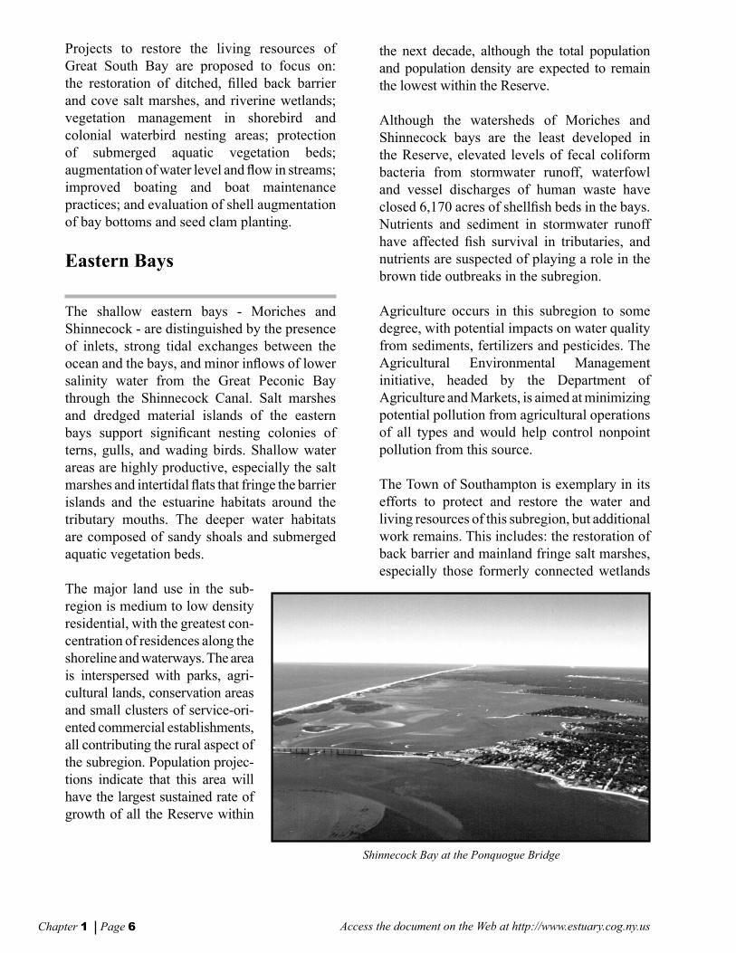
Eastern Bays
The shallow eastern bays - Moriches and Shinnecock - are distinguished by the presence of inlets, strong tidal exchanges between the ocean and the bays, and minor inows of lower salinity water from the Great Peconic Bay through the Shinnecock Canal. Salt marshes and dredged material islands of the eastern bays support signicant nesting colonies of terns, gulls, and wading birds. Shallow water areas are highly productive, especially the salt marshes and intertidal ats that fringe the barrier islands and the estuarine habitats around the tributary mouths. The deeper water habitats are composed of sandy shoals and submerged aquatic vegetation beds.
The major land use in the sub-region is medium to low density residential, with the greatest con-centration of residences along the shoreline and waterways. The area is interspersed with parks, agri-cultural lands, conservation areas and small clusters of service-ori-ented commercial establishments, all contributing the rural aspect of the subregion. Population projec-tions indicate that this area will have the largest sustained rate of growth of all the Reserve within
Shinnecock Bay at the Ponquogue Bridge
the next decade, although the total population and population density are expected to remain the lowest within the Reserve.
Although the watersheds of Moriches and Shinnecock bays are the least developed in the Reserve, elevated levels of fecal coliform bacteria from stormwater runoff, waterfowl and vessel discharges of human waste have closed 6,170 acres of shellsh beds in the bays. Nutrients and sediment in stormwater runoff have affected sh survival in tributaries, and nutrients are suspected of playing a role in the brown tide outbreaks in the subregion.
Agriculture occurs in this subregion to some degree, with potential impacts on water quality from sediments, fertilizers and pesticides. The Agricultural Environmental Management initiative, headed by the Department of Agriculture and Markets, is aimed at minimizing potential pollution from agricultural operations of all types and would help control nonpoint pollution from this source.
The Town of Southampton is exemplary in its efforts to protect and restore the water and living resources of this subregion, but additional work remains. This includes: the restoration of back barrier and mainland fringe salt marshes, especially those formerly connected wetlands
Vers f intr-1 8/30/01, 11:10 AM6-7

Chapter 1 Page 7Access the document on the Web at http://www.estuary.cog.ny.us
where tidal exchange has been halted, and submerged aquatic vegetation beds; the restoration of dredge material islands used for shorebird and colonial waterbird nesting; and the preservation of upland and riparian corridors as protective buffers.
The proposed implementation of management practices will reduce nonpoint source pollution. Management of polluted stormwater runoff in areas where the most signicant reductions can be gained is also an important part of achieving high water quality, and would include local implementation of stormwater remediation projects. Such projects would be constructed at roadway crossing of tributaries, at street ends draining to waterbodies, and in parking lots throughout contributing areas. Parcel acquisition for stormwater management projects, construction of stormwater wetlands, and continued improvements to municipal stormwater drainage systems that reduce the volume and ow of stormwater runoff to the eastern bays will also be important elements of stormwater management.
Vers f intr-1 8/30/01, 11:10 AM6-7

Access the document on the Web at http://www.estuary.cog.ny.us
Vers f intr-1 8/30/01, 11:10 AM8
CHAPTER 2
Improve and MaintainWater Quality
Vers f Chap2 8/30/01, 11:11 AM9

CHAPTER 2Improve and Maintain Water Quality
Access the document on the Web at http://www.estuary.cog.ny.usChapter 2 Page 10
Overview of the Issues
Nonpoint source pollution presently degrades the quality of ground and surface waters in the South Shore Estuary Reserve. Nonpoint source pollution generally results from stormwater runoff, precipitation, atmospheric deposition, drainage, seepage and modications to waterways. In the Reserve it poses potential hazards to human health, causes the periodic closure of bathing beaches, and has forced the closure of approximately 34,643 acres of hard clam beds in the Reserve, about one-third of its total area [Technical report: Nonpoint Sources of Pollution (1998)].
The dominant effect of nonpoint source pollution on water quality in the Reserve is well documented. The NYS Department of Environmental Conservation has identied polluted stormwater runoff from urban areas -- from new and existing development and from roads, highways, and bridges -- as the primary pollutant responsible in nearly all of the fty-one South Shore Estuary Reserve waterbody segments listed with impaired uses in its 1996 Priority Waterbody List (see map at end of this chapter). Furthermore, when the Department updated its 1991 Priority Waterbody List in 1996, only one waterbody segment in the Reserve had improved in water quality while two were added to the list and seven others had their use impairments worsen [Technical reports: Nonpoint Sources of Pollution (1998); Status and Trends (1999)].
At least ve reports, the rst dating from 1978 -- the 208 Areawide Waste Treatment Study, Long Island Segment of the Nationwide Urban Runoff Program, Nonpoint Source Handbook, Nonpoint Water Quality Strategy for Nassau County, and Suffolk County Water Quality Strategy - - concluded that nonpoint source pollution was a priority concern and that, in particular, polluted stormwater runoff was the primary source. Each of these reports sets forth recommendations to control nonpoint source pollution. These recommendations, however, were never fully implemented.
Point sources of pollution - typically discrete and discernible pipe outfalls - also exist within the Reserve, and are regulated and monitored through the State Pollution Discharge Elimination System (SPDES) permit program. Point sources of pollution, while not as widespread and comparatively less signicant than nonpoint sources, can still cause water quality degradation in their immediate areas.
Nonpoint source pollution poses potential hazards to human health, causes the periodic closures of bathing beaches, and has forced the closure of approximately 34,643 acres of hard clam beds in the Reserve.
Vers f Chap2 8/30/01, 11:11 AM10-11

Chapter 2 Page 11Access the document on the Web at http://www.estuary.cog.ny.us
Such point sources include ve wastewater treatment plants (Bay Park, Long Beach, West Long Beach, Lawrence, Jones Beach) that discharge treated efuent into the western bays; the Ocean Beach plant, discharging into Great South Bay; and the Village of Patchogue plant that discharges into the Patchogue River. Point sources also include other discharges regulated by SPDES and inactive hazardo us and inactive and active solid waste disposal sites [Technical report: SSER State Pollution Discharge Elimination System (SPDES) Permit Sites (1999)].
In keeping with Article 46 of Executive Law, the Council established as one of its goals the need to “achieve and maintain the water quality necessary to preserve and rehabilitate resources of the estuary.” Attaining this ambitious water quality goal depends upon the cooperative efforts of many players -- federal, State, and local governments, non-governmental organizations, resource users and residents. This chapter offers a fundamental approach to guide public and private efforts in the achievement of this goal. Recommendations in this chapter provide for the implementation of a strategy to control nonpoint source pollution and to further evaluate the effects of point sources. These recommendations are intended to guide the actions of governments seeking to improve water quality in the estuary.
Pollutants and Nonpoint Sources
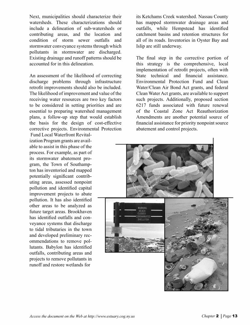
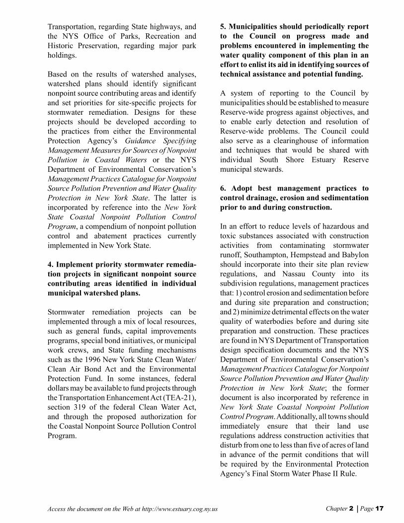
Two of the most signicant pollutants in the South Shore Estuary Reserve are elevated levels of coliform bacteria and excessive concentrations of certain nutrients. Coliform bacteria are typically found within the digestive systems of warm-blooded animals and indicate the potential presence of fecal wastes in surface waters. Coliform bacteria from wildlife, waterfowl and pet wastes and potentially from failing on-site wastewater treatment systems enter streams and coastal waters primarily through stormwater runoff from lawns, roads and parking lots. Elevated levels of coliform
bacteria are responsible for the closure of shellsh beds and bathing beaches due to potential threats to human health [Technical report: Nonpoint Sources of Pollution (1998)].
Nutrients in amounts greater than natural background levels cause eutrophication, the enrichment of surface waters. In some areas
of the Reserve excessive levels of nitrogen cause this over enrichment that results in excessive algal growth (blooms). Algal blooms create low dissolved oxygen levels (hypoxia) through their nighttime respiration and gradual decomposition, threatening the health and survival of nsh and shellsh in eutrophic waters. They also shade out and destroy seagrass beds, estuarine habitats that are nursery areas for juvenile nsh and shellsh and feeding areas for waterfowl. Nonpoint sources of nutrients include fertilizers from lawns and agricultural lands; wildlife, waterfowl and pet wastes; and
Storm water outfall
Vers f Chap2 8/30/01, 11:11 AM10-11
Chapter 2 Page 12 Access the document on the Web at http://www.estuary.cog.ny.us
on-site wastewater treatment systems [Technical reports: Nonpoint Sources of Pollution (1998); Summary Report: South Shore Estuary Reserve Water Quality Workshop (1999)].
In September 1996, a South Shore Estuary Reserve workshop addressed water quality research needs and focused on toxins, nutrients, coliform bacteria, and sediments as the most signicant pollutants entering the estuary. It also examined the potential impacts of re-suspended sediments, bay shoreline erosion, and phytoplankton blooms. The workshop participants reached several important conclusions: that the total loading of toxins within the Reserve and the levels of toxic substances in the waters, sediments and aquatic biota of the estuary need to be evaluated; that the potential presence of pathogens in the estuary clearly represents a risk to public health; and that the impact of pathogens on the health and vitality of the Reserve’s plants and animals remains unclear. [Technical report: Summary Report: South Shore Estuary Reserve Water Quality Workshop (1999)].
The 1996 workshop also determined that human development of the margins of the estuary’s bays and tributaries had increased nutrient loading and resulted in an increased level of eutrophication. The seasonal occurrence of hypoxic conditions associated with excess nutrients and dissolved oxygen highlights this concern. Although the shallow waters of the South Shore bays are well mixed (which discourages oxygen depletion), low levels of dissolved oxygen (hypoxia) are typical along the northern margins of the bays and in the tributary mouths, with tributaries showing clear signs of seasonal hypoxia, a serious threat to aquatic life in these areas.
Strategy for Reduction and Control of Nonpoint Source Pollution
As nonpoint source pollution originates from land use and water-based human activities, the Council’s strategy calls on municipalities within the Reserve to assume a leadership role in reducing and controlling nonpoint pollution by exerting their legal authority to inuence such activities, and preserving high quality waters from future pollution. The strategy presents corrective and preventive actions that local governments can take, supported by State and federal programs and grants and augmented by the efforts of non-governmental organizations, to reduce and control nonpoint source pollution.
The strategy’s corrective and preventive measures fall into four management approaches: 1) identifying opportunities and developing schedules to protect lands that provide signicant pollutant abatement functions; 2) designing and undertaking projects that retrot existing storm sewer and other conveyance systems to remove pollutants carried by stormwater; 3) adopting nonpoint source pollution best management practices; and 4) increasing education and outreach to modify resident and user behavior. The degree to which each of the four approaches may be institutionalized in a municipality will depend upon local circumstances.
Several steps are fundamental to the implementation of the corrective component of the strategy. First, the distribution and relative magnitude of nonpoint source pollution in each watershed should be identied by municipalities. Satellite imagery of land cover has been used with soils, topography and distance to surface water data to identify nonpoint pollution potential for the entire Reserve (see map at end of this chapter). This information will help focus implementation of site-specic stormwater remediation projects and water quality monitoring efforts.
Vers f Chap2 8/30/01, 11:11 AM12-13
Chapter 2 Page 13Access the document on the Web at http://www.estuary.cog.ny.us
Next, municipalities should characterize their watersheds. These characterizations should include a delineation of sub-watersheds or contributing areas, and the location and condition of storm sewer outfalls and stormwater conveyance systems through which pollutants in stormwater are discharged. Existing drainage and runoff patterns should be accounted for in this delineation.
An assessment of the likelihood of correcting discharge problems through infrastructure retrot improvements should also be included. The likelihood of improvement and value of the receiving water resources are two key factors to be considered in setting priorities and are essential to preparing watershed management plans, a follow-up step that would establish the basis for the design of cost-effective corrective projects. Environmental Protection Fund Local Waterfront Revital-ization Program grants are avail-able to assist in this phase of the process. For example, as part of its stormwater abatement pro-gram, the Town of Southamp-ton has inventoried and mapped potentially signicant contrib-uting areas, assessed nonpoint pollution and identied capital improvement projects to abate pollution. It has also identied other areas to be analyzed as future target areas. Brookhaven has identied outfalls and con-veyance systems that discharge to tidal tributaries in the town and developed preliminary rec-ommendations to remove pol-lutants. Babylon has identied outfalls, contributing areas and projects to remove pollutants in runoff and restore wetlands for
its Ketchams Creek watershed. Nassau County has mapped stormwater drainage areas and outfalls, while Hempstead has identied catchment basins and retention structures for all of its roads. Inventories in Oyster Bay and Islip are still underway.
The nal step in the corrective portion of this strategy is the comprehensive, local implementation of retrot projects, often with State technical and nancial assistance. Environmental Protection Fund and Clean Water/Clean Air Bond Act grants, and federal Clean Water Act grants, are available to support such projects. Additionally, proposed section 6217 funds associated with future renewal of the Coastal Zone Act Reauthorization Amendments are another potential source of nancial assistance for priority nonpoint source abatement and control projects.
Vers f Chap2 8/30/01, 11:12 AM12-13

Chapter 2 Page 14 Access the document on the Web at http://www.estuary.cog.ny.us
Some corrective steps of this strategy have already been implemented. Highlights of such municipal accomplishments include: completion of approximately seven hundred stormwater control projects (Southampton); implementation of catch and retention basin maintenance programs (Brookhaven, Islip and Oyster Bay). Projects for which funds have been awarded or are currently underway include wetland restoration (Oyster Bay, Babylon, Brookhaven and Southampton); hard clam restoration (Brookhaven); and highway stormwater discharge remediation (Islip, Southampton and Nassau and Suffolk counties).
The strategy’s preventive component is derived from the assessments of current municipal nonpoint source pollution control practices. To varying degrees, towns in the Reserve have in place practices that can serve as a foundation for improving water quality. They include: land and water use regulations; road/highway design and construction standards; capital improvement programs; operation and maintenance procedures; and targeted education and outreach efforts. But these current practices for managing nonpoint source pollution have not achieved adequate success, and strengthening, expanding and enforcing them is critical to improving and maintaining water quality in the Reserve.
Assessments of municipal nonpoint source control practices have been completed for each of the six Reserve towns and Nassau and Suffolk counties. These assessments suggest actions, in light of local circumstances, that individual towns could implement to improve their efforts at nonpoint pollution abatement and control. These suggested actions are based on management measures and practices documented in the New York State Coastal Nonpoint Pollution Control Program, NYS Department of Environmental Conservation best management practices catalogues, and NYS Department of Transportation guidance documents. Villages in the Reserve, the City of Long Beach, and certain other state agencies still need to assess their current nonpoint control practices.
Another element in this strategy, as of January 2001, is the Environmental Protection Agency’s Final Storm Water Phase II Rule. The rule represents a signicant expansion of historic point source management requirements under National Pollutant Discharge Elimination System permit coverage to encompass sources traditionally considered nonpoint. Its intention is to further reduce adverse impacts to water quality and aquatic habitats by instituting the use of controls on the unregulated sources of stormwater discharges that have the greatest likelihood of causing continued environmental degradation.
The rule applies to two classes of stormwater discharges on a national basis: 1) operators of small municipal separate storm sewer systems located in urbanized areas as delineated by the Bureau of Census or as designated by the permitting authority; and 2) operators of small construction activities that disturb equal to or greater than one and less than ve acres of land. The implementing program, still being developed for New York State, is likely to encourage the use of general permits and provide exibility for regulated operators to determine the most appropriate stormwater controls. While detailed applicability criteria have not yet been established by the Department of Environmental Conservation, it is likely that operators of small municipal separate storm sewer systems and small construction activities in all of the Nassau County portion of the Reserve, and most if not all of the Suffolk County portion, will be required to apply for permits.
The rule requires that all municipalities considered “urbanized areas” under the rule meet certain permit conditions for managing stormwater runoff. These conditions include at least six program elements: public outreach and education; public participation and involvement; illicit discharge detection and elimination; construction site runoff control; post-construction runoff control; and pollution
Vers f Chap2 8/30/01, 11:12 AM14-15

Chapter 2 Page 15Access the document on the Web at http://www.estuary.cog.ny.us
prevention. The recommendations and implementation actions offered in this plan will help municipalities establish a foundation upon which to base their efforts at addressing the required permits and their conditions.
Actions to Enhance Point Source Controls
Previous actions to control point sources of pollution within the Reserve have focused on pollutant loads from private sources and on upgrades to wastewater treatment plants. There is also ongoing remediation of inactive hazardous waste and solid waste disposal sites, cleanup of spills in waterbodies, identication of areas of potentially contaminated sediments, and regulation of discharges through the State Pollution Discharge Elimination System permit program. Future efforts should focus on exploring potential impacts of point sources relative to one another and to nonpoint sources, and the remediation, when feasible, of areas where point sources of pollution have caused documented impairments to designated uses and/or living resources [Technical reports: State Pollution Discharge Elimination System (SPDES) Permit Sites (1999); Inactive Hazardous Waste Disposal Sites and Active and Inactive Solid Waste Disposal Facilities (1999); Areas of Contaminated Sediments (1998)].
Water Resources Monitoring
Surface water quality data in the South Shore Estuary Reserve is collected on a regular basis by the NYS Department of Environmental Conservation under its Rotating Intensive Basin Study and shellsh certication program, and by the U.S. Environmental Protection Agency, the National Park Service, the Suffolk County Department of Health Services, the Town of Hempstead and other municipalities, several citizen monitoring groups and colleges. Groundwater resources in the Reserve are
monitored by the U.S. Geological Survey [Technical report: Coordinated Water Resource Monitoring Strategy for the South Shore Estuary Reserve (1999)].
The coordination of these activities is described in the Coordinated Water Resource Monitoring Strategy for the South Shore Estuary Reserve (1999). This study recommends a comprehensive and coordinated strategy that focuses on multiple objectives beyond corrective efforts for nonpoint source pollution control. These objectives were drawn from the Council’s overall goal to protect and restore the estuary, and include: 1) management of hard clams; 2) control of coliform bacteria in stormwater and maintenance of shellsh areas; 3) control of brown tide; and 4) maintenance and restoration of the natural system. The strategy evaluated the diverse monitoring programs already in place and identied gaps in existing information and approaches. It is a multi-tiered approach, with a baseline monitoring program proposed as a rst tier, and a second tier that calls for hypotheses-driven sampling that would address chemical loading, water quality, and ecological integrity. The strategy: proposes that physical, chemical, biological and human-induced parameters be tracked; identies general locations and frequency of sampling, including the rationale for such sampling; and provides cost estimates. Human-induced parameters include land use changes, sewering and on-site wastewater treatment systems, land application of toxins and fertilizers, resource harvest, recreational boating and inlet control. The coordinated monitoring strategy also recommends that historical water quality data be analyzed in order to establish baseline conditions for the Reserve’s tributaries and bays.
Vers f Chap2 8/30/01, 11:12 AM14-15

Chapter 2 Page 16 Access the document on the Web at http://www.estuary.cog.ny.us
Recommendations
The Council offers the following recommendations to achieve and maintain water quality in the South Shore Estuary Reserve. In an effort to reduce and control nonpoint source pollution, recommendations 1 through 13 call for corrective actions in the form of remediation projects to manage storm water as it moves across the landscape and preventive actions that control the level of pollutants that enter stormwater runoff and the Reserve’s bays and tributaries. Many of these preventive actions involve the implementation of best management practices by municipalities in the Reserve. In an effort to address point sources of pollution, recommendations 14 through 17 call for enhancements to existing source controls. Recommendations 18 through 21 relate to the Environmental Protection Agency’s Storm Water Phase II Final Rule. Recommendations 22 through 24 identify information gaps that need to be addressed within the next three years in order to move toward fulllment of the Council’s vision for Long Island’s South Shore Estuary Reserve.
RECOMMENDATIONS TO REDUCE AND CONTROL NONPOINT SOURCE POLLUTION
1. Complete assessments of nonpoint source pollution management practices and identify and implement needed preventive measures based on priorities.
The six towns and two counties in the Reserve have already co mpleted assessments of their current nonpoint source pollution control practices. Villages in the Reserve, the City of Long Beach, and relevant State agencies should conduct similar assessments of their nonpoint control practices and identify gaps in
those practices. Towns should consider assisting villages within their borders with the completion of such assessments.
2. Spatial analysis of land cover, soils, topography and satellite imagery should be used by municipalities in the Reserve to determine the distribution and relative magnitude of nonpoint source pollution in their communities.
Comprehensive spatial analysis of land cover, soils and topography by the NYS Department of State has resulted in a nonpoint pollution potential model (see map at end of this chapter). The model identies the potential distribution and relative magnitude of nonpoint source pollution and should be used by municipalities as they develop watershed plans that address management of nonpoint source pollution.
3. Complete specic watershed analyses to determine localized distribution and mag-nitude of nonpoint pollution, and prepare watershed plans and retrot improvement designs for cost-effective nonpoint source pollution control projects.
A watershed analysis involves identifying and setting priorities for improvements to storm sewers and other runoff conveyance systems. It should also: examine the overall watershed character, including existing drainage and runoff patterns; evaluate the benets and feasibility of correcting runoff problems through road infrastructure improvements; and identify opportunities for preservation of high quality waters from future pollution. This information could be supported with data from targeted water quality monitoring programs. Such watershed analyses have been conducted in whole or in part by Southampton, Brookhaven, Babylon, Hempstead and Nassau County, and are underway in Islip and Oyster Bay. Similar work needs to be done, where appropriate, by Suffolk County and by New York State, particularly the NYS Department of
Vers f Chap2 8/30/01, 11:12 AM16-17
Chapter 2 Page 17Access the document on the Web at http://www.estuary.cog.ny.us
Transportation, regarding State highways, and the NYS Ofce of Parks, Recreation and Historic Preservation, regarding major park holdings.
Based on the results of watershed analyses, watershed plans should identify signicant nonpoint source contributing areas and identify and set priorities for site-specic projects for stormwater remediation. Designs for these projects should be developed according to the practices from either the Environmental Protection Agency’s Guidance Specifying Management Measures for Sources of Nonpoint Pollution in Coastal Waters or the NYS Department of Environmental Conservation’s Management Practices Catalogue for Nonpoint Source Pollution Prevention and Water Quality Protection in New York State. The latter is incorporated by reference into the New York State Coastal Nonpoint Pollution Control Program, a compendium of nonpoint pollution control and abatement practices currently implemented in New York State.
4. Implement priority stormwater remedia-tion projects in signicant nonpoint source contributing areas identied in individual municipal watershed plans.
Stormwater remediation projects can be implemented through a mix of local resources, such as general funds, capital improvements programs, special bond initiatives, or municipal work crews, and State funding mechanisms such as the 1996 New York State Clean Water/Clean Air Bond Act and the Environmental Protection Fund. In some instances, federal dollars may be available to fund projects through the Transportation Enhancement Act (TEA-21), section 319 of the federal Clean Water Act, and through the proposed authorization for the Coastal Nonpoint Source Pollution Control Program.
5. Municipalities should periodically report to the Council on progress made and problems encountered in implementing the water quality component of this plan in an effort to enlist its aid in identifying sources of technical assistance and potential funding.
A system of reporting to the Council by municipalities should be established to measure Reserve-wide progress against objectives, and to enable early detection and resolution of Reserve-wide problems. The Council could also serve as a clearinghouse of information and techniques that would be shared with individual South Shore Estuary Reserve municipal stewards.
6. Adopt best management practices to control drainage, erosion and sedimentation prior to and during construction.
In an effort to reduce levels of hazardous and toxic substances associated with construction activities from contaminating stormwater runoff, Southampton, Hempstead and Babylon should incorporate into their site plan review regulations, and Nassau County into its subdivision regulations, management practices that: 1) control erosion and sedimentation before and during site preparation and construction; and 2) minimize detrimental effects on the water quality of waterbodies before and during site preparation and construction. These practices are found in NYS Department of Transportation design specication documents and the NYS Department of Environmental Conservation’s Management Practices Catalogue for Nonpoint Source Pollution Prevention and Water Quality Protection in New York State; the former document is also incorporated by reference in New York State Coastal Nonpoint Pollution Control Program. Additionally, all towns should immediately ensure that their land use regulations address construction activities that disturb from one to less than ve of acres of land in advance of the permit conditions that will be required by the Environmental Protection Agency’s Final Storm Water Phase II Rule.
Vers f Chap2 8/30/01, 11:12 AM16-17

Chapter 2 Page 18 Access the document on the Web at http://www.estuary.cog.ny.us
7. Adopt best management roadway opera-tion and maintenance.
To reduce the signicant water quality impacts of stormwater runoff from existing roads, highways and bridges, all towns in the Reserve should formally adopt roadway operation and maintenance practices from portions of NYS Department of Transportation procedural manuals and NYS Department of Environmental Conservation’s Management Practices Catalogue for Nonpoint Source Pollution Prevention and Water Quality Protection in New York State.
8. Institute appropriate best management practices to reduce the contamination of stormwater runoff by hazardous materials, fertilizers, herbicides and pesticides, household hazardous wastes, and wildlife and pet wastes.
To reduce the impacts caused by stormwater runoff contaminated by activity-specic nonpoint sources of pollution, the following practices should be instituted:
1) To mitigate and prevent spills of petroleum products and hazardous materials, all towns in the Reserve should: a) incorporate standards from the National Fire Protection Association and Environmental Conservation Law Article 27 for generation, storage, application, handling and disposal activities before, during and after site preparation and construction into site plan review regulations, and local law; b) incorporate U.S. Occupational Safety and Health Administration standards and procedures pertaining to spill cleanups into site plan review regulations, subdivision requirements and local law; and c) train an emergency spill response team in these standards and procedures.
2) To address excessive fertilizer, herbicide and pesticide use as part of management of turf grass in public and private areas, all towns in the Reserve should educate citizens,
contractors, construction workers, and owners and managers of private facilities on the importance of carrying out best management practices, including soil testing, use of integrated pest management, organic gardening and lawn care.
3) To reduce the amount of wildlife and pet wastes entering waterbodies, Babylon, Hempstead and Southampton should undertake multi-component education programs that discourage the feeding of waterfowl, and Brookhaven and Southampton should institute “pooper-scooper” laws.
9. Adopt marina and recreational boating best management practices, and educate marina patrons about specic best manage-ment practices.
To reduce elevated levels of fecal coliform bacteria and toxic substances associated with existing marinas, all towns in the Reserve should incorporate into local law practices from the NYS Coastal Nonpoint Pollution Control Program, the NYS Department of Environmental Conservation Management Practices Catalogue for Nonpoint Source Pollution Prevention and Water Quality Protection in New York State and the National Fire Protection Association Fire Protection Standard for Pleasure and Commercial Motor Craft. Such efforts should include adoption of appropriate regulations and practices that mitigate the impacts of vessel waste discharges. The imposition of best management practices on private marinas should be balanced against the provision of incentive subsidies such as tax relief and public funding for rehabilitation.
All Reserve towns except Southampton need to target outreach efforts at marina patrons in an effort to reduce solid waste reduction and encourage recycling, while all towns except Babylon need to target outreach efforts on sh cleaning practices at sites designated for that purpose.
Vers f Chap2 8/30/01, 11:12 AM18-19

Chapter 2 Page 19Access the document on the Web at http://www.estuary.cog.ny.us
10. Adopt best management practices for the siting and design of new and substantially redeveloped marinas.
To reduce levels of fecal coliform bacteria and toxic substances associated with new marinas, all towns in the Reserve should incorporate siting and design practices from the NYS Coastal Nonpoint Pollution Control Program and the NYS Department of Environmental Conservation Management Practices Catalogue for Nonpoint Source Pollution Prevention and Water Quality Protection in New York State into site plan review.
These practices should be applied to new and expanding private marinas and to public marinas through formally adopted planning approval procedures. The imposition of these practices on private marinas undergoing redevelopment should be balanced against the provision of incentive subsidies such as tax relief and public funding for rehabilitation.
11. Adopt best management practices to restore and create wetlands.
To reduce the water quality impacts of existing hydromodication activities, all towns in the Reserve should adopt into local operation and maintenance procedures those practices from the NYS Department of Environmental Conservation Management Practices Catalogue for Nonpoint Source Pollution Prevention and Water Quality Protection in New York State for restoring and creating wetlands. All towns except Southampton need to adopt those practices from the catalogue that address improvements to stream corridors and the restoration of riparian habitat and vegetation.
12. Adopt best management practices to protect wetlands and streams.
To prevent the water quality impacts of new private hydromodication activities, all towns in the Reserve should incorporate into their site plan review, and Nassau County into its
subdivision regulations, practices from NYS Department of Transportation design specication documents and the NYS Department of Environmental Conservation Management Practices Catalogue for Nonpoint Source Pollution Prevention and Water Quality Protection in New York State to protect wetlands and streams, and control erosion and sedimentation before and during site preparation and construction. These practices also should be formally adopted into local operation and maintenance procedures and applied to municipal hydromodication activities as well.
All towns also should formally adopt into local operation and maintenance procedures those practices from NYS Department of Transportation procedural manuals and NYS Department of Conservation’s Management Practices Catalogue for Nonpoint Source Pollution Prevention and Water Quality Protection in New York State that address the clearing of debris from streams and culverts.
13. Adopt best management practices that reduce the environmental effects of on-site wastewater treatment systems (OWTS).
To reduce the water quality impacts of on-site wastewater treatment systems, Nassau and Suffolk counties should work with Hempstead, Babylon, Islip and Brookhaven to develop and implement on-site system management strategies that include a regulatory and incentive program for periodic inspections and pumpouts of OWTS, require upgrades of OWTS as part of substantial residential and commercial redevelopment, and establish a public education component that informs system owners of proper use and the maintenance necessary for proper operation. Southampton should institute a similar public education program.
The Town of Brookhaven should enforce those provisions of its town code that address new and replacement systems in special ood areas and that establish design criteria for systems in
Vers f Chap2 8/30/01, 11:12 AM18-19

Chapter 2 Page 20 Access the document on the Web at http://www.estuary.cog.ny.us
coastal high hazard areas. Southampton should fully implement those provisions of its town code that require inspections of systems at ve-year intervals and remediation as necessary, amend those provisions to allow inspections by private individuals certied by the Town, and establish such a certication program. Additionally, Southampton should extend its requirement of OWTS upgrades whenever wetland permits are issued for expansions and additions to commercial establishments.
The Council offers the following recommendations to address actual and potential point source pollution. The recommendations are based on, respectively: a water quality initiative provided for in the federal Clean Water Act; comments from Council members; and completed South Shore Estuary Reserve technical reports. Implementation of these actions will take the concerted effort of State, federal and local governments.
RECOMMENDATIONS TO ENHANCE POINT SOURCE CONTROLS
14. Determine point and nonpoint source controls to reduce loadings of pathogens, nutrients and toxic substances contributing to water quality problems in the Reserve’s tributaries and bays.
In order to determine point and nonpoint source controls necessary to address water quality problems associated with nutrient enrichment, pathogens or toxic substances, a systematic and sequential process must be followed. First, water quality data in the Reserve’s tributaries and bays must be evaluated. Based on this evaluation, the NYS Department of Environmental Conservation will identify any specic waterbodies that should be included on its 303(d) list of impaired waterbodies that require
the development of Total Maximum Daily Loads. In accordance with recently promulgated federal regulations, the next 303(d) list is expected to be nalized in April 2002. Later, for those waterbodies identied on the 303(d) list, the Department of Environmental Conservation will develop Total Maximum Daily Loads (TMDLs) in accordance with the schedule included in the list. TMDLs will identify reductions in point and nonpoint sources of pollutants necessary to meet water quality standards. Finally, the Department of Environmental Conservation, the Department of State, the Council and local governments should work together to implement any load reduction actions identied in the TMDL allocations.
15. Re-examine the need, benets and feasibility of upgrading the municipal sewage treatment plants discharging into the estuary or relocating their outfalls to the Atlantic Ocean.
Five wastewater treatment plants discharge secondarily treated efuent into the western bays. TMDL wasteload allocations for the waterbodies receiving discharges from these facilities should be used to determine whether upgrades of the municipal wastewater plants to tertiary treatment are necessary.
16. Ensure Compliance with Existing State Pollution Discharge Elimination System (SPDES) permits.
The compliance of point source discharges into the Reserve with current SPDES limits and conditions should be investigated. Based on the results, existing and future infrastructure or operational needs necessary to ensure compliance should be identied. The NYS Department of Environmental Conservation, the Department of State, the Council and local governments should then work together to assure that the needs identied are met.
Vers f Chap2 8/30/01, 11:12 AM20-21
Chapter 2 Page 21Access the document on the Web at http://www.estuary.cog.ny.us
17. Prevent the future contamination of sediments through continued implementation of existing programs that address the management of hazardous waste, and remediate identied areas of contaminated sediments where the sources of contamination and impairments to living resources and/or uses are known and well documented, mitigation action is feasible, and funds are available.
National Fire Protection Association and Environmental Conservation Law Article 27 standards regulate hazardous waste generation, storage, application, handling and disposal activities before, during and after site preparation and construction. Practices in previously cited documents are designed to manage nonpoint source pollution. Areas of contaminated sediments that potentially impair waterbodies in the Reserve should be tested to determine required actions, and, if necessary, should be remediated on a priority basis when funding becomes available.
RECOMMENDATIONS TO IMPLEMENT EPA’S STORM WATER PHASE II FINAL RULE
18. The NYS Department of Environmental Conservation should designate as “urbanized areas” under the Environmental Protection Agency’s Storm Water Phase II Final Rule those portions of the Reserve not so designated by the Bureau of Census.
The Phase II Final Rule requires nationwide coverage of all small municipal separate storm sewer systems that are located within the boundaries of a Bureau of Census-dened “urbanized areas” based on the latest decennial Census. All of Nassau County has been designated as an “urbanized area.” It is
anticipated that most of the Suffolk County portion of the Reserve also will be designated as “urbanized areas” based on Census data. The NYS Department of Environmental Conservation, as the permitting authority, should ensure that this stormwater management program applies throughout the entire Reserve by designating those parts of the Reserve not considered “urbanized areas” on the basis of Census gures.
19. All municipalities in the Reserve designated as “urbanized areas” under the Environmental Protection Agency’s Storm Water Phase II Final Rule should immediately begin to prepare to meet Phase II permit conditions and secure the necessary permits by the mandated deadline.
The National Pollution Discharge Elimination System permitting authority (the NYS Department of Environmental Conservation) will issue general permits for Phase II designated small municipal separate storm sewer systems and small construction activity by December 9, 2002. Designated municipalities must obtain permit coverage within 90 days of permit issuance. The permitting authority
Fecal coliform as indicator organisms
Fecal coliform bacteria are present in the digestive systems of warm-blooded animals. While the bacteria themselves are not a threat to public health, their presence in levels in excess of established water quality standards is used to indicate the potential presence of pathogens, microbes that are actually known to cause diseases such as dysentery, gastrointestinal illness and swimmer’s itch.
Vers f Chap2 8/30/01, 11:12 AM20-21

Chapter 2 Page 22 Access the document on the Web at http://www.estuary.cog.ny.us
may phase in coverage for municipalities with populations under 10,000 on a schedule consistent with a State watershed permitting approach. Permitted municipalities must fully implement their stormwater management programs by the end of the rst permit term, typically a ve year period. Permit conditions will include at least six program elements: public outreach and education; public participation and involvement; illicit discharge detection and elimination; construction site runoff control; post-construction runoff control; and pollution prevention. All municipalities should immediately start the process to meet permit requirements. The implementation actions offered in this plan will help municipalities establish a foundation upon which to base their efforts at meeting the required permit conditions.
20. Information and education programs need to be developed and conducted for municipal ofcials on implementation of the Environmental Protection Agency’s Phase II Final Rule.
A cooperative information and education program will facilitate the timely implementation of the Phase II Final Rule by municipalities in the Reserve. Such a program should include: an overview of why the Phase II Storm Water Program is necessary; who is covered by the rule and what the rule requires to manage small municipal separate storm sewer systems and small construction activity; and the Phase II program approach, the schedule for implementation, and the Environmental Protection Agency’s “tool box” of materials available to ensure that program implementation is effective and cost-efcient.
21. Institutional arrangements for implementation of the Phase II Final Rule need to be established.
Implementation of the Phase II Final Rule will be the responsibility of counties, towns and villages in the South Shore Estuary Reserve. In an effort to address the reality of overlapping municipal authorities and to make implementation of the
rule workable, the Departments of State and Environmental Conservation and municipalities in the Reserve should work together to identify optimal ways to develop stormwater management districts and explore the feasibility of those options.
RECOMMENDATIONS TO ADDRESS INFORMATION NEEDS
22. Implement a coordinated water resources monitoring strategy that monitors water quality in the Reserve’s tributaries and bays, and evaluates the extent to which management actions are successful in achieving water quality goals.
The Coordinated Water Resources Monitoring Strategy for the South Shore Estuary Reserve proposed a two-tiered program for monitoring the physical, chemical, biological and human-induced conditions of the Reserve and its watershed. Tier 1 monitoring is designed to establish baseline data on water quality in the Reserve’s bays and tributaries, identify and assess trends in water quality, and evaluate the extent to which desired uses of the Reserve’s water resources are met. Tier 1 efforts include monitoring the occurrence of brown tide blooms in the Reserve’s waters. Tier 2 monitoring activities are in general short-term investigations, more intensive in temporal and /or spatial scale, and designed to test specic hypotheses regarding water quality or ecological issues in the South Shore Estuary Reserve.
The monitoring strategy builds on existing monitoring programs and offers recommendations for improved coordination among agencies conducting those programs. It calls for the hiring of a program manager, the implementation of a quality assurance/quality control program, and centralized data analysis and reporting.
Vers f Chap2 8/30/01, 11:12 AM22-23

Chapter 2 Page 23Access the document on the Web at http://www.estuary.cog.ny.us
23. Develop a hydrologic model of the Reserve.
Once strategic information is developed from the coordinated water quality monitoring program (Recommendation 22, above), a hydrodynamic model addressing groundwater underow, tributary inputs, water circulation, currents, dispersion and residence times would add to the capability of rening and enhancing management strategies. Such a model would need to identify the potential hydrodynamic and water quality impacts, ecological consequences and long-term environmental fate of toxic substances, coliform bacteria, nutrients, and other pollutants to the bays to be of value. The model would be used to test the potential effects of alternative locations for wastewater outfalls and predict the water quality consequences of a storm-related island breach or inlet closure. Coupled with land use and water quality monitoring data through a GIS system, the model would be of use to local governments for understanding water quality impacts of alternative land use decisions.
24. Further investigate the hypothesis that brown tide blooms are related to the ratios of available dissolved organic and inorganic nitrogen.
Additional data are needed to further test the hypothesis that brown tide is related to inputs and the ratios of available dissolved organic nitrogen and dissolved inorganic nitrogen from groundwater, sediment nutrient ux, and other sources. Such research could also shed light on other ecological processes such as the inuence of trace metals and pesticides. This research effort could also provide valuable information on conventional water quality and living resource management issues. Effective enhancement of hard clams, scallops, oysters, nsh, crustaceans, and submerged aquatic vegetation will be difcult until this harmful algal bloom is better understood.
Vers f Chap2 8/30/01, 11:12 AM22-23

Access the document on the Web at http://www.estuary.cog.ny.us
Vers f Chap2 8/30/01, 11:12 AM24

CHAPTER 3
Protect and Restore Living Resources of the Reserve
Vers F Chap3 8/30/01, 11:18 AM25

CHAPTER 3Protect and Restore Living Resources of the Reserve
Access the document on the Web at http://www.estuary.cog.ny.usChapter 3 Page 26
Overview of the Issues
The diversity, abundance and productivity of the living resources of the South Shore Estuary Reserve dene much of the character of Long Island’s south shore and provide a readily recognized and long-standing hallmark. Stewardship of these living resources requires a commensurate effort in management of populations of individual species, restoration of physically dened habitat areas, and realization of the need to recognize a natural landscape that preserves and enhances existing living resource values.
The story of the living resources in the Reserve has been one of natural and human-inuenced changes in the estuarine environment. An obvious example of such change is provided by the estuary’s hard clam populations. This important resource was a signicant and abundant component of at least the Great South Bay portion of the Reserve through the 1970’s. Now, with depressed population levels in these same waters, the species is at the forefront of concern as an indicator of the complex interactions of commercial harvest pressure and environmental and biological changes in the estuary (see map at end of this chapter). The explosion of blue crab stocks in the estuary, although occurring over different time scales
and geographic areas from the coincident depression of hard clam populations, is another example of species-based change. Geographical shifts in colonial waterbird populations represents yet a third type of species-based change in the Reserve. In this case, species-based management approaches have resulted in better understanding of the population dynamics of these species and moderate success in achieving population restoration goals.
Human population growth and burgeoning development in the Reserve, especially since World War II, had and continues to have a dramatic effect on the estuary. Wetlands and other habitats in the Reserve, such as bay bottoms, upland woodlands, and overwash ats,
Now, with depressed popula-tions in these waters, hard clams are at the forefront of concern as an indicator of the complex interactions of com-mercial harvest pressure and environmental and biological changes in the estuary.
Vers F Chap3 8/30/01, 11:18 AM26-27

Chapter 3 Page 27Access the document on the Web at http://www.estuary.cog.ny.us
have undergone substantial change. The loss of historic wetlands since the onset of development has been well documented, with at least half of the remaining wetlands having been lost beginning in the 1950’s. Although wetland losses in New York were largely arrested with the initiation of wetland protection programs in the 1970’s, the remaining wetlands present both challenges and opportunities for management and restoration (see map at end of this chapter). Other types of habitats have also undergone substantial changes, although less obvious. The two most notable examples in the Reserve are the open bays and the upland woodlands; the former inuenced by changes in inlet dynamics, the latter a physical habitat undergoing loss today comparable to the loss of tidal wetlands beginning in the 1950’s.
Despite their importance, species and habitats are only individual components of the Reserve’s broader ecological landscape. Although an essential step in gaining an understanding of its living resources, dividing the Reserve by species use and by geography creates an articial construct that ignores the way in which living resources occur throughout the Reserve’s physical setting. Tributaries offer a prime example of the need to maintain a clear context for understanding and managing any single resource by integrating the physical components of the landscape - open water, ood
plains, wetlands, woodlands, coves and bay bottoms, upland areas and developed shoreline - with the Reserve’s living resources of shellsh, resident and transient sh, and bird species.
As part of its mandate under Article 46 of Executive Law, the Council was to develop strategies to effectively manage the living resources of the Reserve. Building upon the recommendations contained in the technical reports, this chapter offers guidelines for recognizing, protecting and enhancing natural resource values throughout the Reserve.
Living Resources of the Reserve
No one species or group of species exemplies or is most important to the functioning of the Reserve’s ecosystems. All share a reliance on its unique coastal environment. This environment is the product of three primary physical factors: freshwater ow from the mainland; salt water inow; and a sheltered location. Within this hydrogeological setting, habitat formation has been driven and modied by the natural processes of sea level rise, episodic storms, and barrier island washovers and breaches, and biological activities including shell deposition and wetland peat formation. Other physical and chemical factors, including nutrient input and cycling, restricted tidal exchange and relatively
shallow depth, also affect the estuary’s ecology. In combination with its limited freshwater inow, these environmental factors have produced a unique estuary, characterized by high biological productivity and long residence times for most bay waters.
The cumulative effect of these physical forces has been the evolution of highly productive and diverse natural communities and ecosystems within the estuarine watershed. Estuarine
Mosquito Ditching
Vers F Chap3 8/30/01, 11:18 AM26-27

Chapter 3 Page 28 Access the document on the Web at http://www.estuary.cog.ny.us
areas, together with riverine corridors and associated uplands within the Reserve, currently support a myriad of aquatic and terrestrial species. These areas provide: breeding, nesting, and spawning sites; migration pathways and stopover areas; roosting sites; nursery and staging areas; dispersal corridors; species concentration and overwintering areas; and major feeding and foraging grounds.
For most of the Reserve’s natural communities, management concern is centered on the needs of a limited number of key species. These are species or species assemblages that represent signicant recreational, commercial, ecological, or biodiversity values within the Reserve, and whose status provide a measure of estuarine capacity to maintain resource production levels.
Perhaps the most striking feature of the Reserve’s landscape is its extensive tidal wetlands. These salt marshes, which make up about 15% of the total estuarine acreage, are a signicant source of primary productivity and provide critical foraging, nursery, and nesting habitat for many coastal species. Though greatly reduced and substantially degraded by development, the salt marshes offer substantial opportunity for restoration of ecological functions and living resource values.
Beds of submerged aquatic vegetation (SAV), which occupy much of the Reserve’s predominant shallow subtidal zone, and phytoplankton communities, are the major contributors to overall estuarine productivity. Dependent on good water quality, SAV beds provide additional ecosystem benets in terms of nsh and shellsh nursery habitat, as well as foraging areas for many sh, crabs, and avian species. Although lost from many coastal regions, SAV beds, composed primarily of eelgrass, appear to be thriving in many areas of the estuary, where they occupy as much as 20% of estuarine waters [Technical reports: Wetlands (1997); Estuarine Finsh (1998)].
Another hallmark of the estuary is its molluscan shellsh populations, especially the signature species, the hard clam, which has experienced declines in productivity and its commercial harvest. Hard clam and other shellsh provide important nutrient cycling and water ltration functions for the estuary’s waters, and substantial recreational and commercial values as well. As a consequence of its ecological and economic importance, the Council has made the restoration of the estuary’s hard clam population a priority. Also identied within the estuary are its important crustacean shellsh species, particularly its populations of blue crabs. Signicant components of the estuarine food web, blue crab populations have the potential to be an increasingly important commercial and recreational species [Technical reports: Molluscan Shellsh (1999); Crustacean Shellsh (1999)].
The Reserve has also long been recognized for its abundant shorebird and colonial water bird populations. As is the case for many coastal areas, this group includes a number of rare or endangered species such as the piping plover, roseate tern, least tern, and others such as the common tern, all considered reliable indicators of the estuary’s health. While some species have maintained their population level and geographic distribution in the face of development pressure, most have experienced declines in numbers and shifts in distribution. For many species, a major consequence of human disturbance has been a shift in populations to more isolated or protected locations such as the saltmarsh islands of the western bays or protected areas of the barrier beach. Recognition, protection and management of key feeding and nesting areas is critical for these groups of bird species [Technical report: Coastal Colonial Waterbirds (1997)].
In addition to shorebird and colonial waterbird concerns, avian conservation management in the Reserve is also focused on the region’s abundant waterfowl (geese and duck) populations. With NYS Department of
Vers F Chap3 8/30/01, 11:18 AM28-29

Chapter 3 Page 29Access the document on the Web at http://www.estuary.cog.ny.us
Environmental Conservation midwinter aerial surveys indicating an average population for all species of over 42,000 birds and peak counts of over 82,000 birds, the Reserve is an important overwintering area. But it also provides vital breeding and migrational habitat. Although there are regional variations in distribution and abundance, the most numerous species for the Reserve as a whole include black duck (a species of concern), brant, scaup, and Canada goose. This resource supports a substantial recreational base through hunting and birdwatching (Technical report: Waterfowl (1997)]. Another key community within the Reserve, the estuary’s nsh population, provides commercial and recreational pursuits, with activity focused on winter and summer ounders, striped bass, bluesh, and blacksh. Of greater ecological importance, however, are the abundant forage species assemblages which inhabit the shallows and intertidal wetlands that comprise over 55% of the estuary. These nsh transfer food energy, and thus productivity, to predatory nsh and avian populations [Technical report: Estuarine Finsh (1998)].
A less conspicuous species group is the Reserve’s turtles and seals. Although formerly
much more abundant, most marine and freshwater turtle species have experienced severe declines. Diamondback terrapin, although not common, are an exception. Their population numbers have steadily increased, as have those of the various seal species associated with the estuary’s inlets and isolated haulout beaches [Technical report: Sea Turtles, Diamondback Terrapin, Mud Turtles and Seals (1997)].
In addition to wetlands, other community types are of particular importance within the Reserve. For reasons of specialized ecosystem function, critical support for other habitats, or extent of historic loss, riverine corridors and tributary coves deserve special conservation efforts. Tributary systems especially are focal areas of biological diversity, abundance and productivity, and are of high ecological value. Of particular interest is their importance for restoration of anadromous sh populations in the Reserve [Technical report: Diadromous Fish (1997)].
Strategies to Protect and Restore Living Resources
Historically, management of natural resources has been approached in a variety of ways. Ini-tially, the focus was on single species, where
there is a long history of resource management to maximize yields of game and commercial spe-cies or to restore rare species. This approach has demonstrated a limited effectiveness in pro-moting stable, long-term mainte-nance of target species. On Long Island, recent examples of this single-species approach include programs for common terns, piping plovers, winter ounder, and hard clams. Application of this type of management strat-egy was particularly successful in preserving colonial waterbird populations in the Reserve.
Vers F Chap3 8/30/01, 11:18 AM28-29

Chapter 3 Page 30 Access the document on the Web at http://www.estuary.cog.ny.us
Resource management has also occurred at the community level, a community encompassing all the plant and animal species at a given location. Management practices at this level manipulate critical components of habitat. This approach, which evolved from the single-species management, has shown greater promise for sustaining and enhancing living resource values. Within the Reserve, management plans for restoring tidal wetland communities, and for protecting and enhancing the open bays, are guided by community level management principles. [Technical reports: Wetlands (1997); Molluscan Shellsh (1999); Crustacean Shellsh (1999)].
Resource managers over the past two decades have begun to develop a more comprehensive approach directed at increasing resource values throughout an estuary by managing at the ecosystem level. This approach, which incorporates tools from both single species and community level, is used by the U.S. Fish and Wildlife Service, the NYS Departments of Environmental Conservation and State, and most other resource management agencies. In keeping with this approach, the signicance of natural resource use and management issues in the Reserve have been noted in a number of studies that have provided ecological characterizations of the Reserve or signicant portions of it. Most notable among these are The Great South Bay (Schubel et al.1991), Estuarine Resources of the Fire Island National Seashore and Vicinity (NYSGI 1993), and Signicant Habitats and Habitat Complexes of the New York Bight Watershed (USFWS 1997).
Actions to Enhance the Resource
In some cases, information regarding living resources of the Reserve is unparalleled in comparison to many other estuarine ecosystems. Nowhere else in North America is there a comprehensive set of hard clam population monitoring data spanning over ten years. Similarly, comparable data regarding wetland trends has not been advanced elsewhere to the extent that it has for the Reserve. Notwithstanding the quality and quantity of information available for the Reserve, however, these data provide only a portion of the information needed to substantially improve management of the estuary’s living resources. The rst general action is to improve our understanding of these resources through: continued, objective-driven monitoring; empirical research studies designed to address specic management needs; and fundamental biological research necessary to understand the species, population dynamics, and community ecology.
Despite remaining information needs, it is possible to undertake a selective program of habitat restoration in the Reserve. The initial focus of such restoration would address tidal wetlands, colonial waterbird nesting habitat
Wetland habitat of the Carmans River
Vers F Chap3 8/30/01, 11:18 AM30-31

Chapter 3 Page 31Access the document on the Web at http://www.estuary.cog.ny.us
and anadromous sh runs. For tidal wetlands, identifying the complete realm of possible restoration activities and specic sites is a necessary rst step in the development of a restoration plan for the Reserve. Such a step has already been taken for colonial waterbird nesting restoration needs. As for anadromous sh, restoration initiatives such as removal of barriers to sh passage could begin immediately by conrming population data at selected creeks. Other information needs must be addressed before restoration can begin on submerged aquatic vegetation, tributaries, bay bottoms, and forested wetlands.
Recommendations
Based on its technical reports and other literature, the Council offers the following recommendations to direct future management of living resources of the Reserve. These recommendations integrate the large number of individual technical report recommendations into a smaller number of broader, more comprehensive ones. The entire array of living resource technical report recommendations are captured below.
RECOMMENDATIONS TO INCORPORATE AN ECOSYSTEM PERSPECTIVE IN MANAGEMENT OF ESTUARINE LIVING RESOURCES
1. To achieve the greatest benet for the estuary, tailor restoration, protection, and other management recommendations to areas of the Reserve demonstrating similar ecological characteristics.
Managing natural communities requires consideration of the functional connections between communities in the Reserve. For example, SAV beds function as nurseries for numerous crustaceans, shellsh, and resident nsh; and freshwater marshes play the role of sediment lters for tributary waters. In addition to this whole ecosystem perspective, resource managers also need to recognize that there is regional variation within the Reserve that is relevant to management strategies and practices. Differences in physical parameters across the estuary have produced ecological differences between regions, resulting in divergent management needs. The preferred management approach is to segregate or categorize the Reserve into ecological management areas of similar physical habitats and biological communities. This approach provides a rational set of management guidelines for application of restoration, protection and other management methods that recognize the different environments within the Reserve. Based on current resource information, the Reserve can be viewed as three distinctive geographical and ecological units:
• Western bays (Hempstead and South Oyster Bays), a very shallow region of extensive marsh islands and back barrier wetlands, dominated by substantial ocean-bay exchanges, and a high tidal range;
• Great South Bay, a large, shallow embayment with reduced ocean-bay exchanges, substantial freshwater input from tributaries, back barrier wetlands, and extensive SAV beds and subtidal ats; and
• Eastern bays (Moriches and Shinnecock Bays), a smaller, shallow region dominated by ocean-bay exchanges, with a moderate tidal range, higher salinity, and more extensive use by marine species.1
1 For specic depth information see Embayment Use Study, Part 1 Addendum: Composite navigation charts of the South Shore Estuary.
Vers F Chap3 8/30/01, 11:18 AM30-31

Chapter 3 Page 32 Access the document on the Web at http://www.estuary.cog.ny.us
Specic strategies appropriate for each area must be pursued. For example, methods for wetland restoration appropriate to Great South Bay, with its lower tidal range, may need to be modied for application near barrier island inlets. Shellsh restoration efforts provide another example. In this case, different levels of nutrients, estuarine circulation, and nuisance algal blooms in the higher tidal range environments of the eastern and western bays mandate different management strategies.
2. Document the current status of living resources in the Reserve and implement a comprehensive ecosystem monitoring program to document and evaluate improvements in quality and quantity of living resources achieved through restoration and other management measures.
As most resource managers will agree, one of the foremost living resource management issues in the Reserve is the need for more comprehensive baseline information to guide management decisions. This base of information should include documentation of species abundance and distribution and assessment of coastal habitats, as well as determining and measuring natural and manmade factors that affect the functioning of the estuarine ecosystem. At present, an extensive body of species-specic information exists for a select group of living resources, primarily avian species; current data collection programs for these groups should be continued. For other biological resources where existing information may be limited, such as hard clam, estuarine nsh communities, plankton and algae, and benthic invertebrates, expanded efforts are required. For most Reserve living resources, particularly lesser known species and specic habitat types, the existing information base is almost non-existent, with inventory procedures only now developing.
Following the establishment and analysis of a comprehensive baseline for the Reserve’s living resources, an ecosystem monitoring program should be initiated for those resources
and environmental factors determined as most critical. Such a program would involve continued reassessment of the status of critical species and ecosystem components. It would be designed to evaluate the level of success in attainment of specic site goals and the cumulative achievement of projected improvements in estuarine resources from habitat restoration and protection activities. A Reserve-wide monitoring program would also benet visual and aesthetic resources, stormwater control and treatment, and other values, and would provide a measure of progress toward the implementation of this plan.
3. Conserve remaining riverine emergent and forested wetland areas through restoration and protection measures.
The large number of tributaries that drain the Reserve have historically been a focal point for human activities and continue to provide important natural resource values. High potential exists for protecting the remaining tributary systems and restoring impaired ones. In particular, the productive wetlands associated with tributaries warrant continued protection. Based on their proximity to nonpoint pollutant sources, these wetland communities play an important part in mitigating water quality problems in the Reserve. As such, their protection and stewardship should be a Reserve priority.
Coves are a frequently overlooked component of tributary management. Recognized as concentration areas for many estuarine species, including the particularly important winter ounder, these habitats are subject to sedimentation and altered salinities. To curtail degradation of these, as well as other important tributary features, emphasis should be placed on improving the quality of stormwater runoff. Other activities that signicantly affect tributary cove environments include bulkheading of remaining natural shoreline, dock placement, dredging, and groundwater withdrawals that affect stream ow.
Vers F Chap3 8/30/01, 11:18 AM32-33

Chapter 3 Page 33Access the document on the Web at http://www.estuary.cog.ny.us
RECOMMENDATIONS TO INCREASE WETLAND COMMUNITY VALUES IN THE RESERVE
4. Improve the ecological function and productivity of the estuary by increasing the quality and quantity of its wetlands.
Wetlands are a major feature of the estuarine landscape. Key contributors to the high level of biological productivity in the estuary, the Reserve’s 19,000 acres of tidal wetlands are also recognized for other signicant functions, including sediment and nutrient removal, ood prevention, storm protection, and provision of feeding and nursery sites for estuarine species. Historic losses of wetlands through development activity have reduced the estuary’s productivity and diminished the extent to which the benets of other wetland functions accrue. Although many wetlands are permanently lost, a large number of sites present substantial opportunities for wetland restoration, either through reversing wetland loss through removal of ll, or by enhancing specic wetland values.
Principal means available to restore and enhance wetland values in the Reserve include: hydromodication of formerly connected wetlands; restoration of dredge spoil deposit sites; open marsh water management; establishment of protective buffer areas; and recognition of existing high quality wetlands. Wetlands lost to ll disposal and altered hydrology, comprising almost 1,800 acres, may have restoration potential. Another 15,000 acres of salt marsh have been altered by mosquito ditching practices. Many of these wetlands may present restoration opportunities through open marsh water management techniques. An additional 2,200 acres of relatively high quality, unditched tidal wetlands, 5,000 acres of riparian wetlands, and smaller areas of rare wetland
types are found in the Reserve. These areas need to be recognized for their living resource values and provided with enhanced protection efforts, through establishment of protective buffer areas and other measures. The threat presented by exotic invasive species will also need to be addressed as part of the restoration effort.
Wetland restoration projects are being developed by multiple agencies and institutions in the Reserve. Coordination of effort among these parties — U.S. Army Corps of Engineers, U.S. Fish and Wildlife Service, Long Island Wetland Initiative, and various State agencies — is vital to achieving overall goals and securing public support. As part of this coordinated effort, regulations should be streamlined in order to facilitate habitat restoration projects. This would include institution of measures to improve communication among the various entities involved in reviewing restoration projects so as to avoid duplication of effort and to speed up the decision-making process.
RECOMMENDATIONS TO RECOGNIZE, RESTORE, AND PROTECT TRIBUTARY RESOURCE VALUES
5. Restore diadromous sh populations in tributaries where the necessary habitat conditions exist or can be created.
Tributary systems provide signicant habitat values for many diadromous and estuarine sh species in the Reserve, including shelter, nursery areas, and food sources for diadromous sh such as river herrings (alewife and blueback herring), sea-run trout, and American eel. The majority of Long Island tributaries with water quality sufcient to support trout and trout spawning are located within the Reserve. For Suffolk County, nearly 90 percent of such designated
Vers F Chap3 8/30/01, 11:18 AM32-33

Chapter 3 Page 34 Access the document on the Web at http://www.estuary.cog.ny.us
streams fall within the Reserve, and for Nassau County, 67 percent.
Although modication of tributary systems through agricultural practices, ood control, groundwater manipulations, development and land clearing, has been extensive, there is considerable potential for restoring natural tributary function. The greatest concentration of tributaries likely to warrant restoration is in the central and eastern portion of the Reserve. Many of the western tributaries have been irrevocably altered; however, the limited riverine forest associated with these western tributaries warrant restoration effort. Restoration of tributaries would include: recovery of lled wetlands; restoration of stream ows; restoration of wetland hydrology; removal of physical impediments to spawning; water quality improvement measures; and development of buffer areas.
RECOMMENDATIONS TO PROTECT AND IMPROVE HABITAT CONDITIONS FOR ESTUARINE BIRD SPECIES GROUPS
6. Provide for continued abundance and diversity of avian species by protecting key foraging and nesting habitat areas necessary for shorebird, waterfowl, and colonial waterbird populations, as well as feeding and resting areas for migratory birds.
The diversity of physical habitats and biological communities in the Reserve sustains a wide variety of estuarine bird species - colonial waterbirds, shorebirds, and waterfowl. Management of these species entails implementing strategies that ensure their continued existence and provide an environment in which their populations can ourish.
Current programs have exhibited considerable success in conserving colonial waterbird and shorebird populations in the Reserve. Such efforts need to continue and should be expanded to include waterfowl as well. Programs that benet beach-nesting shorebirds by insulating them from human disturbance on the beach face and dune fronts can be highly effective. Likewise, colonial waterbirds, shorebirds, and waterfowl have all benetted from wetland protection activities, and will experience further benets from wetland restoration programs. Currently, the most important management concerns involve protection of nesting sites on beaches and bay islands, including predator exclusion and management of human disturbance, vegetation management and the potential use of dredge spoils in habitat restoration.
RECOMMENDATIONS TO IMPROVE PRODUCTIVITY OF IMPORTANT ESTUARINE LIVING RESOURCES
7. Increase molluscan shellsh populations for commercial harvest through enhance-ment of shellsh stocks and improvements in water quality.
Seed planting should be evaluated rigorously as a management alternative in terms of its effectiveness in increasing shellsh stocks versus associated costs. Consistent with other regions, where seed programs contribute to 25% or more of total hard clam harvest, there is an opportunity to make signicant contributions to stocks by increasing seed clam programs in the Reserve. In particular, growout of seed clams to larger sizes (ie., 25 mm or greater), which confer signicantly higher seed clam survival rates, and protection of cultured stock in predator exclusion racks, could produce marked increases in survival and subsequent harvest.
Vers F Chap3 8/30/01, 11:19 AM34-35
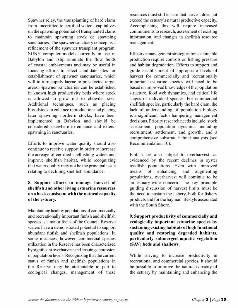
Chapter 3 Page 35Access the document on the Web at http://www.estuary.cog.ny.us
Spawner relay, the transplanting of hard clams from uncertied to certied waters, capitalizes on the spawning potential of transplanted clams to maintain spawning stock or spawning sanctuaries. The spawner sanctuary concept is a renement of the spawner transplant program. SUNY computer models currently in use in Babylon and Islip simulate the ow elds of coastal embayments and may be useful in focusing efforts to select candidate sites for establishment of spawner sanctuaries, which will in turn supply larvae to preselected target areas. Spawner sanctuaries can be established in known high productivity beds where stock is allowed to grow out to chowder size. Additional techniques, such as placing broodstock to enhance reproduction and placing later spawning northern stocks, have been implemented in Babylon and should be considered elsewhere to enhance and extend spawning in sanctuaries.
Efforts to improve water quality should also continue to receive support in order to increase the acreage of certied shellshing waters and improve shellsh habitat, while recognizing that water quality may not be the principal issue relating to declining shellsh abundance.
8. Support efforts to manage harvest of shellsh and other living estuarine resources on a basis consistent with the natural capacity of the estuary.
Maintaining healthy populations of commercially and recreationally important nsh and shellsh species is a major focus of the Council. Reserve waters have a demonstrated potential to support abundant nsh and shellsh populations. In some instances, however, commercial species utilization in the Reserve has been characterized by signicant overharvest and ensuing depression of population levels. Recognizing that the current status of nsh and shellsh populations in the Reserve may be attributable in part to ecological changes, management of these
resources must still ensure that harvest does not exceed the estuary’s natural productive capacity. Accomplishing this will require increased commitments to research, assessment of existing information, and changes in shellsh resource management. Effective management strategies for sustainable production require controls on shing pressure and habitat degradation. Efforts to support and guide establishment of appropriate levels of harvest for commercially and recreationally important estuarine species will need to be based on improved knowledge of the population structure, food web dynamics, and critical life stages of individual species. For commercial shellsh species, particularly the hard clam, the lack of understanding of population biology is a signicant factor hampering management decisions. Priority research needs include: stock assessment; population dynamics including recruitment, settlement, and growth; and a comprehensive substrate habitat analysis (see Recommendation 10).
Finsh are also subject to overharvest, as evidenced by the recent declines in oyster toadsh populations. Even with improved means of enhancing and augmenting populations, overharvest will continue to be an estuary-wide concern. The key principle guiding discussion of harvest limits must be the need to sustain the shery, both for shery products and for the bayman lifestyle associated with the South Shore.
9. Support productivity of commercially and ecologically important estuarine species by sustaining existing habitats of high functional quality and restoring degraded habitats, particularly submerged aquatic vegetation (SAV) beds and shallows.
While striving to increase productivity in recreational and commercial species, it should be possible to improve the natural capacity of the estuary by maintaining and enhancing the
Vers F Chap3 8/30/01, 11:19 AM34-35

Chapter 3 Page 36 Access the document on the Web at http://www.estuary.cog.ny.us
habitat conditions that support this productivity. Loss and degradation of estuarine habitats has reduced and fragmented populations of a number of the Reserve’s important estuarine species. Maintaining or restoring population levels of these species will require both restoration of key physical habitats and protection of existing high quality habitat features.
Many nsh species use the Reserve for spawning, nursery habitat, seasonal feeding grounds, and general living space. A number of nsh, particulary forage sh species, display a strong habitat linkage to the estuary. Spawning and nursery habitats for estuarine sh in the Reserve are largely dependent on wetlands, shallows, and SAV beds, all of which are juxtaposed between intense human activity and the open waters of the estuary. Finsh populations will benet from overall habitat protection and restoration. Potential management actions, including conservation area designation for selected cove areas important for winter ounder spawning and persistent hard clam beds, should be developed to protect the habitat values of these areas. Habitat-related recommendations in shery management plans should be implemented.
Shellsh populations may also benet from habitat restoration efforts. Habitat enhancement can be initiated at specic sites where management efforts focus on improvement of water quality, the control of nonpoint sources of pollution near shellsh resources, wetland restoration, and substrate restoration or improvement. Shellsh habitat enhancement efforts also need to recognize variation within the Reserve of critical environmental parameters, such as water temperature, salinity, and substrate characteristics, which affect management approaches. At present, a focus on the potential for substrate improvement through shell augmentation appears to be well deserved as a means of increasing shellsh populations.
RECOMMENDATIONS TO ADDRESS SCIENTIFIC INFORMATION NEEDS
10. Address critical information needs regarding productivity of hard clam and other shellsh with research that focuses on growth and nutrition, recruitment, settle-ment, predation and Brown Tide effects.
Fundamental research investigating the life history stages of various shellsh, especially hard clams, would permit the identication of those stages during which year class abundance is established and the biotic and abiotic factors that control the shellsh abundance. Coupled with applied research and monitoring of stock abundance and population structure, the minimum information would be on hand to effectively manage the Reserve’s shellsh resources.
11. Evaluate the conditions and needs for rehabilitation of palustrine forested wetlands associated with the Reserve’s tributary corridors and the tidal wetlands that play an important role in the ecology of the Reserve’s bay bottoms and barrier islands.
The NYS Department of State, in collaboration with the U.S. Fish and Wildlife Service, has completed substantial study of the Reserve’s tidal wetlands, including:
• cataloging and mapping of historic and existing wetlands;
• calculating the total acreage that might be restored or enhanced;
• assessing the Reserve-wide benets of restoration; and
• identifying the number and location of candidate restoration sites within Reserve.
Vers F Chap3 8/30/01, 11:19 AM36-37

Chapter 3 Page 37Access the document on the Web at http://www.estuary.cog.ny.us
Similar information is not available for tributaries in the Reserve, especially tributary mouths, which are important for many species but especially vulnerable and poorly understood. Monitoring and mapping efforts are also critical for submerged aquatic vegetation beds and other benthic habitats that are especially important for shellsh populations.
Also lacking is information on the potential effects of sea level rise on the Reserve’s tributaries and associated corridors, tidal marshes, bay bottoms and barrier islands, and the potential impacts of projects aimed at preventing overwash and inlet formation.
Vers F Chap3 8/30/01, 11:19 AM36-37

Access the document on the Web at http://www.estuary.cog.ny.us
Vers F Chap3 8/30/01, 11:19 AM38

CHAPTER 4
Expand Public Use andEnjoyment of the Estuary
Vers F Chap4 8/30/01, 11:27 AM39
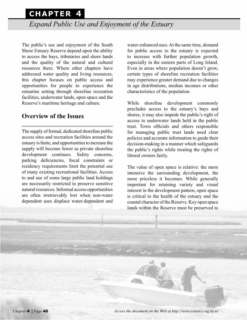
CHAPTER 4Expand Public Use and Enjoyment of the Estuary
Access the document on the Web at http://www.estuary.cog.ny.usChapter 4 Page 40
The public’s use and enjoyment of the South Shore Estuary Reserve depend upon the ability to access the bays, tributaries and shore lands and the quality of the natural and cultural resources there. Where other chapters have addressed water quality and living resources, this chapter focuses on public access and opportunities for people to experience the estuarine setting through shoreline recreation facilities, underwater lands, open space and the Reserve’s maritime heritage and culture.
Overview of the Issues
The supply of formal, dedicated shoreline public access sites and recreation facilities around the estuary is nite, and opportunities to increase the supply will become fewer as private shoreline development continues. Safety concerns, parking deciencies, scal constraints or residency requirements limit the potential use of many existing recreational facilities. Access to and use of some large public land holdings are necessarily restricted to preserve sensitive natural resources. Informal access opportunities are often irretrievably lost when non-water dependent uses displace water-dependent and
water-enhanced uses. At the same time, demand for public access to the estuary is expected to increase with further population growth, especially in the eastern parts of Long Island. Even in areas where population doesn’t grow, certain types of shoreline recreation facilities may experience greater demand due to changes in age distributions, median incomes or other characteristics of the population.
While shoreline development commonly precludes access to the estuary’s bays and shores, it may also impede the public’s right of access to underwater lands held in the public trust. Town ofcials and others responsible for managing public trust lands need clear policies and accurate information to guide their decision-making in a manner which safeguards the public’s rights while treating the rights of littoral owners fairly.
The value of open space is relative: the more intensive the surrounding development, the more priceless it becomes. While generally important for retaining variety and visual interest in the development pattern, open space is critical to the health of the estuary and the coastal character of the Reserve. Key open space lands within the Reserve must be preserved to
Vers F Chap4 8/30/01, 11:27 AM40-41

Chapter 4 Page 41Access the document on the Web at http://www.estuary.cog.ny.us
buffer wetlands, protect sensitive natural habitat, control nonpoint source pollution and retain visual quality in the estuarine setting. All levels of government must work together and in cooperation with private development interests to achieve these ends.
Commercial shing, island bay houses, recreational boating, marinas, yacht clubs, boat repair shops, ferries and shoreline parks are some of the facilities and activities that manifest the region’s maritime heritage and contribute to its present day culture. Nevertheless, some traditional estuarine uses are gradually being displaced by more economically competitive non-traditional uses. Concerted public and private sector efforts will be needed to perpetuate the estuary’s historical legacy.
Shoreline Public Access and Recreation
Shoreline properties owned or leased and managed for public use provide formal access to the estuary. A 1996 update of prior inventories identied 245 municipally-owned, 22 State-owned, and 18 federally-owned shoreline public access and recreation sites within the Reserve. The sites range in size from less than one acre to more than 5,000 acres and consist of active and passive recreation areas, environmental education centers and natural habitat preserves. Many of the recreation facilities are subject to residency restrictions that favor local residents; some have physical limitations that affect potential use; and others have lacked adequate maintenance due to scal constraints [Technical report: Shoreline Public Access and Recreation (1999)].
Street ends abutting the shore can afford the public informal access opportunities. In most cases, however, the lack of parking and objecting neighbors force local ofcials to restrict use of the street ends. Water-dependent businesses such as marinas or yacht clubs and water enhanced businesses such as restaurants also provide informal access opportunities. The displacement of these businesses by non-water dependent uses usually forecloses such opportunities.
Other factors restrict public access to the Reserve’s bays and shores. Legal requirements and administrative mandates protect sensitive coastal resources and endangered species and affect access to municipal lands in the estuary to a signicant degree. Thirty-nine sites in Nassau and Suffolk counties that encompass 9,911 acres are closed for protection and preservation purposes. This is true also for many State and federal holdings. State-owned shorelines, predominantly tidal wetlands owned by the Department of Environmental Conservation, are accessible only by permit in an effort to protect them. Federal facilities also require a balance between preservation of environmental values and demands for access. Restricted parking and limits on permitted activities preserve the
Opportunities to enjoy the estuary
Vers F Chap4 8/30/01, 11:28 AM40-41

Chapter 4 Page 42 Access the document on the Web at http://www.estuary.cog.ny.us
quality of those resources [Technical report: Shoreline Public Access and Recreation (1999)].
While the present supply of public access sites and recreation facilities is thus constrained, continued development and population growth eastward from the center of the Reserve is expected to heighten recreational demand. Changes in the age distribution of the population may also result in greater demands for certain types of facilities. The anticipated growth in demand is documented in the Statewide Comprehensive Outdoor Recreation Plan (SCORP) and the NYS Department of Environmental Conservation Marine Recreational Fishing Access Plan. Based on the demand model developed for the SCORP, recreational needs in Nassau and Suffolk counties are expected to exceed statewide averages by the year 2010, especially in water-related activities. Development pressures are expected to severely limit access and intensify the demand on existing public facilities at the same time. The SCORP also acknowledges that scal constraints on tax revenues have left many public shoreline facilities with inadequate funds to conduct the routine repairs necessary to maintain current use, let alone meet future increases in demand [NYS Department of Parks, Recreation and Historic Preservation, (1991)].
The Marine Recreational Fishing Access Plan supports these ndings. It cites limitations on shing access that include residency restrictions at 135 municipal sites in the Reserve and a shortage of State-operated shing access facilities. The study also nds a correlation between declining participation in marine recreational shing and a loss of access due to residential and commercial development of the coastline. The loss of access due to municipal parking restrictions at residential street ends is a prime example. Fishermen no longer can park their cars on these streets and walk to the beach.
Underwater Lands and the Public Trust
Unique to South Shore towns is the extent of underwater land received from colonial patents and held in the public trust by those towns. Derived from English common law, the Public Trust Doctrine applicable to these lands plays an important role in protecting public access to the estuary. In general, the Public Trust Doctrine aims to perpetuate the rights of the public to pass along the foreshore and to use the water for the purposes of commerce, navigation and shing. Many municipally-held access sites include public trust lands, but such public trust lands may also adjoin privately held uplands.
The conicts that arise between the rights of littoral owners and those of the public must be viewed from the perspectives of both the property owner and the government as protector of the public trust. For the most part, the South Shore towns have proprietary and regulatory authority over the use of the public trust underwater lands of the estuary’s bays, with the exception of the Blue Point Oyster Company holdings. Thus, these local governments are in the best position to make decisions regarding the use of these lands, with the goal of achieving a lasting and practical balance between the public interest and that of the littoral property owner.
Case law in New York clearly upholds the Public Trust Doctrine and its application to the foreshore and publicly-held underwater lands. An exercise of governmental police powers, however, must be reasonable and must serve legitimate public purposes. The management of public trust lands requires the formulation of clear policies based upon comprehensive, accurate databases which dene property interests, identify historical uses of the waterways and analyze natural resources and community character values [Technical report: Underwater Lands and the Public Trust Doctrine (1997)].
Vers F Chap4 8/30/01, 11:28 AM42-43

Chapter 4 Page 43Access the document on the Web at http://www.estuary.cog.ny.us
Open Space
Open spaces provide variety and visual interest within the built environment of the Reserve, contributing signicantly to the region’s sense of place. Parks, conservation lands, large estates, public and private institutions, agricultural and undeveloped lands contribute public values associated with open space: opportunities for public access and recreation; aesthetic qualitites that benet tourism and quality of life; and, preservation and buffering of environmentally sensitive lands with high natural resource values.
In the portion of the Reserve west of the Connetquot River most land development took place more than thirty years ago. At the height
of this development many of the larger tracts were purchased and retained for recreation and preservation purposes. Some of the more important holdings include: Lido Beach Town Park; Nassau Beach County Park; Point Lookout Town Park; Tobay Beach and the JFK Wildlife Sanctuary; Baldwin Town Park; Cow Meadow County Park; Cedar Creek County Park; Jones Beach State Park; Gilgo State Park; Gardners County Park; Robert Moses State Park; Seatuck
National Wildlife Refuge; and, Heckscher State Park. In the eastern portion of the Reserve, the largest protected open space areas include: Wertheim National Wildlife; Fire Island National Seashore; Havens Point State Tidal Wetlands; and Suffolk County’s Terrel River, Smith Point, Cupsogue, and Shinnecock parks.
Efforts to identify potential open space lands in the region warranting protection have been reected in the report Conserving Open Space in New York State: State Open Space Plan (1998), completed as a joint project of
the Department of Environmental Conservation and the Ofce of Parks, Recreation and Historic Preservation. More recently, work has been done for the Reserve through an open space preservation study which identied common objectives, heightened awareness of the value of open space and the pressing need to preserve it, and established a dialogue between various agencies and groups interested in protecting open space. However, there is still little
From an early period of subsistence farming, oyster harvesting and near shore whaling to present day com-mercial shing, recreational boating and intensive shore-line development, generations have depended upon the resources of the estuary and enjoyed a unique quality of life on the south shore.
Governor George E. Pataki announces the State’s acquisition of open space at Benton Bay
Vers F Chap4 8/30/01, 11:28 AM42-43

Chapter 4 Page 44 Access the document on the Web at http://www.estuary.cog.ny.us
coordination of efforts by municipalities, State and federal agencies, nonprot organizations and developers to protect open space in the Reserve. Further, there is no strategy to protect open space to ensure that Council goals for water and living resource protection, and public access and recreation enhancement, can be achieved [Technical report: Open Space Preservation Study (2000)].
The Maritime Character
For centuries the estuary has been a magnet for human activities. From an early period of subsistence farming, oyster harvesting, and near shore whaling to present day commercial shing, recreational boating and intensive shoreline development, generations have depended upon the resources of the estuary and enjoyed a unique quality of life on the South Shore. From those generations arose a cultural legacy and maritime character that cannot be replaced. Yet, new shoreline development is gradually eroding the South Shore’s maritime heritage as more economically competitive non-traditional uses displace traditional uses.
Contemporary manifestations of the Reserve’s traditional cultural resources include continued use of its bay houses, commercial and recreational shellshing and nshing, boat building and repair, commercial and recreational
boating, and “gunning” (waterfowl hunting). These cultural resources are less tangible than physical historic resources and are vulnerable to degradation and loss due to a lack of recognition and protection.
Bay houses provide an architectural link with estuary tradition. Their presence characterizes the region’s unique place along the eastern seaboard. Although only a small number of the hundreds of bay houses that once sustained the shing, gunning, and summer colony traditions of the Reserve continue to do so, all bay houses need to be protected. Their existence is threatened by restrictions placed on them through current land lease agreements with the towns, the most threatening being those that do not permit 100 percent in-kind replacement following storm damage, and those that prohibit the transfer of bay houses to non-relatives [Technical report: Maritime Centers of the South Shore Estuary Reserve (1999)]. There also are numerous signicant historic resources throughout the Reserve. Only a small number of these are listed on the State and National Registers of Historic Places, with many others potentially eligible for listing. Many have not been identied and could be at the least eligible for local designation. Historic resources of particular signicance are maritime-related or those that once played
an important role in settlement or growth of the Reserve. But despite their importance, there is no comprehensive survey of historical resources in the Reserve [Technical report: Inventory and Analysis of Cultural and Historic Resources (1999)].
Vers F Chap4 8/30/01, 11:28 AM44-45
Chapter 4 Page 45Access the document on the Web at http://www.estuary.cog.ny.us
Recommendations
This section presents recommendations that build upon those contained in the pertinent technical reports and address the issues confronting use and enjoyment of the estuary.
RECOMMENDATIONS TO IMPROVE SHORELINE PUBLIC ACCESS AND ESTUARY-RELATED RECREATION
1. Expand public shoreline access opportu-nities by increasing the amount of land dedi-cated to physical and visual access.
To meet growing demand, public access opportunities should be expanded at existing underutilized sites and increased by acquisition of additional sites. Where feasible, linear connections should be developed to physically link both existing and new sites. Where practical, shoreline barriers should be removed.
Priority should be given to those thirty-seven sites already identied as having the potential to accommodate increased public access, especially those that address specic geographic and demographic access needs and that are proposed in communities with a plan and commitment to meet regional as well as local demands for access.
2. Develop new water-related recreational facilities at a level proportionate with the estuary’s capacity to accommodate greater human activity.
New water-related recreational facilities should be developed to meet anticipated increases in the demand for recreation opportunities around
the estuary, especially during peak periods. Care in the selection of sites and in the design and construction of facilities will be critical to increasing public use and enjoyment of the estuary without degrading natural resource values.
3. Improve and sustain the levels of public access and recreation opportunity at existing sites.
A “no net loss” policy toward access to the estuary should be implemented at existing public access sites. Bulkheads, parking lots and other essential infrastructure at existing recreation facilities should be improved when necessary and maintained to allow sustained recreational use. Continued informal access at public and private locations should be ensured through easements, tax incentives, and other voluntary means.
RECOMMENDATIONS TO PROTECT PUBLIC INTERESTS IN PUBLIC TRUST LANDS
4. Develop management plans for underwater lands.
The six towns should develop management plans to guide decision-making regarding shoreline development and the use of underwater lands. Each management plan should be based on a complete and compelling base of information to distinguish existing littoral and public rights. Each plan should set forth policies that provide the basis for reasonable the regulation of underwater lands.
Vers F Chap4 8/30/01, 11:28 AM44-45

Chapter 4 Page 46 Access the document on the Web at http://www.estuary.cog.ny.us
RECOMMENDATIONS TO RETAIN OPEN SPACE WITHIN THE RESERVE
5. Increase acquisition and preservation of open space.
Additional open space lands should be acquired or otherwise protected to achieve the following objectives: protect areas with high natural resource values; minimize additional ows of polluted runoff into the rivers, streams and bays of the estuary; enhance physical and visual public access to the water; establish physical linkages between protected open space lands; and protect community character and historic resources. Open space preservation should consider large parcels as well as small
parcels that would have cumulative open space benets in a region characterized as heavily developed or under signicant development pressure.
6. Create a land trust to facilitate open space acquisition, preservation and management within the Reserve.
Currently there is no single entity focusing on open space preservation throughout the Reserve. The Peconic Land Trust, known for its efforts to preserve agricultural lands along the north and south forks of Long Island, is currently unable to expand its efforts to the Reserve area. A land trust can facilitate open space preservation with private land owners outside the framework of government. A land trust’s expertise could include: matching the appropriate tax benets to the needs of potential land donors; executing land conservation easements; acquiring land; assessing land’s open space values; and monitoring and enforcing easement restrictions. The creation of a Reserve-wide land trust to facilitate open space preservation is a necessary element for a successful open space preservation program. Initial nancial support through the Environmental Protection Fund could help in the creation of a land trust to assist in achieving the open space preservation goals within the Reserve.
7. Develop a regional comprehensive approach to open space protection.
An open space plan should be developed for the acquisition, protection, and management of open space lands in the Reserve. The plan should include criteria for determining priority lands for acquisition and protection to meet regional objectives. Also, the Council should facilitate and coordinate the protection and long term management of open space. The committee should be given the following responsibilities: advise the full Council regarding open space planning; identify lands to be recommended for
Southampton’s Community Preservation Fund
A good local example of open space protection is the Town of Southampton’s Community Preservation Fund. Approved by Town voters and an act of the State Legislature in 1998, this unique program uses revenues from a locally collected two percent land transfer tax to fund natural land purchases and the creation of recreational parks. The program also invites owners of selected properties to join with the Town in exploring various options for conserving their land.
Vers F Chap4 8/30/01, 11:28 AM46-47

Chapter 4 Page 47Access the document on the Web at http://www.estuary.cog.ny.us
inclusion in the 2001 State Open Space Plan; sponsor workshops on open space preservation for interested parties within the Reserve; and give periodic progress reports to the Council on open space activities.
8. Establish a Geographic Information System for Open Space Protection.
The Council should foster development of a Geographic Information System (GIS) data base to achieve the following objectives: maintain pertinent information on open space sites already identied for acquisition; analyze the landscape’s vulnerability to potential development in relation to its open space values warranting protection; maintain data on lands protected by conservation easements; and monitor protected lands for long-term management.
9. Provide technical assistance to local governments and nonprot organizations.
State agencies should coordinate efforts to provide technical assistance to local governments and nonprot organizations to protect and manage open space.
10. Increase the amount of funds dedicated for open space preservation.
Funds from federal, State and local sources should be allocated to facilitate open space acquisition and associated monitoring and management activities. Dedicated funds should be matched with local, non-prot, and private revenues available for open space acquisition and preservation.
11. Complete community opens space plans.
The success of open space protection within the Reserve is largely dependent on the commitment of Reserve communities to implement an open space protection program at the local level. Local governments should
develop comprehensive open space assessments and protection strategies. Community open space plans should be developed as a component of a Local Waterfront Revitalization Programs or other planning processes such as a coastal/waterfront open space study. Examples of successful programs include the Suffolk County Greenways Program and the Southampton Community Preservation Project Plan.
12. Establish a land and water trail system to link existing and new open space lands of the Reserve.
A system of land and water routes should be developed across the Reserve to link open spaces with recreational lands and heritage areas in order to increase opportunities for appropriate public use and appreciation of open space.
RECOMMENDATIONS TO PROTECT, MAINTAIN AND ENHANCE THE RESERVE’S MARITIME HERITAGE
13. Promote and preserve the cultural resources that contribute to the Estuary’s unique character and sense of place.
Museums and education centers in the Reserve need increased levels of support so that they can play a leading role in interpreting, celebrating and promoting the present culture and maritime heritage of the Reserve. There is a need also to document and recognize historic and cultural resources that epitomize the rich maritime heritage of the region. Additionally, efforts should be made to encourage sailing as a traditional activity; protect the cultural values of “gunning” and other hunting activities; and promote better understanding of the relationships between Native Americans, early European settlers and the estuary.
Vers F Chap4 8/30/01, 11:28 AM46-47

Chapter 4 Page 48 Access the document on the Web at http://www.estuary.cog.ny.us
14. Provide for the perpetuation of island bay houses and the bay house lifestyle.
In order to preserve an important link with the South Shore’s past and to maintain the traditional uses dependent on bay houses, lease agreements should be facilitated between the towns and bay house owners to ensure the continued existence and use of the houses while still protecting the bay island environment. The legacy of each bay house should be researched and documented, and interpretive programs on the cultural value of the bay houses and their traditional uses should be prepared. Endangered bay houses should be conveyed to local museums or historical societies for protection and interpretive use.
15. Protect and support the continuation of historic maritime resources of the Reserve.
Historic resources that reect the estuary’s inuence on settlement patterns should be designated and protected through historic resource protection programs, local historic preservation districts and laws, the transfer of development rights, acquisition, and other available means. A Reserve-wide survey is needed to document important historic resources and to identify potential threats to their existence. Historic features of the State, federal, and local park systems should be protected through designation as State and National Register landmarks, especially those in the State ocean beach park system. Monuments and commemorative features that recognize and celebrate the maritime history of the estuary should be installed at waterfront parks and bay access sites. A maritime heritage program should be established and coordinated with local tourism programs. The heritage program should promote local design standards for new construction that reect the character of the local maritime heritage.
16. Recognize and preserve elements of the coastal landscape that contribute to the Reserve’s unique character and sense of place.
Valuable scenic resources of the Reserve should receive recognition through designations of Scenic Areas of Statewide Signicance. To provide the basis for such designations, a comprehensive assessment of the estuary’s visual elements should be conducted. The assessment should focus on the uniqueness and quality of the visual elements and the public recognition they receive. Particular emphasis should be given to areas where the scenic values are enhanced by associated cultural and historic resources.
17. Preserve remaining large estates for their historical, scenic, and natural resource values.
A number of large estates formerly played important roles in the estuary’s naturalist movement. Those that remain should be identied, recognized, and protected for their historic, scenic and natural resource values through acquisition.
Vers F Chap4 8/30/01, 11:28 AM48

CHAPTER 5
Sustain and Expand theEstuary-related Economy
Vers f Chap5 8/30/01, 11:29 AM49

CHAPTER 5Sustain and Expand the Estuary-related Economy
Access the document on the Web at http://www.estuary.cog.ny.usChapter 5 Page 50
Overview of the Issues
The relatively calm, protected waters and abundant natural resources of the estuary provide the basis for water-related economic activities that have evolved from harvesting of salt hay for livestock, harvesting of oysters, shing and boat building to recreational boating and sport shing, commercial shing and shellsh harvesting, waterborne transport and tourism. Changes in the nature of estuary-related businesses
1 reected the pervasive inuences
of burgeoning population and market demand in New York City coupled with transportation improvements and expanding recreational use of the estuary [Technical report: Historical Development Patterns (1997)].
1Estuary-related businesses include both water-depen-
dent and water-enhanced commercial uses. Water- depen-dent uses are uses that can only be conducted on, in, over or adjacent to the water; each involves, as an integral part of the use, direct access to and use of the water. Water-enhanced uses do not require a waterfront location to function, but are often essential to the efcient func-tioning of water-dependent uses and can be essential to their economic viability. Water-enhanced uses increase the public’s enjoyment of the waterfront.
Today, the estuary is home to the largest concentrations of commercial and recreational vessels, marinas and other water-dependent businesses in the State of New York.
Vers f Chap5 8/30/01, 11:29 AM50-51

Chapter 5 Page 51Access the document on the Web at http://www.estuary.cog.ny.us
Today, the estuary is home to the largest concentrations of commercial and recreational vessels, marinas and other water-dependent businesses in the State of New York. It supports, in whole or in part, about 3,000 water-dependent and water-enhanced business establishments employing nearly 30,000 people. The economic contribution of these businesses varies among towns in the Reserve with Hempstead receiving the largest share and Oyster Bay the smallest [Technical reports: Embayment Use Study (1999); South Shore Estuary Reserve: Value of Economic Impacts and Sectors with a Perspective on Uses (1997)].
The amount of estuary shoreline suitable for establishing new water-dependent uses or expanding existing ones is limited. At the same time, some existing water-dependent businesses are gradually being displaced by more economically competitive non-water-dependent uses. This is of particular concern in maritime centers where water-dependent uses are concentrated and embody much of the estuary-related cultural heritage that supports local tourism.
Certain traditional water-dependent businesses such as shellsh harvesting and shing are closely tied to the health of the estuarine ecosystem--an ecosystem that has been subjected to signicant direct and indirect impacts from development in the Reserve this century. The viability of such businesses will depend, in part, on the success of measures recommended in other chapters of this plan to mitigate the impacts of past development and avoid or minimize impacts from new development.
Water-dependent Businesses Historically, water-dependent businesses gravitated to locations along the shoreline of the estuary where water access and navigable depths were especially well-suited to their function. Today, still tending to be clustered along coves and channels, around the mouths of tributaries or near inlets, these businesses include: marinas; boatyards; support facilities for commercial shing vessels; petroleum terminals; ferry services; marine construction businesses; and marine fueling facilities. Waterfront property, however, has also attracted non-water-dependent uses, and only a limited amount of shoreline remains that is suitable and available for expanding existing water-dependent uses, establishing new ones or re-establishing former, more traditional ones. West of the Connetquot River, the estuary shoreline was substantially developed by the 1970s except for public parkland and the remaining tidal wetlands2
.
2 1977 Existing Land Use map, Suffolk County Regional Planning Board.
Vers f Chap5 8/30/01, 11:29 AM50-51

Chapter 5 Page 52 Access the document on the Web at http://www.estuary.cog.ny.us
Although the extent of shoreline development gradually diminishes east of the Connetquot River, shallowness and tidal wetlands limit the suitability of shoreline parcels for water-dependent businesses to those embayment areas in which they are presently located. Thus, other shore lands not already committed to non-water-dependent uses are often publicly owned, have signicant physical constraints or are subject to regulatory controls protecting high quality natural resources.
For the owner of a water-dependent business, ceasing business operation and selling the shoreline property may yield an attractive nancial return. This may be particularly true for water-dependent businesses affected by decline in nsh or shellsh stocks, seasonal variation in demand, public perception of health concerns regarding seafood products or constraints such as harvest limits, enforcement of shing or shellshing restrictions or permit requirements for in-water structures. Local government ofcials have expressed concerns about displacement of water-dependent businesses by non-water-dependent uses and the need to address issues such as dredging and installation of in-water structures critical to many water-dependent uses [Technical report: Embayment Use Study (1999)].
Zoning regulations in some municipalities only make provision for water-dependent businesses to the extent that their waterfronts have a business or industrial district. Additional emphasis could be given to facilitate the siting of water-dependent uses and deter their displacement by non-water-dependent uses [Technical report: Zoning for Water Dependent Uses (1999)].
Maritime Centers Maritime centers are areas with concentrations of water-dependent businesses that are often supported by water-enhanced businesses and may be linked to or situated near a business district. Many of these centers embody a
maritime heritage and community character uniquely associated with the estuary. Six major and fourteen secondary maritime centers have been identied to date. Major maritime centers encompass an array of water-dependent businesses covering a large geographical area, offer substantial opportunities for public access to the estuary and serve as tourist destination points. Secondary maritime centers support less diverse mixes of water-dependent businesses, cover smaller geographic areas and are more likely to serve primarily local residents. The major and secondary maritime centers are listed below, by town.
South Shore Estuary Reserve Maritime Centers
Hempstead:Major: Village of FreeportSecondary: areas in Oceanside, Point Lookout, Merrick and Seaford
Babylon:Major: Village of BabylonSecondary: Villages of Lindenhurst and Amityville and West Babylon area
Islip: Major: Hamlets of Bay Shore and SayvilleSecondary: Captree Boat Basin, along Orowock Creek and West Sayville areas
Brookhaven:Major: Village of PatchogueSecondary: areas of Center Moriches and East Moriches
Southampton:Major: Shinnecock Canal area near the Hamlet of Hampton BaysSecondary: along Seatuck Cove and at the Shinnecock Inlet
Displacement of a maritime center’s water-dependent businesses can reduce the diversity
Vers f Chap5 8/30/01, 11:29 AM52-53

Chapter 5 Page 53Access the document on the Web at http://www.estuary.cog.ny.us
of its estuary-related activities and erode its maritime character and unique sense of place. These consequences may, in turn, affect the center’s quality of life for local residents and attractiveness of the waterfront to visitors. In this way, displacement of water-dependent businesses can also affect water-enhanced businesses such as restaurants and other businesses that depend on tourist expenditures [Technical report: Maritime Centers of the South Shore Estuary Reserve (1999)].
Recommendations The economic value contributed by estuary-related businesses is readily apparent, as are the role of maritime centers and the need to manage development impacts that affect the estuary’s health. This section presents recommendations that collectively reect those presented in the relevant technical reports. The recommendations below aim to strengthen and protect estuary-related business by supporting water-dependent businesses and enhancing maritime centers.
RECOMMENDATIONS TO SUPPORT WATER-DEPENDENT BUSINESSES
1. Promote public/private efforts to enhance the economic viability of water-dependent businesses.
The Council should foster the development and maintenance of a shoreline parcel database for water-dependent and water-enhanced uses with information on: current land use and zoning; existing land-based and in-water infrastructure; suitability for water-dependent use; availability for development or redevelopment; and other pertinent data. The database should be made available to State, county, and municipal agencies for use in preparing or amending comprehensive land use plans and zoning regulations, and in formulating waterfront redevelopment and revitalization strategies. With periodic updating, the database would allow the
Council and various government agencies to monitor local and regional trends in establishing, expanding and retaining water-dependent businesses. It would also represent a potential source of information for preparing boating guides and other tourism promotion materials.
An analysis of regional market trends should be undertaken to determine the potential for attracting and establishing new water-dependent businesses. A market trends analysis would also help existing water-dependent businesses in tailoring their operations and investing in site improvements to meet consumer demand more effectively.
Vers f Chap5 8/30/01, 11:30 AM52-53

Chapter 5 Page 54 Access the document on the Web at http://www.estuary.cog.ny.us
The Council should sponsor an annual workshop for maritime business owners and operators. Workshop sessions could focus on resource issues affecting the viability of businesses that depend on the estuary and explore solutions with local government ofcials and State and federal resource managers.
The Council should promote and support programs that provide technical marine trade skills to youths and adults.
2. Provide for the siting, expansion and retention of water-dependent businesses as part of municipal comprehensive land use plans and zoning regulations.
To the maximum extent practicable, municipalities along the estuary’s shoreline should exercise their authority to provide for the establishment and retention of businesses which depend on access to the estuary. As part of establishing a vision for the waterfront, local comprehensive land use plans can identify areas particularly well-suited for water-dependent businesses and set forth policies giving such businesses appropriate support. Based on such plans, existing zoning regulations can be amended to establish waterfront districts where water-dependent businesses and appropriate accessory use are allowed as permitted uses. Water-enhanced businesses and public water-dependent uses might be allowed to the extent that they enhance the economic viability of water-dependent businesses.
3. Facilitate the establishment and expansion of water-dependent businesses as part of municipal waterfront redevelopment plans and revitalization programs.
When preparing redevelopment plans and revitalization programs for their waterfronts, municipalities should give priority to establishing and expanding water-dependent businesses on vacant and or deteriorated shoreline parcels that have suitable land and
water access. Strategies for public infrastructure improvements should consider the extent to which such improvements will benet water-dependent businesses, especially regarding maintenance of in-water structures, appropriate dredging maintenance, and navigation safety. Public improvements or public uses planned in a waterfront area having water-dependent businesses should be designed and undertaken in a manner that complements those businesses. As part of implementing municipal waterfront redevelopment and revitalization strategies, local development corporations could acquire and improve suitable shoreline parcels for siting or expanding traditional water-dependent businesses.
4. Enhance the economic viability of traditional estuary-related businesses.
Municipalities should explore the use of tax relief, public/private partnerships and other techniques to attract and retain traditional water-dependent businesses such as boat building and repair. This kind of support will be particularly helpful for small businesses, such as commercial clam harvesting, that are uniquely dependent upon the estuary’s resources. A municipality could make winter boat storage space available to baymen at existing shoreline parks having adequate boat launch capability. Also, a municipality could offer incentives for existing non-water-dependent commercial establishments along the shore to make affordable dock space available to baymen.
5. Assist municipal efforts to support water-dependent businesses.
The Council should promote the provision of technical assistance by State and county agencies to help communities in their efforts to establish, expand and retain water-dependent businesses through comprehensive land use plans, zoning amendments, waterfront redevelopment plans and revitalization programs.
Vers f Chap5 8/30/01, 11:30 AM54-55

Chapter 5 Page 55Access the document on the Web at http://www.estuary.cog.ny.us
6. Address navigation and related infrastruc-ture needs of water-dependent businesses.
The Council should coordinate development and implementation of a dredging and dredged material management plan for addressing the navigation needs of water-dependent uses while protecting the estuarine ecosystem.
The Council should promote public/private efforts to explore the potential for increasing the number of ferry routes and landings and providing additional linkages with rail and other pubic transportation facilities. Investigations of potential ferry routes should include connections between Freeport and Jones Beach, Babylon and Robert Moses State Park, and the Brookhaven mainland and Great Gun Beach.
State investment in navigation and related infrastructure improvements for the estuary should be commensurate with the proportion of water-dependent businesses concentrated in this region.
RECOMMENDATIONS TO ENHANCE MARITIME CENTERS
7. Promote maritime centers as the most viable locations for concentrations of water- dependent businesses.
Maritime centers exist because of the water access they offered in the past and continue to offer today for water-dependent businesses. These centers should be maintained and strengthened for this traditional role. New waterfront development and redevelopment should not diminish a maritime center’s ability to support water-dependent businesses and compatible water-enhanced businesses.
8. Encourage and support waterfront redevelopment and revitalization in maritime centers.
Maritime center communities with blighted, obsolete or underutilized waterfront areas should prepare and implement waterfront redevelopment and revitalization strategies that support water-dependent businesses in conjunction with protection and enhancement of traditional maritime character. In major maritime centers, the enhancement of traditional maritime character will improve the community’s ability to attract tourists; in minor maritime centers, the enhancement will improve the quality of life for local residents.
9. Promote efcient surface water use in embayments that support maritime centers or other signicant numbers of water-dependent businesses.
Individually or jointly, maritime center communities and other municipalities with substantial numbers of water-dependent uses should prepare harbor management plans to address: protection of natural resource values; shoreline management; in-water structures; navigation safety; harbor infrastructure needs; and other embayment issues affecting the viability of water-dependent uses.
10. Showcase maritime centers in tourism promotion activities for the region.
In promotion activities for tourism within the Reserve, the Council should highlight maritime centers along the estuary and the traditional water-dependent businesses which embody much of the region’s maritime history and culture. In partnership with local water-dependent businesses and organizations committed to the preservation and enhancement of estuary culture and traditions (e.g., Long Island Maritime Museum, Long Island Marine Education Center, Long Island Traditions), maritime centers should organize and hold
Vers f Chap5 8/30/01, 11:30 AM54-55

Chapter 5 Page 56 Access the document on the Web at http://www.estuary.cog.ny.us
waterfront festivals featuring activities, techniques or equipment related to clamming, boat building, bay houses and other maritime traditions.
In addition to emphasizing maritime centers and traditional water-dependent businesses, promotion of tourism in the Reserve would necessarily reect the considerable recreation opportunities offered by the estuary, both through businesses that thrive on demand for recreational shing and boating and at public access and recreation facilities. The Council should sponsor preparation of coastal guides for identifying tourism opportunities and encouraging appropriate use of the estuary as it relates to recreational boating, shing and public enjoyment.
Vers f Chap5 8/30/01, 11:30 AM56

CHAPTER 6
Increase Education,Outreach and Stewardship
Vers f Chap6 8/30/01, 11:32 AM57
CHAPTER 6Increase Education, Outreach and Stewardship
Access the document on the Web at http://www.estuary.cog.ny.usChapter 6 Page 58
Overview of the Issues
In 1998, the Council conducted a survey of residents to better understand how they perceive the region and their place in it. The intent of the Council and its Citizens Advisory Committee was to gain insights that would help guide their education and outreach efforts. A questionnaire was distributed to a random sample of 1,000 Reserve households. The results of the survey paint an intriguing picture of how the respondents relate to the environment of the Reserve [Technical report: Long Islanders and the Environment of the South Shore: A Survey of Public Opinion (1998)].
The South Shore Estuary Reserve Act stresses the importance of managing the estuary as a single integrated ecosystem and calls for a comprehensive management plan to be developed. For this plan to be fully implemented, it is essential that citizens understand how they t into and affect the ecological workings of the overall system. Thus, a primary objective of the survey was to assess the degree of importance people attach to the environment of their immediate
neighborhood versus that of the region as a whole. Contrary to expectation, a substantial majority of respondents consider the Reserve’s environment as a whole to be just as important as the environment in their own back yards. As might be anticipated, those living closest to the water seem to have a greater understanding of regional or ecosystem interdependencies. However, despite their broad perspective and very high levels of concern about the natural environment, there were uncertainties about basic ecological facts of practical import, such as where stormwater runoff goes or which sources of harm are causing the greatest damage to the estuary.
A majority of respondents [to a survey on public per-ceptions] consider the South Shore environment as a whole to be just as impor-tant as the environment in their own backyards.
Vers f Chap6 8/30/01, 11:32 AM58-59
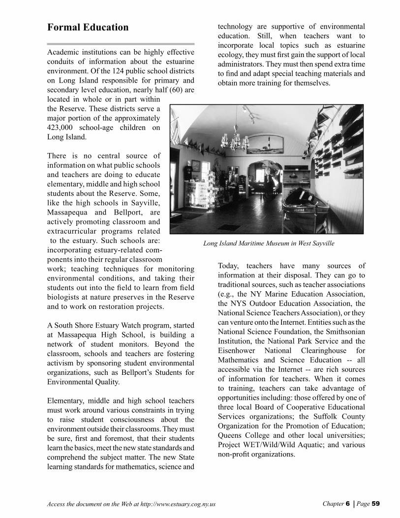
Chapter 6 Page 59Access the document on the Web at http://www.estuary.cog.ny.us
Formal Education
Academic institutions can be highly effective conduits of information about the estuarine environment. Of the 124 public school districts on Long Island responsible for primary and secondary level education, nearly half (60) are located in whole or in part within the Reserve. These districts serve a major portion of the approximately 423,000 school-age children on Long Island.
There is no central source of information on what public schools and teachers are doing to educate elementary, middle and high school students about the Reserve. Some, like the high schools in Sayville, Massapequa and Bellport, are actively promoting classroom and extracurricular programs related to the estuary. Such schools are: incorporating estuary-related com-ponents into their regular classroom work; teaching techniques for monitoring environmental conditions, and taking their students out into the eld to learn from eld biologists at nature preserves in the Reserve and to work on restoration projects.
A South Shore Estuary Watch program, started at Massapequa High School, is building a network of student monitors. Beyond the classroom, schools and teachers are fostering activism by sponsoring student environmental organizations, such as Bellport’s Students for Environmental Quality.
Elementary, middle and high school teachers must work around various constraints in trying to raise student consciousness about the environment outside their classrooms. They must be sure, rst and foremost, that their students learn the basics, meet the new state standards and comprehend the subject matter. The new State learning standards for mathematics, science and
technology are supportive of environmental education. Still, when teachers want to incorporate local topics such as estuarine ecology, they must rst gain the support of local administrators. They must then spend extra time to nd and adapt special teaching materials and obtain more training for themselves.
Today, teachers have many sources of information at their disposal. They can go to traditional sources, such as teacher associations (e.g., the NY Marine Education Association, the NYS Outdoor Education Association, the National Science Teachers Association), or they can venture onto the Internet. Entities such as the National Science Foundation, the Smithsonian Institution, the National Park Service and the Eisenhower National Clearinghouse for Mathematics and Science Education -- all accessible via the Internet -- are rich sources of information for teachers. When it comes to training, teachers can take advantage of opportunities including: those offered by one of three local Board of Cooperative Educational Services organizations; the Suffolk County Organization for the Promotion of Education; Queens College and other local universities; Project WET/Wild/Wild Aquatic; and various non-prot organizations.
Long Island Maritime Museum in West Sayville
Vers f Chap6 8/30/01, 11:32 AM58-59
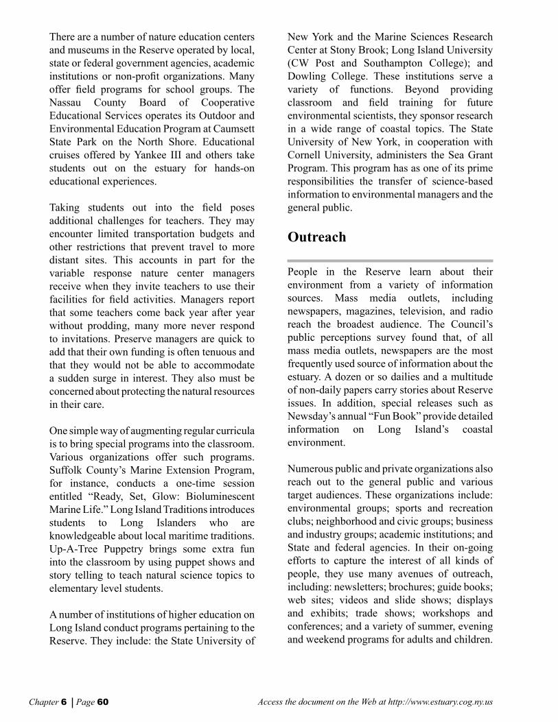
Chapter 6 Page 60 Access the document on the Web at http://www.estuary.cog.ny.us
There are a number of nature education centers and museums in the Reserve operated by local, state or federal government agencies, academic institutions or non-prot organizations. Many offer eld programs for school groups. The Nassau County Board of Cooperative Educational Services operates its Outdoor and Environmental Education Program at Caumsett State Park on the North Shore. Educational cruises offered by Yankee III and others take students out on the estuary for hands-on educational experiences.
Taking students out into the eld poses additional challenges for teachers. They may encounter limited transportation budgets and other restrictions that prevent travel to more distant sites. This accounts in part for the variable response nature center managers receive when they invite teachers to use their facilities for eld activities. Managers report that some teachers come back year after year without prodding, many more never respond to invitations. Preserve managers are quick to add that their own funding is often tenuous and that they would not be able to accommodate a sudden surge in interest. They also must be concerned about protecting the natural resources in their care.
One simple way of augmenting regular curricula is to bring special programs into the classroom. Various organizations offer such programs. Suffolk County’s Marine Extension Program, for instance, conducts a one-time session entitled “Ready, Set, Glow: Bioluminescent Marine Life.” Long Island Traditions introduces students to Long Islanders who are knowledgeable about local maritime traditions. Up-A-Tree Puppetry brings some extra fun into the classroom by using puppet shows and story telling to teach natural science topics to elementary level students.
A number of institutions of higher education on Long Island conduct programs pertaining to the Reserve. They include: the State University of
New York and the Marine Sciences Research Center at Stony Brook; Long Island University (CW Post and Southampton College); and Dowling College. These institutions serve a variety of functions. Beyond providing classroom and eld training for future environmental scientists, they sponsor research in a wide range of coastal topics. The State University of New York, in cooperation with Cornell University, administers the Sea Grant Program. This program has as one of its prime responsibilities the transfer of science-based information to environmental managers and the general public.
Outreach
People in the Reserve learn about their environment from a variety of information sources. Mass media outlets, including newspapers, magazines, television, and radio reach the broadest audience. The Council’s public perceptions survey found that, of all mass media outlets, newspapers are the most frequently used source of information about the estuary. A dozen or so dailies and a multitude of non-daily papers carry stories about Reserve issues. In addition, special releases such as Newsday’s annual “Fun Book” provide detailed information on Long Island’s coastal environment.
Numerous public and private organizations also reach out to the general public and various target audiences. These organizations include: environmental groups; sports and recreation clubs; neighborhood and civic groups; business and industry groups; academic institutions; and State and federal agencies. In their on-going efforts to capture the interest of all kinds of people, they use many avenues of outreach, including: newsletters; brochures; guide books; web sites; videos and slide shows; displays and exhibits; trade shows; workshops and conferences; and a variety of summer, evening and weekend programs for adults and children.
Vers f Chap6 8/30/01, 11:32 AM60-61

Chapter 6 Page 61Access the document on the Web at http://www.estuary.cog.ny.us
Organizations represented on the Reserve’s Council engage in outreach activities to varying degrees. Local government members of the Council, in particular, are well-positioned to reach signicant numbers of people through established channels of communication. Most devote at least some resources to outreach on environmental topics. The Council’s Citizens Advisory Committee has been playing a key role in reaching out to citizens in the Reserve through its newsletter, educational brochure, displays, radio spots, information line, web site, and a directory of educational facilities. The committee also has sponsored public meetings on developing the Reserve’s comprehensive management plan [Technical report: Directory of Educational Facilities, Programs, and Resources (1998)].
How effective all these diverse organizations are in raising awareness about the estuary is not known, nor is it very clear how the delivery of information might be better orchestrated to improve the overall level of understanding. The Council’s public perceptions survey sheds only a little light on this. The survey found that respondents appear to differ markedly in the pathways by which they get useful information about the estuary. Fourteen per cent of the respondents received information from only one or two sources while 20% say they receive information from eight or more sources. A small percentage -- 5% -- actually said they received no useful information from any source. These results are important because, although cause and effect are hard to determine, there is ample evidence that respondents who depend on different sources of information differ from each other in terms of demographics, behavior and attitudes. This nding suggests that a varied program of outreach activities targeted to different audiences is necessary.
Stewardship
When the Council, in its public perceptions survey, looked at how committed people are to actively protecting the estuary, it found that respondents had modest to high levels of motivation, especially when they expected to benet in a personal way from an action. Motivation, however, varies with age. Young people between the ages of 21 and 34 tend to have lower levels of knowledge and concern about the environment despite the fact that they frequently engage in activities that depend upon natural resources of the Reserve.
Many organizations on Long Island and elsewhere are moving beyond simple education and outreach activities and are striving to motivate individuals to become active stewards of the environment. Efforts in Reserve towns include: Oyster Bay’s Separate Oyster Bay’s Recyclables Today, Stop Throwing Out Pollutants, and composting programs; and the
SPLASH volunter displays dummy made from bay litter
Vers f Chap6 8/30/01, 11:32 AM60-61

Chapter 6 Page 62 Access the document on the Web at http://www.estuary.cog.ny.us
native landscaping display at Southampton Town Hall. These give residents the practical information they need to take action. Beyond the Reserve, there are innumerable examples of materials and programs developed to promote personal stewardship.
At the community level, local governments and neighborhood, civic and environmental groups are bringing citizens together in collective efforts to improve the environment. They are spearheading an assortment of activities in the Reserve. Examples include: harbor clean-up cruises organized by Stop Polluting, Littering and Save Harbors; beach clean-up activities associated with events such as Coastweeks; and habitat restoration projects such as Babylon’s Santapogue Creek tidal wetland project. The NYS Department of Environmental Conservation has a Water Stewardship Program that encourages organizations to adopt a wetland, stream or even an entire watershed. These efforts bring out volunteers of all sorts -- concerned citizens, representatives of civic organizations, local businesses, school children and their teachers. By some accounts, the level of interest is growing as is the level of sophistication in how to take maximum advantage of this pool of willing workers.
Some organizations connect with potential volunteers through word-of-mouth, newspaper notices, or presentations to local organizations; others use clearinghouses such as Long Island Volunteer Enterprise to assemble volunteer crews. Sponsors agree that managing volunteers effectively takes a lot of effort. Volunteers need to feel a sense of accomplishment when the day is done, which means they must be matched with tasks that reect their particular interests, skills, and time constraints. Volunteers come out in part to socialize and have fun. Organizers need to recognize this aspect of the volunteer experience
and make sure that volunteers feel welcome and have a chance to get to know one another. Finally, when a project is done, organizers report that simple rewards -- a certicate of recognition for work well done, for instance -- help to make people feel appreciated and strengthen their commitment to return another day.
Recommendations
Participants in public meetings on developing the comprehensive management plan for the Reserve emphasized the importance of education and outreach in building a citizenry that can play an effective role in shaping the future of the estuary. In keeping with this sentiment, the following recommendations focus on: educating young people; reaching out to the general public to raise awareness and understanding; and motivating citizens to become active stewards of the Reserve. The Council considers all the proposed recommendations to be of equal importance. However, the human and nancial resources available to accomplish them are nite. To maximize the effectiveness of these resources, the many organizations currently engaged in education, outreach, and stewardship activities
Future Stewards: Students get an understanding of bay ecology through seining.
Vers f Chap6 8/30/01, 11:32 AM62-63

Chapter 6 Page 63Access the document on the Web at http://www.estuary.cog.ny.us
will need to reinforce their cooperative ties. The Council can serve as a promoter and facilitator, but can by no means accomplish the job alone.
RECOMMENDATIONS TO STRENGTHEN THE MECHANISMS FOR RAISING AWARENESS AND UNDERSTANDING OF THE SOUTH SHORE ESTUARY
The following recommendations specify the organizational structure needed to carry out the education and outreach recommendations made in this plan.
1. Create and support the efforts of a formal education workgroup, consisting of Council and advisory committee members and other interested parties, which would advise and guide the full Council, its Citizens and Technical Advisory committees, and/or their successors, on formal education activities in the Reserve.
A formal education workgroup would be responsible for furthering the formal education recommendations presented on subsequent pages. Its membership should include representatives of organizations such as: school districts (e.g., science administrators); Boards of Cooperative Educational Services; professional organizations (e.g., New York Marine Educators Association); parent organizations (e.g., Parents as Partners, Parent Teachers Associations); local governments; State agencies (e.g., NYS Departments of Education, Environmental Conservation and State, and Ofce of Parks, Recreation and Historic Preservation); colleges and universities; Cooperative Extension and Sea Grant; the Peconics and Long Island Sound estuary programs; and nature centers and maritime museums. The workgroup’s main purpose would be to nurture formal education
activities focused on the estuary. The Reserve’s Citizens Advisory Committee should convene the initial meeting of the formal education workgroup.
2. Increase support for the Reserve’s Citizens Advisory Committee and its outreach activities.
The Citizens Advisory Committee should be responsible for outreach and stewardship activities, both on-going and proposed (see recommendations on subsequent pages). The South Shore Estuary Reserve Act created the Citizens Advisory Committee and gave it responsibility for integrating citizen and user group concerns into the Reserve planning process and for encouraging public education and involvement. During the process of developing the comprehensive management plan, the committee has reached out to the public through various publications and activities. Completion of the plan will initiate a new phase for the Citizens Advisory Committee and will increase its responsibilities.
3. Encourage formation of local outreach groups in Reserve communities to help promote estuary-related education, outreach and stewardship activities at local, sub-regional and regional levels.
Local neighborhood, civic and environmental organizations in Reserve communities engage citizens in activities aimed at protecting and improving the local environment; however, few focus exclusively on the estuary. To build a strong citizen base for implementing the comprehensive management plan, local outreach groups should be encouraged to form. Each group would determine its own particular objectives but, in general, would be active in: (1) promoting local estuary-related education, outreach and stewardship activities; (2) networking with counterpart groups in nearby communities to organize sub-regional activities; and (3) cooperating with the Citizens Advisory Committee on estuary-wide activities. Local
Vers f Chap6 8/30/01, 11:32 AM62-63

Chapter 6 Page 64 Access the document on the Web at http://www.estuary.cog.ny.us
groups should sponsor a variety of activities, including: a Reserve column in a municipal newsletter or in the local newspaper; a local cable TV program; local forums on issues, such as supporting water-dependent businesses or promoting tourism; local programs aimed at helping homeowners to reduce nonpoint sources of pollution or to create new habitats on their property; natural area restoration projects; and local waterfront festivals.
4. Maintain full-time personnel, under the guidance of the Council, to facilitate and coordinate education, outreach and stewardship activities throughout the Reserve and to provide administrative support to the Citizens Advisory Committee and a formal education workgroup.
Municipal employees responsible for community education and awareness should work closely with the Council, its Citizens Advisory Committee, and other community groups to coordinate and implement education and outreach activities that relate to the Reserve’s natural, cultural and historic resources.
5. Build greater capacity on the part of local government in the Reserve to increase public awareness and understanding and to engage citizens in protecting and improving the estuary.
Reserve towns and counties have been on the front lines in the effort to raise public awareness and understanding of the Reserve and to engage citizens in stewardship activities. However, local governments need to strengthen their capacity to inform and involve citizens.
RECOMMENDATIONS TO NURTURE YOUTH AWARENESS AND UNDER-STANDING THROUGH FORMAL EDUCATION ACTIVITIES THAT FOCUS ON THE ESTUARY
A formal education workgroup will be primarily responsible for furthering the following recommendations to provide students with the information and tools they need to become responsible citizens, better able to form well-reasoned opinions and make intelligent decisions about how their immediate environment should be used and managed.
6. Increase opportunities for teachers to obtain professional training that pertains to the Reserve.
Many teachers lack the condence and knowledge to present multi-disciplinary estuarine-related topics. To correct this situation, a concerted effort is needed to expand opportunities for teachers to obtain training in content and teaching methods in estuarine ecology for both classroom and eld settings. Support should be solicited from existing training providers. Providing more training opportunities may not be sufcient to achieve the goal of better educated teachers. In order to inspire teachers to seek additional training, it will be necessary to work with school districts to provide more in-service credits (e.g., salary increments associated with professional development).
Another way of enhancing skills is to bring teachers together for regular meetings and conferences. The New York Marine Educators Association holds an annual conference; a special program for teachers in Reserve districts should be added to their agenda.
Vers f Chap6 8/30/01, 11:32 AM64-65

Chapter 6 Page 65Access the document on the Web at http://www.estuary.cog.ny.us
7. Develop and package teaching materials related specically to the South Shore estuary for teachers to incorporate into regular class work.
Some work has already been done to develop estuary-related teaching materials. The Citizens Advisory Committee supported development of a course on Long Island estuaries. It was tested in Sayville High School during the 1996-97 school year and was to be offered in Massapequa High School as an elective science course. The Town of Oyster Bay has developed activity sheets specically about waterfowl in the estuary, while the Long Island Sound Program and the Peconic Estuary Program have developed their own educational packets. All these could be adapted for use in Reserve school districts.
New teaching materials should conform with the State learning standards for math, science and technology and with core curricula. To ensure that students at all levels receive age-appropriate education in estuarine topics, a comprehensive approach to developing special materials should be pursued.
A complete list of teaching materials should be included in the updated Directory of Educational Facilities, Programs and Resources of the South Shore Estuary Reserve (see Recommendation 13).
8. Create more opportunities for students to obtain rst-hand experience with the estuarine environment and with Long Islanders who have intimate knowledge of the estuary and its resources.
At best, teachers are able only occasionally to take their students on eld trips to distant sites. To bring students into more frequent contact with the estuarine environment, teachers should take advantage of convenient opportunities on or near school grounds. In addition, more
concerted attempts should be made to bring special in-school programs to classrooms.
Examples of possible activities for primary and second level students include:
• developing gardens and habitats on school grounds using native vegetation. The “Out of the Classroom and into the Garden” program provides training for teachers interested in developing school gardens. The program is a joint venture of Suffolk County Cooperative Extension, Suffolk County Organization for the Promotion of Education, and individual teachers. A garden has been developed in Sayville.
• adopting tributary or wetland areas near schools and engaging in cleanup and monitoring activities at these sites. The South Shore Estuary Watch program, begun by the Massapequa High School Science Research Program and expanding to other high schools in the Reserve, is training students to gather and test soil and water samples from selected sites in their communities.
For college level students to obtain better access to the estuary, there is need for one or more conveniently-located research facilities along the shore which might include labs, meeting space, and boat storage. One such facility already exists at the Southampton campus of Long Island University. Dowling College has been suggested as a potential site; there may be others.
9. Sponsor annual events that bring together students from throughout the Reserve to learn more about estuarine resources and to share concerns.
Students for Environmental Quality, a club at Bellport High School, holds an annual
Vers f Chap6 8/30/01, 11:32 AM64-65

Chapter 6 Page 66 Access the document on the Web at http://www.estuary.cog.ny.us
conference for high school students in connection with their Save the Bay Mayday project. The Town of Oyster Bay and Nassau County both sponsor environmental education days geared to fourth and fth graders respectively. These types of gatherings are both fun and educational. They could be replicated in other towns and school districts or expanded into larger events that would bring together students from throughout the Reserve. Other ways of bringing students together include science fairs and poster competitions.
RECOMMENDATIONS TO INCREASE PUBLIC AWARENESS AND UNDER-STANDING THROUGH OUTREACH ACTIVITIES GEARED TO GENERAL AND SPECIFIC AUDIENCES
Public awareness and understanding can be increased through a variety of outreach activities, but whatever the venues, the same messages about the estuary should be conveyed. In broad terms, they are as follows:
• Value -- the estuary is valuable to the local economy and to the overall quality of life in the Reserve.
• Fragility -- the living resources and geologic features in the Reserve are fragile. Incremental damage may be difcult to redress.
• Interconnections -- the human inhabitants, living estuarine resources and geologic features of the estuary are interconnected in a single ecosystem.
The Citizens Advisory Committee would be primarily responsible for furthering the following recommendations.
10. Build an interpretive system that presents a unied picture of the Reserve and encourages people to travel throughout the Reserve to learn about and enjoy its many features.
The Reserve is a vast area, but many parts of an interpretive system are already in place -- from State and local parks to nature preserves, historic sites, maritime museums, and visitor centers for tourists. The Long Island Convention and Visitors Bureau already packages information that helps visitors nd attractions of interest throughout Long Island. What is needed are ways to link disparate sites within the Reserve into a “system” that includes one or more primary visitor centers, “point of entry” exhibits and various satellite exhibits. System planners have an array of techniques available to create linkages. In addition to traditional methods such as paper maps and guidebooks, they can now take advantage of modern computer networks to link one site with another.
It is easy to nd examples of efforts to link and interpret multiple sites in large geographic areas similar to the Reserve. These include: the NYS Canal Recreationway; the Hudson River Valley; the Blackstone River Valley National Heritage Corridor (in Massachusetts and Rhode Island); and various scenic byways programs, such as the Seaway Trail and the one conceived for New York’s North Country.
11. Continue to build and maintain the dedicated Reserve Internet web site.
The Internet is a potentially powerful outreach tool. A web site has been established to introduce people to the Reserve. The site should be expanded to include: a calendar of events; the Directory of Educational Facilities, Programs and Resources of the South Shore Estuary Reserve; a volunteer registry; and fact sheets about the estuary’s resources. Links to other web sites of potential interest should also be established.
Vers f Chap6 8/30/01, 11:32 AM66-67

Chapter 6 Page 67Access the document on the Web at http://www.estuary.cog.ny.us
12. Revise and augment the Directory of Edu-cational Facilities, Programs and Resources of the South Shore Estuary Reserve.
A great deal of information exists pertaining to education and outreach in the Reserve. The June 1998 edition of the Directory of Educational Facilities, Programs and Resources of the South Shore Estuary Reserve was a rst attempt to assemble some of this information. The directory currently contains a mix of information about educational facilities open to the public and about organizations that provide various other educational services.
To make the directory more useful, it should be expanded to include new information, such as: a map showing the location of nature centers and other educational facilities; a listing of important education contacts; a bibliography of written material (brochures, fact sheets, how-to guides, etc.) available from various sources; information on funding available for educational activities; a catalogue of teaching materials or sources of such materials; a listing of teacher training opportunities; and a listing of in-school programs offered by various organizations. The directory should be available both in paper form and on the Reserve web site.
An expanded directory will be a valuable reference for municipal outreach coordinators, interpretive planners, tour organizers, economic development planners, residents, visitors, teachers, and others. An upgraded directory would also serve as a marketing device for various organizations that have developed education and outreach programs.
13. Collaborate with traditional mass media outlets, as well as government and private sector information outlets, to run stories and carry information on a regular basis about the estuary.
The mass media (e.g., newspapers, magazines, radio, TV) contend with a constant overload of information, while government and private sector
information outlets (e.g., local governments and non-prot organizations) operate with their own limitations on staff and time. The Citizens Advisory Committee has developed and released two public service announcements and worked with reporters interested in the Reserve. However, to take full advantage of the media, an orchestrated campaign needs to be undertaken to convey messages about the estuary in easy-to-use formats through: draft articles; press releases; press advisories about upcoming events; short radio spots; and other means. Weekly newspapers, local cable TV stations and local government newsletters that target more localized audiences may be more fruitful outlets for information than some of the larger media organizations in the region.
14. Encourage and work with coalitions of public and private sector entities to organize and sponsor events about the Reserve as part of existing state and national festivities that aim to raise awareness about the estuaries and the coastal environment.
State and national festivities include: Earth Day; Coastweeks; National Estuaries Day; and Water Week. Local events that involve sporting competitions, food, and entertainment are excellent ways of attracting people to the shore where they can learn about the estuary while having a good time. These events are especially good for attracting young adults, an important audience of individuals who are otherwise difcult to reach.
15. Develop and maintain a roster of speakers who will reach out to members of civic, non- prot, and business and industry organizations in the Reserve.
Speakers could be solicited from various sources, including member organizations of the Council and its committees, and encouraged to sign up for several speaking engagements per year. A slide show that introduces people to the estuary should be developed for use at such events and other outreach programs.
Vers f Chap6 8/30/01, 11:32 AM66-67

Chapter 6 Page 68 Access the document on the Web at http://www.estuary.cog.ny.us
16. Develop and distribute one page fact sheets on geology, oceanography, estuarine species and topics and issues pertinent to the Reserve.
Brief, readily understandable fact sheets should be prepared to complement other efforts to disseminate information and increase public awareness and understanding.
17. Continue on-going outreach activities, including Reserve newsletters, mobile displays, and information phone line, that have proven effective in reaching the general public.
The Citizens Advisory Committee should continue in its efforts in planning and conducting education, interpretation, outreach and stewardship activities within the Reserve.
RECOMMENDATIONS TO ENCOURAGE PEOPLE OF ALL AGES TO BECOME STEWARDS OF THE ESTUARY
The Citizens Advisory Committee should be responsible for furthering the following recommendations.
18. Expand and adapt existing stewardship programs in order to encourage more residents of the Reserve to engage in personal actions that address various issues, in particular nonpoint source pollution and loss of habitat.
There are many existing examples of stewardship programs that encourage people to change their beliefs and behaviors in ways that will benet the natural environment. The
most successful programs are grounded in a solid understanding of historical reasons for why people think and behave in certain ways. These programs recognize that if people are to change long-standing beliefs and behaviors, they need to understand how their own actions impact the environment and what personal benets they can expect from making changes. The best programs provide clear and simple guidance on what people can do in their daily lives to protect and enhance the environment.
Within the Reserve, nonpoint source pollution and loss of sh and wildlife habitats are considered to be major problems. Programs should be expanded or adapted to provide practical information on how they can help address these particular problems. Examples of possible activities include:
• developing native landscaping demonstra-tion sites on town and village properties and at other highly visible public locations throughout the Reserve;
• instituting new programs that promote minimal use of pesticides and herbicides on residential properties; and
• adapting programs that encourage clean marina and boating practices (e.g., Maryland’s Clean Marine Program and the “SoundWaters” boaters’ guide for Long Island Sound).
19. Encourage more people to join their neighbors in volunteering for various activities that benefit the Reserve and its residents.
Local governments, non-prot organizations and nature centers need volunteers of all ages and interests to help with a variety of tasks, including: habitat restoration projects; envi-ronmental monitoring; facility maintenance;
Vers f Chap6 8/30/01, 11:32 AM68-69
Chapter 6 Page 69Access the document on the Web at http://www.estuary.cog.ny.us
and programming (e.g., leading tours, giving lectures, and conducting workshops).
Examples of possible activities to promote volunteer involvement include:
• creating a registry of volunteer opportunities in the Reserve to help match volunteers with appropriate activities;
• conducting workshops for resource managers and others where they can share experiences in how to employ volunteers effectively;
• holding orientation workshops for volun-teers where they can get to know project organizers and other volunteers and where they can learn about their tasks;
• coordinating a citizen monitoring effort to gather eld data that meet standards required by researchers who are examining water quality and other environmental conditions in the Reserve; and
• promoting participation in the Master Naturalist Training Program as a way of building up the pool of volunteer stewards who could supplement full-time staff at Reserve parks and nature centers (Suffolk County Cooperative Extension conducts the Master Naturalist Training Program in collaboration with the NYS Ofce of Parks, Recreation, and Historic Preservation, the NYS Department of Environmental Conservation and Suffolk County Parks).
20. Institute a Reserve stewardship award to honor: individuals; families; schools; businesses and business associations such as the Telephone Pioneers of America; non-prot organizations; communities; and others who have made outstanding contributions to protecting and enhancing the natural resources of the Reserve.
Non-prot and government organizations present awards that recognize individuals and organizations for their commitment and contributions to protecting and enhancing the environment. Awards are frequently presented at special ceremonies and announced in local newspapers. Recognition of this sort is one of the most effective ways to sustain a committed citizenry.
Vers f Chap6 8/30/01, 11:33 AM68-69

Access the document on the Web at http://www.estuary.cog.ny.us
Vers f Chap6 8/30/01, 11:33 AM70

CHAPTER 7
Implementation
Vers f Chap7 8/30/01, 11:34 AM71

CHAPTER 7Implementation
Access the document on the Web at http://www.estuary.cog.ny.usChapter 7 Page 72
Overview of the Chapter
Building on what has already been accomplished since 1995 by the State and local governments (see Appendix B), the implementation actions presented in this chapter provide the necessary road map to fullling the recommendations offered in the preceding chapters.
An integrative analysis of technical information was used to guide development of the specic implementation actions. The rst phase of this analysis focused on water quality and its impacts to living resources (sheries and hard clams) and public health (shellsh bed and bathing beach closures due to high levels of fecal coliform in stormwater runoff). This analysis resulted in the identication of stormwater abatement projects in specic nonpoint source pollution contributing areas that would directly address these living resource and public health concerns. Subsequent phases of the analysis looked at: land use from the perspective of impacts to water quality and living resources; habitat restoration and its benets to water quality; living resources and public access; open space preservation and its benets to water quality; living resources, public access and tourism;
and economic development in maritime centers as it relates to water quality, living resources, and public access and tourism in the Reserve. Council members reviewed each phase of the analysis through a series of workshops. A series of integrative analysis maps is provided at the end of this chapter. The actions described below target effort where the greatest potential exists for halting further degradation of the Reserve’s natural resources and realizing improvements to them, and where multiple goals and objectives of the Council can be achieved. The actions focus attention where problems have been clearly identied and where the existence of motivated partners assures a higher likelihood of success. They are organized and presented according to outcomes
The actions focus attention where problems have been clearly identied and where the existence of motivated partners assures a higher likelihood of success.
Vers f Chap7 8/30/01, 11:34 AM72-73
Chapter 7 Page 73Access the document on the Web at http://www.estuary.cog.ny.us
they will fulll and are referenced to the recommendations in the preceding chapters that would be implemented.
Following each implementation action is a line titled Responsibility. It identies suggested entities and/or partners that would have lead responsibility for implementation of the action. An implementation map is provided at the end of this chapter.
Outcome 1: Reduced nonpoint source pollution.
Nonpoint source pollution is the primary water quality concern in the Reserve. Stormwater runoff alone is a principal pollutant causing use impairments in 48 of the 51 waterbody segments in the Reserve that appear on the 1996 Priority Waterbody List. Elevated levels of coliform bacteria in stormwater runoff, an indicator of the potential presence of pathogens, is responsible for the closures of shellsh beds and bathing beaches; sediment and excessive nutrients in stormwater runoff have pronounced negative effects on the Reserve’s living resources.
Implementation Actions
1-1 Construction of stormwater abatement projects in signicant nonpoint source contributing areas associated with closed shellsh beds, impaired living resources, and bathing beaches that experience periodic closures due to water quality concerns. Numerous stormwater management projects have been completed to date under the Clean Water/Clean Air Bond Act and the Environmental Protection Fund (see Appendix B), and many projects are currently in progress. However, much remains to be done before signicant reductions in polluted stormwater runoff are achieved. Local and State governments need to continue with their
implementation of stormwater management projects and retrots of stormwater outfalls, with future projects being those identied as priorities in the watershed action plans called for in Action 1-6. Implementation needs to be targeted in drainage areas associated with closed shellsh beds, impaired living resources, and bathing beaches that experience periodic closures due to water quality concerns. (Addresses Recommendation 4 in Chapter 2 and Recommendation 3 in Chapter 3)
1-1(a) In the western bays subregion, priorities should include:
• the watersheds of Mill River and the Freeport Creek/Reservoir*/East Meadow Brook complex, where nsh resources are impaired by silt and excessive nutrients in stormwater runoff;
• the watershed of the Massapequa Creek/Lake/Reservoir complex*, where shing and sh propagation and survival are affected by pollutants in runoff; and
• contributing areas to Zachs Bay and South Oyster Bay at Biltmore Beach where two swimming beaches experience periodic closures due to elevated levels of coliform bacteria.
1-1(b) In the Great South Bay subregion, priorities should include:
• upland areas from Amityville Creek* to Willets Creek*, which include six tributaries with impaired living resources, and which drain into waters associated with 1,845 acres of conditionally closed shellsh beds and three swimming beaches that experience periodic water quality-related closures;
• contributing areas to Great Cove, which include four tributaries with impaired living resources, and which drain into waters associated with 673 acres of conditionally closed shellsh beds and a swimming beach that experiences periodic water quality-related closures;
Vers f Chap7 8/30/01, 11:34 AM72-73

Chapter 7 Page 74 Access the document on the Web at http://www.estuary.cog.ny.us
• the watershed of the Connetquot River*, a Wild and Scenic River and Signicant Coastal Fish and Wildlife Habitat that supports alewives and trout and has impaired living resources;
• the watershed to Patchogue Bay, associated with 615 acres of conditionally closed shellsh beds and four tributaries with impaired living resources;
• the watershed of the Carmans River*, a Wild and Scenic River and Signicant Coastal Fish and Wildlife Habitat that supports alewives and trout and that has impaired living resources; and
• the watershed of Beaverdam Creek (Town of Brookhaven), a Signicant Coastal Fish and Wildlife Habitat that supports alewives and trout.
1-1(c) In the eastern bays subregion, priorities should include:
• the watershed of the Terrell River*, where sh survival is impaired in the entire (3.0 mile) river by bacteria, sediment and excessive nutrients in runoff. The river discharges into Moriches Bay*, where shellshing is closed in 47% of the bay (5,142 acres) due to elevated levels of coliform bacteria from stormwater runoff;
• the watershed of Beaverdam Creek* (Town of Southampton), which also drains into Moriches Bay. The Beaverdam is stocked with trout by the NYS Department of Environmental Conservation and supports alewives. Fish survival is impaired in the entire (4.0 mile) creek due to sediment in runoff;
• the watershed of Aspatuck Creek*, where sh survival is impaired in the entire (2.0 mile) creek from sediment and excessive nutrients in runoff. The creek ows into Quantuck Bay*, where shellshing is precluded in all of its 730 acres;
• the watershed of Quantuck Creek*, known to support alewives but where sh survival is impaired due to sediment and excessive nutrients in runoff, and which also empties into Quantuck Bay;
• the watershed of Weesuck Creek*, which drains into Shinnecock Bay*. A 270-acre segment of the bay is closed to shellshing due to elevated levels of coliform bacteria in runoff. About 20 acres of the upper tidal portion of the creek are closed to shellshing; and
• contributing areas to Tiana Bay*, where shellshing is precluded in 12 acres of the upper bay due to elevated levels of coliform bacteria in runoff.
* included on NYSDEC’s 1996 Priority Waterbody List
Responsibility: Counties, towns, villages, City of Long Beach, NYS Department of Transportation, NYS Ofce of Parks, Recreation and Historic Preservation
1-2 Amendment of county and local government codes and regulations to include best management practices. The following list of best management practices, and the municipalities identied as needing to adopt them, are based on the completed municipal nonpoint pollution control assessments for the six towns and two counties in the Reserve. Implementation of these best management practices should include, when practicable in select cases, evaluation of effectiveness of implementation and enforcement.
Reduction of construction-related pollutants. To reduce the amount of erosion during site preparation and during and after construction, best management practices need to be incorporated by Nassau County into its subdivision regulations and by the towns of Hempstead, Babylon and Southampton into their site plan review regulations. (Oyster Bay,
Vers f Chap7 8/30/01, 11:34 AM74-75

Chapter 7 Page 75Access the document on the Web at http://www.estuary.cog.ny.us
Islip and Brookhaven have practices in place.) This is especially necessary given that such action eventually will be required under the Environmental Protection Agency’s Phase II stormwater regulations (see Action 1-7).
To address the generation, storage, application, handling and disposal of petroleum products and hazardous materials associated with site preparation and construction, relevant standards from the National Fire Protection Association, NYS Environmental Conservation Law Article 27, and the U.S. Occupational Safety and Health Administration that pertain to spill cleanups need to be adopted by Nassau County into its subdivision regulations and by each of the Reserve towns into their codes. Additionally, each local government should train its spill response team in these standards and procedures. (Addresses Recommendations 6 and 8 in Chapter 2)
Improvement of roadway maintenance practices. To reduce contamination of stormwater runoff by pollutants from existing roads, highways and bridges, best management practices for roadway maintenance from NYS Department of Transportation procedural manuals and from NYS Department of Environmental Conservation’s Management Practices Catalogue for Nonpoint Source Pollution Prevention and Water Quality Protection in New York State that reduce pollutant loads to stormwater need to be formally adopted, as appropriate, in each local government’s standard procedures and codes. (Addresses Recommendation 7 in Chapter 2)
Reduction of fertilizer, herbicide and pesticide use. Best management practices that reduce the use of and need for fertilizers and pesticides should be used on municipal golf courses and other public properties, and should be strongly encouraged on privately-owned lands as well. This should include eliminating the use of pesticides for aesthetic purposes on golf courses; implementing golf course management plans that control the use of substances that may
harm the aquatic environment; requiring new golf courses to be designed and built to limit impacts from these pollutants on water and living resources; requiring the use of the less toxic alternatives of Integrated Pest Management (IPM); using native plant species in new landscaping on public lands; and targeting outreach programs on this issue at individuals in both the public and private sectors. (Addresses Recommendation 8 in Chapter 2)
Adoption of a “pooper-scooper” law. A “pooper-scooper” law that reduces bacterial contamination of stormwater from domestic animal feces, similar to that in Hempstead, Oyster Bay, Babylon and Islip, needs to be adopted by those towns in the Reserve that have no such law in place. (Addresses Recommendation 8 in Chapter 2)
Reduction of pollutants associated with new and redeveloping marinas and recreational boating. Best management practices from the NYS Department of Environmental Conservation’s Management Practices Catalogue for Nonpoint Source Pollution Prevention and Water Quality Protection in New York State for the siting and design of new and redeveloping marinas, marina-based maintenance practices, and recreational boating need to be adopted into local regulations by Nassau County and towns and villages in the Reserve. This action should include: verifying the number of existing pumpout facilities in each of the Reserve’s bays, assessing their operation and maintenance and, if warranted, improving their user fee structure; increasing the numbers of land and water-based pumpout facilities to meet the needs of recreational boaters and criteria for designation of each bay as a no-discharge zone for vessel wastes; and upgrading and coordinating enforcement of vessel waste regulations. A comprehensive marina and boater education program should be a critical component of this effort. (Addresses Recommendations 9 and 10 in Chapter 2)
Vers f Chap7 8/30/01, 11:34 AM74-75
Chapter 7 Page 76 Access the document on the Web at http://www.estuary.cog.ny.us
Adoption of hydromodication best management practices. Municipal activities which involve hydromodication (e.g., channelization and channel modications; dam construction, repair, or removal; and alterations to streambanks and shorelines) potentially have negative impacts on the aquatic environment. In order to reduce the scope of impacts, practices from the NYS Department of Environmental Conservation’s Management Practices Catalogue for Nonpoint Source Pollution Prevention and Water Quality Protection in New York State that protect and restore wetlands, streams and riparian corridors need to be formally adopted and incorporated into any hydromodication activities. (Addresses Recommendations 11 and 12 in Chapter 2)
Responsibility: Counties, towns, villages, City of Long Beach, Council, Citizens Advisory Committee, Reserve ofce (for training component)
1-3 Implementation of on-site wastewater treatment (septic) system maintenance and upgrades. When located in the coastal zone, septic systems are a known and constant source of nutrients to groundwater, and when they fail (discharge to the surface), are sources of bacteria that can be transported by stormwater runoff. To reduce the environmental impacts of on-site systems, Suffolk County should consider requiring periodic pumpouts and inspections of such systems in Reserve portions of the county not served by public sewers. Suffolk County should also consider requiring upgrades to septic systems with change of use or substantial redevelopment of real property in the county, and explore the feasibility of employing alternative on-site wastewater treatment systems that would be managed through a decentralized wastewater treatment district.
In the Town of Hempstead, all residences and businesses in the community of Point Lookout are serviced by septic systems that may discharge indirectly to Reynolds Channel.
The Nassau County Department of Health should work to develop and implement a strategy that: requires periodic pumpout and inspection of these systems; requires upgrades of existing septic systems with change of use or redevelopment of real property; and establishes a public education program that addresses proper use and necessary maintenance of such systems. All towns, except for Oyster Bay, which has no residential septic systems in Reserve portions of the town, should work closely with their respective counties to offer similar education programs.
This action should also include evaluation of the potential water quality impacts of on-site septic systems in high-density residential areas of the Patchogue River Maritime Center (see Action 2-5), and in low-lying areas of Mastic Beach and Bellport. (Addresses Recommendation 13 in Chapter 2)
Responsibility: Counties; Council, Citizens Advisory Committee, Reserve ofce (for education component)
1-4 Implementation of Agricultural Envi-ronmental Management. The Agricultural Environmental Management (AEM) Initiative should be implemented in Suffolk County. This voluntary program calls on local soil and water conservation districts to provide technical assistance to farm operators to assure environmental stewardship through the use of best management practices and compliance with relevant environmental regulations. Availability of State funding for remediation of environmental problems on farms is largely contingent upon participation in the AEM program. (Addresses Recommendation 8 in Chapter 2)
Responsibility: Suffolk County Soil and Water Conservation District
Vers f Chap7 8/30/01, 11:34 AM76-77

Chapter 7 Page 77Access the document on the Web at http://www.estuary.cog.ny.us
1-5 Completion of assessments of municipal nonpoint pollution management practices. Nassau and Suffolk counties, and all six towns in the Reserve, have completed assessments of their current nonpoint source pollution management practices. These assessments have identied the corrective and preventive actions that remain to be taken by those local governments as well as the need for training that incorporates best management practices. Similar assessments need to be undertaken by the City of Long Beach and all incorporated villages in the Reserve. Such assessments of current regulations and practices should be used to identify gaps in those practices and determine the necessary actions to address those gaps. (Addresses Recommendation 1 in Chapter 2)
Responsibility: Villages, City of Long Beach (Technical assistance provided by NYS Department of State, counties and towns)
1-6 Development of watershed action plans. Although local governments in the Reserve and involved State agencies have addressed various plan components, all need to complete watershed action plans in an effort to target signicant nonpoint source pollution contributing areas and prioritize stormwater remediation projects. These plans should include: an inventory and analysis of contributing areas; inventories of stormwater conveyance infrastructure; identication of opportunities for protection of high quality waters from future pollution; and build-out analysis for privately-owned undeveloped lands and population projection as part of watershed planning. Villages should be included in these plans to the extent practicable. (Addresses Recommendations 2 and 3 in Chapter 2)
Responsibility: NYS Department of Transpor-tation, NYS Ofce of Parks, Recreation and Historic Preservation, counties, towns (Techni-cal assistance provided by NYS Department of State.)
1-7 Preparation for compliance with the Environmental Protection Agency’s Storm-water Phase II Final Rule. In order to meet theupcoming criteria and permit conditions under the Environmental Protection Agency’s Storm Water Phase II Final Rule permit program: 1) the NYS Department of Environmental Conservation should designate the entire contributing area to the estuary as requiring stormwater permits; and 2) counties and municipalities in the Reserve need to adopt and implement the required regulations (see Action 1-2) for operators of small construction activities (from one to less than ve acres of land disturbed) and principal separate stormwater systems. This action should also include information and education programs by the NYS Departments of State and Environmental Conservation for local government ofcials on implementation of the Phase II Final Rule. (Addresses Recommendation 18 and 19 in Chapter 2)
Responsibility: NYS Department of Environ-mental Conservation (for designation), coun-ties, towns, villages, City of Long Beach (Technical assistance from NYS Departments of State and Environmental Conservation for required regulations)
1-8 Exploring the feasibility of stormwater management districts. A study of the feasibility of establishing stormwater management districts needs to be undertaken in an effort to address overlapping municipal authorities and the implementation of Environmental Protection Agency Phase II Final Rule permit conditions. (Addresses Recommendation 21 in Chapter 2)
Responsibility: NYS Department of State, counties, towns, villages, City of Long Beach
Vers f Chap7 8/30/01, 11:34 AM76-77

Chapter 7 Page 78 Access the document on the Web at http://www.estuary.cog.ny.us
Outcome 2: Reduced point source pollution.
Point sources of pollution - typically discrete and discernible pipe outfalls - also exist within the Reserve and are regulated and monitored through State Pollution Discharge Elimination System (SPDES) permits. Point sources of pollution, while not as widespread and comparatively less signicant than nonpoint sources, can still cause water quality degradation in their immediate areas. Such point sources include: ve wastewater treatment plants (Bay Park, Long Beach, West Long Beach, Lawrence, Jones Beach) that discharge treated efuent into the western bays; the Ocean Beach plant, discharging into Great South Bay; and the Village of Patchogue plant that discharges in to the Patchogue River. Point sources also include: other discharges regulated by SPDES permits; inactive hazardous waste disposal sites; inactive and active solid waste disposal sites; and known areas of contaminated sediments.
Implementation Actions
2-1 Assessment of inactive hazardous waste sites. In order to determine the potential impact of inactive hazardous waste sites on water and living resources of the Reserve, 1) Remedial Investigations (RI) need to be completed for all Priority Classication 2 inactive hazardous waste sites where contaminants have been shown, through Preliminary Site Assessments, to pose a potentially signicant threat to public health or the environment; 2) Feasibility Studies (FS) need to be developed that identify alternative remedial actions for such sites; and 3) appropriate steps to remediate such Priority Classication 2 inactive hazardous waste sites need to be taken. (Addresses Recommendation 17 in Chapter 2)
Responsibility: NYS Department of Environ-mental Conservation, towns or current property owners
2-2 Assessment of abandoned and closed landlls. The potential or actual impacts of abandoned and closed landlls on ground and surface waters and living resources need to be determined through cooperative efforts of the Reserve ofce (see Action 11-2), the NYS Department of Environmental Conservation, and individual towns. At facilities where signicant threats to public health and the environment are found, the feasibility of upgrades to such facilities through installation of impervious covers needs to be explored. (Addresses Recommendation 14 in Chapter 2)
Responsibility: Reserve ofce and towns (inves-tigation), NYS Department of Environmental Conservation (evaluation)
2-3 Exploring regulation of private petroleum tanks less than 1,100 gallons. The regulation of privately-owned residential heating oil tanks less than 1,100 gallons in capacity should be explored in an effort to reduce the potential for leaks and spills from such tanks. Nassau County regulated these tanks at one time but found the program costly and burdensome; they now have a voluntary program. Suffolk County needs to identify management options for such tanks. New York State should encourage regulation of tanks less than 1,100 gallons. (Addresses Recommendation 14 in Chapter 2)
Responsibility: Counties, NYS Department of Environmental Conservation
2-4 Evaluation of need for wastewater treatment plant upgrades and outfall relocations. If Total Maximum Daily Loads (TMDLs) for nutrient inputs to the western bays and Reynolds Channel are developed (see Action 6-3 for explanation of the TMDL development process), the expected benets of upgrades to the municipal wastewater treatment plants discharging to these bays, or the relocation of their outfalls to the Atlantic Ocean, need to
Vers f Chap7 8/30/01, 11:34 AM78-79

Chapter 7 Page 79Access the document on the Web at http://www.estuary.cog.ny.us
be weighed against the costs of such actions, the legal requirements associated with TMDLs, and other potential alternatives for meeting reductions in SPDES discharges that will likely be necessary to conform with TMDL nutrient allocations. (Addresses Recommendation 15 in Chapter 2)
Responsibility: Nassau County, City of Long Beach, Village of Lawrence, NYS Department of Environmental Conservation
2-5 Expansion of Village of Patchogue Sewer District. Once the water quality impacts of on- site wastewater treatment (septic) systems in high density residential areas of the Patchogue River Maritime Center are veried and reected in NYS Department of Environmental Conservation’s Priority Waterbody List, the expected costs and benets of expanding the Village of Patchogue Sewer District to include the Patchogue River Maritime Center, and upgrading the Village sewage treatment plant to tertiary treatment, should be evaluated. (Addresses Recommendation 15 in Chapter 2)
Responsibility: Village of Patchogue, NYS Department of Environmental Conservation
Outcome 3: Increased harvest levels of hard clams and other estuarine shellsh species.
Town shellsh management programs have incorporated an array of strategies and technologies to increase and sustain their shellsh resources, including enhancement of shellsh population levels, improvements in habitat quality, and regulation of harvest. Some of these approaches, such as seeding or harvest restrictions, are used Reserve-wide, while others, like shell augmentation, have been conned to specic bays. A combination of existing approaches and new technologies, supported by improved monitoring and research, will aid the rebuilding of shellsh stocks.
Implementation Actions
3-1 Population assessment and seeding of hard clams and other shellsh species. Continuation and expansion of shellsh population assessment are critical to development of sustainable shellsh management programs. While the towns of Babylon, Islip, and Brookhaven have well-established programs in place, the towns of Hempstead, Oyster Bay, and Southampton need to develop comprehensive town-level sampling programs to guide distribution of seed and other shellsh management actions. Town programs to increase commercial shellsh populations of hard clams, oysters, scallops, and/or other shellsh through seed placement should be supported and increased where appropriate, as determined by water quality, substrate character, depth, and other habitat characteristics, and where economically effective. The strategy of town seeding programs (i.e., seeding rates, optimal size ranges of seed, shellsh species, and seed distribution) should incorporate the results of current and anticipated research concerning shellsh reproduction, settlement, and growth. Seeding in Great South Bay and the eastern bays is contingent on the results of continuing research on Brown Tide, an algal bloom that interferes with shellsh growth and survival. (Addresses Recommendations 7 and 8 in Chapter 3)
Responsibility: Towns
3-2 Expansion of Islip hatchery. The existing Islip shellsh hatchery should be evaluated for potential expansion into a large regional facility, which could satisfy the needs of all towns in the Reserve. Given the brown tide occurrences in Great South Bay, this should include assessment of expanding only land-based seed production and consideration of other locations less likely to be affected by this harmful algae. (Addresses Recommendation 7 in Chapter 3)
Responsibility: Reserve ofce
Vers f Chap7 8/30/01, 11:34 AM78-79

Chapter 7 Page 80 Access the document on the Web at http://www.estuary.cog.ny.us
3-3 Increasing grow-out of shellsh. An important shellsh management strategy is the grow-out of seed to a size which confers signicantly higher survival rates. The Town of Babylon, using predator exclusion rafts to grow out seed clams, has achieved a rate of clam survival approaching 90%. Existing town shellsh grow-out efforts should be supported, building on the results of current hard clam growth and recruitment research. The economic feasibility of expanding public aquacultural grow-out of hard clams, oysters, scallops and other shellsh species should be evaluated, and potential pilot projects and locations identied. (Addresses Recommendation 7 in Chapter 3)
3-3(a). In the western bays subregion, priorities should include evaluation of expansion of existing hard clam grow-out by Town of Hempstead.
3-3(b). In the Great South Bay subregion, priorities should include evaluation of expansion of existing hard clam grow-out by the Town of Babylon, and hard clam and oyster grow-out programs being conducted by Town of Islip.
3-3(c). In the eastern bays subregion, priorities should include evaluation of expansion of existing oyster and scallop grow-out programs being conducted by the Town of Southampton, and support for proposed Town of Southampton aquaculture pilot projects involving improved grow-out techniques.
Responsibility: Towns, NYS Department of Environmental Conservation, Marine Sciences Research Center
3-4 Enhancement of hard clam habitat through shell augmentation. Recent research suggests that hard clam populations may be enhanced through addition of appropriate shell materials to the bottom substrate. Based on proposed sediment mapping (Action 6-3), shellsh population surveys, and an evaluation of the results of current experiments in eastern
Great South Bay by the Town of Brookhaven and the Army Corps of Engineers, hard clam populations in Great South Bay, Moriches, and Shinnecock bays may be enhanced through shell augmentation projects, using shell materials from appropriate sources. (Addresses Recommendation 9 in Chapter 3)
Responsibility: Towns of Brookhaven and Southampton, NYS Department of Environ-mental Conservation, U.S. Army Corps of Engineers
3-5 Evaluation of potential spawner sanctuaries. A spawner sanctuary is an area stocked with large, mature hard clams to enhance fertilization of eggs, and which is located so that it will increase the set of sanctuary-produced larvae in predetermined areas that are capable of sustaining good growth and high densities. Additional spawner sanctuary locations should be identied, with site selection based on stock assessments, substrate analysis and improved estuarine circulation models. A monitoring program needs to be developed and implemented in order to determine the effectiveness of the spawner sanctuaries. (Addresses Recommendations 7 and 9 in Chapter 3)
Responsibility: Towns, Marine Science Research Center, NYS Department of State
3-6 Creation of a Reserve shellsh management forum. A shellsh management forum should be created for the purpose of promoting effective exchange of management-related information, improving the efciency of management operations, and establishing a Reserve-wide approach to optimizing shellsh productivity, including guiding the development of a Reserve hard clam sheries management plan. (Addresses Recommendations 7, 8, and 9 in Chapter 3)
Responsibility: Council, towns, NYS Department of Environmental Conservation, bayman’s associations
Vers f Chap7 8/30/01, 11:35 AM80-81

Chapter 7 Page 81Access the document on the Web at http://www.estuary.cog.ny.us
Outcome 4: Coastal habitats protected and restored to support shellsh, nsh and coastal bird populations.
Wetlands and other habitats in the Reserve, such as bay bottoms and upland woodlands, have undergone considerable change in the past century. Past losses of wetlands to development have been substantial, at least half of which occurred between the 1950’s and 1970’s. Paralleling these changes has been a decline in populations of many coastal species, most notably molluscan shellsh, nsh, waterfowl, colonial waterbirds and shorebirds, with numbers of some species declining by as much as 95%. Management measures that strengthen protection for natural habitats in the Reserve, and provide for restoration or rehabilitation of impaired habitats will enhance the ability of coastal sh and wildlife species to maintain or increase their populations within the Reserve.
Implementation Actions
4-1 Restoration of tidal wetlands. Human activities related to development, agriculture and navigation have resulted in a signicant historical loss or degradation of the Reserve’s tidal wetlands. Additional marsh losses from erosion, particularly of marsh islands, have also been substantial and require further investigation (see Action 6-12). Loss of tidal wetlands has meant a reduction in the ability of these habitats to stabilize sediments, mitigate storm impacts, provide habitat for nsh and shellsh, waterfowl and colonial waterbirds, and remove water-born nutrients and contaminants. Within the Reserve, there are approximately 19,000 acres of tidal wetlands most of which have been altered by mosquito ditching practices, dredged material placement, and restriction of tidal ow. The complete extent of potential restoration will require further evaluation (see Action 6-10). Noteworthy
restoration has already been completed by the towns of Babylon (Ketcham’s Creek and Santapogue Creek corridors), Hempstead (Norman J. Levy Park) and Southampton (Ponquogue Bridge area), and there are restoration projects currently underway in the Town of Brookhaven in the Mastic Beach area. Within the context of a coordinated Reserve-wide plan, all towns need to develop local tidal wetland restoration programs. (Addresses Recommendation 4 in Chapter 3)
In cooperation with various partners, application of the NYS Department of State’s wetland restoration assessment tool has provided guidance for an initial list of wetland sites appropriate for restoration activity (see example at end of chapter) with an initial focus on wetland sites degraded through deposition of dredge material or restricted tidal ow. The Long Island Wetlands Restoration Initiative, a formal cooperative effort between the NYS Department of Environmental Conservation, the U.S. Fish and Wildlife Service, Suffolk County’s Division of Vector Control, and Ducks Unlimited has selected wetland restoration sites in the Reserve. These are large sites requiring restoration of natural tidal ow patterns through closure of mosquito ditches. The U.S. Army Corps of Engineers, as part of its South Shore of Long Island Environmental Restoration Study, has identied a number of restoration candidate sites: Meadow Island, West Meadow Island, Pearsall’s Hassock and Alder Island (Hempstead); Ox Island/Nazeras Island, North Gilgo and Indian Island County Park (Babylon); Northeast Captree Island/Sand Island and Brown’s River (Islip); and Island Point Marsh (Brookhaven). These are primarily large sites requiring removal of dredged material deposits. A list of initial project sites is being developed for the Town of Islip using the assessment tool.
Responsibility: NYS Departments of State, Environmental Conservation and Transporta-tion, NYS Ofce of Parks, Recreation, and His-toric Preservation, counties, towns, Long Island Wetlands Restoration Initiative
Vers f Chap7 8/30/01, 11:35 AM80-81

Chapter 7 Page 82 Access the document on the Web at http://www.estuary.cog.ny.us
4-2 Coordination of wetland restoration efforts. Current State regulations regarding tidal wetlands have been very successful in preventing direct wetland acreage losses. However, signicant indirect loss of wetlands, such as through erosion or nonpoint source pollution impacts, may still occur and is not well covered by existing regulations. Additionally, there is a need for improved coordination between restoration implementers and regulatory agencies in order to promote wetland restoration. The NYS Department of Environmental Conservation is considering revisions to tidal wetland regulations in order to address indirect losses and to facilitate tidal wetland restoration as a presumptively benecial activity. (Addresses Recommendation 4 in Chapter 3)
Responsibility: NYS Department of Environ-mental Conservation
4-3 Restoration of anadromous sh. A key component of the estuarine ecosystem are its populations of anadromous sh, or marine sh that use fresh waters for spawning. Reserve populations of anadromous sh, particularly salmonid (trout) and alosid (herring) species, have declined signicantly from historic levels. Future salmonid restoration efforts should focus on tributaries proximal to existing inlets, which provide lower stable temperature regimes, especially in the summer and fall. For alosid restoration, where effort does not relate to inlet proximity, alewife populations should be the initial focus of effort. The ultimate goal of alewife restoration efforts should be the re-introduction of alewives into all former parts of their estuarine range with suitable or restorable habitat areas. Fundamental to enhancing or re-establishing anadromous sh in tributaries will be management actions that focus on abating polluted stormwater and undertaking other water quality improvement measures, while augmenting stream ow, restoring wetland hydrology, and removing or modifying physical barriers to the upstream passage of sh where suitable potential habitat exists. (Addresses Recommendations 3 and 5 in Chapter 3)
4-3(a) In the Great South Bay subregion, priorities for initial evaluation of trout and herring restoration potential should include the Carlls, Connetquot, Carmans and Swan rivers; and Orowoc and Beaverdam creeks.
4-3(b) In the eastern bays subregion, priorities should include the Terrell and East rivers; Tiana Bay, and Quantuck, Weesuck , Heady, and Beaverdam creeks.
Responsibility: NYS Departments of State and Environmental Conservation, Towns of Babylon, Islip, Brookhaven and Southampton 4-4 Habitat restoration in tributaries. The Reserve’s tidal and freshwater streams provide important habitats for the Reserve’s sh and wildlife, and warrant particular attention. Preservation of these habitats hinges on protection of the 5,000 acres of riverine emergent and forested wetland areas remaining in the Reserve. These areas need to be conserved through protection and restoration measures, such as open space acquisition, establishment of vegetated buffer areas, restoration of tidal ow, and construction of stormwater runoff control projects. (Addresses Recommendation 3 in Chapter 3)
4-4(a) In the western bays subregion, priorities should include: Mill River and Massapequa Creek.
4-4(b) In the Great South Bay subregion, priorities should include: the Carll’s, Connetquot, Carmans, Brown’s and Swan rivers; and Orowoc and Beaverdam creeks.
4-4(c) In the eastern bays subregion, priorities should include the Terrell, Forge, and East rivers, and Tiana, Quantuck, Weesuck, Heady, Speonk, and Beaverdam creeks.
Responsibility: NYS Departments of State and Environmental Conservation, counties, towns
Vers f Chap7 8/30/01, 11:35 AM82-83

Chapter 7 Page 83Access the document on the Web at http://www.estuary.cog.ny.us
4-5 Evaluation and restoration of eelgrass beds. An important habitat in the Reserve, eelgrass beds help to stabilize bottom sediments, serve as a food source for brant and other waterfowl, and provide critical nursery habitat for estuarine nsh and shellsh, especially scallops. Eelgrass habitat has been lost or degraded in the western bays and in portions of Great South Bay, although the current extent and potential reasons for such loss have not been documented. The condition of eelgrass beds in the remainder of the Reserve has not yet been determined (see Action 6-11). While current regulations (i.e., Protection of Waters Act and Tidal Wetlands Act) potentially offer some protection for existing eelgrass beds, more comprehensive coverage is required. The NYS Department of Environmental Conservation needs to: 1) create improved guidance for interpreting eelgrass bed protection under the current regulations; 2) develop a management plan for eelgrass and other submerged aquatic vegetation; and 3) explore development of new regulatory protection specically for submerged aquatic vegetation. Continued research in eelgrass restoration methodologies should be encouraged and the results should be incorporated in eelgrass restoration efforts. (Addresses Recommendations 2, 6 and 9 in Chapter 3)
Responsibility: NYS Departments of Environ-mental Conservation and State, towns 4-6 Vegetation management for coastal birds. Protecting shorebirds, waterfowl, and colonial waterbirds, as well as coastal populations of migratory birds, will require: 1) continued support for current management programs (administered by the U.S. Fish and Wildlife Service, NYS Department of Environmental Conservation, Reserve towns, The Nature Conservancy, National Audubon Society chapters and others), which include protection of nesting sites on beaches and bay islands, regulatory and educational measures to reduce predation by domestic animals and human disturbance; 2) development and implement-ation of improved
habitat enhancement and restoration measures; 3) regulatory reform to allow devegetation and use of dredged material to enhance or create nesting habitat, particularly on dredged material or marsh islands; and 4) identication of barrier beach and dune areas that provide critical foraging and nesting habitat for colonial waterbirds and shorebirds for open space acquisition and/or improved management actions. In addition, the NYS Department of State should modify guidelines contained in the existing Signicant Coastal Fish and Wildlife Habitat narratives to include consideration of the nesting and foraging requirements of colonial waterbirds and shorebirds, as well as long term erosion dynamics of inlet islands, in beach management and inlet maintenance activities. (Addresses Recommendation 6 in Chapter 3)
Responsibility: U.S. Fish and Wildlife Service, Fire Island National Seashore, NYS Departments of Environmental Conservation and State, U.S. Army Corps of Engineers, towns
4-7 Recognition of shorebird reserves. Undeveloped portions of Fire Island and the Carmans River corridor should be identied as regionally important sites in the Western Hemisphere Shorebird Reserve Network. The Network links wetland and associated upland sites essential to migratory shorebirds in a voluntary, non-regulatory program. The goal of the Network’s program is to increase public recognition, improve habitat management and monitor threatened populations by providing technical assistance, management training and developing educational materials. (Addresses Recommendation 6 in Chapter 3)
Responsibility: Shorebird Reserve Network, Towns of Babylon, Islip, and Brookhaven 4-8 Increased protection of marine turtle populations. Several endangered species of marine turtles use the deepwater areas of eastern Shinnecock Bay for feeding and juvenile development. Biological information, regional
Vers f Chap7 8/30/01, 11:35 AM82-83

Chapter 7 Page 84 Access the document on the Web at http://www.estuary.cog.ny.us
geographic distribution of turtles, and boating guidelines related to improving protection for marine turtles should be incorporated into the existing Signicant Coastal Fish and Wildlife habitat narratives for the area. The Town of Southampton should encourage cooperation with these guidelines through outreach efforts. (Addresses Recommendation 9 in Chapter 3)
Responsibility: NYS Departments of State and Environmental Conservation, Town of South-ampton
4-9 Management of upland ponds. NYS Department of Environmental Conservation’s Suburban Pond Management Plan should be implemented. Priority attention should be given to completing work on Milburn Pond and Roosevelt Pond, and conducting restoration feasibility studies on Lofts Pond, Silver Lake, Mill Pond and Grant Pond. (Addresses Recommendations 3, 6 and 9 in Chapter 3)
Responsibility: NYS Department of Environ-mental Conservation, Nassau County
4-10 Augmentation of streamow. Nassau County should complete ow augmentation efforts in those streams identied by the Flow Augmentation Needs Study as in need of such remediation. Augmentation actions would include a variety of different stormwater diversion measures designed to mitigate loss of baseow in these streams. Remediation activities have been completed on East Meadow Brook and Seaford Creek. Work remains to be done on Massapequa Creek, Pines Brook, Mill River, Cedar Swamp Creek, Bellmore Creek and Carmans Creek. Methods for improving stream ow need to take into account the potential effects of stormwater diversions on living resources and groundwater resources, and the potential effects of sediment check dams as physical barriers to the upstream migration of diadromous sh. (Addresses Recommendations 3 and 4 in Chapter 3)
Responsibility: Nassau County
Outcome 5: Open space preserved to sustain community character and protect water quality and habitat.
Open space preservation is the foremost mechanism to sustain community character, prevent further degradation of water quality from potential new development, and protect living resource values. Retention of open space also protects community character within the Reserve by ensuring variety and visual interest within the built environment, maintaining the sense of place, providing for passive public access and recreation opportunities, and safe-guards aesthetic qualities that benet tourism and the quality of life.
Preservation of undeveloped lands along the shoreline and tributary watersheds will reduce the land available for new development and hence limit potential for pollution from runoff entering the estuary system. The greatest extent of potentially developable land is found east of the Connetquot River. In the western part of the Reserve, protection of smaller open space lands is critical to provide adequate space for remediation of polluted stormwater runoff. This plan calls for the immediate protection of open space as an action that serves the multiple objectives described above. The Council must assume a leading role to coordinate the open space preservation efforts of the various partners and facilitate the development of an action strategy to guide the expenditure of funds in a manner that will achieve the greatest open space preservation benet.
Implementation Actions
5-1 Development of a Reserve open space acquisition and protection action strategy. A Reserve Open Space Workgroup should be established and charged with coordination and development of an Open Space Acquisition and
Vers f Chap7 8/30/01, 11:36 AM84-85
Chapter 7 Page 85Access the document on the Web at http://www.estuary.cog.ny.us
Protection Action Strategy to guide future open space preservation efforts in a manner that will achieve goals of the Council for water quality and living resource protection as well as public use. The workgroup should: coordinate efforts for open space planning between State and federal agencies, county and local governments and non-prot organizations; identify potential open space lands warranting protection for the Regional Committee of the State Open Space Plan; identify potential federal, State and local funding for open space protection; support a local land trust as a vehicle to further open space protection; track and report to the Council the progress of open space protection efforts; support acquisition of lands identied for open space protection in the technical report series and various county and town open space plans; and identify other open space properties that may warrant protection. The strategy would include criteria for determining priority open space protection and acquisition to meet the regional objectives and priorities based on the following property attributes: physical or visual signicance; historical or cultural integrity; ease of linkages with access, recreational values; importance to community character; natural resource values that protect water quality and support living resources and susceptibility to repetitive ooding. (Addresses Recommenda- tions 1, 4, 5, 6, 7 and 8 in Chapter 4)
Responsibility: NYS Departments of State and Environmental Conservation, NYS Ofce of Parks, Recreation and Historic Preservation, Reserve ofce, Reserve Open Space Workgroup
5-2 Analysis of small parcel open space opportunities. In many areas the remaining open spaces coincide with small parcels. These small parcels must be analyzed for their potential open space values. Priority should be given to protecting smaller parcels in stream corridors, along embayment shoreline and at street ends. Properties proposed for water quality improvement projects should also be analyzed for their open space and public access
values. Protection of small parcels can provide a cumulative open space benet to the Reserve. (Addresses Recommendation 5 in Chapter 4)
Responsibility: NYS Departments of State and Environmental Conservation, counties, towns, villages, City of Long Beach, Reserve ofce, non-prot organizations
5-3 Use of a land trust to assist local acquisition efforts. In many areas through out the State, land trusts facilitate open space protection by working with private land owners outside the government framework. The Council should work with one or more land trusts to facilitate the acquisition of smaller parcels to protect community character, water quality and living resources, and provide for increase public access and recreational opportunities. The assistance from a land trust would provide expertise to: match the appropriate tax benets to the needs of the potential land donors; acquire land conservation easements; acquire land; assess open space values; develop open space preservation and public use plans for specic properties; and monitor and enforce easement restrictions. (Addresses Recommendation 6 in Chapter 4)
Responsibility: Council, land trust(s)
5-4 Implementation of local open space plans. Nassau and Suffolk counties and the Town of Southampton have prepared open space plans to guide decision-making and expenditure of limited funds for open space protection. Other local governments within the Reserve should develop open space plans as Local Waterfront Revitalization Program components. (Addresses Recommendation 11 in Chapter 4)
Responsibility: Counties, towns, villages
5-5 Acquisition of open space. Responsible entities should continue to build upon the list of potential open space sites identied in the South Shore Estuary Reserve Open
Vers f Chap7 8/30/01, 11:36 AM84-85
Chapter 7 Page 86 Access the document on the Web at http://www.estuary.cog.ny.us
Space Preservation Report for acquisition and protection. (Addresses Recommendation 5 in Chapter 4)
Responsibility: NYS Department of Environ-mental Conservation, counties, towns, villages, non-prot organizations 5-5(a) In the western bays subregion, priorities should include approximately 60 acres west of the recently protected de St. Aubins property in Lido Beach, Hempstead, and approximately 10 acres along the oceanfront in Long Beach.
5-5(b) In the Great South Bay subregion, priorities should include acquisition:
• within the Town of Babylon, along the Carlls River and Sampawams Creek, especially in the northern portions, to improve water quality and increase the extent of preserved open space;
• within the Town of Islip, along the Champlin Creek, Sans-Soucci Lakes, Green Creek, and Orowoc Creek tributaries; and
• within the Town of Brookhaven, along tributaries entering Patchogue Bay, including Corey and Tuthills creeks, the Patchogue and Swan rivers, and Mud, Abets and Hedges creeks to help reduce nonpoint source pollution to the tributaries and resultant shellsh closures in the Bay; and along tributaries which enter Bellport Bay within the Beaverdam Creek watershed as well as the Carmans River, to improve and maintain water quality.
5-5(c) In the eastern bays subregions, priorities should include acquisition within the Town of Brookhaven along the Forge River corridor, along the eastern side of the Terrell River corridor, and in other waterfront areas with signicant open space values. The Town of Southampton should continue the implementation of its open space plan with emphasis on protection of the back bay of Shinnecock Bay, the Weesuck Creek corridor, properties in the Village of Quogue and other pristine areas identied in the plan.
Outcome 6: Improved knowledge for ecosystem management.
The process of developing the Reserve’s technical report series resulted in the identication of gaps in the current knowledge of the Reserve. Filling information gaps is critical to improved management of the estuary.
Implementation Actions
6-1 Monitoring water quality. A comprehensive water quality monitoring program, coordinated by the Reserve ofce, needs to be implemented. Such a program should maximize the utility of existing monitoring programs, strive to be cost effective, and guide and improve future management efforts. The two-tiered approach identied in the coordinated monitoring strategy for the Reserve calls for the immediate implementation of a baseline monitoring program (Tier 1) that would analyze historical water quality data, expand existing monitoring efforts throughout the Reserve, and provide strategic information that would identify and assess trends in water quality and the extent to which designated uses of the Reserve’s waterbodies are met. To augment Tier 1 monitoring, Tier 2 activities would be short-term investigations designed to test specic hypotheses regarding water quality or ecological issues in the Reserve. Monitoring should also include a component that studies the ecological consequences of the presence of: toxic substances, including pesticides; human pathogens; excessive nutrients; low dissolved oxygen levels; and ocean-bay water and sediment exchange. Additionally, this action should include: the continuation of Suffolk County’s extensive water quality monitoring program; the installation of rain gauges at all tidal monitoring locations in the western bays; and the deployment of an additional 4 - 6 data recording instruments there to supply realtime
Vers f Chap7 8/30/01, 11:36 AM86-87

Chapter 7 Page 87Access the document on the Web at http://www.estuary.cog.ny.us
and electronic data gathering of tidal heights and storm surges, and where opportunities exist, salinity and water temperature. (Addresses Recommendation 22 in Chapter 2)
Responsibility: Various government agencies and academic institutions with existing pro-grams, volunteers, Reserve ofce (for coordina-tion)
6-2 Land use build-out analysis. The future potential impact from new development and the effects of existing land use on water quality and estuarine productivity are key research needs. The development of the South Shore Estuary Reserve pollution potential model, using land cover, soil permeability and topographic information, was a major effort to begin assessing water quality impacts from land use. Signicant work in this area is still necessary. For the majority of the Suffolk County portion of the Reserve, a complete land use verication and build-out analysis must be completed before there can be a clear estimation of the impacts of existing and planned development. In Nassau County assessment parcel data is needed. In both Nassau and Suffolk counties potential browneld parcels must be identied and a strategy for their cleanup and reuse developed. For the entire Reserve, a detailed analysis must be performed on the results of the 2000 census information to determine the population trends over the past 10 years, anticipated future population growth and a review of the water quality management recommendations in the plan to ensure their validity. (Addresses Recommendation 2 in Chapter 2)
Responsibility: NYS Department of State, coun-ties, towns
6-3 Determination of additional point and nonpoint source pollution controls. In order to determine additional point and nonpoint source controls necessary to reduce loadings of pathogens, nutrients and toxic substances in the Reserve, water quality data for tributaries and bays need to be evaluated and used to identify
specic waterbodies that should be included on the State’s 303(d) list. For waterbodies identied on the 303(d) list, the NYS Department of Environmental Conservation needs to develop Total Maximum Daily Load gures (TMDLs) in accordance with the schedule included in the list, which is expected to be nalized in April 2002. TMDLs will identify the reductions in point and nonpoint sources of pollutants necessary to meet water quality standards. (Addresses Recommendation 14 in Chapter 2)
Responsibility: NYS Department of Environ-mental Conservation
6-4 Determination of sediment composition in Reserve tributaries and bays. In order to determine if contaminants are present in bottom sediments the following steps should be taken: 1) develop a sediment texture (composition) map to evaluate the potential for contaminants to adhere to sediment based on grain size in tributaries and bays; 2) further investigate areas of bottom sediments with high potential for being contaminated to determine the actual presence of contaminants and the signicance of resources impaired or at risk; and 3) conduct site-specic sampling and testing to assess the feasibility of remedial actions in areas determined to have contaminated sediments that threaten signicant water and living resources. (Addresses Recommendation 17 in Chapter 2)
Responsibility: NYS Departments of State and Environmental Conservation
6-5 Monitoring landll performance and compliance. The monitoring of ground and surface waters in proximity to landlls should be continued and strengthened as a part of landll operation and for a period of thirty years after a landll stops receiving solid wastes. Such an effort is critical to assure that the performance of solid waste landlls in the Reserve are operated in a manner protective of public health and the environment. As part of this effort, towns operating solid waste planning units need to continue to monitor their landlls, re-evaluate
Vers f Chap7 8/30/01, 11:36 AM86-87

Chapter 7 Page 88 Access the document on the Web at http://www.estuary.cog.ny.us
their solid waste disposal strategies and increase efforts at waste reduction. (Addresses Recommendation 14 in Chapter 2)
Responsibility: NYS Department of Environ-mental Conservation, towns
6-6 Analysis of existing information on leaks and spills. Reserve-wide information on the frequency of leaks and spills should be analyzed with respect to causative factors with the aim of further reduction in such incidents. Information about existing facilities has been compiled and is currently maintained in a centralized data bank. This information should be used to identify opportunities for focused programs to reduce leaks and spills. This action should also include determining if there is a feasible and scally-responsible approach to identifying environmental problems due to abandoned storage tanks. (Addresses Recommendation 14 in Chapter 2)
Responsibility: NYS Department of Environ-mental Conservation, counties 6-7 Development of a Reserve-wide hydrologic model. Groundwater underow, tributary inputs, circulation and ocean-bay exchanges need to be measured, modeled and used to predict the water quality impacts of dredging, bay ooding and erosion, land use decisions, shoreline hardening, sea level rise and the transport and fate of pollutants. (Addresses Recommendation 23 in Chapter 2)
Responsibility: NYS Departments of State and Environmental Conservation, U.S. Army Corps of Engineers, U.S. Geological Survey
6-8 Monitoring the ecosystem. A comprehensive ecosystem monitoring program, coordinated by the Reserve ofce (see Action 11-2), needs to be developed and implemented. Such a program should document the current abundance and distribution of critical Reserve species, endangered and threatened species, and important habitat needs, and should include
development of biological indicators of ecosystem health and measurable ecological goals. The program should also be used to evaluate restoration and other management efforts. (Addresses Recommendation 2 in Chapter 3)
Specic objectives for ecosystem monitoring include: expanded assessment of waterfowl usage; documentation of critical waterbird foraging areas; analysis of population dynamics of blue crab and other crab species; benthic invertebrate surveys including ecological assessment of other shellsh species such as oysters, scallops, soft shell clams and mussels; assessment of estuarine nsh spawning, nursery and sheltering habitat needs; and distribution and abundance of seagrasses (other than eelgrass) and macroalgae.
Responsibility: NYS Department of Environ-mental Conservation, U.S. Fish and Wildlife Service, Reserve ofce
6-9 Study of hard clam biology. Although over harvest has played a contributing role in reducing the level of hard clam stocks, a general decline in both recruitment and growth rates is also involved. Shellsh managers are hindered in their efforts to rebuild stocks by critical information gaps regarding both of these factors. Based on recommendations from the Hard Clam Workshop, the Molluscan Shellsh Technical Report and directed study supported by Sea Grant’s Hard Clam Initiative, research should be conducted that addresses critical information on hard clam settlement, growth and recruitment. (Addresses Recommendation 10 in Chapter 3)
Responsibility: NYS Department of Environ-mental Conservation, U.S. Fish and Wildlife Service, Reserve ofce, various academic institutions
6-10 Assessment of additional tidal wetland sites for restoration. The GIS-based assessment tool developed by the Department of State in
Vers f Chap7 8/30/01, 11:36 AM88-89

Chapter 7 Page 89Access the document on the Web at http://www.estuary.cog.ny.us
cooperation with the U.S. Fish and Wildlife Service’s Coastal Ecosystems Program should serve as a guide for planning and design of tidal wetland restoration activities throughout the Reserve. Assessment of potential restoration sites will identify priority sites and technical approaches appropriate for towns and other restoration partners. Cooperation and coordination among federal, State, local governments, and non-governmental partners should be facilitated by this analysis. (Addresses Recommendations 2 and 4 in Chapter 3)
Responsibility: NYS Departments of State and Environmental Conservation, U.S. Army Corps of Engineers, U.S. Fish and Wildlife Service
6-11 Completion of a baseline inventory of eelgrass distribution. Current mapping of the estuary’s eelgrass beds by the National Oceanic and Atmospheric Administration will establish a baseline of eelgrass distribution and abundance. Periodic monitoring (see Action 6-8) will provide the basis for evaluation of eelgrass loss or impairment trends in relation to restoration efforts. The role of nutrient loading in eelgrass decline should also be assessed. (Addresses Recommendations 2, 6 and 9 in Chapter 3)
Responsibility: NYS Department of State, U.S. Fish and Wildlife Service
6-12 Undertaking research on bay ooding and erosion. Research is needed to better understand the natural causes of bay ooding and erosion, the impacts of development in erosion prone areas and the effects of shoreline hardening. Such research should include an estuary-wide network of tide gauges for monitoring water levels. New methods for mitigating bay ooding and erosion impacts in the estuary should be explored. A comprehensive analysis should be conducted of anticipated changes in the shoreline due to continuing rise in sea level, including effects on natural resources, real property and infrastructure. The extent and geographically specic cause(s) of erosion losses of back barrier and mainland
tidal marshes and salt marsh bay islands also need to be determined. Appropriate management actions to address marsh and bay island erosion problems, including the installation of wave attenuation structures, need to be evaluated. (Addresses Recommendations 4, 9 and 11 in Chapter 3)
Responsibility: U.S. Army Corps of Engineers, NYS Departments of State and Environmental Conservation, Marine Science Research Center
6-13 Expansion of brown tide research. Harmful algal blooms known as brown tide cause a marked decline in the feeding response of shellsh and reduce light penetration through the water column, limiting the growth of submerged plants. The brown tide research being conducted by Suffolk County and the Brown Tide Research Initiative must be continued until the causes of such blooms are identied and it is determined that such causes can be prevented or mitigated. Doing so will allow more effective management of hard clams and other shellsh species, nsh and submerged aquatic vegetation. (Addresses Recommendation 24 in Chapter 2; Recommendation 10 in Chapter 3)
Responsibility: Suffolk County, Brown Tide Research Initiative
6-14 Analyzing duck sludge deposits as potential pollutant sources. Accumulations of duck sludge in Moriches Bay should be analyzed to determine if movement of nutrients from those sediments into the water column occurs at levels that affect the bay’s shellsh and submerged aquatic vegetation. Signicant deposits of sediments rich in duck sludge should be identied and mapped, and steps taken to remediate those with potential for causing signicant impacts to the ecosystem. (Addresses Recommendation 14 in Chapter 2 and Recommendations 3 and 9 in Chapter 3)
Responsibility: NYS Department of Environ-mental Conservation
Vers f Chap7 8/30/01, 11:36 AM88-89
Chapter 7 Page 90 Access the document on the Web at http://www.estuary.cog.ny.us
Outcome 7: Increased public use of the estuary and expanded tourism.
Public use and enjoyment depend upon access to the estuary’s shore lands, recreational sites, natural areas, cultural resources and interpretive facilities. Located in a heavily populated metropolitan area, the Reserve draws residents and tourist with high demands and expectations for estuary-related experiences. Crowded conditions, understaffed facilities in disrepair and poor water quality can effect a visitor’s experience and willingness to return. While the supply of land dedicated to public access, recreation and cultural interpretation is limited, demand for use of these amenities is growing.
Local, State and federal governments are the principal providers of access, recreation and interpretation through generally autonomous facilities and programs operated with limited coordination. To promote and expand the public use and understanding of the estuary it is necessary to make better use of the existing facilities, increase the number of sites and types of activities, and increase overall coordination between facilities.
Implementation Actions
7-1 Expanding public access and recreation facilities at existing sites. To meet the growing demand for estuary-related activities, access, boat launches, shing piers and other recre-ational facilities should be upgraded at the 37 sites identied in the 1996 inventory of shore-line public access and recreation sites. In some instances, increasing access is as simple as removing barriers such as fences along the shore. Additional sites with improvement poten-tial have been identied and are described below for each subregion. Further, each local govern-ment should assess how its land use regulations could be improved to insure that public access is
provided at private water-dependent uses wher-ever appropriate. (Addresses Recommendation 1 in Chapter 4)
Responsibility: Various federal agencies, NYS Ofce of Parks, Recreation and Historic Preser-vation, NYS Departments of Transportation and Environmental Conservation, counties, towns, villages and City of Long Beach
7-1(a) In the western bays subregion, priorities should include the rehabilitation of shing facilities, bulkhead and vessel docks at the Guy Lombardo Marina, West Marina, and East Marina.
7-1(b) In the Great South Bay subregion, priorities should include increasing public access in the Town of Islip and at selected street ends in the Village of Patchogue. Such action in Islip could include, for example, connecting the existing bikeway between the Hecksher Spur of the Southern State Parkway at Timber Point with Hecksher State Park.
7-2 Creating new public access and recreation opportunities. New opportunities are needed to meet the increasing demand for public access and provide a greater variety of recreational activities. Existing sites should be linked by a system of vehicle, vessel, bicycle and pedestrian trails to increase access opportunities. (Addresses Recommendations 3, 12, 13 and 16 in Chapter 4 and Recommendation 10 in Chapter 5)
Responsibility: Various federal agencies, NYS Ofce of Parks, Recreation and Historic Preser-vation, NYS Departments of Transportation and Environmental Conservation, counties, towns, villages, City of Long Beach
7-2(a) In the western bays subregion, priorities should include:
• development of biking/pedestrian trails from the mainland, along Meadowbrook Park-
Vers f Chap7 8/30/01, 11:37 AM90-91

Chapter 7 Page 91Access the document on the Web at http://www.estuary.cog.ny.us
way, to Jones Beach State Park and Point Lookout, and from Jones Beach east along the barrier island;
• waterfront revitalization improvements in the City of Long Beach along Reynolds Channel to develop the area as a regional destination for water-dependent recreation;
• in the Village of Freeport, public access along Little Swift Creek and public facilities and a vessel for educational use by the Long Island Marine Education Center;
• facilities at the newly acquired open space property along the bay in the Lido Beach area (de St. Aubins property);
• designation of non-motorized vessel use areas for wildlife appreciation at the Cow Meadow Preserve wetlands, Lawrence Marsh, and other town preserve areas;
• in the Village of East Rockaway, public improvements to create new public recreational access to the waterfront along East Rockaway Channel; and
• determining the feasibility of providing public access with parking near the parkway bridges for shing and enjoyment of scenic views.
7-2(b) In the Great South Bay subregion, priorities should include development of bike/pedestrian trails:
• from the mainland along Robert Moses Causeway to Jones Island and Robert Moses State Park;
• along the Southern State Parkway corridor between Hecksher State Park and Robert Moses State Park; and
• along the Robert Moses, Sagtikos and Sunken Meadow State Parkway corridors between Robert Moses State Park and Sunken Meadow State Park.
Connections should be developed in the eastern portion of the subregion to include Smith Point County Park North.
7-2(c) In the eastern bays subregion, priorities should include development of a bike/pedestrian link along existing highways from the Shirley-Mastic area through the entire subregion.
7-3 Expansion of existing interpretive centers and development of new ones. On a regional basis, facility operators must coordinate, share ideas and contribute to the expansion of existing interpretive programs and the development of new interpretive centers and/or initiatives. Priority should be afforded to the Long Island Marine Education Center in Freeport, Long Island Maritime Museum in West Sayville, Post-Morrow Foundation in Brookhaven and other facilities that may be identied in the future as key centers for interpretation. In each subregion new interpretive centers should be added or expanded at existing federal, State, county and local recreation facilities, and near wildlife areas and other sites with unique landscape character and historical and cultural attributes. (Addresses Recommendation 3 in Chapter 4, Recommendation 10 in Chapter 5 and Recommendation 10 in Chapter 6)
Responsibility: Various federal agencies, NYS Ofce of Parks, Recreation and Historic Pres-ervation, NYS Department of Environmental Conservation, counties, towns, villages, City of Long Beach, non-governmental organizations
7-3(a) In the western bays subregion, priorities should include expansion of interpretive facilities and opportunities at the Freeport maritime center; Long Beach recreation area; Nassau County museum; Tackapausha Museum; JFK Sanctuary; and other parks and natural areas throughout the subregion where opportunities to do so exist. One such opportunity is at the abandoned incinerator in the City of Long Beach, which has been proposed to be renovated into an environmental education/art center.
7-3(b) In the Great South Bay subregion, priorities should include: establishing natural heritage corridors in the Connequot River and Carmans/Beaverdam River watersheds. For the
Vers f Chap7 8/30/01, 11:37 AM90-91
Chapter 7 Page 92 Access the document on the Web at http://www.estuary.cog.ny.us
Connetquot River corridor in the Hecksher/Connequot/Oakdale area, this should include the development of a cohesive program that links existing interpretive and recreation facilities, wildlife habitats, historic estates and the West Sayville maritime center, and that focuses on upland and wetland restoration efforts, water quality improvement efforts, and cultural, historic and landscape resources. For the Patchogue River waterfront and Fire Island, priorities include the Fire Island National Seashore’s plans to develop a visitors center. For the Carmans/Beaverdam River corridor, priorities should include an interpretive program, in conjunction with the Wertheim Wildlife Refuge that focuses on the natural, historic and cultural resources of the area.
7-3(c) In the eastern bays subregion, priorities should include development of an interpretive program that highlights the history and use of the Shinnecock Canal area in conjunction with increasing public access and stimulating revitalization there. The Town of Southampton should adopt the Shinneock Canal Public Access Improvements Plan to guide future access and recreation projects and implement the plan’s proposed interpretation program to bolster tourism and economic development.
7-4 Establishing a South Shore Estuary Reserve Coastal Heritage Trail. A Coastal Heritage Trail should be established to serve as a regional framework for Reserve-wide interpretation of the estuary and its maritime and cultural heritage. Development of the trail should begin with a comprehensive analysis of suitable public access and cultural and historic sites and their optimum connections, activities and areas or subjects for interpretation. The analysis should also identify potential nodes that would function as destinations and means to build upon existing strengths while adding new initiatives. (Addresses Recommendations 1,2, 3, 12 and 13 in Chapter 4)
Responsibility: Various federal and State agencies, counties, towns, villages, City of Long Beach, non-governmental organizations
Outcome 8: Water-dependent businesses sustained.
The Reserve is home to the largest concentration of commercial and recreational vessels, marinas and other water-dependent businesses in the State. There are approximately 3,000 water-dependent or water-enhanced businesses employing nearly 30,000 individuals. These businesses depend on access to the estuary, safe navigation, infrastructure to support their daily operations and clean estuarine waters. Loss of the economic contribution from individual estuary-related businesses can weaken the viability of the estuary-related economy. Further, as traditional water-dependent businesses are displaced, the maritime heritage of the estuary will be diminished.
Implementation Actions
8-1 Provision of adequate infrastructure to support existing and new water-dependent uses. Competition for waterfront space from non-water-dependent uses, such as residential use, has increased the cost of waterfront property and limited the availability of land for the businesses dependent on having access to the water. In order to insure the continuation of traditional water-dependent businesses, adequate infrastructure must be available to meet their needs. Throughout the region the greatest need is for docking and loading facilities for baymen and land for the expansion of water-dependent businesses. (Addresses Recommendations 2, 3, 4, 5 and 6 in Chapter 5)
Responsibility: Federal agencies, NYS Department of Transportation, NYS Ofce of Parks, Recreation and Historic Preservation, counties, towns, villages, City of Long Beach, private sector partners
8-1(a) In the western bays subregion, priorities should include a feasibility analysis of ferry
Vers f Chap7 8/30/01, 11:37 AM92-93

Chapter 7 Page 93Access the document on the Web at http://www.estuary.cog.ny.us
service between the Village of Freeport and Jones Beach State Park, and preservation of dockage for the commercial shing industry in Freeport and Point Lookout.
8-1(b) In the Great South Bay subregion, priorities should include a feasibility analysis of ferry service between the Village of Babylon and Robert Moses State Park, and preservation and expansion of ferry services in Bay Shore, Sayville and Patchogue.
8-1(c) In the eastern bays subregion, priorities should include establishment of ferry service between Senix Creek in the hamlet of Center Moriches and Great Gun Beach as recommended in the Great Gun Beach Ferry Feasibility Study.
8-2 Development of a dredging and dredged materials management plan. In many areas of the estuary, the lack of dredging of authorized navigation channels has diminished navigability and increased the risk of groundings. The dredging issue is further complicated by the rising costs to dredge and dispose of dredged materials as well as inadequate cooperation and coordination among agencies with overlapping authorities. A regional dredging and dredged materials management plan must be prepared and implemented to provide a strategy to ensure the future navigability of the estuary’s waters for commercial and recreational vessel use. Such a plan should review and evaluate previous dredging plans (e.g. the Association of Marine Industries plan). Further, the plan should address ways to fund dredging equipment and activities and could include an analysis of the benets of creating dredging districts to offset the costs associated with dredging. (Addresses Recommendation 6 in Chapter 5)
Responsibility: Various federal and State agencies, counties, towns, villages, City of Long Beach, Reserve ofce
8-2(a) In the western bays subregion, priorities should include planning for dredging to improve navigability for water-dependent uses in the Village of Freeport, especially the Hudson Canal area.
8-2(b) In the Great South Bay subregion, priorities should include planning for dredging in:
• the navigation channels serving the maritime centers in the towns of Babylon and Islip (Orowoc, Green, Brown and Sampawams creeks; Oak Island and West Babylon Creek channels; Neguntatogue and Narrasketuck creeks; and sections of the New York State Boat Channel serving Captree Boat Basin); and
• the Patchogue River in the Town of Brookhaven.
8-3 Dredging for safe navigation. There are immediate needs for specic public dredging projects throughout the estuary including maintenance dredging of inlet areas, areas where shoaling impacts navigation, and locations where natural shifting of channels occurs due to tides, storms and ice movement. Safe navigation is a priority for water-dependent public facilities and businesses, especially in maritime centers. In some instances county and local government agencies need funding for equipment to more effectively and efciently complete necessary dredging. (Addresses Recommendations 6 and 9 in Chapter 5)
Responsibility: Various federal and State agencies, counties, towns, villages, City of Long Beach
8-3(a) In the western bays subregion, priorities should include ensuring direct access to Jones Inlet Channel and the Atlantic Ocean for shing eets from the Village of Freeport and Point Lookout; and access to the Village of Freeport’s Hudson Bay, Freeport Creek and Woodcleft Canal.
Vers f Chap7 8/30/01, 11:37 AM92-93

Chapter 7 Page 94 Access the document on the Web at http://www.estuary.cog.ny.us
8-3(b) In the Great South Bay subregion, priorities should include dredging of the Patchogue River.
8-4 Planning for local waterfront development. Waterfront development plans should be prepared that identify opportunities for siting new water-dependent businesses, retaining those in existence and redeveloping deteriorated or underutilized waterfront properties and brownelds. Plans should consider Local Development Corporations, tax incentives, municipal investments in facilities and other public-private partnerships to spur waterfront development. (Addresses Recommendations 1,2,3 and 4 in Chapter 5)
Responsibility: Towns, villages, City of Long Beach (Technical assistance from NYS Department of State and counties)
8-4(a) In the western bays subregion, priorities should include the deteriorated or underutilized waterfronts properties along Hog Island Channel and Reynolds Channel, and select properties in and near the Village of Freeport.
8-5 Improving local waterfront regulation. Local governments are in the best position to ensure that their land use regulations effectively protect water-dependent uses and facilitate new waterfront development. State and county agencies should encourage and assist communities interested in modifying waterfront regulations to sustain water-dependent businesses. (Addresses Recommendations 2,3,4 and 5 in Chapter 5)
Responsibility: Towns, villages, City of Long Beach (Technical assistance from NYS Department of State and counties)
8-6 Facilitating public/private partnerships to support water-dependent business. A Geographic Information System (GIS) shoreline parcel database should be developed and used in monitoring the availability of waterfront sites and exploring opportunities for waterfront
revitalization through publicly and privately nanced waterfront redevelopment projects. The database would allow an analysis of market trends to guide appropriate waterfront redevelopment efforts to the best locations throughout the Reserve. Where appropriate, programs should be undertaken to exchange and distribute information to the water-dependent industry. (Addresses Recommendations 1, 2,5 and 6 in Chapter 5)
Responsibility: NYS Department of State, Reserve ofce
8-7 Preparation of Local Harbor Management Plans. The estuary system shows signs of disturbance from vessel wakes in and around wetlands and shorelines. Further, crowded conditions from too many vessels in channels and inlets during peak periods raise safety concerns. Attention must be directed at the carrying capacity of the estuary to support commercial and recreational vessel activities. In order to promote efcient use of surface waters and address multiple uses in the embayments and tributaries, local harbor management plans need to be prepared that consider the protection of natural resource values, shoreline management, navigational safety, infrastructure needs and the viability of water-dependent uses. The towns of Oyster Bay and Southampton are currently preparing Local Harbor Management Plans. The remaining towns, shoreline villages and the City of Long Beach should prepare such plans. (Addresses Recommendation 9 in Chapter 5)
Responsibility: Towns, villages, City of Long Beach (Technical assistance from NYS Department of State)
Outcome 9: Maritime Centers thrive.
There are twenty maritime centers within the Reserve where water-dependent uses historically concentrated and continue to function today.
Vers f Chap7 8/30/01, 11:38 AM94-95
Chapter 7 Page 95Access the document on the Web at http://www.estuary.cog.ny.us
Maritime centers are the core of the estuary’s unique maritime heritage and contribute to the Reserve’s sense of place. Many of the maritime centers need a clearer waterfront vision to guide new public and private development and stimulate revitalization.
Implementation Actions
9-1 Preparation of maritime center action plans. Maritime centers are locations in which water-dependent and water-enhanced businesses can benet signicantly from public improvements to waterside infrastructure. Local governments often underestimate the potential cultural and economic role of their waterfront as a center of maritime activity. Long range planning for protection of existing water-dependent businesses, attracting new complementary water-dependent and water-enhanced uses, and providing additional public improvements are key to the future of maritime centers and protection of the Reserve’s maritime heritage. Regionally, maritime center action plans are needed to: develop strategies for increasing economic development opportunities; identify potential projects and funding sources; establish implementation time frames; capitalize on unique historic and cultural resources; build upon waterfront public access and recreation opportunities; and, connect with the Reserve’s Coastal Heritage Trail. (Addresses Recommendations 4 and 9 in Chapter 4, Recommendations 2,3,4,7, 8, 9 and 10 in Chapter 5, and Recommendation 10 in Chapter 6)
Responsibility: Various State agencies, county, towns, villages
9-1(a) In the Great South Bay subregion, priorities should include development of maritime center action plans for:
• West Sayville, focusing on improved facili-ties for commercial shing, increased public access and preservation and interpretation of cultural and historic resources to pre-
serve and retain maritime character while supporting tourism;
• Bay Shore, focusing on development of an interpretive center to act as the “Gateway to the Fire Island Communities” to be integrated with the proposed new aquarium facility;
• Sayville, focusing on improving the public waterfront and ferry service areas, integrating them with the central business district and protecting water-dependent uses and the architectural resource values that comprise Sayville’s community character.
9-2 Implementation of maritime center action plans. Each of the largest maritime centers - Freeport, Bay Shore, Patchogue and the Shinnecock Canal area - have prepared action plans for all or portions of their waterfront areas. Their action plan recommendations for additional design work and implementation should be undertaken as soon as possible.(Addresses Recommendations 2,3,5,7,8, 9 and 10 in Chapter 5 and Recommendation 10 in Chapter 6)
Responsibility: Villages of Freeport, Bay Shore and Patchogue, Town of Southampton, various State agencies, Reserve ofce
9-2(a) In the western bays subregion, priorities should include redevelopment initiatives called for in Freeport’s Action Plan to strengthen the village as a regionally signicant tourist destination by:
• maximizing use of existing infra- structure and developing underutilized lands; public improvements to facilitate the development of the Swift Creek property at the base of Woodcleft Avenue and improving the image along Woodcleft Avenue;
• ensuring appropriate water-dependent development on the waterfront properties on the eastside of Hudson Canal, just beyond the Freeport’s boundary though coordinated
Vers f Chap7 8/30/01, 11:38 AM94-95

Chapter 7 Page 96 Access the document on the Web at http://www.estuary.cog.ny.us
efforts between the Town of Hempstead and Village of Freeport;
• conducting a market feasibility analysis for a new ferry services between Freeport and the barrier island at Jones Beach State Park and Long Beach; and
• improving bulkhead and dockage facilities to improve recreation and waterborne travel to Village, Town of Hempstead and Nassau County sites.
9-2(b) In the Great South Bay subregion, in the Town of Islip, priorities should include:
• redevelopment initiatives called for in Bay Shore’s Harborview Study to encourage water-dependent development and connect the activities and visitors utilizing the ferry services with the western portion of the harbor area and
• revitalizing the harbor area for increased public use.
In the Village of Patchogue, priorities should include:
• implementing the adopted Patchogue River Maritime Center Plan to foster economic development, support traditional maritime uses and encourage growth and
• developing an interpretive center in Patchogue as the Gateway to Fire Island National Seashore to connect the mainland to the barrier island.
9-2(c) In the eastern bays subregion, in the Town of Southampton, priorities should include adopting and implementing the Shinnecock Canal Maritime Planned Development District Final Recommendations to revitalize waterfront businesses, establish the Canal area as a suitable area for economic growth in the eastern bays and improve public access.
9-3 Promotion of maritime centers. The unique composition of businesses, public uses
and cultural elements dene each maritime center’s character. Known as a port for commercial shing and recreational boating, Bay Shore is home to the Fire Island ferries and boasts one of the largest public marinas in the State. The Patchogue River is the gateway to the Fire Island National Seashore and a hub of activity in Brookhaven. The Shinnecock Canal in Southampton links the estuary to the Peconic Estuary.
Maritime centers should be promoted as appropriate locations for new water-dependent businesses. The following actions should be undertaken to promote maritime centers, foster waterfront redevelopment and revitalization, and encourage interpretive programs to attract visitors:
• technical assistance should be provided to secure funds to prepare necessary maritime center and harbor management plans and implement public and private improvement projects;
• market analysis should be conducted to determine the potential for new water-dependent businesses;
• regional meetings with local governments should be held to share and explore solutions to common problems;
• annual workshops should be sponsored for the maritime business owners and operator to share concerns and seek solutions to common problems;
• programs should be developed to provide technical marine trade skills; and
• the interests of maritime centers should be represented in the development of the Coastal Heritage Trail. (Addresses Recom-mendations 1,5,7,8,9 and 10 in Chapter 5)
Responsibility: NYS Department of State, Reserve ofce
Vers f Chap7 8/30/01, 11:38 AM96-97

Chapter 7 Page 97Access the document on the Web at http://www.estuary.cog.ny.us
Outcome 10: Heightened public awareness of the estuary.
The Council and its advisory committees recognize that an informed and involved public is crucial for successful restoration and protection of the Reserve’s natural and cultural resources, preservation of its maritime heritage, and strengthening its estuarine-related economy.
Implementation Actions
10-1 Supporting a Reserve web site. Additional funding is needed for web site programming and maintenance. The site should be expanded to include a children’s section; a data depot for technical reports and a registry of volunteer opportunities in the Reserve. (Addresses Recommendation 11 in Chapter 6)
Responsibility: Council, Citizens Advisory Committee, Reserve ofce
10-2 Updating education resource directory. The Directory of Educational Facilities, Programs and Resources of the South Shore Estuary Reserve needs to be updated and placed on the Reserve web site, with the following elements added:
• a map that locates signicant resources in the estuary;
• a reference grid for resources;
• a directory of web site addresses for available resources; and
• a user group category for each resource (i.e., educators, families).
(Addresses Recommendation 12 in Chapter 6)
Responsibility: Council, Citizens Advisory Committee, Reserve ofce
10-3 Creation of an access guide. A Reserve access guide should be created, in paper and electronic formats, that links the natural resources of the estuary in an instructive and unied manner. This action would include expanding the Reserve’s tributary identication program and developing appropriate storefront and library poster displays and one-page fact sheets on natural, cultural and historic aspects of the Reserve. (Addresses Recommendations 10 and 16 in Chapter 6)
Responsibility: Council, Citizens Advisory Com-mittee, Reserve ofce
10-4 Production of South Shore video. A Reserve video should be developed for use on public television, orientation at interpretive centers and museums throughout the region, and for loan to schools and libraries. (Addresses Recommendation 13 in Chapter 6)
Responsibility: Council, Citizens Advisory Com-mittee, Reserve ofce
10-5 Working with outreach partners. Municipal employees responsible for public awareness, and active citizen groups within each municipality, should be identied and encouraged to promote estuary-related education, stewardship and outreach activities. (Addresses Recommendations 5 and 14 in Chapter 6)
Responsibility: Council, Citizens Advisory Com-mittee, Reserve ofce, towns (environmental departments), counties
10-6 Identication of professional development opportunities for teachers. Existing organizations and groups that provide professional development opportunities for teachers need to be identied. Reserve ofce staff and Council members should work with these groups to advertise and enhance their programs and develop specic training modules on Reserve-related topics and issues. Such action should also include the development of instructional units and supporting material that
Vers f Chap7 8/30/01, 11:38 AM96-97

Chapter 7 Page 98 Access the document on the Web at http://www.estuary.cog.ny.us
correlate environmental, cultural and historical aspects of the Reserve with New York Stateteaching standards. (Addresses Recommenda-tions 6 and 7 in Chapter 6)
Responsibility: Council, Citizens Advisory Committee, Reserve ofce
10-7 Supporting the existing network of entities that conduct education programs on board watercraft. Reserve ofce staff and the Council should work with marine trades associations, marinas, yacht clubs and museums to support the existing network of educational boating programs for students. (Addresses Recommendation 8 in Chapter 6)
Responsibility: Council, Citizens Advisory Committee, Reserve ofce, Nassau and Suffolk County Boards of Cooperative Education Services
10-8 Identication of potential mentors. A list should be compiled of local experts, professionals and scientists who could serve as mentors for high school students on topics relating to the estuary and its management. (Addresses Recommendations 8 and 15 in Chapter 6)
Responsibility: Council, Citizens Advisory Committee, Reserve ofce
10-9 Establishment of a clearinghouse for student research. A clearinghouse for Reserve- related student research papers and competitions should be developed. This action should also include a series of Reserve-related student research competitions and conferences and a small grants program for students and school districts that foster awareness of and advance recommendations in the comprehensive management plan. (Addresses Recommendations 8 and 9 in Chapter 6)
Responsibility: Council, Citizens Advisory Committee, Reserve ofce
10-10 Establishing an awards program. An awards program that recognizes signicant Reserve-related accomplishments should be established by business associations like the Telephone Pioneers of America and local corporations. Such awards would acknowledge the stewardship efforts of schools, students and student groups, corporations and their employees, government agencies and their employees, and individuals and families. (Addresses Recommendation 20 in Chapter 6)
Responsibility: Council, Citizens Advisory Committee, Reserve ofce
10-11 Designation of bird conservation areas. Public understanding of the value of coastal bird species should be promoted through designation of bird conservation areas and adoption of appropriate conservation management measures on town and county parklands within the Reserve. (Addresses Recommendation 6 in Chapter 3)
Responsibility: Counties, Towns of Hempstead, Oyster Bay, Babylon, Islip and Brookhaven
10-12 Undertaking a native landscaping pilot program. A native landscaping program for residential lands should be developed, and pilot projects should be instituted to demonstrate how this best management practice can be used to help reduce sediment loading and improve water quality. (Addresses Recommendation 19 in Chapter 6)
Responsibility: Council, Citizens Advisory Committee, Reserve ofce
10-13 Creation of a homeowner certication program. A homeowners certication program for nonpoint source pollution prevention efforts should be developed, and pilot projects should be instituted, in conjunction with the native land-scaping program. (Addresses Recommendation 19 in Chapter 6)
Responsibility: Council, Citizens Advisory Committee, Reserve ofce
Vers f Chap7 8/30/01, 11:38 AM98-99

Chapter 7 Page 99Access the document on the Web at http://www.estuary.cog.ny.us
Outcome 11: Reserve-wide actions advanced through Council partnerships and Reserve ofce efforts.
The future role of the South Shore Estuary Council will be to promote, coordinate and monitor implementation of the comprehensive management plan and to oversee and coordinate future research. The Council’s success will depend signicantly upon commitments of resources by governments and non-prot entities of the Reserve, including staff for an ofce dedicated to estuary-wide imple-mentation. Furthermore, success will depend upon the Council’s exibility in structuring its advisory committees to focus on implementation and evaluation of progress. The participation of any groups not currently represented on the Council would be sought.
Implementation Actions
11-1 Promotion and oversight of plan implementation. The Council should work closely with the NYS Department of State and the Reserve’s local governments to coordinate promotion and estuary-wide implementation of the comprehensive management plan. This action needs to include tracking implementation of the plan, providing for a periodic update of the plan every ve years, and reporting on all Reserve projects. Responsibility: Council, NYS Department of State, counties, towns, villages, City of Long Beach
11-2 Establishment and operation of Reserve ofce. It is anticipated that a Reserve ofce on Long Island would be staffed by representatives from each of the six towns in the Reserve, Nassau and Suffolk counties, the NYS Departments of State, Environmental Conservation and Transportation, and the NYS Ofce of Parks,
Recreation and Historic Preservation. Reserve ofce staff, under the Council’s guidance, would work cooperatively with public and private organizations and provide administrative and technical support to the Council in its implementation of the Reserve’s comprehensive management plan. The Reserve ofce would be responsible for tracking the overall progress of plan implementation as well as the progress of each project recommended under the plan. Ofce duties would include:
Supporting efforts to improve water quality. The Reserve ofce needs to assume a strong supportive role in the Council’s effort to implement actions called for in this plan to improve water quality in the Reserve. Such a role should include: 1) providing technical assistance to issue-based workgroups and technical assistance and coordination in completing the remaining municipal assessments of current nonpoint source pollution control practices, watershed action plans, and water resource components of local waterfront revitalization programs; 2) coordinating a comprehensive water quality monitoring program, including a citizen-based tributary monitoring element; 3) coordinating research on system-wide ecological consequences of pollutants; 4) revising the northern boundary of the Reserve to reect new information on drainage patterns provided by Nassau County; 5) identifying potential funding sources for water quality improvement projects and research; and 6) tracking planning and project progress, and providing the Council with periodic updates of implementation of the plan.
Supporting living resource protection and restoration actions. The Reserve ofce should also take the leading role in supporting the Council’s efforts to implement the plan’s recommended living resource actions. The primary support provided by Reserve ofce staff would be technical assistance and coordination of management efforts. Duties would focus on:
• providing technical assistance to living resource workgroups;
Vers f Chap7 8/30/01, 11:39 AM98-99
Chapter 7 Page 100 Access the document on the Web at http://www.estuary.cog.ny.us
• providing technical assistance and coordination in completion of restoration plans for tidal wetlands and other aquatic habitats;
• guiding development of living resource components of local waterfront revitaliza-tion programs;
• coordinating a comprehensive ecosystem monitoring program, including the devel-opment of a citizen-based habitat restora-tion monitoring element;
• identifying potential funding sources for habitat improvement projects and research; and
• tracking progress of planning and project activities, and providing the Council with periodic updates on implementation of this plan.
Coordination of open space management. An open space work group, with support from the Reserve ofce, would lead the effort to:
• establish a geographic information system inventory and analysis of potential areas for protection;
• develop open space protection priorities based on water and living resource values, physical and/or visual signicance, historical and/or cultural importance, access, recreation, and community character;
• work with a land trust as a vehicle for open space protection;
• serve as a liaison to the State and local governments for acquisition of parcels; and
• recommend parcels for acquisition to the NYS Department of Environmental Conservation Region 1 Open Space Advisory Committee.
Guiding development of Local Waterfront Revitalization Program components. Guidance should be provided by the Council and Reserve ofce staff for the development of Local Waterfront Revitalization Program (LWRP) components. The components should include:
• natural resource inventory analysis and protection;
• watershed/contributing area management;
• open space and community character pres-ervation;
• public access, recreation and interpreta-tion;
• management of habitats and underwater lands; sustaining water-dependent busi-nesses; and management of ooding and erosion.
Development of greenway and blueway trail systems. The Reserve ofce should lead the development of a Coastal Heritage Trail that links the scenic, natural, recreational, historic, maritime and cultural resources of the Reserve. This would be done through a coordinated effort on the part of federal and State agencies, and local governments, to inventory existing trails, identify feasible trail linkages, and identify and secure available funds to accomplish this action.
Development of maritime centers. The Reserve ofce should serve as a clearinghouse for technical assistance, consultant selection, pursuit of funding, identication of potential needs and/or opportunities within the Reserve, and coordination of such activities with federal and State agencies, local governments and business groups. This should include sponsor-ship of an annual workshop on economic development and establishment of a program to sustain and encourage marine trade skills.
Vers f Chap7 8/30/01, 11:39 AM100-101

Chapter 7 Page 101Access the document on the Web at http://www.estuary.cog.ny.us
Supporting special initiatives. The Reserve ofce should serve as a clearinghouse for implementation of the Quality Communities and Waterfront Rediscovery initiatives within the Reserve.
Coordination of education and outreach activities within the Reserve. The Reserve ofce should work closely with the Council’s Citizens Advisory Committee in planning and conducting education, outreach and stewardship activities within the Reserve. This effort should also include:
• the Council’s establishment of a formal education workgroup, which includes a representative of the NYS Department of Education, that encourages formal education activities that focus on the estuary; and
• development of an education and interpretation plan for the Reserve that identies key messages, target audiences, delivery vehicles, and design standards for publications and signage.
Securing funds for plan implementation. Dedicated sources of local, State and federal funds needs to be secured to implement the comprehensive management plan and prepare periodic updates to it. This action should include securing sufcient funds for operation of the Reserve ofce so that it can continue to assist the Council with plan implementation, and securing the funds needed for priority research issues.
Updating the plan. The Council should update the comprehensive management plan on a regular basis. Such updates should reect changes in: research conclusions; water quality and living resource concerns; changes in development and related issues; funding sources; and plan implementation.
Responsibility: Council, NYS Department of State, counties, towns, villages, City of Long Beach, non-governmental organizations
Vers f Chap7 8/30/01, 11:39 AM100-101

Chapter 7 Page 102 Access the document on the Web at http://www.estuary.cog.ny.us
IMPLEMENTATION COSTS AND FUNDING SOURCES
In order to implement the individual actions in this chapter, funding will be necessary from a variety of government and non-government sources. The chart below provides a conservative estimate of the costs associated with each outcome allocated between the Clean Water/Clean Air Bond Act and other sources. Further information about each funding category is provided.
The following is a summary list of the earmarked and potential funding sources available for implementation actions identied in this plan.
Clean Water/Clean Air Bond Act
Initial funding for priority water quality improvement projects, including aquatic habitat restoration projects, will come from the $30 million earmarked in the Clean Water/Clean Air Bond Act for the South Shore Estuary Reserve and Peconic Estuary Program. In addition to the funds specically earmarked for management programs, the Bond Act makes funding available on a competitive basis for open space protection, landll closures, browneld clean up, and agricultural and farmland protection efforts.
ESTIMATED IMPLEMENTATION COSTS YEARS 1 THROUGH 5 (Figures in $Millions)
CLEAN WATER/ OTHER OUTCOMES CLEAN AIR BOND ACT SOURCES TOTAL
1 Reduced nonpoint source pollution 10.35 19.865 30.215
2 Reduced point source pollution 0.029 0.029
3 Increased harvest levels of hard clams 0.15 1.199 1.349
4 Coastal habitats protected and restored 3.45 15.641 19.091
5 Open space preserved 13.386 13.386
6 Improved knowledge for ecosystem 8.672 8.672
7 Increased public use and tourism 12.68 12.68
8 Water-dependent businesses sustained 6.928 6.928
9 Maritime centers thrive 4.075 4.075
10 Heightened public awareness 1.456 1.456
11 Actions advanced through Council partnerships and ofce* 0
ALL OUTCOMES 13.95 83.931 97.881
* Costs included in Outcomes 1 through 10.
Vers f Chap7 8/30/01, 11:39 AM102-103

Chapter 7 Page 103Access the document on the Web at http://www.estuary.cog.ny.us
Other Sources
The South Shore Estuary Reserve Council and the Reserve ofce would seek additional funds from a variety of federal, state, local and non-government sources, including the following:
Federal
Department of Agriculture
• The Water Quality Special Research Grants Program provides funds to identify and resolve agricultural related degradation of water quality and provide watershed-based information that can be used to assess impairments in targeted watersheds.
(www.epa.gov/owow/watershed/wacade my/fund/special.html)
• The Wetland Reserve Program provides landowners nancial incentives to improve wetlands in exchange for removing marginal agricultural land from agriculture.
Department of Interior
• Funds from the Land and Water Conservation Fund are allocated to the states by the Department of Interior for land acquisition and development of outdoor recreation.
• The Partners for Fish and Wildlife Program encourages wildlife habitat restoration on private property through technical and nancial assistance.
• The Coastal Preservation Partnerships programs seek to conserve and restore habitat on public and private land by working with a variety of partners including private land owners, local governments, states and conservation organizations.
Environmental Protection Agency
• The BEACH Program is designed to protect public health by strengthening local beach water monitoring programs, improving public information about daily beach water quality conditions, and advancing scientic research that can lead to better identication of public health risks.
(www.livablecommunities.gov/ toolsandresources/wr_beach.htm)
• Watershed Assistance Grants provide funding through the River Network for projects involving partnerships within a watershed which will make a measurable difference in protecting the health of a watershed.
(www.livablecommunities.gov/toolsandresources/wr_watershed.htm)
• Environmental Monitoring for Public Access and Community Tracking (EMPACT) provides funds to local governments for monitoring to provide daily information about environmental conditions.
(www.epa.gov/owow/watershed/wacademy/fund/tracking.html)
• Tribal Grants for Groundwater Protection and Pesticide Management Planning helps Federally recognized Indian tribes create a Pesticide Management Plan for the use of specic leaching-prone pesticides.
(Ofce of Water, www.epa.gov/owow/ watershed/wacademy/fund/tribalgw.html)
• Water Quality Cooperative Agreements support new ways to meet stormwater, sewer, combined sewer outows and pretreatment requirements through a number mechanisms.
(Ofce of Wastewater Management, www.epa.gov/owm/wm042000.htm)
Vers f Chap7 8/30/01, 11:39 AM102-103

Chapter 7 Page 104 Access the document on the Web at http://www.estuary.cog.ny.us
• Chemical Emergency Preparedness and Prevention Technical Assistance Grants provide funding for chemical accident prevention activities, chemical emergency planning and community right-to-know programs.
(Ofce of Water, www.epa.gov/owow/watershed/ wacademy/fund/chem.html)
• Pesticide Environmental Stewardship Grants provide seed money to help support pest management practices that reduce pesticide risk to Pesticide Environmental Stewardship Program partners. Applications for membership are accepted on an on going basis.
(Ofce of Water, www.eap.gov/owow/ watershed/wacademy/fund/pesticide.html)
• Wetlands Restoration and Protection Projects provide grants for programs which result in demonstrated progress in wetland protection or support for local wetland stewardship.
(www.livablecommunities.gov/toolsandresources/wr_wetlands.html)
• The Five Star Restoration Challenge Grant Program leverages resources for community- based wetland restoration projects that involve at least ve partners who contribute in-kind services, funding, expertise, land or work.
(www.livablecommunities.gov/toolsandresources/wr_ve_star.htm)
• The Flood Hazard Mitigation and Riverine Ecosystem Restoration Program, formerly known as Challenge 21, focuses on identifying sustainable non-structural solutions to ooding in ood prone areas. This might include: the relocation of threatened structures, land acquisition, conservation or restoration of wetlands and natural ood storage areas, and planning for ood responses.
(Ofce of Water, www.epa.gov/owow/ watershed/wacademy/fundchallenge21.html)
• Sustainable Development Challenge Grants encourage partnering by various local and state entities to develop locally oriented approaches to economic development while protecting the environment.
(www.epa.gov/owow/watershed/academy/fund/sustainable.html)
• The Environmental Education Grants Program provides funding for environmental projects that improve environmental education teaching skills and educate teachers, students and the public about human health issues; build government capacity to develop educational projects; educate communities through community-based organizations; and educate the public through print, broadcast or other media.
(www.epa.gov/owow/watershed/wacademy/fund/envedu.html)
• Science to Achieve Results (STAR) is intended to create greater cooperation between the EPA and the scientic community by providing grants for environmental research.
(www.epa.gov/owow/watershed/wacademy/fund/science.html)
National Oceanic and Atmospheric Administration
• The Community-Based Restoration Program provides funds for small scale habitat res-toration projects that encourage coopera-tive involvement of community groups and stewardship.
(U.S. Department of Commerce, Ofce of Habitat Conservation, www.nmfs.noaa.gov/habitat/restoration)
Vers f Chap7 8/30/01, 11:39 AM104-105

Chapter 7 Page 105Access the document on the Web at http://www.estuary.cog.ny.us
• Fisheries Development and Utilization Research and Development Grants and the Cooperative Agreements Program (Saltonstall-Kennedy Grant Program) provide funds for sheries research and develoment projects that include applied research and demonstration projects that benet commercial and recreational sheries and shing communities.
(U.S. Department of Commerce, National Marine Fisheries Service, www.nmfs.noaa.gov/sfweb/skhome.html)
U.S. Army Corps of Engineers
The Army Corps of Engineers (ACOE) has undertaken a Project Study Plan for the South Shore estuary to identify habitat restoration that may be needed as a result of prior federal activities such as dredging. The ACOE has $1.5 million available to conduct a feasibility study for ten potential restoration projects. The feasibility study is proposed to be supported by the State on a 50/50 matching basis. Based upon engineering estimates for construction activities, the ACOE would provide 75% of the funds necessary for specic restoration projects. The State share would be 25%, of which 50% can be in the form of in-kind services.
New York State
Support for implementation of the South Shore Estuary Reserve comprehensive management plan can also be provided through existing programs of various state agencies. For example, the NYS Department of State, Division of Coastal Resources will continue to support the Council’s efforts as part of the State’s federal Coastal Zone Management grant.
The Environmental Protection Fund, created in Article 54 (Environmental Protection Act) of the Environmental Conservation Law provides a
continuing source of funds for meeting pressing environmental needs in the State. Title 13 has provided State assistance for the preparation of the comprehensive management plan. It is anticipated that the State Legislature would continue to appropriate funds from the Environmental Protection Fund to assist implementation of the plan.
Additional Environmental Protection Fund grants may be awarded on a competitive basis as match to local government funds through several State agencies, including the NYS Departments of State and Environmental Conservation, and the NYS Ofce of Parks, Recreation and Historic Preservation.
Specic funding sources through State agencies include:
Department of State
• Local Waterfront Revitalization Program (LWRP) grants are awarded for planning, design, feasibility studies or construction activities that advance preparation or implementation of Local Waterfront Revitalization Programs or components of those programs. Grants are available to eligible local governments on a 50/50 matching basis for Waterfront Rediscovery, preparation or implementation of intermunicipal waterbody management plans, and coastal education and tourism programs.
(www.dos.ny.us.cstlwww.html)
Department of Environmental Conservation
• The Brownelds Program provides funding to communities for investigation and/or remediation on the properties where there may be soil or groundwater contamination. These properties, once decontaminated, may then be used for a variety of activities.
(Division of Remediation, www.dec.state.us/website/der/index.html)
Vers f Chap7 8/30/01, 11:39 AM104-105

Chapter 7 Page 106 Access the document on the Web at http://www.estuary.cog.ny.us
• Dam Safety Projects funding is for design and /or construction of a water impoundment structure which a community owns or anticipates owning.
(NYSDEC’s Bond Act Ofce at (518) 485-8300)
• Environmental Protection Fund (EPF) /Performance Partnership Grants (PPG) support water quality improvement projects that implement management programs, plans or projects. The project types include nonpoint source abatement and control, aquatic habitat restoration, pollution prevention and municipal wastewater treatment improvements. Funds are awarded through the lead of the Department of Environmental Conservation, in cooperation with the Departments of State and Agriculture and Markets, and the Environmental Facilities Corporation.
(NYSDEC’s Bond Act Ofce at (518) 485-8300 or a Division of Water Regional Ofce)
• Flood Control Projects funds can be used for activities related to the cost of design and construction of ood mitigation projects.
(NYSDEC’s Bond Act Ofce at (518) 485-8300 or a Division of Water Regional Ofce)
Empire State Development Corporation
• Small Cities Community Block Grants are targeted for smaller communities for use in revitalization of neighborhoods, affordable housing opportunities and economic devel-opment.
(www.empire.state.ny.us/bond.html)
Department of Agriculture and Markets
• The Agriculture and Farmland Protection and Implementation Program provides funds to maintain agricultural lands that face signi-cant development pressures and that serve as buffers for a natural public resource.
(www.agmkts.state.ny.us)
Environmental Facilities Corporation
• The Clean Water State Revolving Fund (CWSRF) provides low interest loans for construction of wastewater facilities that reduce or prevent water pollution. There are three categories of eligibility: point source treatment works, nonpoint source projects, and National Estuary Conservation and Management projects.
(www.nysefc.org)
• The Clean Vessel Act Grant Program provides funds to prevent vessel sewage from entering waterbodies through construction and renovation of pumpout facilities and educational programs.
(www.nysefc.org)
Ofce of Parks, Recreation and Historic Preservation
• Funding is provided for projects to preserve, rehabilitate or restore land, waters or struc-tures for parks, recreation or conservation purposes.
• The Historic Preservation Funds provide for projects to improve, protect and restore properties on the State or National Register for parks, recreation, conservation or preservation purposes, and for acquisition of permanent easements to such locations.
(Contact Belmont Lake State Park, Babylon, [(516)669-1000]
Vers f Chap7 8/30/01, 11:39 AM106-107

Chapter 7 Page 107Access the document on the Web at http://www.estuary.cog.ny.us
Department of Transportation
• The Transportation Enhancements Program (TEA-21) funds nontraditional transpor-tation projects such as bike trails, acquisi-tion of scenic easements, cultural/ historic preservation, or environmental mitigation.
(www.dot.state.ny.us/progs/istea/tep.html)
• The New York State Department of Transportation has earmarked $5 million for water quality improvement projects involving State highways within the Reserve.
Local Governments
County, town, city and village governments are key sources of funds and in-kind services to support the plan’s implementation. For example, Suffolk County provides funds to local governments for open space protection through a quarter percent sales tax program and has committed to increasing the level funds and in-kind services for water quality monitoring in the estuary. The Town of Southampton has bonded for open space acquisition as well as water quality improvement projects.
Non-Governmental Organizations
Partnerships are key to implementation of the plan and should be actively pursued. Implementation will require or would benet from the active participation of several key nonprot, academic and private organizations dedicated to the estuary and its restoration, protection and interpretation. Partnership opportunities could be explored with Great South Bay Audubon Society; the Long Island Chapter of the Nature Conservancy; the Marine Sciences Research Center at SUNY Stony Brook; the New York Sport Fishing Federation; the Long Island Association; the Long Island Builders Institute, Inc.; the NY Marine Trades Association; Brookhaven Bayman’s Association; the Captree Boatman’s Association; New York Sea Grant Institute; the Land Trust Alliance; the Trust for Public Land; and the National Fish and Wildlife Foundation; Ducks Unlimited; Dowling College’s Chemistry Department; Fabco Industries, Inc.; Long Island Beach Buggy Association; Mastic Beach Property Owners Association, Inc.; Nissequogue Canoe and Kayak Club; Open Space Preservation Trust; Operation Splash; Target Marketing and Design; and Trout Unlimited.
Vers f Chap7 8/30/01, 11:40 AM106-107

Access the document on the Web at http://www.estuary.cog.ny.us
Vers f Chap7 8/30/01, 11:40 AM108


Appendix A Page A1Access the document on the Web at http://www.estuary.cog.ny.us
APPENDIX AAbstracts of Technical Reports
[Note to reader: An electronic version of the South Shore Estuary Reserve comprehensive management plan, with links to the technical report series and associated data sets and maps, can be accessed at: www.estuary.cog.ny.us.]
Technical reports for Chapter 2: Improve and Maintain Water Quality
Areas of Contaminated Sediments. New York State Department of State, Division of Coastal Resources (October 1998).
Existing State, federal and local government documents were used to identify areas of potentially contaminated sediments that could cause use impairments in the Reserve. These sources included: the 208 Areawide Waste Treatment Study; Long Island Segment of the Nationwide Urban Runoff Program; Nonpoint Source Handbook; Nonpoint Water Quality Strategy for Nassau County; the Suffolk County Water Quality Strategy; and the NYS Department of Environmental Conservation 1996 Priority Waterbody List. The paper concludes that available information is inadequate to assess the extent and impact of contaminated sediments but goes on to state that contaminated sediments may be one factor contributing to water quality degradation in the Reserve. An approach is proposed that would assess the potential for contamination of sediment using grain size and historical land uses as initial screening criteria.
Bulk Storage Facilities and Spills. New York State Department of State, Division of Coastal Resources (October 1999).
This report focuses on leaks, spills and accidents associated with bulk storage facilities in the
Reserve, a potential source of contamination to its ground and surface waters, and includes a summary of spills that have impacted the Reserve’s water resources. The report describes existing programs and regulations that relate to underground and above ground storage tanks, including New York’s Petroleum Bulk Storage, Chemical Bulk Storage, and Spill Response and Remediation programs.
Three databases provided by the NYS Department of Environmental Conservation’s Division of Environmental Remediation were used to create two maps included in the report, one that identies the 18 major oil storage facilities in the Reserve as of 1997, and another that depicts the 95 active and inactive chemical bulk storage facilities in the Reserve as of 1997.
Coordinated Water Resources Monitoring Strategy for the South Shore Estuary Reserve. EcoLogic LLC (January 2000).
The strategy establishes an ecosystem approach toward water quality monitoring linked to the Council’s goals and objectives for the Reserve’s water resources. The report: evaluates the current water quality monitoring efforts of local governments, academic institutions and citizen volunteer organizations; identies gaps in those efforts; and, recommends actions to better coordinate and expand water quality monitoring in the Reserve.
The strategy identies a two-tiered approach to water quality monitoring. Tier 1 calls for the immediate implementation of a baseline monitoring program that would include analysis of historical water quality data, build on existing monitoring programs, and provide strategic information that would identify and assess trends in water quality and the extent to which designated uses of the Reserve’s waterbodies
Vers F APPend 8/30/01, 10:51 AM1
Appendix A Page A2 Access the document on the Web at http://www.estuary.cog.ny.us
are met. Tier 2 activities are meant to augment Tier 1 monitoring and include short-term investigations designed to test specic hypotheses regarding water quality or ecological issues in the Reserve.
Inactive Hazardous Waste Disposal Sites and Active and Inactive Solid Waste Disposal Facilities. New York State Department of State, Division of Coastal Resources (November 1999).
This report evaluates the forty-one inactive hazardous waste disposal sites located within the Reserve to determine their potential for contaminating Reserve waters. Seventeen of those sites were identied as having the potential to impair designated uses of waterbodies of the Reserve. Two of the seventeen sites also have the potential to also affect nsh and shellsh resources of the estuary.
Inactive hazardous waste disposal sites may have resulted from activities that were legal at the time they occurred, but concern over their possible impact grew with the increased awareness of their potential to pollute the environment. Their legality at the time does not reduce the severity of any problems associated with them.
The report also looks at the approximately forty active and abandoned solid waste disposal facilities on Long Island addressed through the 208 Areawide Waste Treatment Management Summary Plan (1976). The Long Island Landll Law (LILL) required the closure of all landlls in Nassau and Suffolk counties by December 18, 1990, except for landlls that are protected by double liners and only accept waste from resource recovery, incineration, or composting. Although current regulations require lining and monitoring of landlls, a reliable estimate of the impacts of leachate from closed landlls is not available.
Land Cover. New York State Department of State, Division of Coastal Resources (November 1997).
Satellite imagery was used to characterize the South Shore Estuary Reserve in terms of various land cover categories, measure the extent of change in land cover between 1984 and 1994, and estimate nonpoint source pollution potential. Findings indicate that the extent of change in land cover in the Reserve has been signicant for both woodland and grassland categories. This report will be especially useful for addressing the link between land use and the actual or potential effects on water quality in the Reserve.
Municipal Nonpoint Source Pollution Control: Model Program and Town Assessment Status Reports. New York State Department of State, Division of Coastal Resources (May 1999).
A model program was developed by the Department of State for assessing a municipality’s current practices to control nonpoint source pollution from existing and potential future sources, both public and private. The model was used to assess those practices currently in place in the towns of Hempstead, Oyster Bay, Babylon, Islip, Brookhaven and Southampton, and in Nassau and Suffolk counties. The reports resulting from those assessments are in this appendix.
Nassau County Nonpoint Source Pollution Control Assessment Report. New York State Department of State, Division of Coastal Resources (December 2000).
This report documents the assessment of Nassau County’s current nonpoint source pollution control practices and identies actions the county should take to better control nonpoint pollution.
Nonpoint Source Pollution. New York State Department of State, Division of Coastal Resources (June 1998).
Vers F APPend 8/30/01, 10:51 AM2-3
Appendix A Page A3Access the document on the Web at http://www.estuary.cog.ny.us
Information on nonpoint source pollution and methods for its control was obtained from local governments, and State and federal agencies. Findings indicate that nonpoint source pollution is a priority concern and many water quality impairments in the Reserve can be attributed to the lack or inadequate implementation of known nonpoint source pollution controls.
Conclusions in the numerous studies reviewed during preparation of this report support these ndings. These studies include: the 208 Areawide Waste Treatment Study; Long Island Segment of the Nationwide Urban Runoff Program; Nonpoint Source Handbook; Nonpoint Water Quality Strategy for Nassau County; the Suffolk County Water Quality Strategy; the NYS Department of Environmental Conservation 1996 Priority Waterbody List; and the New York State Coastal Nonpoint Pollution Control Program.
An approach is described to solve nonpoint pollution management problems based on participation by all levels of government (and non-governmental organizations, as appropriate) using science-based best management practices.
This report served as the basis for the model developed by the Department of State for assessing local government efforts to manage nonpoint source pollution (see Municipal Nonpoint Source Pollution Control: Model Program and Town Assessment Status Report).
State Pollution Discharge Elimination System (SPDES) Permit Sites. New York State Department of State, Division of Coastal Resources (December 1999).
This report provides background information on the State Pollution Discharge Elimination System program and focuses on permitted discharges as potential sources of pollution in the Reserve. Particular attention is given to those permitted discharges with documented or
potential impacts on water quality and living resources.
The 1972 Federal Water Pollution Control Act Amendments require that discharges from point sources associated with industrial activities, including municipal wastewater treatment plants, be authorized by a National Pollutant Discharge Elimination System Permit. New York State, which has the federally-delegated responsibility to administer the program, accomplishes this through State Pollution Discharge Elimination System permits administered by the NYS Department of Environmental Conservation.
Discharge permits establish numerical limits for pollutants. Limits are based on a determination of the pollutant’s potential impacts on waterbodies. Permits require substance monitoring (sampling and analysis) by the permit holder, and specify the frequency of reporting. Discharge permits are specic, focusing on particular pollutants such as pathogen indicator organisms, nutrients, and toxins. For example, permits for a wastewater treatment plant and a metal plating factory will include conditions for different pollutants.
Status and Trends. New York State Department of State, Division of Coastal Resources (June 1999).
This report identies waterbodies in the Reserve that have been adversely impacted by declining water quality. The main source of information is the 1996 Priority Waterbody List published by the NYS Department of Environmental Conservation. Other sources include: the 208 Areawide Waste Treatment Study; Long Island Segment of the Nationwide Urban Runoff Program; Nonpoint Source Handbook; Nonpoint Water Quality Strategy for Nassau County; Suffolk County Water Quality Strategy; New York State Coastal Nonpoint Pollution Control Program; and county health department reports.
Vers F APPend 8/30/01, 10:52 AM2-3

Appendix A Page A4 Access the document on the Web at http://www.estuary.cog.ny.us
Stormwater runoff is the primary cause of water quality impairments in 48 of the 51 waterbody segments in the South Shore Estuary Reserve listed in the 1996 Priority Waterbody List. Stormwater runoff is a secondary source of pollution in 2 of the remaining 3 segments listed.
Issues identied as requiring further investigation include the role of groundwater underow in pollution loadings and the effects of changes in fresh and salt water exchange on water quality and salinity in the Reserve’s bays.
Suffolk County Nonpoint Source Pollution Control Assessment Report. New York State Department of State, Division of Coastal Resources (December 2000).
This report documents the assessment of Suffolk County’s current nonpoint source pollution control practices and identies actions the county should take to better control nonpoint source pollution.
Summary of Town Nonpoint Source Management Practices. New York State Department of State, Division of Coastal Resources (March 2000).
This report presents in summary form the results of the six assessments of town nonpoint source pollution control practices.
Summary Report: South Shore Estuary Reserve Water Quality Workshop. New York Sea Grant and the Living Marine Resources Institute, SUNY Stony Brook (January 1999).
This report describes the ndings, conclusions and recommendations of the September 26, 1996 workshop on water quality in the South Shore Estuary Reserve. The workshop was co-sponsored by New York Sea Grant and the Living Marine Resources Institute of the Marine Sciences Research Center at SUNY Stony Brook. Workshop organizers, with the
assistance individuals with expertise in the eld, prepared brief background papers on pathogens, eutrophication, toxic substances, and dredging and turbidity. Working in small groups in these topical areas, workshop participants critiqued the background papers, recommended additional sources of information, and identied research needs in each area that, if addressed, would improve the understanding of water quality and related management issues in the South Shore Estuary Reserve.
Town of Babylon Nonpoint Source Pollution Control Assessment Report. New York State Department of State, Division of Coastal Resources (June 1997).
This assessment of the Town of Babylon’s current nonpoint source pollution control practices identies actions the town should take to better control nonpoint pollution.
Town of Brookhaven Nonpoint Source Pollution Control Assessment Report. New York State Department of State, Division of Coastal Resources (June 1999).
This assessment of the Town of Brookhaven’s current nonpoint source pollution control practices identies actions the town should take to better control nonpoint pollution.
Town of Hempstead Nonpoint Source Pollution Control Assessment Report. New York State Department of State, Division of Coastal Resources (June 1999).
This assessment of the Town of Hempstead’s current nonpoint source pollution control practices identies actions the town should take to better control nonpoint pollution.
Town of Islip Nonpoint Source Pollution Control Assessment Report. New York State Department of State, Division of Coastal Resources (July 1999).
Vers F APPend 8/30/01, 10:52 AM4-5

Appendix A Page A5Access the document on the Web at http://www.estuary.cog.ny.us
This assessment of the Town of Islip’s current nonpoint source pollution control practices identies actions the town should take to better control nonpoint pollution.
Town of Oyster Bay Nonpoint Source Pollution Control Assessment Report. New York State Department of State, Division of Coastal Resources (July 1999).
This assessment of the Town of Oyster Bay’s current nonpoint source pollution control practices identies actions the town should take to better control nonpoint pollution.
Town of Southampton Nonpoint Source Pollution Control Assessment Report. New York State Department of State, Division of Coastal Resources (April 1999).
This assessment of the Town of Southampton’s current nonpoint source pollution control practices and identies actions the town should take to better control nonpoint pollution.
Technical reports for Chapter 3: Protect and Restore Living Resources of the Reserve
Diadromous Fish. New York State Department of State, Division of Coastal Resources, and the United States Fish and Wildlife Service, Southern New England - New York Bight Coastal Ecosystems Program (October 1997).
Many sh species in the Reserve have an anadromous life strategy. Some use Reserve waters only as nursery grounds, while others have a direct dependence on the estuary’s tributaries. Construction of colonial-era mill dams likely led to the extirpation of alewife runs and whatever local populations of sea-run salmonids (trout) or smelt there might have been. Most South Shore freshwater tributaries probably supported alewife runs. The extent of anadromous salmonid runs is less certain. Naturally-spawned brook trout exist in several Reserve tributaries; sea-run variants would be a rare resource meriting substantial habitat and
population protection efforts. Comparison of anadromous sh habitat, dam location, and water quality classication will show candidate tributaries where potential exists for species reintroduction and where research should be focused.
Coastal Colonial Waterbirds. New York State Department of State, Division of Coastal Resources, and the United States Fish and Wildlife Service, Southern New England - New York Bight Coastal Ecosystems Program (October 1997).
An average annual total of more than thirty-two thousand waterbirds have in recent years nested in the Reserve; in 1987, a maximum of more than forty-ve thousand was recorded. Total numbers are declining, reaching a low of 16,071 nesting waterbirds in 1995. Weather, human disturbance, predation, vegetation succession and population expansion can cause nesting waterbirds to move from site to site from one year to the next. Movement can occur even in a single nesting season. Any historic, newly created, or unoccupied suitable habitats is used, and management must consider this. Extensive development and habitat degradation are major threats to island nesting and beach nesting birds. The elimination and reduction of disturbances will protect and conserve this important and conspicuous component of the coastal ecosystem. Active habitat management and vegetation control can enhance physical habitat conditions favorable to breeding bird colonies.
Crustacean Shellsh. New York State Department of State, Division of Coastal Resources (February 1999).
This report provides a base level of knowledge and preliminary management recommendations regarding blue crab in the Reserve. It includes a general discussion of blue crab biology, life history, ecology and habitat, a description of the commercial and recreational shery, and an assessment of resource status and concerns.
Vers F APPend 8/30/01, 10:52 AM4-5
Appendix A Page A6 Access the document on the Web at http://www.estuary.cog.ny.us
It focuses on the need for research on fundamental biology and population dynamics of blue crabs and the nature of their exploitation, preservation of habitat and responsible stewardship of the species, in which maximum sustainable catch is supported while assuring maximum economic return for the industry and allowing for maximum use by recreational interests.
Estuarine Finsh. New York State Department of State, Division of Coastal Resources, and the United States Fish and Wildlife Service, Southern New England - New York Bight Coastal Ecosystems Program (January 1998).
Many species of nsh use the estuary as spawning and nursery habitat or for seasonal foraging. Of the sh species found in the estuary, only a few have signicant commercial or recreational value. Other species have limited commercial or recreational value, but are ecologically prominent in biomass and abundance. Forage sh species, as prey for many animals, provide an important function in transferring estuarine productivity throughout the food web. Until recently, the marine sheries management process had not given sh habitats proper consideration. For species managed by shery management councils, management plans must now include a description of essential habitats and threats to those habitats. Specic information on ecological, spatial, and temporal characteristics describing estuarine nsh habitats is needed. Initiatives should focus on habitats, avoid interstate issues, and emphasize the ecological importance of forage species. Approaches include the rehabilitation of estuarine habitats, management actions to protect habitats from adverse impacts, and research that leads to improved understanding of habitat and community relationships.
Molluscan Shellsh. New York State Department of State, Division of Coastal Resources (May 1999).
A base level of knowledge and preliminary management recommendations regarding hard clams in the Reserve are documented in this report. It includes a discussion of shellsh biology and habitat, factors that can inuence shellsh abundance, and a brief chronological overview of the estuary’s shellsh industry.
The report focuses on: the need for research on fundamental biology and population ecology; the evaluation of existing eld studies; the implementation of management practices, particularly at the town level, but also Reserve-wide, to optimize shellsh productivity in the Reserve’s bays; the establishment of ecologically sustainable harvest goals consistent with resource capacity; augmentation practices, such as expansion of seed clam production capacity, through private mariculture, and predator exclosure growout operations; preservation of habitat; and improvements to water quality.
The report recommends that existing hard clam abundance and distribution data, as well as new sediment and bathymetry information, be analyzed using digital technologies, including GIS, and spatial statistical approaches, in order to produce a comprehensive hard clam abundance and habitat map. Models of estuarine water exchange, temperature, and salinity regimes should be incorporated into spatial analyses when available.
The report also recommends that attention be given to other shellsh species particularly oysters, scallops, soft shell clams and mussels. Although not as commercially important as hard clams, they merit further assessment of their respective roles in the estuarine ecosystem.
Sea Turtles, Diamondback Terrapin, Mud Turtles, and Seals. The United States Fish and Wildlife Service, Southern New England - New York Bight Coastal Ecosystems Program (October 1997).
Vers F APPend 8/30/01, 10:52 AM6-7
Appendix A Page A7Access the document on the Web at http://www.estuary.cog.ny.us
Few sea turtles are sighted within the estuary. Kemp’s ridley, loggerhead, and green sea turtles make limited use of study area for feeding and juvenile development. Leatherback sea turtles are one of the most abundant turtles in the area May to November, but are found in near shore ocean waters and rarely in the estuary. Diamondback terrapins are year-round residents common along the margins of the estuary, its marsh fringe and near shore bays. Their abundance has rebounded from over harvesting earlier in the twentieth century. Little is known about diamondback terrapin population ecology in any location where they occur. An attempt to characterize the species determined that nesting habitat was probably the limiting factor controlling the study area population. More work is needed to learn about populations of other reptiles and amphibians in the Reserve that need protection.
The harbor seal is the most abundant pinniped of the East Coast. It is found year-round in the Long Island region, but is most abundant November to May. Most seal activity in the Reserve centers on winter haul-out and feeding areas. The seal population coast-wide has steadily increased due to the closure of seal fur harvests and recovery of winter forage species, especially sea herring. Impacts of an increasing wintering seal population on the estuary’s sheries are unknown.
Shorebirds. New York State Department of State, Division of Coastal Resources, and the United States Fish and Wildlife Service, Southern New England - New York Bight Coastal Ecosystems Program (November 1997).
Thirty species of migratory shorebirds use the Reserve’s marine, estuarine, freshwater habitats and adjacent uplands for breeding, summering and wintering grounds, and for stopovers on migration. Many migrants travel great distances between breeding and wintering grounds, concentrating in small stopover areas that offer seasonally abundant food resources. Loss or
degradation of key sites could devastate these populations. Peak migratory periods vary by species, age class, and sex, and each subgroup may use different micro habitats. No systematic assessment of shorebird use in the estuary exists. Shorebird habitat use directly competes with human activities. It is imperative that a conservation strategy focus on preserving and protecting key foraging and roosting habitats, reducing disturbance, and enhancing and restoring wetland and adjacent upland habitats.
Waterfowl. The United States Fish and Wildlife Service, Southern New England - New York Bight Coastal Ecosystems Program (October 1997).
The destruction of habitat essential for breeding, migrating and overwintering is the principal reason for the decline of waterfowl in North America during the twentieth century. To a lesser extent, decline of several species has been attributed to over harvest. Contaminants, oil and chemical spills, lead poisoning, predation, and diseases are other factors that may affect the survival of waterfowl. Thirty-eight species of waterfowl use the estuarine and freshwater wetlands and adjacent uplands of the Reserve for breeding, resting and feeding during migration and for overwintering. Continued efforts to protect and enhance marshes, shallow bays, and adjacent upland areas will be critical for stabilizing and increasing waterfowl populations. Improving water quality in the bays will increase the availability of both plant and animal food items, and reducing contaminants will increase reproductive and survival rates. The entire complex of shallow water habitats from western Hempstead Bay to Captree Point in Great South Bay should be recognized as a unit for management.
Wetlands. New York State Department of State, Division of Coastal Resources (July 1997).
Wetland loss due to lling and subsequent development has forced widespread change to the estuary’s landscape. Many wetlands are lost
Vers F APPend 8/30/01, 10:52 AM6-7

Appendix A Page A8 Access the document on the Web at http://www.estuary.cog.ny.us
forever, but some sites present opportunities for restoration and enhancement. Total acreage of recoverable wetlands is not known, but may approach one thousand acres. The total acreage that might benet by enhancing desirable wetland values is greater, roughly ten thousand acres. Undertaking large-scale wetland rehabilitation will return lost values and functions, increase productivity and fauna, and improved aesthetic and water quality estuary-wide.
Technical reports for Chapter 4: Expand Public Use and Enjoyment of the Estuary
Inventory and Analysis of Cultural and Historic Resources. Allee , King, Rosen and Fleming, (March, 1999).
This report provides an introduction to the diverse cultural and historic resources of the Reserve, documents the cultural development of the area and provides preliminary ndings, recommendations and implementation steps to protect, support and enhance the Reserve’s cultural and historic resources. Three approaches were used to document the Reserve’s cultural resources: 1) previously written information was summarized; 2) various persons and organizations were contacted and questioned about their knowledge of certain cultural resources; and 3) baymen were interviewed about commercial shing and related activities. Local government departments, historians and historical societies provided information on locally designated historic landmarks, existing protective measures, issues and future recommendations. The ndings and recommendations are grouped in four sections: Maritime Heritage, Cultural Resources, Historic Resources and Coastal Landscape.
Inventory of Lands Previously Identied for Acquisition Within the South Shore Estuary Reserve. New York State Department of State, Division of Coastal Resources (November 1997).
This is an inventory of lands previously identied for acquisition based on potential public benet and environmental sensitivity. The report recommends: continued site identication and analysis; coordination of efforts with the NYS Open Space Plan; establishment of a regional land trust; and site acquisition. The inventory is a guide for developing protection measures and establishing acquisition priorities.
Historic, Cultural and Scenic Resources: National Register of Historic Places. New York State Department of State, Division of Coastal Resources (June 1997).
This is an inventory of historic sites as identied and described by the NYS Ofce of Parks, Recreation and Historic Preservation. It contains a brief description of the sites and their signicance to the South Shore Estuary Reserve. The report encourages local communities to continue to maintain records on and protect historic resources within their jurisdiction. The inventory provides historical and cultural information that will be useful for future land use planning.
Maritime Centers of the South Shore Estuary Reserve. Geoffery Steadman (July 1999).
Maritime centers are shoreline centers of water-dependent businesses and facilities that provide important economic, cultural, recreational and other values. There are six “major” maritime centers in the Reserve: the Village of Freeport; the Village of Babylon; the hamlets of Bayshore and Sayville in the Town of Islip; the Village of Patchogue; and the Shinnecock Canal area near the hamlet of Hampton Bays in the Town of Southampton. In addition, fourteen “secondary” maritime centers are dispersed throughout other areas of the Reserve. The study provides information to increase public awareness of the importance of the maritime centers to the estuarine economy, the marine heritage of the Reserve and the estuary’s use and enjoyment by the public. The study contains four parts:
Vers F APPend 8/30/01, 10:52 AM8-9
Appendix A Page A9Access the document on the Web at http://www.estuary.cog.ny.us
Part One provides background information on the Reserve’s maritime centers; Part Two provides descriptive proles of each of the twenty maritime centers identied in the report; Part Three presents the ndings and recommendations of the study; and Part Four includes the sources of information used in conducting the maritime centers study.
Open Space Preservation Study. Allee, King, Rosen and Fleming (October 1999).
This report provides recommendations to preserve open space, including to: identify additional open space sites important to the future of the Reserve; strengthen cooperation among municipalities, state and federal agencies, non-prot organizations, and developers in an effort to protect open space; develop a strategy to protect critical open space; and encourage acquisition of open space parcels previously identied. In order to develop the inventory of lands for open space protection, and the issues, opportunities and recommendations included in this report, information from a workshop, interviews, surveys and published literature were used. The study identies: criteria for determining priorities for acquisition; non- acquisition techniques for land preservation; funding opportunities; and a comprehensive approach for open space planning.
Shoreline Public Access and Recreation. New York State Department of State, Division of Coastal Resources (May, 1999).
This report provides an inventory and analysis of shoreline public access and recreation sites and presents recommendations for achieving the South Shore Estuary Reserve Council’s goal of increasing the public’s use and enjoyment of the estuary. The document indicates that access to and recreational use of the waters of the Reserve are limited by factors related to development, changes in use, design and site characteristics, and planning and administration. Section I of the report presents an inventory
of shoreline public access and recreation sites in the Reserve. Section II uses the inventory to identify and analyze the factors that appear to limit the use of the sites. Section III and IV, respectively, discuss the most important conclusions drawn from the analysis and develop recommendations to improve the public’s use and enjoyment of the estuary.
Underwater Lands and Public Trust Doctrine. New York State Department of State, Division of Coastal Resources (September 1997).
This report documents the evolution of the ownership and regulation of underwater lands in the Reserve, application of the public trust doctrine and other regulatory jurisdictions over these lands, and measures for balancing conicting interests along the shoreline.
The report recommends adoption of a complementary approach to intergovernmental management of underwater lands in an effort to promote a reasonable regulatory environment, based on a factual data base of property interests. A Reserve-wide study of shoreline management and regulations is recommended in order to facilitate a standardization of practices that would allow the reasonable exercise of littoral rights with the least impact upon other rightful uses and users of public trust lands.
Vers F APPend 8/30/01, 10:52 AM8-9

Appendix A Page A10 Access the document on the Web at http://www.estuary.cog.ny.us
Technical reports for Chapter 5: Sustain and Expand the Estuary-related Economy
Dredging and Dredged Material Management. New York State Department of State, Division of Coastal Resources (August 1997).
This overview of dredging and dredged material management issues in the South Shore Estuary Reserve outlines current dredging practices and offers a direction for future action based on a cooperative regional approach to dredging.
Embayment Use Study. Geoffrey Steadman (March 1999).
This report focuses on the ve embayment subareas in the Reserve and the management and regulation of surface water uses pertaining to boating, navigation, dredging, in-water structures, and vessel pump-out facilities. The report includes an overview of physical conditions and uses, summarizes use issues and management considerations, and presents ndings and recommendations.
Recommendations in the report address: the need for more research to determine carrying capacity, factors inuencing the estuarine economy, and the viability of water-dependent uses; the need to manage dredging and dredge disposal on an estuary-wide basis; the need to address embayment use issues through local municipal plans; the feasibility of “no discharge” designations for some or all of the embayments; and the need for local governments to conduct and maintain an inventory of existing and potential surface water uses and of institutional factors that contribute to or detract from a municipality’s ability to maintain or enhance such uses.
Historical Development Patterns. New York State Department of State, Division of Coastal Resources (May 1997).
The historical context for the current pattern of development of the South Shore is described in this technical report. The region consists of crowded urban areas, sprawling suburban areas and clusters of small hamlets. Farms, shing villages and resort centers lie toward the eastern end of the region. The primary historical factors that shaped this development pattern were: the natural resources that favored certain types of economic activity; the transportation system that developed in support of those activities and in response to the pervasive inuence of New York City’s economic and population growth; and the government institutions which evolved. The paper is divided into the following time frames: 1609 - 1720 (the settlement period); 1750 - 1820 (the beginning of maritime economic activity and the local regulation of natural resources): 1825 - 1890 (the growth of major transportation networks and the shift to specialized agriculture); 1900 - 1940 (the era of resort and park development); and 1942 - present (the post World War II building boom and the era of environmental advocacy).
Value of Economic Impacts and Sectors with a Perspective on Uses. Economic Analysis, Inc. (June 1997).
The economic impact of the estuary is summarized based on available data, in terms of number of commercial establishments, employment, wages and estuary-related revenues. The report identies thirty-four economic sectors and key uses of the estuary and estimates their economic impact. It also identies and assesses signicant data gaps and opportunities for further research.
The report presents existing (1995) data which demonstrates that estuary-related sectors comprise an important part of the local economy: eleven percent of the Reserve’s establishments and employment, six percent of its wages, and $856 million in revenues. The report suggests researching non-market values such as recreational, cultural and aesthetic
Vers F APPend 8/30/01, 10:52 AM10-11
Appendix A Page A11Access the document on the Web at http://www.estuary.cog.ny.us
attributes, property values affected by the estuary, and local tax and fee-based revenues generated by estuary-related economic impacts of recreational boating, nshing and shellshing, and beach use.
Zoning for Water Dependent Uses: Case Studies of Four South Shore Estuary Reserve Maritime Centers. Geoffery Steadman (May 1999).
Four centers were chosen based on notable maritime heritage, the intensity of water dependent activity, and the municipal efforts for economic development. The maritime centers chosen were the Village of Freeport; the hamlet of Bayshore in the Town of Islip; the Village of Patchogue; and the Shinnocock Canal area near the Hampton Bays in the Town of Southampton. The purpose of the study was to assess the status of waterfront zoning and present recommendations to preserve, enhance and encourage water-dependent uses and economic development through zoning regulations in the selected maritime centers. Traditional water-dependent uses such as commercial marinas, boatyards and shing docks are of major importance in maintaining the economic viability and maritime heritage of the Reserve. The study recognized that the maritime centers have experienced varying degrees of economic decline in recent years. Through the application of appropriate techniques, including zoning and other land use laws and regulations, it is possible to encourage desired growth and redevelopment in appropriate areas. Recommendations to this end were developed for each of the four maritime centers.
Technical reports for Chapter 6: Increase Education, Outreach and Stewardship
Directory of Educational Facilities, Programs and Resources of the South Shore Estuary Reserve. New York State Sea Grant and the New York State Marine Education Association (June 1998).
The directory provides basic information about agencies and organizations and their educational facilities, programs and/or resources. It also includes an index of facilities open to the public in Nassau and Suffolk counties. The directory’s library listing identies public libraries that hold information pertaining to the South Shore estuary.
Long Islanders and the Environment of the South Shore: A Survey of Public Opinion. Cornell Local Government Program. (May 1998).
The central goal of this study was to better understand and quantify how South Shore residents perceive the South Shore estuary and its watershed. In addition, the research explored how certain socio-demographic and geographic variables inuence this perception. Compared to the physical conditions and processes at work in the estuary, these topics have received less attention. The survey was conducted to provide the South Shore Estuary Reserve Council, the Council’s Citizen’s Advisory Committee (CAC) and others involved in education, outreach and planning within the watershed with a better foundation for their work.
Vers F APPend 8/30/01, 10:52 AM10-11
Appendix A Page A12 Access the document on the Web at http://www.estuary.cog.ny.us
Technical reports for Chapter 7: Implementation
Coastal Flooding and Erosion in the South Shore Estuary Reserve. New York State Department of State, Division of Coastal Resources (March 2000).
This report examines the impacts of ooding and erosion along bay shorelines of the South Shore Estuary Reserve and governmental efforts to address those impacts, and makes recommendations to improve management of existing conditions. The focus is on how best to alleviate the impacts of existing ood and erosion conditions, anticipating that ooding and erosion may worsen in the future due to sea level rise and other known factors. The report draws from existing data and published information.
Institutional Framework, Part I: State and Federal Agencies. New York State Department of State, Division of Coastal Resources (May 1999).
This report is a summary description of applicable federal and state laws and the regulations, management activities and responsibilities of federal and state government agencies. It is organized by major departments and their divisions, except in the case of the NYS Department of Environmental Conservation, where listing by functional areas provided a clearer picture of regulations, activities and responsibilities. The purpose of the report was to identify opportunities for improving cooperative management of the South Shore Estuary Reserve.
Institutional Framework, Part II: Local Agencies. New York State Department of State, Division of Coastal Resources (May 1999).
Part II addresses the management activities and responsibilities of the principal local government agencies in the Reserve. Section I of the report describes the structure authorized by the laws of New York State for each of the major governmental divisions. Relevant activities of counties, towns, villages and the one city in the Reserve are covered in sections II through IV. The list is divided by major government units and further described by department and pertinent regulations and programs.
Vers F APPend 8/30/01, 10:52 AM12
Appendix B Page B1Access the document on the Web at http://www.estuary.cog.ny.us
APPENDIX BState-Assisted Projects to Benet the Estuary
Since 1995 over 70 state-assisted projects improving the South Shore estuary were completed, are underway or soon to start. The majority of these projects result from the fully funded Environmental Protection Fund and the Clean Air/Clean Water Bond Act, initiated by Governor George E. Pataki. This appendix describes the more signicant projects, categorized by the outcome they help to achieve, and identies the local government or other entities involved.
Following each project description in brackets are the State funding share, total project cost, and State funding source. Funding sources include: Clean Air/Clean Air Bond Act (CWCA); Environmental Protection Fund (EPF); Clean Water State Revolving Fund (CWSRF); Certied Local Government Program (CLG); Legislative Member Initiative funds (LMI); the National Recreational Trails Program administered by the Ofce of Parks, Recreation, and Historic Preservation (NRT); and the Environmental Protection Fund/Open Space Account (OSA).
Projects that Improve andMaintain Water Quality
• Nassau County Department of Public Works will rehabilitate the Hempstead Lake North Pond complex. The project will stabilize water levels, restore aquatic habitat, and improve water quality. [$500,000/$1,000,000/CWCA]
• Nassau County will undertake a water quality improvement project at Milburn Pond. The project will improve wetland habitats and enhance sheries resources. [$437,500/$875,000/CWCA]
• The Town of Islip is installing a stormwater collection and treatment system at Brown’s Creek. The project is part of a larger effort aimed at reducing nonpoint source pollution townwide. [$200,000/$400,000/CWCA]
• The Town of Islip is installing a stormwater collection and treatment system in Oakdale on the lower reaches of the Connetquot River. [$600,00/$1,200,000/CWCA]
• The Town of Southampton will construct facilities to intercept and reduce direct discharge of highway stormwater runoff to Tiana Bay, Smith Creek, Quantuck Creek and Seatuck Creek. [$95,000/$190,000/CWCA]
• Hempstead will upgrade the West Long Beach sewage treatment plant by con-structing a second treatment facility. [$1,870,000/$1,870,000/CWSRF loan]
• Nassau County will implement improvements at four pump stations in Wantaugh and Merrick Harbor Collection Districts to improve estuarine water quality. [$5,798,082/$5,798,082/CWSRF loan]
• The Town of Southampton will complete water quality-related land acquisition projects throughout the Town, including portions of the Reserve [$5,800,000/$5,800,000/CWSRF loan]
• The U.S. Geological Survey is developing estimates of nitrogen loading to the estuary from tributary streams and ground water. [$100,000/$155,000/OSA]
• Ofce of Parks, Recreation and Historic Preservation will perform water quality upgrades to facilities at several locations. Petroleum bulk storage tanks will be tested, replaced, and/or retrotted at Robert Moses State Park. [$550,000/$550,000/CWCA]
VersF AP B 8/30/01, 10:59 AM1
Appendix B Page B2 Access the document on the Web at http://www.estuary.cog.ny.us
• Suffolk County will assess and remedy subsurface discharge systems that are in need of rehabilitation at eight Suffolk County parks, three of which are in the Reserve. [$500,000/$1,000,000/CWCA]
• Department of Environmental Conservation will implement water quality improvement measures at Zach’s Bay. [$530,000/$530,000/CWCA]
• Suffolk County will construct facilities for collection and treatment of stormwater at multiple locations. These projects will improve water quality and may allow re-opening of some closed shellsh beds. [$835,000/$1,670,000/CWCA]
• An inter-municipal water quality management plan is underway for the Town of Babylon and the three villages located along the town’s Great South Bay shoreline. The plan identies storm water discharge points, signicant nonpoint source pollution problems, and appropriate mitigation measures. [$39,000/$78,000/EPF]
• The Town of Oyster Bay is conducting a eld inventory of nonpoint source pollution sources for mainland and barrier island areas that surround South Oyster Bay. Information collected will be used as the basis for recommending stormwater mitigation activities to improve water quality in the bay. [$12,500/$25,000/EPF]
• The Town of Brookhaven completed a characterization of stormwater contributing areas which empty into the Great South Bay. [$19,000/$36,000/LMI]
• The Town of Islip is completing a water quality management plan to establish priorities for upgrading poorly functioning drainage systems which empty into Great South Bay. [$39,000/$78,000/EPF]
• The Town of Southampton is constructing drainage improvements along multiple roadways within the watersheds of Tiana and Shinnecock bays to reduce stormwater runoff to the bays. [$280,000/$560,000/CWCA]
• Nassau County has completed a project that maps storm water outfalls and storm water drainage areas in the southern part of the county. [$437,500/$875,000/EPF]
Projects that Protect and Restore Living Resourcesof the Reserve
• New York State has acquired the 19-acre Elias property, adjacent to Wertheim National Wildlife Refuge, for additional protection of the Refuge’s habitats. [$500,000/$5,000,000/other State funds]
• The Town of Oyster Bay is developing engineering designs for shoreline restoration on the Unqua River in Marjorie Post Park. [$10,300/$20,600/EPF]
• The Poospatuck Reservation is restoring tidal wetlands through debris removal and saltmarsh plantings. [$105,000/$140,000/CWCA]
• The Town of Babylon has upgraded its technical capability to map and analyze information about coastal resources using its Geographic Information System. [$2,500/$5,000/EPF]
• The Town of Brookhaven is restoring a degraded salt marsh at Ocean View Park. [$22,000/$45,000/CWCA]
• The Town of Brookhaven is undertaking a demonstration project to restore hard clam habitat in Great South Bay. [$25,000/$50,000/CWCA]
VersF AP B 8/30/01, 10:59 AM2-3

Appendix B Page B3Access the document on the Web at http://www.estuary.cog.ny.us
• The Town of Brookhaven is conducting a feasibility study for broadly restoring shellsh habitat through shell augmentation. [$40,000/$80,000/EPF]
• Ofce of Parks, Recreation and Historic Preservation will rehabilitate an historic sh hatchery and main pond dam at Connetquot River State Park. [$1,000,000/$1,000,000/CWCA]
• The State acquired a 127-acre parcel with freshwater and tidal wetlands at Benton Bay which provides critical sh and wildlife habitat. The property will be managed by the Department of Environmental Conservation. [$3,800,000/$3,800,000/CWCA and EPF]
• The Town of Hempstead installed dune walkovers along a stretch of barrier island. These structures will allow dunes and dune vegetation to become re-established thus restoring the habitat and storm protection functions of the dunes. [$63,000/$126,000/EPF]
• The Town of Oyster Bay, employing a signicant volunteer effort, planted beach grass along dunes at Tobay Beach. The grass is intended to stabilize and promote growth of the dunes, enhancing their value as wildlife habitat and buffering against storm damage. The town is also employing newly-acquired equipment to monitor basic water quality parameters such as salinity, dissolved oxygen, nitrate and ammonia levels, and turbidity. [$105,550/$246,135/CWCA]
• The Town of Oyster Bay has prepared a wetlands habitat management plan for the bay islands in South Oyster Bay as well as a conceptual design for their restoration. [$10,000/$20,000/EPF]
• Town of Babylon staff and a team of volunteers have restored some wetlands along Ketcham’s Creek. The Town has also developed a stormwater management and stream restoration plan for the creek. Similar activities are underway at Santapogue Creek. [$51,250/$102,500/EPF]
• The Town of Islip installed a Geographic Information System to facilitate manage-ment of shellfish populations through standardization of its annual bay bottom surveys. [$13,000/$26,000/EPF]
• The Town of Southampton completed a study to determine the restoration and enhancement potential of Town-owned wetland parcels along Moriches and Shinnecock bays. The Town has restored natural wetlands and created additional wetland areas at the Ponquogue Bridge. This project included installation of interpretive signage and informational kiosks. [$43,900/$87,800/EPF]
• The Town of Brookhaven has developed a plan to help guide restoration of hard shell clam resources in the eastern portion of Great South Bay. (The Town has jurisdiction over the underwater lands in this area). The plan identies areas suitable for establishing hard shell clam beds and sites suitable for the seeding of clams. [$15,500/$31,000/EPF]
• The Town of Southampton has developed a plan for protecting and managing marine resources in Shinnecock and Mecox Bays with the aim of revitalizing commercial and recreational shing. The plan includes strategies to enhance and maintain sustainable use of nsh, shellsh, and other sheries-related resources through regulation of underwater lands. [$30,000/$60,000/EPF]
VersF AP B 8/30/01, 10:59 AM2-3

Appendix B Page B4 Access the document on the Web at http://www.estuary.cog.ny.us
Projects that Expand Public Use and Enjoyment of the Estuary
• The Heckscher Museum of Art will restore the historic Heckscher Cottage in Heckscher State Park, which houses the museum. [$150,000/$419,607/EPF]
• The City of Long Beach has developed local waterfront redevelopment plans for an undeveloped property on Reynolds Channel. The focus is on increasing public access and encouraging a mix of public and private uses. [$50,000/$250,000/EPF]
• The Town of Hempstead will improve wildlife habitat and enhance public amenities at a town park constructed on the former Merrick landll site. [$2,000,000/$4,000,000/CWCA]
• The Town of Oyster Bay is preparing a harbor management plan for South Oyster Bay. [$20,000/$40,000/EPF]
• The Village of Southampton will develop design guidelines for construction within the Village’s historic districts. [$7,972/$7,972/CLG]
• The Town of Brookhaven will acquire an abandoned parcel on the Forge River and Home Creek for development of a neighborhood park. [$170,000/$341,725/EPF]
• The Ketcham Inn Foundation plans to restore the historic Terry Ketcham Inn in Center Moriches. [$100,000/$394,000/EPF]
• The Ofce of Parks, Recreation, and Historic Preservation will restore beach and water supply facilities at Jones Beach and Robert Moses State Parks. [$2,450,000/$2,450,000/EPF]
• The Village of Freeport completed the Woodcleft Avenue Urban Design and Development Study, which examined the feasibility of redeveloping vacant waterfront parcels for commercial and recreational uses. The strategy for revitalizing the Freeport waterfront is being followed by the Village. [$50,000/$100,000/EPF]
• The Village of Freeport, with support of the South Street Seaport Museum, converted a deteriorated and vacant boatyard into a center for the interpretation and preservation of the marine environment and maritime history, as part of the Long Island Marine Education Center. The Museum has been in operation for several years. [$100,000/$200,000/EPF]
• The Village of Freeport is constructing a 120 foot waterfront esplanade along the Woodcleft Canal. The project will facilitate programs for the Long Island Marine Education Center. [$15,000/$30,000/EPF]
• The Village of Freeport is completing a feasibility study and design plans for the four-acre Swift Creek site. The project will facilitate redevelopment of Freeport’s “Nautical Mile”. [$111,500/$223,000/EPF]
• The Town of Hempstead has developed a Geographic Information System to provide a common source of information for agencies involved in the permit process for waterfront projects in the Town. The system is intended to serve as a model for other waterfront communities. [$20,000/$40,000/EPF]
• The Town of Islip has completed a design and marketing study for the Harborview area of Bay Shore’s waterfront. [$37,500/$75,000/EPF]
• The Village of Patchogue has prepared a study of commercial and recreational expansion in its waterfront area. [$35,000/$70,000/EPF]
VersF AP B 8/30/01, 10:59 AM4-5

Appendix B Page B5Access the document on the Web at http://www.estuary.cog.ny.us
• The Village of Patchogue is preparing a redevelopment strategy for the northeast quadrant of the Patchogue River corridor. [$50,000/$100,000/EPF]
• The Town of Brookhaven has conducted a study to determine the feasibility of re-establishing passenger ferry service between the mainland (Center Moriches) and Great Gun Beach on Fire Island. [$15,500/$31,000/EPF]
• The Town of Brookhaven is preparing a Local Waterfront Revitalization Program for the Mastic Beach area. The program will address ooding and erosion, wetlands, water quality, navigation, docks, development pressures, water-dependent businesses, public access and recreation. [$50,000/$100,000/EPF]
• The Village of Ocean Beach is preparing a Local Waterfront Revitalization Program. [$20,000/$102,695/EPF]
• The Town of Southampton is nalizing a Local Waterfront Revitalization Program, an intermunicipal waterbody management plan, and a harbor management plan. [$70,000/$140,000/EPF]
• The Town of Southampton has prepared a plan for the Shinnecock Canal to revitalize the area through commercial redevelopment and public access improvements. [$25,000/$50,000/EPF]
• The Town of Southampton constructed a new boat launch at the Ponquogue Bridge with amenities to increase public recreation and tourism opportunities. [$70,000/$140,000/EPF]
Projects that Increase Education, Outreach, and Stewardship
• The Department of Environmental Conservation will improve facilities at its Quogue Wildlife Refuge, one of its most heavily used environmental education facilities. [$400,000/$400,000/CWCA]
• The Ofce of Parks, Recreation and Historic Preservation established The Theodore Roosevelt Nature Center, a state-of-the-art environmental education facility, at Jones Beach State Park. The Center is a result of a federal-state partnership with the Ford Motor Company Fund and the Long Island Power Authority. [$125,000/$775,000/CWCA].
• The Deer Park School District in Babylon will establish an interpretive nature trail along the Carll’s River. [$48,000/$60,000/NRT]
Additional outreach activities conducted by the Citizen’s Advisory Committee and others are listed below. These were funded in part by the South Shore Estuary Reserve Council and often involve signicant volunteer effort. For these reasons, no funding data are indicated:
• A South Shore information phone line was installed which the public can use to obtain more information about the estuary and become more involved in estuary-related activities.
• The Long Island South Shore Estuary News newsletter is being issued annually.
• A brochure providing information about the Reserve and the effort to develop the comprehensive management plan was developed and has been widely distributed in the Reserve.
• Two portable displays were created and are shown at numerous events throughout the Reserve.
VersF AP B 8/30/01, 10:59 AM4-5
Appendix B Page B6 Access the document on the Web at http://www.estuary.cog.ny.us
• A model estuaries curriculum was launched at Sayville High School during the 1997 spring term.
• A conference of concerned high school students from throughout the Reserve was held at Bellport High School in the spring of 1997.
• A Directory of Educational Resources for the Reserve was released in early 1998; an updated version is scheduled for late 2001.
• A survey of public perceptions about the Reserve was completed in 1998.
• A “Don’t Feed the Quackers Crackers” video and elementary school curriculum was developed by the Town of Oyster Bay to educate students about the environmental impacts associated with feeding wild waterfowl.
• A signage program to identify South Shore tributaries was initiated at Santapogue and Ketcham’s Creeks (Town of Babylon); signs were also installed at Pattersquash creek in Mastic Beach. The program is intended to serve as a model for other sites throughout the Reserve.
Other Accomplishments
In addition to State-assisted projects, there has been a substantial amount of work completed by State agency staff, federal agencies, academic institutions, local governments, environmental organizations, and other local interest groups. Some of these contributions are summarized below
The Department of State developed a GIS method that employs remote sensing technology for assessing tidal wetlands restoration potential in the Reserve. Additionally, as part of a joint project with the National Oceanic and Atmospheric Administration and the State University of New York at Albany — Remote Sensing Laboratory, an extensive amount of
digitized data has been collected, employing various remote sensing techniques, and has been used to map existing land cover in the Reserve and to characterize changes in land cover between 1984 and 1994. The Department has subsequently completed a nonpoint pollution potential model for the Reserve based on topography, soil permeability, land cover type, and proximity to water. The model will be used by municipalities and others in targeting nonpoint source pollution abatement projects across the Reserve.
The U.S. Fish and Wildlife Service conducted a living resources inventory and analysis as part of the general biological characterization of the Reserve and as a key component of the wetland restoration assessment tool.
The Long Island Wetland Restoration Initiative, a cooperative effort by the U.S. Fish and Wildlife Service, the Department of Environmental Conservation, Suffolk County Vector Control and Ducks Unlimited, has restoration projects on approximately 2000 acres to date.
The U.S. Army Corps of Engineers and the SUNY Stony Brook Marine Science Research Center worked collaboratively to initiate a bay hydrodynamics monitoring program.
The U.S. Army Corps of Engineers completed a reconnaissance study and plans to undertake a feasibility study for environmental restoration projects in the Reserve.
Land and Water Conservation Funds were used at the Robert Moses State Park for a hawk watch platform ($7,340); and at Jones Bach State Park for a nature center boardwalk ($108,648).
VersF AP B 8/30/01, 10:59 AM6

Appendix C Page C1Access the document on the Web at http://www.estuary.cog.ny.us
APPENDIX CResponse to Public Comments
Governor George E. Pataki announced, on February 12, 2001, release of the Long Island South Shore Estuary Reserve Draft Comprehensive Management Plan for public review. As required by Article 46, the South Shore Estuary Reserve Council held two public hearings: one on February 28, 2001 in the Village of Patchogue and the other on March 1, 2001 in the Village of Freeport. Combined attendance at the two hearings exceeded 180 people in addition to Council members or designees and Department of State personnel. The public hearings were recorded in both audio and video tape formats.
Seventeen people gave oral comments during the Patchogue public hearing, and thirty-one spoke during the Freeport hearing. Seven of these speakers also submitted written comments, either at the hearing or by mail to the Department of State. By the end of the comment period on March 28th the Department had also received written comments mailed in by another seventeen individuals who hadn’t spoken during the hearings.
An overwhelming majority of people offering comments expressed support for the plan and, in many cases, praised the efforts of the Council and the work of the Department of State. A signicant number of people stressed the need to move forward to implement the plan’s recommendations. A few individuals gave comments suggesting actions beyond the powers and duties given to the Council by the State Legislature.
Comments from several individuals included offers on behalf of their organizations to assist the Council with the plan’s implementation. The specic organizations are identied at the end of Chapter 7.
The specic comments received are summarized below (in bold type) under major topics. A response is provided for each comment or set of similar comments. Most of the responses fall into three general categories: (1) explanation of how and where the comment is already addressed in the plan; (2) explanation that the comment is generally addressed in the plan and that specic details will be addressed as the Council implements the plan over the next 5 years; or (3) indication of revision(s) to be made in the plan.
General Comments
1. Comments in support of the plan from: county legislators; individuals representing environmental organizations, outdoor sports clubs; neighborhood or homeowners associ-ations; academia and others.
The Council appreciates the support.
2. Major concern that the NYS Department of State might discontinue working with local governments on implementation of the Comprehensive Management Plan.
The Department of State will continue to work with the local governments of the Reserve, both directly and in cooperation with the Council, to assist with implementation of the plan.
3. Will local control of the estuary be removed and a new state agency be formed? The Council should consider asking the State Legislature to mandate and at least partially fund municipal watershed action plans and local tidal wetland restoration programs.
VersF AP C 8/30/01, 11:01 AM1
Appendix C Page C2 Access the document on the Web at http://www.estuary.cog.ny.us
Local control will not be taken away nor will a new State agency be formed. The Reserve’s enabling statute intentionally avoided mandates, calling for local governments to voluntarily implement the plan in a coordinated manner. The Environmental Protection Fund and the Clean Water/Clean Air Bond Act provide funds for municipal watershed action plans and local tidal wetland restoration programs, respectively. Federal, local government and other non-governmental funds are also anticipated.
4. More detail should be provided on plan implementation.
The Council has begun developing the rst annual work program for implementation of the Comprehensive Management Plan; this is where details of plan implementation for the rst year will be identied.
5. The plan marks a great start in the effort but consistent follow-up will be needed. The key to implementation will be intergovernmental cooperation and administrative follow-up. Implementation needs to cross jurisdictional boundaries.
The Council, with representatives from State and local governments, academia, the private sector and special interest groups, has made a long-term commitment to a cooperative and coordinated approach to plan implementation. The proposed Reserve ofce (Chapter 7, Action 11-2) reects this approach.
6. The Town of Islip’s commitment to the plan is questioned on the basis of it allowing a house to be built on barely half the square footage required through zoning. This is a troublesome precedent.
Islip’s representative on the Council has been made aware of this issue.
7. The plan includes nothing on preserving Fire Island as a means of protecting the estuary. The State has fallen short in not
getting behind the Fire Island Interim Plan and not protecting the 32-mile barrier which separates the estuary from the Atlantic Ocean. Additionally, there doesn’t seem to be any policy for opening or closing new inlets.
The Reserve’s enabling statute requires the Council to propose recommendations that address numerous issues related to water quality, living resources, public access and recreation, open space, the estuary-related economy and public education. Erosion on the Atlantic Ocean side of the barrier islands is not included. The Council voted to delineate the mean high tide line on the Atlantic as the southerly extent of the Reserve. Uncertainties regarding the benets and detriments of breaches are being examined by the U.S. Army Corps of Engineers and others, but in the interim the Corps of Engineers’ breach contingency plan addresses breach closure along the barrier islands.
8. The systematic exclusion of the U.S. Army Corps of Engineers from the Council’s deliberations demonstrates that the effort was not intended to be a serious look at the estuary’s environmental problems.
The U.S. Army Corps of Engineers was an active participant in Council meetings. The Corps made presentations to the Council on its environmental initiatives, attended a signicant number of meetings of the Council and its Technical Advisory Committee, and is an important participant in resolving the estuary’s environmental problems. The Corps has completed a reconnaissance study to examine federal participation in wetlands restoration, and will soon undertake a detailed feasibility study. In cooperation with the State, the Corps has begun implementation of a water level monitoring program for the bays, which will also collect bathymetric and other information appropriate for hydrodynamic modeling and water quality monitoring. With its State and local partners the Corps has played, and will continue to play, a key role in wetland restoration, dredging, data collection, and other environmental issues in the estuary.
VersF AP C 8/30/01, 11:01 AM2-3

Appendix C Page C3Access the document on the Web at http://www.estuary.cog.ny.us
9. There is a lack of information on the impacts of sea level rise, current research demonstrating the detrimental impacts of shoreline engineering projects, the hazards of shoreline redevelopment, and the need to respect natural coastal processes.
All of these issues were discussed in the Flooding and Erosion Technical Report and the Wetlands Technical Report which served as foundations for the Council in completion of the plan. The technical reports were based on information obtained from scientic literature and studies, and thus provide a good general discussion of these issues. Action 6-12 in Chapter 7 recommends examination of the impacts of shoreline hardening on the estuary, methods for mitigating bay ooding and erosion impacts, change in the estuary’s shoreline due to sea level rise, and causes of wetland loss, in order to develop appropriate site specic management actions.
10. Regarding the problems of beach erosion and salinity in the Reserve, the Council should consider turning to the Netherlands for advice in dealing with these issues.
The Council is aware of this option.
11. The technical reports used in formulating and supporting the various chapters seem to be available only by accessing them on the web and downloading as hard copies and therefore are not readily accessible.
Between 1995 and December 2000 thirty-four technical reports were produced as the basis for development of this plan and are available in printed format from the Department of State by written request. All of the technical reports are contained on a CD-ROM which was distributed to public libraries in the Reserve. The technical reports were reviewed by Council and its advisory committees, providing review by as many as 75 individuals representing government, academia, nonprot organizations and the public sector. Each report was discussed
at a Council meeting and all of the meetings were open to the public. The Council provided time for a public comment period at each meeting.
12. The federal funding under the National Recreation Trails Program has remained untapped even though fees are collected for four wheel drive access for shing, an activity which could qualify for funding as motorized trails improvements.
The plan contains a listing of “Other Sources” of funding for which various State agencies, local governments or non-prot organizations represented on the Council can apply. The list is not meant to be inclusive.
13. Asks for help with Army Corps of Engineers plans to allow a 150’ dock with two huge platforms in Great South Bay at Bellport and is concerned that this will encourage others. Considers this inappropriate for the area or neighborhood.
The Council has no authority to authorize or deny any development proposal.
14. Designate the Reserve as an NEP.
The potential for inclusion of the Reserve within the National Estuary Program was explored by the Council in 1994 and again in 1997. Each time it was clear to the Council that funding was not available for a new NEP designation.
15. Concern that, by establishing an ofce, the Council would have an authority that is not appropriate or warranted. Concern with the size of a building for the Reserve ofce.
The enabling statute calls for cooperation between State and municipal agencies. It requires the Council to encourage and, where feasible, facilitate implementation of the recommendations of the plan and review the
VersF AP C 8/30/01, 11:01 AM2-3
Appendix C Page C4 Access the document on the Web at http://www.estuary.cog.ny.us
plan and its effectiveness. Therefore, the Council sees voluntary participation between partners through the creation of an ofce as an effective use of resources to achieve Reserve-wide implementation of the priority actions.
The plan doesn’t propose an ofce building. Recent discussion of the Reserve ofce by Council members suggest an ofce with a core of four persons (director, administrative assistant, science/technology advisor and education/outreach coordinator) augmented by additional staff as provided or funded by the two counties and six towns to implement plan recommendations.
16. The Shinnecock Tribal Council must be included as a responsible party for lands under its jurisdiction.
The Shinnecock Tribal Council was invited to participate in development of the plan. It has the sole authority to decide which, if any, of the plan’s recommended actions should be implemented on lands under its jurisdiction. 17. In the overview section of Chapter 1, the gure of 1.5 million people stated to live in the Reserve seems high.
The gure was estimated from 1990 census tract and block group data. Information generated by the 2000 Census will be used for any additional population analyses needed during implementation.
18. Fire Island National Seashore has a number of ongoing projects associated with many of the recommendations in the plan and there are many areas in which the National Park Service and the Council should be working together.
The Council may include FINS among other entities it invites to serve in an advisory capacity.
Water Quality
19. Considers water quality implementation most important. Considers stormwater abatement and control important.
The Council shares these views. The plan reects the importance of improving and protecting water quality and the need to abate and control nonpoint source pollution, especially pollutants carried by stormwater runoff.
20. Smart growth controls are needed by local governments to control nonpoint source pollution.
New York State’s Quality Communities Interagency Task Force recently released a report titled State and Local Governments Partnering for a Better New York. The report sets forth quality communities (“smart growth”) principles. These principles are inherent in most aspects of the Comprehensive Management Plan. Thus, local government implementation of the plan’s recommended actions for nonpoint source pollution control will necessarily embody smart growth.
21. The signicance of Ulva (a oating algae that occurs in large mats) in the western bays is being overlooked in the report’s focus on eelgrass.
Eelgrass in the western bays is of ecological signicance; Ulva is the most problematic. The prevalence of Ulva in the bays is thought to be a result of nutrient inputs from both nonpoint sources and sewage treatment plant discharges. Many of the management practices called for under Outcome 1 in Chapter 7 are intended to reduce nutrient loading from nonpoint sources. Total Maximum Daily Load gures for nutrients that will be developed for the western bays (Chapter 7, Action 6-3) will form the basis of evaluating the need for wastewater treatment
VersF AP C 8/30/01, 11:01 AM4-5
Appendix C Page C5Access the document on the Web at http://www.estuary.cog.ny.us
plant upgrades or relocation of their outfalls to the coastal ocean in an effort to reduce point source loadings of nutrients and ultimately control Ulva.
22. Sewage treatment plant discharges are the major source of pollution to the western bays and not nonpoint source pollution. Regulations, education and monitoring are needed to deal with both these sources.
Based on existing information (1996 Priority Waterbody List for the Atlantic Ocean/Long Island Sound Basin), urban runoff (a nonpoint source pollutant) is the primary source of water quality impairments to Hempstead and South Oyster bays; municipal sources, i.e., sewage treatment plants, are considered a secondary source of pollution to Hempstead Bay. The analysis discussed in Chapter 7, Action 6-3 (Determination of additional point and nonpoint source controls.) will further identify the relative contributions of point and nonpoint pollution sources. Future regulations will be based on the results of this analysis and the assessments of municipal nonpoint pollution control practices discussed in Chapter 7, Actions 1-2 and 1-5. Education is acknowledged as important and dealt with extensively in Chapter 6 and Outcome 10 in Chapter 7. Action 6-1 calls for a comprehensive water quality monitoring program.
23. The watershed boundary shown for East Meadow Brook is off by ve miles.
The exact boundaries of watersheds and contributing areas for the Reserve’s tributaries will be determined as part of Action 1-6 (Development of watershed action plans.).
24. Include the watersheds of Swan River, Mud Creek and Milburn Creek as priorities for stormwater remediation.
A detailed integrative analysis of multiple data sets was used to determine areas in urgent need of stormwater management projects. Chapter 7,
Action 1-1 identies the watershed of Patchogue Bay for priority stormwater remediation. This watershed includes the Patchogue and Swan rivers, and Tuthill and Mud creeks. Milburn Creek was not designated as such due to the fact that it did not meet the basic requirement of appearing on the 1996 Priority Waterbody List. 25. Has the connection with the polluted Peconic Bay through the Shinnecock Canal been considered as a potential source of problems for the Reserve?
Yes. Peconic Bay and Shinnecock Bay are included on the Priority Waterbody List. Currently, Suffolk County is planning to fund additional research on impacts to water quality and living resources from ows through the Shinnecock Canal.
26. Concerns were raised about the lack of ushing in the bays due to the small number of inlets and that more inlets were needed.
Various actions identied in Chapter 7 address ocean-bay water exchanges. The water quality monitoring program called for in Chapter 7, Action 6-1 will look at trends in salinity levels in the Reserve and ocean-bay water and sediment exchanges. The hydrologic model called for in Action 6-7 will measure and model groundwater underow, tributary inputs to the bays, circulation in the bays and ocean-bay exchanges with the intent of predicting the water quality impacts of potential management actions. Research on hard clam biology will more closely examine the relation of water quality parameters such as salinity on clam settlement, growth and recruitment.
27. The feasibility of discharging sewage treatment plant efuent to the coastal ocean or to groundwater should be explored in an effort to improve water quality in the bays and reverse the decline in groundwater levels and baseow in streams. Additionally, State Pollution Discharge Elimination System
VersF AP C 8/30/01, 11:01 AM4-5

Appendix C Page C6 Access the document on the Web at http://www.estuary.cog.ny.us
(SPDES) permits need to be reviewed as they relate to permitted nutrient discharges.
Some sewage treatment plants discharge efuent to groundwater but permits to do so are stringent due to the use of groundwater for drinking purposes. The development of Total Maximum Daily Load gures for nutrients for the western bays (Chapter 7, Action 6-3) will be the basis for review of SPDES permitted nutrient loadings and evaluating the need for upgrades to sewage treatment plants and other wastewater disposal options (Action 2-4).
28. Education programs that train municipal ofcials in the water quality impacts of land use decisions should be included in the recommendations.
The need for training municipal ofcials in diverse aspects of land use planning and related impacts on water quality and living resources was one of many areas addressed in the assessments of municipal nonpoint pollution control practices cited in Chapter 7, Actions 1-2 and 1-5. Language will be added to Action 1-5 to clearly state that these assessments identied the need for such training.
29. When will Nassau County begin stormwater abatement?
To date Nassau County has identied its storm sewer outfalls, mapped its stormwater conveyance systems, addressed ow augmenta-tion in a number of streams, and is constructing various stormwater abatement projects using Clean Water/Clean Air Bond Act funds.
30. The impacts on wildlife from toxins from parks and golf courses is a concern. Extensive water and bottom samples are needed for remediation.
Action 6-1 (Monitoring water quality.) and Action 6-4 (Determination of sediment composition in Reserve tributaries and bays.)
include components that will address the ecological consequences of toxic substances and the signicance of the resources at risk or impaired. These issues have also been addressed in two Reserve technical reports, Status andTrends and Areas of Contaminated Sediments, background information used to develop Chapter 2 and related actions in Chapter 7.
31. House barges and live-aboards are proliferating and controls on the disposal of efuent from them are lacking.
Such gaps in local control and enforcement are identied through the assessments of municipal nonpoint pollution control management practices, and Chapter 7, Action 1-2 calls for local governments to address such gaps through amendments to local codes and regulations. To date, assessments have been completed for the Reserve’s counties and towns. Action 1-5 calls for the completion of similar assessments, with technical assistance from the Reserve ofce, for the City of Long Beach and all incorporated villages in the Reserve, with the intent that they too address gaps in their pollution control efforts.
32. There should be dedicated State funds for implementation of the Environmental Protection Agency’s Stormwater Phase II Final Rule.
This issue should be examined once the NYS Department of Environmental Conservation has completed its plan for implementing the rule.
33. There should be a comprehensive inventory of underground storage tanks not accounted for (abandoned in place).
The NYS Department of Environmental Conservation has authority over tanks larger than 1,100 gallon; counties have authority over those less than 1,100 gallons. Action 2-2 in Chapter 7 states that Nassau County regulated such tanks at one time but found the program
VersF AP C 8/30/01, 11:01 AM6-7
Appendix C Page C7Access the document on the Web at http://www.estuary.cog.ny.us
burdersome and costly, and switched to a voluntary approach. Language will be added to Action 6-6 (Analysis of existing information on leaks and spills.) that calls for determining if there is a feasible and scally-responsible approach to identifying environmental problems due to abandoned tanks.
34. Long term water quality monitoring and other fundamental data collection and analysis are important aspects of the plan. It is absolutely critical that these tasks be conducted by those agencies that have been doing so in the past.
The Reserve-wide water quality monitoring program described in Chapter 7, Action 6-1, will strive to be cost effective by analyzing historical water quality data and maximizing the use of existing monitoring programs conducted by federal, State, local governments, academia and volunteer groups.
35. Requests that no-discharge zones be established, more comprehensive water quality testing be done, more enforcement of existing laws be provided and more pumpout stations be made available. Pumpout stations should be monitored to ensure regulatory compliance and reasonable accessibility.
Part of Action 1-2 calls for the reduction of pollutants associated with new and redeveloping marinas and recreational boating. It specically includes the verication of the number of existing pumpout facilities in the Reserve, assessing their operation and maintenance, and improving their user fee structure. The action also calls for increasing the numbers of land and water-based pumpout facilities to meet both the needs of boaters and the criteria for designation of each bay by the towns as a no-discharge zone for vessel wastes. The action also calls for upgrading and coordinating enforcement of vessel waste regulations. Action 6-1 calls for a broad and coordinated water quality monitoring program.
Living Resources
36. The ecological signicance of eelgrass is not sufciently recognized. Eelgrass has sig-nicantly declined and its restoration should be a priority.
The importance of eelgrass is recognized in the plan, as well as in several technical reports (Wetlands, Estuarine Fishes, Molluscan Shellsh). Action 4-5 in Chapter 7 reiterates its importance and details an approach for comprehensive protection and restoration of eelgrass habitat. Action 6-8 provides details on development of an ecosystem monitoring program that includes, as a priority, assessment of submerged aquatic vegetation beds.
37. There is a need to manage shorebird populations aggressively through vegetation and predator control. Efforts to increase public access must be sensitive to management needs of shorebirds.
Action 4-6 in Chapter 7 describes a multi-faceted approach to protection of Reserve shorebird populations. This includes support for current management programs, which include predator control and vegetation management, as well as promotion of devegetation as a means to enhance or create nesting habitat. Improved habitat management is also one of the goals contained in Action 4-7, which recommends recognition of several Reserve sites as regionally important in the Western Hemisphere Shorebird Network Reserve.
38. There needs to be greater emphasis on developing an aquaculture program for the Reserve, including: increased hatchery capacity, improved town growout facilities, and small-scale private bottom leases. Certication of areas closed to shellshing should be revisited and funds allocated for increased monitoring and re-evaluation of certication determination.
VersF AP C 8/30/01, 11:01 AM6-7

Appendix C Page C8 Access the document on the Web at http://www.estuary.cog.ny.us
The importance of improving shellsh growout, through increases in Town seed planting and growout capacity, as well as spawner relay and spawner sanctuaries, is recognized in the plan, as well as in the Molluscan Shellsh Technical Report. Chapter 7, Action 3-2 recommends expansion of regional hatchery facilities. Action 3-3 supports increased growout capability and calls for evaluating the economic feasibility of expanding public aquacultural growout of hard clams, oysters, scallops, and other shellsh, and identifying potential pilot projects and locations within the Reserve. The Molluscan Shellsh Technical Report also recommends exploring possibilities for expanded Town bay bottom leases for shellsh culture. As far as shellsh area certication is concerned, the Department of Environmental Conservation has been made aware of expressed public interest in an expanded water quality testing program. The improved water quality monitoring called for in Action 6-1 should address, among other objectives, the desire for improved monitoring of shellsh closure areas. Additionally, the targeted approach to watershed management recommended in Chapter 2, which focuses attention on those tributary areas where water quality degradation has contributed to shellsh bed closures, should result in reductions in nonpoint source pollution and opportunities for re-evaluation of certication.
39. Does shellsh management mean additional harvest quotas? Commercial shellshers are already over regulated and over licensed.
The plan and the appended technical reports discuss and recommend a wide variety of approaches and techniques that are part of a comprehensive shellsh management program. The particular mix included in a town’s management program should represent the most appropriate measures for that town’s waters. Harvest levels are one component of an overall program and, while the plan recognizes the importance of establishing sustainable levels, it
does not recommend that towns make specic changes to current harvest regulations or licensing practices.
40. Clam seeding is not effective; spawner programs are encouraged. Additionally, overwashes promote increases in hard clam set and recruitment.
As noted in the plan and technical reports, evidence from both local shellsh programs and shellsh management throughout the country indicates that shellsh seeding, in appropriate locations and under proper conditions, can be an effective component of a broad program for restoration of shellsh populations and maintenance of harvest levels. Recognizing that shellsh seeding by itself is not a panacea, the plan and technical reports recommend an array of additional practices, with establishment of spawner sanctuaries being a priority recommendation (Chapter 2, Recommendation 7, and Chapter 7, Action 3-5). Further research, as discussed in the plan and suggested in Action 6-9, is necessary to clarify the impacts of natural coastal processes on hard clam populations, in order to provide the basis for further management actions that promote larval shellsh population growth.
41. We advise against establishing an advisory board for the shellsh industry.
The CMP does not call for the establishment of a shellsh advisory board. Action 3-6 calls for the formation of a shellsh management forum for the purpose of promoting effective exchange of management-related information.
42. Increased emphasis should be placed on the use of spawner clams, rather than seed planting programs. We shouldn’t spend money on an expanded Islip hatchery.
The CMP recognizes that seed planting, under appropriate conditions, is a valid component of an overall shellsh management program.
VersF AP C 8/30/01, 11:01 AM8-9

Appendix C Page C9Access the document on the Web at http://www.estuary.cog.ny.us
The CMP recommends that increased seed production should be considered as part of a town’s shellsh management. As part of this recommendation, it is also suggested that the feasibility and effectiveness of a potential ex-pansion of the Islip hatchery into a regional facility be evaluated. The CMP also calls for wider use of spawner beds as an important tool in re-establishment of shellsh populations.
43. We encourage a high priority (per Outcome 4, Action 4-3) recommendation for USFWS and DEC to focus on reestablishing sh runs (alewives, blueback herring, smelt and salmonids), where water quality shows the most promise. Obstruction to upstream migration will have to be breached or bypassed by appropriate techniques (as stated). While Suffolk County, with three tributaries (pg 84) with existing alewife runs, has the most candidate streams for reintroduction, we would encourage the consideration of two streams in Nassau County that have potential for remediation and stocking.
The Diadromous Fishes Technical Report indicates locations of dams on Reserve tributaries that act as impediments to sh passage. Comparison of dam locations and water quality will indicate candidate tributaries where the potential exists for species reintroduction. USFWS and DEC should be encouraged to focus on reestablishing sh runs.
The CMP and the Diadromous Fishes Technical Report both indicate the need to use water quality information and dam location, as well as other parameters, to select tributaries for potential anadromous sh restoration projects. Recommendation 3 in Chapter 3 encourages restoration of riparian corridors, in part to provide for the needs of anadromous shes. Recommendation 5 in that chapter calls for restoration of [anadromous] sh populations where the necessary habitat conditions exist or
can be created. In Chapter 7, Action 4-3 calls for the restoration or re-introduction of salmonid and alosid (herring and alewife) species to appropriate Reserve tributaries.
44. The following information should be incorporated into the CMP: Weaksh have had a rebound in stock attributable to the shery management plans adopted by the Atlantic States Marine Fisheries Commission and federal plans for the exclusive economic zone. Great South Bay has a spawning season closure period and these areas should be indicated on the maps and discussed in the text.
While recognizing the effectiveness of sheries management plans promulgated by the National Marine Fisheries Service, the NYS Department of Environmental Conservation, the U.S. Fish and Wildlife Service or the Atlantic States Marine Fisheries Commission, the Council established early in the Reserve planning process that shery regulations and species management lie outside the scope of the plan. Because of this, the plan and the Estuarine Fishes and Diadromous Fishes technical reports focused shery-related efforts primarily on broad aquatic habitat protection and restoration concerns. The plan calls for a substantial increase in monitoring of living resources (Chapter 7, Action 6-8), which should include more detailed species-specic geographic information regarding sh habitat and life history requirements.
45. A signicant amount of water quality and living resource research has been conducted in the Reserve. These studies provide excellent starting points for implementation actions to restore the Reserve’s biodiversity. It is disconcerting to see that the plan recommends further studies, rather than providing direct funds necessary to accomplish the plan’s goals. In addition, the plan implies that controls will be directed toward working baymen and commercial
VersF AP C 8/30/01, 11:01 AM8-9

Appendix C Page C10 Access the document on the Web at http://www.estuary.cog.ny.us
shermen, particularly clammers, as indicated in the following statement: “For commercial shellsh species, particularly the hard clam, the lack of understanding of population biology is a signicant factor hampering management decisions.” For a more equitable plan, there needs to be management of recreational sh and shellsh species, in addition to commercial species.
The plan recognizes that, based on research conducted to date, signicant implementation actions for protection and restoration of the Reserve’s natural resources are immediately feasible and appropriate (Ch. 3), including such measures as shellsh seed planting and improved growout capacity. This is reected in a number of the implementation actions listed in Chapter 7 (Actions 1-1, 1-3, 3-1, 3-3, 3-5, 4-1, 4-3, 4-4, 4-6, 4-9, 4-10). These are actions that could be funded immediately, through local, State, and federal funding sources. However, the process of developing the technical report series has also resulted in identication of gaps in the current knowledge of the Reserve’s resources. Filling these gaps is critical to improved management of the estuary. The plan, together with a number of the technical reports, recognizes that harvest levels and habitat degradation, regardless of the source, have been, and will continue to be, important factors in the overall health of the estuary’s living resources. The language in the plan concerning species management, mentioned in the comment above, although it was in reference to species harvested commercially, includes all types of harvest, not solely commercial shing. Additionally, the plan refers to the need for additional information in order for town shellsh managers to sustainably manage the resource. In this case, “management” refers to all types of measures that a town might employ in order to improve or enhance its shellshery. The plan also calls for a comprehensive program of ecosystem monitoring, which would provide critical biological information necessary for management of commercial and recreational species alike.
46. An environmental monitoring program that assesses the water quality and living resource impacts of pesticide treatments for mosquito control should be considered for the Reserve.
Currently, the NYS Department of Environmental Conservation coordinates a water quality monitoring program for pesticides statewide in order to assess status, trends, and public health impacts of any pesticide contamination of ground or surface waters. Participating agencies include USGS and Suffolk County Department of Health Services, which will be sampling 2,000 public and private wells and water supplies over the next two years to identify potential pesticide contaminant plumes. Nassau County Department of Public Works also tracks pesticide levels in 500 monitoring wells. Actions 6-1 and 6-8 in Chapter 7 recommend comprehensive water quality and ecological monitoring programs, which should include assessment of the environmental impacts of toxic substances and other contaminants on the Reserve’s living resources. Language will be inserted in Action 6-1 to acknowledge that water quality monitoring will include the ecological consequences of pesticide use in the Reserve.
47. There has been a drastic reduction in menhaden in the western bays. There maybe a connection to a reduction in water quality. Their absence has had a profound effect on the reduction of game sh in the estuary.
The plan, in Chapters 2 and 3, notes the importance of maintaining the necessary water quality to ensure healthy populations of sh and shellsh resources. Actions 6-1 and 6-8 in Chapter 7 call for comprehensive water and ecosystem monitoring in the Reserve. These programs would include assessment of the ecological impacts of degraded estuarine water quality on nsh populations.
VersF AP C 8/30/01, 11:01 AM10-11
Appendix C Page C11Access the document on the Web at http://www.estuary.cog.ny.us
Public Access and Recreation
48. There is a complete lack of concern on the part of the Town of Oyster Bay regard-ing a local beach that is no longer policed. The facility is not maintained and contains unrepaired storm drains.
The Town of Oyster Bay representative to the Council has been made aware of this comment.
The Council recognizes that there are safety concerns at many public shoreline facilities and scal constraints on tax revenues often leave facilities with inadequate funds to conduct routine repairs necessary to maintain use levels to meet public demand. These issues are reected in Chapter 4 with reference to the Statewide Comprehensive Outdoor Recreation Plan (SCORP). In that chapter, Recommendation 3 specically calls for improving and sustaining the levels of public access and recreation opportunities through a “no net loss” policy by necessary improvements and maintenance.
49. In reviewing the draft Comprehensive Management Plan there is no recommenda-tion for creating access in new localities in Nassau County? This is disappointing especially from the NYS Department of State which administers the State’s Coastal Management Program. The South Shore Estuary Reserve is entirely within the State’s Coastal Management Zone and all of the State Coastal Policies apply (especially those pertaining to water-dependent uses, specically Policies 9, 19, 20, 21, 22, 24 and 25). The Florida Coastal Program should be looked as a model for public access which New York State should emulate.
Chapter 4, Recommendation 1 references 37 existing sites, developed in cooperation with local governments where public access opportunities can be expanded to increase the
amount of land dedicated to physical and visual access. Chapter 7, Action 7 -2 calls for creating new public access and several priority projects are listed, the most ambitious of which are in Nassau County. For example, in Long Beach, the last remaining underutilized land along Reynolds Channel is proposed for public use as a regional water-dependent recreation destination. In Freeport, a new public facility is proposed at the recently acquired Little Swift Creek property. The Town of Hempstead also proposes improvements for passive recreational use at the recently acquired de St. Aubins property.
The New York State Coastal Zone Boundary closely follows the shoreline and some the major tributaries. The Reserve encompasses all of the upland area draining to the bays and is a much larger area. The New York State Coastal Management Program policies remain in effect and the draft Comprehensive Management Plan can be used to provide greater guidance when applying the State policies, especially for use by the localities.
50. The scarcity of land acquisition initiatives in Nassau County appears to reect poorly on the county and its subdivisions as not interested in providing access to the Reserve.
Nassau County representatives have participated in development of this plan through their membership on the Council and have stated their goals to acquire open space and provide public access in the Nassau County Comprehensive Plan. The Nassau County Planning Commission adopted (12/ 98) the Nassau County Comprehensive Plan which “provides a vision for the County focusing on the protection of its resources and on current and long range growth and development compatible with its suburban character and quality of life.” (Nassau County Comprehensive Plan, executive summary). In the plan are a number of policy statements which support options to
VersF AP C 8/30/01, 11:01 AM10-11

Appendix C Page C12 Access the document on the Web at http://www.estuary.cog.ny.us
permanently preserve open space and establish an “Environmental Fund” to aquire and protect open space and natural resources. The plan recommends support of the open space advisory committee and expansion of the committee’s charge to identify an overall open space program for the County (Nassau County Comprehensive Plan p.III-7 to p. III- 15), which was completed in 2000.
51. Baymen need more access and should be allowed to launch anywhere to follow the sh, and they need more ramps, as do recreational boaters.
The plan recognizes the need to enhance the economic viability for traditional water- dependent businesses and lists a number of techniques for municipalities to use in attracting and retaining them, including offering winter boat storage in existing shoreline parks and having adequate boat launch capability. The plan also encourages municipalities to consider, as a matter of waterfront policy, implementing the actions under Outcome 8 (Water-dependent businesses sustained). These actions include providing infrastructure to support existing and new water-dependent uses and states (Chapter 7, Action 8-1), “Throughout the region the greatest need is for docking and loading facilities for baymen...”
52. We request more public access (launch ramps) town-wide (Brookhaven) and the use of town facilities on the Swan River which could have slips to accommodate both baymen and recreational users as well as visitors.
Action 7-2 calls for the creation of new public access facilities. Action 8-1 specically acknowledges the great need for docking and loading facilities for baymen throughout the Reserve. Brookhaven’s representative on the Council has been made aware of these Town-specic requests.
53. Fishing access in Nassau County needs improvement.
State agencies and local governments realize the need for increased access throughout the Reserve. Chapter 7, Action 7-1 states, “To meet the growing demand for estuary-related activities, access, boat launches, shing piers and other recreation facilities should be upgraded at the 37 sites identied in the 1996 inventory of public access and recreation sites.”
This action also identies additional sites for expansion in each sub-region and expansion of access through the development of a vehicle, vessel, bicycle and pedestrian trails. A new bullet will be added in Chapter 7 under Action 7-2(a) to call for determination of the feasibility of providing public access with parking near the parkway bridges for shing and enjoyment of scenic views.
54. A hiking/biking trail should be established that would run from the North Bellmore/Wantagh border south through Bellmore to the end of the Cedar Creek County Park in Seaford.
This proposal ts into the recommendation for increased public use and recreational opportunities presented in the plan. The plan advocates the interconnection of existing public access and recreation facilities by a system of vehicle, vessel, bicycle and pedestrian trails to increase public access (Outcome 7). As part of implementation of the plan it is recommended that local governments inventory opportunities for access linkages and work with the Council, the Reserve ofce and State partners to create a trail system. The plan also identies opportunities for public access facility upgrades and subregional priorities for creating new public access and recreation sites.
55. The plan recommends a bike trail from Jones beach eastward along the barrier island. This trail is already an approved
VersF AP C 8/30/01, 11:01 AM12-13

Appendix C Page C13Access the document on the Web at http://www.estuary.cog.ny.us
project under NYS Department of Transportation’s “Environmental Initiative” and construction should start this year.
In general, both planned and potential projects have been included in the plan in order to be current and complete. The Department of Transportation is in the process of developing design alternatives for the bike trail project.
56. There are a number of paddling trails which may act as a model for the waterway trail mentioned in the text.
Existing models will be examined during the development of access plans and blueway trails.
57. The National Park Service has been working since 1978 to secure funds for a visitor center in Patchogue for the Fire Island National Seashore. It would appropriate to mention this in the plan.
This facility is identied as a priority for the Great South Bay subregion in Action 7-3.
Shoreline Structures/Underwater Lands
58. There should be a moratorium on bulkheading and nonessential eroding bulk-heads should be left to revert to natural shoreline.
The South Shore Estuary Reserve’s enabling statute calls for voluntary participation on part of local governments, and the Council is not in a position to call for a moratorium. However, the issue of bulkheads is recognized.
Open Space
59. There were several comments commend-ing the Council on the open space recommen-dations. Several concerns were expressed: open space lands should continue to be iden-tied; there should be an increase in the amount of land dedicated to open space; and open space lands be maintained. A question was raised asking how the Council resolves conicts between open space and develop-ment. Concern was expressed regarding development proposed for two parcels in the Reserve including the following: 58 acres of “South Oaks Property” along the boundary between Nassau and Suffolk counties and the last piece of undeveloped land in Ami-tyville Harbor that a developer is unwilling to sell. Requests were made for the Coun-cil’s assistance in preserving these lands and that the lands be listed in the Compre-hensive Management Plan priority list. Another request was made for the Town of Brookhaven to purchase the 25-acre Rexon Corporation parcel and for the Council to recommend acquisition.
The Council recognizes that open space preser-vation is a mechanism to sustain community character, prevent further degradation of water quality from potential new development and protect living resources. Further, the plan calls for the immediate protection of open space as an action that serves these multiple objectives. Action 5-1 in Chapter 7 calls for a Reserve Open Space Workgroup to coordinate and develop an Open Space Acquisition and Protection Action Strategy to guide future open space preservation effort. The local government representatives and entities interested in open space protection on the Council have been made aware of the comments.
VersF AP C 8/30/01, 11:01 AM12-13

Appendix C Page C14 Access the document on the Web at http://www.estuary.cog.ny.us
60. There should be strict procedures to protect private property owners’ rights from condemnation proceedings with regard to open space acquisition.
Condemnation procedures are governed by the Eminent Domain Procedure Law, which seeks, among other purposes, “to give due regard to the need to acquire property for public use as well as the legitimate interests of private property owners.” (EDPL § 101). Preservation of open space lands is primarily accomplished by mutual consent between willing parties.
61. Aesthetics and artistic merit of visual access are important to the Reserve. There is a need for consistency in signage efforts which should be coordinated with the New York State Department of Transportation.
Recommendation 16 in Chapter 4 calls for the recognition and preservation of the coastal landscape that contributes to the Reserve’s unique character and sense of place. To raise public awareness, the Council’s Citizens Advisory Committee has initiated a signage program to identify the more than 100 individual tributaries that ow into the estuary. The signs will recognize the numerous tributaries that have local or Native American names contributing to the Reserve’s sense of place. Chapter 7, Action 7-4 calls for the establishment of a Coastal Heritage Trail to unify appropriate trail signs. The Council will consider adding the Department of Transportation as an advisor to the Council.
Maritime Character
62. Further historic research on bay houses is not a critical need. The plan suggests that bay houses be transferred to cultural institu-tions when there is no owner or caretaker. This may create legal problems, especially
in Islip and Hempstead where remedies cur-rently exist. The Council should support bay house preservation in a manner consistent with town policies.
Chapter 4, Recommendation 14 calls for the perpetuation of bay houses while protecting the bay island environment. Bay house owners identied opportunities for improving the cur-rent lease agreements especially where leases do not permit 100 percent in-kind replacement following storm damage and those that prohibit the transfer of bay houses to non-relatives. Information generated from research and doc-umenting the legacy of individual bay houses, can provide a basis for protection so that within lease agreements, performance standards can be included to provide for maintenance, in-kind repair, and seasonal use. The Town of Hemp-stead’s standards for a caretaker or transfer pro-gram are viewed as a model. In instances where there is no family or caretaker, a local museum or historical society may be able to maintain and use the bay house for interpretive programs.
Estuary Economy
63. The economic gures are wrong. The plan puts recreational angler expenditures at $91 million, of which $74 million are boat fees. There is a 1998 study by Dr. James Kahn, SUNY Binghampton, funded by theDepartment of Environmental Conservation and Sea Grant in which he found that New York saltwater anglers spent over $1.139 billion; with a multiplier going to $2.5 billion. If, as the plan states, 43% of this shing occurs in the SSER then direct expenditures would be $490 million. The plan should accurately reect these gures.
The Council appreciates receiving information about a separate study that suggests the expenditures for recreational angling in the
VersF AP C 8/30/01, 11:02 AM14-15

Appendix C Page C15Access the document on the Web at http://www.estuary.cog.ny.us
estuary may be substantially higher than those estimated for 1995 in the technical report titled Value of Economic Impacts and Sectors with a Perspective on Uses.
64. Waterfront properties are taxed at a higher rate than inland properties. The revenue difference between waterfront properties and inland properties should be dedicated to improving the Reserve.
The plan did not address the issue of tax assessment rates. Chapter 5, Recommendation 4 calls for municipalities to explore the use of tax relief, public/private partnerships and other techniques to attract and maintain water dependent businesses to shoreline locations. The concept of dedicated funds for estuary Reserve improvements will continue to be investigated by the Council as a mechanism for long term implementation.
65. The owner of a small marina is concerned with eroding waterfronts and the inappropriate location of industrial parks along the waterfront (Freeport).
The retention and needs of water-dependent businesses such as marinas in the Reserve is the focus of Chapter 5. Recommendation 3 encourages local governments to give priority to water-dependent businesses and develop strategies for public infrastructure improvement with regard to maintenance of in-water structures, dredging maintenance, and navigation safety.
66. The Village of East Rockway asks to be identied in the plan as a maritime center based on its long history as a port and the Havilan-Davison Grist Mill Museum, operated by the Village Trustees. The Village has made it a priority to acquire properties along the waterfront; it purchased the Talfor Boat Basin and White Cannon Park. They are acquiring an additional three acres for redevelopment for public use and water access.
Based on further investigation at the invitation of the Village Superintendent, it was determined that the Village clearly desires to increase public access to the waterfront and be included in the creation of the South Shore Estuary Reserve Coastal Heritage Trail. Identication of the Village as a maritime center, at this time, would not meet its primary objectives. To support the Village’s vision for creating a public waterfront, its waterfront access improvements will be added to priorities for implementation under Action 7-2 (a) in Chapter 7.
67. Upland disposal of dredged material may be more advantageous than borrow pits within the bays, especially once the borrow pits are lled. The Army Corps of Engineers has granted a blanket 10 year dredging permit to the Town of Oyster Bay which will impact an individual property owner.
The plan recognizes the need to address navigation needs of water-dependent uses while protecting the estuarine resources. Recommendation 6 in Chapter 5 calls for the Council to coordinate development and implementation of a dredging and dredged material management plan for the estuary. Chapter 7, Action 8-2 provides greater detail on the elements which would be covered in the proposed dredging and dredged material management plan. The Town of Oyster Bay representative to the Council has been made aware of the concern over this specic dredging project in the Town’s jurisdiction.
Education
68. The public needs to be educated on the importance of parkland and appropriate behavior in parks.
The importance of parklands and open space is an recurring theme in Chapter 4 and is highlighted again in Outcome 5. Appropriate behavior on parklands is usually clearly dened
VersF AP C 8/30/01, 11:02 AM14-15

Appendix C Page C16 Access the document on the Web at http://www.estuary.cog.ny.us
in each park. It is hoped that the plan’s efforts to increase stewardship of the Reserve will be reected in positive changes in individual behavior.
69. Each tributary in the Reserve should have a Riverkeeper program.
Local stewardship of the environment is the basis for many of the education actions called for under Outcome 10 in Chapter 7. Riverkeeper programs can be considered among the many stewardship options.
70. Outreach targeted at property owners is an important way to solve environmental problems.
Property owners are one of the intended targets for education actions identied in Outcome 10 of Chapter 7. Action 10-14 calls for a homeowner certication program for nonpoint source pollution prevention in conjunction with the native plants landscaping program proposed in Action 10-13.
71. Long Island local history is not on the curriculum due to the focus of State social studies exams. The State Education Department should be added to the list of agencies participating in implementation of the plan.
Wording will be added to Chapter 7, Outcome 11 calling for the State Education Department to be represented on the Council’s formal education workgroup.
72. Public awareness and appropriate behavior are crucial to solving environmental problems, and publicity is an important element of public awareness. The most important aspect of implementation is a community awareness program.
Chapter 6 and Outcome 10 in Chapter 7 are based on the fact that public awareness is the
foundation of environmental education, and the intent of related education activities, which in-clude publicity of diverse types and local stewardship programs, is to change individual behavior.
73. The Council should empower the Citizens Advisory Committee to provide project grants to organizations who have sustainable and curriculum-appropriate programs, or to provide funds for such purposes to be administered by NYS Council for the Arts, Arts-in-Education program or by Nassau/Suffolk BOCES. A more appropriate role for the Council regarding education might be to develop a marketing tool such as a brochure on educational opportunities for students and teachers.
Neither the Council nor the Citizens Advisory Committee (CAC) have authority under the Reserve’s enabling statute to give grants. It is envisioned that the formal education workgroup called for in the plan would recommend areas for funding to the CAC and Council, and these recommendations would be forwarded to the appropriate agency. The workgroup will help to encourage formal education activities that relate to the estuary and would be composed of repre-sentatives from appropriate State agencies and local organizations.
74. Mandatory education programs should be created for use in all Long Island schools in an effort to facilitate awareness and concern about local environmental matters.
The New York State Board of Regents has the responsibility for mandating education programs in the State. Environmental education and outreach are important components of the plan, as described in Chapter 6 and Outcome 10 in Chapter 7. The Council’s formal education workgroup will be taking the lead in developing education programs and working to incorporate them into school curricula.
VersF AP C 8/30/01, 11:02 AM16-17
Appendix C Page C17Access the document on the Web at http://www.estuary.cog.ny.us
75. On page 6 of the Preface [actually the Executive Summary] you may want to add interpretive tours and eld trips as a major way in which visitors, residents and students learn about the estuary.
The list in the Executive Summary was not meant to be inclusive. Such delivery mechan-isms are discussed in Chapter 6 (Increase Education, Outreach and Stewardship) and inferred in various actions under Outcome 10 (Heightened public awareness of the estuary.). Interpretive tours and eld trips and other mechanisms are details that will be considered as part of implementation.
Offers of Assistance
Several organizations offered assistance with implementation of the plan. The Non-Govern-mental Organizations section at the end Chapter 7 will be adjusted to expand the list of potential non-governmental partners.
Speakers at the Suffolk County Public Hearing
Ginny Fields, Oakdale, NY (Suffolk County Legislator)
Brian X. Foley, Patchogue, NY (Suffolk County Legislator)
Dr. Mohammad Rana, Patchogue, NY (St. Joseph’s College)
David Thompson, Mt. Sinai, NY (Trout Unlimited)
Craig Kessler, E. Moriches, NY (Ducks Unlimited)
Don Pendleton, Patchogue, NY (Swan Creek Environmental)
John W. Lund, Sayville, NY (Davis Park Assn./Fire Island Assn.)
Dr. Lori Zaikowski, E. Patchogue, NY
(Dowling College)
Dan Morris, Brookhaven, NY (Open Space Council)
Florence Sharkey, Brookhaven, NY (Brookhaven Bayman’s Assn.)
William Hamilton, Brookhaven, NY (Brookhaven Bayman’s Assn.)
Tom Berger, E. Patchogue, NY (Swan Lake Park Civic Assn.)
Mary Jane Rau - (LWV)
Adrienne Esposito, Patchogue, NY (Citizens Campaign for the Environment)
Mr. & Mrs. Wayne Brooks, Oakdale, NY
Roger Baker, E. Moriches, NY (Ducks Unlimited)
Dr. Diana C. Teta, E. Patchogue, NY (South Country Alliance)
Speakers at the Nassau County Public Hearing
Glenn Bucalo, W. Babylon, NY (Target Marketing & Design)
George Kiesel, Freeport, NY
Morris Kramer, Atlantic Beach, NY
Alan Jay, Freeport, NY
Adeline Quinn, Lido Beach, NY
Elaine Y. Reinke, Massapequa, NY
Alan J. Leo, Patchogue, NY (Open Space Preservation Trust)
John R. Fischer, Freeport, NY (Trout Unlimited)
Marie Pendzich, Massapequa Park, NY (Sierra Club)
Kenneth Arnold, Hicksville, NY (Nassau County DPW)
B.A. Schoen, Baldwin, NY - (SSBHOA)
Jack McGreevy, N. Merrrick, NY
VersF AP C 8/30/01, 11:02 AM16-17
Appendix C Page C18 Access the document on the Web at http://www.estuary.cog.ny.us
(Peconic Land Trust)
Vic Consiglio, Massapequa, NY (Outcast Anglers)
John McDermott, Baldwin, NY
Steven Nagasheema, New Rochelle, NY (NEMO)
Vicky Rosenberg, Wantagh, NY (President, Wantagh/Seaford Homeowners)
Dennis McCabe, East Rockaway, NY (Village of East Rockaway)
Gerald Crockett, W. Babylon, NY (Independent bayman)
Joseph M. Kralovich, Merrick, NY
Richard Wertz, Massapequa, NY (Nassau Shores Civic Assn.)
Mary B. Rice, Massapequa, NY (East End Civic Assn.)
Dr. Michael J. Weiss, Atlantic Beach, NY
Ruby Kast, Massapequa, NY
Susan Blake, Massapequa, NY
Joan Wild, Amity Harbor, NY (Friends of Essex Lagoon)
Peter Anglim, Freeport, NY
Vincent Greco, Freeport, NY
Dave Denenberg, Merrick, NY
Christine L. Marzigliano, Seaford, NY (Cedar Creek Health Risk Assesment)
Ken Bogatelle, Freeport, NY - (NWCA)
Guy Jacob, Elmont, NY (Chair, Sierra Club Coastal Resources)
Individuals Who Submitted Written Comments
Dr. Mohammad Rana, Patchogue, NY (St. Joseph’s College)
Lori Zaikowski, PhD., Oakdale, NY (Dowling College)
John W. Lund, Sayville, NY (Davis Park Association)
Dennis McCabe, East Rockaway (Village Superintendent )
Robert C. Weltner, Freeport, NY (President, Operation SPLASH, Chairman, Bring Back the Bay)
Alan Jay, Freeport, NY
Walter C. Reich, Patchogue, NY (President, Fire Island Nation Seashore Advisory Board)
William E. Miller, Bethpage, NY (Mid-Island Surfcasters)
Gerald Crockett, West Babylon, NY (Commercial bayman)
Janice Schaefer, Mastic Beach, NY (President, Mastic Beach Property Owners Assn.)
John E. Markee, Bohemia, NY (General Manager, Fabco Industries, Inc.)
David Bishop, Lindenhurst, NY (Suffolk County Legislator)
David Thompson, Medford, NY (President, Art Flick Chapter of Trout Unlimited)
Guy Jacob, Elmont, NY (Chair, Sierra Club Coastal Resources)
Jerry Stoddard, New York, NY (President, Fire Island Assn.)
Robert J. Kent, Riverhead, NY (Program Coordinator, Marine District, New York Sea Grant, Cornell University)
VersF AP C 8/30/01, 11:02 AM18-19
Appendix C Page C19Access the document on the Web at http://www.estuary.cog.ny.us
Nancy Soloman, Port Washington, NY (Executive Director, Long Island Traditions, Inc.)
Alan J. Leo, Brookhaven, NY (Executive Director, Open Space Preservation Trust)
Jovan Torres, Garden City, NY
George Kiesel, Freeport, NY
Matthew N. Karp, Mineola, NY
Richard Schary, North Bellmore, NY (Member, Board of Directors , Long Island Greenbelt Trail Conference)
Elizabeth Marcellus, Bay Shore, NY
Edward Luke, West Sayville, NY (President, Nissequogue Canoe & Kayak Club)
VersF AP C 8/30/01, 11:02 AM18-19

Access the document on the Web at http://www.estuary.cog.ny.us
VersF AP C 8/30/01, 11:02 AM20

Technical Advisory Committee
Cornelia Schlenk, Chair, New York Sea GrantDiane Abell, Fire Island National SeashoreKen Arnold, Nassau County Department of Public WorksCharles Bartha, Suffolk County Department of Public WorksLorne Birch, Department of Planning and Economic Development, Town of HempsteadBetty Borowsky, South Shore Audubon SocietyStuart Buckner, Department of Environmental Control, Town of IslipKenneth Budny, Brookhaven Bayman’s AssociationRobert Cerrato, Marine Sciences Research Center, SUNY Stony BrookKaren Chytalo, NYS Department of Environmental ConservationWalter Dawydiak, Ofce of Ecology, Suffolk County Department of Health ServicesLauretta Fischer, Suffolk County Department of PlanningJack Foehrenbach, Great South Bay Chapter, Audubon SocietyMichael Foley, Department of Conservation and Waterways, Town of HempsteadDan Fucci, Nassau County Department of Public WorksChristopher Gobler, Natural Sciences Division Southampton College, Long Island UniversityJoe Guarino, Department of Environmental Control, Town of BabylonEmerson Hasbrouck, Suffolk County Marine Program, Cornell Cooperative ExtensionStephen Jones, Suffolk County Department of Planning Jeffrey Kassner, Department of Planning, Environment and Development, Town of BrookhavenGreg King, South Shore Estuary AllianceHenry Levine, Audubon SocietyEd Lynch, Suffolk County Department of Public WorksSarah Meyland, Citizens Campaign for the EnvironmentVito Minei , Ofce of Ecology, Suffolk County Department of Health Services Dan Morris, Open Space CouncilCarole Neidich-Ryder, North Shore Audubon SocietyRobert Nuzzi, Suffolk County Department of Health ServicesRobert Nyman, U.S. Environmental Protection AgencySteve Papa, U.S. Fish and Wildlife ServicePaul Ponessa, Nassau County Planning CommissionGeorge Proios, Suffolk County Executive’s Ofce Lou Siegel, Science Department, Oceanside High SchoolVincent Vario, Nassau County Planning CommissionJohn Waltz /James Mulligan, Department of Public Works, Nassau CountyRobert Wenegonofsky, Department of Conservation and Waterways, Town of HempsteadWilliam Wise, Marine Sciences Research Center, SUNY Stony BrookBrian Zimmerman, U. S. Department of Agriculture, Natural Resources Conservation Service
Citizens Advisory Committee
Jeff Fullmer, Chair, Citizens Campaign for the EnvironmentAllan Aronoff, Brookhaven League of Women VotersForrest Clock, Islip Town Leaseholders AssociationHank Dam, Suffolk Alliance of Sportsmen, Inc.Ed Davis, Great South Bay Audubon SocietyBill Fahey, Mastic Beach Property Owners AssociationLudwig Farr, Long Island Beach Buggy AssociationJoe Kayal, member at large Gil Kelley, Association of Marine IndustriesEd Kilgus, Empire State Marine Trades AssociationAlan J. Leo, Open Space CouncilPaul Lichtman, Uniondale Public SchoolsJohn Lund, Fire Island AssociationTom McCloskey, Long Island Sierra ClubDave Schaper, New York Seafood Council Florence Sharkey, Brookhaven Bayman’s AssociationEd Sheehan, South Shore Bayhouse Owners AssociationChris Spies, Fire Island Year-Round Residents AssociationDiana Teta, South Country AllianceKimberly Zimmer, New York Sea Grant
Photo Credits
Cover (clockwise from the left): Great South Bay/Robert Moses Causeway (G. Steadman); Shells (NYSDOS); Clam Boat (NYSDOS); Robert Moses Causeway from Captree Island State Park (V. Kemler); Recreational Boating (NYSDOS); Shellsh Hatchery (NYSDOS/J. Zappieri); Egret (J. Barlocher); Theodore Roosevelt Nature Center/Jones Beach (J. Barlocher).
Chapter 1: Freeport Shoreline/Western Bays (G. Steadman); Great South Bay/Robert Moses Causeway (G. Steadman); Shinnecock Bay/ Ponquogue Bridge (G. Steadman).
Chapter 2: Stormwater outfall (NYSDOS); E. coli, a form of colirm bacteria (S. Owens Center for Electron Optics, MSU); Beach Closure Sign ( NYSDOS); Trashed Shoreline (unknown).
Chapter 3: Mosquito Ditching (J. Barlo-cher); Diamondback Terrapin (NYSDEC\Breck P. Kent); Least Tern with Chick on Beach (unknown); Osprey (unknown); Wetland Habitat/Carman’s River (G. Steadman).
Chapter 4: Trophy Fish (J. Barlocher); Bay Shore Marina (G. Steadman); Crab-bing off Pier (J. Barlocher); Wetland Trail (NYSDOS); Governor Pataki Announces the State’s Aquisition of Lands at Benton Bay (J. Jachimiack); Bay House (E. Sheehan); Cleaning Nets (J. Barlo-cher); Clamming Tools (J. Barlocher).
Chapter 5: Taryn Ann; (W. White/Allee, King Rosen & Flemming, Inc.); Steamers (J. Barlocher); Crab in Hand (J. Barlocher); Clam Boat (W. White/AKRF); Tour/Charter Boats/Captree Boat Basin (NYSDOS); Marina/Shinnecock Canal (G. Steadman); Nautical Mile Sign (W. White/AKRF).
Chapter 6: A Maritime Center/West Say-ville (NYSDOS); SPLASH Volunteer Display; Trash Dummy (J. Barlocher); Future Stewards: Students Seining (J. Barlocher).
Design: Octopus® Design Groupwww.octopusdesign.com
Vers F CMP B covers 8/30/01, 11:03 AM1

Vers F CMP B covers 8/30/01, 11:03 AM2