continents close-up. today’s objectives i will understand what continents are and how they were...
TRANSCRIPT
ContinentsClose-Up
Continents Close-Up
Today’s Objectives• I will understand what continents are and how
they were created based off the theory of Pangaea.
Need To Know Words• Continent• Catastrophe• Continental Drift• Pangaea• Laurasia• Gondwanaland• Plates• Plate Tectonics
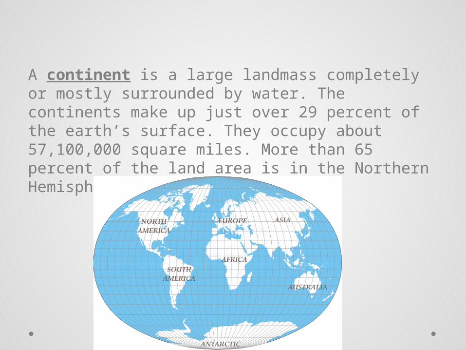
A continent is a large landmass completely or mostly surrounded by water. The continents make up just over 29 percent of the earth’s surface. They occupy about 57,100,000 square miles. More than 65 percent of the land area is in the Northern Hemisphere.
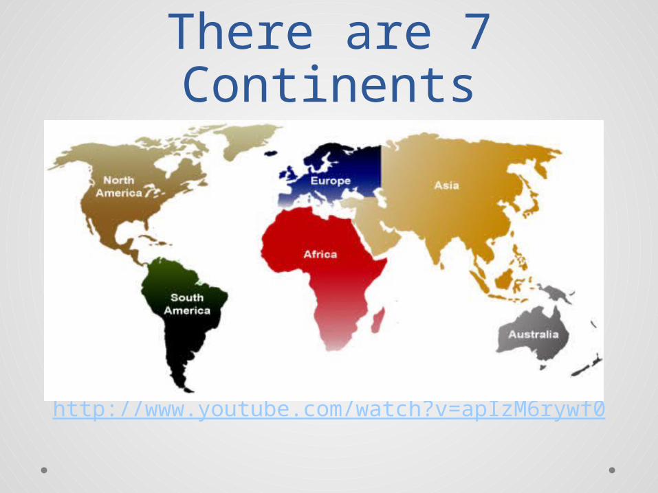
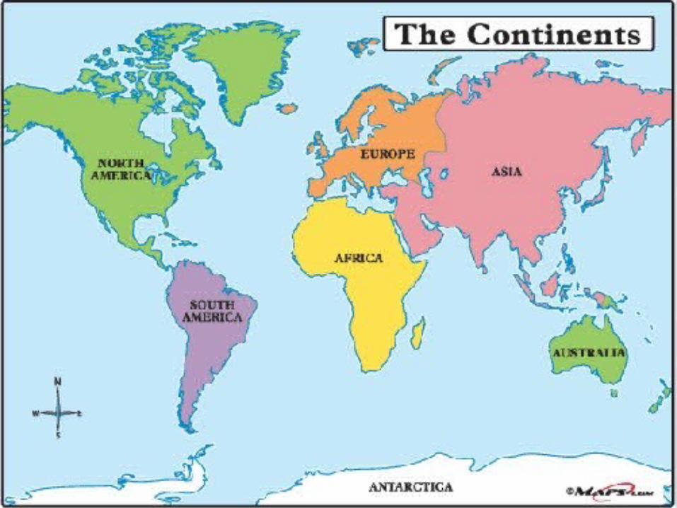
There are 7 Continents
http://www.youtube.com/watch?v=apIzM6rywf0
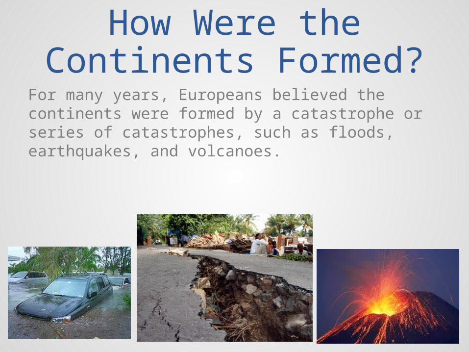
How Were the Continents Formed?
For many years, Europeans believed the continents were formed by a catastrophe or series of catastrophes, such as floods, earthquakes, and volcanoes.
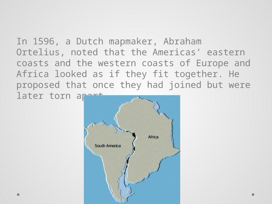
In 1596, a Dutch mapmaker, Abraham Ortelius, noted that the Americas’ eastern coasts and the western coasts of Europe and Africa looked as if they fit together. He proposed that once they had joined but were later torn apart.

Abraham Ortelius
Abraham Ortelius

Many years later, a German names Alfred Lothar Wegener published a book in which he explained his theory of the “Continental Drift.” Wegener, like Ortelius, believed that the earth originally had one supercontinent.

Alfred Lothar Wegener
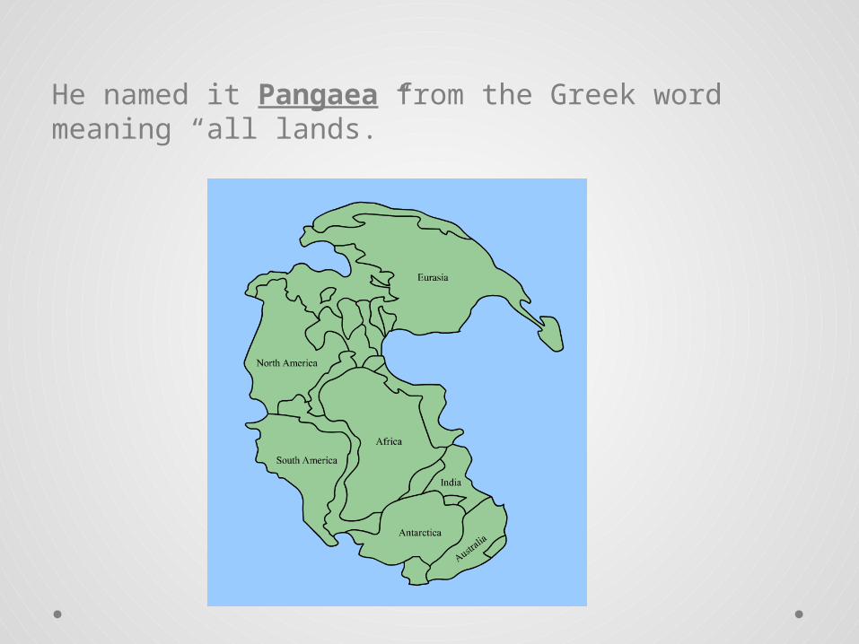
He named it Pangaea from the Greek word meaning “all lands.”
Video Time! Groundbreaking research by Alfred Wegener reveals
that all the continents were once connected as one single land mass he called Pangaea.
http://videos.howstuffworks.com/science/pangaea-videos-playlist.htm#video-28764
Why did the Earth's last supercontinent, Pangaea, separate into the seven chunks we have today? Why do continents continue to shift about an inch a year?
http://videos.howstuffworks.com/discovery/39887-why-tell-me-why-why-pangaea-broke-apart-video.htm
ActivityPangaea Puzzle
1. With a partner, label each continent and the country of India on the provided handout.
2. Cut out the continents and India3. Piece the continents together into one landmass
like a puzzle to represent how Pangaea might have looked 190 million years ago.
4. Once you have the continents in place, glue them onto a piece of construction paper.
5. Title the page “Pangaea”6. IF YOU HAVE TIME color and
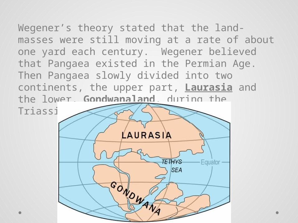
Wegener’s theory stated that the land-masses were still moving at a rate of about one yard each century. Wegener believed that Pangaea existed in the Permian Age. Then Pangaea slowly divided into two continents, the upper part, Laurasia and the lower, Gondwanaland, during the Triassic Age.
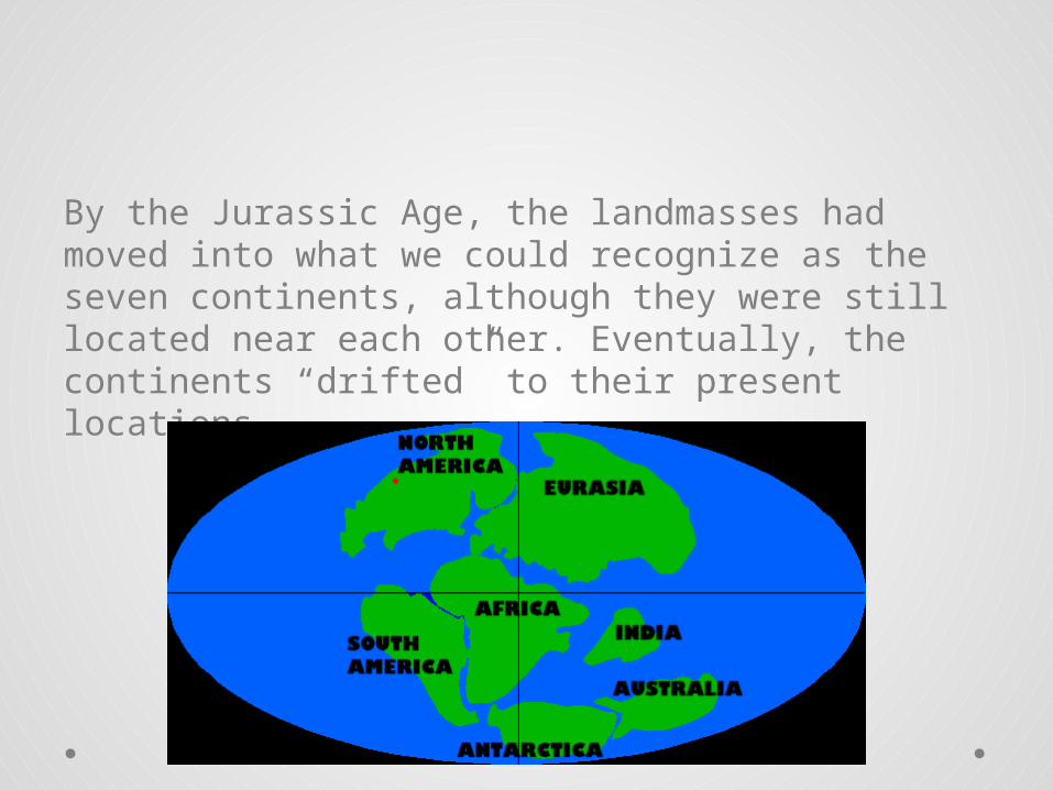
By the Jurassic Age, the landmasses had moved into what we could recognize as the seven continents, although they were still located near each other. Eventually, the continents “drifted” to their present locations.

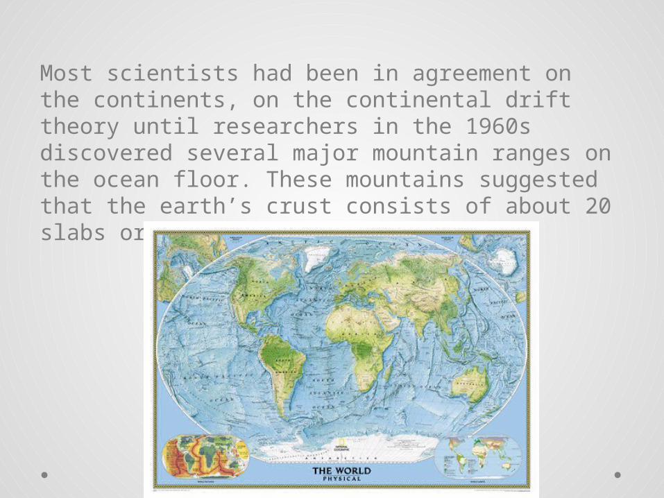
Most scientists had been in agreement on the continents, on the continental drift theory until researchers in the 1960s discovered several major mountain ranges on the ocean floor. These mountains suggested that the earth’s crust consists of about 20 slabs or plates.
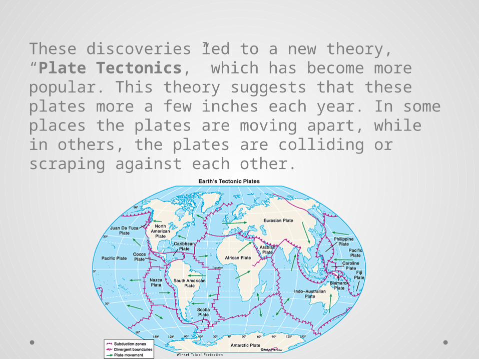
These discoveries led to a new theory, “Plate Tectonics,” which has become more popular. This theory suggests that these plates more a few inches each year. In some places the plates are moving apart, while in others, the plates are colliding or scraping against each other.
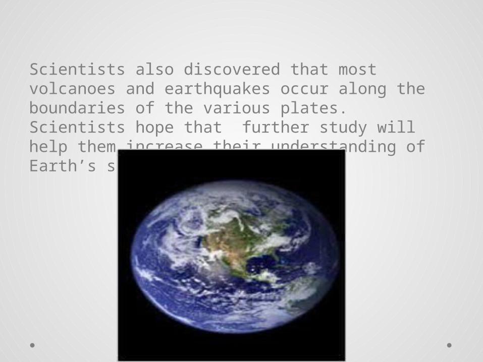
Scientists also discovered that most volcanoes and earthquakes occur along the boundaries of the various plates. Scientists hope that further study will help them increase their understanding of Earth’s story.

Ticket Out the DoorAnswer one of the following questions in at least 3 sentences:
• What did you find most interesting during todays lesson? Why?
• When you learned about Pangaea what were your thoughts?