country programme seascape strategy - … programme seascape strategy for community development and...
TRANSCRIPT
Country Programme Seascape Strategy For Community Development and Knowledge
Management (COMDEKS)
Indonesia
Prepared by: P. Raja Siregar, Ery Damayanti, Pantoro Tri Kuswardono,
Sofyan, Ina Nisrina

TABLE OF CONTENTS
Executive .................................................................................................................................................... 1
1. Priority Area ............................................................................................................................... 3
2. Situation Analysis ...................................................................................................................... 7
2.1. Community Resilience Assessment ........................................................................... 7
2.2. Issues and Threats in Semau Island …………........................................................... 9
2.3.Social – Economic Conditions ....................................................................................... 9
2.4.Stakeholder Analysis ........................................................................................................ 10
3. Seascape Strategy ...…………………………………………...….................................................. 12
3.1. CPLS Indonesia .......……………………………………………............................................. 12
3.2. CPLS Indonesia Planning and Implementation Process Strategy ................................................................................................................. 14
4. Typology of Potential Community-based Projects and Criteria for Project Selection ............................................................................................... 15
5. Monitoring and Evaluation Plan ........................................................................................ 18
6. Knowledge Management Plan ............................................................................................ 20
7. References ................................................................................................................................... 21
Appendix

Executive summary
The Community Development and Knowledge Management for the Satoyama Initiative Project (COMDEKS) was launched in 2011 as the flagship of the International Partnership for the Satoyama Initiative1, and is implemented by UNDP in partnership with the Ministry of the Environment of Japan, the Secretariat of the Convention on Biological Diversity, and the United Nations University – Institute of Advanced Studies. The project is funded by the Japan Biodiversity Fund and has been designed to support local community activities to maintain and rebuild socio-ecological production landscapes and seascapes (SEPLS), and to collect and disseminate knowledge and experiences from successful actions for replication and up-scaling in other parts of the word. The project aims to develop sound biodiversity management and sustainable livelihood activities with local communities by providing small-scale finance to local community organizations. The project is being delivered through the Global Environment Facility’s Small Grants Programme, and is currently under implementation in 20 countries, including Indonesia.
In Indonesia, Semau Island in Kupang District, East Nusa Tenggara was selected as the target seascape for the activities of the COMDEKS Country Programme. East Nusa Tenggara lies in the Wallacea bioregion and is host to rich marine biodiversity. Most of Semau Island is managed under the Marine Recreation Park (under Ministry of Forestry-MF) and a smaller part is managed by the Marine National Park (under Ministry of Marine Affairs and Fisheries MMAF). Semau Island was selected based on the consideration that it is an island separate from the mainland, at risk for potential impacts from climate change and extreme weather on its agriculture given the limited fresh water and thin soil layer in karst dominated terrain. Furthermore, the island is rich in terrestrial, coastal, and marine biodiversity. The people of the island have survived for generations on the available agricultural and piscine resources of this small island.
On November 14th-20th, and December 14th-17th 2013, Bingkai Indonesia Foundation conducted a baseline survey for GEF-SGP Indonesia. The baseline survey was conducted through literature review, field observations, community interviews, and participatory assessment of the community resilience. The assessment of community resilience used indicators of socio-ecological production landscapes and seascapes (SEPLS) developed by UNU-IAS (United Nations Univesity-Institute of Advanced Studies) and Bioversity International to help measure and understand the resilience of target landscapes and seascapes. The indicators were added to some highlighted issues related to climate change in coastal and island areas in Indonesia. The term socio-ecological production landscapes (SEPLs) was coined to refer to mosaic production landscapes that have been shaped through long-term harmonious interactions between humans and nature in a manner that fosters
1 Satoyama Initiative is a global effort to realize “societies in harmony with nature”. Satoyama is a Japanese term that stands for “Yama” mountains, grasslands, woodlands, and “Sato” surrounding villages.
1
well-being while maintaining biodiversity and ecosystem services (Gu and Subramanian 2012 in UNU 2013).
The baseline survey provides the material to develop strategies to improve community resilience on this island. Based on the community resilience’s scores assessment, in general the participants provided high scores for the “Ecosystem Protection and the Maintenance of Biodiversity” and “Biodiversity of Agriculture and Mariculture” indicators. The participants tended to agree with this scoring indicated by the low deviation in each indicator. The landscape of the island is equally dominated by clan forests, state forest, bushes and agriculture land. Agricultural lands are planted with various staple crops, vegetables and fruits. The majority of staple food grown, mostly rice and maize, are kept for family consumption for the year, while most income comes from short-term cash crops (vegetables and fruits), seaweed and fishing. Although the scores were relatively high for indicators of these two categories, participants tended to agree that the ecosystem and biodiversity protection is slowly declining and that there is a significant threat to the future of the island’s biodiversity.
Based on the baseline survey and consultation with the community, issues such as limited water sources, limited knowledge and innovations in agriculture or mariculture, increasing use of chemicals for agriculture, and decreasing clan forest area are critical to be addressed by the COMDEKS programme in the island in the next two years. Consultations were conducted with local community, district government, and national stakeholders to collect inputs for strategies, activities, and the potential for program collaborations.
2
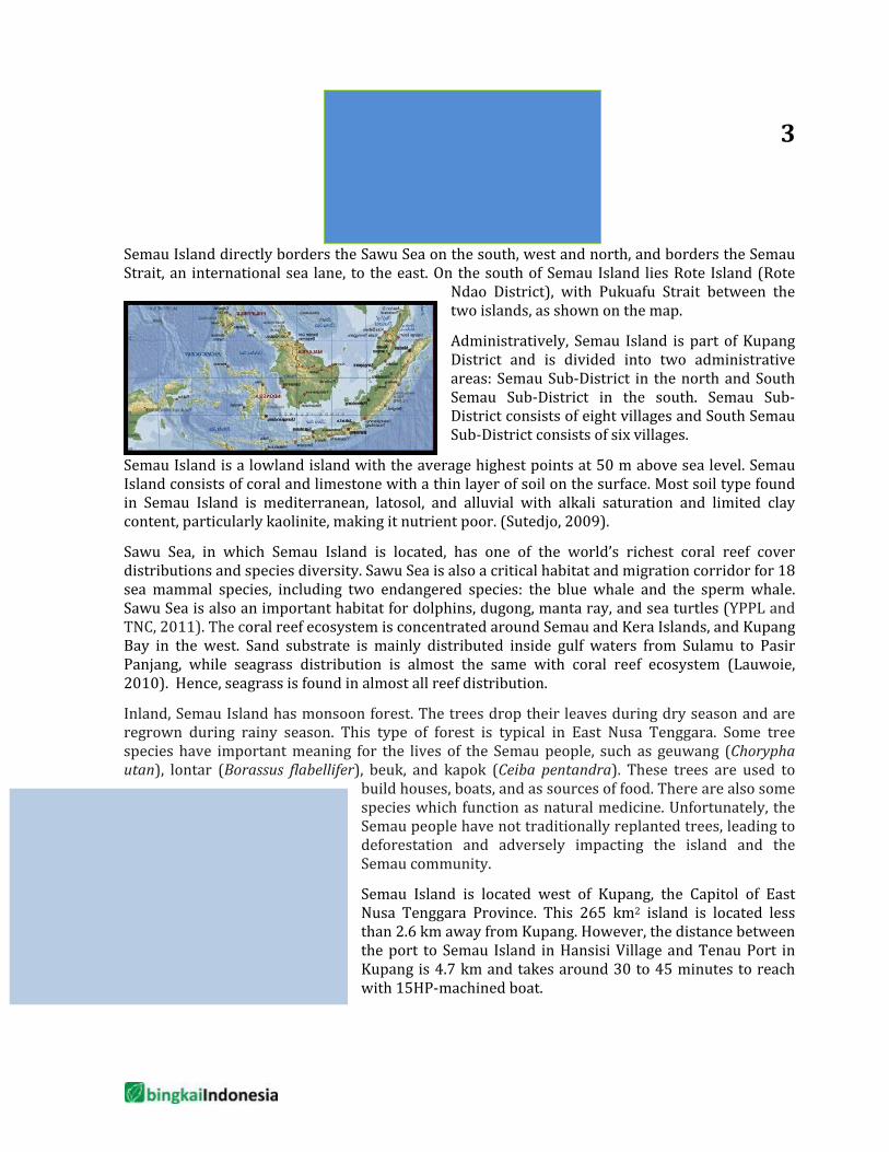
Priority Area Semau Island directly borders the Sawu Sea on the south, west and north, and borders the Semau Strait, an international sea lane, to the east. On the south of Semau Island lies Rote Island (Rote
Ndao District), with Pukuafu Strait between the two islands, as shown on the map.
Administratively, Semau Island is part of Kupang District and is divided into two administrative areas: Semau Sub-District in the north and South Semau Sub-District in the south. Semau Sub-District consists of eight villages and South Semau Sub-District consists of six villages.
Semau Island is a lowland island with the average highest points at 50 m above sea level. Semau Island consists of coral and limestone with a thin layer of soil on the surface. Most soil type found in Semau Island is mediterranean, latosol, and alluvial with alkali saturation and limited clay content, particularly kaolinite, making it nutrient poor. (Sutedjo, 2009).
Sawu Sea, in which Semau Island is located, has one of the world’s richest coral reef cover distributions and species diversity. Sawu Sea is also a critical habitat and migration corridor for 18 sea mammal species, including two endangered species: the blue whale and the sperm whale. Sawu Sea is also an important habitat for dolphins, dugong, manta ray, and sea turtles (YPPL and TNC, 2011). The coral reef ecosystem is concentrated around Semau and Kera Islands, and Kupang Bay in the west. Sand substrate is mainly distributed inside gulf waters from Sulamu to Pasir Panjang, while seagrass distribution is almost the same with coral reef ecosystem (Lauwoie, 2010). Hence, seagrass is found in almost all reef distribution.
Inland, Semau Island has monsoon forest. The trees drop their leaves during dry season and are regrown during rainy season. This type of forest is typical in East Nusa Tenggara. Some tree species have important meaning for the lives of the Semau people, such as geuwang (Chorypha utan), lontar (Borassus flabellifer), beuk, and kapok (Ceiba pentandra). These trees are used to
build houses, boats, and as sources of food. There are also some species which function as natural medicine. Unfortunately, the Semau people have not traditionally replanted trees, leading to deforestation and adversely impacting the island and the Semau community.
Semau Island is located west of Kupang, the Capitol of East Nusa Tenggara Province. This 265 km2 island is located less than 2.6 km away from Kupang. However, the distance between the port to Semau Island in Hansisi Village and Tenau Port in Kupang is 4.7 km and takes around 30 to 45 minutes to reach with 15HP-machined boat.
3
Picture 1. Map of Semau Island
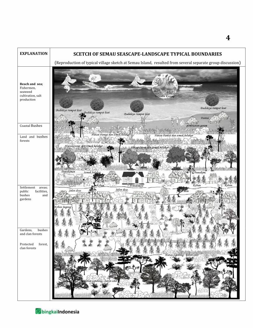
EXPLANATION SCETCH OF SEMAU SEASCAPE-LANDSCAPE TYPICAL BOUNDARIES
(Reproduction of typical village sketch at Semau Island, resulted from several separate group discussion) Beach and sea; Fishermen, seaweed cultivation, salt production
Coastal Bushes
Land and bushes forests
Settlement areas; public facilities, bushes and gardens Gardens, bushes and clan forests Protected forest, clan forests
4
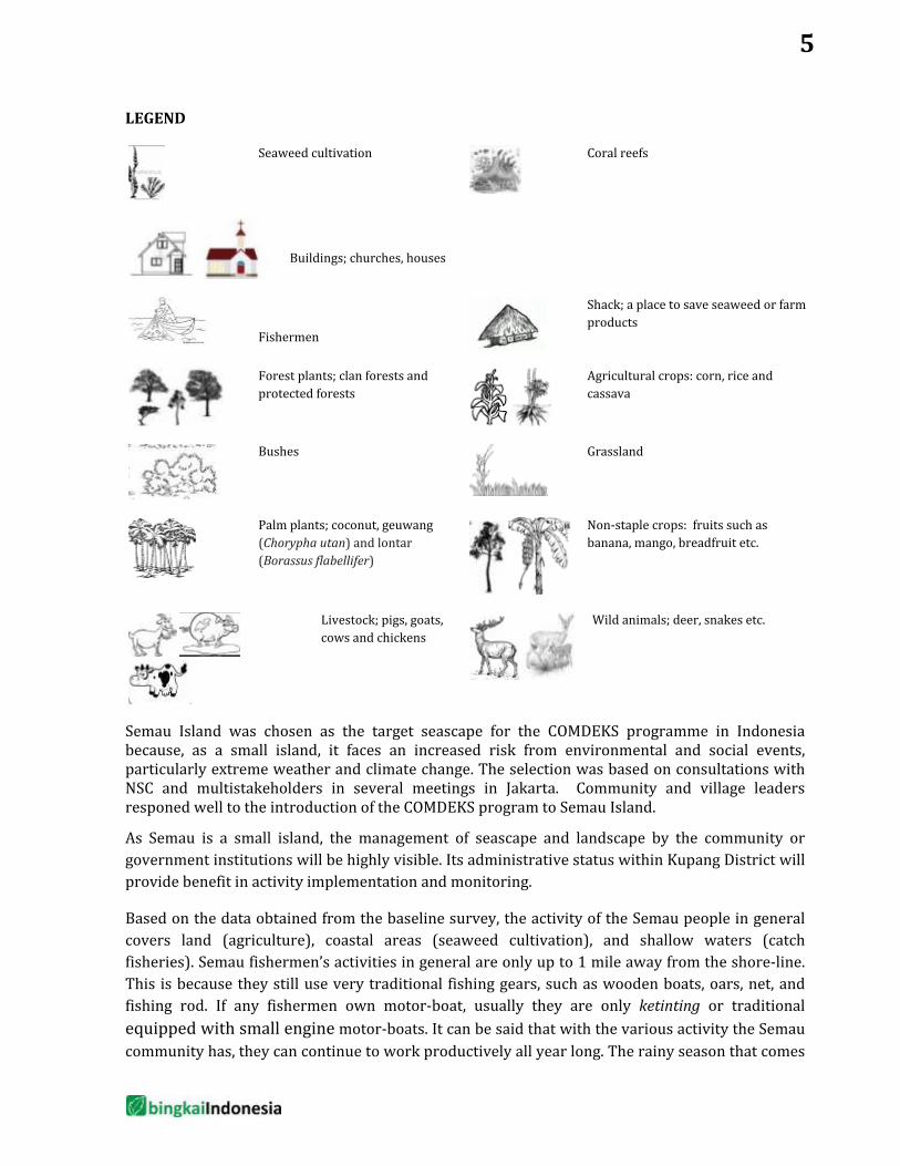
LEGEND
Seaweed cultivation
Coral reefs
Buildings; churches, houses
Fishermen
Shack; a place to save seaweed or farm products
Forest plants; clan forests and protected forests
Agricultural crops: corn, rice and cassava
Bushes
Grassland
Palm plants; coconut, geuwang (Chorypha utan) and lontar (Borassus flabellifer)
Non-staple crops: fruits such as banana, mango, breadfruit etc.
Livestock; pigs, goats, cows and chickens
Wild animals; deer, snakes etc.
Semau Island was chosen as the target seascape for the COMDEKS programme in Indonesia because, as a small island, it faces an increased risk from environmental and social events, particularly extreme weather and climate change. The selection was based on consultations with NSC and multistakeholders in several meetings in Jakarta. Community and village leaders responed well to the introduction of the COMDEKS program to Semau Island.
As Semau is a small island, the management of seascape and landscape by the community or government institutions will be highly visible. Its administrative status within Kupang District will provide benefit in activity implementation and monitoring.
Based on the data obtained from the baseline survey, the activity of the Semau people in general covers land (agriculture), coastal areas (seaweed cultivation), and shallow waters (catch fisheries). Semau fishermen’s activities in general are only up to 1 mile away from the shore-line. This is because they still use very traditional fishing gears, such as wooden boats, oars, net, and fishing rod. If any fishermen own motor-boat, usually they are only ketinting or traditional equipped with small engine motor-boats. It can be said that with the various activity the Semau community has, they can continue to work productively all year long. The rainy season that comes
5
together with westerly monsoon season is the time for Semau community to plant main crops: corn and rice. In the dry season the community focuses on seaweed culture and short-lived food plants such as vary of vegetables, onion, cayenne pepper, tomatoe, etc.
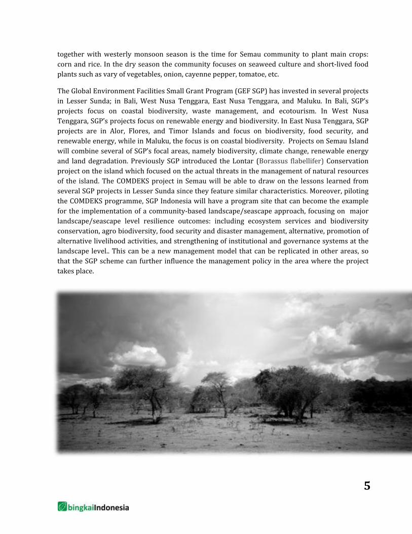
The Global Environment Facilities Small Grant Program (GEF SGP) has invested in several projects in Lesser Sunda; in Bali, West Nusa Tenggara, East Nusa Tenggara, and Maluku. In Bali, SGP’s projects focus on coastal biodiversity, waste management, and ecotourism. In West Nusa Tenggara, SGP’s projects focus on renewable energy and biodiversity. In East Nusa Tenggara, SGP projects are in Alor, Flores, and Timor Islands and focus on biodiversity, food security, and renewable energy, while in Maluku, the focus is on coastal biodiversity. Projects on Semau Island will combine several of SGP’s focal areas, namely biodiversity, climate change, renewable energy and land degradation. Previously SGP introduced the Lontar (Borassus flabellifer) Conservation project on the island which focused on the actual threats in the management of natural resources of the island. The COMDEKS project in Semau will be able to draw on the lessons learned from several SGP projects in Lesser Sunda since they feature similar characteristics. Moreover, piloting the COMDEKS programme, SGP Indonesia will have a program site that can become the example for the implementation of a community-based landscape/seascape approach, focusing on major landscape/seascape level resilience outcomes: including ecosystem services and biodiversity conservation, agro biodiversity, food security and disaster management, alternative, promotion of alternative livelihood activities, and strengthening of institutional and governance systems at the landscape level.. This can be a new management model that can be replicated in other areas, so that the SGP scheme can further influence the management policy in the area where the project takes place.
5
Picture 2; Land in dry season
Situation Analysis
2.1. Community Resilience Assessment As part of the community consultation process, indicators for Resilience in Socio-ecological Production Landscapes and Seascapes (SEPLS) were piloted in the target seascape. This piloting exercise and the feedback received will help UNDP and other IPSI members refine the overall methodology for measuring and understanding landscape/seascape resilience.
In Indonesia, the practical application of the indicators during the baseline assessment was conducted by measuring elements of SEPL resilience along four interrelated dimensions; ecosystems protection and the maintenance of biodiversity; agricultural biodiversity; knowledge, learning and innovation; and social equity and infrastructure. Those indicators were adjusted with coastal and sea area. We separate indicators and questions on almost half of the original indicators to be ‘land’ and ‘coastal-marine’. One indicator was added to the original SEPLS indicators in category II to adopt characteristics of small islands and climate risk. The added indicator is the ability of community to deal with extreme seasonal variability. The two questions asked were: (1) Does the local agricultural and maricultural environment produce food sources (eg: rice, corn, sagoo, cassava, fish) for the whole year? (2) Does the community have the opportunity to communicate and get transportation to the outer island back and forth from time to time to fulfil their needs or in emergency situation? These indicators related to community resilience in fulfilling the community’s basic needs within a year under risk of extreme seasonal variation and isolation.
Prior to the workshop assessment on SEPL’s indicators, we conducted 9 small group discussions and 6 individual interviews with village leaders. Out of the group discussions, there were about 24 women involved, and two of the discussions were attended exclusively by women. The workshop on scoring SEPL’s resilience indicators was attended by a total of 25 participants, 5 of whom were women. A similar composition of men and women participated in the second consultation to present SEPL’s score results and to discuss and agree on key problems and potential activities to respond it. This consultation was attended by 33 participants, 4 of whom were women. During the consultation workshop with the government of Kupang District, 17 participants, including two male and one female representative of the village community, attended.
The assessment indicates that each theme receives an average score between 3 and 4 (see diagram below). The community resilience in Semau Island is categorized as good. Category I (Ecosystem and Biodiversity Protection) and category II (Cultural and Environmental Biodiversity) indicators have relatively higher scores than other categories. The participants tend to agree with these scoring indicated by the low deviation in each indicator. Although the scores were relatively high, participants tended to agree that ecosystem and biodiversity protection is slowly declining and that there is a future threat to island biodiversity. In category III (Documentation, Innovation, and Knowledge) and category IV (Social Justice and Infrastructure) the scores given were around 3, which can be classified as medium-good. Social justice and infrastructure is still low but show tendency of slowly improving, including in communication and sea transportation. Participants tend to agree on the increasing role and knowledge of women. Participants also had low scores for the knowledge and agricultural/aquaculture innovations that they have.
7
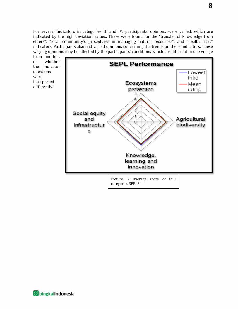
For several indicators in categories III and IV, participants’ opinions were varied, which are indicated by the high deviation values. These were found for the “transfer of knowledge from elders”, “local community’s procedures in managing natural resources”, and “health risks” indicators. Participants also had varied opinions concerning the trends on these indicators. These varying opinions may be affected by the participants’ conditions which are different in one village from another, or whether the indicator questions were interpreted differently.
Picture 3; average score of four categories SEPLS
8
2.2. Issues and Threats in Semau Island
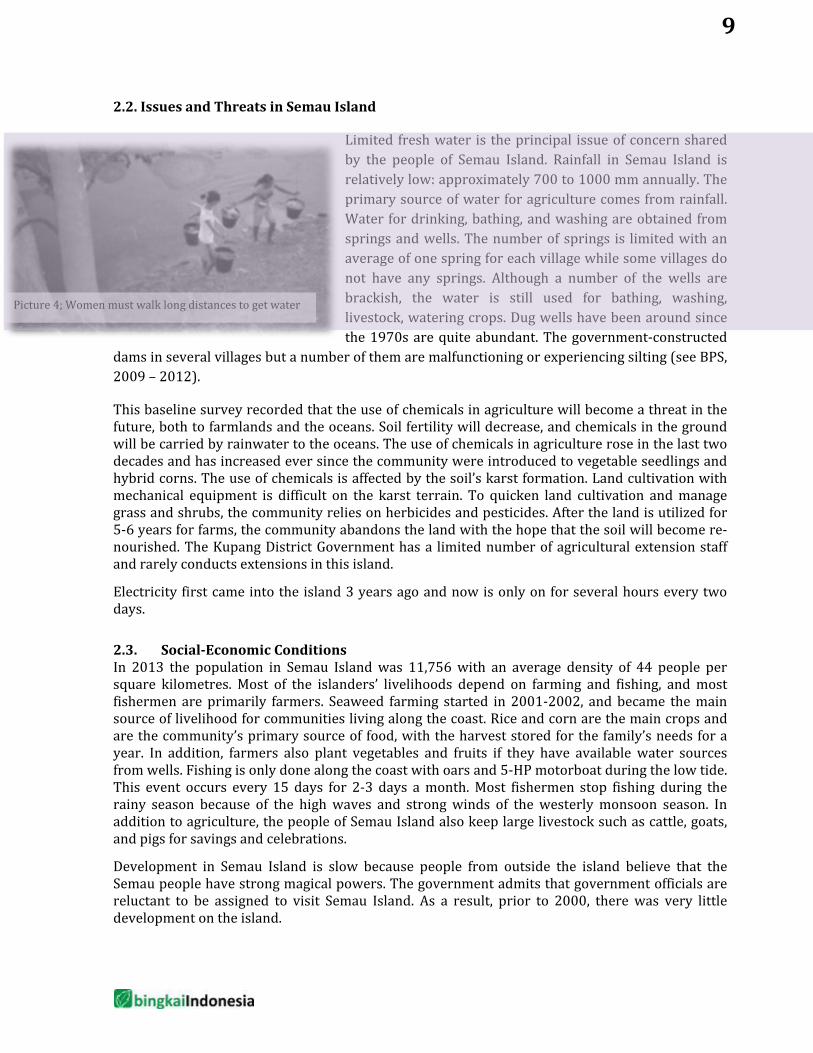
Limited fresh water is the principal issue of concern shared by the people of Semau Island. Rainfall in Semau Island is relatively low: approximately 700 to 1000 mm annually. The primary source of water for agriculture comes from rainfall. Water for drinking, bathing, and washing are obtained from springs and wells. The number of springs is limited with an average of one spring for each village while some villages do not have any springs. Although a number of the wells are brackish, the water is still used for bathing, washing, livestock, watering crops. Dug wells have been around since the 1970s are quite abundant. The government-constructed
dams in several villages but a number of them are malfunctioning or experiencing silting (see BPS, 2009 – 2012).
This baseline survey recorded that the use of chemicals in agriculture will become a threat in the future, both to farmlands and the oceans. Soil fertility will decrease, and chemicals in the ground will be carried by rainwater to the oceans. The use of chemicals in agriculture rose in the last two decades and has increased ever since the community were introduced to vegetable seedlings and hybrid corns. The use of chemicals is affected by the soil’s karst formation. Land cultivation with mechanical equipment is difficult on the karst terrain. To quicken land cultivation and manage grass and shrubs, the community relies on herbicides and pesticides. After the land is utilized for 5-6 years for farms, the community abandons the land with the hope that the soil will become re-nourished. The Kupang District Government has a limited number of agricultural extension staff and rarely conducts extensions in this island.
Electricity first came into the island 3 years ago and now is only on for several hours every two days.
2.3. Social-Economic Conditions In 2013 the population in Semau Island was 11,756 with an average density of 44 people per square kilometres. Most of the islanders’ livelihoods depend on farming and fishing, and most fishermen are primarily farmers. Seaweed farming started in 2001-2002, and became the main source of livelihood for communities living along the coast. Rice and corn are the main crops and are the community’s primary source of food, with the harvest stored for the family’s needs for a year. In addition, farmers also plant vegetables and fruits if they have available water sources from wells. Fishing is only done along the coast with oars and 5-HP motorboat during the low tide. This event occurs every 15 days for 2-3 days a month. Most fishermen stop fishing during the rainy season because of the high waves and strong winds of the westerly monsoon season. In addition to agriculture, the people of Semau Island also keep large livestock such as cattle, goats, and pigs for savings and celebrations.
Development in Semau Island is slow because people from outside the island believe that the Semau people have strong magical powers. The government admits that government officials are reluctant to be assigned to visit Semau Island. As a result, prior to 2000, there was very little development on the island.
Picture 4; Women must walk long distances to get water
9
The majority of the island’s inhabitants are made up from two ethnic groups with different cultures and languages: the Helong and the Rote. The Helong people are the native inhabitants of the island. In the past several decades, the great Helong clan leaders distributed the land to the sub-clans and the Rote clan. The remaining undistributed land became clan forests in several villages. Along the coast and sea, the community used to implement a marine management authority based on the clan’s land ownership, but since the 1970s this authority is no longer endorsed. Today the utilization of the coast and adjacent shallow waters (several hundred meters from the coastline) are regulated by the Village Government. Since seaweed cultivation became an important source of livelihood, the village government has implemented zoning for the villagers’ seaweed cultivation.
In the culture on Semau Island, the women’s voice is an important factor in families, and in the decision-making processes of the village. A relatively poorer condition that women experience is concerning land rights (inheritance). For several generations women do not have the right to inherit land. If a husband passed away and the family is without children, then his land is returned to the husband’s family. However, individually owned land is now certified, providing an alternative way for women to have legal rights to land.
2.4. Stakeholder Analysis The stakeholders who are directly related to food security in Semau Island are agriculture farmers, mariculture farmers, fishermen, women, youth, clan leaders, collectors, village officials, church officials, and land and sea transportation operators. Other stakeholders play supporting roles to food security, such as district government (along with their branch offices), sub-district government, central government, and civil society organizations. The Ministry of Forestry and the Ministry of Marine Affairs and Fisheries are branches of the central government with interests in Semau Island. Nearly all of the Coast of Semau Island is part of the Marine Natural Recreation Park managed by the Ministry of Forestry, while part of the south/southeast waters are part of the Sawu Marine National Park managed by the Ministry of Marine Affairs and Fisheries (MMAF).
The central and district governments have the National Program for Community Empowerment (NPCE), which includes infrastructure development and loans for community and women’s economic businesses. There are also the Semau Development Foundation (SDF) managed by local community and Pandu Lestari Foundation (PLF) that is managed by lecturers from Cendana University in Kupang. SDF has education programs while PLF have conducted biodiversity and conservation programs from Kehati Foundation and GEF-SGP. Previously in 2000-2001, the central government had the COREMAP project for the protection of the area’s coral reef, which had components of ecotourism and seaweed cultivation development. In addition there is the Arafura and Timor Ecosystem Action (ATSEA) program from GEF to protect Arafura and Timor waters. Although this program focuses on the vast Arafura and Timor waters, there is a chance that baseline survey in Semau Island will be conducted in the near future.
Community groups have low capacity and knowledge. They have begun their activities under NPCE. The activities are limited to construction of basic village infrastructure and economic ventures. Increasing knowledge and innovations will require knowledge and skills that the community groups currently do not have. Civil society organizations in Kupang are expected to be able to facilitate to bring in new knowledge and innovations to agriculture and fisheries activities and to harmonize with the local community’s knowledge.
Country Programme Landscape Level M&E: The SEPL scorecard will be utilized at a defined timeframe annually to measure and document change against the baseline assessment values generated in October 2013. A final assessment of SEPL indicators will take place at a workshop
10
11
financed by a grant. This will serve as a final evaluation of the Country Programme Landscape Strategy. Landscape Specific Project Level M&E: Prior to project approval, each project will have to identify the specific landscape strategy outcome to which it is contributing and will monitor the corresponding indicators. Progress towards the outcome will be updated using the grantees’ progress reports. Additionally, the individual project will have an indicator system aligned with GEF SGP OP5 indicators.
SEASCAPE STRATEGY
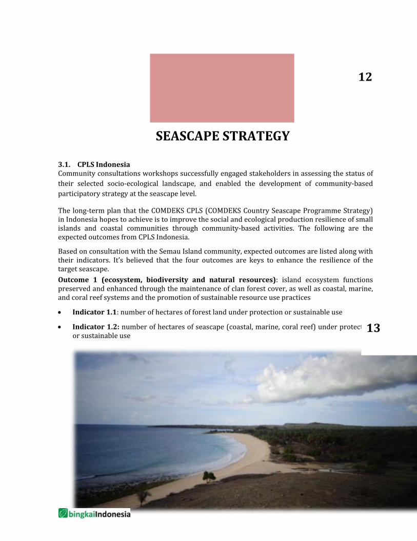
3.1. CPLS Indonesia Community consultations workshops successfully engaged stakeholders in assessing the status of their selected socio-ecological landscape, and enabled the development of community-based participatory strategy at the seascape level.
The long-term plan that the COMDEKS CPLS (COMDEKS Country Seascape Programme Strategy) in Indonesia hopes to achieve is to improve the social and ecological production resilience of small islands and coastal communities through community-based activities. The following are the expected outcomes from CPLS Indonesia.
Based on consultation with the Semau Island community, expected outcomes are listed along with their indicators. It’s believed that the four outcomes are keys to enhance the resilience of the target seascape. Outcome 1 (ecosystem, biodiversity and natural resources): island ecosystem functions preserved and enhanced through the maintenance of clan forest cover, as well as coastal, marine, and coral reef systems and the promotion of sustainable resource use practices
• Indicator 1.1: number of hectares of forest land under protection or sustainable use
• Indicator 1.2: number of hectares of seascape (coastal, marine, coral reef) under protection or sustainable use
12
13
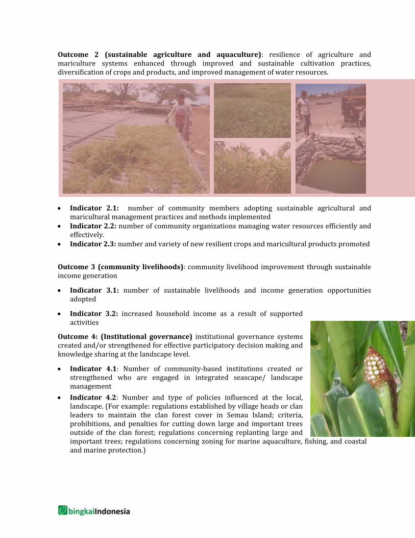
Outcome 2 (sustainable agriculture and aquaculture): resilience of agriculture and mariculture systems enhanced through improved and sustainable cultivation practices, diversification of crops and products, and improved management of water resources.
• Indicator 2.1: number of community members adopting sustainable agricultural and maricultural management practices and methods implemented
• Indicator 2.2: number of community organizations managing water resources efficiently and effectively.
• Indicator 2.3: number and variety of new resilient crops and maricultural products promoted
Outcome 3 (community livelihoods): community livelihood improvement through sustainable income generation
• Indicator 3.1: number of sustainable livelihoods and income generation opportunities adopted
• Indicator 3.2: increased household income as a result of supported activities
Outcome 4: (Institutional governance) institutional governance systems created and/or strengthened for effective participatory decision making and knowledge sharing at the landscape level.
• Indicator 4.1: Number of community-based institutions created or strengthened who are engaged in integrated seascape/ landscape management
• Indicator 4.2: Number and type of policies influenced at the local, landscape. (For example: regulations established by village heads or clan leaders to maintain the clan forest cover in Semau Island; criteria, prohibitions, and penalties for cutting down large and important trees outside of the clan forest; regulations concerning replanting large and important trees; regulations concerning zoning for marine aquaculture, fishing, and coastal and marine protection.)
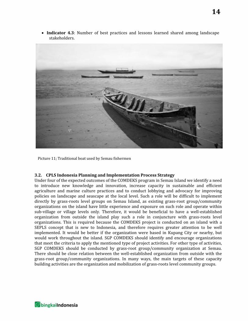
• Indicator 4.3: Number of best practices and lessons learned shared among landscape stakeholders.
3.2. CPLS Indonesia Planning and Implementation Process Strategy Under four of the expected outcomes of the COMDEKS program in Semau Island we identify a need to introduce new knowledge and innovation, increase capacity in sustainable and efficient agriculture and marine culture practices and to conduct lobbying and advocacy for improving policies on landscape and seascape at the local level. Such a role will be difficult to implement directly by grass-roots level groups on Semau Island, as existing grass-root group/community organizations on the island have little experience and exposure on such role and operate within sub-village or village levels only. Therefore, it would be beneficial to have a well-established organization from outside the island play such a role in conjuncture with grass-roots level organizations. This is required because the COMDEKS project is conducted on an island with a SEPLS concept that is new to Indonesia, and therefore requires greater attention to be well implemented. It would be better if the organization were based in Kupang City or nearby, but would work throughout the island. SGP COMDEKS should identify and encourage organizations that meet the criteria to apply the mentioned type of project activities. For other type of activities, SGP COMDEKS should be conducted by grass-root group/community organization at Semau. There should be close relation between the well-established organization from outside with the grass-root group/community organizations. In many ways, the main targets of these capacity building activities are the organization and mobilization of grass-roots level community groups.
Picture 11; Traditional boat used by Semau fishermen
14
Typology of Potential Community-based Projects and Criteria for Project Selection
The main criterion required in project selection is the fulfilment of one or more CPLS outcomes. In addition, the capacity of the organization or individual behind the project is an important element in the effort to minimize the risk of project failure. The previous chapters have explained that the role of an NGO from outside of Semau is crucial to facilitate the program planning and implementation processes in accordance with CPLS. The following are several strategic activities key to the accomplishment of each outcome. The activities of each outcome will become guidelines for project selection in Semau Island.
Outcome 1: Outcome 1 (ecosystem, biodiversity and natural resources): island ecosystem functions preserved and enhanced through the maintenance of clan forest cover, as well as coastal, marine, and coral reef systems and the promotion of sustainable resource use practices
Activities required to achieve Outcome 1 are the following:
• Community education of the benefits of maintaining clan forest protected state forest, and coastal and marine ecosystems.
• Introduction to the benefits of coral reef and FAD in fishing. • Training and facilitating for community groups and village
government in creating and planting artificial coral reef or FAD in shallow coastal waters.
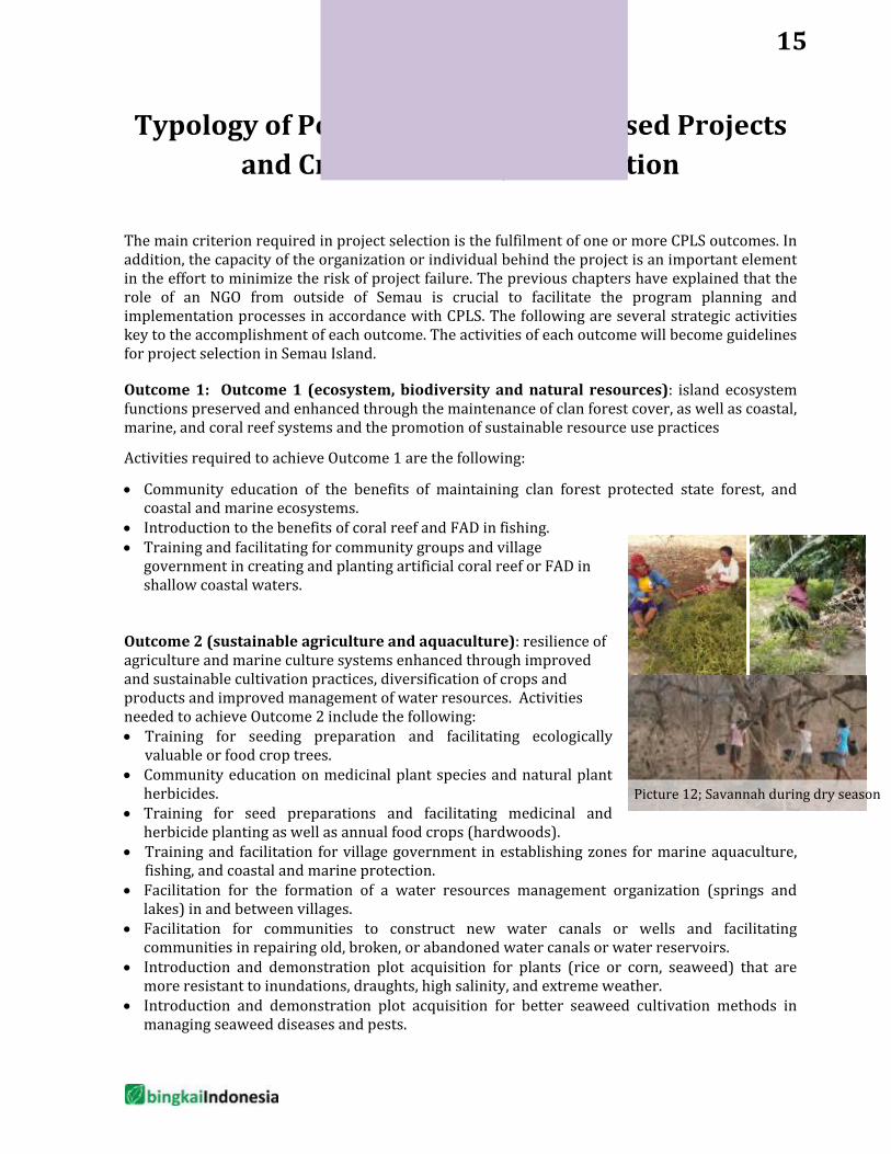
Outcome 2 (sustainable agriculture and aquaculture): resilience of agriculture and marine culture systems enhanced through improved and sustainable cultivation practices, diversification of crops and products and improved management of water resources. Activities needed to achieve Outcome 2 include the following: • Training for seeding preparation and facilitating ecologically
valuable or food crop trees. • Community education on medicinal plant species and natural plant
herbicides. • Training for seed preparations and facilitating medicinal and
herbicide planting as well as annual food crops (hardwoods). • Training and facilitation for village government in establishing zones for marine aquaculture,
fishing, and coastal and marine protection. • Facilitation for the formation of a water resources management organization (springs and
lakes) in and between villages. • Facilitation for communities to construct new water canals or wells and facilitating
communities in repairing old, broken, or abandoned water canals or water reservoirs. • Introduction and demonstration plot acquisition for plants (rice or corn, seaweed) that are
more resistant to inundations, draughts, high salinity, and extreme weather. • Introduction and demonstration plot acquisition for better seaweed cultivation methods in
managing seaweed diseases and pests.
15
Picture 12; Savannah during dry season
• Community education on long-term impacts of using chemical fertilizers and pesticides on soil fertility, harvest quality, groundwater, and health.
• Training and facilitation for community groups to make and use organic fertilizers and pesticides.
• Introduction to food crop varieties (rice, corn, seaweed) that are more resistant to inundations, draughts, strong winds, and diseases, and facilitation for demonstration plot preparations.
• Regular comparative study and extensions on agriculture and aquaculture with experts and Kupang District Agriculture and Fisheries Extension Agencies.
• Introduction to the benefit of weather and climate forecast information for agriculture and aquaculture as well as fishing.
• Dissemination of climate and weather forecast from the Indonesian Agency for Meteorology, Climatology and Geophysics (BMKG) to the community to make agriculture, aquaculture, and fishing decisions.
• Introduction and innovation demonstrations in chemical-free land cultivation and/or implementation of agriculture mechanism.
• Study on the ideal land cover (environmental carrying capacity) in Semau Island. • Study on water supply and demand in Semau Island. • Study on pests and plant diseases in Semau Island.
Outcome 3 (community livelihoods): community livelihood improvement through sustainable income generation. The activities required to achieve Outcome 3 include: • Training, comparative study, and facilitating community groups in preparing and keeping
honey bees as well as increasing awareness on the importance of planting hardwood trees for honey production.
• Training and introduction of agriculture and aquaculture product manufacturing and packaging as well as seed storing methods.
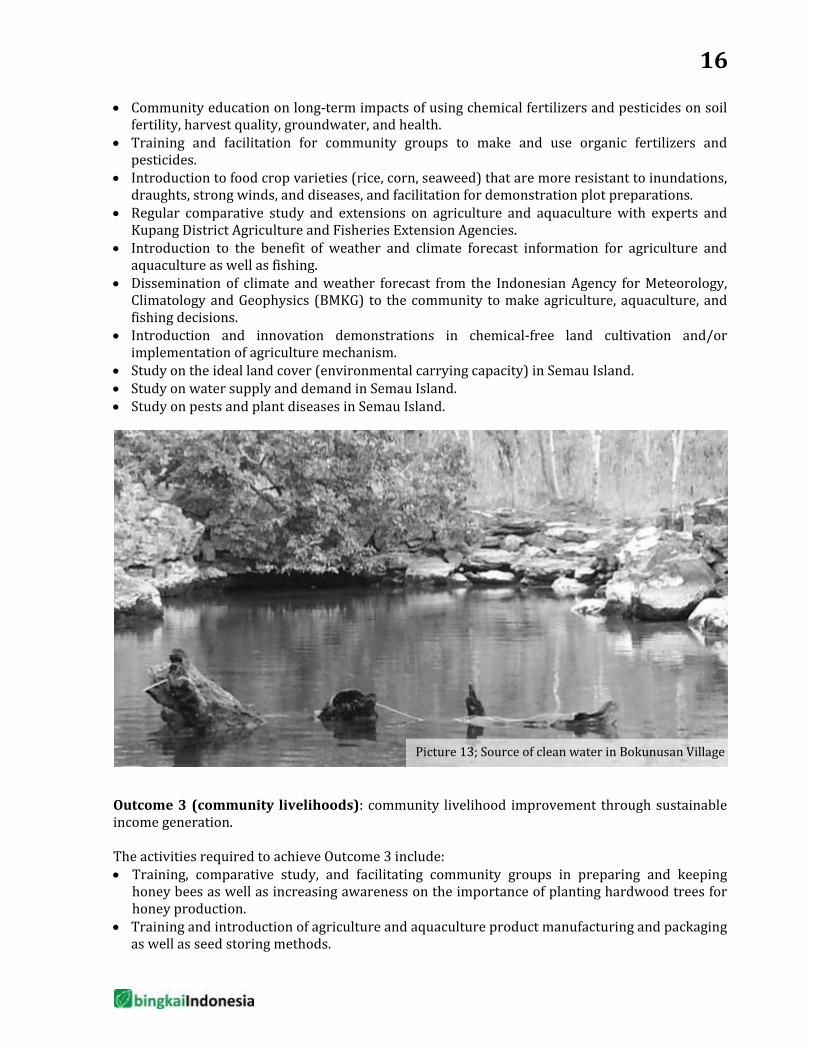
Picture 13; Source of clean water in Bokunusan Village
16
• Introduction to sustainable and efficient fishing gear, especially for extreme season (west monsoon period).
• Study on the opportunities of agriculture and aquaculture commodities from Semau Island in Kupang and East Nusa Tenggara markets.
Outcome 4: Institutional governance systems created and/or strengthened for effective participatory decision-making and knowledge sharing at the landscape level.
• Promotion of village government regulations or agreement between clan leaders for the maintenance of biodiversity in the target landscape/seascape.
• Lobbying and facilitation for village government and clan leaders to establish make decisions and regulations to protect the remaining clan forests.
• Lobbying and facilitation for village government and clan leaders to establish criteria prohibiting cutting down large trees and replanting, especially or trees around water sources, and introducing planting as a civil administration requirements and part of customary penalty system.
In addition to focusing on knowledge transfer, the projects that will be supported by COMDEKS in Indonesia also emphasizes on the project’s impact on community livelihood, gender equality,
and strengthening the capacity of local organizations. Therefore, local community-based groups or organizations that have demonstrated great leadership in community development processes are expected to participate in COMDEKS’ projects. In addition, COMDEKS also prioritizes projects that highlight agriculture and marine aquaculture innovations as the spearhead of community livelihood in coastal areas and small islands.
The role of the SGP National Steering Committee (NSC) is to provide resources institutionally or individually for routine meetings, special meetings, or field visits. One of its important roles is as a filter for proposals submitted by CSOs or NGOs in this process. Along with the SGP secretarial team, the NSC will
provide substantial inputs to the submitted proposals, in accordance with each member’s expertise. The revised proposal will be reported back to the NSC. During the evaluation and monitoring processes, NSC will be requested to conduct a field visit if specific skills are required, such as community economic development, organic agriculture development, terrestrial and marine biology, community product marketing, and others. In the COMDEKS scheme, similar to the on-going SGP program scheme, NSC meetings are held every two months. During the preparation stage, the SGP secretariat team will hold comprehensive discussions with one or more NSC members based on the required elements, along with technical team provided by the GEF Secretariat in the Ministry of Environment. NSC members are also involved in the monitoring and evaluation planning processes, which will be developed with one of the NGOs based in Kupang.
There will be at least one annual visit from NSC members and monitoring/evaluation team to the program site. The participation of NSC team member in the COMDEKS scheme can be varied. Some may be needed to provide substantial inputs for the program, while others may be required as organizations to provide references for collaborations with other agencies to expedite the achievement of COMDEKS goals.
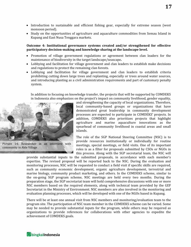
Picture 14; Researcher in an interview with community in Akle Village
17
Monitoring and Evaluation Plan
The method employed during the consultation process in the baseline survey is a combination of qualitative and quantitative approaches. A list of SEPLS indicators and scores for each indicator is used as a guideline. Before the community scored the indicators, the baseline survey team prepared issues or examples of actual local problems based on semi-structured interview, informal discussions, and observations. Therefore scoring can be done by minimizing the gap of understanding available indicators. Examples of local issues or problems can help the scoring participants to evaluate indicators in accordance with their understanding of everyday lives. Results of this scoring are analyzed by the baseline survey team, and the analysis results are returned to the Semau Island community. Analysis results are then verified and the community lists the identified problems based on priorities, and selects the priorities and proposed solutions. The results are then submitted to the district, brought to an NSC meeting, and followed by national consultation.
Due to Semau’s proximity to Kupang, SGP Indonesia suggests working with one of the well-established NGOs in Kupang to facilitate the preparation and implementation processes as well as monitoring and evaluation. This NGO will be an extension of SGP in facilitating village-based programs, and conducting routine monitoring. The NGO will be the same organization that takes role to introduce new knowledge and innovation, increase capacity in sustainable and efficient agriculture and marine culture practices and to conduct lobby and advocacy for improving policies on landscape and seascape at local level. It will also role in knowledge management in which it is expected to produce several products expressing the community’s process in managing their knowledge in COMDEKS project. This scheme is not the same as to what SGP has done in the past, however, it appears that SGP will change its monitoring and evaluation scheme by requesting assistance from a selected organization so that SGP’s programs can be monitored and evaluated in a more objective manner. There are few organizations in Kupang City and nearby that meet the qualification. Association of PIKUL is the strongest candidate.
Other community and stakeholders involved will be active participants in the monitoring and evaluation processes. Monitoring and evaluation will not only look at developments that are directly impacting the communities, but also the impacts on other stakeholders. The NSC will be involved in monitoring and evaluation, from receiving monitoring and evaluation reports to being directly involved in monitoring and evaluation in the field based on the required expertise. The organization selected to facilitate monitoring and evaluation in Kupang will conduct routine site visits. During the start of the project, facilitation is expected to be done every 2 weeks. When the project has run for 3 months, facilitation can be done monthly until the end of the first year. Monitoring and evaluation are done every 6 months in the first year. During the second year, facilitation can be done every 2 month and monitoring and evaluation is done in the 3rd semester and at the end of the program. The last monitoring and evaluation will be consulted in a stakeholder workshop at the district and national levels.
In preparing future monitoring and evaluation, it would be ideal to have baseline data for every activity of the project. For example, for a project related to increasing number of honeybee farm and project on reducing disease incident of seaweed farming. Monitoring and evaluation requires existing number of honeybee farm in every village (or targeted
18

village) and existing disease incident of seaweed farming. The baseline assessment project does not provide such detail quantitative information.
It will be monitored and evaluated by a selected independent agency. The time for monitoring and evaluation will be jointly determined by SGP and the selected agency based on the needs of the SGP projects and their geographical locations.
Monitoring and Evaluation will be carried out in two levels, the country programme landscape level and at the level of individual projects.
Country Programme Landscape Level M&E: The SEPL scorecard will be utilized at a defined timeframe annually to measure and document change against the baseline assessment values generated in October 2013. A final assessment of SEPL indicators will take place at a workshop financed by a grant. This will serve as a final evaluation of the Country Programme Landscape Strategy. Landscape Specific Project Level M&E: Prior to project approval, each project will have to identify the specific landscape strategy outcome to which it is contributing and will monitor the corresponding indicators. Progress towards the outcome will be updated using the grantees’ progress reports. Additionally, the individual project will have an indicator system aligned with GEF SGP OP5 indicators.
19
Knowledge Management Plan
Since knowledge management is a primary component of COMDEKS, significant effort will be placed into external communication of the lessons learned from the project. Each community project is required to allocate a portion of its budget to knowledge management, and the production of knowledge management products (i.e. videos, publications etc.). Currently SGP is conducting the Terrace of SGP Grantees (Teras Mitra) annual meeting to showcase market-ready products produced by SGP grantees throughout Indonesia. In the future, SGP plans to hold annual SGP grantee meeting to provide a forum for SGP grantees to meet, share experiences, discuss and exchange practical knowledge useful for each project. This meeting can also allow SGP grantees to meet NSC and other stakeholders invited (academics, government, or private sector) based on the required expertise. This meeting can be utilized so that the grantees’ work is publicly acknowledged by inviting the media and holding exhibitions for public. To date, lessons learned from the SGP projects have been documented into books: - “Pengalaman Terbaik Menginspirasi Indonesia” (“Best Experiences Inspiring Indonesia”, in
comic format) - “Mewarnai Indonesia” (“Coloring Indonesia”, in photo story format) As in other SGP projects, this COMDEKS project will be treated similarly. COMDEKS project grantee will be present in annual meetings, become the subject of lessons learned by SGP management knowledge documentation and if possible, become an example of learning areas for other parties. In the future, SGP plans to hold SGP Awards, which exhibits filmed documentation sent by grantees about their projects. This event will be held annually, and is expected to encourage active knowledge documentation by SGP grantees. The SGP Award can be a platform to showcase SGP grantees’ documentation of knowledge to the public. In addition, the SGP secretariat also urges each grantee to hold some form of celebration at the end of their project. This celebration can be held with other important events according to the situation in each project site. During the national strategy development phase, the COMDEKS project in Semau has invited the participation of other stakeholders in Semau Island, including the Ministry of Marine Affairs and Fisheries (MMAF). The ministry has programs to develop small islands. Currently the MMAF, especially the Directorate of Small Island Utilization, is interested in supporting the development of Semau Island in accordance with their present capacity. In the future, lessons learned from Semau Island can be disseminated through FGDs with relevant stakeholders, documentation exhibitions (photos, film, and flyers) during the SGP Award or SGP grantee annual meeting, or in local discussions in Kupang District and East Nusa Tenggara Province initiated by SGP grantee or other stakeholders. Media involvement in disseminating lessons learned from the COMDEKS project and other SGP projects are also needed. Therefore, SGP has a good relationship with several strategic media, to publish interesting articles on the lessons learned from COMDEKS and other SGP projects. SGP is also actively working with other NGO networks that have similar forums to share knowledge with the public.
20
References
Adam, Jack. Perusakan Hutan di Timor dan Pulau di Sekitarnya Memprihatinkan, Suara Pembaruan Online 2 Jan. 1997 www.library.ohiou.edu/indopubs/1997/01/02/0028.html>.
Badan Pusat Statistik, Kecamatan Semau dalam Angka 2009 – 2012, BPS Kabupaten Kupang.
Badan Pusat Statistik (2008,2009,2010,2011,2012). Kecamatan Semau Dalam Angka, BPS
Badan Pusat Statistik (2008,2009,2010,2011,2012). Kecamatan Semau Selatan Dalam Angka, BPS
_________________, Kecamatan Semau Selatan dalam Angka 2009 – 2012, BPS Kabupaten Kupang.
Foenay, Rolinda Inneke, 2011. “Penilaian Efektifitas Pengelolaan Taman Wisata Alam Laut (TWAL) Teluk Kupang Nusa Tenggara Timur.” Unpublished Thesis. Denpasar: Program Pascasarjana Ilmu Lingkungan Universitas Udayana.
Fox, J. J. (1996). Panen Lontar: Perubahan Ekologi dalam Masyarakat Rote dan Sawu. Jakarta: Sinar Harapan.
Hägerdal, H. (2012). Lords of the land , lords of the sea. Conflict (pp. 1600–1800). Leiden: KITLV Press.
Kamlamsi, Yusuf, 2008. Kajian Ekologis dan Biologi untuk Pengembangan Budidaya Rumput Laut (Eucheuma cottonii) di Kecamatan Kupang Barat Kabupaten Kupang Propinsi Nusa Tenggara Timur.” Unpublished Thesis. Bogor: Program Studi Pengelolaan Sumberdaya Pesisir dan Lautan IPB.
Kementerian Kelautan dan Perikanan Republik Indonesia Direktorat Jenderal Kelautan, Pesisir dan Pulau-Pulau Kecil dan Balai Kawasan Konservasi Perairan Nasional Kupang, 2010.Rencana Pengelolaan 20 Tahun Taman Nasional Perairan Laut Sawu (2011-2030). Draft tidak untuk Disebarluaskan.
Lauwoie, Yvonny, 2010.Keterkaitan Kondisi Terumbu Karang dengan Kelimpahan Ikan Herbivora di Pesisir Selatan Teluk Kupang Provinsi Nusa Tenggara Timur. Unpublished Thesis. Bogor: Program Studi Pengelolaan Sumberdaya Pesisir dan Lautan IPB.
Monk, Kathryn A., Yance de Fretes dan Gayatri Reksodiharjo-Lilley, 1997. The Ecology of Nusa Tenggara dan Maluku. Singapore: Periplus Editions.
Munasik, H. Adri, et al. Kondisi Terumbu Karang di Taman Nasional Perairan Laut Sawu Provinsi Nusa Tenggara Timur.The paper was presented at Workshop Sosialisasi Peraturan Gubernur tentang Pengelolaan Terumbu Karang COMEMAP II, Kupang 25 Juli 2011.
Ormeling, F. J. (1955). The Timor Problem A Geographical Interpretation of Undeveloped Island. The Hague: Martinus Nijhof.
21

Paulus, Chaterina Augusta, 2012. Model Pengembangan Minapolitan Berbasis Budidaya Laut di Kabupaten Kupang. Unpublished Disertation. Bogor: Program Studi Pengelolaan Sumberdaya Alam dan Lingkungan Hidup IPB.
Soetedjo, P., Aspatria, U., Surayasa, M. T., & Rachmawati, I. (2009). Pengelolaan Sumber Daya Alam dan Lingkungan di Pulau Semau. Jakarta: Yayasan KEHATI
The Nature Conservancy, tanpa tahun. Kondisi Ekosistem Terumbu Karang Kabupaten Kupang – Pulau Semau. Brief Report. Kupang: TNC.
United Nations University Institute of Advanced Studies (UNU-IAS), 2013.Indicators of Resilience in Socio-ecological Productions Landscapes (SEPLs). Policy Report. Yokohama: UNU-IAS.
Yayasan Pengembangan Pesisir dan Laut (YPPL) dan The Nature Concervancy (TNC), 2011.Pemetaan Partisipatif Taman Nasional Perairan Laut Sawu. Final Report. Kupang: YPPL.
22

Appendix
1. Scorecard of SEPLS assessment conducted on 18 November 2013
Stakeholder
Ecosystems protection and the
maintenance of biodiversity
Agricultural and
mariculture biodiversity
Knowledge, learning and innovation
Social equity and
infrastructure
Lexi Adu 3.80 3.75 3.81 3.63 Otniel Lona 4.00 3.50 4.13 3.38 Ridolof Loao 4.40 3.50 4.75 4.13 Yelkianus Lido 4.20 3.50 4.75 4.13 Marice Laiskodat 3.60 4.25 3.19 3.75 Rini Boboy 4.00 3.50 3.94 3.14 Zefanya Tausbele 4.20 4.00 3.72 3.38 Herman Lay 4.40 4.00 3.53 3.50 Yusak Manafe 4.80 3.25 3.56 3.63 Fenis Doky 3.60 3.50 3.94 3.38 Seprinanus Batu 4.20 4.00 3.31 3.00 Habel Solet 3.40 4.33 3.88 3.50 Mellod Solu 4.20 3.50 3.50 2.88 Abjen Lona 4.60 4.00 4.00 3.43 Anis Bako 4.40 3.75 3.75 3.88 Merry Mestuni 4.00 3.75 3.72 3.13 Seprianus A. B Mestuni 3.80 3.75 3.97 4.75 Yaner Taopan 4.20 3.75 3.84 3.75 Lasarus Lola 4.00 3.75 3.60 3.38 Samuel Lasi 4.00 3.75 3.84 3.88 Johan R. Lima 4.00 4.00 3.53 3.13 Evan Beeh 4.40 3.50 3.81 3.63 Yoel Bising 4.40 3.75 3.84 4.25 20
Means for each category are automatically calculated below and converted into the Radar Diagram on the right
Ecosystems protection
Agricultural and mariculture biodiversity
Knowledge, learning and innovation
Social equity and
infrastructure Lowest third 4.08 3.75 3.98 3.63 Mean rating 4.11 3.75 3.82 3.59 Highest third 4.18 3.75 3.76 3.64 Standard dev. 0.334805707 0.268833832 0.367828327 0.441580109