cover: lp supercell near wheeler, texas on may 18, 1990 ... · cover: lp supercell near wheeler,...
TRANSCRIPT
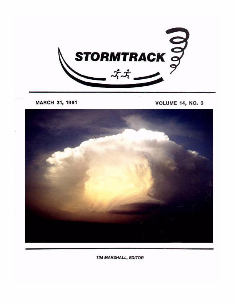
COVER: LP supercell near Wheeler, Texas on May 18, 1990. Photograph by EricEvenson.
Storm Track is a non-profit publication intended for the scientist and amateur alikewho share an avid interest in the acquisition and advancement of knowledge concerningsevere or unusual weather phenomena. It is published bi-monthly in Lewisville, Texas.David Hoadley founded the publication in 1977 and Gene Rhoden designed the currentcover. Anyone interested in copies of back issues should contact the editor.
Persons are encouraged to submit articles to STORMTRACK. Papers should be double-spaced and contain proper english. Photographs should be loose or lightly taped. Highcontrast photographs are preferred. Diagrams should be clear and legible. Allarticles will be reviewed by the editor.
STORM TRACK CLASSIFIEDS
Sell or swap your wares. Only 25c per word (20 word minimum @ $5), 100 word maximum @$25. Send your request for the next issue by May 15, 1991.
PILEOUS -- THE STORM CHASE ADVENTURES OF 1990....$34.95 postpaid. Meet the Storm ChaseTeam of Tim Dorr and Jack "Thunderhead" Corso. View 2 hours of video packed with realstorm chasing action and good times! See tornado funnels, hail, lightning, and blindingrains. Storms as seen across the U.S. from the midwest, thru the plains, to Florida. Onthe ground and in the air. Checks only. Payable to Jack Corso, P.O. Box 650, Harrison,NY 10528.
TORNADOES, LIGHTNING, SUPERCELL STORMS AND HAIL -- Free catalog now available ofweather videos and products. Write to: Warren Faidley, Weatherstock, P.O. Box 44124,Tucson, AZ 85733.
FOR SALE: ALDEN, 18 inch weather facsimile recorder. Copies satellite photos andweather maps. MUST SELL. Shawn Woolen, R.R. 1, Box 73, Wilcox, NE 68982. phone: 308-478-5473.
-----------------------------------CORRIGENDUM---------------------------------
Please note the following corrections found in the last issue of STORMTRACK.
In the Chaser News section, the motel in Norman is not the Dorchester Inn hut theWinchester Inn. You can make reservations to stay there during the Tornado Symposium at405-360-4380. There is another Winchester Inn in Moore, Oklahoma, located a few milesnorth of Norman on Interstate 35 at 405-794-5070. Both motels have reasonable rates(between $25-30) per night.
The date on the heading of page 8 should have read: April 25, 1990. Only the wedgetornado at the bottom of the page occurred on May 24, 1990. There were just too manywedges in Kansas last year![ Corrected in CD-ROM ]
March 31, 1991Tim Marshall1336 Brazos Blvd.Lewisville, Texas 75067
STORMTRACK$10.00/YR.
Volume 14, No. 3Bi-monthly
CHECKS PAYABLETO EDITOR ONLY
THE YEAR OF THE TORNADO SYMPOSIUMI. COMMENTARY
1991 will be remembered as the year of the tornado, or should I say the "TornadoSymposium". From April 2 through 5, scientists, chasers, and weather buffs will convergeat the Sheraton Inn in Norman, Oklahoma to present the latest findings and share some oftheir vast knowledge on tornadoes. It will he the largest gathering of vorticity ever! Thelast symposium was held in 1976, and a lot has happened since then. At the previoussymposium, the Union City tornado, and Super Outbreak of April 3, 1974 were "new" events.The F-scale was invented only five years earlier. Much has happened since in the overallstudy of storms, and computer technology.
Such a symposium is actually overdue since the amount of knowledge gained over the past 15years has increased almost too much. I would like to see such a symposium more regularly,say every 5 to 7 years. After all, there are such regular conferences on Severe LocalStorms, Hydrometeorology, Hurricanes, and Radar Meteorology.
II. CHASER NEWS
Eugene McCaul Jr. and David Blanchard have an excellent article in the December 1990Monthly Weather Review entitled: A Low-Precipitation Cumulonimbus Along the Dryline inColorado, pages 2768 to 2773. Other 1990 articles in Monthly Weather Review you may findinteresting are lead authored by Howie Bluestein: Thermodynamic Measurements under a WallCloud, March issue, pages 794-799, An Observational Study of Splitting Convective Clouds,June issue, pages 1359-1370, and Doppler Analysis of a LP Severe Storm, August issue,pages 1640-1664.
An article about the Plainfield, IL tornado disaster appears in the February issue ofReaders Digest.
Richard Keen is looking for a few good stories and photographs. He is currently writingtwo books, MINNESOTA WEATHER and ALASKA WEATHER. Those who have material in these states,please write Richard at 34296 Gap Road, Golden, CO 80403.
So you just saw a tornado and want to let STORM TRACK know? Just call the ST tornadohotline at 214-221-0372 and leave your message on the recorder. If home, I'll be more thanhappy to talk to you. Please identify yourself on the recorder first (after the tone) as Itry to screen out the half dozen solicitors or so who call our house each day. --TheEditor.
STORM TRACK continues to grow. This past year, ST saw a 10 percent increase in subscribersto 350, thanks mostly to periodic referencing in Weatherwise Magazine. For those of yourenewing your STORM TRACK subscription, please be sure to make your checks payable only toTim Marshall and not STORM TRACK. I do not have a separate account solely for thispublication and my bank is picky. THANKS-The Editor.
If there is ANY book a chaser should own in his or her lifetime, it is the historicalcompendium entitled: SIGNIFICANT TORNADOES: 1880-1989 by Thomas Grazulis, P.O. Box 302,St. Johnsbury, VT 05819. Write for price information.
Want a three-D, color severe storm on your television? A nine minute video entitled: Studyof a Nuaerically Modelled Severe Storm is available from NCSA, c/o Dr. Robert Wilhelmson,5251 Beckman Institute, 405 N. Mathews St., Urbana, Il. 61801. Price is $9.35 U.S., $15.53Canada, and $41.35 Europe.
A set of detailed highway maps can be obtained for the following states:
KANSAS: Dept. of Transportation, Topeka, KS 66612 ($15)NEBRASKA: Public Info., P.O. Box 94759, Lincoln, NE 68509 ($21)OKLAHOMA: Dept. of Transportation, OKC, ($55)TEXAS: The Roads of Texas, 406 Post Oak Rd., Fredericksburg, Tx 78624 ($15)NEW MEXICO: The Roads of New Mexico, same address as the Texas maps. ($15)
SKYWARN FOR ALL!!!- Carson Eads {N5LTN) states: "On December 13, 1990, history was made inthe amateur radio world. For the first time ever in the U.S., a person wanting to becomean amateur radio operator (ham), can now become one WITHOUT taking or learning MORSE CODE(CM). The code has been a stumbling block for many people obtaining a radio license. Thischange was announced by the FCC and became official on February 14, 1991 when first testswere administered. You must, however, learn the rules and regulations for operating. Thistest will consist of 55 multiple choice questions, 30 from the Novice level (pool of 372total) and 25 from the Technician level (pool of 326 total). You must answer 22 of the 30Novice correctly and 19 of the 25 Technician questions correctly in order to pass. Thiswill earn you a Technician class license which entitles you to all VHF/UHF operatingprivileges, 50 Mhz and up in frequency. Most skywarn nets are on the 2 meter band (144-148Mhz). Get your license and be part of these weather nets. You can help gain valuable chaseinformation and give information that can help issue warnings and save lives. The beststudy package on the market to get your license is available on PC disks and manuals onrules/regulations for $39.95 from : THE W5YI GROUP, P.O. Box 565101, Dallas, Texas 75356,phone: 1-800-669-9594.
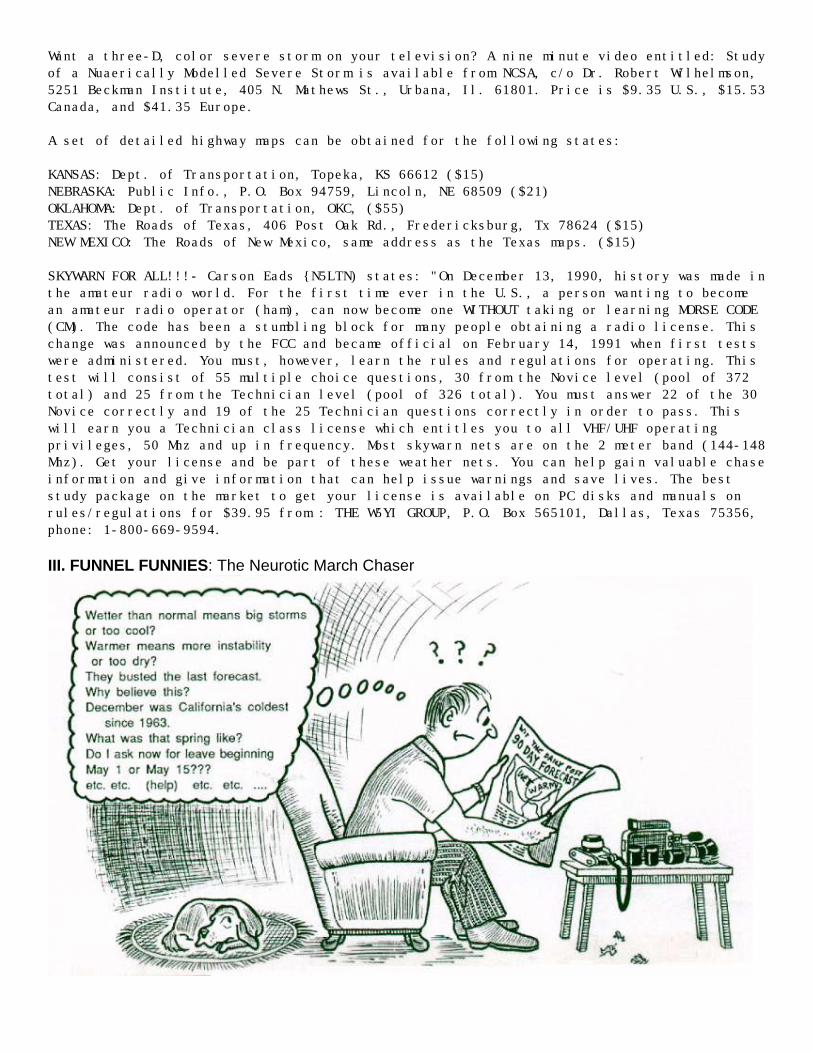
III. FUNNEL FUNNIES: The Neurotic March Chaser
IV. LETTERS TO THE EDITOR
Joel Ewing writes: "For years I've noticed during Arizona's "monsoon" season (July throughSeptember) that the most impressive echoes filled with "red blobs" show up on our eveningradar in a largely uninhabited area in south-central Arizona just north of the Mexicanborder. This area is generally flat and owned by one of the native American tribes. Theroads in that area are rough at hest, often requiring four wheel drive. I've long beensuspicious that tornadic thunderstorms might be occurring in this region. Mentioning thisto one of our local NOAA meteorologists at Warren Faidley's chase party, he becameinterested and went on to say that once in every three days during the monsoon season, theTucson radar shows hook echoes in that area. One storm top last year was measured to70,000 feet! Not long after that, I was reading in the local paper about an interview witha very old Indian women. Among the many subjects she touched on were summer storms. 'Theworst ones looked like they had snakes coming out of them', she said!! I'd love to hear aresponse from anyone who can shed some knowledge on what may be happening southwest ofTucson. Who knows, perhaps this is an undiscovered 'Hale County, Texas'.
Editor's note: I have made similar observations of storms south of the Texas border. Fromtime to time I've seen giant storms on satellite from just south of Laredo to Del Rio toSanderson. I know some of these have been tornadic.
Joel also mentions: "I was watching a few small but active Cb's grow and die this summerabout 2 miles from my home in Tucson, AZ. Suddenly, one Cb let loose with a thin veil ofprecipitation, almost as if someone hit the start button. The next thing I knew, a funnelextended out at an angle from the cloud base, appearing like the reverse letter "L",lasting about 3 minutes. Although the cloud top wasn't more than 25,000 ft., it formed astout funnel." Jon Davies says the Hesston, KS tornado continues to have a life of itsown. "Duane Steigler from the University of Chicago sent me his revised map of tornadotracks for the Hesston storm. His aerial survey identified five distinct tornado pathsextending from near Castleford to Wamego, KS."
Antonio Caridade sent a news clipping of a tornado which struck central Japan on December12, 1990. According to the Asahi Evening News, a tornado struck Mobara City around 7:20 pmshattering window panes at a hospital causing 26 injuries. Roof tiles and metal sheetswere sent flying into the air causing an additional 40 injuries.
V. ROSTER
The ST Roster lists names, addresses, and brief biographies of those persons interested inor willing to correspond with others about storms or chasing.
Tom Hoffmann, 2847 N. Bremen Street, Milwaukee, WI 53212 -- "I'm looking for a chasepartner for this year's trip to chase storms. Call or write."
Marty "VIP6" Feely, 1075 Space Park Way, #245, Mountain View, CA 94043 -- "I'm 37, andhave been chasing out of Norman, OK since 1984. I author the SPRING FEVER column in theAmerican Weather Observer. My chase vehicle is pushing 170,000 miles, so I am looking foran enthusiastic chase partner(s) with a car. Call me: 408-379-1850.
Dean Cosgrove, 109 Pine Log Lane Village, Fort Morgan, CO 80701 -- "Please place my newaddress in the Roster section of STORM TRACK."
Bruce Feingerts, 24921 Muirlands Bl., #45, El Toro, CA 92630 -- "I would like to meetpeople in thunderstorms, lightning, and tornadoes. Call me at: 714-587-9436.
SOUTHEAST FLORIDA HP SUPERCELL TORNADOES OF 15 JANUARY 1991by Roger Edwards
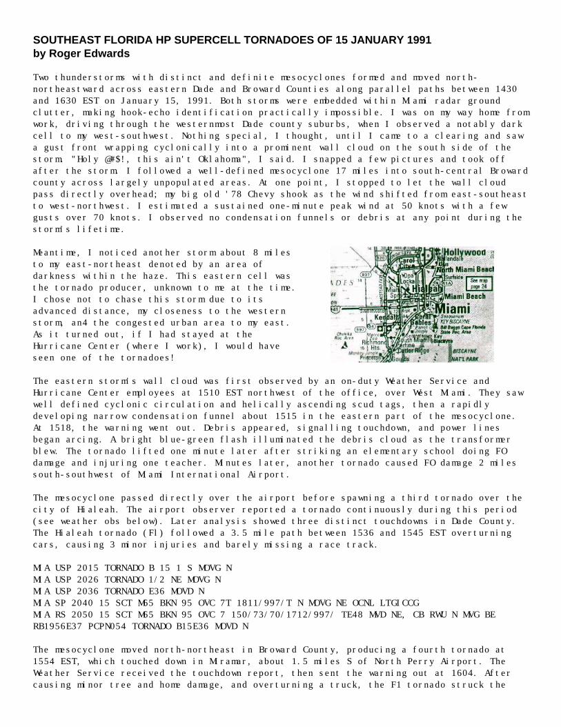
Two thunderstorms with distinct and definite mesocyclones formed and moved north-northeastward across eastern Dade and Broward Counties along parallel paths between 1430and 1630 EST on January 15, 1991. Both storms were embedded within Miami radar groundclutter, making hook-echo identification practically impossible. I was on my way home fromwork, driving through the westernmost Dade county suburbs, when I observed a notably darkcell to my west-southwest. Nothing special, I thought, until I came to a clearing and sawa gust front wrapping cyclonically into a prominent wall cloud on the south side of thestorm. "Holy @#$!, this ain't Oklahoma", I said. I snapped a few pictures and took offafter the storm. I followed a well-defined mesocyclone 17 miles into south-central Browardcounty across largely unpopulated areas. At one point, I stopped to let the wall cloudpass directly overhead; my big old '78 Chevy shook as the wind shifted from east-southeastto west-northwest. I estimated a sustained one-minute peak wind at 50 knots with a fewgusts over 70 knots. I observed no condensation funnels or debris at any point during thestorm's lifetime.
Meantime, I noticed another storm about 8 milesto my east-northeast denoted by an area ofdarkness within the haze. This eastern cell wasthe tornado producer, unknown to me at the time.I chose not to chase this storm due to itsadvanced distance, my closeness to the westernstorm, an4 the congested urban area to my east.As it turned out, if I had stayed at theHurricane Center (where I work), I would haveseen one of the tornadoes!
The eastern storm's wall cloud was first observed by an on-duty Weather Service andHurricane Center employees at 1510 EST northwest of the office, over West Miami. They sawwell defined cyclonic circulation and helically ascending scud tags, then a rapidlydeveloping narrow condensation funnel about 1515 in the eastern part of the mesocyclone.At 1518, the warning went out. Debris appeared, signalling touchdown, and power linesbegan arcing. A bright blue-green flash illuminated the debris cloud as the transformerblew. The tornado lifted one minute later after striking an elementary school doing FOdamage and injuring one teacher. Minutes later, another tornado caused FO damage 2 milessouth-southwest of Miami International Airport.
The mesocyclone passed directly over the airport before spawning a third tornado over thecity of Hialeah. The airport observer reported a tornado continuously during this period(see weather obs below). Later analysis showed three distinct touchdowns in Dade County.The Hialeah tornado (Fl) followed a 3.5 mile path between 1536 and 1545 EST overturningcars, causing 3 minor injuries and barely missing a race track.
MIA USP 2015 TORNADO B 15 1 S MOVG NMIA USP 2026 TORNADO 1/2 NE MOVG NMIA USP 2036 TORNADO E36 MOVD NMIA SP 2040 15 SCT M65 BKN 95 OVC 7T 1811/997/T N MOVG NE OCNL LTGICCGMIA RS 2050 15 SCT M65 BKN 95 OVC 7 150/73/70/1712/997/ TE48 MVD NE, CB RWU N MVG BERB1956E37 PCPN054 TORNADO B15E36 MOVD N
The mesocyclone moved north-northeast in Broward County, producing a fourth tornado at1554 EST, which touched down in Miramar, about 1.5 miles S of North Perry Airport. TheWeather Service received the touchdown report, then sent the warning out at 1604. Aftercausing minor tree and home damage, and overturning a truck, the F1 tornado struck the
airport. A total of 22 aircraft were destroyed. Hanger damage was limited to roofs, doorsand non-load bearing walls. The South Campus of Broward County Community College was hitnext causing one minor injury. Modular classrooms were heavily damaged, and a pre-fabricated metal gym was flattened. The tornado dissipated about 1605 EST after travelling2.5 miles.
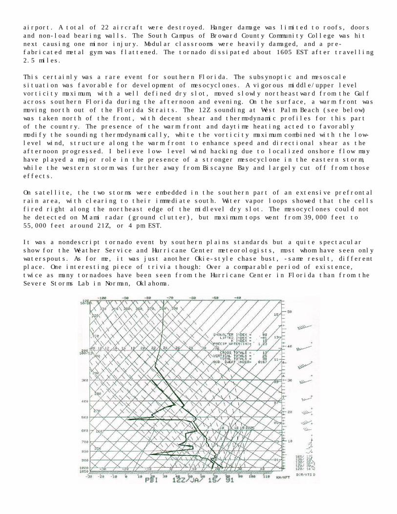
This certainly was a rare event for southern Florida. The subsynoptic and mesoscalesituation was favorable for development of mesocyclones. A vigorous middle/upper levelvorticity maximum, with a well defined dry slot, moved slowly northeastward from the Gulfacross southern Florida during the afternoon and evening. On the surface, a warm front wasmoving north out of the Florida Straits. The 12Z sounding at West Palm Beach (see below)was taken north of the front, with decent shear and thermodynamic profiles for this partof the country. The presence of the warm front and daytime heating acted to favorablymodify the sounding thermodynamically, white the vorticity maximum combined with the low-level wind, structure along the warm front to enhance speed and directional shear as theafternoon progressed. I believe low- level wind hacking due to localized onshore flow mayhave played a major role in the presence of a stronger mesocyclone in the eastern storm,while the western storm was further away from Biscayne Bay and largely cut off from thoseeffects.
On satellite, the two storms were embedded in the southern part of an extensive prefrontalrain area, with clearing to their immediate south. Water vapor loops showed that the cellsfired right along the northeast edge of the midlevel dry slot. The mesocyclones could nothe detected on Miami radar (ground clutter), but maximum tops went from 39,000 feet to55,000 feet around 21Z, or 4 pm EST.
It was a nondescript tornado event by southern plains standards but a quite spectacularshow for the Weather Service and Hurricane Center meteorologists, most whom have seen onlywaterspouts. As for me, it was just another Okie-style chase bust, -same result, differentplace. One interesting piece of trivia though: Over a comparable period of existence,twice as many tornadoes have been seen from the Hurricane Center in Florida than from theSevere Storms Lab in Norman, Oklahoma.
A NEW SEASON by David Hoadley
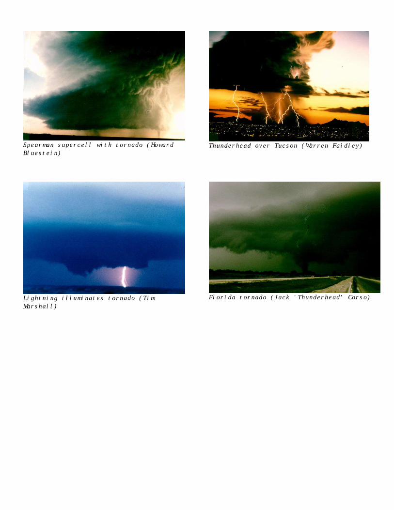
Spearman supercell with tornado (HowardBluestein)
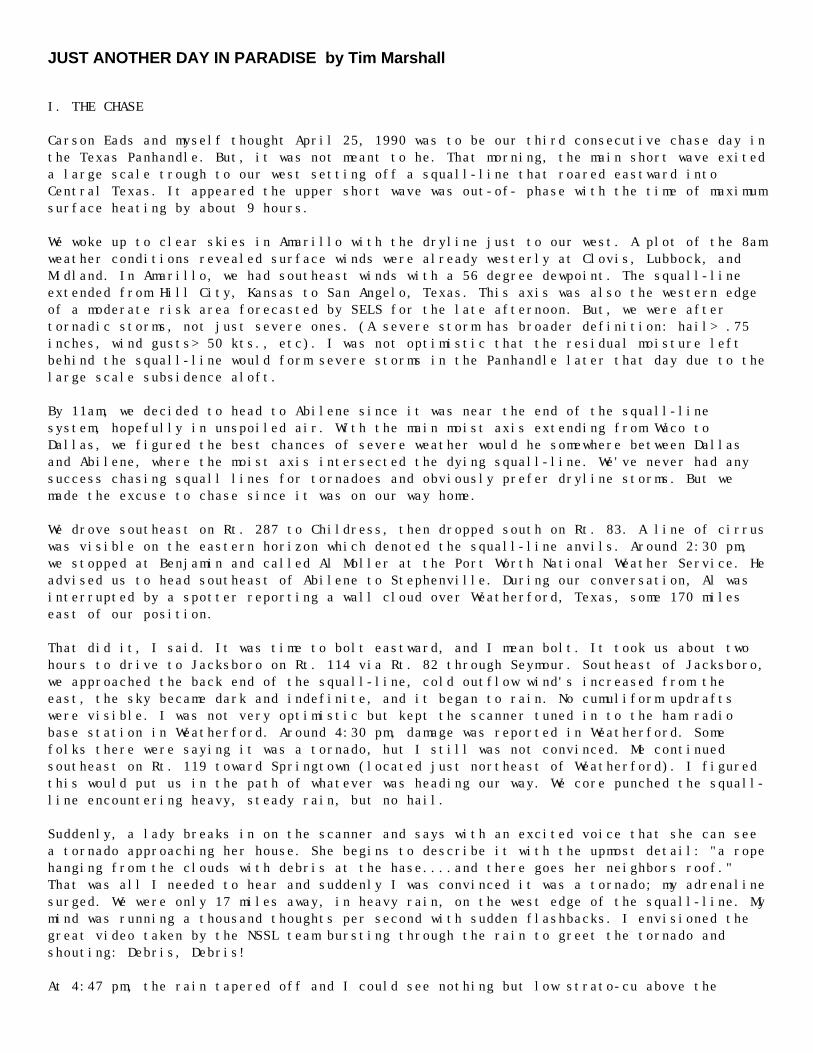
Thunderhead over Tucson (Warren Faidley)
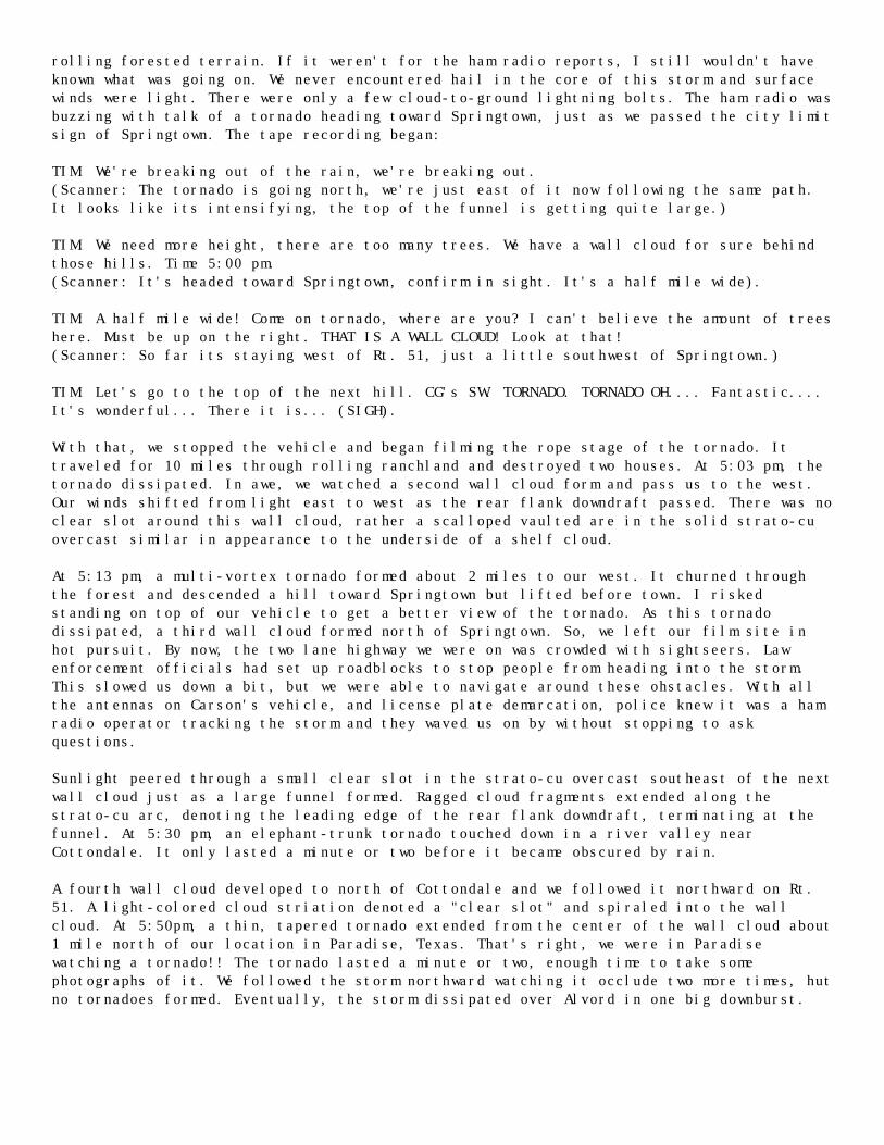
Lightning illuminates tornado (TimMarshall)
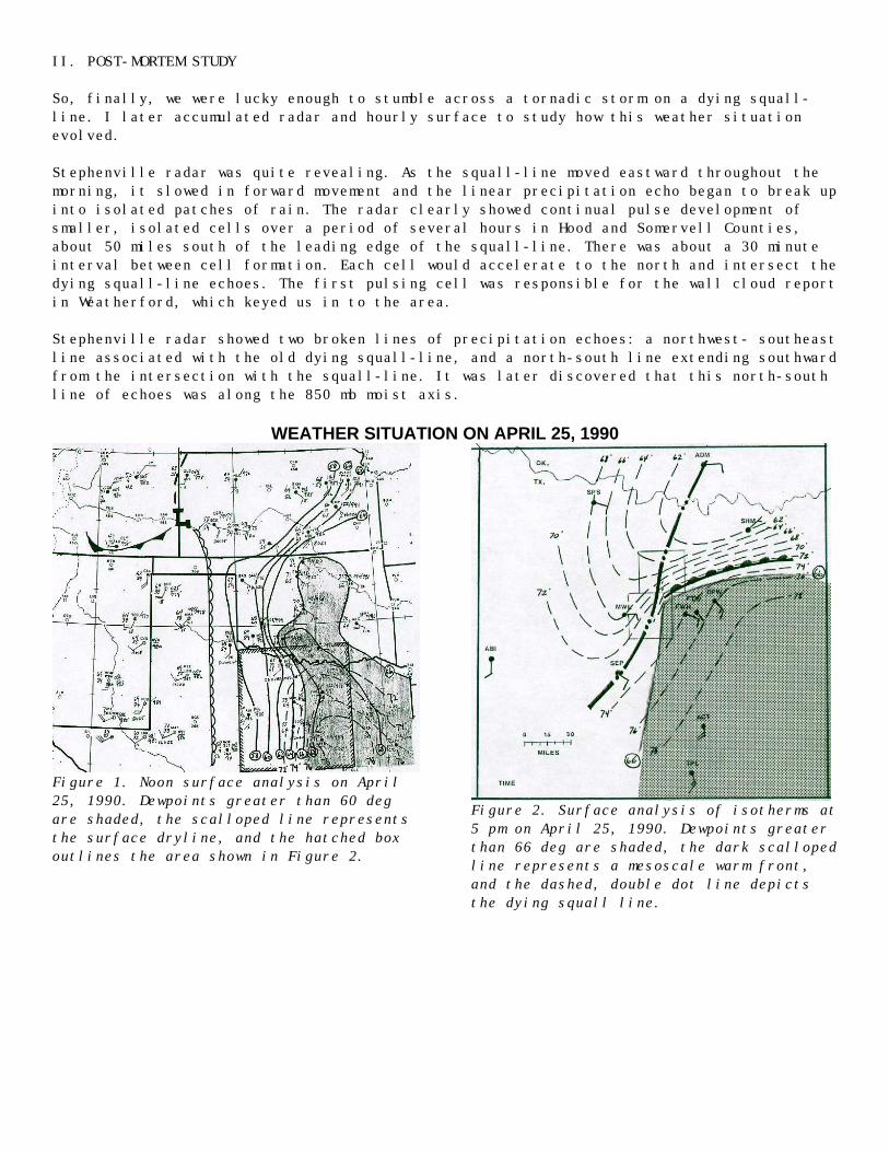
Florida tornado (Jack 'Thunderhead' Corso)
JUST ANOTHER DAY IN PARADISE by Tim Marshall
I. THE CHASE
Carson Eads and myself thought April 25, 1990 was to be our third consecutive chase day inthe Texas Panhandle. But, it was not meant to he. That morning, the main short wave exiteda large scale trough to our west setting off a squall-line that roared eastward intoCentral Texas. It appeared the upper short wave was out-of- phase with the time of maximumsurface heating by about 9 hours.
We woke up to clear skies in Amarillo with the dryline just to our west. A plot of the 8amweather conditions revealed surface winds were already westerly at Clovis, Lubbock, andMidland. In Amarillo, we had southeast winds with a 56 degree dewpoint. The squall-lineextended from Hill City, Kansas to San Angelo, Texas. This axis was also the western edgeof a moderate risk area forecasted by SELS for the late afternoon. But, we were aftertornadic storms, not just severe ones. (A severe storm has broader definition: hail> .75inches, wind gusts> 50 kts., etc). I was not optimistic that the residual moisture leftbehind the squall-line would form severe storms in the Panhandle later that day due to thelarge scale subsidence aloft.
By 11am, we decided to head to Abilene since it was near the end of the squall-linesystem, hopefully in unspoiled air. With the main moist axis extending from Waco toDallas, we figured the best chances of severe weather would he somewhere between Dallasand Abilene, where the moist axis intersected the dying squall-line. We've never had anysuccess chasing squall lines for tornadoes and obviously prefer dryline storms. But wemade the excuse to chase since it was on our way home.
We drove southeast on Rt. 287 to Childress, then dropped south on Rt. 83. A line of cirruswas visible on the eastern horizon which denoted the squall-line anvils. Around 2:30 pm,we stopped at Benjamin and called Al Moller at the Port Worth National Weather Service. Headvised us to head southeast of Abilene to Stephenville. During our conversation, Al wasinterrupted by a spotter reporting a wall cloud over Weatherford, Texas, some 170 mileseast of our position.
That did it, I said. It was time to bolt eastward, and I mean bolt. It took us about twohours to drive to Jacksboro on Rt. 114 via Rt. 82 through Seymour. Southeast of Jacksboro,we approached the back end of the squall-line, cold outflow wind's increased from theeast, the sky became dark and indefinite, and it began to rain. No cumuliform updraftswere visible. I was not very optimistic but kept the scanner tuned in to the ham radiobase station in Weatherford. Around 4:30 pm, damage was reported in Weatherford. Somefolks there were saying it was a tornado, hut I still was not convinced. Me continuedsoutheast on Rt. 119 toward Springtown (located just northeast of Weatherford). I figuredthis would put us in the path of whatever was heading our way. We core punched the squall-line encountering heavy, steady rain, but no hail.
Suddenly, a lady breaks in on the scanner and says with an excited voice that she can seea tornado approaching her house. She begins to describe it with the upmost detail: "a ropehanging from the clouds with debris at the hase....and there goes her neighbors roof."That was all I needed to hear and suddenly I was convinced it was a tornado; my adrenalinesurged. We were only 17 miles away, in heavy rain, on the west edge of the squall-line. Mymind was running a thousand thoughts per second with sudden flashbacks. I envisioned thegreat video taken by the NSSL team bursting through the rain to greet the tornado andshouting: Debris, Debris!
At 4:47 pm, the rain tapered off and I could see nothing but low strato-cu above the
rolling forested terrain. If it weren't for the ham radio reports, I still wouldn't haveknown what was going on. We never encountered hail in the core of this storm and surfacewinds were light. There were only a few cloud-to-ground lightning bolts. The ham radio wasbuzzing with talk of a tornado heading toward Springtown, just as we passed the city limitsign of Springtown. The tape recording began:
TIM: We're breaking out of the rain, we're breaking out.(Scanner: The tornado is going north, we're just east of it now following the same path.It looks like its intensifying, the top of the funnel is getting quite large.)
TIM: We need more height, there are too many trees. We have a wall cloud for sure behindthose hills. Time 5:00 pm.(Scanner: It's headed toward Springtown, confirm in sight. It's a half mile wide).
TIM: A half mile wide! Come on tornado, where are you? I can't believe the amount of treeshere. Must be up on the right. THAT IS A WALL CLOUD! Look at that!(Scanner: So far its staying west of Rt. 51, just a little southwest of Springtown.)
TIM: Let's go to the top of the next hill. CG's SW. TORNADO. TORNADO OH.... Fantastic....It's wonderful... There it is... (SIGH).
With that, we stopped the vehicle and began filming the rope stage of the tornado. Ittraveled for 10 miles through rolling ranchland and destroyed two houses. At 5:03 pm, thetornado dissipated. In awe, we watched a second wall cloud form and pass us to the west.Our winds shifted from light east to west as the rear flank downdraft passed. There was noclear slot around this wall cloud, rather a scalloped vaulted are in the solid strato-cuovercast similar in appearance to the underside of a shelf cloud.
At 5:13 pm, a multi-vortex tornado formed about 2 miles to our west. It churned throughthe forest and descended a hill toward Springtown but lifted before town. I riskedstanding on top of our vehicle to get a better view of the tornado. As this tornadodissipated, a third wall cloud formed north of Springtown. So, we left our film site inhot pursuit. By now, the two lane highway we were on was crowded with sightseers. Lawenforcement officials had set up roadblocks to stop people from heading into the storm.This slowed us down a bit, but we were able to navigate around these ohstacles. With allthe antennas on Carson's vehicle, and license plate demarcation, police knew it was a hamradio operator tracking the storm and they waved us on by without stopping to askquestions.
Sunlight peered through a small clear slot in the strato-cu overcast southeast of the nextwall cloud just as a large funnel formed. Ragged cloud fragments extended along thestrato-cu arc, denoting the leading edge of the rear flank downdraft, terminating at thefunnel. At 5:30 pm, an elephant-trunk tornado touched down in a river valley nearCottondale. It only lasted a minute or two before it became obscured by rain.
A fourth wall cloud developed to north of Cottondale and we followed it northward on Rt.51. A light-colored cloud striation denoted a "clear slot" and spiraled into the wallcloud. At 5:50pm, a thin, tapered tornado extended from the center of the wall cloud about1 mile north of our location in Paradise, Texas. That's right, we were in Paradisewatching a tornado!! The tornado lasted a minute or two, enough time to take somephotographs of it. We followed the storm northward watching it occlude two more times, hutno tornadoes formed. Eventually, the storm dissipated over Alvord in one big downburst.
II. POST-MORTEM STUDY
So, finally, we were lucky enough to stumble across a tornadic storm on a dying squall-line. I later accumulated radar and hourly surface to study how this weather situationevolved.
Stephenville radar was quite revealing. As the squall-line moved eastward throughout themorning, it slowed in forward movement and the linear precipitation echo began to break upinto isolated patches of rain. The radar clearly showed continual pulse development ofsmaller, isolated cells over a period of several hours in Hood and Somervell Counties,about 50 miles south of the leading edge of the squall-line. There was about a 30 minuteinterval between cell formation. Each cell would accelerate to the north and intersect thedying squall-line echoes. The first pulsing cell was responsible for the wall cloud reportin Weatherford, which keyed us in to the area.
Stephenville radar showed two broken lines of precipitation echoes: a northwest- southeastline associated with the old dying squall-line, and a north-south line extending southwardfrom the intersection with the squall-line. It was later discovered that this north-southline of echoes was along the 850 mb moist axis.
WEATHER SITUATION ON APRIL 25, 1990
Figure 1. Noon surface analysis on April25, 1990. Dewpoints greater than 60 degare shaded, the scalloped line representsthe surface dryline, and the hatched boxoutlines the area shown in Figure 2.
Figure 2. Surface analysis of isotherms at5 pm on April 25, 1990. Dewpoints greaterthan 66 deg are shaded, the dark scallopedline represents a mesoscale warm front,and the dashed, double dot line depictsthe dying squall line.
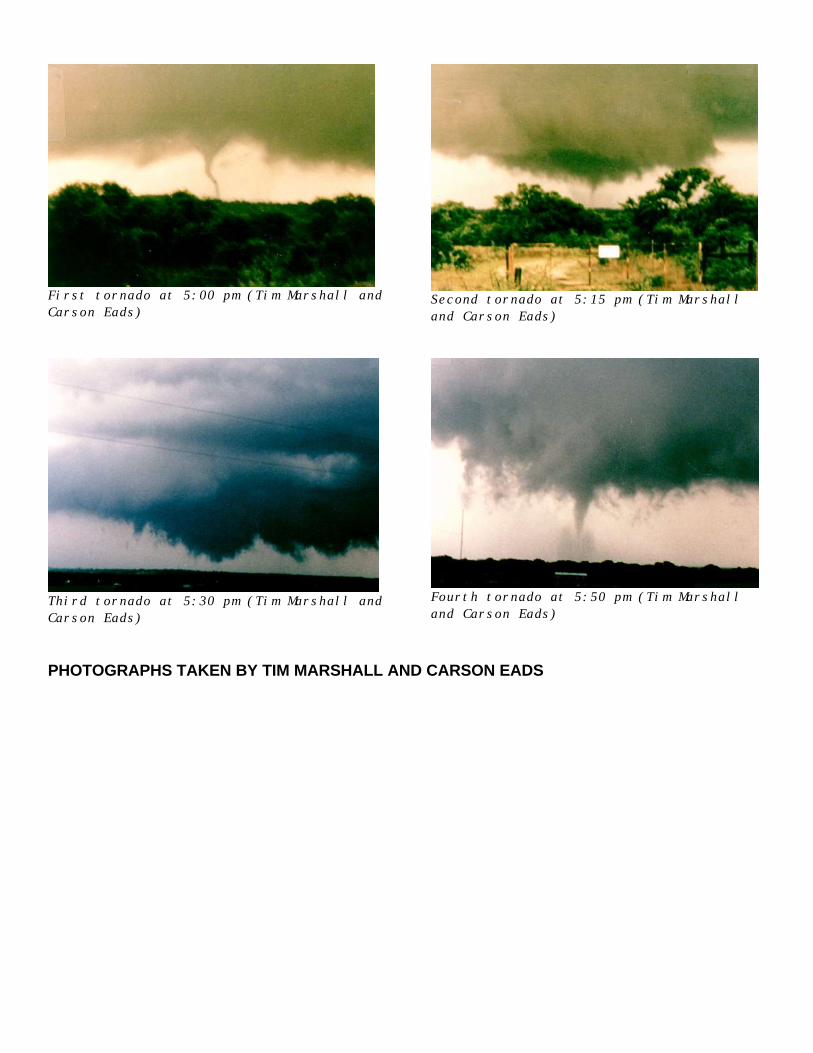
First tornado at 5:00 pm (Tim Marshall andCarson Eads)
Second tornado at 5:15 pm (Tim Marshalland Carson Eads)
Third tornado at 5:30 pm (Tim Marshall andCarson Eads)
Fourth tornado at 5:50 pm (Tim Marshalland Carson Eads)
PHOTOGRAPHS TAKEN BY TIM MARSHALL AND CARSON EADS

1990 CHASE SEASON by Dave Schaffer[ unabridged for CD-ROM ]
In 1990, after several discouraging years, tornadoes finally returned to Kansas. Many,however, were difficult to photograph because they occurred in fast-moving storms, afterdark, were partially obscured or occurred in low contrast conditions. Nonetheless, it wasa pretty good year to at least see tornadoes in Kansas, even if photography was a problem.Interestingly, the best chases of 1990 occurred outside of Kansas and those did yieldpictures.
The 1990 chase season kicked off here on March 11th. I remarked to several fellow chaserson the 10th that north central Kansas looked like the best place to chase the next day.Unfortunately, I was on duty on the 11th so I had to be content to observe an unusuallysmall storm on radar as it produced tornado after tornado as tracking from south centralto north central Kansas. My fellow chasers went to north Texas but that was a rainy messdespite several tornado watches. Incredibly, as they returned through central Oklahema,they saw the Kansas storm go up and roared north in only two hours in time to see thestorm produce its last funnels near Salina.
On the morning of March 13, I went on the air at KAKE with a tornado warning for westernKansas before an ominous lull occurred in severe activity. Dynamics were great and therewas a tremendous push in the dry air over western Kansas with winds gusting from thesouthwest up to 55 mph. The cloud deck moved off the dry line and allowed solar heating ofthe moist air just east of the dry line.
At about three p.m. a single storm formed near Medicine Lodge. I went home, grabbed myfifa and took off west to meet the storm. But it was moving fast and got ahead of us. Awild three hour chase ensued. It was incredible! We saw obvious precipitation hooks, thefirst tornado touchdown, several multiple vortex funnels and two other tornadoes. Weobserved tornadoes off and on for two hours, despite serious trouble with closed roads.This was the day an F4 tornado hit Hesston, Kansas. We saw that tornado near Haven,Kansas, before it got to Hesston and it was bigger and looked stronger than it did when ithit Hesston.
Most of April and May consisted mixed results. I observed several tornadoes and numerousfunnel clouds but didn't garner many good pictures. Had three chases start with very goodforecasting but was unable to close with tornadic storms because they were moving toofast. Had at least 600 fruitless miles listening to tornado reports on the radio in stormsjust out of reach.
Another fruitless day occurred when I went to Oklahoma and a tornado touched down just afew miles north of Wichita. Ouch! Then forecast so well a subsequent day that all I didwas drive right to where the first storm started. But after a while there was more thanone storm. I picked the one with an FO. Another storm to the east produced a huge tornadonear Bushton, Kansas. Ahggggg!
Another frustrating episode occurred when calls started coming in to KAKE's sister stationin southwest Kansas about tornadoes. Our radar in Wichita showed a clear scope and thelatest satellite image a cloudless sky. But storms can occur out of radar range or underthe radar beam and satellite pictures aren't current. We called the operator of theNational Weather Service radar in Garden City who told us that there were no storms in thearea. A short time later we found out that there was a storm and it was producingtornadoes. Luckily, no one was killed because of this lapse. I embarked on a furious 3hour chase that culminated in observing a tornado just before dark at a distance of about5 miles. I had to drive under a funnel cloud to do it but I was beyond caring at thatpoint.
I spent several days moaning about how I wasn't ever going to get a good look at atornado. Then came the great chase in Chase county, Kansas. I saw several tornadoes and abushel basket of funnels. But Chase county is in the Flint hills and good roads are few. Igot cornered when a muddy one-lane "road" ended in a hilltop cow pasture with a funnelclose behind. There weren't evan any ditches to hop into. I watched the funnel slide by,shrouded in rain, a quarter mile away. About an hour later, this time on a paved road, arotating wall cloud approached. But the road was narrow and had no shoulder. As I inchedaround and headed the other way the wind suddenly began to rock the car and make oddwhirring noises. The swirl of a FO tornado went across the road just in front of the car.I stopped, unrolled the window and looked up. A long, thin, gray funnel was hanging out ofthe circular, rotating wall cloud directly overhead.
Interestingly, I heard the same whirring sound just west of Fort Worth at night whilestopped at the side of the road in golf ball size hail. A tornado and baseball size hailhad been reported nearby a short time earlier. Luckily, I got out of that with only a fewhail dents and a cracked windshield. But I didn't get many pictures.
I finally got a few tornado pictures when I got off work at 7 p.m. one day in mid May anddrove right to a severe storm just 45 miles south southwest of Wichita (wish all chasescould be this economical). However, I still had no really good tornado pictures or a long,undisturbed look at one. But all that changed an two fabulous, back to back chases.
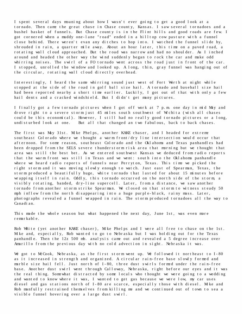
The first was May 31st. Mike Phelps, another KAKE chaser, and I headed for extremesoutheast Colorado where we thought a warm front/dry line intersection would occur thatafternoon. For some reason, southeast Colorado and the Oklahoma and Texas panhandles hadbeen dropped from the SELS severe thunderstorm risk area that morning but we thought thatarea was still the best bet. As we entered southwest Kansas we deduced from radio reportsthat the warm front was still in Texas and we went: south into the Oklahoma panhandlewhere we heard radio reports of funnels near Perryton, Texas. This time we picked theright storm and it was moving slowly enough to watch. Just east of Spearman, Texas, thestorm produced a beautifully huge, white tornado that lasted for about 15 minutes beforewrapping itself in rain. Oddly, this tornado occurred on the north side of the storm, avisibly rotating, banded, dry-line supercell. Later, from a distance, we saw anothertornado from another storm strike Spearman. We closed on that storm to witness steady 50mph inflow from the north disappearing into a huge purple-black, rainy mass. Later,photographs revealed a funnel wrapped in rain. The storm produced tornadoes all the way toCanadian.
This made the whole season but what happened the next day, June 1st, was even moreremarkable.
Rob White (yet another KAKE chaser), Mike Phelps and I were all free to chase on the 1st.Mike and, especially, Rob wanted to go to Nebraska but I was holding out for the Texaspanhandle. Then the 12z 500 mb. analysis came out and revealed a 5 degree increase overAmarillo from the previous day with no cold advection in sight. Nebraska it was.
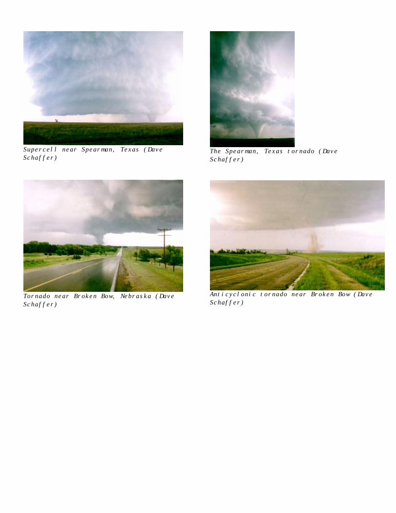
We got to McCook, Nebraska, as the first storm went up. We followed it northeast to I-80as it increased in strength and organized. A circular rain-free base slowly formed andmarble size hail fell. Just north of I-80, three dust swirls formed under the rain-freebase. Another dust swirl went through Calloway, Nebraska, right before our eyes and it wasthe real thing. Somewhat distracted by some locals who thought we were going to a weddingand wanted to know where it was, I wanted to get gas because we were low, my car usesdiesel and gas stations north of I-80 are scarce, especially those with diesel. Mike andRob manfully restrained themselves from killing me and we continued out of town to sea avisible funnel hovering over a large dust swirl.
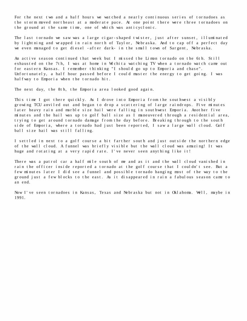
For the next two and a half hours we watched a nearly continuous series of tornadoes asthe storm moved northeast at a moderate pace. At one point there were three tornadoes onthe ground at the same time, one of which was anticyclonic.
The last tornado we saw was a large cigar-shaped twister, just after sunset, illuminatedby lightning and wrapped in rain north of Taylor, Nebraska. And to cap off a perfect daywe even managed to get diesel -after dark- in the small town of Sargent, Nebraska.
An active season continued that week but I missed the Limon tornado on the 6th. Stillexhausted on the 7th, I was at home in Wichita watching TV when a tornado watch came outfor eastern Kansas. I remember thinking "I should go up to Emporia and chase".Unfortunately, a half hour passed before I could muster the energy to get going. I washalfway to Emporia when the tornado hit.
The next day, the 8th, the Emporia area looked good again.
This time I got there quickly. As I drove into Emporia from the southwest a visiblygrowing TCU anviled out and began to drop a scattering of large raindrops. Five minuteslater heavy rain and marble size hail were falling in southwest Emporia. Another fiveminutes and the hail was up to golf ball size as I maneuvered through a residential area,trying to get around tornado damage from the day before. Breaking through to the southside of Emporia, where a tornado had just been reported, I saw a large wall cloud. Golfball size hail was still falling.
I settled in next to a golf course a bit farther south and just outside the northern edgeof the wall cloud. A funnel was briefly visible but the wall cloud was amazing! It washuge and rotating at a very rapid rate. I've never seen anything like it!
There was a patrol car a half mile south of me and as it and the wall cloud vanished inrain the officer inside reported a tornado at the golf course that I couldn't see. But afew minutes later I did see a funnel and possible tornado hanging most of the way to theground just a few blocks to the east. As it disappeared in rain a fabulous season came toan end.
Now I've seen tornadoes in Kansas, Texas and Nebraska but not in Oklahoma. Well, maybe in1991.
Supercell near Spearman, Texas (DaveSchaffer)
The Spearman, Texas tornado (DaveSchaffer)
Tornado near Broken Bow, Nebraska (DaveSchaffer)
Anticyclonic tornado near Broken Bow (DaveSchaffer)