dam safety phase ii report: project definition options
TRANSCRIPT

OSHPC BARKI TOJIK TECHNO-ECONOMIC ASSESSMENT STUDY FOR ROGUN HYDROELECTRIC CONSTRUCTION PROJECT
Dam Safety Part 1: Basic data & Dam Design
Phase II Report: Project Definition Options

TECHNO-ECONOMIC ASSESSMENT STUDY FOR ROGUN HYDROELECTRIC CONSTRUCTION PROJECT
2
• Geology / Geotechnics ..….:
• Tectonics / Seismicity …………:
• DAM Design
• - Dam Location
• - Type of Dam
• - Dam Stability
• Hydrology ………………………………:
• DAM Protection
• - Flood Evacuation Organs
DAM Safety
Part 1
Part 2

TECHNO-ECONOMIC ASSESSMENT STUDY FOR ROGUN HYDROELECTRIC CONSTRUCTION PROJECT
3
PAMIR JURASIC
0 100 200 300 400 500 km
Site geology

TECHNO-ECONOMIC ASSESSMENT STUDY FOR ROGUN HYDROELECTRIC CONSTRUCTION PROJECT
4 Site geology

TECHNO-ECONOMIC ASSESSMENT STUDY FOR ROGUN HYDROELECTRIC CONSTRUCTION PROJECT
Site geology - Faults
• IONAKSH fault, GULIZINDAN fault
• Rooted in the Jurassic salt layer, salt wedges extruded in the hanging wall
• Oriented NE-SW, steep dip SE, SE bloc thrusts over NW bloc
• Fault zone acts as hydraulic barrier in the upstream – downstream direction, except for the residual cap above the salt wedges
• IONAKSH fault – medium-high permeability measured in BH-DZ1 in the atypical zone, at elevation 1450 (150 m above the FSL)
Regional thrust faults within the Tajik Depression unit
5

TECHNO-ECONOMIC ASSESSMENT STUDY FOR ROGUN HYDROELECTRIC CONSTRUCTION PROJECT
Site geology - Faults
Local faults
Antithetic faults: dip opposite to the main thrusts
Fault no.35, Fault no.70
The main discontinuity system (S4) has similar attitude
Faults and discontinuities cross the dam foundation and the tunnels
The PH cavern is tackled by the zone of influence of F no.35 and is crossed by S4
discontinuities
Other faults
Fault no.28, near parallel with bedding, steep dip, in the area of the outlets and
downstream pool
Fault no.367, near perpendicular to the bedding strike, steep dip, upstream, cut
by Ionaksh fault. Tackles the upstream cofferdam.
6
TECHNO-ECONOMIC ASSESSMENT STUDY FOR ROGUN HYDROELECTRIC CONSTRUCTION PROJECT
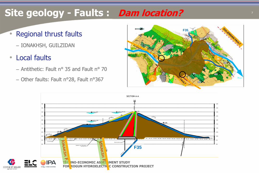
Site geology - Faults : Dam location?
• Regional thrust faults
– IONAKHSH, GUILZIDAN
• Local faults
– Antithetic: Fault n° 35 and Fault n° 70
– Other faults: Fault n°28, Fault n°367
7
F35
F35
TECHNO-ECONOMIC ASSESSMENT STUDY FOR ROGUN HYDROELECTRIC CONSTRUCTION PROJECT
8
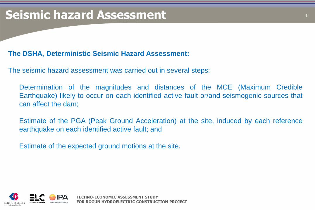
The DSHA, Deterministic Seismic Hazard Assessment:
The seismic hazard assessment was carried out in several steps:
Determination of the magnitudes and distances of the MCE (Maximum Credible
Earthquake) likely to occur on each identified active fault or/and seismogenic sources that
can affect the dam;
Estimate of the PGA (Peak Ground Acceleration) at the site, induced by each reference
earthquake on each identified active fault; and
Estimate of the expected ground motions at the site.
Seismic hazard Assessment

TECHNO-ECONOMIC ASSESSMENT STUDY FOR ROGUN HYDROELECTRIC CONSTRUCTION PROJECT
9 Estimate of Maximum Credible Earthquake (MCE)
TECHNO-ECONOMIC ASSESSMENT STUDY FOR ROGUN HYDROELECTRIC CONSTRUCTION PROJECT
10
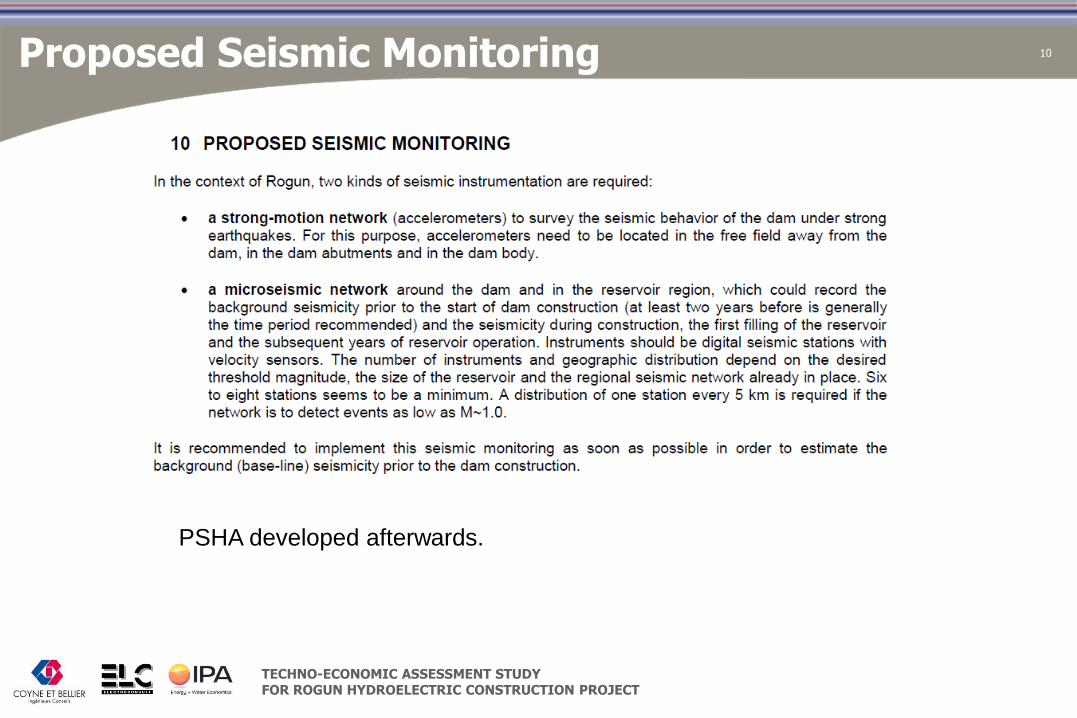
PSHA developed afterwards.
Proposed Seismic Monitoring

TECHNO-ECONOMIC ASSESSMENT STUDY FOR ROGUN HYDROELECTRIC CONSTRUCTION PROJECT
11
Some typical results
Dam stability – Results of dynamic analysis

TECHNO-ECONOMIC ASSESSMENT STUDY FOR ROGUN HYDROELECTRIC CONSTRUCTION PROJECT
12
Dam stability: conclusions:
The Rogun dam stability is governed by the seismic load case.
Dam slopes have been found to be sufficient to ensure the dam stability.
Large horizontal displacements call for widening (d ≥ 10 m) filter and transition sections
in order to ensure function continuity even in the case of the MCE.
Freeboard should be enough to accommodate maximum settlement (s ≈ 1.5 % for MCE).
Special care should be given to the upper 50m of the dam, by placing there rock fill that
has a higher friction angle than alluvium.
Further studies for design optimization:
3D geometry: S-shaped valley and steep banks: arch effects and stress reorientation.
Elasto-plastic, non-linear material: permanent displacements and excess pore pressure.
Dam stability - conclusions

TECHNO-ECONOMIC ASSESSMENT STUDY FOR ROGUN HYDROELECTRIC CONSTRUCTION PROJECT
13 Dam cross section
Original Design
TEAS-Consortium design (FSL 1290)
71.4 Mm3
73.6 Mm3
- Cofferdam crest heightened.
- Water tightening arrangements
for PC+CD+S1 improved.
- More frictional material in critical
areas.
- Filter widths enlarged.

TECHNO-ECONOMIC ASSESSMENT STUDY FOR ROGUN HYDROELECTRIC CONSTRUCTION PROJECT
Slope stability – General considerations
Rock falls
Frequent occurrence, mainly a threat to safety of workers
Recommended: cleaning, rock bolts, wire meshes and monitoring
Landslides involving Quaternary deposits
Well identified since the early stages
Standard mitigation measures are recommended to prevent their development (drainage, reshaping the slopes, retention structures)
Landslides controlled by structural discontinuities
Left Bank
Downstream Right Bank
14

TECHNO-ECONOMIC ASSESSMENT STUDY FOR ROGUN HYDROELECTRIC CONSTRUCTION PROJECT
15
Right Bank Disturbed Zone

TECHNO-ECONOMIC ASSESSMENT STUDY FOR ROGUN HYDROELECTRIC CONSTRUCTION PROJECT
"DISTURBED ZONE" OF RIGHT BANK
• Atypical morphology of the upper right bank
– Large flat plateau exhibiting karstic features
– Former investigations did not extend to this zone (apart from some seismic survey in 2005)
– Interpreted as the result of old landslides according to previous studies (up to 900Mm³!)
• Reveals to be of tectonic origin (see Geological Report)
16 Right Bank Disturbed Zone

TECHNO-ECONOMIC ASSESSMENT STUDY FOR ROGUN HYDROELECTRIC CONSTRUCTION PROJECT
17
Salt Wedge

TECHNO-ECONOMIC ASSESSMENT STUDY FOR ROGUN HYDROELECTRIC CONSTRUCTION PROJECT
Top of salt wedge 952-970 masl, close to the GWL
Thickness increasing 15 m / 100 m depth
Base of the salt layer at Rogun HPP site ~2000 m below the river level
The salt wedge is watertight, but the residual cap is locally permeable
Extrusion rate of salt wedge is estimated at 2.5 cm/year
Site geology – Salt wedge 18

TECHNO-ECONOMIC ASSESSMENT STUDY FOR ROGUN HYDROELECTRIC CONSTRUCTION PROJECT
Seepage modelling: results
Same graphical scale.
Same scale of equipotentials
19

TECHNO-ECONOMIC ASSESSMENT STUDY FOR ROGUN HYDROELECTRIC CONSTRUCTION PROJECT
• Remedial measures are needed to manage the potential dam safety and sustainability risks of the salt wedge
• Measures should include both grouting of the cap rock and hydraulic barrier.
• Adequate monitoring to detect any loss of efficiency and ensure timely maintenance
• These two measures are sufficient to ensure that the salt wedge dissolution does not endanger the integrity and function of the dam
• The costs of these measures have been estimated and appropriately included in the economic analysis of the proposed project
20 Salt wedge: conclusions
TECHNO-ECONOMIC ASSESSMENT STUDY FOR ROGUN HYDROELECTRIC CONSTRUCTION PROJECT
21
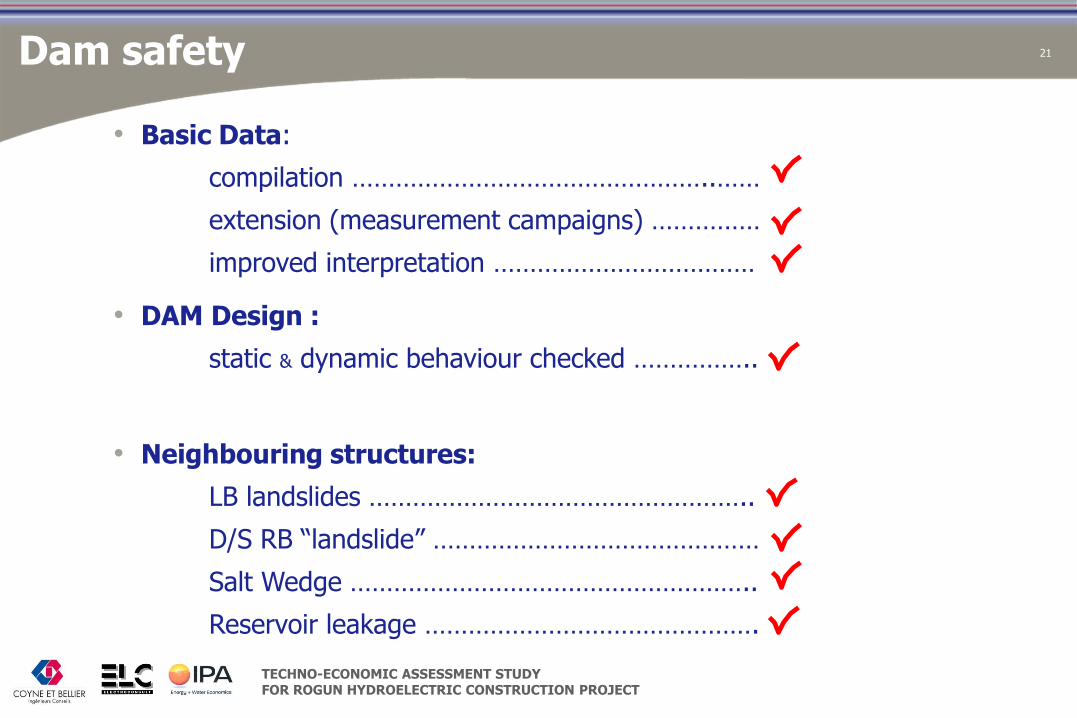
• Basic Data:
compilation …………………………………………..……
extension (measurement campaigns) ……………
improved interpretation ………………………………
• DAM Design :
static & dynamic behaviour checked ……………..
• Neighbouring structures:
LB landslides ……………………………………………..
D/S RB “landslide” ………………………………………
Salt Wedge ………………………………………………..
Reservoir leakage ……………………………………….
Dam safety

TECHNO-ECONOMIC ASSESSMENT STUDY FOR ROGUN HYDROELECTRIC CONSTRUCTION PROJECT
22
Thank you !