danapur village hospet taluk bellary … vist presentations/danapur.pdf · myths, male child...
TRANSCRIPT

DANAPUR VILLAGE HOSPET TALUK
BELLARY DISTRICT KARNATAKA
04/11/2013 TO 10/11/2013
Presented By Ms. Rashmi, IRS (C&CE) (SGL)
Dr. Sanchit Tyagi, IRTS Mr. Warkad Yogesh, IFoS
Dr. Amanpreet Kaur Walia, IRS (IT)

Karnataka
Bellary

DANAPUR VILLAGE COORDINATES: 15.28N 76.37E
HOBLI: MARIAMANAHALLI
TALUK:HOSPET
DISTRICT : BELLARY
POPULATION:
2001 CENSUS: 1599
PRESENT: 2156 (year 2013)
COMPOSITION: SC, NAYAKS, LINGAYATS,MUSLIM,
OTHERS
SEX RATIO: 974
LITERACY RATE: 70%
GOVERNMENT: GRAM PANCHAYAT HEADED BY
4 REVENUE VILLAGES AND 3 HAMLETS
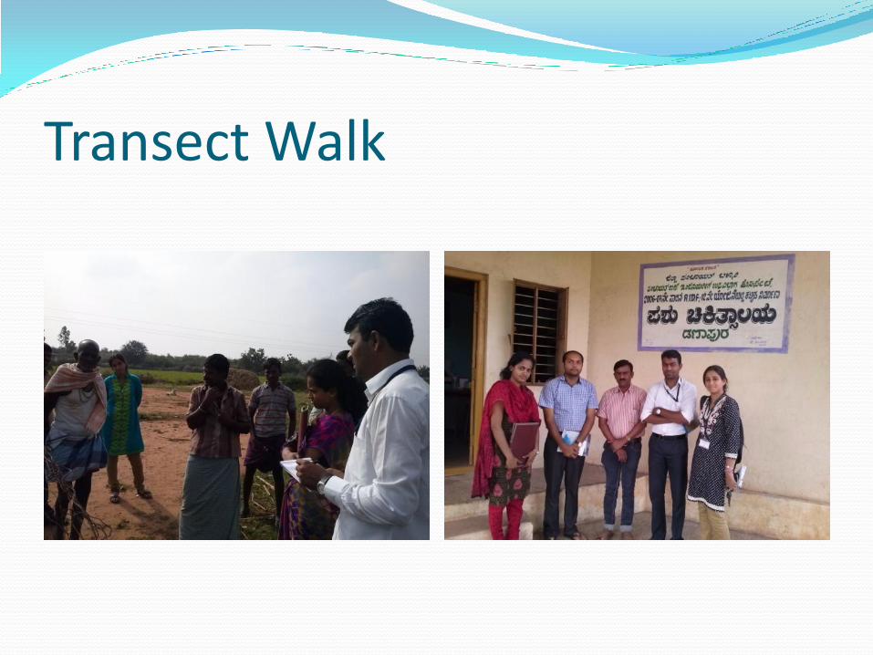
Transect Walk
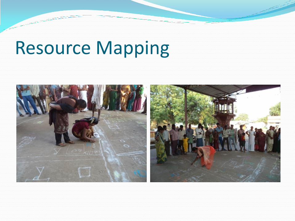
Resource Mapping

Resource Map

Social Map
SC colony
Muslims Nayaks
Lingayats

Medieval Period The village was said to be a part of the Vijayanagara Empire
Modern Period It was a part of British Empire
Ishwar nama samvatsar Establishment of the village
1913 Paddy cultivation, sugarcane
1943 Maize cultivation
1942 Dam was constructed
1953 Cloud burst – flood animal
1960 School
1963 Drought
1970 Electricity
1980 Rangamandir/Open air Auditorium
1986 Credit society/PDS, Panchayat Office was started during Mandal Panchayat
1987 Anganwadi
1993 Veterinary hospital
1998 Sub-health centre
2001 BMM factory
2003 MYRADA
2010 2010 toilets toilet
2011 Tractors
2012 filtration plant by MSPL, community hall, drainage system
2013 high school
TIMELINE

INFRASTRUCTURE
Roads: All weather CC roads; well connected
Panchayat Bhawan: well maintained; digitally connected.
Drinking Water: 2 overhead tanks, piped water supply, RO plant by MSPL
PHC/Hospitals: well functioning veterinary hospital
Electricity: good electric power supply
School: primary and higher secondary
Recreation: community hall
Other: library, defunct computer centre
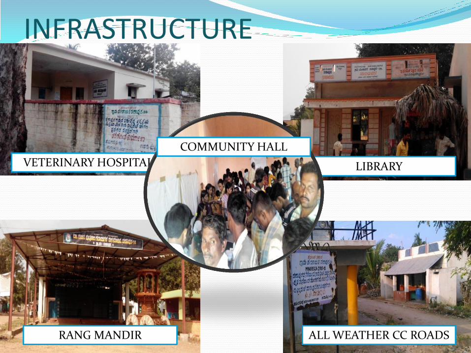
VETERINARY HOSPITAL LIBRARY
ALL WEATHER CC ROADS RANG MANDIR
COMMUNITY HALL
INFRASTRUCTURE

EDUCATION PHYSICAL INFRASTRUCTURE: Primary and high school, 3
Anganwadis
Well maintained and furnished, adequate, accessible and gender sensitive
HUMAN RESOURCE: 7 teachers for primary school, 7 for high school, 3 anganwadi workers
Student teacher ratio: 1:41
STUDENTS’ PROFILE: Primary school:288,Secondary school: 80
Enrollment is across communities and different sections of society
• MID-DAY MEAL: Akshay Patra model
Hygienic, adequate and well prepared according to requirements of balanced diet

INSIDE SCHOOL

•TEACHING METHODOLOGY: Visual aids and learning by doing •RELATION BETWEEN ANGANWADI AND SCHOOL: The crucial link is weak. •NON ENROLLEMENT AND DROP-OUTS: 1 drop-out each from 1-5 classes; 3 boys and 2 girls Migration was most common cause followed by family issues • SDMC( School Drop-out monitoring committee) The problem of non enrollment is very low as people identify with school.
EDUCATION(contd.)

LEARNING BY DOING

Agriculture

GROUNDNUT PADDY AMONGST FALLOW LAND
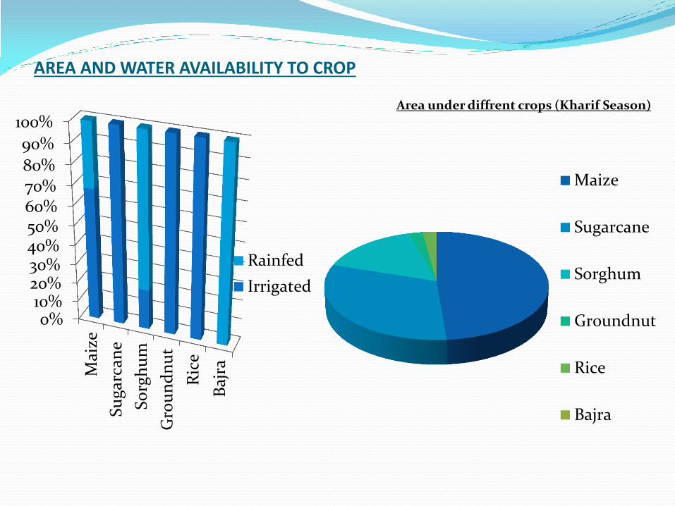
AREA AND WATER AVAILABILITY TO CROP
Area under diffrent crops (Kharif Season)
Maize
Sugarcane
Sorghum
Groundnut
Rice
Bajra
0%10%20%30%40%50%60%70%80%
90%
100%
Mai
ze
Su
gar
can
e
So
rgh
um
Gro
un
dn
ut
Ric
e
Baj
ra
Rainfed
Irrigated
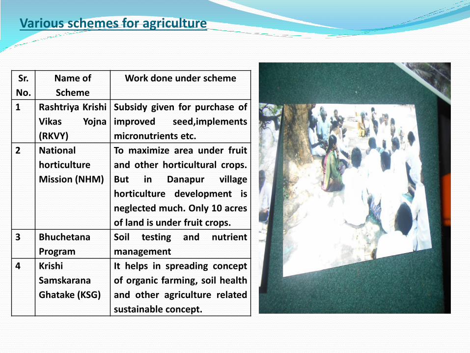
Various schemes for agriculture
Sr.
No.
Name of
Scheme
Work done under scheme
1 Rashtriya Krishi
Vikas Yojna
(RKVY)
Subsidy given for purchase of
improved seed,implements
micronutrients etc.
2 National
horticulture
Mission (NHM)
To maximize area under fruit
and other horticultural crops.
But in Danapur village
horticulture development is
neglected much. Only 10 acres
of land is under fruit crops.
3 Bhuchetana
Program
Soil testing and nutrient
management
4 Krishi
Samskarana
Ghatake (KSG)
It helps in spreading concept
of organic farming, soil health
and other agriculture related
sustainable concept.

Seasonality Map

HEALTH ISSUES PREVALENT HEALTH PROBLEMS: Respiratory ailments,
malaria, dengue, typhoid, TB, HIV/AIDS
INFRASTRUCTURE: defunct sub centre , well functioning
PHC 2 km away, transport facility available
HUMAN RESOURCE: 1ANM, 3 ASHAs, 3AWWs
DRINKING WATER AVAILABILITY : RO water not
extensively used, piped water for rest
SANITATION : 50% IHHL, delays in NBA, resistance to
change

Health WASTE MANAGEMENT: no solid and liquid waste
management plan
MATERNAL AND CHILD HEALTH : Zero maternal
mortality, 1 infant death for 58 live births.
IMMUNIZATION:50% in totality but extensive for polio
MALNUTRITION: grade 2 and 3 are most prevalent
FAMILY PLANNING: terminal method more common;
myths, male child preference, family dynamics, non involvement of women in decision making leads to low acceptance.


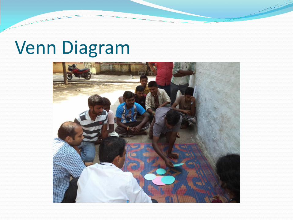
Venn Diagram

General community

Backward communities

Poverty and Unemployment Poverty Profile of the Village – 375 out of 436 households
were under BPL (PDS data) People’s Perception of Poverty – landlessness, houseless,
lack of access to comforts Our Observations - Poverty was multi-dimensional (a combination of amenities and thatched
houses) - Poverty was cross community - Poverty was conspicuous in women headed households - Unemployment – lands were sold to factories, and the money was exhausted –
hence, land, no job - People’s preference for easy jobs and dependence on government - Addicted to vices
Focus group Interview

Preference Ranking

Preference Ranking

Poverty Alleviation Programmes MGNREGA – less enrollment, less awareness, defective selection of
works
Indira Awaas Yojana/Basava Vasati Yojana – skewed selection of
beneficiaries and delay in fund disbursal
Public Distribution System – functioning effectively, but inclusion of
ghost beneficiaries
Indira Gandhi National Old Age Pension Scheme – good
delivery of funds but with a pinch of corruption
Self Help Groups (SHG) – performing well, scope for further expansion
Role of MYRADA – appreciative in SHG, scope for involvement in
watershed management

Positives
Good geographical
location
Good infrastructure
Prompt delivery of goods from
government side
Grey Areas
Lack of unity among people
Lack of motivation from
within
Untapped potential

Experience from PLA exercise • Team: Better understanding of the village
• Villagers: Familirization Transect Walk
• Villagers: Potential opportunities identification
• Team: Ice-breaking
Mapping and Seasonality
• Villagers: People’s perception about the utility and access of various institutions
• Team: Our perception also changed Venn Diagram
• Team: In-depth understanding of issues
• Villagers: Solutions to problems
Focus group interview
• Villagers: Priorities
• Changed our outlook towards a problem
Preference Ranking
• Villagers: A new approach to problems and solutions
• Team: Time-saving and easy rapport building
Over PLA Exercise

ACTION PLAN
Dealing with dust
Utilization of Irrigation potential
Participation in Gram Sabha
Initiatives by authorities in spreading awareness
Liqour shop picketing
Community-based waste management and hygiene
Pro-active participation in SHG

Lessons Learnt
Ground realities
Conducting with the villagers
Handling tools of PLA
Percolation of govt. schemes
Change in outlook
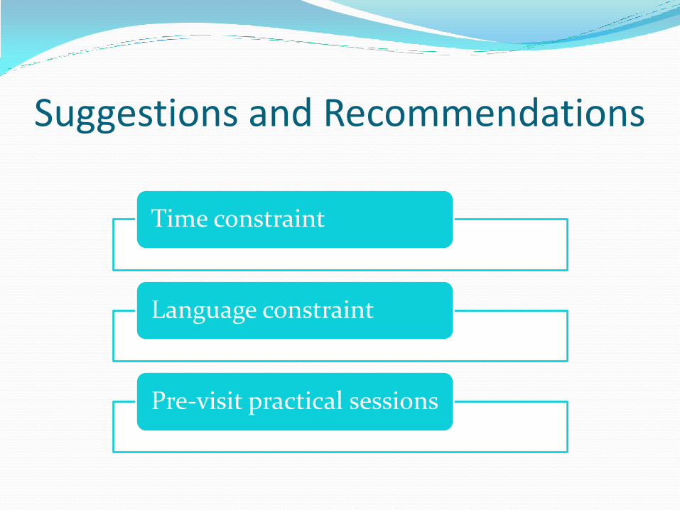
Suggestions and Recommendations
Time constraint
Language constraint
Pre-visit practical sessions

Thank you