danforth avenue study - toronto · acknowledgements the danforth avenue study is the result of the...
TRANSCRIPT
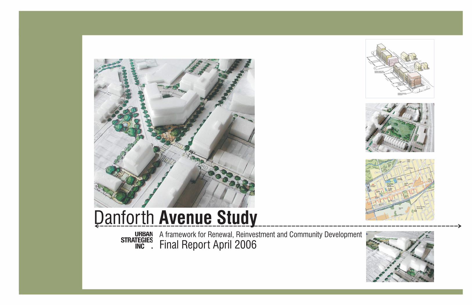
Danforth Avenue StudyA framework for Renewal, Reinvestment and Community Development
Final Report April 2006

The
Danfo
rth
Avenue
Stu
dy
The Danforth Avenue Study , Toronto 2006
AcknowledgementsThe Danforth Avenue Study is the result of the efforts of many individuals including
the City of Toronto, TTC staff, members of the broad community including the Local
Advisory Committee, commercial property owners on Danforth Avenue, residents of
the Oakridge Community, representatives of the development community, and ward
area councillors. The ideas and thoughts expressed by those who have taken an
active interest in the study have resulted in an inspiring and compelling Framework for
Community Development for the Danforth Avenue Study.
We would like to acknowledge and thank the following individuals for sharing their
input through meetings and stakeholder working sessions, for contributing to and
participating in the Meetings and the Charette, or for simply taking the time to engage
the project team in conversation about their ideas and thoughts for the future of the
area. We would like to particularly thank the members of the Local Advisory
Committee, a 20 person Committee comprised of local residents, business operators
and Councillor Altobello, who contributed significantly throughout the study and six
meetings to define and refine the Vision for the Avenue.
Consulting Team
Municipal Staff
Urban Strategies Inc., with BA Group, completed the study between November 2004
and June 2005. The study team included Mark Reid, Cyndi Rottenberg-Walker,
Pascale Dionne and Andrew Goodyear from Urban Strategies, Tim Arnott from BA
Group and Ed Watkins and Andrea Reaney from the City. This document outlines the
result of extensive consultation, which included meetings, workshops, presentations
and discuss of key findings, and project recommendations.
Ed Watkins - City Planning, Community Planning
Andrea Reaney - As above
Xue Pei, City Planning - Urban Design
Dipak Dhrona, City Planning - Transportation Planning
Peter Langdon, City Planning - Policy and Research
Sherry Goldstein, as above
Susan Bookbinder, as above
Dave Twaddle, Transportation Services
Ashraf Hanna/Ieuan Jones-Ashton, Technical Services
Michael Saunders, Economic Development, Culture and Tourism
Christy Cook, Parks, Forestry & Recreation
Tiyanne McLean, as above
Sai-Man Lam, as above
Peter Simon, as above
Chris Foster, TTC
Amanda Charrion, Toronto Parking Authority
Mary Ann Gingras, Toronto Public Library
Mario Silva, Toronto District School Board
Barbara Leporati, Toronto Catholic District School Board
The Danforth Avenue Study , Toronto 2006
The
Danfo
rth
Avenue
Stu
dy
Introduction to the Study“We thank all of those who contributed to the study process”

The
Danfo
rth
Avenue
Stu
dy
The Danforth Avenue Study , Toronto 2006
PHASE 1| Research and Investigation
Background
Danforth Avenue, the commercial heart of the Oakridge Community, is a long-
established Toronto street that functions as a suburban artery. Although some
traditional pre-war Main Street buildings remain, the Avenue is generally
characterized by low and high-density residential buildings, small commercial plazas
and automobile sales and service. The initial phase of the Study included
conversations with stakeholders and an extensive review of these existing conditions
to fully understand the history, contemporary context, opportunities and constraints
of Danforth Avenue. This review included an analysis of the broader context area;
open space resources; the transportation network; current initiatives, precedents and
areas of change; heritage; key destinations; automotive uses; and the planning
framework. It was determined that:
While there are many open space resources throughout the Study Area,
connections between them, and the quality of the streetscapes generally, could
be significantly improved;
The road network and area parking options function adequately, but conditions
will deteriorate as development along the Avenue intensifies;
The Oakridge Community has been the focus of several recent initiatives and
studies which indicate both the desire and potential for growth;
Apart from a small collection of pre-war buildings, Danforth Avenue has little built
heritage. Heritage exists in the form of land use, particularly auto uses, and
personal legacies, such as the donation of land for parks purposes;
Several commercial, recreation, leisure, entertainment and institutional uses are
located throughout the Community, but these are poorly linked and do not
contribute to a cohesive streetscape;
Auto uses, such as gas stations, sales and service centres, are prevalent along
Danforth Avenue. These detract from the pedestrian experience on Danforth but
they are important economically to the Community.
While policies in the existing Official Plan and Secondary Plan are generally
consistent with and appropriate for the evolution of Danforth Avenue as an
'Avenue', zoning for the area is fragmented and complex and does not present a
clear direction for Danforth Avenue.
�
�
�
�
�
�
�
The Danforth Avenue Study , Toronto 2006
The
Danfo
rth
Avenue
Stu
dy
Introduction to the Study
Development Framework
Following the background review, a broad framework for redevelopment was
established to provide a focus for discussions and to target specific areas for
change. Proposed directions for specific redevelopment options included:
Mixed-use buildings, built to the street edge on underutilized Danforth Avenue
sites;
Residential buildings on underutilized sites that abut Danforth Avenue sites;
Park and streetscape enhancements;
A realignment of Danforth Road and Danforth Avenue to create a traditional
four-way intersection and vibrant node and to improve opportunities for
redevelopment on adjacent sites;
Road and path connections to improve the disconnected street network south
of Danforth Avenue; and,
Laneways and parking behind Danforth Avenue development to allow buildings
to frame the street and to separate servicing from other vehicular traffic.
�
�
�
�
�
�
Executive SummaryPurpose
The Danforth Avenue Study was undertaken from December 2004 to April 2006
to establish a framework for change, as envisioned by the new City of Toronto
Official Plan. The new Official Plan, as a policy, directs that reurbanizing
Avenues will be achieved through the preparation of Avenue studies for strategic
mixed use segments throughout the City. Danforth Avenue, between Victoria
Park and Warden Avenues, is a priority area for an Avenue Study due to its
redevelopment potential on vacant and underutilized lands, and existing areas of
surface parking. The primary objective of the Study is to maintain and improve
the quality of life in the Study Area, which includes all properties fronting onto
Danforth as well as some properties on lands north and south of the Avenue.
The Study is expected to direct physical change incrementally throughout the
next 15-20 years.
Public consultation was integral to and encouraged throughout the Study and
included meetings with the Local Advisory committee established to represent
broad community goals; key stakeholder interviews; public meetings; a public
Design Charrette; and, regular meetings between the Consultant Team, the client
group, the Councillor.
i
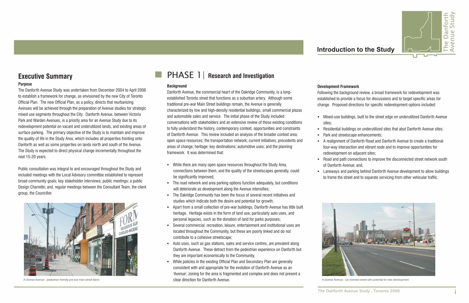
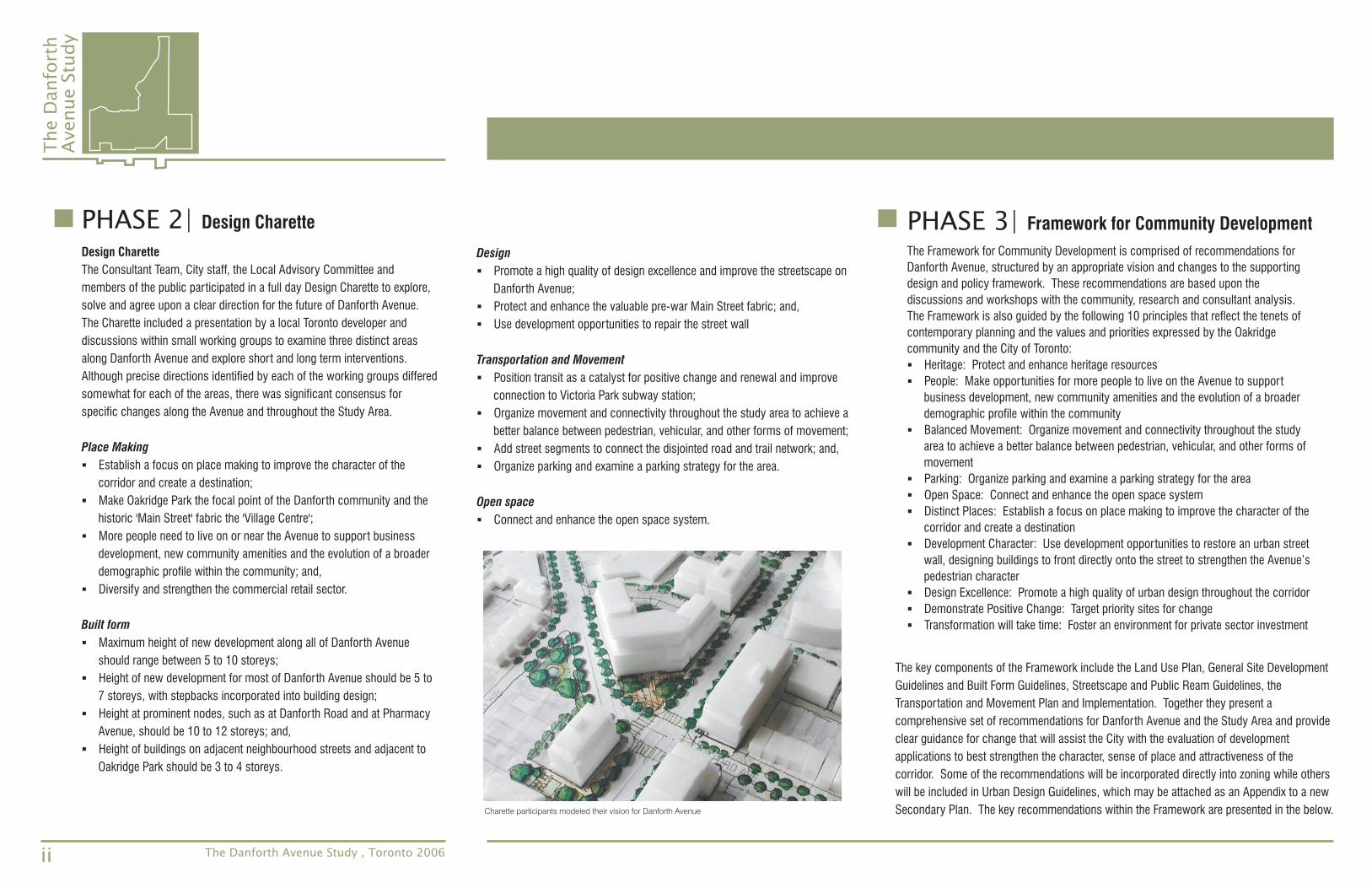
A diverse Avenue: pedestrian friendly pre-war main street fabric A diverse Avenue: car oriented street with potential for new development
The
Danfo
rth
Avenue
Stu
dy
The Danforth Avenue Study , Toronto 2006
PHASE 3| Framework for Community Development
The Framework for Community Development is comprised of recommendations for
Danforth Avenue, structured by an appropriate vision and changes to the supporting
design and policy framework. These recommendations are based upon the
discussions and workshops with the community, research and consultant analysis.
The Framework is also guided by the following 10 principles that reflect the tenets of
contemporary planning and the values and priorities expressed by the Oakridge
community and the City of Toronto:
Heritage: Protect and enhance heritage resources
People: Make opportunities for more people to live on the Avenue to support
business development, new community amenities and the evolution of a broader
demographic profile within the community
Balanced Movement: Organize movement and connectivity throughout the study
area to achieve a better balance between pedestrian, vehicular, and other forms of
movement
Parking: Organize parking and examine a parking strategy for the area
Open Space: Connect and enhance the open space system
Distinct Places: Establish a focus on place making to improve the character of the
corridor and create a destination
Development Character: Use development opportunities to restore an urban street
wall, designing buildings to front directly onto the street to strengthen the Avenue’s
pedestrian character
Design Excellence: Promote a high quality of urban design throughout the corridor
Demonstrate Positive Change: Target priority sites for change
Transformation will take time: Foster an environment for private sector investment
�
�
�
�
�
�
�
�
�
�
PHASE 2| Design Charette
Design Charette
The Consultant Team, City staff, the Local Advisory Committee and
members of the public participated in a full day Design Charette to explore,
solve and agree upon a clear direction for the future of Danforth Avenue.
The Charette included a presentation by a local Toronto developer and
discussions within small working groups to examine three distinct areas
along Danforth Avenue and explore short and long term interventions.
Although precise directions identified by each of the working groups differed
somewhat for each of the areas, there was significant consensus for
specific changes along the Avenue and throughout the Study Area.
Establish a focus on place making to improve the character of the
corridor and create a destination;
Make Oakridge Park the focal point of the Danforth community and the
historic 'Main Street' fabric the 'Village Centre';
More people need to live on or near the Avenue to support business
development, new community amenities and the evolution of a broader
demographic profile within the community; and,
Diversify and strengthen the commercial retail sector.
Maximum height of new development along all of Danforth Avenue
should range between 5 to 10 storeys;
Height of new development for most of Danforth Avenue should be 5 to
7 storeys, with stepbacks incorporated into building design;
Height at prominent nodes, such as at Danforth Road and at Pharmacy
Avenue, should be 10 to 12 storeys; and,
Height of buildings on adjacent neighbourhood streets and adjacent to
Oakridge Park should be 3 to 4 storeys.
Place Making
Built form
�
�
�
�
�
�
�
�
Design
Transportation and Movement
Open space
Promote a high quality of design excellence and improve the streetscape on
Danforth Avenue;
Protect and enhance the valuable pre-war Main Street fabric; and,
Use development opportunities to repair the street wall
Position transit as a catalyst for positive change and renewal and improve
connection to Victoria Park subway station;
Organize movement and connectivity throughout the study area to achieve a
better balance between pedestrian, vehicular, and other forms of movement;
Add street segments to connect the disjointed road and trail network; and,
Organize parking and examine a parking strategy for the area.
Connect and enhance the open space system.
�
�
�
�
�
�
�
�
ii
Charette participants modeled their vision for Danforth Avenue
The key components of the Framework include the Land Use Plan, General Site Development
Guidelines and Built Form Guidelines, Streetscape and Public Ream Guidelines, the
Transportation and Movement Plan and Implementation. Together they present a
comprehensive set of recommendations for Danforth Avenue and the Study Area and provide
clear guidance for change that will assist the City with the evaluation of development
applications to best strengthen the character, sense of place and attractiveness of the
corridor. Some of the recommendations will be incorporated directly into zoning while others
will be included in Urban Design Guidelines, which may be attached as an Appendix to a new
Secondary Plan. The key recommendations within the Framework are presented in the below.
The
Danfo
rth
Avenue
Stu
dy
Introduction to the Study
Land Use Plan, General Site Development Guidelines andBuilt Form Guidelines
Land Use
Density
Height
Setbacks
Parking
Danforth Avenue: Commercial uses at grade withcommercial uses or multiple family dwellings abovegrade.
Residential Streets: stacked townhouses, duplexes,detached homes.
New auto uses (gas stations, sales centres andservice and repair centres) should not be permitted.
Sites with existing auto uses, where the use is toremain but the site is to be redeveloped, will besubject to the same design standards as otherproperties on Danforth Avenue.
Danforth Avenue: minimum 2.0 fsi; maximum 3.5 fsigenerally; maximum 4.5 fsi at key nodes.
Residential Streets: maximum 2.0 fsi.
Danforth Avenue: minimum 3 storeys; 5 + 2 storeysetback (1.5 metres from the building face) generally;8 + 2 storey setback (1.5 metres from the buildingface) at key nodes.
Residential Streets: maximum 4 storeys.
0.0 metres from the front lot line for buildings frontingonto primary streets.
1.5 metres from the front lot line for buildings frontingonto secondary and local streets.
Not permitted between the edge of the public right ofway and the building face on any street.
Should be located to the rear of the block or withinthe interior of the block or to the rear of a property.
Parking areas should be screened from view with aminimum 0.6 metre landscape buffer, with aminimum height of 0.6 metres and a maximum heightof 1.0 metres.
Access/Laneway
Primary Streets
Parks
Vehicular ParkingSupply Strategy
Direct vehicular access onto primary streets should bediscouraged.
Access to surface parking areas should be fromsecondary streets or a rear laneway.
A contiguous and connected private laneway systembehind Danforth Avenue should be created as a servicecorridor.
Main pedestrian corridors within the study area whichaccommodate more intensive forms of development andinclude Danforth Avenue, Danforth Road, Victoria ParkAvenue and Warden Avenue.
Danforth Avenue: 5.5 metre public pedestrian zoneoccurring from the curb edge to the edge of the publicright of way.
Danforth Avenue: 0.0 metre minimum streetscapesetback between new development and the edge of thepublic right-of-way.
Propose 9.4 acres of open space in new and existingparks throughout the Study Area.
Oakridge Park and Madelaine Park should be focal pointsfor the community
Streetscape and Public Ream Guidelines
Transportation and Movement Plan
iiiThe Danforth Avenue Study , Toronto 2006
Residential Tenant:Adopt a “bedrooms per unit” based approach to tenantparking supply: 0.3 stalls per bachelor unit; 0.7 stalls per 1bdrm unit; 1.0 stalls per 2 bdrm unit, and 1.2 stalls per 2+bdrm units
Residential Visitor:0.2 stalls per unit initially, with consideration for 0.13 stallsper unit as area public parking becomes available -supporting justification required
Office Commercial:Maintain “Reduced” parking standards option in existingOakridge Community By-law modify requirements for GFA >1,000 square metres for office parking to a minimum of 2.5stalls per 100 square metres of GFA
Retail Uses:1 stall per 80 square metres of GFA; any parking proposed inexcess of this amount would have to be provided withinmunicipally operated parking facilities
Restaurant Uses:1 stall per 33 square metres of GFA; any parking proposed inexcess of this amount would have to be provided withinmunicipally operated parking facilities
Maintain existing minimum by-law supply rates for remainingland uses in Oakridge Community By-law; any parkingproposed in excess of this amount would have to beprovided within municipally operated parking facilities
Adopt Shared Parking Principles similar to City ofMississauga standards achieves slightly higher office ratesduring weekday afternoon periods relative to City of Torontostandards.
Maximize On-street Paid Parking along Danforth corridor
Consider Permit Parking system for residential side streets
Any commercial parking proposed in excess of the minimumrequirements set out herein would have to be provided withinmunicipally operated parking facilities.
Staff should recommend for Council approval a wellunderstood, publicly acceptable method for the provision ofarea public (municipal) parking coincident with the adoptedZoning recommendations provided for herein.
Vehicular ParkingSupply Strategy
The
Danfo
rth
Avenue
Stu
dy
The Danforth Avenue Study , Toronto 2006
Background to the Study
Research and Investigation
Documentation of the Design Charette
Framework for Community Development
Implementation
Phasing diagram
Study area (focus area and area of influence)three scales of investigationexisting open spacelinked open space networktransportation networkcurrent initiativeskey places and destinationsexisting conditionsautomotive usesareas of changestreet wall diagramofficial planzoningdevelopment framework
Victoria Park to Wanstead AvenueWanstead Avenue to Leyton AvenueLeyton Avenue to Warden Avenue
The VisionLand use planUrban design planBuilt form guidelines axonometricPrimary building elements axonometricVertical relief and articulation along street frontage axonometricTypical Mid-block section (pre-war fabric Main Street)Typical Mid-block section (mixed-use development node)Streetscapes and Public Realm Improvements planPrimary Streetscape Section at Danforth Avenue and Danforth RoadPrimary Streetscape Section at Danforth Avenue and August AvenuePublic Realm axonometricTransportation and movement plan
Municipal Real Estate Investment PlanCommunity Improvement Project Area Boundary
�
�
�
�
�
�
�
�
�
�
�
�
�
�
�
�
�
�
�
�
�
�
�
�
�
�
�
�
�
�
�
�
�
10
13
14
16
18
20
22
24
26
27
28
29
30
31
36
40
41
42
47
51
54
59
60
61
62
63
64
65
66
67
71
81
82
iv
CommunityImprovement Plan
Land Acquisitionand Disposition
Peer Review
Section 37
Increase boundaries of the existing CommunityImprovement Plan Area to extend improvementsthroughout the Study Area.
Acquire land to complete a street south of DanforthAvenue, connecting Coventry Street, Mansion Avenueand Lucy Avenue.
Acquire and dispose of land to re-align Danforth Road tocreate a traditional four way intersection with DanforthAvenue.
Acquire certain lands throughout the Study Area for publicparking facilities.
Acquire and dispose of land to reconfigure Oakridge Parkand add a community centre.
Adopt an architectural and design peer review process forsignificant new developments along Danforth Avenue.
For development proposals which exceed the permittedheight and/or density along Danforth Avenue, use Section37 of the Planning Act to secure certain public benefitsincluding, land for public parks, public realm andstreetscape improvements and new community servicesand facilities.
Implementation
The Danforth Avenue Study provides the basis for the creation of Urban Design
Guidelines and changes to the planning framework, specifically the Scarborough
Official Plan, the Oakridge Community Secondary Plan and the applicable Zoning By-
law. With implementation of the Study's recommendations, commitment of municipal
leaders and support from the community, Danforth Avenue can be a vibrant and
beautiful Avenue.
Establish a private, rear laneway system across eachdevelopment block to minimize impact upon DanforthAvenue public realm, to improve vehicular mobility in thearea, to maximize on-street parking opportunities, and tofacilitate on-site circulation characteristics.
Complete public road network south of Danforth Avenue tofacilitate vehicular, bicycle, and pedestrian connectivity.
Realign key intersections in Study Area to improve pedestriancrossing conditions and facilitate adjacent developmentopportunities.
Ensure appropriate pedestrian crossing times are provided atStudy Area signalized intersection.
Consider reduced Rights-of-Way along new public roadsegments adjacent to public land.
Extend existing bicycle routes/lanes within Study Area toprovide greater non-auto travel opportunities.
Increase on-street bicycle parking opportunities alongDanforth Avenue post and ring bike racks.
On-site bicycle parking requirements similar to the FormerCity of Toronto should be implemented within developmentsin the Study Area.
Mid-block pedestrian crossing locations should be reviewedin the context of future planned uses within the public right-of-way along Danforth Avenue.
Transit improvements along the Danforth corridor would besupportive of the planned residential and non-residentialdensities. The proposed Avenues plan is consistent with anddoes not preclude potential future Higher Order Transitservice along this corridor.
Private Laneway System
Public Road Strategies
LIST OF DRAWINGS
1.1
1.2
1.3
1.4
1.5
Study Purpose and Key Municipal Goals
The Local Advisory Committee
The Project Team
Study Process and Summary of Method
Summary of Consultation
06
07
07
08
09
Documentation ofBackground to the Study
Research and Investigation Framework for
Implementation
4.1
4.2
4.3
4.4
4.5
4.6
4.7
Emerging Principles
The Vision
The Vision Components
Land Use Plan
Urban Design Plan and Built Form Guidelines
Streetscape and Public Realm Guidelines
Transportation and Movement Plan
4.5.1
4.5.2
General Site Development Guidelines
Built Form Guidelines
4.6.1
4.6.2
4.7.1
4.7.2
4.7.3
The Streetscapes
The Public Realm
Vehicular, Bicycle, Pedestrian and Transit Movements
Access to, and Circulation on, Private Development Parcels
A Vehicular Parking Strategy for the Study Area
44
47
51
51
54
64
64
67
71
71
73
73
55
59
3.1
3.2
3.3
3.4
3.5
Overview and Objectives
Structure
Group 1: Macey Precinct Area and Madelaine Park
Group 2: Oakridge Park and Pre-war Main Street
Group 3: Danforth Avenue and Danforth Road
38
38-39
40
41
42
5.1
5.2
5.3
Policy Changes
Municipal Real Estate Investment Plan
Additional Tools
78
81
83
the Design Charette
Community Development
PART 1
2.1
2.2
2.3
2.4
2.5
2.6
2.7
2.8
2.9
2.10
2.11
2.12
2.13
2.14
2.15
2.16
2.17
The Study Area
Three Scales of Investigation
Existing Open Space
Linked Open Space Network
Access and Transportation
Current Initiatives
Heritage
Key Places and Destinations
Existing Conditions
Automotive Uses
Areas of Change
Street Wall Diagram
Planning Framework
Precedent Imagery
What We Heard
Development Framework
Preliminary Principles
12
14
16
18
20
22
23
24
25
27
28
29
30
31
35
36
37
PART 2
PART 3
PART 4
PART 5
The Danforth Avenue Study , Toronto 2006
“Imagine the future” The
Danfo
rth
Avenue
Stu
dy
Introduction to the Danforth Avenue Study 04
TABLE OF CONTENTS
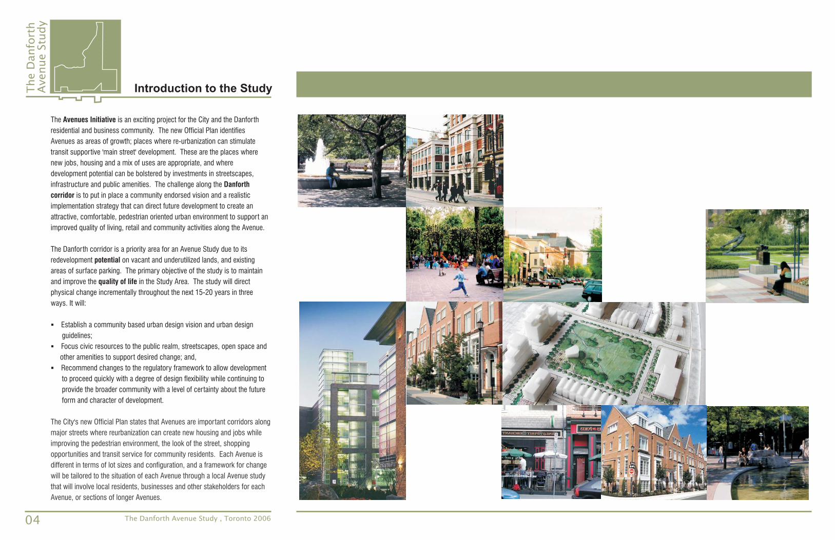
The is an exciting project for the City and the Danforth
residential and business community. The new Official Plan identifies
Avenues as areas of growth; places where re-urbanization can stimulate
transit supportive 'main street' development. These are the places where
new jobs, housing and a mix of uses are appropriate, and where
development potential can be bolstered by investments in streetscapes,
infrastructure and public amenities. The challenge along the
is to put in place a community endorsed vision and a realistic
implementation strategy that can direct future development to create an
attractive, comfortable, pedestrian oriented urban environment to support an
improved quality of living, retail and community activities along the Avenue.
The Danforth corridor is a priority area for an Avenue Study due to its
redevelopment on vacant and underutilized lands, and existing
areas of surface parking. The primary objective of the study is to maintain
and improve the in the Study Area. The study will direct
physical change incrementally throughout the next 15-20 years in three
ways. It will:
Establish a community based urban design vision and urban design
guidelines;
Focus civic resources to the public realm, streetscapes, open space and
other amenities to support desired change; and,
Recommend changes to the regulatory framework to allow development
to proceed quickly with a degree of design flexibility while continuing to
provide the broader community with a level of certainty about the future
form and character of development.
Avenues Initiative
Danforth
corridor
potential
quality of life
�
�
�
The City's new Official Plan states that Avenues are important corridors along
major streets where reurbanization can create new housing and jobs while
improving the pedestrian environment, the look of the street, shopping
opportunities and transit service for community residents. Each Avenue is
different in terms of lot sizes and configuration, and a framework for change
will be tailored to the situation of each Avenue through a local Avenue study
that will involve local residents, businesses and other stakeholders for each
Avenue, or sections of longer Avenues.
The
Danfo
rth
Avenue
Stu
dy
Introduction to the Study
04 The Danforth Avenue Study , Toronto 2006
The Land Use Plan
Urban Design Plan and Built Form Guidelines
Streetscape and Public Realm Guidelines
Transportation and Movement Plan
: Implementation
Implementation Recommendations
Municipal Real Estate Investment Plan
Additional Tools
provides direction on the location and extent of distinctive land
uses and densities, establishing the basis for changes to the policy framework
which seek to achieve renewal;
The guide the character and place-
making along the corridor and establish recommendations to organize and structure
the development of primary urban components including the built form, street
system and public realm. The guidelines provide specific criteria to logically
organize, structure and evaluate elements of the built environment to ensure the
creation of a high quality pedestrian friendly and attractive mixed use and
commercial district that is compatible with adjacent neighbourhoods;
The create specific detailed
recommendations for the configuration of the public realm, open space and the
Danforth Avenue streetscape to strengthen the character and amenity of the district
and ensure the creation of an attractive civic setting capable of encouraging desired
private sector reinvestment along the Avenue;
The highlights pedestrian and vehicular access
points, indicates improved connections along Danforth and throughout the Study
Area, articulates parking standards and summarizes related transportation
recommendations.
is comprised of the following components:
which outline changes to the governing policy
and procedure framework necessary to achieve the vision;
which indicates priority land acquisition
and disposition initiatives needed to achieve the vision, balance municipal capital
expenditure within the area, and kick start longer term civic and private sector re-
investment;
which outlines further actions that will guide new development and
support implementation of the vision.
Part V
The Danforth Avenue Study , Toronto 2006
“Imagine the future” The
Danfo
rth
Avenue
Stu
dy
Introduction to the Study
05
The Danforth Avenue Study is presented in five parts:
outlines the purpose of the study and broad
municipal goals, describes the Study Area and the existing policy framework, and
presents an overview of the study process, elements and events associated with
the work program and the consultation process.
sets the context for change by providing
an overview of the evolution of the area, describes contemporary existing
conditions, such as open space and automotive uses, and outlines contemporary
challenges, opportunities and potential which provide a clear direction for the
development of key planning principles and a vision to effectively achieve
revitalization along Danforth Avenue and, to a lesser degree, within adjacent
areas.
describes the structure and
results of a one day workshop that engaged participants in the formation of an
interim and long term vision for the renewal and redevelopment of Danforth
Avenue. This event established the basis for Study recommendations as well as
a clear direction for municipal actions and initiatives necessary to support the
vision.
is comprised of the
following components:
which outline broad conceptual objectives for the renewal of
the study area and which should be used to guide development, investment and
decision-making toward long term community building;
and Precinct Areas which translates planning principles, and
community and municipal goals to demonstrate how change and development
should be positioned to achieve a balanced range of opportunities for living,
working, investing and recreating offering residents an improved quality of life
and property and business owners a more vibrant and economically successful
commercial environment;
Part I
Part II
Part III
Part IV
: Background to the Study
: Research and Investigation
: Documentation of the Design Charette
: Framework for Community Development
Planning Principles
The Vision
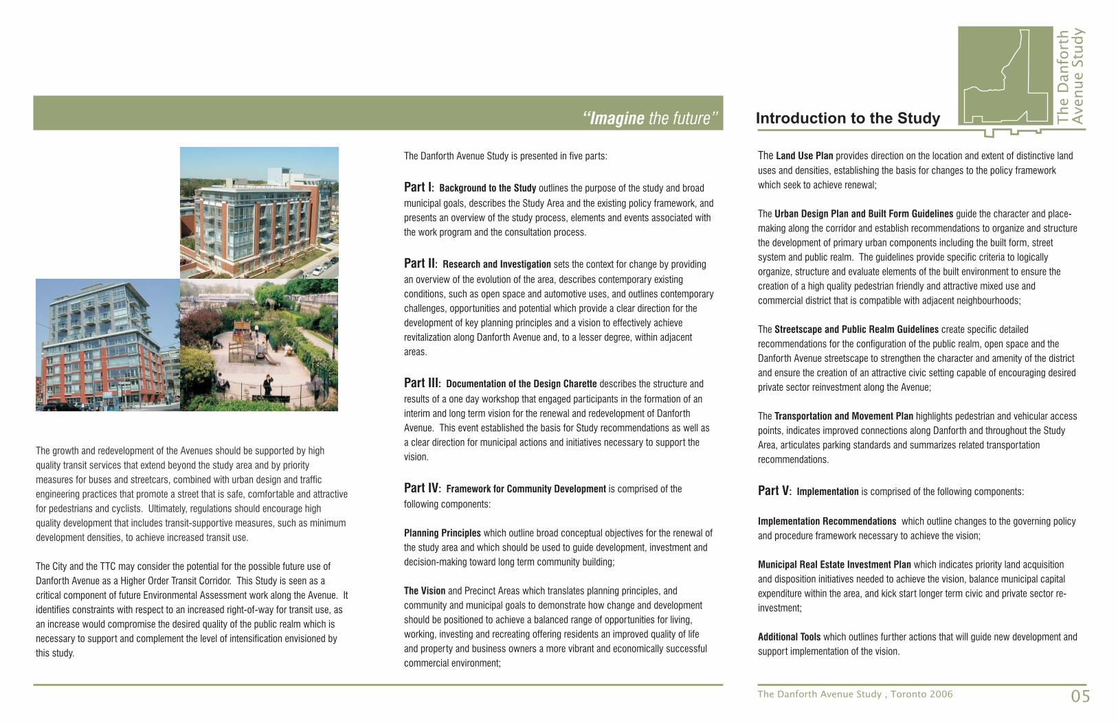
The growth and redevelopment of the Avenues should be supported by high
quality transit services that extend beyond the study area and by priority
measures for buses and streetcars, combined with urban design and traffic
engineering practices that promote a street that is safe, comfortable and attractive
for pedestrians and cyclists. Ultimately, regulations should encourage high
quality development that includes transit-supportive measures, such as minimum
development densities, to achieve increased transit use.
The City and the TTC may consider the potential for the possible future use of
Danforth Avenue as a Higher Order Transit Corridor. This Study is seen as a
critical component of future Environmental Assessment work along the Avenue. It
identifies constraints with respect to an increased right-of-way for transit use, as
an increase would compromise the desired quality of the public realm which is
necessary to support and complement the level of intensification envisioned by
this study.